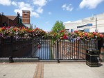
Fun At The Elephant And Castle
When I was driving, I used to find the Elephant and Castle roundabout confusing, especially as being a North Londoner, you don’t cross the Great Sewer unless you’re accompanied by a posse. (Make sure, they’re not Ipswich supporters, as they get lost at Liverpool Street!)
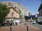
The Underground Station
In some ways Elephant and Castle tube station can be confusing and is almost two separate stations connected by long, dark tunnels under the roundabout.
- The Northern entrance is directly over the Bakerloo Line platforms
- The Southern entrance seems to give better access to the Northern Line platforms.
There are no escalators, but the Southern entrance is likely to be rebuilt. Wikipedia says this.
A major upgrade is being planned by Transport for London to bring improvements to the station; these include a new Northern line ticket hall, three new escalators and additional lifts to provide step-free access to the Northern line platforms. This will be done in conjunction with the major transformation in the Elephant & Castle area to create thousands of new homes and potential for new retail development to provide growth potential in the area.
That would be a great improvement.
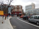
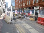
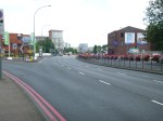
The New Road Layout
Things look like they’re going to get a lot more fun for drivers at the Elephant and Castle judging by this traffic scheme that will start on Sunday.
This Tfl web page shows the scheme and this TfL map shows the final layout.
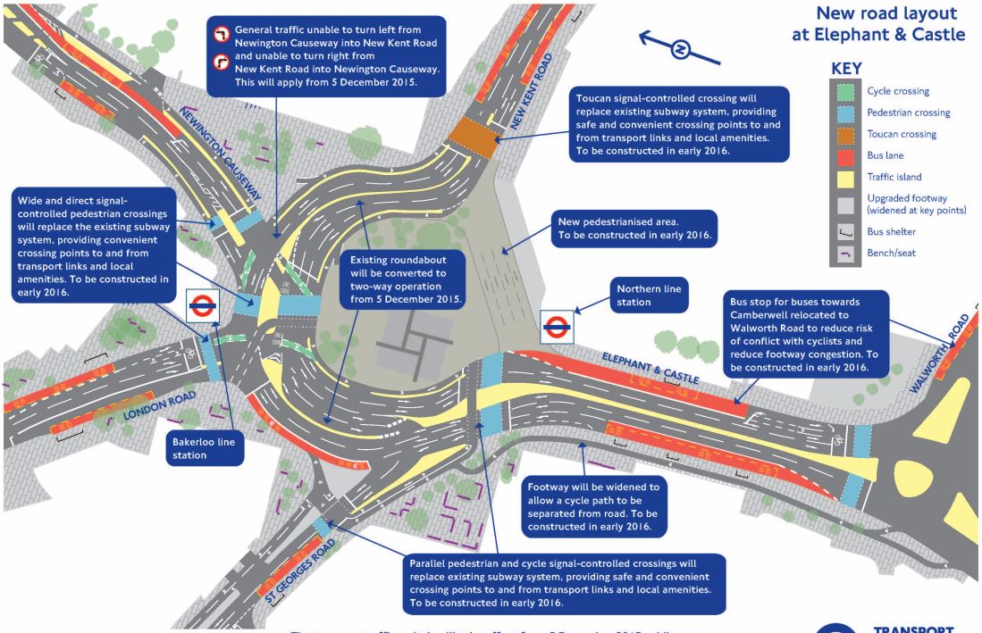
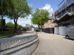
Elephant And Castle Roundabout
It’s even got its own web-site.
For comparison, this is a Google Map of the area before any roadworks.
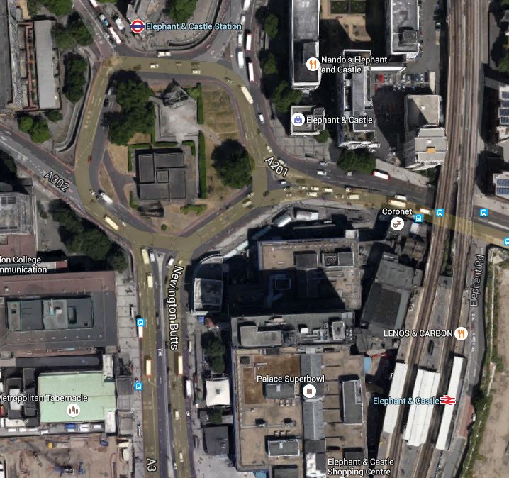
Elephant And Castle Northern Roundabout
Note.
- The drawing of the new scheme has North to the left.
- The Bakerloo Line entrance is on the North Side of the old roundabout, with the Northern Line entrance at the South
- A quick look could say that the road space will be wider, but shorter after reconstruction.
It could well be a lot easier for pedestrians like me!
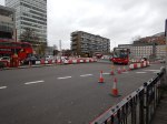
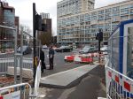
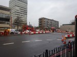
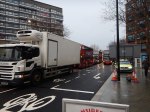
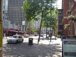
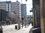
December 3rd, 2015
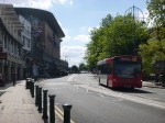
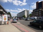
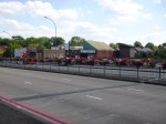
These are pictures taken on Thursday the third.


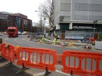


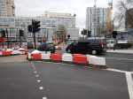


The traffic seemed pretty dense even at ten in the morning.
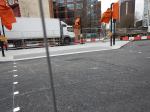
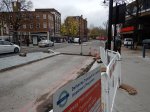
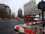
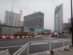
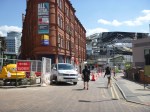
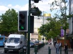
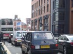
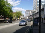
December 5th, 2015
These pictures were taken about the same time on Sunday the 5th.
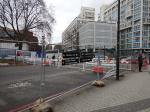


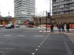

Note that I walked a similar route on the third.
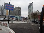
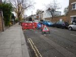
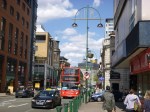
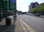
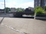
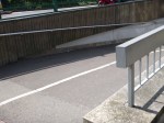
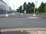
The Pedestrian Routes Are Emerging
The main difference between the two sets of pictures, is that on the North, West and East sides of the roundabout, traffic is now two-bay with a traffic island between the two carriageways.
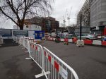
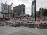
The South side is no longer used for traffic and will be pedestrianised early in 2016.
It is now possible to see how when the scheme is complete, that the centre of the old roundabout will be joined to the South Side. This will mean that to walk from the Northern Line station to the Bakerloo line station, will require only one road crossing at the North Side of the old roundabout.
I have some questions.
- Will the middle be landscaped? Obviously!
- Will there be a cafe in the middle? Hopefully?
- Will the preferred route to the Bakerloo Line trains from the surface, always be to enter the Bakerloo Line entrance and then descend in the lifts there, which take you directly to the platforms? It might be a shorter and more pleasant walk, than a long one in a tunnel!
After my visit today, I think I can see a purpose to the new design.
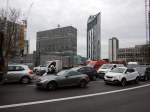
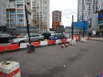
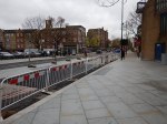
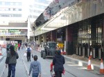
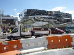
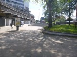
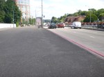
December 7th, 2015
This was the first working day at the same time as the previous sets of pictures.


I did see a picture, which showed a cafe and I think that if they can do the same at Old Street, which seems to be the next roundabout removal I’ll be pleased.
Although there is this article on the BBC, which is entitled Elephant and Castle: Two-way traffic redesign causes chaos. This is said.
The removal of the Elephant and Castle roundabout has been causing chaos for commuters, with motorists complaining of queues of more than an hour.
But then good news doesn’t draw viewers to the web site.
I’ll come back and watch this one in the future.
A Lesson In Traffic Management
On Friday, next door got low water pressure. So now we have a chicane around the hole that Thames Water have dug, whilst they look for the problem!


My road certainly seems quieter, as traffic could be much less and slower.
Perhaps Thames Water and National Grid, should be asked to dig holes in rat runs as a traffic-calming measure!
Walthamstow Doesn’t Like Going Dutch!
This article from the Waltham Forest Guardian is entitled Grand opening of mini Holland scheme dominated by angry protestors.
I have posted it, as we are getting the Cycle Superhighway through where I live in the northern part of D Beauvoir Town in the near future and there are various opposing groups wanting or not wanting road closures and different parking restrictions.
As a Control Engineer, who has quite a bit of experience of dealing with complex liquid flow systems in chemical plants, I think that Councils tend to take a too definitive approach to the problem.
So my experience of chemical plants was in the late 1960s and we used an amazing PACE 231R. But that machine was the state-of-the-art computer of its day for solving differential equations. The computer was also the unrecognised star of the amazing rescue of the astronauts on Apollo 13.
The aim of the modelling in the chemical plant was to get different chemical streams flowing at the right rate into various reaction vessels, where they could be safely reacted and handled. The reaction products would then flow off in a controlled manner in other directions.
On a chemical plant the flows are controlled by various measures, but typically by valves, of which a domestic example is your mains water stop cock.
Often after modelling the flow system, it was found that the various valves were set almost to a fixed position for normal running of the plant.
If you look at traffic flows in say Walthamstow Village, as in the article, or De Beauvoir Town, you have an area bounded by main routes, which is crossed in a random manner by buses, cars, cyclists, pedestrians and trucks.
So what is different between modelling fluid and traffic flows?
Mathematically, it is the same process, but there is no variable method for regulating traffic flows.
The only regulation in De Beauvoir Town and other traffic systems is the brain of cyclists, pedestrians and regular drivers, who adapt their route according to their knowledge.
What the Mini Holland system in Walthamstow and other systems try to do is modify the thought processes of regular uses. The problem is that it may do that with the regular uses, but it doesn’t influence say your casual driver, who ventures into the area.
So in Walthamstow the local businesses and others see the drop in traffic and protest.
We need to apply more subtle ways of regulating the traffic, through areas like Walthamstow Village, that are understood by everybody.
- Speed limits should be set to twenty and they should be enforced. The Police need all the money they can get, so I would be happy to see mobile enforcement cameras on the top of Police vehicles parked at the side of the road.
- Computer-controlled traffic lights can be used as restrictors, so for instance at a notorious place where rat-runners enter an area, a pedestrian-crossing with lights could be placed. Timings could be adjusted automatically to the day of the week and time of the day.
- Speed humps aren’t as affective as they used to be. Perhaps car suspensions are better and Councils have softened them, so they don’t get sued?
- Cambridge has used rising bollards, that are automatically opened by certain vehicles, like buses, taxis, fire engines and ambulances.
- Even physical gates can even be opened and closed at various times. Suppose to calm an area, there was a need to shut off a road past a church. Why couldn’t it be opened on Sundays?
We are not being innovative enough.
Solutions like mini Hollands and just shutting routes are just too simplistic for a complex city like London.
As an aside, I’m old enough to remember London’s first experiment in traffic managment.
Green Lanes through Harringay in the 1960s was even more crowded with traffic than it is today. So traffic lights were put every fifty metres or so between Harringay Green Lanes and Turnpike Lane stations. There are quite a lot less lights today.
It cut the traffic through the area, but we all diverted through the side streets and made the lives of residents hell!
Glasgow Bin Lorry Driver Should Have Been Charged
According to this article on the BBC web site, a former prosecutor has said that the driver of the Glasgow bin lorry, that killed six people should have been charged. The report starts like this.
A former senior prosecutor has strongly criticised the decision not to charge the driver at the centre of the Glasgow bin lorry tragedy.
Brian McConachie QC said there was sufficient evidence to prosecute Harry Clarke.
He said the Crown Office had “jumped the gun” in not pressing charges.
I feel very strongly about this. After I had my stroke, my eyesight was terrible and I decided that to start driving again would not be a responsible thing to do.
My current GP, who has seen me for three years, feels that if I wanted to, I could get my licence back.
But quite frankly I couldn’t be bothered. And I have a lot of backing from my healthy bank account.
What worries me, is how many other Harry Clarkes are there driving around?
In the last four years, I had lifts from other drivers a few times and quite frankly with two of them my eyesight seemed better.
My eyesight problem incidentally, is that I can’t see moving objects low down on the left. So one nightmare on the street, is meeting a crocodile of young children, say being led by their teachers. Luckily I haven’t done anything I shouldn’t! A few times though, people wheeling cases have pulled in front of me from the left and I’ve bumped into the case. Only once have I ended up on the ground, as usually my balancing skills which are still tip-top have got me out of trouble.
Harry Clarke was extremely irresponsible, in not reporting his failing health problems!
Incidentally, if say I was fifty and had got my eyesight problem, as I live in London, I would get a Freedom Pass, entitling me to free public transport in Greater London. I get one anyway as I’m over the qualifying age.
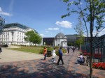
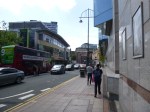
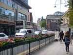
Walking The Route Of The Midland Metro Line One Extension
I’ve walked the Line One Extension of the Midland Metro between New Street and Snow Hill stations before, but I’ve never walked the proposed extension as far as Five Ways. I took these pictures on the route.


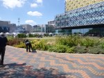


The Extension was planned to be opened to Centenary Square in 2017 and to Brindleyplace, Five Ways and Egdbaston later. Nothing much seems to be happening past New Street station, except for some utility works, which must be sorted before tram tracks and station are put over the top.
The walk is fairly easy, but the last section around Five Ways and to Five Ways station was designed using Birmingham’s 1960s philosophy of deling with traffic and pedestrians, that I’ve seen going to Birmingham City several times – Pedestrians should be channelled into dangerous areas, so they are run over and killed. This would of course make it less likely a driver will damage his car, by hitting one.
Birmingham could do a lot worse than extend the tram to Five Ways. Some of the running routes would be challenging and Birmingham’s many drivers would probably object, but if they want more visitors to the City, surely it is a price worth paying?
I do wonder about the costs of extending tram lines, as opposed to building new ones. Obviously, some costs like new trams and getting power to the trams will be minimised, but you’ve still got the costs of actually putting in the rails and divering utilities.
Crossrail’s Royal Oak Portal
Unlike the Crossrail tunnel portals at Abbey Wood and Stratford, the portal at Royal Oak is rather hidden away under the Westway, with no suitable vantage point to see the site. This Google Map shows the tunnel portal from Royal Oak station to the footbridge at Westbourne Park, where I took these pictures.
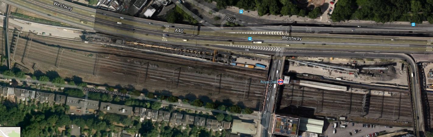
Royal Oak Tunnel Portal
It shows the cramped nature of the site, which is just 21m. wide. This is an enlarged image of the ramp leading down to the start of the tunnel under London.
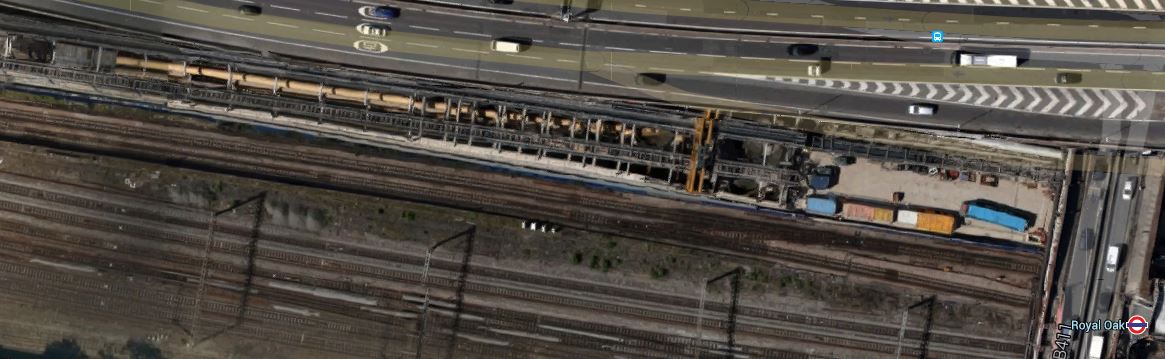
An Enlarged View
The only pictures I can find on the web with a proper explanation are in this article on the London Reconnections web site. In that article a picture is labelled as the remains of the arches and they are shown under the Westway and facing South. They are probably the arches in these pictures I took from the train.

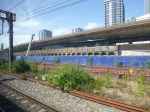
I am not sure, but it looks like the arches support the access ramp that lead up to the Westway. But they are not shown in this architectural drawing from Acanthus, which shows the area around the Ventilation shaft they have designed for Crossrail.
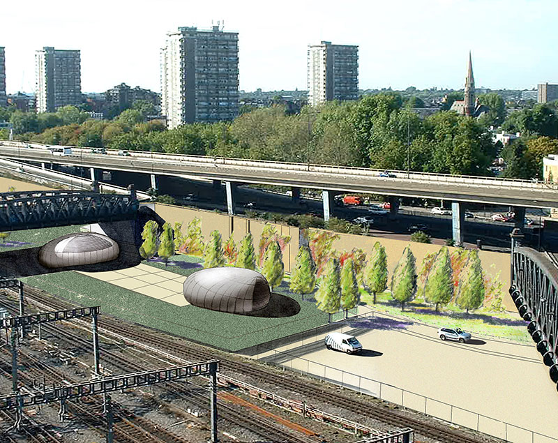
Crossrail Ventilation Shaft By Acanthus
This Google Map shows the current access with relation to the two bridges and Royal Oak station.
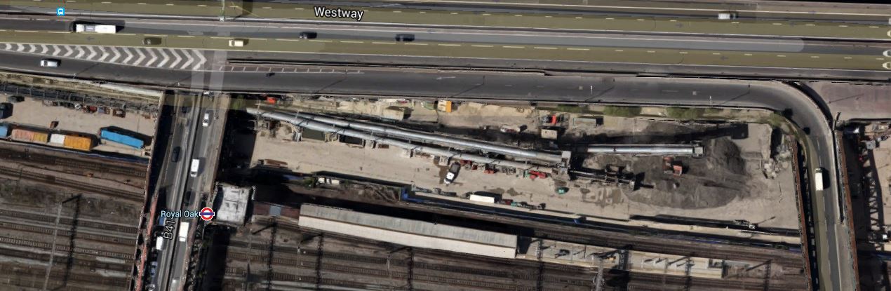
Access To The Westway
Note the long pipes, which I assume are either covering conveyors that remove the spoil for the tunnels or are to there to pump fresh air into the tunnels.
The station has recently been renovated, but once Crossrail is complete to the North of the station, are we going to see a comprehensive redevelopment of the area.
All will be revealed in time.
What Is The New Mayor Of London Going To Do For Car Drivers?
Most of the London Mayor candidates for 2016 seem to ignore car drivers.
As a non-driver, I wouldn’t mind if the new Mayor decreed that no-one in London could own a car, but if he or she did, they wouldn’t get elected.
I do occasionally need to be transported by car and as I don’t have the expense of actually owning one, I can afford to take a black cab, which I do perhaps a dozen times a year, at a total cost of perhaps three hundred pounds.
The most difficult journeys are ones where say, a friend is picking me up and taking me somewhere, so they have to drive into Hackney and out the other side again. Which just adds to the congestion unneccesarily.
The other tricky thing for car-drivers, is those coming into London often have no convenient Park-and-Ride. I was lucky, when I lived near Newmarket, as I could park at Whittlesford Parkway and get a train into Liverpool Street.
But when years ago, when I lived near Ipswich, parking was very limited and I had to get a taxi to the station. I once had a letter from British Rail suggesting that I ask my wife to drive me to the train.
I also see problems with the new Night Tube. This will generate an amazing night life all over the centre of London and I think we’ll see large numbers of people using the Tube late into the night and early morning. Those living in London will be able to use the Tube, but as there is little adequate parking at or around stations just inside the M25, visitors and those working late in the evening, may well lead to a lot of parking congestion around the stations.
To add to that, as London becomes an increasingly twenty four hour/seven day a week city, there will be an increasing need for some form of parking for night workers.
I have checked the map and the only Tube and rail stations close to a junction of the M25 will parking, can be counted on the fingers of one hand.
I believe that London needs a ring of well-designed car/bus/train interchanges around the M25. I did propose one at Waltham Cross, but that idea was not put together properly.
The interchanges would be designed for the following services.
1. Park-And-Ride, particularly aimed at those not wanting to stay all day. So perhaps the parking charges would be sensible for say the first four hours and then draconian afterwards. Obviously, at weekends and in the evenings, they would be reduced and aimed at those perhaps going to a sporting event or seeing a show or concert.
2. Pick-Up and Drop-Off of passengers, perhaps linked to something like thirty minutes free parking.
3. Car Hire for those living in London.
4. Long Distance Coach Services
5. Motorway Services
Obviously, there would be a frequent service into Central London. The service would have to be step-free and wi-fi enabled. I also think that like Cambridge’s superb Park-and-Ride, it would be linked into the cycle network.
Get it right and it would cut vehicular traffic into London.
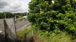
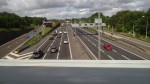
I Like This TfL Proposal
Transport for London have proposed changes at the junction of Stamford and Kingsland Roads near where I live. The changes are detailed in this page on their web site. This image shows the proposed junction.
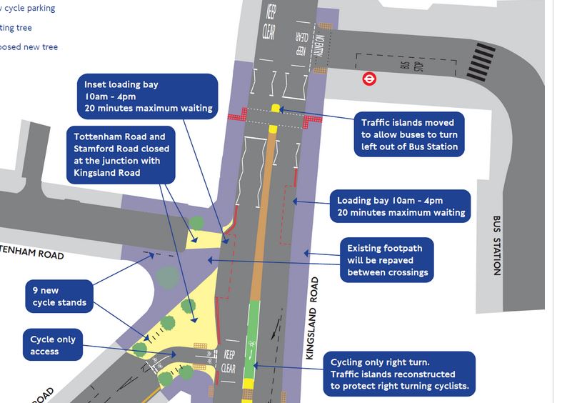
Proposed Kingsland Road Stamford Road Junction
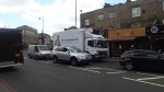
And this is a Google Map of the area.

Kingsland Road Stamford Road Junction
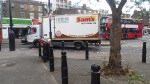
Note the inevitable truck parked outside Tesco, gumming everything up. Why is it that Tesco do this more than other supermarkets? Or they seem to do it in my opinion! As the crossing has been moved to allow buses to turn left out of the bus station, the loading bay has been moved further south, so I suspect that trucks won’t be able to park there and cause other vehicles to block the crossing that I regularly use. So that is one reason I like it, as it will make it easier for me to cross the road to get into Dalston Junction station. As buses will be able to turn left out of the bus station, I do wonder if TfL have got plans for more bus routes from Dalston, which of course I would support. I don’t think others will be so supportive. Look at these pictures of the junction and Tottenham Road.


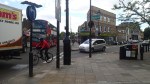
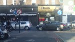
Note that the Tesco store is quite a way up towards the Balls Pond Road and after the changes are made, they will have a cycle lane in front of the shop. My heart bleeds for them! – I don’t think! There are quite a few businesses in Tottenham Road, who might find movements of vehicles rather difficult. Especially, as the Cycle Superhighway will soon cross the road in the middle. I also think that some residents of Tottenham Road will be objecting, as effectively unless they do a three-point turn, they will have to go a long way round to get out, as they’ll be a dead-end at one end of the road and the Cycle Superhighway across the middle. As I don’t drive, I don’t care!
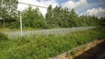
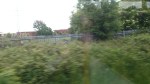
The M25 South Of Waltham Cross
If you travel along the M25 between junctions 25 (A10) and 26 (A121), you pass south of an area which I know well from my teens. Obviously the motorway wasn’t there in those days and a lot of the area was closed off as it was the Royal Gunpowder Mills. Some of the area has been developed, but a lot is still pretty much undeveloped or farmland, as this Google Earth image of the area shows.

M25 South Of Waltham Abbey
Note how two of the Lea Valley Lines pass North-South through the area.
The line between Turkey Street and Theobalds Grove, known as the Southbury Loop, crosses the motorway on its way to its terminus at Cheshunt, just to the East of the large factory, which is News International’s Print Works at the top left of the image.
Further to the East is the West Anglia Main Line between Enfield Lock and Waltham Cross, which is just to the west of the collection of large distribution depots.
So you have a large area of relatively undeveloped land with four stations at the corners. Turkey Street and Theobalds Grove are now part of the London Overground and Enfield Lock and Waltham Cross are proposed to be on Crossrail 2.
So although the connections to London aren’t bad they are going to get a lot better.
Surely, with these rail connections this area could be developed sensibly.
I’ve always felt that London needs more Park-and-Ride sites. In fact there isn’t one rail station, where you can come off the M25 drive a kilometre or so, perhaps pick-up or drop-off a passenger, and return easily to the motorway.
As to being able to park all day or just an evening, whilst you do business or visit a friend relative, then you can just about forget it. Especially, as those stations with parking never have enough of it.
A couple of times, since I’ve stopped driving, I’ve needed to be picked up near the M25, either to guide someone to my house or perhaps go to a football match with a fellow sufferer. There are few suitable places, so we generally end up using eithe Cockfosters or Newbury Park Tube Stations.
What is needed is a series of rail/car/bus interfaces all along the motorways and not just on the M25.
I took these pictures from a train going between Turkey Street and Theobalds Grove stations.
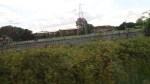
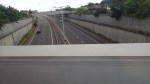
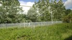
The M25 dominates and there is a few large developments, like the News International Print Works and lots of undeveloped green space.
,So could such an interchange be developed somewhere on this section of the M25 near Waltham Cross, perhaps with a Service Area and a Park-and-Ride. It would certainly ease transport difficulties for many.
How To Organise Chaos
At the moment N1 is seems to be in permanent chaos on the roads.
But I don’t drive, so why should I bother?
Every day, perhaps two or even four times, I take a bus to or from the Angel or Highbury Corner.
Yesterday, I wanted to get to Paddington to go to have lunch with a friend in Burnham near Slough. My normal method to that station, is to walk to Dalston Junction and take the East London Line to Whitechapel, where I get the Metropolitan across London. That may seem a long way round, but it’s quite reliable in the time it takes. But yesterday the Metropolitan and \district lines were not serving Whitechapel, due to engineering work. So I thought, I’d get a bus to the Angel, where I’d swap to a 73 or 30 for Kings Cross, from where I’d get the Hammersmith and City Line to Paddington. Highbury and Islington is solid at the moment due to the rebuilding of the bridge, so the direct route up the Essex Road using a 38 or 56 would be sensible. But then that road was locked solid, as they’d decided to resurface it, on a weekend with no Metrolitan Line and jams at Highbury Corner.
It took nearly an hour, to do a journey that takes just twenty minutes normally. I was even later to Kings Cross as there were diversions on the way, which meant I missed my train to Burnham by five minutes. I might have actually caught it, if the ticket machine at Paddington hadn’t gone bonkers and issued loads of blank tickets.
The problems could have been avoided, if whilst they’re doing the bridge replacement at Highbury and Islington, they refrain from doing any other major works.
It was no better today and they’ve now moved the road works further towards me on the Essex Road.
Someone is definitely not getting their project management right!
