After One Tunnel Finishes In London, Another One Starts
Crossrail’s massive tunnel under London is now in the fitting out stage and some of the capitals human moles, are probably now working on the Thames Tideway Scheme to create a super sewer under London.
But according to this article in Global Rail News, others have moved on to Kennington and have started to dig their way to Battersea for the Northern Line Extension.
This though is one of London’s traditional smaller-bore tube tunnels and the tunnellers are stating in a traditional way. This is said.
The article also has this map of the line.
Although TBMs will be used to construct much of the extension, tracked excavators supplied by Schaeff are being used initially to excavate the tunnels around the Kennington loop, where the new line meets the existing railway.
This map from carto.metro.free.fr, shows the layout of the lines at Kennington station.

Track Layout At Kennington
Note.
- The map can’t show it, but the platforms at Kennington are on two levels.
- There is also a reversing siding between the two tracks going South.
- Charing Cross Branch trains use the loop and Bank Branch trains use the siding to reverse.
- The extension to Battersea is shown in dotted lines.
It was very good of the engineers, who extended the Northern Line in 1926, to future-proof it with a loop, that looks like it makes the extension to Battersea, easier to build!
Will Crossrail And Its Class 345 Trains Set Mobile Connection Standards For The UK?
Search for “Class 345 trains 4G” or “Class 345 trains wi-fi” and you find reports like this on London Reconnections about the Class 345 train.
This or something like it, is said in several of these reports.
According to the accompanying press notes both free wifi and 4G services will be delivered on board, as will multiple wheelchair and luggage spaces.
It would be very embarrassing for London’s flagship multi-billion pound project, if it wasn’t correct.
So it would appear that I could board a Class 345 train at Shenfield and watch a video all the way to Heathrow or Reading.
But where does this leave Thameslink?
Their Class 700 trains have been designed without wi-fi, 4G and power-sockets as I said in By Class 700 Train To Brighton And Back.
But at least Siemens felt that the Department for Transport, who ordered the trains, were out of step with reality and appear to have made provision to at least fit wi-fi.
This article on Rail Engineer is entitled Class 707 Breaks Cover and it describes the Class 707 train, which is a sister train to the Class 700. This is said about the two trains and wi-fi and toilets.
Thameslink (or the Department for Transport which ordered the trains) decided not to include Wi-Fi in the Class 700s, a questionable decision that has now apparently been reversed. Fortunately, Siemens had included the technology framework in the design so, hopefully, the upgrade will not require too much effort. Suffice it to say that South West Trains has included Wi-Fi in its specification for Class 707s.
Reversing the story, Thameslink Class 700s are all fitted with toilets. However, South West Trains has decided not to include toilets in its Class 707 specification given that the longest journey time is less than one hour and their inclusion would reduce the overall capacity of the trains.
So it appears that Siemens may have future-proofed the trains.
This article on the Railway Gazette describes the third fleet of the Siemens trains; the Class 717 trains for Moorgate services. This is said.
Plans for the installation of wi-fi are being discussed with the Department for Transport as part of a wider programme for the GTR fleet.
So at least something is happening.
But how close will mobile data services get to the ideal that customers want.
- 4G everywhere from the moment you enter a station until you leave the railway at your destination station.
- Seamless wi-fi, so you log in once and your login is valid until you leave the railway.
It will be tough ask to achieve, as it must be valid on the following services.
- Crossrail
- Thameslink
- London Overground
- London Underground
- All train services terminating in London.
And why not all buses, trams and taxis?
On a related topic, I believe that for safety and information reasons, all bus and tram stops and railway stations must have a quality mobile signal and if it is possible wi-fi.
One life saved would make it all worthwhile.
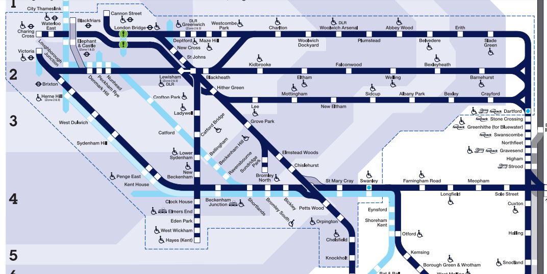
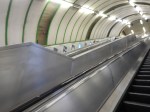
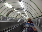
Improving Services To Cannon Street And Charing Cross Stations
Platform Changes At London Bridge Station
The Thameslink Programme will change the platform layout at London Bridge station considerably.
In 2012, the platform layout at London Bridge was as follows.
- Platform 1 – From Cannon Street
- Platform 2 – To/From Cannon Street
- Platform 3 – To Cannon Street
- Platform 4 – From Charing Cross
- Platform 5 – From Charing Cross and Bedford
- Platform 6 -To Charing Cross and Bedford
- There was also a through line to Charing Cross without a platform.
I can’t remember much about those days, except that the platforms were very crowded.
When London Bridge station and the Thameslink Programme is completed, the new platform layout will give opportunities to create new services through London Bridge to both; Cannon Street and Charing Cross stations.
The platform layout at London Bridge station will be as follows.
- Platform 1 – From Cannon Street
- Platform 2 – To/From Cannon Street
- Platform 3 – To Cannon Street
- Platform 4 – From Thameslink
- Platform 5 – To Thameslink
- Platform 6 – From Charing Cross
- Platform 7 – From Charing Cross
- Platform 8 – To Charing Cross
- Platform 9 – To Charing Cross
So, six through platforms and seven lines have been replaced by nine through platforms. This is a 50% increase in platforms and a 28% increase in tracks. The Borough Market Viaduct was the major engineering in creating the extra two tracks across the South Bank.
Other factors help capacity in the area include.
- The Bermondsey dive-under sorts out all the lines South of London Bridge station and will present trains to the right platforms at London Bridge. |Spaghetti Junction is so 1960s!
- Effectively, there are now three parallel and probably separate railway systems virtually from Bermondsey through London Bridge station, that split after the station; a pair of lines for Cannon Street, another pair for Thameslink and two pairs for Charing Cross.
- There has been a lot of work on track and signalling.
- The Tanners Hill Fly-Down has been built to improve capacity between London Bridge and Lewisham, which must help Cannon Street and Charing Cross services.
- The design of London Bridge station with its wide through platforms and more escalators than a science-fiction fantasy, could mean that passengers are there in time for their trains.
- The electrification changeover for Thameslink has been streamlined.
- The Class 700 trains must be better at changing voltages in the Thameslink tunnel.
All of these factoras must have positive affects on the capacity of the system.
I also think that one of the major benefits of the new layout, is what happens if something goes wrong.
If say a train breaks down on Thameslink at Blackfriars, because it is a separate railway, this doesn’t affect Cannon Street and Charing Cross services in the way it did before the new layout. There would still be the problems of fixing the train and what to do with those following behind, but the new design of London Bridge station means that passengers can be handled safely in all the space.
I’d love to see Network Rail’s thinking for handling all problems, but the design of London Bridge and its tracks could be one of those designs, that in a hundred years, engineers will look at and copy.
I can’t believe that the new layout won’t allow more trains to go to and from Cannon Street and Charing Cross, just as it allows more trains to go through the core Thameslink tunnels.
Thameslink is going from something like fifteen trains per hour (tph) to 24 tph or an increase of 60%. So what sort of increase will we see into Charing Cross and Cannon Street?
Services To Charing Cross
In 2012, Charing Cross to London Bridge was handled on three tracks between the two stations and three platforms at London Bridge. Two of the platforms were shared with Thameslink running 15 tph through them.
These three tracks and platforms have been replaced with four tracks, each with its own platform at London Bridge and possibly Waterloo East stations.
The tracks must have been fitted with a higher-capacity signalling system and an efficient track layout.
I am surprised that the four lines to and from Charing Cross share a platform at London Bridge with the other line going the same way.
Surely, it could be better if the Thameslink and Charing Cross services shared an island platform, when they were going in the same direction.
This would give a same-platform interchange between Thameslink and Charing Cross services, which the 2012 layout had.
I suspect that sharing is not possible, as it would mean that services would have to cross other lines to get there and the track doesn’t and can’t allow it.
But if the current service level of fourteen tph to and from Charing Cross station, can be achieved with just two platforms at London Bridge station as they are in the half-completed station, then there must be potential to increase the number of services to and from Waterloo East and Charing Cross, by a worthwhile margin.
Compared to some places in the UK, Charing Cross station already has an intense level of services to stations in South East London and beyond.
These are some example of trains out of Charing Cross between eleven and twelve in the morning.
- Abbey Wood – 2 trains
- Ashford International – 2 trains
- Dartford – 6 trains
- Gravesend – 4 trains
- Greenhithe – 4 trains
- Hayes – 4 trains
- Lewisham – 7 trains
- Orpington – 6 trains
- Rochester – 2 trains
- Sevenoaks – 8 trains
- Tonbridge – 6 trains
- Woolwich Arsenal – 2 trains
If this is increased, I can’t see any complaints from passengers, especially as most trains appear to have ten-cars or more.
I do think though that there will be a need to improve capacity, onward connections and walking routes at Waterloo East and Charing Cross stations.
I say more about these two stations in A Look At Charing Cross Station and Around Waterloo East Station.
It’s just that all these passengers will need somewhere to go.
Services To Cannon Street
Cannon Street station will be getting the same number of lines in 2018, as it did in 2012.
So I doubt, that the service will be any less intense, than it was in 2012.
Currently, in the Off Peak, there is a sixteen tph service, to and from Cannon Street station, which compares well with the current fourteen to and from Charing Cross station.
There is also going to be improvement at Cannon Street station with respect to onward connections and walking routes.
- Bank tube station is getting two new entrances, which are closer to Cannon Street.
- The connection between Cannon Street station and the Central Line will be improved with a travelator running North-South between the two Northern Line tracks at Bank station.
- The connection between Cannon Street station and the Northern Line will be improved with triple escalators directly down from Cannon Street, perhaps a hundred metres from Cannon Street station.
- The link to the District and Circle Lines is already excellent and those lines will be improved and get higher frequencies in the next few years.
- The City of London has ambitions to pedestrianise a lot of the area around Bank station.
Cannon Street station will certainly become one of London’s better-connected terminal stations.
There are more observations in Improvements At Bank Station.
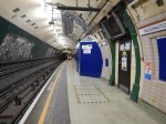
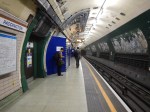
Interchange At London Bridge Station
Effectively, London Bridge station has four sets of services.
- Those that terminate in the station.
- Through services on Thameslink
- Through service to and from Charing Cross station.
- Through service to and from Cannon Street station.
I’ll leave out the Underground, as the entrance to that hasn’t been fully opened yet!
All the current sets of services have their own set of platforms.
Interchange between the various services is a matter of taking an escalator down from the platform on which you arrive and then take another escalator up to your departure platform.
At present, they seem to be using the rebuilt through platforms flexibly as follows.
- Platform 7 – From Charing Cross
- Platform 8 – To/From Charing Cross
- Platform 9 – To Charing Cross
As trains out from Charing Cross seem to pass through London Bridge on either platform 7 and 8, there does seem to be a degree of flexibility in the track. But then there are no Thameslink services needing to be accommodated.
I do wonder if at some time in the future, they will arrange the lines at London Bridge, so that there is some cross platform interchanges. But I suspect that given the complex layout of the tracks, changes will only be limited.
So passengers will continue to go down and up the escalators. But they don’t seem to be complaining!
The Southeastern Metro
This map shows Southeastern Metro services, which are close to the London termini and fall within the Oystercard area.
Southeastern Metro
If nothing else the map shows why Transport for London want to get control of Southeastern Metro services and paint them orange, as it is a ready made network that compliments the current Underground and Overground services.
The network has five Central London termini and stations; Cannon Street, Charing Cross, London Bridge, Victoria and Waterloo East.
It also connects to the following other lines.
- Several Underground Lines including the Bakerloo, both branches of the Northern Line, the District Line and and the Circle Line.
- The Overground at Denmark Hill, New Cross and Peckham Rye
- The Docklands Light Railway at Greenwich, Lewisham and Woolwich Arsenal.
- Tramlink at Elmers End.
- Crossrail at Abbey Wood.
- Thameslink at Dartford, Greenwich, London Bridge and Orpington.
In addition, many of the stations have step-free access..
These are the services from a selection of stations close to London.
- Dartford has six tph to Charing Cross and two tph to Cannon Street and Victoria.
- Greenwich has six tph to Cannon Street.
- Hayes has two tph to Charing Cross and Cannon Street.
- Lewisham has eight tph to Cannon Street, 4 tph to Charing Cross and 2 tph to \Victoria.
- Orpington has four tph to each of Cannon Street, Charing Cross and Victoria
- Woolwich Arsenal has six tph to Cannon Street and 2 tph to Charing Cross.
So in some ways it’s an all-places-to-all-terminals Metro.
Transport for London must look at the Southeastern Metro and have all sorts of ideas about how they could use the network to the benefit of London.
These are some Off Peak service levels.
- Sixteen tph between London Bridge and Cannon Street.
- Fourteen tph between London Bridge and Charing Cross.
- Ten tph between New Cross and Cannon Street.
- Eight tph between Orpington and London Bridge.
- Eight tph between Dartford and London Bridge
- Twelve tph between Lewisham and London Bridge.
Also consider.
- Would more services be possible after Thameslink is completed between London Bridge and Charing Cross.
- Could more use be made of an interchange at New Cross to get passengers to Canada Water for Canary Wharf and Witechapel for Crossrail?
- Could better use be made of Orpington station?
- Could Lewisham be improved?
- Will Brockley Lane station be rebuilt and a connection to the East London Line created?
- How would the area be affected by an extended Crossrail to Gravesend?
- How would New Cross cope with more than four tph on the East London Line?
I think that TfL could have lots of fun!
For instance, with a bit of reorganisation of services, it might be possible to create a ten tph or upwards set of lines across South London.
As an example Lewisham to Charing Cross via New Cross, London Bridge, Waterloo East could easily be ten tph.
No new trains, track or signalling would be needed, but the bottleneck of London Bridge must probably be removed before it is possible. And the Thameslink Programme is doing that!
Effects On The Jubilee Line
I don’t have any figures on passengers, but the section of Jubilee Line from London Bridge, will get a high-capacity by-pass on the surface.
But if we assume the current 14 tph on the rail line and 2019 frequency of 36 tph on the Jubilee Line, these are the numbers of carriages going between London Bridge and Charing Cross/Waterloo.
Heavy rail – 14 tph x 12 cars = 168
Jubilee Line – 36 tph x 7 cars = 252
Incidentally, the seats per hour figures are 10206 for Class 377 trains and 8424 for the S Stock on the Jubilee Line.
So will passengers choose to travel on the surface, thus freeing up capacity on the Jubilee Line?
Consider.
- Changing from say Thameslink after travelling up from Brighton to a Charing Cross service at London Bridge will be down and up two escalators and fully step-free.
- How many passengers will walk or take a bus to and from London Bridge to complete their journey?
- Some connections to the Underground at London Bridge require lots of walking.
- Going between London Bridge and Waterloo by a train rather than the Jubilee Line may well be a more pleasing experience.
- There are people like me, who prefer not to use a deep-level Underground Line, if there is an alternative.
Remember though that the the Charing Cross platforms at London Bridge are paired with 6/7 handling trains from Charing Cross and 8/9 trains the other way. Both pairs will share an island platform, escalators and a lift. So it may be quicker if you’re going to say Waterloo station, Trafalgar Square or Covent Garden to take a train.
Every so often, various plans are put forward as to what to do with the closed Jubilee Line platforms at Charing Cross. This is said about the platforms in Wikipedia.
As the Jubilee line platforms and track are still maintained by TfL for operation reasons, they can can also be used by film and television makers requiring a modern Underground station location. While still open they were used in the 1987 film The Fourth Protocol, and after closure in numerous productions, including different episodes of the television series Spooks.
I can envisage someone coming up with a plan, whereby these platforms are used as a second Southern terminus for the Jubilee Line. By 2019, it is intended that 36 tph will be running from North Greenwich to West Hampstead.
But there could be a problem, in that depending on what you read, there may not be enough trains for this increase in service.
But if, the uprated service between London Bridge and Charing Cross takes passengers from the Jubilee Line between London Bridge and Waterloo could the service be split into two?
- Most Jubilee Line trains would run as now and provide sufficient service between North Greenwich to West Hampstead.
- A small proportion of trains, perhaps 10 tph, would divert into the closed platforms at Charing Cross station.
It would give some advantages.
- There would be improved Underground connections at Charing Cross station.
- Trafalgar Square would gain another Underground Line.
- Charing Cross would have a two-stop link to Crossrail and the Central Line at Bond Street station.
Unlike most new station and interchange projects, the infrastructure is already there and maintained.
Consequences For Southern Crossrail
If everything works out with the Thameslink Programme and the rebuilding of London Bridge station, I can see no point to Southern Crossrail.
However, there idea of rebuilding Waterloo East station, is probably a good idea, to improve connectivity to the Underground and Waterloo station.
Waterloo East station could be handled a lot more passengers in the near future.
Conclusion
It looks to me, that Thameslink has been well-thought out and if the trains, track and signalling performs from London Bridge along the South Bank, as everybody hopes it should, we will see a world class Metro service across South-East London.
But I do feel that if the service along the South Bank is a quality one, then it will take passengers from the Jubilee Line and this line could be open for development.
London’s New Tube Map For Walking Between Stations
This map from Transport for London may seem a bit unusual, but the aim behind it is probably sound.
This page on the TfL web site, entitled New Tube map launched to help get Londoners walking. This is said.
The new map is the first official version in the world to show the number of steps between stations. It follows TfL’s very popular Walking Tube map, which launched last year and shows the walking times between stations. The new steps Tube map shows how to save time on everyday journeys. It will also help the increasing number of Londoners who set themselves a daily target of steps to take as part of daily exercise and getting fit.
I have always felt that what is needed as well, is more information on the walking short-cuts on the tube. A good place to start is at the list of Out Of Station Interchanges, which are generally a short walk.
The Cats At Clapham Common Station
Clapham Common station has replaced some of the adverts with pictures of cats.
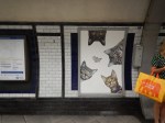


This article on the BBC gives more details.
Perhaps the station should be renamed as Catham Uncommon.
Do We Need More Angels?
Before my reader, thinks I’ve gone all religious, I’m talking about the Angel tube station.
The station was substantially rebuilt in the early 1990s and this is said in Wikipedia in a section about the rebuilding.
For years since its opening, the station regularly suffered from overcrowding and had a very narrow island platform (barely 12 feet (3.7 m) in width), which constituted a major safety issue and caused justified fear among passengers. Consequently, the station was comprehensively rebuilt in the early 1990s. A new section of tunnel was excavated for a new northbound platform, and the southbound platform was rebuilt to completely occupy the original 30-foot tunnel, leaving it wider than most deep-level platforms on the system. The lifts and the ground-level building were closed and a new station entrance was opened on 10 August 1992 around the corner in Islington High Street together with the northbound platform while the southbound platform opened on 17 September 1992. Because of the distance between the new entrance and the platforms, and their depth, two flights of escalators were required, aligned approximately at a right angle.
So that explains why the station is unusual and safe. Rather than unusual and scary!
This map from carto.metro.free.fr shows the layout of the tunnels through Angel station.

Note.
- The dotted lines of the original tracks.
- The track to the North (top) was the original Northbound track.
- The Southbound track still has the same layout.
- The original twelve-foot island wide platform has now been widened to create the platform labelled 2.
- The platform labelled 1 and the track labelled 1992 is new work.
- The other dotted line was a siding.
I suppose the only complaint, is that the new station is not step-free, but then the work pre-dated the time from when disabled-access became commonplace.
London Bridge station went through a similar process in the late 1990s.
This map from carto.metro.free.fr shows the track layout of the Northern and Jubilee Lines at the station.
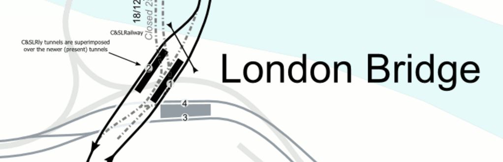
London Bridge Tube Station
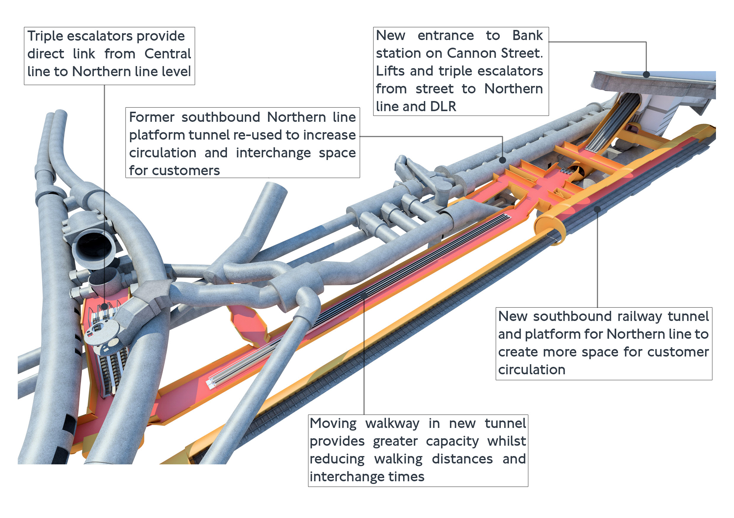
The work that will be carried out at Bank station follows some of the things that were done over twenty years ago at Angel.
This map from carto.metro.free.fr shows the current layout at the station.
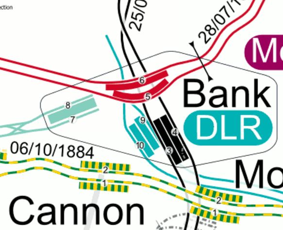
bank Tube Station
Note the following about the current layout and future developments.
- Platforms 3 and 4 are the current Southbound and Northbound platforms respectively, with non-traditional on the right running.
- A new single-track Southbound tunnel is being built to the West of the current one, to create a space between the lines.
- The current platform 3 will become part of the passenger space as it has at Angel.
- Platforms are being widened.
- Better step-free access is being created.
- There will be escalators direct to the Central Line.
- Oversite development is being added on the top of the new station entrance on Cannon Street.
- In some ways too at Bank station, the precedents set by the new Walbrook Square entrance are also being followed.
This visualisation, shows what the new Bank station will look like.
I think more stations can be rebuilt along using similar techniques.
Clapham North and Clapham Common stations are the last two Northern Line platforms with an island platform in the tunnel and must be towards the top of any list. This map from carto.metro.free.fr shows their locations.

Note their closeness to Clapham High Street station, I am sure, that eventually a better solution to these two stations will come about because of property development in the area.
- Euston station must be added, but this will probably be sorted with HS2 and the rebuilding above.
- Camden Town station is planned for a major upgrade with property development on top.
- Finsbury Park station is being improved, but given the station’s future importance, is what is planned enough?
And then there is always Highbury and Islington station, which is probably the worst station on the Victoria Line for platform access.
This map from carto.metro.free.fr shows the lines through the station.
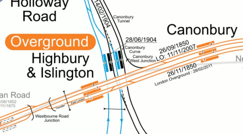
Note the following about Highbury and Islington station.
- The Overground has been sorted with step-free access.
- The bridge outside the station, which was decidedly dodgy will be fixed soon.
- Islington Council have ambitious plans for Highbury Corner.
- The Northern City Line is being upgraded to a high frequency with new Class 717 trains.
- The frequency on the North London Line is going to be increased a notch or so.
- There will be more trains to the South on the East London Line.
- The Victoria Line is going to get closer to forty trains per hour.
All of this adds up to a desperate need to rebuild the station with more escalators and lifts, probably on both sides of the Holloway Road.
There is a further unlikely possibility at Highbury and Islington station.
Note the Canonbury Curve in the map, which lies on a single-track electrified line that links the North London Line to Finsbury Park on the East Coast Main Line, Thameslink and the Northern City Line.
If, as I suspect, that in a few years the Northern City Line is upgraded to a higher frequency, once the new Class 717 trains, there will be an even bigger need to sort out this station.
Why Aren’t There More Female Train Drivers?
In Have The RMT Seen The Writing On The Wall?, I asked the following question.
As an aside, when did you last see a woman driving a train on the National Rail Network?
So I searched the Internet to see if I could get any information.
I found this article in The Guardian, which is entitled Meet the women doing ‘men’s work’, there is a section about Alison Miller, who drives trains for ScotRail. This is said.
Alison drives trains out of Glasgow Central for ScotRail. One of only 4% of train drivers who are women, Alison is also on Aslef’s Women’s Representative Committee.
Four percent is not very many. Perhaps, as Alison hints in the article, the rather uncompromising unisex uniform is a discouragement.
Nearly twenty years ago, when they had a severe driver shortage, London Underground placed an advert in Cosmopolitan to attract women. It is reported in this article in The Guardian entitled Cosmo ads target women train drivers.
You certainly see more female drivers on the Tube, than on the main lines.
I used to travel up to London years ago, with a driver-supervisor on the Central Line. I can’t ever remember discussing female drivers with him, but he did say one of the reasons suitable applicants backed out of being Underground drivers, was after seeing the wildlife with long tails, running about in the tunnels.
I lived with a woman for forty years, who wouldn’t have bothered with rats, mice or spiders, but if the tunnels had been filled with chickens, that would have been a totally different matter.
Paddington Is Operational Again
Paddington Underground station on the Bakerloo Line has now got its escalators back and getting to the station for me, is now so much easier.


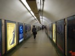


As the pictures show there seem to be quite a few new blue hoardings at platform level.
This map from carto.metro.free.fr shows the layout of the Bakerloo Line and Crossrail at Paddington.

Bakerloo Line And Crossrail At Paddington Station
Note.
- The Bakerloo Line runs roughly South-East to North-West through Paddington.
- The platform labelled 4 is the Southbound Bakerloo Line platform.
- The platform labelled 3 is the Nouthbound Bakerloo Line platform.
- The escalators run down to the platforms from the South-East
- Crossrail would appear to have an island platform between the two tracks.
There would appear to be two places on the platforms where blue hoarding have been put up to protect the works behind.
- The most obvious is the big blue wall that greets you as you come down the escalator, where some artistic tiling used to be.
- There are also blue hoardings at the London (South East) end of the platforms.
There is a pedestrian tunnel to Crossrail called the Bakerloo Line Link (BLL). A memeber of staff also told me that lifts will be installed to the Bakerloo Line.
This document on the TFL web site gives a bit more information.
Engineers will also carefully dig a new 165m tunnel underneath the station to enable passengers to interchange between the Bakerloo line and new Crossrail platforms, which will become operational from 2018. The new pedestrian link will incorporate escalators, lifts, stairs and new passageways in order to make interchanging between the Tube and Crossrail as easy as possible for passengers.
So it looks like the tunnel will go under the lines and come up between the two Bakerloo tracks. The length of one hundred and sixty-five metres would easily reach the Crossrail platforms.
I found this image on the web.
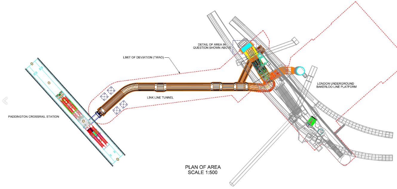
The Bakerloo Line Link At Paddington
It looks to be a very well thought out link.
- It is connected to the Crossrail station by escalators and lifts in the middle of the island platform at that station.
- The connection at the Bakerloo Line end, would appear to have lifts, stairs and escalators.
- Wll the lifts go direct to the surface as well?
- All routes seem to be direct to the central landing in the Bakerloo Line platforms.
- It may be a hundred and sixty five metres, but the design probably means most passengers will do it fairly fast.But I’m only speculating.
It will certainly be a very powerful interchange, as it will give a much needed connection to London’s least-developed Underground Line.
One good thing from the TFL document, is that it says this.
TfL will re-open the platforms in time for the Notting Hill Carnival on Sunday 28 and Monday 29 August.
So they beat their deadline by four weeks.
It certainly looks like a job well done!
Certainly, it makes my journey to the station easier.
The next thing needed is to get the Marks and Spencer reopened at the station.
Could More Pedestrianisation And Better Public Transport Be A Weapon Against Terrorism?
Protecting against the sort of attack like the one in Nice last night , must be every policeman’s nightmare.
The City of London put a ring of steel around the Square Mile and there hasn’t been a serious attack since. But it caused lots of other problems.
I actually think, that we now have so many areas where large crowds congregate for work, shopping and sporting events, that we need more and more traffic restrictions like those proposed for Oxford Street.
Intriguingly, the City of London is going the same way and wants to remove a lot of traffic from the area around Bank.
So is this pedestrianisation, perhaps linked with better public transport, one of our best weapons against terrorism?
The Mind Of A Terrorist
I don’t know, as I’m at best, a poor amateur psychologist, but it strikes me there are two types of terrorist wanting to create mayhem and kill lots of people.
The first group, are those who want to leave a bomb or device and get safely away.The Bishopsgate and Baltic Exchange bombings which in today’s money together caused over a billion pounds of damage, are examples of this type, where no-one was ever prosecuted, or even publicly named.
The second group are the much-more suicide bombers, who generally strike without warning
Incidentally, I only think one Irish bomber was killed by his own bomb and we can all be thankful for that, as if suicide tactics had been employed, we would have seen many more deaths.
The City Of London’s Ring Of Steel
The City of London is protected by a so-called Ring of Steel, which is a network of barriers, check-points and 649 CCTV cameras.
It certainly seems to have protected the City from further bombings and made terrorists seek out alternative targets outside the Square Mile.
It has had one very positive effect, although at times that doesn’t seem to be as effective as it was. The City inside the ring, is now a very pleasant place to walk about and explore, as traffic is much-reduced.
Also, at weekends, the City is now a very quiet place for much of the year.
When I was still driving and needed perhaps to park a car for the evening or overnight, I would also park it prominently on a meter or legal parking space inside the ring, as I knew it would still be there in the morning.
The Future Of The City Of London
The City of London is pushing ahead with a policy of pedestrianisation, improved walking routes and better access to the Underground and rail network.
They have one great advantage compared to most other local authorities. Land is so expensive in the City and therefore fortunes are spent to create buildings that will earn billions, that if the City says to a developer, can you put an Underground entrance in your building, the answer is usually yes.
At the present time, Bloomberg are creating a new headquarters building called Walbrook Square, that will incorporate a second entrance to the Waterloo and City Line.
Other cities across the UK and the wider world are not so lucky!
Crossrail and the upgraded Thameslink will have their effects on the City, because of the positions of their stations and other factors.
- , Crossrail will have a massive double-ended station stretching from Liverpool Street in the East to Moorgate in the West.
- Thameslink will have a line of stations; Fasrringdon, City Thameslink and Blackfriars, down the West of the City.
- Crossrail and Thameslink will have their important interchange at Frarringdon.
- Crossrail will have a major interchange at Whitechapel serving the East of the City.
- Thameslink will also have a major interchange at London Bridge, just across the River from the City.
- Crossrail and Thameslink will be running two hundred metre long trains at a frequency of twenty-four trains per hour in both directions.
Add to that the existing services of the Central, Circle, District, Metropolitan and Waterloo and City Lines of the Underground and National Rail services out of Cannon Street, Fenchurch Street, Liverpool Street and Moorgate, all of which will be upgraded and I believe that at some point in the future, the City of London, will take the bold and very green step of making the whole area a pedestrian-only one, with the only vehicles allowed in the day, being approved electrical ones.
It would be a bold move, but it have several positive effects.
- Air quality would improve.
- The City would be the place to work!
- The City would become one of London’s major tourist attractions, with visitors able to walk all across from St. Pauls to the Tower and the River.
- Innovation would work to provide the services a city needed despite the restrictions.
Would terrorists realise that the sort of spectaculars they love, would be more difficult and go elsewhere?
We could see a return to suicide bombers on the Underground!
Conclusions
The City of London will reinvent itself, as it does periodically with great success.
Given that Oxford Street has said that it will pedestrianise by 2020, are we seeing a green transport revolution?
I can think of a few other cities and towns, that could follow London’s example.
