Council’s Concerns Over Suggested Tunnel Charges
The title of this post, is the same as that of this article on the BBC.
This is the sub-heading.
Concerns have been raised by a county council over suggested charges at the Silvertown and Blackwall tunnels in London.
These are the first two paragraphs.
Kent County Council (KCC) said the proposed charges could impact on the county’s traffic, including at the Dartford Crossing.
The council said although it supported TfL’s ambition to improve journey reliability and reduce air pollution, it believed the proposed changes could “significantly affect” drivers from Kent.
I can’t see that the charges on the two tunnels won’t affect drivers habits.
Thirty years ago, before satellite-navigation had been invented, when my family and myself lived in East Suffolk, if I was returning from Brighton or Gatwick, I would make a choice about, whether to use the Dartford Crossing or the Blackwall Tunnel. Sometimes traffic was so bad, that I had to take the longer Western route using the M11 and the A14.
I didn’t really bother about the toll on the Dartford Tunnel, as it was then, but often the free Blackwall route was quicker.
In those days, I was relying on radio reports, but now with satellite-navigation, drivers will be taking more intelligent decisions, that take account of tolls.
The BBC article also says this.
The council says Kent drivers make up 10% of the Blackwall Tunnel’s users.
So it looks like the drivers of Kent will be paying tolls to London.
These are my thoughts.
How Can The Tolls Be Avoided?
There will still be two free crossings, to the East of Tower Bridge; the Rotherhithe Tunnel and the Woolwich Ferry, but how long will they remain free, if they drain money from the tolled tunnels?
What About The Trains?
Trains from somewhere like Ebbsfleet international station can be used.
Ebbsfleet international station has a lot of parking, but at some stations parking is distinctly limited.
I doubt though, that Transport for London have done a professional survey of the amount of parking that is needed.
They tend to believe if people live out of London, that parking for trips to London is not a Transport for London problem.
Are there any plans to increase the train frequencies, if more people use them?
Note that Off Peak Day Return tickets can be purchased with a Railcard, from Dartford to London for under a tenner, and from Ebbsfleet international to London for under fifteen pounds.
If Built, Will The Lower Thames Crossing Help?
The first paragraph of the Wikipedia entry for the Lower Thames Crossing, describes it like this.
The Lower Thames Crossing is a proposed road crossing of the Thames estuary downstream of the Dartford Crossing that links the counties of Kent and Essex, and its proposed approaches. If built it would pass through the districts of Thurrock and Gravesham, supplementing the Dartford route. The approximately 14.3-mile (23.0 km) route is being assessed by the Planning Inspectorate.
As it is likely to cost nine billion pounds and take six years to build, I can’t see the current Government building it.
But it would certainly make it easier for traffic to go between the Channel Tunnel and North of London.
Conclusion
I can see the UK muddling through, when we should be bold and create the transport infrastructure for the Twenty-First Century.
For instance, I would extend the Elizabeth Line in the North-East to Southend and in the South-East to Ebbsfleet and Gravesend. With the existing cross-platform interchange at Whitechapel, I believe, it could pick up much of the cross-river passenger traffic close to London.
I also feel that there will need to be improved connections between the fast-expanding London Gateway freight port and the Channel Tunnel.
Silvertown Tunnel: Cracks In Mayoral Policies
The title of this post, is the same as that, as this article on the BBC.
This is the sub-heading.
It is an infrastructure project that is well-underway with the boring almost completed — but it has a very low profile.
These three paragraphs possibly explain why.
Every step of the Crossrail tunnelling, the media were invited along. Not so with this project.
This is Silvertown Tunnel. It is more than 1km long and will be London’s first road tunnel in over 30 years.
Perhaps one of the reasons it isn’t being pushed publicity-wise, is it is very controversial.
Reading the rest of the article it certainly is controversial in many people’s minds.
These are my thoughts.
Avoiding The Dartford Crossing
When I drove back to Suffolk from Gatwick, Kent or Sussex, in the last century, because of congestion at the Dartford Crossing, I would sometimes cut through London and use the Blackwall Tunnel, when I thought it would be quicker.
When the Silvertown Tunnel opens, this could be a viable alternative for vehicles.
My experience of modelling flows, tells me, that water finds its own level. With driving, Satellite Navigation will be able to tell drivers, which will be the fastest route.
It is my view, that the Silvertown Tunnel will become the biggest rat-run in London.
Except some of these rats will be super-rats in 45-tonne HGVs.
Cutting Pollution In London
If super-rat-running is going to happen, then this will raise pollution in Central London, with all those heavy trucks going through.
The only way to cut pollution would be to have differential pricing for vehicles in the tunnels.
Perhaps hydrogen and electric vehicles should be at a discount.
But then Sadiq Khan doesn’t have a hydrogen policy, except to ignore it and hope it goes away.
The Elizabeth Line Effect
Talking to Elizabeth Line staff at Whitechapel station, they feel that there is an increasing number of passengers, who do journeys in East London on an up-one-branch-down-t’other basis between places like Ilford and Woolwich.
I believe, that other cross-river railways and the Bank station improvements, will also take passengers out of their cars, which will free up the Silvertown Tunnel for more HGVs.
A City Airport Station On The Elizabeth Line
I wrote about this in Thoughts On London City Airport And The Elizabeth Line.
How many cars would this remove from the tunnels under the Thaames?
Memories Of Althorpe
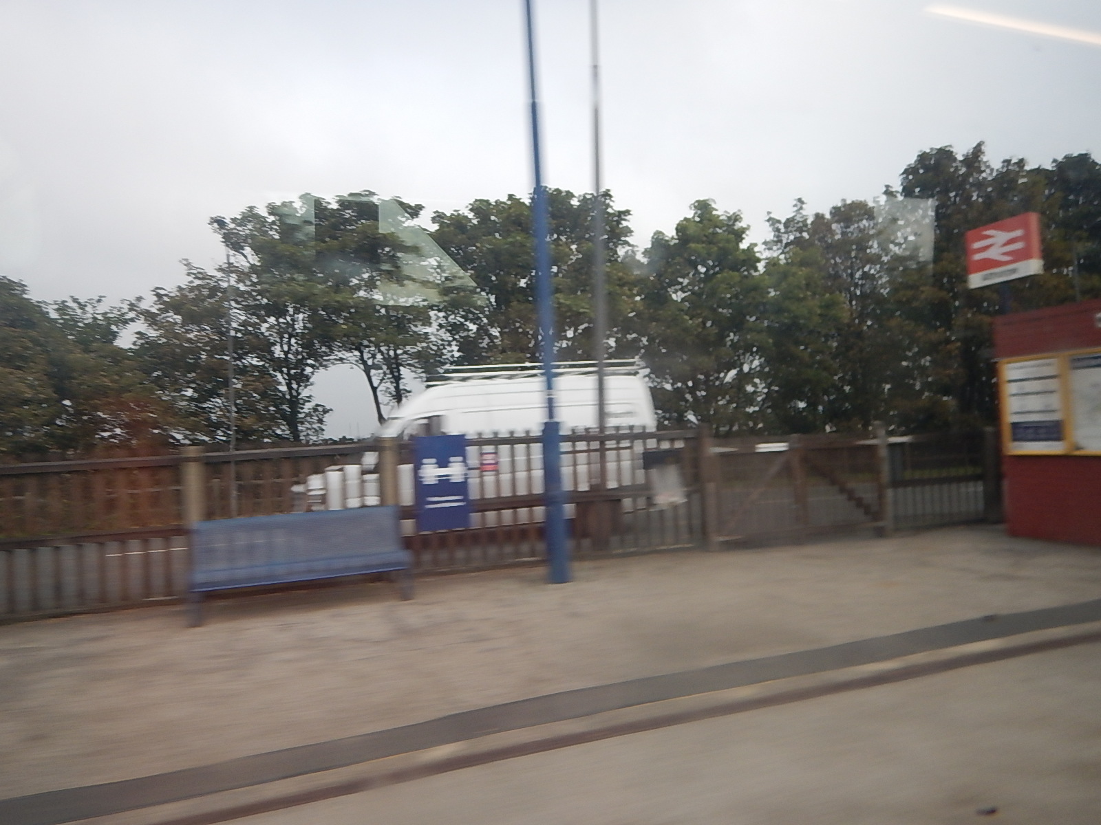
On The way to Cleethorpes, I passed through Althorpe station.
This Google Map shows the area.
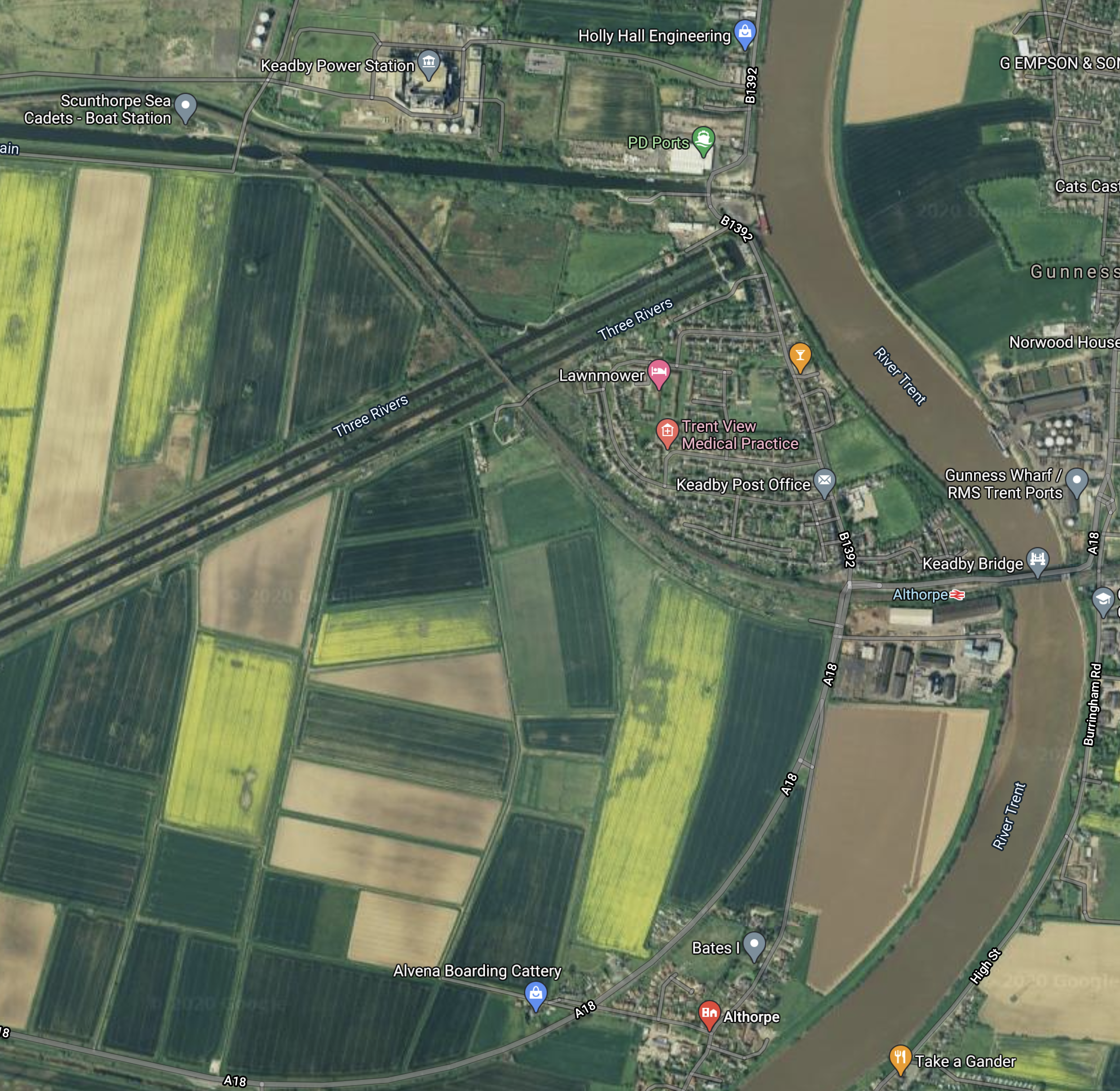
Note.
- The River Trent flowing South to North.
- Keadby power station at the top of the map.
- Althorpe station close to the bridge over the river.
- The village of Althorpe is at the South of the map by the river.
C and myself had friends, who farmed much of the land in the curve of river, South of the railway.
These are a few tales, some might enjoy.
Althorpe And Princess Diana’s Grave
I was once told, that regularly tourists would appear looking for the last resting place of Princess Diana.
Sat-navs may be a wonderful gadget for some, but they do lead those with a certain lack of common sense on wild goose chases.
C And The Tug-Boats
C once spent a night in their farmhouse, which was by the River Trent.
She didn’t sleep well, as tug-boats pulling barges were constantly going past and sounding their sirens. The river was actually above the house, due to the embankments to stop flooding.
Princess Anne And The Centrefold
Our friends’ daughter was a very good rider in eventing and used to supplement her variable income in the sport with modelling. At one point, I used her for some promotional shots for one of my companies.
Some years ago, she was competing at an event in Yorkshire. Coincidentally, this was just after she had appeared as the centrefold in a well-known men’s magazine.
The event was a bit of a nightmare for her, as paparazzi were following her with open copies of the magazine.
At one point, it all got a bit much, so she decided to sneak back to the calm of her horsebox, by a circuitous route.
As she walked back, she encountered Princess Anne, who was also competing and using the same route to avoid the paparazzi.
They talked about the pressures of the paparazzi, who were being a nuisance, with the Princess saying, she approved of my friends’ daughter’s modelling and hoped it continued, as it had taken the pressure off herself.
Flixborough
My friends’ farm was not far from Flixborough, which is infamous for the Flixborough Disaster in 1974, when a chemical plant exploded and killed 28 people and seriously injured a further 36.
My friends also lost several thousand pigs because of the explosion.
Wikipedia says this about the cause of the explosion.
The disaster involved (and may well have been caused by) a hasty modification. There was no on-site senior manager with mechanical engineering expertise (virtually all the plant management had chemical engineering qualifications); mechanical engineering issues with the modification were overlooked by the managers who approved it, nor was the severity of the potential consequences of its failure appreciated.
At the time, I had just left ICI and I was still in contact with my former colleagues.
One told me, that he had met a Senior ICI Engineer, who had been involved with the enquiry into the disaster.
The plant had been a copy of a Dutch plant, that had been built to metric units, which were converted to Imperial to build the Flixborough plant.
As ICI had used metric units since the mid-1950s, there was considerable alarm in the mind of the Senior Engineer, that when the hasty modification was made, someone got mixed up.
Would the Flixborough disaster have happened, if the plant had been built as a copy of the Dutch plant using metric units?
Do Sat-Navs Exploit Rat Runs
This afternoon my son brought me home in his car through North-East London.
- He was using a sat-nav and it was a mazy drive down a succession of narrow residential roads usually with cars parked on both sides.
- I’m sure we did two totally unnecessary loops.
- He also approached my house the wrong way, so he did two unnecessary right turns.
I’ve never used a sat-nav and doubt I ever will, as I don’t drive any more and when I’m walking, I prefer to use a proper map, like there are on most London bus stops or train stations.
I wonder how many acxcidents and traffic jams are caused by sat-navs.
