Sheringham
I spent an hour or so in Sheringham, but sadly I didn’t find anywhere suitable for lunch.
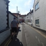
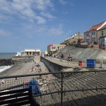
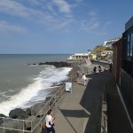
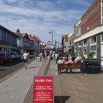
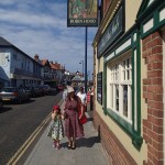
I was too late for lunch and too early for supper, so I just had half a pint of Aspall’s cyder and walked back up the hill to get the train back. I could have got plenty of unhealthy food and judging by the size of many of the visitors, there was an answer to “Who ate all the pies?”
It was a lovely day as the pictures show, but quite a few cafes and restaurants were closed.
It is also a town, crying out for the main street to be pedestrianised, as the traffic and the pavements crowded with the obese made walking up and down to the beach a real obstacle course.
The Long-Awaited Walthamstow Link Is Nearly Here
It should have been a simple job, but it has grown into an eighteen year saga.
Walthamstow Central and Queen’s Road stations are not far apart and a pedestrian link has been needed for years to make interchange possible. Finally, it will be opening next month, as is reported here in ThisisLocalLondon. In the end despite an agreement the Council had to take the developers to the High Court.
How many other simple links should be created to make travelling by public transport easier?
A Gluten-Free Cafe By The River
I went to Richmond for a walk by the river in the sun. I was surprised to find a cafe with a prominent gluten-free menu. So I couldn’t resist a gluten-free cheese and onion quiche with my cup of tea.

A Gluten-Free Cafe By The River
It was excellent. And it was lovely to sit in the sun!
Maps And Information In Berlin
This is a subject that I find important and feel that if a town or city wants to be a Grade One tourist destination, then they must have good maps and information.
London has always had a street map at each Underground station and this policy has been extended to most of the proper bus shelters. It’s a policy that Londoners and tourists must like, as more and more maps and information is appearing, with yellow topped liths popping up everywhere.
Warsaw it seems has started to add liths and maps for tourists, with quite a few finger posts too.
But I only one map on the street in Berlin.

A Solitary Map
There are maps at stations, but they are not up to the detailed level, you get in other cities, including some German ones.
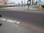
Is This From A Green Perspective?
I saw this sign in Manchester.

Is This From A Green Perspective?
As one myself, I of course think that pedestrians look right.
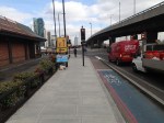
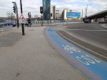
What Do You Do With A Problem Like Euston?
Or more particularly, how do you connect Euston station to Euston Square Underground station.
I walked between the two stations today and took these pictures.


It’s a congested route and it involves at least one busy road crossing.
I had wondered if some sort of pedestrian over-bridge could be used with a moving pavement to link the two stations. But it would appear that layout of the buildings plonked in the front of Euston station would probably make this impossible.
Wikipedia does state that Network Rail devised plans in 2005 to link the two stations with a subway. This project seems to have sunk without trace.
The only thing that could possibly be done, is to put a lift to the street on the Northern side of the lines in Euston Square station, to improve access to the Eastbound platform.
I never walk between the two stations and to get to and from the station, I usually use a 30 or 73 bus, as the tube station underneath the mainline station is a dark warren of tunnels and escalators.
The trouble though with the buses, is they get stuck in the traffic on the Euston Road.
Why a proper connection between the two stations wasn’t incorporated, when they rebuilt Euston in the 1960s, only a genius of the level of Einstein could tell. But sadly he’s dead, so we’ll have to use the ouija board.
What puzzles me, is that how come the architects in the 1960s, could create two stations as bad as Manchester Piccadilly and Euston and yet leave Liverpool Lime Street as a properly working station! This section in Wikipedia offers a few clues.
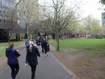
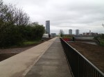
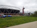
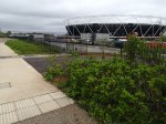
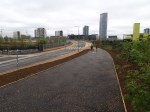
Walking To The Olympic Park
I went to the newly-reopened Queen Elizabeth Olympic Park today by walking from Hackney Wick station.
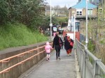


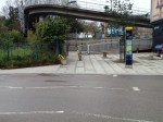
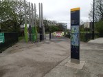
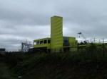
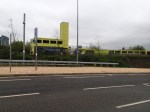
I actually stopped for a cup of tea at the ViewTube.
But it was an easy walk, once you started along the Greenway.
There is also a nice slope up and down from the ViewTube, which as is typical for a Sunday was fairly busy.
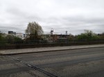
Walking Across Manchester
I know I posted that it was wet, as I walked between Manchester Piccadilly and Manchester Victoria stations. But it wasn’t an easy walk!
There were a few signposts to Victoria, but I didn’t see one map anywhere, so in the end I followed the tram lines, which I knew went to the station. Or they did last time I was in Manchester, but now due to the rebuilding of Victoria they don’t. I met a couple from Bolton with their grandchildren at Victoria, who’d used the tram to get to Victoria. They missed the alternative stop and had ended up in Rochdale. So they had to come back on another tram.
Incidentally, when I left Piccadilly, I found that the free buses that go all over Manchester city centre don’t actually connect the two stations without a change. I suppose this is to ensure that those changing between the two stations with or without heavy baggage use a taxi or pay for a tram to get lost in Rochdale.
Because my eyes don’t respond quickly to fast moving objects from the left, I always cross the road using a light controlled crossing. For extra safety I generally use the thingy underneath to tell me of the green light. But I found a lot of these buttons were missing as I got near Victoria. As were the signposts! Vandalism or theft?
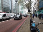
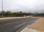
The Notorious Bow Roundabout
Several cyclists have been killed or injured on this notorious roundabout.
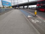
Work has been done to improve it, but it’s still not a great place to walk.
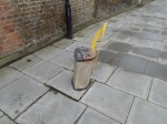
Navigating Around Bexhill
Why is it that so many towns that want to attract visitors, have such poor maps and information? I saw just one solitary lith by the De La Warr Pavilion.

A Lonely Lith In Bexhill
But the worst crime was the only usable walking map at the station, which was positioned for those, who were tall enough to be basketball players.
How many people after visiting a town, where they got lost, go back and tell their friends about their experiences?
Let’s hope that Bexhill increases the number of liths and especially puts one outside the station.
