The Connection Between Northern And Circle/District Lines At Bank Station
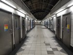
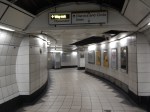
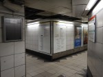
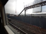
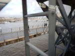
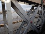
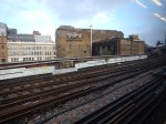
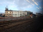
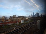
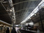
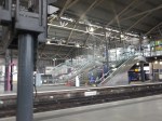
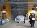
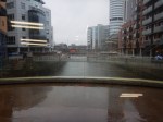
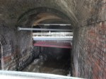
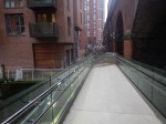
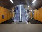
I’ve done this interchange at Bank station a few times but not that I remember it. These pictures show my route as I walked from a southbound Northern Line train to the Circle/District Lines, where I went one stop to Cannon Street station.

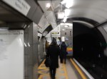


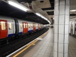
The Northern Line is unusual in Bank station, in that the southbound track is on the right hand side of the two lines, whereas normally in the UK, they follow the same rules as the roads.
I walked down the platform, took the exit at the far end and then used the escalators to get to the passageway leading to the Circle/District Line platforms.
When the station is upgraded with a new Cannon Street entrance, a new southbound tunnel will be bored several metres to the west and the space between the two tunnels will become a generous circulation space, with four cross tunnels linking the two Northern Line platforms, which hopefully will be wider than the current narrow ones.
Connections to and from the circulation space will be as follows.
- A set of three escalators will ascend to the new entrance. They are actually two sets vertically, with a landing to turn everthing the right way.
- Two travalators will connect to the Central Line platforms to the North.
- Another set of three escalators will descend to the DLR platforms some ten metres below.
- Two lifts will connect to the new entrance above and the DLR platforms below.
- The two escalators and their connection to the Circle/District Lines will be opened out and upgraded.
I’m not sure how this space connects to the Waterloo and City Line, but I’m sure that the architects have a solution.
But I do think, it’s rather a neat solution to convecting all the lines together, as the amount of walking that passengers will do compared to the current station will be greatly reduced.
I also think, it’s going to be a straightforward station to build, in that you can leave the current platforms to handle the trains until you’ve dug most of the station tunnel for the new southbound line, completing as much of the entrance as you want above the working Northern Line and DLR. Once the Northern Line is closed, the circulation space with all its lifts, escalators and travalators is put together.
I think a lot of the work will be done from the top in a big hole, lifting everything in, by the use of large cranes.
Will much of the mechanical infrastructure be put together in a nice, warm, dry factory?
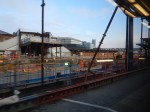
The New Cannon Street Entrance To Bank Station
This entrance will help to solve Bank station’s chronic problems. It will go on the corner of Nicholas Lane and Cannon Street.
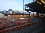
These pictures were taken on a walk from King William Street to Cannon Street station.
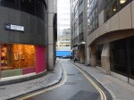
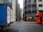


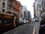

I would assume, it will replace the McDonald’s, with a new office block on top.
This Google Map shows King William Street, Nicholas Lane, Cannon Street and the various stations.
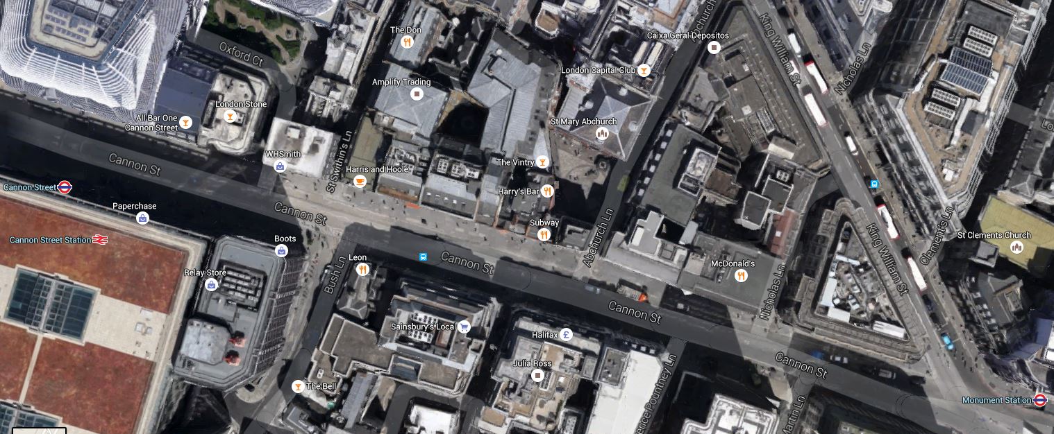
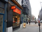
New Cannon Street Entrance At Bank Station
Note the McDonald’s. I had an excellent lunch in the Leon.
If you want to read more about the proposed station, you start by looking at this page on the TfL web site, which is entitled.
I found these two documents answered a lot of the questions, I had about the design of the station.
Design and Access Statement – Part 1 – Opens with a detailed drawing of the whole new entrance project.
Design and Access Statement – Part 2 – Opens with a detailed summary of the proposal.
They also have a lot of good images, visualisations and diagrams.
Summarising what I learned, I will make the following points.
- The new entrance will be a wide one where the current McDonald’s is situated.
- Passengers will go through the wide gate line and banks of escalators will take them down to the Northern Line.
- Passengers requiring step-free access will have a dedicated route to the lifts from two wide gates on the left of the entrance.
- The Northern Line is deep and because of the constricted nature of the site, the escalators will be vertically split into two banks with a landing, as some at London Bridge station are.
- At the bottom of the escalator will be a large circulation area, with cross passages accessing the rebuilt and wider Northern Line platforms.
- Moving walkways from the circulation area, will take you to the Central Line.
- The rise between the Northern and Central Line levels will be handled by escalators between the Central Line platforms.
- Access to the DLR platforms, which are several metres below and parallel to the Northern Line platforms, will be via escalators in the middle.
- The District and Circle Lines will be accessed from the Southern end of the circulation space by means of an improved passage to existing escalators.
- I suspect that the access to the Central Line and DLR platforms, can be built without any lengthy closures.
- Don’t forget that there is a new entrance at Walbrook Square being built to give lift and escalator access to the Waterloo and City Line, that will open in 2017.
- All existing links between lines and the existing entrances will be preserved and upgraded.
- Two seventeen passenger lifts will descend from the new entrance to both the Northern Line and the DLR.
- The station is to be completed by 2021.
I think it is true to say, that the new Cannon Street entrance is effectively a second station that is connected to all the existing lines.
In the latter part of the project, the Bank branch of the Northern Line will be closed, so that the new running tunnel can be dug. I don’t think it will be possible to turn trains at say Moorgate and London Bridge, so the branch will cease to be any use.
Could this blockade, be planned to happen after Crossrail opens, so that passengers can walk to Liverpool Street/Moorgate to access other North-South routes?
- Crossrail to Farringdon station for Thameslink
- Crossrail to Tottenham Court Road station for the Charing Cross Branch of the Northern Line.
- Crossrail to Whitechapel for the East London Line.
- The Northern City Line at Moorgate station.
The Central, District and Circle Lines had better behave too!
So how would the new station at Bank change my transport habits?
- Journeys between my house and Bank station are often done on a 21 or 141 bus, where the stops are within a hundred metres of my house. I would hope for better access between buses and the new complex at Bank.
- The new Wallbrook entrance and the improved access to the Waterloo and City Line, will greatly improve one of my routes to Waterloo,
- I often go south on the Northern Line, as it is easy to get a 38 or 56 bus around the corner from my house and dive straight into the Northern Line at Angel station. From Bank I will use the easy access to the DLR and the District and Circle Lines.
- I suspect that when I need the DLR, I will go to Bank, rather my route now via Shadwell on the East London Line.
- If I’m coming North on the Northern Line, I get out at either Bank, Moorgate or Old Street and take the 21 or 141 bus.
I shall certainly have a lot of interesting transport routes.
The expansion of the station, in addition to sorting the connection between the various lines at the station, will after the Wallbrook entrance is complete, create two new terminii for the two smaller lines at the station.
Waterloo And City Line
The new Wallbrook entrance will create a step-free entrance into an upgraded Waterloo and City Line.
This will generate a few questions.
- How long will it be before demand is such, that the Waterloo and City Line opens on a seven-day-a-week basis?
- Will the passageways still connect the Waterloo and City Line platforms to the to the DLR and the Northern Line?
- Will the connections to other lines at Bank station be good enough?
- As the Bank end of the line will be step-free, what will happen at the Waterloo end?
- Could access to the line be improved from Waterloo East station?
I think that the Waterloo and City Line will get a few more small upgrades. Especially, as during the blockade of the Northern Line to build the new spouthbound tunnel, it will be used to bring travellers to and from Bank station.
Docklands Light Railway
The two DLR platforms and their connections to the other lines will be transformed by the station expansion.
- Many of the walking routes to other lines and the exits will be step-free, and all will be an improvement on the present routes.
- The important connection to the Northern Line will be by escalator or lift.
- There will be a lot more space around the two DLR platforms.
I think this ease-of-use of the DLR part of the station, will increase passenger numbers dramatically.
It appears to me that the new design will future-proof the DLR terminus, as the new layout of the DLR platforms and their connections seems to have been designed, so that the DLR can be extended to the West.
According to Wikipedia, two possible westward extensions have been proposed.
I think that the former which would take the DLR to Charing Cross and possibly Victoria via City Thameslink and Aldwych would be the most promising.
This would give me a route to Charing Cross station, which is probably the most difficult station to get to from Dalston.
But will it ever happen?
Bank station will certainly ready for a DLR extension in 2021.
From Cannon Street To London Bridge
I took this journey after the Christmas reorganisation of services through London Bridge station.


It’s all coming on.
The next big date is August, when a bit more of London Bridge station opens.
From Charing Cross To London Bridge
I took these pictures on a trip from Charing Cross station to past London Bridge station.


The train used the new viaduct over Borough Market.
I’m All For This!
This article on the BBC web site entitled Lib Dems pledge to halve London morning commuter fares, caught my eye. This is said.
London mayoral candidate Caroline Pidgeon has promised if she is elected in May she will cut Tube and rail fares for journeys before 07:30 by half.
As someone who has generally started work before eight, ever since I marked up newspapers at 05:30 in the morning as a sixteen-year-old, if I’d worked in London over the years, I would have saved money.
Now of course, I don’t pay, as I have a Freedom Pass. it would be interesting to see how many journeys, I do start before 07:30. It’s probably about four a week.
This is one of those ideas that could be tested using sound Control Engineering principles.
At the present time, any journey starting before 04:30 is in the Off Peak.
So for a period of six-months say, you would use 05:00 and see how the usage and revenue changes.
And then later, you move it to 05:30 for a period.
With some clever analysis of the data, I suspect that the time that is the best compromise between customer satisfaction, service costs and revenue can be found.
Giving a fixed time now, is totally wrong!
But in my view, if a politician said, they were aiming to increase the time in which Off Peak fares applied, it would be a sensible policy.
Could IPEMU Trains Use KERS?
I have just read this article on The Business Desk, which is entitled Torotrak’s bus KERS system gets all-clear. The article starts like this.
Torotrak, a developer and supplier of emissions reduction and fuel efficiency technology in vehicles, and Wrightbus are celebrating the successful completion of the in-service trial of the Flybrid mechanical kinetic energy recovery system (KERS) for buses.
The trial was conducted with Arriva, one of the largest bus operators in the UK.
It must have been successful, as other reports say Torotrak shares have risen and the company is expected to start production of the Flybrid KERS in 2016.
I’m probably not the only engineer, who’s wondering, whether the technology can have applications with trains.
My one regret is that I only bought a thousand pounds worth of shares in the company.
The Future Of The Calder Valley Line
On Saturday and Sunday, I did four trips on the Calder Valley Line
- From Leeds to Burnley Manchester Road
- From Burnley Manchester Road to Manchester Victoria
- From Manchester Victoria to Hebden Bridge
- From Hebden Bridge To Leeds
The pictures aren’t as comprehensive, as I would like, but at times the rain was very heavy.
The Route And Trains
This diagram clipped from Wikipedia, shows the route of the Calder Valley Line.
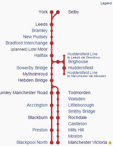
Calder Valley Line
Note.
- Since the opening of the five hundred metre long Todmorden Curve last year, there is now a direct hourly service between Blackburn and Manchester Victoria via Accrington, Burnley Manchester Road and Todmorden. I used this valuable new service on Sunday.
- Brighouse station reopened in 2000 on a link between the Calder Valley Line and the Huddersfield Line.
- The Huddersfield Line is being electrified.
- Low Moor station is being built and should open next year.
There is not much electrification.
- Leeds to York is either electrified or will be in conjunction with the Huddersfield Line electrification.
- Other routes between Leeds and the other Bradford station; Forster Square are electrified.
- Manchester Victoria station is electrified.
- Preston station is electrified and hopefully will be electrified to Blackpool North station.
The trains are a mixture of diesel Class 150 and Class 158 trains, run by Northern Rail. The Class 150s are a bit small and uncomfortable for the route and the top speeds of 75 mp for the Class 150s and 90 mph for the Class 158s, are probably not fast enough, especially as the two ends of the line have higher speed limits.
The Future
Wikipedia has a section on the Future of the Calder Valley Line. This is said.
Improvements to the line are proposed as part of Network Rail’s Northern Hub plans, which would allow for more frequent services on the line. Some services via Bradford would also be extended to Chester,Crewe, Liverpool and Manchester Airport. The Chester & Liverpool services have since been incorporated into the new Northern Rail franchise agreement – awarded to Arriva Rail North in December 2015 and due to start in April 2016, these will be marketed under the “Northern Connect” brand and operated by new 100mph DMUs once delivered. The Manchester Airport trains will follow one the Ordsall Curve is completed in 2018.
Low Moor station, between Bradford Interchange and Halifax, is due to be re-opened in 2016. A business case is being developed to re-open Elland station between Halifax and Brighouse.
There is no mention of electrification, for which the earliest dates are quoted as somewhere in the period from 2019-2024.
But there is this article is on the Shields Gazette web site, with a title of Electrification of the Calder Valley is ‘top priority’ says Rail Minister.
This article is backed up by other statements, so Network Rail and the Government are thinking seriously about electrification of the Calder Valley Line.
Network development and/or electrification is happening at both ends of the Calder Valley Line and I’ll look at both.
Network Development in Leeds and Bradford
The West Yorkshire Metro has proposed electrification of the Harrogate Line and have performed an extensive new station study.
They have already opened Apperley Bridge station and Kirkstall Forge station will follow in a few weeks.
The new stations survey mentions these new stations.
- East Leeds Parkway – This will be a Parkway station on the Selby Line and will also be a terminus for services from the West, that now terminate in Leeds.
- Elland – This will be between Halifax and Brighouse.
- Haxby – This will be on the York to Scarborough Line
- Crosshills – This will be on the Airedale Line
As I said earlier Low Moor station is being built. It will be on the unelectrified line between Bradford Interchange and Halifax. If Elland station is reopened, then it will be the other side of Halifax towards Brighouse. To serve both these new stations trains will have to serve the following stations.
- Bradford Interchange
- Low Moor
- Halifax
- Elland
- Brighouse
- Huddersfield
This is a modification to the current hourly service from Bradford Interchange to Huddersfield via Brighouse.
In the next few years hopefully, Huddersfield will be electrified, but there is no chance that this route into Bradford Interchange will be electrified at the same time. It would probably be pointless, as Bradford Interchange station, unlike Bradford Forster Square station is not electrified.
To make matters a lot more complicated, the stupid fact that Bradford has two entirely separate stations, means the following.
- There is no train, that calls at both Leeds and Bradford and goes on to Huddersfield and Manchester.
- There is no train, that calls at both Leeds and Bradford and goes on to Halifax and Hebden Bridge.
- There will be no direct train between Leeds and Low Moor.
I think other journeys of less than twenty or thirty miles in the Leeds-Bradford area will probably be either impossible or much more complicated than they should be.
Also, at the moment, two of the Leeds-Bradford routes are electrified and the Calder Valley Line is not.
The only new electrification in the area planned, will be the fast route on the Huddersfield Line from Leeds to Huddersfield via Dewsbury.
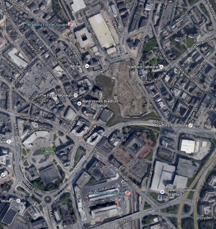
To help in comprehension, this is a Google Map, showing how the Calder Valley Line links into Bradford Interchange.

Bradford And The Calder Valley Line
Bradford Forster Square Station is in the North-East corner of the map, with Bradford Interchange below it.
Note how the Calder Valley Line comes in from Leeds in the east, before doing a turn to the north and Bradford Interchange station. After reversing in the station, trains leave the station in a southerly direction towards the new Low Moor station and onto the West. Because of the dark scar below the line, I wonder if in the past, there has been a connection by-passing the station.
It’s a mess!
The solution needs to be four-fold.
- Electrify Leeds to Huddersfield via Dewsbury. This is being done.
- Electrify the Calder Valley Line from Leeds through Bradford and Low Moor as far as Halifax.
- Electrify the link between the Calder Valley Line and the Huddersfield Line through Brighouse.
- Sort out the absurd situation of the two Bradford stations.
This would enable the West Yorkshire Metro to expand its network of electric trains in the area. It could even use IPEMUs, which would charge their batteries on the electrified core network and then provide services to other towns and cities.
- Scarborough via York and Haxby
- Hull
- Sheffield via Doncaster
- Ripon via Harrogate – I wrote about this in North Yorkshire Proposes Rail Expansion
- Colne via Skipton and a new section of track. – I wrote about this in The Todmorden Curve Has Helped A Campaign For More
I’m sure that the West Yorkshire Metro can be ambitious and will have other and better ideas.
Network Development in Lancashire
Currently, there is a lot happening at the other end of the Calder Valley Line.
- The Todmorden Curve has opened and a new hourly service runs between Blackburn and Manchester Victoria.
- Manchester Victoria station is becoming a top class station and an electrified hub for services spreading out from Manchester.
- Manchester Victoria to Liverpool Lime Street is now electrified.
- Manchester Victoria to Blackpool North via Bolton and Preston is being fully electrified.
- The Ordsall Curve is finally being built to link Manchester Piccadilly and Victoria stations.
- Merseyrail is acquiring a new fleet of trains, which may include IPEMUs.
With the devolution of local rail services to local bodies, I suspect other things will happen.
Northern Connect
Northern Connect is a new sub-brand that will be introduced by Arriva Rail North.
Services in the sub-brand using the Calder Valley Line include.
- Chester to Leeds via Warrington, Manchester Victoria and the Calder Valley
- Blackpool North to York via Preston and Leeds
- Bradford to Manchester Airport via the Calder Valley.
Will the first two services call at Bradford Interchange and will the third call at Leeds?
According to the January 2016 Edition of Modern Railways, these routes will be worked by new diesel multiple units.
The Chester and Manchester Airport services may need to be delayed until after the Ordsall Chord is opened.
But whatever happens Arriva Rail North will be running more services on the Calder Valley Line.
For commercial reasons, they would like to do the following.
- Run faster services.
- Run more frequent services.
- Run services with smart new trains.
- Run services with electric trains.
All except the last could be possible in the next few years.
The Current Infrastructure
The Calder Valley Line between Halifax and Burnley is summed up by Wikipedia like this.
For the section between Halifax and Burnley the line uses the valley of the River Calder, which in fact comprises two separate valleys with rivers of the same name, that of West Yorkshire and the Lancashire River Calder thus giving the services their name; it also follows the Rochdale Canal from Todmorden into Manchester. Since the route crosses the Pennines, there are many tunnels to negotiate en route.
I counted twelve tunnels and at least two major viaducts. The tunnels include at least three over a thousand metres, one of which; the Summit Tunnel is over 2.6 miles long.
The Summit Tunnel is one of the oldest rail tunnels in the world, is lined with 23 million bricks and has been used continuously since it opened in the 1840s.
This Google Map shows the challenging nature of the line.

Between Burnley And Todmorden
Note how the line threads its way between the hills and houses and uses a tunnel to get through.
It must be a nightmare on which to work.
As if the hills, valleys and rivers wasn’t enough, stuck in the middle of the line is the Grade II Listed Hebden Bridge station. I wrote about it in Hebden Bridge and feel that the heritage lobby will strongly resist any changes to this station.
In fact, electrification across the Pennines could bring out all the environment lobby, who feel views are more important, than jobs and prosperity.
I have a feeling, that any sane electrification engineer will look at this line between Manchester Victoria and Halifax and between Blackburn and Todmorden and say that electrifying the line is just not on!
He or she would also feel that leaving the sleeping giant of the Summit Tunnel lie would be best.
But apart from that, the line seems sound and in good order.
Electric Trains On The Calder Valley Line
If electrification of the Calder Valley Line is a top priority of politicians how can that be squared with the undoubtedly difficult nature of the work that would be required to electrify the line.
So what can be electrified?
- As I said earlier, there will be strong pressure to electrify around Leeds and Bradford. to perhaps as far as Halifax and Brighouse.
- I also suspect that electrifying from the West Coast Main Line at Preston to Blackburn would be relatively easy.
So this would leave the these gaps of lines and routes without electrification.
- Blackburn to Halifax – Around thirty miles
- Manchester Victoria to Halifax – Around thirty-five miles
- Blackburn to Manchester Victoria – Around forty miles
All of these runs would be totally within the range of an IPEMU.
Preston to Blackburn electrification, might also allow IPEMUs to take over the following routes.
- Blackpool South to Colne and possibly on to Skipton on a new section of track.
- Blackpool North to Settle
- Manchester Victoria to Clitheroe via Blackburn
So I believe it is possible for the Calder Valley Line to get electric trains, without the cost and disruption of installing the overhead wires.
The Summit Tunnel On The Calder Valley Line
Until I started writing my post called Manchester Victoria To Hebden Bridge, I’d never heard of the Summit Tunnel on the Calder Valley Line.
Reading Wikipedia, the tunnel sounds like a masterpiece of Victorian engineering.
- It is 2.6 km. long and was built by hand through shale, coal and sandstone, in the 1830s.
- It was once the longest rail tunnel in the world.
- The tunnel takes two tracks in a single horseshoe-shaped bore, which is lined with twenty-three million bricks.
- It has caused odd bits of trouble in the last thirty years, so I suspect it is well known to and respected by tunnel engineers.
- It has been in continuous use since it opened.
I suspect many engineers will let this sleeping giant lie, after taking every check that he or she is fast asleep.
I also suspect that the heritage lobby, could get very protective about this tunnel.
If they electrify the Calder Valley Line, they would probably treat this tunnel in one of two ways.
- Leave well enough alone and use electric trains with an IPEMU capability.
- Call in the Swiss, who seem to be the experts in electrifying tunnels.
I would think, that the first option will be chosen, as it will be more affordable and probably have no more risk, than today’s use of diesels through the tunnel.
The IPEMU could have been designed for this tunnel, as it is the only electric train, that could pass through, without any modifications to the tunnel.
Why Does Bradford Have Two Stations?
When I wrote The New Apperley Bridge Station, I noted that on my journeys on the Calder Valley Line on Saturday and today, my trains called at Bradford Interchange, but that the trains through Apperley Bridge station called at Bradford Forster Square station.
So I asked myself, the question, that is the title of this post.
This Google Map shows the two stations.
Bradford Stations
Bradford Forster Square station is towards the top and Bradford Interchange station is towards the bottom of the map.
Bradford Interchange, which is a combined bus and rail station rebuilt and opened in the 1970s, which is not an outstanding period for superbly executed Rail stations.
To make matters worse, all trains must reverse at Bradford Interchange, which means the driver changes ends.
Note that between the two stations, there is a large shopping centre, that has been opened in 2015.
You’d have thought with all this rebuilding that a solution to the two station problem would have been found.
Two solutions have been proposed.
- Bradford Crossrail – A heavy rail link between the stations.
- A tram-train is outlined in this article in the Bradford Telegraph and Argus.
I know the Germans would squeeze a tram-train through somewhere, but I suspect there might be something more imaginative and much more affordable.
After all the distance is 0.7 km. and the stations only have seven platforms between them.
Around the world, there are several successful lightweight people movers in city centres.
- High-tech and expensive monorails.
- Light railways like the Docklands Light Railway in London.
- Tram shuttles.
- Travelators and escalators.
- Free mini buses as in Manchester.
Surely, a good engineering solution at an affordable price must exist., which could connect the two stations to each other and to the shopping centre.
But what about some eco-friendly battery buses, as the distance is under a kilometre.
.
Leeds Station And The New Entrance
On my trip up to Burnley, I went up via Leeds station and because of the weather, I came back the same way.

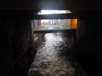
On the way up the new southern entrance to the station wasn’t open, but it opened on Sunday morning.
Apart from a few snags, it seemed to be a great addition to the station.
This Google Map shows the new entrance under construction in the South-west corner of the station.
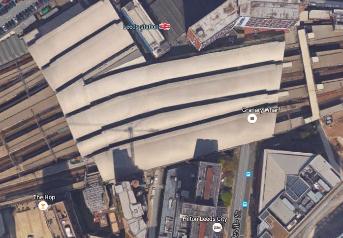
New Southern Entrance To Leeds Station
This image also shows the solid nature of the 2002 station roof, which is glass and not plastic like Manchester Victoria, Birmingham New Street and Crystal Palace stations.
Roof technology has moved on and I suspect costs have moved down.
One problem they may have is the shops like Boots, WH Smith and M & S are outside the barriers in the old (north) entrance.
So passengers needing these shops after entering the station on the south side, will have to go through the barriers to do it.
This problem will probably be solved with a new south concourse.
With other expansion, including new platforms and splitting Platform 1 into three separate platforms and the arrival of HS2, Leeds station is certainly having a lot of men (and women!) in!
