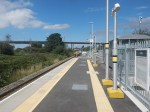
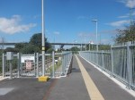
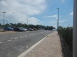
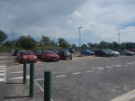
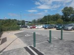
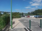
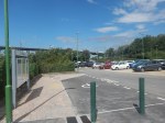
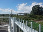
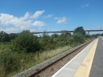
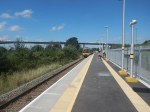
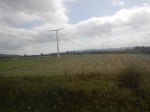
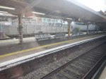
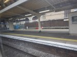
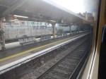
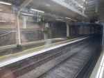
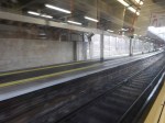
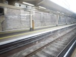
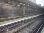
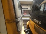
Portway Park & Ride Station – 10th August 2023
Portway Park & Ride station, opened on the first of this month, so I went to visit today.


Note.
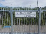
- The Portway Park & Ride is served by both buses and trains.
- Buses serve the City Centre and rugby and football at Ashton Gate stadium.
- Trains serve Avonmouth, Bristol Temple Meads, Severn Beach, Weston-super-Mare and a large number of other Bristol stations.
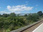
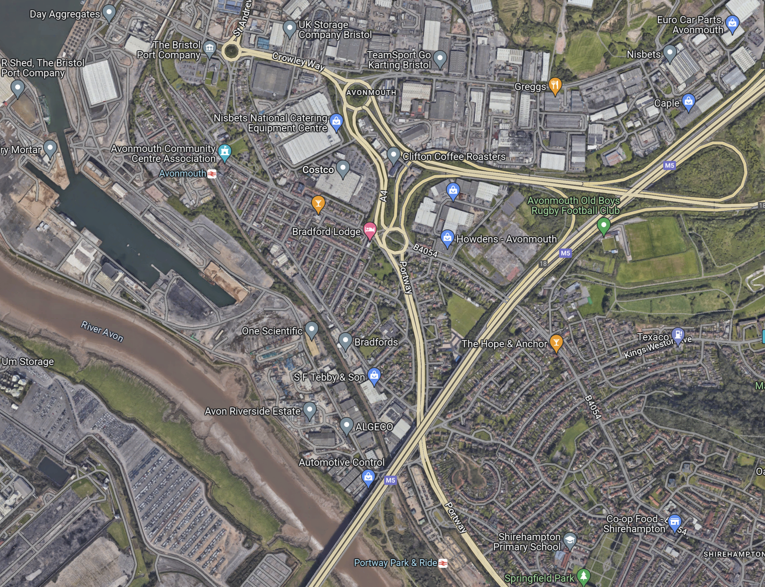
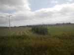
The M5 crosses over the railway to the West of the station.
This Google Map shows the M5 and the Portway Park & Ride.
Note.
- The M5 goes diagonally SW-NE across the map.
- The wide river is the Avon.
- Portway Park & Ride with its station is in the middle of the bottom of the map.
- Avonmouth station is in the North-West corner of the map.
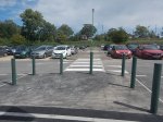
The Portway Park & Ride seems to be an extremely well-connected Park & Ride.
These are my thoughts.
Are There Any Other Park & Ride Sites, Where A Station Could Be Added?
Consider.
- I wrote about a possible new station at Leicester Forest East in A Station At Leicester Forest East.
- In A Look At New Station Projects, several possible Park & Ride stations are mentioned.
Has Portway Park & Ride been developed to see if sites served by buses and trains are a good idea?
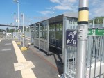
Is Portway Park & Ride The Solution To Big Matches At Ashton Gate?
Consider.
- Ashton Gate Stadium has a capacity of 27,000.
- Wikipedia says that buses from Portway Park & Ride are used to bring supporters to games.
- The platform at Portway Park & Ride might be able to take a five-car Class 802 train for a big match.
I wouldn’t be surprised that Portway Park & Ride has been designed for large crowds at big matches at Ashton Gate.
T-Pylons To The West Of Yatton Station
I talked about National Grid’s first T-pylons in National Grid Energise World’s First T-Pylons.
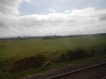
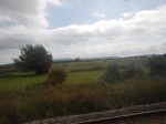
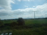
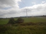
Today, I went and had a look for them and found where they cross the Bristol-Exeter Line between Yatton and Worle stations.
I took these pictures.


Note.
- The first nine pictures were taken going West between Yatton and Worle and the last eleven were taken going East.
- Some of the mature trees seem to hide the pylons, as the train passes.
T-pylons are deliberately smaller than traditional pylons, as these pictures show.


It is certainly a good attempt at producing a less noticeable electricity transmission line.
Northumberland Line Station Contracts Are Signed
The title of this post, is the same as that of this news item from Nexus.
These are the first three paragraphs.
The signs are good for the new Northumberland rail line after the green light was given for construction to get underway on three new stations.
Contracts have been exchanged for principal contractor Morgan Sindall Infrastructure to formally start work on Bedlington, Blyth Bebside and Seaton Delaval stations.
Main construction works are progressing at pace, with station works well underway at Newsham and works approaching completion in Ashington, and 21km of new track is already installed.
It certainly looks like it’s all systems go.
I hope Network Rail have the next reopening ready to go!
An INEOS Grenadier Spotted In De Beauvoir Town
I saw an INEOS Grenadier by my doctor’s surgery this morning.


I think, if I was still driving and lived in the country, I’d take a serious look at one.
Chiltern Railways Seeks Proposals For Low-Emission Multiple-Unit Fleet
The title of this post, is the same as that of this article on Railway Gazette.
These are the first three paragraphs.
Chiltern Railways is seeking proposals for the supply of between 20 and 70 new or converted ‘low-emission’ multiple units.
The operator has called for ‘established’ rolling stock manufacturers, owners and modifiers to propose vehicles which would provide a ’meaningful’ reduction in the emissions and external noise compared to its existing diesel multiple-units, particularly in urban areas.
The envisaged five-year framework agreement has an estimated value of up to £400m, including supply and maintenance of the fleet, refuelling infrastructure and any depot modifications.
I have my thoughts.
Chiltern’s Rolling Stock
Chiltern Railways have two different types of rolling stock; diesel multiple units and rakes of coaches haled by diesel locomotives.
Chiltern’s Diesel Multiple Units
Chiltern has these diesel multiple units.
- Class 165 diesel trains – 28 x two-cars – 56 cars
- Class 165 diesel trains – 11 x three-cars – 33 cars
- Class 168 diesel trains – 9 x two-cars – 18 cars
- Class 168 diesel trains – 9 x three-cars – 27 cars
- Class 168 diesel trains – 10 x four-cars – 40 cars
Note.
- The trains were built between 1990 and 2004.
- The Class 165 trains are 75 mph units, whereas the Class 168 trains are 100 mph units.
- These total to 67 trains and 174 cars.
- This is an average train length of 2.6 cars.
Could a fleet of three-car low-emission 100 mph trains fit Chiltern’s requirements?
- They could work in pairs for six-car units for Birmingham Moor Street and Oxford.
- There may be a need for some four-car units.
But how will they be powered?
- Pure diesel will surely give out too many emissions!
- Would an mtu Hybrid PowerPack lower emissions enough?
- Could hydrogen-power be used, either with fuel-cells or a hydrogen internal combustion engine?
In Alstom And Eversholt Rail Sign An Agreement For The UK’s First Ever Brand-New Hydrogen Train Fleet, I wrote about Alstom’s proposed Hydrogen Aventra.
A version of these trains could be ideal, if Children could source the fuel economically.
Chiltern’s Diesel-Hauled Rakes Of Coaches
Chiltern have four rakes of Mark 3 coaches hauled by Class 68 locomotives.
These could be replaced by pairs of three-car low-emission’ multiple units.
Conclusion
A fleet of seventy three-car ‘low-emission’ multiple units, powered by hydrogen could be an innovative solution to the trains to run Chiltern’s services.
Northern Trains Plans Framework Contract For 450 Multiple-Units
The title of this post, is the same as that of this article on Railway Gazette.
This is the first paragraph.
Northern Trains has invited expressions of interest in a framework contract covering the supply of up to 450 multiple-units to replace ‘significant quantities of its ageing fleet’.
These are other details.
- Firm orders would be placed in phases.
- The initial order would be for ‘multi-mode’ multiple-units.
- Battery-electric or electric-only trains would be included in subsequent orders.
- Trains would have a minimum design life of 35 years from acceptance.
- The ability for the multi-mode units to be converted to electric or battery-electric power as part of an ‘in-life decarbonisation’ programme.
These four paragraphs outline the framework agreement between Northern Trains, the train manufacturer and the owners, who will finance the trains.
The framework agreement would run for eight years, with Northern able to order rolling stock in multiple phases.
Each phase would include a train manufacturing and supply agreement and a technical support and spares supply agreement.
The supplier would provide tools and spare parts, and there would be options for the supply of mock-ups and a cab simulator. Northern is to run a separate procurement for an owning party which would purchase each fleet and lease it to the operator.
The owner would be party to each manufacturing and supply agreement, and there may be different owning parties for each order phase.
This is a well-thought out proposal, that would be worth around a billion pounds to the train manufacturer.
It would probably be based around a family of trains like Alstom’s Aventra, CAF’s Civity or Stadler’s FLIRT.
For a series of orders of such a value, I think we will see some excellent proposals.
The deal will transform rail travel in the North.
I have some thoughts.
Which Trains Will Be Replaced?
Northern Trains fleet includes these ageing trains.
- Class 150/0 diesel trains – 6 x three-car – 18 cars
- Class 150/1 diesel trains – 46 x two-car – 92 cars
- Class 150/2 diesel trains – 26 x two-car – 52 cars
- Class 155 diesel trains – 7 x two-car – 14 cars
- Class 156 diesel trains – 65 x two-car – 130 cars
- Class 158/0 diesel trains – 45 x two-car – 90 cars
- Class 158/9 diesel trains – 8 x three-car – 24 cars
- Class 319 electric trains – 12 x four-car – 48 cars
- Class 323 electric trains – 34 x three-car – 102 cars
- Class 333 electric trains – 16 x four-car – 64 cars
- Class 769 bi-mode trains – 8 x four-car – 32 cars
Note.
- These total to 273 trains and 661 cars.
- If the 16 Class 170 trains, which are of three-cars, were also to be replaced. that would bring the total trains to be replaced to 289 trains and 709 cars.
I would expect the difference between 273-289 current trains and 450 trains in the article, is explained by new services and increased services on certain routes.
Which Trains Could Be Retained?
Northern Trains fleet includes these new trains.
- Class 195 diesel trains – 25 x two-cars – 50 cars
- Class 195 diesel trains – 33 x three-cars – 99 cars
- Class 331 electric trains – 31 x three-cars – 93 cars
- Class 331 electric trains – 12 x four-cars – 48 cars
Note.
- These trains were all built by CAF in the last five years.
- These total to 101 trains and 290 cars.
But if they have an expected life of 35 years, the diesels will have to be converted to zero-carbon trains.
Will The CAF Trains Be Retained?
Consider.
- If all the ageing trains and those not built by CAF were to be replaced then that would be 289 trains and 709 cars.
- If the nearly-new CAF trains were also to be replaced that would be 390 trains and 999 cars.
- Add in a few more trains for expanded services and you’re got the figure of 450 trains given in this article.
- If the CAF trains were to be replaced, then Northern Trains would have an homogenous fleet of new trains from one manufacturer, with all the advantages in operation and maintenance.
On the other hand, I haven’t read any bad criticism of these CAF trains, so I will assume that there is no pressing reason to replace them.
And of course Northern Trains could have an homogenous fleet of new CAF trains.
This is said in the article.
The supplier would provide tools and spare parts, and there would be options for the supply of mock-ups and a cab simulator.
As this is specifically mentioned, do Northern lack a simulator for driver training?
What About The Manchester Bee Network And Other Local Networks?
Will these networks want to take control of their local trains?
If there is an homogenous fleet of new trains from one manufacturer, then surely, it would be easier to give control of some routes to the local transport interests.
Training and driver rostering could be retained in what was left of Northern Trains.
Tram-Trains
Tram trains would be an added complication, but as the South Wales Metro is showing, tram-trains are an interesting way of expanding a network.
Battery Train Deployment Report Commissioned
The title of this post, is the same as that of this article on Railway Gazette.
This is the first paragraph.
The Rail Safety & Standards Board has commissioned consultancy WSP to produce evidence-based recommendations for optimising and standardising the adoption of battery-powered trains.
Note.
- The train shown in the picture in the article is a Stadler FLIRT Akku.
- WSP are a well-respected Canadian engineering consultancy.
To commission a development report sounds to be a sensible act.
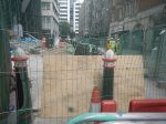
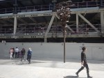
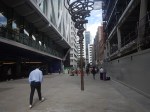
Progress In Front Of Moorgate Station – 7th August 2023
The pedestrian area in front of the Elizabeth Line entrance at Moorgate station is progressing and I took these pictures this morning.

Note.
- The tree-like sculpture is Manifold (Major Third) 5:4, is by Conrad Shawcross, which I showed being installed in An Art Installation In Front Of Moorgate Station.
- The pedestrian area will be protected by the City of London’s distinctive bollards.
- Only two of the bollards have been painted in their final colours.
- In No Budget; Employ Students, I talked about how the City of London has form in using art students to do decorative paintwork.
The UK is certainly going for appropriately-sized pedestrian areas in front of stations to allow travellers to get easily clear at busy times.
Traffic Constipation At The Angel
On Tuesday, I went to the Angel, with the intention of doing some shopping and then got tuck in an enormous traffic jam.


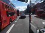
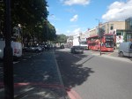


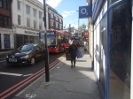

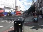

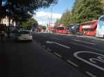


Note.
- In the end I abandoned the bus and walked.
- It looked like it was all caused by emergency roadworks at the Angel.
- These happen regularly, as Islington’s water pipes aren’t the best quality.
I believe traffic jams at the Angel will get worse, when the Silvertown Tunnel opens, as this will encourage trucks to take routes through Central London, when the Dartford Crossing is busy.
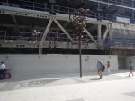
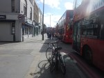
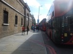
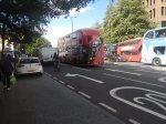
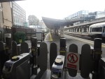
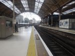
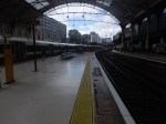
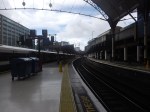
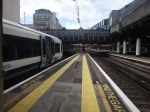
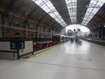
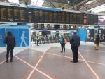
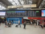
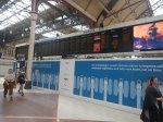
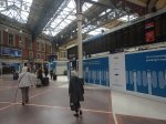
The Platform 1 End Of Victoria Station – 2nd August 2023
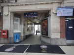
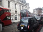
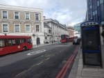
I took these pictures of Platform 1 at Victoria station and Wilton Road, which runs along the side of the station.
This gallery shows Platform 1, how it is accessed and the retail units that you pass to access the platform.


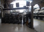
Note.
- The glass barrier between the retail units and the toilets and Platform 2.
- Passengers for Platform 1 have to walk down to gates that are at the far end of the retail units.
- The Victoria end of Platform 1 is set back from the other platforms.
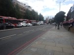
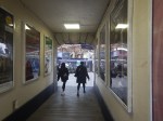
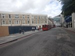
This gallery shows Wilton Road.


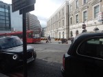


Note.
- Wilton Road is immediately outside of the station
- Parts of the outside of the station has quality stonework.
- There is a bus stand close to the station.
- There is a taxi rank on the other side.
- There is an entrance to the station.
- There is also an entrance to the Underground station, if you walk to the front of the station.
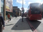
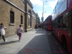
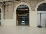
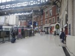
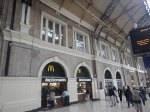
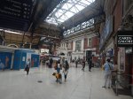
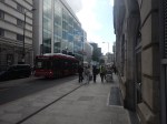
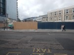
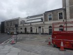
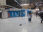
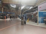
This gallery shows Hudson’s Place.


Note.
- The shops inside the station by Platforms 1 and 2 are behind the three-story Victorian facade.
- An M & S sign is in one window.
- There is an entrance to the station.
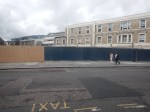
What is happening behind the hoardings in the middle of Hudson’s Place?
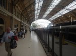
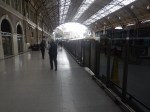
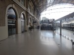
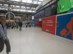
This gallery shows Platforms 1 and 2.
Note.
- Platform 1 is surprisingly long,
- I’ve seen steam specials in the platform with the engine at the country end.
- Platform 2 is also long.
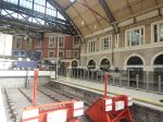
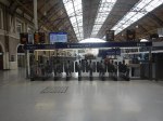
This gallery shows the gateline upgrade and a few odds and sods.
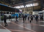
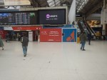

Note.
- The platforms 3 and 4 would appear to be shorter and can only take eight-car trains.
- The gatelines in the two halves of the station are being upgraded and new destination boards are being upgrade.
This table gives the platform lengths for Platforms 1 to 7.
- Platform 1 – 270 metres
- Platform 2 – 359 metres
- Platform 3 – 180 metres
- Platform 4 – 203 metres
- Platform 5 – 247 metres
- Platform 6 – 245 metres
- Platform 7 – 286 metres
Note.
- Platforms 3 and 4 will only take eight-car trains, which are 160 metres long.
- All other platforms will take twelve-car trains, which are 240 metres long.
- A single High Speed Two Classic Compatible Train os 200 metres long.
This OpenRailwayMap shows the platforms at Victoria station.
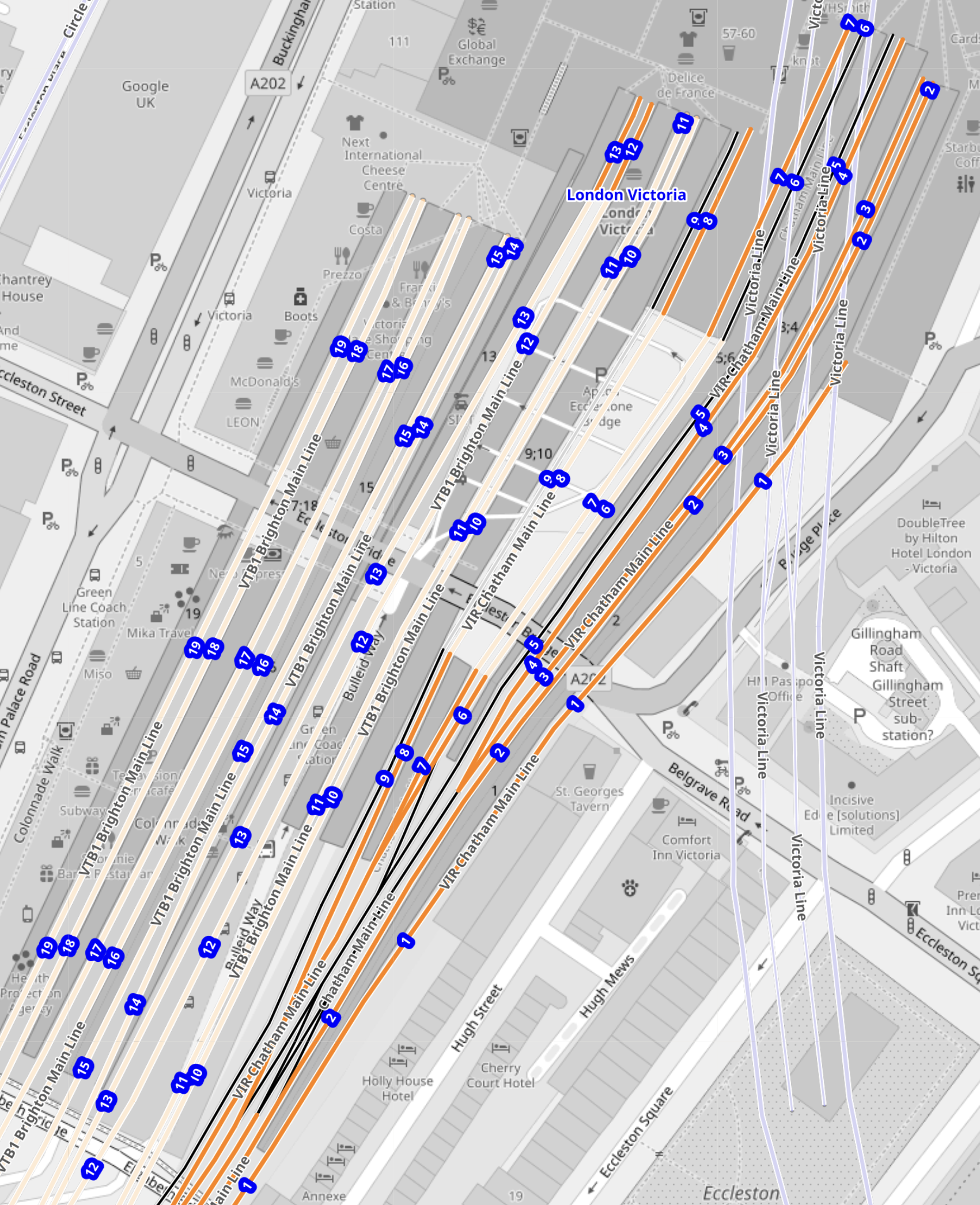
Note.
- The platforms are numbered starting with one on the right.
- The blue numbers give the platform numbers.
- Platform 1 is stepped-back from all the others.
- Platform 2 is the longest platform.
- Platforms 1 and 2 share an island platform.
This second OpenRailwayMap shows the North-East corner of the previous map to a larger scale.
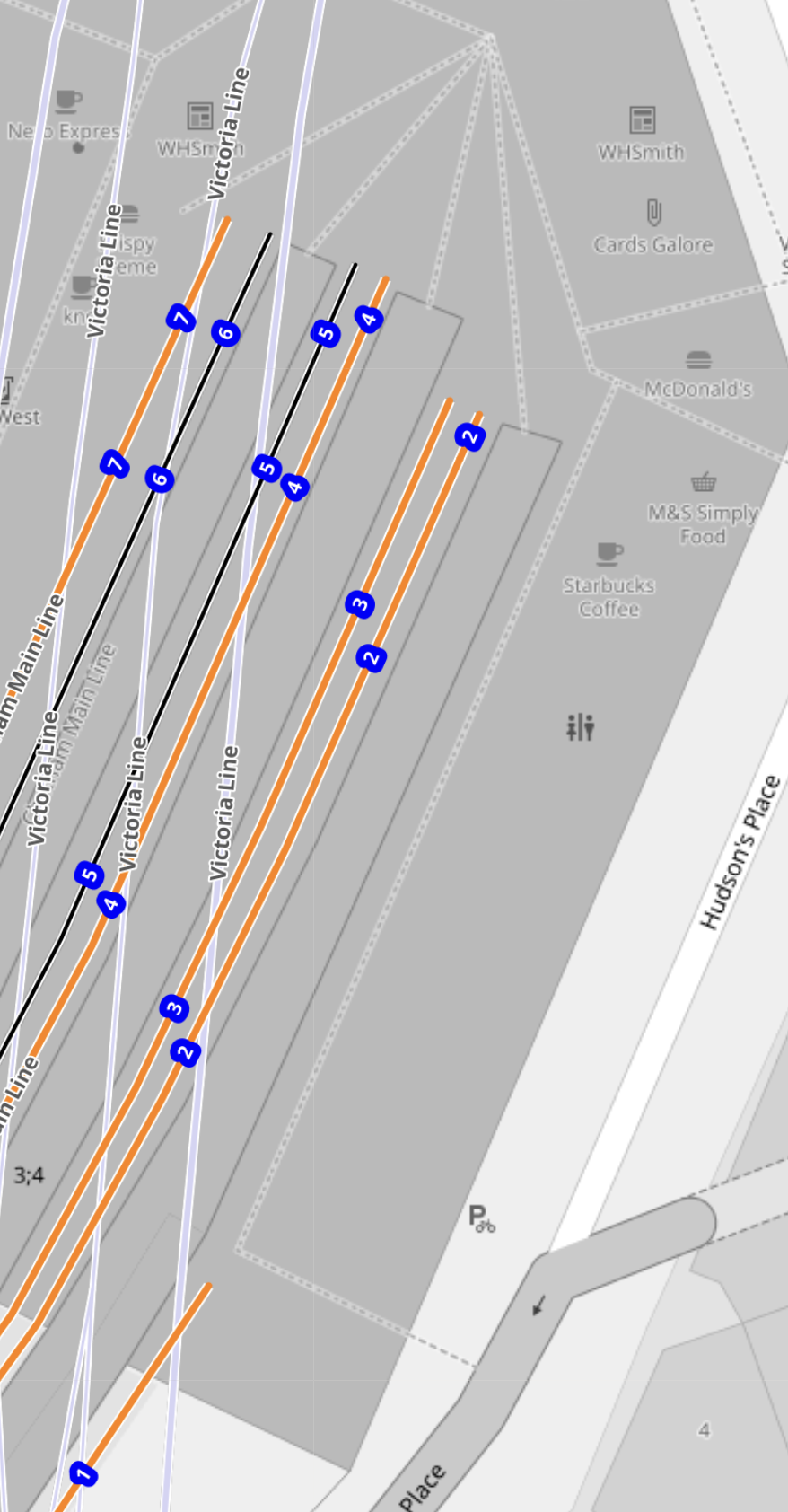
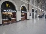
Note that there are retail units for WH Smith, Cards Galore, McDonalds, M & S Simply Food and Starbucks, toilets and a reception area for British Pullman.
Could this area be revamped to be a Customs and Immigration are for passengers going to and from Europe?
- I estimate the area available is about twenty-five metres wide over a hundred metres long.
- There are also two extra floors above the ground floor.
- It might be possible to build over part of Hudson’s Place outside of the station.
I suspect that, if the space is efficiently used, that a secure and efficient Customs and Immigration facility, that would handle perhaps four trains per hour (tph) could be created.
