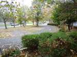
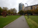
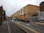
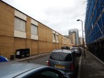
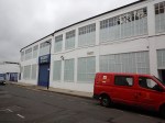
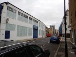
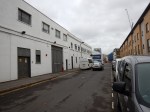
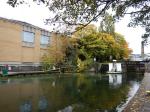
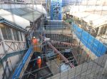
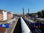
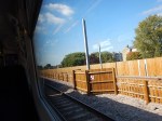
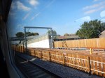
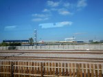
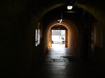
Crossrail Works Around Pudding Mill Lane Station
I took these pictures as I went through the area on a TfL Rail train to Shenfield and then later, when I took a DLR train!
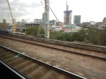


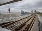


The Crossrail tunnel portal is now recognisable as two holes leading into the ground.
They appear to be building something over the top of the tunnel just before it goes under the water and on into London. Could this be a ventilation shaft?
Crossrail 2 October 2015 – Shoreditch Park Area
This is Crossrail 2’s map of their possible worksites in the Shoreditch Park area. It comes from this Crossrail 2 document entitled Crossrail 2 Shafts.

Crossrail 2 Shoreditch Park
Note that the Worksites are labelled A to E.
To show them in more detail, this is a Google Map of the same area.

A Google Map Of The Area
Crossrail 2 have said this about the choice of work site.
A single worksite would be required to build and equip the shaft and the junction.
We are currently considering a number of options for the shaft in the area. Our current options have been selected because they would allow us to position the possible ‘Eastern Branch’ junction under the open space of Shoreditch Park.
Bear in mind that Crossrail 2 tunnels will be twenty or so metres down, so positioning the junction, which could be noisy, as trains rattle over the points, under a park some fifty metres and more from any dwellings, could be a good idea. Crossrail 2 wouldn’t want a repeat of the Victoria Line noise problems at Walthamstow
If we assume that one work site is what they’d like to do, I don’t feel that they would use more than two. The sites are as follows.
- Sites A and B to the West are commercial storage.
- Site C is the North-West corner of the Park
- Sites D and E are in the Britannia Leisure Centre.
The sites D and E are on the Hackney branch of the line, so unless that line is built in Phase 1, I doubt that they will be used.
If they are, knocking down and rebuilding leisure centres or commercial premises is a lot less costly and inconvenient, than demolishing houses or flats.
I don’t know what Crossrail 2 will do, but I visited the Crossrail site at Stepney City Farm, which is over a massive junction on Crossrail, so is very similar to Shoreditch Park.
I found a very good relationship existing between all parties. There certainly hasn’t been any bad reports about the Stepney City Farm site on the web.
This report is from the East London Advertiser.
Crossrail 2 will cause themselves a lot of problems, if they don’t do as well as Crossrail!
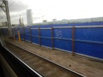
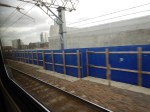
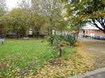
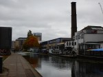
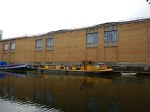
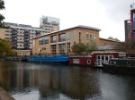
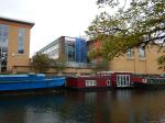
I took these pictures as I walked from the Britannia Leisure Centre through Shoreditch Park to Eagle Wharf Road. At the end of Eagle Wharf Road, I crossed the Regent’s Canal and looked at the building in Eagle Wharf Road from the towpath.


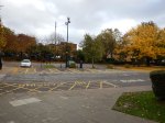


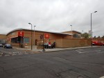


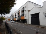


I can’t see any obvious reason, why the Leisure Centre would be used for Crossrail 2, as neither of the commercial buildings in Eagle Wharf Road are of the finest quality and given Crossrail’s treatment of Mile End Park, there would appear no reason the corner of the Park can’t be used.
One of the great advantages of the Park, would be that if you need to bring in some really heavy equipment, you’d just remove the iron railings and roll it through the gap.
Under current plans, there would appear to be no reason to extract or insert a tunnel boring machine in the Shoreditch area.
But choosing the Park would allow this to be done if required.
There is also the problem of a head-house.
It might be difficult to provide one in the Park, but evacuating into a large park from a problem in the tunel might be very safe.
Head houses on the sites in Eagle Wharf Road could even be built into any new buildings on the site.
Architecture and engineering design is moving on apace and who knows what will be possible when Crossrail 2 is built?
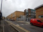
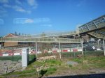
Whitechapel Station – 26th October 2015
The floors are going in at Whitechapel station.
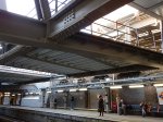


It does seem that progress is being made.
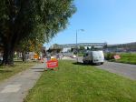
A Walk From Plumstead To Abbey Wood
I went to look at the Crossrail program at the short length of surface line, that connects London’s new railway to Abbey Wood.


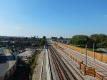
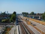
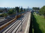


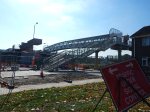
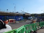
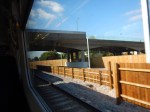

I was able to cross the railway three times and it will soon be four, when the new footbridge close to the station is completed. This Google Map shows the are of the walk.

Plumstead Abbey Wood
Plumstead station is to the left (West) and Abbey Wood is to the right (East)
Crossrail Are Uphill Excavating Again
In Coal Mining In Whitechapel, I described how the Crossrail contractors were using a technique called uphill excavation to connect the Crossrail tunnels to the existing Whitechapel station above.
In this document on the Crossrail web site, the company describes how the technique is being used again to connect the running tunnels to the Broadgate ticket hall above. This is said about the methods used.
This excavation will be carried out using an innovative method of uphill excavation. Traditional uphill excavation is considered unsafe due to the risk of excavated material falling onto the excavator and operatives, however the BBMV team realised that the ability to excavate upwards from existing tunnels at the base of the escalator shaft would generate significant time and cost savings. In response BBMV introduced a bespoke uphill excavator that is suspended from the ceiling of the construction tunnel and advances in line with the tunnel progression. A walkway along the side of the excavator provides the engineer with a safe working area and emergency egress for the operator. Once this excavation of this escalator shaft is complete we will begin to construct an access passage that will lead passengers from the Ticket Hall into the station tunnels, in early 2016.
There is also the first published picture I’ve found of an uphill excavator.
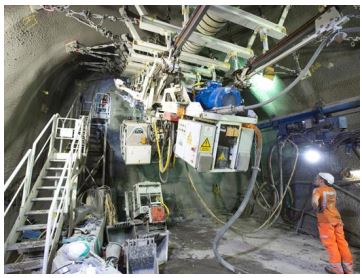
BBMV’s Uphill Excavator
I think we’ll find in the coming years that uphill excavation will be increasingly used in the construction of railways and other tunnels underneath towns and cities.
I’m sure, Crossrail 2 will use the technique to create stations at Angel, Chelsea and Tottenham Court Road. The biggest advantage is that it will silence the Militant Wing of the heritage lobby and all the luvvies, who are against London getting a better public transport system.
I also think, that we could build underground stations for HS2 at Euston, Birmingham, Manchester and Leeds, and use the technique to provide link tunnels to the existing stations above.
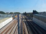
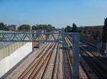
Platforms 11 and 12 At Stratford
In December this year, an service hourly service called STAR will be started between Stratford and Angel Road along the Temple Mills Branch of the Lea Valley Lines via Lea Bridge, Tottenham Hale and Northumberland Park stations. Wikipedia says this about services to and from the Angel Road station.
Angel Road is only served by a number of trains every weekday to and from Stratford. No services operate at the station on weekends or public holidays. However, from December 2015 Angel Road will receive an hourly service to Stratford that will start here and vice versa, the service will be known as (STAR).
STAR services will obviously call at the new Lea Bridge station, when it opens next year.
I shall probably use the service occasionally, when I need to get home from Stratford, as Lea Bridge station is on the 56 bus route that passes by my house.
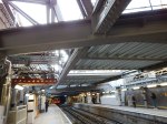
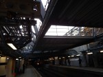
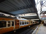
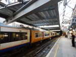
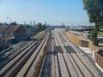
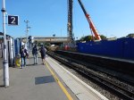
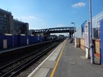
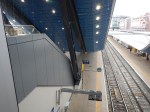
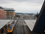
At Stratford, there are two platforms that have been positioned to give easy access to the Temple Mills Branch through Lea Bridge and Tottenham Hale and onwards to Stansted Airport. I took these pictures of the platforms.
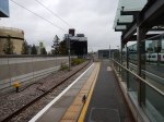
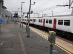

They sit at the end of the two London Overground platforms, which are the Eastern terminus of the North London Line. You can see two Class 378 trains peeking out from underneath the rusty bridge. (Not my name, but an East London nickname, I’ve heard from locals and station staff!) This Google Map shows the layout of the platforms.
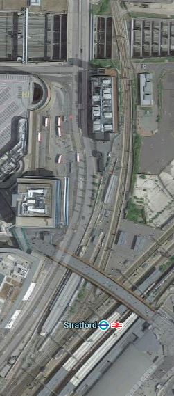
Stratford Platforms 11 And 12
In the map, platforms 11 and 12 curve away to the North from underneath the rusty bridge, which connects Eastfield to Stratford town centre.
Platform 11 is the Easternmost platform and is used as the terminus of the Stratford to Bishops Stortford service, which has been rumoured many would like extended to Stansted.
Platforms 1 and 2 for the North London Line are connected to the unused Platform 12, by a simple walkway, so in the future if Platform 12 is used for the STAR services, passengers going from anywhere on the North London Line to Tottenham Hale or Angel Road would just have an easy interchange.
As the STAR service will initially be an hourly service and the Bishops Stortford service is half-hourly and they run from platforms connected by a subway, I can’t help feeling that this will be an arrangement that won’t last long, before it is improved.
Suppose you arrive at Stratford wanting to get home to your house near Lea Bridge station and just miss the hourly train. Do you wait an hour for another train or catch the Bishops Stortford train, that will probably stop at Lea Bridge, after the new station opens?
It would be so much easier, if the two local services started from an shared island platform or at lest two platforms with a level walk between them.
This is going to get very complicated, if some of the plans for Stratford services up the Lea Valley are implemented.
- I’ve read several times, that reinstatement of the link to Stansted Airport is an aspiration of many, especially as Stratford is close to the Olympic Park and it is an important rail interchange and a terminus for two branches of the DLR and the Jubilee and North London Lines.
- There are also aspirations to start a direct service between the Chingford branch and Stratford using the reinstated Hall Farm Curve.
- With all of the housing, business and leisure developments along the lower Lea Valley, it will not be long before an hourly STAR service is inadequate.
- If the Hall Farm Curve is reinstated, would there be a need to run services between the Chingford branch and the North London Line?
- There is also the Crossrail effect, which in the Lea Valley’s case could not be just Crossrail, but Crossrail 2 if that ever gets built.
- Perhaps unlikely now, but I feel that at some point the Dalston Eastern Curve will be reopened, so enabling services between say Walthamstow to South London.
- Is there a need to better connect Stratford International station to the main regional complex?
I can’t help feeling that the layout of Platforms 11 and 12 will at some time not be able to handle all the Lea Valley services.
I suspect though there may be an innovative solution.
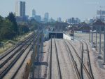
Look at the Google Map and you see that the Temple Mills Branch passes over the deep hole of the International station. I wrote Is This The Most Unwelcoming Station In The UK? about that dreadful station.
So could two or three bay platforms to serve the Lea Valley and Stansted Airport, be built alongside the Temple Mills Branch, as it passes over the International station?
This Google Map shows Stratford International station.
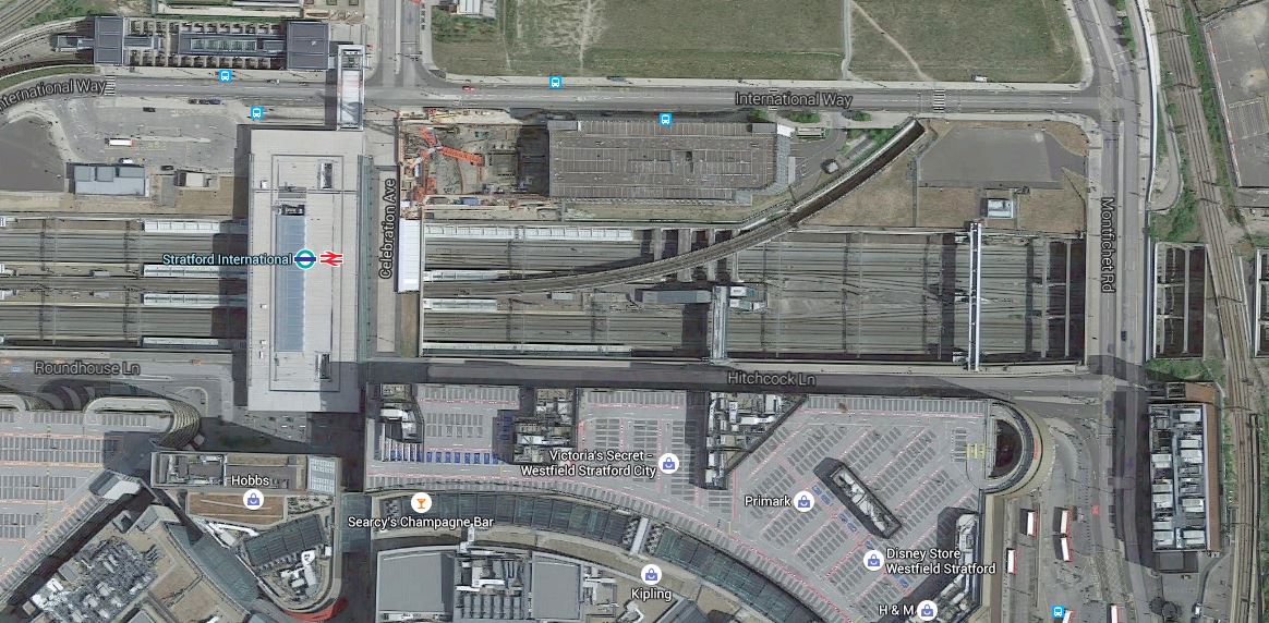
Stratford International Station
The building at the bottom right is also shown on the previous map that shows Platforms 11 and 12.
If the extra platforms were built over the Eastern end of the International station, it would enable the following.
- A new Eastern entrance to the International station could be created to give better connections between International and High Speed services from Stratford International and all the other services at Stratford Regional station.
- Crossrail would have a step-free interchange to Eurostar and other International services, if those services stopped at the International station.
- Interchange between Lea Valley and North London Line services, would be via a double Clapham Kiss, where passengers would just walk on the level to the other set of platforms.
- There might be opportunities to extend or improve the connectivity of the DLR. The current DLR station is at the top left of the map.
- Any direct services between the Temple Mills Branch and the North London Line would use the existing Platforms 11 and 12.
To get the connection right, the pedestrian links would have to be well-designed, but surely there is space to put a travelator effectively between the Regional and International stations.
Stratford International station would end up as what it should be, the International section of Stratford station.
Reading Station Just Gets Better!
Reading station is one of the best in the UK and rivals any second level station in Europe.
It first impressed me, when it opened and I wrote Is It Architecture, Engineering Or Art?
I took these pictures when I went to the Reading Ipswich match.


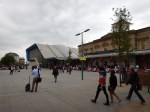
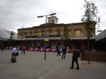

These changes were noted.
- The football buses are now parked by the station
- The Reading flyover is clearly visible from the massive footbridge over the station.
- The area in front of the station is now a plaza and not a building site.
The only problem I had was when returning after the match, It was difficult to find the first fast train to Paddington and I ended up on a stopping train to everywhere.
I did look around the station when I arrived, to see if there was any clue as to which will be the Crossrail platforms. The local services are currently served by Platforms 12 to 15 on the North side of the station. So it would probably be safe to assume that one island platform would be for Crossrail and the other is for services to places like Oxford, Newbury and Bedwyn.
It would appear that Rediung will not be served by Crossrail under December 2019.
A Ticketing Problem For Crossrail
Ipswich are playing at Reading tonight and as it’s an easy trip out from London, I bought a ticket in case I wanted to go.
I certainly won’t have a problem getting back, as there are fast trains to London after midnight.
But the match is on television and the weather looks to be pretty good, so I might just go and not waste my fifteen pound ticket.
As going to Reading in time for the match would mean a journey out restricted by the rush hour, I could go via any number of places like Windsor, Maidenhead or Slough to have a late lunch.
It got me thinking!
The Mayor has said, that when Crossrail opens, you’ll be able to use a Freedom Pass to Heathrow, just as you can now on the Piccadilly Line.
But how far will you be able to use a Freedom Pass on the branch to Reading?
The problem is complicated by the fact that there are three branches off the line between London and Reading; Henley, Marlow and Windsor.
To further complicate matters, direct peak-hour services operate between the Henley and Marlow branches and London.
Putting together snippets in the news and from Theresa May’s web site, led me to the conclusion which I talked about in this article, that all three branches will probably be served by new IPEMU trains (Class 387 or Aventra), as this would avoid the need for electrification.
So we’ll end up with a main line Crossrail service with a frequency of at least four trains per hour to Reading and shuttles and the occasional through trains from the branches.
The whole area will certainly end up with contactless ticketing using Oyster and bank cards, with perhaps a travel card or Ranger ticket thrown in.
But the real problem is organising the charging structure, as contactless will work well at collecting the fares, but how do you charge.
Crossrail will effectively link Windsor to Central London with a fast train and one change, so for tourists going to Windsor will be as easy as going to other important suburban venues like Wembley or the Olympic Park.
Get the ticketing right and the Thames Valley will get a lot of extra visitors.
To return to my earlier question, how far will my Freedom Pass get me in the West?
Crossrail’s journey calculator says that Bond Street to Shenfield, which will be the Freedom Pass limit in the East will take me 48 minutes.
Projected times from Bond Street for the West are as follows.
- Maidenhead – 40 minutes
- Twyford – 46 minutes
- Reading – 52 minutes
I do wonder if TfL and Crossrail will adopt the same rule as they have for Shenfield, as Reading is projected to only take four minutes longer than Shenfield.
This rule would mean that you can travel to Reading, provided you use Crossrail.
I can see an awful lot of protests, if passenger to Reading, got a worse deal than those going to Shenfield.
Which leaves us with the problem of the branches.
- Will the branches follow London rules on ticketing and be cashless and contactless, but still allow through paper tickets?
- Will direct trains to London still be run in the peak hours?
- Will the branches be part of the Great Western franchise or Crossrail?
- Will Booking Offices be closed on the branches?
I suspect that however the branches are managed, passengers from London will consider them part of Crossrail and will want to use contactless ticketing all the way.
The most contentious issue would be if it was decided that there would be no direct trains between Marlow and Henley and London.
All of these problems will hopefully be sorted before Crossrail opens.
Faster London Trains Could Make Your Commute Even Longer
I have spent much of my working life calculating the dynamics of systems, be they complex sets of calculations for a Bank, the solving of massive sets of differential equations or calculating how many days, hours and minutes a project will take and how many pounds, groats or donkeys it will consume.
So when I saw an article in New Scientist with the title of this post, I had to read it.
You should!
In my modelling of complex systems, nearly fifty years ago, I used state-of-the-art, digital and analogue computers to model complex interactions in chemical reactions and plants. In more than one case the answer that was obtained was unexpected.
But then you can’t argue your feelings against thoroughly correct mathematical equations!
The same is happening in this transport example. Your feelings may say faster trains will get you there quicker, but properly modelled it would appear that the reverse may be true.
One thing that may be true in some places, is that adding new stations to a line reduces the time taken to commute.
So sometimes residents wanting a new station near their houses, may just be right!
Only a rigorous mathematical model will tell the truth!
Leeds seems to have an ambitious station building program, whereas only one new station;Lea Bridge, is being built in London.
And intriguingly in London, Crossrail is being built with only one new station; Woolwich, although some are being substantially rebuilt!
I hope they’ve done their modelling extensively enough!
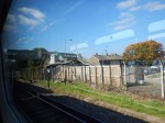
Hanwell Station – 10th September 2015
My walk ended at Hanwell station.
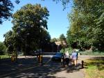


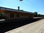
It seems to have had a good clean since my Before Crossrail visit and some small works.
However the real Hanwell station appears to be standing up and it looks like it will be good.
