The Worksites Of The Bakerloo Site Extension
Building the Bakerloo Line Extension will hopefully finish around 2028/29.
So I’m publishing these maps of the areas, that could be affected by works, so if perhaps you’re thinking of moving house, you can take an appropriate decision.
The Route
This is TfL’s latest route map between Elephant and Castle and Lewisham stations.
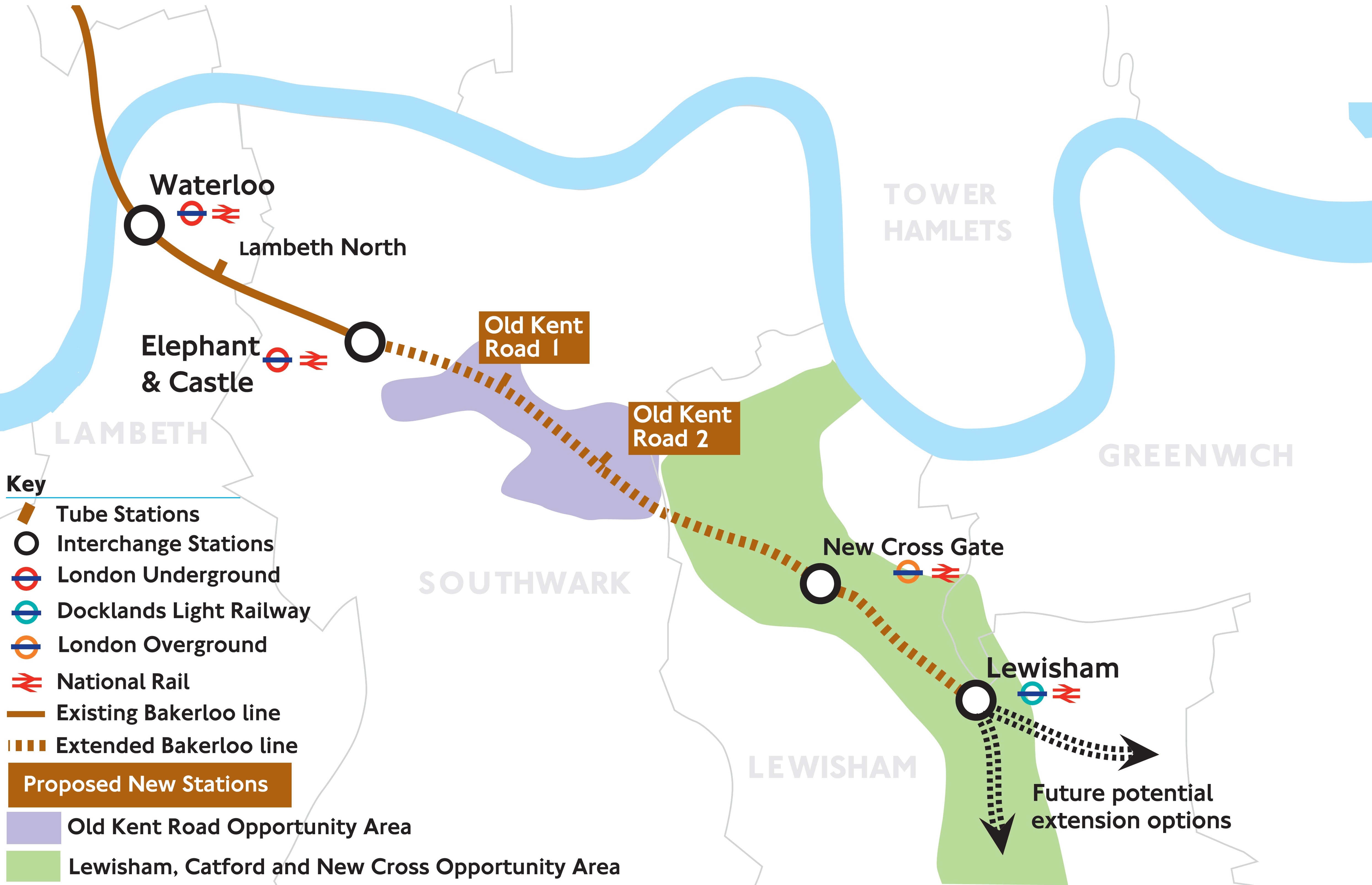
Note the two completely new stations with the imaginative names of Old Kent Road 1 and Old Kent Road 2.
The full document is here on the Transport for London web site.
The Worksites
The sites are given in route order from the North.
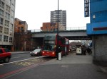
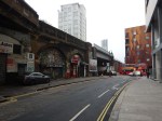
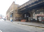
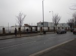
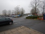
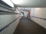
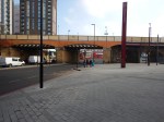
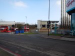
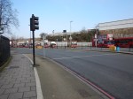
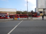
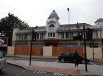
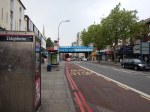
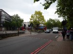
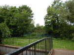
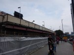
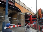
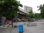
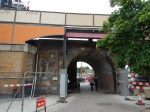
Elephant And Castle
The map from carto.metro.free.fr shows the lines through the station.
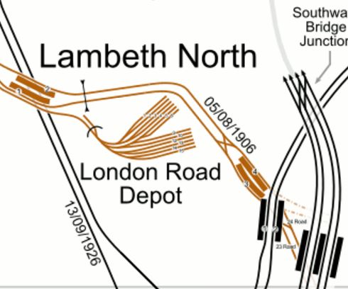
The North-South lines across the map are from West to East.
- The Charing Cross Branch of the Northern Line – Dated 13/09/1926
- The Bakerloo Line – Dated 05/08/1906
- The Bank Branch of the Northern Line.
- Thameslink to Blackfriars and Orpington, Rainham, Sevenoaks, Sutton and Wimbledon.
Just below this map is Kennington station, where the two branches of the Northern Line meet and will divide to Morden and Battersea Power Station stations.
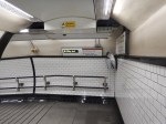
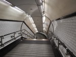
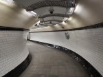
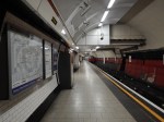
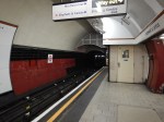
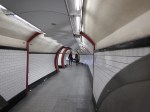
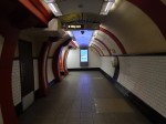
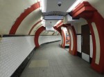
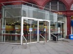
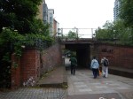
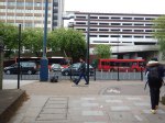
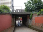
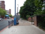
Elephant and Castle is effectively two separate stations at present, with one for the Bakerloo Line and one for the Northern Line. Both stations have lifts and narrow, dingy platforms and passageways. Connections between the two stations underground is not good.
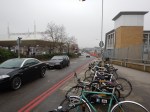
These pictures of Elephant and Castle station were taken on February 12th, 2017


Works envisaged at Elephant and Castle station include.
- A new larger ticket hall for the Bakerloo Line
- Wider platforms for the Bakerloo Line
- Escalators aren’t mentioned, but would probably be included for the Bakerloo Line
- New ticket hall for the Northern Line
- Three escalators and more lifts for the Northern Line to provide step-free access.
- Better connections between the two lines.
I would hope that a comprehensive design would include a step-free link to the Thameslink station.
I suspect, that the two stations could be rebuilt as two separate projects, with the Northern Line station being updated before the Bakerloo Line station.
If the two projects were properly planned, I believe that trains could continue to run on the Northern Line throughout the works, with trains running to the Bakerloo Line platforms until they needed to be closed for updating and connection to the new tunnels.
I wouldn’t be surprised to see an updated pedestrian connection between the Bakerloo and Northern Line platforms created first, so that at least one entrance to the platforms is available throughout the works.
This Google Map shows the area around Elephant and Castle.
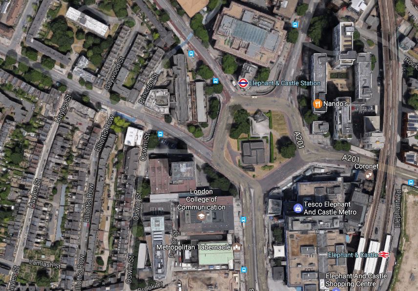
Eephant And Castle
Transport for London have said they need a worksite in the area.
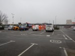
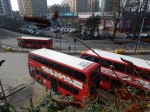
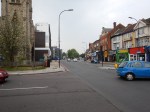
Bricklayers Arms
Bricklayers Arms is known to many as a roundabout and flyover on the A2 into London.
This Google Map shows the roundabout.
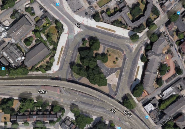
Bricklayers Arms
It is one of two possible locations for a shaft that will be needed between Elephant and Castle and Old Kent Road 1 stations.
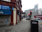
These pictures of Bricklayers Arms were taken on February 12th, 2017.

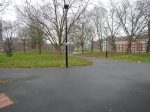


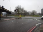
The worksite could be in the middle of the roundabout.
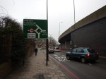
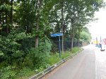
Faraday Gardens
This Google Map shows the South-East corner of Faraday Gardens.
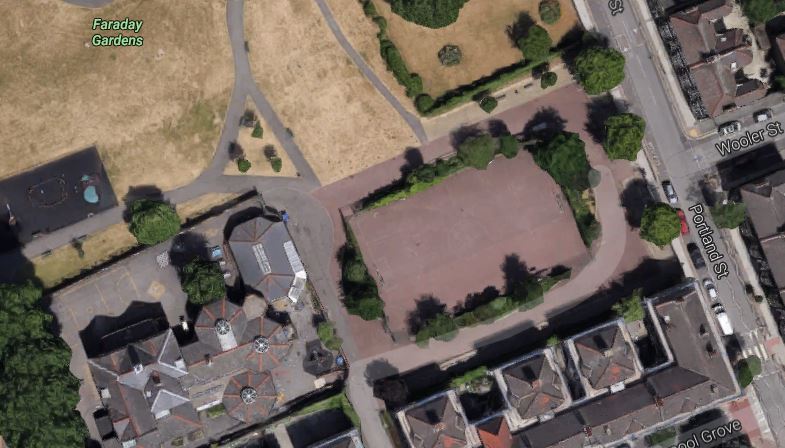
Faraday Gardens
It is one of two possible locations for a shaft that will be needed between Elephant and Castle and Old Kent Road 1 stations.
These pictures of Faraday Gardens were taken on February 13th, 2017


The worksite could be in the a hard playground.
My personal view is that the Bricklayers Arms site is the better from a working point of view, but is it in the best position?
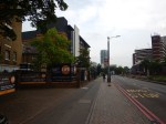
Old Kent Road 1 Station
This Google Map shows the area, where Old Kent Road 1 station will be located.
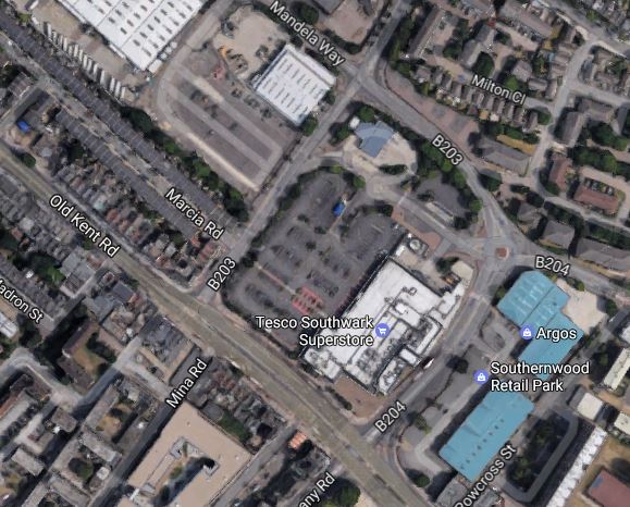
Old Kent Road 1 Station
There are two options given for the location of the station.
Note the Tesco Southwark Superstore in the middle of the map, with its car park alongside.
- Option A for the station is on the other side of Dunton Road and slightly to the North West of the car park.
- The other Option B is on the Old Kent Road on the site of the store itself.
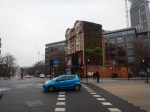
These pictures of the area around the Tesco store were taken on February 12th, 2017.

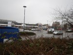

The group of people most affected by the construction of the station will be those who shop at this Tesco.
I suspect that given the company’s current position, Tesco would be happy to co-operate with TfL. After all there must be advasntages in having a superstore on top of an Underground station.
If the Tesco Superstore had to be knocked down, there are lots more anonymous architectural gems like this one.
So I wouldn’t be surprised to see Option B implemented, with a brand new station alongside the Old Kent Road.
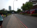
Old Kent Road 2 Station
There are two options for this station.
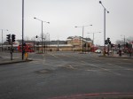
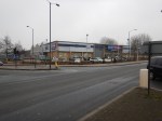
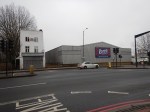
This Google Map shows the location of Option A opposite B & Q.
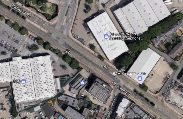
Option A For Old Kent Road 2 Station
The station will be on the the Currys PCWorld site along the road.
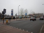
These pictures of the area around the Currys PCWorld store were taken on February 12th, 2017.

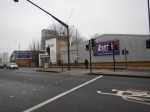
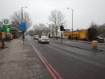
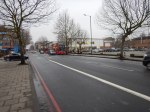
This Google Map shows the location of Option B on the Toys R Us site on the other side of the Old Kent Road.
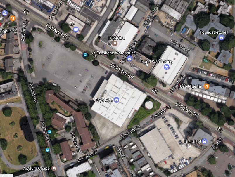
Option B For Old Kent Road 2 Station
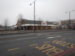
These pictures of the area around the Toys R Us store were taken on February 12th, 2017.

Both chosen sites would appear to have plenty of space and wouldn’t require the demolishing of any housing.
Note that the Toys R Us stored was closed in April 2018. Did Transport for London rewrite their plans and are they in negotiation for the now-vacant site?
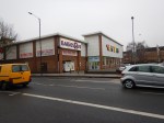
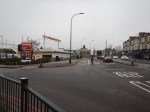
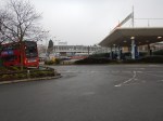
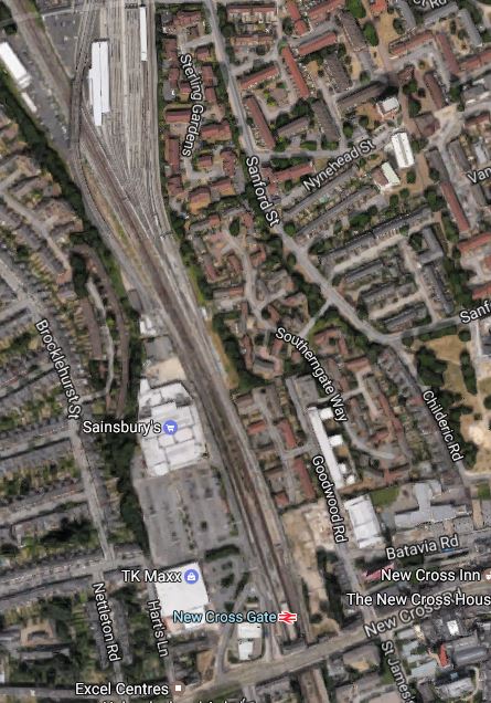
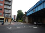
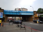
New Cross Gate Station
New Cross Gate station is an existing Overground and National Rail station.
This Google Map shows the station and the Retail Park, that is alongside the station to the West.
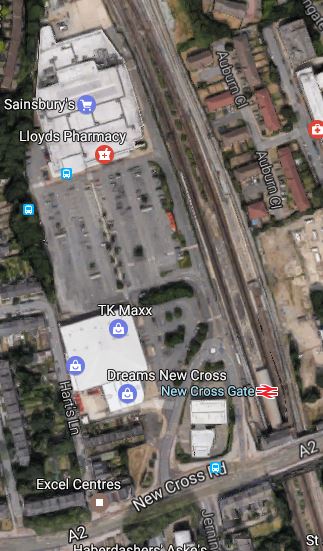
New Cross Gate Station
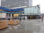
These pictures of the area around the Sainsburys store were taken on February 12th, 2017.


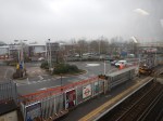
The worksite would take over the car park, with the station being built underneath.
This worksite is very much the most important site of the extension. The consultation says this.
The size of the proposed site provides several opportunities for the project. It could allow soil to be taken away by train rather than using local roads. We could also start the tunnel machinery from this site.
When the station is completed, I can envisage New Cross Gate becoming an important transport hub, with a quality shopping experience.
Alexandra Cottages
Alexandra Cottages, a short road off Lewisham Way has been proposed as the location of a shaft between New Cross Gate and Lewisham stations.
This Google Map shows the location.
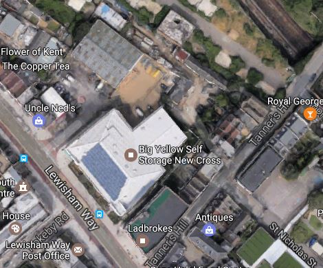
Alexandra Cottages
I suppose the site has been chosen, as the site contains a Big Yellow Self Storage facility and a Ladbrokes betting shop.
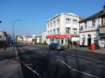
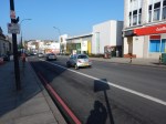
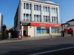
These pictures of the area around the storage facility were taken on February 13th, 2017.
Will the shaft be buried in the basement of a development suitable for the area?
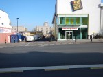
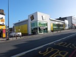
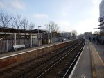
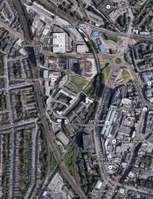
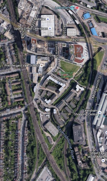
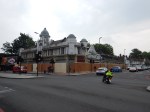
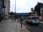
Lewisham Station
This Google Map shows the current Lewisham station.
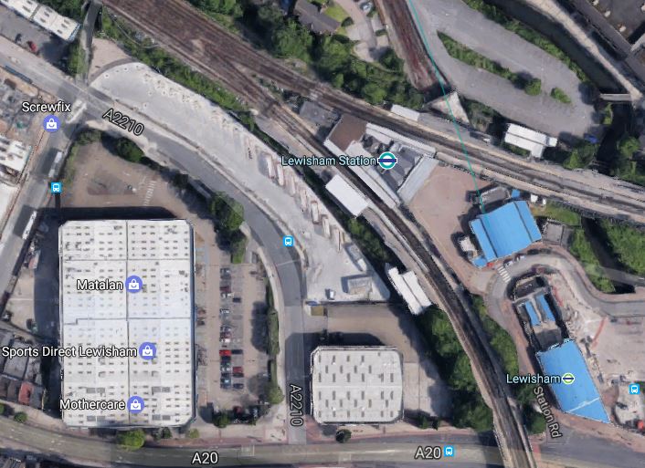
These pictures of the area around the Lewisham station were taken on February 13th, 2017.

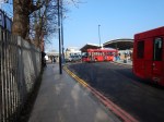


The new Bakerloo Line station will be underground between the station and Matalan. The area is currently bus parking.
Because of the different levels and tunnels and some railway arches in good condition, the addition of the Bakerloo Line station could be a challenging one, but also one that could be architecturally worthwhile.
Consider.
- Is the current station built on arches, that could allow passengers to circulate underneath?
- Could escalators and lifts connect the main line and ?Underground stations?
- Could there be significant oversite development on top of the station?
- Could the Bakerloo Line station be built without a blockade of the current station?
- Will Lewisham station be reorganised to be less of a bootleneck?
It will be interesting to see the final design.
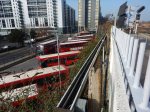
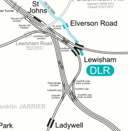
Wearside Road
This Google Map shows the worksite in Wearside Road, which will be used to create a shaft to the overrun tunnels.
The multi-track line going North-West to South-East is the South Eastern Main Line, whilst the line going South-West to North-East is the Hayes Line.
The worksite will go at the Northern end of the light-coloured area South of where the two lines cross.
This map from carto.metro.free.fr shows the lines in the area.
I think it is quite likely that the overrun tunnels will be under the Hayes Line.
Extension To Hayes
This document on the Lewisham Borough Council web site is a must-read document, as it gives the view of the Council and their consultants; Parsons Brinckerhoff about the Bakerloo Line Extension.
The report is very much in favour of the Extension being built and it hopes that it can be extended using the Hayes Line, where the trains would terminate at either at Hayes or Beckenham Junction stations.
Currently, Elephant and Castle station handles 14 tph, so as there would appear to be no terminal platform at that station, at least this number of trains will connect between the Bakerloo Line at Lewisham station and the Hayes Line..
But as other deep-level tube lines handle more trains, with the Victoria Line handling 36 tph by the end of this year, I don’t think it unreasonable to expect a service frequency in excess of 20 tph.
The Wikipedia entry for the New Tube for London is quoting 27 tph.
So could this give at least 10 tph to both Southern terminals?
To handle 10 tph, I think it reasonable to assume that two terminal platforms are needed.
Hayes has two platforms, but Beckenham Junction has only one spare platform, as this Google Map shows.
But I suspect if Waitrose are reasonable, a deal can be done.
If the overrun tunnels at Lewisham station,are more-or-less under the Hayes Line, these tunnels would be easily connected to the Hayes Line in the following manner.
, with all other services using the Courthill Loop to go on their way.
Hayes station would swap its two tph services to both Cannon Street and Charing Cross stations for at least a 10 tph service on the Bakerloo Line.
I also think, that services could go direct between Hayes and London Bridge, Cannon Street or Charing Cross using the Ladywell Loop.
Beckenham Junction would have a similar service and I’m sure this would please Lewisham Borough Council.
Network Rail would gain four paths per hour through Lewisham station to use for other services.
Lewisham Borough Council also suggests the following for the Hayes Line.
- Move Lower Sydenham station further to the North.
- Create an interchange between Catford and Catford Bridge stations.
- Look seriously at the zones of stations on the Hayes Line.
They are certainly forcible in what they want.
Conclusion
This extension, looks like it is a railway designed to be built without too much fuss and objections.
Most of the worksites seem to have good access and it would appear that few residential properties will be affected.
How Will They Build The Bakerloo Line Extension?
I ask this question, as my trip yesterday to Redbridge station, got me thinking.
Wanstead, Redbridge and Gants Hill stations share several characteristics.
- They are built under a main road.
- They are architecturally significant, with two being designed by Charles Holden.
During the Second World War, they were part of an underground factory for Plessey.
It strikes me that as the route of the Bakerloo Line Extension, will for some way, lie under the Old Kent Road, with two stations currently called; Old Kent Road 1 and Old Kent Road 2, that the section of line could be similar in nature to the Redbridge stretch of the Central Line.
This map shows a route.

Bakerloo Line Extension Map
I’m sure, that they’ll come up with better names, on their initial route to Lewisham, via New Cross Gate.
This Google Map, shows the route of the Old Kent Road from Bricklayers Arms to New Cross Gate station.
Bricklayers Arms To New Cross Gate
Bricklayers Arms is at the North-West corner of the map and New Cross Gate station is the South-East.
To my naive mind, the route would be one that an experienced Tunnelling Engineer would find attractive.
- Elephant and Castle station is not far to the West of Bricklayers Arms.
- The current Bakerloo Line station at Elephant and Castle points vaguely East, so could probably be connected to under Bricklayers Arms.
- The tunnels could go under the Old Kent Road between Bricklayers Arms and New Cross Gate.
- The tunnels could go under the railway between New Cross Gate and Lewisham stations.
- The Extension could terminate in two deep-level platforms under the current Lewisham station.
- The Old Kent Road is lined with supermarkets and large out-of-town stores like Asda, B & Q, Sainsburys and Toys R Us.
But possibly above all, the extension could probably be built without causing too much disruption to existing infrastructure.
I’ll look at a few issues in a bit more detail.
Cut And Cover Or Bored Construction
Some European nations would build the extension using cut and cover methods, but then we’re the tunnel kings!
As there has also been improvement in the tunnel boring machines over the last twenty years, I would expect that a big hole will be dug somewhere and then the main tunnels will be bored out, as is being done on the Northern Line Extension.
The choice of the main tunneling site will depend on several factors.
- Sufficient space.
- Good road or rail access to get heavy equipment to the site.
- Away from sensitive areas for noise.
Probably the most difficult problem, is getting the tunnel spoil out.
Although there are plenty of large sites along the Old Kent Road, look at this Google Map of New Cross Gate station.
New Cross Gate Station
Note that next to the station is a large Sainsburys. The supermarket group has form in co-operating with large rail infrastructure projects, in that their Whitechapel superstore was virtually rebuilt to make space and access for Crossrail.
So could we see the same co-operation here?
New Cross Gate Station
New Cross Gate station is the middle interchange on the Bakerloo Line Extension.
If as I speculated above, Sainsburys co-operate, I think we could see a rebuilt superstore growing into a more important shopping centre with good rail and tube access.
Consider.
- Trains between London Bridge and Surrey call.
- East London Line trains call.
- Thameslink trains will soon be passing through at speed.
- Around a dozen bus routes pass the station.
- There would probably be space for housing above the development.
So could we see New Cross Gate station growing into a major transport interchange?
Yes! Especially, if Thameslink called at the station!
Lewisham Station
Lewisham station has been proposed as the terminus of the Extension.
This map from carto.metro.free.fr shows the lines in through the station.
Lines Through Lewisham
Lewisham station has one of those layouts designed by Topsy.
Perhaps for now, the best solution would be to just add a couple of deep-level platforms to create a new terminus for the Bakerloo Line.
Consider.
- Transport for London are planning at least 36 trains per hour (tph) between two underground two platform terminals on the Victoria Line.
- Battersea Power Station station is being built like this.
- I doubt the extension will need a depot South of Elephant and Castle station.
Lewisham station would be rebuilt to provide a high capacity interchange between all services at the station.
The Bakerloo Line Train Frequency
Wikipedia says this in the Current And Future Infrastructure section of the Bakerloo Line.
Transport for London proposes to upgrade the line eventually, but not until other deep-level lines have been dealt with. This will include new signalling and new trains, enabling a maximum frequency of 27 trains per hour. TfL currently expects these to be in place by 2033.
So when the Extension is built, it would seem logical that the line could be rebuilt for 27 tph.
The Northern Section Of The Bakerloo Line
If the Bakerloo Line is extended to the South, then it would seem logical that the Northern end should be improved to take the increased number of trains, which share a lot of the line to Watford Junction with London Overground.
Platform Height Issues
At some station on the Northern section to get in to and out of the Bakerloo Line 1972 Stock trains, is quite a step and it would be difficult in a wheel-chair.
I have covered this in Platform Height Issues On The Watford DC Line and feel that dual-height platforms could be used.
Onward From Lewisham
Most proposals for the extension of the Bakerloo Line, envisage the line taking over one or both of the terminals on the Hayes Line.
Wikipedia has a section on the current proposal.
This is said.
In December 2015, Transport for London announced that the Old Kent Road option was indeed its preferred route, and proposed taking the line as far as Lewisham, which it said could be running by 2030. Proposals for a further extension beyond Lewisham, such as to Hayes and Beckenham or Bromley, would now be considered in a separate phase in the more distant future.
But I do wonder, if extensions to Hayes and Beckenham Junction could be less necessary than they were a few years ago.
- The construction of a Camberwell station on Thameslink is being considered.
- Good design at New Cross Gate and Lewisham could improve connections for passengers on the Hayes Line.
- The extra capacity across the South Bank and through London Bridge, must benefit passengers from the Hayes Line.
- Elmers End station is getting an improved Tramlink service.
Bear in mind too, that Transport for London now have much better statistics from which to plan new connections and lines.
How would the following smaller projects on various wish-lists affect services South from Lewisham?
- Better links connecting to Abbey Wood station in addition to Crossrail.
- A decent connection between Catford and Catford Bridge stations.
- Interchanges at Brockley and Penge on the East London Line.
Could they even kick extension of the Bakerloo Line in the Hayes direction into at least the 2040s?
The Issue Of Bakerloo And National Rail Trains Sharing Tracks
If the Bakerloo Line is to be extended past Lewisham on the Hayes Line to Hayes and Beckenham Junction, you have the problem of two types of train with different characteristics.
- First Class is not available on the Underground.
- Platform height can be matched to the train, to give level access.
Restricting the Bakerloo Line Extension to deep-level platforms at New Cross Gate and Lewisham, avoids the sharing issues, by keeping the two sizes of train separate.
- Bakerloo Line trains terminate at Lewisham.
- Good interchange must be provided between the Bakerloo Line and National Rail trains.
Obviously, by the correct design of the deep-level platforms at Lewisham, extension of the Bakerloo Line to somewhere suitable in the future is not ruled out.
The Northern And Bakerloo Line Extensions Are Similar
The similarity between the two extensions is very strong.
- The Northern Extension adds two stations and the Bakerloo adds only four.
- Both extensions are reasonably short.
- Both extensions start at an existing station.
- Both extensions could end in similar underground two-platform terminals.
- Both extensions might be extended further.
So could the Bakerloo Line Extension be an ideal follow on project for the Northern Line Extension?
And after that, there are other follow-on projects, where provision for extension has been left.
- Extending the Northern Line Extension from Battersea Power Station to Clapham Junction.
- Extending the Bakerloo Line Extension to wherever is needed.
- Extending the Jubilee Line from North Greenwich and Charing Cross.
- Extending the DLR from Bank
- Extending the Victoria Line to Herne Hill.
Could the relative success in getting such a good start on the Northern Line Extension, with hardly any controversy or disruption have influenced Transport for London to bring forward the Bakerloo Line Extension.
Perhaps with even the same team!
Conclusion
I feel that the Bakerloo Line extension will be built in a very similar way to the Northern Line Extension.
The more I dig, the more I like the plan for the extension and think it is right for project management reasons to bring it forward.
Southern Crossrail
I noticed that Southern Crossrail has appeared in the list of proposed UK rail projects on Wikipedia.
There is a Southern Crossrail web site.
An Outline From History
Basically through tracks at Waterloo station would go straight on and take over the lines from Charing Cross station, through Waterloo East station.
This is said in the Wikipedia entry for Waterloo East station.
Formerly a rail connection ran across the concourse of the main station. This saw little service, although H.G. Wells’s novel The War of the Worlds describes its use to convey troop trains to the Martian landing site. The bridge which carried the line over Waterloo Road subsequently accommodated the pedestrian walkway between the two stations until replaced by the current high level covered walkway. The old bridge remains and is now used for storage.
So it’s not science fiction courtesy of Mr. Wells.
Shutting Stations And Joining Up Services
Charing Cross station could be shut or reduced in size, Waterloo East could be moved over Southwark tube station and the services into Charing Cross would run back-to-back with some into Waterloo.
This Google Map shows the stations and the lines.
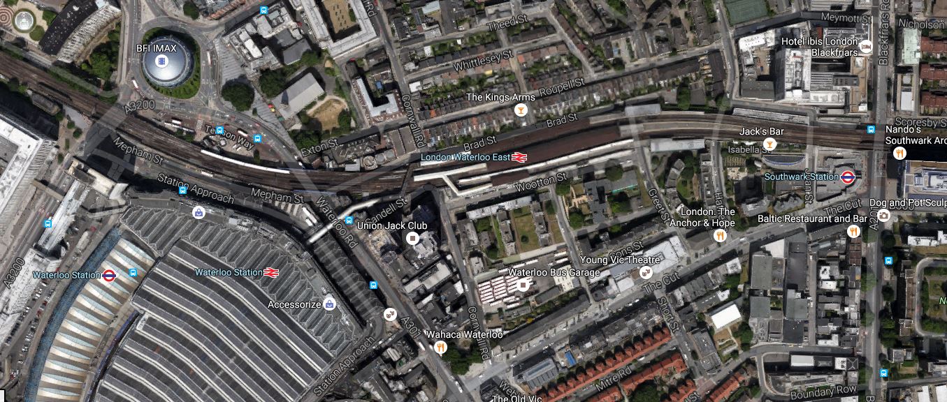
Southern Crossrail
Destinations Served
Destinations in the West could include.
With the following destinations in the East.
At least it does something useful with the Hayes Line.
Building Southern Crossrail
Southern Crossrail say this about the engineering required.
The minimum engineering requirement would be for the centre part of the concourse at Waterloo to rise up over four through tracks. There would need to be lifts and escalators.
A new bridge, alongside the old one, would be required to carry three new tracks over Waterloo Road.
The old bridge referred to is the one that is referred to in Wikipedia, as being used for storage.
The engineering involved is probably no more difficult than that used to update Thameslink at London Bridge, with the new viaducts over Borough Market.
But I can remember , that when that project was mooted, there was a lot of local opposition.
Given the farce of at times, when London Bridge station was being rebuilt, I think passenger groups will be against the changes.
Southern Crossrail give these additional changes on their web site.
- Signalling changes to increase the throughput
- Flyovers between Battersea and Waterloo thus allowing the local, suburban and express lines to be segregated on the approach to Waterloo, would increase throughput further
- Waterloo East Station would close releasing some land and a new station above the new Southwark station on the Jubilee line could be opened for interchange with Thameslink
- Closing the line up to Charing Cross would allow for greater throughput. Commuters travelling to the west end can change at London Bridge using the Jubilee line. This will have the added advantage of opening up the front of Waterloo through to the South Bank.
My views on these changes and other points follow.
Signalling And Flyovers
The signalling and flyovers probably need to be done anyway, whether Southern Crossrail is built or not.
Certainly, both Thameslink and Crossrail provoked a bit of a track sort-out on the approaches to London.
A sort-out of the lines into Waterloo would probably need to be done for Crossrail 2 anyway.
Rebuilding Waterloo East Station
I rarely use Waterloo East station, but it has a terrible connection to Southwark tube station and a tortuous walk to Waterloo station, unless you’re going to the balcony for lunch or to meet someone.
The map from carto.metro.free.fr shows the Undserground lines beneathe Waterloo East station.
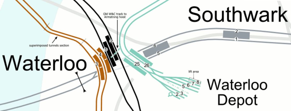
Lines Underneath Waterloo East Station
A new Waterloo East station could be built that had better connections to all of the Underground Lines in the area.
- Bakerloo Line – Very useful for the West End and Crossrail.
- Jubilee Line – Double-ended with connections to both Waterloo and Southwark stations.
- Northern Line (Charing Cross Branch)
- Waterloo and City Line
If rebuilding Waterloo East station would allow building on released land and above the station, together, then surely it is a project a quality developer would relish.
Decent pedestrian links could also be provided into Waterloo, as they should be anyway.
I think that there could be a strong case for the redevelopment of Waterloo East station, whether Southern Crossrail is built or not.
Improving The Waterloo And City Line
One of the side effects of rebuilding Waterloo East station would be improved access to the Waterloo and City Line.
A new entrance is being built at the Northern end and if the Southern end were sorted, London would have got a useful short new Unerground line, with a lot of the money provided by property development.
Serving Charing Cross Station
I believe that a rebuilt Waterloo East station would give better connections to the Underground, than does Charing Cross.
What Waterloo East lacks is connection to the District and Circle Lines and good walking routes to Whitehall. And you mustn’t annoy the Sir Humphries in their commute from Sevenoaks or Petts Wood!
Providing you didn’t close Charing Cross completely, there would be a same platform interchange at London Bridge.
But I suspect that an innovative solution could be found to get passengers from Waterloo East station to the North Bank of the Thames.
Properly done, it would enable passengers using the trains at Waterloo to get easily across the river .
Why are we wasting millions on the Garden Bridge, when a proper cross river connection further West would give benefit to millions of travellers?
At present these are the services that serve Charing Cross in the Off Peak.
- 2 trains per hour (tph) Dartford via Bexleyheath
- 2 tph Gravesend via Sidcup
- 2 tph Gillingham via Lewisham and Woolwich Arsenal
- 2 tph Hayes avoiding Lewisham
- 2 tph Sevenoaks via Orpington
- 2 tph Hastings via Tunbridge Wells
- 1 tph Dover via Ashford International
- 1 tph Ramsgate via Ashford International and Canterbury West
Obviously, there is a lot more in the Peak.
As it looks like the limit of trains through London Bridge to Waterloo East and Charing |Cross is somewhere around or above 20 tph, it could be that if Southern Crossrail is built, then there is a logical split.
- Suburban services go through to Waterloo and into the South West suburban network.
- Long distance services go to Charing Cross.
Platform arrangements at London Bridge and Waterloo East could be designed, so that if you’re on a train going to the wrong destination, you step off and step on the next one.
The Jubilee Line By-Pass
Now that we can see the new London Bridge station emerging and Charing Cross services are calling at the station again, I think we’ll see some interesting ducking-and-diving alomg the South Bank of the Thames.
Suppose you arrive at London Bridge on perhaps a train from Uckfield and need to go to Waterloo to get to Southampton. Until about a month ago, you would have to struggle across London on the Underground. Now you could take a frequent Charing Cross service to Waterloo East and just walk into Waterloo.
We mustn’t underestimate the effects that a fully rebuilt Thameslink and London Bridge station will have on passengers getting across South London.
If Southern Crossrail was built, it would be an alternative for the Jubilee Line between London Bridge and Waterloo.
Southern Crossrail might even lead to a rethink about how the Jubilee Line operates.
Positive Points
- Terminal platforms are released in Waterloo station, as services are joined up.
- No infrastructure changes would be required at London Bridge station.
- No tunnelling
- Southern Crossrail can be built before Crossrail 2.
- Southern Crossrail can be built to be compatible with Crossrail 2.
- The Tramlink connects Wimbledon in the West to Elmers End in the East.
But it will exceedingly difficult to convince the powers-that-be that it is a viable project.
Conclusion
I think it could be one of those projects that is so bizarre and wacky it might just be feasible.
But if it is built or not, London could benefit tremendously, by a quality rebuild of Waterloo East station.
In a phased building of Southern Crossrail, the order of construction could be.
- Rebuild Waterloo East station.
- Upgrade the lines into Waterloo with flyovers and signalling.
- Rebuild the concourse at Waterloo, so that the connecting tracks could go through to Waterloo East.
- Put in the bridges between Waterloo and Waterloo East.
- Connect up the services one-by-one.
It is the sort of project, that a good project management team, could push through with little disruption to services and passengers.
Improving Lewisham Station
In the June 2016 Edition of Modern Railways, there was an article entitled Turning South London Orange.
One of the proposals is to try to sort out Lewisham station.
My mother used to tell me never to go South of the Thames as you’ll get lost. Perhaps she had Lewisham in mind, as just look at this Google Map of the lines through the station.
Lines Through Lewisham
The rail lines in the Lewisham area are.
- The lines to the West of the map is the South Eastern Main Line from Charing Cross to Dover and Folkestone.
- The line curving down from the station to the South Eastern Main Line is the Hayes Line, which meets it in a complicated junction.
- Going off to the East from the station is the North Kent Line.
Was the designer of the lines in this area having a laugh, as it must make running trains through Lewisham in an efficient manner extremely difficult.
I also assume that anybody going to and from Dover, can’t change trains at Lewisham, unless they an force a window and jump out.
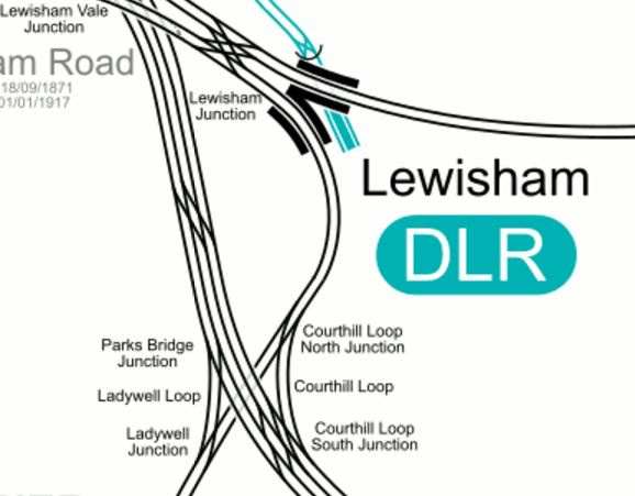
In order to try to improve matters, the Centre for London report is proposing Lewisham South interchange platforms on the South Eastern Main Line, which are connected to the main station using a travelator running alongside the Hayes Line.
The thinking behind all this is detailed in this document from JRC consultants.
Some major points and recommendation from the document include.
- There are too many flat junctions and other track problems.
- The service levels from the area into London is erratic and nowhere near TfL’s oreferred level of four trains per hour.
- Getting to and from anywhere other than the City or Central London in the peak can be difficult.
- Connectivity to Lewisham to get the DLR to Canary Wharf could be improved.
- Southeastern’s commuter services should be taken over by TfL.
- Extending the East London Line to Lewisham wll be difficult and expensive, if not impossible.
The document also includes a map of the proposed travelator on Page 14.
It shows the travelator curving along the Eastern side of the Hayes Line to an island platform on the South Eastern Main Lines.
It also says this.
However a southern location closer to Lewisham High Street, placed over the Hayes branch line, in low value or empty land on the slow lines alongside Parks Bridge Junction and north of the Courthill loop, would permit a 12-car island platform connected into the Lewisham Interchange and making that much more of a hub station. A direct entrance to the southern part of Lewisham High Street could also be opened up. A travelator alongside the Hayes line, in several segments, would link to the interchange in 540 metres and also provide fast access to Lewisham shopping centre at an intermediate point.
This Google Map shows the area from the current Lewisham Interchange to the proposed Lewisham South.
Note the blue roofs of the DLR station at the top of the map and the crossing by the South Eastern Main Line of the Hayes Line at the bottom, where it is surrounded by green space.
To get a better feel for the area. I took these pictures ass I walked from where the South Eastern Main Line crosses the High Street back to the station.


After this walk along the dual-carriageway from the Western end of Lewisham High Street to the station, I certainly think that a better walk could be created.
Let’s hope that when the current construction and road works are complete, that the current walking route between the station, the Shopping Centre and Lewisham High Street is improved.
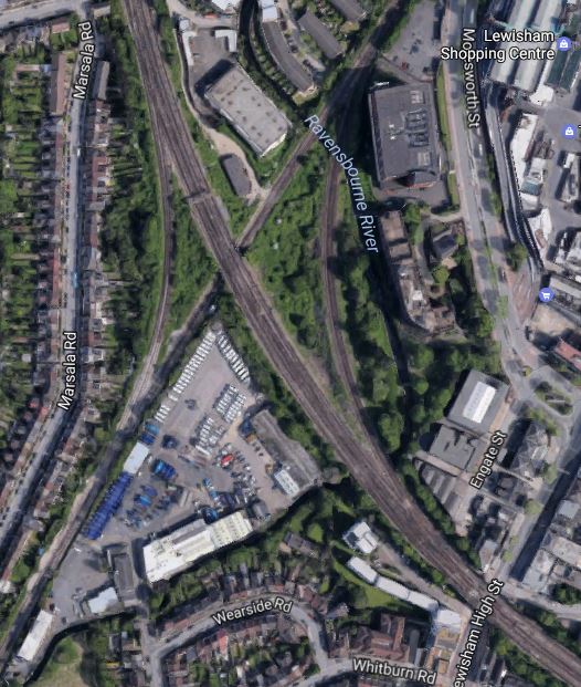
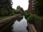
What disappointed me was that surely better use of the Ravensbourne River, which I called a Hidden Waterway in the pictures. This Google Map shows how it twists and turns through the area.
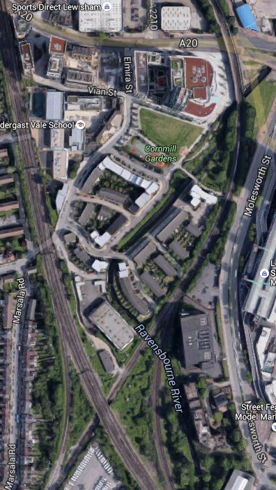
The Ravensbourne River Through Lewisham
I certainly think something better can be done.
For those who think a travelator is a bit naff, the JRC report also suggests that the DLR could be extended.
Consider.
- If it’s worth extending the DLR to Lewisham South, perhaps it should go further.
- One of the themes of the JRC report is prudence and affordability, which I think pushes the author to the travelator solution.
- The travelator route may make it easier to serve the Shopping Centre.
- A travelator might make it easier to catch the buses on the other side of the Shopping Centre, which every time I go to Lewsiham, I seem to have to do.
I also think that to extend the DLR would probably involve some impressive engineering to get over the roads by the station, whereas a walking route/travelator might even start from or beside the Hayes Line platform (2) on the bridge over the road. The latter option would mean that at the station end, all of the lifts are there for step free access to the other platforms.
I also think that not many passengers would want to transfer between Platform 1 at Lewisham station and the Lewisham South platforms, so starting the walkway from Platform 2, which has a level connection to Platform 3 and good connections to the DLR, would not be a bad idea.
Overall, I don’t think we make enough use of travelators and outside escalators.
But I do like the idea of the new platforms at Lewisham South and a travelator.
Something will have to be done at Lewisham, before the Bakerloo Line is extended to the area.
More Thoughts On Dalston Junction To Hayes
In February this year, I wrote Should Trains Run From Dalston Junction To Hayes?
I finished the post like this.
So is New Cross the least used direct southern destination on the East London Line? Also, was it only included in the East London Line for historic reasons, as it had been a Metropolitan Line destination?
If so, it might be an idea to see if extension of the four trains per hour services terminating at the station is possible. Perhaps two could go Hayes and two to Orpington, which would double the frequency to both places from New Cross.
I could also have said in the summing up, that this would give four trains per hour from Dalston Junction to Lewisham, with all its connections to South East London and Kent.
This morning, I was reading an article on London Reconnections about extending the Bakerloo Line, entitled Death, Taxes and Lewisham: Extending the Bakerloo.
So it got me thinking!
I returned to my original article and had the following blasphemous thought.
Is Transport for London, so obsessed with using the supposed spare capacity on the Bakerloo Line, that it doesn’t think straight about what to do with this line?
Consider the following points.
- Passengers like the Overground model and many rate it higher than the Underground.
- When Crossrail and Thameslink and the East London Lines are up to capacity of twenty-four trains per hour, the increase in capacity will change London’s transport system dramatically, as there will be an H-shaped network with interchanges at Farringdon, Whitechapel and possibly some other places.
- Most trains going to Kent and South East London start from Victoria, which is not well placed for some of the important parts of Central London. Would extra connections to a twenty-four trains per hour East London Line at Penge and Brockley be a better route for many passengers?
- I feel that there would be a backlash, if the Hayes Line became part of the Bakerloo Line, just like there was when Thameslink wanted to stop all Sutton Loop Line trains at Blackfriars! If you’ve been commuting for years in First Class from Hayes into Cannon Street for the City, I don’t think you’d be happy if your train was a smaller one-class, crowded Underground train. But you might accept an Overground train to Canada Water for the Jubilee Line or Whitechapel for Crossrail and the Metropolitan/Circle/District Lines.
- Thameslink together with the Bakerloo Line and an upgraded Jubilee Line will create a resilient North-West to East routing, that could withstand the occasional serious failure. The East London Line provides that resilient link in the East.
- Thameslink doesn’t connect with the Central Line, but the East London Line could at Shoreditch High Street.
I’m coming more to the conclusion that there is no way that a long extension to the Bakerloo Line would be needed. Perhaps it should be extended in a loop down the Old Kent Road to Camberwell, to get high-quality rail services into that area.
Should East London Line Services To New Cross Go Further?
Four services per hour on the East London Line have their Southern terminus at New Cross station and could these venture further into South London?
At the moment these services terminate in a bay Platform D, which is just a walk across from the trains going South. But when coming North, you have to go over the step-free bridge to get from Platform A to Platform D.
In the next few years, various developments will happen, that will affect travel in the area bordered by New Cross, Cannon Street and Whitechapel.
- London Bridge and Thameslink will be improved, so interchange between Cannon Street services and Thameslink will be much easier.
- Hopefully, access to the Underground at London Bridge will be eased by the redevelopment of the station.
- Will the Thameslink improvements increase the capacity into Cannon Street?
- Crossrail will open.
- The Metropolitan/District and Circle Lines will have been fully upgraded with bigger trains and new signalling.
- The Jubilee Line will have been upgraded.
- Bank station will have been upgraded.
- There will be large numbers of office developments around the City, increasing the numbers of needed final destinations.
I believe that the increasing flexibility will mean passengers will be less likely to use the same route.
I also believe that passengers will switch between London Bridge/CannonStreet and the East London Line destinations of Canada Water, Whitechapel and Shoreditch High Street.
Many more will want to change at New Cross!
If the East London Line services started South of New Cross and just called at Platform A on their way North, just as London Bridge/Cannon Street services do, this would this give a simple change for Northbound passengers.
If you were on a Tunbridge Wells to Cannon Street train and wanted to go to Whitechapel for Crossrail, you would get off at New Cross and wait for an East London Line train on the same Platform A.
This interchangeability of Northern destinations, is unlocked by sending East London Line trains past New Cross.
Can East London Line Services To New Cross Go Further?
After Crossrail and an upgraded Thameslink opens, it will take some time for passenger numbers to stabilise.
These figures will decide if it is worthwhile to extend the services past New Cross.
The other constraint will be whether paths are available to continue to Lewisham and beyond.
The simplest plan would be to run the four trains per hour to Lewisham and then run two trains to both of Orpington and Hayes.
Extra Interfaces On The East London Line
I would also build the following interchanges on the East London Line.
- Central Line at Shoreditch High Street. This can’t be done until Crossrail opens.
- A New Penge station to connect to the Chatham Main Line
- A high-level Brockley station to link to the Nunhead to Lewisham Line.
There may also be scope for linking the East London Line to Thameslink. It is probably a pity, that the East London Line serves West Croydon rather than East Croydon, as the latter station has so much better connectivity.
Today, I visited South East London and I can make these observations.
New Cross Station
I wrote Changing At New Cross, when I looked at New Cross station.
I can’t see any obvious reason, why East London Line trains have to terminate at New Cross. I suspect, that it’s only for historic reasons, as that’s what the Metropolitan Line did many years ago.
St. Johns Station
I wrote Investigating St. Johns Station, when I looked at St. Johns station.
My only feeling about this station is that if it were to be upgraded to the standard passengers expect, it could be a valuable step-free interchange station between an extended East London Line and the services into and out of Cannon Street.
Lewisham Station
I wrote Changing At Lewisham, when I visited Lewisham station
If it were to be served by four trains per hour on the East London Line, with two trains per hour going to Hayes and the other two to Orpington, Lewisham would be an important interchange to increase the connectivity between South East and North East London.
Catford and Catford Bridge Stations
I wrote An Opportunity At Catford, when I looked at the twin stations of Catford and Catford Bridge and can say this.
- Currently, all trains through Catford Bridge station are going to and from Hayes.
- All trains through Catford are Thameslink ones between Blackfriars and Sevenoaks.
- Track exists to send trains between Catford Bridge to and from Orpington.
If cross-platform interchange could somehow be provided between the two northbound and the two southbound lines at Catford/Catford Bridge, this would give passengers from Hayes and Orpington a big choice of Northern destinations.
Effect On Dalston Junction
If the four trains per hour shuttle service between Dalston Junction and New Cross was replaced by two trains per hour to each of Orpington or Hayes, it probably wouldn’t have much overall effect on the Dalston Junction to New Cross section of the line, but what would the timings look like?
Currently trains leave Dalston Junction in the Off Peak at 04, 19, 34 and 49 past the hour taking twenty-two minutes to get to New Cross. They then return at 07, 22, 37 and 52.
So the 04 train gets to New Cross at 26, returns at 37 and gets back to Dalston Junction at 59, which means it waits eleven minutes at New Cross and six at Dalston Junction.
New Cross to Hayes takes thirty minutes, so that would be fifty two minutes from Dalston Junction to Hayes.
Would that be fast enough for each train to do one trip each hour?
I suspect that one of Transport for London’s timetabling experts could devise a pattern.
More Trains Through The Thames Tunnel
At present there are sixteen trains per hour through the Thames Tunnel.
- 4 – Dalston Junction to New Cross
- 4 – Dalston Junction to West Croydon
- 4 – Highbury and Islington to Crystal Palace
- 4 – Highbury and Islington to Clapham Junction
Which means that as there is a theoretical limit of twenty-four trains per hour, there are another eight paths available.
In Increased Frequencies On The East London Line, I wrote that London Overground have plans to introduce the following extra services.
- From 2018, there will be an extra two trains per hour between Dalston Junction and Crystal Palace.
- From 2019, there will be two additional trains between Dalston Junction and Clapham Junction.
So that would mean that there are still possibly another four paths available.
I would assume that the extra trains would be accommodated at the Northern end by just tightening the turn-round times.
I can’t believe that it won’t be long before Transport for London come up with ways of using the remaining four paths.
If they are planning to turn back two extra trains from Crystal Palace and two from Clapham Junction at Highbury and Islington, I can’t believe that they couldn’t turn back another four services at Dalston Junction. Assuming the extra trains to Crystal Palace and Clapham Junction, this would give the following frequencies.
- 12 tph between Highbury and Islington and Dalston Junction.
- 24 tph between Dalston Junction and Surrey Quays.
The core section of the East London Line will interface in 2020 with the following lines.
- Crossrail at Whitechapel will be 24 tph
- The Jubilee Line at Canada Water will be 36 tph
- The Victoria Line at Highbury and Islington will be 36 tph by 2016.
Father and son, Marc and Isambard Brunel, will be spinning in their graves, to see what their Nineteenth Century engineering curiosity-turned-marvel has become.
The Emergence Of Overground Transport Hubs
More trains on the East London Line between Dalston and Clapham Junctions is to be welcomed.
I use the well-connected Clapham Junction, if say I’m going to Southampton, Portsmouth or many other places, as it means I can avoid the difficulty of getting to Waterloo or Victoria.
The one problem with Clapham Junction in my view is that Thameslink or the Gatwick Express doesn’t call at the station.
Even so, Clapham Junction, Dalston Junction and Stratord are evolving as the major hubs on the Overground Network.
In the next few years, the following stations will become major hubs.
- Whitechapel because of its important location on Crossrail
- Old Oak Common because of its connections to Crossrail and HS2
- Hackney Interchange (Central plus Downs) because it joins the North London Line to the West Anglia Lines.
Will Lewisham, Crystal Palace or other stations join this elite group?
Southeastern
Southeastern is the train operating company that operates most of the train services to South-East London. Kent and East Sussex.
The company has three sub brands.
- Highspeed operates high-speed service on the Channel Tunnel Rail Link using Class 395 trains.
- Mainline operates traditional long distance services to Kent and East Sussex.
- Metro runs services to South East and South London.
London Overground makes to secret of the fact that it would like to bring the Metro services under its control.
I would very much welcome this takeover for the following reasons.
- As a North Londoner, who grew up in the North, South London trains are very much a mystery to me and Southeastern’s information could be substantially improved.
- The East London Line and Southeastern services could be properly co-ordinated.
- When the Overground took over the West Anglia Lines, there was a definite improvement in stations and customer service.
- The whole of Southeastern’s Metro and Mainline network needs to be brought into Transport for London’s Oyster and contactless bank card ticketing.
Hopefully, the takeover will happen, when the franchise is up for renewal in 2018.
Crossrail Extension To Ebbsfleet International And Gravesend
I wrote Crossrail Extension to Gravesend after a visit to the area and I feel that it would be possible to extend Crossrail, so that it served both Ebbsfleet International and Gravesend stations.
This would enable a direct link between Heathrow Airport and Continental trains and you’d only need to change once if you were going to Gatwick, Luton or Stansted Airports.
Conclusions
On a brief look, there is a lot of potential to extend the New Cross branch of the East London Line to Lewisham, Hayes, Orpington and perhaps some more places.
Get it right and it might not be the best thing to have a long extension of the Bakerloo Line.
Improving The East London Line
I make no apologies for returning to this subject, but I use the East London Line of the Overground virtually every day and it is very much part of my daily life.
What also prompted me to think about this topic, was coming back from Birmingham into Marylebone and thinking how I would get home in the aftermath of a Friday rush-hour. At the time I was passing Dollis Hill station, where the Chiltern Line runs alongside the Jubilee And Metropolitan Lines.
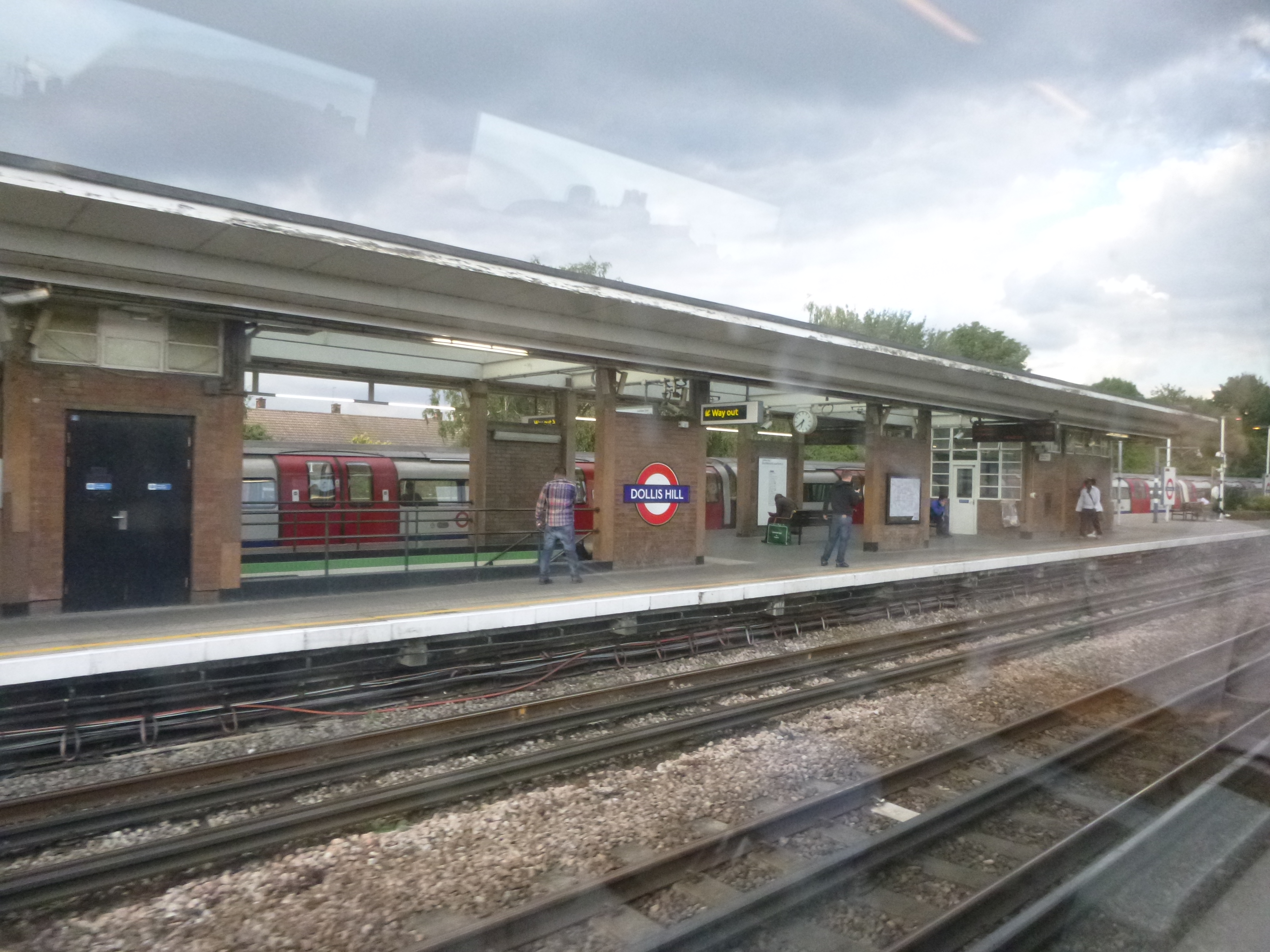
Dollis Hill Station From A Marylebone-Bound Train
It reminded me of the plan to create a proper Interchange between all of lines at West Hampstead. But I can’t expect all trains into Marylebone to stop there, so that I can get easily to Dalston on the North London Line.
So in the end, when I got to Marylebone, I took one stop to Baker Street to get the Metropolitan line to Whitechapel for the East London Line. But usually the Metropolitan was a disaster with no trains and no information, so in the end I took the Jubilee Line to London Bridge from where I got a bus home.
To put it mildly, I’d hit the usual problem. – Getting to and from the Bakerloo Line from East London. It just doesn’t interchange with anything useful within a couple of stops from say Whitechapel or Dalston Junction.
There are two major developments that will happen in the next few years to the East London Line. As the Eastern end of the North London Line from Highbury & Islington to Stratford is closely tied to the East London Line, related improvements to that line will also be covered.
1. Six-car trains
As I indicated in this earlier post on improving the Overground, the East London Line could be easily upgraded to take twenty-four six-car trains in each direction. I said this in that post.
At the moment the East London Line has 16 four-car trains an hour in the core route, so 24 six-car trains will mean an increase of capacity of 2.25.
But the East London Line already has five-car trains, so the improvement in capacity will be just a factor of 1.8.
The history of the Overground and their Class 378 trains has been one of continuously adding new carriages, ever since they were introduced. I feel that by the end of this decade plans will be in place for a sixth carriage on the East London Line.
There are documents from Network Rail and Transport for London, that also show that six-car trains and higher frequencies will be operating on the North London Line.
I don’t know the economics of building trains, but I suspect that Bombardier would like all new trains to be Aventras, so that they only have one type in production. After all the next order from London Overground is for Aventras for the Lea Valley Lines.
So we might see an early order for sixth carriages or London Overground may go for a fleet that was 100% Aventras. The latter wouldn’t be a waste of a fleet of Class 378 trains, as Birmingham, Cardiff, Glasgow, Leeds and Liverpool, would probably like to acquire a fleet of trains less than a decade old.
2. Crossrail
Crossrail will also interface to the East London Line at Whitechapel station and who can predict accurately how much the new line will increase passengers on the East London Line? I suspect that Transport for London’s forecasts will be wrong, just because you are dealing with East Londoners, who have all the flexibility and cunning in their transport plans of little furry animals, who want to enter your property. I think this is due to the legacy of East London having pretty terrible Underground and rail lines until the last few years.
All of these extra passengers travelling on the East London Line will generate a series of actions that will need to be taken, which fall vaguely into two groups.
1. Extra Terminal Platforms At Both The North And South Ends
For operational reasons, it is probably better to have the same number of North and South terminal platforms at both end of the line.
At present the East London Line operates four separate services with one train every fifteen minutes in both directions.
- Dalston Junction to West Croydon
- Dalston Junction to New Cross
- Highbury & Islington to Crystal Palace
- Highbury & Islington to Clapham Junction
Which gives the current sixteen trains per hour, so if they keep to the current balancing rule and a four trains per hour, they’ll need two extra terminal platforms in both North and South.
I think it is probably right to assume that the terminus shouldn’t be too far away from Whitechapel. Currently, West Croydon and Clapham Junction take about 40 minutes, so much longer than this is probably not possible.
I suspect that the planners of Transport for London have some surprising ideas, when they have a few drinks on a Friday night.
2. New Stations And Interchanges
The Overground and the East London Line in particular always seems to have someone pushing for a new station or better interchange with other lines.
Current interfaces beween Overground and Underground lines are as follows.
Bakerloo Line – Harrow & Wealdstone, Queen’s Park, Wembley Central and Willesden Junction
Central Line – Shepherds Bush and Stratford
District Line – Gunnersbury, Kew, Richmond, West Brompton and Whitechapel
Hammersmith And City – Whitechapel
Jubilee Line – Canada Water, Stratford And West Hampstead
Metropolitan
Northern Line – Camden Road-Camden Town
Piccadilly Line – None
Victoria Line – Highbury & Islington
I think, that there is scope for a lot more connections.
So what has been suggested and what would I like to see?
In alphabetical order we have.
Bakerloo Line Extension
The route of the Bakerloo Line Extension has not been decided yet, although TfL have received overwhelming support for the extension.
The three options for the extension all interchange with the East London Line.
Option 1 via Burgess Park, east to Peckham Rye and Catford Bridge,with the option of taking over the Hayes Line to terminate at Hayes, interchanges at Peckham Rye and Honor Oak Park.
Option 2 south to Camberwell Green, and then on to Herne Hill and Streatham Hill, with a branch at Tulse Hill which would take over the National Rail line to Beckenham Junction, interchanges at Crystal Palace and Norwood Junction
Option 3 a similar route to option 1, but after Burgess Park running via the Old Kent Road and New Cross before joining the Hayes line at Lewisham and terminating at Hayes, interchanges at New Cross.
So whatever option is chosen will effectively create a circular route round Central London with this route.
- Highbury & Islington
- Whitechapel
- Surrey Quays
- Crystal Palace, Honor Oak Park, Lewisham, New Cross, Norwood Junction or Peckham Rye
- Elephant & Castle
- Waterloo
- Charing Cross
- Piccadilly Circus
- Oxford Circus
- Baker Street
- Marylebone
- Paddington
- Queen’s Park
- Willesden Junction
- Harrow & Wealdstone
The line could follow its old route and end up in Watford.
It would appear that this route is more useful than the current truncated one to Elephant & Castle.
Hopefully, it would go some way to making it easier to get from East London to Marylebone and other awkward to access places in North West London.
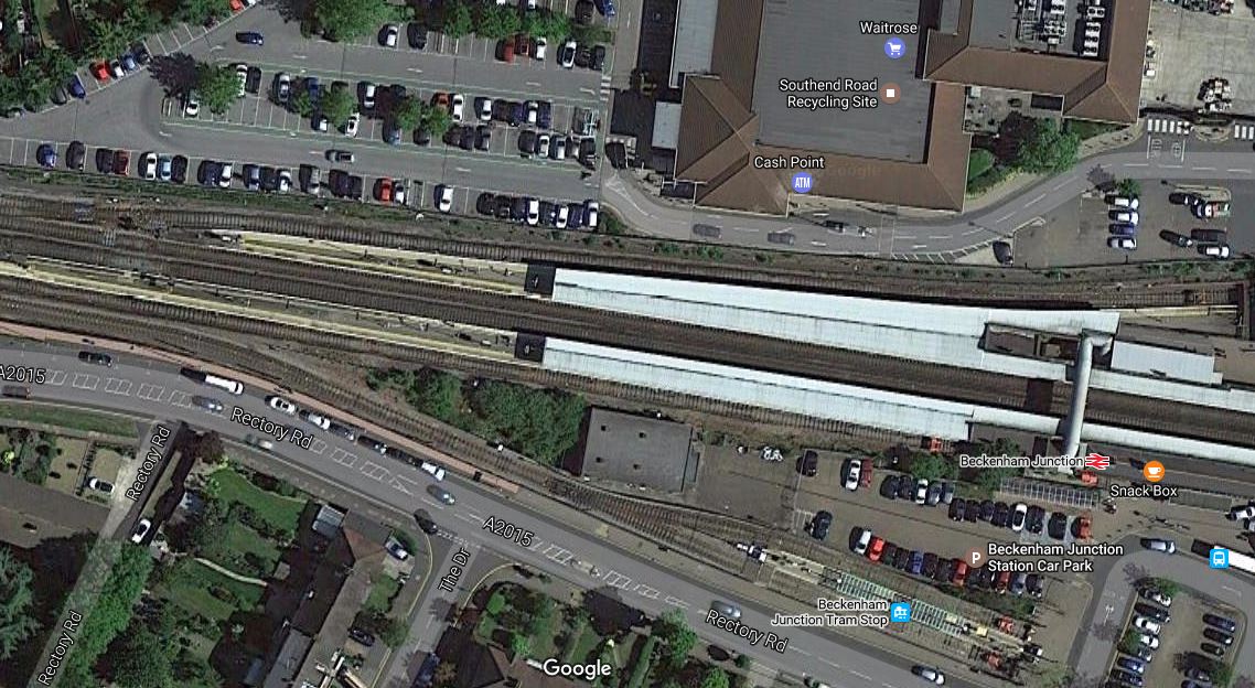
Beckenham Junction As A New Southern Terminal
Beckenham Junction station has a lot going for it as a southern terminal. It has rail and tram services and it even has a bay platform, which is clearly shown in this Google Map.
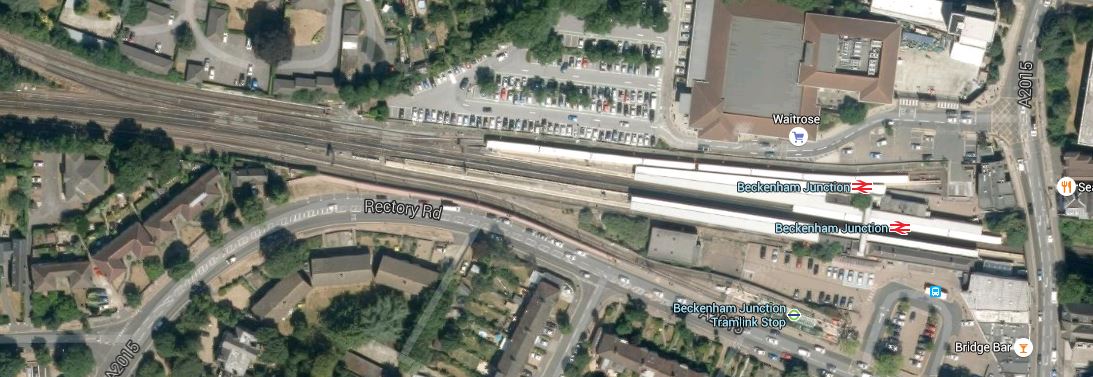
Beckenham Junction Station
As Beckenham Junction is probably less than forty minutes from Whitechapel, it may be a possibility, provided passenger statistics show it can generate enough revenue.
If as seems a possibility, the Hayes Line gets to become part of the Bakerloo Line, how will this effect Beckenham Junction.
It’s all very complicated as to how the Bakerloo Line Extension will fit in with the East London Line.
Brixton High Level Station
In their Transport Infrastructure Plan for 2050, Transport for London are proposing a Brixton High Level station.
The connection of a Brixton High Level station to the existing Brixton station and the Victoria Line will be difficult. Before the Overground opened to Brixton, I visited and wrote Could the London Overground Call at Brixton? This is a picture from that article from May 2012.
The Overground Flies Over Brixton Station
Either a high climb or a big set of lifts or escalators.
I said this in the article.
I tend to think that the only solution would be to spend millions to create a proper interchange station, that connects all of the three lines; Victoria, East London and main line together. But in the present financial climate that is impossible.
Perhaps with the current upgrading of the Victoria Line to allow 36 trains per hour on the full line and London’s growing population, the economic rules have changed Or a big property developer needs to get a Planning Application through?
I wonder if when they are upgrade the Victoria Line at Brixton, they will also extend the southern end of the line to Herne Hill, as is described here in Wikipedia.This is said.
For many years there have been proposals to extend the line one stop southwards from Brixton to Herne Hill. Herne Hill station would be on a large reversing loop with one platform. This would remove a critical capacity restriction by eliminating the need for trains to reverse at Brixton.[48] The Mayor of London’s 2020 Vision, published in 2013, proposed extending the Victoria line “out beyond Brixton” by 2030.
There’s an interesting article from London Reconnections, which describes the problems at Herne Hill.
If they got their contracts and project management right, they might even be able to use one of the tunnel boring machines bought for the Northern Line Extension.
Brockley High Level Station
In their Transport Infrastructure Plan for 2050, Transport for London are proposing a Brockley High Level station.
Brockley station sits underneath and is crossed by the Bexleyheath Line as this Google Map shows.
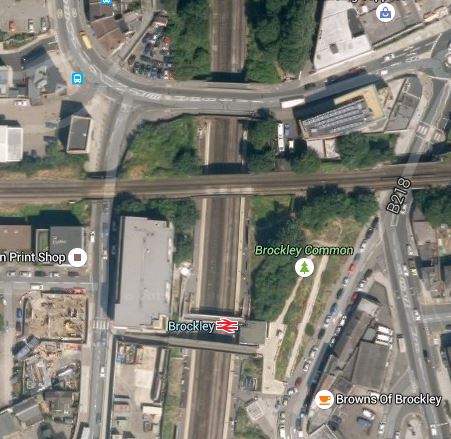
Brockley Station
There was a station called Brockley Lane on the Bexleyheath Line, but it closed in 1917.
After the complicated nature of the problem at Hackney, I wouldn’t think creating a Brockley High Level station would be that difficult.
TfL would just have to make sure it was worth doing.
Camden Road Station Connection To The Northern Line
In their Transport Infrastructure Plan for 2050, Transport for London are proposing a link between Camden Road and Camden Town stations.
Having walked between the two stations several times, I wouldn’t have thought they were close enough. However this railway map of the two stations, shows that they are closer than they appear on the surface and it might be possible to create perhaps an escalator connection. This Google Map shows the area.
Camden Town And Camden Road Stations
Camden Town station is going to be rebuilt to relieve the chronic overcrowding. It is a project that will take several years and I suspect Transport for London will want to get as many other issues, like the interchange to the North London Line out of the way for ever.
Chingford As A New Northern Terminal
Chingford station is a possible new northern terminal if the Dalston Eastern Curve is reinstated. Trains would go via the High Meads Loop at Stratford, the new Lea Bridge station and the Hall Farm Curve. This would mean that a new station could be created within easy walking distance of Stratford International station, which would also serve the Northern part of the Olympic Park. This Google Map shows how the High Meads Loop curves between Stratford International station and the Olympic Park.

Olympic Park And Stratford International Station
An East London Line station at Stratford International would certainly ease problems getting to events at the Velopark.
Lea Bridge station could also connect to services up the Lea Valley, Bishops Stortford, Cambridge and Stansted Airport.
Chingford is a well-appointed station, linked to a bus station, that could probably be reached in forty minutes from Whitechapel.
Using Chingford as a terminal would also directly link much of the boroughs of Waltham Forest and Hackney on a single line and then link the stations directly to South London.
But Chingford has big advantages in that it is already run by London Overground and it has three platforms and some sidings to park trains. This Google Map shows the station.
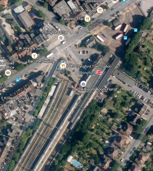
Chingford Station
Note the bus station to the North-East of the station and the extensive sidings on the approach to the station.
Using Chingford as a new northern terminal, would also intertwine the two sections of the Overground together, with direct same platform interchange at Hackney Central, Homerton, Hackney Wick and all stations after St. James Street on the Chingford branch.
Dalston Eastern Curve
In my view the Dalston Eastern Curve could be important, as it would enable direct services between the Eastern terminal of the North London Line at Stratford and any of the South London destinations.
Also, if the Hall Farm Curve were to be rebuilt to give the Chingford Branch a direct connection to Stratford, services could run between Chingford and Walthamstow Central, and South London, by using the High Meads Loop.
There will be opposition to rebuilding the curve, but the number of passengers, will decide the issue.
I have a feeling that because the Kingsland Shopping Centre is going to be upgraded and the owners of that have rights over the land, that we might see a decision one way or the other on this fairly soon. Although on the contrary, this article in the Hackney Citizen seems to be all about various delays and problems, with redevelopment of the Shopping Centre.
I would also think that a lot of the arguments in the Hackney Citizen article about development and car parking, are getting to be more and more irrelevant, as Eastfield is probably taking a lot of the business of the Dalston Kingsland Shopping Centre. In my mind, the sort of people moving into the flats being developed around Dalston Kingsland are probably not the sort of people, who would shop in the Centre. Unless of course, it was substantially upgraded! Could this be, why the proposed development incorporates quite a few residential properties?
The other thing that could kickstart work in this area, would be a decision to proceed with either Dalston Kingsland station or Crossrail 2.
An interesting point, is that if Transport for London believed that rebuilding the Dalston Eastern Curve is essential to handle the traffic on the East London Line, they would probably get their way and the Shopping Centre would have to be redeveloped.
I think there is a lot of horse trading going on in dark corners of various offices of Hackney Council, Transport for London, the developers; Criterion Capital and hopefully a decent architect.
Whatever happens, when and if Crossrail 2 is given the go aged, Criterion Capital won’t be taking a loss.
What the outcome will be, is anybody’s guess!
I know nothing that hasn’t been published on the Internet, but I have this feeling that the Dalston Eastern Curve will be reinstated. Or at least it won’t be compromised! No Project Manager worth his salt would do the latter!
Dalston Station For Crossrail 2
In this article called Crossrail 2 Through East London, I said this when I was discussing the Dalston stations.
I have heard from Michele Dix of Crossrail 2, that they are looking at a double-ended station to serve both Dalston Kingsland and Junction stations. This was said.
We have been working closely with the London borough of Hackney on the early development of the proposals for how Crossrail 2 could ultimately serve Dalston. The work to date has been based around delivering a double-ended station, with one end being at Dalston Junction, and the other at Dalston Kingsland, thereby allowing the Crossrail 2 station to link to both existing stations. As Mr. Miller rightly points out, the distance between the existing stations is well suited to the 250m long platforms that will be required for the Crossrail 2 station, and the greater interchange opportunities to London Overground services also deliver significant benefits.
I believe that there is an opportunity to create a world class station that subtly brings together all the good elements of the area. The only necessary demolition would be the unloved Dalston Kingsland station. TfL have told me off the record, that Kingsland station will be replaced fairly soon.
Hayes As A New Southern Terminal
The Hayes Line and its terminal at Hayes, would seem to be a line that Network Rail doesn’t want, but TfL do, if you read this section in Wikipedia. Here’s a short extract.
The driving force for this change is that Network Rail would like the train paths freed up for services mainly from the South Eastern Main Line. Transport for London prefer this route due to its largely self-contained after Lewisham.
You also have the passenger reaction to being told they are going on smaller Underground trains to a different part of Central London.
Hayes though is just over forty minutes from Whitechapel and there are two terminal platforms at the station, so it could be used as a southern terminal.
But on balance, I think it is unlikely that Hayes will be chosen as a southern terminal.
Herne Hill Congestion
Herne Hill station may well be Grade II Listed, but read the Future section in its Wikipedia entry.
It has problems, as it would appear a gallon is being squeezed into a gill pot! If you read this article in London Reconnections, you’ll see that it is not just a serious problem, but an almost impossible one. Take this paragraph, which is one of many in a similar vein.
There are also specific local issues arising from land ownership and planning. Aside from being in a Conservation Area, where buildings and trees are protected, the Dulwich Estate retains significant planning powers and is probably the freeholder of the rail lines alongside the estate. Network Rail will be cognisant of the potential level of opposition from local residents in this affluent part of south London, as well as the likely difficulties in negotiating with the Estate, including any legal wrangling which may necessitate revisiting the 1870 Act of Parliament curtailing the Estate’s powers. This probably explains why the default position is to keep this project firmly in the pending tray ― something needs to be done, but not right now.
The report was written in 2012, so let’s hope that some of the problems have gone away.
I’ve never scheduled trains, but I’ve scheduled things that are just as difficult and the solution to the congestion at Herne Hill station needs either more capacity or less passengers wanting to use the line. Taking this direct from Wikipedia illustrates the problem.
Network Rail, in its July 2011 London & South East route utilisation strategy, recommended that all services from Herne Hill towards Blackfriars should terminate in the bay platforms at Blackfriars after London Bridge’s redevelopment is completed in 2018 and the diverted Thameslink trains return there. Passengers from Herne Hill would then have had to change at Blackfriars to travel further north. Network Rail made this recommendation because more services will be using the route between St Pancras and London Bridge from 2018; sending trains from Herne Hill to the terminating platforms on the western side of Blackfriars (instead of the through tracks on the eastern side of the station) would have removed the need for them to cross in front of trains to/from Denmark Hill and trains to/from London Bridge at junctions south of Blackfriars.
In January 2013, the Department for Transport (DfT) announced that trains serving the Sutton Loop Line (also known as the Wimbledon Loop) will continue to travel across London after 2018. The number of trains calling at Herne Hill on the route will remain unchanged, with four trains per hour. The DfT has also decided the Sutton/Wimbledon Loop will remain part of the Thameslink franchise until at least late 2020; as such, the route will eventually be served by the new Thameslink trains.
Network Rail have a solution and then the politicians kill it.
So is there anything that the Overground and the East London Lines in particular can do to help?
Probably not!
But longer trains on the Clapham Junction branch may persuade passengers to take a different route. On the other hand, commuters are very conservative.
Hopefully, three other developments will help.
1. The opening of Crossrail, which might mean that some commuters travel via Abbey Wood. Crossrail’s opening will also improve the East London Line’s access to Central London, with a single change at Whitechapel.
2. If Crossrail were to be extended to Ebbsfleet International, as has been safeguarded, then this could help.
3. The completion of Thameslink with the new Class 700 trains, may increase capacity and persuade passengers to go via a reopened London Bridge station, rather than Victoria.
But it very much looks like Transport for London is pedalling hard to stand still.
Highbury & Islington Needs Rebuilding
Highbury & Islington station has needed rebuilding ever since British Rail’s cheapskate design produced the inadequate Underground station, that came with the Victoria Line.
When the East and North London Lines get more and bigger services through Highbury & Islington, this can only result in more and more passengers using the inadequate escalators and tunnels to access the Victoria and Northern City Lines. The station won’t be able to cope, just as it can’t now when Arsenal play at home.
The first stage of the rebuilding has started, as contractors are replacing the ageing bridge that carries the road over the Overground lines. No firm plans have been published yet for the station, but it needs a large increase in both capacity and accessibility.
I have a feeling though, that this station has a lot of potential possibilities, that could be used to create a top-notch station. For instance, there is a second building and entrance on the other side of the road, which has been used for signalling equipment for the Victoria Line.
Lewisham As A New Southern Terminal
Lewisham station is a possible choice for an extra southern terminal, as it has lots of rail and bus connections. This a Google Map of the station.
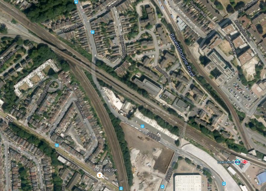
Lewisham Station
It shows a possible problem, in that there appears to be no easy place for a terminal platform. As it’s also only four or five minutes away from the existing terminus at New Cross, I think that Lewisham can be discarded as a terminal.
Maiden Lane Station
Maiden Lane station is an aspiration for Camden Council to serve the Kings Cross Central developments.
I discussed Maiden Lane station in this article in January and came to the conclusion, that the station might only be built as part of one the large developments in the area.
Using the station as a way of getting to Kings Cross and St. Pancras stations is probably not a possibility due to the distances involved.
Meridian Water As A New Northern Terminal
Angel Road station which will be renamed to serve the Meridian Water development, would be the most unlikely choice for a new northern terminal if the Dalston Eastern Curve is reinstated. Trains would go via the High Meads Loop at Stratford, the new Lea Bridge station and could possibly interface with a future Crossrail 2 at Tottenham Hale, Northumberland Park and Meridian Water itself.
New Entrances And Stations
Over the last few years, London has been going through a quiet ticketing revolution.
People are rarely using cash in a station to buy tickets and if rumours are right, the proportion of those using contactless bank cards for tickets is increasing rapidly. Over the last week or two, signs are up everywhere on the Underground, saying that ApplePay is now accepted.
I’ve not really seen an article anywhere discussing the effects of this cashless and booking office free ticketing.
I recently used the new entrance at Shepherds Bush station and it was just a gate line with a shelter over the top and a refuge for staff. Obviously, as that entrance has been built to serve the Westfield Shopping Centre, There is also a similar entrance at Harold Wood station, serving the car park.
I think we’ll be seeing more of these short-cut entrance/exits at several stations. I proposed this for Highbury & Islington in this article in March 2013 and personally, I’d like one at Hackney Central on the Westbound platform, to give access to the buses on Graham Road.
The technology could also mean that complete stations could be built much more easily and quickly.
It will be interesting to see how architects use their imagination in the freer environment created by the new ticketing technology, to design exciting, practical and very passenger and staff friendly.
New Interchanges
The new ticketing technology may also open up opportunities to create new interchanges between lines.
Obviously, this will probably be more to do with interchanges between two surface railways, as anything where digging is involved will be very expensive and probably rules out most linking with the Underground.
With the recent building of the walkway between Hackney Downs and Hackney Central stations, Transport for London have shown that they won’t rule out connecting lines by any affordble and sensible method.
So are there any possibilities for new interchanges, made possible by the new technology linked to some imaginative thinking?
I think there are stations that could be improved in this way and they are in the text in their alphabetical position.
North Acton Station Connection To The Central Line
Development at North Acton station on the Central Line has for a long time talked about linking to the North London Line.
Just a few years ago, it would have needed a lot of expensive construction, but with the development of new ideas in ticketing, station architecture and the successful introduction of the walkway at Hackney, the cost will have been considerably reduced. This Google Map shows the area around North Acton station.
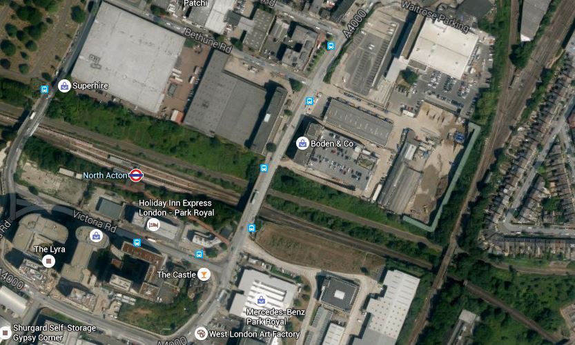
North Acton Station
The North London Line is at the right of the image and at the top is the junction where the Dudding Hill Line branches off.
Whether it is now a station and interchange worth building is up to Transport for London, but modern techniques have opened up possibilities.
Old Oak Common As A New Northern Terminal
The yet to be developed, Old Oak Common station is a possible new northern terminal. As a completely new station, hopefully you’d get a perfect solution.
But I don’t think you’d want to have both Old Oak Common and Willesden Junction stations as terminals, but a lot of the reasoning, that applies to Willesden also applies to Old Oak Common.
There is not much point in predicting what will happen at Old Oak Common, but I suspect whatever is proposed will be worth waiting for.
Orpington As A New Southern Terminal
Orpington station is a possible choice for an extra southern terminal, as it has lots of rail and bus connections.
This a Google Map of the station.

Orpington Station
Orpington would be reached by way of New Cross, Lewisham and Beckhenham Junction is around 35 minutes, so it is actually closer than West Croydon and only just five ,minutes longer than Crystal Palace. It also has several terminal platforms, that could easily accommodate the six-car trains.
An extension to Orpington would appear to connect a lot of places in South East London to Crossrail at Whitechapel and the Jubilee Line at Canada Water.
Penge
In their Transport Infrastructure Plan for 2050, Transport for London mention a new interchange at Penge. This is a Google Map showing both stations.
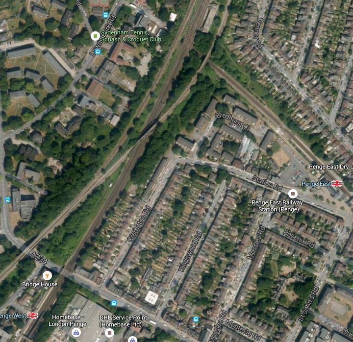
Penge East station has services between Victoria and Orpington and on Thameslink.
Penge West Station has services on the East London Line and the Brighton Main Line.
This small mention in the TfL report is the only thing I can find about an interchange at Penge.
But could it be a dastardly plot to overcome the Great Anomaly in South London’s suburban services, where many services to Kent and the South East tend to terminate at Victoria?
Look at this enlarged Google Map, where the line through Penge West cross over the line through Penge East.
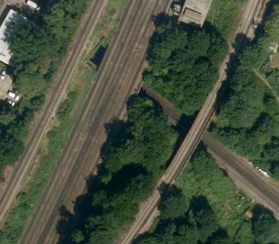
A Place For Penge Station?
Note the isolated line a short distance to the East of the main lines to London Bridge. This is the line that carries East London Line services to Crystal Palace
TfL must think there is a need for an interchange between East London Line and London Bridge services and those Victoria and Thameslink services.
Shoreditch High Street Station Connection To The Central Line
Shoreditch High Street station sits on top of the Central Line and Wikipedia in a section on plans for the station, says this about creating a connection between the two lines.
There have also been discussions of creating an interchange with the Central line between Liverpool Street and Bethnal Green which runs almost underneath the station. However, this would not be able to happen until after the Crossrail 1 project is complete, due to extreme crowding on the Central line during peak times.
It would appear from this detailed map of the London Underground and around Liverpool Street in particular, that trains can be turned back at both Liverpool Street and Bethnal Green stations, so as there are depots at both ends of the Central Line, once Crossrail was providing a bypass, construction might be possible, if the link was actually needed.
The Shoreditch area has also been talked about for some more platforms for Liverpool Street station. I found this article in the Architect’s Journal.
I put forward my idea in this article called An Idea For A New Station At Shoreditch High Street.
My idea is probably total crap, but who’d have thought the rickety North London Line and the orphaned branch of the Metropolitan Line, through the Thames Tunnel would have morphed from forgotten, crumbling and dirty assets into one of the best urban railways in Europe?
One thing I said in the previous post, when talking about a new station to handle traffic for Liverpool Street was this.
I think if a station gets built alongside or under Shoreditch High Street station, it will be nothing like any ideas, that might get talked about in the media now. One of the Foster/Farrell/Rogers fraternity could probably do something extraordinary here.
I think we’ll see something spectacular at Shoreditch High Street, with the Overground and possibly the Central Line in the thick of it.
Stratford As A New Northern Terminal
Stratford station is a possible new northern terminal if the Dalston Eastern Curve is reinstated.
It is a well-appointed station, linked to Crossrail and long distance services, buses and the shops at Eastfield, that could probably be reached in thirty minutes from Whitechapel.
I think that a platform could be found to terminate services, but using Stratford offers nothing that isn’t also solved by the opening of Crossrail. Also it doesn’t solve one of the main problems of the Stratford stations, which is the difficulty of getting to Stratford International. On the other hand, using Chingford as a terminal gives the possibility of a connection to the high speed station.
Willesden Junction As A New Northern Terminal
Willesden Junction station is a possible new northern terminal.
When the original plans for the East London Line were published a few years ago, I’m sure Willesden Junction was mentioned as a possible terminal.
It is a well-appointed station, linked to the Bakerloo and Watford DC Lines, that could be reached from Whitechapel in under forty minutes.
It already has a bay platform, which lies between the two North and South platforms, that could be used as a terminal, as it has been recently lengthened and upgraded. There is also another disused bay platform that might be reinstated. This Google Map show the station.

Willesden Junction Station
If Willesden Junction is made a terminal, this has other advantages, especially if it gets the standard service of four trains per hour.
As now there are effectively three Northern branches going to Highbury & Islington instead of two, there will be a fifty percent increase in services between Highbury & Islington and Whitechapel and South London, with an extra destination served directly.
The four trains an hour to Willesden Junction, would increase the service frequency on the section of the North London Line between Dalston and Willesden. Various pronouncements from Transport for London have said that the frequency of trains on the North London Line should be increased.
If the Dalston Eastern Curve were to be reopened and four trains per hour went to either Chingford, Meridian Water or Stratford, this would effectively put an extra four trains per hour between Stratford and Willesden Junction.
A Radical Idea For The Bakerloo Line Extension
I have spent forty years involved in project management, writing software for project managers and generally listening to some of the thoughts and experiences of some of the best engineers from all over the world.
One common thread, which is best illustrated by how the size of lift possible increased in the North Sea in the 1970s, is that as time has progressed machines have got bigger and more capable, and the techniques of using them has improved immeasurably.
The Crossrail tunnel boring machines (TBM) make those used on the Jubilee Line extension or the Channel Tunnel look like toys. But not only are the TBMs bigger and faster, they have all the precision and control to go through the eye of the smallest needle.
If we look at the proposals for the Bakerloo Line Extension, there have been several differing ideas. Some envisage going under Camberwell and in others the trains terminate on the Hayes line.
Transport for London (TfL), obviously know the traffic patterns, but do we really want to take the chance of say connecting the Hayes line to the Bakerloo and then finding that it’s not the best solution?
What we should do is augment the services in the area, by providing a good alternative transport mode, that links to some of the traditional rail lines to give even more flexibility. We certainly shouldn’t repeat the grave mistake that was made at Brixton in the 1960s by not connecting the Victoria line to the surface rail lines.
This is Transport for London’s indicative map of the extension.

Bakerloo Line Extension Map
I have reason to believe that the Northern Line Extension may be being built as an extension to the Kennington Loop.
So could we design the Bakerloo Line Extension as a loop starting and finishing at Elephant and Castle calling at important stations?
A possible route could be.
- Elephant and Castle – Interchange with Northern Line and National Rail including Thameslink
- Old Kent Road 1 – Proposed on Map
- Old Kent Road 2 – Proposed on Map
- New Cross Gate – Interchange with London Overground and National Rail
- Lewisham – Interchange with Docklands Light Railway and National Rail including Hayes Line
- Catford Bridge – Interchange with Catford station and National Rail including Hayes Line and Thameslink
- Peckham Rye – Interchange with London Overground and National Rail
- Camberwell – Interchange with National Rail including Thameslink
- Elephant and Castle
The advantages of this simple design are.
- The tunnel would be excavated in one pass by a single TBM.
- The line could be deep under any existing infrastructure.
- Most stations would be simple one-platform affairs, with perhaps only large lifts and emergency stairs, to give unrivalled step-free access for all from the street to the train. Surely lifts exist, that are large and fast enough to dispense with escalators.
- For safety, passenger convenience and flows, and other reasons, the stations could have two entrances, at opposite ends of the platform.
- The simple station entrances would be much easier to position on the surface, as they wouldn’t need to be much bigger than the area demanded by the lifts.
- A single loop would only need half the number of platform edge doors.
- At stations like New Cross Gate, Lewisham, Catford and Peckham Rye the lifts would surface within the confines of the existing surface stations.
- The route has interchanges with the Brighton Main Line, East London Line, Hayes Link, Thameslink and other services, so this would give lots of travel possibilities.
- Trains do not need a terminal platform, as they just keep going on back to Elephant and Castle.
- The loop would be operationally very simple, with no points to go wrong. TfL have aspirations to run twenty-seven trains per hour on the Bakerloo and a simple reversing loop , which would mean the driver didn’t have to change ends, must certainly help this. It would probably be a lot more difficult to get this capacity at the northern end of the line,where Harrow and Wealdstone doesn’t have the required capacity and the only possibility for a reversing loop would be north of Stonebridge Park.
- Elephant and Castle would need little or no modification. Although it would be nice to have lifts to the Bakerloo Line.
- Somewhere over two billion pounds has been quoted for the extension. A single loop with simple stations must be more affordable.
The main disadvantage is that the loop is only one-way.
But making even part of the loop two-way would create all the operational difficulties of scheduling the trains. It would probably be better, less costly and easier to make the trains go round the loop faster and more frequently.
But if a passenger went round the loop the wrong way and changed direction at Elephant and Castle that would probably only take a dozen minutes or so.
Alternatively, I’m sure some New Routemasters would step up to the plate and provide service in the other direction between the stations.
