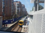
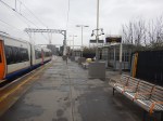
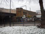
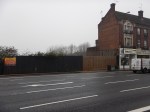
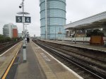
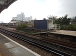
West Hampstead Station – 7th July 2018
The new bridge at the West Hampstead station is now in use and it looks like the new station will be completed by the end of the year.
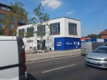
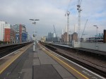
As the last picture shows this could be one of those station developments, where a deck could have been built over the North London Line to increase the number of flats built in the development on the South side of the railway.
This Google Map shows West Hampstead station on the North London Line and West Hampstead tube station on the Jubilee and Metropolitan Lines, although the latter don’t stop.
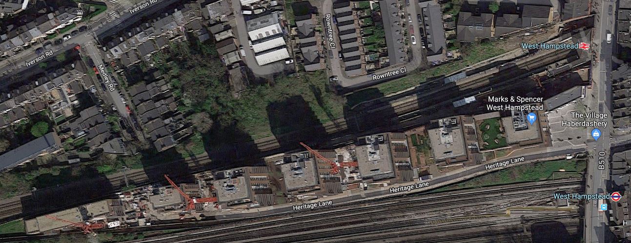
Note the development stretches a long way to the West between the North London Line and Underground Lines.
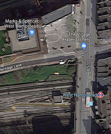
There have been plans to create a West Hampstead Interchange on West End Lane.
As these envisaged moving the Overground station to the East side of West End Lane and the new station is being built on the West side, It would appear there’s been a rethink.
Perhaps the Underground station is to be moved to the West side of West End Lane and will have an entrance on the small square in front of the M & S Simply Food and alongside the new Overground station.
This Google Map shows an enlargement of the area.
The new station could have platforms on the following lines.
- Jubilee Line
- Metropolitan Line
- Cjhiltern Railway
It would be a very worthwhile interchange. Especially, as passengers could do the following.
- Walk across the square for the Overground for East London.
- Walk perhaps another hundred metres to West Hampstead Thameslink station, which is also proposed as the terminus of the West London Orbital Railway.
There could also be a development on the top of the new station, which would hopefully contribute to the cost.
I have no idea, if anything will happen here, but Transport for London are looking to create new stations with over-site development. The Mayor also seems keen on the West London Orbital Railway, as it is based on under-used infrastructure and requires no new track or tunnels.
A Good Timetable Change In May For De Beauvoir Town
I live in the North of an area in London called De Beauvoir Town.
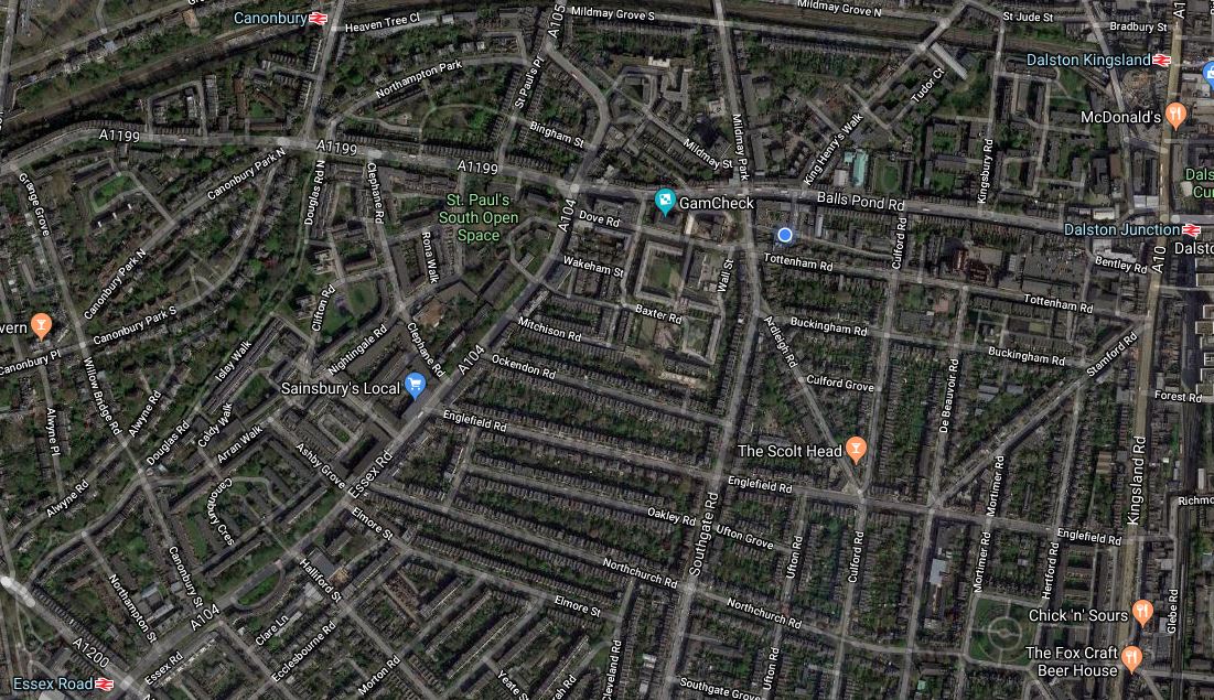
On the map, I live close to the junction of Mildmay Park/Southgate Road and the Balls Pond Road of Round the Horne fame!
The junction is a major bus interchange, with buses going regularly in all directions.
- North to Manor House, Turnpike Lane and Wood Green.
- South to Old Street, the City and London Bridge
- West to Highbury and Islington station, the Angel and the West End.
- East to Hackney, Waltham Forest and the River Lea.
All these buses was one of the reasons I moved here.
But note the railway stations ringing the area.
- Canonbury station is to the North-West about fifteen minutes walk away
- Dalston Kingsland station with its new M & S Food is a similar distance in the North-East corner of the map.
- Dalston Junction station is also in the North East corner.
- Essex Road station is in the South-West corner of the map.
But that is not all!
- Haggerston station is within walking distance on a good day, off the map to the South-East.
- Highbury and Islington station is a short bus ride off the map to the West.
- Angel station is a short bus ride off the map to the South-West.
- Manor House station is a short bus ride off the map to the North.
- Hackney Downs station is a short bus ride off the map to the East.
I can also get direct buses from local stops to Euston, Kings Cross, London Bridge, St. Pancras, Victoria and Waterloo.
From December 2018, I’ll be able to get a bus from the junction to the new Crossrail station at Moorgate/Liverpool Street.
Is there a better place to live for public transport?
On the twentieth of May, the date of the rail timetable change, things will get better.
An article on the timetable change in the May 2018 Edition of Modern Railways says this.
London Overground’s East London Line services are being recast in conjunction with the new Thameslink timetable. On the North and West London Lines, the off-peak timetable is being enhanced to match broadly the peak service, providing 8 tph between Stratford and Willesden Junction for most of the day seven days a week, with four continuing to Clapham Junction and the other four to Richmond.
London’s ugly duckling of the last century, is turning into a whole bevy of swans.
The service on the North London Line has improved several-fold since I moved here and will now be eight tph or a train every seven and a half minutes.
The East London Line will be recast, with another two tph this year to Crystal Palace station and two more next year to Clapham Junction station.
And then there’s the Northern City Line to Moorgate, that calls at Essex Road and Highbury and Islington stations!
In First ‘717’ In UK In June, I wrote about what will be happening in the May 2018 timetable change.
I said this.
From the May 2018 timetable change, the service levels will become.
- Four tph to Welwyn Garden City
- Five tph to Hertford North, with two tph extended to Stevenage or Watton-at-Stone.
- No direct services will run to Letchworth Garden City. Change seems to be a cross-platform interchange at Finsbury Park.
The service termination at Watton-at-Stone station is only temporary until Network Rail build a new bay platform at Stevenage station.
These changes mean that there will be nine tph between Alexandra Palace and Moorgate stations.
This represents a fifty percent increase in service frequency.
Access To The Western End Of The Camden High Line
I took between Camden Road and Camden Town stations on Sunday.
I was investigating two questions.
- How would you provide access to the Western end of the Camden High Line?
- How would you improve interchange between the North London Line and Northern Line stations?
These are some of the pictures that I took.
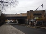
I can see a few strengths and problems.
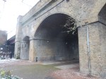
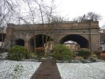
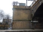
Architectural Quality
Camden Gardens has several Listed buildings, but the viaduct appears not to be Listed.
The brick viaduct is a substantial one and like most of this type of structure in the UK, Network Rail seem to keep it in good condition.
You have to remember that there was a derailment on the bridge, which I wrote about in Fall Out From A Train Crash. So I suspect, it has had a detailed check-up since.
The only eyesore is the steel bridge over Camden Street. But Network Rail have ways of making them look better. A good coat of paint would help.
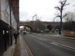
Camden Gardens
To my mind, Camden Gardens needs development. Not in any negative sense, but it is surrounded by pedestrian traffic generators.
- Camden Road station to the East
- The Regents Canal to the South
- Camden Town station to the South, which will have a new step-free Northern entrance, about a hundred metres from the Gardens.
- |A large mixed development on the other side of Kentish Town Road.
- It is on the direct route between Camden Road station and the tourist attractions around Camden Lock.
It could be developed into a convenient oasis for those walking in the area.
Perhaps there needs to be a cafe in one of the arches.
Camden Interchange
In Boris Johnson’s Transport Infrastructure Plan for 2050, the Appendix mentioned that there will be an interchange between Camden Town and Camden Road stations. Unfortunately, a copy of the report is not available on the Internet.
But it can’t be deleted from my memory.
I feel strongly, that as after the expansion of Camden Town station, the two stations will be physically closer, that a Western entrance to Camden Road station, should be built, if the sums added up.
Consider.
- It would create a convenient interchange between the two rail services.
- It would improve access from Camden Lock and the new developments on the North side of the Regent’s Canal.
But it could also create access to the Camden High Line.
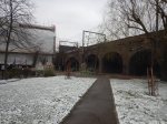
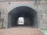
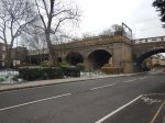
The Height Of The Viaduct
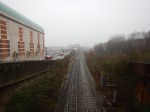
The viaduct is high, as the last-but-one picture in the gallery shows.
Because of the railway tracks, between the two platforms, which means the only way to cross is to walk to the other end of the platforms and go down and up again, design of affordable and practical access, will be challenging.
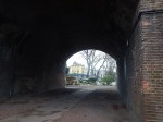
A Station Entrance On The Camden High Line
The first picture in the gallery, shows the shrubbery on the two disused tracks, that could become the Camden High Line, behind a fence.
It would surely be possible to create a ticket gate in a small building on the wide platform.
Conclusion
With clever design it would be possible to provide access to the Camden High Line and the station in a single development.
Thoughts On The Camden High Line
Last night, I was made aware of the Camden High Line proposal.
On their web site, they say this is their mission.
Our mission is to transform the disused railway into a sustainable green space and transport link that is open for and used by everyone.
Here are my thoughts.
The Railway Line In Question
This map from carto.metro.free.fr shows the disused railway tracks.
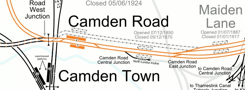
Note.
- The line shown in orange is the North London Line of the London Overground.
- Camden Road is a two-platform station, with full step-free access.
- Maiden Lane is a disused station, that closed a hundred years ago.
I would assume that the two dotted lines between the two stations, will be converted into the Camden High Line.
This Google Map shows the North London Line between Camden Road and Maiden Lane stations.
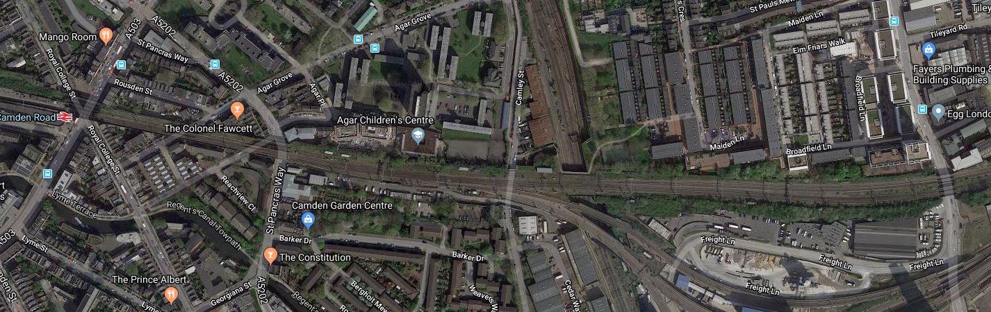
One of the most striking features visible from this map, is the large amount of development going on to the South of the North London Line.
The new residents and workers could probably do with a good walking and cycling route between Camden Town and Kings Cross.
Plans For The North London Line
The North London Line is a heavily-used passenger and freight route and it is unlikely, that traffic levels will drop.
Freight Traffic
There are now two electrified rail routes across North London; the North London Line and the Gospel Oak to Barking Line.
As two of the UK’s main container ports; Felixstowe and London Gateway, are not served by electrified railways, this still means that large numbers of diesel-hauled freight trains have to pass through North London to get to the Midlands, North and Scotland, despite the routes from Ipswich and Tilbury being fully-electrified.
These diesel-freight trains are boosted because the alternative route via Ipswich, Ely and Peterborough is not electrified.
The following needs to be done to seriously cut the number of diesel-hauled freight trains through North London.
- Electrify Ipswich to Felixstowe.
- Electrify to London Gateway.
- Electrify Ipswich to Peterborough.
- Replace a large fleet of polluting diesel Class 66 locomotives with modern electric units.
In some ways, the replacement of the locomotives by private freight companies is the largest stumbling block.
However, I think that the two shorter lengths of electrification will happen, which will mean that less diesel-hauled freight trains will pass through London, as they will go via Peterborough.
On the other hand, the need for freight trains will increase.
- More traffic to and from the ports.
- Freight to and from the Channel Tunnel, which must go through London.
- Trains carrying vehicles seem to be becoming more numerous.
I wouldn’t be surprised to see calls from the rail freight industry for improvements to the two freight routes through London.
One thing that will help freight trains, would be extra passing loops, where freight trains can wait for the passenger trains to overtake.
The double track of the Camden High Line is one of the few places, where another freight loop could possibly be installed.
Passenger Traffic
Sometime this year, two extra passenger trains per hour (tph) will run on the North London Line between Stratford and Clapham Junction stations.
This will bring the frequency to six tph.
On the past history of the London Underground, this will mean more full trains and pressure for longer trains and more services.
Old Oak Common Station
But the biggest changes will come in the next few years with a new Old Oak Common station, which will connect the North London Line to HS2, Crossrail, Chiltern, Great Western Railway and the West Coast Main Line.
Remember too, that the North London Line will be connected to Crossrail at Stratford.
Will these developments create a demand for extra trains on the North London Line?
Camden Town Station
Camden Town station on the Northern Line is being extended, with a new Northern entrance closer to the North London Line.
Will better routes be provided between Camden Road and Camden Town stations?
Interchange Between Camden Town And Camden Road Stations
Camden Town station’s new entrance will be to the North of the current entrance just off Kentish Town Road.
This Google Map, shows the Western end of Camden Road station.
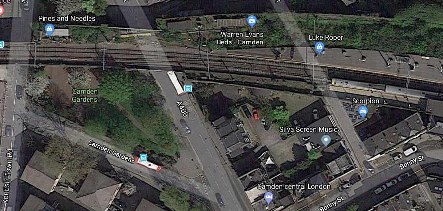
Note.
- There is a train in the Westbound platform.
- Kentish Town Road meets the station by Camden Gardens.
- The overgrown unused tracks to the North of the current station.
- The green space of Camden Gardens, with the 88 bus stand.
Could a second entrance to Camden Road station be built within the viaduct, perhaps with a ground-level entrance in Camden Gardens?
- It would be a short walk to the new entrance to Camden Town station.
- It would be convenient for walking to Camden Lock and the other attractions along the Regents Canal.
If the Camden High Line is created, access to the Eastbound platform could be directly to and from the High Line, which would be a garden to the North of the station.
Maiden Lane Station
Wikipedia says this about the re-opening of Maiden Lane station.
Camden Council has suggested this station could be rebuilt and reopened, in conjunction with the King’s Cross Central redevelopment project.
In June 2017, the Council were talking with Tfl on the possible reopening of Maiden Lane & York Road stations which it wished to reopen with Maiden Lane more likely to reopen then York Road.
I suspect, if the station is reopened, it will be on the Southern pair of lines, currently used by the London Overgr4ound.
One of the problems of reopening Maiden Lane station, is that a stop at the station would decrease capacity on the North London Line, through the area.
Plans For The East London Line
The East London Line is one of the UK’s rail successes of the last few years.
An outpost of the London Underground, through a tunnel, built by the Brunels, was turned into a modern railway with new trains and sixteen tph all day.
But this is only a start!
Plans exist for more new trains, an extra fout tph through the tunnel and a possible uprating of the signalling to handle a frequency to 24 tph.
If the latter should happen, I feel that another Northern terminal will be needed for the East London Line.
The obvious terminal is Willesden Junction station.
- Willesden Junction was certainly mentioned, when the London Overground was opened.
- There is a bay platform at the station.
- ,The station can be reached via Camden Road, Primrose Hill, South Hampstead, Kilburn High Road, Queen’s Park and Kensal Green stations.
- It will have good connections to an extended Bakerloo Line.
It would create another route across North London.
Would it mean extra platforms at Camden Road station?
Conclusion
I think that there will be a very large demand for using the two old tracks for rail purposes.
Should This Be Done On More Building Projects?
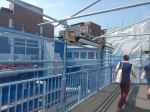
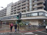
Buckingham Group are building the new West Hampstead station on the North London Line.
This picture was taken of the architect’s layout drawing of the new station, that was fixed to the hoardings.
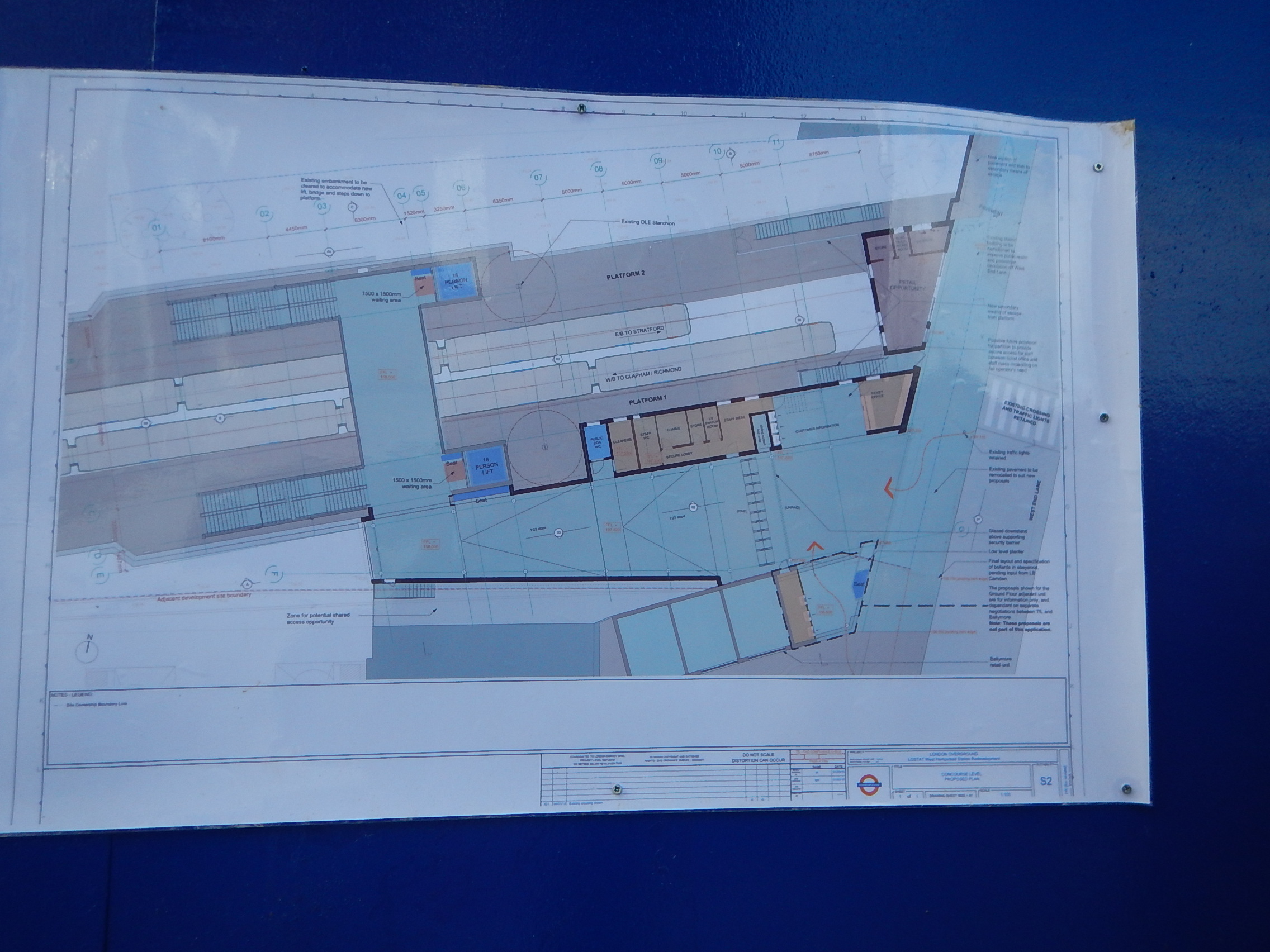
I wasn’t the only person giving it a good study.
I think it is a good way to inform the public.
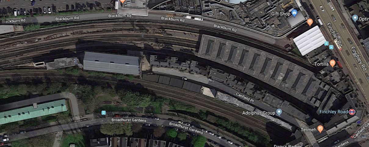
A Walk Down The Finchley Road
Aleks2cv made this comment on my long post about the West London Orbital Railway, which was entitled New Railway Line For West London Proposed.
West London’s version of Goblin, an available resource with potential. All urban London so suitable for Overground 4 car metro service.
I would add extensions to your outline.There is space at the former Midland Finchley Road station for a single terminating platform with existing street facade. Interchange with North London, Metropolitan, and Jubilee and coaches on Finchley Road such as Stansted AirLink.
It got me thinking.
This is only part of the comment and I’ll deal with the rest after Christmas, if I renmember.
This is a Google Map of the area along the Finchley Road, between Finchley Road and Frognal station in the North and Finchley Road station in the South.
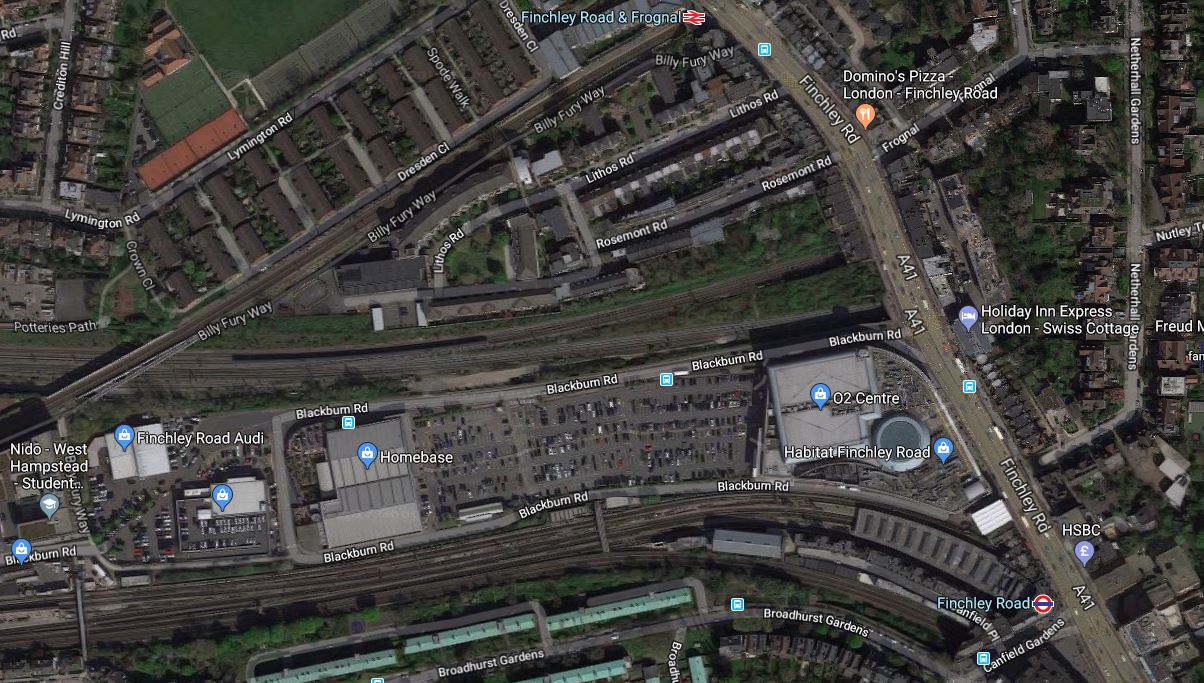
It is one of those interchanges, you might do in a North to South direction, as you have gravity assistance.
This second map from carto.metro.free.fr shows the various rail lines.

Note, the following lines can be seen in both maps.
- The Midland Main Line through West Hampstead Thameslink station, which crosses Finchley Road between Finchley Road and Frognal and Finchley Road stations.
- The Metropolitan and Jubilee Lines going through West Hampstead and Finchley Road stations.
- The North London Line going through West Hampstead and Finchley Road and Frognal stations.
I took these pictures as I walked down Finchley Road.

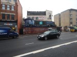


My thoughts on various parts of the area.
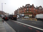
Finchley Road And Frognal Station
The station is a very poor example.
- There is no step-free access.
- Station buildings are minimal.
- There is a ruin next door.
- There is a need for perhaps a light-controlled crossing outside the station, as the road is very busy.
Improvement wouldn’t be helped, by the fact that the station is at the end of Hampstead Heath tunnel.
This Google Map shows a close-up of the station.
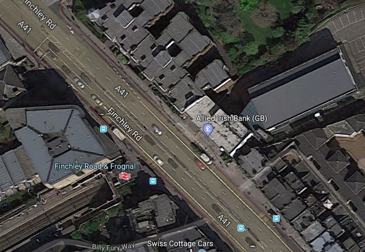
The only solution is probably a full rebuilding with perhaps a block of housing or offices on the top of a modern station.
The Midland Main Line
This Google Map shows the Midland Main Line as it passes under Finchley Road, to the North of the O2 Centre.
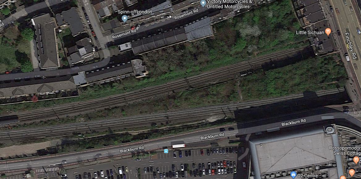
Note.
- There is not much space between the railway and the service road for the O2 Centre.
- The large surface-level car park of the O2 Centre is visible.
- The two slow lines are the Northern pair of lines, with the two fast lines to the South.
At least there is space in the middle of the lines.
A Terminus For The West London Orbital Railway
Aleks2cv in his comment, felt that the West London Orbital Railway can be extended to Finchley Road.
I think this could be very difficult, as the West London Orbital Railway will probably be a single track railway sneaking up the South side of the Midland Main Line.
- There is very little space.
- Passengers would still have to walk about a hundred metres to connect to the Underground.
- Connecting to the Overground would require a stiff walk up the hill.
This Google Map shows the limit of the freight line, that could possibly be turned into the West London Orbital Railway.
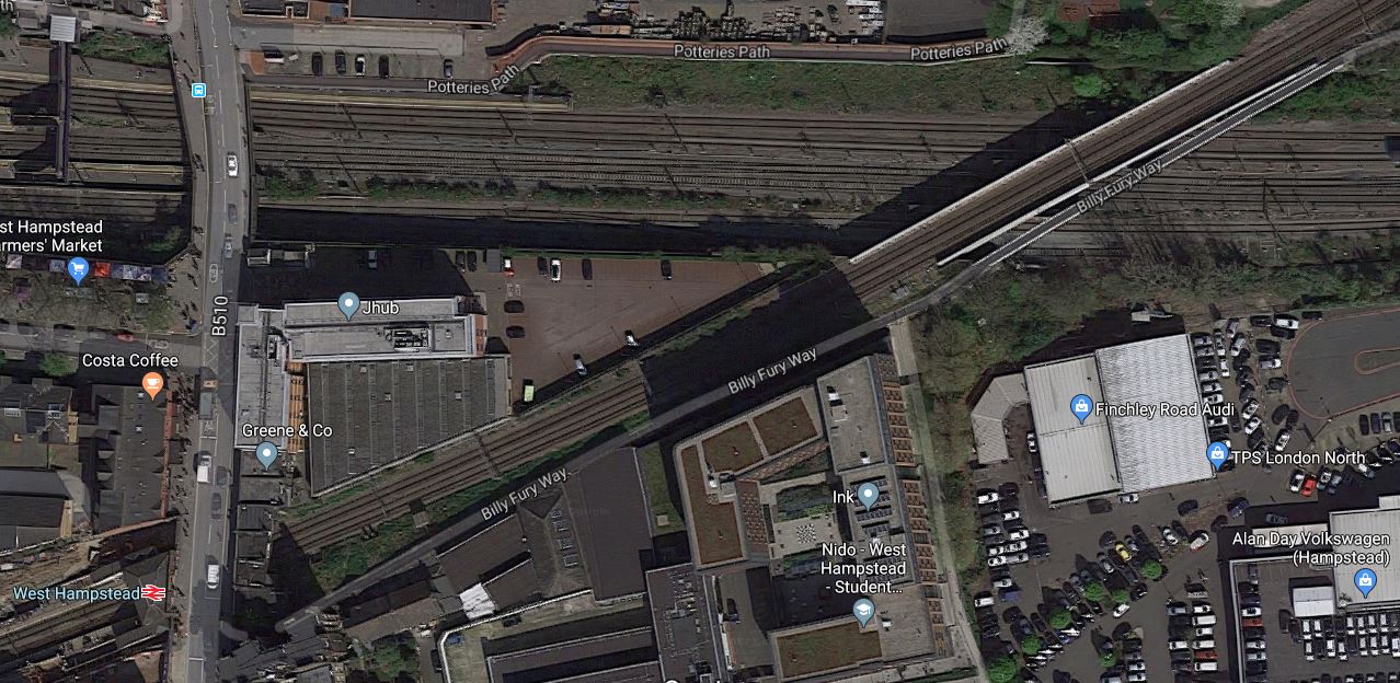
Note.
- The railway going East-West is the Midland Main Line.
- The diagonal railway is the North London Line through West Hampstead station.
In the shadows on the South side of the Midland Main Line, you can just see tyhe freight line, which connects to the Down Fast of the Midland Main Line to the East of the bridge.
It looks to me, that years ago, the land now occupied by the O2 Centre was some form of railway yard or factory premises.
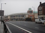
Finchley Road Underground Station
Finchley Road Underground station is a station in need of a degree of refurbishment.
- It is not step-free.
- Pedestrian access to the O2 Centre is not good.
But it is a cross-platform interchange between the Jubilee and Metropolitan Lines.
This Google Map shows the station.
Note.
- The two Chiltern tracks to the South of the station.
- The closeness of the Western end of the station to the Car Park of the O2 Centre.
- There is space to the South of the Chiltern tracks.
I feel very much that this station could be developed sympathetically to be a very good station, that could be paid for by housing on the top.
The O2 Centre
I think the O2 Centre could be the key to Aleks2cv’s idea for the West London Orbital Railway.
- The O2 Centre appears tired.
- Public transport can take people easily to the shopping at Oxford Street or Brent Cross.
- Surface car parking is so Twentieth Century.
As the O2 Centre is owned by British Land, who are one of the UK’s biggest property companies, I think that it is likely the site could be redeveloped.
Suppose the site was developed as follows.
- It extended over and connected to the Western ends of the platforms at Finchley Road Underground station.
- A two-platform terminal station for the West London Orbital Railway could probably be fitted in reasonably close to the Underground station.
- A small bus station.
Over the top would be shops, offices, housing or whatever was desired.
Conclusion
I believe that something will be done to redevelop this site.
Whether it has the terminal for the West London Orbital Railway underneath, will only be made clear, when planning permissio is given.
Musical Trains On The Overground
The November 2017 Edition of Modern Railways (MR) has a news item entitled Nine More Class 710s Planned.
This is the first paragraph.
Transport for London is proposing the acquisition of nine additional Class 710 EMUs from Bombardier to support the London Overground rxtension to Barking Riverside and an enhanced service on the East London Line.
Transport for London (TfL) are ordering six five-car and three four-car Class 710 trains.
This article on London Reconnections (LR) is entitled More Trains for London Overground: A Bargain Never to be Repeated.
The title gives a clue as to the first part of the article and it talks about how it may be necessary for TfL to get their order in now to get the best terms and price for the trains.
Putting the two articles together, some interesting train use could be happening on the various lines of the Overground.
The East London Line
Certain improvements have been planned for the East London Line.
The Class 378 Trains
The current fleet of 57 Class 378 trains are now five cars in length, after starting at just three cars.
Many of the stations on the East London Line could accept six-car trains and the other could be worked using selective door opening.
So TfL probably have an option to increase capacity on the East London Line by twenty percent, by adding an extra car to the Class 378 trains on the line.
The Class 378 trains are also certified for working the Thames Tunnel, whereas the Class 710 trains don’t appear they will be.
The Night Overground
A 24-hour service on Friday and Saturday nights, between New Cross and Dalston Junction/Highbury and Islington stations.
Crossrail And The East London Line
This will happen in December 2018, when Stage 3 of Crossrail opens between Abbey Wood and Paddington stations, with a connection to the East London Line at Whitechapel station.
When you consider that Whitechapel will be served by 12 x nine-car Crossrail trains per hour (tph) from December 2018 and 24 x nine-car tph from May 2019, you do wonder if the East London Line’s sixteen x five-car tph will cope with the extra passengwe.
Increased Frequencies
TfL have said they will increase the core frequency of the East London Line from sixteen tph to twenty in 2021.
I wrote about this two years ago in Increased Frequencies On The East London Line, so the plan is an old one, even if it has slipped a bit.
The original plan envisaged the following extra trains on the East London Line.
- Two tph – Dalston Junction to Crystal Palace in 2018
- Two tph – Dalston Junction to Clapham Junction in 2019
It would need the following.
- More Class 378 trains, as the Class 710 trains are not certified for the Thames Tunnel.
- Improved digital signalling in the core, which would eventually enable twenty-four tph.
The LR article suggests that there may be capacity problems at Clapham Junction station and two tph to Battersea Park station is suggested as an alternative.
Battersea Park Station
Battersea Park station is already served by the Overground, with this service, which is detailed in Wikipedia.
1 train per day to Highbury & Islington / 1 train per day from Dalston Junction.
Wikipedia adds this comment.
Until December 2012, Southern operated a twice-hourly service from London Victoria to London Bridge via Denmark Hill. This ceased when London Overground’s Clapham Junction to Dalston Junction service commenced at that time. However, since December 2012, a skeleton London Overground service has run to/from Battersea Park (instead of Clapham Junction) at the extreme ends of the day to retain a “parliamentary service” between Battersea Park and Clapham High Street.
This map from carto.metro.free.fr shows the track layout at Battersea Park station.
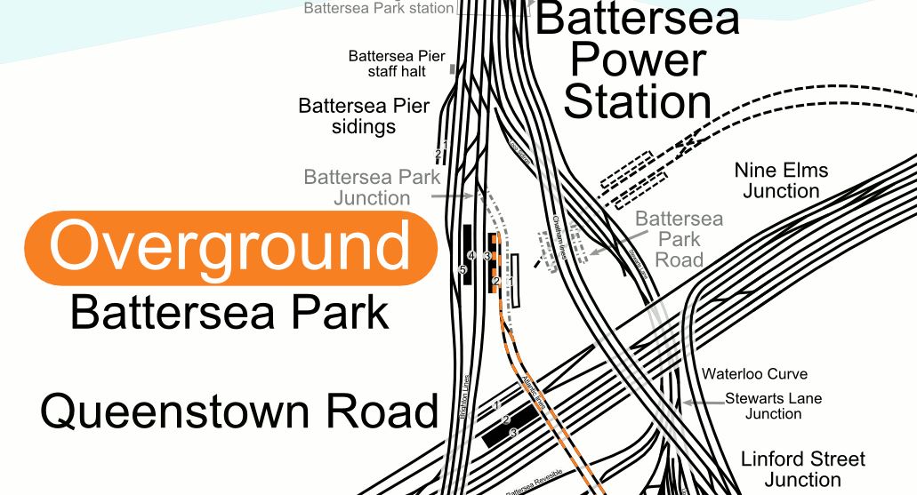
Note.
- The single track going in to Platform 2.
- Platform 1 at Battersea Park station is disused.
- The close proximity of the station to the new Battersea Power Station station, that opens in a few years.
These are some selected pictures of Battersea Park station.
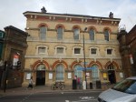
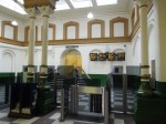

I think it is true to say, that it is a Victorian station, that wasn’t designed for the modern age.
- The station is Grade II Listed.
- The booking hall is a tidy Victorian example.
- There is a lot of excellent Victorian detailing.
- Platform 2 and 3 is wide with sensible stairs.
- Platform 2 is a well laid out terminal platform.
- Platform 4 and 5 is narrow with terrible stairs.
- Plstforms 3 and 4 seem to be long enough for ten-car trains.
It could be turned into what Roy Brooks would have called something better than a ruin. For those of you born since 1960, check the link to a memory of one of the world’s late great honest estate agents.
I’m sure Londoners used to buy the Sunday Times, just to read his adverts.
I can remember my late wife sitting on the sofa, laughing loudly, as she read aloud an advert about a flat, that wouldn’t suit an owner with a cat,.
Battersea Park station and a two tph service from Dalston Junction across South London have a lot going for them.
- I’m sure a budding Lord Foster or Zaha Hadid could come up with a scheme to fix the platform access and make the station passenger friendly and their name.
- The station is a short walk from Battersea Power Station station and must open up routes across London.
- Battersea Park station could easily handle two tph on a single platform.
- In A New Station For Battersea, I talked about a proposal to create a station at Battersea that linked the new tube station to the Southeastern lines into Victoria.
- In Four Trains Per Hour Between Dalston Junction And Battersea Park Stations, I write about how on the 6th November 2017, because of a track fault, London Overground ran a four tph shuttle between the two terminals.
Will all of this be tied together?
Train Requirements On The East London Line
Doing a quick calculation, I think that each of the four branches need the following number of trains for four tph.
- Dalston Junction to Clapham Junction – 8 trains
- Highbury and Islington to Crystal Palace- 8 trains
- Dalston Junction to New Cross – 2 trains
- Highbury and Islington to West Croydon – 8 trains
Which gives a total requirement of 26 trains.
Up the frequency to six tph on each branch or one train every 2½ minutes, which would be 24 tph through the Thames Tunnel and you get the following.
- Dalston Junction to Clapham Junction – 12 trains
- Highbury and Islington to Crystal Palace- 12 trains
- Dalston Junction to New Cross – 3 trains
- Highbury and Islington to West Croydon – 12 trains
Which gives a total requirement of 39 trains.
If you just have an increase to six tph on just the Clapham Junction and Crystal Palace routes as London Overground are proposing for 2020, you get the following.
- Dalston Junction to Clapham Junction – 12 trains
- Highbury and Islington to Crystal Palace- 12 trains
- Dalston Junction to New Cross – 2 trains
- Highbury and Islington to West Croydon – 8 trains
Which gives a total requirement of 34 trains, providing a service of one train every 3 minutes, which would be 20 tph through the Thames Tunnel.
This is eight more trains than at the present time.
It’s all rather impressive for the Thames Tunnel, which was built between 1825 and 1843, by the Brunels.
The Ultimate Capacity Of The East London Line
If we look perhaps ten years into the future, the following will have happened.
- Signalling will have improved.
- Crossrail will be running more than 24 tph through Whitechapel.
- Automatic Train Operation (ATO) will be driving the trains, with the driver keeping a vigilant watch, just as happens on the Victoria Line now!
- Passenger information and management will have improved and passengers will be able to handle the increased frequency of trains easily.
So if Dear Old Vicky can manage thirty-six tph in a 1960’s tunnel, will the East London Line be able to manage the same frequency in an 1840’s tunnel?
The Brunels would have made sure it happened and if it is needed, so will their engineering successors!
Let’s cut it back a bit and aim for 32 tph through the Thames Tunnel, as that was the sort of target engineers were looking at, for the Victoria Line in the 2000s, when the East London Line was being proposed.
How many trains will be needed to run the eight tph on the four routes, that would comprise thirty-two tph through the Thames Tunnel?
- Dalston Junction to Clapham Junction – 16 trains
- Highbury and Islington to Crystal Palace- 16 trains
- Dalston Junction to New Cross – 4 trains
- Highbury and Islington to West Croydon – 16 trains
Which gives a total requirement of 52 trains.
The London Overground has fifty-seven Class 378 trains. I can’t believe that the original fleet was sized on eight tph in operation through the tunnel and a few as hot spares and in maintenance!
But surely eight tph is impossible, as turning the trains at the terminal platforms would be too much!
Think again!
- The Victoria Line at Brixton and Walthamstow Central stations handles 36 tph using two platforms or 18 tph per platform.
- The Northern Line is targeting 36 tph on both lines, when it has been split into two.
With ATO, I’m sure each terminal platform can handle more than eight tph.
More Trains On The East London Line
According to the LR article, the planned new services on the East London Line will require another eight trains. This fits with my calculation.
- These trains have to be Class 378 trains, due to evacuation issues in the Thames Tunnel.
- These trains have to be able to work on lines with third-rail electrification.
London Overground has ordered six five-car Class 710 trains and they will be run on the North London Line and West London Line, where they will displace some five-car Class 378 trains for running on the East London Line.
Some five-car Class 378 trains on the Watford DC Line will also be replaced by four-car Class 710 trains.
So it would look like the East London Line will get some of the eight Class 378 trains that it needs.
Improvements To The North London Line/West London Line
The LR article says this.
London Overground have a long-held desire to increase the frequency on the WLL from 4tph to 6tph. They also aspire to another 2tph (at least) from Clapham Junction continuing to Stratford, to further increase the frequency on the North London Line (NLL). This would enable 10tph on eastern end of the North London line. This is due to be implemented with with main order of the new Class 710 stock.
The article also suspects that London Overground want to run the following services.
- 6 tph – Stratford to Richmond
- 6 tph – Stratford to Clapham Junction
This would deliver a twelve tph service between Stratford and Willesden Junction.
Living about halfway between those two stations, I’m not complaining.
But the article concludes, that London Overground’s objective can’t be achieved until some freight is moved to the Gospel Oak to Barking Line after the electrification of that line is completed.
As I said earlier, the pair of lines will get six extra five-car Class 710 trains and displace some Class 378 trains to the East London Line.
So will London Overground stick with a mixed fleet on these lines? Or will they perhaps run one class on each route?
I have no idea, but there are quite a few Class 378 trains, that could be displaced by new Class 710 trains to allow the East London Line frequency to be increased.
The Watford DC Line
Currently the Watford DC Line has a three tph service and I suspect that this needs six five-car Class 378 trains to run it.
The LR article says that London Overground want to run four tph on this line and I calculate this will need eight four-car Class 710 trains.
The new trains will probably be a few minutes faster and they will offer an hourly capacity increase of six percent.
But they will release six five-car Class 378 trains to strengthen services on the North, East and West London Lines.
Step-Free Access
Step-free access from platform to train is not good on the Watford DC Line.
You step up into a Class 378 train and step down into a Bakerloo Line 1972 Stock train.
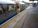
These pictures show the problem with the Class 1972 trains. When I got off one of these trains at Willesden today it was a jump.
It is some of the worst step-free access on the Underground.
On my short trip on the Bakerloo Line today, I deliberately sat in the last carriage. On most stations the the last carriage was aligned with the end of the platform, which leads me to the conclusion, that most stations are about as long as the trains, which are over 110 metres long.
Can a step-free platform be designed, that will work with the following trains?
- The current Class 378 trains
- The future Class 710 trains
- The current Underground 1972 Stock.
- Any future deep-level Underground trains
The latter could make design more difficult, if the train is built for Unattended Train Operation (UTO) and if platform edge doors are needed at all stations with UTO.
The only solution I can think of, is one that is used in Karlsruhe in Germany and is now being used at Rotherham Central station to accommodate main line trains and Class 399 tram-trains.
The platform is long enough to have two sections, with different platform heights.
- A high section is used with the main line trains.
- A low section is used with the Underground trains.
- Platform edge doors could be fitted to the low section.
- A gentle slope would connect the two sections.
- Entry to the combined platform could be near where the two sections join.
Also, consider the following.
- Given that the length of a Class 710 train is around 80 metres and that of a 1972 stock is in excess of 110 metres, it will be a long platform.
- Selective door opening will be installed on all trains.
- I do wonder, if the new trains for the Watford DC Line are only four cars to ease the problem of step-free access. The reduced length could knock twenty metres off every platform.
- Could we even see the new Underground trains built to a shorter length?
I’m sure that a workable platform design is possible.
The Bakerloo Line And The Watford DC Line
The Bakerloo Line is being extended to the South, but nothing has been said about how it will be changed in the North.
Possibilities for Northern terminals for the line could include.
- Queen’s Park
- Stonebridge Park
- Harrow and Wealdstone
- Watford Junction
It’s also complicated because the depot is at Stonebridge Patk.
I wouldn’t rule out extending the of the Bakerloo Line to Watford Junction, as is talked about in Wikipedia under Re-extension to Watford Junction.
What would be the consequences, if the following were to be done?
- An extended Bakerloo Line has an increased frequency of at least twenty tph between Watford Junction and Lewisham.
- The new trains for the Bakerloo Line are faster.
- The new Bakerloo Line trains had a capacity increase from the current 700, so they carried about the same as the five-car Class 378 trains.
The increased frequency of Bakerloo Line service, would probably result in London Overground’s Euston to Watford service to be discontinued.
The benefits would be as follows.
- Stations from Queen’s Park to Watford Junction would get a more frequent service, of possibly a train every three minutes.
- The problems of step-free access and platform-edge doors would be solved, as all trains would be on the Bakerloo Line.
- London Overground would not need any platforms at Euston, which could help in the rebuilding of Euston for HS2.
It would also mean that London Underground got another high-frequency Underground Line without any junctions, that could be run very efficiently.
But it would mean Kilburn High Road and South Hampstead stations would lose their connection to Euston.
A Willesden Junction To Stratford Via Kilburn High Road, South Hampstead and Primrose Hill Service
Reopening Primrose Hill station has been mooted in the past. This is said in the Wikipedia entry for the station.
It has been proposed to re-open Primrose Hill station by bringing the short stretch of line between South Hampstead and Camden Road stations back into the regular passenger service by incorporating it into the London Overground network.
A reopened Primrose Hill station, would only be a short walk to Chalk Farm station.
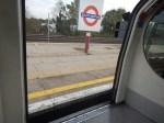
At Willesden junction station, there is even a convenient South-facing bay platform, that is numbered 2 and could handle four tph.
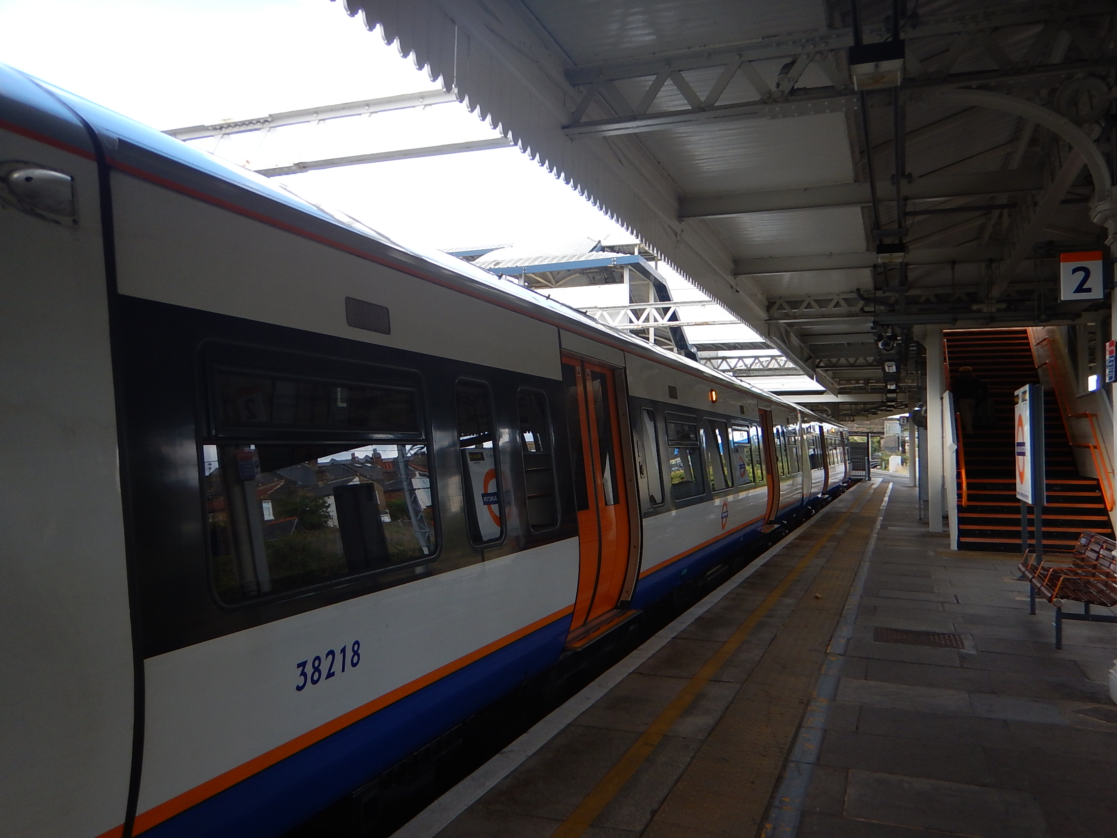
The picture shows a Class 378 train in Platform 2 at Willesden Junction station, was taken on Sunday, the 2nd of October 2016, during engineering works, when a Rail Replacement Train was run between Willesden Junction and Stratford stations.
But there are problems.
- Where would you terminate the service at its Eastern end? Highbury and Islington, Stratford or somewhere else, like perhaps a reopened Maiden Lane station?
- Kilburn High Road and South Hampstead stations sill lose their srtvoce to Euston and they would have to change at Highbury and Islington.
- Organising the time-table might be difficult.
- I also think, it would mean that Kensal Green station would be very difficult to make step-free, if it had to be served by both Overground and Bakerloo Line trains.
On the other hand, Queen’s Park station is an excellent example of a step-free cross-platform interchange between the two types of trains and Willesden Junction station could be equally good.
Crossrail, The Bakerloo Line And The Watford DC Line
All these three lines either serve Watford Junction or it has been suggested that they do.
- Plans to extend Crossrail up the West Coast Main Line would probably include a stop at Watford Junction, if they materialise.
- Extending the Bakerloo to Watford Junction is suggested from time-to-time.
- The Watford DC Line already serves Watford Junction station.
Given that a high-frequency efficient extended Bakerloo Line running between Watford Junction and Lewisham would serve the smaller stations on the way to Watford very capably, I suspect that whatever happens to Crossrail and the Watford DC services, the Bakerloo Line will be extended to Watford Junction.
The extended Bakerloo Line would have the following characteristics.
- Probably all trains running between Watford Junction and Lewisham.
- A frequency of upwards of 20 tph
- No junctions and end-to-end running like the Victoria and Jubilee Lines.
- Full step-free access at all stations.
- New faster, walk-through trains with wi-fi and 4G.
- An efficient connection to Crossrail at Paddington will be opened in December 2018.
- National Rail connections at Charing Cross, Elephant and Castle, Lreisham, Marylebone, Paddington, Waterloo and Watford Junction
It may be London’s forgotten line, but once extended, it could be a new star. Especially, if it gets to be linked directly into Old Oak Common station for all the services including HS2, that will be available there.
The Watford DC Line doesn’t connect to Crossrail, which makes me feel, that when everything gets decided about the extended Bakerloo Line and the new station at Old Oak Common, then the Watford DC Line could miss out.
Through Running Between North And East London Lines
I seem to remember reading in Modern Railways about ten years ago, that there was an ambition in TfL to extend some East London Line trains to Willesden Junction.
Look at this map from carto.metro.free.fr, which shows the lines at Highbury and Islington station.
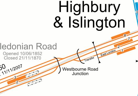
Note the single line labelled Transfer, that connects Platform 2 at Highbury and Islington station to the Westbound North London Line, that runs through Platform 7.
I think it would be possible to make Platform 2 into a bi-directional through platform.
- All Westbound trains on the Westbound North London Line would leave from the island platform between platforms 2 and 7.
- Voltage changeover between 750 VDC and 25 KVAC would take place in Platform 2.
- A four tph service in both directions would mean a train every 7-8 minutes.
- The four-track section of the North London Line between Highbury and Islington and Camden Road stations, includes two reversible lines.
Was this all future-proofing to allow services to run between the North London and East London Lines?
It is interesting to note, that Platform 2 is used for services to and from West Croydon station.
These services take around 51-55 minutes and currently need eight trains for a four tph service.
This screen capture shows the train timetable, when I rode between Highbury and Islington and Willesden Junction stations.
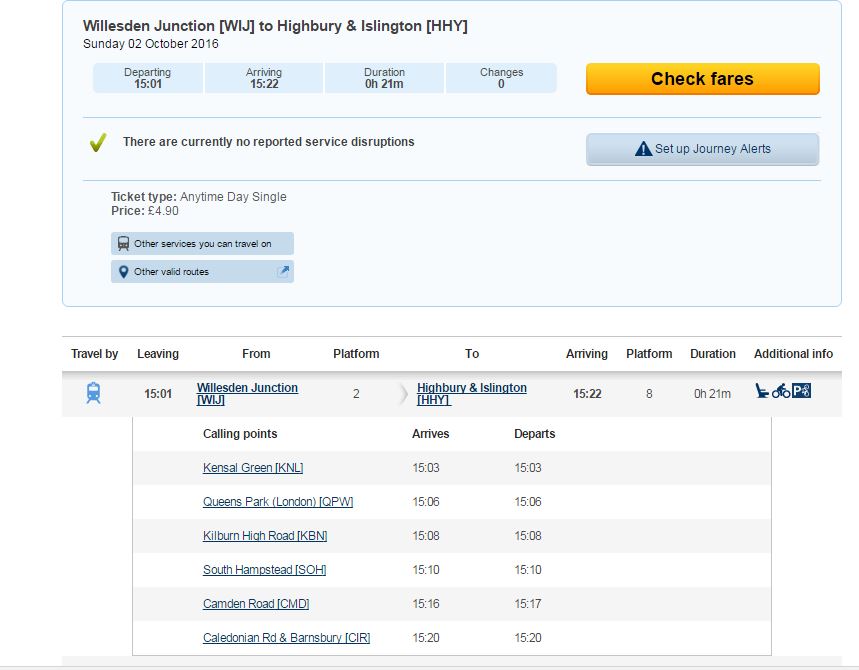
Note that the journey takes 22 minutes.
I am led to the conclusion, that it would be possible to run a service between West Croydon and Willesden Junction stations.
The service would run via Kilburn High Road, South Hampstead and and a reopened Primrose Hill stations.
It would have a frequency of four tph.
Trains would change voltage at Highbury and Islington station.
I would certainly like the service for these reasons.
- I regularly travel along the North London Line from the West to Dalston Junction station. The change between the North and East London Lines at Highbury and Islington can be very busy.
- Going West along the North London Line from Dalston Junction can involve a lot of walking up and down at Highbury and Islington station.
- Using Dalston Kingsland station to go East can be difficult, as there are masses of passengers changing between rge two Dalston stations.
- I like to go to Primrose Hill and London Zoo.
- Could the service also ease the pressure on Camden Town station, until the upgrade is complete?
I have no idea if London Overground would do this, but if there was a vote, I’d say yes!
The Gospel Oak To Barking Line
I have never seen a detailed analysis of running trains on the Gospel Oak to Barking Line (GOBLin).
Currently, eight Class 172 trains provide the four tph service. Consider this round trip.
- Leave Gospel Oak station at 09:05
- Arrive Barking station at 09:42
- Leave Barking station at 10.03
- Arrive Gospel Oak station at 10.45
Note.
- It is a very generous timetable.
- There is a twenty minute turn-round time at both ends of the route, which is good for recovering the timetable after a delay.
- The Class 710 trains could save time at every one of the ten stops, as they accelerate faster, have smooth regenerative braking and should have a better platform-train interface.
This leads me to the conclusion, that the Class 710 trains could run a faster service on the line.
Extending Services To Barking Riverside
Barking Riverside station will only be a short distance from Barking station and I suspect, it would only add ten minutes at most to the end-to-end journey time.
As there is a twenty minute turn-round time, I suspect that a train will be able to go from Gospel Oak to Barking Riverside and back again in under two hours.
This would mean that the current service of four tph could be possible on the extended route, with the same fleet of eight trains.
This is said in the MR article about the Class 710 trains.
The remaining two additional four-car units would support the extension of Gospel Oak to Barking services to Barking Riverside.
This leads me to one of these conclusions.
- The service is going to be extended somewhere else.
- The frequency on the route is going to be increased to five tph.
The next few sections deal with the various options.
Extending To The West Along The North London Line From Gospel Oak
I sometimes change between the GOBLin and the North London Line, as I can get a convenient bus from my house to Harringay Green Lanes station.
Allowing GOBLin services to continue along the North London Line would need extensive and expensive remodelling of Gospel Oak station to create an Eastbound plstform for the GOBLin.
The tracks to the West of the station, would probably need to remodelled to allow efficient operation.
The GOBLin trains would also be four-car trains, as opposed to the five-car trains on the North London Line.
Extending To The North Along The Midland Main Line
By using the Carlton Road Junction after Upper Holloway station, GOBLin trains could access the Thameslink tracks and go North to a convenient station.
Unfortunately, the track layout is such, that crossing to the Dudding Hill Line is difficult.
But continuing to the proposed Brent Cross Thameslink station is surely a possibility.
Although, I can’t see anything happening until plans for the West London Orbital Railway are agreed and Brent Cross Thameslink station is opened.
So it can probably be discounted for a few years yet!
Extending Across The Thames From Barking Riverside
Barking Riverside station is being built so that an extension under the Thames is possible.
But as a tunnel would be involved, I can’t see this extension being started or even planned fully for several years.
Five tph On The GOBLin
If two extra trains are added to the GOBLin fleet, this would mean that there are ten trains, which would be enough to run a five tph service between Gospel Oak and Barking Riverside stations.
I think this will be the most likely use of the two extra trains on the GOBlin.
Romford To Upminster
The Romford To Upminster Line is slated to get a brand-new Class 710 train to work the two tph shuttle.
The DR article says that it is possible that this line could be served by a Class 315 train, held back from the scrapyard.
This would mean a new Class 710 train could be deployed elsewhere, where its performance and comfort levels would be more needed.
Surely, this would be enough capacity for the line and a lot cheaper than a new Class 710 train! Provided of course, that it was reliable, comfortable and could maintain the current two tph service.
I discuss this in detail in A Heritage Class 315 Train For The Romford-Upminster Line.
Conclusion
It looks like Transport for London are planning for a large increase in services on the East London Line.
A Proposal For Two London Overground Stations At Old Oak Common
Transport for London published this proposal a few weeks ago, but it’s only now that I’ve found time to document it here.
TfL’s Proposal
This document on Tfl’s web site, gives full details of their proposals.
The Location Of The Stations
This map from TfL shows the location of the two stations.
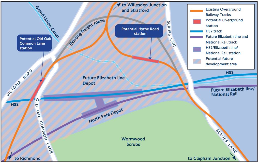
Hythe Road station will be on the West London Line between Willesden Junction and Shepherd’s Bush stations.
Old Oak Common Lane station will be on the North London Line between Willesden Junction and Acton Central stations.
This Google Map shows the area.
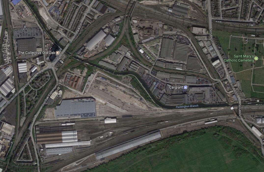
Three features on both maps link them together.
- The Grand Union Canal.
- The layout of the two Overground Lines that meet at the distinctive Willesden High Level Junction.
- The long silver-roofed North Pole Depot at the bottom of the maps.
Note from the Google Map, how much space is available.
Are Two New Stations Needed?
There are various factors at work here.
More Stations And Entrances Shorten Journey Times
Research has shown that the more routes you give passengers, the quicker and easier the journeys.
Old Oak Common Is A Large Site
25,500 new homes and 65,000 jobs are being created in the Old Oak Common/Park Royal area and two new stations are probably needed.
The North And West London Lines Pass Separately Through The Site
Two separate stations give direct services to the following.
- West and South-West London via the North London Line.
- North and North-East London via the North London Line.
- Clapham Junction for South London via the West London Line.
Some might argue, that a new spur from Willesden High Level Junction, where the two lines divide direct to the combined HS2 and Elizabeth Line station, may be a better and cheaper option.
But this would only provide a connection to North and North-East London. Connections to the latter area, are also provided by the Elizabeth Line with a change of train at Liverpool Street or Stratford.
Conclusion About Two Stations
I’m convinced, that two Overground stations are needed and I suspect eventually, there will be other stations.
Hythe Road Station
TfL’s proposal for Hythe Road station would be built to the North of the existing embankment of the West London Line, which would be demolished.
This visualisation is from the TfL document.
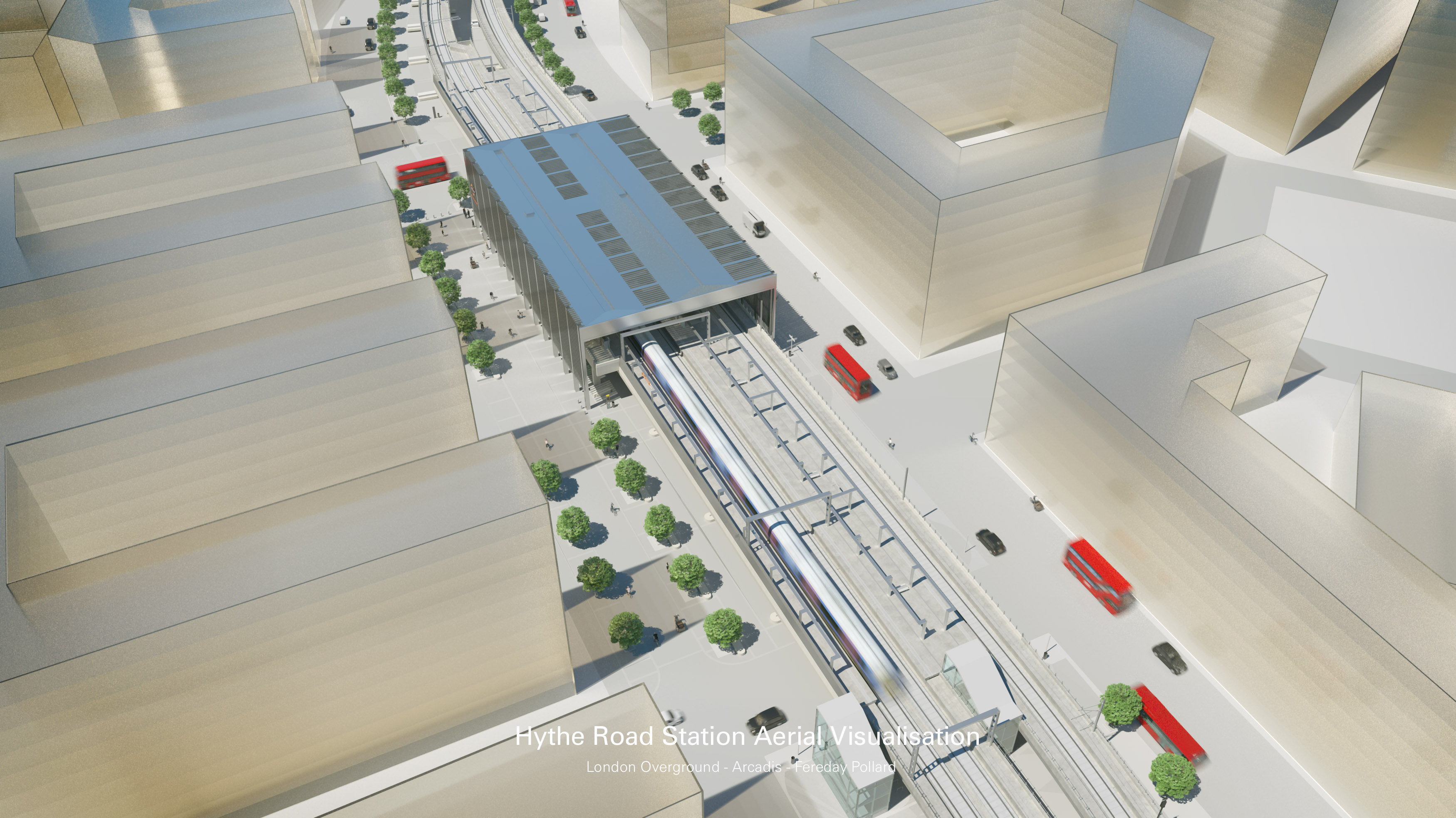
It would appear to be reminiscent of Shoreditch High Street station, but built at ground-level.
Conclusion About Hythe Road Station
It is an inherently simple proposal, that can be built around an existing rail line, so it shouldn’t create too many construction problems.
Old Oak Common Lane Station
TfL’s proposal for Old Oak Common Lane station would incorporate an overbridge extending westwards to Victoria Road, to allow pedestrians and cyclists to cross the railway.
This map from the TfL document shows the location of the station.
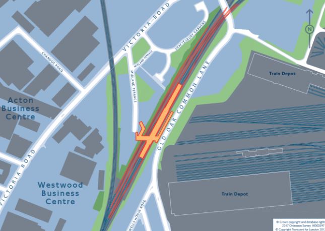
And this Google Map shows roughly the same area.
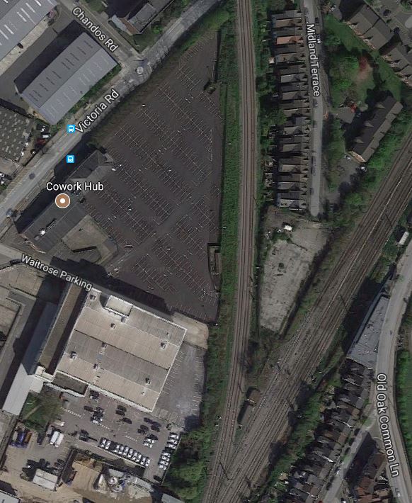
The line breaking off to the North is the Dudding Hill Line, which is an important part of a proposal for a new railway line in West London, which I wrote about in New Railway Line For West London Proposed.
This visualisation is from the TfL document.
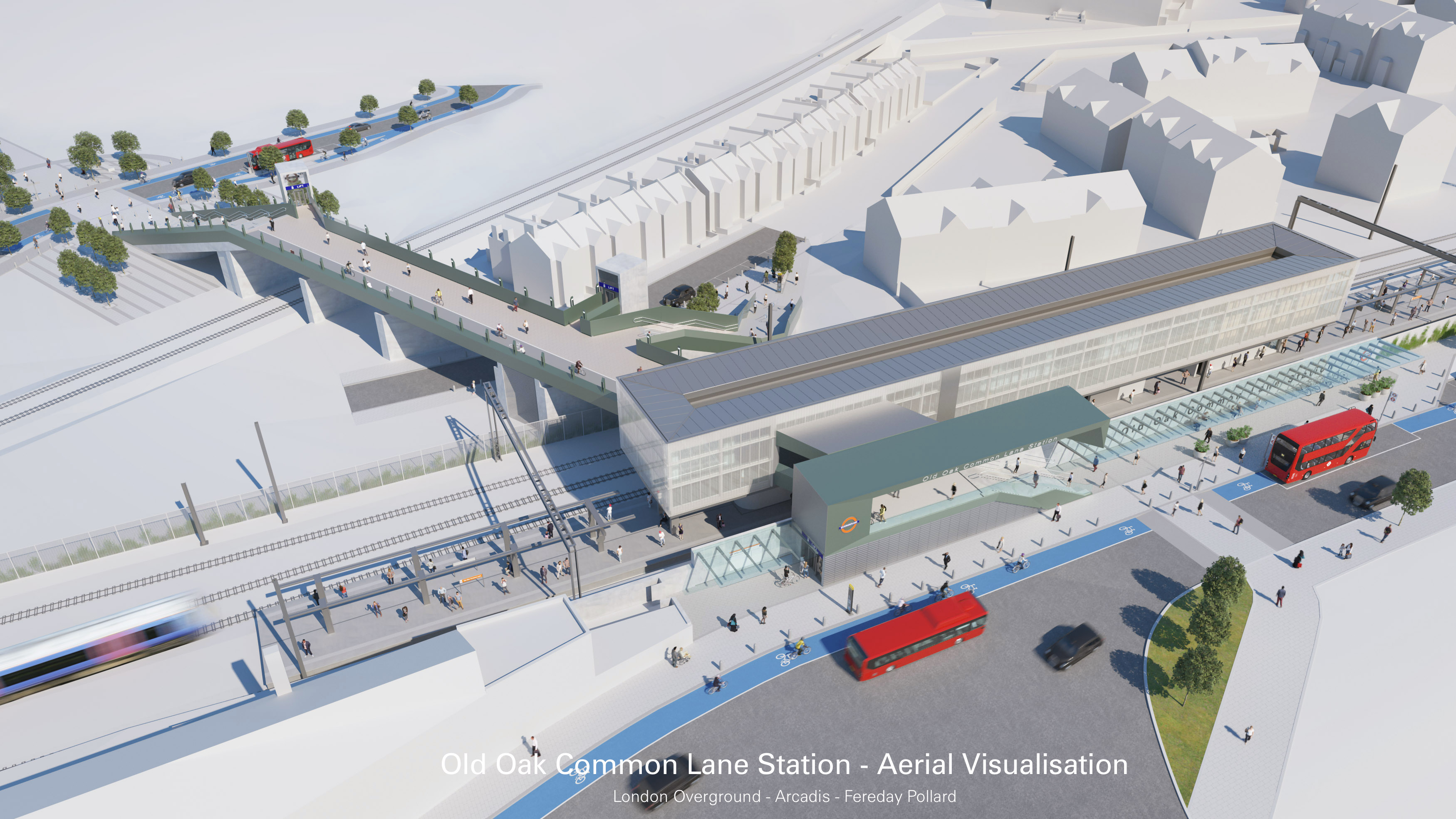
Note.
- The bridge for cyclists and pedestrians to Victoria Road.
- The Dudding Hill Line passing under the bridge.
It very much looks like Old Oak Common Lane station could have platforms on the Dudding Hill Line, which would be a very important addition to the West London Orbital Railway proposal.
Cnclusion About Old Oak Common Lane Station
TfL’s proposal looks comprehensive and reasonably simple to build.
It also includes provision to connect to the proposed West London Orbital Railway.
What Else Would I Do?
Here are my thoughts.
An East-West People Mover
The only one thing I would definitely add, is some form of people mover stretching East-West across the whole Old Oak Common site.
My preferred option would be to use a high-level moving walkway perhaps enclosed in a glass tunnel, which would stretch from Victoria Road in the West to perhaps Wormwood Scrubs Park in the East.
Escalators and lifts would give step-free connections to Old Oak Common Lane, HS2, Elizabeth Line and Hythe Road stations.
We’re not getting any younger!
Terminal Platforms
Both stations could have terminal platforms in the visualisations.
But they would surely be a good idea to allow extra services to be run to and from the major station complex.
Both new stations will have a platform on each track.
Would it be a good idea to have a third platform, that could be used as a bay platform in both directions?
A Terminal Platform At Hythe Road Station
The West London Line currently has a Milton Keynes to East Croydon service and this must mean that services to the West Coast and Brighton Main Lines are possible from a Hythe Road station.
- Trains to the South could go to Clapham Junction, East Croydon, Gatwick and any desired station South of London.
- Trains to the North could go to Wembley Central, Watford and Milton Keynes.
A stopping service on the West Coast Main Line would be complementary to HS2. Take for instance, sports or music fans going to an event at Wembley Stadium.
A Terminal Platform At Old Oak Common Lane Station
The only passenger services on the North London Line are London Overground services, between Stratford and Eichmond, but surely a terminal platform at Old Oak Common Lane station could be useful in providing some needed services.
If the West London Orbital Railway is created, this will add eight trains per hour after Acton Central. This might be too many trains for the route, so perhaps there would be a need to turn-back some trains from Stratford at Old Oak Common Lane?
A terminal platform at Old Oak Common Lane station might be used for an extended Gospel Oak to Barking service.
Building The Stations
I haven’t had a good look at the sites of the two stations and I don’t know the area well.
But I do have the feeling that both these stations can be built independently without affecting any other projects.
So they could be built at any convenient time in the development of this large site.
Simon Jenkins Questions Southern HS2 Terminal
Simon Jenkins in the Standard has a piece today entitled It’s Not Too Late To Make HS2 Somehow Work For London, by proposing even at this late stage the Southern terminal of HS2 be moved from Euston station to Old Oak Common station.
He makes these points against choosing Euston.
- HS2 has never had many friends among politicians, railway buffs or think-tanks.
- Serious questions must be asked about HS2’s most costly and controversial feature, the line’s route into Euston from its last stop at Old Oak Common in west London.
- Euston is London’s worst station, with the worst connections.
- The new Euston will need a costly new tunnel under Primrose Hill, incidentally wiping out hundreds of houses.
- It will claim seven of Virgin’s platforms at Euston, thus reducing station capacity.
- For some time, smart money in HS2 circles has been on the line stopping at Old Oak Common, at least “temporarily”
- Successive plans for a new station have been submitted to Camden council and then withdrawn.
- Either way, choosing Euston will mean a decade of chaos.
Against these points he says this in favour of Old Oak Common station.
Meanwhile, a terminus at Old Oak Common is plausible. The old Great Western Railway depot and marshalling yard has become London’s largest regeneration area since Canary Wharf. Its acres of tracks include lines to Paddington, Euston and Heathrow, as well as stations on Crossrail and the Central and Bakerloo lines. The site is near the North Circular and the M40, and is within spitting distance of the M1 and M4. Passengers on HS2 heading for the City would find it more convenient to join Crossrail at Old Oak Common, rather than trundle their bags down crammed access tunnels at Euston.
He makes strong arguments and personally, I would not be against what he says, as getting to Old Oak Common station will be easy for me on the North London Line.
But once Crossrail 2 is built, then Euston will be just two stops away from an enlarged Dalston station at the end of my road.
Conclusion
I can’t lose on house prices!
