Scotland’s Gritter Tracker
Scotland’s Gritter Tracker was mentioned on BBC Breakfast.
So I had to point to it! Just click here!
Note the names!
Progress On The Sheffield-Rotherham Tram-Train – October 13th 2017
It is only a couple of weeks since I wrote Progress On The Sheffield-Rotherham Tram-Train and progress seems to have accelerated in that time.
The Class 399 tram-trains are now running between Cathedral and Herdings Park, as I reported in Class 399 Tram-Trains In Service.
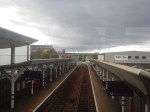
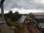
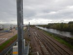
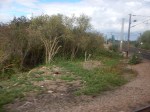
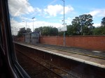
Progress On The Tinsley Chord
I took these pictures at Tinsley Chord, where the track connects theMeadowhall branch of the Supertram to the freight line to Rotherham.
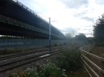
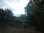
There isn’t really much to see, as trees obscure any good view from the road.
This Google Map shows the area.
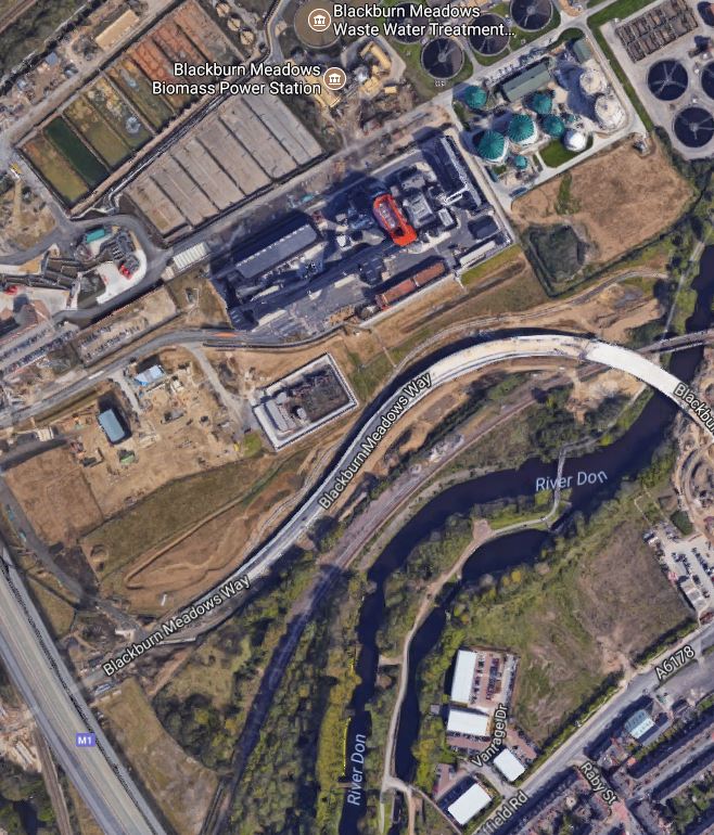
Note.
- The Tinsley Viaduct carrying the M1 cutting across the bottom-left corner of the map.
- Blackburn Meadows, with the Water Treatment Plant and Biomass Power Station, at the North of the map.
- The Blackburn Meadows Way linking into Meadowhall.
- The freight line to Rotherham runs to the outh of this road.
- The Supertram running along the West side of the motorway.
The Tinsley Chord, that links the tram and freight lines is hidden under the viaduct.
I did get some more pictures later.
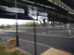
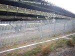

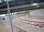
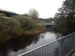
The Tinsley Chord appears to be double-track, where it will join the existing tram line.
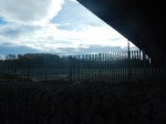
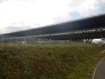
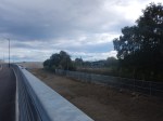
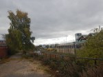
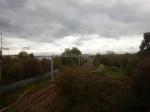
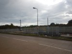
The Wires Are Going Up
These pictures show that the wires are going up between the freight line and Rotherham Central station.
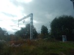
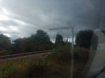

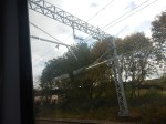
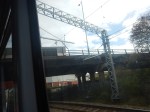
The gantries seem much more main line than tram.
But the Class 399 tram-trains, won’t care if they contain 750 VDC or 25 KVAC. Changing the volts is a lot easier than changing the catenary.
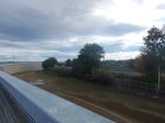
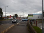
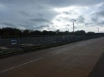
Rotherham Station
These pictures show the current state of Rptherham Central station.

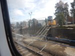


Note.
- The wires are going up.
- The low-level platform extensions need to be completed.
- Trains will use the high end of the platforms and tram-trains the low end.
Karlsruhe have much worse platform height problems, as they have two generations of tram-trains and German trains that need low platforms to cope with.
Walking To The Parkgate Shopping
I thought about using a taxi, but in the end, I walked to the Parkgate Shopping, as the weather was sunny.
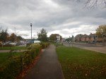
I did manage to get an idea of the distance in a thirty minute walk.
Parkgate Shopping
Parkgate Shopping is the sort of shopping centre I rarely visit.
I am a guerrilla shopper, who decides what he needs and then chooses where to go and buy it. Being a coeliac, food shopping usually requires a couple of shops. One of these must be a Marks and Spencer, as their gluten-free staples like bread, biscuits, beer and muesli are better than most.
These days, I don’t drive, but a couple of doctors have told me, they reckon I could get my licence back.It’s just that not having a car, removes a whole chunk of hassle from your life. I don’t want it back!
I also often create shopping with a visit to either a friend, a restaurant, a museum or perhaps even a dentist.
I’ll often plan my day, so I come home via somewhere like the Angel, Moorgate, Eastfield or King Cross, where I pick up my supper.
Parkgate might be a place to go if it fitted my target requirements and I lived locally.
But it would need decent public transport like Meadowhall down the riad.
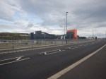
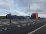
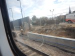
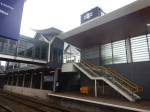
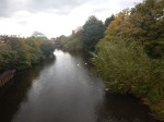
The Tram Stop At Parkgate Shopping
These pictures show the railway that passes Parkgate Shopping and the tram-train stop being built.

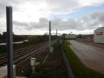

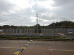
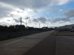
The stop needs finishing and a route to the stops would need to be created.
But it looks like the designers have developed a simple one platform stop capable of handling the required three trains an hour.
Conclusion
The project appears to be coming towards the end.
There are several things that need to be completed.
- The catenary.
- The connection of the tracks at the Tinsley Chord.
- Rotherham Central station pltforms
- Parkgate Shopping tram stop.
Then it would need to be tested.
If I have a question about the project, I wonder how they managed to be so late and over budget, as IS reported in this article in the Guardian, which is entitled Sheffield to Rotherham Tram-Train Is Five Times Over Budget, Says NAO.
My gut instinct tells me, that there are a few problems with this project, that would have been avoided by a little bit more thought before it started.
But I think it’ll come out alright on the end.
Heathrow Plan To Build Third Runway – On Stilts Over M25
This is the title of an article in the Business section of the Sunday Times.
Apparently, three viaducts would be built over the M25, with a wide one for the runway and two narrower ones for the taxi-ways.
Sounds fine by me!
I also feel that the technique of using stilts could be applied to build new housing and commercial properties over roads and railways.
Look at all that space over some city centre stations!
Relief For Ely
Ely station is not only a bottleneck for trains, but because the A142 only has a headroom of nine foot under the railway, a serious bottleneck for road traffic and an accident blackspot that stops both road and rail traffic.
But this article from the Cambridge News is entitled Work to start on new Ely bypass as final designs get the go-ahead.
This is the article’s simple description of the by-pass.
The new route will bypass the railway level crossing, as well as the accident prone low-bridge underpass, by providing a new link between Stuntney Causeway and Angel Drove to the south of the city.
Preparatory works are set to start on January 9 to mark out the site area to build the 1.7km of road, which will include two new bridges to cross the River Ouse and its flood plain, as well as additional railway lines.
I have been at Ely station a couple of times in the past week and these pictures show that work has now actually started.


The first four pictures were taken from an Ely to Ipswich train and the last one was taken from Plstform 3 at Ely station.
This Google Map shows the area.
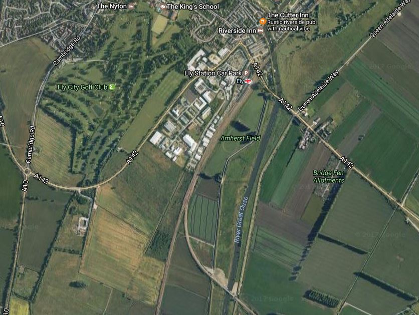
Note.
- Stuntley Causeway is the A142, which leads South-East from the station.
- The Great Ouse.
- The two railway lines meeting at Ely Dock Junction.
- Angel Drove is the road labelled A142, that curves from the city to the roundabout at the West of the map.
- The work site is in the angle between the Great Ouse and the railway line to Bury St. Edmunds, just to the West of the Hawk Bridge, where railway crosses the river.
As the new road crosses the river, the junction with Stuntley Causeway must be somewhere to the South-East of where the A142 currently crosses the river, which must make the road take a widish loop.
The project would appear to be a well-designed solution.
- Is the wide loop of the road, to keep noise of heavy traffic away from the river and the city?
- It should give relief for road traffic at Ely station.
- Hopefully it will cut bridge strikes.
- The viaduct over the railway and the river, incorporates a footbridge.
The question must be asked, if the building of the by-pass and the double-tracking of the railway line to Bury St. Edmunds are two projects that will co-operate.
The Hawk Bridge has already got space for a second track, so could this be laid first, so that it could be used as a siding to bring in the heavy components for the viaduct that will be built over the river? Or will they be floated in, using a barge on the river?
The order of construction on this project could be tricky, but the quality of project management has increased greatly in recent times.
West Anglia Route Improvement – Meridian Water, Road Traffic And Level Crossings – 1st March 2017
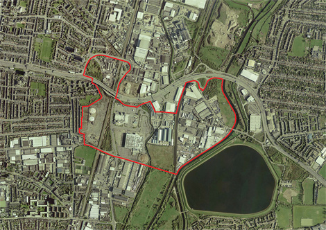
This map from the Meridian Water web site shows the area of Meridian Water outlined in red.
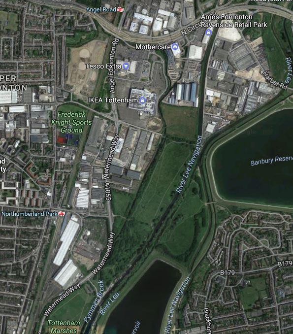
And this Google Map shows the Lea Valley from the North Circular Road in the North almost to Tottenhsm Hale in the South.
Note.
- Tesco and IKEA are in the middle of the Meridian Water site with the West Anglia Main Line and the main North South road to their West.
- The River Lea and the River Lea Navigation Canal pass between the Meridian Water site and the Banbury Reservoir.
With the building of Meridian Water, traffic in the area is only going to get worse.
The main North-South route shown in the second map starts North of Enfield Lock, where it has rather dodgy connections to the M25 and is generally a single carriageway road, all the way to the Tottenham Hale Gyratory, where traffic is heavy at all times.
One problem is going or coming West from this North-South route, as vehicles need to cross the West Anglia Main Line.
Starting from the North, the crossings of the railway are as follows.
- A level crossing at Enfield Lock station.
- A level crossing at Brimsdown station.
- A bridge for the A110
- A bridge at Conduit Lane, just North of the current Angel Road station.
- The North Circular Road, which is not well-connected to the North-South route.
- A bridge at Leeside Road, just South of the proposed site of Meridian Water station.
- A level crossing at Northumberland Park station.
Another bridge over the railway delivers you into the jams at Topttenham Hale.
STAR is currently envisaged to provide a seven-day-a-week services of four trains per hour (tph) between Angel Road and Stratford with calls at Northumberland Park, Tottenham Hale and Lea Bridge stations.
However the current local service up the Lea Valley from Stratford goes to Hertford East and Bishops Stortford stations with a rather erratic stopping pattern at stations North of Tottenham Hale.
So will STAR be based on these services or a separate train turning back at Meridian Water station?
But whatever happens it will increase the number of trains through Northumberland Park station.

It has now been announced in the last few weeks, that the level crossing will be closed.
Drivers wanting to go across the level crossing, following the closure will now do one of the following.
- Go South and over the railway to Tottenham Hale.
- Go North and cross the railway on the Leeside Road bridge.
They could always use the train.
I think the following would help mitigate the loss of the crossing.
- Some road improvement at the junction of Leeside Road and the North-South road.
- A decent pedestrian route between the new Meridian Water station and Glover Drive for Tesco and IKEA.
- The STAR service going North from Meridian Water station, as well as South to Stratford.
Hopefully, it will all be clear by the end of 2018.
Bat Bridges In Norfolk
The One Show on the BBC has just had a piece about how £300,000 was spent on special bat bridges over the A11 in Norfolk.
Now anybody with Suffolk connections will tell you that they are a bit funny up north, but surely not three hundred grand funny!
To bring the other East Anglian county into the piece, the BBC had also had an interview with a bat Professor from Cambridge University, who had found that the bats weren’t using their expensive highway.
For some years, I’ve always believed that bats are not stupid animals. After all, they can fly!
I was putting up offices on my stud, and in the middle of the cart shed we would be demolishing, the council planning officer thought he saw some bat droppings.
So I called in an expert, from Cambridge University! As one does!
The expert felt there might be the odd evidence of bats, but not to worry as bats often have as many as three roosts and swap between them for various reasons.
He told the council planning officer that the bats wouldn’t mind my new offices.
I do wonder if protesters use the possible existence of bats as a means to stop a development.
The Newark Crossing
To improve services between Lincoln and Nottingham, the Route Utilisation Strategy (RUS) for the East Midlands recommends doing something about the notorious flat junction at Newark, which is best described as a cross roads, where a B-road crosses a motorway. This is said.
Of the remainder, the RUS recommends that the provision of a flyover at Newark is further developed in CP4 to refine the infrastructure costs and potential benefits. It is recognised that the development of the East Coast Main Line Intercity Express Programme service requirements beyond those proposed for LDHS services from May 2011, combined with freight growth beyond 18 freight trains per day on the east – west corridor, may drive the requirement for the flyover in CP5.
I shall now look at this Victorian railway relic.
This Google Map shows the location of the crossing.
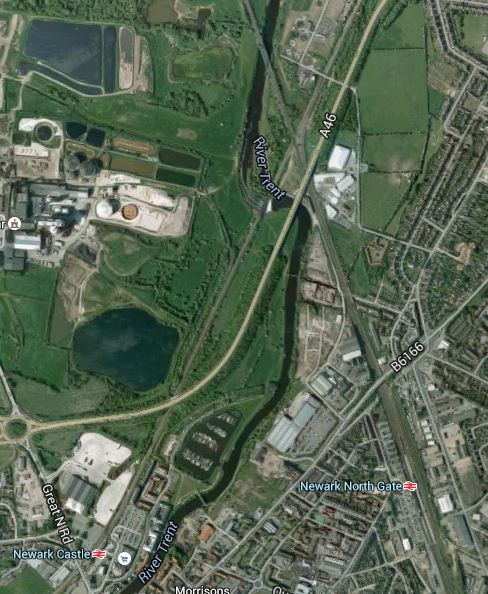
Newark Crossing
Newark Northgate station is on the East Coast Main Line, which runs top to bottom right on the map, whereas Newark Castle station is on the Nottingham to Lincoln line, which runs top to bottom left. To make matters worse the two lines cross by the River Trent and the A46, with the A1 a short distance to the East. These pictures were taken in quick succession from a train going from Lincoln to Nottingham.


The Civil Servant who signed that the road off, should have the knighthood taken away, that he obviously got for making a decision, which should have included sorting the railway, by building a flyover to take both the railway and the A46.
If this crossing were to be sorted, it would deliver benefits all up the East Coast Main Line and on the routes that use it from Nottingham to Lincolnshire.
I can’t find anything on the Internet, but hopefully some Network Rail engineers have the envelopes and fag packets on the table.
In my view there are two possible solutions to the problem of the Newark Crossing. But whatever solution is chosen, these criteria must apply.
- The new crossing must be able to handle probably twenty long freight trains and upwards of a couple of dozen passenger trains pass every day, that need to cross the East Coast Main Line.
- It must be built without any long closures of the East Coast Main Line.
The first approach is the obvious one, where a flyover or an avoiding line on a different route, is built to allow trains on the Nottingham to Lincoln Line to cross the East Coast Main Line. But if it is so obvious and as I suspect that the place where it would be built has been surveyed and examined in great detail, then Network Rail must have a plan that has a reliable cost and time-scale assigned to it.
As the benefits of eliminating the Newark Crossing must be very well defined, it would therefore appear that the cost of building the flyover is way out of line, as otherwise this important project would be published somewhere on Network Rail’s web site.
This snippet from the RUS suggests the problem.
The gradient of the flyover will need to be able to accommodate the freight trains travelling east – west along this corridor. A key geographical constraint is the proximity to the River Trent and the A1 trunk road which adds to the overall construction cost for the flyover.
As freight trains and especially those going from East to West, will only get longer and heavier, there will have to be a large margin for increasing weight and length built in to any design for the crossing, which not only crosses the East Coast Main Line, but the River Trent. The river probably kills off any chance of a dive-under.
The other approach is that Network Rail are working on a radical plan, that perhaps uses some of the many Nottingham rail lines to completely by-pass the Newark Crossing. Trains could cross the East Coast Main Line on either the Allington Chord, North of Grantham or where the High Marnham Test Track crosses South of Tuxford.
Thinking Big In Essex
I found this report in the Southend Echo from 2008 interesting.
It is a plan to link Canvey Island with the Hoo Peninsular in Kent using an immersed tube road and rail tunnel. This is an extract from the report.
Metrotidal’s blueprint seeks to combine the tunnel with new flood defences protecting London and a tidal power plant in the middle of the Thames Estuary.
This could support a new eco-town or generate enough power to operate a rail service through the tunnel, the consortium said.
This is a Google Earth image of the Thames south of Canvey Island.
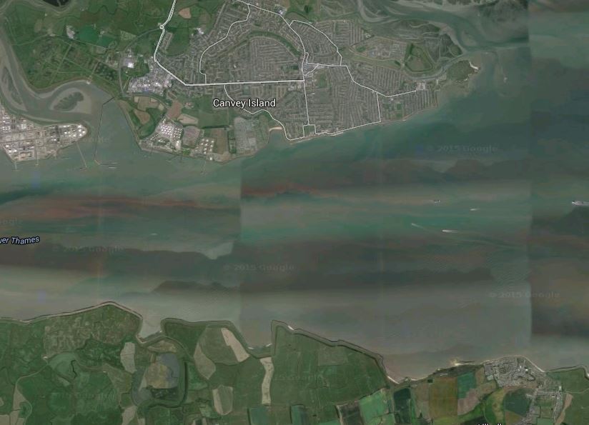
The Thames South Of Canvey Island
The surprising thing is that the river isn’t that wide and is probably about a couple of kilometres.
There hasn’t been anything on the news in recent years, so I suspect that the plan is very much on the back burner.
But one day, a project like this will be built!
Germany Thinks About Charging Foreign Drivers To Use The Roads
I saw this story in the Sunday Times, but it is also discussed in detail here, in The Local, which is German news in English. Quite a few countries now use vignettes to enforce tools.
I feel we should do the same, as being a non-driver, why should I subsidise foreigners, who drive on the roads of the UK.
I suppose the advantage of driving in Germany, is that you don’t have to put up with their crowded and often late trains.
Hackney’s Cracked Pavements
I took this picture in the little bit of the City of London, that is actually in the London Borough of Hackney.

Hackney’s Cracked Pavements
My Hackney pavements are very good, but obviously not all parts of the borough get the same quality of service.
