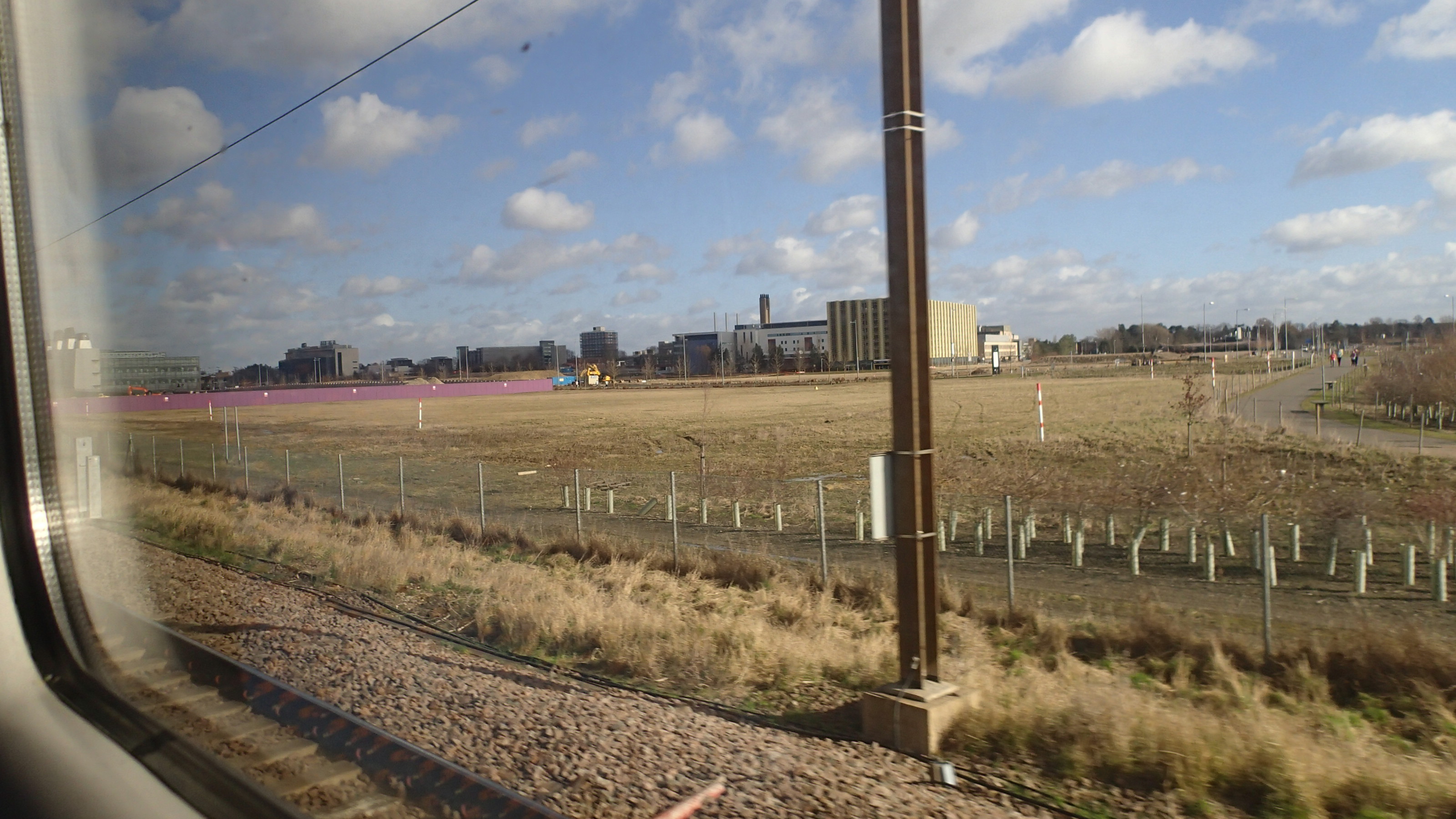
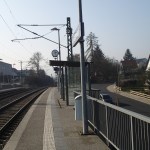
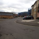
Will We See A Station At Addenbrooke’s?
Addenbrooke’s is the major hospital in Cambridge and it is starting to be surrounded by the Cambridge Biomedical Campus and a cluster of innovative medical companies.
Will We See A Station At Addenbrooke’s?
The picture shows the hospital sitting like a medical Ship of the Fens in the Cambridgeshire countryside.
Public transport between the hospital and the centre of Cambridge and the Science Park relies on the Guided Bus, but as a station is being developed at the latter, it was no surprise that David Cameron suggested that there should be a station at Addenbrooke’s.
If Cambridge continues to develop, then the rail lines that fan out from the city will need to be developed, if only to allow more commuting into a crowded city. Cambridge may have a very good Park and Ride System, but getting from Cambridge Science Park station station to Bury St. Edmunds or Ipswich would mean a change of train at either Cambridge or Ely.
As all the lines in the area are either electrified or are being studied for possible electrification, I suspect we’ll see some extra lines, junctions and curves around Cambridge to improve transport routes, especially to improve links to the East West Rail Link.
The only certainty is that in a dozen years the Cambridge rail system will be unrecognisable from that we have today.
Improving Rail Transport In Warwickshire
Warwickshire doesn’t often feature in rail infrastructure, but I was pleased to see that work is poised to start on a new station at Kenilworth, according to an article in Modern Railways. This will be served by new services on the Coventry and Leamington Line.
The council has even put up a blog. From which I clipped this plan of the new station.

New Kenilworth Station Plan
Compare this with the area now from Google Earth.
Kenilworth Now
Note that the current pedestrian bridge is retained. It also appears that the line through the station is going to be double-tracked.
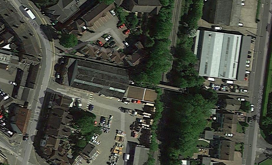
Plans are also in place to upgrade the Coventry to Nuneaton Line, with better services and new stations at Coventry Arena and Bermuda Park, for which work has started in October 2014. Does this Google Eart image of the Coventry Arena, show the work site?
Coventry Arena Station Site
There’s an on-line leaflet describing the station improvements on the Nuckle on the Warwickshire County Council web site. The fenced-off com pound, would appear to be in the fright place for the station.
Fom this leaflet, I think that Bermuda Park station is north of the Griff Roundabout, where the B4113 joins the A444. The leaflet shows the station at some point on St. George’s Way, where the rail line goes close.
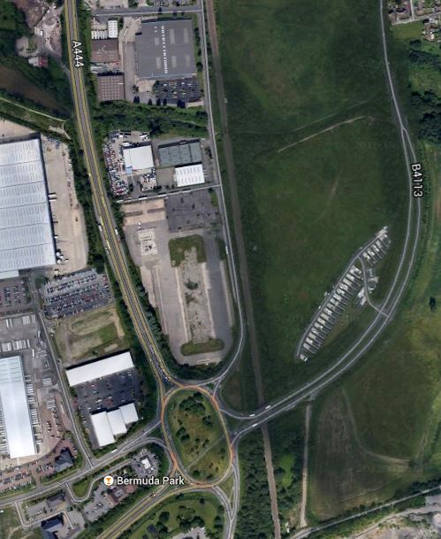
Bermuda Park Station
These three new stations and the upgraded lines are the sort of improvements to be welcomed.
As the Coventry to Nuneaton Line connects two electrified main lines, I wonder how long it is before the line gets wired? Or would this be a classic place to use a battery electric multiple unit?
An Ideal Place For A New Station
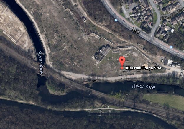
This map shows the development site at Kirkstall Forge in Leeds.
Kirkstall Forge
The site is being developed between the A65 and the River Aire and the Leeds to Bradford rail line in a £400million scheme. This is from the developer’s web site.
Kirkstall Forge will be transformed into a thriving mixed-use community in a wooded riverside setting. Ultimately it will deliver new homes, a high quality office park, shops, restaurants, a gym, crèche and other facilities. The scheme will create in the region of 2,400 new jobs, boosting the local economy by more than £5 million per year.
The DfT will provide a maximum of £10.3m towards the £16.9m needed to deliver railway stations on this site and at Apperley Bridge. The remaining 40% of the cost is made up of a local funding package comprising a private sector contribution of over £5m, supplemented by funding from the West Yorkshire Combined Authority.
Surely, this is the type of development that is good for everyone.
It will be interesting to know the extra return that developers get, by having a rail station in their plans. In London, a station is being provided at Barking Riverside for developments there, but stations in new developments seem to be fairly rare.
Strasbourg Station
Strasbourg station is unusual in that they’re put a glass canopy on a magnificent nineteen-century station.


I liked it. The design also allows the Strasbourg trams to be in a tunnel under the front of the station and be accessed by lifts and escalators.
As the building of these glass or plastic canopies and roofs is getting easier and cheaper, due to the work of structural engineers, I think we’ll see a lot more Strasbourg-style stations.
A Design Crime – Crap Station Design In Kassel
Some parts of Kassel’s urban tram system might well have been good, but these images of some of the stations, show the crap level of some of the design.

One thing that surprised me was the crudeness of some of the stations I visited, which just had steep steps and no lifts. This certainly wouldn’t be acceptable in the UK for a new station and I’m surprised that German disability rules allowed such a station design.
I nominate their stations as a Design Crime.
Birmingham Gets A Big Snow Job
It is said by many in the regions of the UK, that London gets and eats all the pies.
At present there are four main rail projects on the go in London; Thameslink, Crossrail, the Northern Line Extension and the London Overground.
Thameslink is a government funded project, whereas Crossrail and the NLE are paid for wholly or in part by property developers and business.
The smaller Overgroundisation of London surface railways is more a methodology that is starting to be copied and expanded in places like Merseyside, the Cardiff Valleys and the West Midlands. Although you could argue that other railways in the UK have had the same idea of frequent clean and sometimes new trains, smart stations and good staffing levels, working for some time. Some of the stations on the Overground, have been or will be expanded, in conjunction with property development.
But other projects where co-operation between Network Rail, rail companies.local government and property developers are starting to be proposed and implemented, Often these projects are led by a major redevelopment of a station.
1. Leeds Station
Leeds station was rebuilt and extended a few years ago, but little use was made of the space above the station.
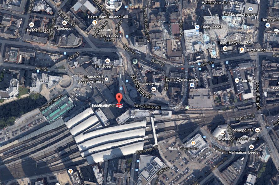
Leeds Station And City Centre
This Google Earth map shows the central location of the station and also its closeness to the main Trinity Shopping Centre at the top right of the map. Walking routes between the two are not good and the station should have been improved with development on the northern side to link it to the city centre. According to Wikipedia. future plans are in place to add much needed extra platforms and develop the south side of the station.
I believe, that you should walk out of a station into an open space, from where you can get your bearings of the city. This has been done well at London Kings Cross, Liverpool Lime Street, Huddersfield and Cardiff Central and some station rebuilding and expanding, is embracing such a concept.
I hope that Leeds develop the concept to a new level, when they create a new southern entrance. Perhaps on a personal level, they could create an easy way to get a bus to Elland Road.
2. Reading Station
Reading station has also been rebuilt and is surrounded by development, as this Google Earth map shows.
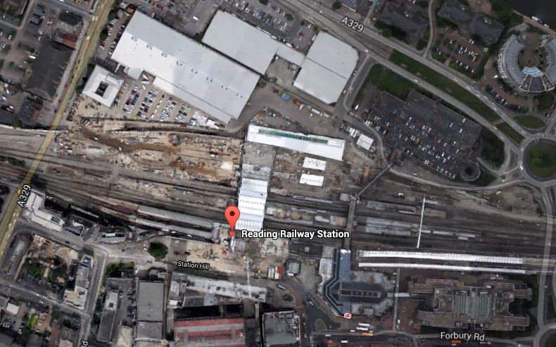
Around Reading Station
In the future it will be getting Crossrail,the new western link to Heathrow and probably more offices around the station. Network Rail, who now manage the station, have already created entrances on both sides of the station and I hope that development in the next few years, will make what is a spectacular station, a true gateway to the City.
3. Birmingham New Street
Birmingham New Street station is approaching the end of its rebuilding, which is now Gateway Plus. It includes a lot of retail including a new John Lewis. The station will also be connected to the Midland Metro. This Google Earth map shows the station and it’s surroundings.
Birmingham New Street
It shows the problem that the station suffers, when compared to many. It is in a deep dark hole surrounded by busy roads, with the buses some way away. I don’t think you would design a station like that these days, as they did in the 1960s.
The station has a problem, as does Leeds, that there is not enough lines and platforms, but whereas at Leeds space is available, it would appear that at Birmingham New Street, it will be difficult to find.
The design of the station means that natural light on the platforms is difficult to provide. Hopefully, though by providing that light on the concourse and lots of lifts and escalators to get to the trains, the architects may have improved things. At present, it’s a bit like a bad Underground station experience arriving and departing at the station. One of the reasons, I generally travel between London and Birmingham by Chiltern Railways, is that Moor Street is a light and airy station, that has been tastefully updated for the modern age.
One of the biggest problems at New Street, is getting onward connections around the City Centre. On my visits to Birmingham, I often walk to Brindley Place to have a drink or lunch with friends. It’s not a difficult walk, but in a few years time, I’ll be able to do this sort of journey on the Midland Metro from the stop in Stephenson Street. When HS2 opens, this tram will be used as the connection between all four Birmingham city centre stations.
4. Manchester Victoria Station
The updating of Manchester Victoria station is the centrepiece of two big projects in Manchester; the Northern Hub and the extensions to the Manchester Metrolink like the Second City Crossing. This Google Earth map shows The station and the surrounding area.

Manchester Victoria
This image is quite old and doesn’t show the new roof, but it does show the roof of Manchester Arena next door, how the tram lines call at the station, the nearby green space and the river. All the station needs now is completing, the Metrolink extensions and new electric train services to Liverpool, Preston, Blackpool, Bolton, Leeds, Huddersfield, Sheffield, Newcastle and Hull.
I would also personally, like to see an hourly service to the South and Euston, so that I can avoid, the mostly dreadful Piccadilly. This will be possible once the Ordsall Chord is opened, although some might say that it is a real pity, the Picc-Vic tunnel was never built. Perhaps Virgin will get permission to run a service to Huddersfield via both main Manchester stations.
5. Newcastle Station
Newcastle station is a station that I don’t remember as anything special from my last visit some yeas ago, although it is a Grade I Listed Building. But since then, several millions have been spent according to Wikipedia, mainly on internal and retail facilities and on opening up the area round the station. So perhaps I should pay the city a visit. This Google Earth image shows the unique position of the station.
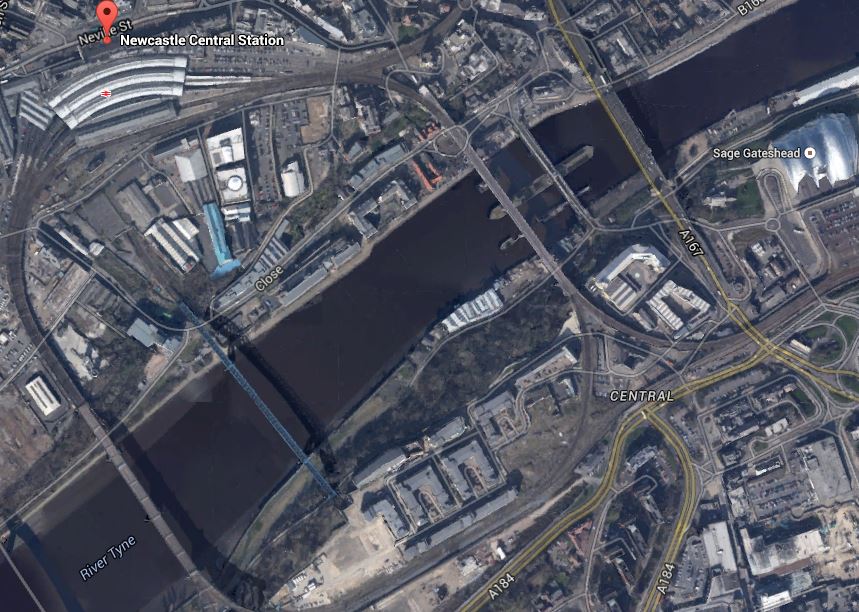
Newcastle Station
It is high above the Tyne on the edge of the city centre and uniquely the station is on a curve. It must be a very difficult to add extra tracks and platforms, which seem to be needed, as both through and local services are going to increase significantly.
I have only given five major examples, but they show how stations are becoming the focus of development.
One of my manual searches on the Internet picked up this article on Modern Railways entitled Snow Hill ‘transformation’ plan. This is the first paragraph.
Birmingham City Council has released its Snow Hill Masterplan, which outlines plans to grow the business district surrounding the station and includes proposals for the ‘transformation’ of the station into a transport hub.
Snow Hill is Birmingham’s station that is ignored by visitors from around the country, although it is important for commuters and others brought into the city on the Snow Hill Lines.
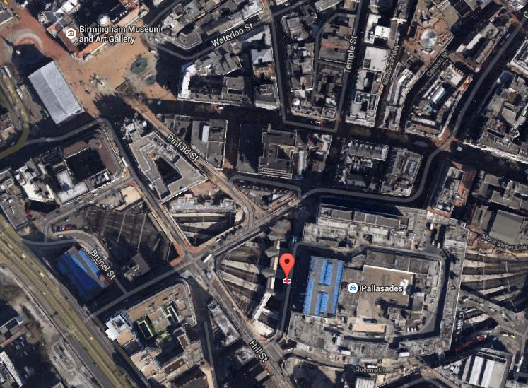
The Snow Hill Masterplan is here on the Birmingham Post website. Some of those who have commented don’t like it and they could be right. But the principles behind the plan of creating high quality offices, retail and apartments over a well-connected station is one that has been proven to work at Canary Wharf. After all it does actually make double use of the same piece of land. This is a Google Earth image of the Birmingham Snow station and its location.

Birmingham Snow Hill
You don’t see much of the actual station, as it is covered by a multi-story car park. As someone who can’t drive and manages well without a car, I can’t see why cities don’t do what London, Cambridge and Oxford have done and discourage people from driving in by providing top quality public transport.
The Snow Hill Masterplan would need an updated Midland Metro and also extra trains and routes through Snow Hill station.
I think that if I could get trains direct from Marylebone to Snow Hill, then that would be my preferred way of going. Snow Hill is in a much friendlier and welcoming part of the City than New Street.
I think on balance it is a good plan.
Sunderland Port Gets A Rail Connection
I’m all for freight traffic to be on the railways, even if it sometimes means that noisy and smelly freight trains pass through residential areas. But on the plus side, I’ve seen how rail improvements connecting the Port of Ferlixstowe to the wider rail network, has taken so much traffic off the busy A14. It is my belief, that one of the best ways to increase motorway capacity, is to remove as much long distance freight as possible.
DB Schenker obviously want to promote rail freight for commercial reasons and they seem to be backing a lot of new rail developments like the Northern Hub.
So I was not surprised to see the company very much behind the re-opening of a rail link into the Port of Sunderland, as reported in this piece in Modern Railways. DB Schenker’s spokesman says this.
‘Ports play a crucial part in DB Schenker Rail’s growth strategy and we are delighted to bring rail back to Port of Sunderland.
It will be interesting to see how busy this rail link becomes in the next few years.
Increasingly, these last mile rail links are being created or renewed. The only losers are probably the drivers of heavy good vehicles.
This small rail link has been renewed in an area that could see a lot of development in the next few years. This Google Earth map shows the rough route of the rail link along the coast.
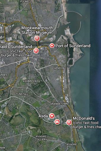
The Durham Coast South Of Sunderland
Sunderland Port is marked by the two curved breakwaters at the top and the link joins the Durham Coast Line that runs from Newcastle via Sunderland and Hartlepool to Middlesbrough, at Ryhope Grange junction, which is near to the marked McDonalds.
The Durham Coast Line has an hourly service between Newcastle and Middlesbrough and also connects various ports and sites to the rail freight network. It is also used by Grand Central services between Sunderland and London and as a diversionary route for the East Coast Main Line. Local groups are also keen that the line be upgraded with a better passenger service between the Tyne, Wear and Tees areas.
In a sane world, this line would be a prime candidate for electrification linked to the East Coast Main Line at Newcastle and Darlington. A few points.
1. It would be an important electrified diversion for the increasingly crowded East Coast Main Line.
2. I suspect Grand Central and other East Coast Main Line operators are pushing for this electrification, as it would enable direct high speed services between Newcastle and London via Sunderland, Hartlepool and Middlesbrough.
3. After the completed electrification of the Trans-Pennine routes, it would also improve services from towns and cities not on the East Coast Main Line to the western side of the Pennines.
However full electrification is probably not possible as the northern part of the line has been electrified for the Newcastle Metro to a different standard. But the new passenger trains like the Class 800 and new freight locomotives like the Class 88, would just switch to their on-board diesel power,
As an aside here, Tees Valley Metro, is being developed around Middlesbrough, in rather a stop-go fashion. Surely if the Durham Coast Line is electrified and that electrification is extended to Darlington and then perhaps on the Tees Valley Line to Bishops Auckland to serve both the National Railway Museum at Shildon and the Hitachi train factory at Newton Aycliffe. It would seem a bit mad to build a large factory to make electric trains and then have to haul them in-and-out with a diesel locomotive.
If nothing else, all of these options prove to me, that the North East should have a similar sort of autonomy as Greater Manchester is getting. That would enable the area to bring together all of the ideas about extending the transport system.
Looking at Wikipedia’s list of proposed rail infrastructure projects, these are in the North East.
Newcastle Station Redevelopment
Tyne And Wear Metro Developments
It’s not a long list. Other areas south of Hadrian’s Wall, like Bristol, Birmingham, Cardiff, Leeds, London, Merseyside and Manchester have much better developed plans on the drawing board, even if they know some will be a long time coming.
I wonder if Department of Transport officials when talking to representatives from the North East, say to them, you’ve got an electrified railway to London, the Tyne and Wear Metro, rebuilding of Newcastle station and a brand new train factory, so what more do you want?
Surely, local elected representatives should decide what is best value to the communities they serve. No-one based outside an area, can ever know all of the subtle local reasons, why things should or should not be done. As an example, Greater Anglia’s stations in East London are managed from Norwich. I don’t think they manage them very well and not for good reason are most being put under the care of Transport for London.
Most transport in the North East should be under the control of a single body, so that the limited finances available will be better allocated.
Walking Between Walthamstow Central And Queens Road Stations
Walthamstow Central and Walthamstow Queens Road stations are not far apart and are considered to be an out-of-station interchange. This means that if you touch out in one station and then walk to the other to continue your journey, you only get charged for one journey.
It used to be tortuous to walk between the two stations, but in recent months a link called Ray Dudley Way has opened.
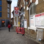

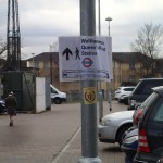
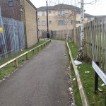
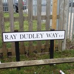

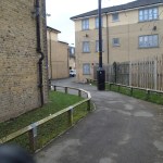
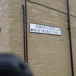


It does make the walk easier, but it is still not properly signed.
Note too, that it would appear that the eastern entrance to Walthamstow Central has been closed.
Energy Saving In Thameslink Stations
Thameslink have made a lot of fuss about the solar panels on the roof of Blackfriars station, which is on a bridge across the Thames. Read this article in The Guardian.
It’s certainly impressive and good PR, but I changed trains on the bridge platforms a couple of weeks ago and it was rather cold and draughty. A station guy felt it was an awful place to work.
At the new London Bridge station, they are not using solar panels, as the dreaded Shard puts the station in the shade for a lot of the day. But they are going to use a ground source heat pump and possibly footfall tiles that generate electricity.
I think we should think very hard about how we design stations and other large buildings, so that they don’t need the energy in the first place.
I suspect we all have our least-favourite cold and draughty station.
I think is is probably true to say that designing the perfect station is an impossible task. In some ways one of the best in London is Liverpool Street, which was the second major terminus (after Euston) to be rebuilt in the modern era. Of the stations serving the South, Waterloo is an order of magnitude better than the others, since the latest updating. But generally, it is still a 1920s station. But both Liverpool Street and Waterloo aren’t high up in the cold and draughty league.
The Shape Of Things To Come
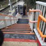
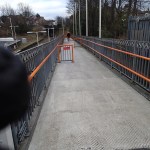
I visited the newly-reopened Tottenham Court Road station and took these pictures.


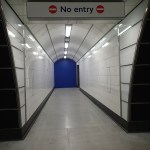
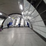
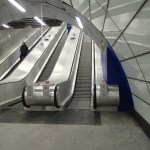
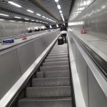
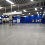
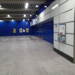
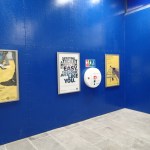

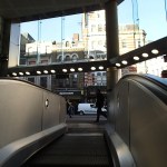
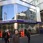
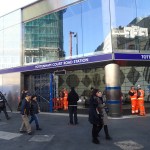
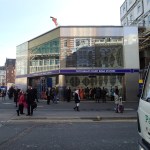
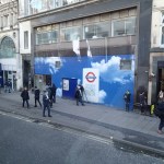
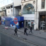
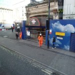

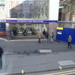

The pictures were taken in sequence. I arrived on a Northern Line train from Embankment, took the steps and long escalators to the enormous ticket hall, where I got sanother escalator to the station entrance, where you are delivered at pavement level. I then left on a 10 bus, from where I took the last pictures.
Obviously, there is still work to do, but you have to remember that this is perhaps a third of the station that will have been created by when Crossrail opens. The Central Line will be connected again, an entrance will be positioned by Centre Point and a new large entrance to the west in Dean Street is being built.
This Google Earth image shows the area around Soho Square.
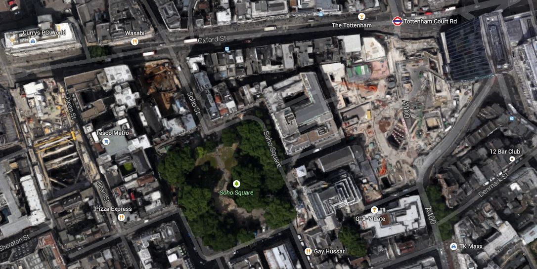
The Soho Square Area
Tottenham Court Road station and the iconic Centre Point at the top right corner and Dean Street to the left or west.
Note the distance between the two entrances, which emphasises how long the platforms are to accommodate two hundred metre long trains, that call at two hundred and sixty metre long platforms. Crossrail describes their new station with these points.
- 24 trains per hour service at peak times in each direction
- 260m – length of platform tunnels
- 25m – platform depth
- 102,000 passengers are estimated to use Crossrail station each day
- 40 utilities diverted in and around Charing Cross Road and Oxford Street
- 500,000 square feet of premium retail, office and residential accommodation created at eastern end of Oxford Street and Tottenham Court Road
- £1bn – total investment to build Crossrail station and upgrade capacity of existing Tube station
It is a massive project in its own right and will totally reform the area.
This new tube station is just the first manifestation. The first benefit other than better exit and exit to the Underground, will probably be lots of walking short cuts on the area, when it is busy or raining hard.
