How Did South East Water Become Such A Disaster?
The title of this post, is the same as that of this article in The Times.
This is the sub-heading.
As tens of thousands of homes in Kent and Sussex lose supply the company and its well-remunerated boss, David Hinton, face a torrent of anger
These two paragraphs add some detail.
Perhaps the worst moment for South East Water was when it opened a bottled water station in the wrong town. Staff set up in Tonbridge, Kent, and not Tunbridge Wells five miles away, where the company had left some 24,000 properties without drinking water for two weeks.
Or maybe it was when David Hinton, the chief executive, repeatedly called the local MP one evening not to apologise but to berate him about the crisis — not, Hinton later admitted, “my finest moment”. Or it could have been when more properties lost their supply only hours after Hinton had told MPs his company’s response to the incident should score eight out of ten.
It wasn’t exactly the water industry’s finest moment.
I played a small and hopefully professional and a hundred-percent scientifically correct manner in the formation of the modern water industry in the UK.
In the 1970s, I wrote the software, that WS Atkins rented from their time-sharing computer to the Water Resources Board at Reading to model water supply in all or part of the UK.
My differential equation solving software had been designed to handle up to around a million equations and the contact at the WRB was a Dr. David Dimeloe.
I was never given details of their model and the conclusions, but I assume they must have done a good job, as there haven’t been too many problems with actual water supply, but mainly with management, ownership and failure of ancient infrastructure.
In my 79 years in the UK, I’ve never had a problem with water supply.
Searching for the WRB on the Internet finds one in Sri Lanka.
It would be good to get a copy of that report or even talk to one of the engineers on the project.
National Grid Has Awarded £12bn In HVDC Supply Chain Agreements
The title of this post, is the same as that of this press release from National Grid.
These are the first three paragraphs.
National Grid has completed the award of its High Voltage Direct Current (HVDC) civil works supply chain framework, with £12bn worth of agreements confirmed. This announcement marks the third and final stage of our £59bn supply chain framework awards and underlines the commitment to delivering the energy infrastructure needed to support the Great Grid Upgrade and the UK’s energy transition.
A total of six HVDC converter civil works suppliers have been awarded positions on Lot 1 of the Framework Agreement totalling approximately £9.07bn. In addition, three HVDC onshore cable civil works suppliers being awarded places on Lot 2 of the Framework, worth an estimated £3.7bn. The successful HVDC converter civils suppliers are Balfour Beatty, BAM Nuttall, Galliford Try, Laing O’Rourke, Skanska and Taylor Woodrow. The HVDC onshore cable civils Framework has been awarded to Balfour Beatty, Murphy, and VolkerFitzpatrick.
Contracts have been secured for a five-year period, with the potential to extend for a further three years. Both Frameworks cover confirmed and anticipated projects, including Eastern Green Link 4, in partnership with SP Energy Networks and LionLink in partnership with TenneT .
These are a lot of money allocated to projects, that will be delivered in the next few years.
Where’s the consolidated plan for capital expenditure from the Water Industry?
Water is also simpler, than electricity, as you are only dealing with one country. If you go through the paragraphs above, you’ll find TenneT, who do a similar job to National Grid in the Netherlands and parts of Germany.
I also found this advert from Thames Water, in a Southeastern train last week.
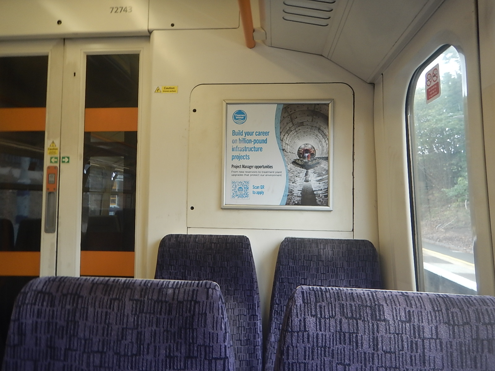
Does this indicate that Thames Water has project management problems?
Poo power To Heat Homes In West London As Thames Water Continues To Reduce Its Carbon Footprint
The title of this post, is the same as that of this press release from Thames Water.
These are the three bullet points.
- Thames Water unveils its second successful gas-to-grid project.
- Around 4000 homes in West London will be heated using converted sewage sludge from Mogden sewage treatment works starting early this year.
- This initiative is part of Thames Water’s commitment to reduce its carbon emissions across its operations thereby reducing its contribution to the causes of climate change.
These three paragraphs outline the project.
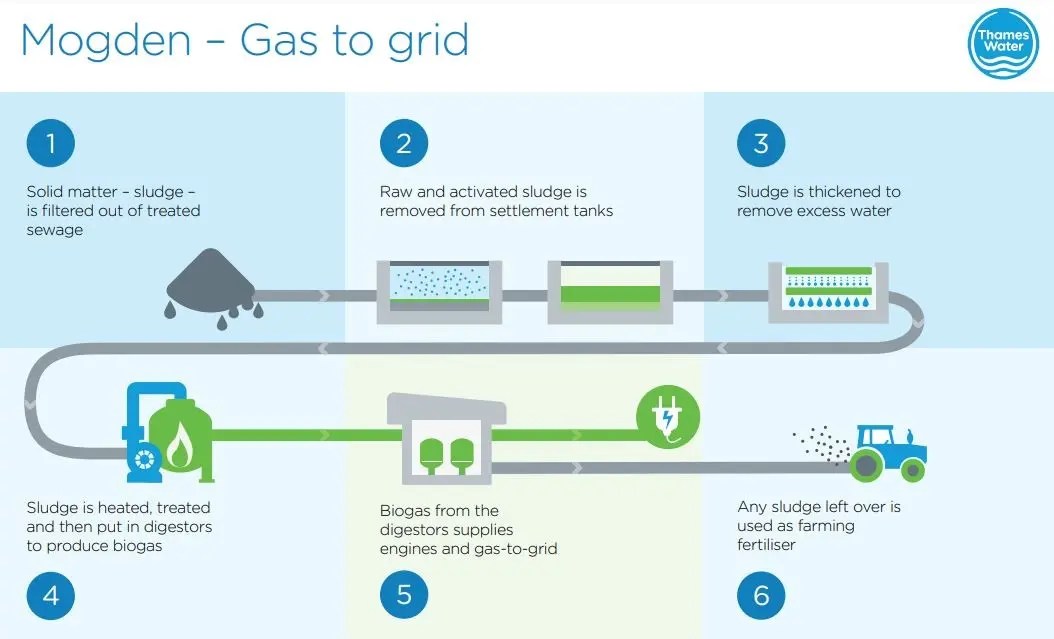
Thames Water has announced sewage sludge will be used to heat homes in West London early this year, after successfully delivering its second gas-to-grid (G2G) project, at its Mogden Sewage Treatment Works (STW).
The success of the gas-to-grid model established at Deephams STW in North London in 2021, where biogas is converted into biomethane to heat homes in Enfield, served as the blueprint for the project at Mogden.
Currently serving over 2 million customers, Mogden is the third largest STW in the UK, and has the potential to reach and supply gas to 4000 homes in West London. This comes as part of the company’s commitment on energy transition, by transforming the way it creates and uses power to reach net zero carbon emissions.
The press release then gives a paragraph of explanation as to how the system works.
A byproduct of the sewage treatment process is sewage sludge, which is then digested to produce BioGas. Mogden STW then generates electricity with this BioGas via Combined Heat and Power (CHP) engines. The Gas-to-Grid plant, which will be managed by gas supplier SGN, intends to take a proportion of this BioGas and to ‘uprate’ it to export quality which is achieved by filtering, scrubbing and then compressing gas so it can be used as fuel for cooking and heating.
This Thames Water graphic illustrates the process.
This press release is not Thames Water’s image from many of its customers.
Energy Efficient Bricks Made From Human Waste To Help Build London Homes
The title of this post is the same as that of this article in The Standard.
This is the first two paragraphs.
New homes and factories will be built from bricks made out of the human waste of four million Londoners.
Dried sewage from millions of homes will be transformed into two million heavy-duty breeze blocks a year.
It’s all happening at Beckton.
A Lesson In Traffic Management
On Friday, next door got low water pressure. So now we have a chicane around the hole that Thames Water have dug, whilst they look for the problem!


My road certainly seems quieter, as traffic could be much less and slower.
Perhaps Thames Water and National Grid, should be asked to dig holes in rat runs as a traffic-calming measure!
From Walthamstow To Hackney
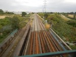
The space in the East of London up the Lea Valley between Walthamstow and Hackney is all grass, scrub, reservoirs, canals, rivers and railways.
These pictures were taken on a train between Walthamstow James Street and Clapton stations.
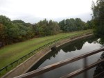


It is a very underused area and lies just to the south of the proposed Walthamstow Wetlands. The only development that will happen here is to reinstate the Hall Farm Curve to enable trains from Walthamstow and Chingford to join the Lea Valley Line to Lea Bridge and Stratford. It will probably end up though, ringed by high-rise housing, like you can see along the River Lea.
London is a surprising city. Soon it will be a City with a world-class nature reserve just a few minutes from the business heart of the City, This is a Google Map of the area.
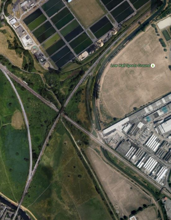
Walthamstow To Hackney
Note the two rail lines crossing in the middle. The route of the Hall Farm Curve can be made out, as it hugs the boundary of the unmanaged area.
At the top of the picture you can see the filter beds of Thames Water’s giant water factory, that provide a lot of London with water using the massive reservoirs of the Lea Valley, some of which will form part of the Walthamstow Wetlands.
If you take a train from Liverpool Street to Stansted Airport or Cambridge, you’ll come over the River Lea and then take the curve to join the main line before passing through the Walthamstow Wetlands and stopping at Tottenham Hale.
Thames Tideway Tunnel Site – Blackfriars Bridge Foreshore
Index Thames Tideway Tunnel Sites Blackfriars Bridge Foreshore
Blackfriars Bridge Foreshore is going to be a major site for the construction and operation of the Thames Tideway Tunnel.
This Google Earth image shows the area of the site.
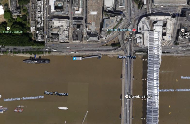
Blackfriars Bridge Foreshore
Note the pier for the river boats and HMS President in the angle between Blackfriars Bridge and the Victoria Embankment. Compare this image with this visualisation clipped from the Thames Tideway Tunnel web site.

Blackfriars Bridge Foreshore
The pier for the river boats will obviously be moved downstream and I found the works for this a few days ago and wrote about it here.
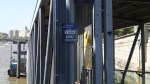
The first thing anybody will notice here is the relocation of the pier, which Thames Water say won’t happen until the new one is ready. At the moment the current pier is looking a bit tired, as these pictures show.

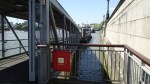

The text system for the Next Boat works.
Thames Tideway Tunnel Site – Albert Embankment Foreshore
Index Thames Tideway Tunnel Sites Albert Embankment Foreshore
The Albert Embankment Foreshore site must have given the Secret Intelligence Service kittens, as it is going to be located across the front of their famous building. I also went to a lecture at University College London, which said that in the river at this point, there are prehistoric structures.
Thames Water say this on the Thames Tideway Tunnel web site.
Work will comprise construction of a new area of reclaimed land in the foreshore, in front of Camelford House for a shaft approximately 48 metres deep with an internal diameter of approximately 16 metres. Connection to the existing sewers will be made within a second new area of reclaimed land underneath Vauxhall Bridge and in front of the Vauxhall Cross building. These two areas will be connected under the foreshore. The shaft is required to transfer sewage flows from the combined sewer overflows to the main tunnel.
Once construction is complete there will be new public space extending into the foreshore providing a viewing platform to Central London, benches and intertidal terraces. The Thames Path will be widened to allow pedestrians to be diverted in front of (rather than underneath) Camelford House.
It is certainly a large set of works in the area, which they also say will link the Clapham Storm Relief and Brixton Storm Relief sewers to the new Thames Tideway Tunnel. This is a visualisation of how the completed site will look

Albert Embankment Foreshore
Joseph Bazalgette would be pleased at the expansion of his Albert Embankment. These are a few pictures I took around Vauxhall Bridge.


There is certainly scope to improve the river in this area.
Thames Tideway Tunnel Site – Victoria Embankment Foreshore
Index Thames Tideway Tunnel Sites Victoria Embankment Foreshore
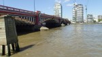
The Victoria Embankment Foreshore is a site just to the west of Hungerford Railway Bridge on the North Bank of the Thames. The Thames Tideway Tunnel web site says this about the site.
The Victoria Embankment Foreshore site is on the northern bank of the River Thames. It comprises a section of the foreshore and a section of pavement and roadway on Victoria Embankment (A3211).
This is a Google Earth image of the site.
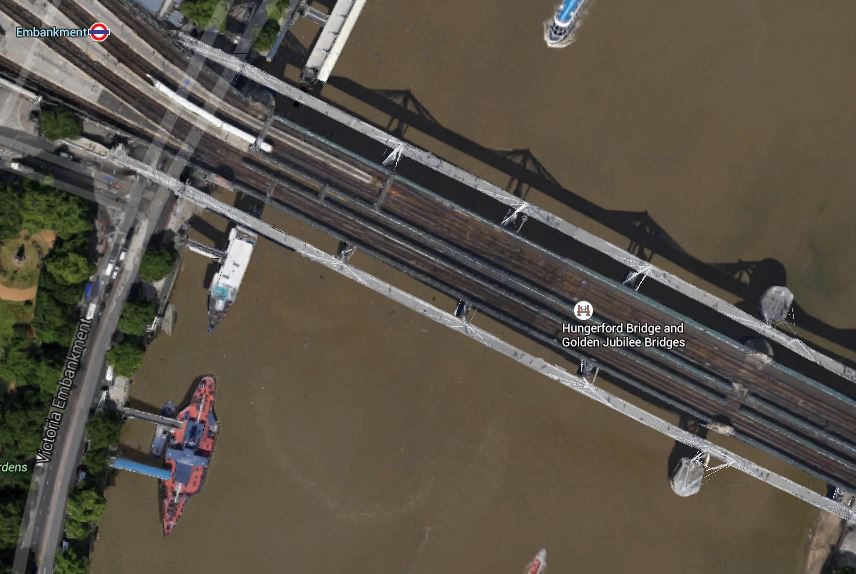
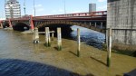
Victoria Embankment Foreshore
Note the two ships; the larger Tattersall Castle and the smaller Hispaniola. Moving the Tattersall Castle to a new mooring is going to be one of the first tasks on site.
This image from the Thames Tunnel web site, shows what the completed installation will look like.
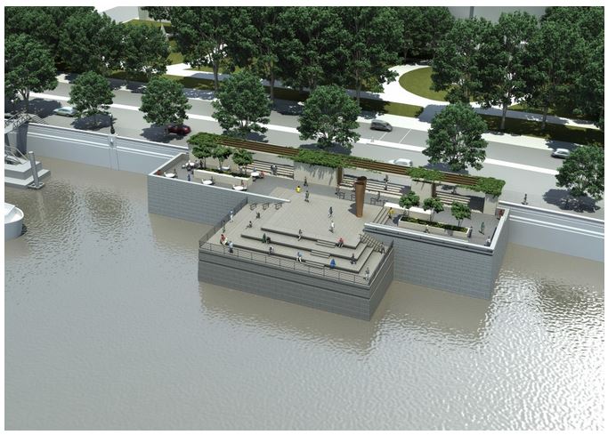
Victoria Embankment Foreshore
It might look a bit like a Victorian memorial to an important Admiral, but it certainly could be made into an excellent garden with a unique water feature. I took these pictures as I walked over the Jubilee Footbridge on the Hungerford Bridge and then walked along the Embankment.


One of the pictures is of Whitehall Gardens. I’ve included it, as it looks like the finished feature over the works might be modelled on the Victorian gardens.
My only worry with getting the design of this site right, is that they have talked to those designing the Cycle Superhighway through the area.
This is probably one of those sites, where there are few residents to annoy, proving that the traffic isn’t disrupted too much. On the other hand, whilst the site is being worked, it would appear that the footbridge might make a good grandstand.
Thames Tideway Tunnel Site – King Edward Memorial Park Foreshore
Index Thames Tideway Tunnel Sites King Edward Memorial Park Foreshore
King Edward Memorial Park Foreshore is a site on the river at Wapping just to the East of a prominent Rotherhithe Tunnel Ventilation Shaft and will be on the main Thames Tideway Tunnel. On the Thames Tideway Tunnel web site, this is said.
This site will be used to intercept the existing local combined sewer overflow, known as the North East Storm Relief Combined Sewer Overflow.
This is a Google Earth image of the area.
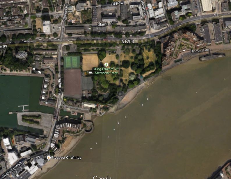
King Edward Memorial Park Foreshore
Note the circular shape of the tunnel ventilator, which is just back from the foreshore in the middle of the park.
This image shows a visualisation of what the finished site could look like.
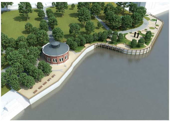
King Edward Memorial Park Foreshore
I also took a few photographs, as I walked through


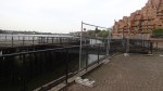
It is rather a quality urban park and given the location and the increase in size, when the works are complete, I suspect that any good managers could make more than a fist of this contract.
