Great Western Railway Launches Lobster Class
Great Western Railway serves the best food on a British scheduled train, but this article on Rail News entitled Lobsters ‘take the train’ to London is not a piece of fun. This is an extract.
Live lobsters are now being transported by rail from Cornwall to top London restaurants.
Sending produce by rail will be faster than road, ensuring the lobsters are fresher when they arrive. It will also help to lower carbon emissions by reducing road freight.
Great Western Railways and InterCity RailFreight Ltd will be delivering the lobsters daily on the 1739 Penzance to London Paddington service. WEGO Carbon Neutral Couriers will then take them to their final destination.
It’s good to see innovative uses of resources.
Tottenham Court Road Station Gains A Giant Fosterito
The second new entrance to Tottenham Court Road station opened today.


The entrance under the shadow of Centre Point, is a giant British version of the fosteritos on the Bilbao Metro.
Tottenham Court Road station, is probably one of first stations to be designed since London adopted contactless ticketing.
In my view, the design has certainly benefited, with its vast ticket hall, wide gate line and uncluttered area, where people can pass through quickly.
Simple is certainly efficient!
Crossrail Extension To Gravesend
A possible Crossrail Extension to Gravesend has been safeguarded, although because Crossrail doesn’t call at St. Pancras for Eurostar, I feel that extending Crossrail to Ebbsfleet International station to catch Continental trains there, would be part of any extension to Gravesend.
This Google Map shows both Ebbsfleet International and Gravesend stations.

Ebbsfleet International And Gravesend Stations
Ebbsfleet International is to the West and Gravesend is to the East.
There would have to be some major construction work, but it would probably be feasible.
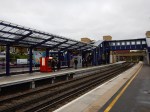
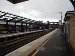
However this Google Map of Gravesend Station shows a serious problem.
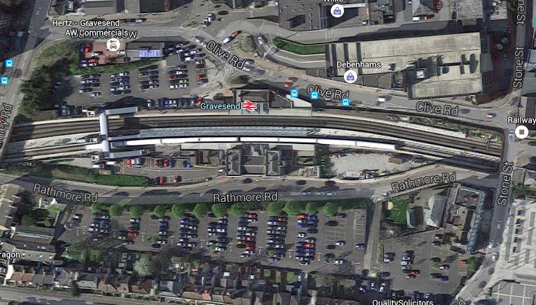
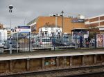
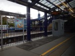
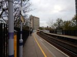
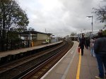
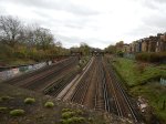
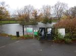
Gravesend Station
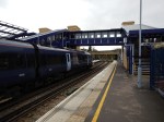
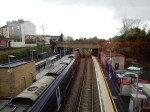
As can be seen, it is a very cramped site. These pictures show the station.


I doubt any extension to Gravesend will terminate at Gravesend station.
There is a page on the Crossrail web site, which is entitled Safeguarding. This is said.
An additional extension from Abbey Wood to Gravesend and Hoo Junction, has been safeguarded however there are no current plans to extend the railway beyond the route currently identified.
This is a Google Map of the Hoo Junction area to the East of Gravesend.

Hoo Junction
Currently, it is occupied by a freight yard. It certainly could be used as the terminus, but it is about ten kilometres East of Ebbsfleet International station.
So could a train on the North Kent Line that runs from the current Crossrail terminus at Abbey Wood to Gravesend, do a detour to Ebbsfleet International?
This Google Map shows the lines in the Ebbsfleet International area.
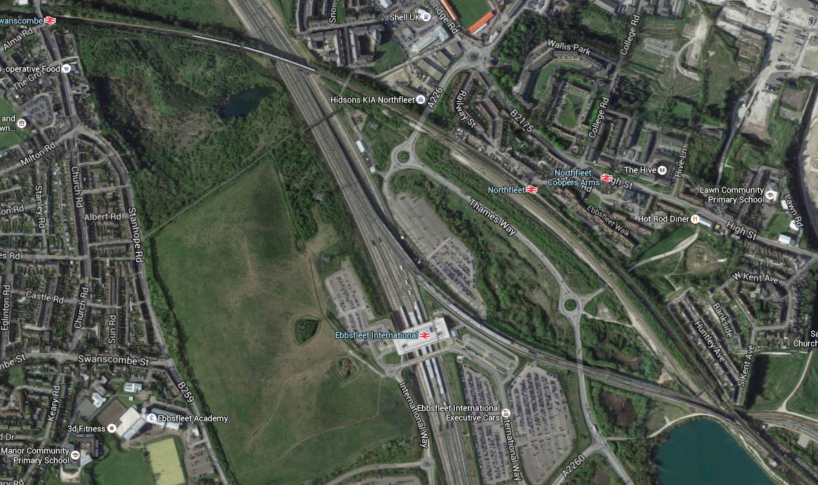
Lines Around Ebbsfleet
The North Kent Line starts in the top left at Swanscombe station, crosses over the lines into Ebbsfleet International. It then goes through Northfleet station, before going off in a South-Easterly direction to Gravesend.
A connection could surely be built so that after passing Swanscombe station, the trains on the North Kent Line could pass through Ebbsfleet International, rather than through Northfleet station.
An alternative would be to provide a proper connection perhaps using a travelator between Northfleet and Ebbsfleet International stations.
One problem to sort out would be the level of services through Abbey Wood, that continue on to Ebbsfleet International and Gravesend.
More Thoughts On Dalston Junction To Hayes
In February this year, I wrote Should Trains Run From Dalston Junction To Hayes?
I finished the post like this.
So is New Cross the least used direct southern destination on the East London Line? Also, was it only included in the East London Line for historic reasons, as it had been a Metropolitan Line destination?
If so, it might be an idea to see if extension of the four trains per hour services terminating at the station is possible. Perhaps two could go Hayes and two to Orpington, which would double the frequency to both places from New Cross.
I could also have said in the summing up, that this would give four trains per hour from Dalston Junction to Lewisham, with all its connections to South East London and Kent.
This morning, I was reading an article on London Reconnections about extending the Bakerloo Line, entitled Death, Taxes and Lewisham: Extending the Bakerloo.
So it got me thinking!
I returned to my original article and had the following blasphemous thought.
Is Transport for London, so obsessed with using the supposed spare capacity on the Bakerloo Line, that it doesn’t think straight about what to do with this line?
Consider the following points.
- Passengers like the Overground model and many rate it higher than the Underground.
- When Crossrail and Thameslink and the East London Lines are up to capacity of twenty-four trains per hour, the increase in capacity will change London’s transport system dramatically, as there will be an H-shaped network with interchanges at Farringdon, Whitechapel and possibly some other places.
- Most trains going to Kent and South East London start from Victoria, which is not well placed for some of the important parts of Central London. Would extra connections to a twenty-four trains per hour East London Line at Penge and Brockley be a better route for many passengers?
- I feel that there would be a backlash, if the Hayes Line became part of the Bakerloo Line, just like there was when Thameslink wanted to stop all Sutton Loop Line trains at Blackfriars! If you’ve been commuting for years in First Class from Hayes into Cannon Street for the City, I don’t think you’d be happy if your train was a smaller one-class, crowded Underground train. But you might accept an Overground train to Canada Water for the Jubilee Line or Whitechapel for Crossrail and the Metropolitan/Circle/District Lines.
- Thameslink together with the Bakerloo Line and an upgraded Jubilee Line will create a resilient North-West to East routing, that could withstand the occasional serious failure. The East London Line provides that resilient link in the East.
- Thameslink doesn’t connect with the Central Line, but the East London Line could at Shoreditch High Street.
I’m coming more to the conclusion that there is no way that a long extension to the Bakerloo Line would be needed. Perhaps it should be extended in a loop down the Old Kent Road to Camberwell, to get high-quality rail services into that area.
Should East London Line Services To New Cross Go Further?
Four services per hour on the East London Line have their Southern terminus at New Cross station and could these venture further into South London?
At the moment these services terminate in a bay Platform D, which is just a walk across from the trains going South. But when coming North, you have to go over the step-free bridge to get from Platform A to Platform D.
In the next few years, various developments will happen, that will affect travel in the area bordered by New Cross, Cannon Street and Whitechapel.
- London Bridge and Thameslink will be improved, so interchange between Cannon Street services and Thameslink will be much easier.
- Hopefully, access to the Underground at London Bridge will be eased by the redevelopment of the station.
- Will the Thameslink improvements increase the capacity into Cannon Street?
- Crossrail will open.
- The Metropolitan/District and Circle Lines will have been fully upgraded with bigger trains and new signalling.
- The Jubilee Line will have been upgraded.
- Bank station will have been upgraded.
- There will be large numbers of office developments around the City, increasing the numbers of needed final destinations.
I believe that the increasing flexibility will mean passengers will be less likely to use the same route.
I also believe that passengers will switch between London Bridge/CannonStreet and the East London Line destinations of Canada Water, Whitechapel and Shoreditch High Street.
Many more will want to change at New Cross!
If the East London Line services started South of New Cross and just called at Platform A on their way North, just as London Bridge/Cannon Street services do, this would this give a simple change for Northbound passengers.
If you were on a Tunbridge Wells to Cannon Street train and wanted to go to Whitechapel for Crossrail, you would get off at New Cross and wait for an East London Line train on the same Platform A.
This interchangeability of Northern destinations, is unlocked by sending East London Line trains past New Cross.
Can East London Line Services To New Cross Go Further?
After Crossrail and an upgraded Thameslink opens, it will take some time for passenger numbers to stabilise.
These figures will decide if it is worthwhile to extend the services past New Cross.
The other constraint will be whether paths are available to continue to Lewisham and beyond.
The simplest plan would be to run the four trains per hour to Lewisham and then run two trains to both of Orpington and Hayes.
Extra Interfaces On The East London Line
I would also build the following interchanges on the East London Line.
- Central Line at Shoreditch High Street. This can’t be done until Crossrail opens.
- A New Penge station to connect to the Chatham Main Line
- A high-level Brockley station to link to the Nunhead to Lewisham Line.
There may also be scope for linking the East London Line to Thameslink. It is probably a pity, that the East London Line serves West Croydon rather than East Croydon, as the latter station has so much better connectivity.
Today, I visited South East London and I can make these observations.
New Cross Station
I wrote Changing At New Cross, when I looked at New Cross station.
I can’t see any obvious reason, why East London Line trains have to terminate at New Cross. I suspect, that it’s only for historic reasons, as that’s what the Metropolitan Line did many years ago.
St. Johns Station
I wrote Investigating St. Johns Station, when I looked at St. Johns station.
My only feeling about this station is that if it were to be upgraded to the standard passengers expect, it could be a valuable step-free interchange station between an extended East London Line and the services into and out of Cannon Street.
Lewisham Station
I wrote Changing At Lewisham, when I visited Lewisham station
If it were to be served by four trains per hour on the East London Line, with two trains per hour going to Hayes and the other two to Orpington, Lewisham would be an important interchange to increase the connectivity between South East and North East London.
Catford and Catford Bridge Stations
I wrote An Opportunity At Catford, when I looked at the twin stations of Catford and Catford Bridge and can say this.
- Currently, all trains through Catford Bridge station are going to and from Hayes.
- All trains through Catford are Thameslink ones between Blackfriars and Sevenoaks.
- Track exists to send trains between Catford Bridge to and from Orpington.
If cross-platform interchange could somehow be provided between the two northbound and the two southbound lines at Catford/Catford Bridge, this would give passengers from Hayes and Orpington a big choice of Northern destinations.
Effect On Dalston Junction
If the four trains per hour shuttle service between Dalston Junction and New Cross was replaced by two trains per hour to each of Orpington or Hayes, it probably wouldn’t have much overall effect on the Dalston Junction to New Cross section of the line, but what would the timings look like?
Currently trains leave Dalston Junction in the Off Peak at 04, 19, 34 and 49 past the hour taking twenty-two minutes to get to New Cross. They then return at 07, 22, 37 and 52.
So the 04 train gets to New Cross at 26, returns at 37 and gets back to Dalston Junction at 59, which means it waits eleven minutes at New Cross and six at Dalston Junction.
New Cross to Hayes takes thirty minutes, so that would be fifty two minutes from Dalston Junction to Hayes.
Would that be fast enough for each train to do one trip each hour?
I suspect that one of Transport for London’s timetabling experts could devise a pattern.
More Trains Through The Thames Tunnel
At present there are sixteen trains per hour through the Thames Tunnel.
- 4 – Dalston Junction to New Cross
- 4 – Dalston Junction to West Croydon
- 4 – Highbury and Islington to Crystal Palace
- 4 – Highbury and Islington to Clapham Junction
Which means that as there is a theoretical limit of twenty-four trains per hour, there are another eight paths available.
In Increased Frequencies On The East London Line, I wrote that London Overground have plans to introduce the following extra services.
- From 2018, there will be an extra two trains per hour between Dalston Junction and Crystal Palace.
- From 2019, there will be two additional trains between Dalston Junction and Clapham Junction.
So that would mean that there are still possibly another four paths available.
I would assume that the extra trains would be accommodated at the Northern end by just tightening the turn-round times.
I can’t believe that it won’t be long before Transport for London come up with ways of using the remaining four paths.
If they are planning to turn back two extra trains from Crystal Palace and two from Clapham Junction at Highbury and Islington, I can’t believe that they couldn’t turn back another four services at Dalston Junction. Assuming the extra trains to Crystal Palace and Clapham Junction, this would give the following frequencies.
- 12 tph between Highbury and Islington and Dalston Junction.
- 24 tph between Dalston Junction and Surrey Quays.
The core section of the East London Line will interface in 2020 with the following lines.
- Crossrail at Whitechapel will be 24 tph
- The Jubilee Line at Canada Water will be 36 tph
- The Victoria Line at Highbury and Islington will be 36 tph by 2016.
Father and son, Marc and Isambard Brunel, will be spinning in their graves, to see what their Nineteenth Century engineering curiosity-turned-marvel has become.
The Emergence Of Overground Transport Hubs
More trains on the East London Line between Dalston and Clapham Junctions is to be welcomed.
I use the well-connected Clapham Junction, if say I’m going to Southampton, Portsmouth or many other places, as it means I can avoid the difficulty of getting to Waterloo or Victoria.
The one problem with Clapham Junction in my view is that Thameslink or the Gatwick Express doesn’t call at the station.
Even so, Clapham Junction, Dalston Junction and Stratord are evolving as the major hubs on the Overground Network.
In the next few years, the following stations will become major hubs.
- Whitechapel because of its important location on Crossrail
- Old Oak Common because of its connections to Crossrail and HS2
- Hackney Interchange (Central plus Downs) because it joins the North London Line to the West Anglia Lines.
Will Lewisham, Crystal Palace or other stations join this elite group?
Southeastern
Southeastern is the train operating company that operates most of the train services to South-East London. Kent and East Sussex.
The company has three sub brands.
- Highspeed operates high-speed service on the Channel Tunnel Rail Link using Class 395 trains.
- Mainline operates traditional long distance services to Kent and East Sussex.
- Metro runs services to South East and South London.
London Overground makes to secret of the fact that it would like to bring the Metro services under its control.
I would very much welcome this takeover for the following reasons.
- As a North Londoner, who grew up in the North, South London trains are very much a mystery to me and Southeastern’s information could be substantially improved.
- The East London Line and Southeastern services could be properly co-ordinated.
- When the Overground took over the West Anglia Lines, there was a definite improvement in stations and customer service.
- The whole of Southeastern’s Metro and Mainline network needs to be brought into Transport for London’s Oyster and contactless bank card ticketing.
Hopefully, the takeover will happen, when the franchise is up for renewal in 2018.
Crossrail Extension To Ebbsfleet International And Gravesend
I wrote Crossrail Extension to Gravesend after a visit to the area and I feel that it would be possible to extend Crossrail, so that it served both Ebbsfleet International and Gravesend stations.
This would enable a direct link between Heathrow Airport and Continental trains and you’d only need to change once if you were going to Gatwick, Luton or Stansted Airports.
Conclusions
On a brief look, there is a lot of potential to extend the New Cross branch of the East London Line to Lewisham, Hayes, Orpington and perhaps some more places.
Get it right and it might not be the best thing to have a long extension of the Bakerloo Line.
Changing At Lewisham
Lewisham station is a major station in South East London, where several routes meet. The Docklands Light Railway also serves the area.
This Google Map shows the lines in the area.
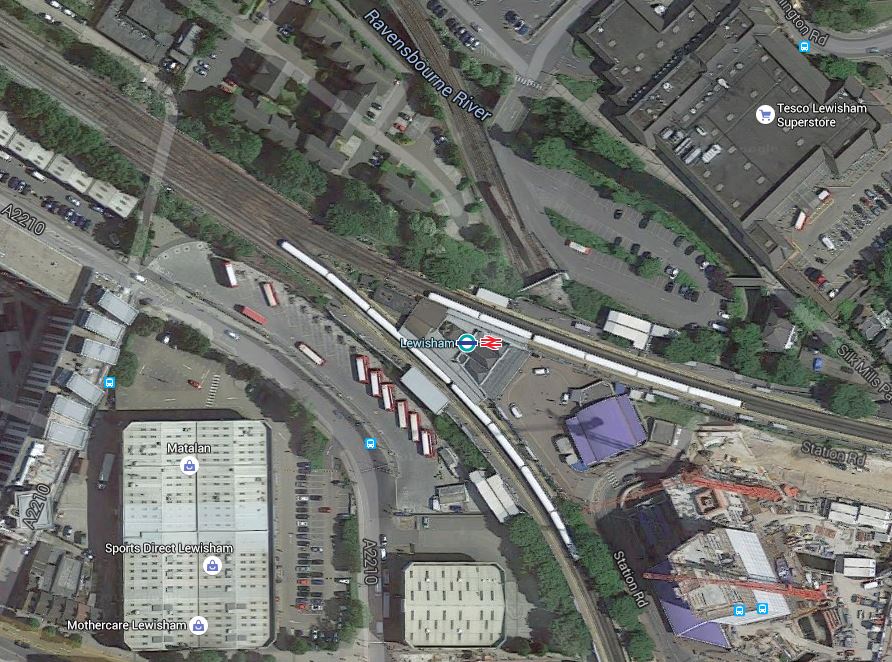
Lewisham Station
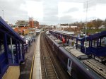
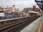
Note how there are two pairs of platforms, with one pair going off top the East towards Kent and another pair going South towards Beckenham and Hayes. These are pictures of the station.


According to a section called Services in the Wikipedia entry for the station, there are typical off-peak service in trains per hour.
- 4 to London Charing Cross
- 8 to London Cannon Street
- 2 to London Victoria
- 2 to Orpington
- 4 to London Cannon Street via Sidcup or via Bexleyheath both returning via Greenwich
- 2 to Hayes
- 4 to Dartford via Bexleyheath
- 2 to Gillingham via Woolwich Arsenal
In addition there are twelve services on the Docklands Light Railway to Bank
Some of these services come via New Cross.
It would seem to me, that if Transport for London achieve their aim of taking over some or all of Southeastern’s services, there could be scope for simplification, or even a simple extension of the historic New Cross service to Lewisham.
But if you look at the Google Map of the station, I think it would be very difficult to create a terminal platform.
So it would seem easier for services to go past Lewisham to stations like Hayes and Orpington.
Wandsworth Common Station
This was the destination of my walk today, where I took pictures for Crossrail 2 Consultation – Wandworth Common Shaft
It is a strange station with two fast and two slow lines, that probably hasn’t been looked at by an architect since the 1920s.
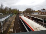
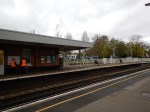


As you can see, it’s not a station for those who need step-free access and it also had one of the lsargest platform-train gaps I’ve seen in the UK.
Crossrail 2 Consultation – Wandsworth Common Shaft
This Crossrail document is entitled Wimbledon to Clapham Junction.
If contains a small section about a proposed shaft that will be built at Wandsworth Common. It says this about the two shafts between Clapham Junction and Wimbledon.
Between Wimbledon and Balham stations – one shaft in the Weir Road site and another within the Springfield Hospital development
Between Balham and Clapham Junction stations – one shaft on the eastern edge of Wandsworth Common, at the end of Honeywell Road.
A single worksite would be required to build each shaft and a typical shaft would take approximately five years to complete. Activity on site would fluctuate during this period. Once the site has been cleared and prepared, the major construction work to dig out the shaft would usually be complete within two years
This map from the Crossrail 2 document shows the position of the shaft at Wandsworth Common.
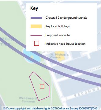
Wandsworth Common Shaft Site
This is a map of the rail lines as they pass the site.
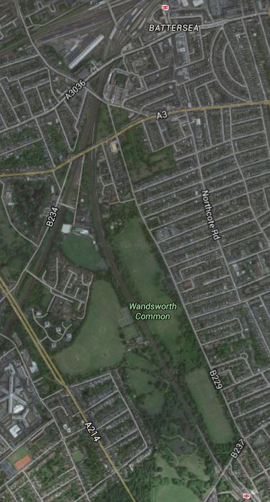
Between Clapham Junction And Wandsworth Common Stations
The shaft will be at the position, where the Google Map has the Wandsworth Common legend. The Crossrail 2 document says this.
The shaft would be on the eastern edge of Wandsworth Common, at the end of Honeywell Road (off Bolingbroke Grove). Our current preferred site has been selected because it is the only non-residential piece of land in the area which is large enough to allow construction of a shaft.
This morning I walked from Clapham Junction station at the top of the map to Wandsworth Common station at the bottom and took these pictures.


Most of my thoughts are in the comments for the pictures, but I would also add the following.
- The site of the shaft seems to have been chosen with care, so that no mature trees are affected. It’s all flat grass.
- I have a feeling that for Health and Safety reasons the designers like shafts in large open spaces. Crossrail trains hold 1,500 passengers. Evacuating them into Wandsworth Common or Mile End Park would be easier than say bringing them up in the City.
- Information appears to be very preliminary at the moment. That at Wimbledon is more detailed and I would expect more detail on Wandsworth Common in the future.
- I’d never been to Wandsworth Common before and what surprised me most, was that it appeared to be on top of a hill. I have a feeling that this could make the routing of the tunnel less complicated and it could be deeper under all the buildings.
The Head House
People worry, that they’ll get some awful head house on the shaft, like those for the Channel Tunnel Rail Link, which look like they were used as defences against Napoleon.
This shows the head house, that Crossrail is building in Mile End Park.

In fact the Mile End Park shaft, with an appropriate head house, would probably be closest to what is proposed to be built at Wandsworth Common.
- It will be a similar size underground.
- As head houses will be here for virtually ever, lots of care is taken in their design.
- They are both in large open spaces.
- They both have good road access on wide roads.
The shaft at Mile End Park was one of several designed by Fereday Pollard. Not all were actually built, as Crossrail cut a few out in the detailed design phase.
Construction
The biggest worry for many is the construction of the shafts.
This Google Map shows the site of the Mile End Park shaft under construction.
Mile End Park Shaft Site
I estimate the work site is around fifty metres across and has been deliberately positioned alongside the road.
The black hole is the actual shaft.
When I wrote How Will Crossrail 2 Affect De Beauvoir Town?, about how Crossrail 2 will affect where I live, I said this.
I’m pretty certain, that the digging of the southern shaft at Site A will be the only major part of the construction, that will affect De Beauvoir Town, as I suspect they’ll have to remove the spoil in a succession of trucks. I estimate there will be about 10,000 cubic metres of spoil to remove to create the hole for the shaft.
As the shaft at Wandsworth Common is probably the same size as that at Dalston, it would mean about a thousand truck loads, spread over the time that the shaft was being dug. Unless, they decide to use conveyors to move the spoil across the Common to the railway. I’m not sure what they did at Mile End, but I haven’t heard of any complaints.
The big difference between Wandsworth Common and a lot of the other sites, is that there will be no demolition.
It is a perfect green field site. I doubt there’s any gas mains or power cables across the site.
Conclusions
I think that everybody who lives in South London, will get lots more hassle from the large construction project at Wimbledon, where according to current plans, the station will be completely rebuilt for Crossrail 2.
If I lived near Wandsworth Common, I would start to think now, what would be appropriate for a head house to the shaft, as if cards are played right, then Crossrail 2 will provide it.
Wandsworth might like a temple in a garden.
This was actually built in the 1960s as the head house of a ventilation shaft for the Victoria Line in Gibson Square, Islington.
We need more whimsey!
Tram-Trains In Stockport
In the Proposed Systems section for the United Kingdom in the Wikipedia entry for tram-trains, there is a reference to tram-trains being proposed for Manchester to Marple.
I have also found this report on the Stockport Council web site, which is entitled Stockport Rail Strategy. The strategy has been developed by respected engineers; WSAtkins.
Search the report for tram-train and you get 35 hits, including references to Manchester to Marple.
The report also has this helpful map of tram-train routes in the Stockport area.
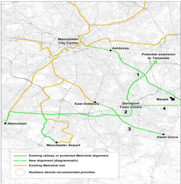
Possible Stockport Tram-Train Routes
I’ll look at some of the routes.
Manchester to Marple
Note that Manchester to Marple is given the highest priority of 1.
In Section 5.5.1 of the report, this is said about the Manchester to Marple route.
Manchester – Marple Metrolink would replace local rail services on the Manchester – Marple via Bredbury line with a more frequent service that would access the heart of Manchester City Centre. A further benefit of the scheme is that it contributes to relieving platform capacity constraints to Manchester Piccadilly, since the scheme would enter Piccadilly via the Metrolink platforms.
It also says it won’t go through Stockport Town Centre.
As the map shows the Manchester to Marple route goes via Ashburys station, which is to the South of the Etihad Stadium.as this Google Map shows.

Ashburys And Etihad Stadium
Note Ardwick and Ashburys stations on the line used by trains between Manchester Piccadilly and Rose Hill Msrple Marple stations.
A second Google Map shows the Etihad Campus tram stop, surrounded by various stadia, centres and arenas.

Etihad Campus
Note in both maps there is a rail line that leaves the rail line to the west of Ashburys station and goes north to the west of Etihad Campus.
This is one route that could be used to get tram-trains into the Manchester Metrolink.
In the Wikipedia entry for Ashburys station, this route is also proposed.
Significant new infrastructure works would be required between Piccadilly and Ashburys station, known as ‘Piccadilly Link’. It would be incorporated within a major mixed-use development by Grangefield Estates, known as ‘Chancellor Place’, around the former Mayfield Station site.
It would appear that both routes have their advantages.
But surely, the Etihad route has these specific ones.
- ,It would only need a connection between the rail line and the tram line to Etihad Campus.
- It doesn’t rely on the ever-changing fortunes and minds of large property companies to deliver the infrastructure on the Mayfield Station site.
- The route would not interfere with the addition of the two new platforms proposed for Manchester Piccadilly.
- The trams end up under Piccadilly station from where they could continue to any number of destinations.
- Manchester to Marple services are removed from the crowded Piccadilly station.
- A station or tram stop could be provided to the west of the Etihad Stadium, if that was required.
- Delivery of the scheme would be down mainly to Manchester Metrolink, Network Rail and the various councils, with perhaps some input from the owners of the Etihad Campus.
On a rough analysis, I suspect that going the Etihad route would be more affordable and a lot easier to bring to fruition.
The WSAtlins report also suggests this for tram-trains between Manchester and Marple.
Stockport station could be served by using the Stockport to Stalybridge Line.
- A proposed service would be five trains per hour from Manchester City Centre to both Stockport and Rose Hill Marple.
- There would be a tram-train every six minutes on the busiest part of the route between Reddish North and Manchester.
- Other services between Manchester and Marple would go via Hyde.
Obviously, there are questions to be asked.
- The tram-trains get to Manchester City Centre, but where do they go from there?
- Could we see a tram and tram-train interchange in Piccadilly Gardens, just as I saw in the centre of Kassel and wrote about in The Trams And Tram-Trains Of Kassel?
- Could Manchester’s tram network be used by a Class 399 tram-train, as is being trialled in Sheffield?
I can understand why the Manchester to Marple route was offered as a place to do the tram-train trial!
It strikes me, that if the costs add up, then it would be a good proposal.
Stockport To Tameside
The WSAtlins report says this about a link from Stockport to Tameside.
A further possibility utilising the proposed section of Metrolink route between Stockport and Reddish would be a direct link from Stockport to Tameside, possibly terminating in Ashton Town Centre.
Note the following.
- This would use the Stockport to Stalybridge Line, which currently has only one train a week on a Friday morning.
- The report gives this line a priority of 2.
- Tram-trains to Ashton Town Centre would go via Reddish South, Denton and Guide Bridge.
- There was also a station at Ashton Park Parade to the South of Ashton Town Centre.
- Ashton Town Centre has Ashton-under-Lyne station to the North.
- Ashton-under-Lyne Metrolink station is the terminus of the East Manchester Line and it has five trams per hour to Manchester City Centre.
- Stalybridge station, which is another natural terminus for tram-trains from Stockport, is served by services from Manchester Victoria to Huddersfield and the East.
This Google Map shows Ashton Town Centre.
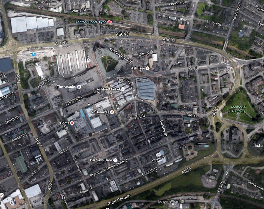
Ashton Town Centre
Note.
- The Stockport to Stalybridge Line at the bottom of the map.
- Park Parade is shown and I suspect Ashton Park Parade was in this area.
- Ashton-under-Lyne station at the top.
- Ashton-under-Lyne Metrolink station is in the top left of the map.
- Ashton-under-Lyne has a five trams per hour service to Manchester City Centre.
In my view, there are lots of possibilities to improve the transport links in Ashton Town Centre.
West of Stockport
The WSAtlins report discusses routes to the west of Stockport.
This group of routes would utilise the Stockport – Altrincham railway line west of Stockport Town Centre, which would be restored to a double-track formation with new stops being added in residential areas.
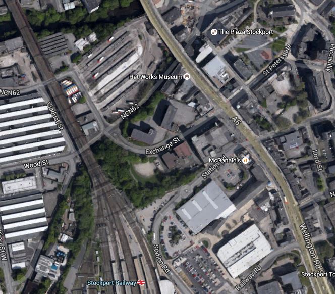
This Google Map shows Stockport station and Edgeley Junction.
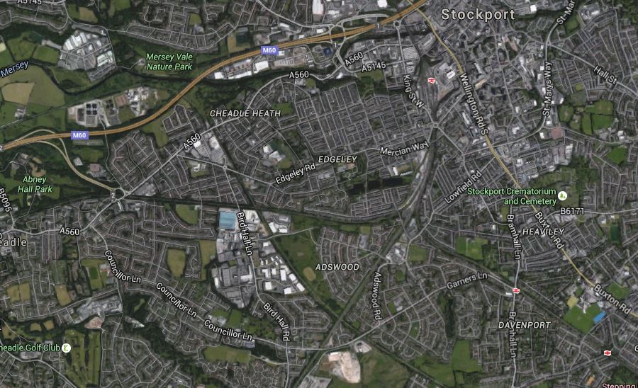
Stockport Station And Edgley Junction
The Mid-Cheshire Line, that goes between Stockport and Altrincham goes off to the west, passing south of Abney Hall Park and the Buxton Line goes to the south east, with stations at Davenport and Woodsmoor being visible.
The report also says this.
A new section of Metrolink route would be created from Stockport Interchange to the start of the Stockport – Altrincham railway line immediately south of Edgeley Junction. That would include a new stop adjacent to Stockport Station, fulfilling a long-held aspiration to provide a direct public transport link between Stockport Station and Stockport Interchange.
This Google Map shows the location of Stockport Interchange with respect to Stockport station.
Stockport Bus AndTrain Stations
Stockport Interchange is between the railway and the A6 towards the top and Stockport station is towards the bottom.
I suspect that given the layout of the Town Centre and the various modes of transport to connect, that an innovative solution will be needed.
- Stockport Interchange and Stockport station are about four hundred metres apart.
- Stockport station is on the thirty-three metre high, Grade 2* Listed Stockport Viaduct.
- Tram-trains from Manchester will come and go to the North.
- There could be five tram-trains per hour to each of Ashton and Manchester City Centre.
- Tram-trains from the Mid-Cheshire Line will come and go to the South.
- Was the new Platform 0 built to make the station more suitable for tram-train services?
A good design probably won’t be easy.
One solution would be to cut Platforms 0 and 1 in half, with the Northern ends accepting tram-trains from the North and the Southern ones, those from the South.
The area in between the two halves could be made into a small courtyard with seats, a coffee stall and a kiosk, so passengers arriving from the North would just walk to the court and wait for the appropriate tram-train to the south and vice-versa.
The tram-train platforms would also have level step-free access to Platform 2 for the expresses going South through Stockport.
Stockport to Manchester Airport
The WSAtkins report has a lot to say about the value of this route.
The main driver for the Stockport – Airport route is the expected transformation of Manchester Airport and its surrounding area into a multi-purpose regional economic hub. That will require a step-change in the proportion of trips to/from the area using non-car modes. A high proportion of trips travel to the area is from distances greater than 8km, for which stopping bus services cannot usually provide an attractive alternative to car travel, even with ambitious bus priority measures. TfGM indicated that there are many trips to the Airport that currently originate in or near Stockport.
It also says this about the route.
The route to the Airport would be achieved by a new curve at Baguley linking the Stockport – Altrincham line with the planned Manchester Airport Western Loop Metrolink line. TfGM has indicated that it expects many trips accessing the Manchester Airport area would interchange onto Metrolink from bus and heavy rail in Stockport Town Centre. The route would also facilitate access from its residential catchment to the national rail network at Stockport Station and at the proposed HS2 Station near Manchester Airport.
This Google Map shows the area to the north of Baguley Metrolink station.
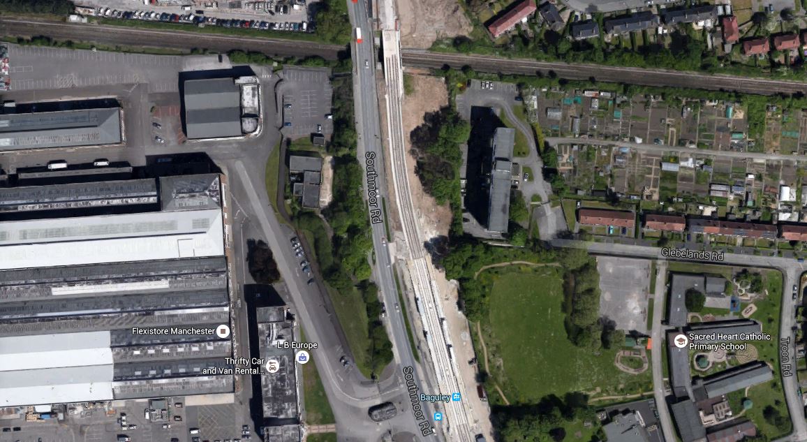
The Baguley Curve
The Stockport to Altrincham Line runs across the top and the scar down the middle is now the Airport Branch of the Manchester Metrolink.
Building a curve shows one of the useful advantages of tram-trains, which can turn tighter than a standard train.
The question has to be asked if tram-trains would run to the airport from both Althincham ans Stockport!
Stockport To Altrincham
The WSAtkins report has this to say about the route.
A Stockport – Altrincham service would connect residential areas on the Stockport – Altrincham corridor with both of their main local centres. The residential areas expected to benefit from new stops include Adswood, Cheadle Heath, Cheadle, and Gatley. The service would also improve the link between Altrincham and Stockport and its onward inter-urban rail connections.
I would assume that as nothing is menbtioned about the terminus at Althincham, this is not considered to have any issues.
Stockport To East Didsbury
Plans for this route have existed since the late 1990s. But following a southern raoute, rather than one along the Mersey could offer cost savings. The WSAtkins report has this to say about the new route.
This southern route from Stockport to East Didsbury would join the Hazel Grove to Sharston freight line via a new junction at Cheadle Heath, and then cross the River Mersey via a new alignment to East Didsbury. This has the potential to provide a new stop at Gorsey Bank, providing sustainable transport access to the proposed new development site. This route would provide Metrolink services to Manchester City Centre from the Edgeley and Adswood areas, and would provide much-improved connections from Stockport to Didsbury, Chorlton and Salford Quays and Trafford Park.
This Google Map shows the routes of the Stockport to Altrincham Line, the freight line from Hazel Grove to Sharston, the M60 Motporway and the River Mersey in the west of Stockport.
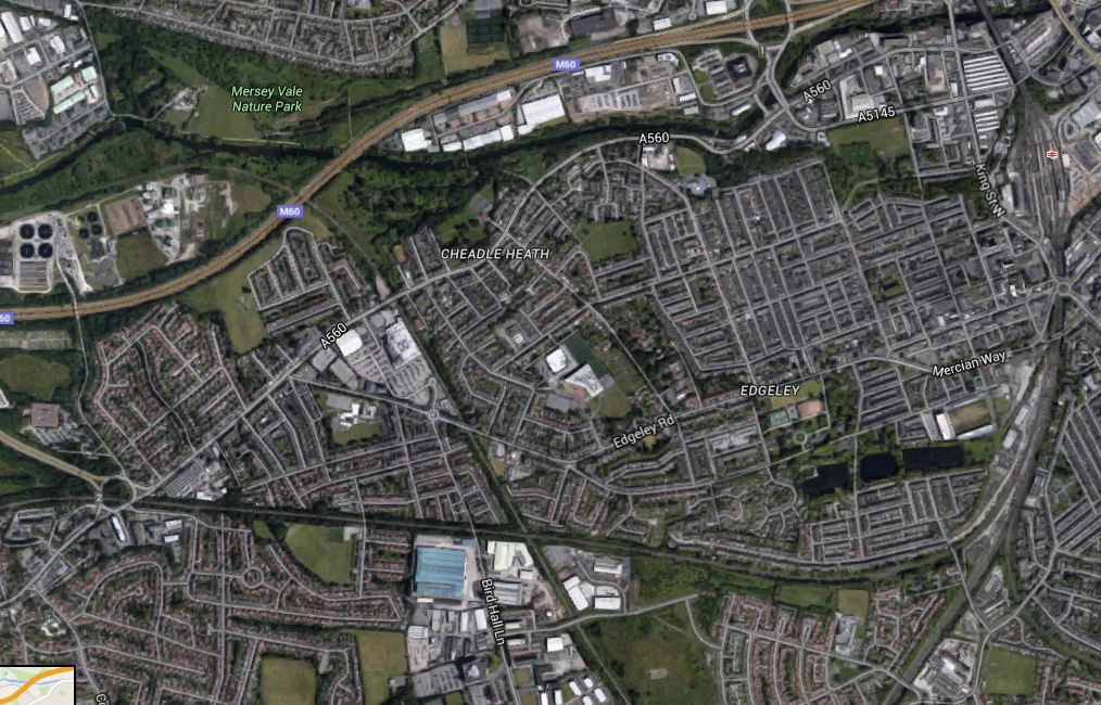
Stockport To East Didsbury
Note.
Stockport Station and Edgeley Junction in the East.
The Stockport to Altrincham Line runs horizontally across the map.
The freight line crosses the motorway, just to the right of the blue M60 label.
Towards A Circular Metrolink
The WSAtkins report says this.
With both the Manchester – Belle Vue – Marple/ Stockport and Stockport West routes built, a Manchester – Belle Vue – Stockport – Airport service could operate. This route would combine radial and orbital elements and could potentially be developed in the longer term into a more extensive orbital Metrolink system, for example by extending northwards beyond Reddish to Ashton-under-Lyne.
I suspect Manchester feels rather pleased that all those old railway lines across and around the city, weren’t dug up for housing and motorways.
Hazel Grove to East Didsbury
The WSAtkins report says this about running tram-trains betwen Hazel Grove station and East Didsbury Metrolink station.
The Hazel Grove to East Didsbury tram-train route would form an extension to the Manchester to East Didsbury Metrolink line, and would result in a Manchester – Hazel Grove Metrolink service.
It would utilise the following rail/ Metrolink lines.
- New Metrolink line from East Didsbury to Gorsey Bank, crossing the river Mersey to join the rail (presently freight only) line at a point north of the M60.
- Existing rail (presently freight only Sharston to Hazel Grove line) redoubled from Gorsey Bank to Hazel Grove.
The report also says this about the route.
It is envisaged that new stops would be provided at Gorsey Bank, Edgeley Lane, Davenport and Woodsmoor. The section of the scheme between East Didsbury and the existing Stockport-Altrincham rail line is identical to that proposed in the Stockport West group of routes, offering cost savings if both schemes were progressed. This service would not replace the existing heavy rail service but further work would be needed to define the appropriate mix of Metrolink and local rail services between Manchester and Hazel Grove.
So it looks like to create improved connectivity from East Didsbury can be delivered by tram-trains, some doubling of lines, electrification, signalling and devising a better timetable.
Tram-Trains Running On Manchester Metrolink
The WSAtkins report says this about possible constraints on running tram-trains on the Manchester Metrolink.
In Greater Manchester Metrolink has been developed by converting existing railway lines and disused rail alignments and building new on-street embedded rails. Metrolink therefore currently runs on a separate network to heavy rail, with an operating system managed on behalf of TfGM. The concept of a Metrolink type service utilising currently active heavy rail lines, which would continue to be used by trains as well as a Metrolink service, has been discussed for a number of years. This type of operation is referred to as ‘tramtrain’.
Tram-train is currently used in several locations in mainland Europe, and a pilot project in Sheffield was commissioned by the Department of Transport to consider the potential of adopting this approach in the United Kingdom. The pilot project is considering the technical issues but the actual running of a tram on a rail way has been delayed several times. The most recent timescale is to start running sometime in 2016.
The Greater Manchester Metrolink vehicles are of a different design to the Sheffield trams as they were designed to operate on converted heavy rail lines. As such, it is anticipated there may be fewer technical issues associated with tram-train operation in Greater Manchester. The outcome of the pilot is expected to influence the prospects for tram-train elsewhere in the UK.
I would hope that the Manchester Metrolink and the Sheffield Supertram, both decide to use the same tram-trains, as this would enable tram-trains to start in the centre of Sheffield and then run on the Hope Valley Line to Srockport and Manchester City Centre.
Conclusion
In my view, if the use of tram-trains happens in around Stockport, it would be a good thing for the area.
I would hope that the Manchester Metrolink and the Sheffield Supertram, both decide to use the same tram-train, as this would enable tram-trains to start in the centre of Sheffield and then run on the Hope Valley Line to Srockport and Manchester City Centre.
If the concept works and the tram-train tril is successful, Sheffield, Manchester and a lot of other places in the UK, are going to have tremendous fun with tram-trains.
T
Tram-Trains Hit The National Papers
Unless you live in Sheffield, the saga of the tram-train to Rotherham, will probably be unknown to you.
But today there is a balanced news item in The Times, which is entitled Tram-train plan to put commuters on track.
This is the first time, I’ve seen an item about tram-trains in the national media.
Perhaps, journalists are at last realising that the revolution is coming here!
Will The Canny Glaswegians Back Tram-Trains?
This article on Global Rail News is entitled Glasgow Planning Airport Tram-Train. This is said.
A tram-train, which would operate between Glasgow Central Station and Paisley Gilmour Street before moving onto a new light rail line to the airport, is the preferred option.
This Google Map shows the relationship between Paisley Gilmour Street station and the airport.
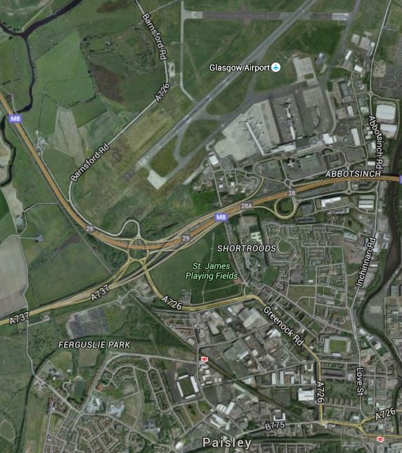
Glasgow Airport Tram-Train Link
Paisley Gilmour Street station is in the bottom right corner of the map and the Inverclyde Line runs past the Airport alongside the M8 Motorway, after passing through Paisley St. James station.
The article gives some interesting figures on the costs of the .link between Glasgow Central station and the Airport.
- A conventional rail link would cost £317million.
- A tram-train link would cost £144million
- A light rail rapid transit, which would need a change of vehicle at Paisley Gilmour Street would cost £102million.
These costs probably explain, why the Germans are building as many tram-train systems as they are!
Having seen tram-trains working in a number of German cities, I would choose a tram-train tomorrow.
These points should be noted.
- The tram-train trial between Sheffield and Rotherham should highlight the changes that would need to be made to existing stations, signalling and operation.
- The Class 399 tram-train, would probably be used. It is a standard German tram-train modified to run on our overhead line electrical voltage. Surprisingly, it is the Germans, who are non-standard.
- When running as trams, tram-trains have all of the tram’s agility to go round tight curves and sneak into cramped sites.
- When running as trains the performance of the Class 399 tram-trains is only marginally slower than the Class 314 trains, that current work the Inverclyde Line. So they would be able to mix it on the train line.
- Passengers will probably think that they’re on a train, that is perhaps a bit different.
- Liverpool are seriously thinking of using tram-trains to connect to Liverpool Airport.
The only unusual thing in the proposed Glasgow and Liverpool tram-train systems, is that tram-trains are running as trains for most of their routes, except for the branch into the airport.
Normally tram-trains run as trains outside of the City Centre and as trams inside it. But then both Liverpool and Glsasgow don’t have any other tram system.
