More Government Details Emerge On How Fleetwood’s Rail Link Will Be Restored – Using Tram-Train Technology
The title of this post, is the same as that of this article on the Blackpool Gazette.
This is the sub-heading.
New details have emerged about how the Government plans to restore the rail link between Fleetwood and Poulton using state-of-the-art tram-train technology.
These are points from the article, which mainly come from a letter to the local MP; Paul Maynard.
- In a letter to Mr Maynard, Rail Minister Huw Merriman has set out for the first time how the Government intends to restore the rail link.
- The Government is now looking at the finer details of a tram-train scheme and how the project can be funded.
- Tram-trains will be used for the link.
- The re-opened railway can be linked into the existing Blackpool to Fleetwood tramway, allowing services to run into the heart of Fleetwood.
- Services would operate twice hourly from Preston station to Poulton-le-Fylde over the existing heavy rail network, before joining a new light rail link between Poulton-le-Fylde and the Denham Way roundabout on Amounderness Way, calling at up to three new intermediate stops.
- From the roundabout, the services would continue on the existing Blackpool tram network towards Fleetwood town centre and Fleetwood ferry terminal.
- The Government is committed to the project.
These are my detailed thoughts.
The Route
The Blackpool Gazette article describes the route like this.
Services would operate twice hourly from Preston station to Poulton-le-Fylde over the existing heavy rail network, before joining a new light rail link between Poulton-le-Fylde and the Denham Way roundabout on Amounderness Way, calling at up to three new intermediate stops.
From the roundabout, the services would continue on the existing Blackpool tram network towards Fleetwood town centre and Fleetwood ferry terminal.
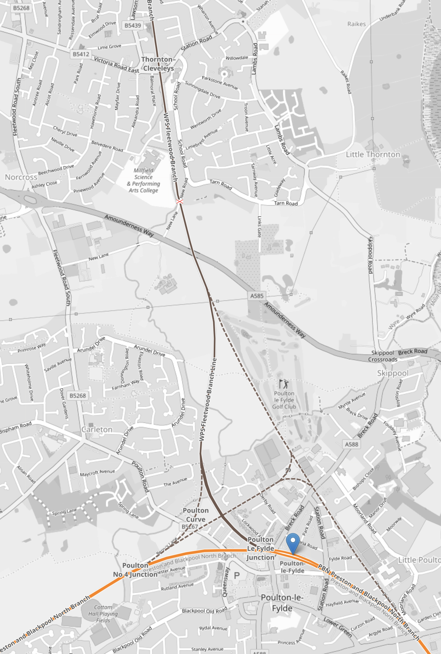
This map from OpenRailwayMap shows the route.
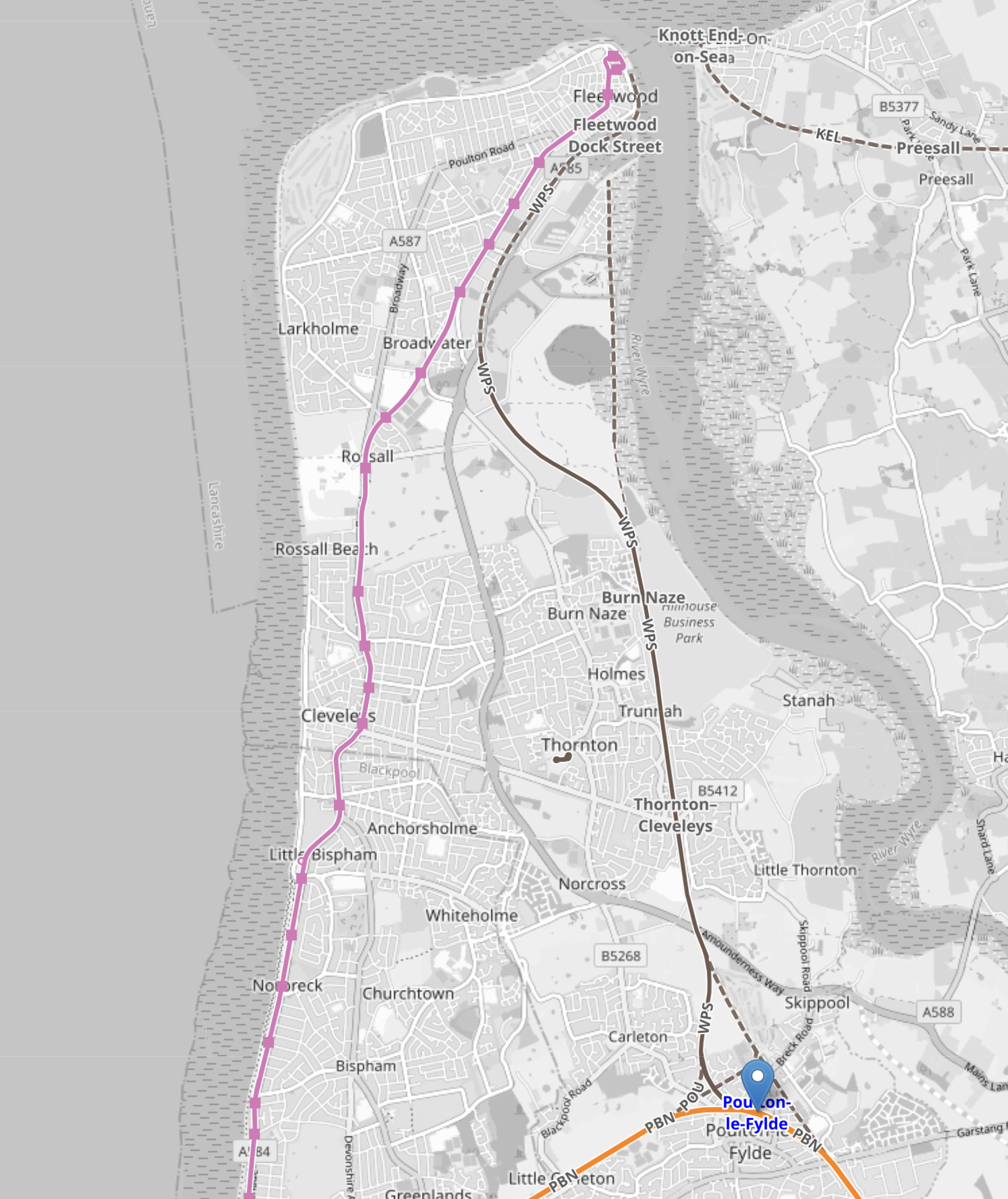
Note.
- Poulton-le-Fylde station is marked by the blue arrow in the South-East corner of the map.
- The pink line running up the coast is the Blackpool tramway.
- The Blackpool tramway terminates at Fleetwood Ferry at the top of the map.
This second OpenRailwayMap shows Fleetwood Ferry tram terminus.
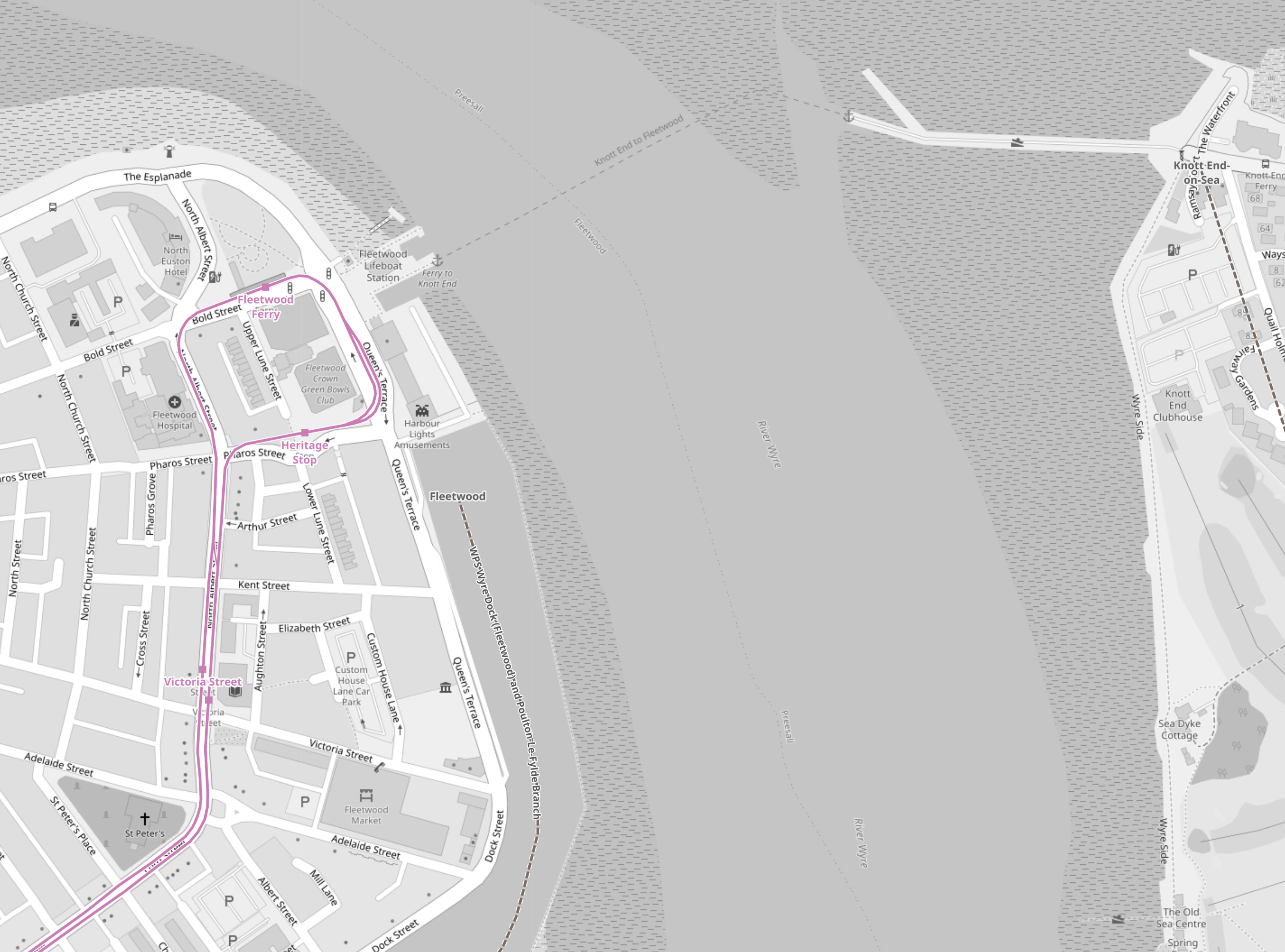
Note.
- As before, the Blackpool tramway tracks are shown in pink.
- There is a lifeboat station and a ferry to the other side.
- The tracks allow a tram to come from the South, go round the loop and return to the South.
- I believe that both the Blackpool tramway and the Fleetwood tram-train will both reverse direction in the same way.
- No new infrastructure would be needed at the Fleetwood Ferry terminal, except for perhaps a few signs.
This third OpenRailwayMap shows the track from Fleetwood Ferry to the Lindel Road tram stop.
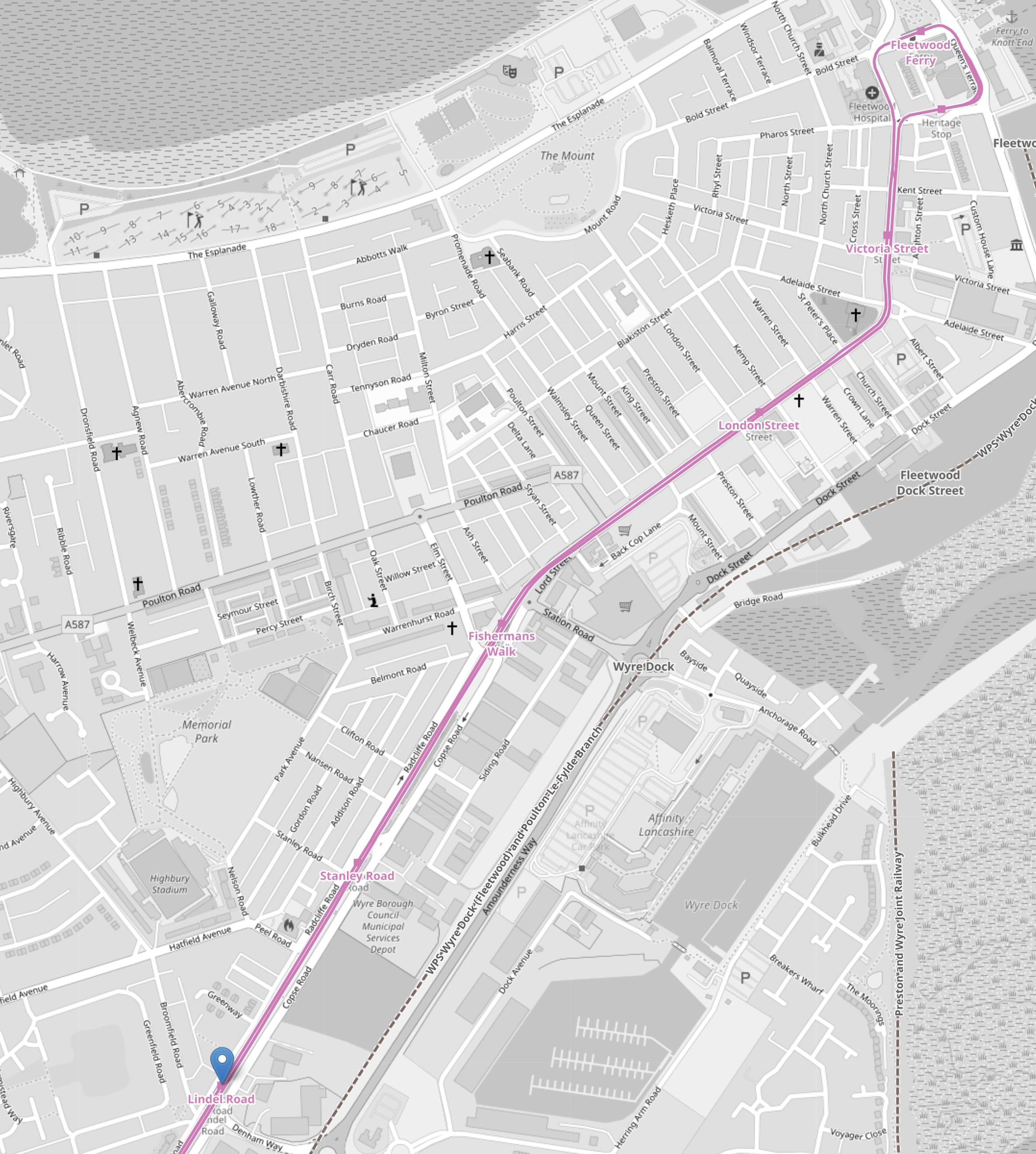
Note.
- As before, the Blackpool tramway tracks are shown in pink.
- Fleetwood Ferry is in the North-East corner if the map.
- Lindel Road tram stop is marked by the blue arrow in the South-West corner if the map.
This fourth OpenRailwayMap shows the Lindel Road tram stop area at a larger scale.
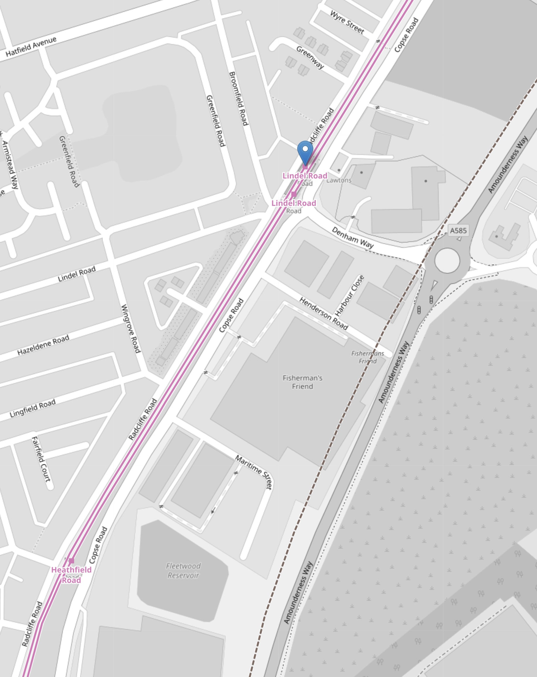
Note.
- As before, the Blackpool tramway tracks are shown in pink.
- Lindel Road tram stop is marked by the blue arrow.
- Running parallel to and to the East of the Blackpool tramway is Amounderness Way, which appears to have been built on the line of the railway to Fleetwood.
- Along the West side of Amounderness Way, a disused railway is indicated, which must be the closed railway to Fleetwood.
I believe that Network Rail or their engineers have found a route to connect the old branch line to the Blackpool tramway.
- The railway connecting the Blackpool tramway and the closed railway to Fleetwood, would only need to be single-track.
- There might be a convenient route, where all the land is owned by the Council.
- If the tram-trains were to be was fitted batteries, then there would be no need to electrify the line.
I suspect, that the connection would be to the South of Lindel Road tram stop.
- This would mean that the tram-train would serve a number of stops in the town centre.
- The tram-train could use the catenary of the Blackpool tramway.
- Connection and disconnection to the catenary could be done in the Lindel Road tram stop.
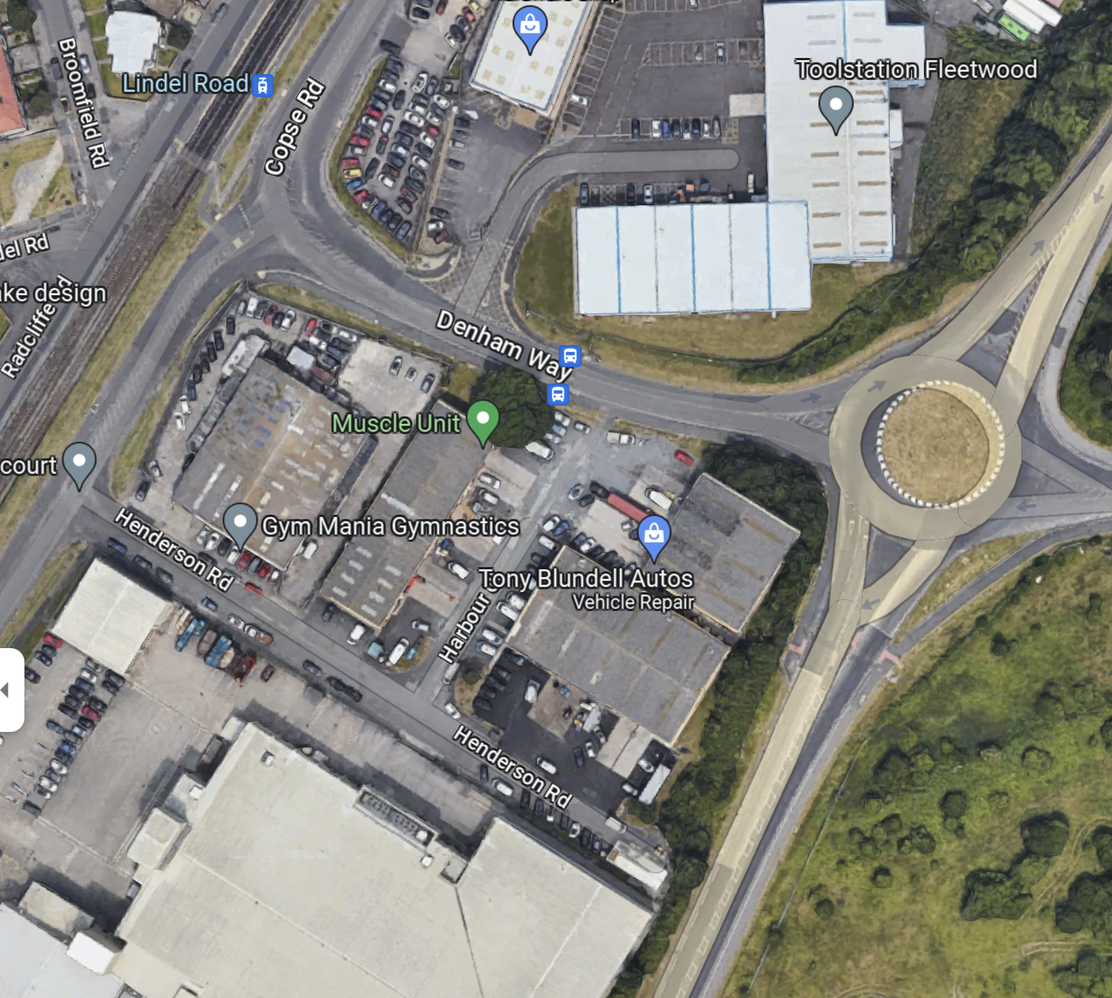
This Google Map shows the area of the Lindel Road tram stop and Denham Road.
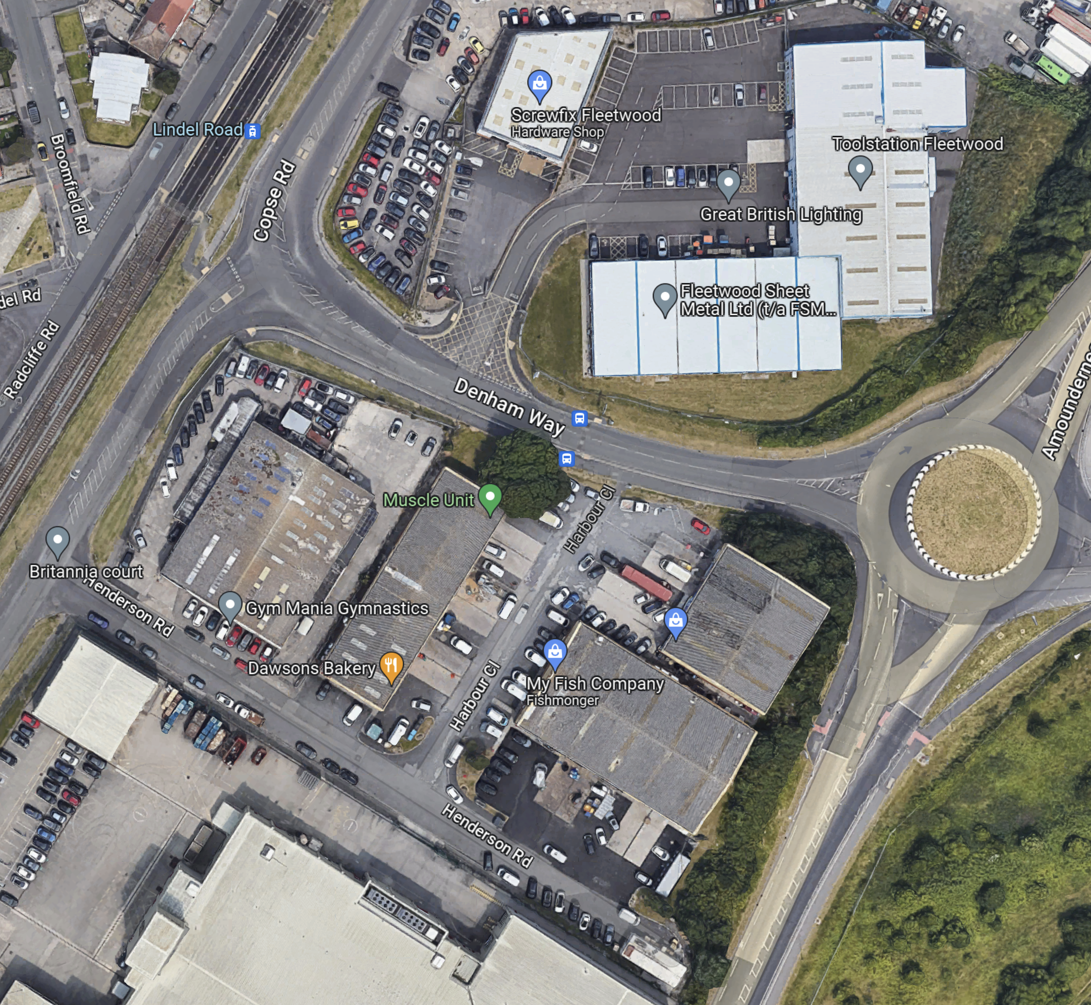
Note.
- The Lindel Road tram stop in the North-West corner of the map, with the Blackpool tramway running NE-SW across the corner of the map.
- The roundabout and Amounderness Way on the East side of the map.
- Denham Way connecting the roundabout to Copse Road and the tram stop.
- On the fourth OpenRailwayMap it showed the original line of the railway was to the West of Amounderness Way.
So could the spur between the Lindel Road tram stop and the railway to Poulton-le-Fylde station take the following route?
- Just South of the tram stop the two tracks connect to a new single-track that goes East on the South side of Denham Way.
- The turn would be quite sharp, but trams and tram-trains have the articulation of a snake and can use tight turns and narrow formations.
- The crossing of Copse Road would be protected by traffic lights.
When the tram-train gets to the roundabout other end of Denham way, I think there are two choices.
- Turn sharp right and go South alongside the West side of Amounderness Way.
- Somehow cross Amounderness Way and go down the West side.
This Google Map Amounderness Way going South.
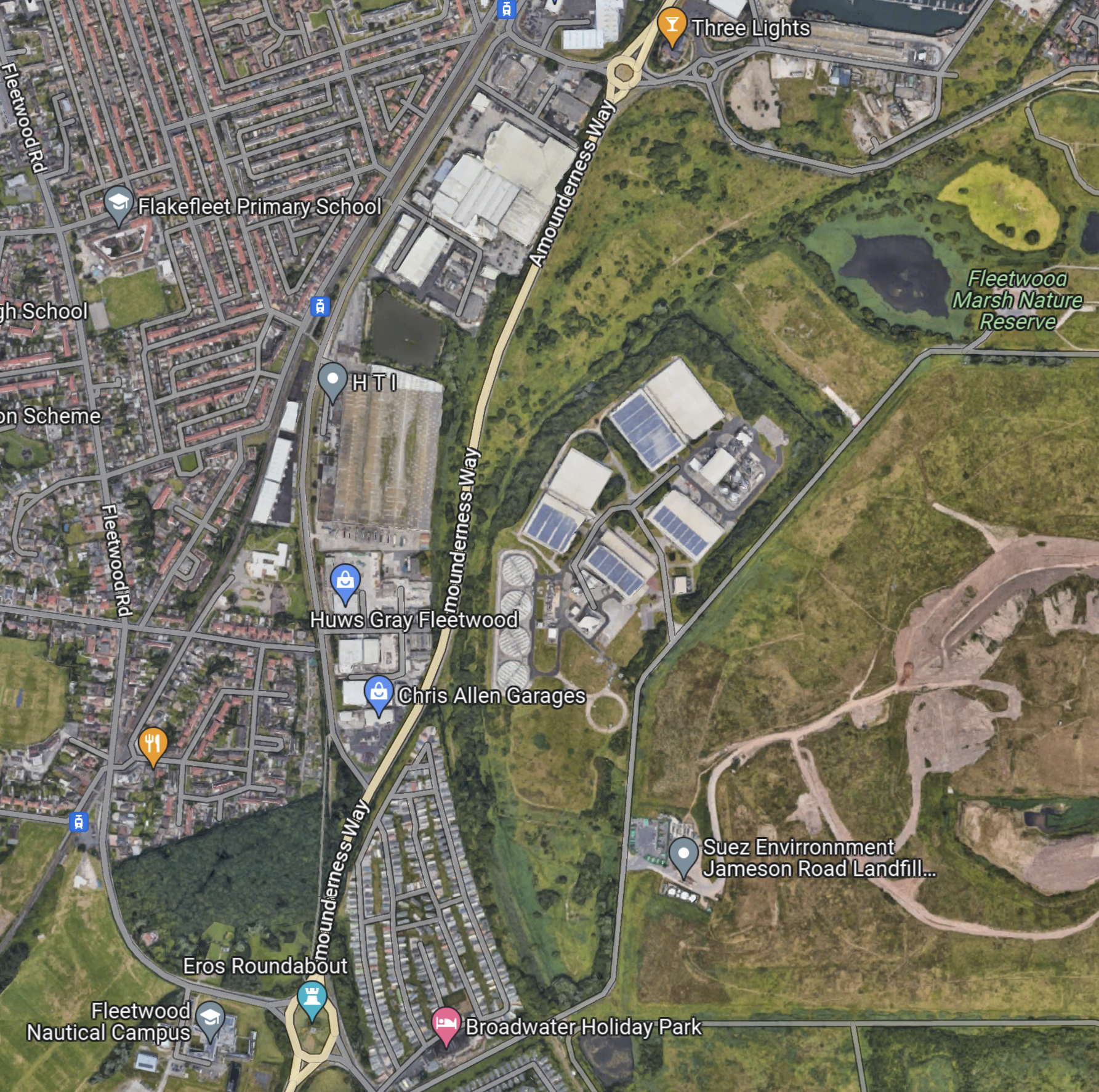
Note.
- Amounderness Way runs North-South down the map between two roundabouts.
- The large industrial area to the East of the road is labelled as SUEZ Recycling and Recovery.
- North-East of SUEZ is Fleetwood Marsh Nature Reserve.
- South-East of SUEZ is SUEZ Environmental Jameson Road Landfill and Lancashire County Council’s Fleetwood Household Waste Recycling Centre.
- There also seem to be a lot of large holiday caravans.
- There is a road running along the South-East of the large SUEZ site called Jameson Road.
The Wikipedia entry for the Fleetwood branch line, says this about the state of the branch.
Some of the line is now cleared of overgrowth because the northern track was not lifted from past Burn Naze Halt to just beyond Jameson Road Fleetwood. However, the road bridge was filled in below it. The junction, last used when goods trains took coal to Fleetwood Power Station, still exists. Looking over the road bridge on Jameson Road, the track to both north & south can still be seen through the undergrowth. In the 1990s, the new A585 The Amounderness Way bypass has been built on the former trackbed, although sufficient space still exists for a reinstated railway should it be required.
Note.
- It appears that enough space has been left at the Northern end to connect to the Blackpool tramway.
- It doesn’t seem to be in too bad a state.
- I suspect that rebuilding the branch has a similar degree of difficulty to rebuilding the Dartmoor Line to Okehampton, which is now operating successfully.
This gave me hope, that a single-track tramway could be built between Poulton-le-Fylde junction and the Lindel Road tram stop.
This Google Map shows the track meeting the filled in road bridge on Jameson Road.
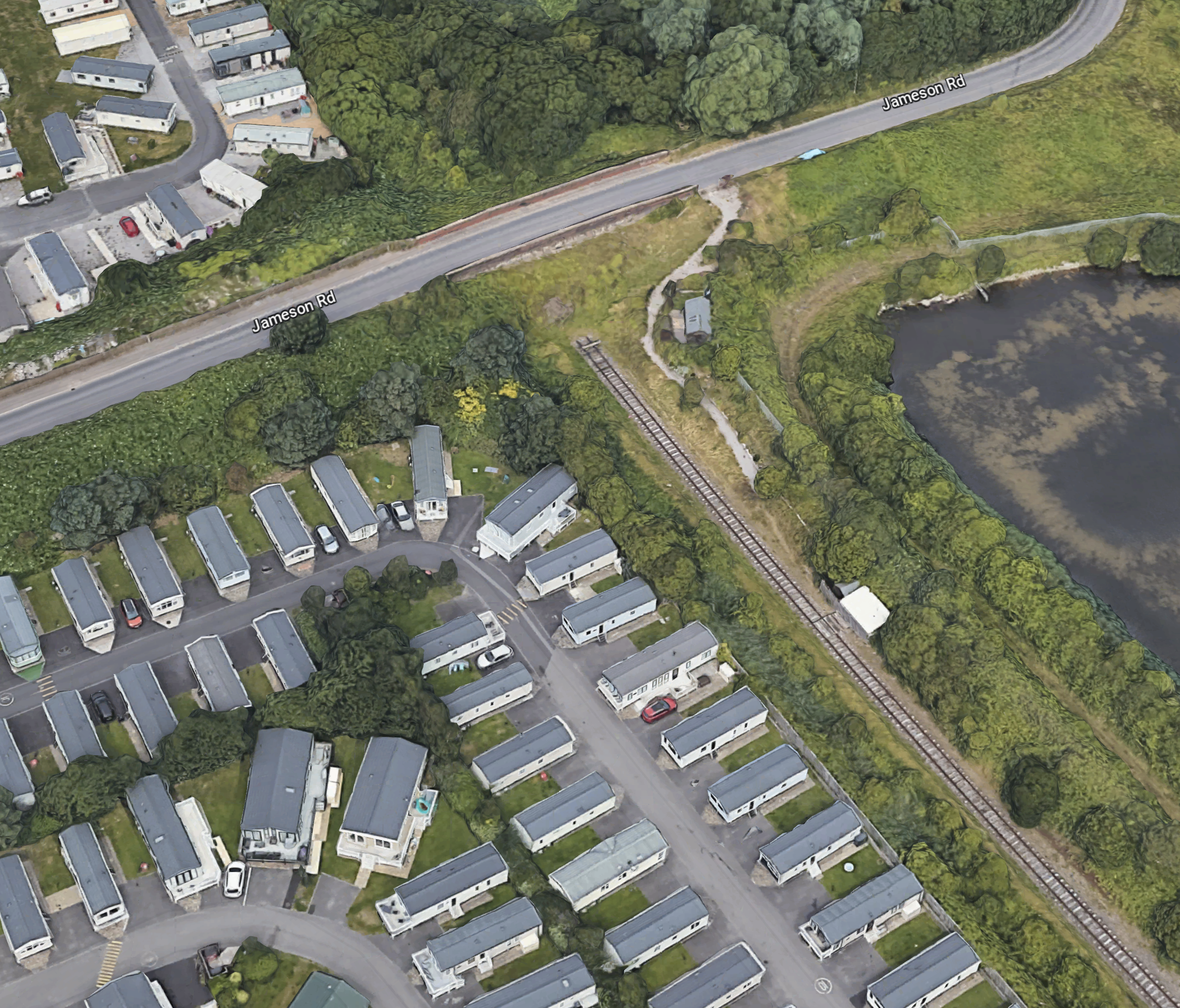
Note.
- If that’s not a single-track railway and the filled-in bridge on Jameson Road, I’m a Dutchman.
- The railway can be followed on Google Maps for most of the way to Poulton-le-Fylde station.
- Google Maps also shows traces of railway to the North of the bridge on Jameson Road.
This Google Map shows the section of Amounderness Way from the North of the SUEZ Recycling and Recovery site to the Denham Way roundabout.
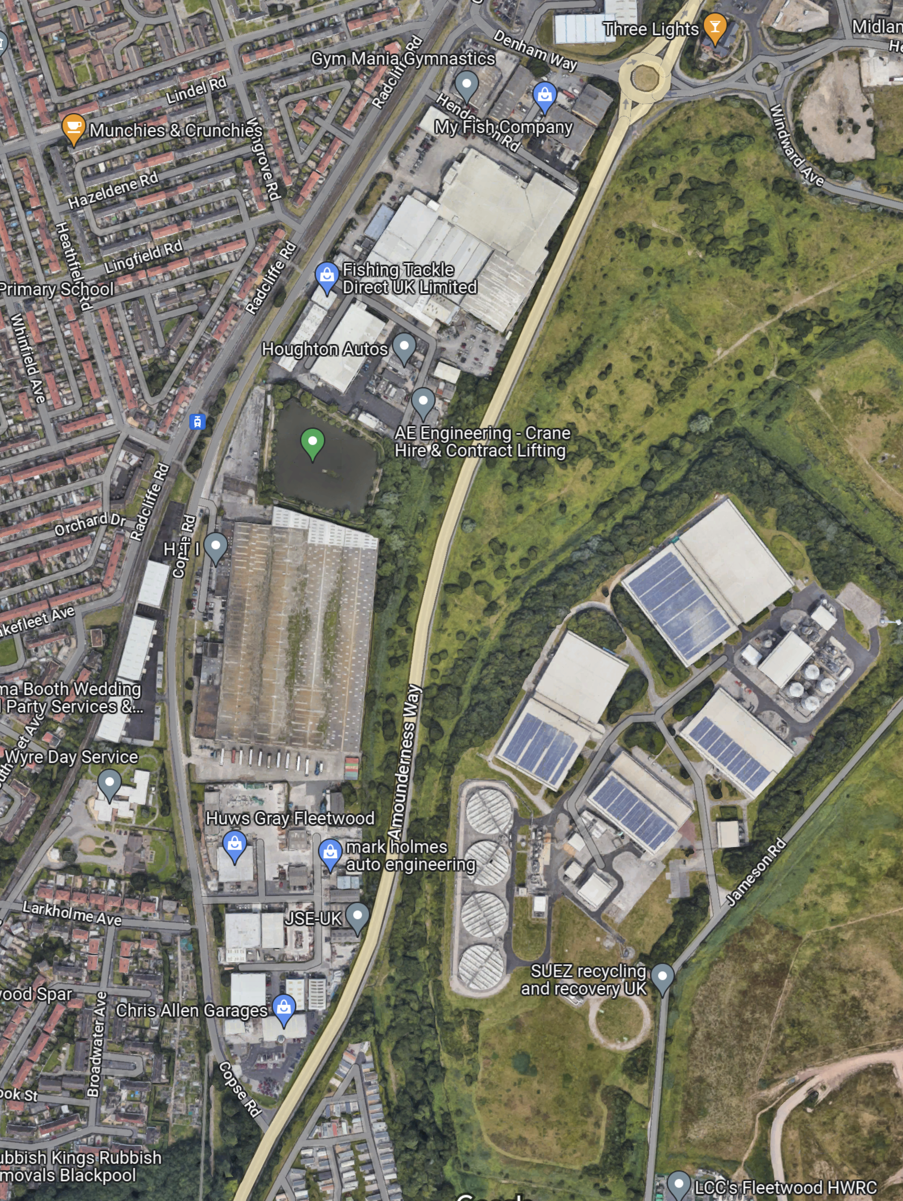
I suspect that the tram would go straight up the East side of ‘Amounderness Way.
But how would the tramway cross the road.
This Google Map shows Denham Way, the roundabout and Lindel Road tram stop.
I am fairly sure that a single-track bridge of some sort could connect Lindel Road tram stop with a single-track railway along the East side of Amounderness Way, to link up with the orphaned track South of Jameson Road.
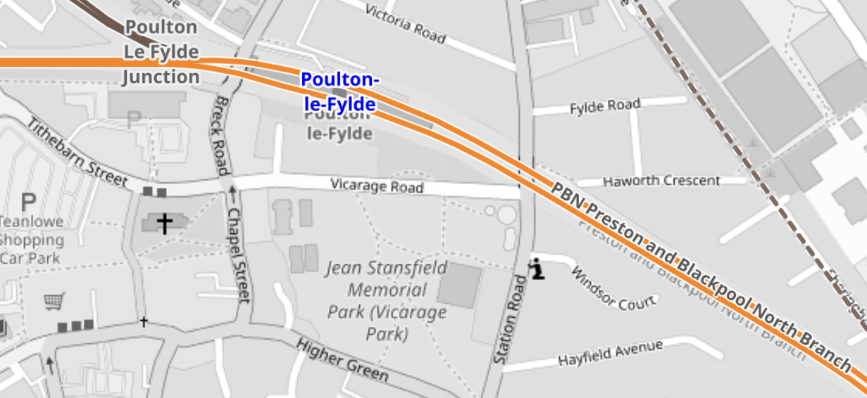
This OpenRailwayMap shows Poulton-le-Fylde junction, where the former railway to Fleetwood, joins the Blackpool branch.
Note.
- Poulton-le-Fylde station is indicated by the blue arrow.
- The orange track is the Blackpool branch to Blackpool North station.
- Poulton-le-Fylde junction is to the West of the station.
- The track going North from the junction, is the disused track to Fleetwood.
- The map also shows a couple of level crossings.
I am fairly certain, that a single-track tramway could be built between Poulton-le-Fylde junction and the Lindel Road tram stop.
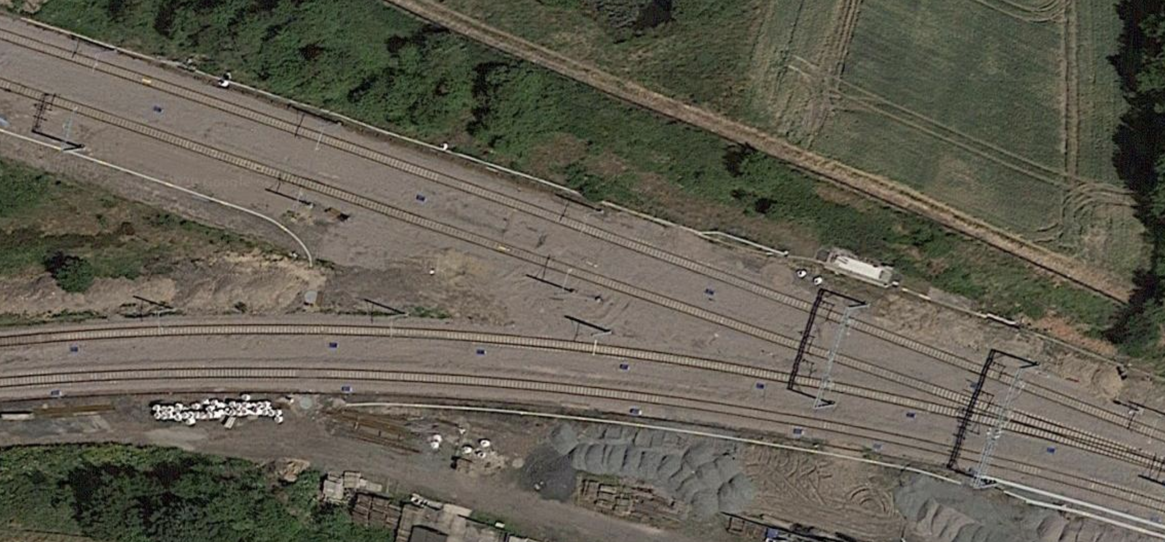
This OpenRailwayMap shows Poulton-le-Fylde junction and Poulton-le-Fylde station.
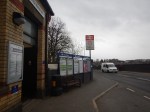
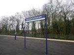
These pictures taken in 2018, show Poulton-le-Fylde station.
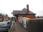
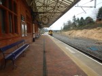
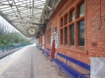
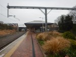
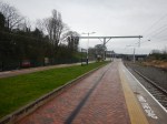
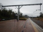
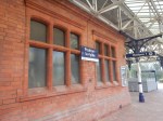
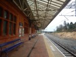
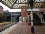
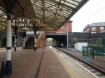
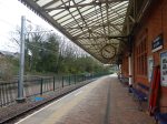
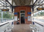
Note.
- It is a small station, that oozes quality.
- The tracks and electrification were all installed or renewed in the last few years.
- There is even a cafe and a lift to the street.
- The flower-beds in the middle of the platform, are at the Preston end of the station.
- As the tram-trains will stop in the station, they can raise and lower the pantograph in the station.
- Tram-trains and trains will share the appropriate platform.
The possibility can probably be arranged that an incoming train to Blackpool North will be able to drop passengers at a waiting tram-train for Fleetwood Ferry.
Will The New Fleetwood Branch Be Electrified?
There are various arguments for and against electrification between Poulton-le-Fylde station and the Lindel Road tram stop.
In favour, is that a continuous catenary can be run from end-to end, with 750 VDC electrification.
- An insulated section would be used at Poulton-le-Fylde station to separate the 750 VDC of the tramway and the 25 KVAC of the Blackpool branch.
- Standard tram-trains, like Sheffield’s Class 399 tram-trains could be used.
- Battery-electric tram-trains are probably more expensive.
Against electrification are.
- There would be no electrification between Poulton-le-Fylde station and the Lindel Road tram stop to install.
- There would be no need for any modifications to the catenary at Poulton-le-Fylde station and the Lindel Road tram stop.
- The filled in bridge mentioned in Wikipedia, might only need a tram-sized hole and not complete rebuilding to get the trams through.
- Occasional freight trains could probably be run, if required.
- Battery-electric tram-trains are proven technology.
It will definitely one for the accountants to decide.
The Tram-Trains
These are pictures of Stadler Citylink tram-trains in Sheffield.
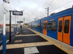

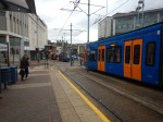
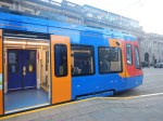
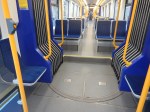

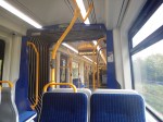
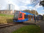
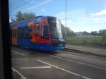

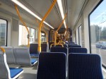
Note.
- These Class 399 tram-trains were the first tram-trains to run in the UK, when they entered service in 2017.
- They were built by Stadler in Spain.
- They share the tracks in Sheffield happily with Sheffield’s other trams of a different type.
- At the time, Paul Maynard, who is the local MP, was the Parliamentary Under Secretary of State for Transport, so I suspect that explains, why the MP appears pleased with the choice of tram-trains and talks knowledgeably about them.
- There is also a battery electric version of these tram-trains, which has been ordered by the South Wales Metro.
- Blackpool’s tramway uses Bombardier Flexity 2 trams. However, it doesn’t seem, that there is a tram-train version of the Flexity 2.
- Merseyrail in the Liverpool area, are introducing a large fleet of Stadler trains, which will be running to Preston in a couple of years.
I suspect that these tram-trains will be built by Stadler and they could be fitted with batteries.
Tram-Train Frequency Between Fleetwood Ferry And Poulton-le-Fylde Station
The Blackpool Gazette article is definite, that the frequency of the tram-train will be two trains per hour (tph).
Consider.
- The Blackpool tramway operates a service of trams every 10-15 minutes between Starr Gate and Fleetwood Ferry, so the frequency will be increased by two tph North of Lindel Road tram stop.
- As heritage trams also share the route to Fleetwood, I suspect that at some busy times, the Fleetwood Ferry and Preston service could be reduced to hourly.
- But it does look to me, that the all-important terminal at Fleetwood Ferry has been well-designed and can handle the extra traffic.
- Looking at the timetable for the Blackpool tramway, trams take forty-one minutes between Fleetwood Ferry and the North Pier.
- As Poulton-le-Fylde station and North Pier tram stop, are probably similar distances from Fleetwood Ferry, I suspect that Poulton-le-Fylde station and Fleetwood Ferry would take thirty minutes or more.
- Real Time Trains indicates that electric trains to Blackpool North station take around 16-17 minutes between Poulton-le-Fylde and Preston stations, with diesel trains taking a couple of minutes more.
- Add in time for stops at Kirkham & Wesham, possibly another at Salwick and cleaning and crew changeover at Preston station, I suspect that a roundtrip from Preston to Fleetwood Ferry and back will take a very convenient two hours.
A two hour round trip and two tph, will mean four trains will be needed to work the timetable.
I can’t prove it, but I my gut feeling is that there there will be a passing loop somewhere between Poulton-le-Fylde station and the Lindel Road tram stop.
The passing loop would also give scope for operational flexibility.
Train Services Through Poulton-le-Fylde Station
Train services through Poulton-le-Fylde station are currently as follows.
- Avanti West Coast – London Euston and Blackpool North – 1 train per day (tpd)
- Northern – Liverpool Lime Street and Blackpool North – 1 tph
- Northern – Manchester Airport and Blackpool North – 2 tph
- Northern – York and Blackpool North – 1 tph
Note that all trains stop at Preston.
The Avanti West Coast service only calls Southbound, but I wouldn’t be surprised, if the Fleetwood tram-train is built, that Avanti West Coast started a Northbound service.
Could The Blackpool South Branch Be Served By Similar Tram-Trains?
In Beeching Reversal – South Fylde Line Passing Loop, I talked about improving the Blackpool South branch.
Objectives included.
- Two tph.
- Better trains.
- A passing loop that would enable the 2 tph.
Note.
- Pacers have been replaced with Class 150 trains.
- The route is electrified between Preston and Kirkham & Wesham station.
- 12.2 miles are without electrification.
It certainly would seem possible that if a battery-electric tram-train had sufficient range, it could handle the current route to Blackpool South station.
The trams would have a ninety-minute round trip between Preston an Blackpool South stations and two tph, will mean three trains will be needed to work the timetable.
The MP is quoted in the Blackpool Gazette article, as liking the concept of a tram loop to Blackpool from Preston.
Trams might go to Fleetwood, down the promenade and then take the Blackpool South branch beck to Preston.
It could obviously go the other way around the loop.
This Google Map shows the location of Blackpool South station.
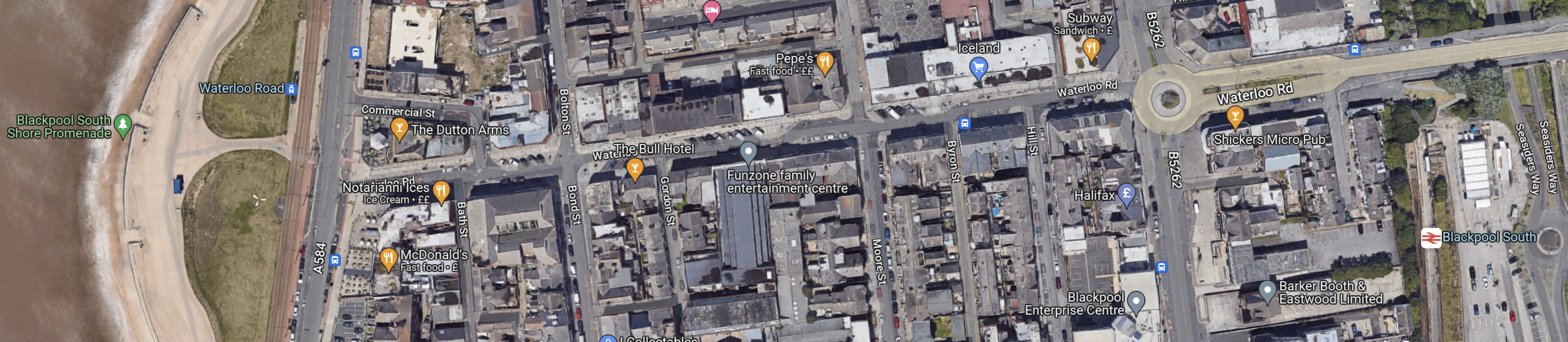
Note.
At the West side of the map is the promenade, with tramway running North and South.
At the East side of the map is Blackpool South station.
The walking route between the tramway and the station is not arduous, but it is not a seamless transfer.
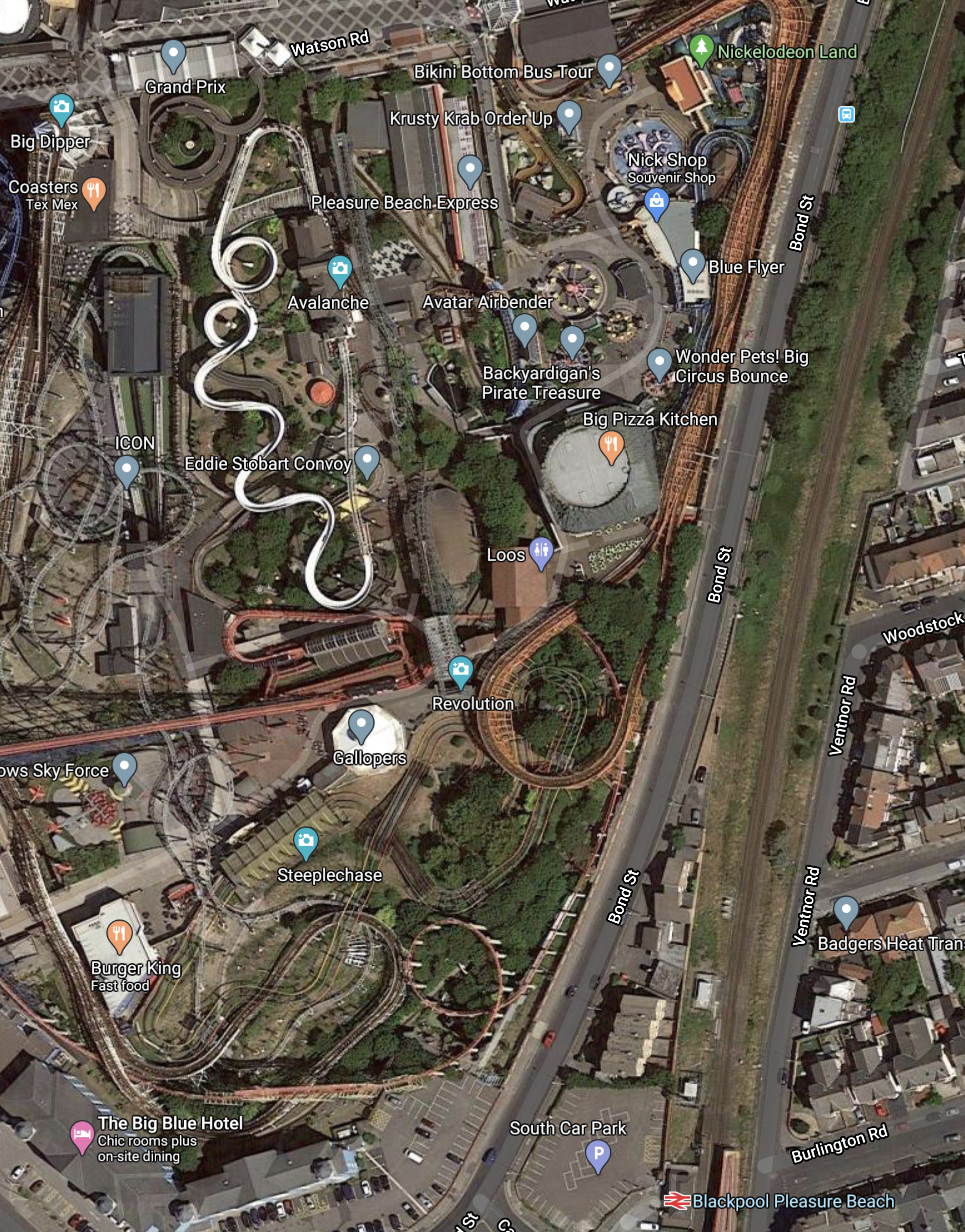
It might be better to make the connection at Blackpool Pleasure Beach, which is shown in this Google Map.
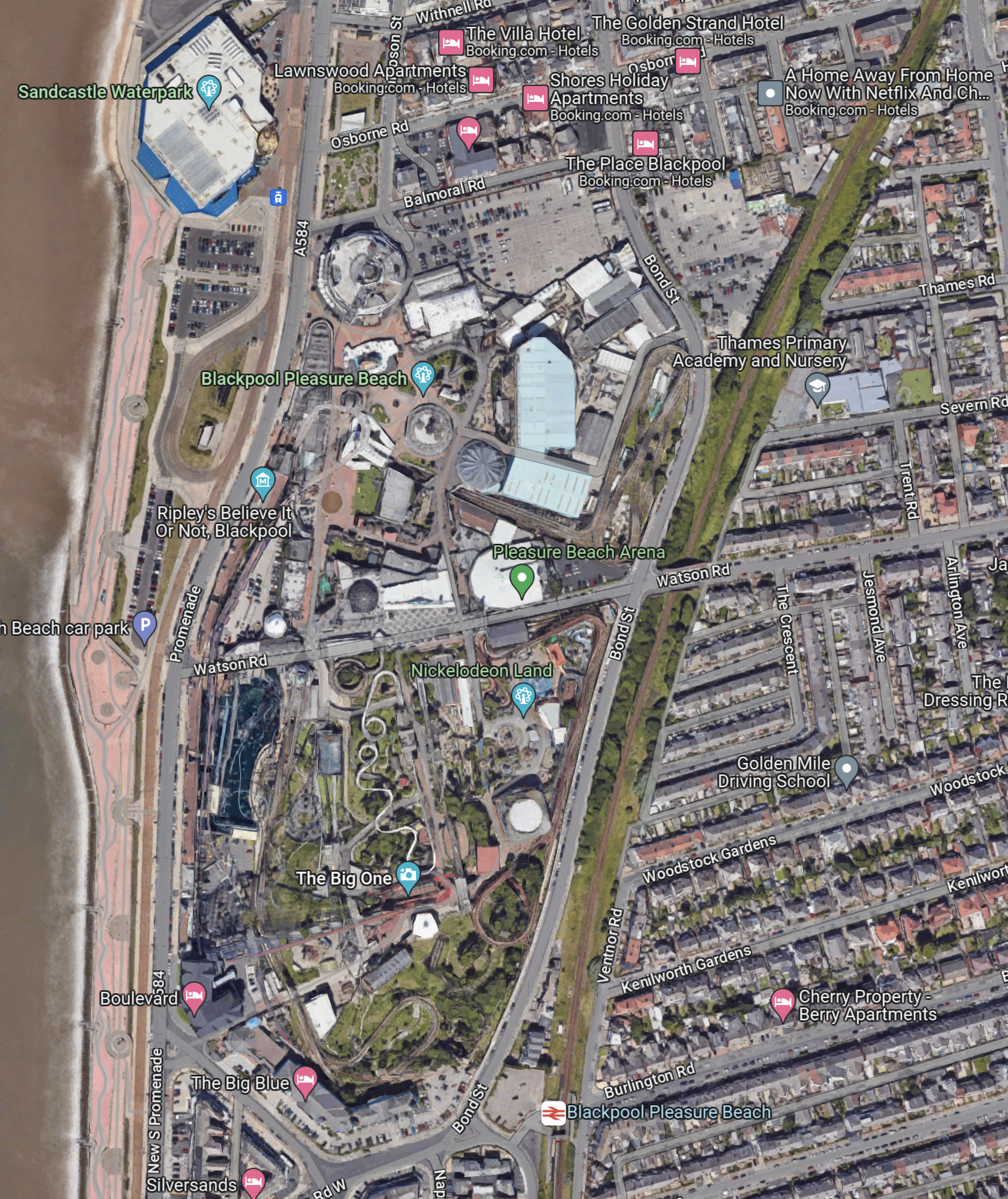
Note.
- The Pleasure Beach lies between the tramway and the promenade by the beach and the Blackpool South branch on the East side.
- There are two stops on the tramway and a station just to the South.
Perhaps, if the Pleasure Beach were redeveloping an area, they might leave provision for tram-trains to to sneak through to join the tramway going North.
But it’s a difficult problem, as there is not much space, that is undeveloped and the roads aren’t very wide.
This Google Map shows the North Pier and Blackpool North station.
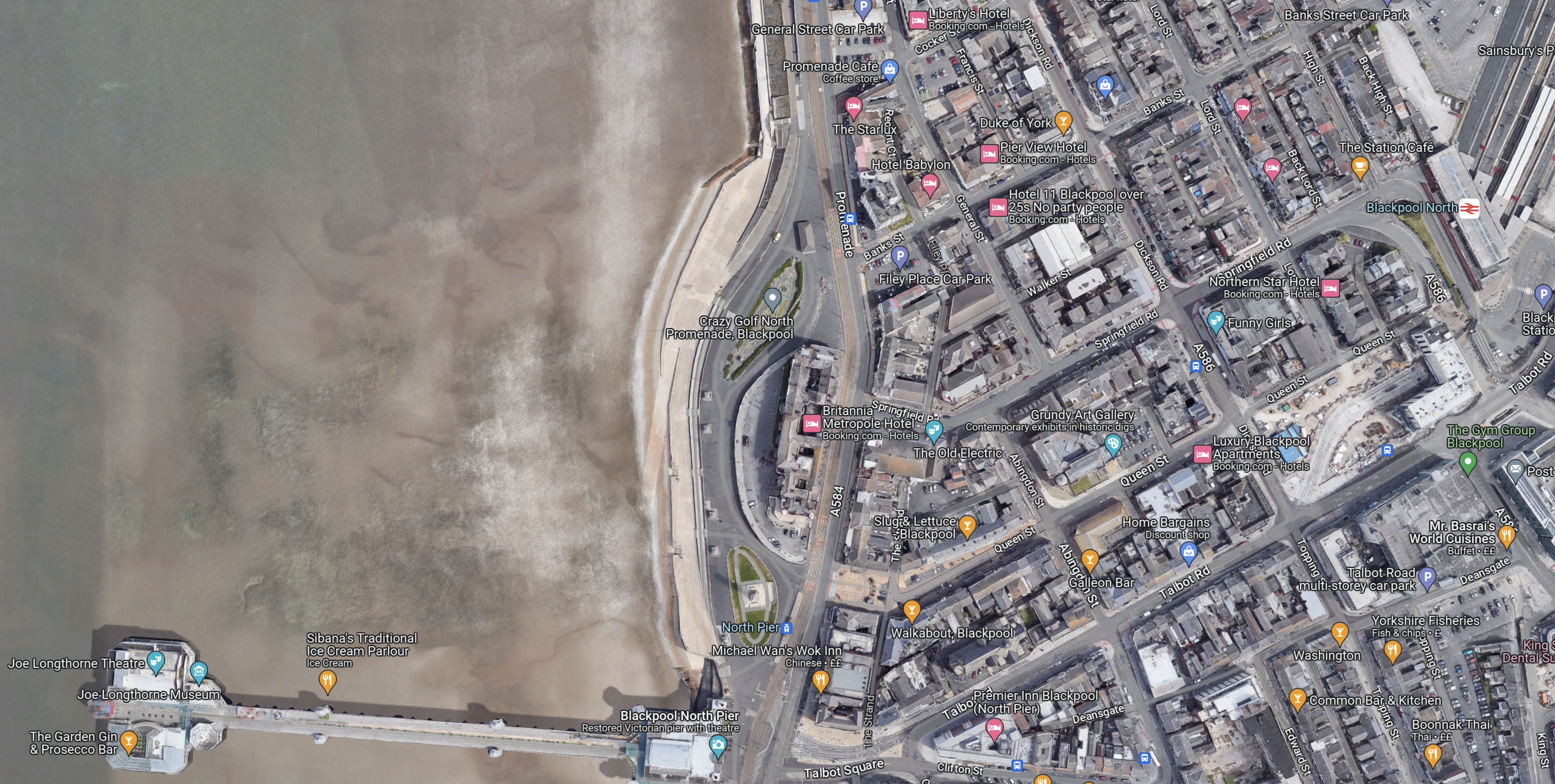
Note.
- The North Pier is in the South-West corner of the map.
- Blackpool North station, which is Blackpool’s main station is in the North-East corner of the map.
- The tramway runs along the sea-front.
The North Pier and the station are linked by Talbot Road.
This Google Map shows Talbot Road and the development of a tram stop by Blackpool North station.
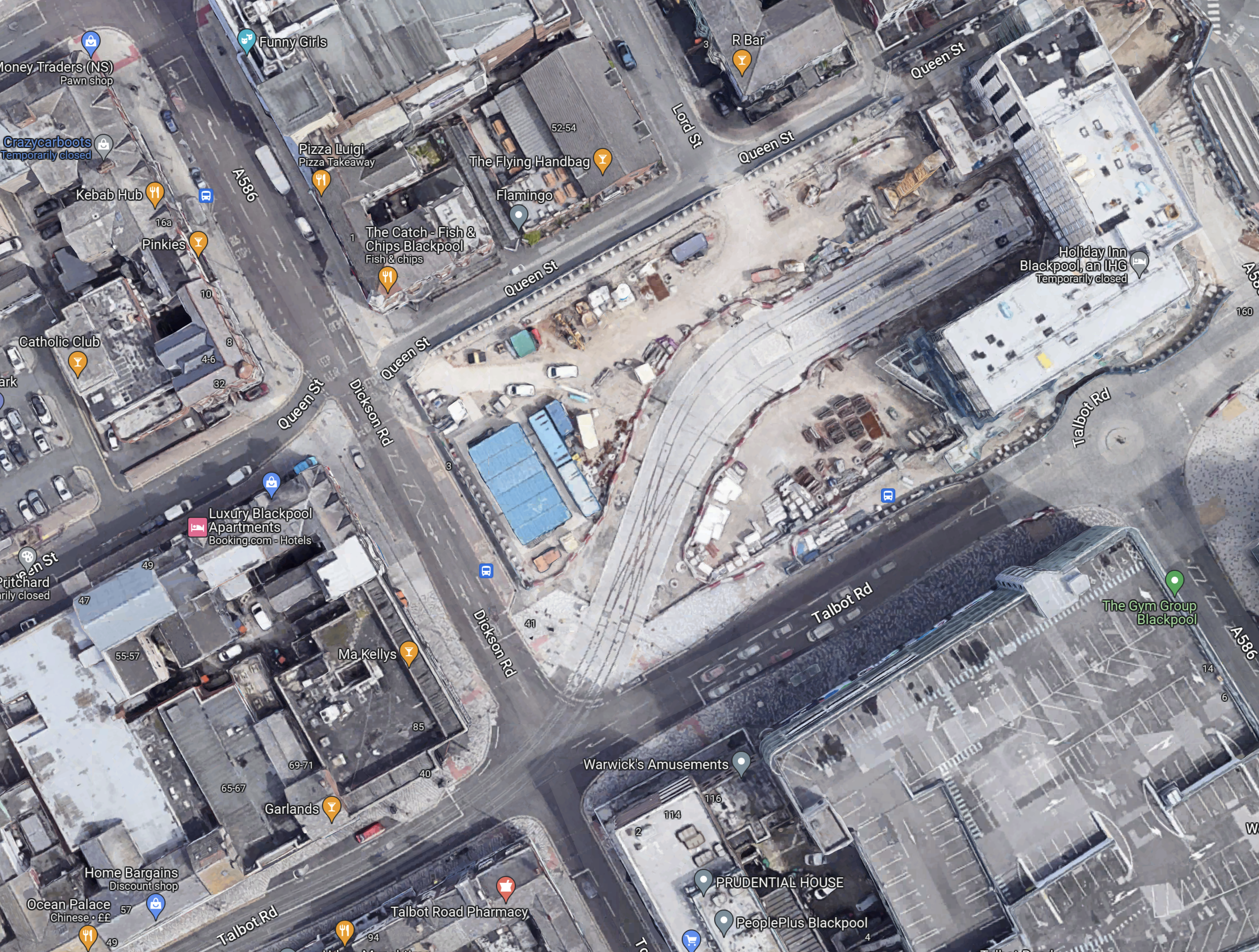
Note.
- To create the space a large Wilkinson’s store was demolished.
- Blaxkpool North station is just off the North-East corner of the map.
- The tram stop will have two platforms.
- There is a large diamond crossing on the approach to the tram stop, so operation is smooth and reliable.
- It looks like there will be substantial development around and possibly over the tram stop.
This Google Map shows Talbot Square, where the tram branch to Blackpool North station joins the main North-South tramway.
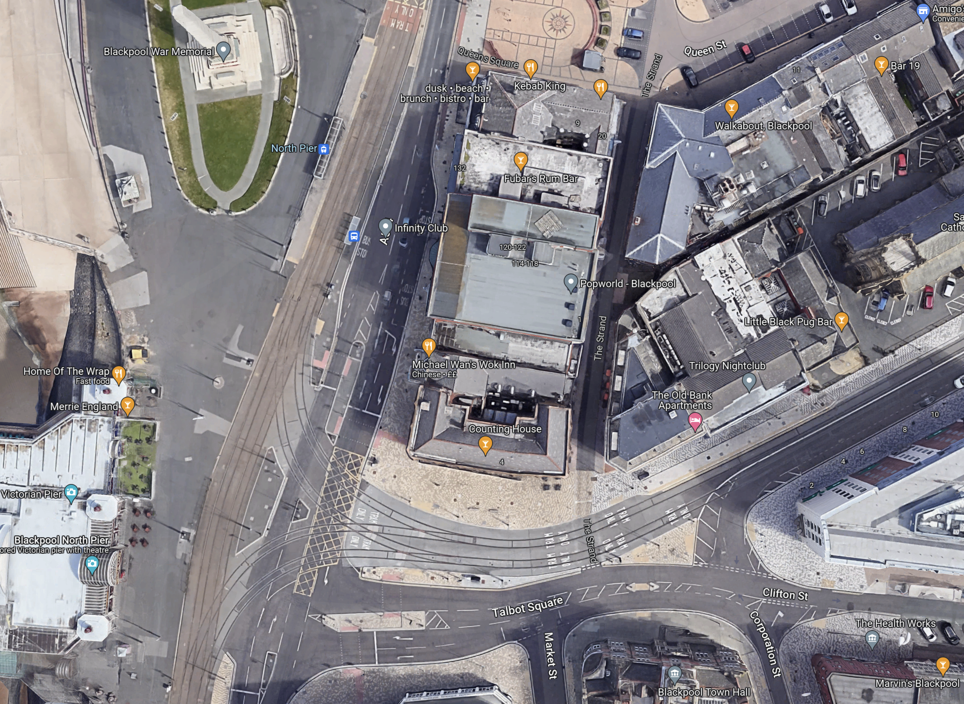
It is all very crowded and I believe this illustrates, why despite their close proximity, there is no rail connection between the Blackpool South branch and the Blackpool tramway.
There just isn’t the space to put in junctions like this and the tramway doesn’t go past Blackpool Airport, so the connection would have to be amongst the crowded houses on the sea front.
The Development Of Blackpool Airport
Aviation is changing and I believe a new breed of airliners and the airports to serve them, will be developed in the next few years.
- Zero-carbon aircraft are being developed and I believe some will have entered service by 2026.
- They will be powered directly by batteries or from green hydrogen.
- Some like the Eviation Alice are already entering a flight-test program, that will lead to certification.
- These airliners are likely to be smaller and quieter than current airliners, with typically a passenger capacity of around 19 passengers.
- They will often fly routes between smaller regional airports.
Blackpool Airport could be an ideal airport for these airliners.
- Offshore electricity and even hydrogen generated offshore will be easy to deliver to Blackpool Airport.
- It could have excellent transport connections with trams and trains.
- Blackpool Airport has good runways.
- Many take-offs will be over the sea.
- We will see airports converting to zero-carbon airports.
So why not Blackpool Airport?
These are distances between Blackpool Airport and other airports.
- Aberdeen – 238 miles
- Amsterdam Schipol – 340 miles
- Belfast City – 128 miles
- Cardiff – 165 miles
- Dublin – 134 miles
- Edinburgh – 150 miles
- Exeter – 211 miles
- Geneva – 661 miles
- Glasgow – 155 miles
- Haverfordwest – 157 miles
- Jersey – 318 miles
- Kirkwall – 358 miles
- London Gatwick – 220 miles
- London Heathrow – 192 miles
- London Southend – 219 miles
- Newcastle – 89 miles
- Paris Orly – 422 miles
- Isle of Man Ronaldsway – 68 miles
- Shannon – 254 miles
- Southampton – 208 miles
- Sumburgh – 427 miles
These distances fit nicely with the range of the nine-seater Eviation Alice electric aircraft, which is predicted to be 620 miles.
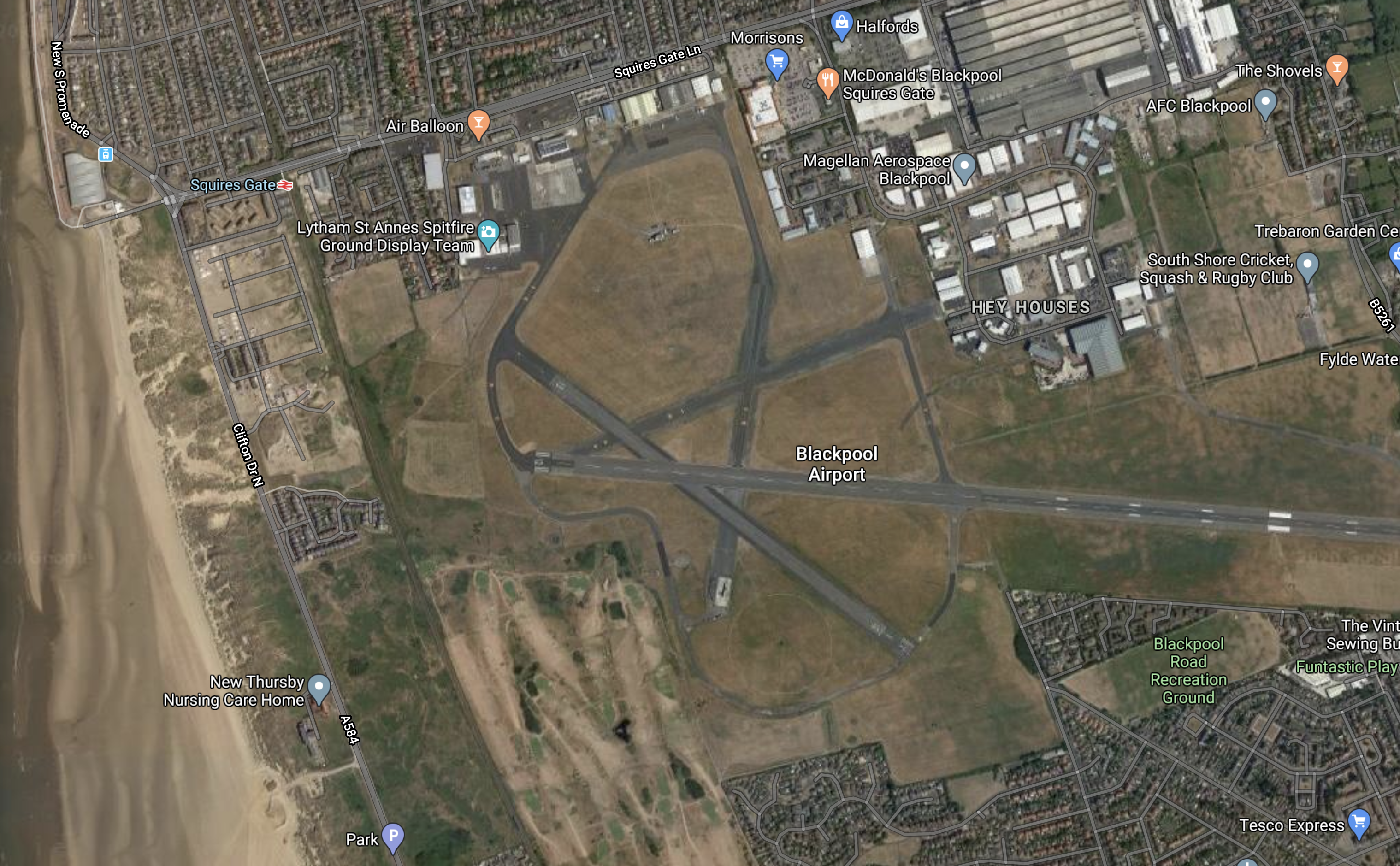
This Google Map shows Blackpool Airport.
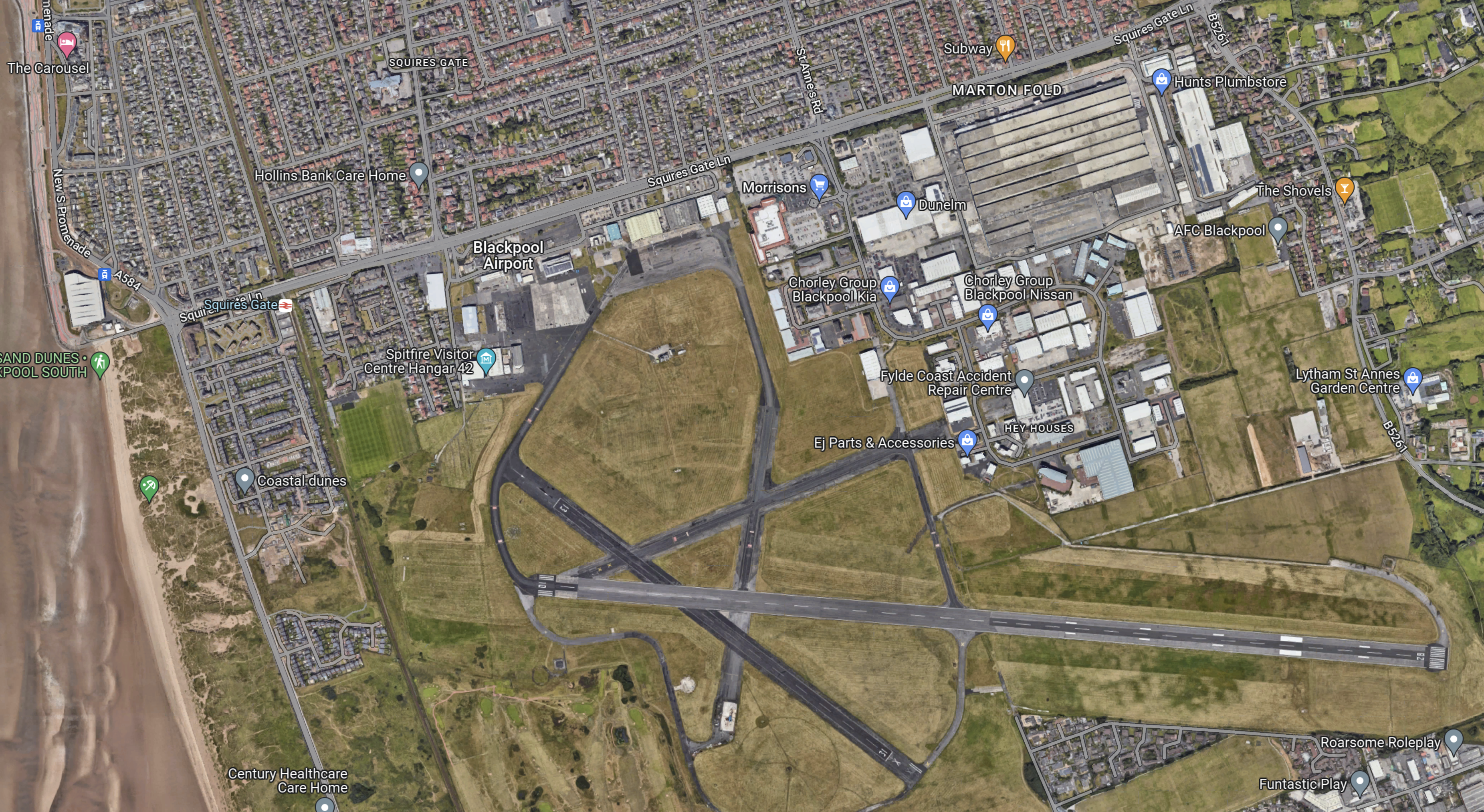
Note.
- The East-West main runway, which is over 1,800 metres long, which will probably mean an easier takeoff into the wind, for much of the time.
- The acres of space.
- The Blackpool South branch running down the side of the airport, with Squires Gate station on the road past the Airport.
- But zoom in on the airport and some improvement and refurbishment needs to be done. Years of neglect and uncertainty has taken its toll.
This Google Map shows the North-West corner of the map at a greater scale.
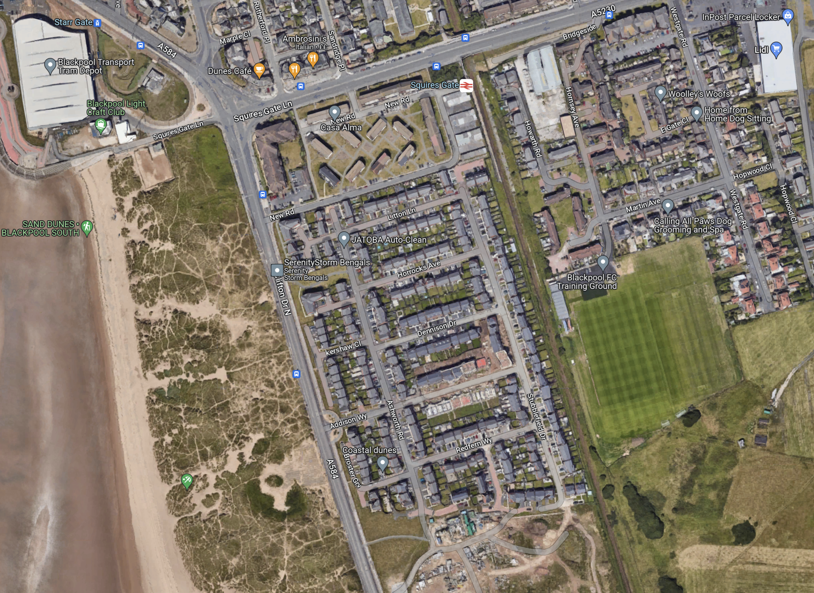
Note.
- In the North-West corner of the map is Blackpool tramway’s depot and Starr Gate tram stop with its loop.
- The rail station is Squires Gate for Blackpool Airport.
- The smart green space to the East of the railway is Blackpool FC’s training ground.
- Below the training ground on the East side is Blackpool Airport.
- On the other side of the track from the Airport, it appears to be the local rubbish dump.
I wonder, if this is where the Blackpool tramway and the Blackpool South branch could be joined up.
- A joint two-platform station partly on Airport land would replace the current Squires Gate station.
- It could be connected to the Airport terminal by some form of shuttle or travellator.
- The trams would be connected to the Starr Gate loop by a line going along the front, as the tramway does in much of Blackpool, before cutting through the waste ground.
- Trains to Blackpool South station would use their current route.
This plan and probably lots of others could allow a Blackpool loop tram-train from Preston.
What would a zero-carbon airport do for Blackpool?
Beeching Reversal – South Fylde Line Passing Loop
This is one of the Beeching Reversal projects that the Government and Network Rail are proposing to reverse some of the Beeching cuts.
The Project
This project is described on this page on the web site of the Fylde MP; Mark Menzies, which is entitled Improving The South Fylde Rail Line.
The page lists that these improvements are needed.
Track And Stations
These improvements are listed for track and stations.
The bid involves laying around three miles of track between Lytham and St Annes stations, the creation of a new rail platform at Ansdell and Fairhaven Station, the installation of signalling along the line, and potential platform changes at Preston Station. There is scope for improvements to St Annes and Lytham Stations, should Network Rail decide it would rather include those stations within the passing loop – but that would be decided further along the process.
Services
The objective is to be able to run two trains per hour (tph) between Preston and Blackpool South stations.
Trains
Better trains are needed.
It certainly looks like the Pacers have already gone.
The Route
I shall describe the current route in this section.
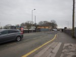
Blackpool South Station
The Google Map shows Blackpool South station.
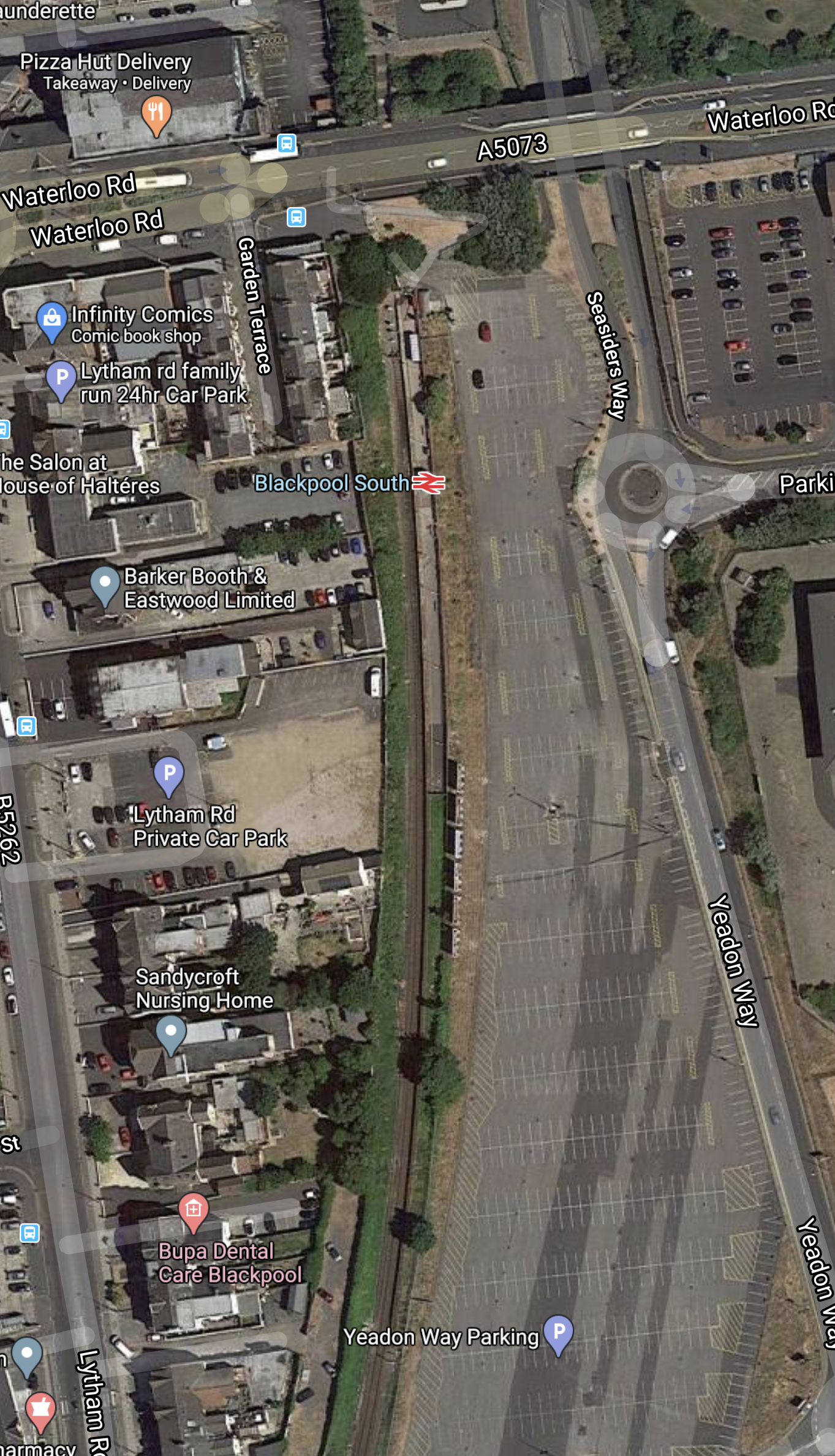
Note.
- Entrance to the station is from Waterloo Road, which runs East-West across the map.
- There are a pair of bus stops by the station entrance.
- There is a lot of car parking close to the station.
- I suspect that the single platform can hold a modern eighty-metre four-car train.
- This seventy-year-old has no difficulty waking to the football ground or the Blackpool trams from the station.
With two tph and some updated facilities, this would be a very useful station.
I suspect there is even space to add a second platform in the future, if that were felt to be necessary.
Blackpool Pleasure Beach Station
This Google Map shows Blackpool Please Beach station and the nearby Pleasure Beach.
We shouldn’t underestimate the importance of this station. One beautiful late summer Saturday, I was going to see Ipswich play at Blackpool and out of curiosity I had explored the train to Colne station. In those days a decade ago, Colne and Blackpool South was one service and the train from Colne was full of families, by the time it got to Preston. A large proportion, left the train at the Pleasure Beach.
The conductor told me, that the crowds, I had witnessed weren’t untypical.
Squires Gate Station and Blackpool Airport
This Google Map shows Squires Gate station and the nearby Blackpool Airport.
Blackpool Airport after a troubled few years seems to be finding a niche market, with a few business, commercial, offshore and training flights.
But I believe that airports like Blackpool in the future can develop another large niche – electric aviation.
Getting to places like Ireland, Northern Ireland, the Isle of Man and Wales by a nineteen-seat electric airliner will need the following.
- As short a flight as possible.
- Close to the coast would help.
- Good public transport links. Blackpool Airport has both tram and train.
- Space for aircraft to be parked, whilst charging.
- Plentiful supplies of renewable electricity. The over-300 MW Burbo Bank Wind Farm is not far away in Liverpool Bay and it will only be joined by more and larger wind farms.
- Frequent public transport.
Blackpool Airport could tick all these boxes, with a thick green marker.
Some example direct distances from Blackpool include
- Aberdeen – 238 miles
- Amsterdam Schipol – 340 miles
- Belfast City – 128 miles
- Cardiff – 165 miles
- Dublin – 134 miles
- Edinburgh – 150 miles
- Exeter – 211 miles
- Geneva – 661 miles
- Glasgow – 155 miles
- London Gatwick – 220 miles
- London Heathrow – 192 miles
- London Southend – 219 miles
- Newcastle – 89 miles
- Paris Orly – 422 miles
- Isle of Man Ronaldsway – 68 miles
- Southampton – 208 miles
These distances fit nicely with the range of the nine-seater Eviation Alice electric aircraft, which is predicted to be 620 miles.
St. Annes-on-the-Sea Station
This Google Map shows St. Annes-on-the-Sea station.
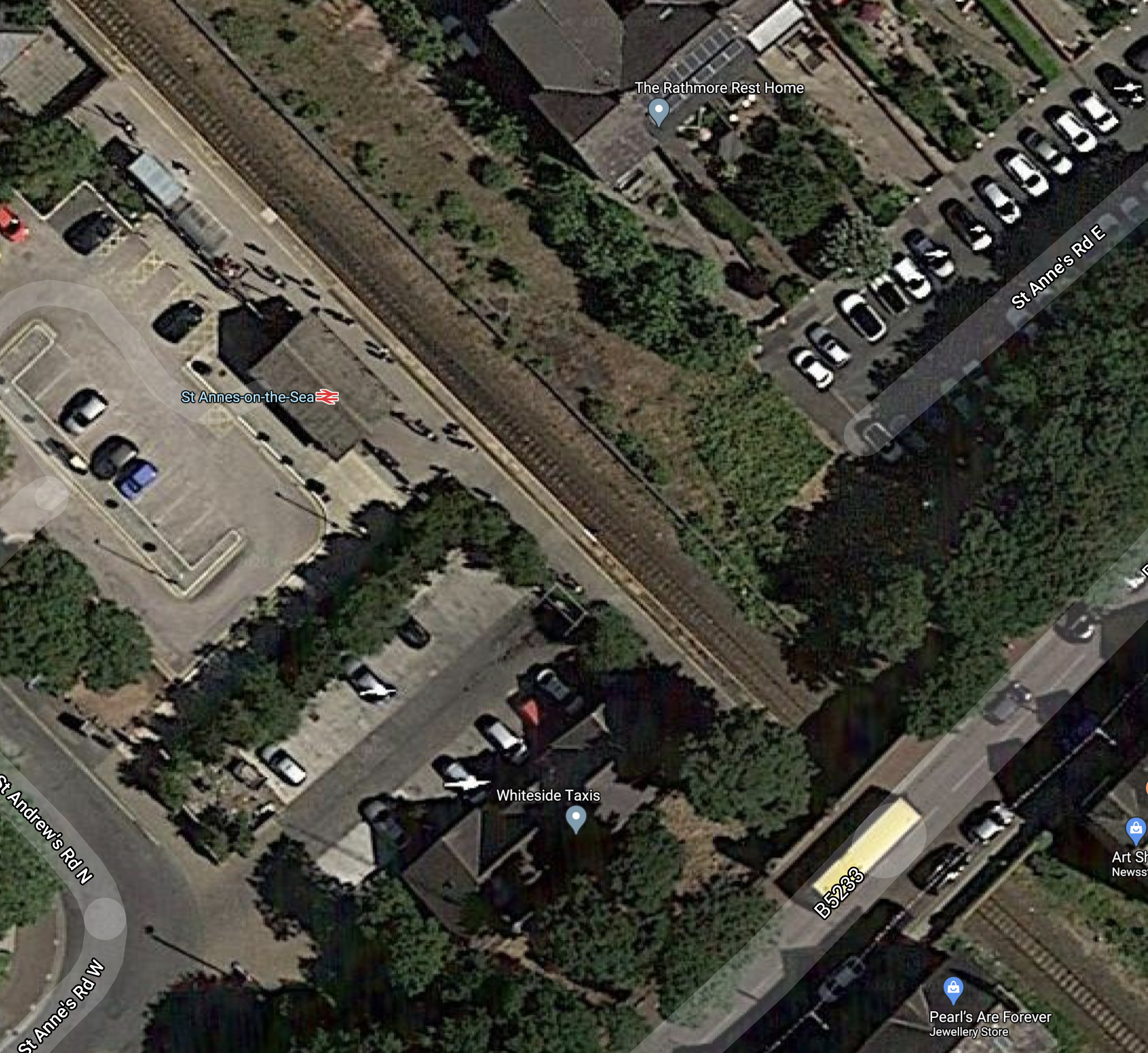
Note.
- Blackpool is to the North-West and Preston is to the South-East
- St. Annes-on-the-Sea is one of those convenient single-platform stations, where you just walk in-and-out on the level.
- The passing loop would start on the Preston side of the bridge.
There would need to be no major infrastructure work at the station, although I would expect the facilities could do with a makeover.
Ansdell And Fairhaven Station
In Should The Blackpool South Branch Be Electrified?, I said this about improvements to Ansdell and Fairhaven station.
Ansdell and Fairhaven station is nearest to the course at Royal Lytham.
-
- The Open Championship is a very important event on the golfing calendar.
- Other important golfing events are also held on the course
- Royal Lytham and St.Annes, last held the Open in 2012 and 2001. So it might come back to Royal Lytham in the mid-2020s.
Ansdell and Fairhaven station used to have two platforms, as described in Wikipedia.
The station was set out as an island platform with tracks on both faces until the singling of the line in the 1980s. Trains now only use the southern face. A disabled access ramp now covers the northern part of the station.
So could a rebuild of the station do the following?
-
- Restore two platforms on an island at the station.
- Put in full disabled access.
- Create a passing loop.
- Longer platforms might be a good idea.
This Google Map shows the station.
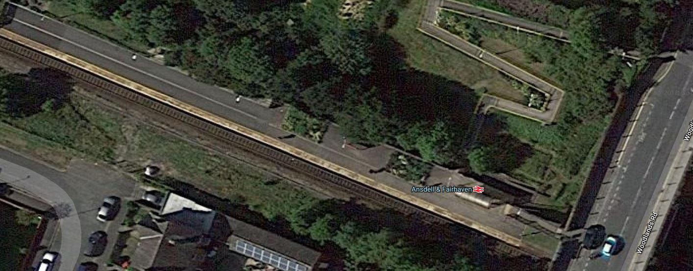
Note.
-
- The disabled ramp winding away.
- The platform is probably about a hundred metres long.
- It would appear that there is space at the far end to extend the platform.
I suspect that an ambitious architect with vision, could design a station that met all objectives.
It could be the best Championship Golf Course railway station in the world.
Lytham Station
This Google Map shows Lytham station.
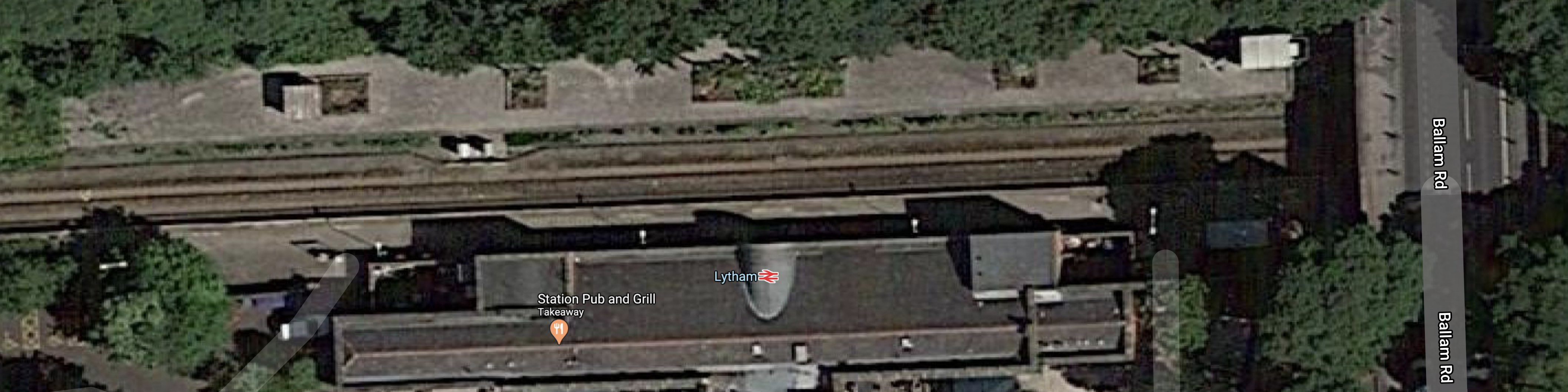
Lytham station will be the Eastern end of the loop and it is likely, that the single-track will change to double at the Western end of the station.
As with St. Annes-on-the-Sea station, I suspect that a good makeover, will be all that will be needed.
Moss Side Station
This Google Map shows Moss Side station.
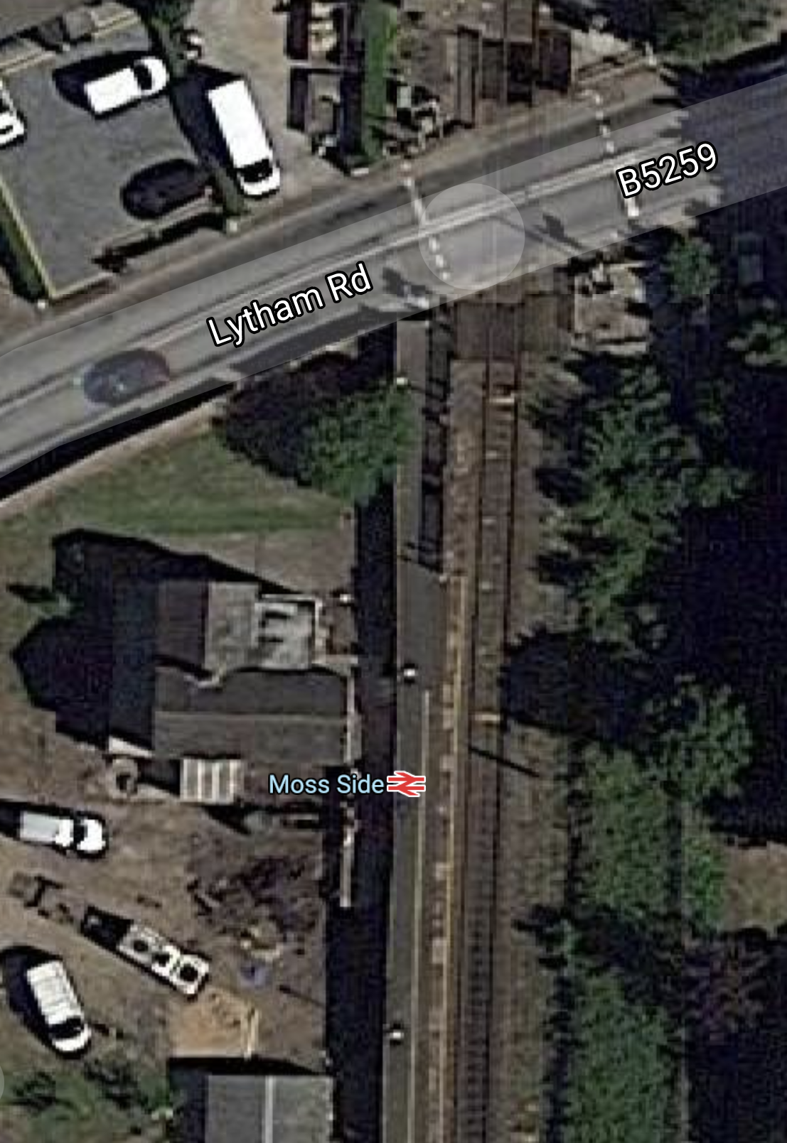
The only problem here is the level crossing, so do Network Rail want to remove it?
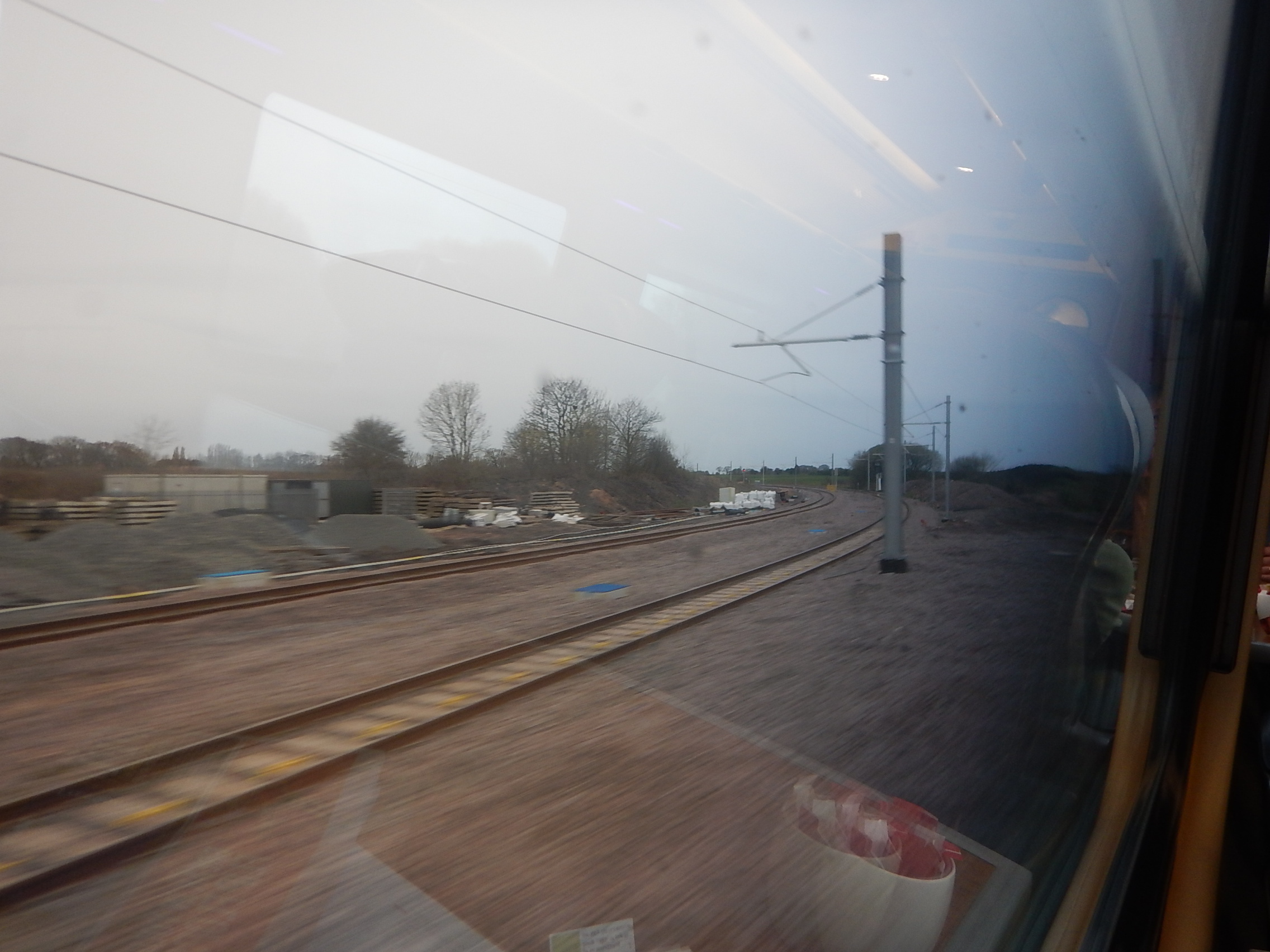
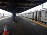
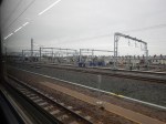
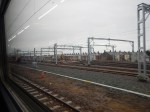
Kirkham And Wesham Station
This Google Map shows Kirkham and Wesham station.
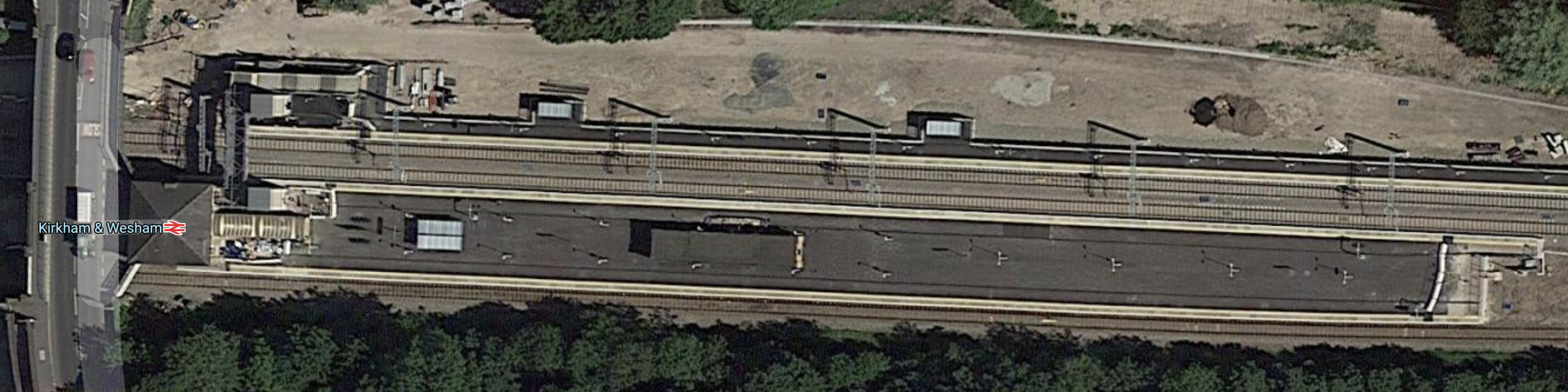
There are three platforms, which from bottom to top on the map are.
- Platform 1 – Trains to Blackpool South
- Platform 2 – Trains to Blackpool North
- Platform 3 – Trains to Preston
All platforms seem to be being electrified in these pictures. that I took during construction.
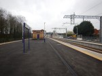


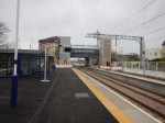
Note.
- It can’t be described as a station, built down to a small budget.
- In the captions to the pictures, I’ve numbered the platforms from left to right.
- The last picture looks down Platform 1 and there is an electrification gantry at the Preston end.
Could this comprehensive electrification be so that trains to Blackpool North can use both Platforms 1 and 2?
- This would allow overtaking of say a local train by a London express.
- Trains could also be turned back in Platform 1, before the end of its journey, if there was a problem.
- The electrification is also substantial enough for the longest Class 390 trains.
- It could even accommodate a classic compatible High Speed Two train.
So does the last point, mean that Blackpool North station is a possible High Speed Two destination? Provided, the platforms at Blackpool North station are long enough, I think it does!
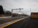
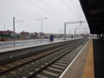
This Google Map shows Kirkham West Junction, where trains to Blackpool North and Blackpool South stations diverge.
Note.
- The electrification gantries and their shadows can be seen.
- Preston is to the South-East and the route is fully-electrified.
- Blackpool North is to the North-West and the route is fully-electrified.
- Blackpool South is to the West. The double-track becomes single before Moss Side station.
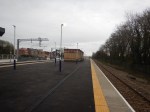
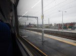
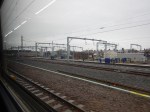
This picture shows the route going off to Blackpool South.
I took the picture from a train going to Blackpool North station.
So why are wires being run along the first few hundred metres of the Blackpool South Branch?
The Timetable
Currently, trains take the following times to do these journey legs.
- Run between Ansdell and Fairhaven and Blackpool South stations – 12 minutes
- Turnback at Blackpool South station – 3 minutes
- Run between Blackpool South and Ansdell and Fairhaven stations – 11 minutes
As the trains will be running every thirty minutes and the three legs total twenty-six minutes, that means there’s four minutes float.
So hopefully, it should be easily stainable, by an experienced rail timetable creator.
The Trains
I have remarked that I find the electrification at Kirkham & Wesham station, both comprehensive and slightly unusual.
Could The Electrification Have Been Designed For Battery Electric Trains To Blackpool South Station?
But there is one very plausible reason for the electrification layout – The Blackpool South Branch has been designed, so that services on the branch can be rum using battery trains.
- The distance between Kirkham & Wesham and Blackpool South stations is just over eleven miles.
- So for a round trip a range of perhaps twenty-five miles on battery power would suffice.
- There would also be a need for a few minutes of hotel power, whilst waiting at Blackpool South station.
These power needs are well within the capabilities of the average battery train.
- Trains could be charged on the nine minute run between Preston and Kirkham & Wesham stations.
- Changeover between electrification and battery power would take place in Kirkham & Wesham station.
An ideal train would surely be CAF’s four-car battery electric version of the Class 331 train, which I wrote about in Northern’s Battery Plans.
- According to an article in the March 2020 Edition of Modern Railways, with the same name, these trains will be working between Manchester Airport and Windermere.
- Class 331 trains without batteries will be running to and from Blackpool North station.
- Four-car trains are probably the right size for the route.
There would also probably be no need for a charging station at Blackpool South station, if trains could leave Kirkham & Wesham station with a full battery.
Where Would The Trains Terminate In The East?
These would be the obvious choices.
- Blackburn – Where there is a convenient bay platform.
- Colne – Where they used to terminate!
- Liverpool – Merseyrail has the trains and Liverpool has lots of punters and the imagination.
- Preston – Where they do now!
- Skipton – If the Skipton-Colne Link is built!
My money would be on Skipton, using a new Skipton-Colne Link, for the following reasons.
- Politicians of all colours and roses are in favour.
- Skipton has an electrified route to Leeds.
- Skipton-Colne would be a valuable by-pass route during the building of Northern Powerhouse Rail.
- Battery-powered trains would be ideal for Skipton-Colne.
Would A Battery Electric Train Be Feasible Between Blackpool South And Liverpool?
Consider.
- An all-stations service would complement the fast service between Liverpool Lime Street and Blackpool North stations via St. Helens, Wigan North Western and Preston.
- The service could either go between Liverpool and Preston via Ormskirk or Southport and a reinstated Burscough Chord.
- The Ormskirk route is 15 miles of unelectrified line and the Southport route is just four miles further.
- A service via Southport would need to reverse at Southport station.
- The service would be run using dual-voltage Class 777 trains fitted with batteries.
- 25 KVAC overhead electrification, is already installed between Preston and Kirkham & Wesham stations,
- Using existing electrification, trains would leave Kirkham & Wesham, Ormskirk, Preston and Southport stations with full batteries.
- A coastal service between Blackpool and Liverpool would surely attract visitors.
- Liverpool and Blackpool are the two biggest urban areas on the coast.
- There are several golf courses on the route, including three courses that have held the Open; Royal Birkdale, Royal Liverpool and Royal Lytham & St. Annes.
It may be a bit fanciful. But.
- Merseyrail will have the trains.
- Liverpool has the potential passengers.
- I believe the route could handle a two tph service.
- In Reopen Midge Hall Station, I showed that it was possible to run a two tph service between Liverpool and Preston, with one tph via each of Ormskirk and Southport.
Liverpool also has bags of ambition and imagination.
Would A Battery Electric Train Handle Preston And Skipton?
I estimate that this route is forty-one miles, with a stiff rise from Rose Grove to Colne station.
So would a battery electric train be able to handle this distance?
Hitachi are talking 56 miles for their Regional Battery Train, so I suspect CAF would want and need to be competitive with a similar specification.
Perhaps the logical service would be to run between Leeds and Blackpool South.
- The service would go via Preston, Blackburn, Burnley Central, Colne and Skipton.
- Leeds and Skipton is electrified.
- Preston and Kirkham & Wesham is electrified.
- No extra chargers for trains would be needed.
The only new infrastructure needed would be the Skipton and Colne Link.
Electrification Between Preston And Blackburn
Consider.
- In Colne – Skipton Reopening Moves Closer, I talked about the proposed Huncoat Rail Fright Terminal, that could be built North of Blackburn on the East Lancashire Line.
- Blackburn is a major hub for passenger services.
- An electrified Blackburn would allow Manchester and Clitheroe to be run by battery electric trains. Clitheroe is ten miles and Bolton is thirteen.
- An electrified Blackburn would allow Blackburn and Manchester Victoria via the Todmorden Curve to be run by battery electric trains. The whole route is 39.5 miles.
- It may be possible for battery electric trains to reach Leeds via Hebden Bridge, as it is only fifty miles away, which is within Hitachi’s range.
- As the Blackburn area grows, there will be more pressure for a daily London service.
- Some think, the Calderdale route should be electrified.
- Preston and Blackburn stations are just twelves miles apart.
- There is a multiple unit depot at Blackburn.
- I also feel that battery electric trains fanning out from Blackburn, wouldn’t do the town’s image any harm.
For all these reasons, I wouldn’t be surprised to see a short stretch of electrification added between Preston and Blackburn.
Conclusion
I like this proposal and it could be a big asset to trains across the Pennines.
Wires, New Platforms And Sidings At Blackpool North Station – 17th April 2018
I took these pictures as I entered Blackpool station.


Note.
- There are now six straight platforms at the station.
- The platforms are long and can probably take an eleven-car Class 390 train.
- There seems to be five or six long sidings for trains, just outside the station.
- There is certainly evidence of ongoing work.
They certainly seem to be expecting a lot of trains.
If not soon, the station is future proofed.
What Trains Will Run To Blackpool?
I think the routes from Blackpool should have a minimum frequency of at least two tph.So the base local service should be.
- Two tph – Blackpool North to Liverpool Lime Street Class 319 train
- Two tph – Blackpool North to Manchester Airport – Class 319 train
- Two tph – Blackpool South nto Colne – Class 769 train
Other routes could include these services.
- 1-2 tph – Blackpool North to York via Leeds
- 1-2 tph – Blackpool North to Hazel Grove via Manchester Piccadilly – Class 319 train
- 1-2 tph – Blackpool North to Huddersfield via Manchester Victoria.
- 1-2 tph – Blackpool North to Ormskirk via Preston – Class 769 trains.
I wrote about the last service in Northern’s Plans For Between Preston And Ormskirk. But as Blackpool North station has six terminal platforms, it might be a better terminus than Preston.
Even if all of these services were to be two tph, this would only be fourteen tph between Preston and Kirkham and Wesham stations.
But the signalling is now modern and Northern have ordered a lot of 100 mph trains.
Obviously, Network Rail have got to finish the electrification.
Wires At Kirkham And Wesham Station – 17th April 2018
These pictures show Kirkham and Wesham station.

Note.
- Two new lifts are being installed.
- The overhead wires appear to be complete on the two main lines.
- The platform used by the Blackpool South Branch appears not to have been electrified.
Does anybody know if the line to Blackpool South station will be electrified?
- After all a four-coach bi-mode train like a Class 769 train could run the service.
- The last two Open Championships at Royal Lytham and St.Annes, were in 2012 and 2001, so it could return in the early 2020s.
But that gives the Blackpool area and Northern time to create the proper transport solution for the next Open at Royal Lytham and St. Annes.
