17 Tube Stations That Face Chronic Overcrowding If Crossrail 2 Is Stopped
The title of this post is the same as that of an article in today’s Standard.
This is the first two paragraphs.
Hundreds of thousands more Londoners will suffer chronic overcrowding on the Tube if Crossrail 2 does not go ahead, it was claimed today.
Transport for London released a list of 17 Underground stations that could buckle under the strain of too many commuters within a few years.
It then lists the stations.
- Euston
- King’s Cross St. Pancras
- Liverpool Street
- London Bridge
- Victoria
- Waterloo
- Finsbury Park
- Stockwell
- Stratford
- Oxford Circus
- Highbury & Islington
- Clapham Common
- Clapham North
- Clapham South
- Holborn
- Warren Street
- Leicester Square
It then quotes Caroline Pidgeon, who obtained the list, as follows.
Overcrowding on the Underground is already a daily battle, with many passengers facing regular delays to simply get through barriers at stations.
Unless Crossrail 2 is built these delays will increasingly build up until drastic measures are necessary at 17 key Tube stations, not to mention Clapham Junction railway station.
“Planning ahead for Crossrail 2 is not an optional extra for London’s transport network but of vital importance to keep London moving.
She has certainly highlighted a serious problem.
Call For Crossrail 2
Two years ago to the day, I wrote a post called Call For Crossrail 2 in response to a letter in The Times, from a wide cross section of business leaders calling for a start to be made on the line.
In the post, I talked about improving various stations, just by building Crossrail 2, so in the following notes on the list of crowded stations, I will refer to this post several times in the following.
Euston
Euston tube station is a particular problem in that in the next decade or so, the following will or could happen.
- HS2 will arrive at the station.
- Euston main line station will be rebuilt.
- Crossrail 2 will pass under the station.
- A connection will be created to Euston Square station for the Circle and Metropolitan Lines.
- There might even be an extension of the Docklands Light Railway to Euston.
- Step-free access must be added for all platforms.
Hopefully, the rebuilding for whichever comes first of HS2 or Crossrail 2, will make provision for even the most fanciful of expansions.
One Transport for London engineer told me that one of the main reasons for building HS2 and terminating it at Euston, is to be able to sort out the dreadful Euston tube station.
Kings Cross St. Pancras
Kings Cross St. Pancras tube station had a pretty good makeover around the time of the 2012 London Olympics, but it does suffer congestion and travellers have to walk long distances.
The Wikipedia entry for Kings Cross St. Pancras tube station has a section for Crossrail 2. This is said.
Since 1991, a route for a potential Crossrail 2 has been safeguarded, including a connection at King’s Cross St Pancras and Euston, forming the station Euston King’s Cross St Pancras. The proposed scheme would offer a second rail link between King’s Cross and Victoria in addition to the Victoria line. The locations for any new stations on the route will depend on the loading gauge of the final scheme. In the 2007 safeguarded route, the next stations would be Tottenham Court Road and Angel.
There is also a proposal to reopen the closed York Road tube station. In the Wikipedia entry for York Road station under Proposed Reopening, this is said.
One of London’s largest redevelopment projects, King’s Cross Central, began construction in 2008 across the road from the station. Islington council and Transport for London commissioned a study in 2005 to consider the possible reopening of the station. At the same time, however, it was recognised that other transport priorities reduced the likelihood of such a project moving forward in the near future. The site would need extensive overhauls to bring the station up to modern day standards, at a cost estimated at £21 million in 2005. Local political groups have been keen to see the station reopened in order to reduce passenger congestion at King’s Cross St. Pancras and to encourage development in the surrounding community. The Islington Liberal Democrats advocated the reopening of the station in their 2006 local election manifesto, and at least one candidate for the Islington Conservative Party similarly campaigned for the station to be reopened. However, to date, the reopening proposal has not been taken forward.
I wonder if York Road tube station will ever be reopened.
Liverpool Street
The Liverpool Street station complex will be even bigger and busier after Crossrail opens.
The main difference will be that the current Shenfield Metro will now disappear into the ground at Stratford and go under Central London to Heathrow and Reading.
Crossrail 2 will effectively channel the Lea Valley services, that current go into Liverpool Street station under London to emerge in the Wimbledon area.
Effectively, Crossrail and Crossrail 2 major effect on Liverpool Street station are to free up capacity in both tracks and platforms, thuis allowing more longer distance services to use the station.
London Bridge
London Bridge station is being rebuilt and expanded, but little seems to be planned for London Bridge tube station to cope with more passengers.
In Call For Crossrail 2, I said this about Crossrail 2 and the Northern Line.
Crossrail 2 will have interchanges with the Northern Line at Angel, Kings Cross St. Pancras, Euston, Tottenham Court Road, Tooting Broadway and possibly Clapham Junction. So it looks like that Crossrail 2 will certainly make journeys easier for users of the Northern Line.
This should mean that travellers on the Northern Line will be able to avoid a congested London Bridge tube station.
Victoria
Victoria tube station is being extended and rebuilt, which should result in sufficient capacity for more than a few years.
In Call For Crossrail 2, I said this about Crossrail 2 and the Victoria Line.
Crossrail 2 will effectively by-pass the central part of the Victoria Line as the two lines connect at Tottenham Hale, Seven Sisters, Kings Cross, Euston and Victoria.
This should take some of the pressure from Victoria tube station.
Waterloo
Waterloo tube station is a very busy tube station, as it has to cope with all the passengers using Waterloo station.
Crossrail 2 will allow passengers to bypass Waterloo, when travelling to and from Central London.
However, three major improvements will be delivered this year.
- The old Eurostar platforms are being brought back into use.
- Extra capacity is being added to the Underground station.
- I also think that when they have completed the improvements at the Bank end of the Waterloo and City Line.
- Will improvements follow at the Waterloo end?
I think Waterloo shouldn’t be judged until the current round of work is completed.
Finsbury Park
Finsbury Park station is a station that suffered badly when the Victoria Line was tunnelled through in the 1960s.
Lifts are being installed, but extra services will be added.
- Thameslink will call regularly at the station.
- The services on the Northern City Line will become the Great Northern Metro with an increased frequency.
Crossrail 2 will provide relief for Finsbury Park, as it provides a by-pass for the Victoria Line.
But the station needs to have quite a bit of rebuilding.
Stockwell
Stockwell tube station is where the Victoria and Northern Lines meet South of Victoria.
This map from carto.metro.free.fr shows the lines at Stockwell station.
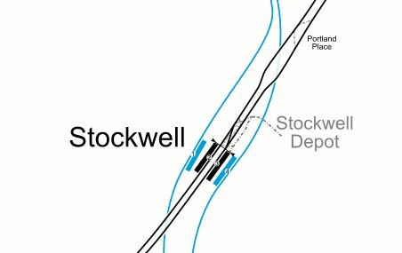
I’m not sure how Crossrail 2 helps here, but I suspect Transport for London hope that the new line will divert passengers away from Stockwell.
Stratford
Stratford station is another station that will be partially bypassed by Crossrail 2.
I do think that after Crossrail opens, that changes will be made at Stratford station to perhaps move some Liverpool Street services to Stansted and Cambridge.
This would bring more services to some not very busy platforms.
In West Anglia Route Improvement – The High Meads Loop, I described how it might all work.
This map from carto.metro.free.fr shows the lines in this area.
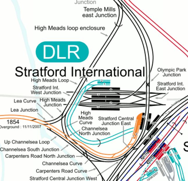
Trains from Cambridge and Stansted would arrive at Temple Mills East Junction and would go round the High Meads Loop dropping and picking up passengers in Platforms 11 and 12 bwfore returning North.
An extra platform could even be added to serve services in Stratford International station.
The tunnels under the platforms at Stratford station would probably need improvement, but who knows how Eastenders will duck and dive after Crossrail opens.
As an example, passengers from Shenfield to Canary Wharf will probably use the cross-platform change at Whitechapel station, rather than pick up the Jubilee Line or the DLR at Stratford.
Oxford Circus
Oxford Circus tube station has needed improvement for years.
Crossrail will give some relief, as there will be new additional entrances to Tottenham Court Road and Bond Street stations closer to Oxford Circus.
I did look at what might happen in What Will The Elizabeth Line Do For Oxford Street?.
I came to this conclusion about Crossrail 2 and Oxford Street.
Crossrail 2 has just one interchange in the Oxford Street area at Tottenham Court Road station.
I would be very surprised in that in the massive rebuilding of the current station for Crossrail, that provision hasn’t been made to connect to Crossrail 2.
There have been surface issues around the station concerned with Crossrail 2, but given good planning of the project, I feel that the building of Crossrail 2 would only effect the area in a similar way to the replacement of a major block on Oxford Street.
Crossrail 2 will have two major effects.
- It will bring large numbers of visitors to the Oxford Street area.
- Just as Crossrail and the Central Line will work as a high-capacity pair, it will work closely with the Victoria Line to relieve that line.
This leads me to the conclusion, that the wider Oxford Street area needs to be and will be pedestrianised.
In some ways preparation for the pedestrianisation has already started by reorganising the buses.
Oxford Circus tube station is also high on Transport for London’s improvement list.
This map from carto.metro,free.fr shows the lines through the station.
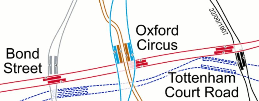
I suspect that if developers were interested in rebuilding any of the buildings on the South side of Oxford Street or perhaps even around the BBC to the North, that there could be arm-twisting and deal-making to sneak new entrances into Oxford Circus tube station.
Highbury & Islington
Highbury & Islington station, is one of my local ones and it is getting some much-needed improvement.
- The Northern City Line will be getting frequent new Class 717 trains to create the Great Northern Metro.
- Highbury Corner will be remodelled to improve pedestrian access to the station.
- Bus and taxi access is being improved..
But nothing has been announced about improving the chronic access to the two deep-level lines at the station.
Speaking to staff at the station, they feel that a solution is possible, using the second entrance on the other side of the road.
In some ways the Great Northern Metro with its cross-platform interchange with the Victoria Line could be the saviour of this station, as it gives direct access to the City and to Crossrail at Moorgate station.
One of London’s forgotten lines could be riding to the rescue.
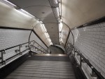
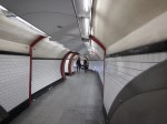
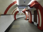
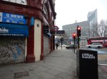
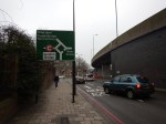
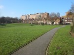
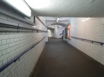
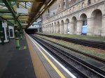
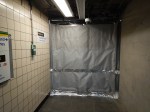
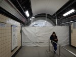
Clapham Common
Clapham Common tube station is one of my least favourite. This picture shows why.
It’s downright dangerous now, so when the Northern Line frequency is increased will the station cope?
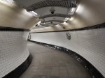
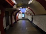
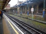
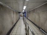
Clapham North
Clapham North tube station is another dangerous island platform.
But at least the station has escalators.
In A Journey Round The Clapham Stations, a post I wrote in December 2015, I said this.
Having seen Clapham North and Clapham Common stations today, I do wonder if a diversion could be dug as at Angel, Bank and London Bridge, to create safe new stations. This new tunnel could surely be part of the works to add step-free access to one or both stations and connect the tunnels to Clapham High Street station.
What with the Northern Line Extension to Battersea, the rebuilding of Bank and Camden Town stations and all the resignalling of the past few years, the Northern Line could at last be fulfilling its potential.
This could go a long way to sorting the problem of the Clapham stations.
Clapham South
Clapham South tube station is not as bad as the other two Clapham stations discussed earlier.
Crossrail 2 may reduce the level of overcrowding on the Northern Line trains through the three Clapham stations, as passengers could change at Balham or Tooting Broadway stations to and from the new high-capacity line.
However, nothing short of some serious building work will solve the island platform problems at Clapham Common and Clapham North stations.
Holborn
Holborn tube station is very busy, but is one that could benefit from Crossrail, due to that line’s relationship with the Cerntral Line.
Crossrail 2 will certainly benefit the station, as it will relieve the pressure on the Piccadilly Line.
But Transport for London have published plans to add a second entrance and full step-free access. This is a 3-Dview of the plans.

Note the second entrance will be in Procter Street.
The only problem is that it could be 2021 before a decision is made.
However as a Piccadilly Line station, Holborn will benefit from the New Tube For London, before the upgrade.
Warren Street
Warren Street tube station is another Central London station on the Victoria Line, that could benefit from Crossrail 2’s duplication of the Victoria Line.
Leicester Square
Leicester Square tube station is just one stop on the Northern Line from the major new interchange of Tottenham Court Road station, which will be served by both Crossrail and Crossrail 2.
The station has needed more capacity since I first used it in the 1950s.
It needs step-free access.
This map from carto.metro.free.fr shows the lines around Leicester Square station.
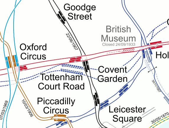
There is quite a tight knot of stations, of which only Tottenham Court Road has both escalators and lifts, although Goodge Street and Covent Garden have lifts only.
Leicester Square is an unusual station in that both the Northern and Piccadilly Lines are accessed by short passages and a short staircase from a fair-sized lobby at the bottom of a long set of escalators.
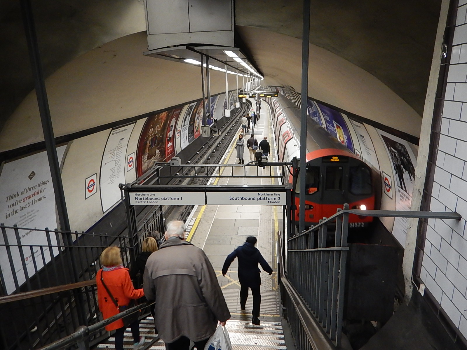
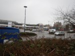
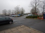
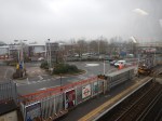
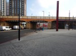
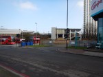
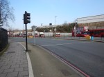
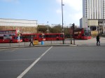
Clapham Junction
Clapham Junction station is the only non-Underground station in the seventeen stations named, where overcrowding could become chronic if Crossrail 2 is not built.
It is the busiest station by number of trains in Europe, so it must be difficult to keep on top of increasing numbers of passengers.
In the Wikipedia entry for the station under Future Proposals, this is said.
In 2007 the alignment of one of the two variants of Crossrail 2, that via the station rather than Putney and Wimbledon, was safeguarded. The Department for Transport and Transport for London continue to discuss proposal for a Clapham Junction Northern Line extension and its London Underground alignment has been legally reserved through Battersea Park, and would connect Clapham Junction to the London Underground for the first time.
Government and Network Rail funding for in the early 2010s of £50 million of improvements was granted. This comprised an upgrade to the main interchange: new entrances and more retail.
Surely something needs to be done, if Crossrail 2 is not built.
My proposals would include.
- Developing the West London Line services.
- Extending the Northern Line from Battersea Power Station station.
- Improving the frequency of trains into Waterloo.
- Make the station subway step-free.
There may be a need for more platforms, but the London Overground found this difficult.
This map from carto.metro.free.fr shows the platforms in the station.
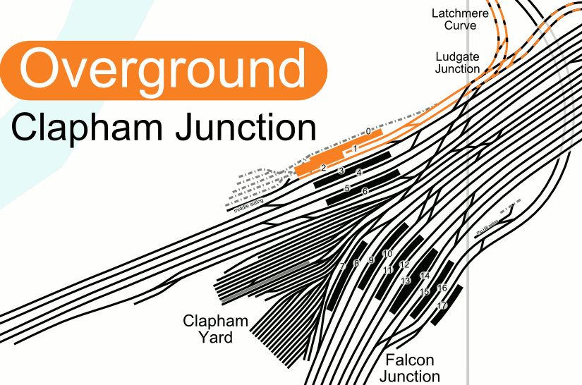
Simple it isn’t!
Conclusions
It surprised me how many of these stations will need substantial building work to cure the overcrowding.
Note.
- Every Victoria Line station between Oxford Circus and Finsbury Park is on the list.
- Four Northern Line stations between Stockwell to Clapham South is on the list.
- I think this shows how the designers of the Northern and Victoria Lines didn’t expect the traffic the lines now handle.
But overall, I think it shows how when you design a station, you don’t cut corners.
I also think to blame all these problems on the uncertainty about Crossrail 2, is probably a bit strong.
Consider.
- Liverpool Street will probably have enough capacity when Crossrail opens, especially as the station will incorporate Moorgate and be substantially step-free.
- The new London Bridge effectively adds high-frequency rail lines to Blackfriars, Cannon Street, Charing Cross and St. Pancras and when Thameslink and Southeastern are fully developed, the station will cope.
- Victoria shouldn’t be judged until the current upgrade is complete.
- Waterloo shouldn’t be judged until the current upgrade is complete.
- Finsbury Park shouldn’t be judged until the current upgrade is complete.
- Stratford will probably have enough capacity when Crossrail opens, especially as the station is substantially step-free.
- Oxford Circus should see improvement when Crossrail opens, especially as there’ll be new step-free entrances to Tottenham Court Road and Bond Street, that will be closer to Oxford Circus, than the current stations.
- Highbury & Islington should see marginal improvement, when the Northern City Line is updated.
However, nothing short of substantial construction will sort Euston, Clapham Common, Clapham North, Holborn, Leicester Square and Clapham Junction.
Will London Build Any More New Tube Lines?
In this post, by Tube, I mean one of London’s narrow-bore Underground lines like the Bakerloo, Central, Jubilee, Northern, Piccadilly and Victoria Lines.
Tube Lines And Crossrail
Yesterday, I rode a Jubilee Line train and after The 10:35 From Liverpool Street To Shenfield, it struck me as a cramped experience.
As I got up to leave from one of the areas of the train with metro-style seating along the train sides, I tripped all over everybody else’s feet.
Compare this to the Class 345 train on Crossrail.
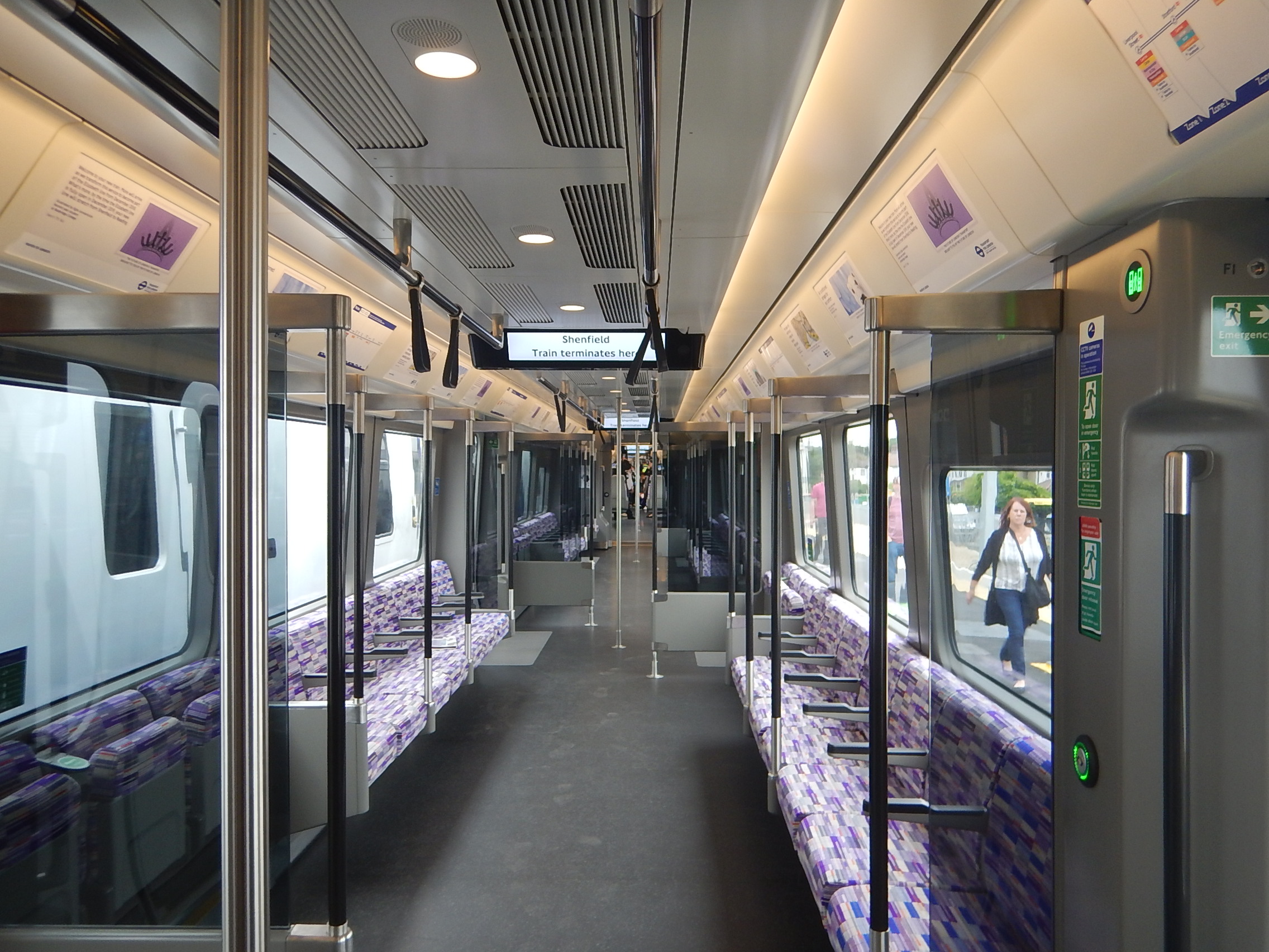
You could seat basketball players either side and they’d have difficulty playing footsie, given the width of the train.
Note too the space under the seats for their kit.
And then there is the air-conditioning, which of course the Tube lines don’t have.
So what is the point of building new narrow-bore Tube lines under London? Especially, as I doubt the cost of a line is much less than the wider-bore Crossrail on a per kilometre basis.
Build extensions to existing Tube lines, by all means, as these probably have a better economic case.
The Bakerloo Line Extension
This is a portion of London’s famous Tube Map.
The Bakerloo Line Extension runs between the following stations.
- |Elephant and Castle
- Burgess Park
- Old Kent Road
- New Cross Gate
- Lewisham
It is a simple scheme to put new transport infrastructure into South-East London.
Conclusion
I doubt, we’ll see a complete new Underground line in London, built to the narrower-bore of the Tube.
Should We Rethink City Centre Public Transport Access And Pricing?
In my view, certain city and town centres in the UK, have too many vehicles going through.
London certainly does!
But London has a plan to increase capacity on its Underground and Overground network.
- Crossrail to increase E-W capacity – Opening by 2020.
- Thameslink to increase N-S capacity – Opening in 2018.
- The Northern Line Extension to Battersea to increase N-S capacity – Opening by 2020.
- The Northern Line will be split into two lines, after rebuilding Camden Town station – From 2025.
- The New Tube for London to increase capacity on the Deep Tube Lines – From 2023.
- The Sub-Surface Lines are being upgraded
- New trains on the Overground from Liverpool Street – From 2018.
- New trains on the Gospel Oak to Barking Line – From 2018.
- Infrastructure on the Underground is being improved with more lifts, escalators, wi-fi and 4G access.
- The Bakerloo Line is being extended – From 2028/2029.
In addition, there will be a lot of improvement to walking and cycling routes in the City Centre.
Crossing the City Centre will be the Magnificent Seven
- Crossrail will be running 24 nine-car trains per hour between Whitechapel station in the East and Paddington station in the West, via the massive combined Moorgate/Liverpool Street, Farringdon, Tottenham Court Road and Bond Street stations.
- Thameslink will be running 24 eight/twelve-car trains per hour between Kings Cross St. Pancras station in the North and London Bridge and Elephant and Castle stations in the South, via Farringdon, City Thameslink and Blackfriars stations.
- The dear old Victoria Line will be running 40 six-car trains per hour between Finsbury Park station in the North and Vauxhall station in the South., via seven intermediate stations including Victoria.
- The two Northern Line branches; Bank and Charing Cross, will each be running 36 six-car trains per hour between a rebuilt Camden Town station in the North and Kennington station in the South.
- The Central Line will be running over 30 six-car trains per hour between Liverpool Street station in the East and Notting Hill Gate in the West, via ten intermediate stations including Bank and Marble Arch.
- The Jubilee Line will be running 36 seven-car trains per hour between Canary Wharf station in the South-East and Baker Street station in the North-West, via eight intermediate stations including London Bridge, Waterloo and Bond Street.
Just these major services add up to a total of over three thousand cars an hour passing through the City Centre.
Note.
- The Northern Line counts as two lines, as once Camden Town station is rebuilt, it will be split.
- The other five lies are either new or have been substantially modernised.
- I have deliberately chosen end stations either in Zone 1 or Zone 2.
- The Central and Jubilee Lines can almost be considered subsidiary lines of Crossrail, running stopping services that call at a lot more stations.
And then there are the second level of unmodernised lines or ones just outside the City Centre.
- The Bakerloo Line will be running at least the current twenty six-car trains per hour between Paddington station in the North and Elephant and Castle station in the South, via ten intermediate stations including Marylebone, Baker Street, Oxford Circus, Charing Cross and Waterloo.
- The Circle Line will be running at least six seven-car trains per hour in a circle around Zone 1 and on a spur to Hammersmith station.
- The District Line will be running at least eighteen seven-car trains per hour between Whitechapel station in the East and Earl’s Court station in the West across the South of Zone 1, via fourteen intermediate stations including Cannon Street, Blackfriars, Charing Cross and Victoria.
- The East London Line will be running at least twenty six-car trains between Shreditch High Street station in the North and Canada Water station in the South, via four intermediate stations including Whitechapel and Shadwell.
- The Hammersmith and City Line will be running at least six seven-car trains per hour between Whitechapel station in the East and Paddington station in the West across the North of Zone 1, via nine intermediate stations including Liverpool Street, Moorgate, Farringdon, Kings Cross St. Pancras and Baker Street.
- The Metropolitan Line will be running at least eleven eight-car trains per hour between Aldgate station in the East and Baker Street station in the West via seven intermediate stations including Liverpool Street, Moorgate, Farringdon and Kings Cross St. Pancras.
- The Northern City Line will be running at least ten six-car trains between Highbury and Islington station in the North and Moorgate station in the South, via Essex Road station.
- The Piccadilly Line will be running at least the current twenty-one six-car trains per hour between Finsbury Park station in the North and Earl’s Court station in the West, via fourteen intermediate stations including Holborn, Piccadilly Circus and Green Park.
- The Waterloo and City Line will be running at least eighteen six-car trains per hour between Waterloo and Bank stations.
Note.
- I have included some Overground and National Rail Lines in this group.
- These routes add approximately forty percent capacity to the City Centre routes.
- Don’t underestimate the Northern City Line.
All of these lines create an extensive network of lines in London’s City Centre.
London’s City Centre has the following problems.
- Traffic congestion.
- Virtually no available parking.
- Limited parking for the disabled.
- The air pollution is getting worse.
- No space to put any new roads or parking spaces.
- Safety for pedestrians and cyclists could be improved.
I return to half the question I asked in the title of this post.
Should We Rethink City Centre Public Transport Access?
I think the answer is yes, as get it better and travellers might be persuaded to abandon their cars further away from the City Centre.
These are a few things, I’d improve or change.
Enough Car Parking At Outlying Stations
This is not always the case. There should also be enough parking for the disabled.
Good Bus Routes At Outlying Stations
Outlying stations in London are better than most, but some stations need more and better bus routes with better information.
Get it right and it might mean that the need for more car parking is avoided.
Step-Free Access
All stations, platforms, lifts and trains must be suitable for a list of approved scooters, wheel-chairs and buggies.
Better Interchanges
Some interchanges like Kings Cross St. Pancras, Green Park and Waterloo are designed for people, who like to walk down endless tunnels. Transport for London can do better as this picture from Bank station shows.
Some certainly need travelators and more escalators and lifts.
My particular least favourite station is Kings Cross St. Pancras, where I always go by bus and come home by taxi, as Underground to and from train, can be a real case of walking for miles.
It’s as if the station complex was designed by someone with a real sadistic streak.
I’m going to Chesterfield from St. Pancras on East Midlands Trains today and will get a bus to in front of the station and walk the length of the station to the platforms at the other end.
When Thameslink is fully open, everybody will be complaining about the lack of lift connections between Thameslink and the EMT platforms, which are on top of each other.
You can’t win with St. Pancras!
More Entrances And Exits At Stations
At Victoria and Shepherds Bush stations, new entrance/exits have been added, and the future Bank, Bond Street and Camden Town stations, will have multiple ways to get in and out.
In addition the massive Crossrail stations at Moorgate/Liverpool Street and Tottenham Court Road will be labyrinthine, with two or more entrances.
More Interchanges
This map from carto.metro.free.fr shows how the East London and Central Lines cross at Shoreditch High Street station.
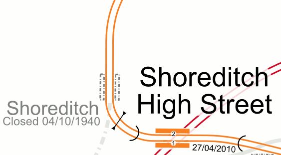
This would be my choice for an extra interchange, as it would mean that I would get easy access to the Central Line after three stations from Dalston Junction station, which is my nearest access to trains.
And What About Pricing?
Crossrail and Thameslink could be railways with an unusual usage profile. I believe that outside of the Peak, the central sections of these two routes could have a much more relaxed feel with the ability to handle lots of passengers in the Off Peak. They will also be like express motorways taking the pressure off lines like the Central, Jubilee, Northern and Piccadilly in the City Centre.
So will this spare capacity, change passengers habits and attract more leisure travellers into the City Centre?
Get the access right and make the City Centre, easy to access from everywhere, with all stations step-free and especially in the City Centre itself, and couple this with the new capacity, I believe that we can reduce the traffic in the City Centre, by encouraging drivers to leave their vehicles further out.
Pricing of tickets could be the smart weapon to encourage this use of Park-and-Ride.
London’s ticketing system, which is based increasing on contactless bank cards collects masses of data about passengers movements and thus Transport for London know all the busy routes and stations.
The system works by logging your various journeys throughout the day and then charging the card overnight, applying any daily, weekly or monthly caps.
Very radical ideas could be applied to the ticketing rules.
For example, anybody who has come into the City Centre from the suburbs can have as many Zone 1 journeys in the day as they want.
So a couple of typical Essex Girls might leave their expensive wheels at Chadwell Heath and just tap in and out all day, as they travelled between Bond Street, Eastfield, Knightsbridge, Marble Arch and Westfield.
How much economic activity would this sort of behaviour generate?
Secondary Effects
If London can persuade anybody coming into the Centre, that the place for a vehicle is not in the Centre, then there will be secondary effects.
- Air pollution levels will drop, especially if all taxis and commercial vehicles are zero-emission.
- Bus numbers can be reduced, if the Underground is more convenient and free for short journeys in the City Centre.
- If traffic in the centre drops, more and more journeys will be done on foot or a bicycle.
Would it also mean, that vehicles could be properly charged for coming into the Centre and checked.accordingly. Would this drop all forms of crime?
What About Other Cities?
Some towns and cities in the UK are developing city centre networks.
To be continued…
Worries About The Metropolitan Line Extension
The title of this article in the Evening Standard is Metropolitan line extension to Watford Junction could be axed due to £50m funding gap.
That obviously is causing worries.
In December 2016 I wrote Is The Croxley Rail Link To Be Given Lower Priority?, where I went through the design and concluded that a simler scheme might be enough and just as useful.
After looking at all the other possible new train services to Watford, which include.
- The Bakerloo Line Extension
- The London Overground
- Crossrail
- Southern
- London Midland
- Metropolitan Line Upgrade
- Chiltern Railways
I postulated if a lower cost link could be built.
And then I wrote this conclusion.
I believe that Watford will get a better train service, whether the Croxley Rail Link is built or not.
Politics will decide the priority of the Croxley Rail Link, with the left-leaning South Londoner Sadiq Khan on one side and right-leaning Bucks-raised Chris Grayling on the other. In some ways, Watford is a piggy-in-the-middle.
My feeling is that on a Londonwide basis, that the Bakerloo Line Extension to Watford, solves or enables the solution of a lot of wider problems and the Croxley Rail Link is much more a local solution.
I think it could turn out to be.
- A mainly double-track route from Watford Junction to Amersham, but with portions of single track.
- No new electrification.
- Stations at Watford High Street, Watford Vicarage Road, Cassiobridge, Croxley and then all stations to Amersham.
- Four Class 710 trains per hour (tph), running on existing electrification and batteries between Watford Junction and Amersham.
- A redeveloped Watford station keeps its four tph to London.
It might even be simpler.
It would certainly by more affordable.
The Adverse Effects Of Electric Vehicles
This article in theMail OnLine has one of those titles which are all you need to read.
UK could need 20 more nuclear power stations if electric cars take over our roads and cause ‘massive strain’ on power network
There is also a similar article in The Times.
The articles are based on research by Transport for London.
The article has a point and TfL have done the sums.
Consider the future.
At present London doesn’t apply the full Congestion Charge for electric vehicles and they get other discounts. So as electric vehicles get more affordable and with a longer range, it will be sensible to purchase an electric vehicle and take advantage of using it at a discount in London.
So will London be grid-locked by electric vehicles?
We may get cleaner air, but how will all those, who depend on buses and taxis get through all this congestion?
Many of these new electric cars will be driverless, which will increase their attraction and just add to the congestion.
All of these vehicles will also need to be charged, so will we see every parking space fitted with a charging point.
Who is going to pay for these points?
And then as Transport for London say, just providing enough electricity for London’s transport, will require two nuclear power stations.
So how about using hydrogen fuel cells to power these vehicles?
But to create the hydrogen you need electricity to electrolyse water. So more nuclear power stations?
So what will we do?
London is lucky, in that compared to other cities in the UK, it has an extensive public transport network that works, that people like to use.
So Crossrail 2 and possibly 3 and 4, if properly designed can take the pressure off London, to allow space for driverless electric buses and taxis, and a severely restricted number of other vehicles.
Just as people are now complaining that they were told by the Government to buy a diesel car and now they are being abused as polluters, in a decade or so, those buying electric cars will be abused as congesters.
Owning a car in the future will become an increasingly expensive and annoying business.
The Worksites Of The Bakerloo Site Extension
Building the Bakerloo Line Extension will hopefully finish around 2028/29.
So I’m publishing these maps of the areas, that could be affected by works, so if perhaps you’re thinking of moving house, you can take an appropriate decision.
The Route
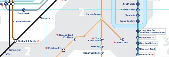
This is TfL’s latest route map between Elephant and Castle and Lewisham stations.
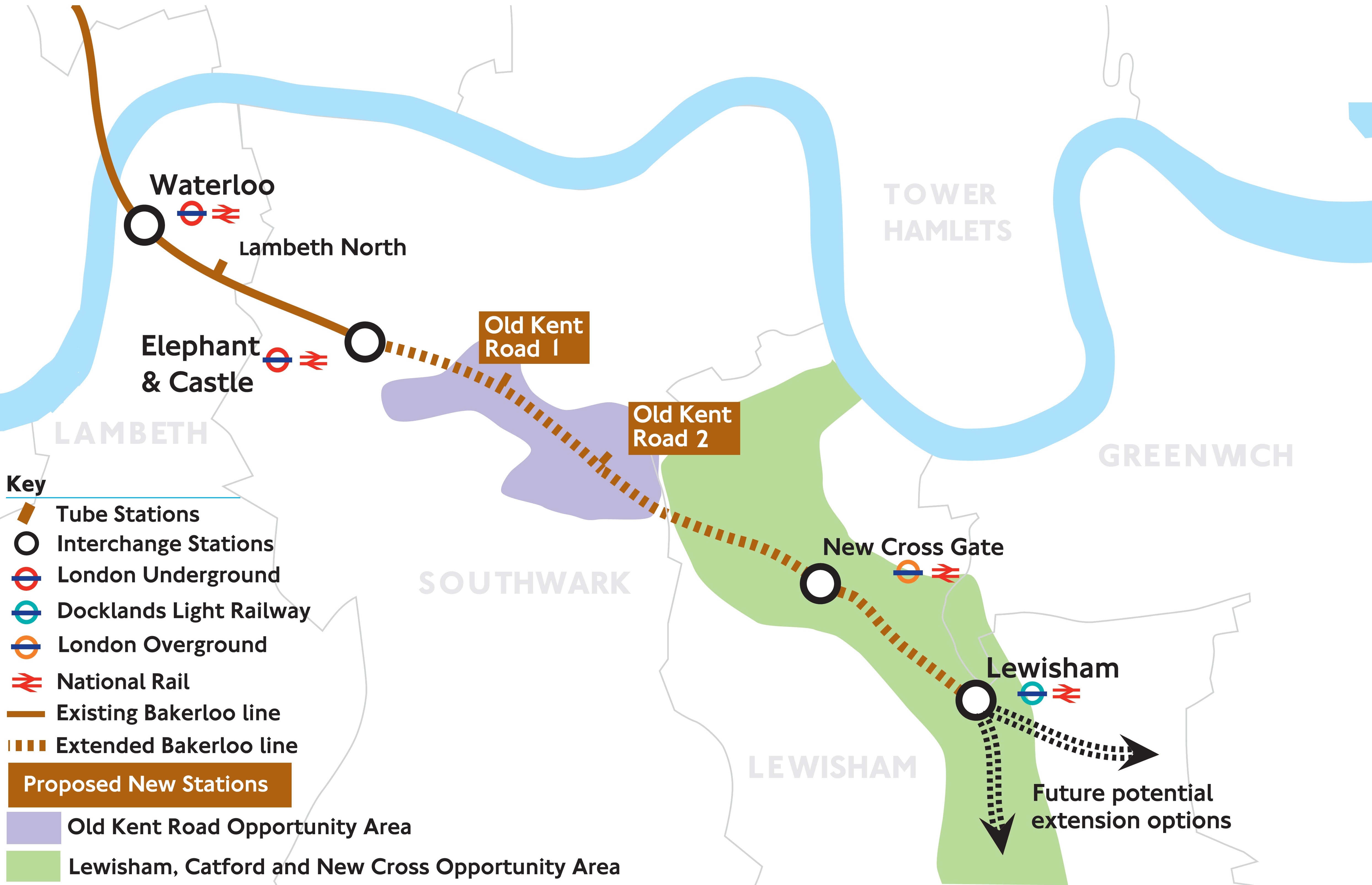
Note the two completely new stations with the imaginative names of Old Kent Road 1 and Old Kent Road 2.
The full document is here on the Transport for London web site.
The Worksites
The sites are given in route order from the North.
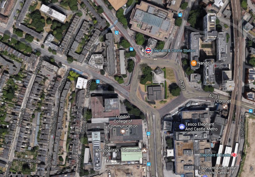
Elephant And Castle
The map from carto.metro.free.fr shows the lines through the station.
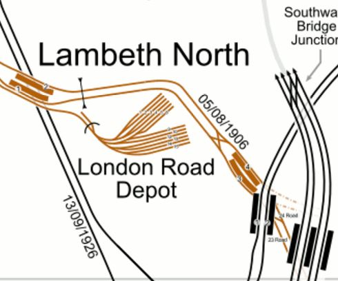
The North-South lines across the map are from West to East.
- The Charing Cross Branch of the Northern Line – Dated 13/09/1926
- The Bakerloo Line – Dated 05/08/1906
- The Bank Branch of the Northern Line.
- Thameslink to Blackfriars and Orpington, Rainham, Sevenoaks, Sutton and Wimbledon.
Just below this map is Kennington station, where the two branches of the Northern Line meet and will divide to Morden and Battersea Power Station stations.
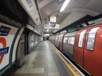
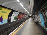
Elephant and Castle is effectively two separate stations at present, with one for the Bakerloo Line and one for the Northern Line. Both stations have lifts and narrow, dingy platforms and passageways. Connections between the two stations underground is not good.
These pictures of Elephant and Castle station were taken on February 12th, 2017


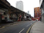
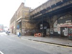
Works envisaged at Elephant and Castle station include.
- A new larger ticket hall for the Bakerloo Line
- Wider platforms for the Bakerloo Line
- Escalators aren’t mentioned, but would probably be included for the Bakerloo Line
- New ticket hall for the Northern Line
- Three escalators and more lifts for the Northern Line to provide step-free access.
- Better connections between the two lines.
I would hope that a comprehensive design would include a step-free link to the Thameslink station.
I suspect, that the two stations could be rebuilt as two separate projects, with the Northern Line station being updated before the Bakerloo Line station.
If the two projects were properly planned, I believe that trains could continue to run on the Northern Line throughout the works, with trains running to the Bakerloo Line platforms until they needed to be closed for updating and connection to the new tunnels.
I wouldn’t be surprised to see an updated pedestrian connection between the Bakerloo and Northern Line platforms created first, so that at least one entrance to the platforms is available throughout the works.
This Google Map shows the area around Elephant and Castle.
Eephant And Castle
Transport for London have said they need a worksite in the area.
Bricklayers Arms
Bricklayers Arms is known to many as a roundabout and flyover on the A2 into London.
This Google Map shows the roundabout.
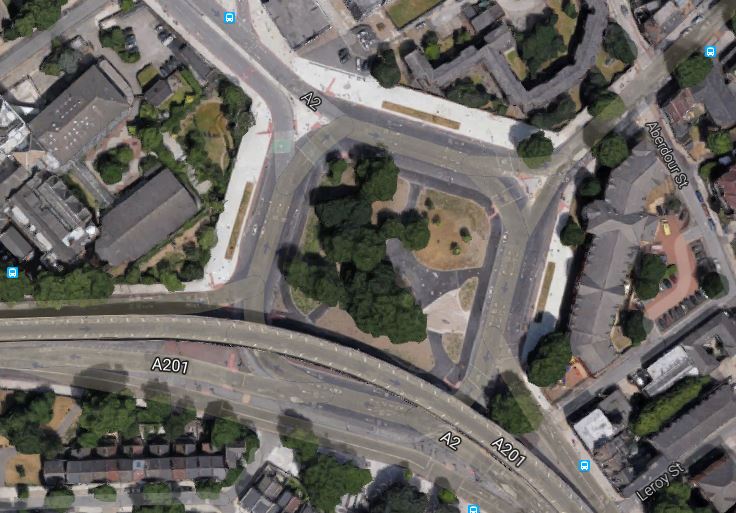
Bricklayers Arms
It is one of two possible locations for a shaft that will be needed between Elephant and Castle and Old Kent Road 1 stations.
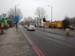
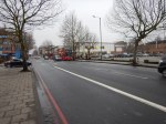
These pictures of Bricklayers Arms were taken on February 12th, 2017.


The worksite could be in the middle of the roundabout.
Faraday Gardens
This Google Map shows the South-East corner of Faraday Gardens.
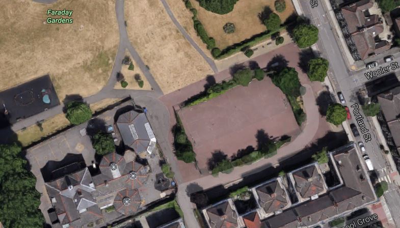
Faraday Gardens
It is one of two possible locations for a shaft that will be needed between Elephant and Castle and Old Kent Road 1 stations.
These pictures of Faraday Gardens were taken on February 13th, 2017
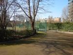
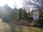
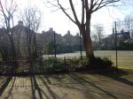


The worksite could be in the a hard playground.
My personal view is that the Bricklayers Arms site is the better from a working point of view, but is it in the best position?
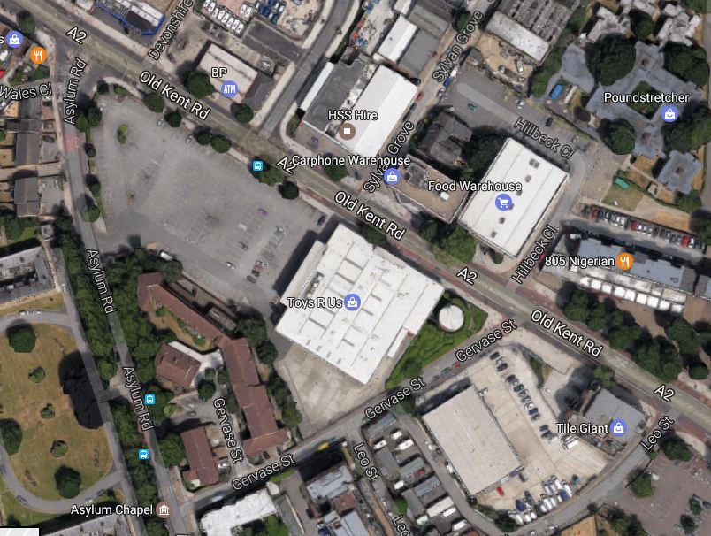
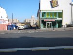
Old Kent Road 1 Station
This Google Map shows the area, where Old Kent Road 1 station will be located.
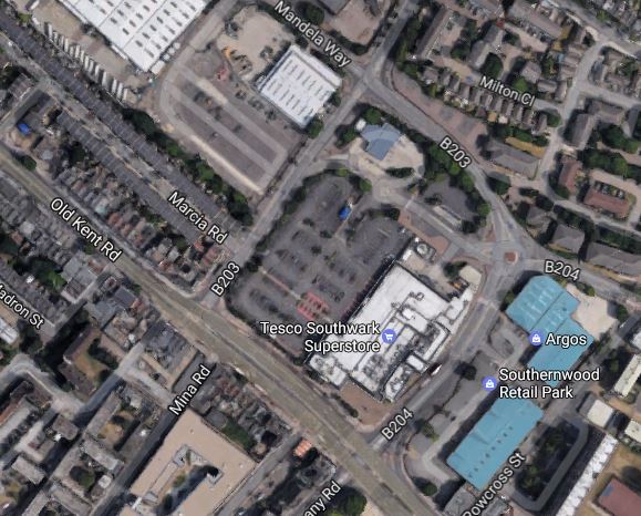
Old Kent Road 1 Station
There are two options given for the location of the station.
Note the Tesco Southwark Superstore in the middle of the map, with its car park alongside.
- Option A for the station is on the other side of Dunton Road and slightly to the North West of the car park.
- The other Option B is on the Old Kent Road on the site of the store itself.
These pictures of the area around the Tesco store were taken on February 12th, 2017.


The group of people most affected by the construction of the station will be those who shop at this Tesco.
I suspect that given the company’s current position, Tesco would be happy to co-operate with TfL. After all there must be advasntages in having a superstore on top of an Underground station.
If the Tesco Superstore had to be knocked down, there are lots more anonymous architectural gems like this one.
So I wouldn’t be surprised to see Option B implemented, with a brand new station alongside the Old Kent Road.
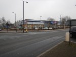
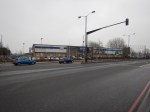
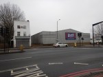
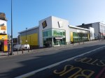
Old Kent Road 2 Station
There are two options for this station.
This Google Map shows the location of Option A opposite B & Q.
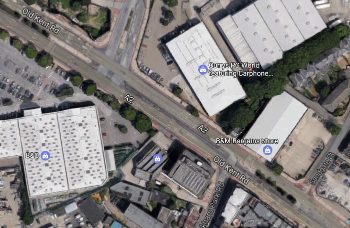
Option A For Old Kent Road 2 Station
The station will be on the the Currys PCWorld site along the road.
These pictures of the area around the Currys PCWorld store were taken on February 12th, 2017.
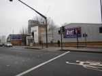
This Google Map shows the location of Option B on the Toys R Us site on the other side of the Old Kent Road.
Option B For Old Kent Road 2 Station
These pictures of the area around the Toys R Us store were taken on February 12th, 2017.

Both chosen sites would appear to have plenty of space and wouldn’t require the demolishing of any housing.
Note that the Toys R Us stored was closed in April 2018. Did Transport for London rewrite their plans and are they in negotiation for the now-vacant site?
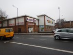
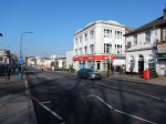
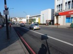
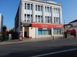
New Cross Gate Station
New Cross Gate station is an existing Overground and National Rail station.
This Google Map shows the station and the Retail Park, that is alongside the station to the West.
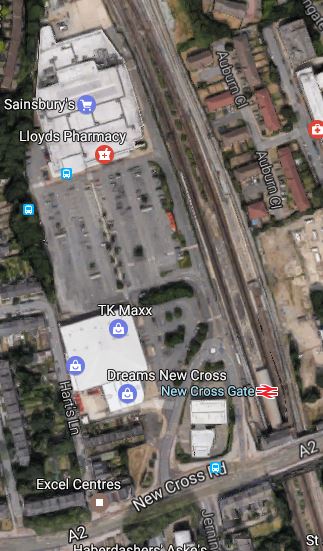
New Cross Gate Station
These pictures of the area around the Sainsburys store were taken on February 12th, 2017.
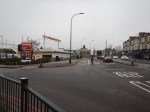
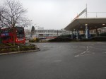


The worksite would take over the car park, with the station being built underneath.
This worksite is very much the most important site of the extension. The consultation says this.
The size of the proposed site provides several opportunities for the project. It could allow soil to be taken away by train rather than using local roads. We could also start the tunnel machinery from this site.
When the station is completed, I can envisage New Cross Gate becoming an important transport hub, with a quality shopping experience.
Alexandra Cottages
Alexandra Cottages, a short road off Lewisham Way has been proposed as the location of a shaft between New Cross Gate and Lewisham stations.
This Google Map shows the location.
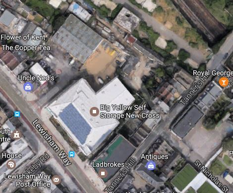
Alexandra Cottages
I suppose the site has been chosen, as the site contains a Big Yellow Self Storage facility and a Ladbrokes betting shop.
These pictures of the area around the storage facility were taken on February 13th, 2017.
Will the shaft be buried in the basement of a development suitable for the area?
Lewisham Station
This Google Map shows the current Lewisham station.
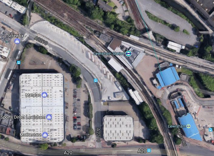
These pictures of the area around the Lewisham station were taken on February 13th, 2017.
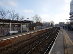


The new Bakerloo Line station will be underground between the station and Matalan. The area is currently bus parking.
Because of the different levels and tunnels and some railway arches in good condition, the addition of the Bakerloo Line station could be a challenging one, but also one that could be architecturally worthwhile.
Consider.
- Is the current station built on arches, that could allow passengers to circulate underneath?
- Could escalators and lifts connect the main line and ?Underground stations?
- Could there be significant oversite development on top of the station?
- Could the Bakerloo Line station be built without a blockade of the current station?
- Will Lewisham station be reorganised to be less of a bootleneck?
It will be interesting to see the final design.
Wearside Road
This Google Map shows the worksite in Wearside Road, which will be used to create a shaft to the overrun tunnels.
The multi-track line going North-West to South-East is the South Eastern Main Line, whilst the line going South-West to North-East is the Hayes Line.
The worksite will go at the Northern end of the light-coloured area South of where the two lines cross.
This map from carto.metro.free.fr shows the lines in the area.
I think it is quite likely that the overrun tunnels will be under the Hayes Line.
Extension To Hayes
This document on the Lewisham Borough Council web site is a must-read document, as it gives the view of the Council and their consultants; Parsons Brinckerhoff about the Bakerloo Line Extension.
The report is very much in favour of the Extension being built and it hopes that it can be extended using the Hayes Line, where the trains would terminate at either at Hayes or Beckenham Junction stations.
Currently, Elephant and Castle station handles 14 tph, so as there would appear to be no terminal platform at that station, at least this number of trains will connect between the Bakerloo Line at Lewisham station and the Hayes Line..
But as other deep-level tube lines handle more trains, with the Victoria Line handling 36 tph by the end of this year, I don’t think it unreasonable to expect a service frequency in excess of 20 tph.
The Wikipedia entry for the New Tube for London is quoting 27 tph.
So could this give at least 10 tph to both Southern terminals?
To handle 10 tph, I think it reasonable to assume that two terminal platforms are needed.
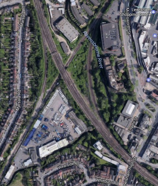
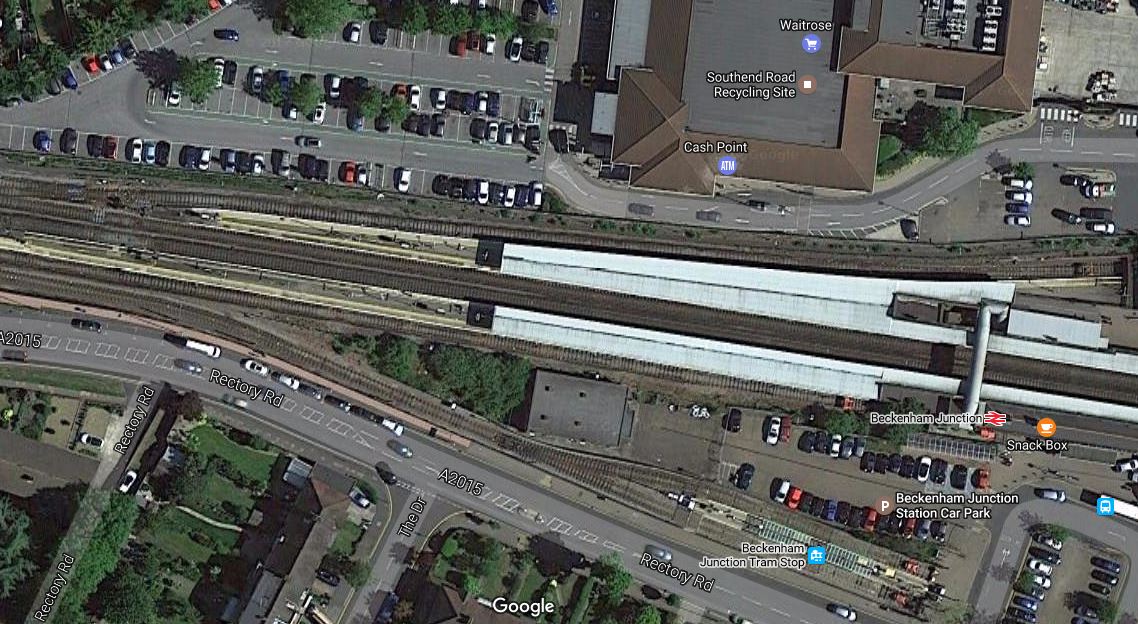
Hayes has two platforms, but Beckenham Junction has only one spare platform, as this Google Map shows.
But I suspect if Waitrose are reasonable, a deal can be done.
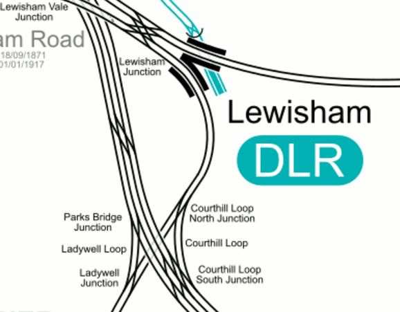
If the overrun tunnels at Lewisham station,are more-or-less under the Hayes Line, these tunnels would be easily connected to the Hayes Line in the following manner.
, with all other services using the Courthill Loop to go on their way.
Hayes station would swap its two tph services to both Cannon Street and Charing Cross stations for at least a 10 tph service on the Bakerloo Line.
I also think, that services could go direct between Hayes and London Bridge, Cannon Street or Charing Cross using the Ladywell Loop.
Beckenham Junction would have a similar service and I’m sure this would please Lewisham Borough Council.
Network Rail would gain four paths per hour through Lewisham station to use for other services.
Lewisham Borough Council also suggests the following for the Hayes Line.
- Move Lower Sydenham station further to the North.
- Create an interchange between Catford and Catford Bridge stations.
- Look seriously at the zones of stations on the Hayes Line.
They are certainly forcible in what they want.
Conclusion
This extension, looks like it is a railway designed to be built without too much fuss and objections.
Most of the worksites seem to have good access and it would appear that few residential properties will be affected.
A Visit To The Design Museum
I visited the Design Museum yesterday.


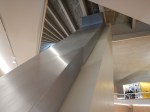

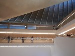

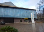
It is an interesting concept and I think as it settles down it will be worth visiting again.
One problem, I had with the Museum is getting to and from the site in Holland Park.
I went by the Underground to High Street Kensington station and took about ten minutes to walk along to the museum.
Coming back, I thought I’d go a different way after a walk.
But after emerging from the Museum, there were none of London’s excellent Legible London maps and signs to be seen.
Eventually, I walked through Holland Park, but it was the same story on the other side of the Park; no maps or signs to the Underground. There were several fingerposts in the Park, but none pointed to the Underground.
I suppose if you’re in a Chelsea Tractor, many of which were rushing around the area, you’re not interested in walking maps and are against your Council spending monry on them, as it might attract more visitors.
Echoes Of The Past At South Kensington Tube Station
South Kensington Tube Station has been through many changes, since it opened in 1868.
This map from carto.metro.free.fr shows the layout of the lines at the two stations.
Unusually for the Circle/District Lines, both these stations are island platforms. But note how there used to be platforms on the outside of the lines we see today.
These are some pictures I took today.

There certainly quite a bit of space and abandoned infrastructure in the station.
In the Wikipedia entry for the station, under Future Proposals, failed plans for developing above the station are detailed.
It’s certainly puzzling, why the space isn’t used better, as it is a site of 0.77 hectares.
It might also be a space large enough to put in an extra platform, if that were needed.
Where The Northern Line Extension Spoil Is Going
This article in Your Thurrock, is entitled London Tube tunnelling project set to benefit arable land in East Tilbury.
It gives a good overview of the tunnelling for the Northern Line Extension and states that the tunnel spoil will be taken by barge to Goshems Farm in East Tilbury.
This Google Map shows the North Bank of the Thames from Tilbury Fort to East Tilbury.
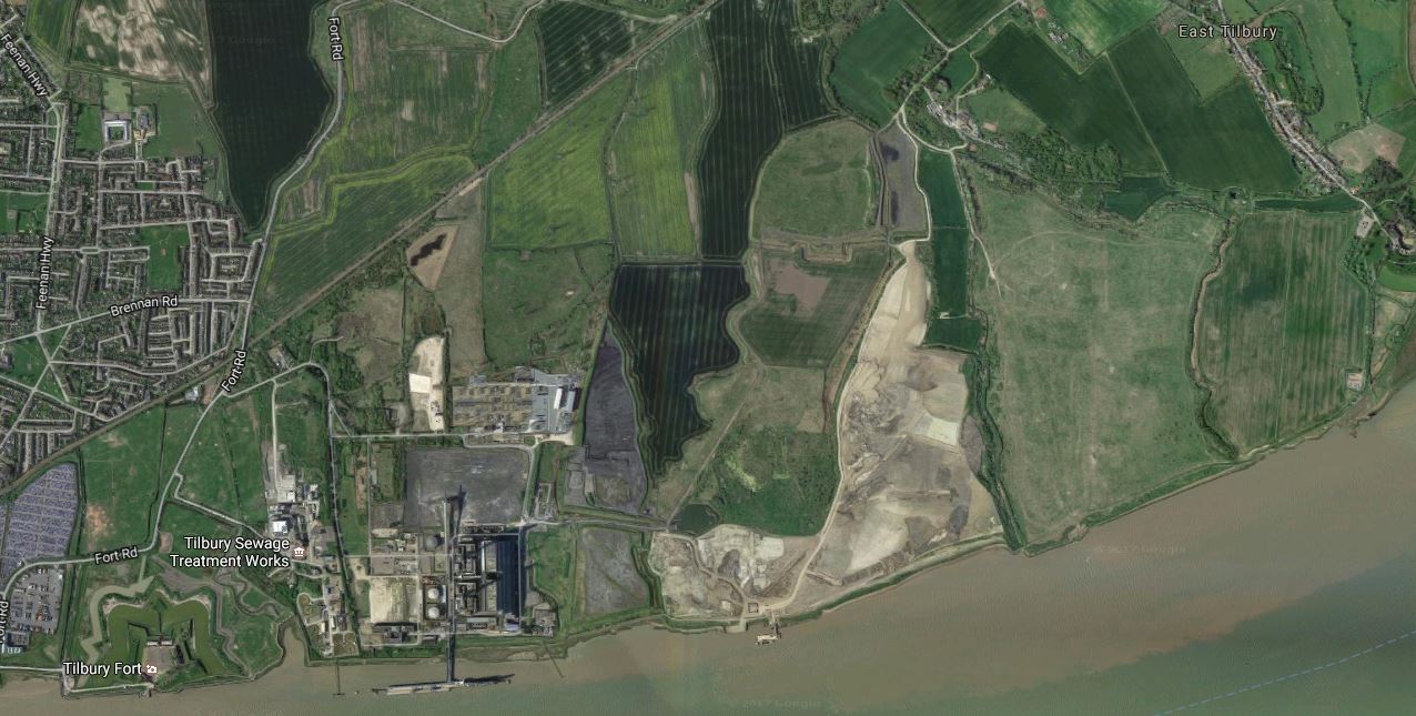
Tilbury Fort is in the South West corner of the map, by the river and East Tilbury is in the North East corner.
This is a more detailed map of the area of Goshems Farm.
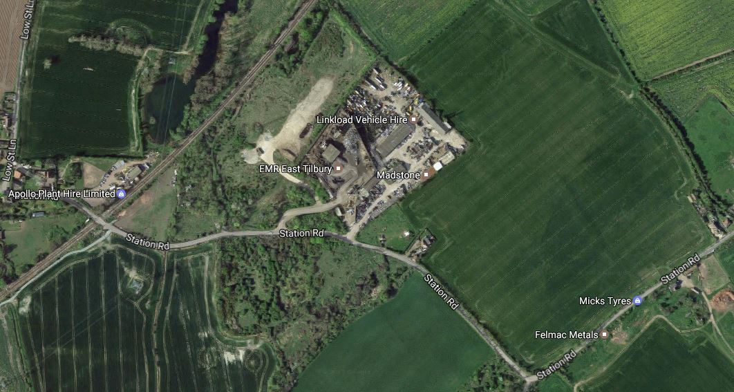
Goshems Farm is in the area of Felmac Metals and Micks Tyres, which from their names are typical businesses, you find in areas like these all over the UK.
Note Station Road leading up to the disused Low Street station, which was on the London, Tilbury and Southend Railway, which is now served by c2c.
I suspect that the spoil will go into the light-coloured land between this area and the Thames, which could be something like an old landfill site.
It’ll certainly be a lot more use as arable land.
The Start Of Change At Victoria Tube Station
On the early-evening BBC London News last night, the BBC showed preview pictures of the new entrance to Victoria tube station, which they indicated is on Brettenham Place.
The station certainly needs more capacity, as this extract from Wikipedia indicates.
Victoria is currently the fourth busiest station on the London Underground, after Waterloo, Oxford Circus and King’s Cross St. Pancras, with nearly 85 million using the station (not including interchanging passengers) in 2013, of which around 60 million (including interchanges) use the Victoria line platforms. The station was not built for this number of passengers, which results in severe overcrowding. To prevent any dangerous situations like crowds pushing people off the platforms onto the track, crowd control measures are in place at the busiest times. This effectively means closing all the entrances to the Underground platforms and operating as an exit-only station until the overcrowding is relieved. These measures can last anywhere between a couple of minutes (when minor delays are occurring) up to several hours (during major incidents).
As to the layout of lines through the station, Victoria tube station is fairly simple, as this map from carto.metro.free.fr shows.

Note.
- The Circle and District Lines have a typical Victorian layout, with two platforms on the outside of the tracks.
- The 1960s designers of the Victoria Line at least left a lot of space between the two tracks.
- The Victoria Line also incorporates two full sidings, numbered 22 and 23 between the tracks.
As nearly all trains throughout the day run run between Walthamstow Central and Brixton, the use of these sidings must only be for purposes like overnight stabling and parking failied trains.
According to Wikipedia, currently each set of lines have their own ticket offices on different levels and built over a hundred years apart.
Walking between the Circle/District Lines and the main line station is not for the faint-hearted or those with need for step-free access. The 1960s designers at least made walking between the Victoria Line and the main line station a bit easier, but there is still a flight of steps to be overcome.
If I go to Victoria station with a wheeled bag, which is not often, I take the easy route of a 38 or N38 bus from around the corner, direct from around the corner from my house.
So what is happening over this weekend?
This Google Map shows the area to the North of the station.
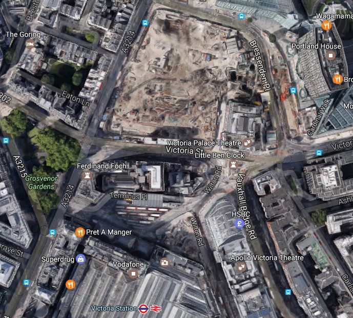
Note.
- North of Victoria Street is a massive building site.
- The rows of white-roofed red buses on the station forecourt..
Wikipedia says this about the current upgrade.
To provide a lasting solution to this problem preparatory building work has begun on major upgrade of the station. This will include a new northern exit/entrance on the north-west corner of Victoria Street which will be accessible via a new additional ticket office under Bressenden Place that will lead to both the Victoria line and the Circle and District line platforms.
I will go and do some more digging.
The Victoria Line Platforms
Currently, the Victoria Line platforms have two sets of escalators.
- The original set of three, that so up into the Victoria Line ticket hall under the bus station.
- A second set of three, that go from the platforms into a series of passages underneath the Circle and District Line platforms, to which they connect with short sets of stairs.
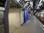
These pictures show the Victoria Line platforms, various passages and works.


It looks like there are two new sets of works.
One set could just be an extension of the current lobby at the bottom of the original escalators. This would increase the capacity between the Victoria Line and the main line station.
Judging by the sign saying Cardinal Place on the other works at the Northern End of the platforms, it would appear that these works are a new entrance from Cardinal Place.
The Cardinal Place Entrance
On the surface, the Cardinal Place Entrance is clearly visible, outside the Cardinal Place development.

According to a personable member of the station staff, The new entrance will open sometime after ten on Monday morning.
At Cardinal Place, the overall design would appear to be simple, where an escalator shaft has been dug between the Northern end of the Victoria Line platforms and a new entrance hall beneath Bressenden Place, which then has the simple pop-up entrance shown in my pictures
The constructure, appears to have been carried out, without massive closures of the Victoria Line platforms.
The surface building also looks very similar in concept to the new standalone glass and steel entrances at Kings Cross St. Pancras and Tottenham Court Road stations.
So I wonder how many new entrances can be created at existing stations, by using a similar design and building method.
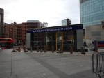
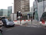
Walthamstow Central Station
Walthamstow Central station suffers very bad overcrowding , with only two escalators and no lifts having to cope with the passengers from over 40 trains per hour.
This map from carto.metro.free,fr shows the layout of platforms at the station.
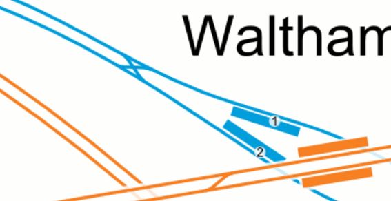
Note how there is a wide lobby at the Eastern end of the platforms underneath the Overground lines, which is used to accommodate the escalators and the waiting queues of passengers.
The crossover to the West of the station was installed in August 2015 and I suspect that this work didn’t compromise any of Transport for London’s thoughts of improving capacity at Walthamstow Central.
It could be tight to dig a shaft for three escalators into this area, but at least the area on top is mainly grass, market stalls and not the best of buildings, with the exception of the Library.
If you look at the length of the current escalators at the station, they indicate that the Victoria Line is not deep. So that would help.
I suspect we could see a very innovative and simple solution to create a new Western entrance at Walthamstow Central station.
I would also be possible to build the entrance without any disruption to either existing train services or passengers in the existing station.
