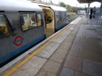
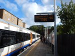
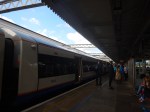
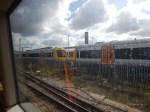
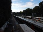
Musical Trains On The Overground
The November 2017 Edition of Modern Railways (MR) has a news item entitled Nine More Class 710s Planned.
This is the first paragraph.
Transport for London is proposing the acquisition of nine additional Class 710 EMUs from Bombardier to support the London Overground rxtension to Barking Riverside and an enhanced service on the East London Line.
Transport for London (TfL) are ordering six five-car and three four-car Class 710 trains.
This article on London Reconnections (LR) is entitled More Trains for London Overground: A Bargain Never to be Repeated.
The title gives a clue as to the first part of the article and it talks about how it may be necessary for TfL to get their order in now to get the best terms and price for the trains.
Putting the two articles together, some interesting train use could be happening on the various lines of the Overground.
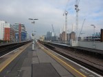
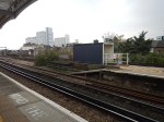
The East London Line
Certain improvements have been planned for the East London Line.
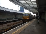
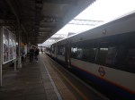
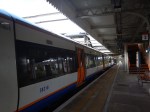
The Class 378 Trains
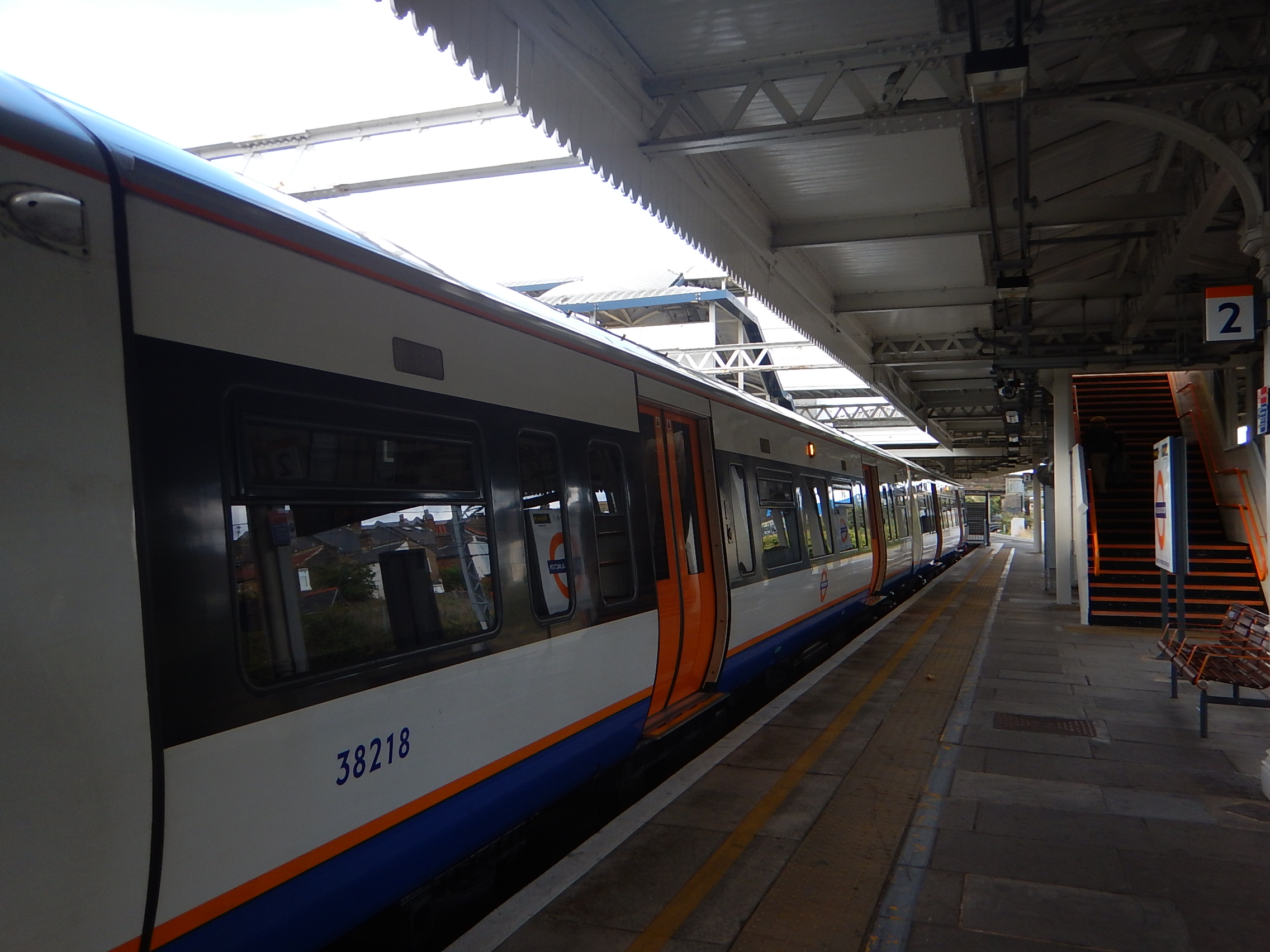
The current fleet of 57 Class 378 trains are now five cars in length, after starting at just three cars.
Many of the stations on the East London Line could accept six-car trains and the other could be worked using selective door opening.
So TfL probably have an option to increase capacity on the East London Line by twenty percent, by adding an extra car to the Class 378 trains on the line.
The Class 378 trains are also certified for working the Thames Tunnel, whereas the Class 710 trains don’t appear they will be.
The Night Overground
A 24-hour service on Friday and Saturday nights, between New Cross and Dalston Junction/Highbury and Islington stations.
Crossrail And The East London Line
This will happen in December 2018, when Stage 3 of Crossrail opens between Abbey Wood and Paddington stations, with a connection to the East London Line at Whitechapel station.
When you consider that Whitechapel will be served by 12 x nine-car Crossrail trains per hour (tph) from December 2018 and 24 x nine-car tph from May 2019, you do wonder if the East London Line’s sixteen x five-car tph will cope with the extra passengwe.
Increased Frequencies
TfL have said they will increase the core frequency of the East London Line from sixteen tph to twenty in 2021.
I wrote about this two years ago in Increased Frequencies On The East London Line, so the plan is an old one, even if it has slipped a bit.
The original plan envisaged the following extra trains on the East London Line.
- Two tph – Dalston Junction to Crystal Palace in 2018
- Two tph – Dalston Junction to Clapham Junction in 2019
It would need the following.
- More Class 378 trains, as the Class 710 trains are not certified for the Thames Tunnel.
- Improved digital signalling in the core, which would eventually enable twenty-four tph.
The LR article suggests that there may be capacity problems at Clapham Junction station and two tph to Battersea Park station is suggested as an alternative.
Battersea Park Station
Battersea Park station is already served by the Overground, with this service, which is detailed in Wikipedia.
1 train per day to Highbury & Islington / 1 train per day from Dalston Junction.
Wikipedia adds this comment.
Until December 2012, Southern operated a twice-hourly service from London Victoria to London Bridge via Denmark Hill. This ceased when London Overground’s Clapham Junction to Dalston Junction service commenced at that time. However, since December 2012, a skeleton London Overground service has run to/from Battersea Park (instead of Clapham Junction) at the extreme ends of the day to retain a “parliamentary service” between Battersea Park and Clapham High Street.
This map from carto.metro.free.fr shows the track layout at Battersea Park station.
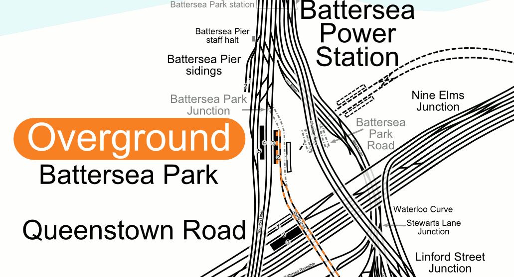
Note.
- The single track going in to Platform 2.
- Platform 1 at Battersea Park station is disused.
- The close proximity of the station to the new Battersea Power Station station, that opens in a few years.
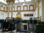
These are some selected pictures of Battersea Park station.
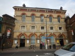

I think it is true to say, that it is a Victorian station, that wasn’t designed for the modern age.
- The station is Grade II Listed.
- The booking hall is a tidy Victorian example.
- There is a lot of excellent Victorian detailing.
- Platform 2 and 3 is wide with sensible stairs.
- Platform 2 is a well laid out terminal platform.
- Platform 4 and 5 is narrow with terrible stairs.
- Plstforms 3 and 4 seem to be long enough for ten-car trains.
It could be turned into what Roy Brooks would have called something better than a ruin. For those of you born since 1960, check the link to a memory of one of the world’s late great honest estate agents.
I’m sure Londoners used to buy the Sunday Times, just to read his adverts.
I can remember my late wife sitting on the sofa, laughing loudly, as she read aloud an advert about a flat, that wouldn’t suit an owner with a cat,.
Battersea Park station and a two tph service from Dalston Junction across South London have a lot going for them.
- I’m sure a budding Lord Foster or Zaha Hadid could come up with a scheme to fix the platform access and make the station passenger friendly and their name.
- The station is a short walk from Battersea Power Station station and must open up routes across London.
- Battersea Park station could easily handle two tph on a single platform.
- In A New Station For Battersea, I talked about a proposal to create a station at Battersea that linked the new tube station to the Southeastern lines into Victoria.
- In Four Trains Per Hour Between Dalston Junction And Battersea Park Stations, I write about how on the 6th November 2017, because of a track fault, London Overground ran a four tph shuttle between the two terminals.
Will all of this be tied together?
Train Requirements On The East London Line
Doing a quick calculation, I think that each of the four branches need the following number of trains for four tph.
- Dalston Junction to Clapham Junction – 8 trains
- Highbury and Islington to Crystal Palace- 8 trains
- Dalston Junction to New Cross – 2 trains
- Highbury and Islington to West Croydon – 8 trains
Which gives a total requirement of 26 trains.
Up the frequency to six tph on each branch or one train every 2½ minutes, which would be 24 tph through the Thames Tunnel and you get the following.
- Dalston Junction to Clapham Junction – 12 trains
- Highbury and Islington to Crystal Palace- 12 trains
- Dalston Junction to New Cross – 3 trains
- Highbury and Islington to West Croydon – 12 trains
Which gives a total requirement of 39 trains.
If you just have an increase to six tph on just the Clapham Junction and Crystal Palace routes as London Overground are proposing for 2020, you get the following.
- Dalston Junction to Clapham Junction – 12 trains
- Highbury and Islington to Crystal Palace- 12 trains
- Dalston Junction to New Cross – 2 trains
- Highbury and Islington to West Croydon – 8 trains
Which gives a total requirement of 34 trains, providing a service of one train every 3 minutes, which would be 20 tph through the Thames Tunnel.
This is eight more trains than at the present time.
It’s all rather impressive for the Thames Tunnel, which was built between 1825 and 1843, by the Brunels.
The Ultimate Capacity Of The East London Line
If we look perhaps ten years into the future, the following will have happened.
- Signalling will have improved.
- Crossrail will be running more than 24 tph through Whitechapel.
- Automatic Train Operation (ATO) will be driving the trains, with the driver keeping a vigilant watch, just as happens on the Victoria Line now!
- Passenger information and management will have improved and passengers will be able to handle the increased frequency of trains easily.
So if Dear Old Vicky can manage thirty-six tph in a 1960’s tunnel, will the East London Line be able to manage the same frequency in an 1840’s tunnel?
The Brunels would have made sure it happened and if it is needed, so will their engineering successors!
Let’s cut it back a bit and aim for 32 tph through the Thames Tunnel, as that was the sort of target engineers were looking at, for the Victoria Line in the 2000s, when the East London Line was being proposed.
How many trains will be needed to run the eight tph on the four routes, that would comprise thirty-two tph through the Thames Tunnel?
- Dalston Junction to Clapham Junction – 16 trains
- Highbury and Islington to Crystal Palace- 16 trains
- Dalston Junction to New Cross – 4 trains
- Highbury and Islington to West Croydon – 16 trains
Which gives a total requirement of 52 trains.
The London Overground has fifty-seven Class 378 trains. I can’t believe that the original fleet was sized on eight tph in operation through the tunnel and a few as hot spares and in maintenance!
But surely eight tph is impossible, as turning the trains at the terminal platforms would be too much!
Think again!
- The Victoria Line at Brixton and Walthamstow Central stations handles 36 tph using two platforms or 18 tph per platform.
- The Northern Line is targeting 36 tph on both lines, when it has been split into two.
With ATO, I’m sure each terminal platform can handle more than eight tph.
More Trains On The East London Line
According to the LR article, the planned new services on the East London Line will require another eight trains. This fits with my calculation.
- These trains have to be Class 378 trains, due to evacuation issues in the Thames Tunnel.
- These trains have to be able to work on lines with third-rail electrification.
London Overground has ordered six five-car Class 710 trains and they will be run on the North London Line and West London Line, where they will displace some five-car Class 378 trains for running on the East London Line.
Some five-car Class 378 trains on the Watford DC Line will also be replaced by four-car Class 710 trains.
So it would look like the East London Line will get some of the eight Class 378 trains that it needs.
Improvements To The North London Line/West London Line
The LR article says this.
London Overground have a long-held desire to increase the frequency on the WLL from 4tph to 6tph. They also aspire to another 2tph (at least) from Clapham Junction continuing to Stratford, to further increase the frequency on the North London Line (NLL). This would enable 10tph on eastern end of the North London line. This is due to be implemented with with main order of the new Class 710 stock.
The article also suspects that London Overground want to run the following services.
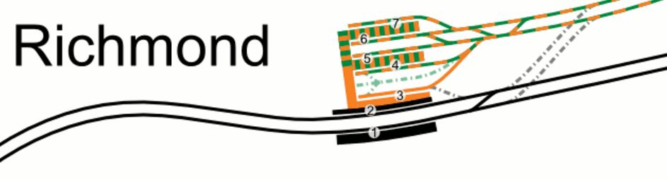
- 6 tph – Stratford to Richmond
- 6 tph – Stratford to Clapham Junction
This would deliver a twelve tph service between Stratford and Willesden Junction.
Living about halfway between those two stations, I’m not complaining.
But the article concludes, that London Overground’s objective can’t be achieved until some freight is moved to the Gospel Oak to Barking Line after the electrification of that line is completed.
As I said earlier, the pair of lines will get six extra five-car Class 710 trains and displace some Class 378 trains to the East London Line.
So will London Overground stick with a mixed fleet on these lines? Or will they perhaps run one class on each route?
I have no idea, but there are quite a few Class 378 trains, that could be displaced by new Class 710 trains to allow the East London Line frequency to be increased.
The Watford DC Line
Currently the Watford DC Line has a three tph service and I suspect that this needs six five-car Class 378 trains to run it.
The LR article says that London Overground want to run four tph on this line and I calculate this will need eight four-car Class 710 trains.
The new trains will probably be a few minutes faster and they will offer an hourly capacity increase of six percent.
But they will release six five-car Class 378 trains to strengthen services on the North, East and West London Lines.
Step-Free Access
Step-free access from platform to train is not good on the Watford DC Line.
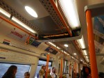
You step up into a Class 378 train and step down into a Bakerloo Line 1972 Stock train.
These pictures show the problem with the Class 1972 trains. When I got off one of these trains at Willesden today it was a jump.
It is some of the worst step-free access on the Underground.
On my short trip on the Bakerloo Line today, I deliberately sat in the last carriage. On most stations the the last carriage was aligned with the end of the platform, which leads me to the conclusion, that most stations are about as long as the trains, which are over 110 metres long.
Can a step-free platform be designed, that will work with the following trains?
- The current Class 378 trains
- The future Class 710 trains
- The current Underground 1972 Stock.
- Any future deep-level Underground trains
The latter could make design more difficult, if the train is built for Unattended Train Operation (UTO) and if platform edge doors are needed at all stations with UTO.
The only solution I can think of, is one that is used in Karlsruhe in Germany and is now being used at Rotherham Central station to accommodate main line trains and Class 399 tram-trains.
The platform is long enough to have two sections, with different platform heights.
- A high section is used with the main line trains.
- A low section is used with the Underground trains.
- Platform edge doors could be fitted to the low section.
- A gentle slope would connect the two sections.
- Entry to the combined platform could be near where the two sections join.
Also, consider the following.
- Given that the length of a Class 710 train is around 80 metres and that of a 1972 stock is in excess of 110 metres, it will be a long platform.
- Selective door opening will be installed on all trains.
- I do wonder, if the new trains for the Watford DC Line are only four cars to ease the problem of step-free access. The reduced length could knock twenty metres off every platform.
- Could we even see the new Underground trains built to a shorter length?
I’m sure that a workable platform design is possible.
The Bakerloo Line And The Watford DC Line
The Bakerloo Line is being extended to the South, but nothing has been said about how it will be changed in the North.
Possibilities for Northern terminals for the line could include.
- Queen’s Park
- Stonebridge Park
- Harrow and Wealdstone
- Watford Junction
It’s also complicated because the depot is at Stonebridge Patk.
I wouldn’t rule out extending the of the Bakerloo Line to Watford Junction, as is talked about in Wikipedia under Re-extension to Watford Junction.
What would be the consequences, if the following were to be done?
- An extended Bakerloo Line has an increased frequency of at least twenty tph between Watford Junction and Lewisham.
- The new trains for the Bakerloo Line are faster.
- The new Bakerloo Line trains had a capacity increase from the current 700, so they carried about the same as the five-car Class 378 trains.
The increased frequency of Bakerloo Line service, would probably result in London Overground’s Euston to Watford service to be discontinued.
The benefits would be as follows.
- Stations from Queen’s Park to Watford Junction would get a more frequent service, of possibly a train every three minutes.
- The problems of step-free access and platform-edge doors would be solved, as all trains would be on the Bakerloo Line.
- London Overground would not need any platforms at Euston, which could help in the rebuilding of Euston for HS2.
It would also mean that London Underground got another high-frequency Underground Line without any junctions, that could be run very efficiently.
But it would mean Kilburn High Road and South Hampstead stations would lose their connection to Euston.
A Willesden Junction To Stratford Via Kilburn High Road, South Hampstead and Primrose Hill Service
Reopening Primrose Hill station has been mooted in the past. This is said in the Wikipedia entry for the station.
It has been proposed to re-open Primrose Hill station by bringing the short stretch of line between South Hampstead and Camden Road stations back into the regular passenger service by incorporating it into the London Overground network.
A reopened Primrose Hill station, would only be a short walk to Chalk Farm station.
At Willesden junction station, there is even a convenient South-facing bay platform, that is numbered 2 and could handle four tph.
The picture shows a Class 378 train in Platform 2 at Willesden Junction station, was taken on Sunday, the 2nd of October 2016, during engineering works, when a Rail Replacement Train was run between Willesden Junction and Stratford stations.
But there are problems.
- Where would you terminate the service at its Eastern end? Highbury and Islington, Stratford or somewhere else, like perhaps a reopened Maiden Lane station?
- Kilburn High Road and South Hampstead stations sill lose their srtvoce to Euston and they would have to change at Highbury and Islington.
- Organising the time-table might be difficult.
- I also think, it would mean that Kensal Green station would be very difficult to make step-free, if it had to be served by both Overground and Bakerloo Line trains.
On the other hand, Queen’s Park station is an excellent example of a step-free cross-platform interchange between the two types of trains and Willesden Junction station could be equally good.
Crossrail, The Bakerloo Line And The Watford DC Line
All these three lines either serve Watford Junction or it has been suggested that they do.
- Plans to extend Crossrail up the West Coast Main Line would probably include a stop at Watford Junction, if they materialise.
- Extending the Bakerloo to Watford Junction is suggested from time-to-time.
- The Watford DC Line already serves Watford Junction station.
Given that a high-frequency efficient extended Bakerloo Line running between Watford Junction and Lewisham would serve the smaller stations on the way to Watford very capably, I suspect that whatever happens to Crossrail and the Watford DC services, the Bakerloo Line will be extended to Watford Junction.
The extended Bakerloo Line would have the following characteristics.
- Probably all trains running between Watford Junction and Lewisham.
- A frequency of upwards of 20 tph
- No junctions and end-to-end running like the Victoria and Jubilee Lines.
- Full step-free access at all stations.
- New faster, walk-through trains with wi-fi and 4G.
- An efficient connection to Crossrail at Paddington will be opened in December 2018.
- National Rail connections at Charing Cross, Elephant and Castle, Lreisham, Marylebone, Paddington, Waterloo and Watford Junction
It may be London’s forgotten line, but once extended, it could be a new star. Especially, if it gets to be linked directly into Old Oak Common station for all the services including HS2, that will be available there.
The Watford DC Line doesn’t connect to Crossrail, which makes me feel, that when everything gets decided about the extended Bakerloo Line and the new station at Old Oak Common, then the Watford DC Line could miss out.
Through Running Between North And East London Lines
I seem to remember reading in Modern Railways about ten years ago, that there was an ambition in TfL to extend some East London Line trains to Willesden Junction.
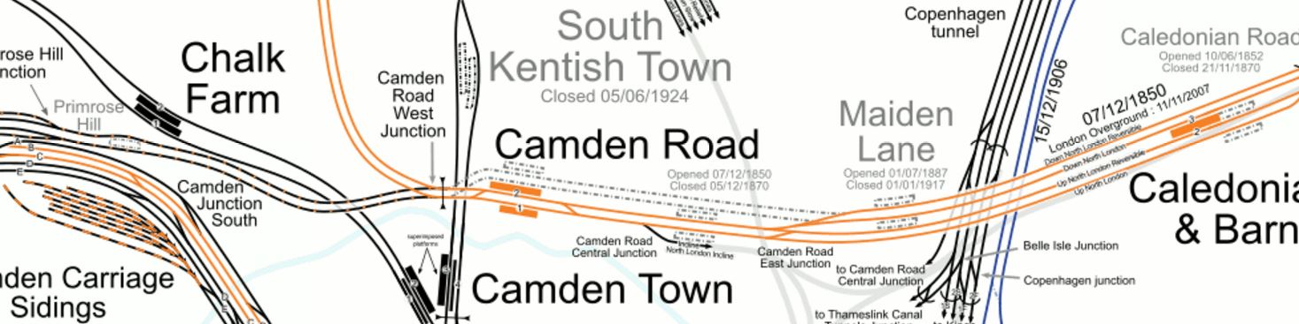
Look at this map from carto.metro.free.fr, which shows the lines at Highbury and Islington station.
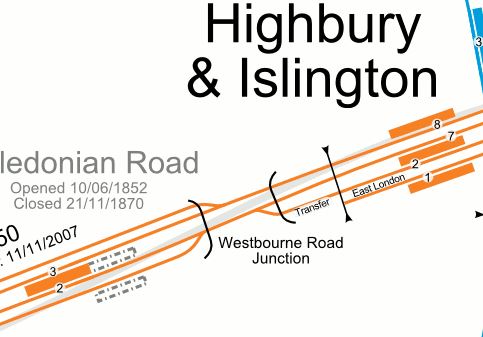
Note the single line labelled Transfer, that connects Platform 2 at Highbury and Islington station to the Westbound North London Line, that runs through Platform 7.
I think it would be possible to make Platform 2 into a bi-directional through platform.
- All Westbound trains on the Westbound North London Line would leave from the island platform between platforms 2 and 7.
- Voltage changeover between 750 VDC and 25 KVAC would take place in Platform 2.
- A four tph service in both directions would mean a train every 7-8 minutes.
- The four-track section of the North London Line between Highbury and Islington and Camden Road stations, includes two reversible lines.
Was this all future-proofing to allow services to run between the North London and East London Lines?
It is interesting to note, that Platform 2 is used for services to and from West Croydon station.
These services take around 51-55 minutes and currently need eight trains for a four tph service.
This screen capture shows the train timetable, when I rode between Highbury and Islington and Willesden Junction stations.
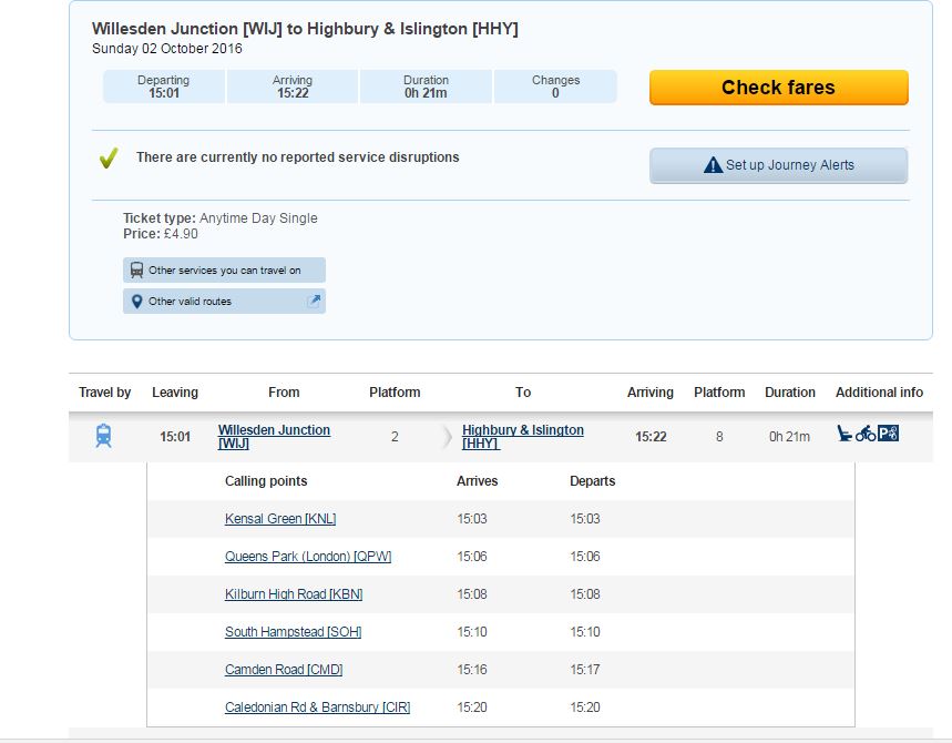
Note that the journey takes 22 minutes.
I am led to the conclusion, that it would be possible to run a service between West Croydon and Willesden Junction stations.
The service would run via Kilburn High Road, South Hampstead and and a reopened Primrose Hill stations.
It would have a frequency of four tph.
Trains would change voltage at Highbury and Islington station.
I would certainly like the service for these reasons.
- I regularly travel along the North London Line from the West to Dalston Junction station. The change between the North and East London Lines at Highbury and Islington can be very busy.
- Going West along the North London Line from Dalston Junction can involve a lot of walking up and down at Highbury and Islington station.
- Using Dalston Kingsland station to go East can be difficult, as there are masses of passengers changing between rge two Dalston stations.
- I like to go to Primrose Hill and London Zoo.
- Could the service also ease the pressure on Camden Town station, until the upgrade is complete?
I have no idea if London Overground would do this, but if there was a vote, I’d say yes!
The Gospel Oak To Barking Line
I have never seen a detailed analysis of running trains on the Gospel Oak to Barking Line (GOBLin).
Currently, eight Class 172 trains provide the four tph service. Consider this round trip.
- Leave Gospel Oak station at 09:05
- Arrive Barking station at 09:42
- Leave Barking station at 10.03
- Arrive Gospel Oak station at 10.45
Note.
- It is a very generous timetable.
- There is a twenty minute turn-round time at both ends of the route, which is good for recovering the timetable after a delay.
- The Class 710 trains could save time at every one of the ten stops, as they accelerate faster, have smooth regenerative braking and should have a better platform-train interface.
This leads me to the conclusion, that the Class 710 trains could run a faster service on the line.
Extending Services To Barking Riverside
Barking Riverside station will only be a short distance from Barking station and I suspect, it would only add ten minutes at most to the end-to-end journey time.
As there is a twenty minute turn-round time, I suspect that a train will be able to go from Gospel Oak to Barking Riverside and back again in under two hours.
This would mean that the current service of four tph could be possible on the extended route, with the same fleet of eight trains.
This is said in the MR article about the Class 710 trains.
The remaining two additional four-car units would support the extension of Gospel Oak to Barking services to Barking Riverside.
This leads me to one of these conclusions.
- The service is going to be extended somewhere else.
- The frequency on the route is going to be increased to five tph.
The next few sections deal with the various options.
Extending To The West Along The North London Line From Gospel Oak
I sometimes change between the GOBLin and the North London Line, as I can get a convenient bus from my house to Harringay Green Lanes station.
Allowing GOBLin services to continue along the North London Line would need extensive and expensive remodelling of Gospel Oak station to create an Eastbound plstform for the GOBLin.
The tracks to the West of the station, would probably need to remodelled to allow efficient operation.
The GOBLin trains would also be four-car trains, as opposed to the five-car trains on the North London Line.
Extending To The North Along The Midland Main Line
By using the Carlton Road Junction after Upper Holloway station, GOBLin trains could access the Thameslink tracks and go North to a convenient station.
Unfortunately, the track layout is such, that crossing to the Dudding Hill Line is difficult.
But continuing to the proposed Brent Cross Thameslink station is surely a possibility.
Although, I can’t see anything happening until plans for the West London Orbital Railway are agreed and Brent Cross Thameslink station is opened.
So it can probably be discounted for a few years yet!
Extending Across The Thames From Barking Riverside
Barking Riverside station is being built so that an extension under the Thames is possible.
But as a tunnel would be involved, I can’t see this extension being started or even planned fully for several years.
Five tph On The GOBLin
If two extra trains are added to the GOBLin fleet, this would mean that there are ten trains, which would be enough to run a five tph service between Gospel Oak and Barking Riverside stations.
I think this will be the most likely use of the two extra trains on the GOBlin.
Romford To Upminster
The Romford To Upminster Line is slated to get a brand-new Class 710 train to work the two tph shuttle.
The DR article says that it is possible that this line could be served by a Class 315 train, held back from the scrapyard.
This would mean a new Class 710 train could be deployed elsewhere, where its performance and comfort levels would be more needed.
Surely, this would be enough capacity for the line and a lot cheaper than a new Class 710 train! Provided of course, that it was reliable, comfortable and could maintain the current two tph service.
I discuss this in detail in A Heritage Class 315 Train For The Romford-Upminster Line.
Conclusion
It looks like Transport for London are planning for a large increase in services on the East London Line.
A Proposal For Two London Overground Stations At Old Oak Common
Transport for London published this proposal a few weeks ago, but it’s only now that I’ve found time to document it here.
TfL’s Proposal
This document on Tfl’s web site, gives full details of their proposals.
The Location Of The Stations
This map from TfL shows the location of the two stations.
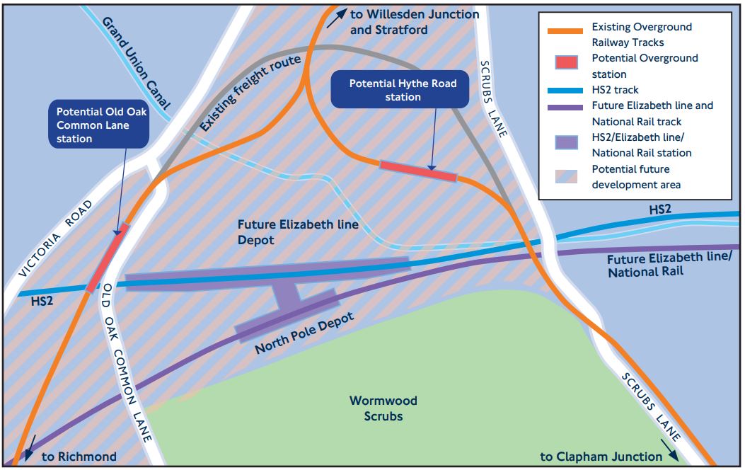
Hythe Road station will be on the West London Line between Willesden Junction and Shepherd’s Bush stations.
Old Oak Common Lane station will be on the North London Line between Willesden Junction and Acton Central stations.
This Google Map shows the area.
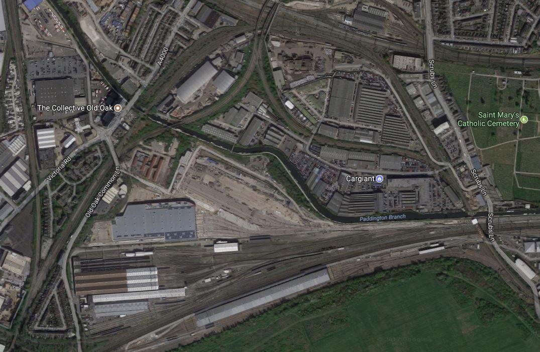
Three features on both maps link them together.
- The Grand Union Canal.
- The layout of the two Overground Lines that meet at the distinctive Willesden High Level Junction.
- The long silver-roofed North Pole Depot at the bottom of the maps.
Note from the Google Map, how much space is available.
Are Two New Stations Needed?
There are various factors at work here.
More Stations And Entrances Shorten Journey Times
Research has shown that the more routes you give passengers, the quicker and easier the journeys.
Old Oak Common Is A Large Site
25,500 new homes and 65,000 jobs are being created in the Old Oak Common/Park Royal area and two new stations are probably needed.
The North And West London Lines Pass Separately Through The Site
Two separate stations give direct services to the following.
- West and South-West London via the North London Line.
- North and North-East London via the North London Line.
- Clapham Junction for South London via the West London Line.
Some might argue, that a new spur from Willesden High Level Junction, where the two lines divide direct to the combined HS2 and Elizabeth Line station, may be a better and cheaper option.
But this would only provide a connection to North and North-East London. Connections to the latter area, are also provided by the Elizabeth Line with a change of train at Liverpool Street or Stratford.
Conclusion About Two Stations
I’m convinced, that two Overground stations are needed and I suspect eventually, there will be other stations.
Hythe Road Station
TfL’s proposal for Hythe Road station would be built to the North of the existing embankment of the West London Line, which would be demolished.
This visualisation is from the TfL document.
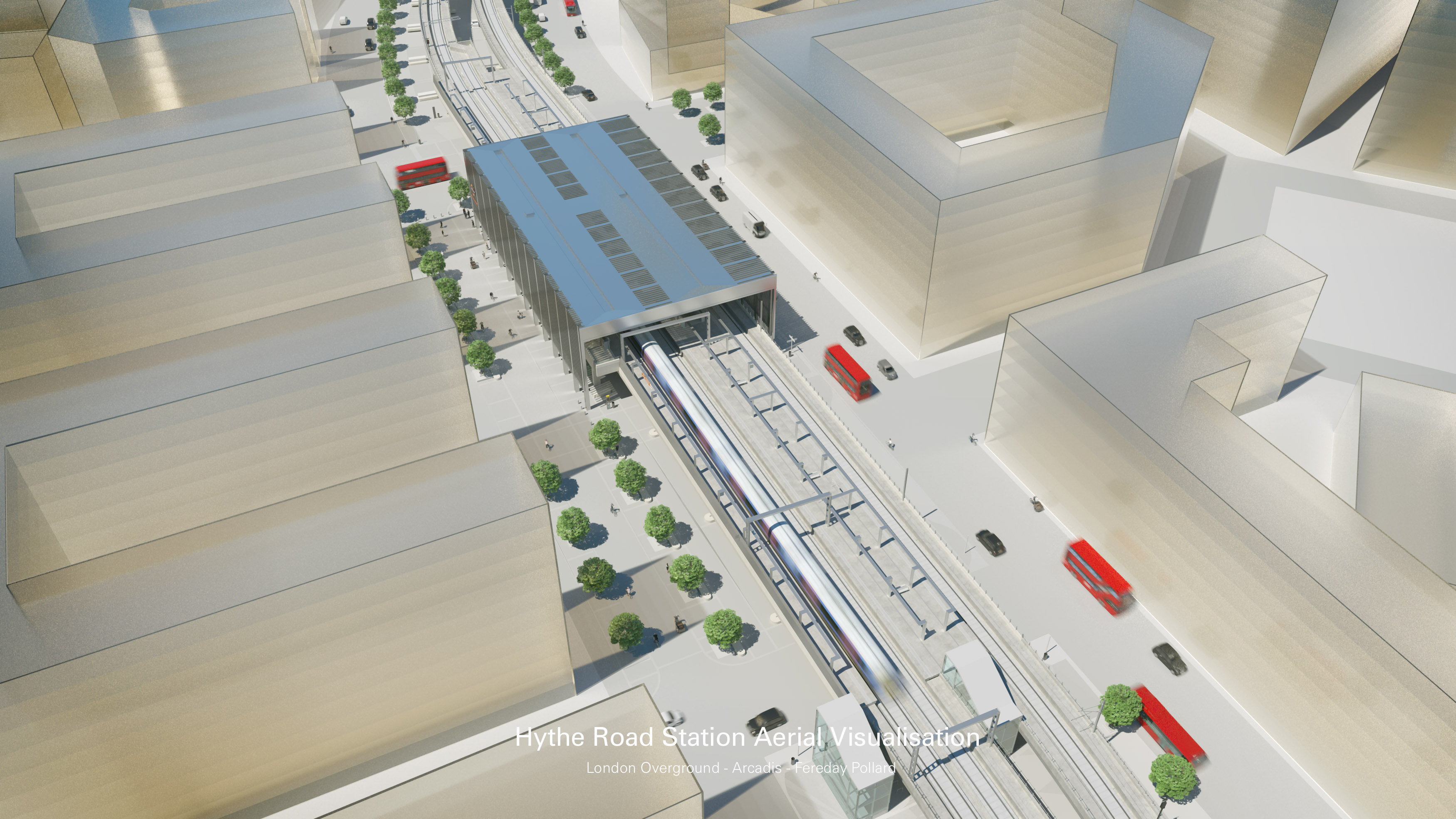
It would appear to be reminiscent of Shoreditch High Street station, but built at ground-level.
Conclusion About Hythe Road Station
It is an inherently simple proposal, that can be built around an existing rail line, so it shouldn’t create too many construction problems.
Old Oak Common Lane Station
TfL’s proposal for Old Oak Common Lane station would incorporate an overbridge extending westwards to Victoria Road, to allow pedestrians and cyclists to cross the railway.
This map from the TfL document shows the location of the station.
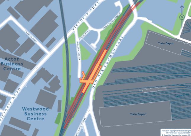
And this Google Map shows roughly the same area.
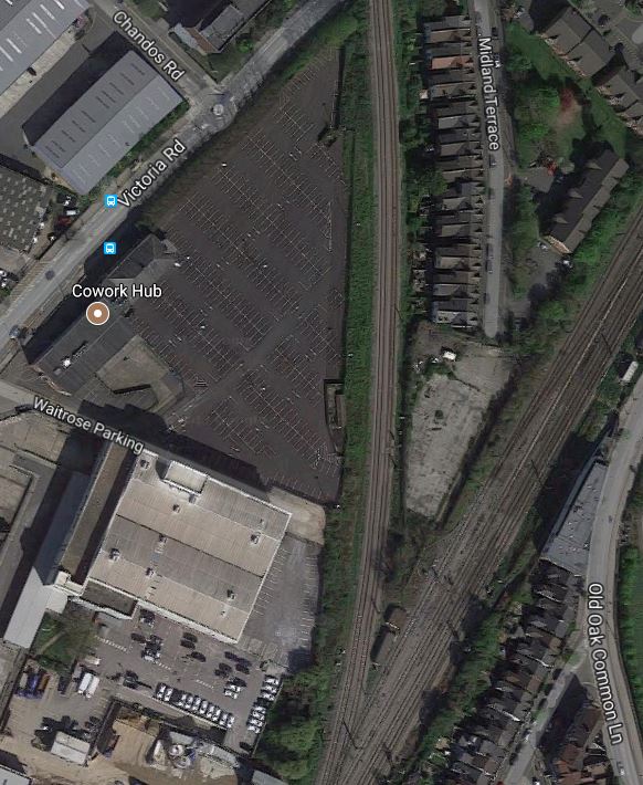
The line breaking off to the North is the Dudding Hill Line, which is an important part of a proposal for a new railway line in West London, which I wrote about in New Railway Line For West London Proposed.
This visualisation is from the TfL document.
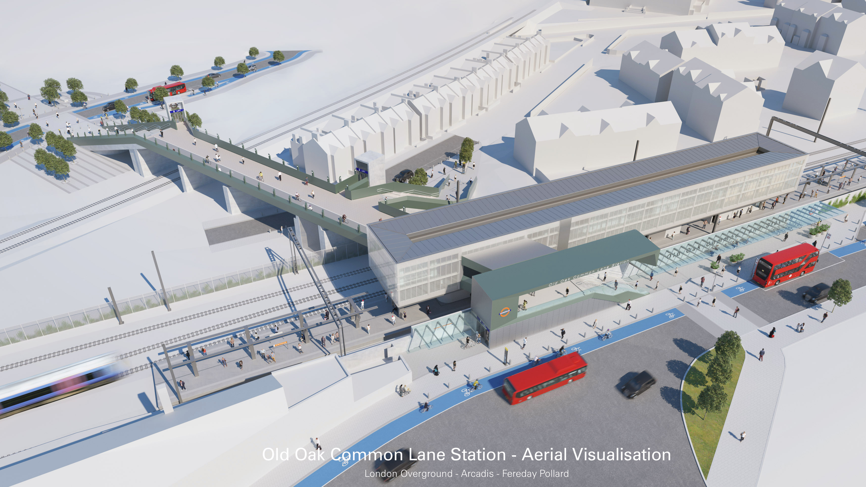
Note.
- The bridge for cyclists and pedestrians to Victoria Road.
- The Dudding Hill Line passing under the bridge.
It very much looks like Old Oak Common Lane station could have platforms on the Dudding Hill Line, which would be a very important addition to the West London Orbital Railway proposal.
Cnclusion About Old Oak Common Lane Station
TfL’s proposal looks comprehensive and reasonably simple to build.
It also includes provision to connect to the proposed West London Orbital Railway.
What Else Would I Do?
Here are my thoughts.
An East-West People Mover
The only one thing I would definitely add, is some form of people mover stretching East-West across the whole Old Oak Common site.
My preferred option would be to use a high-level moving walkway perhaps enclosed in a glass tunnel, which would stretch from Victoria Road in the West to perhaps Wormwood Scrubs Park in the East.
Escalators and lifts would give step-free connections to Old Oak Common Lane, HS2, Elizabeth Line and Hythe Road stations.
We’re not getting any younger!
Terminal Platforms
Both stations could have terminal platforms in the visualisations.
But they would surely be a good idea to allow extra services to be run to and from the major station complex.
Both new stations will have a platform on each track.
Would it be a good idea to have a third platform, that could be used as a bay platform in both directions?
A Terminal Platform At Hythe Road Station
The West London Line currently has a Milton Keynes to East Croydon service and this must mean that services to the West Coast and Brighton Main Lines are possible from a Hythe Road station.
- Trains to the South could go to Clapham Junction, East Croydon, Gatwick and any desired station South of London.
- Trains to the North could go to Wembley Central, Watford and Milton Keynes.
A stopping service on the West Coast Main Line would be complementary to HS2. Take for instance, sports or music fans going to an event at Wembley Stadium.
A Terminal Platform At Old Oak Common Lane Station
The only passenger services on the North London Line are London Overground services, between Stratford and Eichmond, but surely a terminal platform at Old Oak Common Lane station could be useful in providing some needed services.
If the West London Orbital Railway is created, this will add eight trains per hour after Acton Central. This might be too many trains for the route, so perhaps there would be a need to turn-back some trains from Stratford at Old Oak Common Lane?
A terminal platform at Old Oak Common Lane station might be used for an extended Gospel Oak to Barking service.
Building The Stations
I haven’t had a good look at the sites of the two stations and I don’t know the area well.
But I do have the feeling that both these stations can be built independently without affecting any other projects.
So they could be built at any convenient time in the development of this large site.
Simon Jenkins Questions Southern HS2 Terminal
Simon Jenkins in the Standard has a piece today entitled It’s Not Too Late To Make HS2 Somehow Work For London, by proposing even at this late stage the Southern terminal of HS2 be moved from Euston station to Old Oak Common station.
He makes these points against choosing Euston.
- HS2 has never had many friends among politicians, railway buffs or think-tanks.
- Serious questions must be asked about HS2’s most costly and controversial feature, the line’s route into Euston from its last stop at Old Oak Common in west London.
- Euston is London’s worst station, with the worst connections.
- The new Euston will need a costly new tunnel under Primrose Hill, incidentally wiping out hundreds of houses.
- It will claim seven of Virgin’s platforms at Euston, thus reducing station capacity.
- For some time, smart money in HS2 circles has been on the line stopping at Old Oak Common, at least “temporarily”
- Successive plans for a new station have been submitted to Camden council and then withdrawn.
- Either way, choosing Euston will mean a decade of chaos.
Against these points he says this in favour of Old Oak Common station.
Meanwhile, a terminus at Old Oak Common is plausible. The old Great Western Railway depot and marshalling yard has become London’s largest regeneration area since Canary Wharf. Its acres of tracks include lines to Paddington, Euston and Heathrow, as well as stations on Crossrail and the Central and Bakerloo lines. The site is near the North Circular and the M40, and is within spitting distance of the M1 and M4. Passengers on HS2 heading for the City would find it more convenient to join Crossrail at Old Oak Common, rather than trundle their bags down crammed access tunnels at Euston.
He makes strong arguments and personally, I would not be against what he says, as getting to Old Oak Common station will be easy for me on the North London Line.
But once Crossrail 2 is built, then Euston will be just two stops away from an enlarged Dalston station at the end of my road.
Conclusion
I can’t lose on house prices!
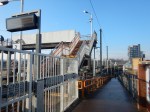
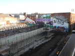
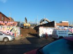
Work Has Really Started At Hackney Wick Station
This article in the Hackney Gazette is entitled Hackney Wick Overground station and surrounding streets on track for £25m redesign.
This is said.
Work is underway on a £25 million scheme for east London’s new Hackney Wick Overground station complex with major improvements in the surrounding streets.
So I went along to take some pictures.


The article says that there will be a subway under the railway by the Spring and the station will by completed next January with new stairs and two lifts.
According to this article on Ian Visits, the tunnel will be built alongside and pushed under the railway. This was done successfully at the new Rochester station.
That certainly fits with what i saw!
Around The Hounslow Loop Line
The Hounslow Loop Line is a suburban railway in South-West London, that runs in a loop off the Waterloo to Reading Line.
Today, to get to know the line, I took a Hounslow train from Waterloo and after passing through Clapham Junction, Putney and Barnes stations, the train took to the Hounslow Loop Line calling at a succession of stations on both sides of the Thames.
We waited a minute or so at Hounslow station, before starting to return via Whitton and Twickenham stations.
When the train got to Richmond station, I changed to the North London Line to come home directly, whilst the train went back into Waterloo, by way of the Waterloo to Reading Line.
These pictures give a flavour of the Hounslow Loop Line.


It is a very tidy suburban line.
- Most platforms have been lengthened to take ten-car trains.
- Whitton station has been rebuilt as I wrote about in How To Spend Five Million Pounds.
- It has a triangular junction with the North London Line around Kew Bridge station.
- In the mid-2000s, the train frequency on the line was doubled from 2 trains per hour (tph) to four.
All of this work has led to a 162% increase in passengers between 2004-5 and 2007-8.
I wonder what is the limit of trains round the Hounslow Loop Line.
This is more proof if it were needed, that suburban lines need at least 4 tph to really bring in the passengers.
Transport for London’s Orbital Railway
In August 2014, I wrote Will The Gospel Oak To Barking Line Be Extended To Hounslow?, which was based on a Modern Railways report on the Mayor’s Transport Infrastructure Plan for 2050. This is said.
There may be a case for further orbital rail capacity, says the document – it shows an indicative, uncosted network to link Hounslow, Old Oak Common, Neasden, West Hampstead, Harringay, Walthamstow, Barking, Abbey Wood, Bexleyheath, Norwood Junction, Sutton and New Malden and back to Hounslow, with another route between Abbey Wood and New Malden via Lewisham, Peckham Rye and Wimbledon.
The proposed orbital railway passes takes a route from Hounslow to Wimbledon via the following stations.
- Whitton
- Twickenham
- Strawberry Hill
- Teddington
- Kingston
- New Malden
- Raynes Park
Nothing concrete has been said since about the railway, but the following is happening or planned.
- The Gospel Oak to Barking Line (GOBlin) is being electrified.
- New four-car Class 710 trains will go to the GOBlin and the Watford DC Line.
- More five-car Class 378 trains will be available to boost services on the North London Line.
All these should happen by the end of 2018.
Will More North London Line Trains Go To Richmond?
Currently the North London Line service from Richmond is 4 tph to and from Stratford.
It takes around an hour, which is ten minutes faster than going via Waterloo and taking the Jubilee Line.
The only possibly faster way would be when Old Oak Common station is opened and a change there would be made to Crossrail.
I estimate, that this could result in a timing of around 45 minutes or perhaps lightly less.
As Old Oak Common station, will also have connections to HS2, the West Coast Main Line ans other important routes, Richmond to Old Oak Common could become a very heavily used route.
4 tph would probably not be enough trains, especially as the current service to the East from Willesden Junction is 8 tph.
So I think it quite likely, that the frequency between Richmond and Old Oak Common stations would be eight tph.
The extra four trains, wouldn’t need to go all the way to Stratford, as there has been talk of alternative routes.
- Terminate at Old Oak Common.
- Terminate at somewhere convenient on the North London Line.
- Terminate at Barking via the Gospel Oak to Barking Line
- Go Along the Dudding Hill Line to Brent Cross Thameslink
The choice would be large.
But could Richmond handle the increased frequency of trains?
If the trains used the same route as now, there is probably a current limit of 4 tph, as the route is shared with the District Line from Gunnersbury station. Especially, as the District Line service will be increased!
So alternative ways of turning the trains is needed.
Trains could take the Houslow Loop Line after South Acton station and go through Hounslow, Whitton and perhaps terminate at Twickenham, where it should be possible to create a suitable bay platform.
But it’s not just events at Twickenham that need more capacity and North London Line services, so could we see services going in a loop via Hounslow, Whitton, Twickenham and Richmond?
This Google Map shows the line between Richmond and North Sheen stations.

Between Richmond and North Sheen Stations
Note.
- Richmond station is to the West.
- North Sheen station to the East.
- The North London Line turns North off the line through the two stations.
In some ways, North Sheen station is a bit of a mess and a real problem.
- It has a level crossing at one end.
- It has no disabled access.
- There is another three level crossings between Mortlake and Barnes stations, which are the next stations on the line towards London.
- The level crossings feature regularly in Google News with respect to accidents, failures and suicides.
It might be best, if North Sheen station was completely rebuilt and the level crossings are consigned to the dustbin of history.
This map from carto.metro.free.fr shows the layout of lines at Richmond station.
Platforms And Lines At Richmond Station
I don’t think it would be too difficult to complete the loop, so that trains from the North London Line could turn without needing a terminal platform
It has a level crossing at one end.It has no disabled access.There is another three level crossings between Mortlake and Barnes stations, which are the next stations on the line towards London.
Improving Richmond To Waterloo
But the problems of the level crossings are still there!
These posts describe the line between Richmond and Barnes station.
- Is There A Worse Station Than This In London?, describes North Sheen station.
- Mortlake Station With A Level Crossing
- A Level Crossing In White Hart Lane, Barnes
- A Pair Of Level Crossings At Vine Road, Barnes
Currently, 8 tph run on the lines between Richmond and Waterloo via Clapham Junction stations.
In the other direction, the service is as follows.
- 2 tph to Reading
- 2 tph to Windsor and Eton Riverside.
- 2 tph to Waterloo via Hounslow and Brentford
- 2 tph to Waterloo via Kingston and Wimbledon.
Richmond will become an important station connecting lots of places to Old Oak Common.
Will 8 tph between Richmond and Waterloo be sufficient?
Heathrow Airtrack
Heathrow Airtrack was an attempt to create a link from Waterloo to Heathrow Airport.
Wikipedia says this about the proposal.
The scheme, estimated to cost around £673 million, was controversial mainly because of the projected impact on local road traffic due to the high number of level crossings on the route.
Trains would have been 2 tph calling at the following stations.
- Clapham Junction
- Richmond
- Twickenham
- Feltham
- Staines
Could another 2 tph be squeezed in through Richmond?
With difficulty and Automatic Train Operation, it might be a possibility.
But it also looks like the level crossings have already killed one project.
On the other hand, it does appear that if more capacity could be created between Richmond and Waterloo, other services would follow.
Rail Replacement Trains
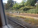
I was alerted by this blog post from Utterlee, that was entitled LONDON OVERGROUND GOES OFF THE RAILS.
It describes how because of engineering works, London Overground were routing North London Line services between Camden Road and Willesden Junction stations by way of South Hampstead, Kilburn High Road and Queen’s Park stations.
These pictures show my journey.


Well it makes a change from the dreaded rail replacement bus.
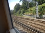
The Route
I took the train from Stratford to Willesden Junction, via the following stations.
- Hackney Wick
- Homerton
- Hackney Central
- Dalston Kingsland
- Canonbury
- Highbury and Islington
- Caledonian Road and Barnsbury
- Maiden Lane – Closed
- Camden Road
- Primrose Hill – Closed
- South Hampstead
- Kilburn High Road
- Queen’s Park
- Kensal Green
The route took eight minutes longer.
I think this was explained by having to wait to slot in with the Bakerloo Line trains at Queen’s Park and the wait of a minute or so, which the power was changed between voltages.
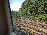
The Class 378 Trains
The Class 378 Trains obviously fit the route, as they run on all of it on a daily basis.
The station display and onboard announcements were correct and the five-car train I rode, fitted all the stations between Camden Road and Willesden Junctions.
The Bay Platform 2 At Willesden Junction
I wrote about this platform in Platform Action Has Finished At Willesden Junction.
Wikipedia says this about the platform.
Normally only the first and last NLL trains of the day, which start or terminate here, use the bay platform, though it is used for empty stock transfers between the depot and the North London and Gospel Oak to Barking lines.
This map from carto.metro.free.fr, shows the lines.
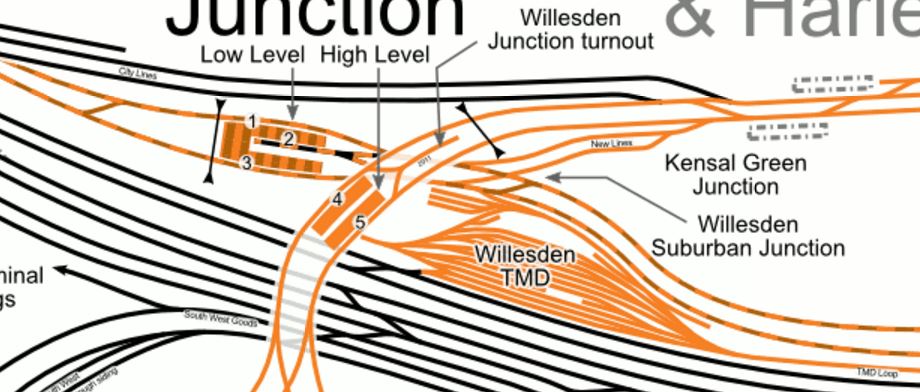
The Bay Platform At Willesden Junction
It looks like the platform can accept trains from the South and East.
It certainly reversed the train efficiently for its return journey.
As it gives a totally step-free access between both Northbound and Southbound services on the Bakerloo and Watford DC Lines, I’m certain that this platform wasn’t built solely to handle empty stock movements, early and late trains, and rail replacement trains.,
If you look at the map, the station can act as a terminus and reverse trains from the following directions.
- From the East on the North London Line in the Bay Platform 2
- From the South on the Watford DC Line in the Bay Platform 2
- From the West on the North London Line in the Willesden Junction Turnout
- From the South on the West London Line in the Willesden Junction Turnout
Because of the crossover to the North of the station, trains can even be reversed coming from the North on the Watford DC Lines.
I can’t believe that Transport for London haven’t got a cunning plan for the use of this convenient platform.
The Class 172 Trains
As the pictures show, all of the Class 172 trains for the Gospel Oak to Barking Line were parked at Willesden Depot.
I know, they’ll be used again from February 2017, but surely there is something more productive they could do in the meantime.
The Class 710 Trains
The Class 710 trains ordered for the Gospel Oak to Barking Line are actually Class 710/2, with a dual voltage capability. This is probably sensible, as it would mean they could go past Gospel Oak to Richmond or Clapham Junction, which has been suggested and the stations are firmly in third-rail territory.
London Overground have also ordered six Class 710/2 trains for the Watford DC Line. Wikipedia says this about the use of Class 710 trains on the Watford DC Line.
The intention is that the five-car Class 378 trains currently used on the Watford route will be cascaded back to the North London and East London Lines to allow for strengthened services.
I suspect that London Overground want a fleet with a consistent capability of dual voltage on all the cross-London Lines.
But will four-car trains on the Watford DC Line be sufficient capacity for the line, which currently has five-car services?
It is probably worth noting that South Hampstead and Kilburn High Road stations have lower passenger levels than say Hackney Central or Dalston Kingsland stations, so perhaps, a three tph four-car service will be sufficient.
Incidentally, as Euston to Watford Junction takes fifty minutes,it would need six trains to run a three tph service all day.
So it looks to me, that the base service through Kilburn High Road and South Hampstead stations will be three four-car trains per hour all day.
Could Stratford To Willesden Junction Via South Hampstead Be Made Permanent?
Last week, when I passed through Willesden Junction station, I noticed a Class 378 train was waiting in the Bay Platform 2.
Perhaps it was an empty stock movement or were London Underground doing a bit of route training for drivers in preparation for the weekend’s Rail Replacement Train.
There are various factors that will affect Transport for London’s thinking.
- The Watford DC Line means that paths and platforms at Euston station must be reserved for third-rail electric trains.
- Watford Junction station will be getting a direct connection to
- Euston station will be rebuilt for HS2.
- Crossrail and Thameslink will be fully open in 2019.
- Camden Town tube station will be rebuilt and extended, possibly with a better link to Camden Road station.
- Old Oak Common station will be built, as part a major infrastructure development and transport hub.
- A future Old Oak Common station could have connections to Central Line, Chiltern Line, Crossrail, HS2, North London Line, West Coast Main Line and West London Line.
- The low passenger numbers at Kilburn High Road and South Hampstead stations.
- Highbury and Islington station must be on an early list for updating to improve its terrible access to the low-level Victoria Line and Great Northern Metro.
- Camden Council would like to reopen Maiden Lane station.
- Primrose Hill station could be rebuilt with a decent walking route to Chalk Farm tube station.
- Four-tracking of the North London Line between Camden Road and Highbury and Islington stations could be possible.
- West Hampstead Interchange could be created to link the North London Line, Chiltern Line and Underground services.
- There is a need for more freight and passenger services across London.
- Electrification and an increase in capacity for the Gospel Oak to Barking Line will change travel patterns.
- Plans exist to run passenger services on the Dudding Hill Line.
I feel that we could be seeing a reorganisation of services across North London and probably there will be no better time
Stopping the Watford DC Line service to Euston might be a good idea for the operation and reconstruction of the crowded London terminus, but it would deprive passengers from Kilburn High Road and South Hampstead of their direct service to Euston.
But is a three trains per hour (tph) service to Euston worth keeping, if stopping it, eases the situation at Euston?
Perhaps if the following interchanges were built or improved, then passengers might accept the closure of the direct service to Euston.
- Primrose Hill station and Chalk Farm tube station.
- Camden Road station and Camden Town tube station.
- Maiden Lane station for everything at Kings Cross.
- Highbury and Islington station for Victoria Line and Great Northern Metro.
I think in an ideal world, the least amount of disruption and uncertainty will be caused by improving one or more of the stations named above and then seeing how the pattern of passenger journeys develop.
Consider.
- Transport for London had a lot of staff on the platforms and in the stations on Sunday, who were explaining what was happening to the trains.
- There could be arguments to reopen Primrose Hill station with a walking route to Chalk Farm tube station, as it would surely give an alternative route to avoid Camden Town station during that station’s rebuilding.
- There are probably freight capacity reasons for four-tracking between Highbury and Islington and Camden Road stations.
I think we could see a package of improvements such as.
- Step-free connection between the Overground and the Victoria Line and Great Northern Metro at Highbury and Islington station, using the closed entrance on the other side of Holloway Road.
- Reopening of Primrose Hill station
- Improved voltage changeover at Primrose Hill station.
- Reopening of Maiden Lane station.
- Enabling works for four-tracking between Highbury and Islington and Camden Road stations.
Organised professionally, I suspect that it could all be done with the minimum of disruption to existing services.
Could The North London Line Be Four-Tracked Between Camden Road And Highbury And Islington Stations?
I ask myself this question every time, I take a train across from between Camden Road Highbury and Islington stations.
This map from carto.metro.free.fr explains why.
North London Line
Note the two extra tracks to the North of the North London Line, that have been closed. Some were closed in 1870, but the space looks from the train that there might be a possibility of reinstatement.
This Google Map shows the four-track section through the site of the former Maiden Lane station.

The Site Of Maiden Lane Station
Note.
- The four tracks of the North London Line at the top.
- The remains of the platforms at Maiden Lane station.
- The East Coast Main Line going down the right hand side pf the map.
- The Channel Tunnel Rail Link going across the bottom -right hand corner.
The single track in the space between the lines , which runs South-West to the North-East, is the North London Incline, which loops to the South of the North London Line and allows train to come down the East Coast Main Line and then go West along the North London Line.
I once took it in a sleeper between Edinburgh and Euston.
It was a journey that illustrates how all sorts of freight and passenger trains, get to use the North London Line.
Four tracks between Hackney and Willesden would certainly add to the capacity of the line and help get its unique mix of trains through this crowded part of London.
Consider.
- East of Camden Road station, there would need to be some reorganisation and new track.
- Highbury and Islington station would need reorganising.
- West of Camden Road station, as there is two routes to Willesden Junction, each of which has two tracks, there are four tracks already.
- New digital signalling will help.
Four tracks might not be created, but something will have to be done to create more capacity for freight trains from London Gateway and the Haven Ports to any part of the country West of London or the M1.
And of course, travellers will demand more passenger trains along the line.
Is Highbury and Islington Station The Key That Unlocks Everything?
Highbury and Islington station suffered a double whammy.
- On the 27th June 1944 it was hit by a V1 flying bomb.
- Much of the remains of the station was then demolished in the 1960s, to create an interchange for the Victoria Line.
Luckily the 1960s architects left the station building on the other side of Holloway Road more or less intact on the outside.
But things are happening at the station.
- The Northern City Line will become the Great Northern Metro with a minimum of twelve trains per hour (tph) between Moorgate and Alexandra Palace before splitting for Welwyn Garden City and the Hertford Loop Line.
- The Victoria Line will keep increasing the number of trains, it squeezes through the 1960s tunnels. One day, I wouldn’t be surprised to see 40 tph. Victoria is a generous lady!
- In Increased Frequencies On The East London Line, I wrote of up to 24 tph along the East London Line, with Automatic Train Control in the core section. This must surely bring more trains to Highbury and Islington.
- The North London Line will get extra trains cascaded from the Watford DC Line from 2018.
- The urban realm outside the station could be improved.
If all these trains and their passengers are going to be handled quickly and safely, then improvements must be made to the station.
This map from carto.metro.free.fr shows the lines at the station.
Highbury And Islington Station
The access to the Overground Lines at the station is easy, but with two just escalators and long passageways the access to the four deep-level platforms is terrible. It’s even worse if you’re disabled or have problems, as there is no lift.
I’ve not seen a 3-D image of the station, but a station-man told me, that he feels that lifts and possibly another bank of escalators could be installed in the second entrance on the other side of Holloway Road.
He might be wrong, but something drastic needs to be done to improve connectivity between the Overground and the deep-level lines.
The only thing that might get the station out of trouble in this matter, is the cross-platform interchange between the Victoria Line and the Great Northern Metro. This will ease passengers speedily to and from Moorgate and its hopefully comprehensive double-ended Crossrail station shared with Liverpool Street.
At present, two of the four lines through Highbury and Islington are bay platforms.
- Platform 1 would probably be left as it is, as going through would probably be difficult.
- However Platform 2 looks like it could accept through sevices, or serve as a terminus from services from either direction.
So will Highbury and Islington station be the key that unlocks everything?
It’ll certainly give passengers from stations like Camden Road, interesting travel options.
Possible New Routes
If you look at the combined North and East London Line system, that runs in a curve around North East London, it has termini; both in use and possible all along its length.
- At the Eastern and Southern ends you have Clapham Junction, Crystal Palace, New Cross, Stratford and West Croydon.
- Walthamstow and Chingford can be reached from Hackney Wick and Stratford.
- At the Northern end you have Watford Junction.
- At the Western ends you have Clapham Junction and Richmond.
- In the middle you have Highbury and Islington and Willesden Junction stations, that could probably turn trains from either direction.
It looks to me, that Transport for London have several options and all the statistics to create cross-London routes that passengers would use.
Could Passenger Services Be Run On The Canonbury Curve?
The Canonbury Curve is described like this in the Wikipedia entry for Canonbury station.
To the west of the station is the Canonbury curve, a freight-only connection through the Canonbury tunnel to the East Coast Main Line at Finsbury Park.
The curve is an electrified single-track.
This picture shows where the curve joins and leaves the North London Line.

The Canonbury Curve To The East Coast Main Line
I don’t know how much traffic uses the line, but I think it is only a few freight trains.
This map from carto.metro.free.fr shows the track layout of the Canonbury Curve.
The Canonbury Curve
Note that it only has a connection to the North London Line, which is the more Northerly of the two pairs of lines. The East London Line is the other pair of lines and only carries third-rail electric services to Dalston Junction and on to the South.
In order for trains to go between Finsbury Park and the East London Line, there would need to some changes to Canonbury West Junction.
This Google Map shows Canonbury West Junction in detail.
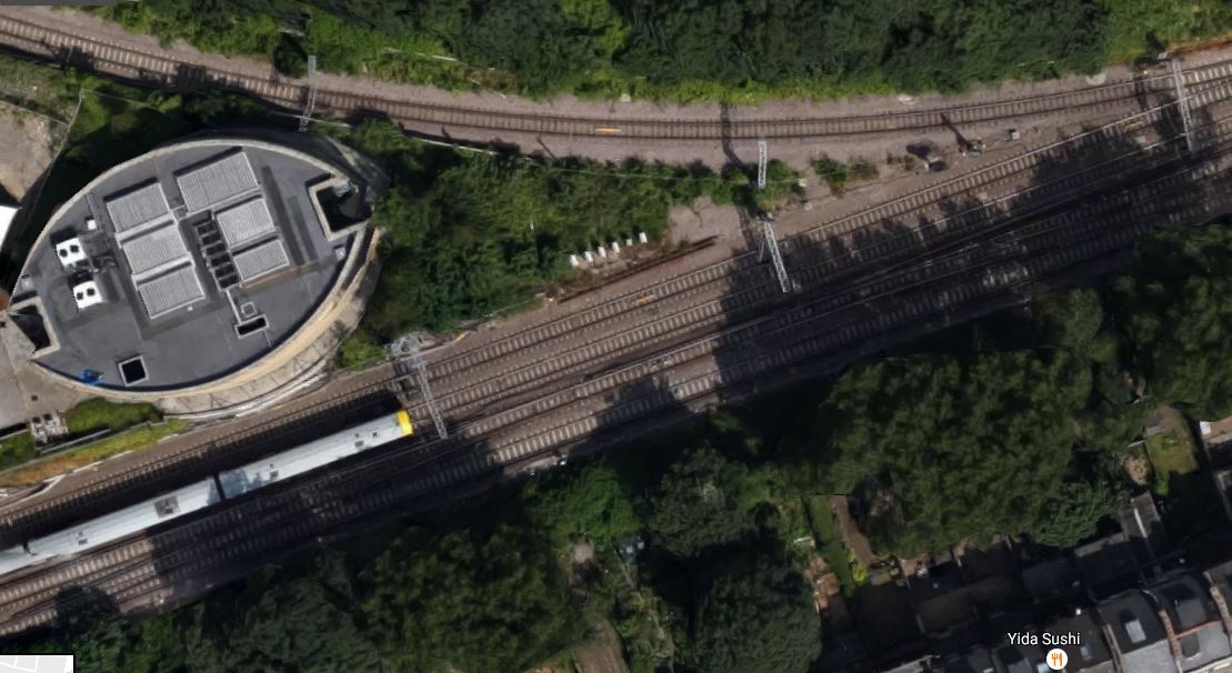
Canonbury West Junction
The elliptical-shaped tower is an evacuation and vent shaft for the Channel Tunnel Rail Link.
There does seem to be space between the lines and I suspect that it would be possible to modify Canonbury West Junction.
The line is also visible as it passes by Drayton Park station to the South of Arsenal’s Emirates Stadium.
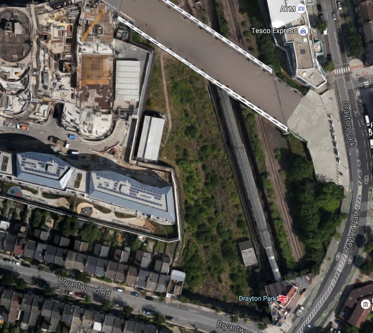
Drayton Park Station
The line is the single track line to the right of the platform roof of the station. This image doesn’t show a true picture, as the line is at a higher level than the Northern City Line.
I think it is true to say, that there is quite a bit of space around Drayton Park station.
When the line gets to Finsbury Park station, the track seems to be extremely complicated, but I’m sure that it is possible to run a passenger train between Canonbury and Finsbury Park stations, as freight trains already make the journey.
A Second Thameslink Route Between Finsbury Park And East Croydon
I feel that a train service could be run between Finsbury Park and East Croydon stations via the Canonbury Curve and the East London Line.
It would require the appropriate political and commercial wills. Some track modifications would be needed.
In the next few sections, I will describe the various issues that will effect, whether such a service is created.
Objectives Of The Route
As a passenger from the East, I see the major objective is to link all those, who travel to and from London’s Eastern boroughs, like Bromley, Croydon, Greenwich, Hackney, Haringey, Lewisham, Tower Hamlets and Waltham Forest, with a better North-South railway.
But Govia Thameslink Railway, London Overground and Sadiq Khan may see things differently.
The East London Line may terminate in a decent purpose-built terminal at Highbury and Islington station, with these connections.
- North London Line to the West.
- Northern City services to the North.
- Victoria Line services to the West End and four major stations.
- Victoria Line to Waltham Forest.
But the termini in the South mean there is often a second change to get where you actually want to go.
- Many passengers want to go to East Croydon station rather than West Croydon station.
- There is no direct link to Thameslink, with all the extra destinations that would bring.
- Getting to London Bridge, Gatwick Airport, Kent and the South Coast is not easy.
I’m not the only one who is unhappy, as there has been a petition to the London Assembley to get Thameslink to call at Norwood Junction.
I think a lot of the problems were caused by the following.
- The East London Line was designed after Thameslink.
- Thameslink designers thought the East London Line was a short route from Whitechapel to New Cross and New Cross Gate.
- Thameslink is a National Rail project, whereas the East London Line is promoted by Transport for London.
On the other hand, East London does particularly well with two branches of Crossrail, so the connection to the East London Line at Whitechapel, will truly be a Jewel In The East.
Extending the East London Line to Finsbury Park in the North would give the following improvements.
- Links to the Piccadilly and Victoria Lines
- Links to Great Northern services to Hertford North, Welwyn Garden City, Letchworth Garden City and Cambridge
- Links to Thameslink services to Peterborough and Cambridge.
Connecting to East Croydon in the South would also be valuable.
- Links to Outer London suburban services to places like Epsom, Caterham and Oxted.
- Links to Thameslink services going to Gatwick Airport, Brighton and the South Coast.
- Links to London Tramlink across South London.
This connectivity at the North and South termini will not only make it better for those living in East London, but visitors and commuters needing to go to the area will find their journey much improved.
Now is the time to properly link Thameslkink and the East London Line to the benefit of users of both systems!
It could be the third line in London’s Crossrail/Thameslink network.
Advantages For Myself
I wouldn’t be being totally honest, if I didn’t point out my personal advantages of a Finsbury Park to East Croydon service.
I live within walking distance of Dalston Junction station and I would get single-change access to places like Brighton, Cambridge, Gatwick Airport and Peterborough.
But then so would the hundreds of thousands of people, who or work live near stations between Canonbury and Norwood Junction on the East London Line.
Thameslink, The Northern City Line And The Canonbury Curve
Thameslink, the Northern City Line to Moorgate and the line through the Canonbury Curve all come together at Finsbury Park station.
There would be opportunities to create a cross- and same-platform interchange between all three services.
I do think that the Northern City Line will because of its important link to Crossrail at Moorgate grow into a high-capacity link between Crossrail, the City of London and Canary Wharf at its Southern end and Finsbury Park, North London and Hertfordshire at its Northern end.
Added together Thameslink and the Moorgate trains could create a 12 tph service up the East Coast Main Line, as far as Welwyn Garden City.
My thoughts on this line are laid out in A North London Metro.
How Many Trains Would Be Needed To Run A Service Between Finsbury Park And East Croydon?
As things stand the current Class 717 trains, that have been ordered for the Northern City Line, couldn’t work the route, as the route is only able to accept five-car trains, but it could probably be run by the following.
- Five-car versions of the Class 717 trains.
- London Overground’s Class 378 trains
- Appropriate versions of the new Class 710 trains.
Current timings on the various sections are.
- Finsbury Park to Highbury and Islington – 4 minutes – Great Northern
- Highbury and Islington to New Cross Gate – 26 minutes – London Overground
- New Cross Gate to East Croydon – 22 minutes – Southern
So this would give a timing of 52 minutes, which could probably be beaten by a direct modern train, that could change current collection on the fly and took the Canonbury Curve short cut.
Any time around fifty minutes, would mean that a train could do the round trip in two hours and that eight trains being needed to run a 4 tph service.
The Design Of An Ideal Terminus
The branches of the East London Line at Clapham Junction, Crystal Palace, Dalston Junction, Highbury and Islington and New Cross end in their own dedicated bay platforms. At West Croydon, a reversing siding is used, as I wrote about in The Bay Platform And The Reversing Siding At West Croydon.
As rarely do any operational problems surface, I feel that a single platform or reversing siding would be sufficient for a route, that is not much longer than Highbury and Islington to West Croydon.
Passengers would also require.
- Decent step-free interchange between services.
- Lots of useful connecting trains and buses.
- Shops, kiosks and cafes.
- An attraction like a market, museum, shopping centre or an entertainment venue.
Perhaps even a place to sit in the sun, like the park at Crystal Palace or Dalston Square at Dalston Junction.
Looking at this, what idiot thought about using the dreadfully dreary and totally useless West Croydon?
An interesting concept is that the last two or three stations are used as a joint terminus, to give passengers more choice of onward routes, either by foot or by train, tram or bus.
You have Cannon Street, which is the actual terminus, but all services will also stop at London Bridge, when Thameslink is complete.
Other pairs include.
- Liverpool Street and Stratford
- Charing Cross, Waterloo East and London Bridge
- Edinburgh Waverley and Edinburgh Haymarket
- Birmingham New Street and Birmingham International
- Manchester Piccadilly and Manchester Oxford Road.
- Highbury and Islington and Dalston Junction
Some have been purposely designed that way, whilst others have just happened.
In the case of choosing the two termini for the Finsbury Park to East Croydon route, they must be within a time that allows the train operator to to use a sensible operating policy to run trains.
It looks like, that if the trip time is fifty minutes or less, that is ideal, as the round trip can be two hours. But even if it’s a few minutes longer, you just add another train into the fleet and work on a two hours fifteen minutes cycle say.
The Northern Terminus
In this example, I have used Finsbury Park station as a Northern Terminus, but I think that as long as Finsbury Park is served by the route, a station to the North could be used instead.
A few thoughts.
- Using Drayton Park could mean an extra change for passengers.
- Crossrail 2 could be coming to New Southgate and/or Alexandra Palace in the future
- A terminus North of where the Hertford Loop Line joins the East Coast Main Line might be confusing and/or annoying for passengers.
- There needs to be space for an elegant solution to the step-free change of train.
I think there are two main possibilities; Finsbury Park and Alexandra Palace.
In some ways, Alexandra Palace would work better as there is more space.
In Could A Reversing Siding Be Built At Alexandra Palace?, I examined the possibility of building a reversing siding at Alexandra Palace station.
I came to the conclusion that it is feasible and also found out that one already exists at Bowes Park station.
So a train reversing at the Northern end of the new route would go through the following procedure.
- The train from the South, would arrive at a down interchange platform in Finsbury Park, where all down Thameslink and local services call, probably with Main Line services on one platform face and Hertford Loop Line services on the other.
- Reversing trains would probably use the Hertford Loop Line platform.
- After discharging passengers, it would proceed to the down Hertford Loop Line platform 4 at Alexandra Palace.
- Any passengers still left, would leave the station or catch another train.
- The train would then proceed to the reversing siding between the two lines of the Hertford Loop Line.
- The train would then start its return journey in the up Hertford Loop Line platform 1 or 2 at Alexandra Palace.
- The train would then return to Finsbury Park.
- It would call in the up interchange platform, before continuing on its way.
Effectively, the route would have a two station terminus with interchange to other trains at both Finsbury Park and Alexandra Palace, with train reversing at the latter.
Note.
- As a maximum of six tph will be using the Hertford Loop line, there is plenty of spare capacity to fit in another four trains.
- Reversing sidings are always useful when there are problems like failed trains or blockades.
- It could be used by Northern City services to Moorgate.
- If it could take an eight-car Class 700 train, it might have uses for Thameslink.
It is one of those small lengths of railway, that if it were properly designed could have a lot more uses than is obvious.
I am also actually surprised that as the space is there between the tracks of the Hertford Loop Line, that it hasn’t been used for something productive before.
The Southern Terminus
Just as the Northern end of the route must serve Finsbury Park, the Southern end must serve East Croydon, as so many services call at the station.
- Thameslink
- Gatwick Express
- Southern services all over the South.
- Tramlink
Another possibility would be to perhaps have a dedicated bay platform at South Croydon station, with services calling at East Croydon before reversing in a dedicated bay platform or a reversing siding at South Croydon.
South Croydon station also has form as a past Southern terminus for the West London Line route to Milton Keynes Central.
This Google Map shows the South Croydon station and the area immediately to the South.
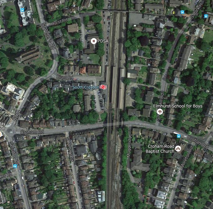
South Croydon Station
At a quick look, it would appear that fitting a bay platform into the Northern end of the station could be difficult.
But, there could be space in the tangle of lines South of the station to create a reversing siding.
There’s certainly more space than there is at East Croydon.
Perhaps, if the station was to be properly sorted as a Southern terminus for the East London Line, it could also become the terminus for an uprated service on the West London Line to the West Coast Main Line.
Drayton Park Station
This map from carto.metro.free.fr shows the lines through Drayton Park station.
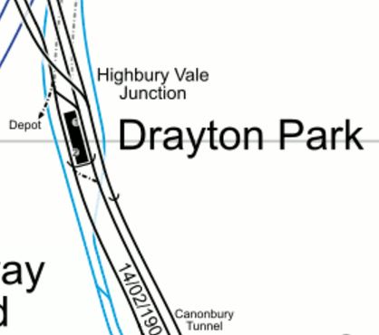
Drayton Park Station
The lines either side of the island platform are the two tracks of the Northern City Line to Moorgate.
The line on the right in the map, links Finsbury Park station to the Canonbury Curve through the Canonbury Tunnel. This line is at a higher level, as this picture taken looking South along the platform at Drayton Park station shows.

Drayton Park Station
The line is behind the retaining wall at the left. It’s position is betrayed by the overhead wires visible in the picture.
If a platform was to be put on this connecting line at Drayton Park, it would not be simple.
But help could be at hand!
In the map of the tracks at the station, there is a disused track labelled Depot. There is quite a large area of land around the station and any housing built on the site, should surely incorporate a new station underneath, with provision for a platform on the connecting line.
It would be a disaster, if housing was built all over the Drayton Park station site, without leaving provision for a station on the Canonbury to Finsbury Park Line.
The Canonbury Curve
As I pointed out earlier, the Canonbury Curve would need modification to enable trains to get between Finsbury Park and Canonbury stations.
This map from carto.metro.free.fr shows the Overground through Canonbury and the two Dalston stations.
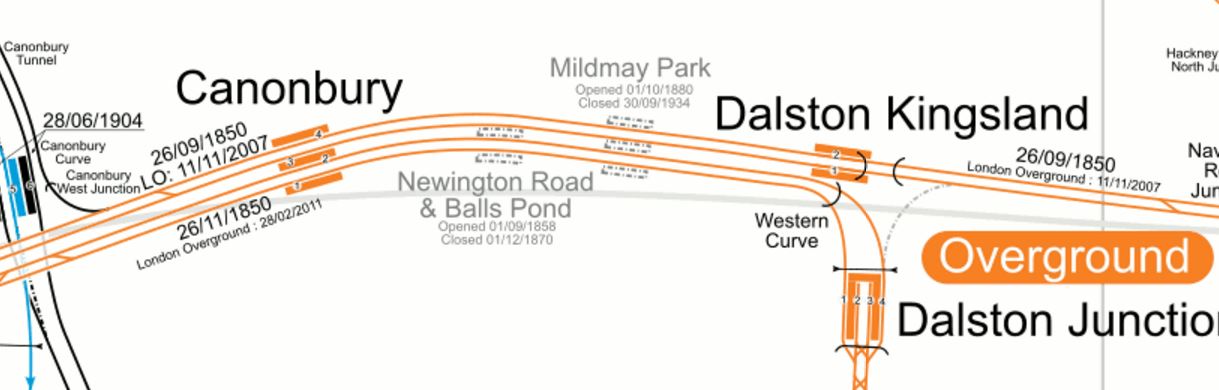
North And East London Lines Through Canonbury And Dalston
The various East-West tracks through the area from North to South are.
- The Eastbound North London Line to Stratford
- The Westbound North London Line to Highbury and Islington and Richmond.
- The Southbound East London Line to Dalston Junction and Croydon
- The Northbound East London Line to Highbury and Islington
A Finsbury Park to Dalston Junction service would do something like the following.
- Take the Canonbury Curve to the Eastbound North London Line.
- Stop in Plstform 4 at Canonbury station.
- Cross over to the Southbound East London Line using two new crossings.
- Continue South after stopping in Platform 4 at Dalston Junction station.
A service going the other way would do something like the following.
- Call in Platform 1 at Dalston Junction station.
- Cross over to the Westbound North London Line using two new crossings. (One would probably be used both ways.)
- Stop in Platform 3 at Canonbury station.
- After leaving Canonbury station take the existing crossover to the Eastbund North London Line.
- Take the Canonbury Curve to Finsbury Park station.
I don’t know whether my route would be possible, but I’m sure that an expert at Network Rail could come up with a workable and very safe solution.
At least there are factors that help.
- The line has been rebuilt in the last few years, so it must be well-documented.
- There are a lot of crossovers South of Dalston Junction station.
- The signalling is capable of handling bi-directional running.
But the most important factor is that to the East of the former Mildmay Park station, there is space for more track, as it would sappear there was an island platform between the pairs of lines. It is actually shown on the map of the lines through Canonbury and Dalston, earlier in this section.
These are some pictures of the lines between the Canonbury Curve and Mildmay Park.


I was really surprised to see how much space there is between Dalston and Highbury and Islington and I don’t believe it would be an impossible task to create a route between Dalston Junction and Finsbury Park stations via the Canonbury Curve.
I think the biggest problem could be where to switch from the third-rail electrification of the East London Line to the overhead electrification of the North London Line and the Canonbury Curve.
One of the solutions would be to use trains with on-board energy storage and they would automatically deploy pantograph or pick-up shoe, once they were on the electrified sections.
Six-Car Trains On The East London Line
Over the years there have been mixed messages about whether six-car trains will ever run on the East London Line.
The problems of lengthening some of the platforms at stations like Shadwell, Wapping and Rotherhithe mean that the current five-car trains need to use selective door opening.
But as this is probably the only problem to running longer trains, I suspect that running six-car Class 378 trains through the Thames Tunnel, is still an option to increase capacity on the East London Line.
So if six-car Class 378 trains with selective door opening can run from Dalston Junction to Surrey Quays and several stations in the South, surely six-car Class 717 trains could do the same, if they had selective door opening fitted.
As both trains are walk-through trains, selective door opening is not a great inconvenience to passengers, as with comprehensive information on the train, the passengers move to doors that open.
I can’t see any reason, why with a few simple modifications, Great Northern’s Class 717 trains could not use the East London Line to connect North and South London.
Frequency Between Finsbury Park And East Croydon
London Overground’s services on the East London Line and some other lines is based on the rule of four.
If you provide at least four tph, then passengers will turn up and go.
So there must be at least four trains between Finsbury Park and Croydon in both directions in every hour.
The upper limit to the frequency would probably be determined by two main questions.
- How many trains could negotiate through the Canonbury Curve and Canonbury station in an hour?
- How many spare paths exist through the Thames Tunnel?
The question also has to be asked if four tph were going to East Croydon, do four tph still need to go to West Croydon?
I think all this will mean that the probable frequency will be four tph.
Alternative Routes
I have been parochial and have concentrated on the core service between Finsbury Park and East Croydon, which would be of the greatest benefits to those like me, who live on the current East London Line.
But if trains can work the route profitably, why does there have to be a limit of where they can go?
Possible termini in the North include all of the current ones used as termini by services into Moorgate.
- Alexandra Palace
- Gordon Hill
- Hertford North
- Letchworth Garden City
- Welwyn Garden City
I have added Alexandra Palace, as it could have a reversing siding and could be invaluable in maintaining the stability of the service. It is also the last station on the route, that serves both Northern branches.
In the South, the possible termini include the following.
- Caterham, which was a Thameslink possible and has now been discarded.
- Gatwick Airport, because it likes to have its fingers in everything.
- Purley, because Southern are using it as a station to split Caterham and Tattenham Corner services.
- South Croydon, because it has form and is in a convenient location.
- Tattenham Corner, which was a Thameslink possible and has now been discarded.
I calculated the core time between Finsbury Park and East Croydon using these current journeys.
- Finsbury Park to Highbury and Islington – 4 minutes – Great Northern
- Highbury and Islington to New Cross Gate – 26 minutes – London Overground
- New Cross Gate to East Croydon – 22 minutes – Southern
This gives a time of 52 minutes, between Finsbury Park and East Croydon which until proven otherwise is a good base time.
It is also the current scheduled time for London Overground’s Highbury and Islington to West Croydon service.
The following should be borne in mind.
- New trains could shave a twenty seconds or so from each of the nineteen stops.
- Cutting the corner using the Canonbury Curve should save time.
- Modern trains would be able to change voltage quicker.
I would think that a sub-fifty minute time between Finsbury Park and East Croydon is possible.
The times between Finsbury Park and my possible Northern termini are.
- Alexandra Palace – 7 minutes
- Gordon Hill – 21 minutes
- Hertford North – 37 minutes
- Letchworth Garden City – 62 minutes
- Welwyn Garden City – 20 minutes
And those between East Croydon and possible Southern termini are.
- Caterham – 25 minutes
- Gatwick Airport – 15 minutes
- Purley – 6-9 minutes
- South Croydon – 3 minutes
- Tattenham Corner – 33 minutes
When linked to passenger statistics and the capacity on the various routes, I suspect that some routes could be shown to be a lot better than others.
Conclusions
If the following projects can be successfully delivered.
- A suitable Northern terminal platform or other arrangement.
- A suitable Southern terminal platform or other arrangement.
- An updated Canonbury Curve to connect the East London Line to Finsbury Park station.
- The procurement of suitable dual-voltage trains.
I can see no reason why a train service from Finsbury Park to East Croydon couldn’t be successfully run via the Canonbury Curve.
It would give the following benefits.
- Extra connectivity for those going to and from stations between Finsbury Park and East Croydon.
- Better access to Canary Wharf, Dalston, Gatwick Airport and Shoreditch.
- It would take some of the pressure off Moorgate services, if Crossrail loads them up.
- Development of a quality Southern terminus, might enable a better service from East Croydon to Old Oak Common and the West Coast Main Line using the West London Line.
Perhaps though, the biggest benefit would be that more trains could be running on the East London Line, without needing extra platform capacity at the current termini.
O
Does London Need To Get A Grip On Rail Connectivity?
This article in the Standard has a title of Old Oak Common regeneration scheme ‘risks being London’s worst cock-up in 50 years’. This is the first three paragraphs.
Boris Johnson’s flagship regeneration scheme at Old Oak Common is in danger of turning into London’s “worst cock-up in 50 years”, a leading government adviser warned today.
Urban planner Sir Terry Farrell said the £10 billion development, the biggest in Britain, is heading for disaster because of the rush to finish Crossrail.
He blamed politicians for ducking key decisions and said the Mayor was partly responsible for a shortsighted “pass the parcel” approach. Sir Terry said: “If a tenth of the energy he put into the Boris island airport idea had gone into Old Oak Common I feel sure it would have happened without a problem.”
Old Oak Common is going to be a major development of 25,000 homes and 55,000 jobs created over the next fifteen years. A major transport hub will be created at Old Oak Common station will be created, linking some or all of the following lines together.
- Bakerloo Line
- Central Line
- Crossrail
- Dudding Hill Line
- Great Western Main Line
- HS2
- North London Line
- Watford DC Line
- West Coast Main Line
- West London Line
This map shows the plans for Option C of TRfL’s Old Oak Common proposals.
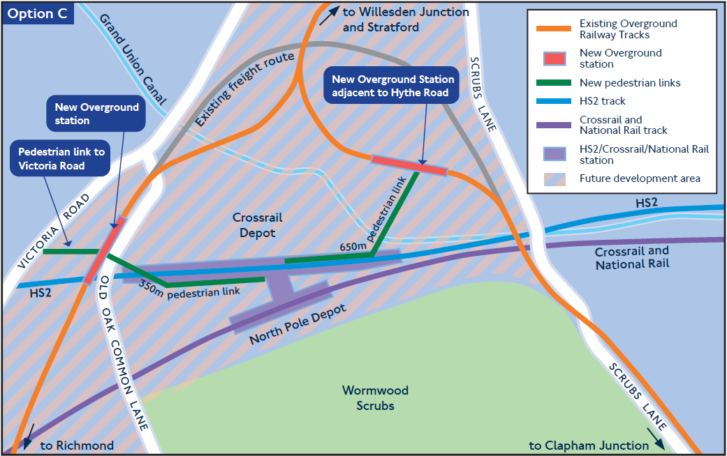
Option C Proposal At Old Oak Common
I wrote about this option in Should An Overground Station Be Built At Hythe Road?
Terry Farrell has said that there is no space between the rail lines to put the piling to support the homes, offices and other developments that will built over the top.
I also believe that the walking routes between the various stations will be far to long and tortuous.
The developers, Transport for London and the rail companies involved all seem to be planning their own parts in isolation.
It seems to echo what I documented in Searching For What Is Going To Happen On The East London Line After The Thameslink Programme Opens, where I was trying to find out how Thameslink will improve my journeys from Dalston Junction using the East London Line.
My correspondence on that issue, would seem to indicate that Thameslink and Transport for London don’t talk to each other and calmly go their own ways.
Someone needs to get a grip on all these big projects at a high level.
The Camden Town Station Upgrade Exhibition
This afternoon I went to the Camden Town Station Upgrade Exhibition at the Trinity United Reformed Church, Buck Street, Camden Town NW1 8NJ.
It will be on tomorrow and Saturday.
I did get a few questions answered and I have a few comments.
- This capacity upgrade is only concerned with the upgrade to Camden Town station and has nothing to do with improving the routes between this station and Camden Road station.
- I do think that provision should be made for a connection, even if it isn’t made until quite a few years.
- As in the current station, steps will still normally be used to access the two Southbound platforms from the main circulating space.
- For those needing step-free access to and from the surface, there will be a second lift lobby at Southbound platform height, below the main circulating space.
- Anybody crossing between the two Southbound or the two Northbound platforms will have a step-free route across.
I think that it is important that in addition to upgrading the capacity at Camden Town station, that the routes between the two Camden station; Town and Road should be improved for the following reasons.
- Camden Road is a station with full step-free access and if you lived or were staying within easy reach of the North London Line, you might find the route a much better alternative for going to the attractions of Camden Town and Camden Lock. I sometimes go for a coffee with my son, who works in Camden Town by that route from Dalston.
- Camden Lock is five hundred metres from Camden Road station and three-hundred and fifty metres from Camden Town stations and the longer route can be less busy.
- Walking between Camden Road station and Camden Lock has been improved recently, by creating a set of steps down from Camden Road to the Regent’s Canal. This may encourage many to walk to the Camden Lock area along the canal.
- Using Camden Road station or a bus for leaving the area avoids using the long spiral staircase to descend to the Northern Line at Camden Town station, which at times is the only route to the platforms.
- During the building of the capacity upgrade at Camden Town station, any alternative route that takes pressure off the station will be welcomed.
- The current walking route along Camden Road is very crowded and involves two crossings of roads on controlled crossings.
- Access to buses could be better thought out.
I would do the following.
- Improve the Regent’s Canal route between Camden Road station and Camden Lock. At present it is a bit difficult at the Camden Lock end, due to the development of Hawley Wharf.
- Improve the steps from the canal to Kentish Town Road, so that, when the Buck Street entrance to Camden Town station is opened, you have a shorter walk between the two stations.
- The Kentish Town Road steps could also provide a possibly quicker route to Camden Lock and the Roundhouse from the Buck Street entrance.
In addition lots of maps and signposting could point out some of the myriad routes and short-cuts in the area.
Eventually, a second entrance could be built at an expanded Camden Road station in the area of Camden Gardens.
Perhaps, by building much of the entrance in the three empty arches under the railway and using external lifts and escalators as has been done in buildings like the Pompidou Centre, the Lloyd Building or Deansgate-Castlefield tram stop in Manchester.
This Google Map shows the area.
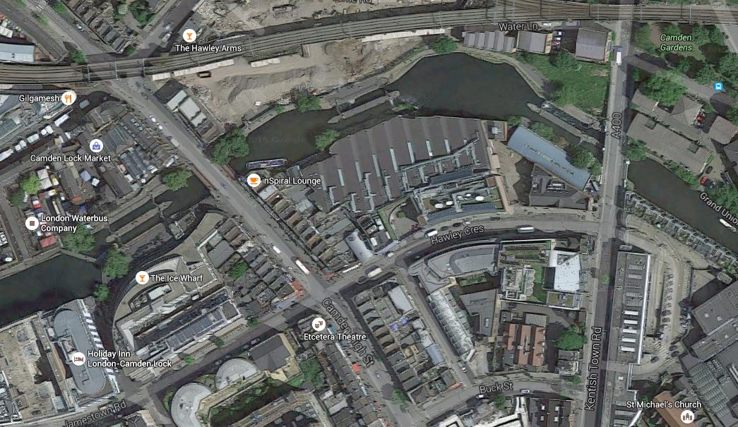
Camden Gardens, Camden Lock And Buck Street
Camden Gardens is at the top right around the viaduct of the North London Line, which runs across the map to Camden Lock. Kentish Town Road goes almost North-South through the area, with Buck Street towards the bottom. The triple building is the school that currently occupies the proposed station site. I would estimate that the distance between Camden Gardens and Buck Street could be little more than two hundred metres.
Perhaps, the Buck Street entrance building, needs a back entrance on Kentish Town Road?
To finish this is a picture of the viaduct across Camden Gardens.
After being rebuilt since the freight train crash of a couple of years ago, I’m sure another good use can be found for it.
