Digital Signalling Implications For North London
As I write this post, two big digital signalling projects are ongoing.
Four Lines Modernisation
This project is described in this document on the TfL web site.
This video is from that document.
The TfL web site says this about the new signalling system.
Work to install a new signalling and control system began in summer 2016. This will eventually allow the trains to be driven automatically, with a train operator in the cab to open and close the doors. The train operator will be responsible for managing customer information and safety.
Similar technology introduced in recent years on the Jubilee and Northern lines improved performance. The new signalling system allows trains to be run closer together, meaning a more frequent service and shorter waiting times, allowing more people to be carried. This new technology will enable us to reduce delays and improve reliability.
The programme will allow us to operate 32 trains per hour, a 33% increase in peak-hour capacity. Installation work will require some line closures.
So it looks that by around 2023, there will be a lot more trains running on the Circle, District, Hammersmith & City and Metropolitan Lines.
The Four Lines Modernisation will have implications for other services.
North London Line
Between Gunnersbury and Richmond stations, the District Line and the North London Line share track, stations and signalling.
This map from carto.metro.free.fr shows the complexity of the tracks around Gunnersbury station.

Obviously, whatever signalling is installed, it must be capable of handling both District and North London Line trains at Gunnersbury Junction and to and from Richmond.
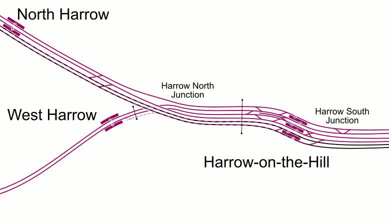
Metropolitan Line To Amersham
Between Harrow-on-the-Hill and Amersham stations, the Metropolitan Line and the London-Aylesbury Line, share track, stations and signalling.
This map from carto.metro.free.fr shows the lines at Harrow-on-the-Hill station.
and this one shows the layout at Amersham station.
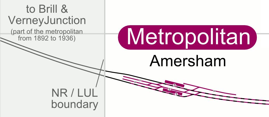
The solution for this section of track is detailed in the Wikipedia entry for the Metropolitan Line, where this is said.
Trackside signals with automatic train protection (ATP) will remain on the line north of Harrow-on-the-Hill, shared with Chiltern Railways DMUs
It is a solution, but will it last for ever?
And what about the Croxley Rail Link, if that is ever built?
Freight Trains Are Going Digital
This page on the Network Rail web site is entitled Freight Trains In Britain To Be Upgraded With Delay-Busting Digital Technology In Multi-Million Pound Deal.
The article says that all 750 freight locomotives will be upgraded.
This project must have implications for the freight services that run across North London on the Gospel Oak to Barking Line and North London Line, especially if these lines were in the future to be digitally signalled.
A Digitally-Signalled Bakerloo Line
At some tie in the next few years a decision will be made about what to do with the Bakerloo Line.
- It will be extended to Lewisham.
- It will receive new trains.
- It will be left as it is.
Options one and two would probably involve new digital signalling.
Addition of digital signalling to the Bakerloo Line would mean implications for the Watford DC Line, with which the Bakerloo Line shares the track between Queens Park and Harrow & Wealdstone stations.
Conclusion
I am drawn to the conclusion, that digital signalling in North London could bring capacity benefits.
Latest On The New London Overground Class 710 Trains
The August 2018 Edition of Modern Railways has a two-page article on the latest on the new Class 710 trains for the London Overground.
Seating Arrangement
Wikipedia says this about the seating.under Background And Specifications.
The units will be delivered in two sub-classes; an AC-only version with longitudinal and transverse seating (very similar to the S8 units on the Metropolitan line of the London Underground) for use on the West Anglia and Romford-Upminster services, and a dual-voltage version with longitudinal seating for the Watford DC and GOBLIN services.
But it now appears that all the seats on the trains will be longitudinal ones.
I use the current trains a lot to go to Walthamstow and I also use the Class 378 trains, which have longitudinal seats, frequently on the North and East London Lines of the Overground.
I probably aren’t bothered too much about longitudinal seats, but I suspect there will be others who will complain.
This discussion of RailForums is entitled Annoying Things About The Class 378. Search for “seat” and you don’t find many complaints about the longitudinal seating, which is also used on much of the Underground.
On the other hand, if all the trains have identical interiors, this must save on construction and maintenance costs.
If the interiors are basically similar to the Class 378 trains, it must also save on staff training costs.
I actually think, that the biggest complaint will not be about the new trains, but why don’t the older Class 378 trains have wi-fi and USB charging points!
Eight-Car Trains On West Anglia Routes
The article also states that services on West Anglia routes to Cheshunt, Chingford and Enfield Town stations will work as eight-car trains or a pair of four-car trains.
If they are always working in pairs, why not build them as eight-car trains in the first place?
In A Detailed Layout Drawing For A Class 345 Train, I said that the formation of a Class 345 train for Crossrail is as follows.
DMS+PMS+MS1+MS3+TS(W)+MS3+MS2+PMS+DMS
Note.that the train is composed of two identical half-trains, which are separated by the TS(W) car.
As the Modern Railways article says that these trains are to be the last to be delivered, would it not be sensible to fully understand the four-car units and then decide if instead of pairs of four-car units, they were built as eight-cars.
Consider.
- Trains would be formed of identical four-car half-trains.
- An eight-car Class 710 train would be nearly fifty metres shorter than a nine-car Class 345 train.
- Passengers would be able to walk through the whole train.
- Passengers can position themselves for their best exit at their destination station.
- Would passenger security be better on a train, where passengers could walk all the way through?
- I have seen drivers on Class 345 trains change ends inside the train
- Aventras and other modern trains are fitted with intelligent control systems, that determine the number and type of the intermediate cars in the train.
- Two Driving Motor Standard Cars (DMS) would be replaced with simpler Trailer Standard (TS) or Motor Standard (MS) cars.
- The choice of a TS or MS car would depend partly on performance issues, which could be tested with the earlier four-car trains.
- Building and maintenance cost savings by reducing the number of driving cars, must be possible.
- Capacity could be increased by adding cars in the middle, if platforms were long enough!
- Would providing overnight stabling for fifteen eight-car trains be easier than for thirty four-car trains?
It should also be noted, Cheshunt station has a very long platform without a roof. Passengers could walk to the front of the train inside a warm dry train. This already happens with the Class 378 trains at Highbury & Islington station.
Romford-Upminster Shuttle
The Modern Railways article says this about the service on the Romford-Upminster Line.
TfL is still considering whether to utilise a ‘710’ on the Romford to Upminster shuttle or to retain an older unit for the line.
I wrote about this in A Heritage Class 315 Train For The Romford-Upminster Line, after this article in London Reconnections, which is entitled More Trains for London Overground: A Bargain Never to be Repeated, said that it is possible that this line could be served by a Class 315 train, held back from the scrapyard.
I came to this conclusion.
If it is decided that a Class 315 train is to be used on the Romford to Upminster Line, I believe that the service could be marketed as a quirky heritage unit, that in conjunction with its main purpose of providing a public service, could also be used for other education, training, marketing, innovation and research purposes.
Eversholt Rail Group might even shift a few redundant Class 315 trains!
Why not?
Chingford Upgrades
The Modern Railways article says this.
A £7million investment has seen the stabling facility at Chingford upgraded, including the addition of an AVIS-scanner here as well.
These pictures show the investment.
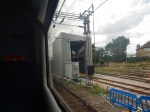
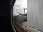


With the Automatic Vehicle Inspection System (AVIS), Chingford is becoming more than a stabling facility.
Note the large maintenance structure, so that trains can be worked on in the dry.
A Few Questions Of My Own
I have a few of my own questions.
If The Thirty Four-Car Trains For West Anglia Routes Are Converted To Eight-Cars, What Happens To The Spare Driving Motor Cars?
If the thirty four-car trains are converted to fifteen eight-car trains, it appears to me that Bombardier could have at best many of the long-lead components for thirty Driving Motor Standard (DMS) cars. At worst, they would have thirty DMS cars for Class 710 trains.
But London Overground will have need for a few more trains in a few years.
In Increased Frequencies On The East London Line, I showed this London Overground table of improvements.
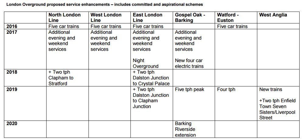
LO Improvements
Note that two extra tph are proposed on the Liverpool Street to Enfield Town service. I calculate, that this would need another two Class 710 Trains.
Similarly, to add two tph to the Liverpool Street to Cheshunt service, would appear to need another three trains.
The Mayor is also looking favourably at creating the West London Orbital Railway.
I estimate that the two proposed routes would need around four trains each to provide a four tph service, if they could be run using dual-voltage Class 710 trains with a range of perhaps ten miles on battery power.
What Is Happening About The Hall Farm Curve?
I heard from someone, who should know, that the Hall Farm Curve and the Coppermill Curve will be reinstated.
These curves would allow the following.
- A direct service between Chingford/Walthamstow and Stratford.
- Better access to the upgraded stabling at Chingford.
But I think these curves would be invaluable in maintaining services, during the construction of Crossrail 2.
Will A Bay Platform Be Developed At Lea Bridge Station?
I also wonder if a bay platform will be developed at Lea Bridge station, which would enable a four tph service to be run between Lea Bridge and Chingford stations, if Chingford Branch trains couldn’t get into Liverpool Street station, because of construction works.
I certainly feel that the curves connecting the lines at Coppermill Junction will have a major part to play in the development of East London’s railways.
A New Train On The North London Line
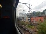
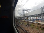
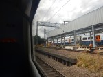
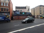
I was waiting at Gospel Oak station on the North London Line, when this train went through.

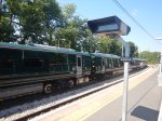
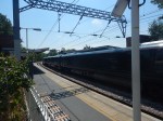
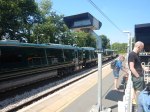

Checking with Real Time Trains, the Class 800 train was going from Hitachi’s depot at Doncaster to North Pole Depot.
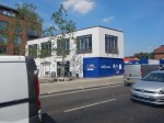
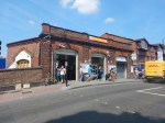
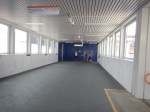
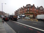
West Hampstead Station – 7th July 2018
The new bridge at the West Hampstead station is now in use and it looks like the new station will be completed by the end of the year.
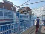
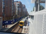
As the last picture shows this could be one of those station developments, where a deck could have been built over the North London Line to increase the number of flats built in the development on the South side of the railway.
This Google Map shows West Hampstead station on the North London Line and West Hampstead tube station on the Jubilee and Metropolitan Lines, although the latter don’t stop.
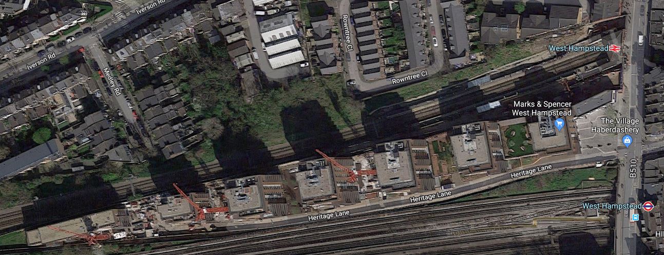
Note the development stretches a long way to the West between the North London Line and Underground Lines.
There have been plans to create a West Hampstead Interchange on West End Lane.
As these envisaged moving the Overground station to the East side of West End Lane and the new station is being built on the West side, It would appear there’s been a rethink.
Perhaps the Underground station is to be moved to the West side of West End Lane and will have an entrance on the small square in front of the M & S Simply Food and alongside the new Overground station.
This Google Map shows an enlargement of the area.
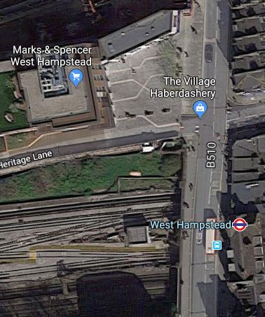
The new station could have platforms on the following lines.
- Jubilee Line
- Metropolitan Line
- Cjhiltern Railway
It would be a very worthwhile interchange. Especially, as passengers could do the following.
- Walk across the square for the Overground for East London.
- Walk perhaps another hundred metres to West Hampstead Thameslink station, which is also proposed as the terminus of the West London Orbital Railway.
There could also be a development on the top of the new station, which would hopefully contribute to the cost.
I have no idea, if anything will happen here, but Transport for London are looking to create new stations with over-site development. The Mayor also seems keen on the West London Orbital Railway, as it is based on under-used infrastructure and requires no new track or tunnels.
A Good Timetable Change In May For De Beauvoir Town
I live in the North of an area in London called De Beauvoir Town.
On the map, I live close to the junction of Mildmay Park/Southgate Road and the Balls Pond Road of Round the Horne fame!
The junction is a major bus interchange, with buses going regularly in all directions.
- North to Manor House, Turnpike Lane and Wood Green.
- South to Old Street, the City and London Bridge
- West to Highbury and Islington station, the Angel and the West End.
- East to Hackney, Waltham Forest and the River Lea.
All these buses was one of the reasons I moved here.
But note the railway stations ringing the area.
- Canonbury station is to the North-West about fifteen minutes walk away
- Dalston Kingsland station with its new M & S Food is a similar distance in the North-East corner of the map.
- Dalston Junction station is also in the North East corner.
- Essex Road station is in the South-West corner of the map.
But that is not all!
- Haggerston station is within walking distance on a good day, off the map to the South-East.
- Highbury and Islington station is a short bus ride off the map to the West.
- Angel station is a short bus ride off the map to the South-West.
- Manor House station is a short bus ride off the map to the North.
- Hackney Downs station is a short bus ride off the map to the East.
I can also get direct buses from local stops to Euston, Kings Cross, London Bridge, St. Pancras, Victoria and Waterloo.
From December 2018, I’ll be able to get a bus from the junction to the new Crossrail station at Moorgate/Liverpool Street.
Is there a better place to live for public transport?
On the twentieth of May, the date of the rail timetable change, things will get better.
An article on the timetable change in the May 2018 Edition of Modern Railways says this.
London Overground’s East London Line services are being recast in conjunction with the new Thameslink timetable. On the North and West London Lines, the off-peak timetable is being enhanced to match broadly the peak service, providing 8 tph between Stratford and Willesden Junction for most of the day seven days a week, with four continuing to Clapham Junction and the other four to Richmond.
London’s ugly duckling of the last century, is turning into a whole bevy of swans.
The service on the North London Line has improved several-fold since I moved here and will now be eight tph or a train every seven and a half minutes.
The East London Line will be recast, with another two tph this year to Crystal Palace station and two more next year to Clapham Junction station.
And then there’s the Northern City Line to Moorgate, that calls at Essex Road and Highbury and Islington stations!
In First ‘717’ In UK In June, I wrote about what will be happening in the May 2018 timetable change.
I said this.
From the May 2018 timetable change, the service levels will become.
- Four tph to Welwyn Garden City
- Five tph to Hertford North, with two tph extended to Stevenage or Watton-at-Stone.
- No direct services will run to Letchworth Garden City. Change seems to be a cross-platform interchange at Finsbury Park.
The service termination at Watton-at-Stone station is only temporary until Network Rail build a new bay platform at Stevenage station.
These changes mean that there will be nine tph between Alexandra Palace and Moorgate stations.
This represents a fifty percent increase in service frequency.
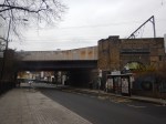
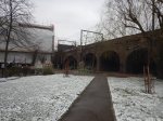
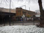
Access To The Western End Of The Camden High Line
I took between Camden Road and Camden Town stations on Sunday.
I was investigating two questions.
- How would you provide access to the Western end of the Camden High Line?
- How would you improve interchange between the North London Line and Northern Line stations?
These are some of the pictures that I took.
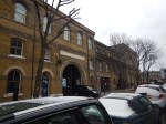
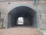
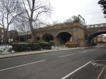
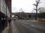
I can see a few strengths and problems.
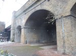
Architectural Quality
Camden Gardens has several Listed buildings, but the viaduct appears not to be Listed.
The brick viaduct is a substantial one and like most of this type of structure in the UK, Network Rail seem to keep it in good condition.
You have to remember that there was a derailment on the bridge, which I wrote about in Fall Out From A Train Crash. So I suspect, it has had a detailed check-up since.
The only eyesore is the steel bridge over Camden Street. But Network Rail have ways of making them look better. A good coat of paint would help.
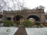
Camden Gardens
To my mind, Camden Gardens needs development. Not in any negative sense, but it is surrounded by pedestrian traffic generators.
- Camden Road station to the East
- The Regents Canal to the South
- Camden Town station to the South, which will have a new step-free Northern entrance, about a hundred metres from the Gardens.
- |A large mixed development on the other side of Kentish Town Road.
- It is on the direct route between Camden Road station and the tourist attractions around Camden Lock.
It could be developed into a convenient oasis for those walking in the area.
Perhaps there needs to be a cafe in one of the arches.
Camden Interchange
In Boris Johnson’s Transport Infrastructure Plan for 2050, the Appendix mentioned that there will be an interchange between Camden Town and Camden Road stations. Unfortunately, a copy of the report is not available on the Internet.
But it can’t be deleted from my memory.
I feel strongly, that as after the expansion of Camden Town station, the two stations will be physically closer, that a Western entrance to Camden Road station, should be built, if the sums added up.
Consider.
- It would create a convenient interchange between the two rail services.
- It would improve access from Camden Lock and the new developments on the North side of the Regent’s Canal.
But it could also create access to the Camden High Line.
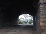
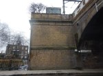
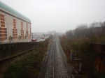
The Height Of The Viaduct
The viaduct is high, as the last-but-one picture in the gallery shows.
Because of the railway tracks, between the two platforms, which means the only way to cross is to walk to the other end of the platforms and go down and up again, design of affordable and practical access, will be challenging.
A Station Entrance On The Camden High Line
The first picture in the gallery, shows the shrubbery on the two disused tracks, that could become the Camden High Line, behind a fence.
It would surely be possible to create a ticket gate in a small building on the wide platform.
Conclusion
With clever design it would be possible to provide access to the Camden High Line and the station in a single development.
Thoughts On The Camden High Line
Last night, I was made aware of the Camden High Line proposal.
On their web site, they say this is their mission.
Our mission is to transform the disused railway into a sustainable green space and transport link that is open for and used by everyone.
Here are my thoughts.
The Railway Line In Question
This map from carto.metro.free.fr shows the disused railway tracks.
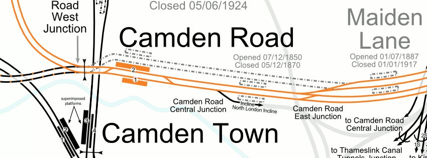
Note.
- The line shown in orange is the North London Line of the London Overground.
- Camden Road is a two-platform station, with full step-free access.
- Maiden Lane is a disused station, that closed a hundred years ago.
I would assume that the two dotted lines between the two stations, will be converted into the Camden High Line.
This Google Map shows the North London Line between Camden Road and Maiden Lane stations.
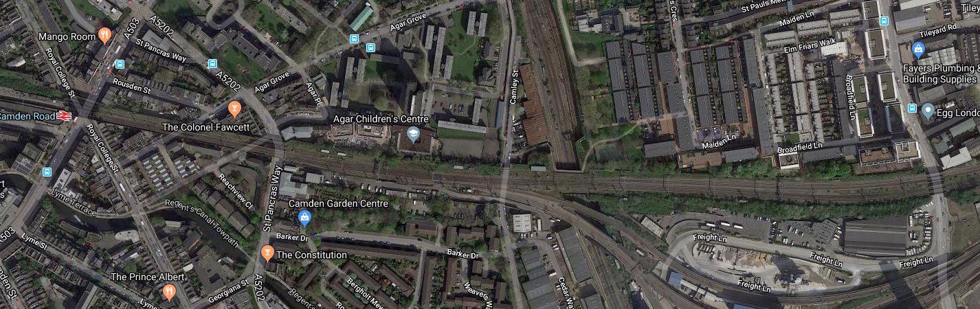
One of the most striking features visible from this map, is the large amount of development going on to the South of the North London Line.
The new residents and workers could probably do with a good walking and cycling route between Camden Town and Kings Cross.
Plans For The North London Line
The North London Line is a heavily-used passenger and freight route and it is unlikely, that traffic levels will drop.
Freight Traffic
There are now two electrified rail routes across North London; the North London Line and the Gospel Oak to Barking Line.
As two of the UK’s main container ports; Felixstowe and London Gateway, are not served by electrified railways, this still means that large numbers of diesel-hauled freight trains have to pass through North London to get to the Midlands, North and Scotland, despite the routes from Ipswich and Tilbury being fully-electrified.
These diesel-freight trains are boosted because the alternative route via Ipswich, Ely and Peterborough is not electrified.
The following needs to be done to seriously cut the number of diesel-hauled freight trains through North London.
- Electrify Ipswich to Felixstowe.
- Electrify to London Gateway.
- Electrify Ipswich to Peterborough.
- Replace a large fleet of polluting diesel Class 66 locomotives with modern electric units.
In some ways, the replacement of the locomotives by private freight companies is the largest stumbling block.
However, I think that the two shorter lengths of electrification will happen, which will mean that less diesel-hauled freight trains will pass through London, as they will go via Peterborough.
On the other hand, the need for freight trains will increase.
- More traffic to and from the ports.
- Freight to and from the Channel Tunnel, which must go through London.
- Trains carrying vehicles seem to be becoming more numerous.
I wouldn’t be surprised to see calls from the rail freight industry for improvements to the two freight routes through London.
One thing that will help freight trains, would be extra passing loops, where freight trains can wait for the passenger trains to overtake.
The double track of the Camden High Line is one of the few places, where another freight loop could possibly be installed.
Passenger Traffic
Sometime this year, two extra passenger trains per hour (tph) will run on the North London Line between Stratford and Clapham Junction stations.
This will bring the frequency to six tph.
On the past history of the London Underground, this will mean more full trains and pressure for longer trains and more services.
Old Oak Common Station
But the biggest changes will come in the next few years with a new Old Oak Common station, which will connect the North London Line to HS2, Crossrail, Chiltern, Great Western Railway and the West Coast Main Line.
Remember too, that the North London Line will be connected to Crossrail at Stratford.
Will these developments create a demand for extra trains on the North London Line?
Camden Town Station
Camden Town station on the Northern Line is being extended, with a new Northern entrance closer to the North London Line.
Will better routes be provided between Camden Road and Camden Town stations?
Interchange Between Camden Town And Camden Road Stations
Camden Town station’s new entrance will be to the North of the current entrance just off Kentish Town Road.
This Google Map, shows the Western end of Camden Road station.
Note.
- There is a train in the Westbound platform.
- Kentish Town Road meets the station by Camden Gardens.
- The overgrown unused tracks to the North of the current station.
- The green space of Camden Gardens, with the 88 bus stand.
Could a second entrance to Camden Road station be built within the viaduct, perhaps with a ground-level entrance in Camden Gardens?
- It would be a short walk to the new entrance to Camden Town station.
- It would be convenient for walking to Camden Lock and the other attractions along the Regents Canal.
If the Camden High Line is created, access to the Eastbound platform could be directly to and from the High Line, which would be a garden to the North of the station.
Maiden Lane Station
Wikipedia says this about the re-opening of Maiden Lane station.
Camden Council has suggested this station could be rebuilt and reopened, in conjunction with the King’s Cross Central redevelopment project.
In June 2017, the Council were talking with Tfl on the possible reopening of Maiden Lane & York Road stations which it wished to reopen with Maiden Lane more likely to reopen then York Road.
I suspect, if the station is reopened, it will be on the Southern pair of lines, currently used by the London Overgr4ound.
One of the problems of reopening Maiden Lane station, is that a stop at the station would decrease capacity on the North London Line, through the area.
Plans For The East London Line
The East London Line is one of the UK’s rail successes of the last few years.
An outpost of the London Underground, through a tunnel, built by the Brunels, was turned into a modern railway with new trains and sixteen tph all day.
But this is only a start!
Plans exist for more new trains, an extra fout tph through the tunnel and a possible uprating of the signalling to handle a frequency to 24 tph.
If the latter should happen, I feel that another Northern terminal will be needed for the East London Line.
The obvious terminal is Willesden Junction station.
- Willesden Junction was certainly mentioned, when the London Overground was opened.
- There is a bay platform at the station.
- ,The station can be reached via Camden Road, Primrose Hill, South Hampstead, Kilburn High Road, Queen’s Park and Kensal Green stations.
- It will have good connections to an extended Bakerloo Line.
It would create another route across North London.
Would it mean extra platforms at Camden Road station?
Conclusion
I think that there will be a very large demand for using the two old tracks for rail purposes.
Should This Be Done On More Building Projects?
Buckingham Group are building the new West Hampstead station on the North London Line.
This picture was taken of the architect’s layout drawing of the new station, that was fixed to the hoardings.
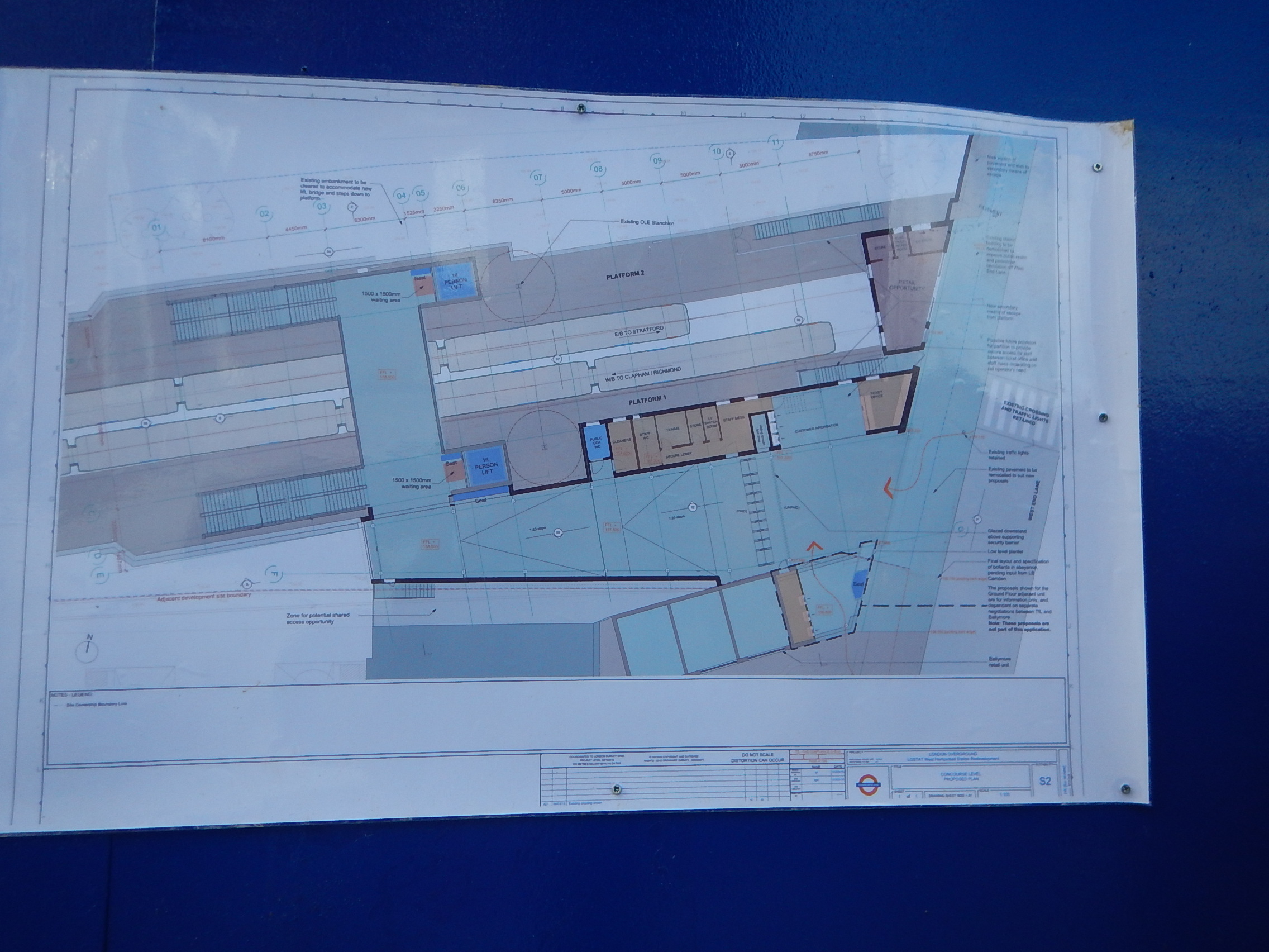
I wasn’t the only person giving it a good study.
I think it is a good way to inform the public.
A Walk Down The Finchley Road
Aleks2cv made this comment on my long post about the West London Orbital Railway, which was entitled New Railway Line For West London Proposed.
West London’s version of Goblin, an available resource with potential. All urban London so suitable for Overground 4 car metro service.
I would add extensions to your outline.There is space at the former Midland Finchley Road station for a single terminating platform with existing street facade. Interchange with North London, Metropolitan, and Jubilee and coaches on Finchley Road such as Stansted AirLink.
It got me thinking.
This is only part of the comment and I’ll deal with the rest after Christmas, if I renmember.
This is a Google Map of the area along the Finchley Road, between Finchley Road and Frognal station in the North and Finchley Road station in the South.
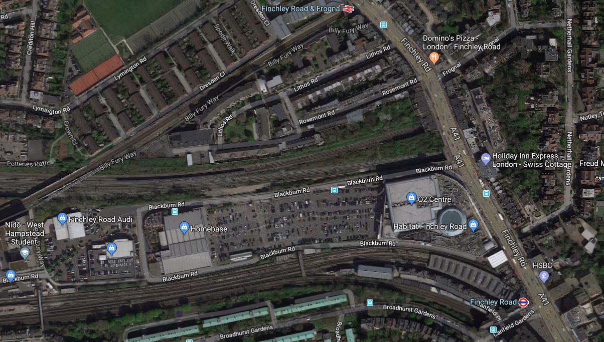
It is one of those interchanges, you might do in a North to South direction, as you have gravity assistance.
This second map from carto.metro.free.fr shows the various rail lines.

Note, the following lines can be seen in both maps.
- The Midland Main Line through West Hampstead Thameslink station, which crosses Finchley Road between Finchley Road and Frognal and Finchley Road stations.
- The Metropolitan and Jubilee Lines going through West Hampstead and Finchley Road stations.
- The North London Line going through West Hampstead and Finchley Road and Frognal stations.
I took these pictures as I walked down Finchley Road.


My thoughts on various parts of the area.
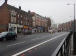
Finchley Road And Frognal Station
The station is a very poor example.
- There is no step-free access.
- Station buildings are minimal.
- There is a ruin next door.
- There is a need for perhaps a light-controlled crossing outside the station, as the road is very busy.
Improvement wouldn’t be helped, by the fact that the station is at the end of Hampstead Heath tunnel.
This Google Map shows a close-up of the station.
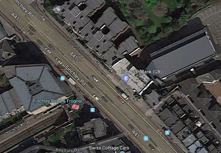
The only solution is probably a full rebuilding with perhaps a block of housing or offices on the top of a modern station.
The Midland Main Line
This Google Map shows the Midland Main Line as it passes under Finchley Road, to the North of the O2 Centre.
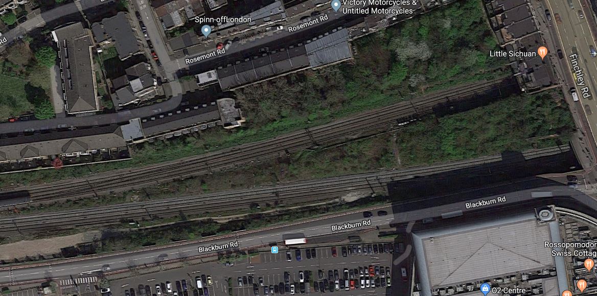
Note.
- There is not much space between the railway and the service road for the O2 Centre.
- The large surface-level car park of the O2 Centre is visible.
- The two slow lines are the Northern pair of lines, with the two fast lines to the South.
At least there is space in the middle of the lines.
A Terminus For The West London Orbital Railway
Aleks2cv in his comment, felt that the West London Orbital Railway can be extended to Finchley Road.
I think this could be very difficult, as the West London Orbital Railway will probably be a single track railway sneaking up the South side of the Midland Main Line.
- There is very little space.
- Passengers would still have to walk about a hundred metres to connect to the Underground.
- Connecting to the Overground would require a stiff walk up the hill.
This Google Map shows the limit of the freight line, that could possibly be turned into the West London Orbital Railway.
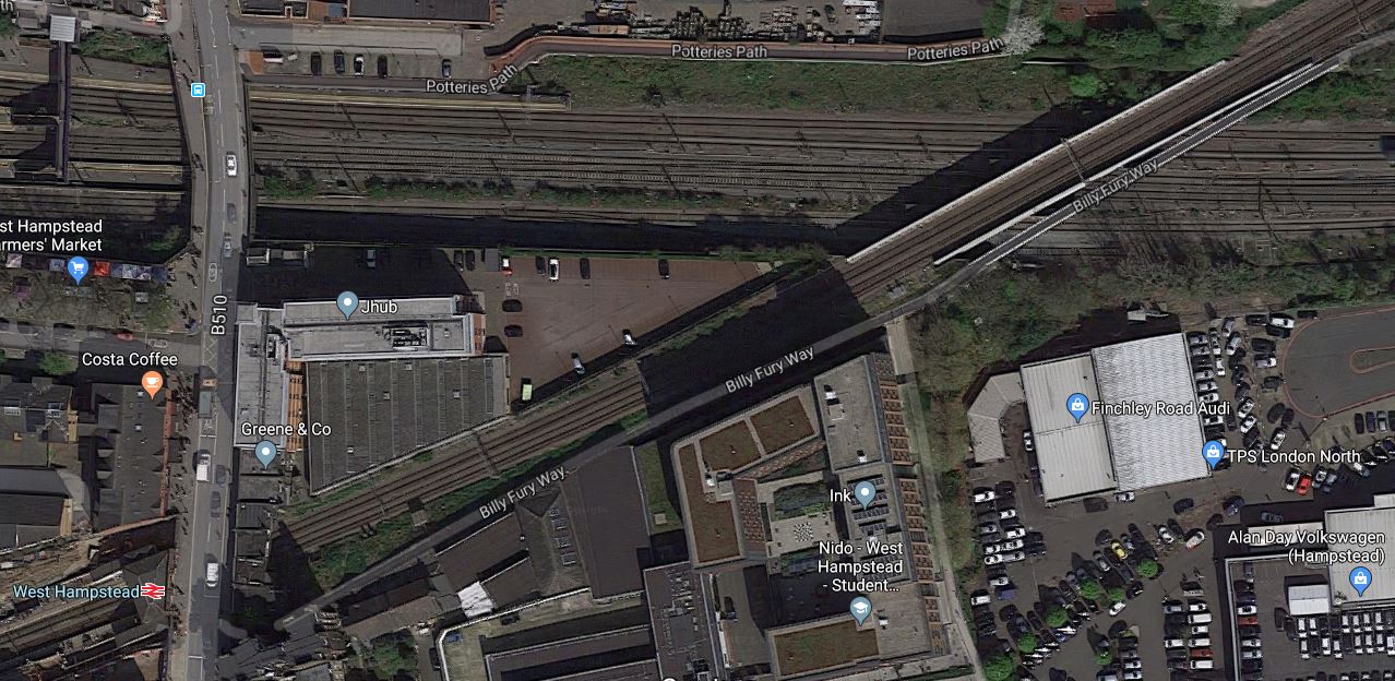
Note.
- The railway going East-West is the Midland Main Line.
- The diagonal railway is the North London Line through West Hampstead station.
In the shadows on the South side of the Midland Main Line, you can just see tyhe freight line, which connects to the Down Fast of the Midland Main Line to the East of the bridge.
It looks to me, that years ago, the land now occupied by the O2 Centre was some form of railway yard or factory premises.
Finchley Road Underground Station
Finchley Road Underground station is a station in need of a degree of refurbishment.
- It is not step-free.
- Pedestrian access to the O2 Centre is not good.
But it is a cross-platform interchange between the Jubilee and Metropolitan Lines.
This Google Map shows the station.
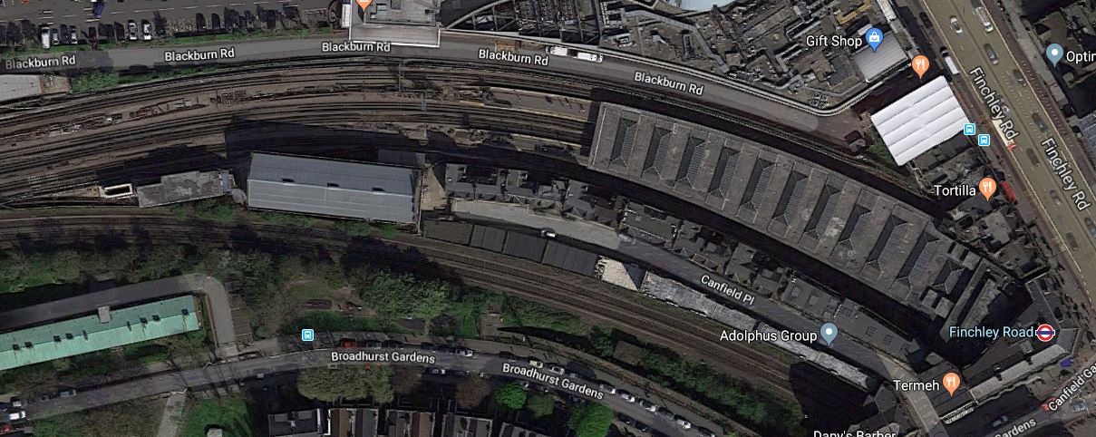
Note.
- The two Chiltern tracks to the South of the station.
- The closeness of the Western end of the station to the Car Park of the O2 Centre.
- There is space to the South of the Chiltern tracks.
I feel very much that this station could be developed sympathetically to be a very good station, that could be paid for by housing on the top.
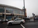
The O2 Centre
I think the O2 Centre could be the key to Aleks2cv’s idea for the West London Orbital Railway.
- The O2 Centre appears tired.
- Public transport can take people easily to the shopping at Oxford Street or Brent Cross.
- Surface car parking is so Twentieth Century.
As the O2 Centre is owned by British Land, who are one of the UK’s biggest property companies, I think that it is likely the site could be redeveloped.
Suppose the site was developed as follows.
- It extended over and connected to the Western ends of the platforms at Finchley Road Underground station.
- A two-platform terminal station for the West London Orbital Railway could probably be fitted in reasonably close to the Underground station.
- A small bus station.
Over the top would be shops, offices, housing or whatever was desired.
Conclusion
I believe that something will be done to redevelop this site.
Whether it has the terminal for the West London Orbital Railway underneath, will only be made clear, when planning permissio is given.
