The Golden Jubilee Bridges In The Sun
I walked across the Thames on the the Golden Jubilee Bridges today in the sun.
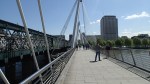
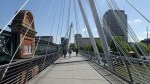
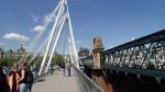


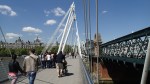

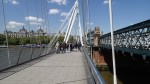
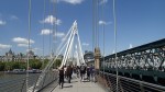
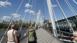

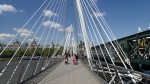
I think it’s one of the first times, I walked across the upstream bridge on the House of Commons side.
I like this pair of bridges and to me, they are much better than the wobbly bridge.
They also don’t wobble!
Thames Tideway Tunnel – Greenwich Interconnection Tunnel
Index Thames Tideway Tunnel Sites
The Greenwich Interconnection Tunnel is a branch tunnel that splits from the Main Thames Tideway Tunnel at Chambers Wharf and goes by way of Earl Pumping Station and Deptford Church Street to Greenwich Pumping Station, from where it will be bored. This map shows the route of the tunnel.
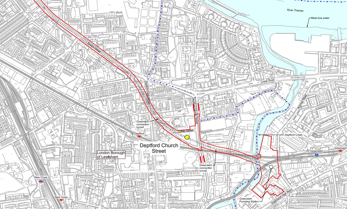
Greenwich Interconnection Tunnel
It would appear that the tunnel is being dug in a single go from Greenwich to the Thames, with most of the route deep under the Greenwich Rail Line.
This Google Earth image shows the rail line between Greenwich and Deptford station.

Deptford To Greenwich Station
The works on Deptford Church Street are just to the north side of the rail line in part of the green space and those at the Greenwich Pumping Station are to the south of the junction, where the DLR branches south from the rail line.
The next site at Earl Pumping Station is just off the main map at the left.
On the page for the Greenwich Pumping Sration, Thames Water say this.
In our application for development consent this site is used to drive the Greenwich connection tunnel, a long connection tunnel which connects the combined sewer overflows (CSOs) at Greenwich Pumping Station, Deptford Church Street and Earl Pumping Station to the main tunnel at Chambers Wharf.
So it looks like Thames Water are sneaking the tunnel into Chambers Wharf.
I doubt they’ll be much disruption from the actual boring of the Greenwich Interconnection Tunnel, as it’ll all be dug from Greenwich from a site with water access. As the tunnel is being bored towards Chambers Wharf, it would seem likely that the large amount of tunnel spoil created will be loaded on barges at Greenwich and taken away for disposal, with little disruption to anybody. It would appear to be a smaller version of the system Crossrail used on the Limmo Peninsular in East London.
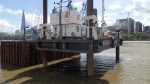
A Second Dazzle Ship
After seeing Snowdrop in Liverpool last week, as I walked along the Embankment, I noticed that HMS President had been given the same treatment.
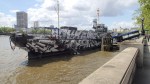

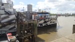

Although it is not as bright.
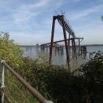
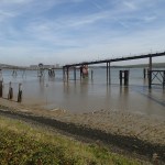
Thames Tideway Tunnel – Preparatory Works At Blackfriars Bridge
As I walked along the river from Cannon Street, I noticed what looked like a small oil rig in the middle of the Thames.

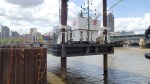
t is actually a secondary site that is being used to develop a new Millenium Pier as the old one is in the way of construction works for the new Thames Tideway Tunnel at Blackfriars.
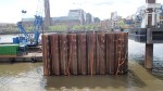
It was good to see that they are putting up pictures of what they are doing.
This picture clipped from this page on the tunnel website, shows an impression of what the completed works will look like.

Tideway Tunnel At Blackfriars
Blackfiars Bridge leads off over the river at the top right of this image.
When completed there will be a public space with shops and a cafe.
The web site for the Thames Tideway Tunnel is impressive.
Thinking Big In Essex
I found this report in the Southend Echo from 2008 interesting.
It is a plan to link Canvey Island with the Hoo Peninsular in Kent using an immersed tube road and rail tunnel. This is an extract from the report.
Metrotidal’s blueprint seeks to combine the tunnel with new flood defences protecting London and a tidal power plant in the middle of the Thames Estuary.
This could support a new eco-town or generate enough power to operate a rail service through the tunnel, the consortium said.
This is a Google Earth image of the Thames south of Canvey Island.
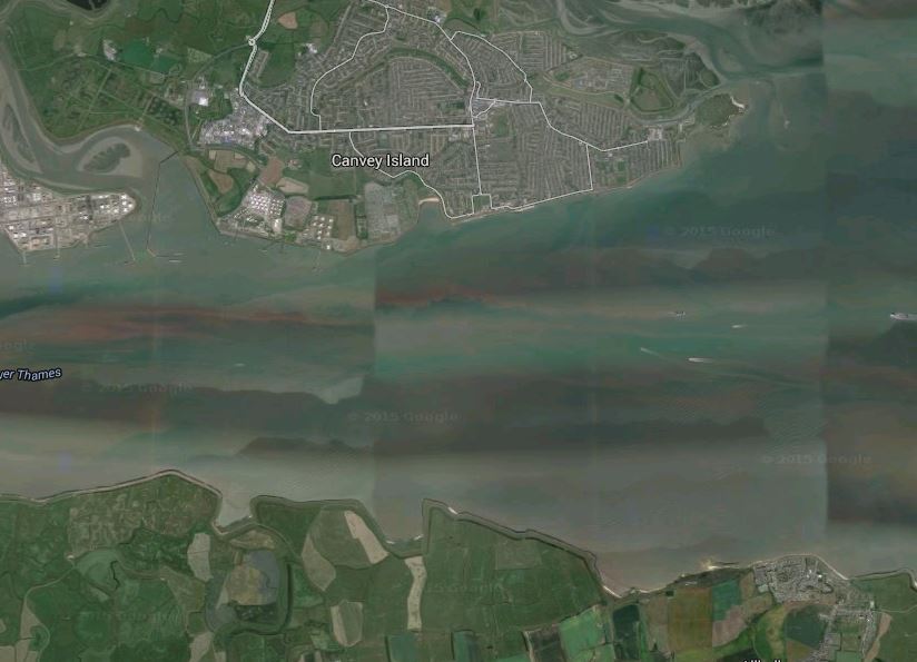
The Thames South Of Canvey Island
The surprising thing is that the river isn’t that wide and is probably about a couple of kilometres.
There hasn’t been anything on the news in recent years, so I suspect that the plan is very much on the back burner.
But one day, a project like this will be built!
How Thameslink Sorts Out London’s Trains
After taking the pictures of the new viaduct at London Bridge yesterday, I thought it would be good to post a map, which showed how it all fits together.

Stations Along The Thames
The picture shows most of the stations along the river that serve the South. And of course the North if they’re connected to Thameslink.
The main stations from left to right (west to east) follow.
Charing Cross is at the far left of the image, where it sits at the end of the Hungerford bridge, by which all trains enter and leave the station. The station is marked by the red British Rail double-arrow symbol, with the London Underground roundel showing the related Embankment tube station.
Waterloo is opposite Charing Cross at the other side of the Thames, although there is no direct rail connection between the stations.
Waterloo East is to the east of Waterloo and this station does have a rail connection to both Charing Cross and London Bridge.
This picture shows the position of the three stations and the rail lines to a larger scale.

Charing Cross, Waterloo and Waterloo East Stations
Note the rail lines going across Hungerford Bridge between Charing Cross and Waterloo East. I’ve never been to Waterloo East or even stopped at it on a train, but you can walk between the two Waterloo stations.
In this image the domed circular roof of the Waterloo IMAX cinema and Nelson’s Column can be clearly seen.
Blackfriars is the next station and its unique position across the river is shown in the middle of the main picture. It is the right one of the pair of bridges and the British Rail symbol indicates the main station entrance on the North Bank of the Rover. This picture shows its position in more detail.

Blackfriars and Thameslink
Note how the Thameslink lines from Blackfriars to the south go in two directions.
One line goes to the East for London Bridge, after joining with the lines from Charing Cross and Waterloo East, at the bottom right of the picture.
The other line goes directly South to Elephant and Castle.
The Temple area is at the top left of this picture, where there is a tube station. London’s new Garden Bridge will between here and the Southbank area, when it is built.
Cannon Street on the North Bank is the next station and like Charing Cross, all trains access the station by a bridge over the Thames.

Cannon Street and London Bridge
Note the triangular junction South of the Thames, that gives access to both Charing Cross and London Bridge from Cannon Street.
London Bridge station is shown in more detail in this picture.

London Bridge Detail
The detail would be a lot better, if it wasn’t for the shadow from The Shard, which is visible at the bottom right.
The pattern of the lines to and through London Bridge that will be in operation with the full Thameslink scheme is beginning to emerge.
1. The number of through platforms at London Bridge, for services on Thameslink and to/from Charing Cross and Cannon Street is being increased from six to nine.
2. The extra viaduct over Borough High Street and the Market can be seen.But it doesn’t have any tracks in this image.
3. London Bridge station itself, appears to be a big building site, with trains going through.
Incidentally, I’m not sure of the date of the Google Earth view.
The Thameslink program is vast and will add a hundred stations to the existing network. Wikipedia sums it up like this.
The Thameslink Programme, is a £6 billion project in south-east England to upgrade and expand Thameslink to provide new and longer trains between a wider range of stations to the north and to the south of London without requiring passengers to change trains in London. Work includes platform lengthening, station remodelling, new railway infrastructure, and additional rolling stock.
In this post, I have traced it south of the Thames and shown how it interfaces with the lines into Charing Cross and Cannon Street. If the architects have got the design of London Bridge station right, this alone should unlock a myriad of new routes for all those millions of Londoners and those that come into the City.
A couple of years after the new London Bridge is completed, Crossrail with its connection to Thameslink at Farringdon will open, adding even more travel possibilities.
Some months ago, I wrote a post called A Divided City.
Hopefully, the enlarged Thameslink, will help to cross the great divide of the Thames, that without which London wouldn’t even exist.
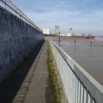
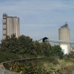
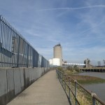
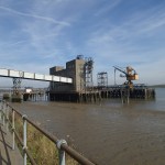
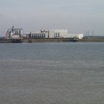
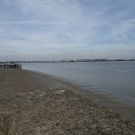
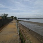
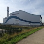
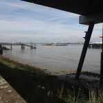
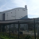
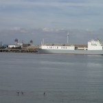
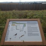
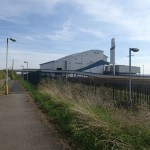
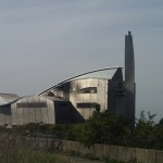
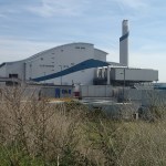
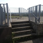
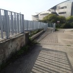
A Walk Along The Thames From Erith Station To Crossness
This afternoon I enjoyed the sun and walked along the Thames Path from near Erith Station to the Victorian Pumping Station at Crossness.
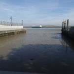
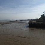
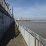


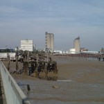
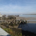
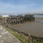
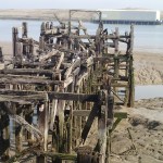


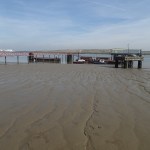

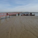


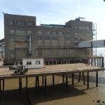
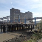

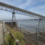


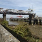

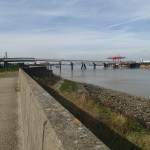
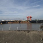


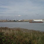


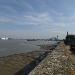

When looking at these pictures, you can see some of the places that I also saw on the cruise down the Thames.
I haven’t fully annotated the pictures yet, as finding out what some of the buildings are isn’t easy.
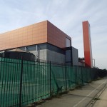
There’s some good technology at work in Crossness and they should tell people about it.
An Evening Cruise On The Thames
I went on an architectural cruise on the Thames, starting from Greenwich and going East.

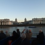
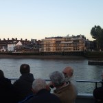
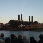
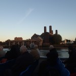
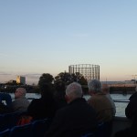
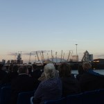
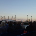
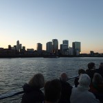
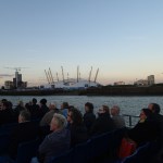
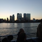


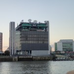
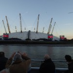
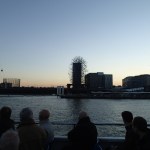
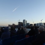
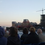

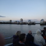

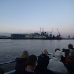
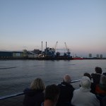

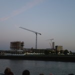
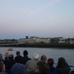
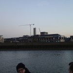
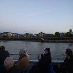
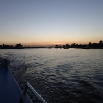
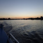
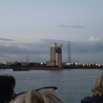
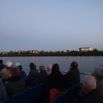
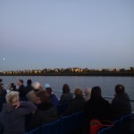
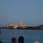

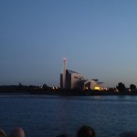


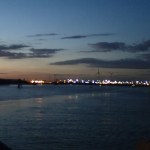
The pictures show the various sights we saw.
Action By The River
There was a lot going on in London by the river.

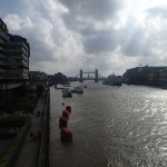

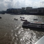
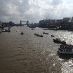
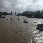
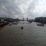
The pictures show the preparations for the Tour of Britain and a barge race on the Thames.
I met a lady from Stoke Newington, who was on her way to see Harmondsworth Barn near Heathrow.
I think there are millions of us, who use their Freedom Passes to explore London.
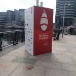
The Tall Ships Race 2014
I went with a friend to see the tall ships moored in London for the Tall Ships Race 2014.


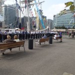
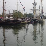
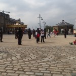


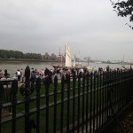
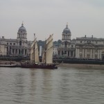
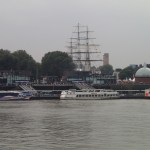
We started at Canary Wharf, then moved on to Woolwich, before going to Greenwich.
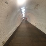
To avoid the crush, we escaped under the river, using the Greenwich Foot Tunnel, before finally taking a look at the ships from the North Bank.
