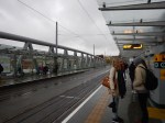
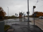
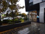
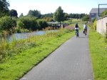
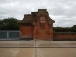
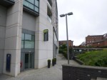
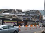
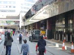
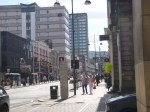
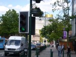
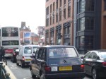
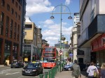
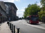
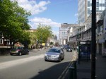
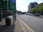
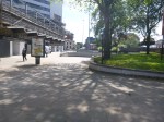
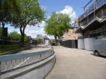
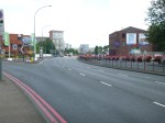
Walking Between St. Pancras And Euston Stations
In 2011, I wrote Getting Between Kings Cross/St. Pancras and Euston about how I walked between the stations.
This route has now been formalised with green signs.

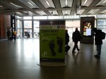

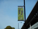


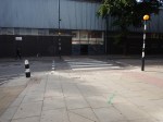
I think when they finish the roadworks, it’ll be a good route. This is cut and modified from my original post.
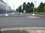
So how would I make it better, so that in effect we had one super station for the north?
- Perhaps, it should be marked on the ground, as a Kings Cross/St. Pancras to Euston walking route.
- You might even provide some eco-friendly transport along the route, like an electric shuttle bus or bicycle rickshaws.
- A couple of suitably placed Boris bike stations would help too.
- Shops and cafes should be developed along the road. There are some already.
I was right that this would happen.
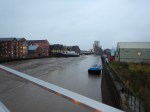
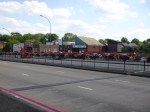
A New Route To The City Ground, Nottingham
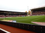
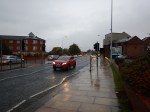
Ipswich Town went to play Nottingham Forest at the City Ground today.
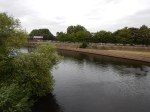
Usually, I walk from Nottingham station using Trent Bridge to cross the Trent.
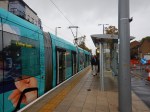
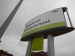
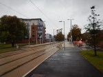
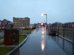
But today, I decided to use the extended tram route to go to the stop at Meadows Embankment, from where I walked along the river to the ground.
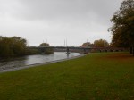


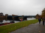
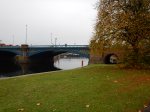

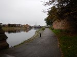

I did cross the Trent once on the Wilford Suspension Bridge that carries utilities over the river, but it is a much more pleasant route, that is less crowded and away from the traffic.
This Google Map allows a comparison of the distances.
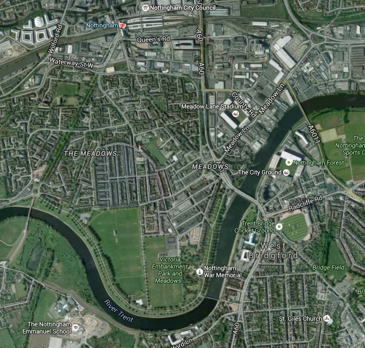
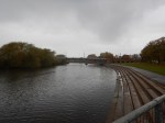
Walking To The City Ground
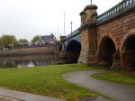
The Wilford Toll Bridge, where the trams cross the Trent, is the westernmost bridge on this map, whilst the Wilford Suspension Bridge is just South of the Nottingham War Memorial.
As an aside the Wilford Toll Bridge, is the only bridge which says it is a toll one, but doesn’t even allow vehicles to cross, let alone charge them for it?
If you are driving to a match at any of the three grounds by Trent Bridge, you can go to the Park and Ride at Clifton South and then get a tram to Meadows Embankment and walk. I think that the Park and Rid could be free if you use the tram.
I walked the obvious route from the tram to the ground, but there may be a shorter route that cuts out the bend in the river or cuts through the houses after crossing the suspension bridge.
Perhaps, Nottingham City Council should signpost the best route!
The 2017 UK City Of Culture
Hull is going to be the 2017 UK City of Culture


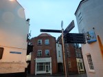


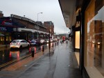
I walked across Hull twice from my supposedly City Centre hotel, which seemed to be almost closer to Grimsby than the railway station.
The first time was in the dark and there were no signs or maps, so I had to climb up on a dual-carriageway bridge, as the direct route across the footbridge was blocked due to demolition. The taxi-driver who brought me to the hotel said that all other routes were dangerous.
Despite the hotel saying it would take twenty minutes to get to football at the KC Stadium, It took me over an hour.
The pictures were taken in the morning and it was very wet, as they show.
I had hoped to find a paper shop to buy my copy of The Times, but in the forty minute walk, I didn’t pass one open shop selling newspapers. They was also no nice cafe for breakfast.
So instead of looking around Hull, I made an executive decision to go to Meadowhall to get some breakfast.
I know it was eight o’clock, but round here in East London, most things start at seven. Even my local Carluccio’s opens at eight in the week and nine at the weekends.
I got lost both times and I couldn’t even find a taxi to take me to the station.
I have never seen a city so badly signposted in my life.
But then to many of these towns and cities, maps are a waste of money, as everybody uses smart phones.
I don’t as my left hand isn’t good enough to hold it steady enough. Also as it was raining, the screen doesn’t appear to be too readable underwater.
UK Capital of Culture 2017?
They’re having a laugh or are they trying to lure visitors into those unsavoury areas my taxi driver warned me about?
I shan’t be going back to Hull again.
The place is an absolute disgrace as regards welcoming visitors, who don’t have cars and prefer or have to walk.
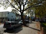
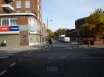
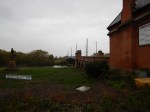
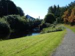
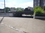
Walking From Three Bridges To Hanwell
I walked from Three Bridges via the Grand Union Canal and Hanwell Locks to Hanwell station.
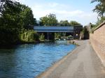


From the canal it was a walk through houses and I didn’t take any pictures.
From The Kelpies To The Falkirk Wheel
I walked from The Kelpies to the Falkirk Wheel. This Google Map shows the route.
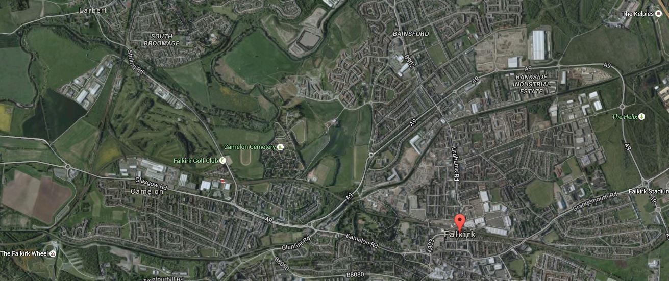
Kelpies To The Falkirk Wheel
I estimate it was about five miles and it is pretty flat with no steep hills. The red arrow shows the centre of Falkirk, with The Kelpies in the top right and the Falkirk Wheel in the bottom left corners respectively.
These are pictures I took along the route.


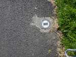


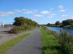


What was a great help was the restaurant called the Gambero Rosso by the Forth And Clyde Canal, where I had an excellent lunch.
The one thing that would have helped was a Boris-style bike you could hire at one end and leave at the other. They have a version of these bikes in Stirling.
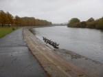
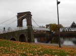
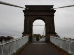
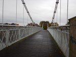
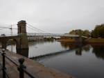
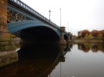
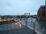
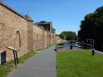
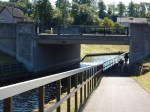
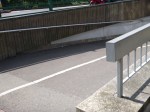
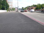
Wliford Bridge On The Nottingham Express Transit
Wilford Bridge opened over a hundred years ago as a toll bridge and parts of it are Listed.
The Nottingham Express Transit (NET) needed to cross the River Trent and instead of building a new bridge this bridge was widened and strengthened to accept trams.


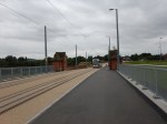


I think that the architects and engineers have done a splendid job to create a very good crossing for trams, pedestrians and cyclists. As I walked across it, there was a lot of cyclists and pedestrians crossing the river.
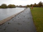
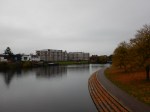
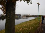
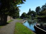
I do wonder if the Meadows Embankment tram stop on the north side of the bridge will become one of the better ways to get to the cricket and football grounds. You would park at Clifton South or another convenient Park-and-Ride and after getting off the tram, would walk along the river. The Google Map shows the Trent from Wilford Bridge to Trent Bridge.

River Trent
I don’t know how good the walking route is at present, but surely signs and information on the river route and a possibly more direct one cutting out the bend in the River Trent should be provided. I suspect that the route is shorter than it first appears, as there is the Wilford Suspension bridge on the other side of the bend.
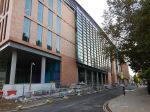
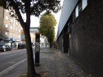
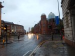
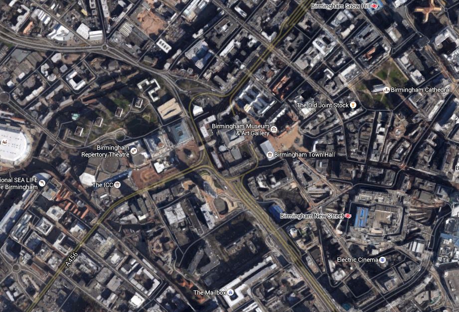
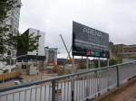
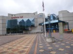
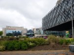
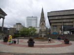
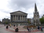
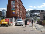
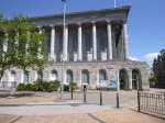
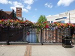
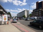
Walking The Contours In Birmingham City Centre
I tend to walk the contours, when I walk. This means you tend to walk on the level and you often only have one stiff uphill section when you feel you can tackle it.
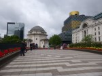
Birmingham is on a hill with the cathedral on the top. Now that I know the city better, if I’m walking across the city, I might walk towards the cathedral, as although some of the route will be uphill, as I’m probably going on my way from any of the three stations at Moor Street, New Street and Snow Hill and it will be downhill all the way from the cathedral. This is a Google Map of Birmingham city centre.
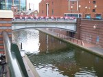
Birmingham City Centre
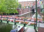
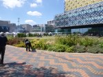
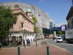
The canal behind the hotel runs South-Esterly from the Sea Life Centre.
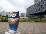
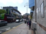
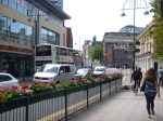
My plan when I left the hotel in the morning was fairly simple. It was to walk down the hill and then walk across to New Street station, which is the other side of the dual-carriageway road, hoping that most of the route was flat. Once at the station, I would buy my West Midlands Day Ranger ticket and my paper and then walk up the hill to Carluccio’s for some breakfast. After breakfast, when the Museum opened, I would would go and see the Staffordshire hoard. I tok these pictures as I walked.


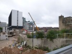
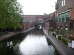


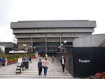
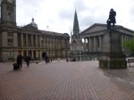

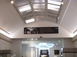


Very little of the walk was uphill. In fact some parts like through the ICC, were actually inside.
I think one of the troubles Birmingham has is that the road layout was determined in the 1960s, when the powers that be felt that everybody would have a car and would want to drive it into the city centre.
Now that the Midland Metro is coming and this will go from New Street Station, up to the Town Hall and then past Centenary Square and Brindley Place on its way to Five Ways, the priorities are all different. The tram route will give people two ways from New Street to get up the slight hill to the axis of the city running from Brindley Place through Centenary Square, past the Town Hall and the Museum to the Cathedral. Someone has thought out how the tram can benefit Birmingham city centre.
Incidentally, I do hope passengers don’t have to buy tickets on the tram by then, as they do now. I will celebrate with joy, when I enter a tram or bus, somewhere in the UK outside of London, by just tapping in with my contactless bank card.
It’s not paying my fare that I object to, it’s having to give over money and get a flimsy piece of paper in return. Drivers on the whole think cash in unsafe! For them! What’s wrong with tapping my bank card on a reader?
Incidentally, I think that the Cross-City Line crossed under my walk by my hotel. Why does it not have more stops in the city centre? The building that is the Nitenite hotel, should have been built over the railway with a station underneath. It certainly would be nowadays.
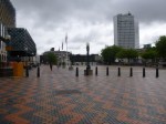
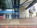
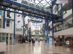
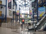
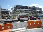
Walking The Route Of The Midland Metro Line One Extension
I’ve walked the Line One Extension of the Midland Metro between New Street and Snow Hill stations before, but I’ve never walked the proposed extension as far as Five Ways. I took these pictures on the route.
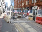


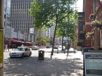

The Extension was planned to be opened to Centenary Square in 2017 and to Brindleyplace, Five Ways and Egdbaston later. Nothing much seems to be happening past New Street station, except for some utility works, which must be sorted before tram tracks and station are put over the top.
The walk is fairly easy, but the last section around Five Ways and to Five Ways station was designed using Birmingham’s 1960s philosophy of deling with traffic and pedestrians, that I’ve seen going to Birmingham City several times – Pedestrians should be channelled into dangerous areas, so they are run over and killed. This would of course make it less likely a driver will damage his car, by hitting one.
Birmingham could do a lot worse than extend the tram to Five Ways. Some of the running routes would be challenging and Birmingham’s many drivers would probably object, but if they want more visitors to the City, surely it is a price worth paying?
I do wonder about the costs of extending tram lines, as opposed to building new ones. Obviously, some costs like new trams and getting power to the trams will be minimised, but you’ve still got the costs of actually putting in the rails and divering utilities.
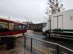
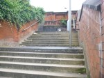
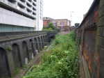
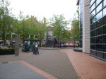
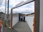
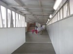
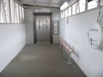
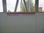
The Hackney Downs/Central Link Is Now Open
The Hackney Downs/Central Link opened at 11:00 this morning.
I’d thought something was finally happening, as there was a group of suits with clipboards about when I had passed through earlier. So after my trip to Surrey, I popped back to get my supper at the Hackney Marks and Spencer. As the link was now open, I took these pictures.

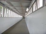
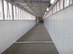

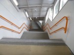
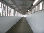


I shall certainly use the walkway regularly, as I often come from Walthamstow or on one the other Lea Valley Lines and either need to go West on the North London Line or like today, get some food at Marks. The walkway will of course be dry in the rain and some might feel safer at night!
I suspect that London Overground might get some ticketing issues with this link.
Take a little old lady with a Freedom Pass, who lives near the current Hackney Downs entrance to what is now a large double-station complex, who perhaps wants to go to the shops on Mare Street in the rain. Being as she’s from Hackney, she would be streetwise and would therefore use her Freedom Pass to work the barrier at the Hackney Downs entrance and then climb up the stairs to Platform 1. She’d then walk down the platform and take the walkway to Central, where she would exit into Mare Street using her Freedom Pass. In other words, she would have done the long walk substantially out of the rain, at no cost to herself.
So what do Transport for London do with someone, who uses an Oyster or contactless card to do the same trip? Will they be charged?
An engineer on Crossrail, who has walked some of the enormous stations, said to me, that in the rain, some of Crossrail stations are so comprehensive, she would use them to keep out of the rain. So we could have the same problem here?
If Transport for London charges, are we discriminating against those who pay for their transport?
Surely, if you come out of the same station complex within the time it takes to walk from one end to the other, you shouldn’t be charged!
What do you get charged now, if you enter a station through the barriers and then you realise you perhaps didn’t pick up your paper or coffee before you did and you return through the barriers virtually immediately?
Remember that if there’s a walking short-cut, Londoners and especially East Enders will find it!
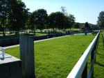
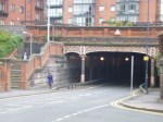
Do Pedestrians Accept Their Lot?
I regularly get a 30 or 277 bus to Highbury and Islington station to get the Victoria Line and it has never been the most convenient walk from the stop, as you have to cross two busy roads on controlled crossings. Over the last few months, they have been rebuilding the bridge at the station, which means they’ve moved one crossing making the journey longer.

Do Pedestrians Accept Their Lot?
The picture shows the second crossing.
Pedestrians seem to be accepting the extra walk without complaint.
Hopefully, there’ll be light at the end of the tunnel, when the bridge is completed and the traffic is properly reorganised.
