After The Northern Hub, Is Network Rail Planning A Midland Rail Hub?
The study on Network Rail’s web site is entitled West Midlands and Chilterns Route Study, proposes a concept of a Midland Rail Hub.
By adding the following infrastructure.
- Bordesley Chords and new platforms at Moor Street
- More tracks through Water Orton
- Kings Norton upgrade
- Snow Hill Platform 4
- Begin rollout of Digital Railway
Network Rail feel, it will bring the following benefits.
- Up to 10 extra trains every hour
- More freight trains
- New journey opportunities between East and West Midlands
- Unlocking new jobs
- Maximising benefits of HS2.
It doesn’t appear to be as radical as the Northern Hub.
These are my notes and thoughts on the various proposals.
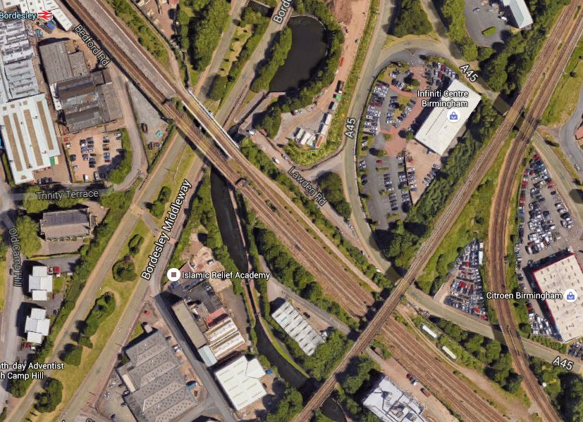
Bordesley Chords
This Google Map shows the Bordesley area of Birmingham.
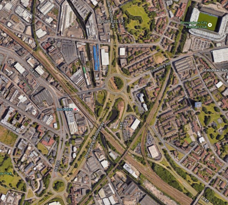
Bordesley Chords
In the top-right or north-eastern corner of the map is Birmingham City Football Ground.
In the middle of the map is Bordesley Circus, which is a roundabout, that is one of the most dangerous for pedestrians in the country. When I was last there, it was being improved and I wrote My Least Favourite Roundabout Gets Pedestrian Lights. I hope they’re working on Tuesday, 13th December, when I’ll be going to see Ipswich play.
Bordesley station, which is one of the worst stations in the UK, lies to the South-West of this roundabout and is on the Chiltern Main Line into Birmingham Moor Street station, although services don’t stop.
Running almost North-South across the map is the Camp Hill Line, which incidentally passes behind the stands at the football ground.
Where it crosses the Chiltern Main Line, there is a chord allowing limited connection between North and East.
I would assume that as the report says Bordesley Chords, that there will be some extra connectivity between these two lines.
Under the future of the Camp Hill Line on Wikipedia, this is said.
The reinstatement of local rail services to the former Camp Hill Line has been a long term aspiration of the City, and during 2007, Birmingham City Council announced that they were looking into the possibility of reopening the line between Kings Norton and Birmingham Moor Street via the construction of a railway viaduct from Sparkbrook to Bordesley, where trains would be taken into the “old” Birmingham Moor Street station. In October 2007, a 1500-name petition was handed in to the council asking for the line to be re-opened. In 2013 the proposal was shelved indefinitely.
As Kings Norton is to the South, this would need a West to South connection at Bordesley.
These pictures show the area from a Chiltern Train going into Moor Street.
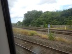


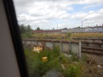
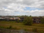
Salubrious it is not! There is certainly a lot of space on the North side, but there might be less on the South. This Google Map shows the area between the station and where the two lines cross.
Bordesley Station And Chords
Note the double-track chord between the Camp Hill Line to the North and the Chiltern Main Line to the East. This chord gives services from the Chiltern Main Line to access Birmingham New Street station. If you take a train from Oxford to Birmingham New Street, it will take this chord, if it doesn’t go via Coventry.
From what I have seen in Manchester and some parts of London, the area could surely be put to a better purpose, perhaps driven by a rebuilt Bordesley station, with regular services to Moor Street, Kings Noton and Solihull. The area does have the added factor of water in the shape of one of Birmingham’s numerous canals.
Hopefully, the first piece of development in a very run-down area, the sorting of a decent walking route between Bordesley station and Birmingham City Football Ground has been completed.
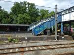
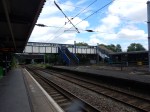
New Platforms At Birmingham Moor Street Station
This Google Map shows Birmingham Moor Street station.
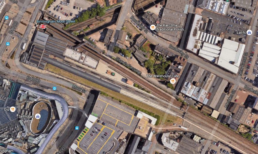
Birmingham Moor Street Station
The most northerly pair of platforms in the station are numbered 1 and 2 and are for the through lines to Birmingham Snow Hill station.
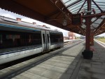
Over the last few years, work has opened the next pair of bay platforms 3 and 4. On my last trip to Birmingham in June, I arrived in Platform 4.
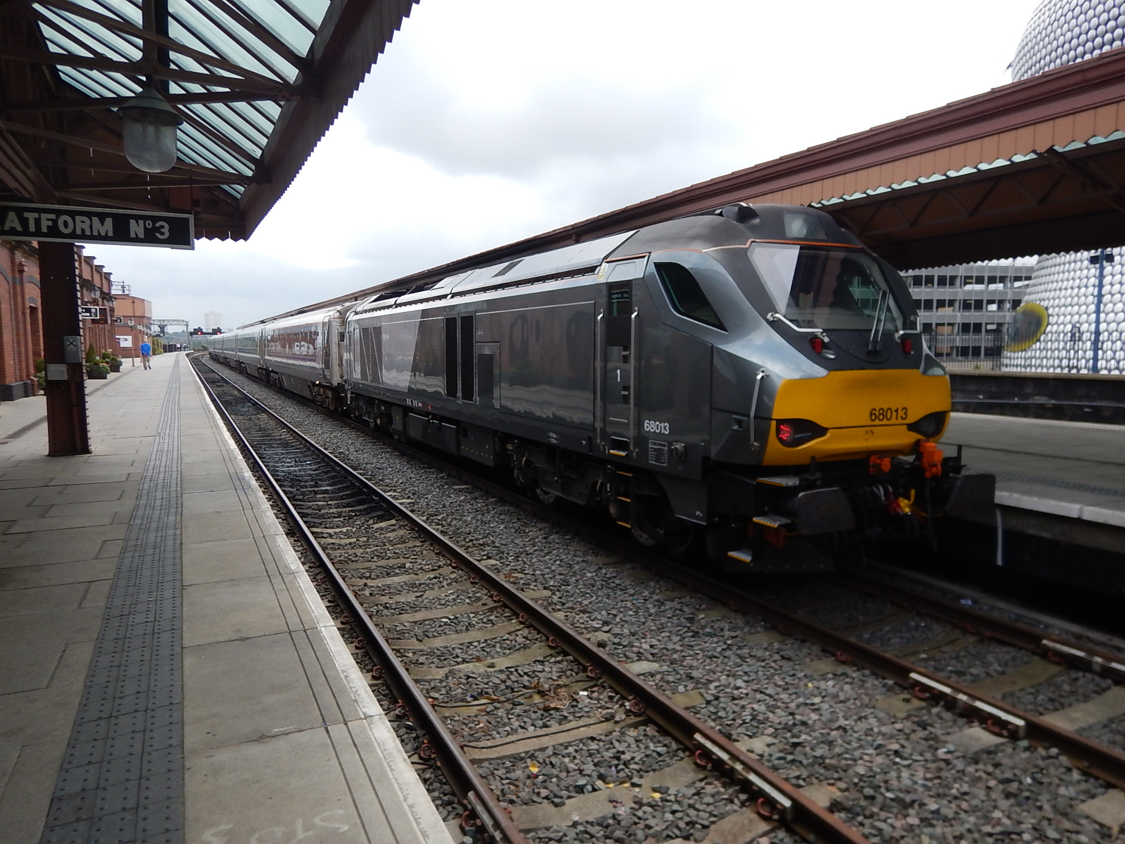
A Chiltern Main Line Train In Platform 4 At Birmingham Moor Street Station
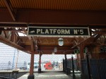
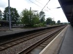
Platform 5 on the other side of Platform 4 may have been reinstated, but there doesn’t seem to be any trains using it, as yet!
The map shows that there would appear to be space to open Platforms 3, 4 and 5, but could a clever architect squeeze in a Platform 6?
These pictures show the space for a possible Platform 5 and 6.
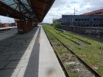

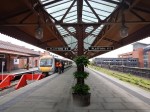


There would certainly appear to be space to shoe-horn two tracks and a new Platform 6 between the current Platform 5 and the retaining wall.
As the pictures show, Platform 5 is a platform that is long enough for any train currently envisaged that might call at Moor Street station.
Looking at the map of the station, it might even be possible to make Platform 6 even longer, if this were thought to be needed.
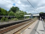
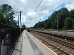
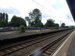
More Tracks Through Water Orton
This Google Map shows Water Orton station and the lines through it.
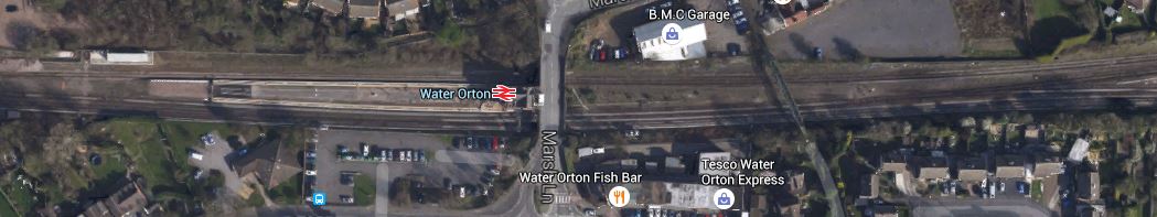
Lines Through Water Orton Station
If you look up services from Water Orton and Coleshill Parkway stations, they are certainly of the turn-up-and-wait-forever variety.
Water Orton has one train every two hours to Birmingham, but at least Coleshill Parkway has a train every half-hour.
Perhaps more lines through Water Orton will enable more trains through the area.
Looking at the rail map of Birmingham, it would be possible to go from Water Orton via the Camp Hill Line to Kings Norton and if the North to West chord was built at Bordesley to Moor Street.
It would certainly be the view of many, including myself, that a Parkway station needs a train or tram every fifteen minutes.
Kings Norton Upgrade
If the Camp Hill Line is reopened to passenger trains, then Kings North station will be the terminus.
This Google Map shows the station.
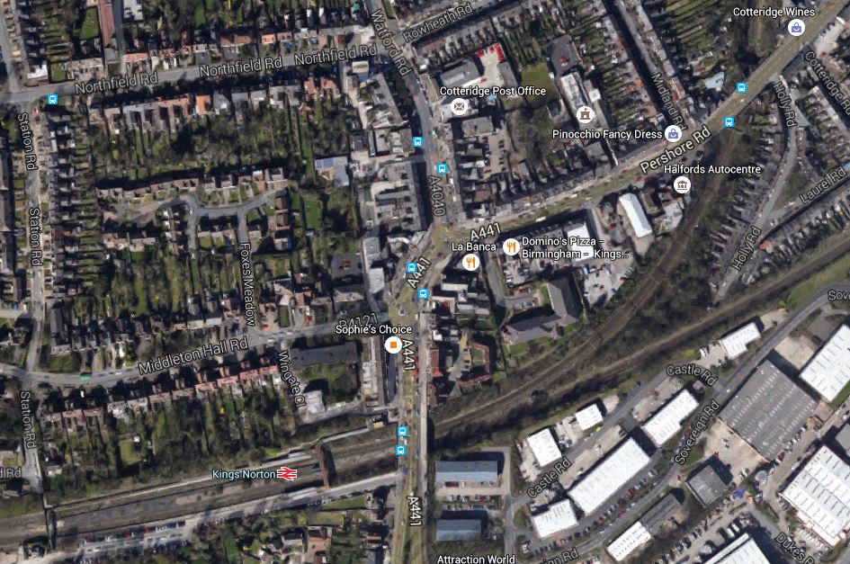
Kings Norton Station
It is a large station with an unused island platform in the middle.
These pictures show Kings Norton station.

There is certainly work to be done.
But the station also has a lot of potential and space that can be utilised. It might even be possible to fit in a bay platform to turn trains back to Moor Street and New Street.
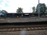
Birmingham Snow Hill Platform 4
Wikipedia says this about platforms at Birmingham Snow Hill station,
The present Snow Hill station has three platforms for National Rail trains. When it was originally reopened in 1987 it had four, but one was later converted in 1999 for use as a terminus by Midland Metro trams. The original tram terminus closed in November 2015, in order for the extension of the Midland Metro through Birmingham city centre to be connected. This includes a dedicated embankment for trams alongside the station, and will also include a new through stop serving Snow Hill. This will eventually allow the fourth platform to be returned to main-line use.
As the Midland Metro now has its own new platform outside the station, the fourth platform can soon be converted back to heavy rail use.
These pictures show the current state of the closed tram platform.


I don’t think that converting it back to heavy rail will be the most difficult of jobs.
Birmingham Station Connectivity
Although, not on the Network Rail infrastructure list, I feel that to gain the full benefits of HS2, then the line must be properly connected to Moor Street and New Street stations.
I can easily walk between Moor Street and New Street stations, but I do feel that Birmingham’s solution of using the Midland Metro as a link and to the Curzon Street HS2 station, is not the way to do it.
It needs some form of people mover. Perhaps a travelator would be better.
City Centre Ticketing
In Liverpool, a ticket to Liverpool stations, allows you to use the Underground to any of the other stations in the City Centre.
In London, many visitors by rail, add a Travelcard to their rail ticket.
Perhaps, in Birmingham, a ticket to Birmingham stations, should include the Midland Metro in the City Centre? Or a simple add-on for the Metro between Jewellery Quarter and Five Ways could be added for a few pounds.
At present, you have to buy a separate ticket. How visitor-friendly is that? At least a short journey is only a pound
If Birmingham is to make the most out of the opportunity of HS2, then they must use easy and understandable ticketing.
Chiltern’s Superb Trains
My trip down to Birmingham was in a Class 168 train, which although was a good experience for a diesel multiple unit, was spoilt as one engine went AWOL and we were late in to Moor Street.
But going home to London, I rode in what I think are one of the best long distance trains anywhere in Europe; Chiltern’s rakes of Mark 3 coaches pulled and pushed by a modern Class 68 locomotive.
- Nearly every seat gets a table and a window aligned to it.
- The seats are spcious and comfortable.
- The ride is the superb one, you always get from a Mark 3 coach.
- Trolley-service of drinks and a buffet on most services.
- Free wi-fi.
- London to Birmingham return for £19.20 with a Railcard.
- I’ve never travelled on Chiltern’s Mark 3 coaches and been unable to read my paper flat in front of me on the table.
The experience may be slower than Virgin’s, but give me Standard Class on Chiltern against First on Virgin every time between London and Birmingham.
The only problem, is that Marylebone station, isn’t as accessible as Euston from where I live. However, when Crossrail opens, times will be within a few minutes.
I can’t help feeling that Transpennine’s decision to use Class 68 locomotives and rakes of new CAF Mark 5 coaches across the Pennines, was influenced by the success of Chiltern’s flagship service and its superb rolling stock.
I’m looking forward to riding the CAF coaches in a few years, to see how they stand up to an almost forty year old British Rail coach.
I wonder how many Spanish engineers have ridden Chiltern’s trains?
I also feel that the Class 68 locomotive is an asset to a passenger service, in that so many diesel locomotives look dirty and smelly, but Class 68s seemed to have been designed to keep clean and also look how a locomotive should; powerful, purposeful and sleek.
For those, who don’t like that the trains are still diesel-hauled, there is even a Spanish solution for that, if the lines ever get electrified, in the shape of the new Class 88 electro-diesel locomotive, which is a sister of the Class 68 locomotive.
And of course, if Chiltern need some more trains and can’t find the Mark 3 coaches, they can always buy some new coaches from CAF.
Conclusions
It’s a very sensible plan and it will open up all sorts of possibilities for Birmingham.
The chords at Bordesley and the extra tracks through Water Orton would seem to open up a new route for trains across the city from Moor Street band Kings Norton to Water Orton and Nuneaton.
- New subsurban services could link Nuneaton and Kings Norton to Moor Street.
- Cross-country services might use Moor Street with a reverse, rather than New Street.
- Extra services from Moor Street to Nuneaton might take pressure off the heavily-loaded New Street to Birmingham route.
- How would the new station at Kenilworth station fit in?
But there are railways all over this area and I’m sure that the Bordesley and Water Orton improvements, will not be the last.
Already there is talk of reopening, the Sutton Park Line and the Stonebridge Railway.
I asked about Kenilworth station. I don’t know, but after Bordesley and Water vOrton are upgraded, there would be the possibility of a Warwickshire Circle, starting and finishing at Moor Street.
- Moor Street
- Solihull
- Warwick Parkway
- Warwick
- Leamington Spa with a reverse.
- Kenilworth
- Coventry
- Coventry Arena
- Bedworth
- Bermuda Park
- Nuneaton
- Coleshill Parkway
- Water Orton
- Moor Street
It would be a route, where several stations could be reopened or built from scratch. Leamington Spar incidentally already has a bay platform for the reverse.
I also think, that one of the biggest beneficiaries of all this will be Chiltern Railways.
Consider.
- Their two Birmingham termini of Show Hill and Moor Street are getting extra capacity.
- Moor Street will become a big terminal with two through and four bay platforms, all of which will be able to handle the longest Chiltern trains.
- Birmingham New Street station lacks capacity.
- The Birmingham New Street to Coventry route is seriously crowded.
- In Will Chiltern Railways Get A Second London Terminal At Old Oak Common?, I talked about Network Rail’s ideas to link the Chiltern route to the new station.
- Banbury station has been upgraded for more traffic.
- Chiltern will be running to Oxford station by the end of this year.
- Chiltern have plans in hand to run to Milton Keynes station.
We’ll certainly see extra services from London to Birmingham and possibly beyond, but will we see a triangular route going between London – Oxford – Birmingham – London?
It will depend on whether the passengers want it, but from Chiltern’s point of view, it might mean that their platforms in London, Oxford and Birmingham, and their trains, saw higher utilisation.
I suspect too, that the Oxford -Birmingham leg has more paths available and that Chiltern’s capacity problems are mainly at the London end of the Chiltern Main Line, especially now, that Banbury has been remodelled.
Chiltern Railways are an ambitious company and if they get a second terminal in London at Old Oak Common, they will certainly use it profitably.
I think that the Network Rail report shows that a few simple improvements, when thought through and executed with care can produce improvements not suspected in the original plans.
But all rail planning has to discount the London Overground Syndrome, where new stations, routes and trains, attract more passengers than originally expected.
Does Sheffield Need A Super High Speed Line To London?
I ask this question because HS2 was put forward in the days, when brute force and high speed was the only way to get fast journey times.
In this article on the BBC, which is entitled HS2 South Yorkshire route change threatens new estate, the following is stated.
- 120 mins – Fastest existing Sheffield to London service
- 79 mins – Fastest Sheffield to London service via HS2
I have not seen any details as to how fast conventional trains could do Sheffield to London, but we do have some useful figures from the Great Eastern Main Line, which I wrote about in Could Class 387 Trains Do Norwich In Ninety And Ipswich In Sixty? I came to the conclusion that a 200 kph Aventra with modest track improvements could reduce the current 120 minutes to ninety.
Compare the Great Eastern Main Line (GEML) with the Midland Main Line (MML)
The GEML is about 180 km long and fully electrified, with only two tracks except South of Shenfield and a 160 kph line speed.
The MML is about 250 km long and not electrified past Bedford, with generally more than two tracks and quite a bit of 200 kph running.
The MML has a lot of potential for improvement.
- In several places there is space to add extra tracks and improve junctions.
- A fully-developed Erewash Valley Line, could possibly be used as a higher-speed diversion, avoiding the line through the Derwent Valley, which is a World Heritage Site.
- The MML is currently being electrified.
- Modern electric trains with regenerative braking would speed stops on the MML.
- Some of the stations on the MML, could be rebuilt to speed trains through.
- This is just the sort of line for which the Digital Railway could have a large positive affect.
I feel that after the line is fully electrified and upgraded between London and Sheffield, that there could be a big improvement in journey times.
I do wonder if the revised plan for HS2 to serve Sheffield, , has come about because engineers have been able to devise a plan to improve the MML, that has created enough capacity from Clay Cross to Sheffield, to allow HS2 to share.
In HS2 Does The Right Thing In Sheffield, I postulated that if the MML from Clay Cross, where it bis joined by HS2 to Sheffield, were to be built to HS2 standards, when it was electrified, then this would have benefits for both lines.
- HS2 trains could approach Sheffield, using the sort of speed profile, they’d use into other stations.
- 200+ kph trains on the MML would knock a few minutes off schedules.
- Any extra tracks would probably fit on railway land.
- Chesterfield station could be rebuilt to accept HS2 trains.
There would be a large saving in costs, as only two tracks would be built. They would also be built when the MML is electrified.
We might not see trains on the classic route between London and Sheffield do the trip in the 79 minutes of HS2, but they would certainly be some minutes quicker than the two hours of today.
HS2 Does The Right Thing At Sheffield
In HS2 Does The Right Thing At Leeds, I put my case for HS2 stations to be in City Centres, so that when passengers arrived, they could use all the current and often well-developed local trains and trams to get to their ultimate destination.
I said this.
I don’t like the concept of most of the HS2 stations.
Euston, isn’t too bad, as the HS2 platforms are alongside those for the main station and I suspect that when and if I see it in reality, I will be able to arrive in the station on perhaps a London Midland train from Bletchley or Tring and just walk across to the HS2 platforms.
At some of our better interchange stations like Reading, to change trains, you go up escalators to a wide overbridge and then walk across to the escalator for the platform of your departing train. The design also allows seats and cafes in a totally non-claustrophobic environment. I have a feeling that the new London Bridge will raise the bar of this type of station even higher!
To my mind the designs for HS2 station at Birmingham is absolute rubbish and truly terrible. Birmingham is developing a local train, tram and bus network centred on New Street station, so instead of HS2 arriving into this hub, it arrives at a separate station some distance away and many passengers will have to get a tram to connect to their ongoing service.
After seeing the light at Leeds and proposed something much more sensible, HS2 has now done a similar thing at Sheffield.
This article on the BBC explains it all.
- HS2 will now serve the main Sheffield station.
- HS2 will now pass to the East of Rotherham.
- HS2 will reach Sheffield on classic lines from a junction near Clay Cross and via Chesterfield.
- Sheffield City Council say the new route will create 6,500 more jobs in Sheffield.
- The old route might have created congestion around Meadowhall.
This map shows the new and the old routes.

HS2 Through South Yorkshire
The yellow route is the old one and the blue one is the new one.
Note how the on the map it says “Link to Sheffield Midland on Existing Railway”
I have followed this route on Google Maps and with the exception of perhaps Chesterfield station, there would appear to be space to get four tracks from the junction at Clay Cross to Sheffield station. There also appears to be few houses close to the line, which seems to be in a wooded corridor between industrial premises.
Good planning says that this line should be upgraded and Chesterfield station should be remodelled, when the Midland Main Line (MML) is electrified.
Is this one of the reasons, that HS2 has chosen this route and moved the station from Meadowhall to Sheffield?
Clay Cross to Sheffield is about twenty miles and if two tracks were rebuilt or added to the MML, to HS2 standards, it would have the following benefits.
- HS2 trains could approach Sheffield, using the sort of speed profile, they’d use into other stations.
- 200 kph trains on the MML would knock a few minutes off schedules.
- Any extra tracks would probably fit on railway land.
- Chesterfield station could be rebuilt to accept HS2 trains.
There would be a large saving in costs, as only two tracks would be built. They would also be built when the MML is electrified.
Unfortunately, this change of route will cause problems as the BBC article explains.
It’s a pity they didn’t lay down a few objectives at the start of the detailed design of HS2.
One of which would have been, that HS2 should access existing well-developed stations if possible.
How To Move 100,000 Containers A Year Between Germany And China
This article on Global Rail News is entitled DB and Georgian Railways to cooperate on new Silk Road rail corridor.
It described how Deutsche Bahn and Georgian Railways have signed an agreement to develop a new rail freight route between the Far East and Europe.
This map from the article, shows the various rail routes across Eurasia and how the new Silk Road will fit in.
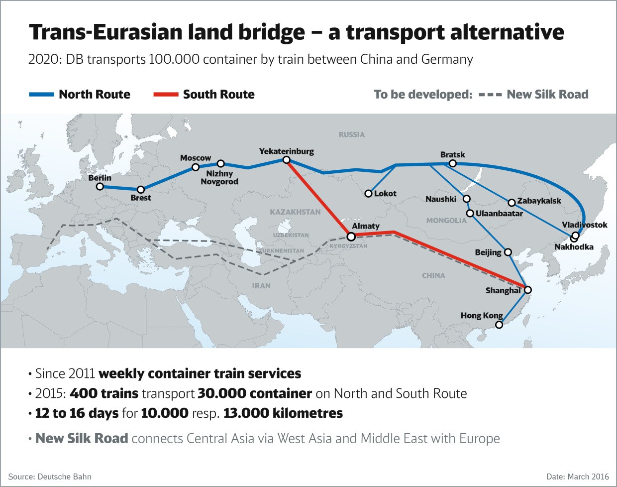
DB transports more container by train between China and Germany
I think the most interesting thing about the new route, is that it doesn’t go through Russia.
Vladimir Putin will not be amused!
If you read the Wikipedia entry for Georgian Railways, it does list a few problems, but it would appear that the route across Georgia is being upgraded to Standard Gauge all the way from the Turkish border to Almaty in Kazakhstan.
With Germany, Turkey and Europe at the Western end and China at the Eastern end both predominately Standard Gauge, I think that this route will be all the same gauge.
When this happens, trains will be able to go straight through, with perhaps just a change of locomotive.
How long will it be before, an enthusiastic entrepreneur starts to run a passenger service between Europe and China. Trans-Siberian Express eat your heart out!
Vladimir Putin will be even less amused!
If DB can build the Standard Gauge railway through to China via Georgia, it will give the following benefits.
- Services will be faster than the Russian routes.
- There will no change of gauge, which means unloading one train and loading another.
- If the line is electrified, this will make the route more efficient.
- Freight will move smoothly across Asia avoiding the pariah that is Russia.
- The route avoids the more volatile parts of the Middle East.
- Countries on the route like Serbia, Turkey, Georgia and Kazahkstan will surely benefit.
- The route will surely be more accessible to Southern European countries, than the current Russian routes.
It is undoubtedly a good plan.
I Am Totally Against Brexit, But Read This!
York Potash are developing a potash mine in you’ve guessed it! – Yorkshire.
This article from the Gazette Live is entitled Work on York Potash mine which could employ 1,000 due to start in September.
This can’t be bad news, as every new job on Teesside is needed. This is also said.
Costs for the project “have moved in our favour”, Mr Fraser told the newspaper. “We are a dollar asset but a big part of the costs will be [paid in] sterling [for] labour… With lower sterling, we will be in a stronger position.”
In the end, I suspect that whether or not we leave Europe, the result will not be a disaster for the country.
The dollar will continue to call the shots, as it moves towards being the universal world currency.
Help From The Germans
I want to go to Sudbury today, so to find the times of the trains, I tried to look them from Shenfield to Sudbury on the National Rail web site.
But the site was having an off day.
So I used the alternative of the Deutsche Bahn web site.
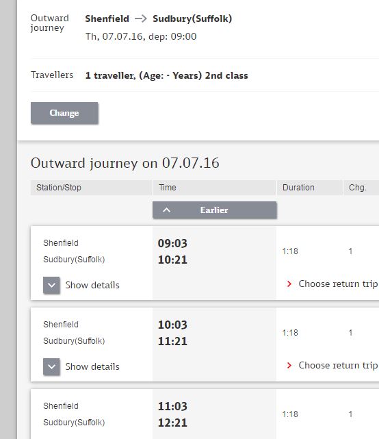
Shenfield To Sudbury By Deutsche Bahn
As you can see it worked. As it does with all European trains!
So if you want to go from Zaragosa to Geneva say, it will give you the route and details.
It even has Llanfairpwll station in the database and looking up the journey to there for Cologne, it even estimates twenty-five minutes for the walk between St. Pancras and Euston.
It is a very comprehensive free service.
An Ambitious Proposal For A New Train Service?
I don’t know Somerset at all, so I can’t judge the proposal for a new train service discussed in this article in the International Railway Journal.
This is the opening paragraph.
GO-OP, a British open-access operating organisation, has presented revised plans to introduce a new rail service from Taunton to Swindon from December 2017.
The route starts via the following stations on the Taunton to Reading Line
Then via the following stations on the Wessex Main Line.
Finally, there are these stations on the Great Western Main Line
Eventually the company aims to extend the service to Oxford, Banbury, Leaminton Spa, Kenilworth, Coventry and Nuneaton.
Leamington Spa and Kenilworth are my additions, but they lie on the route and Kenilworth is a new station opening in Summer 2017. That date now looks like Summer 2018!
I found the article, because they intend to start the service using a pair of Vivarail D-Trains, which would be replaced in 2019 by CAF Civity diesel multiple units.
It is an ambitious proposal, that creates a new cross-country route from Somerset to Warwickshire.
It is unusual in that most Open Access proposals are longer distance services radiating from London.
But commercially and railway-wise the two areas are similar.
- Both attract tourists and visitors.
- Both have a network or underused railways.
- Both are close to big dominating cities.
- Both are probably areas, where lots of new housing is being built.
I don’t know, but perhaps it will set a welcome precedent.
- Norfolk/Suffolk and Cheshire
- Lincoln and Lancashire.
- Cumbria and Derbyshire
- North Wales and Nottinghamshire.
Certainly the Digital Railway, the available of quality DMUs and bi-modes like the Class 769 train, new stations and ambitious councils will all help.
Will Chiltern Railways Get A Second London Terminus At Old Oak Common?
This article on the Rail Magazine web site is entitled Chilterns Route Study to tackle capacity challenges and it describes how Chiltern Railways may gain a second terminal in London at Old Oak Common, which would link to the following lines.
And that’s only for starters as a couple of Underground and other lines pass through the general area.
The full study on Network Rail’s web site is entitled West Midlands and Chilterns Route Study. This is said about Chiltern Railways.
The Chiltern Route provides an important commuter route into London with connections to the Underground.
- London continues to grow, and evolve with economic hubs expanding beyond the traditional City
- Growing towns with major housing development planned at Aylesbury, Bicester and Princes Risborough
- Marylebone Station is approaching its maximum capacity, in terms of train numbers and passengers
- Any expansion of Marylebone is likely to be expensive, and disruptive due to its constrained location.
The report suggests using Old Oak Common as an additional terminal, connected to the Chiltern route. It gives these benefits.
- Up to 4 additional trains per hour, with more travel options in to London.
- Access to HS2, Crossrail and Great West Main Line.
- Reduced cost and disruption compared to upgrading Marylebone.
The report is recommending building a new station at Old Oak Common, rather than upgrading Marylebone.
I think that this is a very sensible use of the space and existing railways in West London.
In Could A Chiltern Metro Be Created?, I looked at the lines between Marylebone and West Ruislip, where Chiltern Railways have ambition to create a Chiltern Metro. I said this.
I think Chiltern too, will make a bid to get into running services on the Greenford Branch and the Acton-Northolt Line, as it would give them a very useful destination in London of Old Oak Common.
Whatever happens, there will be some interesting rail developments involving Chiltern Railways in West London.
Old Oak Common Station And The Acton-Northolt Line
This map from carto.metro.free.fr shows the lines around Old Oak Common.
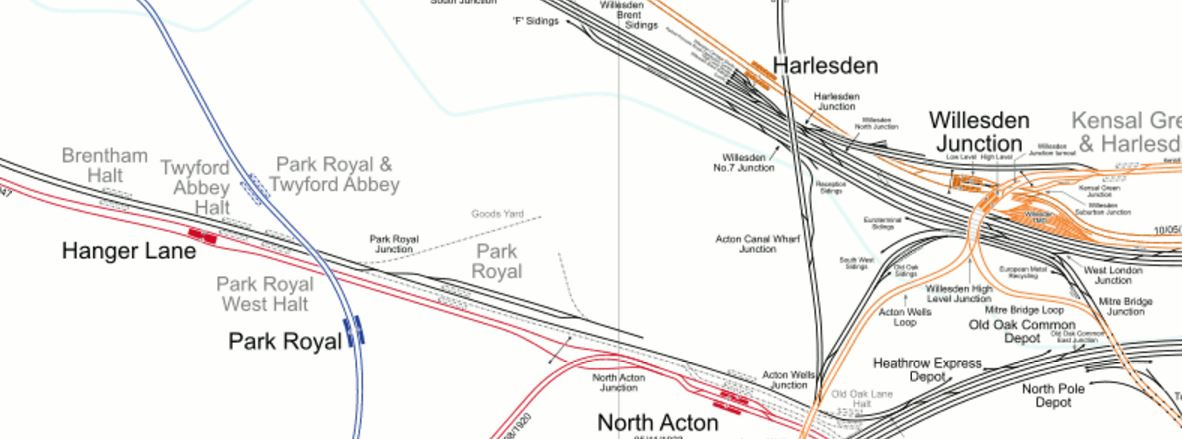
Old Oak Common Station And The Acton-Northolt Line
Note the West Coast Main Line and Great Western Main Line go to the North and South respectively of the Old Oak Common site.
The line going to the West alongside the Central Line is the Acton-Northolt Line which links in the West to the Chiltern Main Line, just to the East of South Ruislip station.
This is the best map, I can find of the proposals for Old Oak Common station.
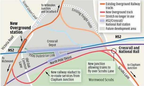
Rail Lines At Old Oak Common
And this map from carto.metro.free.fr shows roughly the same area.
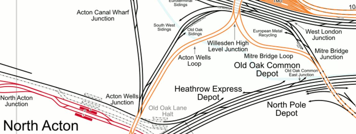
Current Lines At Old Oak Common
The Acton-Northolt Line is currently single-track and without electrification or any stations, other than South Ruislip and West Ruislip after Northolt Junction, where it joins the Chiltern Main Line.
From following the line both on a Central Line train and on Google Maps, it would appear that restoring the Acton-Northolt Line to its original double-track should be possible.
With regard to electrification, as Old Oak Common station will be electrified for Crossrail, the North London Line and other lines, it would at least have power at one end.
The Current And Proposed Service Pattern
Wikipedia lists the current services, outside the peak from Marylebone on Chiltern as the following.
- 2 trains per hour (tph) to/from Birmingham (one fast, first stop Bicester North, and one semi-fast, first stop High Wycombe).
- 1tph to/from Banbury (semi-fast, first stop High Wycombe). Some extend to Stratford-upon-Avon.
- 1tph to/from Bicester North (semi-fast, first stop Gerrards Cross)
- 1tph to/from Princes Risborough (semi-fast, first stop Gerrards Cross)
- 1tph to/from High Wycombe (stopping service)
- 1tph to/from Gerrards Cross (stopping service)
- 2tph to/from Aylesbury (via Amersham). One of these services in each hour continues on to serve Aylesbury Vale Parkway
- 2tph to/from Oxford Parkway (fast)
So that is nine trains an hour through West Ruislip, two up the Aylesbury Line and eleven between Marylebone and Neasden.
The Network Rail report, is saying that another four trains per hour would run from Old Oak Common station, which would mean thirteen trains an hour through West Ruislip.
Where these four trains will go will be up to Chiltern, but I’m sure they’ll find the passengers to fill them.
Crossrail’s Loops And Branches Across London
Most people think of Crossrail, as an East-West railway under London serving the following places on its pair of branches in the East and the West.
- Shenfield and Abbey Wood in the East.
- Heathrow and Reading in the West.
But it is more than that, as the East-West Crossrail can be considered to be part of a larger system that includes a number of North-South routes.
- Thameslink from St. Pancras to East Croydon via Farringdon on Crossrail.
- East Londson Line from Highbury and Islington to Canada Water via Whitechapel on Crossrail.
- West London Line from Willesden Junction to Clapham Junction via Old Oak Common on Crossrail.
- Bank Branch of the Northern Line from Camden Town to Kennington via Tottenham Court Road on Crossrail.
- Charing Cross Branch of the Northern Line from Camden Town to Battersea via Moorgate on Crossrail.
- Bakerloo Line from Willesden Junction to Elephant and Castle via Paddington on Crossrail.
Cross-London journeys will get interesting, as there will often be a dozen ways to go between A and B, when they are in different parts of London.
Kids will race each other across the City.
Crossrail will also grab a strong hold of other cross-London routes.
Central Line
Crossrail has interchanges with the Central Line at the following stations.
- Stratford
- Liverpool Street
- Tottenham Court Road
- Bond Street
- Ealing Broadway
The Central Line will add a loop to Crossrail from Stratford to Ealing Broadway.
People who live say near Queensway will use the Central Line to access the outer reaches of Crossrail., at Ealing Broadway and Stratford.
In Step-Free Interchanges In East London, I pointed out the excellent interchange between Crossrail and the Central Line at Stratford, which sadly is Crossrail’s only top quality interchange to other lines.
The interchanges with the Central Line in Central London would sappear to be very unadventurous. Only when the line is opened, will we know how well they work and the quality of the design.
Perhaps the only way to have got better interchanges would have been for one track of Crossrail to be each side of the Central Line, through Central London.
This map from carto.metro.free.fr shows the section of Crossrail from Marble Arch to Tottenham Court Road.
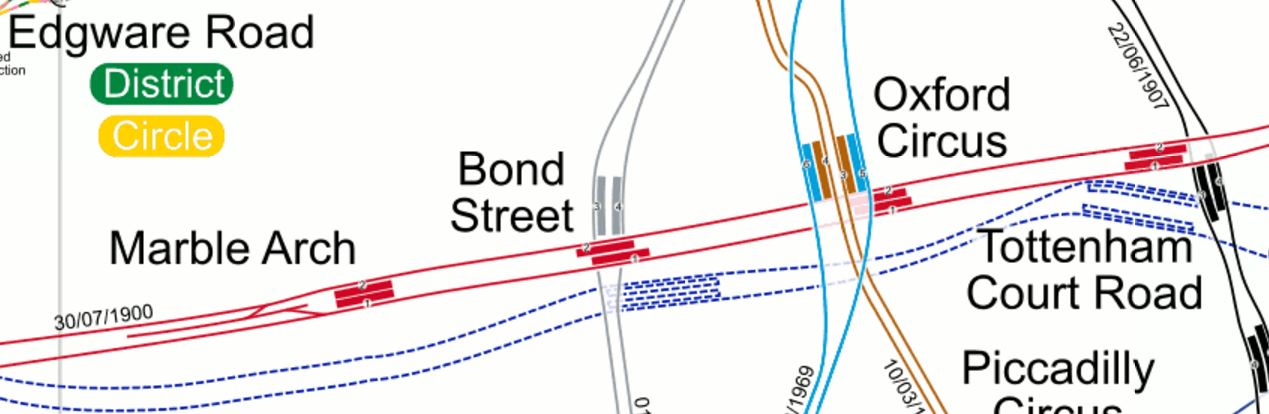
Crossrail Through Central London
From this map it looks like it could be possible, but I know from this section in Wikipedia, that it was difficult squeezing the tunnels past the Northern Line at Tottenham Court Road, so perhaps the route that was chosen, was the best one from a construction and cost point of view. It could even have been the only one possible.
Metropolitan Line
Crossrail has interchanges with the Metropolitan Line at the following stations.
- Whitechapel
- Liverpool Street
- Moorgate
- Barbican
- Farringdon
- Paddington
The Metropolitan Line will add a loop to Crossrail from Whitechapel to Paddington. Although, due to the distance between the two lines at Paddington, this probably means the Metropolitan Line will serve as a North-Western branch of Crossrail, that serves Kings Cross, St. Pancras and Euston.
This map from carto.metro.free.fr shows the section of Crossrail from Whitechapel to Farringdon.
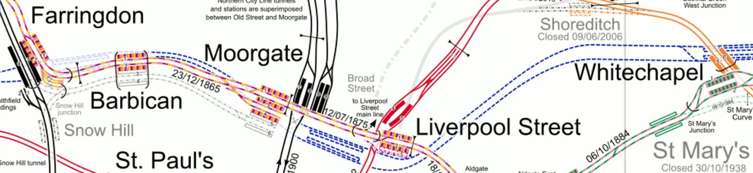
Crossrail Through The City
Note how two Crossrail stations; Liverpool Street-Moorgate and Barbican-Farringdon effectively each serve two Metropolitan stations.
Effectively, it gives a large choice of routes between North West London and East London and Essex.
Crossrail interchanges with the District Line at the following stations.
- Whitechapel
- Paddington
- Ealing Broadway
The District Line will add a loop to Crossrail from Whitechapel to Ealing Broadway, with a partial interchange at Paddington.
This map from carto.metro.free.fr shows the lines around Paddington.
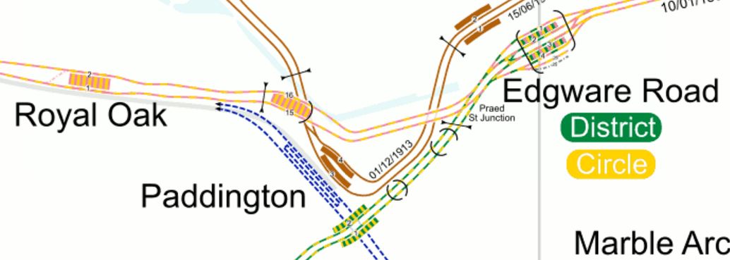
Crossrail Through Paddington
Crossrail would appear to have a good right-angled connection with the District Line, between Edgware Road and Wimbledon.
So it could be argued that after Crossrail opens, the Edgware Road to Wimbledon service of the District Line is another North-South branch of Crossrail, just like with Thameslink and the East London Line.
North London Line
Crossrail interchanges with the following stations on the North London Line.
- Stratford
- Old Oak Common
The North London Line will add a loop to Crossrail from Stratford to Old Oak Common.
Jubilee Line
Crossrail interchanges with the following stations on the Jubilee Line.
- Stratford
- Bond Street
The Jubilee Line will add a loop to Crossrail from Stratford to Bond Street.
The Stations On The Loops
The effect of all these loops, mean that these stations will be on a line that connects to both ends of Crossrail.
- Acton Town
- Aldgate East
- Baker Street
- Bank
- Baron’s Court
- Bermondsey
- Bethnal Green
- Blackfriars
- Brondesbury
- Brondesbury Park
- Caledonian Road and Barnesbury
- Camden Road
- Canada Water
- Canning Town
- Cannon Street
- Canonbury
- Chancery Lane
- Chiswick Park
- Dalston Kinsland
- Ealing Common
- Earl’s Court
- East Acton
- Edgware Road
- Embankment
- Euston Square
- Finchley Road And Frognal
- Gospel Oak
- Gloucester Road
- Great Portland Street
- Hackney Central
- Hackney Wick
- Hammersmith
- Hampstead Heath
- Highbury and Islington
- Holborn
- Hommerton
- Kensal Rise
- Kentish Town West
- Kings Cross St. Pancras
- Lancaster Gate
- London Bridge
- Mansion House
- Marble Arch
- Mile End
- Monument
- North Greenwich
- Notting Hill Gate
- Oxford Circus
- Queensway
- Ravenscourt Park
- St. James’s Park
- St. Paul’s
- Shepherd’s Bush
- Sloane Square
- South Kensington
- Southwark
- Stamford Brook
- Temple
- Tower Hill
- Turnham Green
- Victoria
- Waterloo
- Westminster
- West Acton
- West Ham
- West Hampstead
- West Kensington
- White City
- Willesden Junction
The list may be impressive, even without stations on the North-South lines, but it has consequences.
- Ealing Broadway could see a lot of interchange traffic between Crossrail and the Central and |District Lines. Is it up to the task?
- Stratford and Whitechapel will see a lot of interchange traffic between Crossrail and other lines. These two stations have been designed for it.
- The Victoria Line is difficult to access. However, it is only a short walk from the Hanover Square entrance to Bond Street Crossrail station.
- The Piccadilly Line is difficult to access.
I suspect that as at Oxford Circus, there will be small schemes in several places to create connectivity.
Kings Cross St. Pancras is a big problem as it is a mass of long tunnels, but Crossrail and Thameslink will give passengers the chance to avoid it.
- If you’re on Crossrail and want to go North on the Victoria or Piccadilly Lines, I suspect that it would be easier to take Thameslink to Finsbury Park, where you can dive into the Underground.
- If you’re on Crossrail and want to go South on the Victoria Line, the quickest way might be change to the Bakerloo at Paddington and then walk across the platform to the Victoria Line at Oxford Circus.
But whatever route you take in a few years time, won’t be the obvious one today.
Extra Connectivity
There are various projects either under construction, planned or proposed, that would increase Crossrail’s reach.
- The Hall Farm Curve linking Walthamstow and Chingford to Stratford.
- The rebuilding of Bank, Camden Town, Highbury and Islington and other stations.
- The Northern Line Extension to Battersea.
- The Bakerloo Line Extension.
- The Greenford Branch is being improved.
- The re-signalling of London Underground’s sub-surface lines.
- The four-tracking of the West Anglia Main Line in preparation for Crossrail 2.
- The adding of a Central Line station at Shoreditch High Street.
- Extensions to the Docklands Light Railway.
- Old Oak Common will become more and more important with connections to the West Coast Main Line, HS2 and the Chiltern Main Line.
- Increases in frequency on the Victoria Line, Jubilee Line, Sub-Surface Lines, the Northern City Line and the Overground.
I do think though we could see a few surprises.
- There have been proposals to extend the Waterloo and City Line for years. Modern tunnelling and innovative train concepts might allow a shuttle between Waterloo and Crossrail at Liverpool Street.
- As the City of London wants to cut traffic in the Square Mile, what will they do?
- Will Oxford Street finally become traffic free?
- Will Manor House and Harringay Green Lanes be reorganised?
- Crossrail has seen some interesting concepts developed for building lift and escalator tunnels, which will be used again and again.
- Crossrail will be extended to somewhere not mentioned before.
I have a feeling that Crossrail 2 won’t be so urgent.
Step-Free Interchanges In East London
This map from carto.metro.free,fr shows the lines around where I live, which can be best described as a post code of N1.
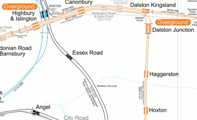
Lines Around N1
I live halfway on the diagonal line between Dalston Kingsland and Essex Road stations. Years ago, there used to be a station at Mildmay Park, between Dalston Kingsland and Csnonbury, which if it still existed would be very useful for me, as it would be about a hundred and fifty metres away.
So my journeys often start from one of the half dozen bus routes, that have stops within fifty metres or so of where I live.
- I’ll take a 38, 30, 56 or 277 to Dalston Kingsland or Dalston Junction stations for the North London Line and East London Line respectively.
- I’ll take a 141 to Manor House station for the Piccadilly Line.
- I’ll take a 38 or 56 bus to Essex Road station for the Northern City Line
- I’ll take a 38 or 56 bus to Angel station for the Northern Line.
- I’ll take a 21 or 141 bus to Moorgate for the Metropolitan and Circle Lines
- I’ll take a 21 or 141 bus to London Bridge for main line trains.
- I’ll take a 21 or 141 bus to Bank for the Central and Waterloo and City Lines
- I’ll take a 56 bus to St. Paul’s for the Central Line
- I’ll take 30 bus to Kings Cross, St. Pancras and Euston for main line trains.
Who said the three most important things when buying a house, are location, location and location?
Strangely, I rarely go directly to Highbury and Islington station, as the station is one of the worst in London for passenger convenience, with long and crowded tunnels and no step-free access to the deep tunnels.
If I need to go North on the Victoria Line, I will sometimes go to Essex Road and then take the Northern City Line for one stop to Highbury and Islington station, where there is a step-free level interchange to the Victoria Line.
There are several of these interchanges in East London, making train and tube travel easier.
Northern City And Victoria Lines At Highbury And Islington Station
This map from carto.metro.free.fr, shows the layout of lines at the station.
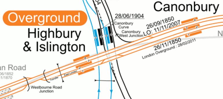
Note how the two Northbound lines and the two Southbound lines of the Victoria and Northern City Lines are paired, so that passengers can just walk through one of several short tunnels that connect the two platforms.
This connection will get more important in the future, as improvements will bring more passengers through the interchange.
- Highbuty and Islington station will be rebuilt, with access to the deep level platforms much improved.
- If traffic said it was needed, the Southbound and Northbound deep-level platforms, which are not far apart might even be connected together and to a second entrance on the other side of Holloway Road.
- The Northern City Line is getting new Class 717 trains, which will give an increase in capacity and I believe that the frequency on the Northern City Line will improve to 6, 8 or even 10 trains per hour (tph), thus making my ducking and diving easier.
- The Northern City Line will connect to Crossrail and for the first time N1 to lots of places, will be one change at Moorgate from the Northern City Line to Crossrail.
- The Victoria Line will increase in frequency to possibly 40 tph and benefit from station improvements at stations like Tottenham Hale, Blackhorse Road and Walthamstow Central.
It should also be noted how the Crossrail connection at Moorgate will help me.
When going to football at Ipswich, I may walk to Essex Road and then get a train to Moorgate, where I will take Crossrail to perhaps Shenfield for a fast train to Ipswich.
But who knows what I’ll do, as there will be several different routes, all of which will have their advantages?
East London Line To North London Line At Highbury And Islington Station
This is only from the East London Line trains arriving from West Croydon in Platform 2 at Highbury and Islington station to Westbound trains on the North London Line in Platform 7.
Although not as powerful as the double interchange at Highbury and Islington station between the Victoria and Northern City Lines, it is typical of well-thought out connections all over the Overground.
Piccadilly And Victoria Lines At Finsbury Park Station
This is a cross-platform interchange, that is heavily used as effectively it gives a simple choice of route through Central London for passengers from the Northern ends of the Piccadilly and Northern Lines. It’s a pity that the interchange between the two lines at Kings Cross St Pancras and Green Park aren’t as simple.
Metropolitan/District And Central Lines At Mile End Station
This picture gives a flavour of the interchange at Mile End station.
Cross-Platform Interchange At Mile End Station
It is a cross-platform interchange, that I use more and more, to go to the East on the Central Line. I usually arrive on a Metropolitan/District Line train from Whitechapel station, which is just a few stops down the East London Line.
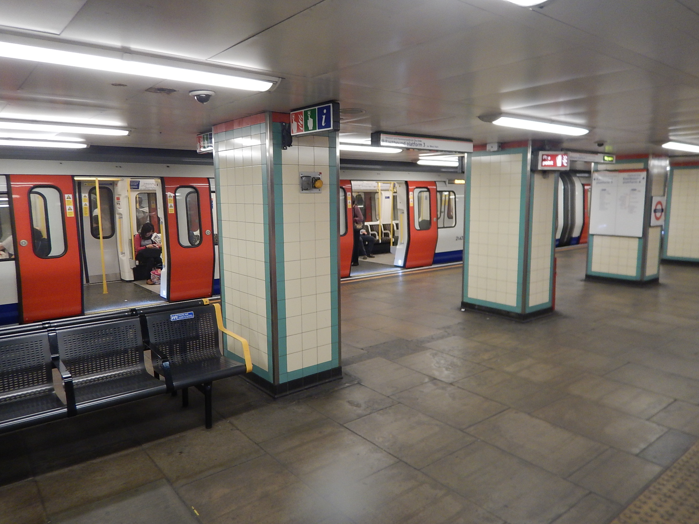
Central Line And Shenfield Metro/Crossrail At Stratford Station
This interchange at Stratford station is going to be an integral part of Crossrail, as it will firmly connect the new line to the Central Line, with advantages to both.
This picture shows the interchange on the Eastbound platform.
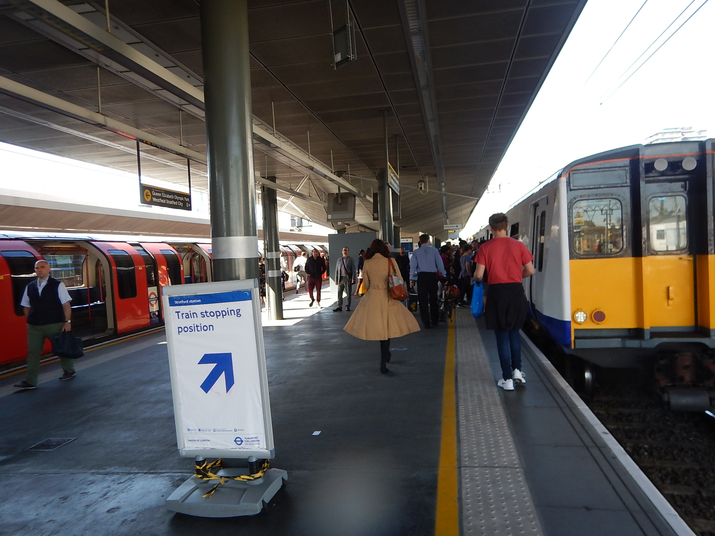
Central Line To Shenfield Metro/Crossrail Interchange
This interchange is certainly well-used and Crossrail will only increase that use.
Why Is This Not Done More Often?
These interchanges seem to work well!
But what always puzzles me, is why this layout is not used more often. And I don’t just mean in London. In all my travels, I can’t remember getting off a train in Europe and just walking across the platform to get a metro or a tram.
I suspect it could be because to get this type of interchange, you need to build some expensive railway infrastructure.
All of the examples I have given concern where a new line is being added to an existing network.
I am surprised that Crossrail doesn’t use a similar interchange anywhere else on its route.
Look at the Crossrail stations I documented in How Are Crossrail’s Eastern Stations Progressing?
In all stations, the Crossrail and fast lines are in pairs, whereas to get Cross-platform interchange between fast and stopping services, probably needs a different layout. That is not the fault of Crossrail, but the way the Great Eastern Main Line was built decades ago.
At the London end of the East Coast Main Line, the two slow lines are on either side of the two fast lines. At Stevenage, they have put two island platforms between the slow and fast lines, so that passengers have a cross-platform interchange between trains.

Stevenage Station
The Google Map clearly shows the layout.
