Is A Ride Across South London On Tramlink, The Worst Rail Ride In London?
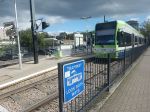
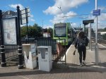
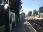
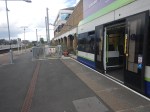
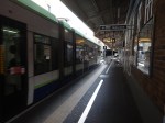
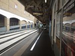
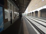
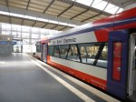
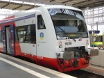
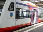
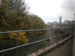
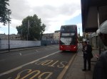
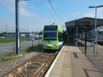
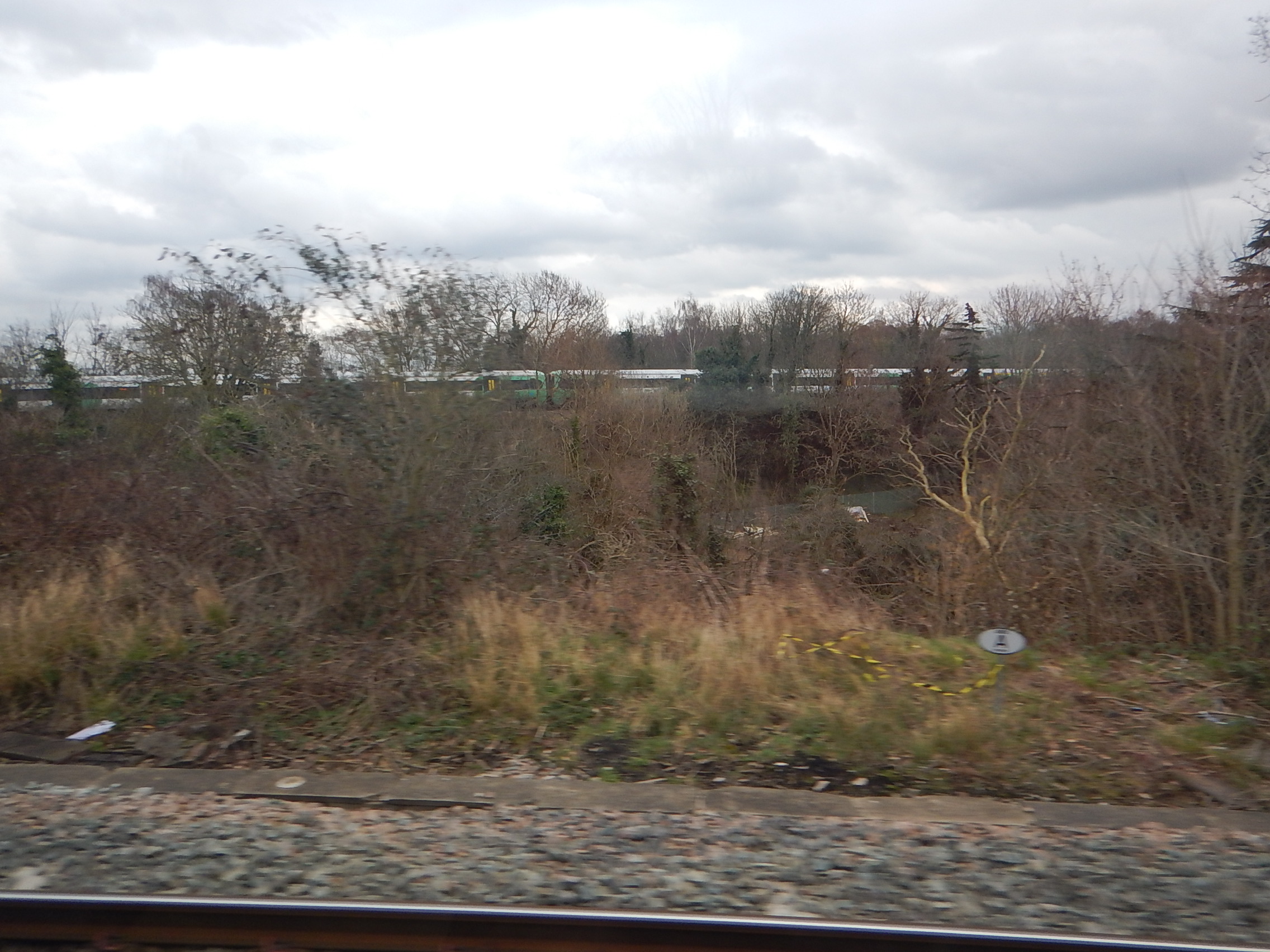
Last week, I took a ride across South London on the London Tramlink from Beckenham Junction to Wimbledon.
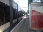
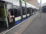
I was in one of the original Bombardier trams and it was very underwhelming.
None Of The Current Trams Have Air-Conditioning
These days, this is expected.
In this article on RailAdvent, which is entitled Potential Tram Builders Announced For New London Trams, this is said.
Transport for London has issued an Invitation to Tender for four manufacturers to design and build a new fleet of trams.
Alstom UK, CAF, Hitachi and Stadler are the four manufacturers who can now proceed to the next stage of the procurement process with Transport for London to design and build the new trams.
The new trams are expected to feature air-conditioning, real time travel info and charging points, along with areas designed for wheelchair users and those with pushchairs and luggage.
It sounds that the new trams will be to a higher standard with more comfort and interior space.
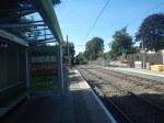
The Current Trams Have Bricks For Seat Padding
In my except from the Rail Advent article, surely this is covered with more comfort.
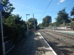
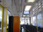
The Current Trams Lack Interior Space
In my except from the Rail Advent article, surely this is covered with more interior space.
On one journey recently, two mothers were having a friendly discussion about the limited space for their buggies.
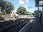
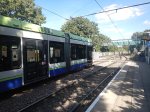
The Current Trams Lack Flat Floors
The floors weren’t flat on my cross-London tram ride and it nearly tripped me up.
All trams, buses and trains should have flat floors and no-step entrances and exits.
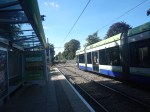
The Current Trams Lack Details That Passengers Now Expect
In my except from the Rail Advent article, surely this is covered with more real time travel info and charging points.
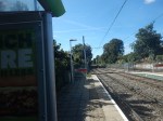
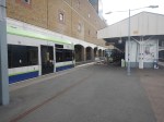
The Route Of The Tramlink Is Boring
I’ve travelled on trams and light rail systems in other cities and towns, in the UK, in Europe and around the world.
But I feel that unlike say Blackpool Tramway, except for a couple of shopping centres and IKEA, London Tramlink doesn’t take you anywhere.
I expected to find refreshment kiosks at the terminals, but only at Wimbledon and East Croydon did they exist.
Perhaps, Transport for London could add a few kiosks, as they have done on the Overground?
Conclusion
Transport for London should look at all aspects of design of the London Tramlink.
Potential Tram Builders Announced For New London Trams
The title of this post, is the same as that of this article on RailAdvent.
These three paragraphs outline the design of the new trams.
Transport for London has issued an Invitation to Tender for four manufacturers to design and build a new fleet of trams.
Alstom UK, CAF, Hitachi and Stadler are the four manufacturers who can now proceed to the next stage of the procurement process with Transport for London to design and build the new trams.
The new trams are expected to feature air-conditioning, real time travel info and charging points, along with areas designed for wheelchair users and those with pushchairs and luggage.
It sounds that the new trams will be to a higher standard with more comfort and interior space.
These are my observations and thoughts.
Will There Be The Same Number of Trams?
These two paragraphs indicate the number of trams.
The initial contract will be for 24 new trams to replace the oldest trams on the network – which are now nearly 25 years old.
There is an option in the contract to replace the trams that were introduced from 2012.
Could this mean, that each tram would be replaced on a one-to-one basis?
It would surely make it easy to introduce the new fleet.
Will The New Trams Be Longer?
To me, the most significant words in the article are “areas designed for wheelchair users and those with pushchairs and luggage”.
As passengers seem to want to carry more and more with them on buses, trains and probably trams in London, I believe the new trams will probably need more interior space.
Increasing the width of the tram, would probably mean gauging difficulties, but with the lengthening of some platforms longer trams might be possible.
The current trams are as follows.
- 24 x Bombardier CR4000 – 30.1 metres – 70+138=208 = 6.9 pass/metre
- 12 x Stadler Variobahn – 32 metres – 72+134 = 206 = 6.4 pass/metre
Note.
- The total number of each tram type is at the left.
- Seats+Standing=Total Passengers.
- The Bombardier trams only have a single articulation, but it looks like the Stadler ones have four.
The longer Stadler trams seem less crowded, despite carrying two fewer passengers.
I have looked at the terminal platforms on maps and it appears, that 35 metre and possibly 40 metre trams would be possible.
At least in London, passengers are used to being told not to use the end door.
A 40 metre tram could probably handle over 250 passengers based on the Stadler passenger density.
Longer Trams Could Increase Capacity By Up To 25 %
I believe my figures show this could be possible.
More Articulations Should Mean A Tighter Turning Circle
This could help operation on some existing or new sections of London Tramlink.
Would Battery Tram-Train Operation Be Useful?
CAF’s trams in the West Midlands already have batteries and Stadler’s tram-trains in Cardiff will have batteries to extend routes on rail tracks, that don’t have electrification.
In Could Beckenham Junction To Birkbeck Be Run Using Third-Rail Tram-Trains?, I detailed how third-rail tram-trains could be used between Harrington Lane tram stop and Beckenham Junction station to create more capacity.
I believe that third-rail tram-trains would work, but that Health and Safety would outlaw the concept.
On the other hand, battery-electric tram trains could probably handle the link between train and tram routes.
If I was bidding for the TramLink contract, I’d make sure the trams could be updated with a battery-electric tram-train capability.
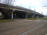
Increasing Capacity At Elmers End Tram Stop
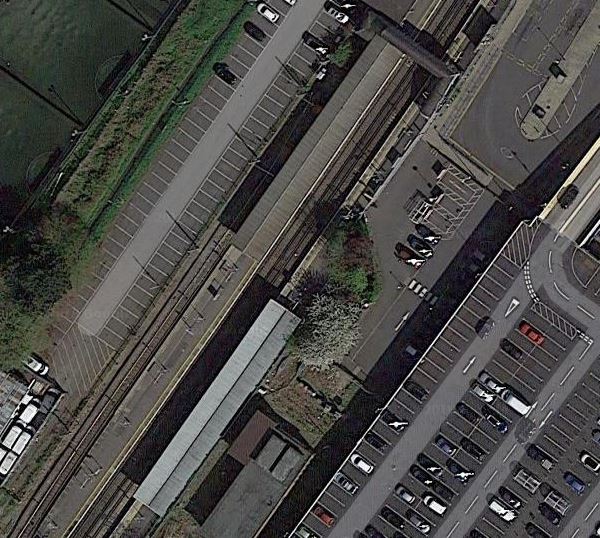
Elmers End tram stop, is the only terminal on the London Tramlink with a single platform.
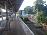
This map from OpenRailwayMap shows the platform layout at Elmers End station.
Note.
- The orange lines are the Hayes Line.
- The mauve line is the London Tramlink.
- The London Tramlink has a single platform on the North-West side of the Hayes Line.
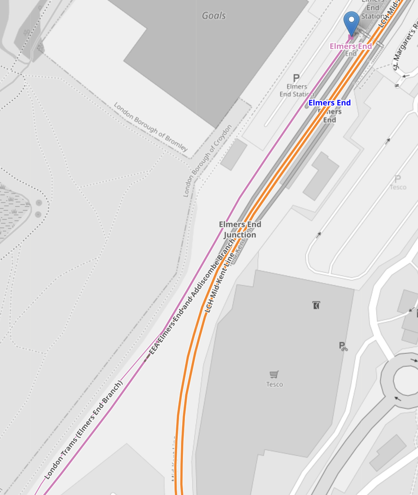
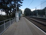
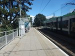
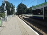
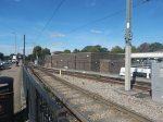
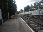
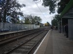
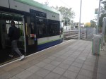
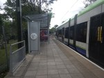
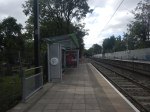
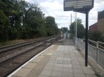
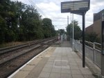
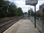
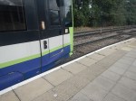
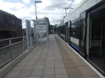
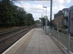
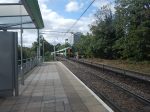
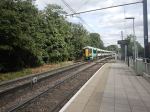
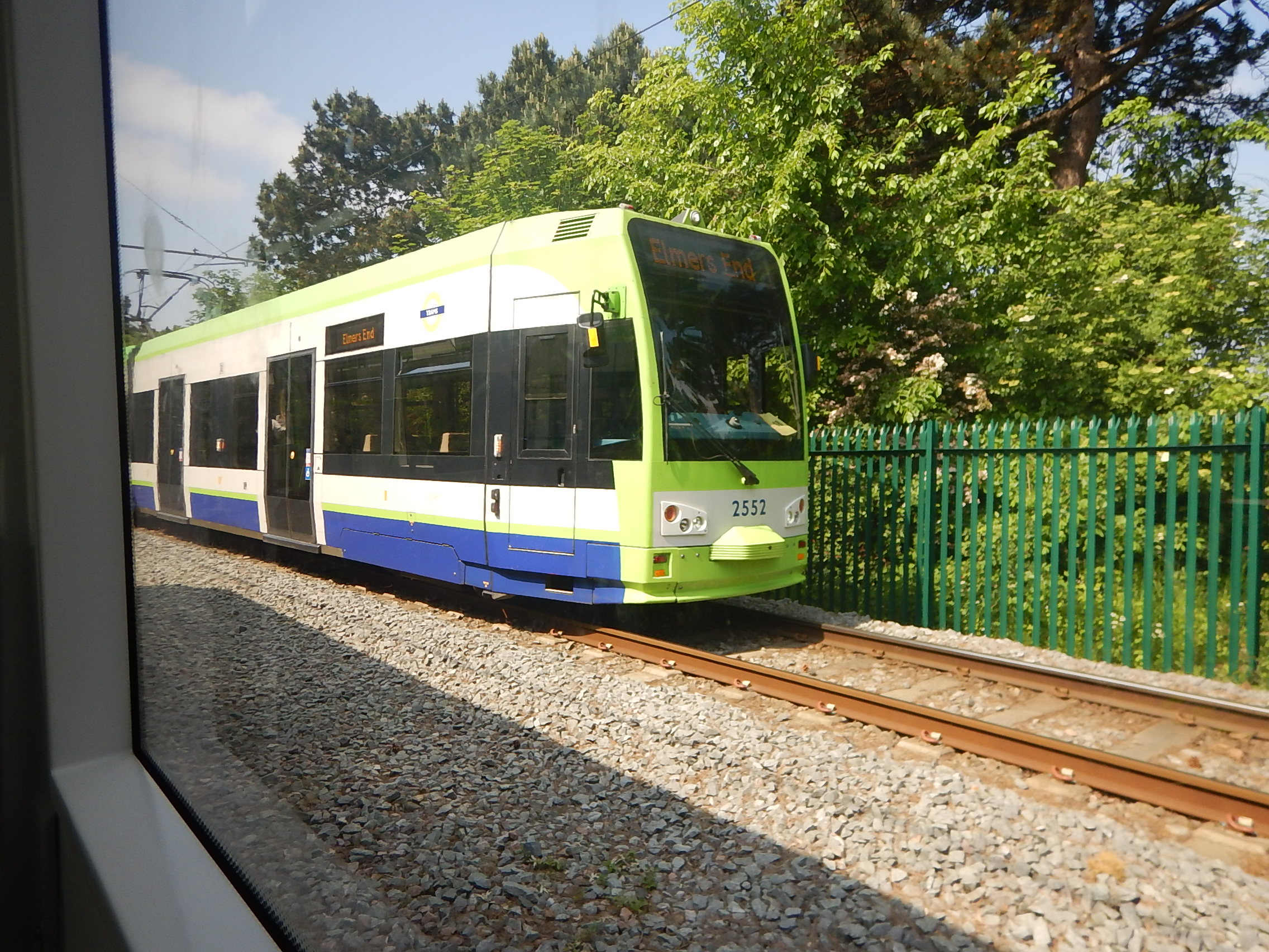
These pictures show Elmers End station and a tram in the London Tramlink platform.
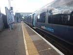
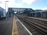
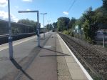
Note.
- The bridge in the station is not step-free.
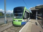
- The tram is a five-section Stadler Variobahn.
- The tram platform would appear to be able to handle a tram, that is several metres longer than the 32.0 metre Stadler Variobahn.
- The London Tramlink has a typical off-peak service to Wimbledon every ten minutes from Elmers End tram stop.
The Wikipedia entry for Elmers End station, says this about Tramlink developments at the station.
Work is underway to open a second tram platform and double the tram line to Arena to increase capacity. As of March 2019, vegetation has been cleared to make way for the new line. The platform was due to open in December 2020, but has been delayed.
My pictures show no ongoing work or evidence of the second Tramlink platform.
There are two main ways, that capacity can be increased at Elmers End station.
- Install a second platform and run more trams to the station.
- Run longer trams with a higher capacity.
Perhaps, Transport for London have decided, that the second way, is the best, especially, if the money saved, allows them to build a much-needed step-free footbridge at Elmers End station.
From my observations, I would estimate that Elmers End tram stop could accommodate a forty metre tram and possibly, one that was even longer.
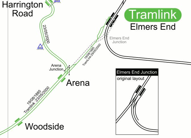
Arena Tram Stop
The Arena tram stop, is where the Beckenham Junction and Elmers End branches join and split.
This map from OpenRailwayMap shows the platform layout at Arena tram stop.
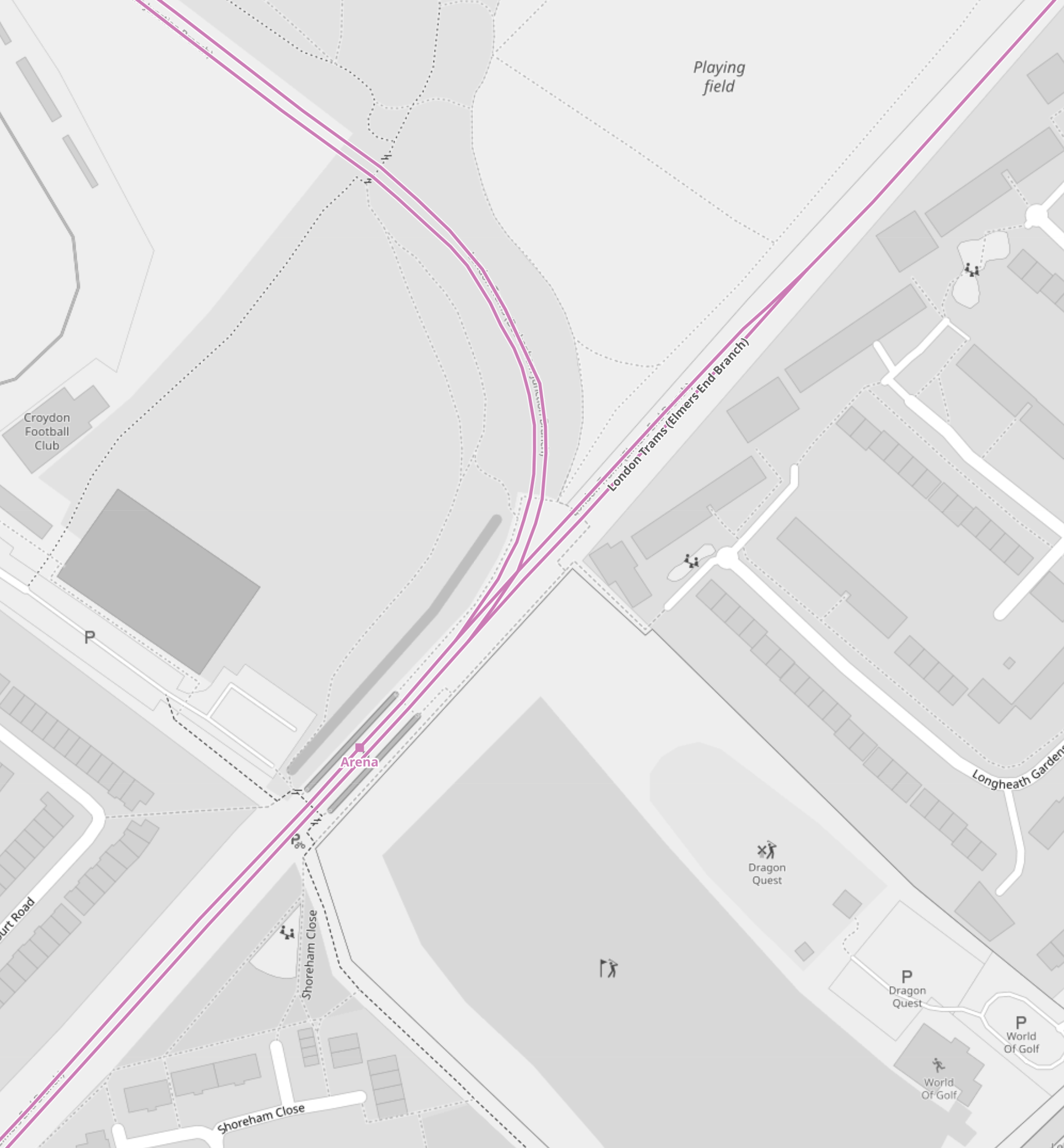
Note.
- The mauve lines are the London Tramlink.
- The line going North-East runs to Elmers End. It starts off as double-track at Arena tram stop and quickly becomes single track all the way to Elmers End. tram stop.
- The line going North-West runs to Beckenham Junction.
- The line going South-West runs to East Croydon and Wimbledon.
- The platforms are on the outside of both tracks.
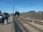
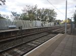
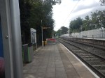
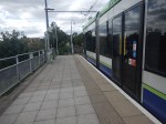
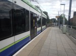
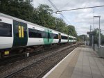
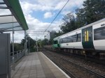
These pictures show Arena tram stop and some trams passing through.
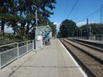
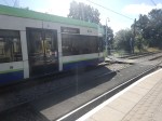
Note.
- The tram platforms are generally a few metres longer than the trams.
- All tram doors are step-free to the platform.
- Passengers walk across the line in front or behind the trams.
- The platform is wide, so that passengers can stay well clear of the occasional passing tram. One picture shows a tram is signed “Not In Service”
I believe, that with some judicial platform lengthening, some selective door opening and trams stopping automatically in the right place on the platform, that longer trams could be handled in a stop like Arena.
As with Elmers End, I believe a forty metre tram will be possible, but this might not be the limit with clever design.
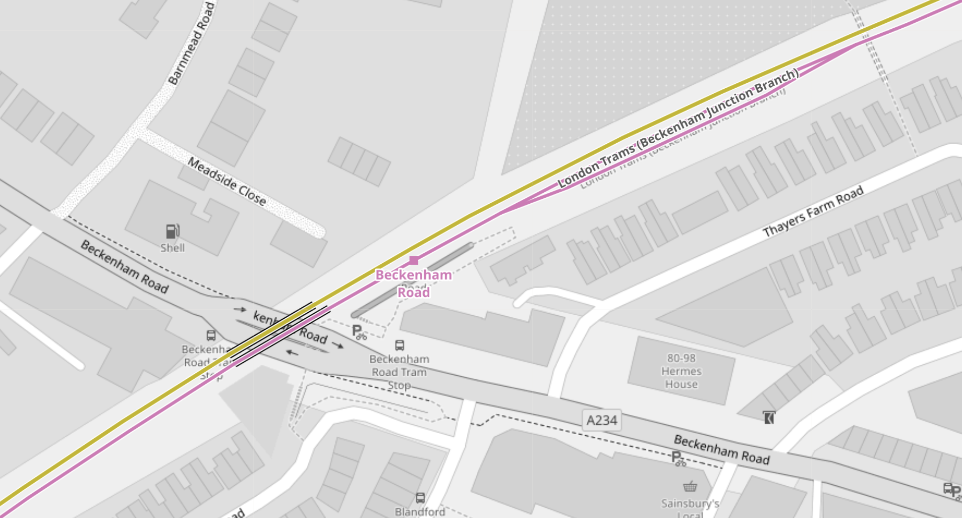
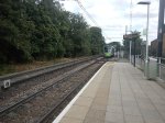
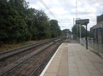
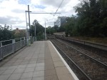
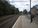
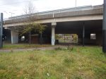
Handling Longer Trams At Beckenham Junction Tram Stop
This map from OpenRailwayMap shows the platform layout at Beckenham Junction tram stop.
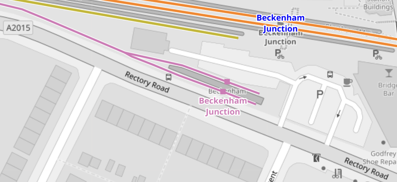
Note.
- The orange lines are the Chatham Main Line.
- The mauve line is the London Tramlink.
- There are a pair of short platforms for the London Tramlink.
- The platforms would be difficult to extend to the East.
- The platforms would be difficult to extend to the West, as the map above shows a building, just to the North of the junction of the two Tramlink platforms.
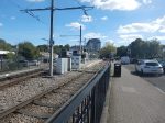
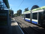
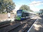
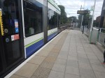
These pictures show Beckenham Junction station and the London Tramlink platforms.
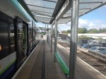
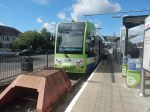
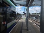

The Wikipedia entry for Beckenham Junction tram stop, says this about the Tramlink service.
Tram services at Beckenham Junction are operated by Tramlink. The tram stop is served by trams every 10 minutes to Wimbledon via Croydon. This is reduced to a tram every 15 minutes on Saturday evenings and Sundays.
Perhaps, the solution to lengthen Tramlink platforms at Beckenham Junction is to do the following.
- Rebuild the building to the North of the junction of the two Tramlink platforms.
- Extend the two Tramlink platforms to the West.
- Move the junction between the two Tramlink platforms to the West.
These pictures show the building in detail.

Note.
- There is a Network Rail van outside the building.
- The building looks like it dates from about 2000, when the Tramlink was built.
- Perhaps, the building houses power supply or signalling equipment for the Tramlink.
After the modifications, operation would be the same, but longer trams could be handled.
Trams And Trains Between Birkbeck And Beckenham Junction Stations
This short section of track must be one of the most unusual and complicated in the UK.
- There are three dual National Rail and Tramlink stations; Birkbeck, Avenue Road and Beckenham Road.
- Each station has a single bi-directional National Rail track and/or platform.
- Birkbeck has a single bi-directional Tramlink platform.
- Avenue Road and Beckenham Road each have two Tramlink platforms.
Engineer; Baldrick was obviously having one of his cunning phases.
This map from OpenRailwayMap shows the track/platform layout at Birkbeck station/tram stop.
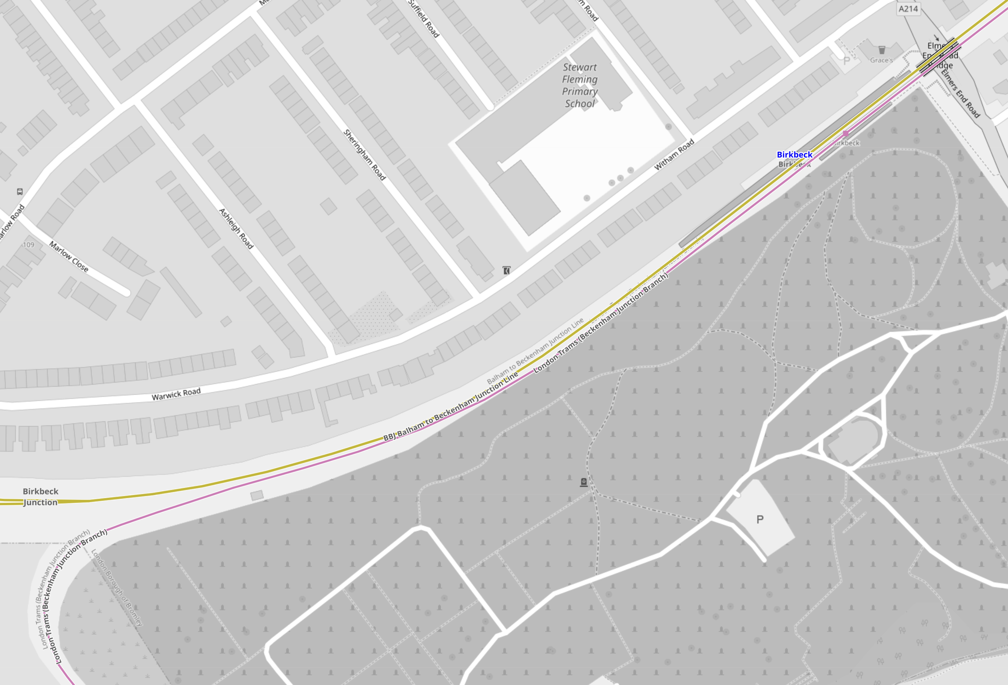
Note.
- The yellow line is the National Rail line between Crystal Palace and Beckenham Junction.
- The mauve line is the London Tramlink between Croydon and Beckenham Junction.
- There is no rail connection between the two lines.
Birkbeck station/tram stop has bi-directional platforms on both National Rail and London Tramlink.
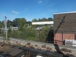
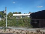
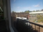
These pictures were taken at the Birkbeck station/tram stop.

Note.
- The two bi-directional platforms.
- The wire fence between the tracks.
- The two tracks appear to be the same level, but the National Rail platforms seem quite a bit higher.
From the pictures, I would estimate that the Birkbeck tram stop platform is currently about thirty-five metres and could probably handle a forty metre tram with selective door opening.
This map from OpenRailwayMap shows the track/platform layout at Avenue Road station/tram stop.
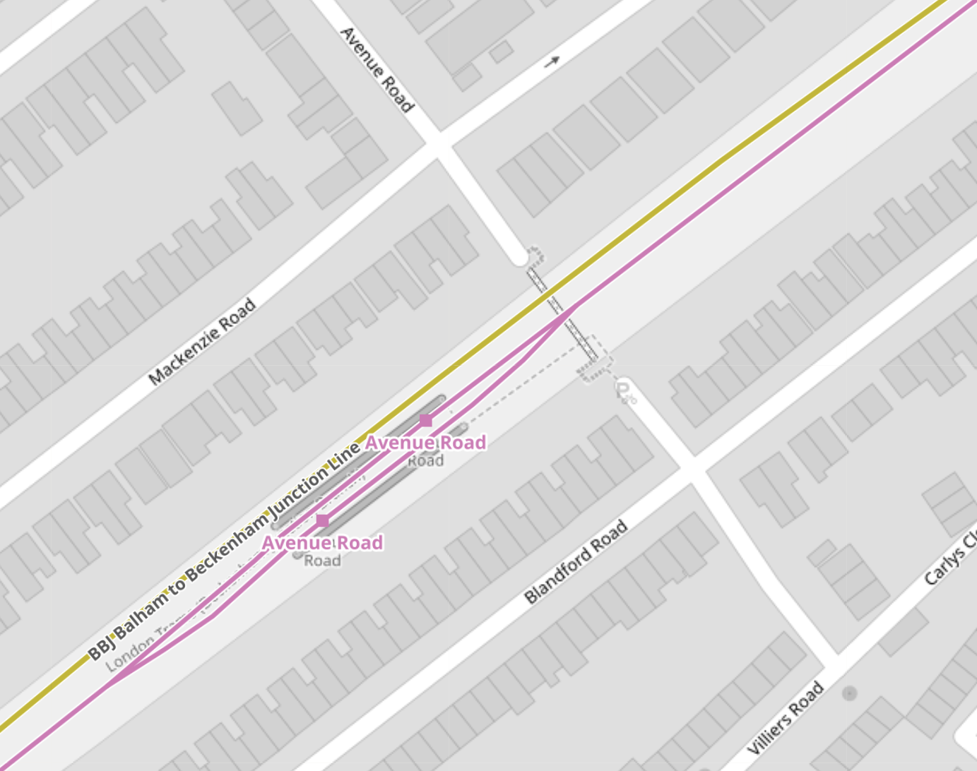
Note.
- The yellow line is the National Rail line between Crystal Palace and Beckenham Junction.
- The National Rail line isn’t shown to have a platform.
- The mauve line is the London Tramlink between Croydon and Beckenham Junction.
- There is no rail connection between the two lines.
London Tramlink has a loop through the tram stop and each branch has a platform.
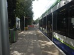
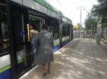
These pictures were taken at the Avenue Road tram stop.
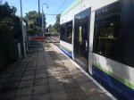
I would estimate the the loop at Avenue Road tram stop could handle a forty metre tram and possibly one of forty-five metres, judging the loop against this thirty-two metre Stadler tram.
This map from OpenRailwayMap shows the track/platform layout at Beckenham Road station/tram stop.
Note.
- The yellow line is the National Rail line between Crystal Palace and Beckenham Junction.
- The National Rail line isn’t shown to have a platform.
- The mauve line is the London Tramlink between Croydon and Beckenham Junction.
- There is no rail connection between the two lines.
The London Tramlink has a single bi-directional platform.
There is also a loop in the London Tramlink to the East of Beckenham Road station/tram stop to allow trams to pass.
These pictures were taken at the Beckenham Road tram stop.
Note.
- A train conveniently came through from London Bridge to Beckenham Junction, when I was taking pictures.
- Several pictures show trams using the loop to the East of the tram stop.
- Both types of tram were pictured in the tram stop.
- The platform in the tram stop is wide.
From the pictures, I would estimate that the Beckenham Road tram stop platform is currently about thirty-five metres and could probably handle a forty metre tram with selective door opening.
Tram-Train Operation Between Birkbeck And Beckenham Junction Stations
I am certain that if this track was being designed today, tram-train operation would be used.
- There would be two tracks, with one for each direction, through Birkbeck, Avenue Road and Beckenham Road stations.
- Both tracks would have dual-height platform at each station/tram stop, so tram and train passengers got level boarding.
- Trains would use third-rail power and trams would use battery-power.
Unfortunately, tram-trains didn’t exist, when the London Tramlink was designed.
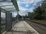
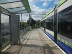
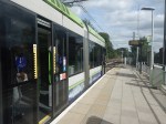
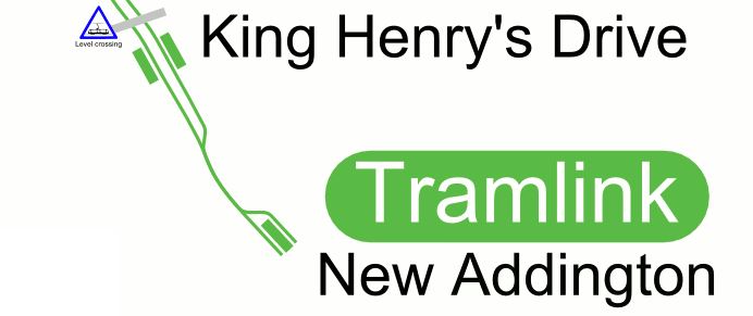
Handling Longer Trams At New Addington Tram Stop
This map from OpenRailwayMap shows the platform layout at New Addington tram stop.
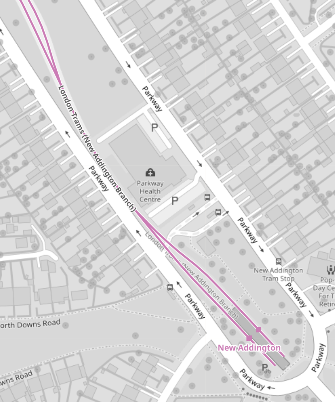
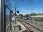
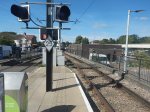
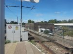
These pictures show the New Addington tram stop and the London Tramlink platforms.


If some of the grassland around the platforms was allocated to the tram stop, I suspect the platforms could be lengthened.
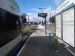
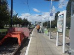
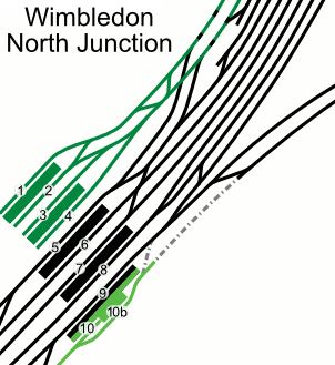
Handling Longer Trams At Wimbledon Station
This map from OpenRailwayMap shows the platform layout at Wimbledon station.
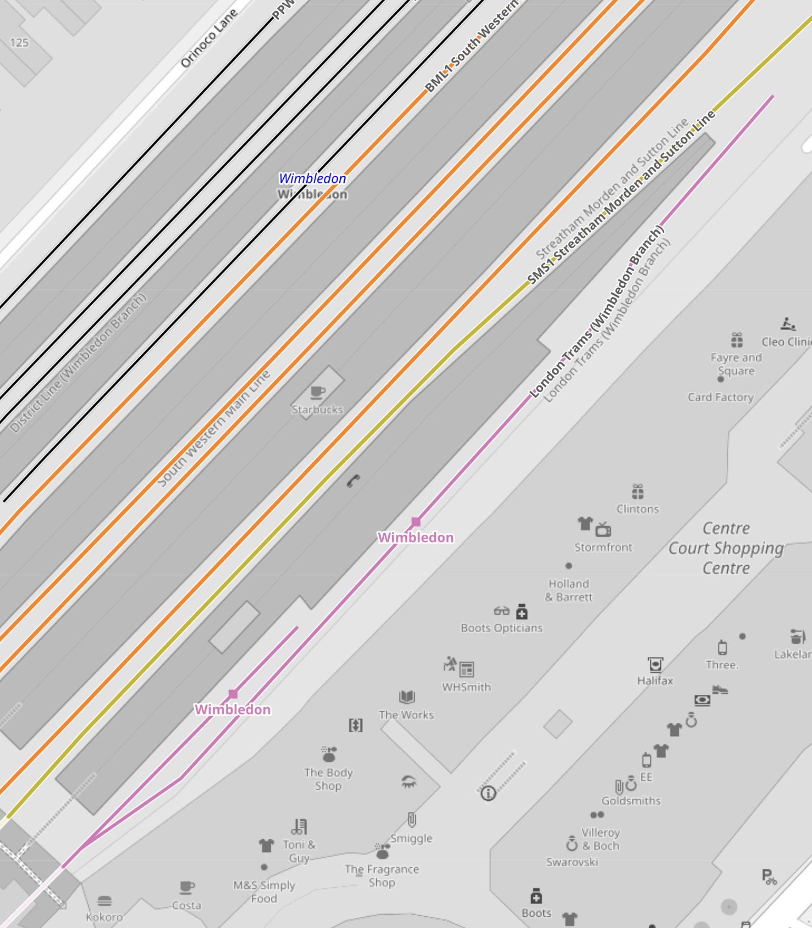
Note.
- The mauve line is the London Tramlink.
- There are two platforms; 10A and 10B, which are indicated with a separate dot.
- Platform 9, which is used by Thameslink, is the other side of Platform 10, so interchange to Thameslink is excellent.
- The main tram platform 9/10 is wide.
- The platforms are step-free to the trams, with lifts to the station bridge and the other platforms and Way Out.
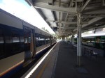
I suspect that when the second platform was built, both platforms were made longer than the thirty-two metres needed for the Stadler trams.
These pictures show the two platforms.
Could another platform be created on the other side of the tracks to give better access to the tracks?
Conclusions
My first conclusion is that the London Tramlink could be run by a new fleet of the same number of trams, that were a few metres longer than the current 30.7/32 metres of the current trams.
- I suspect that forty metre trams would be possible, with a few modifications to platforms.
- It might even be possible to have forty-five metre trams, with a more substantial rebuild at Beckenham Junction.
- Trams could overhang platforms and selective door opening could be used.
- Forty metre trams would carry 25 % more passengers than the current trams.
- The Elmers End and Wimbledon terminals already seem to be capable of handling forty metre long trams and possibly could take trams a few metres longer.
I suspect that Elmers End and Wimbledon, could be the first route, where the longer trams were introduced, as the trams should be able to shuttle between the two end terminals to the current timetable.
The New Addington tram stop would be brought into operation next.
- Platforms would be lengthened as required.
- Trams operate a frying pan loop from New Addington to Croydon, with an Off Peak frequency of 7-8 minutes.
- I suspect that one platform won’t be able to handle this frequency.
- The last point probably means that the two platforms will need to be lengthened.
Works at the New Addington tram stop could be tricky, but not substantial.
Initially, the service to Beckenham Junction could be run by the existing Stadler Variobahn trams.
I believe that a lot of work will need to be done to get Beckenham Junction ready for the new trams if they are longer, which I suspect they are.
- The Network Rail installation will have to be relocated.
- The two platforms will have to be lengthened.
I suspect the works will be substantial.
But I do believe, that there is scope to plan all the works at the terminals, so they can be done efficiently, whilst at least maintaining a partial service.
My second conclusion, is that it will be possible to build a financial model, which shows infrastructure costs against tram lengths.
Longer trams will cost more and cost more for infrastructure, but they will carry more passengers and collect more fare revenue.
Riding Into the Future: Germany’s Pioneering Hydrogen-Powered Tram Project
The title of this post, is the same as that as this article on bnn Breaking.
This is the sub-heading.
Explore Germany’s groundbreaking project to develop a fuel cell-powered tram, leading the charge in sustainable urban mobility and reimagining the future of public transportation.
These are the first two paragraphs.
In the quiet, industrious corners of Germany, a revolution is unfolding on the tracks of public transportation. A consortium led by Hörmann Vehicle Engineering, alongside partners Heiterblick, Flexiva Automation & Robotik, and Technische Universität Chemnitz, has embarked on a groundbreaking journey to conceptualize, design, and test what could be the world’s next leap in eco-friendly mass transit: a hydrogen-powered tram. The project, aptly named the Hydrogen Tram for Next Generation, merges the realms of innovation, sustainability, and practicality, aiming to redefine urban mobility in ways we’ve only begun to imagine.
The project’s heart beats with a simple yet ambitious goal: to create a fuel cell-powered tram that doesn’t just exist as a prototype but thrives as a model for future public transportation. This initiative isn’t just about building a tram; it’s about reimagining the entire ecosystem surrounding urban mobility. From devising a robust refueling strategy to simulating operations and testing the fuel cell system, the collaborators are leaving no stone unturned. The project, with a generous €8 million budget, is buoyed by support from the federal government’s national hydrogen and fuel cell technology innovation program. This isn’t merely an experiment; it’s a statement of intent by Germany to lead the charge in sustainable transit solutions.
I have a few thoughts.
Chemnitz
These pictures show Chemnitz and its trams.


Note.
- Chemnitz used to be called Karl Marx Stadt.
- Chemnitz has some hybrid trams and tram-trains.
- I described how the Chemnitz trams work in Chemnitz Trams And The Chemnitz Model.
Chemnitz could be a very suitable place to try out the technology.
Hence, the involvement of Chemnitz University in the project doesn’t surprise me.
Tram-Trains
This article on Railway Gazette International, which is entitled Hydrogen Tram Development Project Underway, is also about the same project.
This is the first paragraph.
The Hydrogen Tram for Next Generation project has been launched to develop a fuel cell-powered vehicle which would enable services to be extended into new areas and tram-train routes created without the need for electrification.
It looks like this was added in the translation.
Tram Trains In South London
In The Third-Rail Tram-Train, I postulated using third-rail tram trains to extend the London Tramlink.
Since then Merseyrail have tried to extend, their third-rail electrified network and been told they couldn’t.
I have written these posts about using tram-trains to extend the London Tramlink.
- Could There Be A Tram-Train Connection At Reeve’s Corner?
- Would Third-Rail Tram-Trains Affect The Design Of The Proposed Streatham Interchange Station?
- The Cranleigh Line
- Thoughts On The Sutton Loop Line
- Could Third-Rail Tram-Trains Work The Epsom Downs Branch?
- Could Third-Rail Tram-Trains Be Used To Increase Services In South London?
- Could Beckenham Junction To Birkbeck Be Run Using Third-Rail Tram-Trains?
- Could Tram-Trains Be Used To Advantage In Croydon?
So would a hydrogen-powered tram-train be useful technology to extend the London Tramlink?
It just could be!
Zero-Carbon Between Manchester and Sheffield
This OpenRailwayMap shows the electrification across the Pennines.

Note.
- Red lines are electrified with 25 KVAC overhead.
- Mauve lines are tram lines electrified with 750 VDC overhead.
- The mauve lines in the West are the Manchester Metrolink.
- The mauve lines in the East are the Sheffield Supertram
- Black lines are not electrified.
- Red and black lines are currently being electrified.
- The blue arrow at the bottom of the map indicates Buxton.
- To the North of Buxton, the line linking Manchester and Sheffield is the Hope Valley Line.
- Running North-East from Manchester is the main TransPennine route between Leeds and Manchester via Dewsbury and Huddersfield.
This OpenRailwayMap shows the TransPennine route between Morley and Mossley stations.
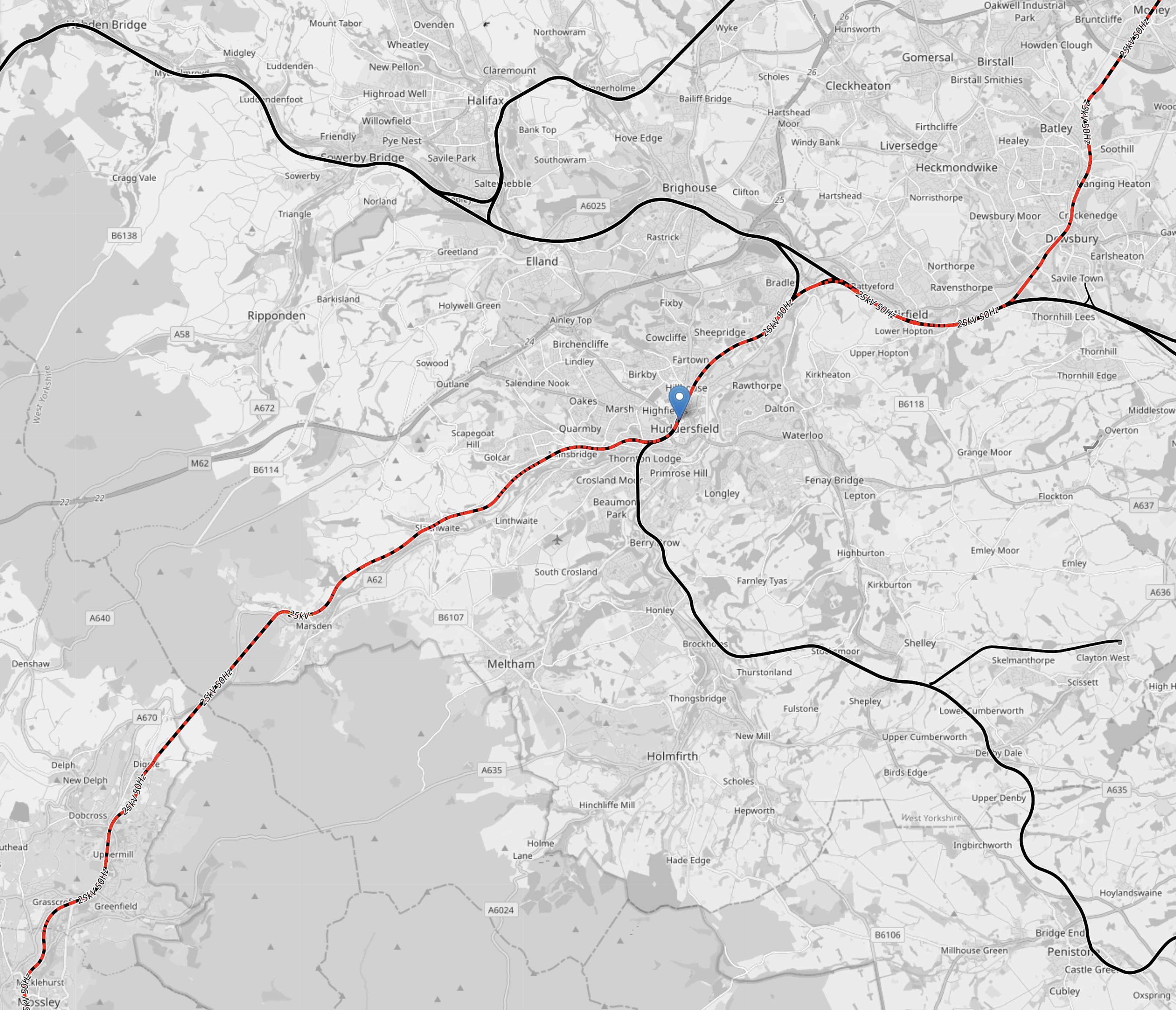
Note.
- Colours are as before.
- Morley station is in the North-East corner of the map.
- Huddersfield station is indicated by the blue arrow in the middle of the map.
- Mossley station is in the South-West corner of the map.
In a few years time, there will be 25 KVAC overhead electrification all the way between Leeds and Manchester via Dewsbury and Huddersfield.
This OpenRailwayMap shows the routes around Manchester and Sheffield and the connecting routes between Barnsley, Huddersfield, Manchester and Sheffield.
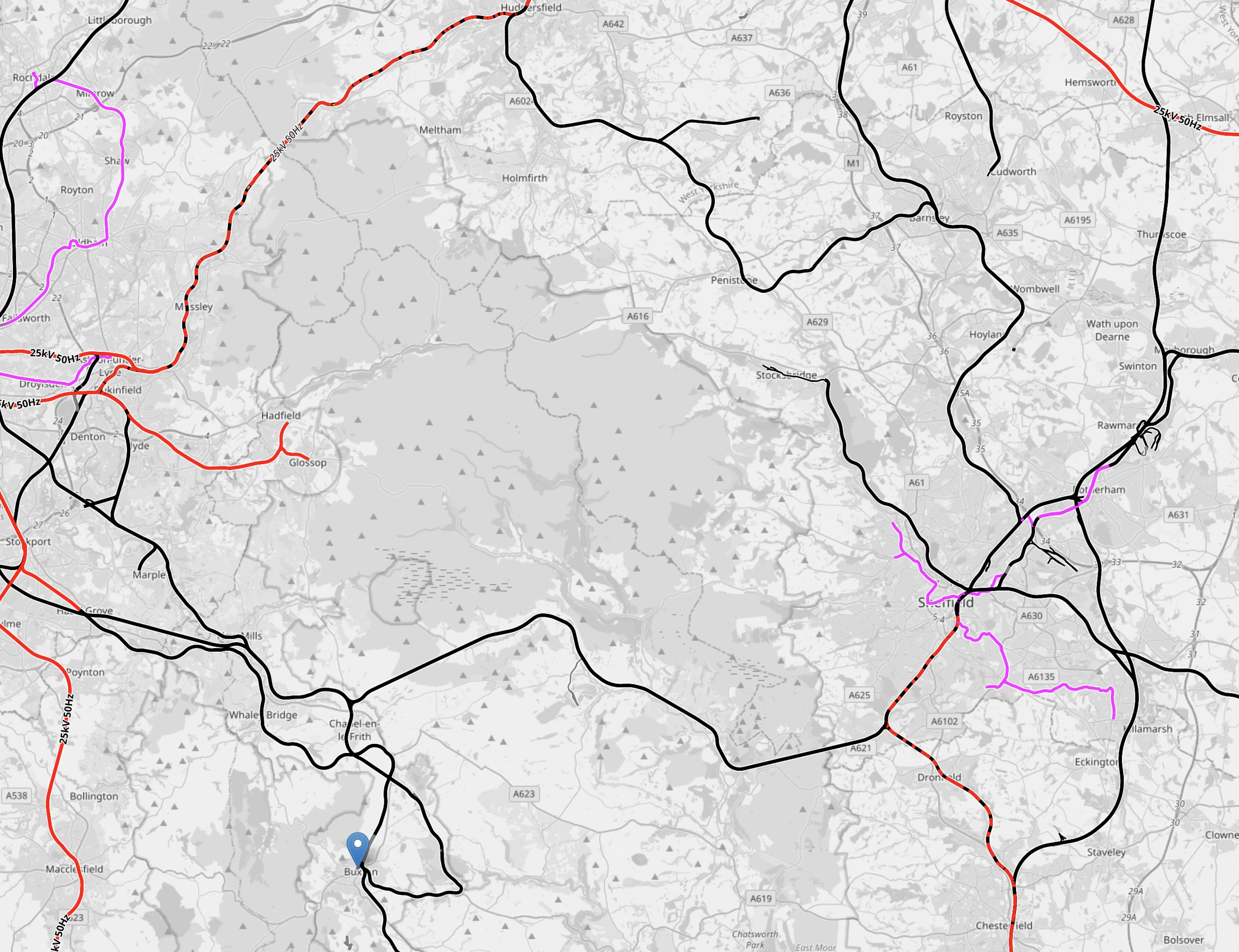
Note.
- Colours are as before.
- The blue arrow at the bottom of the map indicates Buxton.
- The line to Stocksbridge runs North-West from Sheffield.
- To its East the Penistone Line runs to Huddersfield via Barnsley.
- Manchester has a series of lines to the East that need to be electrified.
How many of these lines could be integrated into the tram systems of Manchester and Sheffield, by the use of hydrogen-powered tram-trains?
Hydrogen-powered tram-trains could share lines with battery-electric trains.
Tram-trains could run from say Cathedral in Sheffield to Piccadilly Gardens in Manchester.
Using self-powered trains would cut the need for expensive infrastructure.
The possibilities are endless and carbon free.
Conclusion
Hydrogen-powered trams and tram-trains could be a valuable tool for decarbonising trams and trains.
A Central Londoner’s View Of Thameslink
The Thameslink route, which runs North-South across London is used by different purposes, by different passengers.
- To many, who live close to its outer reaches it is a commuter railway into London.
- It serves two airports at Gatwick and Luton.
- Londoners use it to explore the delights of the South Coast of England.
But to those who live in Central London like me, it is a useful rail line.
Kings Cross And London Bridge
I regularly use Thameslink for this route, as compared to the Northern Line.
- The trains are more spacious and are generally less crowded.
- It is less walking at Kings Cross.
- The trains are air-conditioned.
- The trains have toilets.
- I have a convenient bus or taxi home from both end stations.
I suspect, I use this route a couple of times a week.
Access To Tate Modern
I like the Tate Modern and the gluten-free egg sandwiches are good.
There is also restaurants in the area; Leon and Carluccio’s for a start, that are good places for lunch or dinner.
So sometimes, I’ll use Thameslink to Blackfriars to visit the Tate Modern and then after my visit, I’ll walk over the Wobbly Bridge and take a bus home.
Thameslink is also an easy way to visit St. Paul’s and in a few years, the new Museum of London will be accessed from Farringdon station.
Access to Gatwick And Luton Airports
I haven’t used Luton Airport in years, as getting there by train is a bit tedious.
But I regularly use Gatwick Airport, usually by getting a bus to and from London Bridge station and then using Thameslink.
West Hampstead Thameslink
West Hampstead station on the Overground has recently been rebuilt and regularly I come home by changing between Thameslink and the Overground.
There is also a Marks & Spencer by the station, which helps too.
The area is becoming a major interchange and if the West London Orbital Railway is created, the Overground will be taking over or adding a platform at West Hampstead Thameslink station.
Does Thameslink Cater For All Passengers?
I say this deliberately, as I think that Thameslink concentrates more on the longer distance and airport passengers, rather than those, who use it as another North-South line across London.
Thameslink Will Run At Rapid Transit Frequencies
In the central core section between Blackfriars and St. Pancras International stations, the trains will run at a frequency of 24 trains per hour (tph) or a train every two and a half minutes.
Trains will run automatically at a frequency, that is higher than many rapid transit systems in the world.
Thameslink Is Part Of London’s Oyster/Contactless Ticketing Zone
From Gatwick Airport in the South to Elstree & Borehamwood and Hadley Wood in the North, Thameslink is part of London’s Oyster/Contactless Ticketing Zone.
In Oyster Card Scheme Extension Agreed, I wrote about how the zone is being extended to Luton Airport Parkway and Welwyn Garden City.
So increasingly, Thameslink will be covered by London’s ticketing, that is increasingly used by residents, commuters and visitors.
Thameslink Has Interchanges With The Underground And Overground
Thameslink has several interchange stations with the Overground and Underground.
These include.
- Blackfriars
- Denmark Hill
- Elephant & Castle
- Farringdon
- Finsbury Park
- Kentish Town
- London Bridge
- Peckham Rye
- St. Pancras Thameslink
- West Hampstead Thameslink
- Wimbledon
In addition East Croydon, Mitcham Junction and Wimbledon are interchanges with Tramlink and Blackfriars and London Bridge are interchanges with the river buses.
Thameslink Is Not On The Tube Map
This is a bone of contention with many! Including myself!
According to the Wikipedia entry for the Tube Map, Thameslink was shown on the map between 1977 and 1998.
So why was it removed?
Some Thameslink Stations Don’t Have Tube Maps On The Platforms
I was on the platform at City Thameslink station and needed a Tube Map.
There wasn’t one!
Why not?
Conclusion
Thameslink is very much part of London’s rail network.
It should be treated as such, by doing the following.
- Extending Oyster/Contactless ticketing to all Thameslink stations.
- Adding all or part of Thameslink to the Tube Map.
- Putting a Tube Map on all station platforms in the London area.
But this mess has existed for twenty years, since Thameslink was removed from the Tube Map.
Could There Be A Tram-Train Connection At Reeve’s Corner?
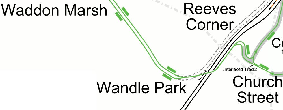
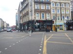
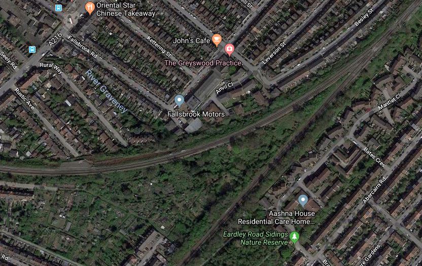
A few day’s ago I took the tram from Croydon to IKEA. Coming back, I got off the tram at the Reeve’s Corner stop and took these pictures.

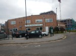
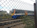
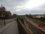
Note how close the trams are to the rail lines just to the West of West Croydon station.
This Google Map shows the area.
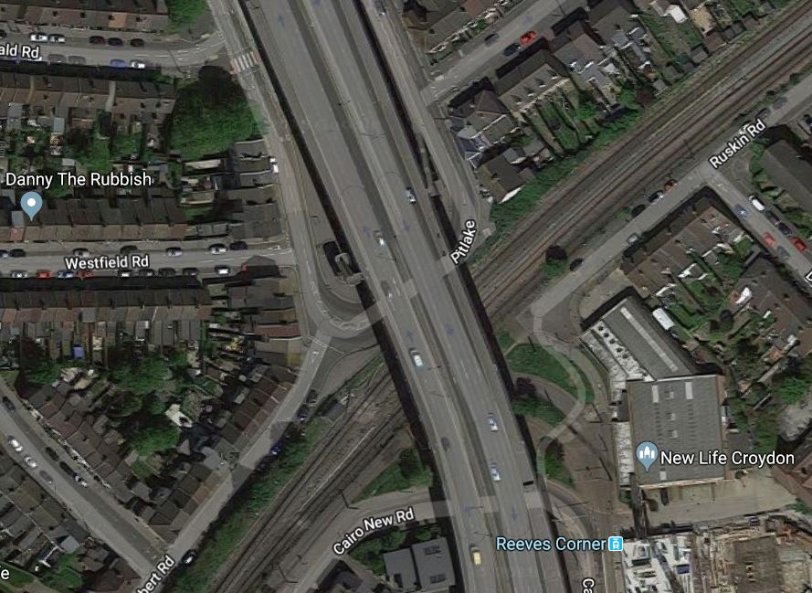
Note.
- The road bridge appears in several of the pictures.
- The rail lines appear to have plenty of space to accomodate an updated layout.
- The Reeve’s Corner tram stop is only used by trams going to Croydon.
- The trams share a single-track section between Reeve’s Corner and Wandle Park tram stop.
The single-track layout must be a restriction on the number of trams that can run between Croydon and Wimbledon.
This map from carto.metro.free.fr, shows the layout of the tracks in the area.
This map shows why there is plenty of space, as there are the dotted-lines of the West Croydon to Wimbledon Line, which was closed in 1997 to be converted into the London Tramlink.
This Google Map shows the route between Wandle Park and Revve’s Corner and how it crosses the rail lines.
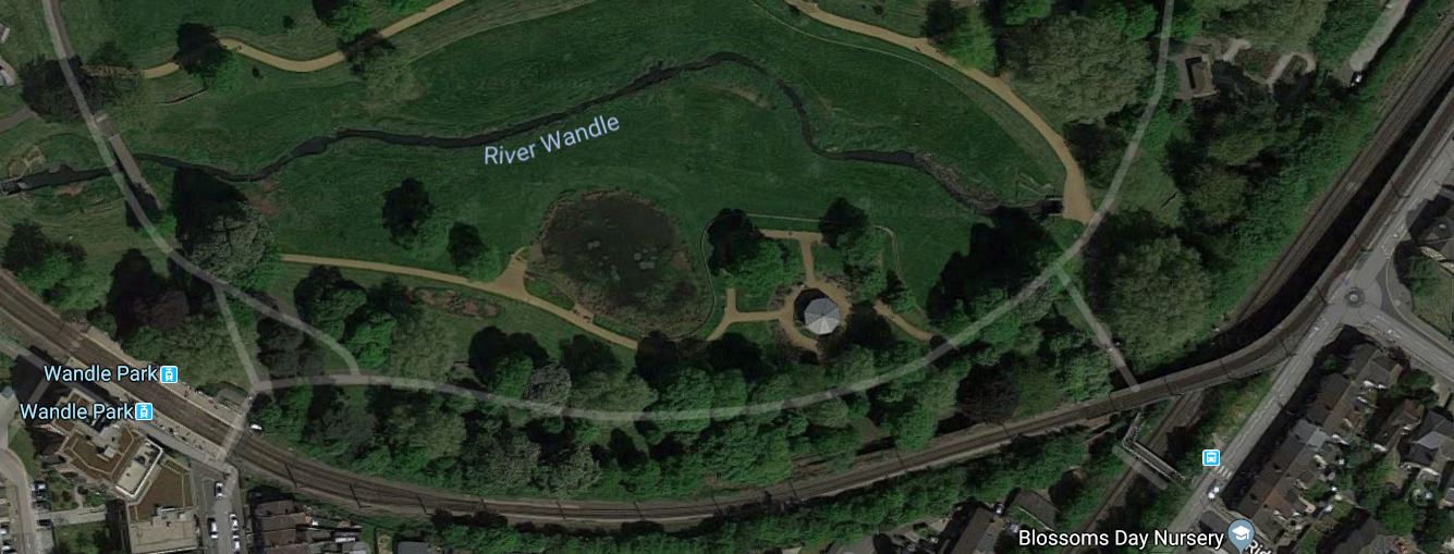
Note that Reeve’s Corner is just beyond the North-East corner of this map.
Third-Rail Tram-Trains And The London Tramlink
The London Tramlink was designed twenty years ago, well before we had modern tram-trains, like those that are running all over Karlsruhe and have just started services between Sheffield and Rotherham.
I believe that third-rail tram-trains, as I proposed in The Third-Rail Tram-Train, are a viable concept, if they only use third-rail electrification, when running as a train.
Why Create A Tram-Train Connection At Reeve’s Corner?
The obvious reason, is that it would allow tram-trains to run between Wimbledon and West Croydon stations.
To the East of West Croydon, they could go to places like the proposed Steatham Interchange or the existing Crystal Palace, Beckenham Junction or Bromley stations.
Conclusion
Creating a tram-train connection at Reeve’s Corner is one of a number of places, where the trams and South London’s third-rail network can be connected.
I believe that developing these connections could enable several useful routes.
- Extra train and tram services to Beckenham Junction station.
- Tram-trains to Bromley South station.
- Extending the Bromley North Branch using tram-trains to Bromley South station, by street running through Bromley Town Centre.
Tram-trains could even serve Gatwick Airport and provide services around the wider Airport site.
Would Third-Rail Tram-Trains Affect The Design Of The Proposed Streatham Interchange Station?
Transport for London’s proposal for the Bakerloo Line Extension comes with a very nice map of the various projects that will be carried out to improve rail services in South London.
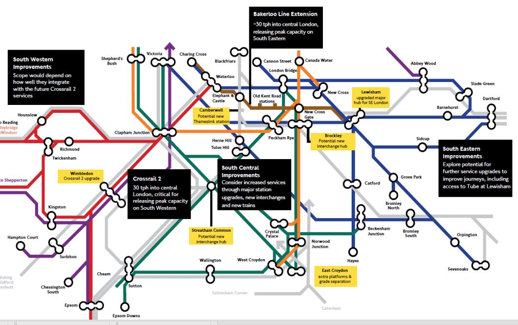
It is all good stuff and most is easily explained.
There is a little yellow box, which has a title of Streatham Common and contains the words.
Potential new interchange hub.
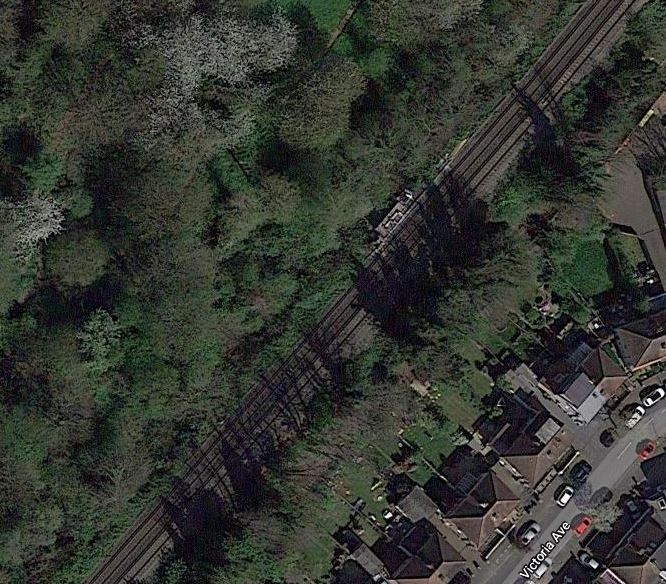
This map from carto.metro.free.fr shows the rail lines around Streatham and Streatham Common stations.
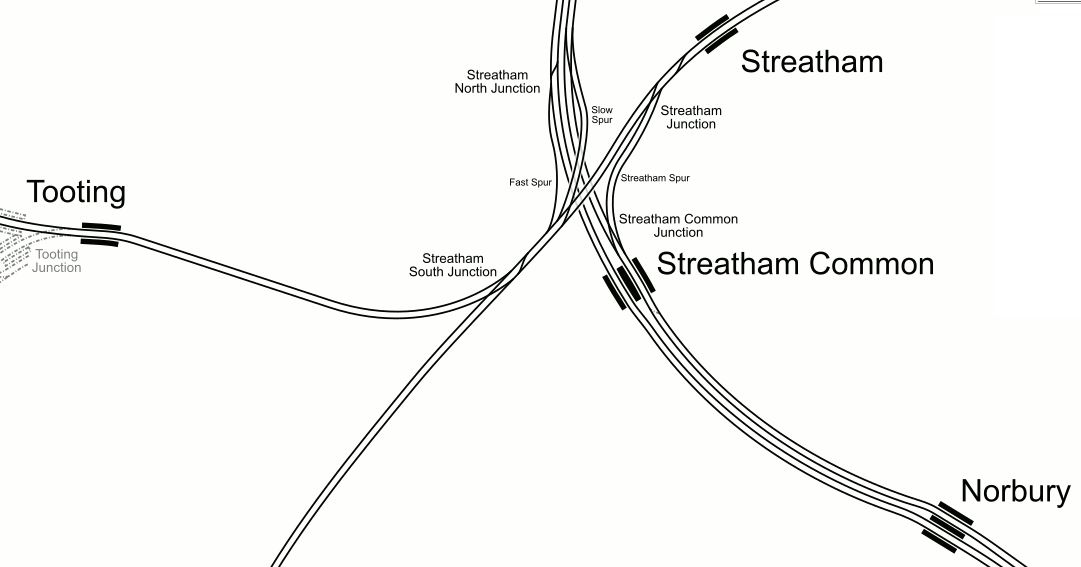
Streatham Interchange station has been proposed and could be at the major junction to the North of Streatham Common station.
Trains on the following routes could call.
- Thameslink services on the Sutton Loop Line, through Wimbledon and Sutton.
- Various Southern services between London Bridge and Victoria in the North and Caterham, Croydon, Epsom and Sutton in the South.
- Fast services between Victoria and the Brighton Main Line pass through.
I have also seen speculation on respected web sites, that the Overground will be extended to the new Streatham Common Interchange.
I suspect Transport for London’s plans will improve the lot of many travellers.
Third-Rail Tram-Trains To Streatham
If Streatham Interchange is going to be an important hub, then surely, it should be served by the Tramlink.
Third-Rail tram-trains would be able to run from any of these power sources.
- Overhead electrification on tramways.
- Third-rail electrification on rail tracks.
- Batteries on any tracks, including those without any electrification.
Most power changeovers would take place at tram-stops or stations. Although, I suspect that changing bertween battery and third-rail power would be automatic.
Third-rail tram-trains could run into Streatham Interchange on any standard third-rail track and could use any platform, be it a through platform or a bay one, that is used by standard trains.
These are the two obvious routes.
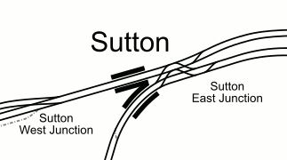
Use The Sutton Loop Line From Mitcham Junction Station
This map from carto.metro.free.fr shows the track layout at Mitcham Junction station and Tramlink between Mitcham and Beddington Lane tram stops.
Note that the black tracks are the Sutton Loop Line with Mitcham Eastfields station to the North and Hackbridge station to the South.
I think it would be possible, from what I have seen on other tram-train systems, to link the Sutton Loop Line to Tramlink, so that tram-trains could go between Bedddington Lane and a proposed Streatham Interchange.
A tram-train going between Croydon and Streatham Interchange would do the following.
- Stop in Beddington Lane tram stop.
- Drop the pantograph and change to battery power.
- Proceed to Mitcham Junction station.
- Connect to third-rail electrification.
- Run as a train to Streatham Interchange.
In the opposite direction, the sequence would be reversed.
Use The Sutton Loop Line From Wimbledon Station
This map from carto.metro.free.fr shows the track layout at Wimbledon station.
Haydons Road station is on the Sutton Loop Line going towards the proposed Streatham Interchange.
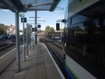
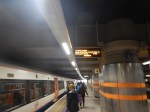
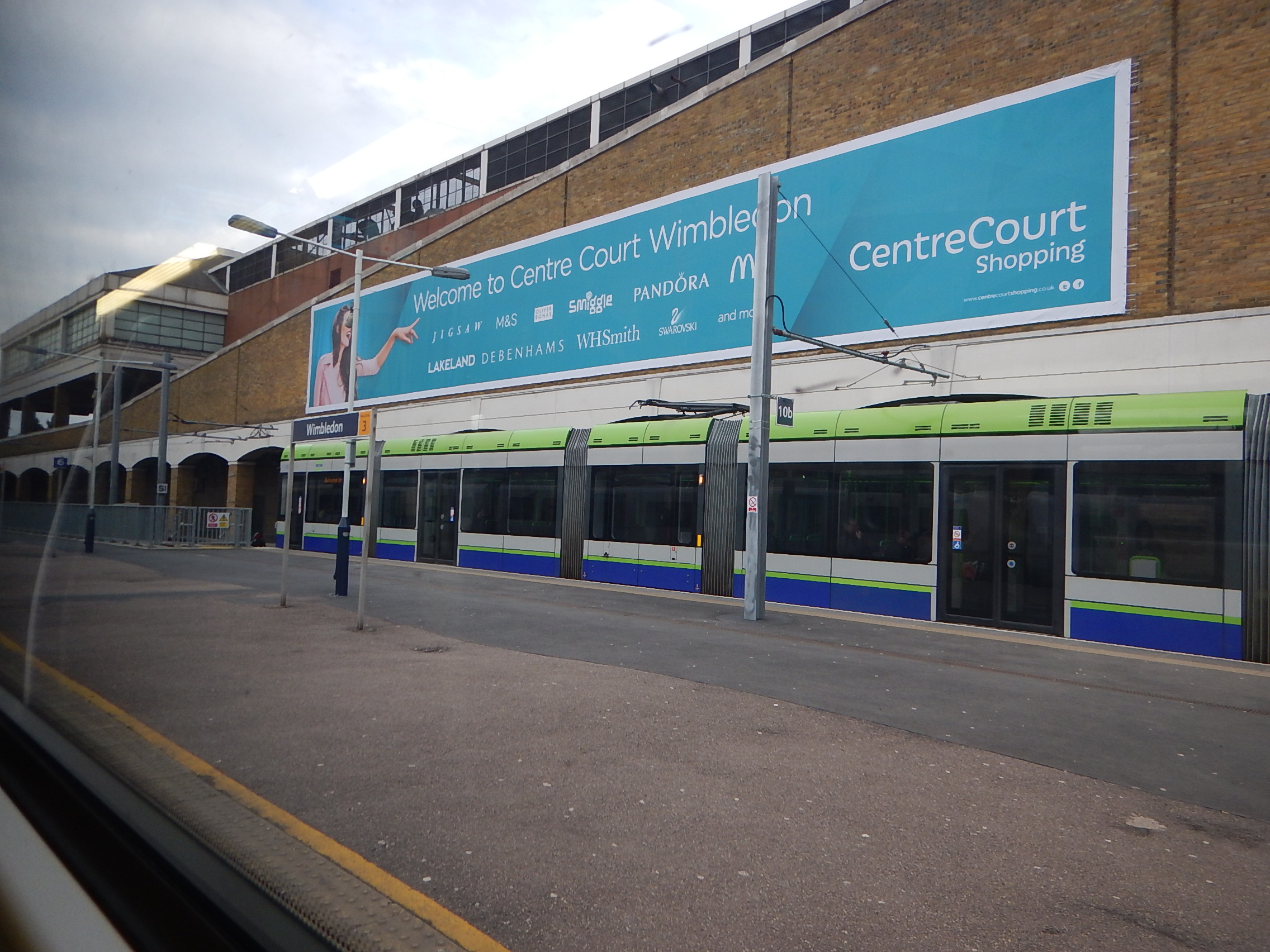
This picture shows a Thameslink train in Platform 9 and a tram in Platform 10b at Wimbledon station.
I think it could be possible to make Platform 10b into a bi-directional Tramlink platform to connect to Streatham Interchange.
Currently, twelve trams per hour turn at Wimbledon and I suspect that this needs two terminating platforms.
Conclusion
Connecting tram-trains at Wimbledon to the Sutton Loop Line may be tricky, but it should be easier at Mitcham Junction.
However, so long as Streatham Interchange has enough capacity for Tramlink services, there shouldn’t be a problem.
A Tram Extension Between Wimbledon And Sutton Could Come In 2025
The title of this post is the same as that of this article in Your Local Guardian.
The article talks about the project starting in 2022 and being ready in 2025, if there is public support.
This map shows the proposed route of the Tramlink’s Sutton to Wimbledon Extension.
I estimate that the route would be around five miles.
With current battery technology, that is probably too far for total running on battery power, but with the Midland Metro fully embracing the technology, this may open up methods for faster and more affordable construction.
I feel this could be an extension to watch, as after the innovative approach taken on the South Wales Metro, there are a lot of ideas being implemented around the world, that could make an extension to Sutton and on to the Royal Marsden, an affordable reality.
Dalston To Gatwick And Back For £6.15
This could be one of the best travel bargains for those like me, who have the privilege of a Freedom Pass.
I can use my pass, as far as East Croydon or West Croydon stations, but I must buy a ticket or use contactless to get to Gatwick Airport.
So I use the following route.
- London Overground to West Croydon station using my Freedom Pass.
- London Tramlink to East Croydon station using my Freedom Pass.
- Thameslink or Southern to Gatwick using a contactless credit card.
I paid £3.10 for the last leg.
These pictures show my journey to Gatwick.


Note that as my flight on Friday was early, I was staying the the Premier Inn, where I watched the World Cup 2018, before taking an early bath and an early bed.
The only problem was finding how to get from the shuttle to the Premier Inn at the Gatwick North Terminal.
Coming back, was just a two-legged journey.
- Thameslink to London Bridge station using the ticket I bought on the way out and my Freedom Pass.
- A 141 bus to just outside my house from the forecourt of London Bridge to just outside my house using my Freedom Pass.
I paid £3.05 for the ticket between Gatwick and East Croydon.
The Journey Could Be Improved
I do this journey a lot of times, especially as it is an easy way to the South Coast.
- Getting to Victoria will continue to be difficult, until there is a comprehensive rebuild of Highbury and Islington station.
- I could go to St. Pancras and get Thameslink, but there are time restrictions on using a Freedom Pass early in the morning.
- I could get a 141 bus to London Bridge, but going South seems a lot longer than coming North due to traffic, road works and bus frequency.
So what would I do to improve things?
The Overground Should Go To East Croydon Not West Croydon Station
Often, when I do the journey to West Croydon, the train is almost empty from perhaps Penge West station.
So do passengers from the East London Line wanting to go to Croydon choose a train to East Croydon?
- East Croydon has a cornucopia of services going all over the South.
- West Croydon has only a few services and no long distance ones.
- There are no intermediate stations between either station and Norwood Junction station.
- East Croydon is the hub station of London Tramlink.
- There is only a tram service going East at West Croydon.
- To get a tram to Wimbledon at West Croydon, it is a long walk, which is badly signposted.
What is needed is a dedicated Overground platform at East Croydon station.
- One platform could handle six trains per hour (tph)
- It would create a simple one-change link between Gatwick Airport, Brighton and other South Coast destinations to East London and especially Whitechapel station, for the Eastern branches of Crossrail.
I know space is difficult, but I suspect that there is a solution somewhere.
Refurbish The Class 700 Trains
The Class 700 trains have only been in service for about two years, but when you travel on one after using another train, you realise their inadequacies.
- The seats are worse than most and certainly not up to the standard of those on Electrostars, like the Class 377 train, I took to Gatwick.
- There is no wi-fi.
- There are no power sockets to charge a mobile phone or laptop.
- Tables don’t exist in most of Standard Class.
- There’s nowhere to put a drink.
- Some drivers, who worked for East Midlands Trains told me, that they are not fast enough for the Midland Main Line.
They are crap design of the highest class. They certainly don’t say “Welcome to the UK”, to arriving passengers at Gatwick.
But I do believe the trains can be sorted, as the Class 707 trains are better.
Extend The Freedom Pass Area
A Freedom Pass works to any station in Fare Zone 6, with a few extensions like Shenfield station using TfL Rail and Watford Junction station using the Overground.
I don’t think that the area, where the Freedom Pass can be used for free, should be extended, but the technology must exist to link a Freedom Pass with a credit or debit card, so that all journeys within the Oyster contactless area are charged appropriately.
I’m surprised that this or something like it hasn’t been implemented yet, as surely it could be an encouragement for Freedom Pass holders to vote for a Mayoral candidate.
Conclusion
Travelling to Gatwick will get easier and more comfortable.
London Tram Enhancements Included In Growth Fund
The title of this post is the same as that of this article in Metro Report International.
This is the first two paragraphs.
Transport for London is to finance around one-third of the cost of double-tracking the Elmers End branch of the tram network, Mayor of London Sadiq Khan announced on May 21.
TfL is to provide £3·3m from its Growth Fund towards the estimated £9m estimated project cost. In addition to double-tracking the short branch, this would add a second tram platform to the Elmers End terminus. TfL says that this would enable service improvements and ‘address reliability issues’ on the network.
This map from carto.metro.free.fr, shows the track layout between the Arena tram stop and Elmers End station.
My thoughts on the various works follow.
Double-Tracking
From the map, it doesn’t appear that a very large amount of track needs to be doubled.
This Google Map shows some of the single track section of the route.

Note the passing loop to the South of Elmers End is visible, at the top of the map.
It would also appear that there is space to add the second track, which used to exist when the tram line was the Addiscombe Line.
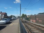
These pictures, which were taken from a tram, show the section of line in the map.
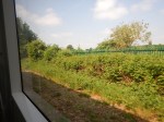


I suspect that a second track linking the double track at Arena to the passing loop South of Elmers End can be created.
Electrification Or Battery
Battery trams will soon be running on many tram networks around the world, including Birmingham in the UK.
Tramlink has a problem, in that they have two types of trams.
Because of their age, I think the CR4000 trams might be difficult to be fitted with batteries.
But Munich already has Variobahn trams fitted with batteries.
If battery power were needed just on the route to Elmers End, I think it would not be an economic decision to fit all trams with batteries.
Obviously, if in the future, more trams were to be ordered, there may be other routes, where batteries are ideal.
I don’t think, there will be any issues about putting up more wires.
Being able to use the current trams on the new track to Elmers End would be very convenient
For these and other reasons, I suspect this line will be electrified.
The New Elmers End Platform
Elmers End is the only one of the four Tramlink termini with a single platform, as Beckenham Junction, New Addington and Wimbledon all have two platforms.
So a second platform at Elmers End would surely make running a service easier, when things go a bit awry.
The need was illustrated as my tram left Elmers End. We stopped for a couple of minutes in the passing loop just outside the station to let another tram enter the platform.
After the proposed works, the two trams would have passed on the double-track to the East of the Arena tram stop.
This Google Map shows the platforms at Elmers End station.
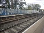
These pictures show the station and in particular, the current single tram platform.
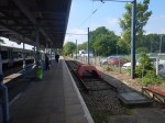
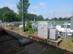


Note.
- Platform level is such, that platform-to-tram is step-free.
- The current platform has a cross-platform interchange with the Northbound Platform 2 on the Hayes Line.
- It would appear, that there is space alongside for a second platform, although it might mean the loss of some car parking spaces.
- Some equipment might need to be moved.
- The footbridge could probably need to be made step-free.
- There is space to add the gantries for the electrification.
The original Addiscombe Line had a platform on the other side of the tracks as shown in the map earlier in this post.
I doubt this old layout will be used, as a flat junction would be rather difficult to operate and a flyover would be expensive.
Could we see a staggered platform layout, so that both platforms are accessible from Platform 2?
This map from carto.metro.free.fr shows the track arrangement at New Addington.
The line appears to be singled a convenient distance from the terminus and then it splits again just outside the platforms.
Beckenham Junction and Wimbledon, both use a similar track layout.
If a layout similar to this were to be applied at Elmers End, it would have the collateral benefit of reducing the current three sets of points to two.
A single track, would also be easy to squeeze through the gap into Elmers End, provided there was space for the points before the platforms.
I believe this layout, would work with staggered platforms.
Would The Elmers End Platforms Be Made Longer?
Wikipedia talks about expanding Tramlink. Under Phase C of Trams 2030, this is said.
Furthermore, if extra capacity is required, tram stops could be lengthened to serve either longer trams or two trams coupled together on services between Wimbledon and Beckenham Junction or Elmers End.
I think that Elmers End will be future-proofed.
An Increase In Frequency To Elmers End
The Wikipedia entry for Elmers End station, says this about current tram frequencies under Services.
Trams depart from the station every 12 minutes; this service falls to four trams per hour during the early morning and evenings. Each tram travels towards Croydon town centre; trams on Route 1 continue to West Croydon tram stop, before travelling back as Route 2 to Beckenham Junction, while trams on Route 4 continue to Wimbledon.
A second platform would surely allow the five trams per hour frequency to be doubled to ten trams per hour, if this was thought necessary.
These trams would either be turned in Croydon or continue to Wimbledon.
Some might use a proposed diverting loop in Dingwall Road, by East Croydon station.
More Trams
If more trams are needed, I’m sure Stadler would oblige with a few new Variobahn trams.
Future Expansion
I also think, that because after the Elmers End scheme is completed, all the Tramlink termini will have two platforms, this will make it much easier to expand the system.
Conclusion
It seems a relatively simple scheme with no serious construction problems.
Thoughts On The Sutton Loop Line
The Sutton Loop Line is a bit of a problem.
- It runs two trains per hour (tph) in both directions.
- Trains are eight-cars.
- It is not the most heavily-used of lines.
It is deeply political and difficult to make any changes.
Network Rail’s original plan is described under Political Developments in the Thameslink entry in Wikipedia. This is said.
Network Rail had planned to terminate Sutton Loop Thameslink trains at Blackfriars station, rather than have them continue through central London as at present. This would increase the capacity of the central core as the Sutton Loop could only accommodate shorter trains. This upset many residents in South London and their local politicians, who saw it as a reduction in services rather than an improvement. In response to pressure, government has ordered Network Rail to reverse the decision.
Was this design by those, who don’t understand the complexity of designing and running a train service?
On the other hand, the line has some strengths.
- It is a double-track railway.
- It is fully-electrified using 750 VDC third-rail.
- Stations have long platforms.
- There seems to be quite a bit of housing and other development.
But in some ways, the line’s biggest strength, is the wide margins at both sides of the tracks.
This section between Hackbridge and Carshalton stations is not untypical.
Adding extra platforms or complete stations would not be difficult.
What solutions are available to improve train services on the Sutton Loop Line, for both passengers and train operators?
Splitting And Joining Trains
In Has Thameslink Got The Wrong Length Of Train?, I proposed the following.
- Using twelve- and six-car trains on Thameslink.
- Allowing two six-car trains to work as a twelve-car unit.
- Trains would be able to join and split automatically, as Hitachi’s Class 395 trains are able to do.
I also proposed the following method of operation for the Sutton Loop Line.
The Sutton Loop Line could be run by using six-car trains that split and join in the area of Streatham station.
This map from carto.metro.free.fr shows the track layout at Streatham, at the start of the loop.
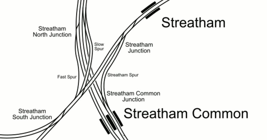
Note.
- Streatham South Junction is the gateway to the Sutton Loop, with the tracks to the West going via Tooting station and those to the South via Mitcham Eastfields station.
- There is a lot of spare land in this area.
- Transport for London keep talking about creating an interchange at this point.
I think, if and when the interchange is built, it could be designed, so that it increased traffic around the Sutton Loop Line.
- Two six-car trains running as a twelve-car could split at the interchange.
- One train would go round the loop clockwise and the other anti-clockwise.
- The trains would rejoin together at the interchange.
The same procedure could be done at Streatham, without creating the interchange, but it would block the station, if trains got delayed on the loop.
Currently, two trains per hour (tph) are proposed to run in both directions on the Sutton Loop Line.
This requires four eight-car trains and four paths through the central core.
If four six-car trains were to be used, running in pairs splitting at Streatham station or a new Streatham Common interchange, there would still be two tph in both directions round the Sutton Loop, but only two paths would be needed in the central core.
Travellers to and from stations on the loop would see six-car, rather than the current eight-car.
If the number of six-car trains were to be doubled and four paths used in the central core, the Sutton Loop Line would see four tph in both directions.
It sounds complicated but it would work and it has the following advantages.
- Train frequency could be increased as required.
- Paths are released in the central core.
- Twelve-car trains would go through the central core, where the capacity is needed.
The service would need a few more drivers and other staff.
Loop Only Services To A New Streatham Common Interchange
If a new interchange station is built at Streatham Common, then extra services could easily be run round the loop.
- Thameslink services could be reduced to perhaps one tph in each direction.
- These would be augmented by perhaps a four tph shuttle around the loop starting and finishing at Streatham Common.
- The shuttle trains could be any suitable unit, but surely a four-car would suffice.
I suspect that this wouldn’t work, as it would upset the natives.
The German Solution
I can’t help feeling that the Germans and especially those in Karlsruhe would look at the Sutton Loop Line and because there are both trams and trains, in the area, they would come up with a solution based on trains and tram-trains.
As fsr as I know, no-one has ever built a third-rail-powered tram-train!
But I don’t think that a tram-train powered by third-rail electrification, when running as a train is an impossibility. I lay out my ideas in The Third-Rail Tram-Train.
Safety
As to safety, look at this picture taken at Mitcham Junction station.
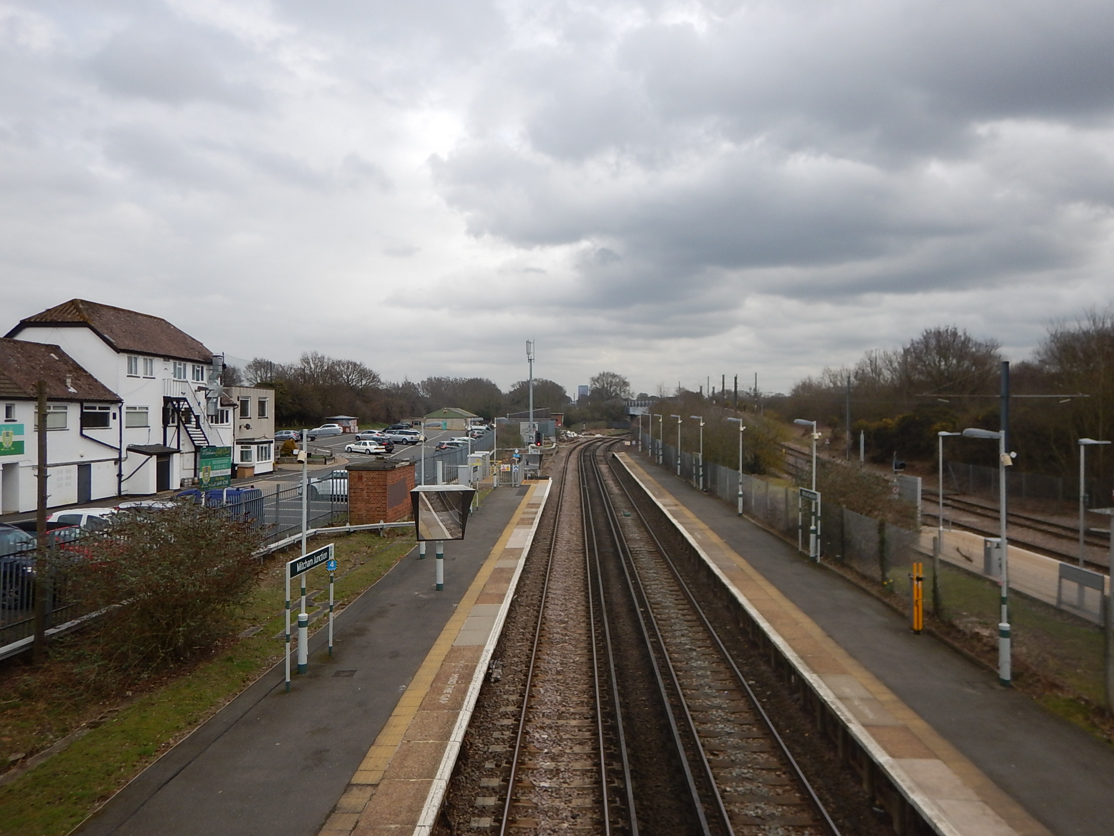
Note how the third electrified rails are in the middle away from the platforms. This is standard practice with this form of electrification.
So if it is deemed to be safe for trains now, it will surely be safe for third-rail train-trams.
When running as trams, the tram-trains will use 750 VDC overhead electrification.
Changing Networks
Tram-trains will need to change between the tram and rail networks.
This map from carto.metro.free.fr shows the track layout at Mitcham Junction station.
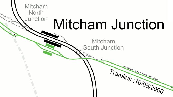
Note.
- Wimbledon is to the West and Croydon is to the East.
- With the addition of some extra tracks, it should be possible for tram-trains to pass between the networks.
- As trams can take tight curves, a chord could allow Westbound tram-trains from Croydon to turn South to Sutton.
- Tram-trains will probably change networks using a couple of ininutes of battery power.
I doubt any of the engineering will be too difficult.
Adding The Sutton Loop Line To Tramlink Using Tram-Trains
Tram-trains would take the following route.
- Arrive from Croydon at Mitcham Junction, where they would turn South onto the Sutton Loop Line.
- Pass through Hackbridge and Carshalton stations.
- Call in Sutton station for interchange with trams and National Rail.
- Continue to Wimbledon station calling in Platform 9 for interchange with trams in Platform 10 and 10b and National Rail.
- Pass through Hatdons Road and Tooting.
- Take new chord to cross to the other leg of the Sutton Loop Line.
- Pass through Itcham Eastfields station.
- Rejoin the tram route at Micham Junction station.
Tram-trains could also travel in the reverse direction.
Trams And Tram-Trains At Wimbledon
This map from carto.metro.free.fr shows the track and platform layout at Wimbledon station.
Note.
- Currently, Thameslink services on the Sutton Loop Line use Platform 9 in both directions.
- Hayons Road station is to the North-East and |Wimbledon Chase station is to the South.
- Tram-trains on the Sutton Loop Line would do the same.
- Platform 9 probably defines the capacity of the Sutton Loop Line.
Access to the trams in Platforms 10 and 10b, is just a walk across the platform.
The picture was taken from a Thameslink train.
There might even be space for another tram platform, that can be accessed from the Haydons Road direction.
Trams And Tram-Trains At Sutton
This map from carto.metro.free.fr shows the track and platform layout at Sutton station.
Note.
- The Sutton Loop Line is the Northernmost pair of tracks.
- Carshalton station is to the East and West Sutton station is to the West.
- It could be possible for tram-trains to by-pass Sutton station and run on the streets of Sutton.
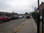
This picture shows Sutton High Street.
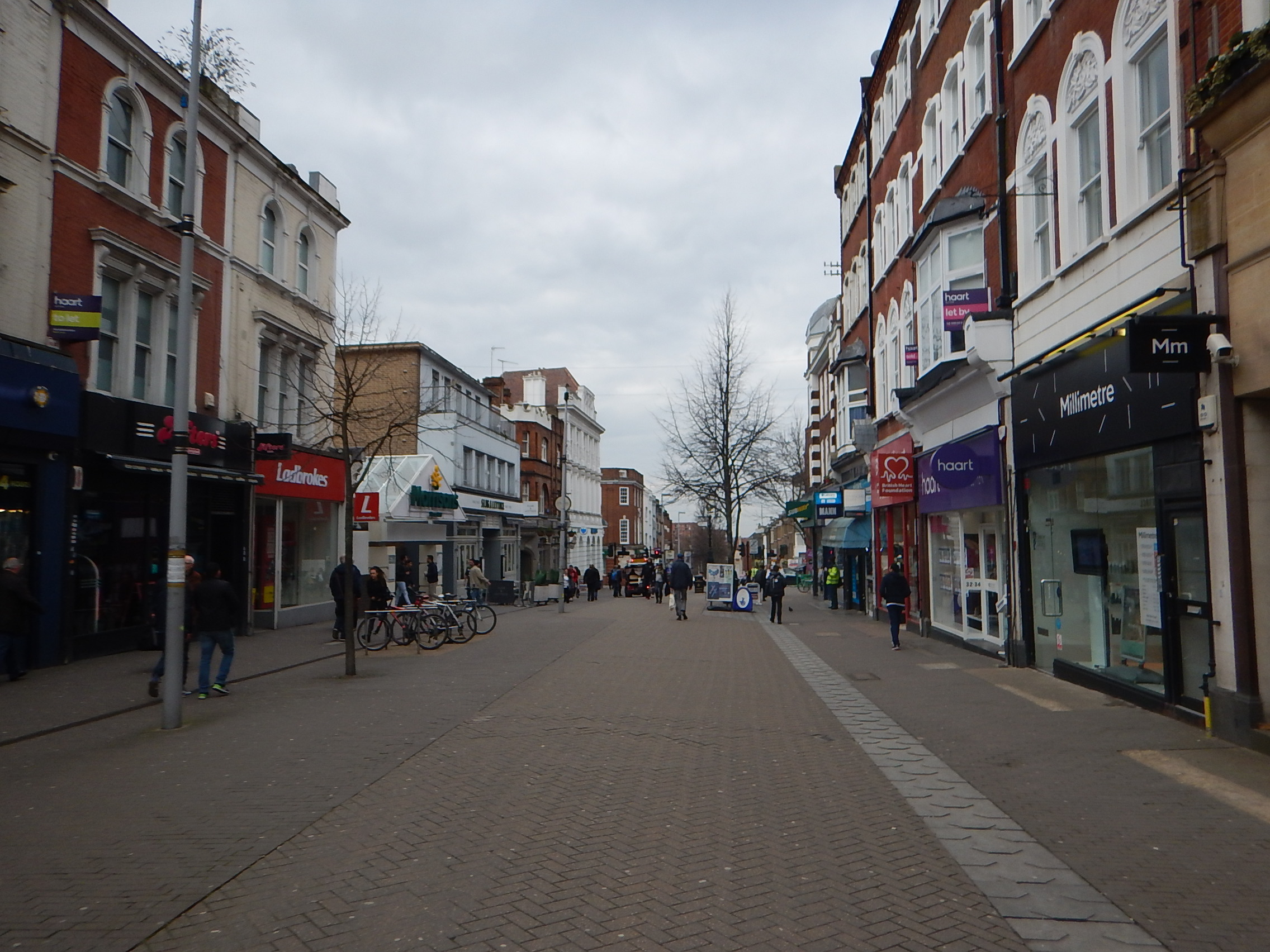
Is it going to be easy to bring the planned tram extension from Wimbledon to Sutton?
Dual Platform Issues
Platforms at the stations on the Sutton Loop Line are long and are certainly capable of taking eight-car trains.
But are they long enough to have a lower section of platform, so that tram-trains can have step-free access?
This is one of the problems, that should be solved in the tram-train trial in Sheffield.
The Split At Streatham Common
This Google Map shows, where the two routes of the Sutton Loop Line meet near Streatham Common station.
This picture shows a train going towards Mitcham, from one having passed through Tooting station.
I don’t think it would be the most difficult engineering project to create a chord, that would allow tram-trains to go directly between Tooting and Mitcham Eastfields stations.
A Possible Service
As I said earlier, Platform 9 at Wimbledon station. is probably the limiting factor on services round the Sutton Loop Line.
Thameslink is planning two tph in both directions.
I suspect that this could be supplemented by two tph services run by tram-trains, if a signalling solution can be implemented to allow four tph in each direction, through the platform.
Conclusion
There are several ways to improve the Sutton Loop Line.
