East London Is A Duckers And Divers Paradise
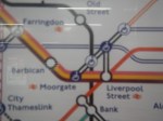
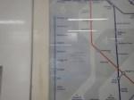
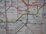
This is the East End Tube Map, which I clipped off the full tube map.
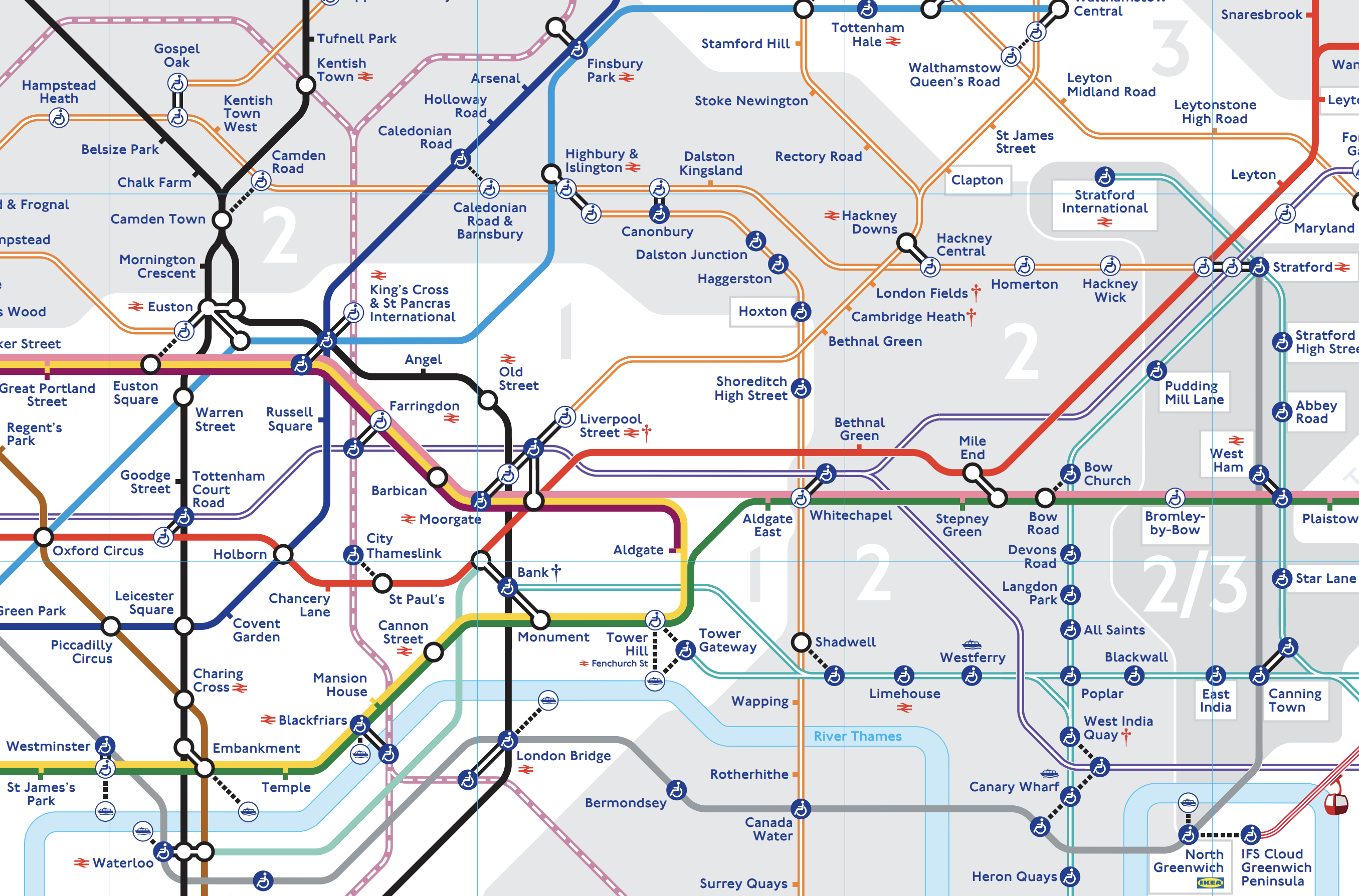
I live just South of the East London Line between Canonbury and Dalston Junction stations.
Today started just after nine, as many others do by braving the nightmare on the buses to take a 141 bus to Moorgate.
- At Moorgate, I had breakfast as I do regularly in the Leon, by Moorgate station.
- After breakfast, it was one stop South on the Northern Line to Bank, to see if the new entrance had opened.
- It was then a trip on the new moving walkway to the Central Line.
- I took the Central Line to Stratford to do my main shopping at the start of the week, in the large Marks and Spencer in Eastfield, by the station entrance.
- It was then on to the North London Line to go back home.
- I didn’t go all the way home on the Overground, but got off the train at Hackney Central and using the new Graham Road entrance, I crossed to get a 38 bus, which would take me home.
- But two 38s passed as I tried to cross the road and in the end I took a 277 bus to Dalston Junction station.
- From the Junction, I got a 56 bus home.
I got home about eleven.
At least now, I’ve got food until Thursday!
Elizabeth Line To Open On 24 May 2022
The title of this post, is the same as that of this press release on Crossrail.
This is the sub-title.
Trains to run every five minutes 06:30 – 23:00 Monday to Saturday between Paddington and Abbey Wood.
And these are the first two paragraphs describe what will open.
Transport for London (TfL) has today confirmed that, subject to final safety approvals, the Elizabeth line will open on Tuesday 24 May 2022. The Elizabeth line will transform travel across London and the South East by dramatically improving transport links, cutting journey times, providing additional capacity, and transforming accessibility with spacious new stations and walk-through trains. The Elizabeth line will initially operate as three separate railways, with services from Reading, Heathrow and Shenfield connecting with the central tunnels from autumn this year.
In the coming weeks, Elizabeth line signage will continue to be uncovered across the network in preparation for the start of customer service. The updated Tube and Rail map will also be released later showing the new central section stations connected with the rest of the TfL network for the first time.
These are some points from the rest of the press release.
- Work will continue in engineering hours and on Sundays to allow a series of testing and software updates in preparation for more intensive services from the autumn.
- All services between Reading and Heathrow to Paddington and Shenfield to Liverpool Street, currently operating as TfL Rail, will be rebranded to the Elizabeth line.
- Passengers wanting to do longer journeys may need to change at Paddington or Liverpool Street stations.
- Services from Reading, Heathrow and Shenfield will connect with the central tunnels in autumn when frequencies will also be increased to 22 trains per hour in the peak between Paddington and Whitechapel.
- Paddington and Canary Wharf will have a journey time of only 17 minutes. It takes thirty minutes by the Underground.
- All Elizabeth line stations will be staffed from first to the last train, with a ‘turn up and go’ service offered to anyone needing assistance.
- Step-free access is in place from street to train across all Elizabeth line stations between Paddington and Woolwich.
- Work is ongoing at Bond Street Elizabeth line station, which means that it will not open with the other stations on 24 May. It will open later in the year.
- Changes will be made to 14 bus routes to improve links to Elizabeth line stations in east and south-east London, where many customers will use buses to get to and from stations.
- Full services across the entire route introduced by May 2023.
I have some thoughts.
My Routes To Crossrail
Like many in London, I will have multiple routes to and from Crossrail.
- I could take a 21 or a 141 bus from the bus stop round the corner to the Moorgate end of Liverpool Street station on Crossrail.
- I could take a 38 bus from another bus stop round the corner to Tottenham Court Road station on Crossrail.
- I could also take a 38 or 56 bus from this stop to Angel station and get a Northern Line train to Liverpool Street station on Crossrail.
- I could also take a 38 or 56 bus from this stop to Essex Road station and get a Northern City Line train to Liverpool Street station on Crossrail.
- I could also take a 30 bus from this stop to Highbury & Islington station and get a Northern City Line train to Liverpool Street station on Crossrail.
- I could take a 30, 38 or 56 from yet another stop round the corner to Dalston Junction station and get an Overground train to Whitechapel on Crossrail.
- I could even walk a few hundred metres to take a 76 bus from the stop in the centre of de Beauvoir Town to the Moorgate end of Liverpool Street station on Crossrail.
One of the reasons, I bought my house, was that it would have good connections to Crossrail.
But there is a cloud on the horizon.
My easiest route will probably be to use a 21 or 141 bus direct to Moorgate.
But our South London Mayor in his wisdom is hoping to retire the 21 bus leaving us with just the 141 direct to Moorgate.
I am by training a mathematical modeller and I have lived much of my life at various points on the transport corridor from Cockfosters to Moorgate formed by the Piccadilly Line and the 141 bus. I can even remember using the predecessor of the 141 bus, which was the 641 trolley-bus to come up to London with my grandmother in the 1950s.
I’m certain that when Crossrail opens, that if you live in say Wood Green, Southgate and Oakwood, if you want to use Crossrail to get to Heathrow or Canary Wharf, you will be highly likely to take the Piccadilly Line to Manor House and then take a 141 bus to Moorgate to pick up Crossrail.
The only alternative will be to change at Finsbury Park for the Moorgate Line, which even after the improvements at Finsbury Park, would not be an easy change with a heavy bag or a baby in a buggy.
I talked about this problem before in Does London Need High Capacity Bus Routes To Extend Crossrail?, where I said this.
I suspect that when Crossrail opens, the 141 bus will be heavily used by travellers going between the Northern reaches of the Piccadilly Line and Crossrail at Moorgate.
The 141 bus goes between London Bridge station and Palmers Green and it has a route length of about nine miles.
Currently, buses run every fifteen minutes or so, but I doubt it will be enough in future as Transport for London are rerouting the closely-related 21 bus.
I suspect any route seen as an extension of Crossrail needs to have the following characteristics.
- High frequency of perhaps a bus every ten minutes.
- Interior finish on a par with the Class 345 trains.
- Wi-fi and phone charging.
I would also hope the buses were carbon-free. Given that some of these routes could be quite long, I would suspect hydrogen with its longer range could be better.
It should be noted that the 43 bus, that passes Moorgate, is already carbon-free.
I will be interested to see what action is taken by Transport for London.
I believe their current plan is lacking and will make it difficult for those where I live to get to Crossrail at Moorgate.
Feeder Bus Routes To Crossrail
I believe that there could be considerable scope for more high-capacity high-quality feeder routes to and from Crossrail.
Currently, there are four bus routes that pass Moorgate station, that come into this category.
- 21 – Lewisham Shopping Centre and Newington Green
- 43 – London Bridge Station and Friern Barnet
- 76 – Waterloo Station and Stoke Newington
- 141 – London Bridge Station and Palmers Green
How many other routes are there, that stop outside a Crossrail station?
I suspect that for many Londoners and visitors, a bus to Crossrail will be their fastest way to their ultimate destination.
For instance, my fastest way to Bond Street, Canary Wharf, Ealing, Heathrow, Paddington and Reading will start with a bus to the Crossrail entrance at Moorgate station.
And it looks like Transport for London will be reducing my bus frequency to Moorgate, when it probably needs a slight increase.
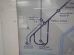
Crossrail’s North-West Essex Extension
One of the elegant parts of Crossrail’s design is its interchange with the Central Line at Stratford station.
- The Eastbound Crossrail and Central Line platforms share an island platform.
- The Westbound Crossrail and Central Line platforms share an island platform.
This arrangement allows step-free cross-platform interchange between the two lines.
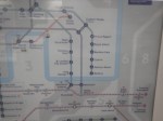
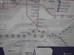
This map, which was clipped from Wikipedia, shows the North-Eastern end of the Central Line.
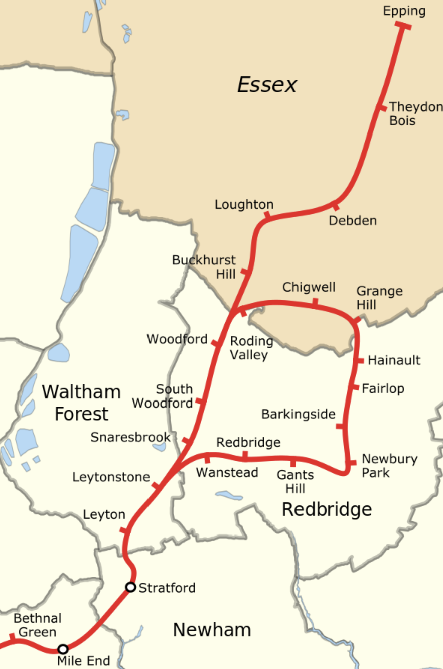
I am sure, that those who live to the North-East of Stratford station will be some of the residents of London, who benefit the most from Crossrail.
The following stations are step-free.
- Buckhurst Hill
- Debden
- Epping
- Hainault
- Newbury Park
- Roding Valley
- South Woodford
- Stratford
- Woodford
I suspect more stations will be made step-free.
Cross-Platform Interchanges
It was originally planned, that a similar cross-platform interchange would have been built at Walthamstow Central station, that would have allowed the Victoria Line to continue to Woodford.
As the Stratford interchange works so well, I’m surprised the track layout hasn’t been used at more places on London’s rail network.
The Whitechapel Reverse
In Is Whitechapel Station Going To Be A Jewel In The East?, I discussed the importance of Whitechapel station.
Whitechapel station solves the round-the-corner problem for passengers, who want to go between say Romford and Woolwich stations.
Passengers just walk the few metres between the two platforms at Whitechapel station and take the first train to their destination.
I will be interested to see if Crossrail has an effect on traffic over the Dartfood Crossing and through the tunnels. How many will use Crossrail instead, when they are visiting their team, clients or family on the other side of the river?
I call stations like Whitechapel reversal stations, as they allow passengers to easily reverse direction. There is more about reversal stations in Reversal Stations.
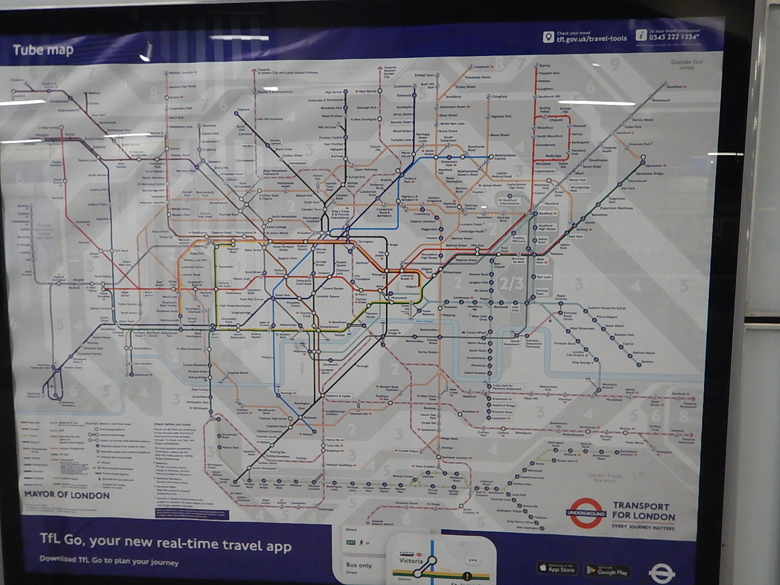
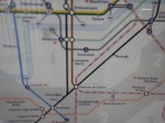
The New Tube Map
These pictures show the new tube map.
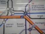
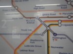
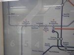
Note.
- Crossrail is shown as a double purple line.
- Thameslink is also shown as a double pink line.
- There are certainly some drawing gymnastics to fit it all in.
But Harry Beck’s design survives.
Abbey Wood Station
The more I look at the design of Abbey Wood station and compare it to the Crossrail/Central interchange at Stratford, the more I think it is a substandard station.
Would it have been better, if one island platform had been designed for Westbound services and the other had been designed for Eastbound services? Crossrail services might be on the outside with North Kent services between the two island platforms.
This would have enabled a journey between say Rochester and Bond Street to have been done with a simple cross-platform change at Abbey Wood station.
No Victoria Line Interchange
I was surprised by these omissions.
This article on London Reconnections is entitled Horrible Holborn: When Postponement Is Not An Option.
It is well worth a read.
One section is entitled The interchange that isn’t, where this is said.
Whilst modelling showed that Bond St and Tottenham Court Road would be capable of managing the expected passengers once the Elizabeth line opens, it was clear that a combined Oxford Circus/Bond St (Crossrail) east entrance could not. If you have ever wondered why the Elizabeth line has no sub-surface interchange with the Victoria line at Oxford Circus despite the eastern ends of the Bond Street platforms being tantalisingly close, this is your answer. As the Victoria line at Oxford Circus is never likely to be able to handle the expected numbers of people that would board if there were direct access from the Bond St Crossrail platforms, it appears the two stations will never be linked with publicly accessible passages below ground.
In other words, you would solve the problem of the interchange between the Elizabeth and Victoria Lines and create severe overcrowding on the Victoria Line.
When I have supper with my son at the Angel, he comes from his home in Walthamstow, via a cross-platform change at Euston.
Routes like this allow those that live on the Victoria Line to access the Elizabeth Line.
No Piccadilly Line Interchange
The article says this about an Elizabeth Line station at Holborn.
It is pertinent to note that an early plan to have a Crossrail station at Holborn was abandoned. In reality, it would have been too close to Tottenham Court Road station to be really worthwhile. It would have restricted the alignment (bearing in mind that sub-surface Crossrail stations have to be straight and level). It would also have added considerable expense and may have put the entire project at risk. At the end of the day, it just wasn’t a good business case. Whilst a station on the scale of the Elizabeth line could not be justified, however, an improvement of the existing Holborn station could.
The article also says that upgrading Holborn station would not be easy, even without the connection to the Elizabeth Line.
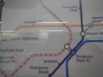
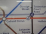
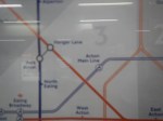
The London Tube Map Gets A New Line
This picture shows the latest London tube map, which now shows the Thameslink network.
Note.
- There is a lot of new pink or red-and-white lines everywhere.
- The lines are numerous in the South-East corner of the map.
- Crossrail is not shown.
These pictures show areas in greater detail.
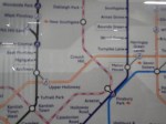
I am surprised that the whole of the Thameslink network has been added.
Thameslink Is Back On The London Tube Map
The title of this post, is the same as that, of this this article on Ian Visits.
Thameslink last appeared on the tub map in 1999.
I’m glad it’s back.
I regularly use Thameslink as a quick route across London, especially, if I want to go to Tate Modern, as the gallery is a short walk from Blackfriars station.
Darlington Station – 28th October 2020
I went to Teesside to have a look round yesterday.
These are my thoughts on Darlington station.
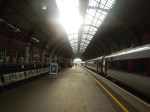
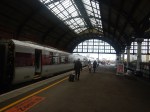
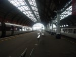
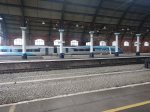
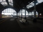
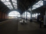
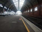
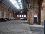
Platform 1 And Platform 4
These pictures show the two main platforms at Darlington station.
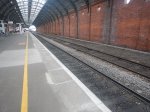
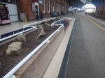
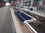
Note.
- They are affectively a very wide island platform.
- Platform 1 handles all trains going South and East to Middlesbrough and Saltburn.
- Platform 4 handles all trains going North and West to Bishop Auckland.
- The platforms are well over 200 metres long.
- Both the main platforms have a second track, between the current track and the walls of the station.
- Both main platforms have a large clock.
- Platform 1 has some innovative seating.
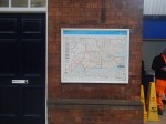
- Uniquely, there is a London Rail Map on the London-bound Platform 1. Every London-bound platform needs a copy of this map, but they are very rare.
They appear to handle all the current services easily.
There is certainly a lot of space to improve the station.
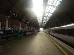
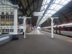
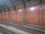
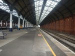
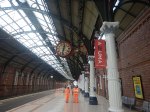
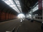
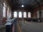
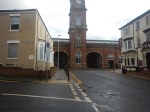
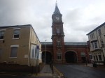
Station Structure
The station stricture is probably best described as grand, stylish and Victorian and it appears to be in good condition.
- The tracks through the station are enclosed in two large brick walls.
- A roof of the period, is supported on the walls and a number of perhaps forty cash-iron columns.
These pictures give a flavour of the station.
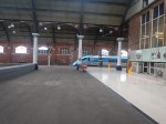
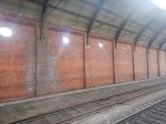

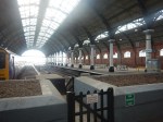
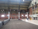
There must be few better station structures than Darlington in the UK and as it is Listed Grade II*. I would expect this is recognised by English Heritage.
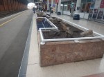
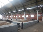
The Southern Bay Platforms
There are two bay platforms at the Southern end of the station.

There were bay platforms at the Northern end, but these have now been removed.
I wonder, if these two bay platforms could be invaluable in the expansion of services both on the Tees Valley Line and generally in the area.
Current plans envisage the following.
- Four trains per hour (tph) between Saltburn and Darlington.
- Two tph between Darlington and Bishop Auckland.
One obvious way to achieve this objective would be to do the following.
- Run two tph between Saltburn and Bishop Auckland. These trains would run as now with Saltburn services using Platform 1 and Bishop Auckland services using Platform 4 at Darlington station.
- Run two tph between Saltburn and Darlington. These trains would use Platform 2 at Darlington station.
The advantages of this are.
- To get to Middlesbrough or Saltburn, you would go to the island Platform 1/2, as you do now.
- To get to Bishop Auckland, you would go to Platform 4, as you do now.
- If battery trains were to be used the bay platforms would be ideal for a Vivarail Fast Charge system
There would probably need to be some changes to the tracks serving Platform 1 and 2.
Other possibilities might include.
- Darlington might also be a useful terminal for a service to Whitby via Middlesbrough.
- Using the station as a Northern terminus for an Express Parcels Service from London.
Lengthened platforms able to take a five-car Class 802 train, could be useful for service recovery.
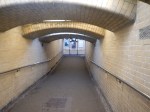
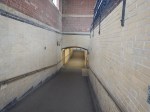
The Western Pedestrian Entrance To The Station
Darlington Town Centre lies to the West of the station and these pictures show what probably was a very grand entrance to the station connected to it by a subway.
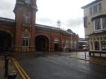
This Google Map shows the size of the entrance.
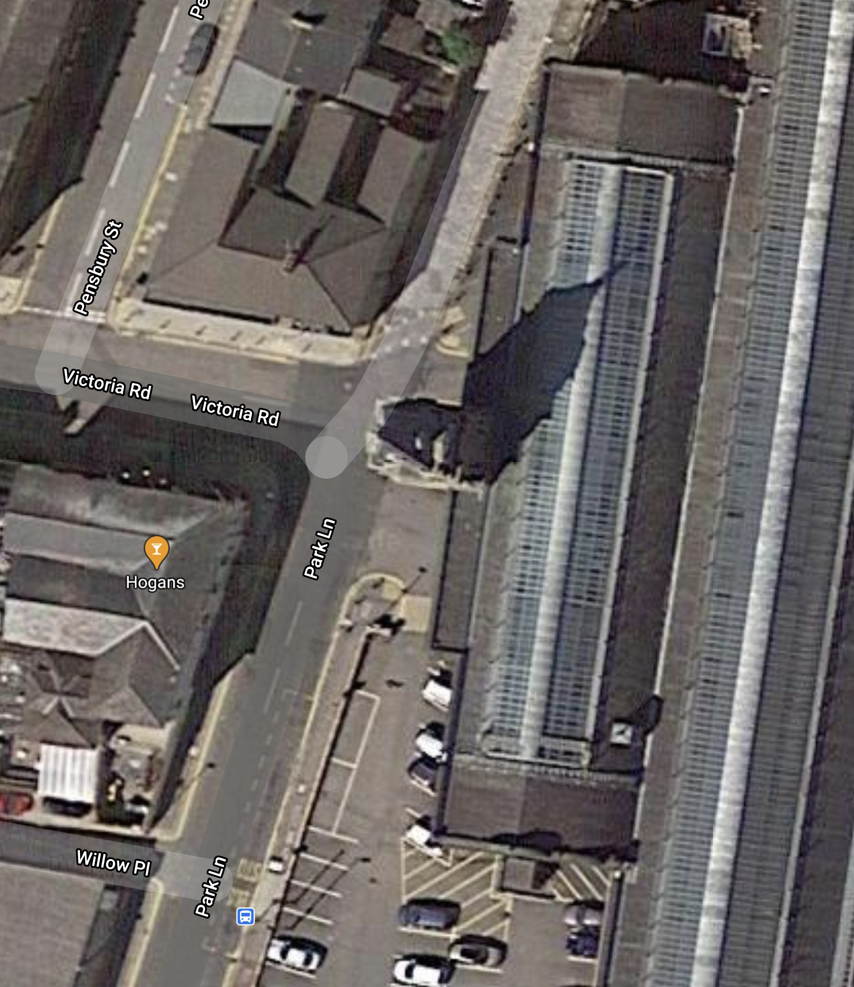
It is one of those buildings that would be described by a certain breed of estate agent, as having development potential.
- There are no lifts to the subway.
- It could be turned into a retail experience.
- Does the clock tell the right time?
- Buses were signposted in this direction, but there appeared to be little information.
Surely, it could be turned into an asset to both the railway and the town.
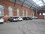
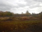
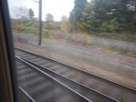
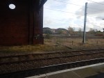
The Southern Approaches To The Station
These pictures show the Southern approach to the station.


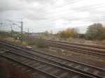


The Tees Valley Line to and from Middlesbrough and Saltburn joins to the South of the station and trains going to Bishop Auckland have to cross over the two tracks of the East Coast Main Line.
This Google Map shows the track layout just to the South of the station.
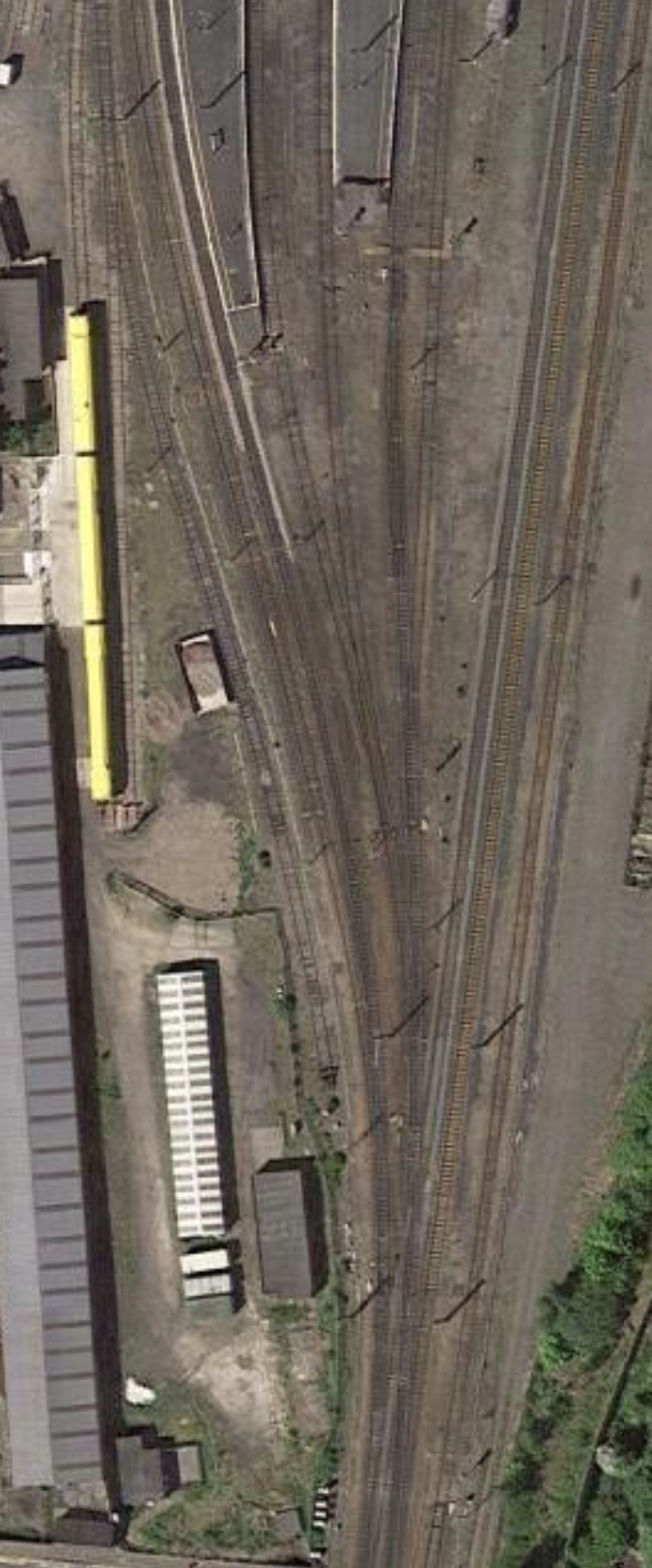
Note.
- The Southern ends of the platforms can just be seen at the top of the map.
- Platforms are numbered 1 to 4 from West to East.
- The two avoiding lines going past the East side of the station.
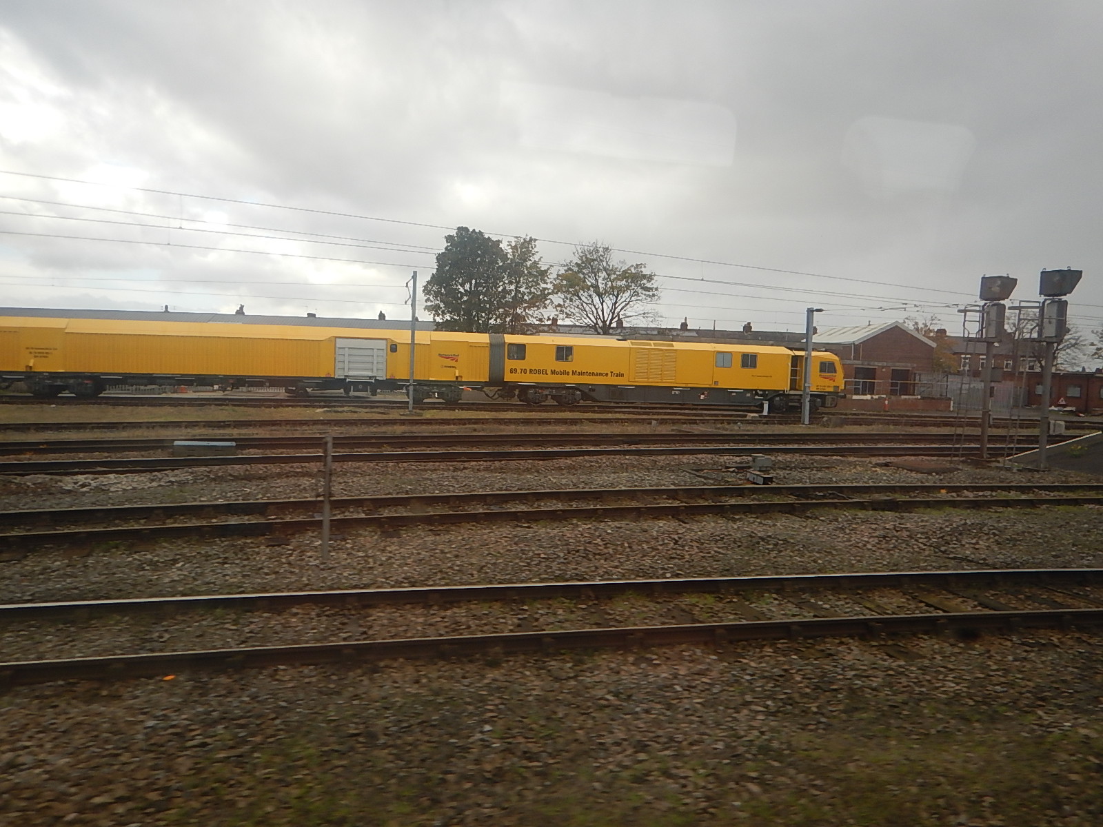
- The yellow train is one of Network Rail’s Mobile Maintenance Trains.
The Mobile Maintenance Train was parked in the same place yesterday, as this picture shows.
The second Google Map shows Darlington South Junction, where the Tees Valley Line from Middlesbrough joins the East Coast Main Line.
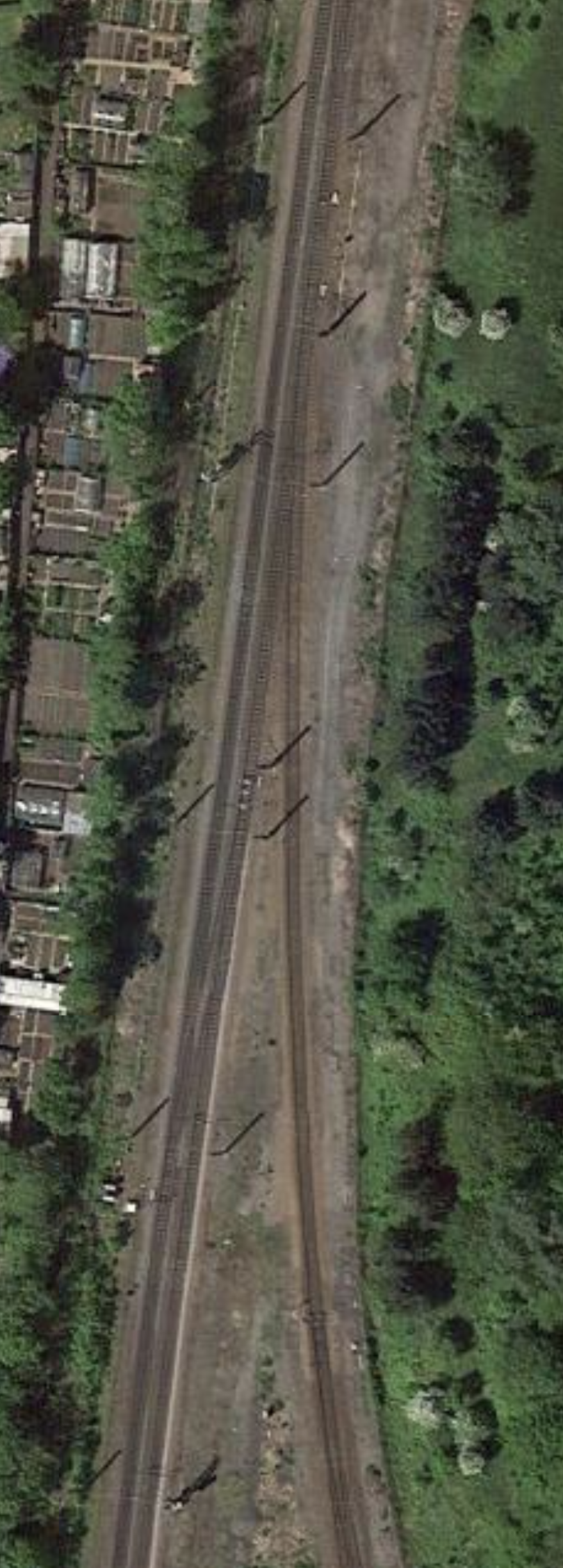
These two maps indicate the problem of train operation at Darlington.
A train between Bishop Auckland in the West and Middlesbrough and Saltburn in the East, can sneak down the Southbound East Coast Main Line and take the Tees Valley Line to continue on its way.
But a train going the other way, needs to cross both tracks of the East Coast Main Line on the flat, which means precision working by drivers and signallers, to avoid causing delays to both main line and local trains.
I suspect all the following are true.
- The number of London and Scotland expresses will increase.
- London and Scotland expresses will be running faster.
- The number of freight services on the route will increase.
- The number of services between Bishop Auckland and Saltburn will increase from the current hourly only service.
- High Speed Two will eventually start to run services between London and Birmingham, and at least as far North as Newcastle
All will make the need for improvements South, and probably North, of Darlington station increasingly important.
Could it be that the simplest solution would be to create a dive-under?
- It would only need to be single-track.
- It could probably be built without affecting current services, as was the Acton dive-under.
- There would appear to be plenty of space.
It would only need to allow trains from the Eastern branch of the Tees Valley Line to access Platform 4 at Darlington station.
High Speed Two Is Coming
High Speed Two is coming to Darlington and I wrote about that in £100m Station Revamp Could Double Local Train Services.
This was my conclusion about what will happen to services at Darlington in that post.
I think that this will happen.
- The Tees Valley Line trains will be greatly improved by this project.
- Trains will generally run at up to 140 mph on the East Coast Main Line, under full digital control, like a slower High Speed Two.
- There will be two high speed platforms to the East of the current station, where most if not all of the High Speed Two, LNER and other fast services will stop.
- There could be up to 15 tph on the high speed lines.
With full step-free access between the high speed and the local platforms in the current station, this will be a great improvement.
So what will the step-free access be like?
The young assistant in WH Smith told me that a hole will be made in the wall on the East side of the current Platform 1.
It does seem that a new bridge could reach over all the platforms with an entrance for the Town Centre in a refurbished Western entrance.
Passengers would arrive by high speed train every few minutes from the South, Newcastle or Scotland.
- Those for the Town Centre would walk across the bridge and exit the station in a refurbished Western entrance.
- Those needing onward local train travel would descend into the current station to catch another frequent train.
- Hopefully, there would be space somewhere for a bus station.
It would be a real gateway station for Darlington.
Put Thameslink On The Tube Map Says London Assembly
The title of this post is the same as that of this article on Ian Visits.
This is the introductory paragraph.
A report on improving accessibility on London’s Transport services has called for the fully accessible Thameslink line to be on the Tube map as a matter of some urgency.
I’m all for this happening.
I use Thameslink quite a bit, as if I’m in some places South of the River and am coming home, taking Thameslink to West Hampstead Thameslink and then using the Overground to Canonbury, from where I walk home, is a convenient route.
- It is step-free.
- There is a Marks and Spencer at West Hampstead, where I can do a bit of food shopping.
- Walking from Canonbury station to my house is gently downhill.
These are some other thoughts about Thameslink,
The Underground Train With A Toilet
Sometimes, I also find it doubly-convenient, as I need to spent a penny or more. Often, the toilets on Thameslink trains are free in the tunnels under London!
How many other Underground trains have toilets?
Obviously, Eurostar does, but does anybody know of any other trains that run deep under the surface, that have toilets?
Do Thameslink Want The Extra Passengers That Being On The Map Would Bring?
This may seem a dumb question, but sometimes, I do wonder, if the answer is that they don’t!
Thameslink Would Surely Make A Good Travel Partner For Eurostar
Increasing, many visitors from the Continent to London and the South East are travelling across the Channel using the excellent Eurostar.
As the Thameslink and Eurostar platforms at St. Pancras International, there could be mutual advantages to both companies to be partners.
Suppose you were travelling on these routes.
- Paris and Gatwick
- Brussels and Greenwich
- Amsterdam and Brighton
- Rotterdam and Luton Airport
And for one reason or other you didn’t want to fly; climate change, you like trains, awkward baggage or just plain fear of flying.
Surely, using Eurostar and Thameslink would be the obvious travel companies.
Note that Thameslink have posters, saying that they are the ideal way to get to Luton Airport.
Do they have posters, saying they are the ideal way to get to Eurostar at St. Pancras?
If I was running Thameslink, I’d do the following.
- Make sure, that all Thameslink stations accepted contactless ticketing using bank or credit cards.
- Put information and advertising on Eurostar trains and stations, telling passengers how to get to and from any Thameslink station without buying a physical ticket.
- Devise a simple add on ticket, that would be printed on your Eurostar boarding pass or held in Eurostar’s app.
- Market Thameslink to the French as the UK’s answer to the RER.
- Put travel information in at least Chinese, English, French, German, Italian, Japanese and Spanish, at St. Pancras station.
I would think, that a properly thought-out plan, could be a nice little earner for Thameslink.
A Toilet On A London Underground Train
On my short journey between City Thameslink, and London Bridge stations, I sat next to one of the toilets.
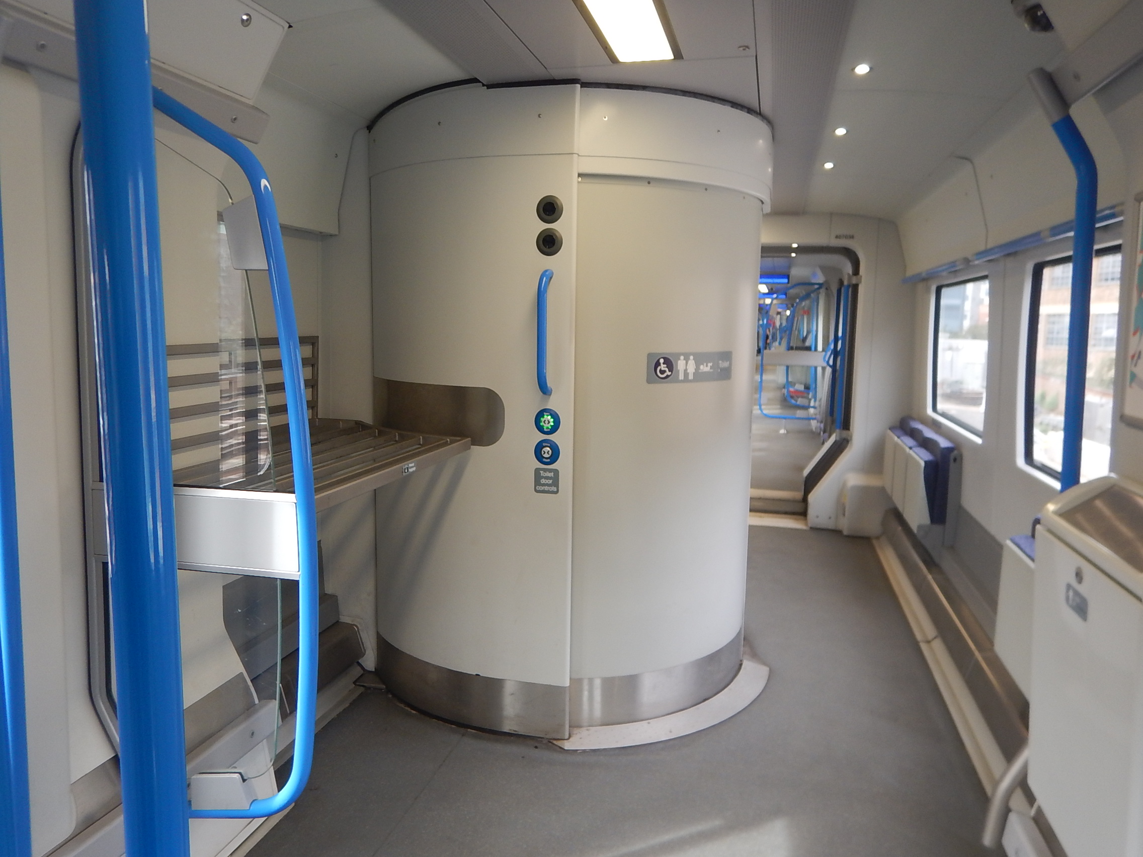
I also made use of the facility.
As there is a lot of pressure to show Thameslink on the Tube Map, will these trains become the only trains on the Underground to have toilets?
As modern controlled emission toilets, don’t throw anything on the tracks, they can be safely used anywhere.
The Shape Of Things To Come
Yesterday, I needed to go between Moorgate and Tottenham Hale stations.
It was just before the evening Peak and I took the escalators down to the Northern City Line platforms, where a new Class 717 train was waiting.
The increased capacity meant I got a seat and I took the train three stops to Highbury & Islington station.
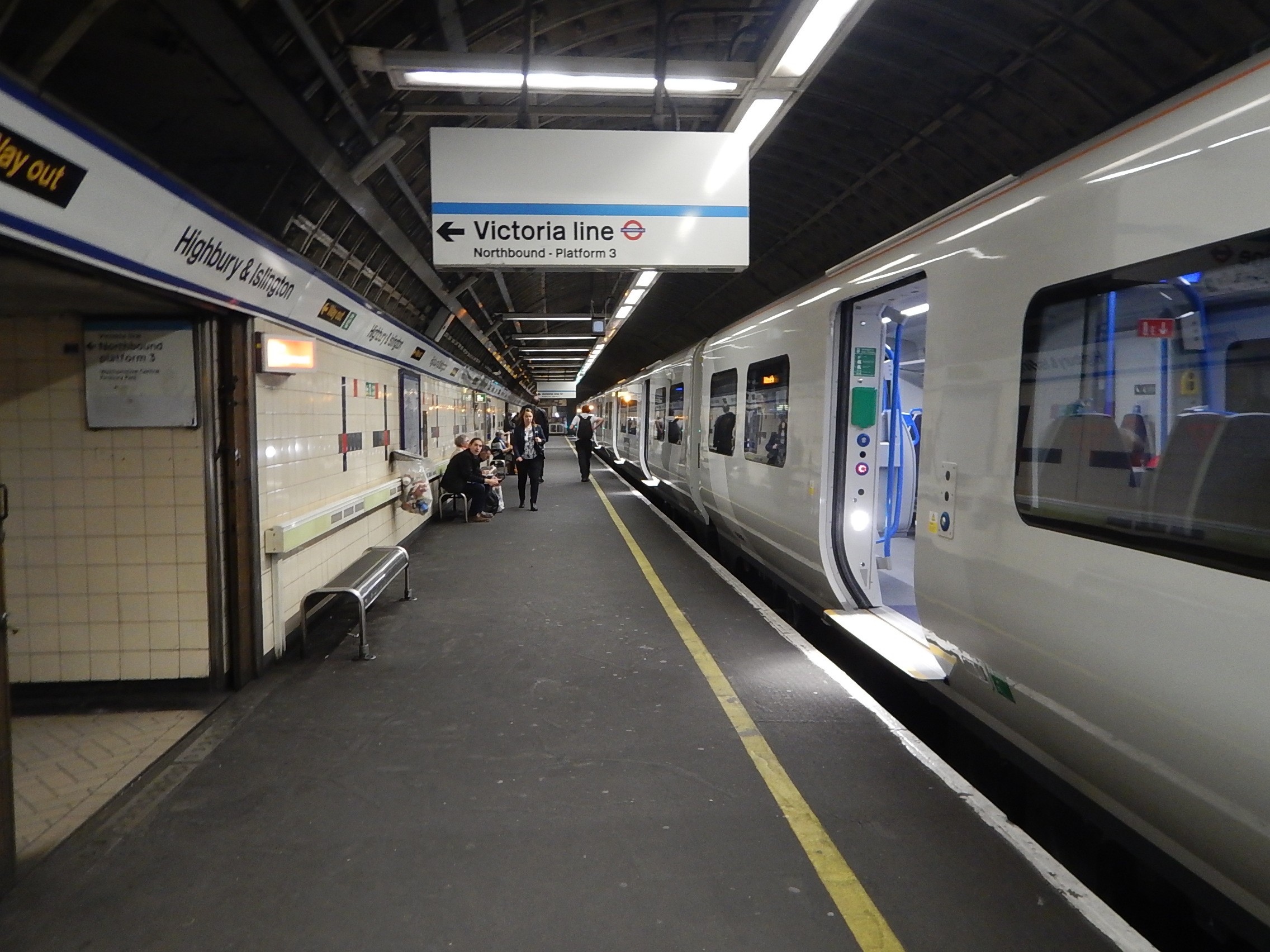
It was then just a walk through a very short tunnel to the Victoria Line and a train to Tottenham Hale.
It was so much more relaxed than squeezing into a crowded and very elderly Class 313 train.
After the timetable change in May, there will be eight trains per hour (tph), as there is now, but given the number of trains in the new fleet and signalling improvements in the pipeline, I feel that this frequency will be increased.
It should also be noted that in the Peak there are twelve tph, which in the future could be used all day.
But in the interim, trains with extra capacity will be very welcome.
From An Ugly Ducking To A Swan
These developments are either underway or planned for the next few years.
- Improved signalling on the Northern City Line.
- Full step-free interchange at Finsbury Park between Moorgate services and Thameslink, Piccadilly and Victoria Lines.
- Higher frequencies on Thameslink and the Piccadilly Line through Finsbury Park
- Full step-free access to the Northern City and Victoria Lines at Highbury & Islington station.
- Full step-free access at Old Street station.
- Hopefully, Essex Road station will be cleaned.
- Crossrail will finally arrive at Moorgate station.
North London’s ugly ducking, which has caused passengers, British Rail and London Underground, so much trouble, will finally have turned into a swan.
I always wonder if the City of London’s transport planners, wish that the Victorians had built the planned extension to a new Lothbury station, close to Bank.
What Will Be The Ultimate Frequency?
Currently the frequency between Alexandra Palace and Moorgate stations in the Peak is twelve tph.
Compare this with the following frequencies.
- Crossrail will be initially 24 tph.
- The East London Line is planned to go to 20 tph
- The Piccadilly Line is currently at 24 tph between Arnos Grove and Acton Town stations in the Peak.
- Thameslink will soon be at 24 tph
- The Victoria Line is currently at 36 tph.
I don’t think it unreasonable that a frequency of at least sixteen and possibly twenty tph between Alexandra Palace and Moorgate stations is achievable.
- Digital signalling and Automatic Train Control will be possible.
- If Dear Old Vicky can turn 36 tph at Brixton and Walthamstow Central stations, with two platforms, then surely 20 tph at Moorgate is possible, once there is better access for passengers to the platforms.
- Alexandra Palace to Moorgate is a double-track railway, that is almost exclusively used by Moorgate services.
- 16-20 tph would make the cross-platform interchange with the Victoria Line at Highbury & Islington station very efficient.
- There are two branches North of Alexandra Palace station. I’m sure each could handle 8-10 tph.
- The Hertford Loop Branch has three terminal stations; Gordon Hill, Hertford North and Stevenage stations.
- The East Coast Main Line has two terminal platforms at Welwyn Garden City station.
I could see the following frequencies.
- Moorgate and Gordon Hill – four tph
- Moorgate and Hertford North – four tph
- Moorgate and Stevenage – four tph
- Moorgate and Welwyn Garden City – four to eight tph
It will be a very high-capacity Metro into Moorgate. There could be a need for a few more trains.
But with increased speed.
Should The Northern City Line Be Shown On The Tube Map?
Increasingly, passengers will use the high-frequency Southern section of the Northern City Line between Alexandra Palace and Moorgate stations, as a new tube line.
So like Thameslink, the arguments will start as to whether this line should be on the Tube Map.
If Crossrail is to be shown, it is my view that nThameslink and the Northern City Line should be shown too!
The Surprising Reason For London Underground’s New Heritage Signs
The title of this post is the same as that of this article on IanVisits.
This post will be finished, when I get a few pictures.
But in the meantime read Ian’s article.
