Battery-Poweed Trams To Beat Congestion
The title of this post is the same as that of an article in today’s copy of The Times.
This is the first two paragraphs.
New tram networks could be rolled out in towns and cities across England under government plans to cut congestion and pollution.
The Department for Transport said that so-called light rail systems could help “reduce dependence on private cars”. A report published yesterday said that trams could carry 20,000 passengers an hour in each direction – about four times more than buses.
It goes on to discuss battery-powered trams and their advantages.
It then discusses the future and says that funding for new tram networks could come from the £2.5billion Transforming Cities Fund.
I’ve been trying to find the report, but it doesn’t appear to be on the Department for Transport web site.
Thanks to Peter, the report is called Light Rail And Other Rapid Transit Solutions In Cities And Towns: Call For Evidence and it is on this page of the Government web site.
Has The Canonbury Cross-Over Become More Difficult?
In The Canonbury Cross-Over, I described how it was possible at Canonbury station to change easily from a Westbound train on the North London Line to a Southbound-train on the East London Line.
Services through Canonbury station on the East London Line in trains per hour (tph) are.
- Four tph between Highbury & Islington and Crystal Palace stations.
- Four tph between Highbury & Islington and West Croydon stations.
This means that eight tph call in Platform 2 at Canonbury station.
Services through Canonbury station on the North London Line used to be.
- Four tph between Richmond and Stratford stations.
- Two tph between Clapham Junction and Stratford stations.
This means that six tph call in Platform 3 at Canonbury station.
Since the December 2018 Timetable Change, two tph have been added to the Clapham Junction service.
So now both services calling at Platform 2/3 have the same frequency of eight tph.
So Why Does The Canonbury Cross-Over Appear To Be More Difficult?
Today, I was coming from Stratford on a Richmond train and was changing to the East London Line to Dalston Junction station, from where I can get a bus from outside the station to my house.
It takes a bit longer, but I was carrying my weekend shopping and as Dalston Junction station has lifts, if you need them and Dalston Kingsland station doesn’t, A lot of passengers, seem to use the Canonbury Cross-Over, when they are going from Stratford to stations on the East London Line.
As my train arrived at Canonbury station, in Platform 3, a Southbound-train was leaving Platform 2. So I had a wait of seven minutes in the rain for the next train to Dalston Junction station.
Since the Timetable Change, it appears that I am having to wait for several minutes a lot more.
Look at these times from the 6th of February. The time is when a train on the North London Line calls in Platform 3 and the integer is the number of minutes before the train calls on the East London Line in Platform 2.
- 1150 – 7
- 1157 – 0
- 1205 – 7
- 1212 – 0
- 1220 – 7
- 1227 – 0
- 1235 – 7
- 1242 – 2
- 1250 – 7
- 1257 – 0
- 1305 – 7
- 1312 – 0
- 1320 – 7
- 1327 – 0
- 1335 – 7
- 1342 – 0
- 1353 – 4
- 1357 – 0
- 1405 – 7
- 1312 – 0
In some cases two Southbound trains call between two Westbound ones.
Quite frankly, it’s crap!
Why?
I am no expert on railway timetabling, but if I look at the timetable, it appears that the two trains often seem to be timetabled to arrive at the same time.
As Southbound trains on the East London Line have only come one stop from Highbury & Islington station, are they more likely to be on time, than North London Line trains that have come all the way from Stratford station.
So like today, do North London Line trains arrive after the East London Line train has departed?
Conclusion
The timetable needs to be improved.
Would it be possible to timetable the East London Line trains a couple of minutes after those on the North London Line?
The Surprising Reason For London Underground’s New Heritage Signs
The title of this post is the same as that of this article on IanVisits.
This post will be finished, when I get a few pictures.
But in the meantime read Ian’s article.
Drax Becomes First Wood-Burning Power Plant To Capture Carbon
The title of this post is the same as that of this article on the Financial Times.
This news has been treated in a more sensationalist way by other news media and sites, but the FT gives it very straight.
Drax power station is running an experiment, that removes a tonne of carbon dioxide a day.
But that is only the start of the process and most of it is released to the atmosphere.
They are currently, looking for profitable and environmentally-friendly ways of disposal, including selling it to beer manufacturers.
Didn’t we have a carbon-dioxide shortage a few months ago?
DfT Consulting On Plans To Expand Pay-As-You-Go Rail Travel Nationwide
The total of this post is the same as that of this article on Rail Technology Magazine.
I can’t see what the problem is.
- My bank card would be linked to my Freedom Pass and Senior Railcard on either a ticketing web site or even better on my on-line bank account.
- If it were the latter, then when I checked my bank account, as I do regularly, I could also check my travel.
- I would then just touch in and touch out for each journey.
- The central computer would then give me the best price for my journey.
As an example, if I went to say Oxford, I would only be charged between the Zone 6 boundary, which is my Freedom Pass limit and Oxford station.
I would not need to buy an extra ticket.
This is all well and good for those with UK bank accounts, but how would it handle other eventualities?
Overseas Visitors
If say one of my overseas friends was in the UK, they would just use a contactless bank card.
If they had a Railcard, as several do, they would register the link on a ticketing web site.
Advance Tickets
These could still be bought on-line or at a booking office as now.
Buses, Taxis and Trams
The system should be extended to buses, taxis, traims and any other future transport systems like cable-cars and pod systems.
Conclusion
It would be a very complicated computer system to program, but most of the work has already been done for London and is working successfully.
It would make the UK’s public transport system one of the most passenger-fruendly in the world.
What would that do for ridership? And tourism?
Row Erupts Over Decision To Scrap Glasgow Rail Link For Transport Pods
The title of this post is the same as that of this article on Global Construction Review.
This is the first two paragraphs.
A row has broken out over a decision to cancel a direct rail link between Glasgow Airport and the town of Paisely, just east of Glasgow, in favour of exploring a self-driving transportation pod system.
The direct rail link was announced as part of a £1.1bn investment in the Glasgow City Region deal agreed in 2014 and was expected to be operational by 2025.
I am not sure, which system I prefer, but then I’m a rather different type of airport traveller.
- I generally travel alone.
- I rarely have anything more than a man-bag and a small hold-all.
- I want convenience and can easily walk up to a kilometre with my hold-all.
- I only fly Ryanair as an airline of last resort.
But what annoys me most, is if to get to the Airport, I have to scratch around buying a ticket for the link from the station to the Airport.
At all London Airports, except Luton, you buy a ticket to the airport station or use a contactless card.
Luton is introducing an automated shuttle between the airport and Luton Airport Parkway station and if it is not free, I’ll never use the airport.
A Tram-Train Rail Link
Edinburgh and Manchester Airports have tram links between the Airport and the City Centre, so I can’t see any problems with a tram-train link, that instead of dropping you on the street in the City Centre, as a tram would do, drops you in a railway station.
The way Manchester is thinking about tram-trains, I wouldn’t be surprised to see them at Manchester Airport.
Based on what I have seen in Sheffield, I don’t believe there would be any serious problems developing a tram-train link to Glasgow Airport..
However, these could be issues.
- Is there enough spare capacity on the Inverclyde Line?
- The tram-train link would go to Paisley Gilmore Street and Glasgow Central stations, but what if your local train service to Glasgow goes to Glasgow Queen Street station.
Would many people still use their cars to get to the Airport?
A Pod System
I wrote about the proposed pod system for Glasgow Airport in An Innovative Scheme For A Rail Link To Glasgow Airport.
It has its plus points, but I worry that getting the right number of pods to provide a good service might be tricky.
Would many people still use their cars to get to the Airport?
IThe Connection In Glasgow
Glasgow’s problem is that both these links connect into the centre of Glasgow at Glasgow Central station.
So if your connection to Glasgow comes into Glasgow Queen Street station, you will have to hump your bags across the City Centre.
A plan has existed for years to create Crossrail Glasgow, which would make matters easier.
But nothing has so far been decided.
Conclusion
There is no point in building any form of link to Glasgow Airport, unless Crossrail Glasgow is built.
Otherwise, passengers with an indirect route to Glasgow Central station will still drive or avoid the airport entirely.
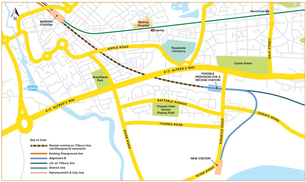
The Junction Between The Barking Riverside Extension And The Tilbury Line
This map from carto.metro.free.fr shows the route of the Barking Riverside Extension of the Gospel Oak to Barking Line and how it connects to the c2c lines between Barking and Tilbury.

One big advantage is that the two c2c lines between Barking and Tilbury, go either side of the Barking Freightliner Terminal.
- The Down Tilbury Line between Platform 7 at Barking station and Dagenham Dock station goes around the Northern side.
- The Up Tilbury Line to Platform 8 at Barking station goes around the Southern side.
This is extremely convenient, as there is plenty of space between c2c’s busy tracks to build the flyover.
If you want to get a better look, click on the map and this will give you a larger image on which you can follow the two tracks from Dagenham Dock station.
This second map from carto.metro.free.fr, shows the complicated tracks to the West of the Freightliner Terminal.
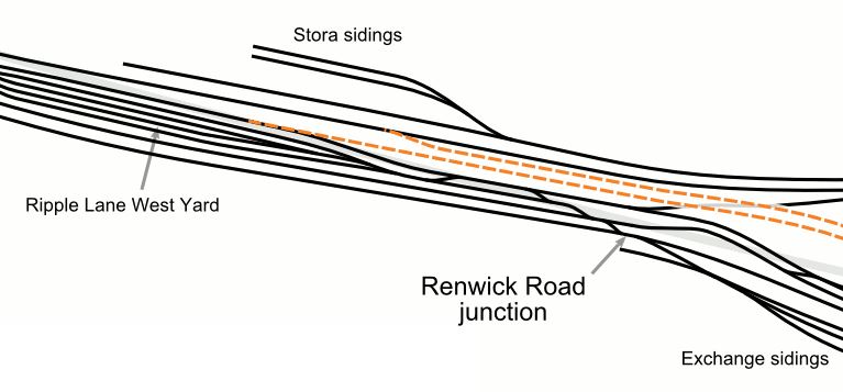
The Renwick Road bridge goes North-South over the tracks. I appears to cross, at the point, where the Stora sidings join the East-West track.
Note how the two new tracks connect the flyover to tracks that connect to Platforms 7 and 8 at Barking station.
This is a Google Map which shows where the Renwick Road bridge crosses the tracks.

The two new tracks will need to be squeezed under Renwick Road.
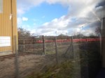
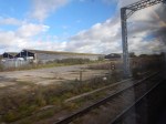
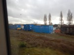
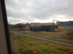
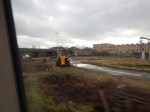
I took these pictures on a walk down Renwick Road, just to the South of the bridge, that takes the road over the railway lines.
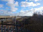
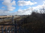
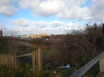

Unfortunately, most of Renwick Road is surrounded by high concrete walls.
But as these pictures show, there is quite a large amount of land crossed by a few sparse railway lines.
I then took a train between Barking and Rainham stations and was able to take a few pictures of work in the area of the proposed viaduct, which will go over the freight terminal.
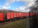

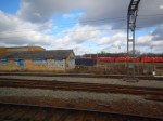
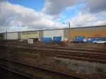
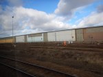
The red train was parked on theStora sidings at the top of the second map.
The top four pictures were taken going to Rainham station and the bottom four were taken coming back.
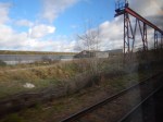
Tilbury Down Line Train-By
These pictures were taken from a train going to Grays station on the Tilbury Down Line.

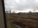


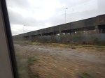
The last two picture show the Renwick Road bridge and the vehicle ramp leading to the freight terminal.
The Design Of The Viaduct
It looks to me, that two new tracks will do the following.
- Start to the West of Renwick Road bridge, with connections that take them to Platforms 7 (Down) and 8 (Up) at Barking station..
- Go through the safeguarded site of the future Renwick Road station and under Renwick Road.
- Climb on a viaduct, that will lift them over the freight terminal and the lines to Tilbury and continue to Barking Riverside.
It could be a spectacular ride.
Renwick Road Station
I walked to the Renwick Road bridge from the Renwick Road bus stop on the 173 bus from Dagenham Heathway station.
It was about four hundred metres along broken pavements and in freezing cold, but dry weather.
So a Renwick Road station will be appreciated by those, who live and/or work in the area.
Wikipedia says this about Renwick Road station.
The station would lie east of the proposed merge / diverge points with the Essex Thameside (Tilbury Loop Line) line along which c2c services operate, so whilst the station would not provide an interchange with the aforementioned c2c services, nor would the station’s construction disrupt those services. The new station could generate 5,000 homes.
This Google Map shows the land to the West of Renwick Road bridge.

Note.
- The Stora siding at the top, where the red train was parked.
- The Down Tilbury Line going West-East towards the top of the map and connected to the sidings.
- The three lines towards the bottom of the map are currently the Down Goods, Up Goods and Up Tilbury
It could be that Network Rail could have decided to put the new Renwick Road station in the ample space between the lines.
The station could be very simple.
- A single island platform between the two tracks.
- The tracks could be generously spaced to allow a wide platform.
- The platform would have shelters and perhaps a coffee stall.
- The platform would be linked by stairs and a lift to Renwick Road.
It could certainly be built without disrupting c2c services.
Travelling Between Fenchurch Street And Renwick Road Stations
According to the Wikipedia extract, I included earlier, Renwick Road station, will not have a direct service to Fenchurch Street station.
Renwick Road station will be served by at least four London Overground trains per hour (tph) all day between Gospel Oak and Barking Riverside stations.
Currently, c2c provide the following services between Fenchurch Street and Grays station.
- Four tph in the Peak
- Two tph in the Off Peak
It is also planned that both services will share Platforms 7 and 8 at Barking station.
So passengers from Renwick Road and Barking Riverside stations wanting to go to London will get off a train on Platform 8 at Barking station and wait for the first c2c service to Fenchurch Street station.
I would also suspect that c2c will increase the Off Peak service to match the frequency of the Gospel Oak to Barking Riverside service.
Beam Park Station
Beam Park station is another new station planned for the area.
- It will be between Dagenham Dock and Rainham stations.
- It will be built to serve three thousand new houses.
This station will make it more likely that c2c will run four tph between Fenchurch Street and Grays stations.
Travelling Between Grays And Barking Riverside Stations
This will require a change at Barking station.
This change would be a walk across the island platform 7/8, which would be step-free.
Conclusion
Train services along the Thames from Barking to Grays are going to get a lot better.
Plans To Pedestrianise Bank Junction In The City Of London
The title of this post is the same as this article on IanVisits.
Bank Junction is the heart of the City and to pedestrianise it and just allow cyclists and buses could create a central focus for the City, where people will meet just as they do at other important squares like Trafalgar and others all over the world.
In a couple of years time, Bank Underground station will be an extremely well-connected step-free station, with even more entrances.
Taken with the pedestrianisation of the junction, the two projects will transform access to the City of London.
Further pedestrianisation in the area is also on the cards, which will make things even better.
The Design Of Barking Riverside Station
The information is coming together about the new Barking Riverside station.
Wikipedia
The Wikipedia entry at the moment is not very information, but it does say that the station has two platforms.
Location
This map from Transport for London, shows the location of the station.
The location of Barking Riverside station is at the end of the branch line that comes South from the Barking to Tilbury Line.
As it is a long term ambition of Transport for London to extend the railway under the River to Abbey Wood station, the North-South orientation of the station is probably important.
carto.metro.free.fr
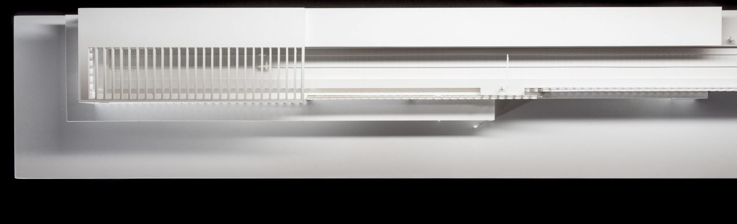
This map from carto.metro.free.fr gives the layout of Barking Riverside station and the tracks leading to it.
It shows two tracks leading to a two-platform station, with a crossover to allow both platforms to be used.
The Architect’s Visualisations
These are available on this page on the Moxon Architect’s web site.
This is the first visualisation on the site.
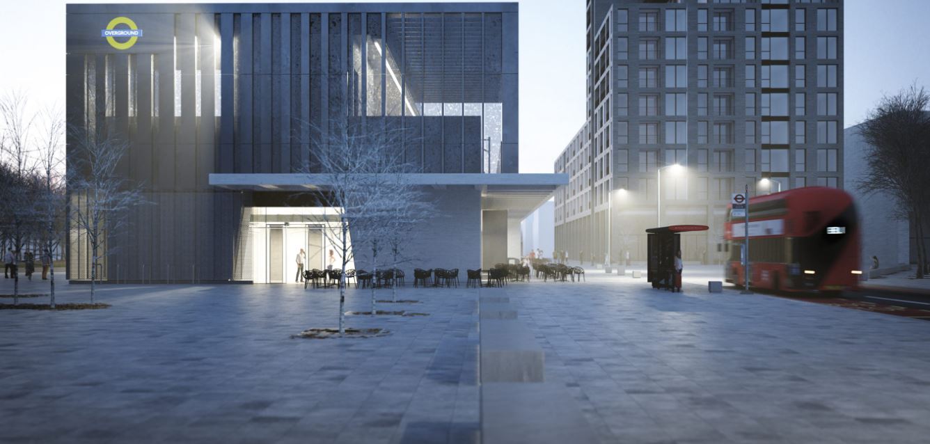
It shows the end view of the station and as no railway lines are visible, I assume that it is looking North, so the River Thames is behind the viewer and Renwick Road is on the left.
This is the second visualisation.
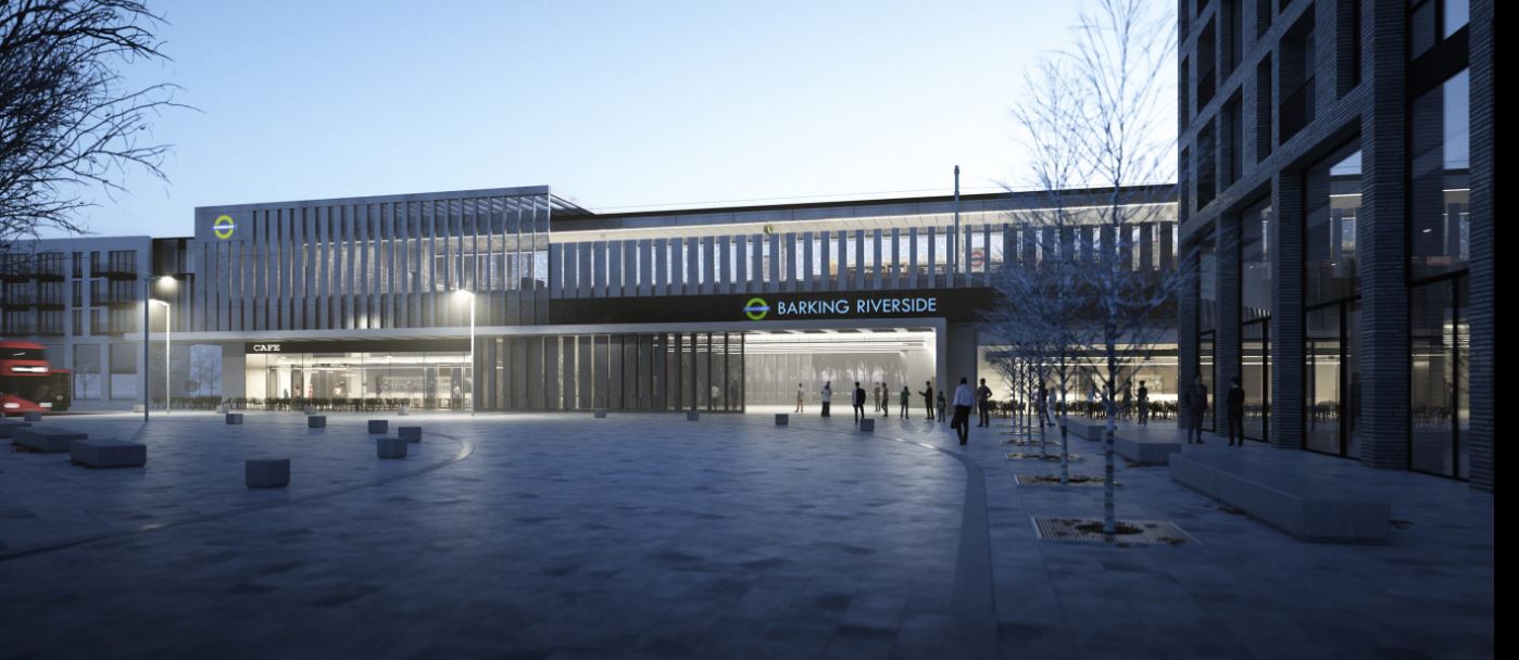
It shows the station looking from the East towards Renwick Road. Note the bus in both images.
As at Hackney Wick station, there is an underpass, so the station is not a barrier to pedestrians.
The seventh visualisation shows the station from above.
It only shows one platform in the image, as do other visualisations.
Is It A Single Platform Station?
Is this the way the station will be built or is it just to make the visualisation simpler?
A single platform station should be able to handle six trains per hour (tph).
- This year, this frequency will be implemented between single platforms at Highbury & Islington and Crystal Palace stations on the Overground.
- The Gospel Oak to Barking Line will have a maximum frequency of five tph in the Peak.
- The infrastructure and the trains will all be brand new and use the best technology.
So it looks like a single platform station should be able to handle the planned number of trains for the simple extension to Barking Riverside station.
Will There Be Electrification?
This is the fifth visualisation.
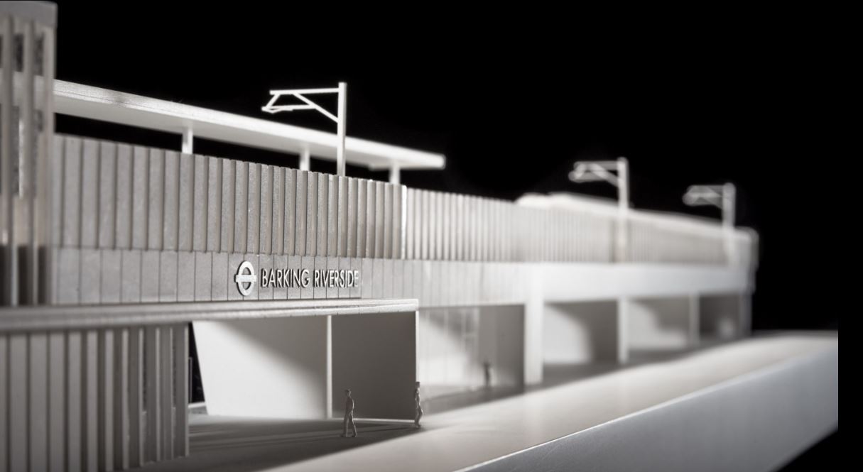
It clearly shows gantries for overhead wires.
But it appears that only one platform is there.
I have thought for some time, that the Barking Riverside Extension could be built without electrification and battery/electric trains could be used.
I laid out my views in Don’t Mention Electrification!.
- All Aventras are wired for on-board electrical storage.
- The Barking Riverside Extension is only 1.5 km long.
- The area of the extension has some very large electricity pylons, that the extension has to dodge through.
- If the line is extended under the Thames, it would be cheaper to build a tunnel for third rail, as it will connect to third-rail lines on the South Bank.
- There must be substantial savings by not putting up overhead wires.
- A safer and more reliable railway in extreme weather.
I also repeated my views in an article in Rail Magazine, which I described in I’ve Been Published In Rail Magazine.
No-one has told me that they disagree with my views.
So why are electrification gantries shown?
- Transport for London or Network Rail don’t believe that battery/electric trains are possible. This is unlikely, as battery/electric trains have been successfully demonstrated in the UK and elsewhere, and ordered for Wales and Liverpool.
- Obviously, there has to be a backstop if conventional electric trains have to be used. So, provision is being made to electrify the extension.
- The single platform is electrified, so that a battery/electric train can be fully-charged before it returns towards Barking and Gospel Oak.
If before the station is built, it is decided that electrification is not needed, the overhead wires can be omitted from the construction phase.
I do feel though, we will know more about the performance and reliability of battery/electric trains in a few years, and we will alter the designs of overhead electrification accordingly.
Extending Across The River
The station has been built to enable extension to Abbey Wood station on the other side of the Thames.
There are probably several designs that would fit with the current station.
The simplest is probably to install a second platform and connect both to a tunnel under the river or a bridge over the river.
This would have several disadvantages.
- A lot of the station would need to be demolished.
- The train service to Barking Riverside station might have to be stopped for several months, during construction.
- All services would have to cross the river.
A better option is probably to install the second platform on a track, that goes under the river in a tunnel.
- The single tunnel portal would require less land take, as it could be very close to Barking Riverside station.
- The tunnel under the river could be a mix of single or double track, to create the most affordable tunnel.
- The current single platform would become a bay platform.
- During construction, the service to Barking Riverside station would be able to continue as normal.
- The bay platform could be used for service recovery in times of disruption.
I particular like the idea of a loop railway on the South Bank of the Thames with perhaps four or five stations. Alternatively, it could be a tram-train on the surface.
Conclusion
It looks like the design of Barking Riverside station, is one that will cater for all eventualities.
I am looking forward to taking the first train to the station.
