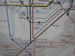
The London Tube Map Gets A New Line
This picture shows the latest London tube map, which now shows the Thameslink network.
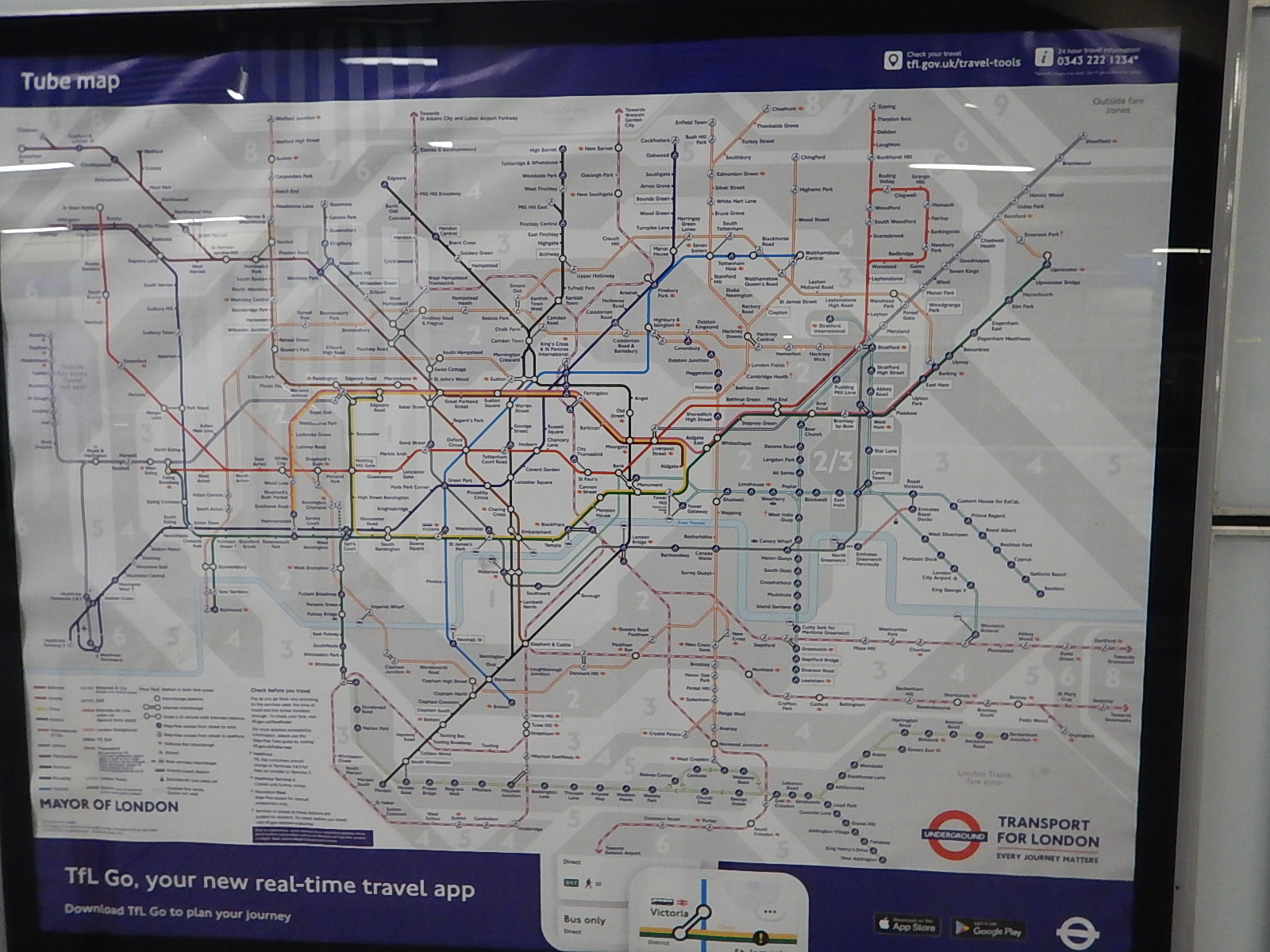
Note.
- There is a lot of new pink or red-and-white lines everywhere.
- The lines are numerous in the South-East corner of the map.
- Crossrail is not shown.
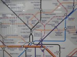
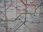
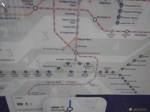
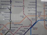
These pictures show areas in greater detail.
I am surprised that the whole of the Thameslink network has been added.
Transport Secretary Urged Not To Derail Aylesbury Spur Plans
The title of this post, is the same as that of this article on The Bucks Herald.
This is the sub-heading of the article.
Leader of Buckinghamshire Council, Martin Tett has written to Transport Secretary Grant Shapps urging him to confirm Government support and funding for the much needed Aylesbury link section of East-West rail.
I think this Aylesbury link needs very careful thinking.
There are certainly a lot of issues to consider.
The Aylesbury Link
The Great Central Main Line used to run from London Marylebone station to the East Midlands and North.
Much of the route closed in the 1960s and the only section with a regular passenger service is that that run by Chiltern Railways, between Marylebone and Aylesbury Vale Parkway station.
North of Aylesbury Vale Parkway this rail link connects to the East-West Rail Link.
It was originally proposed to run a service between Aylesbury and Milton Keynes.
High Speed Two
High Speed Two is the herd of elephants in the room and it could have multiple effects all over the country.
Is High Speed Two For London, The Midlands, The North And Scotland Or For The Whole UK?
The answer surely, is that High Speed Two is for the whole UK.
Train Services Between Wales and the West Of England And The North Of England And Scotland
Consider.
- North Wales is well served by a change at Crewe for passengers from the North and Scotland.
- Mid Wales is served by a change at Crewe or in Birmingham.
- South Wales, Bristol and the West and South-West of England are well-served by high speed trains from London Paddington and Reading.
Could South Wales, Bristol and the West and South-West of England, be better connected to the North and Scotland?
One of the ways to improve these services could be with a connection between High Speed Two and East-West Rail Link to allow trains to connect to the Great Western Railway at Didcot Junction.
Train Services Between East Anglia And The North Of England And Scotland
One of the ways to improve these services could be with a connection between High Speed Two and East-West Rail Link to allow trains to connect to and from Cambridge and East Anglia.
A High Speed Two Station At Calvert
Calvert is a village surrounded by landfill and wildlife sites to the South of where High Speed Two and East-West Rail Link cross to the North of Aylesbury.
This Google Map shows the area.
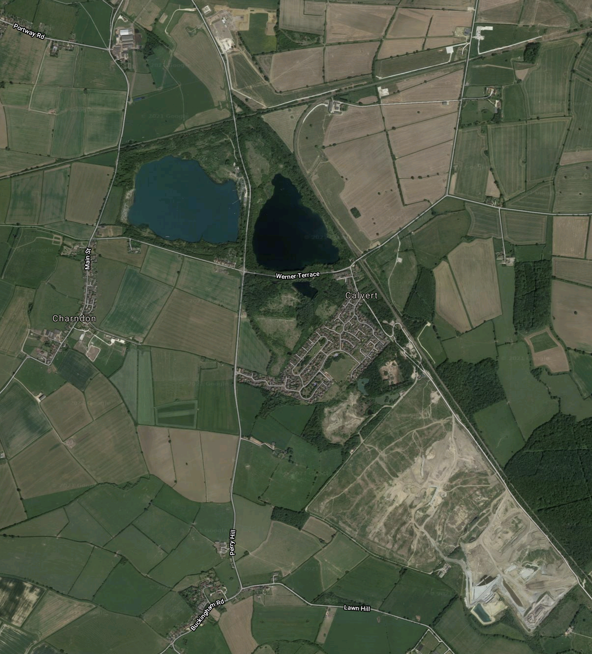
Note.
- Calvert is the village in the middle of the map.
- The light-coloured area to the South-East of the village is one of London’s biggest landfill sites.
- The single-track railway to Aylesbury runs along the North-East side of the landfill.
- To the North of the village, this railway connects to the East-West Rail Link.
This Google Map shows the junction between the two railways in greater detail.
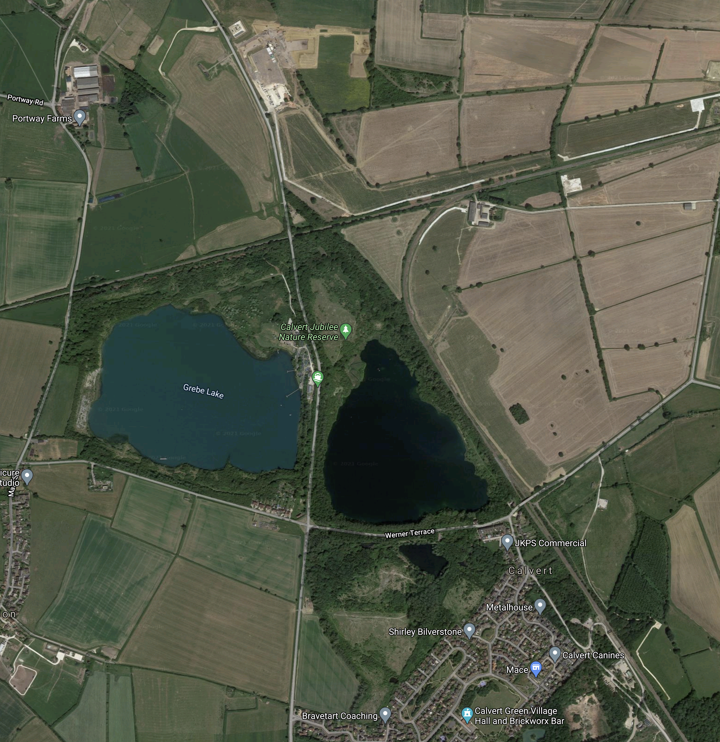
Note.
- The Northern part of Calvert is in the South-East corner of the map.
- The East-West Rail Link crossing across the North of the map
- The railway to Aylesbury running SE-NW across the map, to the East of the village of Calvert.
- The chord connecting the two railways, which allows trains to and from the South to connect to the East.
This map from High Speed Two shows the route of the new railway through the area.
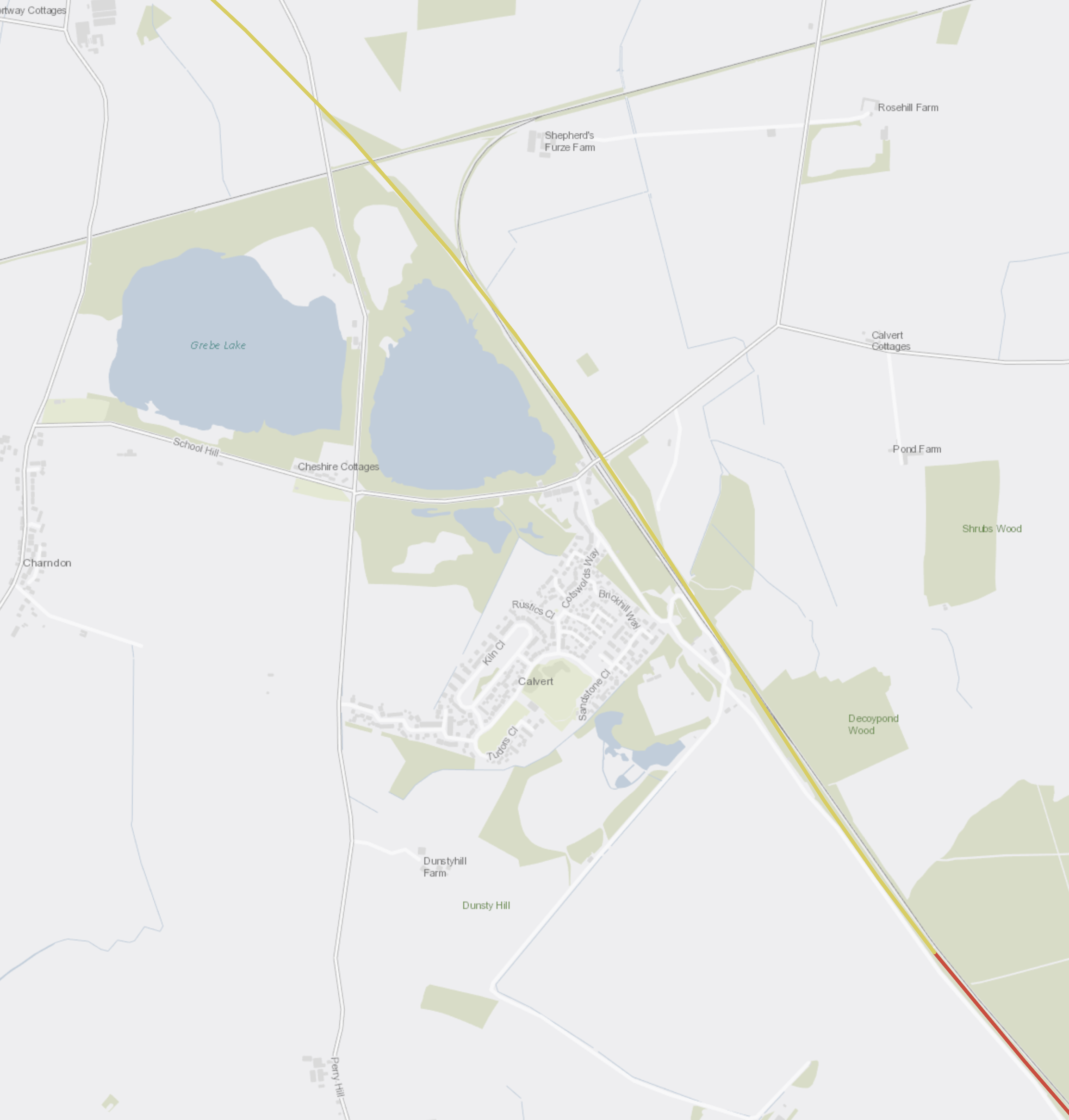
Note.
- High Speed Two is shown in yellow (cutting) and embankment (red).
- High Speed Two appears to run either on the same route or alongside the route to Aylesbury.
The Oakervee Review into High Speed Two, says this on Page 53, about a new station at Calvert in Buckinghamshire.
The Review also heard evidence from a number of informed stakeholders suggesting there should be a new station near Calvert, where HS2 would cross East-West Rail proposals to improve connectivity along the OxfordCambridge corridor. Previously, due to the impact on speed, no interim station had been planned between London and Birmingham Interchange.
The Review concluded that the DfT should consider making passive provision for a future HS2 station near to Calvert. If it is decided that a HS2 station should be built near to Calvert, passive provision will help prevent any disruption to HS2 services. There could be merit in developing an HS2 station in the future here if local plans support a significant residential and commercial development in this region, and if there is passenger demand to justify the cost of developing a station here. Without this coordinated planning, the experience of HS1 stations risks being repeated. The Review notes that the cost of developing a future station near Calvert could be shared with others including potentially the East West Rail Company.
I must admit, that I like the concept of a new station at Calvert.
- The double-track High Speed Two and the single-track Aylesbury Link run alongside each other and a station wouldn’t be a very expensive one.
- High Speed Two Trains will be very powerful and should be able to do a quick stop perhaps losing about two minutes.
- The important Milton Keynes Central station would get a good High Speed Two service, with a change at Calvert.
- Trains between Oxford and Cambridge could serve Calvert station.
It might also be possible for one of High Speed Two’s Classic Compatible trains to join High Speed Two at the station with a reverse.
This could enable a service between say Cardiff and Edinburgh.
- Intermediate stops could be Newport, Bristol Parkway, Swindon, Oxford, Bicester Village, Calvert, Birmingham Interchange, Crewe, Preston and Carlisle.
- It might even join and split at Swindon and Carlisle, with a second Classic Compatible train going between Penzance and Glasgow, which stopped at Plymouth, Exeter, Bristol Temple Meads, Bath, Swindon, Oxford, Bicester Village, Calvert, Birmingham Interchange, Crewe, Preston and Carlisle.
- It would need extra two-hundred metre long platforms at Swindon, Oxford, Bicester Village and Calvert.
If this train ran hourly, there would certainly be a need for an hourly feeder train between Aylesbury and Milton Keynes.
But as yet, it hasn’t been decided to provide provision at Calvert for a possible High Speed Two station.
Rolling Stock For The East-West Rail Link
In July 2019, I wrote Tender Set To Be Issued For East West Rail Rolling Stock.
I analysed if battery electric trains could run services on the East West Rail Link.
I said this.
Consider.
-
- All the major stations except Oxford have electrification.
- Sections of the route are electrified.
- The route is not very challenging.
- The longest section without electrification is around forty miles.
All this leads me to believe that a battery-electric train with a range of forty miles could handle the route, if there was the means to charge the train at Oxford.
Possibly the easiest way to achieve the charging station at Oxford station, would be to electrify between Didcot Junction and Oxford stations.
Since then Hitachi have released the Hitachi Regional Battery Train, whose specification is shown in this infographic.

I believe this train could work the East-West Rail Link and also between Aylesbury and Milton Keynes.
I also believe, that other manufacturers could provide battery electric trains for the route.
These or similar trains would also be suitable for the decarbonisation of Chiltern’s diesel multiple units, that run the suburban services.
Conclusion
High Speed Two could have a station at Calvert.
If it does, there will certainly be a need between Aylesbury and Milton Keynes.
To be continued…
The Welsh Find A Use For Japanese Knotweed
I had to laugh at a story, which is the secondary story in this article on Rail News, which is entitled New Station Opens Quietly – And Knotweed Is Useful At Last.
The main story is about the opening of Bow Street station to the North of Aberystwyth.
When the London Overground took over the Lea Valley Lines, I comforted a semi-distraught London Overground manager, who had just found that one station was totally overrun with this heinous invader. It was so bad, he couldn’t even check how bad it was!
But it does seem, that the Welsh have come up with a solution on the line of Make The Bugger Work.
This is the paragraph, which describes the solution.
Bow Street has also made use of a plant pest which had been growing in the area, because 5000 cubic metres of Japanese Knotweed was treated and re-used for fill at the site, saving 400 lorry loads which would otherwise have been taken to landfill.
It’s very innovation and totally appropropriate.
Station Reopening At Bow Street Brings First Trains For 56 Years
The title of this post, is the same as that of this article on the BBC.
Hopefully, I shall be able to visit this summer.
It must be around sixty years since I was last in that area. I can remember my father driving his MG Magnette (676 RME) on the beach at Borth, whilst we spent a few days at a B & B in Savage’s Garage in Aberystwyth.
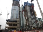
Nine Elms Underground Station – 14th February 2021
Nine Elms Underground station, is now recognisable as a station.

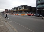
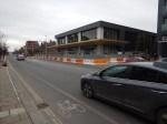
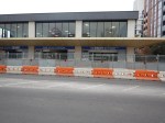

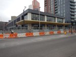
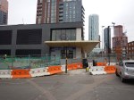


Note.
- It certainly looks like an Autumn opening is not impossible.
- I couldn’t past the station to have a look at Arch 42, which I wrote about in Nine Elms Gateways By Projects Office.
I walked to the station from Vauxhall station this morning, through a forest of new skyscrapers.
Is A Crossrail For Leeds On The Way?
This article on Insider Media is entitled Schemes Totalling More Than £140m Backed By Investment Committee.
This is introductory paragraph.
Schemes totalling more than £140m to support the region’s recovery from the Covid-19 pandemic, have have been backed by West Yorkshire Combined Authority’s Investment Committee.
These are the two main schemes.
A £24.2m million (including £17m Combined Authority funding) rail station between Morley and Cotttingley on the Transpennine route at White Rose/
A 31.6m (including £13.9m of Combined Authority funding) parkway rail station at Thorpe Park on the Leeds to York section of the route.
There are also several other schemes for West Yorkshire.
White Rose Station
This Google Map shows the White Rose Centre.
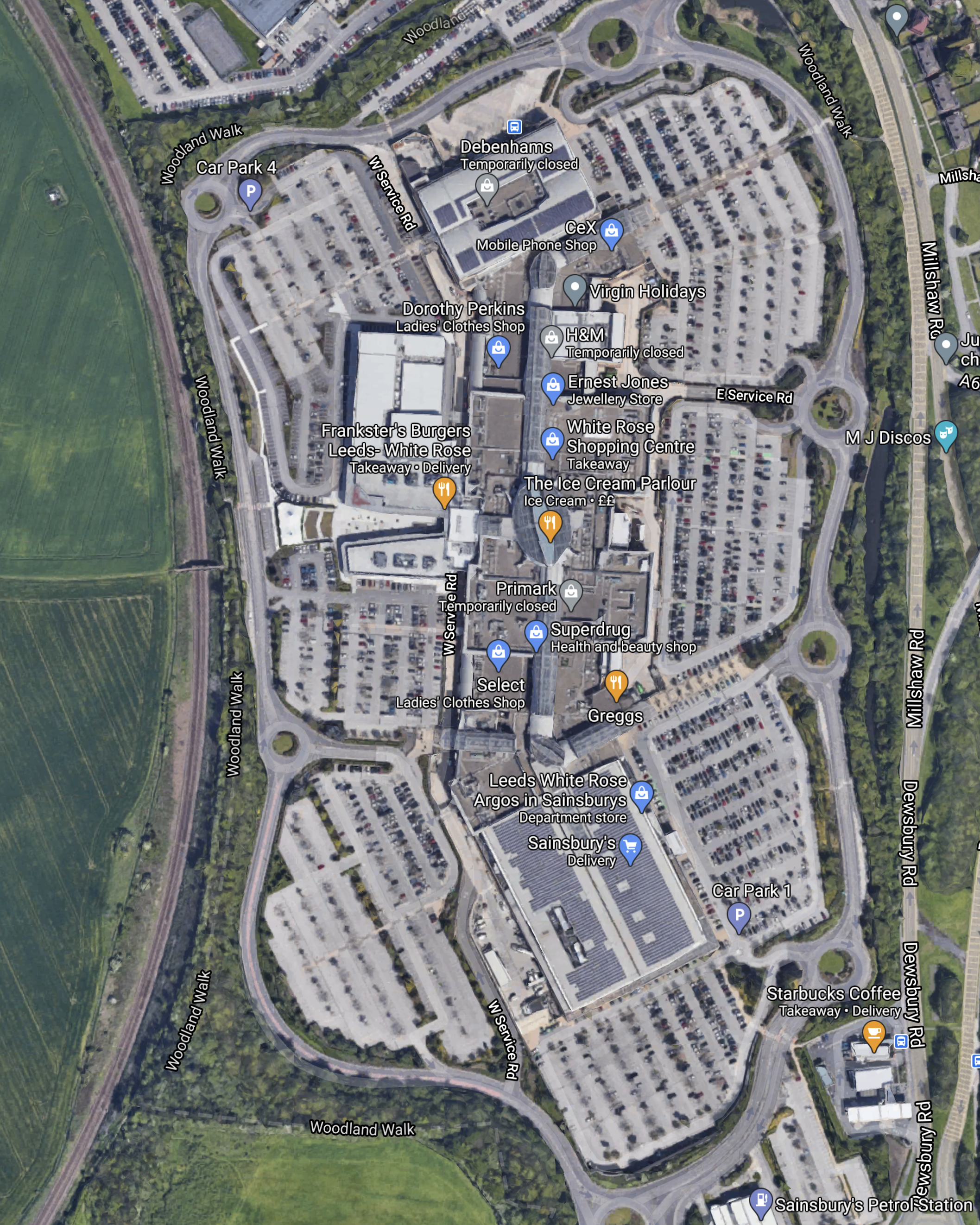
The Huddersfield Line runs North-South alongside the Centre and there must be plenty of space for a new White Rose station.
From Wikipedia and other sources, the following seems to be on the agenda for the station.
- Two platforms.
- Ability to take six-car trains, with a possibility to extend to eight-cars.
- Two trains per hour (tph) in both directions.
- Up to 340,000 passengers per year.
- Lots of parking.
The station would be about 3.5 miles to the South-West of Leeds station.
Thorpe Park Station
This Google Map shows the area where the station could be built.

Note.
- The Selby Line curving across the Northern side of the map.
- Cross Gates station is the next station to the West.
- Going East on the Selby Line, you pass through Garforth, East Garforth and Micklefield stations before the line divides for York to the North and Selby and Hull to the East.
- The M1 Motorway passing to the East of Leeds.
Other features of the proposed station and the area include.
- Wikipedia says that the station will have two island platforms and the ability to handle inter-city trains.
- The route through the station would be electrified.
- High Speed Two could be routed to go close to the station.
- Lots of parking.
The station would be about 4 miles to the East of Leeds station.
A Crossrail For Leeds
Could these two stations in the future become stations on a high-capacity route across Yorkshire centred on Leeds?
- The Western end of the route could be Huddersfield.
- The Eastern end of the route could be both York and Hull.
- Plans exist and projects have started to fully electrify between Huddersfield and York.
- Both stations will be Park-and-Ride stations with good connections to the motorway network.
- Intermediate stations between Leeds and Huddersfield could include Cottingley, White Rose, Morley, Batley, Dewsbury, Ravensthorpe, Mirfield and Deighton
- Intermediate stations between Leeds and York could include Cross Gates, Thorpe Park, Garforth, East Garforth, Micklefield, Church Fenton and Ulleskelf.
- Intermediate stations between Leeds and Hull could include Cross Gates, Thorpe Park, Garforth, East Garforth, Micklefield, South Milford, Selby, Wrassle, Howden, Eastrington, Gilberdyke, Broomfleet, Brough, Ferriby and Hessle.
With the exception of the two new stations and the electrification, infrastructure needs would not appear to be large.
These are some thoughts.
Distances And Timings
These are some distances and estimated timings from Leeds.
- Huddersfield – 27 miles – 32 minutes – 51 mph
- Hull – 52 miles – 55 minutes – 57 mph
- York – 15,5 miles – 23 minutes – 40 mph
Note.
- With full electrification, timings could be improved.
- York and Huddersfield would be under an hour.
- Kull and Huddersfield could be under ninety minutes.
These timings would certainly be achievable by a 125 mph Class 802 train, but I suspect, that they could be achieved by a 110 mph electric train like a Class 730/1 train.
Current Services Through White Road, Leeds and Thorpe Park Stations
These services currents pass through the three stations or their proposed sites.
- TransPennine Express – Liverpool Lime Street and Edinburgh
- TransPennine Express – Liverpool Lime Street and Scarborough
- TransPennine Express – Manchester Airport and Newcastle
- TransPennine Express – Manchester Airport and Redcar Central
- TransPennine Express – Manchester Piccadilly and Hull
Note.
- All of these trains are one tph.
- There could be five quality tph on the route, most of which would be five-car Class 802 trains.
In addition the following services would pass through Leeds and Thorpe Park stations.
- CrossCountry – Plymouth and Edinburgh/Glasgow
- Northern Trains – Blackpool North and York via Bradford Interchange
- Northern Trains – Halifax and Hull via Bradford Interchange
Note.
- All of these trains are one tph.
- Two trains serve Bradford Interchange.
These services could mean eight tph between Thorpe Park and Leeds stations.
In addition the following services would pass through Leeds and White Rose stations.
- Northern Trains – Wigan Wallgate and Leeds
- TransPennine Express – Huddersfield and Leeds
Note.
- All of these trains are one tph.
These services could mean seven tph between White Rose and Leeds stations.
A Possible Future Service
I believe that services across Leeds could be recast to give the City a network of railways that would satisfy the needs of the City.
Possible services could include.
Four tph – York and Huddersfield via Thorpe Park, Leeds and White Rose in under an hour.
Two tph – Hull and Huddersfield via Thorpe Park, Leeds and White Rose in under ninety minutes.
Two tph – Halifax and Thorpe Park via Leeds and Bradford
Note
- There are a lot of possibilities.
- Services would be timed to make interchange easy with other services at Leeds.
I would also arrange for East to West and West to East services to share the same island platform at Leeds.
Conclusion
Leeds will get the electrified local railway the city deserves.
Think Britain To Belfast Is A Bridge Too Far? Try Tunnelling Across Instead
The title of this post, is the same as that of this article in The Sunday Times.
It is a well-written article, with good graphics and maps, which fills out the descriptive title.
This paragraph sums up the overall objective.
For the rail industry, it is part of a long-term ambition to reduce journeys by rail between London and Glasgow and Edinburgh to below three hours, which it is also advocating in the review. Trains to Belfast would turn west near Carlisle, around the Scottish border, and lorries bound for Ireland could be loaded there.
The article also predicts London and Belfast in four hours, with Dublin in six.
In a A Glimpse Of 2035, I looked into the future and left London at eight in the morning on the first train between London and Dublin and arrived at 13:30.
My predictions were thirty minutes less than The Times.
But I also predicted, that eventually, times will be three hours to Belfast and four to Dublin.
A Deep Water Port At Shannon And Its Consequences
One thing not mentioned in the Times article, is that the Irish Government and the EU have a plan to develop a deep water port at Shannon.
It would have a rail link to any rail link to the UK and would speed goods between Germany and North America, avoiding the increasingly congested ports of Rotterdam and Hamburg. Time savings of as much as a day are predicted.
I should say, that I part-grew up in Felixstowe in the 1950s and 1960s and I can remember a sleepy little dock with a giant crane to lift seaplanes out of the water, before the massive container port we know today. There are now something like forty container trains per day, going along the sleepy branch line to Ipswich and then to the rest of the UK mainland. If anybody had predicted that in 1960, they’d have been laughed at.
If the Shannon Port is built, I can see twenty high-speed freight trains per day between Shannon and the Channel Tunnel. There will probably need to be massive improvements to the freight network in the South East of England, to get all those freight trains through or around London.
Standard Or Irish Gauge
If the EU develops the deep water port at Shannon, this would surely be rail connected to the new tunnel.
But the EU only likes to build standard gauge railways, so everybody can use them. I would expect that all new tracks in the Republic of Ireland would be standard gauge.
If you look at Spain, all their high-speed railways are standard gauge and they have both narrow and Spanish gauge railways as well.
Some of the awkward squad in Ireland will object to the standard gauge railways, but he who pays the piper calls the tune.
As the UK will be paying from London to the place where the tunnel emerges and the EU from South of the Irish border, it would be much cheaper to make all the route standard gauge. But some diehards would be against it!
Nine Elms Gateways By Projects Office
I first heard of this project in September last year, in this article on Ian Visits, which is entitled Nine Elms Railway Arch To Be Opened As Pedestrian Tunnel.
Ian introduces the problem like this.
A blocked off railway arch under the tracks in Nine Elms could be opened up as a new pedestrian tunnel. What is officially plain Arch 42 would create a walking link that starts just outside the back of the future Nine Elms station on the Northern line and the cluster of new blocks of flats and the US Embassy on the north side of the mainline railway.
I would appear to be a shorter walking route.
This Google Map shows the area.
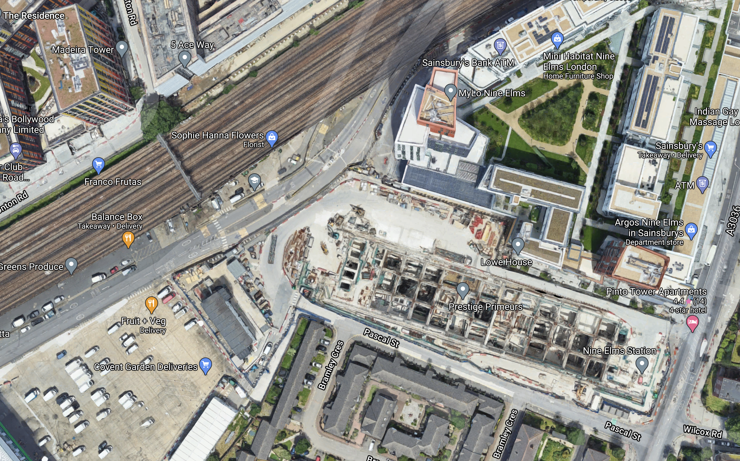
Note.
- The substantial box-like structure with all the buttresses in the South-East corner of the map is the future Nine Elms station.
- Arch 42 is one of the arches, that pass under the railway crossing the North West corner of the map.
It would appear that the proposal to turn the arch into a tunnel could be a good idea.
This article on SWLondoner is entitled Nine Elms Viaduct To Get “Tunnel Vision” Makeover and gives a few details of the project.
This page on the Projects Office web site shows a visualisation of the tunnel.
Have a look and see what you think!
Note.
- In the visualisation, there is a signal gantry across the track, which is also shown in the map above.
- What will be the building material? Brick, steel or even recycled plastic?
I used to know a free-style bricklayer, who would have created an interesting portal.
I like the design and can’t wait to see it in reality!
You certainly won’t miss it, if you’re looking for it to get to the US Embassy or another building on the other side of the tracks.
Conclusion
Could Projects Office have come up with a distinctive way of making tunnels under railways and roads more welcoming?
First Planning Applications Due On Northumberland Line
The title of this post, is the same as that of this article on the News Post Leader.
I described the Northumberland Line projevt in Trains: £34m For Revival Of 50-Year-Old North-East Railway Line, which I wrote a fortnight ago.
This paragraph from the News Post Leader article, describes the scope of the project.
The project will upgrade 18 miles of track, open six new stations, three new footbridges and new signal locations.
And this paragraph, describes the initial work.
Planning applications are set to be submitted to the council for new stations at Ashington and Northumberland Park in North Tyneside, along with a new footbridge at Chase Meadows in Bebside.
It is aimed to open the passenger service in 2024.
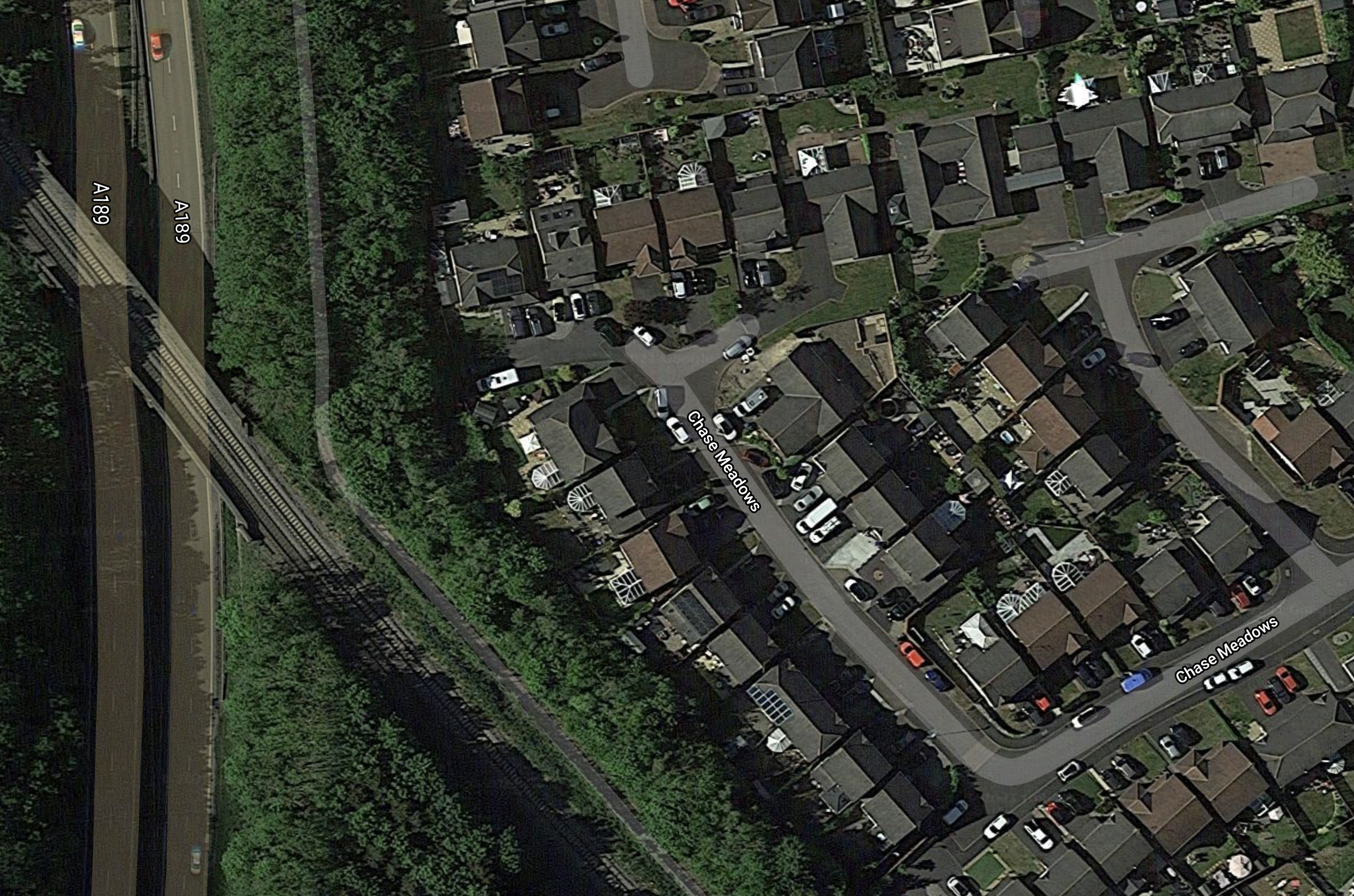
Chase Meadows Footbridge, Bebside
This Google Map shows the location of the new footbridge at Chase Meadows in Bebside.

Note.
- The A189 dual-carriageway running North-South.
- The single-track Northumberland Line curving in a similar direction
- Blyth Academy looks to be an important school.
- Chase Meadows runs from the Academy to the railway.
I have no clue, as to where Bebside station is to be built, but it would seem logical for this to happen on the sizeable plot between the road and the railway. This currently appears to be a small farm, with horses in the fields.
This second Google Map shows where the railway crosses the road.
Note, the path going alongside the road to Asda.
Will the bridge be built on the North-East or South-West side of the railway?
I will assume it will be step-free with either ramps or lifts.
This picture shows Horden station.
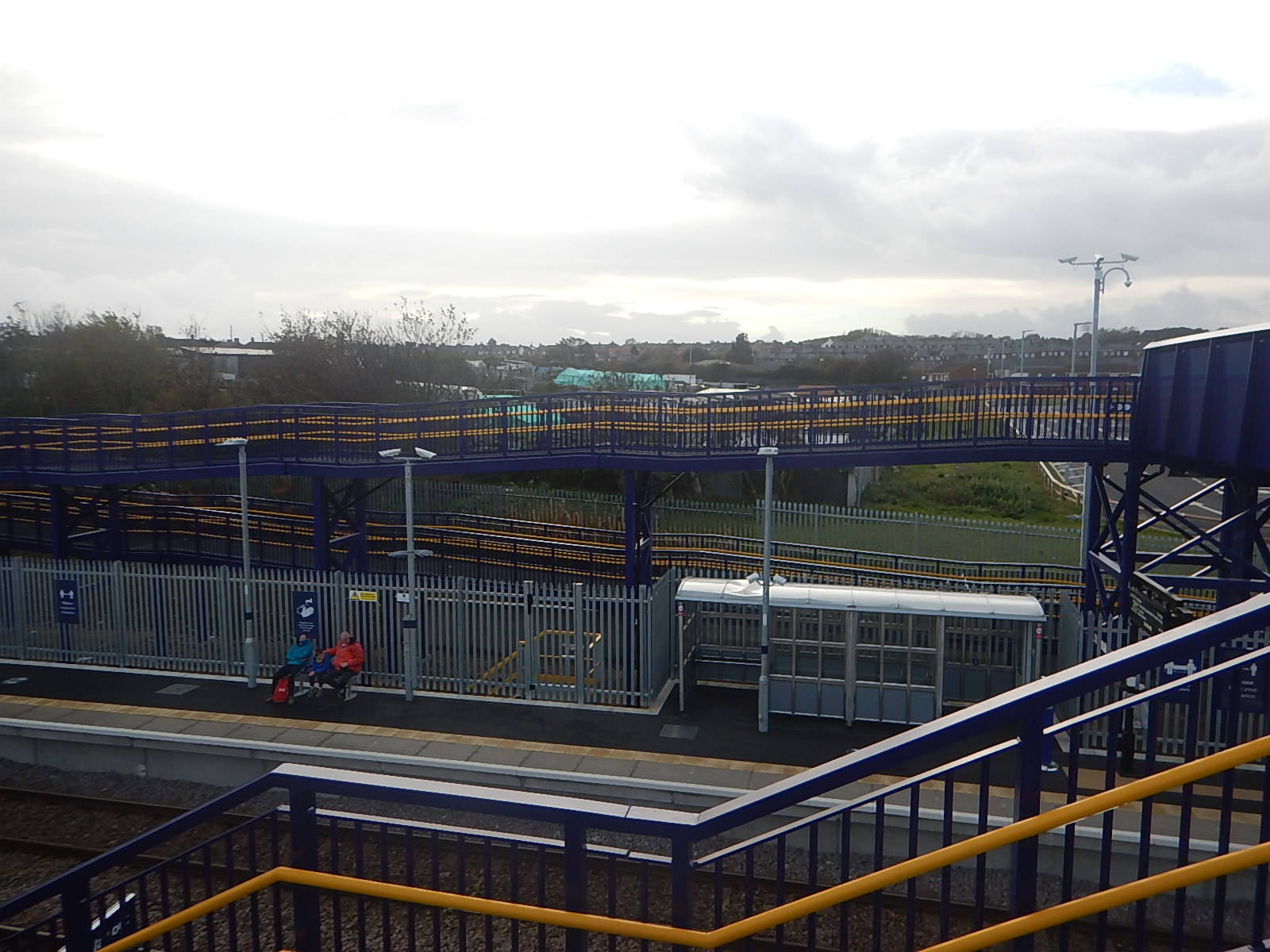
This station is South of Newcastle and only has ramps, so will something similar be built here?
