Eurostar Orders First Double-Decker Trains
The title of this post, is the same as that of this article on the BBC.
This is the sub-heading.
Eurostar has revealed plans to run double-decker trains through the Channel Tunnel for the first time.
These three paragraphs add more details.
The cross-channel rail operator has confirmed it will order up to 50 trains from manufacturer Alstom, eventually increasing the size of its fleet by nearly a third.
The expansion plans would include investing heavily in a crucial London depot, it said.
But questions remain over whether the facility has enough space for both Eurostar and potential rival operators to use it.
This my solution to the problem outlined in the last paragraph.
Note, that I wrote the software that planned the building of the Channel Tunnel and the rail links to London and was also friends with the project manager of the 1960s attempt to build a Channel Tunnel.
We need more terminal platforms and depot space in the UK to handle Eurostar’s extra trains and the other companies who want to run to London.
We should split services into two groups.
Group 1 would terminate as now in an updated St. Pancras with more passenger handling capacity, which could probably be built over the tracks at the Northern end of the station. Trains would still be stabled at Temple Mills.
Group 2 would terminate at Ebbsfleet International, which would have extra platforms, a new depot, masses of car parking and a coach terminal.
Some trains from both groups could also stop at Ashford International.
To access Ebbsfleet from Central London and also create a Heathrow link to the Channel Tunnel, the Lizzie Line would be extended to Northfleet, where there is space to handle up to eight trains per hour in new platforms built in two disused sidings.
This OpenRailwayMap shows the location of Northfleet and Ebbsfleet stations.
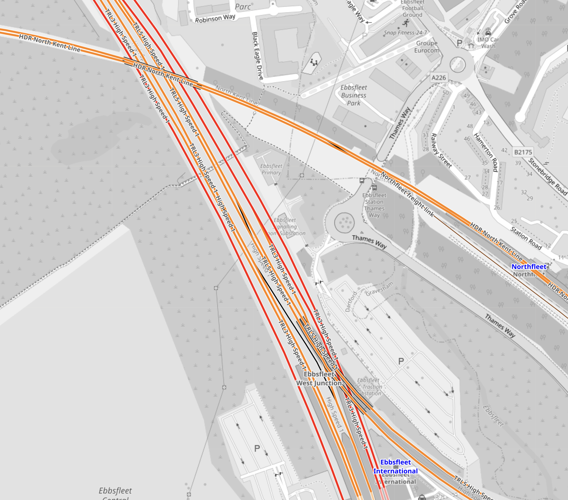
Note.
- Ebbsfleet International station at the bottom of the map.
- The red tracks are High Speed One.
- The orange tracks are third-rail electrified lines.
- The orange tracks going across the map is the North Kent Line.
- Northfleet station is at the right edge of the map on the North Kent Line.
- Northfleet and Ebbsfleet stations are less than a kilometer apart.
- Ebbsfleet has a lot of car parking spaces.
I believe a spectacular cable-car or other link would connect Northfleet and Ebbsfleet stations.
These are some other thoughts.
Ebbsfleet International Station Has Good Motorway Access
This Google Map shows the location of Ebbsfleet International station in relation to the motorways.
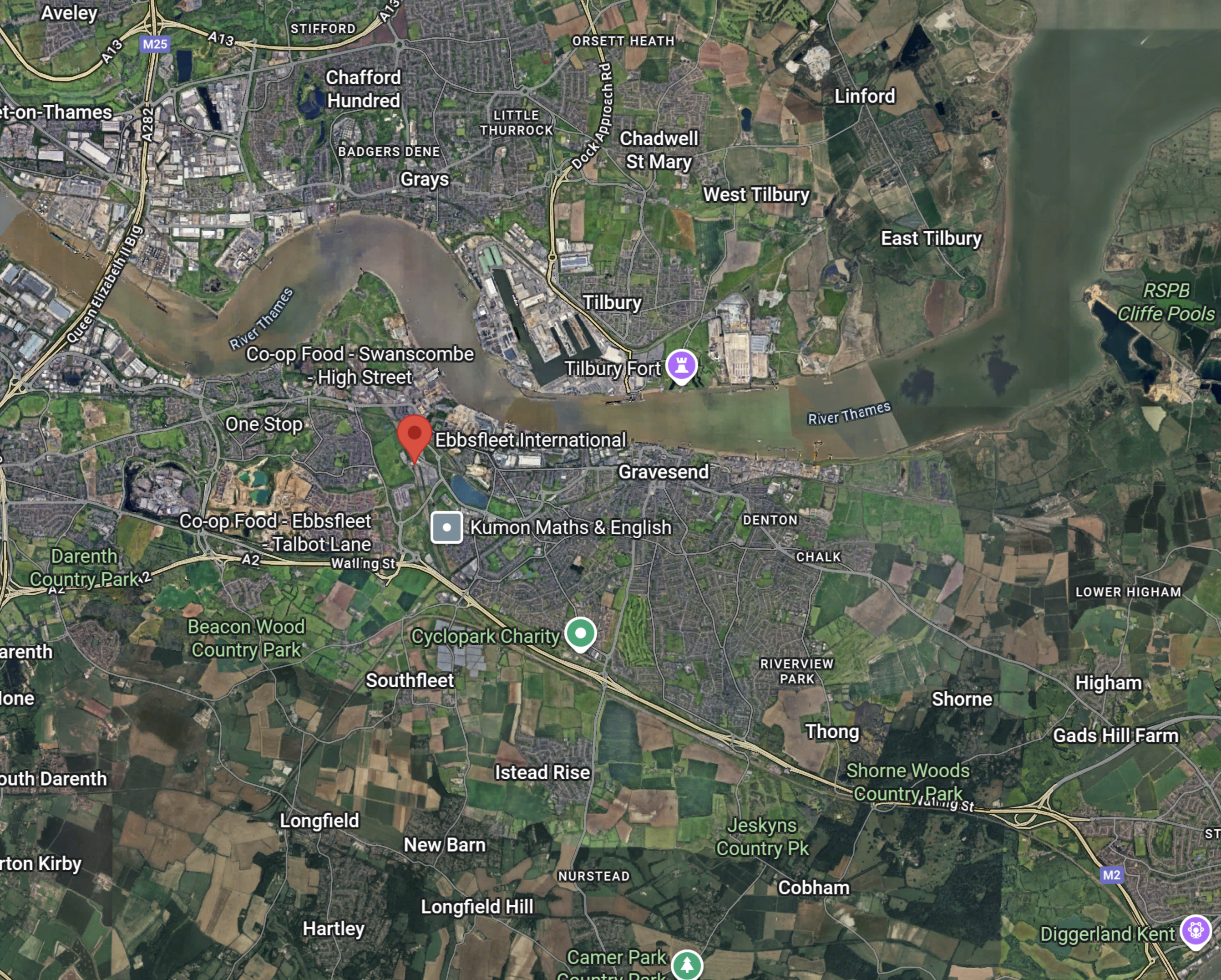
Note.
- The A2/M2 road runs across the bottom half of the map.
- The red arrow marks the position of Ebbsfleet International station.
- The Dartford Crossing is a few miles West of the station.
In my last few years, as an Ipswich season ticket holder, I regularly had a lift to Ebbsfleet International from a friend and the route to the station from the M25 and the A2/M2 wasn’t bad.
But it will be getting better.
This map from the Government’s consultation on the Lower Thames Crossing, shows the road layout in a few years.
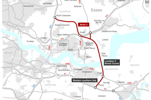
Note.
- The Lower Thames Crossing is shown in red.
- Ebbsfleet International station is about a mile South of Northfleet
- The new crossing will connect to the A2, a few miles East of the link road to the station.
Travellers from much of the East of and Middle England could use the new crossing to get to Ebbsfleet International station.
These are current times from Google.
- Birmingham – 2 hours and 41 minutes
- Cambridge – 1 hour and 17 minutes
- Edinburgh – 7 hours and 44 minutes
- Fishguard – 5 hours and 29 minutes
- Glasgow – 7 hours and 6 minutes
- Holyhead – 5 hours and 29 minutes
- Hull – 4 hours and 1 minute
- Ipswich – 1 hour and 29 minutes
- Leeds – 3 hours and 55 minutes
- Liverpool – 4 hours and 40 minutes
- Manchester – 4 hours and 28 minutes
- Milton Keynes – 1 hour and 37 minutes
- Newcastle 5 hours and 25 minutes
- Norwich – 2 hours 23 minutes
- Nottingham – 2 hours and 55 minutes
- Peterborough – 1 hour and 54 minutes
- Sheffield – 3 hours and 35 minutes
- Stoke-on-Trent – 3 hours and 25 minutes
- York – 4 hours and 16 minutes
Note.
- I would suspect that the opening of the Lower Thames Crossing will knock 10-15 minutes off these times.
- Edinburgh, Glasgow, Hull, Leeds, Newcastle, Nottingham, Peterborough, Sheffield and York would probably be quicker to Europe with a change to Continental train services at St. Pancras, rather than Ebbsfleet International.
- With improvements to rail services, more of these journeys will be quicker by train.
- High Speed Two should connect Birmingham, Liverpool, Manchester and Stoke-on-Trent to London, by the mid 2030s.
But there are some, who always feel their car is safer in a car park!
Ebbsfleet International Station Has A Large Amount Of Car Parking
This map shows the car parks at Ebbsfleet International station.
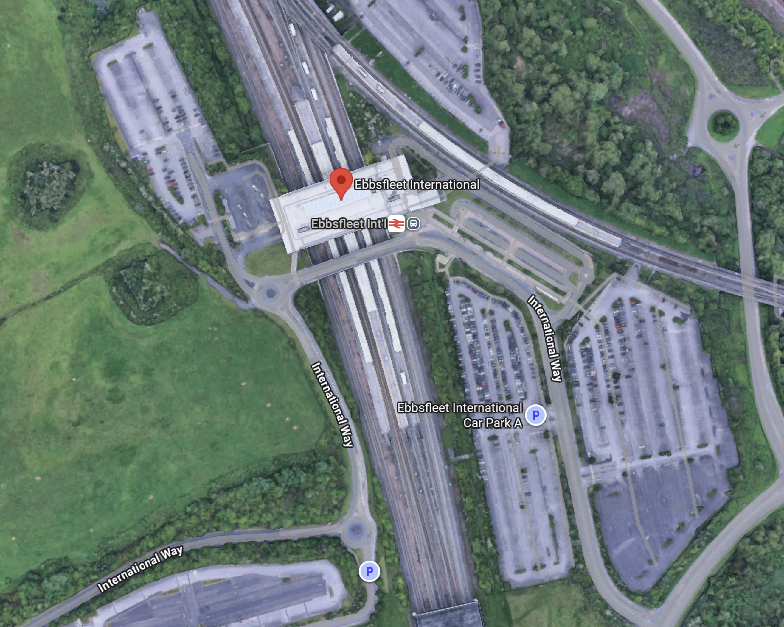
Note.
- Some of the parking areas are marked with a P.
- It is easy to pick-up and drop passengers.
- The car parks could be double-decked to add more spaces if needed.
- According to the Ebbsfleet International web site, the station currently has 5225 parking spaces, 68 accessible car parking spaces.
For those that have a lot of luggage or a large family, taking the car to Ebbsfleet International may be the best option.
Ebbsfleet International Station Should Have A Coach Station
Consider.
- In the next few years, hydrogen-powered coaches with a thousand kilometre range will come to dominate the long distance coach market.
- Mercedes and Wrightbus are know to be developing long-distance hydrogen-powered coaches.
- Hydrogen-powered coaches will be able to reach all of England and Wales and a large part of Scotland from Ebbsfleet International.
- Ebbsfleet International is closely connected to the UK motorway network.
- Continental coaches using the Channel Tunnel, could use Ebbsfleet as a coach interchange with the UK.
- Ebbsfleet International could also handle customs services for Continental coach services, which would take the pressure off the Channel Tunnel and the ferries.
- Ebbsfleet International could also have a coach link to Gatwick Airport.
These and other reasons make me feel, that a coach terminal at Ebbsfleet International is essential.
A Green Connection Between The Two Halves Of The European Union For the Gretas Of This World
Consider.
- There is no zero-carbon route between the island of Ireland and Continental Europe.
- Eurostar is all-electric between London and Continental Europe, but only serves a limited number of destinations.
- Low- or zero-carbon ferries are being designed, that run on hydrogen.
- Trains between London and the Irish ferries are diesel-powered.
- The simplest solution would surely be to run hydrogen-powered coaches between Ebbsfleet International and Fishguard and/or Holyhead. Both journeys would take three and a half hours.
Hydrogen-powered coaches are under development by Wrightbus.
I also asked Google AI if anybody is planning zero-carbon ferries between the UK and ireland and received this answer.
Yes, there are plans for zero-carbon ferries between the UK and Ireland, with a specific “Green Corridor” feasibility study underway for the Holyhead to Dublin route, and a separate, separate commuter service project planned between Belfast and Bangor. The Belfast Maritime Consortium is developing the zero-carbon commuter service, and a separate “Green Corridor” feasibility study is assessing potential low-carbon pathways between Holyhead and Dublin
I believe the green connection is feasible, provided the following happens.
- Ebbsfleet International is reopened and developed as a station for Continental Europe.
- The zero-carbon ferries are developed.
- The busmasters from Ballymena deliver the ultimate hydrogen-powered coach.
- Hydrogen and other fuels are made available, where they is needed.
This could do wonders for the economy of the island of Ireland.
Out of curiosity, I did ask Google AI, what is the longest coach route in the UK and received this answer.
The longest scheduled coach journey in the UK is the Scottish Citylink route from Glasgow to Uig on the Isle of Skye (route 915 or 916), which is about 230 miles and takes around 7 hours and 50 minutes. Historically, there have been much longer international bus routes, such as the Penn Overland tour from London to Ceylon, but these were not regular, scheduled services.
So my proposal at five hours and 29 minutes is only a short hop.
I also believe that with good project management that the additional infrastructure could be built by 2030, with little or no disruption to existing services.
The Three Baltic Countries Sign The Largest Railway Electrification Agreement In History
The title of this post, is the same as that as this news item on the LTG Group web site.
This is the sub-heading.
Today in Vilnius, the institutions of the three Baltic countries responsible for implementing the Rail Baltica project signed a historic agreement on railway electrification. The contract, valued at €1.77 billion (excluding VAT), has been awarded to COBELEC Rail Baltica – a consortium formed by the Spanish companies Cobra Instalaciones y Servicios S.A. and Elecnor Servicios y Proyectos S.A.U.
These three paragraphs add more detail.
The electrification of the Rail Baltica European railway is considered the largest cross-border railway electrification initiative in Europe, implemented as a single, joint project.
“Rail Baltica is more than just infrastructure – it is an economic and security link to the West. This contract is particularly important for our integration into the European railway network, enabling smooth passenger and freight transport while strengthening the resilience of the Baltic region. It is our strategic pathway to the future,” said Eugenijus Sabutis, Acting Minister of Transport and Communications of Lithuania.
One of the largest contracts in the history of the Baltic States was signed by the institutions responsible for implementing the project: LTG Infra, the infrastructure company of the LTG Group; Eiropas Dzelzceļa Līnijas in Latvia; and Rail Baltic Estonia in Estonia. Representatives from the ministries of transport and communications of all three countries also gathered in Vilnius for the occasion.
Note.
- The electrification will be to the European standard of 25 KVAC overhead.
- There will be a total of 2,400 km. of electrification.
- High-speed passenger and freight trains will operate on the full length of the route.
- It is planned that the electricity used will be generated from renewable energy sources.
- I feel everybody will be pleased except Putin.
The Russian dictator and war-monger won’t like it, as the railway will not be built to Russian standards.
The Future Of HS2 Could Lie In Its Original Vision
The title of this post, is the same as that of this article on Railway Gazette.
This is the sub-heading.
High Speed 2 should be rescoped to run from London Euston to Crewe, taking advantage of the lessons learned and supply chain foundations established during Phase 1, says Dyan Perry, Chair of the High Speed Rail Group.
The article has been written by Dyan Perry, who knows her railways and especially high speed ones well.
These two first paragraphs introduce her arguments.
High Speed 2 stands at a defining crossroads. Phase 1 from Old Oak Common to Birmingham has the green light, and under the new leadership of HS2 Ltd CEO Mark Wild the project is undergoing a positive and much needed ’reset’. With around 31 000 jobs currently supported, more than 75% of tunnelling completed and construction underway on two-thirds of HS2’s viaducts, momentum is building again.
This fresh injection of energy is welcome after years of shifting goalposts and cuts to the project’s scope. However, while Phase I pushes ahead, the handbrake has been pulled on the next critical phases of the project: the route from the West Midlands to Crewe and Old Oak Common to London Euston.
In the short term, this may appear fiscally sensible. However, as with all infrastructure investments, the project and potential returns must be viewed through a long-term lens. After all, a half-built railway moulded by short-term decision-making risks squandering investment to date and losing billions of pounds of taxpayers’ money.
The High Speed Rail Group (HSRG) has these recommendations.
- A “Euston to Crewe” Core.
- West Midlands to Crewe must be given the go-ahead before the powers to do so run out. This would provide much needed capacity on the West Coast Main Line.
- Use the lessons learned on Phase 1 to build West Midlands to Crewe more effectively.
- Build a streamlined, cost effective station at Euston.
- HSRG believes a concession let for a London to Birmingham and Crewe railway line, one that takes learning from the High Speed One financing model, could generate between £7·5bn and £10bn in concession value, a significant return for taxpayers.
High Speed Two needs a cohesive long term plan.
I very much agree with what Dyan and the HSRG are saying.
I also have some related thoughts.
High Speed East Coast
I am a Control Engineer by training and I’ve felt for some time, that the some of the bottlenecks on the East Coast Main Line to the South of Doncaster could be solved by intelligent digital signalling.
I believe that the major cities of the North-East of England and Eastern Scotland would be best served by direct high speed trains from London on the East Coast Main Line. I also think, that such an approach would deliver similar times to High Speed Two via Birmingham.
North of York
Just as stations on the West Coast to the North of Crewe will be served by High Speed Two and the West Coast Main Line, stations North of York will be served by trains going up the East Coast Main Line.
The Element Of Competition
I said earlier, that if a 30-year concession were to be sold for the West Coast Main Line, it could raise between £7.5bn and £10bn.
So why not sell a concession for the East Coast Main Line?
A further benefit, is that competition between the two concessions and the budget airlines, might bring down timings and prices, just as competition did in the Railway Races of 1888 and 1895.
High Speed North Wales
I have believed for some time, that there is a need for a zero-carbon (green) route between London and Dublin and ultimately between the Channel Tunnel and Dublin.
The last Conservative government promised to electrify Crewe and Holyhead along the North Wales Coast.
This route could deliver passengers to Holyhead for a zero-carbon high speed catamaran to Dublin.
The EU would be a beneficiary and might like to help fund the route.
First High-Speed Rail Service From Rochdale To London In 25 years Secures Political Support
The title if this post, is the same as this article on Rochdale Online.
These are the first three paragraphs.
MPs, local council leaders, businesses and academics gathered in Manchester to show their support for a new high-speed rail service linking Rochdale with London for the first time in 25 years, in a boost to local jobs, growth and connectivity in the North West.
Lumo, which already delivers more reliable, cheaper train travel along the East Coast Main Line, plans to run six return trains a day between Rochdale, Manchester Victoria, Eccles, Newton-le-Willows and Warrington Bank Quay to London Euston from 2027, providing 1.6 million more people in Greater Manchester with a direct link to the capital.
The three-hour service will knock 2hrs 15mins off current journey times by car, secure important emissions savings and create at least 124 direct jobs along the route.
How many other larger towns and cities could use a service like this proposed one to Rochdale?
But Rochdale’s service is more than just a one-dimensional route to and from London.
- Rochdale and Warrington Bank Quay forms a convenient long-range cross-Manchester service.
- Connections at Newton-le-Willows and Warrington Bank Quay provide links to Liverpool and North West England, Wales and Scotland.
- Connections at Manchester Victoria and Eccles provide links to most of Great Manchester.
- Liverpool’s and Manchester’s plans mean that connectivity will only get better.
It will be interesting to see how Lumo’s Rochdale service evolves and develops in the next few years.
Other cities will certainly want one.
Ten Spanish Companies Join Forces To Apply Hydrogen Propulsion To A High-Speed Train For The First Time
The title of this post, is the same as that of this press release from Talgo.
These are the three bullet points.
- The Hympulso project is part of the Strategic Projects for Economic Recovery and Transformation (PERTES)
- A new technical car with hydrogen and batteries to be developed for a Talgo 250 train, allowing it to run on clean energy on non-electrified lines.
- The main partners are Talgo, Golendus, Ingeteam, Repsol, Sener and Optimus3D.
These are the first four paragraphs.
Ten Spanish companies have joined forces to design, build and install, for the first time in the world, a propulsion system based on renewable hydrogen fuel cells on a high-speed train. Under the Hympulso project, the companies will develop a set of technologies that can be applied to the Talgo 250 ‘all-terrain’ train, making it possible to electrify the rail network with energy generated entirely from renewable sources, even on lines without overhead power lines.
Led by Talgo, Hympulso also includes Golendus, Ingeteam, Optimus3D, Repsol and Sener as partners. Universidad Pontificia Comillas and Tecnalia are collaborators, while Adif is an observer. The initiative has received a grant of €6.5 million and is part of the Incentive Programme for the Innovative Value Chain and Knowledge of Renewable Hydrogen, as part of the Recovery, Transformation and Resilience Plan.
Hympulso will be comprehensive in nature: it will activate the entire renewable hydrogen value chain in the railway system, from production to consumption. The project will also make it possible to analyse the impact of the future transition on the various railway infrastructure assets managed by Adif, such as maintenance facilities or the track.
Thus, the project will result in a joint output of hydrogen supply installations adapted to railways -both mobile and static- and a pioneering prototype of a hybrid bimodal train for passengers with automatic track-gauge change, which will be able to run both on conventional and high-speed networks, using catenary supply when available, or hydrogen and batteries in those corridors that are not electrified.
This picture shows a visualisation of the train.
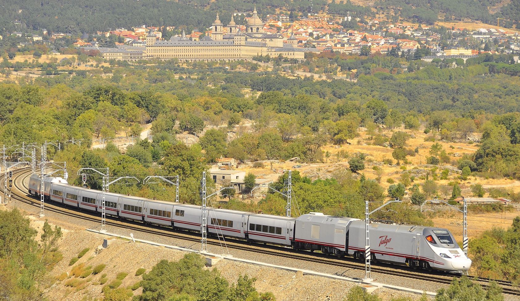
Note.
- There is a power car containing the hydrogen fuel cells and other gubbins behind the one or both locomotives.
- Hydrogen power is used, where there is no electrification.
- Talgo already make a high speed train with a diesel power pack, so engineering would only involve developing a new hydrogen power pack.
My only questions are.
- Do the trains come without gauge-changing?
- Could they be run on a typical UK rail line?
- Do they speak, Cornish, Gaelic and Welsh?
If the answer to all questions is yes, then this must be the ideal train for these routes.
- London Euston and Aberystwyth
- London Euston and Holyhead
- London King’s Cross and Aberdeen.
- London King’s Cross and Cleethorpes/Grimsby
- London King’s Cross and Inverness.
- London King’s Cross and Thurso/Wick.
- London Paddington and Carmarthen
- London Paddington and Penzance
Note.
- No more electrification on these routes would be needed.
- The trains could use High Speed Two to wherever it goes.
- The trains could do 140 mph on the Great Western Main Line, East Coast Main Line and West Coast Main Line.
Hympulso looks a very comprehensive, professional and practical plan, that could easily be adapted to the UK mainland.
High Speed Yorkshire
In December 2019, I wrote Could High Speed Two Be A One-Nation Project?, which I started like this.
As currently envisioned, High Speed Two is very much an English project, with the following routes
- London and Birmingham
- London and Liverpool via Birmingham
- London and Manchester Airport/Manchester via Birmingham and Crewe
- London and Sheffield via Birmingham and the East Midlands Hub
- London and Leeds via Birmingham and the East Midlands Hub
There are large numbers of mid-sized towns and cities that it won’t serve directly.
This is what I said about the East Coast Main Line in the post.
The East Coast Main Line serves the following routes.
- London and Bradford
- London and Cambridge
- London and Edinburgh via Doncaster, York and Newcastle
- London and Harrogate via Leeds
- London and Hull
- London and Kings Lynn via Cambridge
- London and Lincoln via Newark.
- London and Leeds via Doncaster
- London and Middlesbrough
- London and Skipton via Leeds
- London and Sunderland
The East Coast Main Line could become another high speed line.
Extra services could be added.
- London and Norwich via Cambridge
- London and Nottingham
- London and Grimsby and Cleethorpes via Lincoln.
- London and Sheffield via Retford.
Add the East Coast Main Line and High Speed Two together and there could be a wider range of towns and cities served.
- Peterborough and Doncaster could play the same role in the East as Birmingham and Crewe will play in the West.
- The East Coast Main Line between London and Doncaster will be upgraded to in-cab ERTMS signalling in a few years time, which will allow 140 mph running on several sections of the route.
- Improvements are either under way or being planned to reduce bottlenecks on the East Coast Main Line.
- If High Speed Two can handle eighteen trains per hour (tph), then surely the East Coast Main Line, which has a lot of quadruple track, can handle upwards of twelve 140 mph trains per hour between London and Doncaster, after the improvements to track and signalling.
- I estimate that 140 mph running between London and Doncaster could save as much as twenty minutes.
- I feel that Barnsley, Doncaster, Hull, Leeds, Sheffield and York could all be reached in under two hours from London using the existing Azuma trains.
- This morning the 0700 from Kings Cross is timetabled to reach York at 0852. Would it be possible for London and York to be around just ninety minutes?
- Savings would also apply to trains between London and Leeds, Middlesbrough, Newcastle, Scotland and Sunderland.
- Sub-four hour journeys between London and Edinburgh would be commonplace.
Note that the Internet gives a driving time of nearly three and a half hours between London and Leeds. Surely, two hours or less on High Speed Yorkshire would be much preferable.
I would add this infrastructure.
- There might be a good case to create electrified routes to Hull and Sheffield and between Sheffield and Leeds, but they wouldn’t be needed to start the service or obtain the time savings. But they would ease operation, cut carbon emissions and save a few more minutes.
- A station at Doncaster-Sheffield Airport.
- A parkway station at Barnsley on the Dearne Valley Line with direct services to Doncaster, Leeds, London and Sheffield.
The two latter improvements have been proposed in Sheffield Region’s transport plans.
High Speed Yorkshire should be finished as soon as possible. A completion date of 2024 is not unreasonable.
This was the first time I used the term High Speed Yorkshire.
Benefits Of Digital Signalling On The East Coast Main Line
The obvious benefit is there will be 140 mph running on several stretches of the East Coast Main Line.
But as a Control Engineer, I believe that the digital signalling can be used to eliminate two major bottlenecks on the route.
- The Digswell Viaduct, which I wrote about in Is There An ERTMS-based Solution To The Digswell Viaduct?.
- The Newark Flat Crossing, which I wrote about in Could ERTMS And ETCS Solve The Newark Crossing Problem?.
Digital Signalling will also offer techniques to run more trains per hour on the route.
LNER Orders CAF Tri-Mode Sets
The title of this section, is the same as this article in the December 2023 Edition of Modern Railways, which has this paragraph.
Modern Railways understands the new fleet will be maintained at Neville Hill depot in Leeds and, like the ‘225’ sets, will be used predominantly on services between London and Yorkshire, although unlike the ‘225s’ the tri-modes, with their self-power capability, will be able to serve destinations away from the electrified network such as Harrogate and Hull.
Note.
- This surprised me, as I’d always expected the Yorkshire routes will be served by Hitachi battery-electric trains.
- But it does look that both Harrogate and Hull stations, have long enough platforms to hold a ten-car train.
- With their tri-mode technology, it also looks like the CAF trains won’t be needed to be charged before returning to London.
The last point would enable them to try out new routes.
But it does look like LNER are planning to strengthen their Yorkshire routes.
- Does Azuma Test Train Takes To The Tracks As LNER Trials Possible New Route, also mean that they’re looking at a service to Cleethorpes?
- The curtailment of High Speed Two was hard on Yorkshire.
- The Government has had time to get a verdict from experts on TransPennine Express.
It could just be that, it’s easier to sell rail tickets to Yorkshire folk, than Lancashire folk.
FirstGroup Applies To Run New London To Sheffield Rail Service
The title of this section, is the same as that of this press release from First Group.
These two paragraphs outline FirstGroup’s initial plans.
FirstGroup plc, the leading private sector transport operator, has today submitted the first phase of an application for a new open access rail service between London and Sheffield to the Office of Rail and Road (ORR).
FirstGroup plans to expand its open access rail operations as part of its award-winning Hull Trains business, building on their successful existing service which has transformed long-distance connectivity between Hull and London.
Note.
- FirstGroup want to run two trains per day (tpd) between London King’s Cross and Sheffield stations via Retford.
- Services will be non-stop between London King’s Cross and Retford.
- The service will be run by Hull Trains.
- I suspect that Hull Trains will use a fleet of identical Hitachi trains for both services.
- Hull Trains could decarbonise the services by using battery-electric trains.
- I believe a time of 82 minutes will be possible between London King’s Cross and Sheffield.
- High Speed Two were promising a time of 87 minutes for their route from London Euston via Birmingham and Nottingham.
I believe there could be up to seven tpd to both Hull and Sheffield.
Timings On High Speed Yorkshire
In FirstGroup Applies To Run New London To Sheffield Rail Service, I felt the following is possible, between London King’s Cross and Sheffield.
- After the digital signalling is completed between King’s Cross and Retford, I suspect that a 135 mph average speed can be maintained between Woolmer Green and Retford. This would mean that a King’s Cross and Retford time of 68 minutes would be possible.
- If Network Rail improve the track between Retford and Sheffield, I believe that a 70 mph average could be achieved on the Retford and Sheffield section. This would mean that a Retford and Sheffield time of 20 minutes would be possible.
- I would expect at least six minutes would be saved by missing stops.
This gives a time of 82 minutes between London King’s Cross and Sheffield.
I will use these timings to calculate other possible times.
- Current time between London King’s Cross and Retford – 82 minutes
- Digitally signalled average speed between Woolmer Green and Retford – 135 mph
- Digitally signalled time between London King’s Cross and Retford – 68 minutes
- Digitally signaled time between London King’s Cross and Sheffield – 82 minutes
These are my estimated timings from London King’s Cross.
Barnetby via Newark Northgate and Lincoln
Operator: LNER
Served by High Speed Two: No
Time to/from London King’s Cross: 114 minutes
Barnetby via Peterborough and Lincoln
Operator: LNER
Served by High Speed Two: No
Time to/from London King’s Cross: 128 minutes
Barnsley via Sheffield
Operator: Hull Trains
Served by High Speed Two: No
Time to/from London King’s Cross: 112 minutes
Note: Uses Penistone Line and Hull Trains times to Sheffield
Beverley
Operator: Hull Trains
Served by High Speed Two: No
Time to/from London King’s Cross: 101 minutes
Note: Uses Hull Trains times from Doncaster
Bradford Foster Square via Leeds
Operator: LNER
Served by High Speed Two: No
Time to/from London King’s Cross: 146 minutes
Note: Uses LNER times from Leeds
Bradford Interchange via Doncaster
Operator: Grand Central
Served by High Speed Two: No
Time to/from London King’s Cross: 166 minutes
Note: Uses Grand Central times from Doncaster
Brighouse via Doncaster
Operator: Grand Central
Served by High Speed Two: No
Time to/from London King’s Cross: 143 minutes
Note: Uses Grand Central times from Doncaster
Brough
Operator: Hull Trains
Served by High Speed Two: No
Time to/from London King’s Cross: 101 minutes
Note: Uses Hull Trains times from Doncaster
Cleethorpes via Newark Northgate and Lincoln
Operator: LNER
Served by High Speed Two: No
Time to/from London King’s Cross: 141 minutes
Cleethorpes via Peterborough and Lincoln
Operator: LNER
Served by High Speed Two: No
Time to/from London King’s Cross: 155 minutes
Darlington
Operator: LNER
Served by High Speed Two: Yes
High Speed Two time to/from London Euston: 116 minutes
Time to/from London King’s Cross: 127 minutes
Doncaster
Operator: Grand Cenreal, Hull Trains, LNER
Served by High Speed Two: No
Time to/from London King’s Cross: 76 minutes
Durham
Operator: LNER
Served by High Speed Two: Yes
High Speed Two time to/from London Euston: 136 minutes
Time to/from London King’s Cross: 160 minutes
Eaglescliffe
Operator: Grand Central
Served by High Speed Two: No
Time to/from London King’s Cross: 155 minutes
Note: Uses Grand Central times from Northallerton
Edinburgh
Operator: LNER
Served by High Speed Two: Yes
High Speed Two time to/from London Euston: 220 minutes
Time to/from London King’s Cross: 234 minutes
Grantham
Operator: LNER
Served by High Speed Two: No
Time to/from London King’s Cross: 53 minutes
Grimsby Town via Newark Northgate and Lincoln
Operator: LNER
Served by High Speed Two: No
Time to/from London King’s Cross: 134 minutes
Grimsby Town via Peterborough and Lincoln
Operator: LNER
Served by High Speed Two: No
Time to/from London King’s Cross: 148 minutes
Halifax via Doncaster
Operator: Grand Central
Served by High Speed Two: No
Time to/from London King’s Cross: 153 minutes
Note: Uses Grand Central times from Doncaster
Harrogate
Operator: LNER
Served by High Speed Two: No
Time to/from London King’s Cross: 147 minutes
Note: Uses LNER times from Leeds
Hartlepool
Operator: Grand Central
Served by High Speed Two: No
Time to/from London King’s Cross: 175 minutes
Note: Uses Grand Central times from Northallerton
Horsforth
Operator: LNER
Served by High Speed Two: No
Time to/from London King’s Cross: 124 minutes
Note: Uses LNER times from Leeds
Huddersfield via Leeds
Operator: LNER
Served by High Speed Two: No
Time to/from London King’s Cross: 161 minutes
Note: Uses LNER times from Leeds
Huddersfield via Sheffield
Operator: Hull Trains
Served by High Speed Two: No
Time to/from London King’s Cross: 140 minutes
Note: Uses Penistone Line and Hull Trains times to Sheffield
Hull
Operator: Hull Trains
Served by High Speed Two: No
Time to/from London King’s Cross: 114 minutes
Note: Uses Hull Trains times from Doncaster
Keighley via Leeds
Operator: LNER
Served by High Speed Two: No
Time to/from London King’s Cross: 178 minutes
Note: Uses LNER times from Leeds
Leeds
Operator: LNER
Served by High Speed Two: Yes
High Speed Two time to/from London Euston: 81 minutes
Time to/from London King’s Cross: 116 minutes
Lincoln via Newark Northgate
Operator: LNER
Served by High Speed Two: No
Time to/from London King’s Cross: 85 minutes
Lincoln via Peterborough
Operator: LNER
Served by High Speed Two: No
Time to/from London King’s Cross: 99 minutes
Market Rasen via Newark Northgate and Lincoln
Operator: LNER
Served by High Speed Two: No
Time to/from London King’s Cross: 101 minutes
Market Rasen via Peterborough and Lincoln
Operator: LNER
Served by High Speed Two: No
Time to/from London King’s Cross: 115 minutes
Meadowhall via Sheffield
Operator: Hull Trains
Served by High Speed Two: No
Time to/from London King’s Cross: 90 minutes
Note: Uses Penistone Line and Hull Trains times to Sheffield
Middlesbrough
Operator: LNER
Served by High Speed Two: No
Time to/from London King’s Cross: 155 minutes
Mirfield via Doncaster
Operator: Grand Ccentral
Served by High Speed Two: No
Time to/from London King’s Cross: 136 minutes
Note: Uses Grand Central times from Doncaster
Newark Northgate
Operator: LNER
Served by High Speed Two: No
Time to/from London King’s Cross: 60 minutes
Newcastle
Operator: LNER
Served by High Speed Two: Yes
High Speed Two time to/from London Euston: 137 minutes
Time to/from London King’s Cross: 145 minutes
Northallerton
Operator: Grand Central, LNER
Served by High Speed Two: No
Time to/from London King’s Cross: 126 minutes
Peterborough
Operator: Grand Central, LNER
Served by High Speed Two: No
Time to/from London King’s Cross: 40 minutes
Pontefract Monkhill
Operator: Grand Central
Served by High Speed Two: No
Time to/from London King’s Cross: 103 minutes
Note: Uses Grand Central times from Doncaster
Retford
Operator: LNER
Served by High Speed Two: No
Time to/from London King’s Cross: 68 minutes
Selby
Operator: Hull Trains
Served by High Speed Two: No
Time to/from London King’s Cross: 92 minutes
Note: Uses Hull Trains times from Doncaster
Sheffield
Operator: Hull Trains
Served by High Speed Two: Yes
High Speed Two time to/from London Euston: 87 minutes
Time to/from London King’s Cross: 82 minutes
Shipley via Leeds
Operator: LNER
Served by High Speed Two: No
Time to/from London King’s Cross: 168 minutes
Note: Uses LNER times from Leeds
Skipton via Leeds
Operator: LNER
Served by High Speed Two: No
Time to/from London King’s Cross: 191 minutes
Note: Uses LNER times from Leeds
Sleaford
Operator: LNER
Served by High Speed Two: No
Time to/from London King’s Cross: 83 minutes
Spalding
Operator: LNER
Served by High Speed Two: No
Time to/from London King’s Cross: 61 minutes
Sunderland
Operator: Grand Central
Served by High Speed Two: No
Time to/from London King’s Cross: 194 minutes
Note: Uses Grand Central times from Northallerton
Thirsk
Operator: Grand Central
Served by High Speed Two: No
Time to/from London King’s Cross: 116 minutes
Note: Uses Grand Central times from Northallerton
Thornaby
Operator: LNER
Served by High Speed Two: No
Time to/from London King’s Cross: 146 minutes
Wakefield Kirkgate
Operator: Grand Central
Served by High Speed Two: No
Time to/from London King’s Cross: 118 minutes
Note: Uses Grand Central times from Doncaster
Wakefield Westgate
Operator: LNER
Served by High Speed Two: No
Time to/from London King’s Cross: 95 minutes
Worksop
Operator: Hull Trains
Served by High Speed Two: No
Time to/from London King’s Cross: 81 minutes
York
Operator: LNER
Served by High Speed Two: Yes
High Speed Two time to/from London Euston: 84 minutes
Time to/from London King’s Cross: 98 minutes
Note.
- Times have improved because of the digital signalling.
- As the digital signalling goes further North timings will will come down further.
- Unelectrified branches like those to Beverley, Cleethorpes, Grimsby, Harrogate, Huddersfield, Hull, Lincoln, Middlesbrough and Sheffield will be improved and further bring down times.
Sheffield could be as low as 80 minutes, with York at 91 minutes.
FirstGroup Applies To Run New London To Sheffield Rail Service
The title of this post, is the same as that of this press release from First Group.
These four paragraphs outline FirstGroup’s initial plans.
FirstGroup plc, the leading private sector transport operator, has today submitted the first phase of an application for a new open access rail service between London and Sheffield to the Office of Rail and Road (ORR).
FirstGroup plans to expand its open access rail operations as part of its award-winning Hull Trains business, building on their successful existing service which has transformed long-distance connectivity between Hull and London.
FirstGroup’s new proposals comprise two return journeys a day from London King’s Cross, calling at Retford, Worksop, Woodhouse and Sheffield, and the company aims to provide a faster link between London and Sheffield than alternative services. Almost three quarters of trips between London and Sheffield are currently made by car, with a further 9% of trips made by coach, and a competitively priced new rail offering will help stimulate a shift in transport mode of choice from road to rail.
The new proposed route will give Sheffield the first regular service from London King’s Cross since 1968 and will also give Worksop in Nottinghamshire the first regular direct London trains in decades. FirstGroup estimates there are 350,000 people in the Worksop and Woodhouse catchment areas who will have direct rail access to London because of these proposals. A sizeable number of rail users in these areas currently drive to Doncaster station to pick up faster services to London rather than travelling via Sheffield, and a convenient rail offering from local stations will also help to reduce the number of these car journeys.
Note.
- The press release says this is only the first phase.
- It appears to be an extension of Hull Trains.
- Comments on a news story based on the press release in The Times, have been generally positive.
These are my thoughts.
The Two Routes Are Similar
Consider.
- Beverley is 44.3 miles from the electrified East Coast Main Line at Temple Hirst Junction.
- Hull is 36.1 miles from the electrified East Coast Main Line at Temple Hirst Junction.
- Sheffield is 23.5 miles from the electrified East Coast Main Line at Retford station.
- There is no electrification at Beverley, Hull or Sheffield.
Note.
- Trains must be capable of having a range sufficient to go from the East Coast Main Line to the destination and back again.
- It is slightly surprising that Sheffield station is closest to the electrification of the East Coast Main Line.
- Hull Train’s electro-diesel Class 802 trains regularly handle the 88.6 miles to Beverley and back.
It does look like an appropriate number of Class 802 trains could handle Hull Trains current and future services to Beverley, Hull and Sheffield.
Hull Trains Need Ten-Car Trains
Consider.
- In Ten-Car Hull Trains, I show some details of Hull Trains using a pair of five-car trains.
- I’ve since seen ten-car Hull Trains regularly.
- There were two ten-car services on the 29th December 2023 between London King’s Cross and Hull.
Hull Trains must procure enough trains for all possible scenarios.
Intermediate Stations Of The Two Routes
Intermediate stations are.
- Going North from London King’s Cross to Hull, trains call at Stevenage (limited), Grantham, Retford, Doncaster, Selby, Howden and Brough.
- Going North from London King’s Cross to Sheffield, trains call at Retford, Worksop and Woodhouse.
There are only a small number of stops on the Sheffield service. Is this to reduce the journey time as much as possible?
What Will Be The Time Of The London King’s Cross And Sheffield Service?
Consider.
- Non-stop trains take 82 minutes between London King’s Cross and Retford, which is 138.6 miles, so it’s an average speed of 101.4 mph.
- Woolmer Green and Retford are 111.7 miles and will in a couple of years, be digitally signalled.
- Non-stop trains take 66 minutes between Woolmer Green and Retford, which is an average speed of 112 mph.
- I have found a direct Retford and Sheffield train, that takes 31 minutes for the 23.5 miles with six stops, which is an average speed of 45 mph.
- The Retford and Sheffield section has a mostly 60 mph maximum speed.
I can now build a table of times between King’s Cross and Retford based on the average speed North of Woolmer Green.
- 125 mph – 72 minutes
- 130 mph – 70 minutes
- 135 mph – 68 minutes
- 140 mph – 66 minutes
Note.
- Getting a high average speed using the power of digital signalling can save several minutes.
- I have measured an InterCity 125 averaging 125 mph on that section.
I can now build a table of times between Retford and Sheffield based on the average speed.
- 45 mph – 31 minutes
- 50 mph – 28 minutes
- 60 mph – 24 minutes
- 70 mph – 20 minutes
- 80 mph – 18 minutes
Note.
- The planned service is expected to stop only twice after Retford, so if we take off two minutes for each of the four stops not taken, this could reduce the time between Retford and Sheffield by 8 minutes.
- There will be a couple of minutes to add for the stop at Retford.
- I feel a typical journey with 125 mph to Retford, 50 mph to Sheffield, could take 94 minutes
- Currently, the fastest London St. Pancras to Sheffield take around 116-118 minutes.
Hull Trains new service could save 22-24 minutes on the current service.
I also feel a fast journey could involve 130 mph to Retford, 60 mph to Sheffield, could take 88 minutes.
Hull Trains new service could save a few minutes over half-an-hour.
Could The Time Of The London King’s Cross And Sheffield Service Be Under 90 Minutes?
I reckon the following is possible.
- After the digital signalling is completed between King’s Cross and Retford, I suspect that a 135 mph average speed can be maintained between Woolmer Green and Retford. This would mean that a King’s Cross and Retford time of 68 minutes would be possible.
- If Network Rail improve the track between Retford and Sheffield, I believe that a 70 mph average could be achieved on the Retford and Sheffield section. This would mean that a Retford and Sheffield time of 20 minutes would be possible.
- I would expect at least six minutes would be saved by missing stops.
This gives a time of 82 minutes between London King’s Cross and Sheffield.
In Anxiety Over HS2 Eastern Leg Future, I said that High Speed Two’s promised London and Sheffield time via a dedicated track would be 87 minutes.
It looks to me that running under full digital signalling on the East Coast Main Line, Hull Trains can beat the HS2 time.
Could Hitachi’s Battery-Electric Trains Handle The Routes?
This page on the Hitachi web site is entitled Intercity Battery Trains.
This is the sub-heading
Accelerate the decarbonisation of intercity rail with batteries.
These paragraphs outline the philosophy of the design of the trains.
A quick and easy application of battery technology is to install it on existing or future Hitachi intercity trains. Hitachi Rail’s modular design means this can be done without the need to re-engineer or rebuild the train and return them to service as quickly as possible for passengers.
Replacing one diesel engine with just one battery reduces emissions by more than 20% and offers cost savings of 20-30%. Our intercity battery powered trains can cover 70km on non-electrified routes, operating at intercity speeds at the same or increased performance.
Wouldn’t it be great, if we could take the diesel engine out of our cars and replace it with an electric power pack?
Paul Daniels would’ve classed it as engineering magic.
But it’s an old engineer’s trick.
As a fifteen year old, I spent time in a rolling mill, building and fitting replacement control systems on large machines. Transistors were used to replace electronic valves and relays.
It’s certainly possible to create a battery pack, that is plug-compatible with an existing diesel generator, that responds to the same control inputs and gives the same outputs.
At the extreme end of this technology, there would be no need to change any of the train’s software.
In The Data Sheet For Hitachi Battery Electric Trains, these were my conclusions for the performance.
- The battery pack has a capacity of 750 kWh.
- A five-car train needs three battery-packs to travel 100 miles.
- A nine-car train needs five battery-packs to travel 100 miles.
- The maximum range of a five-car train with three batteries is 117 miles.
- The maximum range of a nine-car train with five batteries is 121 miles.
As the East Coast Main Line to Beverley is a round trip is 88.6 miles, I suspect that Hull Trains’s five-car Class 802 trains will need to be fitted with a full-complement of three batteries.
Will Hull Trains Have An Identical Fleet Of Trains?
An identical fleet must have advantages for train staff, maintenance staff and above all passengers.
I believe FirstGroup have two choices.
- They buy an appropriately-sized batch of identical Class 802 trains.
- They convert their current fleet to battery-electric operation and buy an appropriately-sized batch of identical new trains.
Note.
- The second option means that they fully-decarbonise Hull Trains.
- Neither option would need any new infrastructure.
- I feel this means that this order is more likely to go to Hitachi.
It’ll probably all come down to the accountants.
Retford Station
This OpenRailwayMap shows the tracks around Retford station.
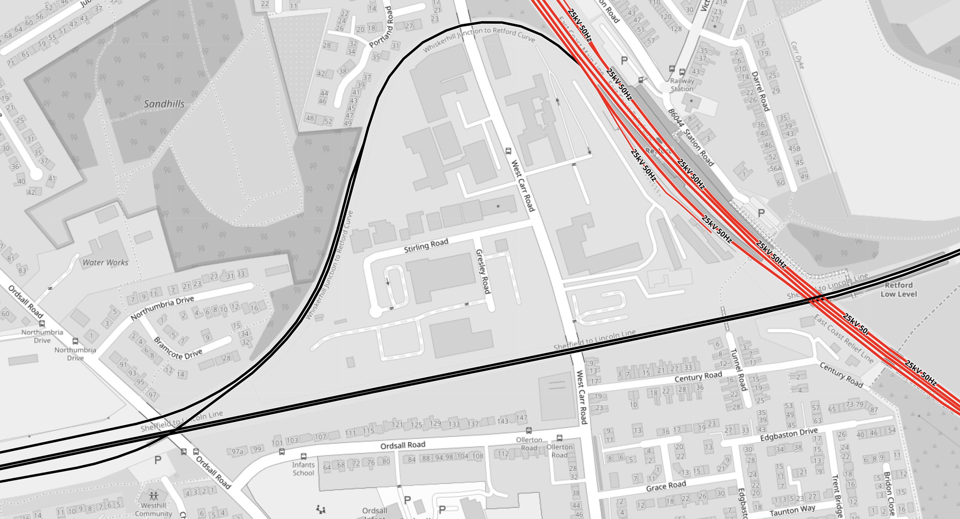
Note.
- The red tracks are electrified and are the East Coast Main Line.
- The black ones aren’t electrified.
- Doncaster is to the North.
- The black line to the East goes to Lincoln
- The black line to the West goes to Sheffield
- The red line going South-East goes to Peterborough and London.
The unusual loop allows trains to connect from one direction to another.
This second OpenRailwayMap shows the tracks in more detail.
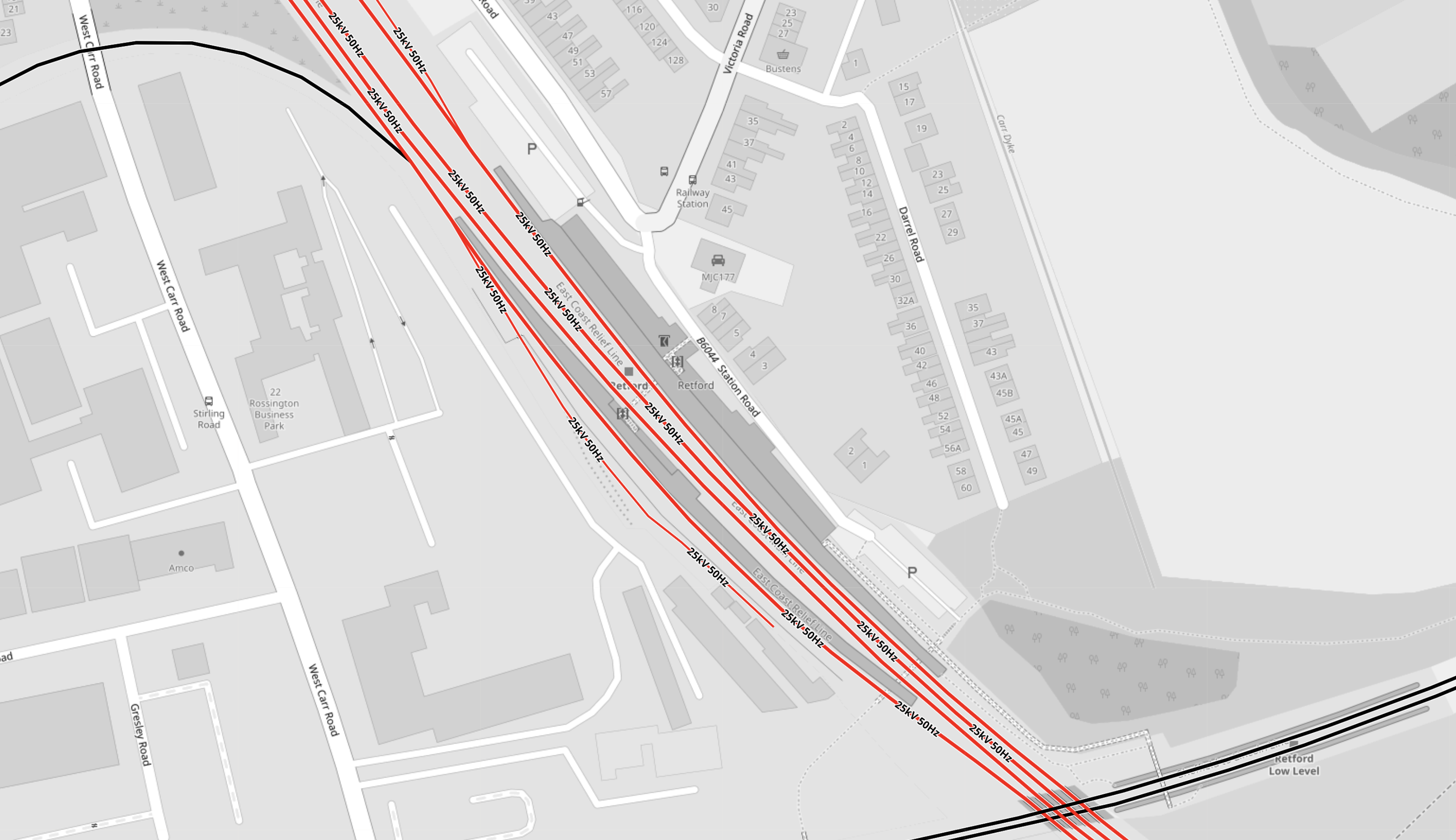
Note.
- As before red lines are electrified and black ones aren’t
- Platforms 1 and 2 are on the East Coast Main Line.
- Platforms 3 and 4 are on the Sheffield and Lincoln Line.
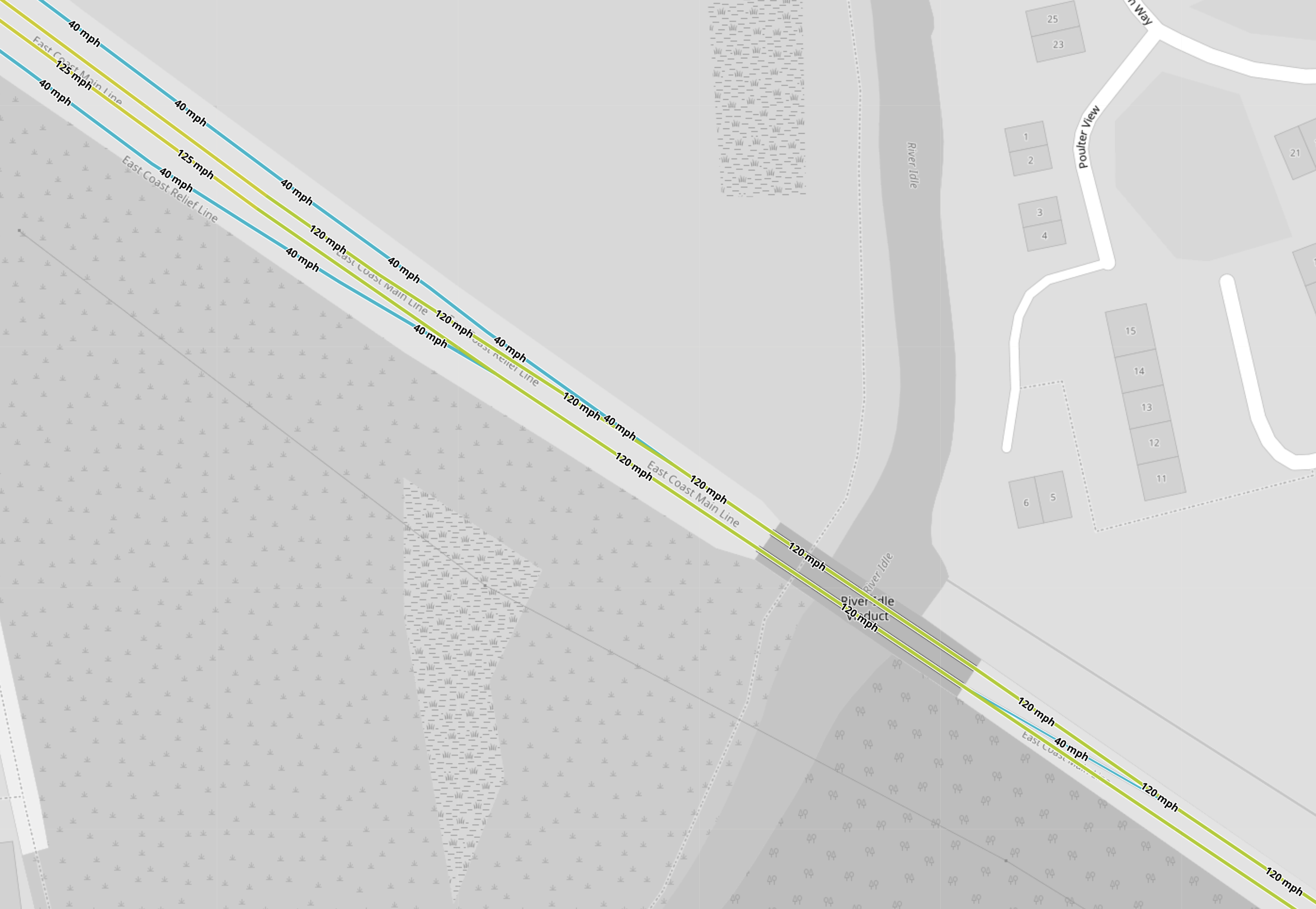
This third OpenRailwayMap shows the platforms in more detail.

Note.
- The yellow tracks are the 125 mph fast lines of the East Coast Main Line.
- The light blue tracks are the 40 mph relief lines of the East Coast Main Line.
- Northbound tracks are to the left of each pair of lines.
- The dark blue track is the 10 mph chord that connects the Northbound relief line of the East Coast Main Line to the Sheffield and Lincoln Line.
- Platform 1 is on the Southbound relief line.
- Platform 2 is on the Northbound relief line.
- Unusually, both platforms are on the same side of the line.
- In The Lengths Of Hitachi Class 800/801/802 Trains, I state that the full length of an InterCity 225 train is 245.2 metres.
- I suspect that both platforms can accommodate a full length InterCity 225, as the trains have been calling at Retford since the 1980s.
I doubt Retford station has any problem accommodating a pair of Class 802 trains, which it does regularly.
How Do Northbound Trains Go To Sheffield From Retford Station?
This OpenRailwayMap shows the tracks to the South of Retford station in detail.
Note.
- The yellow tracks are the 125 mph fast lines of the East Coast Main Line.
- The light blue tracks are the 40 mph relief lines of the East Coast Main Line.
- Northbound tracks are to the left of each pair of lines.
Trains needing to stop in Retford station will need to cross to the Northbound relief line to enter Platform 2 at Retford station.
This OpenRailwayMap shows the curve that connects Platform 2 at Retford station to the Sheffield and Lincoln Line to Sheffield.

Note.
- The green tracks are the 60 mph Sheffield and Lincoln Line.
- Sheffield is to the West.
- The blue tracks are the curve that connects Platform 2 in Retford station to the Sheffield and Lincoln Line.
- There appears to be a grade-separated junction, where the two lines join to the West of Retford station.
A Northbound train to Sheffield will take curve and then join the line to Sheffield.
How Do Southbound Trains Go From Sheffield Through Retford Station?
I suspect trains do the opposite from a train going to Sheffield.
The train takes the curve and then stops in Platform 2 facing South.
This OpenRailwayMap shows the tracks to the South of Retford station in detail.
When the train is cleared by the signals to go South, it will leave Retford station going South on the Northbound relief line.
Note that on the map there are two crossovers, which the train will take to get on the Southbound fast line for Newark and London.
As a Control Engineer, I suspect this is the sort of manoeuvre, that modern digital signalling will make slicker and safer.
How Do Northbound Trains Go To Hull From Retford Station?
On leaving the station, the train will continue along the relief line until it merges with the Northbound fast line for Doncaster.
This is exactly as any Northbound train stopping at Retford does now.
How Do Southbound Trains Go From Hull Through Retford Station?
Currently, trains from Hull stop in Platform 1 on their way to London.
- Trains needing to stop in Retford station will need to cross to the Southbound relief line to enter Platform 1 at Retford station.
- When the train is cleared by the signals to go South, it will leave Retford station going South on the Southbound relief line.
- The Southbound relief line joins the Southbound fast line to the South of the station.
This is exactly as any Southbound train stopping at Retford does now.
Could A Hull And A Sheffield Service Run As A Pair And Split And Join At Retford Station?
Consider.
- Class 802 trains, as used by Hull Trains are designed to be run as a pair of trains, with easy coupling and uncoupling between the two trains.
- Hull Trains regularly run services as a pair of Class 802 trains.
- A pair of trains could leave King’s Cross. They would then split at a convenient station, after which the two trains go to different destinations.
- There are advantages with respect to infrastructure charges.
I feel that Hull Trains two services to Sheffield and Hull/Beverley could work as a pair.
- A pair of trains could leave King’s Cross.
- At Retford station they would split, with one train going to Hull and the other to Sheffield.
Coming South they would join at Retford.
How Would Splitting Of A Hull And Sheffield Service Be Performed At Retford Station?
The procedure would be something like this.
- As the pair of train is stopping in Retford station, it would use the relief line to enter Platform 2.
- It would stop in Platform 2.
- The trains would be uncoupled.
- The front train would go to its destination.
- The rear train would go to its destination.
Note.
- As the track to Doncaster and Hull is faster, the front train should probably be for Hull.
- Platform 2 is electrified, so the Sheffield train could top up its batteries .
- The Sheffield train could lower its pantograph.
Uncoupling takes about two minutes.
How Would Joining Of A Hull And Sheffield Service Be Performed At Retford Station?
Consider.
- Joining would have to be performed in Platform 2, as there is no route for a train from Sheffield to access Platform 1.
- North of Retford station there are two convenient crossovers, to allow a train to cross to the Northbound relief line. There are also a couple of loops, where trains could wait.
- As this is coal-mining country, perhaps, they were part of a freight route between Sheffield and Doncaster?
But this infrastructure would allow, a train from Hull to access Platform 2 at Retford station.
As the Sheffield train can easily access Platform 2, the two trains could meet in Platform 2 and then be joined together for a run to London.
Is There A Problem With Splitting And Joining Of the Hull And Sheffield Services?
Earlier, I said these were the stops of the two services.
- Going North from London King’s Cross to Hull, trains call at Stevenage (limited), Grantham, Retford, Doncaster, Selby, Howden and Brough.
- Going North from London King’s Cross to Sheffield, trains call at Retford, Worksop and Woodhouse.
Surely, if the trains were travelling as a pair, they would need to stop at the same stations to the South of Retford.
But modern digital signalling will allow trains to run closer together, so perhaps this would be the procedure going North.
- The two trains start in the same platform at King’s Cross, with the Sheffield train in front of the Hull train.
- The two trains leave King’s Cross a safe number of minutes apart.
- At its Stevenage and Grantham stops, the Hull train will tend to increase the distance between the two trains.
- The Sheffield train would stop in Platform 2 at Retford station, so that space is left for the Hull train.
- The Hull train will stop behind the Sheffield train in Platform 2 at Retford station.
- The Sheffield train will leave when ready.
- The Hull train will leave when ready.
And this would be the procedure going South.
- The train from Sheffield would line up in Platform 2 at Retford station.
- The train from Hull would line up in Platform 1 at Retford station.
- The train from Sheffield would leave when everything is ready and the train is cleared by the signalling system.
- The train from Hull would leave a safe number of minutes behind the train from Sheffield.
- At its Grantham and Stevenage stops, the Hull train will tend to increase the distance between the two trains.
- The trains could share a platform at King’s Cross.
The digital signalling and the driver’s Mark 1 eyeballs will keep the Hull train, a safe distance behind the faster Sheffield train.
The Capacity Of The Lincoln And Sheffield Line
Looking at the Sheffield and Lincoln Line, it has only an hourly train, that calls at Darnall, Woodhouse, Kiverton Park, Kiverton Bridge, Shireoaks and Worksop between Retford and Sheffield.
- I would suspect that there is enough spare capacity for Hull Trains to run a one train per two hours (tp2h) service between London King’s Cross and Sheffield.
- If LNER feel that a 1 tp2h frequency is viable for Harrogate, Lincoln and other places, surely Hull and East Sheffield could support a similar service from King’s Cross.
If the services could be run by battery-electric trains, capable of running at 140 mph on the East Coast Main Line and giving times of ninety minutes to Sheffield, this could be a success.
Could Woodhouse Station Become A Transport Hub?
This Google Map shows Woodhouse station.
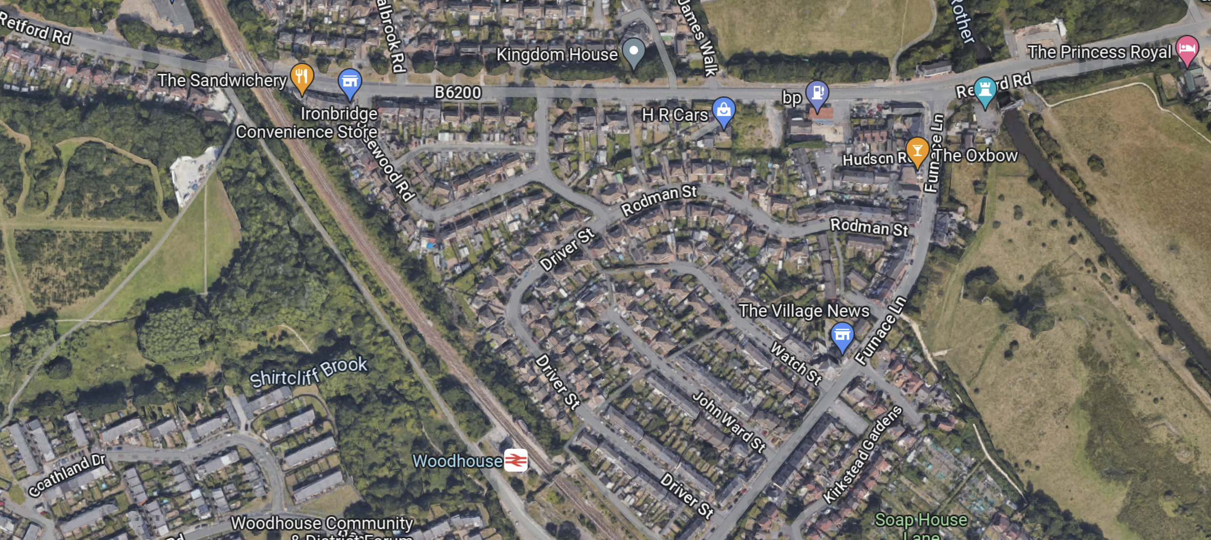
Note.
- It is certainly surrounded by a lot of houses.
- Could it be provided with car-parking?
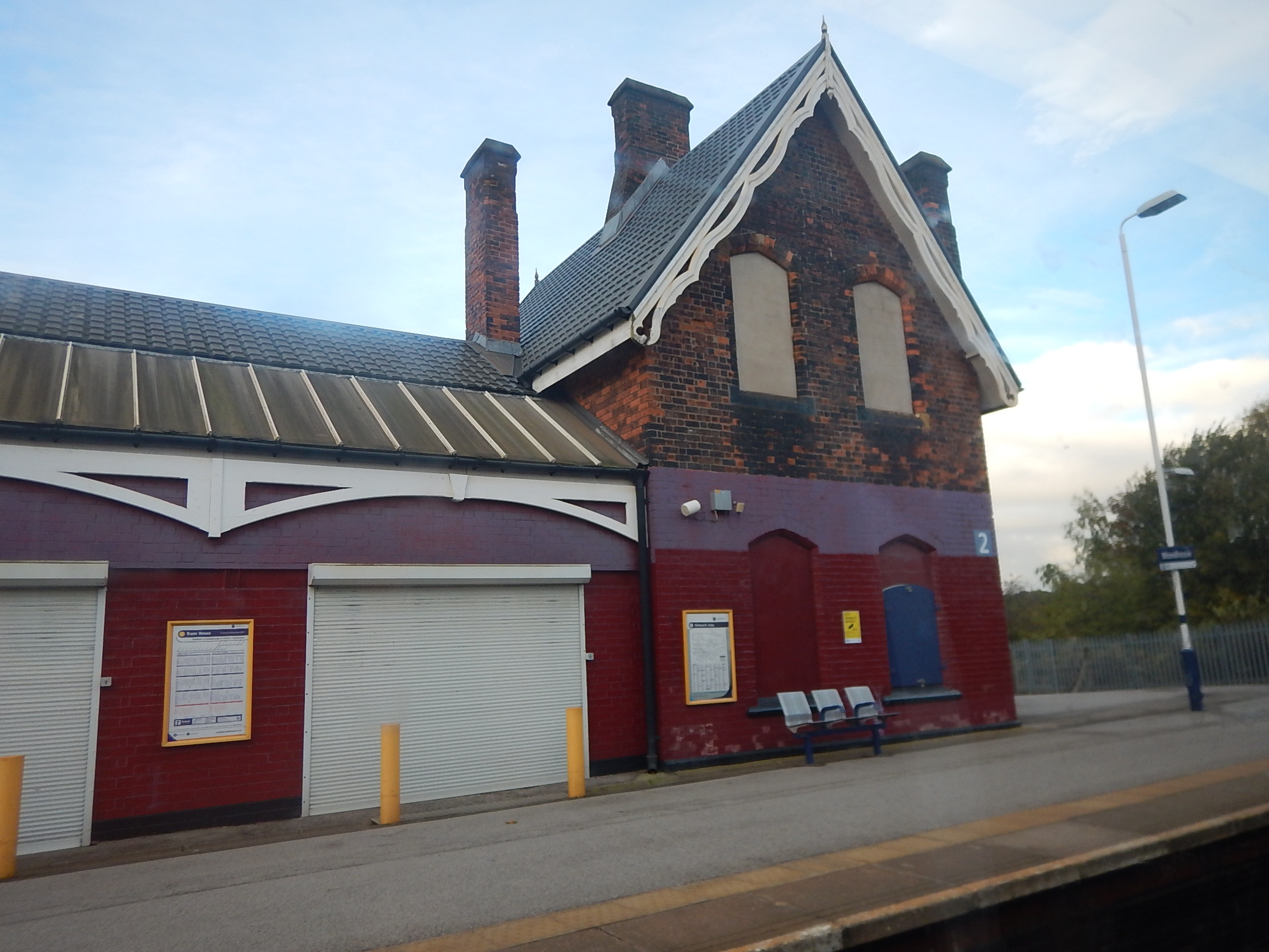
Although, as this picture shows it is not blessed with lots of facilities.
But.
- The station is in an area, which Sheffield want to develop.
- The Advanced Manufacturing Centre is nearby.
- There are aspirations to run a tram-train between Sheffield and Chesterfield via Darnall, Woodhouse and Barrow Hill stations.
- The station could be on the tram-train route to Stocksbridge, that I wrote about in Reopening The Don Valley Section Of The Former Woodhead Line Between Stocksbridge and Sheffield Victoria To Passenger Services.
Woodhouse station could be an interchange or it could become something bigger like a hub station.
How Many Sheffield Services Per Day Could Be Run?
If the Hull and Sheffield trains run as a flight under control of the digital signalling, this will mean that every Hull train can be paired with a Sheffield train.
- There are five trains per day (tpd) to and from Hull and two to and from Beverley.
- It seems a maximum of one tpd in both directions can be a ten-car train.
- Two five-car trains could fit in a platform at King’s Cross.
I suspect that the maximum number of trains per day to and from Sheffield is the same as for Hull. i.e. seven tpd.
But there is no reason, if they have enough trains and paths are available, that Hull Trains couldn’t add extra services to both destinations.
Onward From Sheffield
Several of those, who have commented on the new service have suggested that the service could go further than Sheffield, with Manchester and Leeds being given specific mentions.
This OpenRailwayMap shows the platforms at the Northern end of Sheffield station.
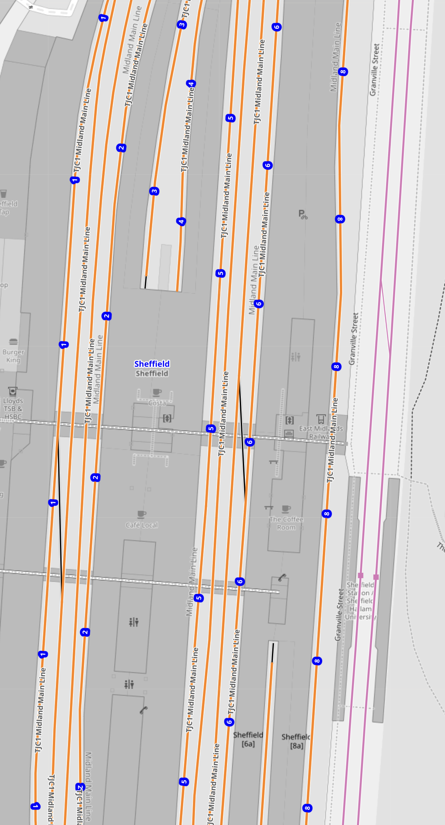
Note.
- The pink tracks at the East are the Sheffield Supertram.
- Trains to and from Barnsley, Huddersfield, Hull, Leeds, Lincoln and Retford access the station from the Northern end.
- Trains to and from Chesterfield, Derby, London, Manchester and Stockport access the station from the Southern end.
- The tracks in Sheffield station are numbered 1 to 8 from the West.
- There are five through platforms. 1, 2, 5, 6 and 8 and two bay platforms at either end.
- An extension of the service to Manchester via the Hope Valley Line, could go straight through the station.
- An extension of the service to Barnsley, Huddersfield or Leeds, would mean the train reversing at Sheffield.
It looks like an extension to Manchester Piccadilly over the recently upgraded Hope Valley Line would be the easiest extension. But would Avanti West Coast, who have FirstGroup as a shareholder want the competition?
Recently, it has been announced that the Penistone Line to Barnsley and Huddersfield will be upgraded to accept two trains per hour (tph) and allow faster running.
Because Sheffield could be around eighty minutes from London, there could be some smart times to and from the capital.
- Meadowhall in 90 minutes
- Barnsley in 112 minutes.
- Huddersfield in 140 minutes.
Huddersfield could be almost twenty minutes faster than the route via Leeds.
Comments From The Times
These are some readers comments from The Times.
- Hope the prices are competitive with LNER. I rarely go to London from Chesterfield with EMR as they’re so expensive. LNER from Newark is much cheaper but a service from Worksop for me would be perfect.
- Excellent News in so many ways. I hope it really takes off which could help ease the congestion on the M1 and also thin out overcrowding on busy LNER services. It really does deserve to succeed.
- This is excellent news. The Lumo service has been a game changer for me and those living in the north east.
The public seem in favour.
Conclusion
I really like this proposal from FirstGroup.
- It has the possibility to provide Sheffield with a fast train link to London.
- It could run about six trains per day.
- It will be faster than High Speed Two was proposed.
It could be the first service of High Speed Yorkshire.
Getlink To Enable The Doubling Of Direct High Speed Rail Services From The UK Over The Next 10 Years Via The Channel Tunnel
The title of this post, is the same as that of this press release from Getlink.
This is the sub-heading.
This doubling will be achieved by reducing the “time to market” from 10 to 5 years for operators who intend to launch new services between London and Cologne, London and Frankfurt, London and Geneva, London and Zurich.
These three paragraphs introduce the press release.
On 6 May 2024, Eurotunnel, a wholly owned subsidiary of Getlink, will celebrate 30 years since the opening of the Channel Tunnel and the introduction of the first LeShuttle and LeShuttle Freight rail services linking Folkestone (Kent)to Coquelles (Pas-de-Calais). This year will also mark the 30th anniversary of the first direct rail links between London and Paris, and London and Brussels.
Three decades after this pioneering step forward in Europe’s rail network, and in the wake of the development of the recently introduced link between London and Amsterdam, Eurotunnel is aiming to further accelerate the low-carbon mobility of people between the UK and continental Europe by doubling the number of new direct destinations from London via the Channel Tunnel over the next 10 years.
The reduction in the time needed to launch new services to just 5 years is the fruit of the work by Eurotunnel, the infrastructure manager and keystone of the cross-Channel high-speed links, in cooperation with partners from across the European ecosystem (infrastructure managers, authorities, manufacturers, regulators).
Getlink will use these four steps towards simplification.
- Market research carried out by Eurotunnel to identify destinations.
- Standardisation of Tunnel regulations with the relevant authorities.
- Integration of tunnel specific criteria with manufacturers in their standard rolling stock offering.
- Preparing cross-Channel connections with network operators and stations.
It will be so good to have more services between London and Europe.
Could A Mega-Station Be Built For The Channel Tunnel?
This article on Railway Gazette International, is entitled Start-Up Announces Amsterdam To London And Paris High Speed Train Ambitions.
It talks about how Dutch start-up; Heuro wants to run fifteen trains per day (tpg) between London and Amsterdam.
The article then has this paragraph, which details other operators, who are wanting to run services between London and the near Continent.
Heuro’s announcement comes after Spanish start-up Evolyn announced plans in October for a Paris – London service, while on November 11 British newspaper The Daily Telegraph reported that Sir Richard Branson and Phil Whittingham, former head of Virgin Trains and Avanti West Coast, were also drawing up plans to compete with Eurostar and had held discussions with infrastructure managers.
This leads me to the conclusion, that there will be a need for more capacity for trains and/or passengers at some time in the future.
- There are six International platforms at St. Panvcras International station, which can each probably handle four trains per hour (tph), so I suspect the station could handle 24 International tph.
- As a modern high speed train can carry over 500 passengers, that is 12000 passengers per hour.
- Visit St. Pancras station in the morning and it is often crammed with travellers coming from and going to Europe.
I suspect that the number of trains may not be a problem, but the number of passengers will.
We could always join Shengen, but then that would be an open door to all the would-be migrants to the UK.
This Google Map shows Stratford International station.
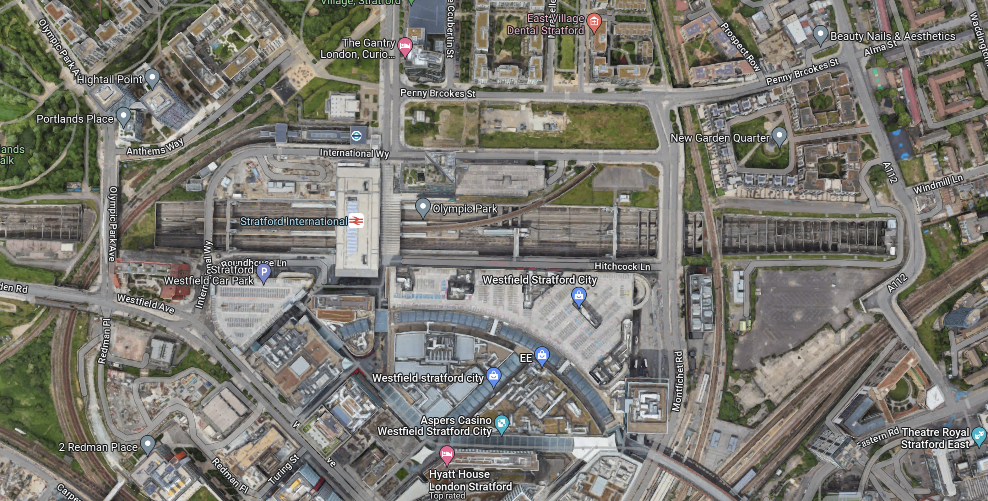
Stratford International station is in a soulless concrete cavern, that lies across the middle of the map.
In Platforms 1 And 4 At Stratford International Station, there are a lot of pictures of the station.
I think it would be extremely difficult to add extra platforms and passenger facilities to the station.
This Google Map shows Ebbsfleet International station.
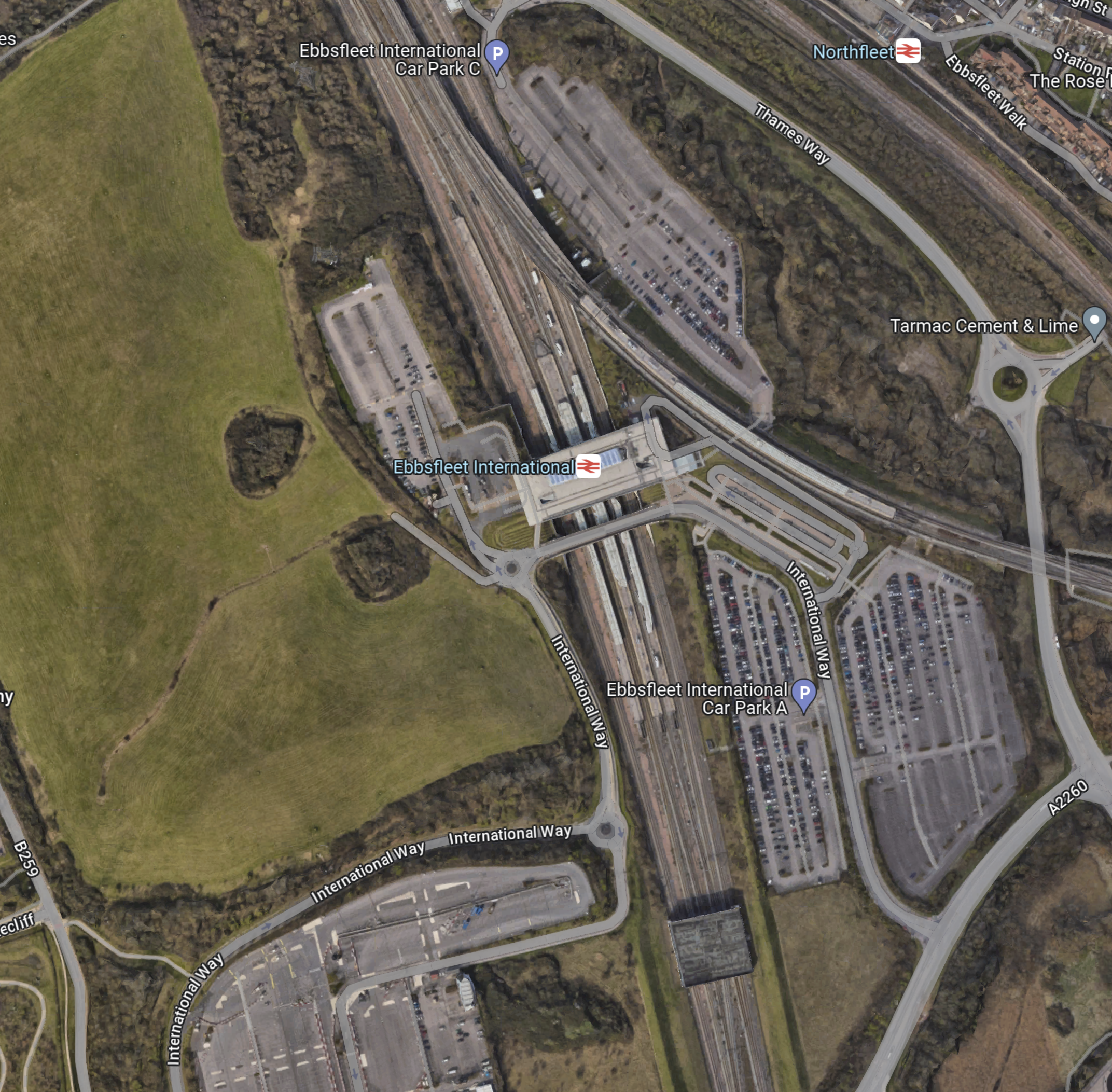
Note.
- Ebbsfleet International station, with its two International and four domestic platforms is in the middle of the map.
- The station is surrounded by car parks with a total of 5,000 spaces.
- Northfleet station is in the North-East corner of the map.
There is a lot of land, without any buildings on it.
These are my thoughts.
Enough Extra Bay Platforms To Handle The Additional Trains
There would appear to be space for perhaps two bay platforms to terminate trains.
But would passengers we happy being dumped outside Central London?
Would An Elizabeth Line Extension To Ebbsfleet Be Needed?
There are various plans to link the Elizabeth Line tp Ebbsfleet International.
In Elizabeth Line To Ebbsfleet Extension Could Cost £3.2 Billion, I showed this map from the Abbeywood2Ebbsfleet consultation.
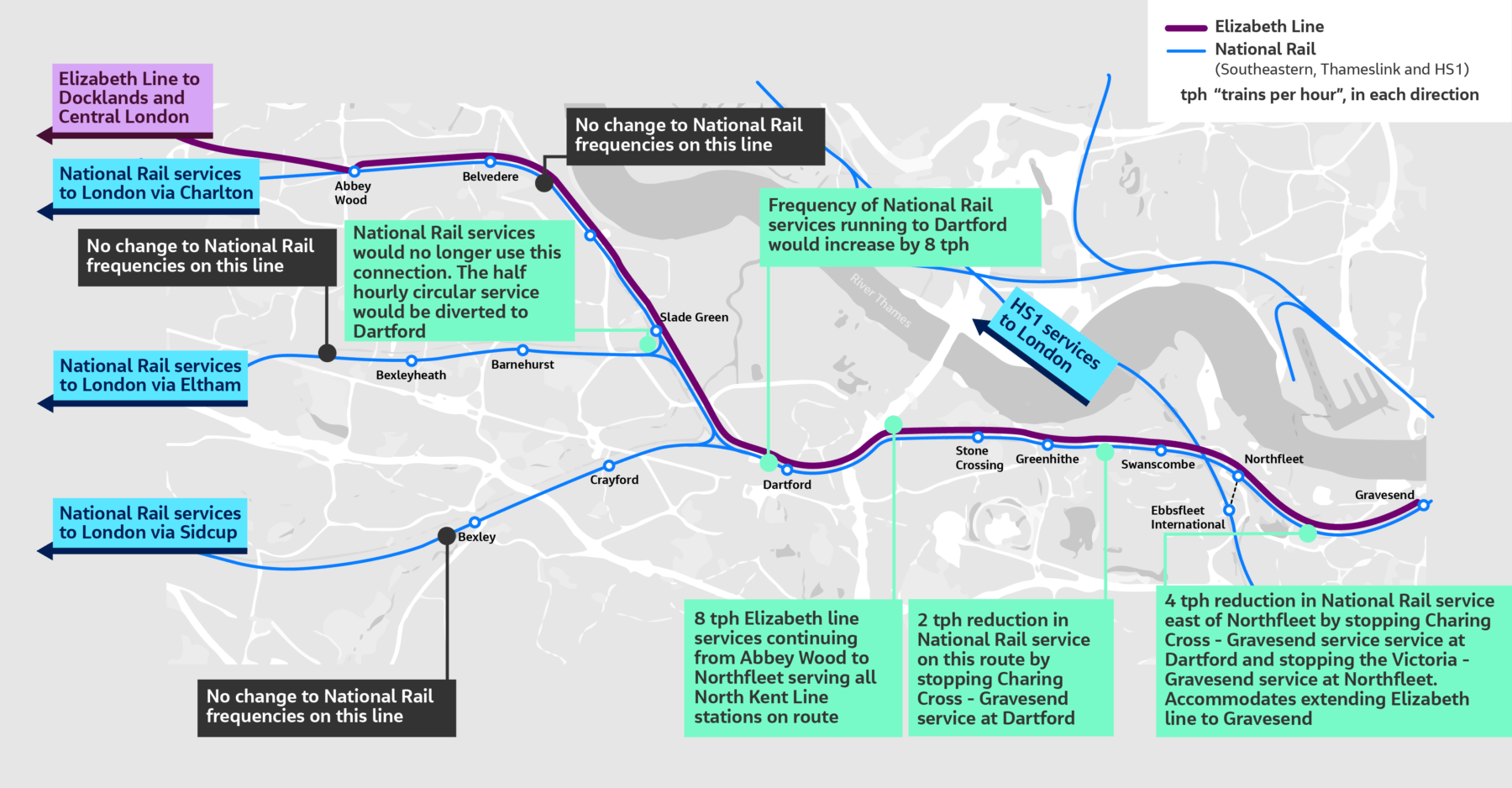
There doesn’t appear to be too much new infrastructure, except for a proper connection between Northfleet and Ebbsfleet stations. References on the Internet, say that the similar-sized Luton DART connection at Luton Airport, cost around £225 million.
The Elizabeth Line connects to the following.
- Bond Street
- Canary Wharf
- City of London
- Farringdon for Thameslink
- Heathrow Airport
- Old Oak Common for High Speed Two
- Liverpool Street station
- Oxford Street
- Paddington station
- Slough for Windsor
- Tottenham Court Road for the British Museum, Oxford Street, Soho, Theatreland and the Underground.
- West End of London
- Whitechapel for the Overground and Underground
For many people like me, the Elizabeth Line at Ebbsfleet will provide one of the quickest ways to get to and from European trains.
Ebbsfleet Has Space For A Bus Station
A bus station with comprehensive routes could be built at Ebbsfleet station, which I don’t think will be possible at St. Pancras.
It would also be possible to provide an easy route to Gatwick Airport along the M25.
Hotel Accommodation
This is surely necessary.
It would make an ideal base for tourists and business people, who wanted to visit several of the large cities connected to Ebbsfleet.
A Very Large Car Park
Consider.
- Heathrow Airport is looking at providing upwards of 50,000 car parking spaces.
- Some travellers are seriously allergic to public transport and will always use their car.
- Many travellers these days want to take a severely outside case with them, when they’re only having a weekend in Paris.
I feel that a mega-station for Europe will need upwards of 10,000 car parking spaces. All of them with vehicle-to-grid chargers.
A Very Large Storage Battery
According to this page on the E-on web site, the average size of the battery in an electric vehicle is 40 kWh.
If 5,000 car parking spaces were to be fitted with vehicle-to-grid charging (V2G), that would be 2 MWh of energy storage, that could be used by National Grid, to store surplus electricity.
Get V2G right and it could make a serious contribution to your parking costs.
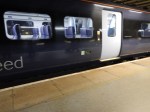
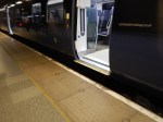
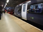
Pictures Of Ebbsfleet Station
These are some pictures I took at Ebbsfleet station today.

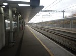
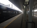


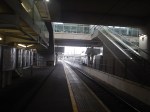


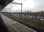
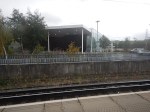
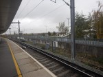
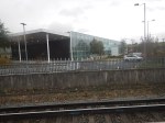
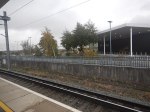
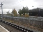
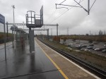
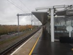
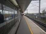
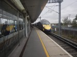
Note.
- The station is a fairly boring concrete, glass and steel construction.
- The SouthEastern HighSpeed services also go to St. Pancras, so they don’t offer any different connectivity towards the capital.
In addition, the SouthEastern HighSpeed Class 395 trains aren’t step-free at the platforms, as these pictures shows.
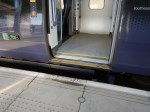
As I came back into St. Pancras International station, staff were struggling to load a wheelchair onto a train using a ramp.
Would A Two-Station Solution Increase Capacity?
High Speed Rail lines have high capacity trains and there are examples of more than one station at the end of a route.
- The London end of High Speed Two will have stations at Old Oak Common and Euston.
- The Manchester end of High Speed Two will have stations at Manchester Airport and Manchester Piccadilly.
- The Edinburgh end of the East Coast Main Line has stations at Waverley and Haymarket.
- The Amsterdam end of Eurostar and Thalys has stations at Rotterdam, Schipol Airport and Amsterdam.
A selection of stations gives choice and convenience for travellers.
Conclusion
I believe that selective development of Ebbsfleet International station could be used to take the pressure away from St. Pancras International station.
These developments could include.
- A comprehensive bus station
- Elizabeth Line to Northfleet
- Hotel Accommodation
- Lots Of Car Parking
Are Short Lengths Of High Speed Line A Good Idea?
In New ‘HS3’ Link To Yorkshire Proposed By Thinktank After Region’s HS2 Axe, I showed that a short length of faster by-pass line could give decent ties savings.
So in this post, I will look at home much time, diversions or by-passes like the Selby Diversion could save.
The diversion runs between Temple Hirst Junction and Colton Junction.
- It is 13.8 miles long.
- A typical train takes 7.5 minutes, which is an average speed of 115 mph.
- But Wikipedia claim that the route was well-designed and British Rail felt it was good for 160 mph.
So what times are possible at various speeds?
- 115 mph – 7.5 minutes
- 120 mph – 6.9 minutes
- 130 mph – 6.4 minutes
- 140 mph – 5.9 minutes
- 150 mph – 5.5 minutes
- 160 mph – 5.2 minutes
- 180 mph – 4.6 minutes
They are not great savings, but if you could increase operating speed on straight sections of thirty miles and raise the average speed from 120 to 180 mph, that would save five minutes. It would all mount up.
If you look at the railway maps of the UK, there are sections of the East Coast Main Line, Great Western Main Line, Midland Main Line and West Coast Main Line, where the track is straight and sometimes as many as four-tracks.
Stevenage Station And Stoke Junction
A simple example in a few years could be between just North of Stevenage station and Stoke junction, which after current works and some others could be four tracks all the way.
- It is 72.2 miles.
- Trains take 39 minutes.
- My timings give an average speed of 111 mph.
- There are a number of level crossings.
- Flat junctions at Hitchin and Werrington have been replaced with grade separated junctions.
Note that it is longer than the Cologne-Aachen high speed railway in Germany, which is only 43 miles long and has an operating speed of 250 kph or 155.3 mph.
Savings on the Stevenage and Stoke stretch could be as follows.
- 140 mph – eight minutes
- 155.3 mph – eleven minutes
- 160 mph – twelve minutes
- 180 mph – fifteen minutes.
- 200 mph – seventeen minutes.
This alone could mean that London Kings Cross and Leeds could be around two hours with trains such as the proposed High Speed Two Classic-Compatible Trains.
It couldn’t be extended to the North very easily as Stoke Tunnel is between Stoke junction and Grantham.
This Google Map shows the tunnel.
If it could easily be converted into a four-track cutting, this would add nearly six miles to the four-track section with high speed lines in the middle and slow lines on the outside.
A Diversion At York
When improving speeds and times on the East Coast Main Line, a diversion at York is sometimes mentioned.
The Google Map shows the East Coast Main Line, as it goes through York station.
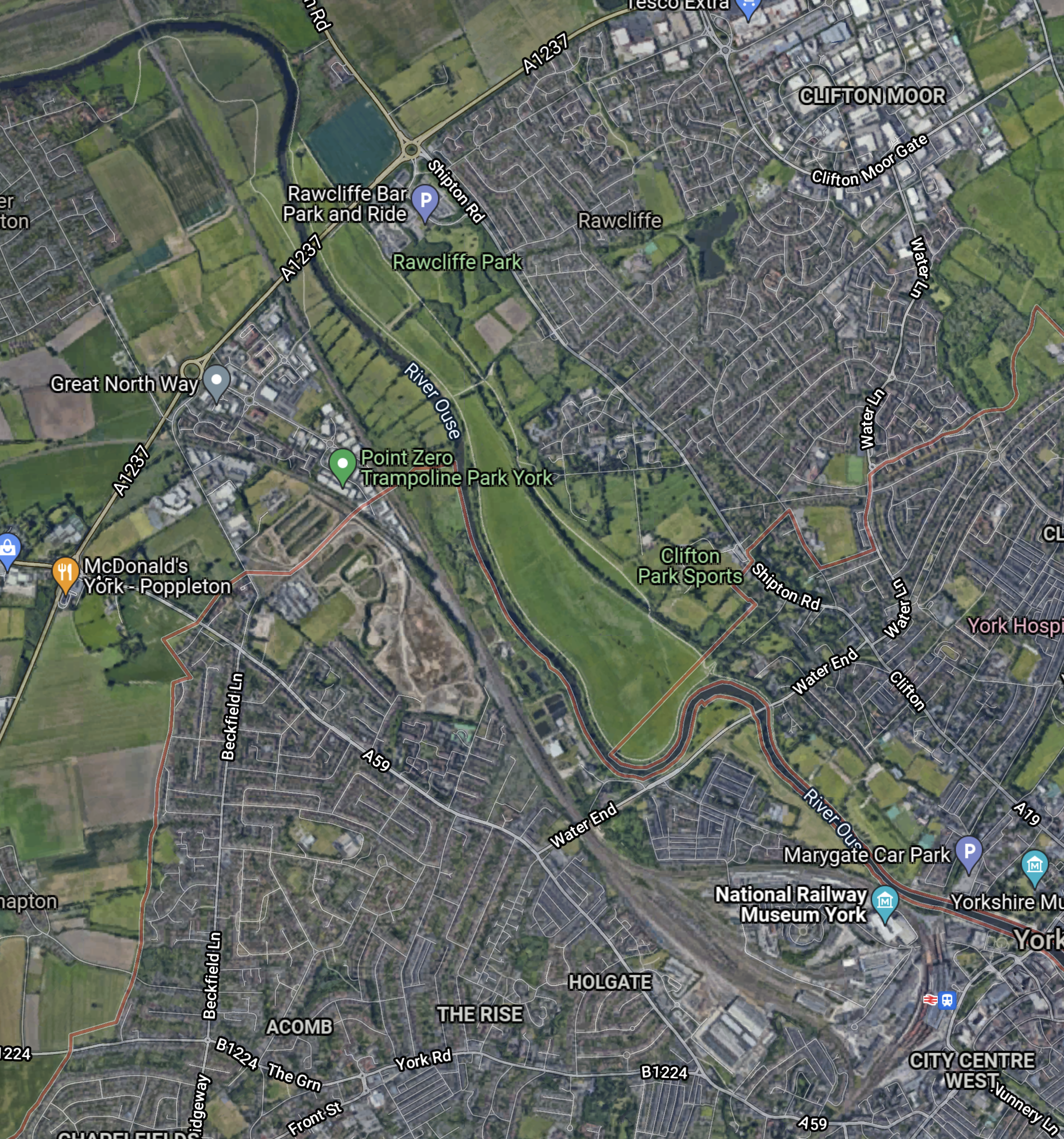
Note.
- York station is in the South East corner of the map.
- The River Ouse meandering North from near the station, before turning West at the top of the map.
- The East Coast Main Line running North from the station to the West of the river.
The railway crosses the river just to the North of Skelton junction.
This Google Map shows the tracks at York in more detail.
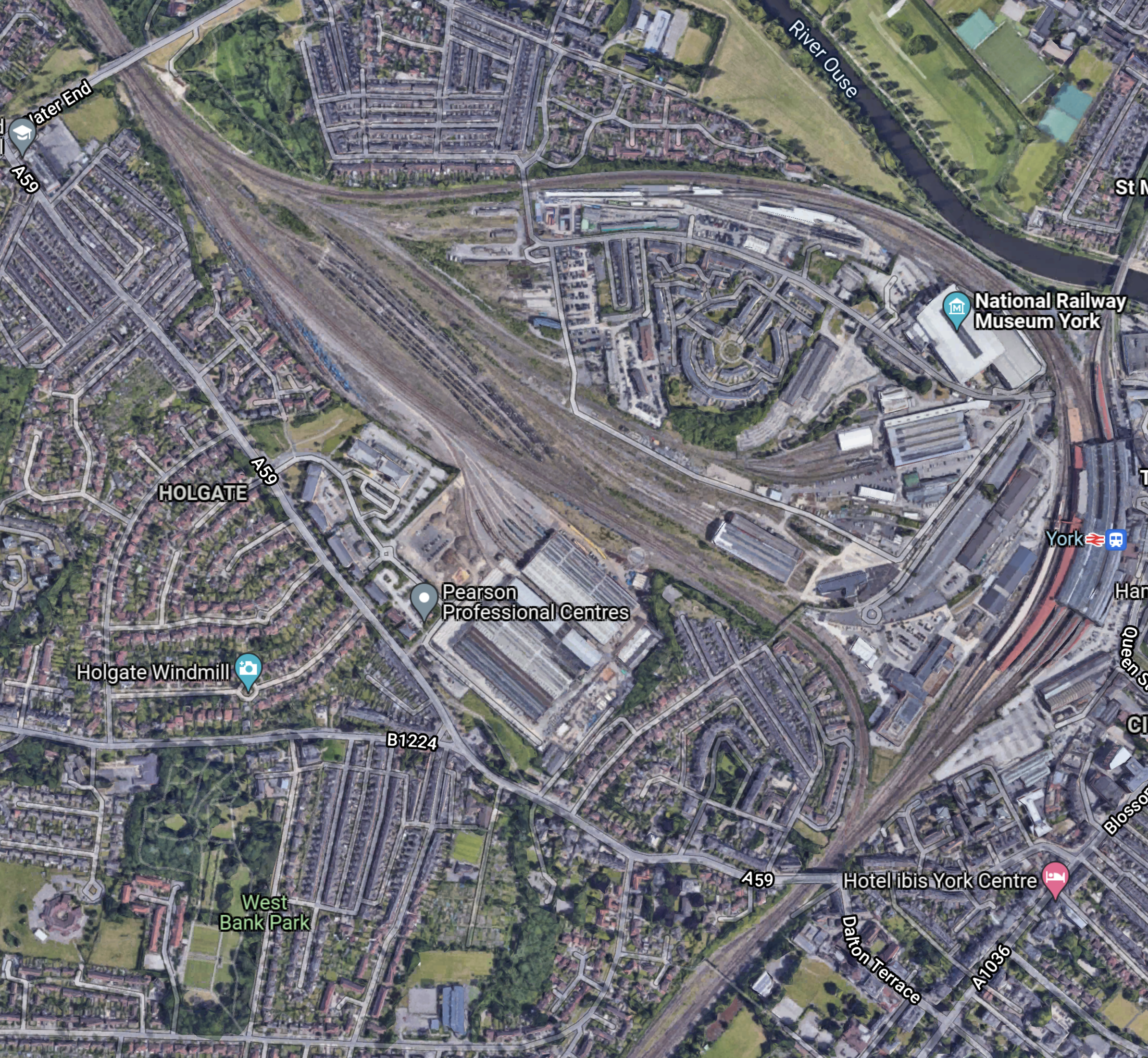
Note.
- The River Ouse in the North-East corner of the map.
- The East Coast Main Line through York station curving round the Railway Museum, before going North.
- A second rail route and sidings to the West of the East Coast Main Line can be seen.
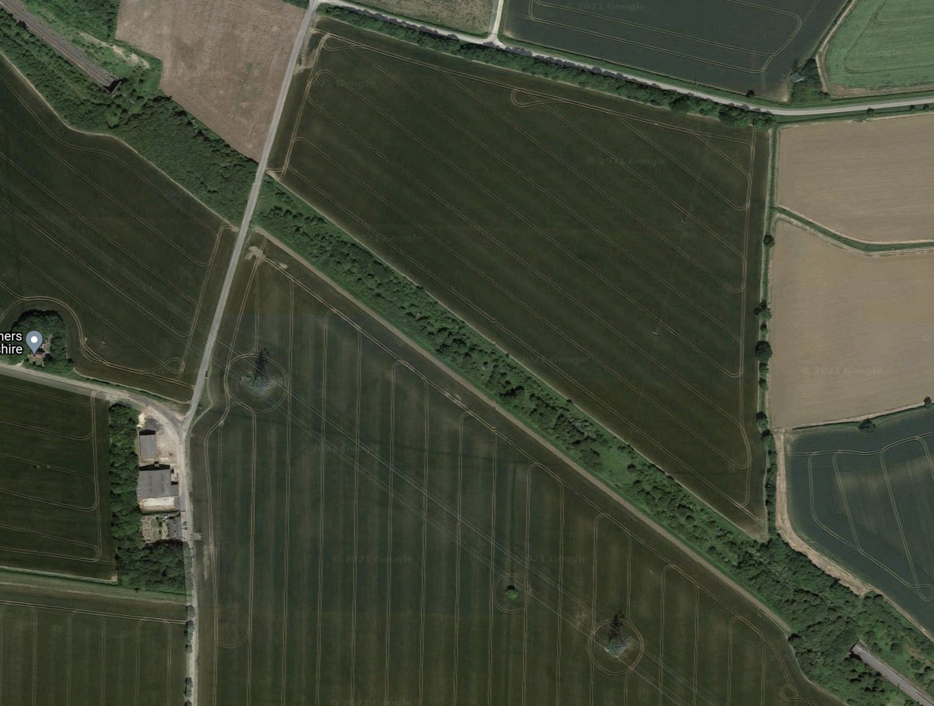
Could a diversion route be created between Holgate and Skelton junctions on railway land?
- It would be about two miles long.
- It could be built to also sort out the bottleneck at Skelton junction.
- It might be possible to extend the fast line to Northallerton station.
This could create up to thirty miles of fast lines between Holgate junction and Northallerton.
A Diversion At Durham
When improving speeds and times on the East Coast Main Line, a diversion at Durham is sometimes mentioned.
The Google Map shows the East Coast Main Line, as it goes through Durham station.
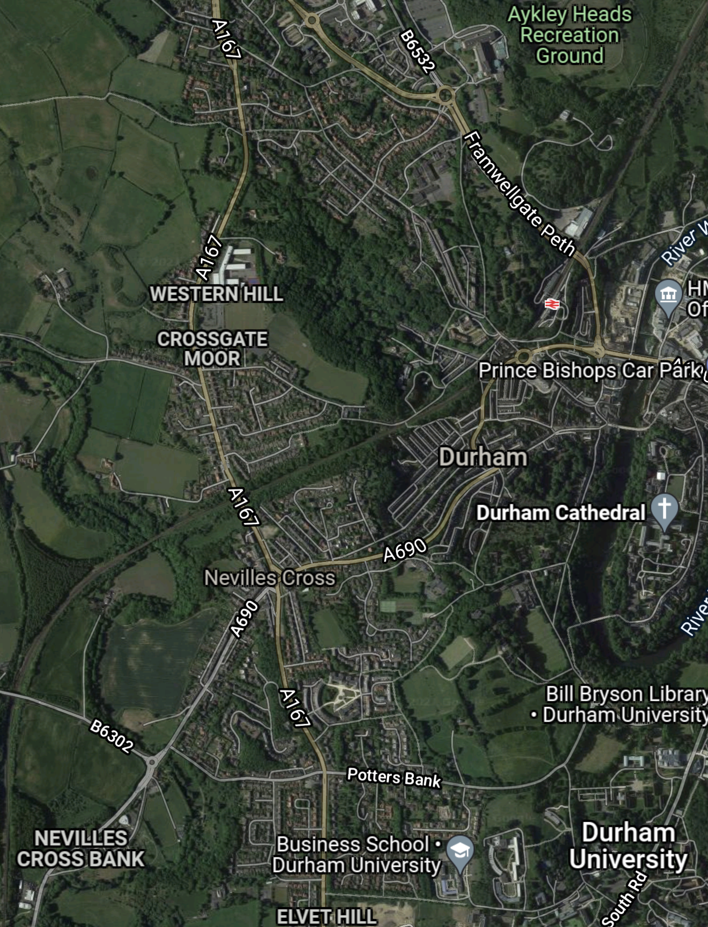
Note.
- I have arranged the map so that the East Coast Main Line goes between the South-West and North-East corners of the map.
- Durham station is clearly visible.
- The railway line curves East towards the station around Nevilles Cross after running North from the South.
This Google Map shows the East Coast Main Line, as it goes through Chester-le-Street station.
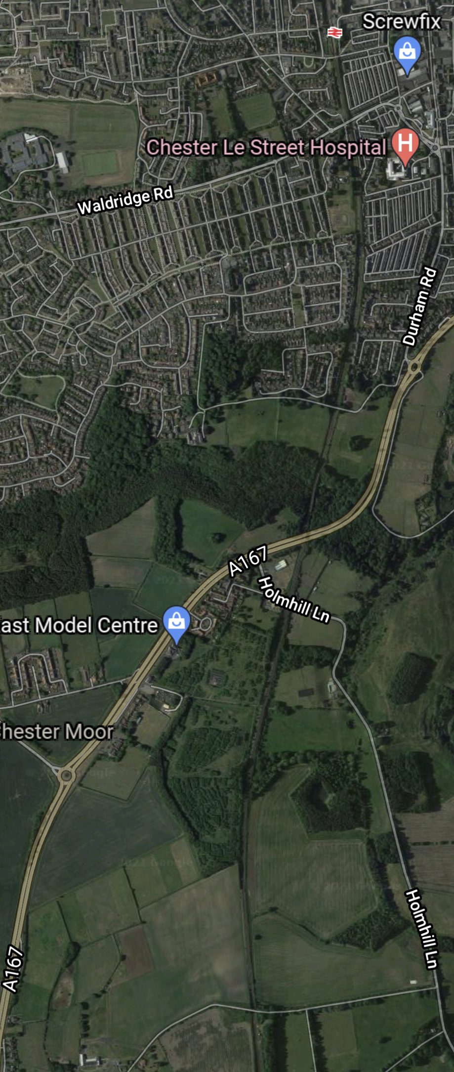
Note.
- Chester-le-Street station is in the North-East corner of the map.
- The East Coast Main Line runs North-South down the middle of the map.
- About halfway down the map, the East Coast Main Line starts to veer to the East.
If you look at the bigger picture of these maps, it appears that to serve Durham, the line took a loop to the East, so would a diversion cut off the corner between Chester-le-Street and Nevilles Cross and put Durham on a loop?
It would be a bit shorter, but it could be built to enable running at a higher speed.
Short German High Speed Lines
I have travelled a lot on German trains and they have some of our problems.
- Infrastructure dating back to the times of Kaiser Bill.
- A high mileage of track without electrification.
- Less high speed railways than France or Spain.
They are creating several high speed railways.
Earlier, I indicated that the Cologne-Aachen high speed railway, which is only 43 miles long, has an operating speed of 250 kph.
Other short high speed railways include.
- Lübeck–Hamburg railway – 39 miles – 200 kph.
- Lübeck–Puttgarden railway – 55.1 miles – 200 kph.
- Mannheim–Stuttgart high-speed railway – 62 miles – 280 kph
- Nuremberg–Erfurt high-speed railway – 66 miles – 300 kph
- Stuttgart–Wendlingen high-speed railway – 9.5 miles – 250 kph
- Wendlingen–Ulm high-speed railway – 37 miles – 250 kph
Note, that the Germans are still upgrading lines to 200 kph or 125 mph.
The Germans would appear to favour some shorter high speed lines, so it must be a worthwhile philosophy.
Conclusion
I very much feel there is scope to create some new high speed sections on the current UK network, with only building very little outside of the current land used by the network.
As with Germany would it be worthwhile to upgrade some lines to 125 mph running?
These could be possibilities.
- Basingstoke and Exeter – Currently 121 miles at 90 mph – Not electrified
- London Liverpool Street and Norwich – Currently 114.5 miles at 100 mph – Electrified
- North Wales Main Line – Currently 84.4 miles at 90 mph – Not electrified
- Reading and Taunton – Currently 107 miles at 110 mph – Not electrified
There are probably others.
