A Report On The Bakerloo Line Extension
Transport for London, have released a report on the Bakerloo Line Extension that they call the Option Selection Summary Report.
It is one of those worthy documents, you get from analysing the data from consultations.
But it is full of several nuggets, which although not directly associated with the Bakerloo Line could be very important for passengers coming from or venturing to South London.
They have also provided this helpful map, which lays out possible actions and improvements.
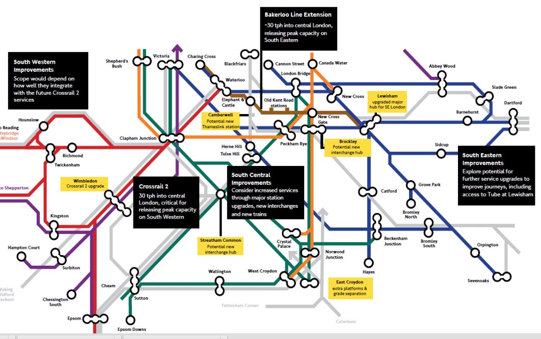
Rail Improvements South Of The Thames
I hope that the boxes can be read.
I shall deal with the various boxes in separate sections, going in a vaguely East to West direction. I will leave out the Crosrail 2 related topics for the moment.
Bakerloo Line Extension
The summary on the map says thirty trains per hour (tph) into Central London, releasing peak capacity on South Eastern. They describe the extension like this in the Executive Summary of the report.
Following the 2014 consultation, we have conducted a comprehensive assessment of the consulted route options alongside alternatives suggested by respondents and stakeholders. The work has concluded that an extension to Lewisham via the Old Kent Road is currently the best option as a first phase, as the route would serve the Old Kent Road Opportunity Area and support significant numbers of new homes and jobs for London. This would include a major new interchange at Lewisham. It is estimated that the selected corridor could enable over 25,000 new homes by serving Opportunity Areas and regeneration areas along its length.
From the map, the route of the extended Bakerloo Line, would be a simple one from the current terminus at Elephant and Castle station to Lewisham station, via two new stations in the Old Kent Road and an interchange at New Cross Gate station with the London Overground and main line services from London Bridge.
These are various highlighted points from the report.
- Assessment of the alternative route options suggested during the 2014 public consultation has demonstrated that the options towards Lewisham remain the most effective for addressing the challenges in south east London.
- An extension should serve Lewisham station due to the new homes that could be unlocked in growth areas along its route, and the wider transport connectivity and access improvements it would provide. 4.2.1. Our assessment work has found that although shor
- We currently recommend a route to Lewisham via Old Kent Road for further development as part of an initial phase for an extension. We have found that this option has the greatest potential to unlock new homes to support London’s growth and significantly improve transport provision in south east London.
- An extension via Old Kent Road would provide a step-change in the capacity, connectivity, accessibility and speed of travel for residents.
- By improving transport and unlocking new homes and jobs growth, the economic benefits of the Old Kent Road option are higher than the route via Camberwell and Peckham Rye. The latter option is estimated to be more expensive to deliver and has a lower potential of obtaining funding.
- Delivering a major transport infrastructure project is a challenging and often risky process. By integrating planning with the Opportunity Area development, the proposed route via the Old Kent Road offers the best prospect of successful delivery.
- An initial extension to Lewisham could form part of a wider package of complementary rail improvements across south and south east London, providing improved journeys via Tube and rail connections.
The report doesn’t rule out extensions beyond Lewisham. This is said.
The assessment shows there could be significant additional benefits from an extension beyond Lewisham and therefore it has not been ruled out at this stage, with further work required to develop the deliverability and case further.
Under Next Steps, this is said.
We will focus developing plans for the first phase of an extension to Lewisham via the Old Kent Road, with further public consultation anticipated in 2016.
TfL’s proposals for the Bakerloo Line Extension would appear to be simple and deliverable at an acceptable cost to give the greatest benefit to South East London.
It should also not be the most difficult line to build, as it is only three stations, with it would appear plenty of green space and cleared sites on the surface for access.
It would almost be a repeat of the Northern Line Extension, except that it is shorter.
For people like me living on the East London Line, the interchange to the Bakerloo Line at New Cross Gate will be very much welcomed, as it improves connectivity to that difficult-to-access area between Piccadilly Circus and Elephant and Castle. Try getting from Dalston to Charing Cross in the rush hour!
I think the biggest problem of this short extension, is going to be that even at an increased frequency of 30 tph, it will quickly get close to capacity.
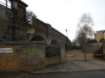
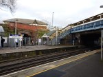
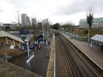
Lewisham Station
The map also labels Lewisham station with a box saying upgraded major hub for SE London.
This Google Map shows Lewisham station.
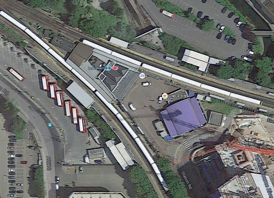
Lewisham Station
I think that there would appear space for improvements and digging the shafts for the creation of the Bakerloo Line Extension.
South Eastern Improvements
The summary on the map says explore potential for further service upgrades to further improve journeys, including access to Tube at Lewisham.
Some stations have been upgraded to a modern standard, but many still don’t have the fscilities that passengers expect these days.
Nothing is said about TfL’s long term ambition to take over the Metro services of Southeastern.
South Central Improvements
The summary on the map says consider increased services through major station upgrades, new interchanges and new trains.
I could repeat what I said in the previous section for South Eastern Improvements.
New Trains
This is very much a general point about new trains.
London’s latest train fleets are increasingly becoming walk-through from one end to the other.
Passengers are also getting very savvy in their train usage and often board a train in a coach, that will be close to their exit at the destination.
And if they get on at the wrong point, they will often walk to their desired exit position, before the train stops.
So could this be used to advantage in the design of stations, with more perhaps having multiple exit points, as do some Crossrail stations?
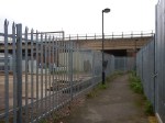
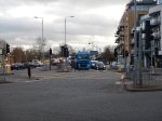
Brockley Station
The map also labels Brockley station with a box saying potential new interchange hub.
This Google Map shows Brockley station.
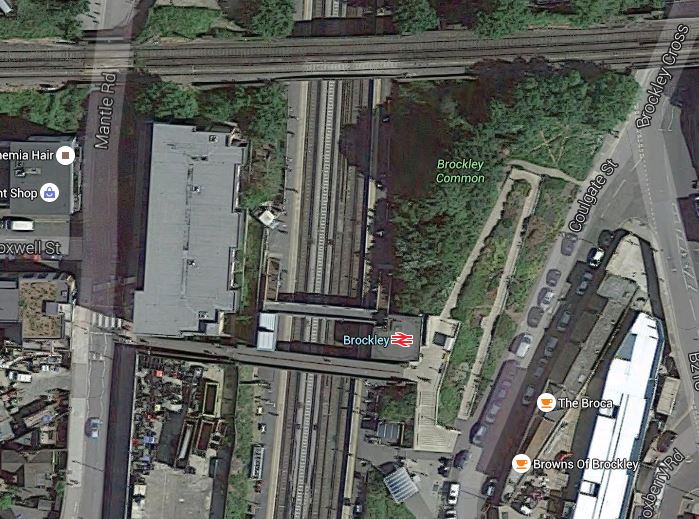
Brockley Station
The Bexleyheath Line between Nunhead and Lewisham stations crosses the East London Line and Brockley station at a high level.
I wrote A Four-Poster Station about connecting these two lines.
It would appear that Transport for London have advanced this project from one word in their 2050 Infrastructure Plan to a proposal.
This is the sort of connectivity, that us plebs in Dalston will like a lot. From 2018, as I wrote in Increased Frequencies on the East London Line, there will be ten services per hour between Dalston Junction and Brockley stations and one change at Brockley, will open up many transport opportunities.
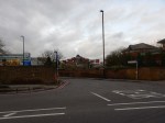
East Croydon Station
The map also labels East Croydon station with a box saying extra platforms & grade separation.
This Google Map shows East Croydon station.
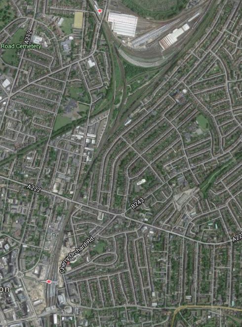
East Croydon Station
The station is towards the bottom of the map and the semi-circular shape at the top is Selhurst Depot.
There is a large section labelled Future in the station’s Wikipedia entry and given the legendary congestion and the large expansion plans for Croydon, I think it is highly likely that expansion of the station and grade separation will go ahead even if the Bakerloo Line Extension doesn’t!
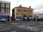
Camberwell Station
The map also labels the now-disused Camberwell station with a box saying potential new Thameslink station. The TfL report says this.
Similarly, we are working with Southwark Council to look into the re-opening Camberwell station on the Thameslink line to improve access into Central London and support local development.
This Google Map shows the area around the disused station.

Camberwell Station
Camberwell station used to be where Camberwell New Road crosses under the railway.
The TfL report makes these points.
- Camberwell has no direct rail connection.
- A two-branch extension of the Bakerloo Line; Old Kent Road and Camberwell, will be very costly.
- A Thameslink station at Camberwell, would serve the same area as an Underground station and is a much more affordable option.
The TfL report gives this concise summary.
A new station at Camberwell would be a significantly lower cost option to a Tube extension, whilst serving the same catchment area. Investigations show significant journey time improvements could accrue to Camberwell passengers and that operationally there may be scope to integrate re-opening of the station into the launch of the completed Thameslink programme.
We will therefore undertake further planning work with Network Rail and the London Borough of Southwark to assess the proposal.
I would be very surprised if the Bakerloo Line Extension calls at Camberwell.
I would also suspect that being able to open a new Ca,berwell station, at the same time as Thameslink, would be very easy to justify on a costs basis.
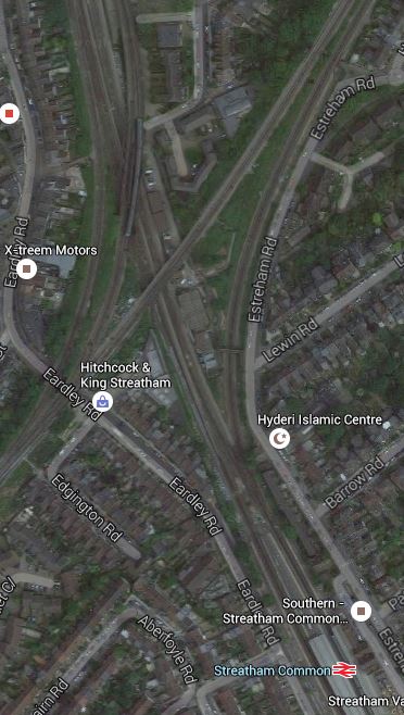
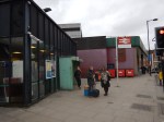
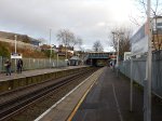
Streathham Common Station
The map also labels Streatham Common station with a box saying potential new interchange hub.
This Google Map shows Streatham Common station.
Streatham Common Station
Wikipedia introduces Streatham Common station with these words.
The station is managed by Southern who also operate trains from the station. Direct trains from the station run to Victoria, London Bridge, East Croydon, Shepherds Bush, and Milton Keynes Central. Southern consider the station to be the 6th busiest station on their 158 station network as it receives 12,932 passenger journeys a day, totalling 4,655,520 per year. The Office of Rail and Road figures are lower at 3,827,296.
The station has four platforms, but only platforms 1 and 2 are in daily use; platforms 3 and 4 are normally for passing Express trains, but they are occasionally used during engineering work or major disruption. Step free access to both platforms and both station entrances is available.
Just to the North of the station, is the Sutton Loop Line of Thameslink and I suspect that Streatham Common is mentioned in TfL’s report, is that they have a cunning plan to link the various lines in the area together.
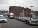
To try to get a better feel of the area, I took a train to Streatham Common station, walked to Streatham station and then took a train to Micham Junction, which travelled across Streatham Common station. I took these pictures.


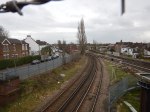
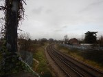


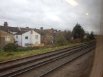


My walk showed me how complicated the lines are in the area and that is emplasised by this Google Map of the junction.
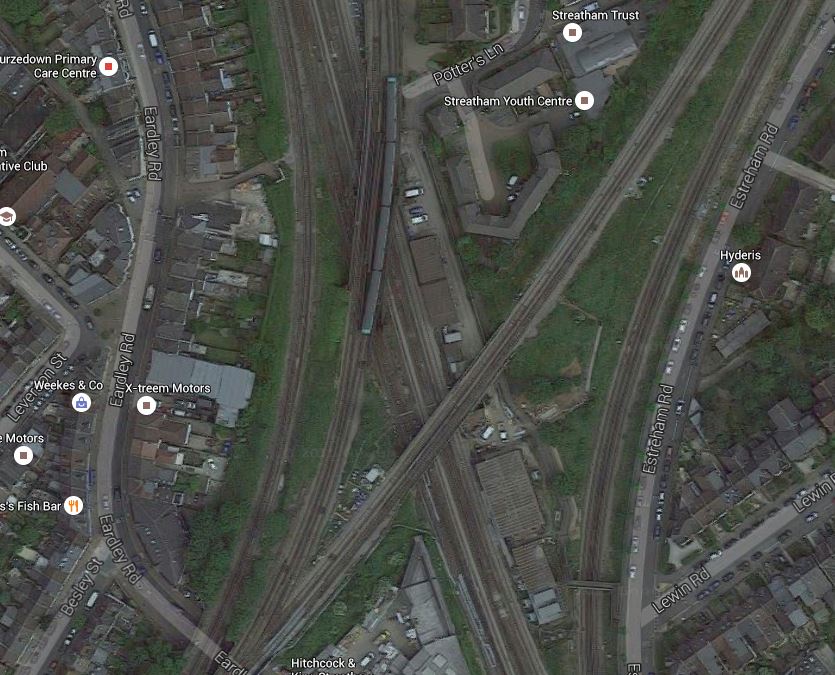
A Tangle Of Lines
I do wonder if there are operational problems in Streatham, that perhaps necessitate a bit of a sort out.
It’s also not an easy walk between Streatham and Streatham Common stations because there is a massive Tesco Extra blocking the walking routes. It certainly follows Tesco’s tradition of trying to create some of the ugliest buildings in the UK.
My other thought, is that the space around the railway lines is quite generous and are Network Rail looking to create some more housing around the junction.
I think that any plans that Network Rail have for Streatham will be revealed in due course.
Conclusion
I think Network Rail, Transport for London and others have decided to bundle a lot of smaller projects under the umbrella of the Bakerloo Line Extension, with the intention of getting value-for-money, that delivers a lot of improvement in an ordered manner in a short timescale, all over South London.
It could be described as the following.
- One large billion pound project to create the actual Bakerloo Line Extension.
- One large project, possibly with a property developer, to sort out East Croydon station.
- Three mid-sized projects to create the Brockley and Streatham Common interchanges and Camberwell station.
- A lot of small projects to create quality stations all over South London.
- Some new trains as required.
So there would be something for everybody. Even the man on the Clapham omnibus!
But who knows?
A Gatwick Express At An Unexpected Location
When I went to Milton Keynes to take the pictures for Platform Space At Milton Keynes Central, I was surprised to see one of the new Class 387/2 trains, replendent in the red Gatwick Express livery going the other way.
As I was drinking a hot chocolate, I didn’t get a picture, but there is a YouTube video of a Class 387/2 at Crewe.
The train is also seen to be wearing pantographs to get its electric power.
This article in Rail Magazine explains the sighting. This is said.
The ‘387s’ being commissioned are 387104 and 387129. They were moved from Derby Litchurch Lane to Bletchley on April 8 and April 20 respectively. They will be tested on the West Coast Main Line, driven by Freightliner Heavy Haul drivers, after which they will move to Brighton Lovers Walk ready for their entry into traffic.
The article refers to the older Class 387/1 trains. But obviously to test an 110 mph train, you need a fast line.
The Class 387/2 seen at Crewe, could of course have been on a sales demonstration, as surely the configuration of a Class 387/2 Gatwick Express, with lots of space for luggage and families, would be ideal for services to and from Manchester Airport.
Finding An Errant Parcel!
I ordered something on-line for Christmas and realised this morning that it had not arrived.
So I got on to the company and they replied in an hour or so, that Parcelforce had tried to deliver it on the eighth and that they had left a card and taken it to the Post Office.
I searched my hall and I could find no red Parcelforce card amongst the masses of junk mail, that I get. But then I’ve had a couple of incidents like this, where a parcel has not been delivered and no card has been left, from different couriers. I should say that I’ve also had delivery drivers and couriers get lost and end up in the mews at the back of the house.
I think the problem, is that there are several banned right turns and because of this sat-navs send drivers on a roundabout route. If a driver knows the area, it might encourage them to take a short cut and the mews is one that looks a good one. But unfortunately, the far end is blocked.
So as they can’t find my house, they just card one with a similar number and get off out of it.
I then went over to Camden, as I suspected the parcel was at their main depot.
It wasn’t!
But they said, if I could get the Tracking Number, they would find it.
So when I got the Tracking Number, I found it was in a Post Office about a mile away.
It took me about thirty minutes and two buses to get it.
I think there are various lessons to be learned from this.
- The system of the cards needs to be improved.
- Sat-nav systems must get better.
- Purchasers should have easy access to the Tracking Numbers.
But at least no harm was done!
‘Encouraging signs’ on Borders Railway Extension to Carlisle
The title of this post is the title of an article on the BBC. This is said.
An MP has said there are “encouraging signs” that the “fantastic vision” of extending the Borders Railway to Carlisle could be realised.
Calum Kerr made the claim in a piece written for the Campaign for Borders Rail newsletter.
This is original article on the Borders Railway! This is said.
The good news is that there are encouraging signs we may be able to win cross party support on this. For instance, I’ve spoken to my neighbouring MP David Mundell, who is the Secretary of State for Scotland in the UK Government. He’s broadly supportive and is planning to speak to the Department of Transport in London to gauge its views.
I’ve also been in discussion with MPs on the English side of the border. They’re also warming to the idea. In particular, I’ve had several discussions with Rory Stewart, who represents the seat of Penrith and the Border, and he’s keen on getting it onto the agenda.
I think the involvement of Rory Stewart is significant. I remember him from one of his excellent documentaries called Border Country: The Story of Britain’s Lost Middleland, which was a fascinating history of the lands both sides of the England-Scotland border.
When I wrote If Manchester Victoria And Birmingham New Street Were The First Two Courses, Is Carlisle The Third?, I wrote this.
I just wonder, if whilst they are rebuilding the platforms, they will electrify some of the bay platforms. Or at least do the preparation work!
This would enable IPEMUs to be able to be recharged, if they were serving routes out of Carlisle, like the Tyne Valley Line, Settle to Carlisle and possibly an extended Borders Railway.
Incidentally, I think that by the time Carlisle station is updated in 2019, IPEMUs or battery trains, would have enough range to reach Edinburgh. You can see the headlines in the Sun!
After reading Calum Kerr’s thoughts, I feel even more that Network Rail have a cunning plan to make Carlisle station a hub for IPEMUs, which would serve the following routes.
- The Borders Railway to Edinburgh
- The Glasgow And South Western Railway to Glasgow
- The Tyne Valley Line to Newcastle
- The Settle-Carlisle Line to Leeds
- The Cumbrian Cost Line to Barrow and Lancaster
Note the following.
- The only major infrastructure work would be the completion of the Borders Railway to Carlisle.
- The area is noted for its superb scenery and occasional extreme weather. Not electrifying large sections of remote and exposed rural lines, is an attractive option, in terms of planning, engineering, building and maintenance.
- Technology exists to do all signalling by radio links.
- The last two lines would probably need some limited electrification to charge the trains en route.
- The Cumbrian Coast Line could be electrified between Sellafield and Barrow, where the line is better protected.
- The infrastructure needs of a four-car IPEMU train, is similar to that of a four-car diesel multiple unit.
- The Glasgow and South Western and Tyne Valley Lines could probably accept IPEMUs tomorrow.
- The network has several connections to the major Anglo-Scottish routes, at Edinburgh, Glasgow, Leeds, Newcastle and Preston.
It would be one of the most scenic set of railway routes in the world!
I won’t comment on the commercial, social and tourism aspects of creating such a railway system.
Kew Bridge Station And The New Brentford Stadium Site
I went to Kew Bridge station to see if anything could be seen of the new Brentford Community Stadium site.

You can’t see much of the stadium, but to my mind you could make the station a lot more attractive.
Look at this Google Map of the station and the Southern part of the stadium site.
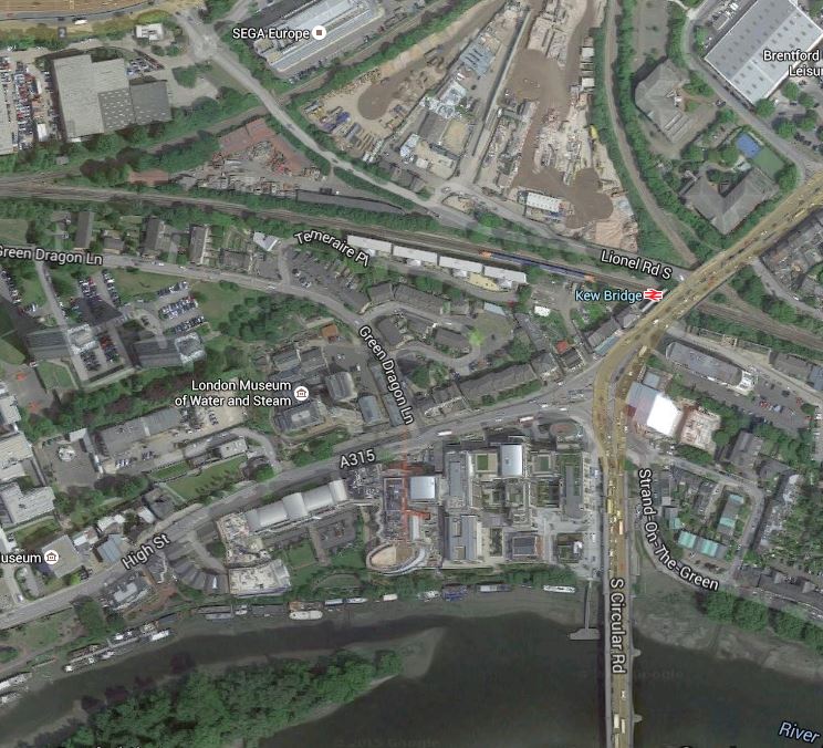
Kew Bridge Station
Note.
- The stadium is proposed to be on the northern part of the cleared site backing on to the northern side of the triangular junction, of which two of the lines meet at the station.
- The South-Eastern part of the site will be mainly residential.
- The closeness of the London Museum of Water and Steam and the River Thames to the station.
- In Transport for London’s plans for the Gospel Oak to Barking Line, extension to Houslow via the Dudding Hill Line and this junction is a distinct possibility.
- The platforms at Kew Bridge station are very long.
- If trains were ever to be restored to the northern side of the junction, a station begind the stadium could be connected to Kew Bridge station by lineside walkways.
- If trains were ever to be restored to the eastern side of the junction, they could serve Kew Bridge station.
- The Kew Bridge station building is Grade 2 Listed.
I think that even an average architect could make Kew Bridge station, a superb gateway to the stadium and the other developments.
Serial Cooking Teriyaki Beef And Noodles
This is another based on a recipe from Lindsey Bareham in The Times.
The main ingredients for meal for two, are a decent sirloin steak, an onion, 100 grams of green beans, a small cup of frozen peas, 50g of noodles and some teriyaka and soy sauces.


This recipe has various options and this is my method for two small portions.
It’s certainly more interesting that steak with chips and peas.
What’s Got Twenty-Eight Legs and An IQ Of Fourteen?
As there are fourteen of them at the moment, it’s Republican Party presidential candidates, 2016.
This is a joke that might get bigger!
I Wouldn’t Trust Santander’s Banking
Yesterday and today, I received two letters from Santander, correctly addressed to someone I’d never heard of at my address.
I should say, that I get a lot of junk mail addressed to previous tenants and I’d never seen the name before.
These are the two letters.
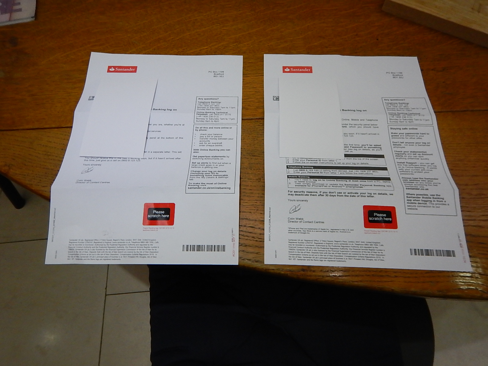
Two Letters From Santander
I suspect that if I’d been dishonest, I could have got access to their money, so they are now safely in a letter to Santander.
I have other reasons for not banking with Santander, like the fact that I will not bank with an organisation, that is not domiciled in the UK and preferably England.
But after this, I wouldn’t trust them to keep a brass farthing safe!
I think what is more important here, is that surely a bank would check you lived at the address you gave. Or at least had permission to collect mail from there!
Trump Forgot The Ace Of Clubs
This article on the BBC web site, is entitled Donald Trump loses wind farm legal challenge. This is said.
Donald Trump’s legal challenge to a planned offshore wind farm has been rejected by the UK’s Supreme Court.
The UK Supreme Court is probably the end of an expensive road.
My late friend; Brian, would have said that an old accountancy phrase would apply – Screwed, Glued and Tattooed.
Seeing as it’s Scotland, perhaps it should be the Scottish version – Screwed, Glued and Bagpiped. I’m certain, there are a large number of Scots, who have innovative uses of a set of bagpipes as an instrument of torture.
There is this article on the Aberdeen Renewable Energy Group, entitled EOWDC partners welcome Supreme Court decision. This is said.
Vattenfall and Aberdeen Renewable Energy Group (AREG), partners of Aberdeen Offshore Wind Farm Ltd, the company behind the European Offshore Wind Deployment Centre (EOWDC), welcomed today’s Supreme Court decision.
Andy Paine, Project Director for AOWFL, said: “This is another significant step forward for the EOWDC. It affirms the scheme’s potential to position Scotland, and particularly the North-east, as a centre of innovative offshore wind power. The project partners remain committed to seeing the EOWDC come to fruition and delivering long-term economic benefits to the region.”
It certainly looks like Trump didn’t have the heaviest club; the Ace, in his bag.
I’ll leave the last word to the Professional Golfers Association, as detailed in this report on the BBC entitled Donald Trump controversy bad for golf – PGA chief Sandy Jones. This is said.
The chief executive of the Professional Golfers’ Association says the ongoing controversy generated by Donald Trump is “not a positive thing for golf.”
Trump, who owns two Scottish courses, has been criticised for comments made during his bid to become the Republican Party’s US presidential candidate.
And Sandy Jones says the negative publicity around Trump is bad for golf.
“Sadly his political campaign in America seems to be getting in the way of all the great things golf offers.”
Tìoraidh!
Cinty’s Fish Pie With Celia
Cinty’s fish pie is excellent and goes down well with a beer.
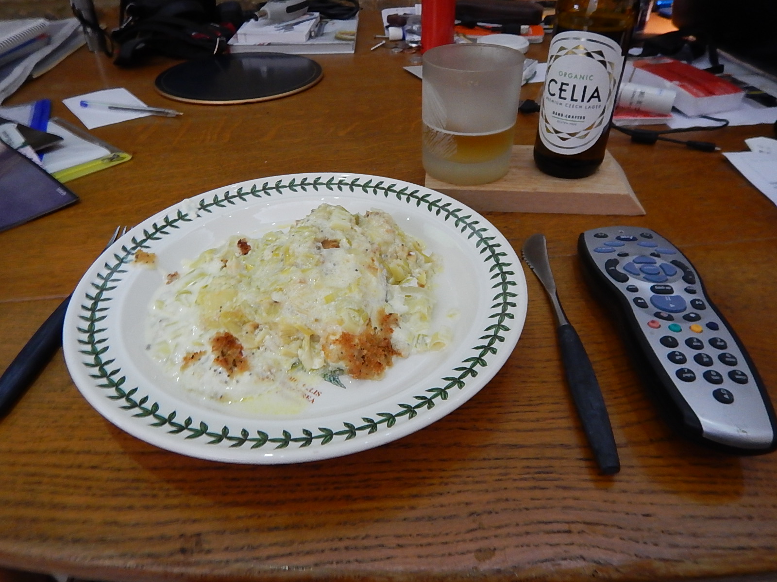
Cinty’s Fish Pie With Celia
I made two and the other kept in the fridge for a couple of days.
