The Proposed Lionel Road Station On the West London Orbital Railway
Starting with Lionel Road station may seem a strange place to start, but this important station for supporters of Brentford FC, may in the end define how the new line is designed and built.
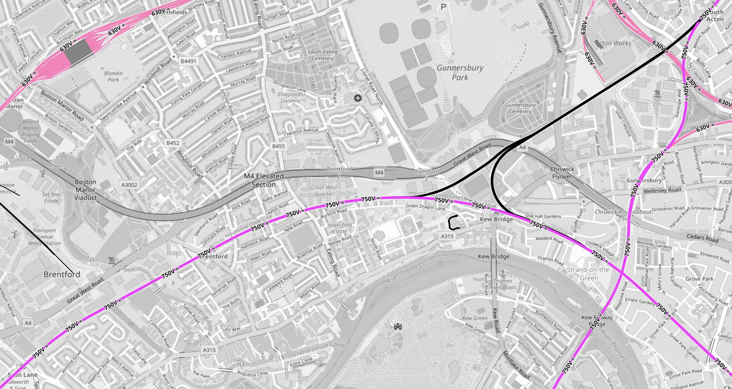
This OpenRailwayMap shows the tracks around the stadium, that has been built for the Premier League football club, which is now called the Gtech Community Stadium.
Note.
- In the North-West corner of the map is the Piccadilly Line branch to Heathrow Airport.
- Northfields Depot is prominent, with the station of the same name to its East.
- South Acton station is in the North-East corner of the map.
- Syon Lane station is in the South-West corner of the map.
- The West London Orbital Railway runs between these two stations.
- Lilac sections are electrified and black sections have none.
- South Acton station is also on the North London Line, which runs North-South to Richmond station off the bottom of the map.
- Syon Lane Station is also on the Hounslow Loop Line, which curves across the bottom half of the map to the South-East corner.
- Click the map to show it to a larger scale.
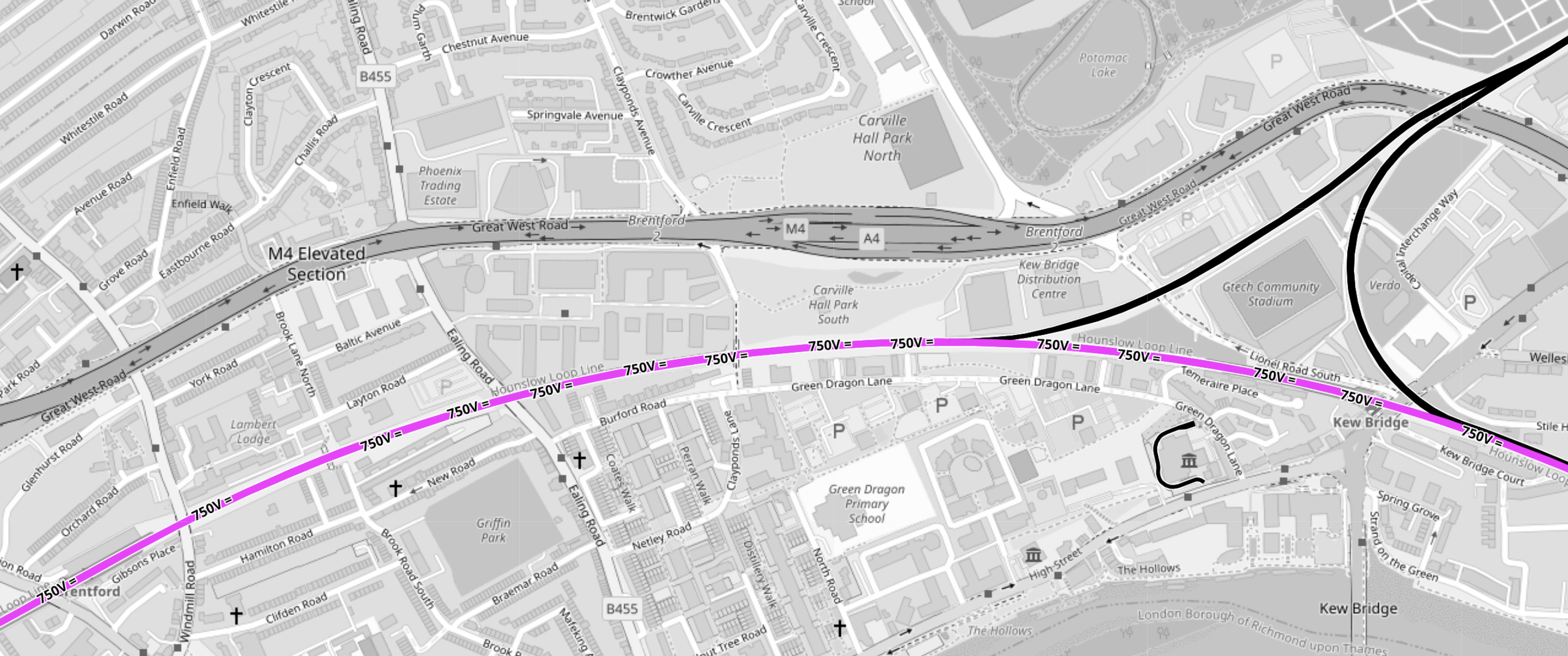
This second OpenRailwayMap shows triangular junction in the middle of the first map to a larger scale.
Note.
- The Gtech Community Stadium sits in the middle of the triangular junction.
- Provision has been made in the layout of the stadium for the station to be on the North-West leg of the triangular junction.
- Kew East Junction is in the North-East corner of the map.
- Old Kew Junction is in the South-West corner of the triangular junction.
- New Kew Junction is in the South-East corner of the triangular junction.
- The lilac track crossing the map is the electrified Hounslow Loop Line.
- The M4/A4 runs across the map
- Only the Southern leg of the triangular junction is electrified.
- Click the map to show it to a larger scale.
These are some of my thoughts.
Lionel Road Station Will Be Unlikely To Be Electrified
Consider
- It will be extremely unlikely that between South Acton station and Old Kew junction will be electrified with third-rail electrification because of safety issues.
- There is a very long chance, that it might be decided to create a 25 KVAC overhead electrified route across London, by means of the North London Line.
- I believe hydrogen trains will be developed for freight services.
- The station will have large numbers of passengers on match-days, so safety may determine an electrification-free station.
- The electrification gap is only 1.4 miles, which is well within range of a battery-electric train.
I think it is more likely that hybrid trains will use what is available.
Will Lionel Road Station Be Step-Free?
Sixty years ago, I used Manchester United station to see a match.
This Google Map shows the station.
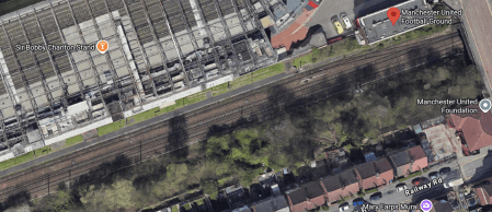
Note.
- The station is a single platform tucked in behind the South stand.
- The station entrance is indicated by a red arrow.
- When I went in the 1960s, the train was a steam-hauled shuttle from the city centre.
- This Wikipedia entry gives more details.
I suspect a similar space-saving design could be used at Lionel Road station.
There will be a need for a bridge if the station is used on more than match days.
Will Lionel Road And Kew Bridge Stations Be An Out Of Station Interchange?
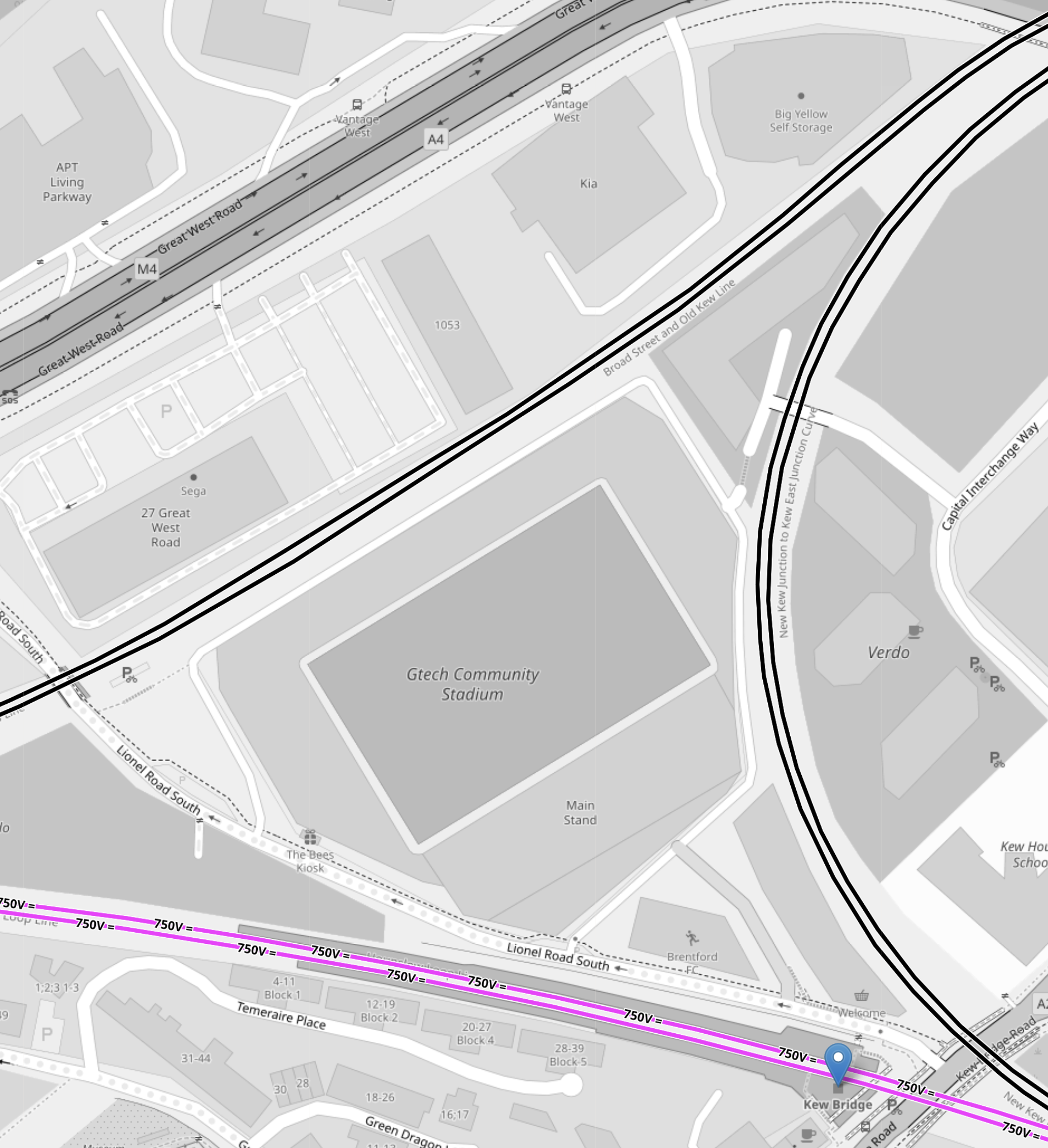
This OpenRailwayMap shows the triangular junction, with the GTech Community Stadium in the middle.
Note.
- Lionel Road station will be on the North-West side of the station.
- Kew Bridge station is marked by a blue arrow.
- There appear to be walking routes all over the plot on which the stadium sits.
- All sides of the junction are double track.
I think an Out-Of-Station Interchange would be useful, especially for those who don’t know the area.
How Easy Will It Be To Get To Lionel Road Station From Major London Stations?
These are my best estimates at a degree of difficulty.
- Bank – 1 Change – Take Central Line with a change at Old Oak Common Lane to Lionel Road.
- Blackfriars – 1 Change – Take Thameslink with a change at Brent Cross West to Lionel Road.
- Bond Street- 1 Change – Take Elizabeth Line with a change at Old Oak Common Lane to Lionel Road.
- Cannon Street – 2 Changes – Get out at London Bridge – Take Thameslink with a change at Brent Cross West to Lionel Road.
- Charing Cross – 1 Change – Take Bakerloo Line with a change at Harlesden to Lionel Road.
- City Thameslink – 1 Change – Take Thameslink with a change at Brent Cross West to Lionel Road.
- Euston – 1 Change – Take Watford DC Line with a change at Harlesden to Lionel Road.
- Farringdon – 1 Change – Take Thameslink with a change at Brent Cross West to Lionel Road.
- King’s Cross – 1 Change – Take Thameslink with a change at Brent Cross West to Lionel Road.
- Liverpool Street – 2 Changes – Get out at Stratford – Take the Overground with a change at South Acton to Lionel Road.
- Liverpool Street – 1 Change – Take Elizabeth Line with a change at Old Oak Common Lane to Lionel Road.
- London Bridge – 1 Change – Take Thameslink with a change at Brent Cross West to Lionel Road.
- Marylebone – 1 Change – Take Bakerloo Line with a change at Harlesden to Lionel Road.
- Moorgate – 1 Change – Take Elizabeth Line with a change at Old Oak Common Lane to Lionel Road.
- Old Street – 2 Changes – Go to Moorgate – Take Elizabeth Line with a change at Old Oak Common Lane to Lionel Road.
- Oxford Circus – 1 Change – Take Bakerloo Line with a change at Harlesden to Lionel Road.
- Paddington – 1 Change – Take Elizabeth Line with a change at Old Oak Common Lane to Lionel Road.
- Piccadilly Circus – 1 Change – Take Bakerloo Line with a change at Harlesden to Lionel Road.
- St. Pancras – 1 Change – Take Thameslink with a change at Brent Cross West to Lionel Road.
- St. Paul’s – 1 Change – Take Central Line with a change at Old Oak Common Lane to Lionel Road.
- Tottenham Court Road – 1 Change – Take Elizabeth Line with a change at Old Oak Common Lane to Lionel Road.
- Vauxhall – 2 Changes – Go to Oxford Circus – Take Bakerloo Line with a change at Harlesden to Lionel Road.
- Victoria – 2 Changes – Go to Oxford Circus – Take Bakerloo Line with a change at Harlesden to Lionel Road.
- Waterloo – Direct – Direct train to Kew Bridge.
- Waterloo – 1 Change – Take Bakerloo Line with a change at Harlesden to Lionel Road
Note.
- It does appear that the connections in stations like Brent Cross West, Harlesden and Old Oak Common Lane, will make a lot of difficult cross-London journeys easier.
- But not many journeys to the GTech Community Stadium, finish at Kew Bridge station.
- Most journeys pick up the West London Orbital at Brent Cross West, Harlesden or Old Oak Common Lane, which probably means these three stations should be step-free.
- As I’ve been writing this, I do wonder if now is the time to create a pedestrian connection between City Thameslink and St. Paul’s stations, that I wrote about in A Pedestrian Connection Between City Thameslink Station And St. Paul’s Tube Station.
I do believe though that there are places on the Central Line, where small projects can give a high return on expenditure.
Conclusion
Surprisingly, this is a lot more than just a station for a Premier League football club.
Could Anglia Railways’ London Crosslink Be Recreated As Part Of The London Overground?
This is the first paragraph of the Wikipedia entry for the original London Crosslink.
London Crosslink was a passenger train service operated by Anglia Railways between Norwich and Basingstoke, using the North London Line to bypass central London. Class 170 Turbostar diesel multiple units were used, and the service operated between 22 May 2000 and 28 September 2002, supported by funding from the Strategic Rail Authority through its Rail Passenger Partnership fund.
Note.
- The service called at Diss, Stowmarket, Ipswich, Colchester, Whitham, Chelmsford, Ingatestone, Romford, Stratford, Highbury & Islington, Camden Road, Willesden Junction, West Hampstead Thameslink, Brentford, Feltham, Staines, Woking, and Farnborough (Main)
- It ran six times on Monday to Friday and five times on Sunday.
- Feltham and Woking stations have a coach link to Heathrow.
- Journeys took around 3 hours and 44 minutes.
Over the years, attractions and other rail lines and stations served by the route have changed. improved and been added.
- In 2006, the Arsenal’s Emirates Stadium opened within walking distance of Highbury & Islington station.
- In 2012, the Olympic Stadium opened at Stratford and is now used by West Ham United.
- In 2020, Brentford Stadium opened within walking distance of Brentford station.
- There are long-term plans for a station at Brentford stadium.
- In 2022, Romford and Stratford stations were connected to the Elizabeth Line.
- In 2025, Beaulieu Park station was added to the Greater Anglia Main Line.
- In 2026, both ends of the route came under the control of Great British Railways.
At some point in the future, Old Oak Common Lane station will open to link the route to High Speed Two, the Great Western Main Line and the Elizabeth Line.
In Can The Signalling Of The London Overground Be Improved?, I looked in detail at the signalling of the London Overground and if it could handle more trains.
My conclusion was that on the East and North London Lines, another three trains per hour (tph) could probably be accommodated, which over an average day was probably around sixty trains.
As a restored London Crosslink would need just six paths per day, I would suspect the service could be restored, if it were thought to be a good idea.
I certainly feel that capacity would not be a problem.
These are a few other thoughts.
Will There Be Political Problems?
Providing the London Mayor approves, I can’s see any problem with Labour and I can’t see other parties objecting if passengers like it.
Would It Be Sensible To Use Lumo Branding And Trains?
Consider.
- Lumo is trusted branding.
- A five-car Lumo Class 803 train is 132 metres long and a pair of four-car London Overground Class 710 trains is 166 metres long, so I suspect platform length problems will be minimal.
- I doubt there will be problems on the Greater Anglia network.
- Stratford and Norwich is mainly a 100 mph network.
- Not all parts of the route have 25 KVAC overhead electrification, but batteries can be fitted to the Class 803 trains, that will cover any gaps.
- My calculations show that the modern trains will be twenty-two minutes quicker, than Anglia Railways Class 170 diesel trains.
- At one point Anglia Railways was owned by First Group, so FirstGroup may have knowledge of the problems of the route.
I believe it would be sensible to use Lumo branding and trains.
Could The Route Be Extended?
Consider.
- It could probably be extended to Winchester, Southampton and Bournemouth in the South.
- If offshore hydrogen takes off at Great Yarmouth, it might be worth extending with a reverse to Yarmouth in the North.
- Yarmouth has had a direct service from London in the past.
The service could also develop days out by the sea.
London Overground: Design Work For West London Orbital Route Begins
The title of this post, is the same as that as this article on the BBC.
This is the sub-heading.
Plans for a new London Overground link in west London are progressing, London’s mayor Sadiq Khan has said.
These paragraphs outline what will happen.
Engineering consultants who worked on the Elizabeth line have been chosen for the West London Orbital service.
“This engineering design will help determine the cost of delivering the scheme, which is currently unfunded,” Transport for London (TfL) said.
It hopes the scheme, which would connect Hounslow with Hendon and West Hampstead, could start next decade.
My feeling, is that they should get on with it.
- There would be no major construction like tunnels.
- Four stations would need to be built.
- I doubt there will be any demolition.
- It wouldn’t need more electrification, as the route is electrified at both ends and battery-electric trains could be used.
- It would create more connections to Old Oak Common for High Speed Two.
But if it does for North West London, what the Overground has done for North and East London, it will be very much worth it.
These are a few thoughts and observations.
The Route
This is a schematic of the route from the BBC article.
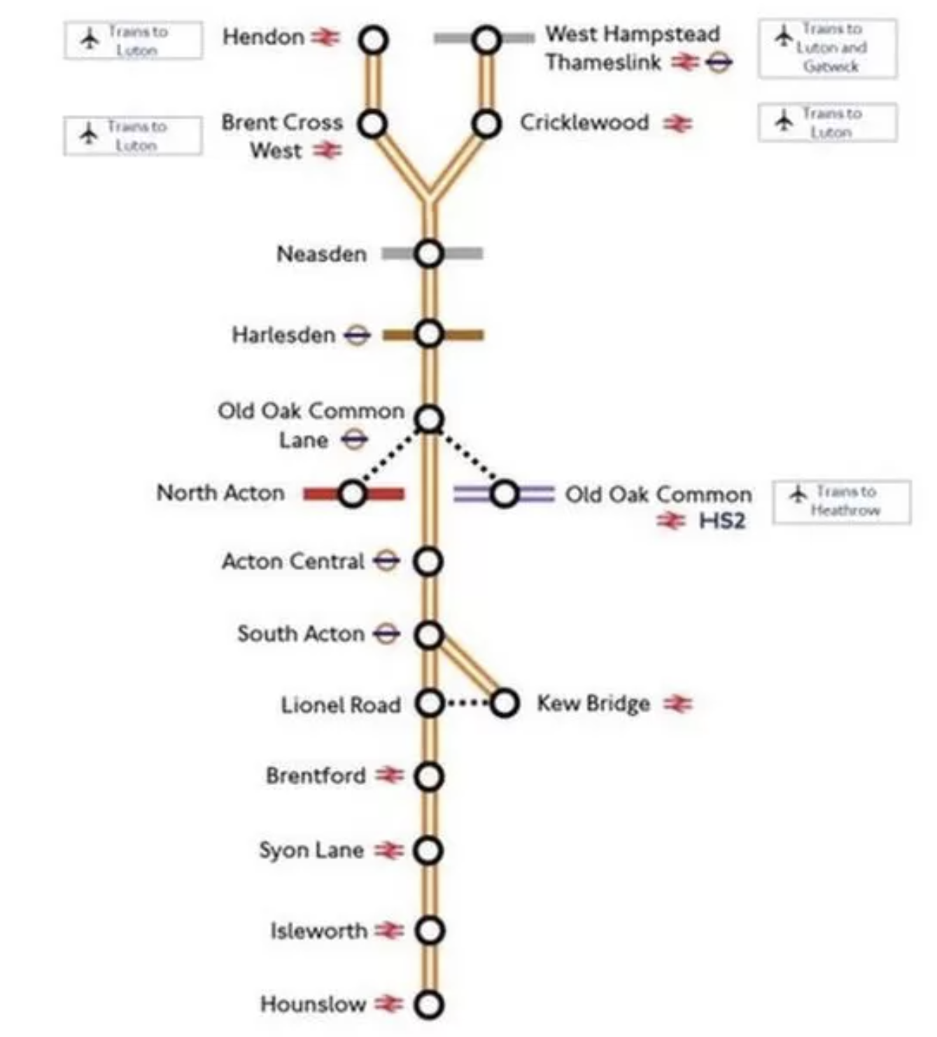
Note.
- Services will be between West Hampstead Thameslink and Hounslow stations and between Hendon and Kew Bridge stations.
- If services follow the London Overground frequency, they will be four trains per hour (tph).
- The new stations are Neasden, Harlesden, Old Oak Common Lane and Lionel Road.
- Acton Central, Brentford, South Acton, Syon Lane and West Hampstead Thameslink are step-free and Isleworth is on the way.
- The fully step-free Brent Cross West station will open soon.
- Lionel Road station will serve the new Brentford stadium.
- Old Oak Common Lane will serve High Speed Two, the Elizabeth Line and the North London Line.
They look to be a useful set of stations.
Kew Bridge Station
There’s been a lot of development at Kew Bridge station, since I was last there.

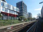
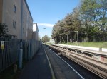
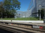
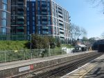
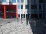
There are lots of flats and Brentford’s new stadium.
I suspect all the stations between Kew Bridge and Hounslow will see similar levels of development.
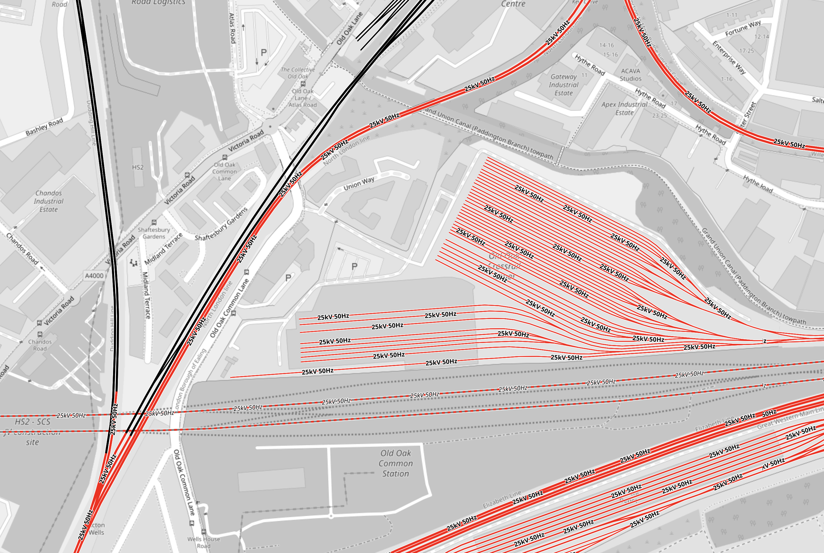
Electrification Issues On The Dudding Hill Line
The Dudding Hill Line forms the Northern section of the route between the Midland Main Line and the North London Line at Acton Wells Junction.
This map from OpenRailwayMap shows the junction between the Dudding Hill and Midland Main Lines.
Note.
- The Midland Main Line is shown in red as it is electrified with 25 KVAC overhead wires.
- The Dudding Hill Line is shown in black, as it isn’t electrified.
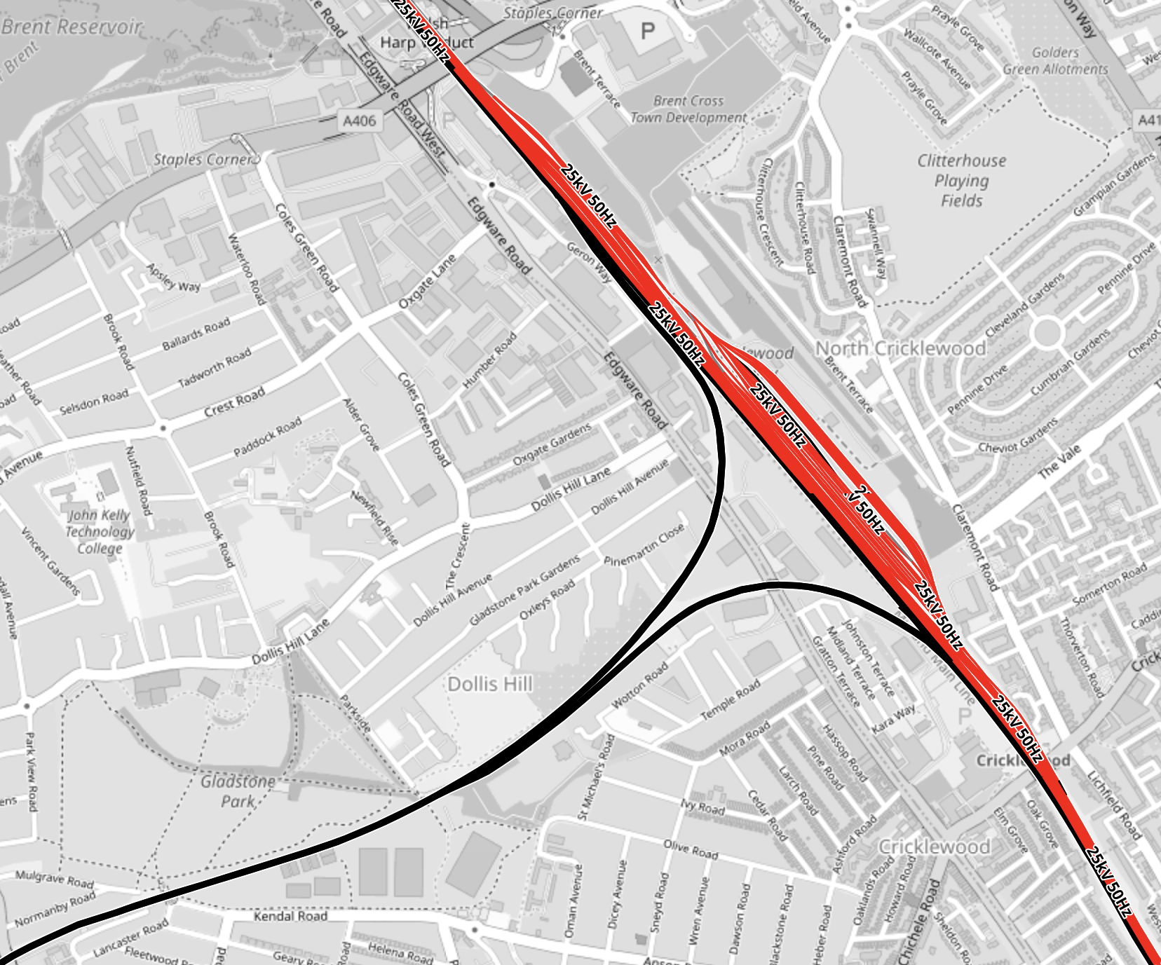
This second map from OpenRailwayMap shows the junction between the Dudding Hill and North London Lines at Acton Wells junction.
Note.
- As before red tracks are electrified with 25 KVAC overhead wires and black tracks have no electrification.
- The Dudding Hill Line is the black track running North-South at the West of the map.
- Acton Wells junction, where the Dudding Hill and North London Lines join is in the South-West corner of the map.
- The North London Line is shown in red running across the North-West corner of the map.
- The Great Western Main Line is shown in red running across the South-East corner of the map.
- High Speed Two will run East-West across the map and is shown dotted in red.
- The red lines in the middle of the map is the Elizabeth Line depot.
With all the 25 KVAC overhead electrification at both ends of the Dudding Hill Line, it would appear, that if this section is ever electrified, it will be electrified with this form of electrification.
There may be a problem, in that there are three or four bridges over the line.
Electrification Issues At Kew
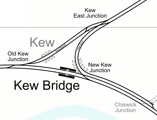
This map from OpenRailwayMap shows the triangular junction by Kew Bridge station.
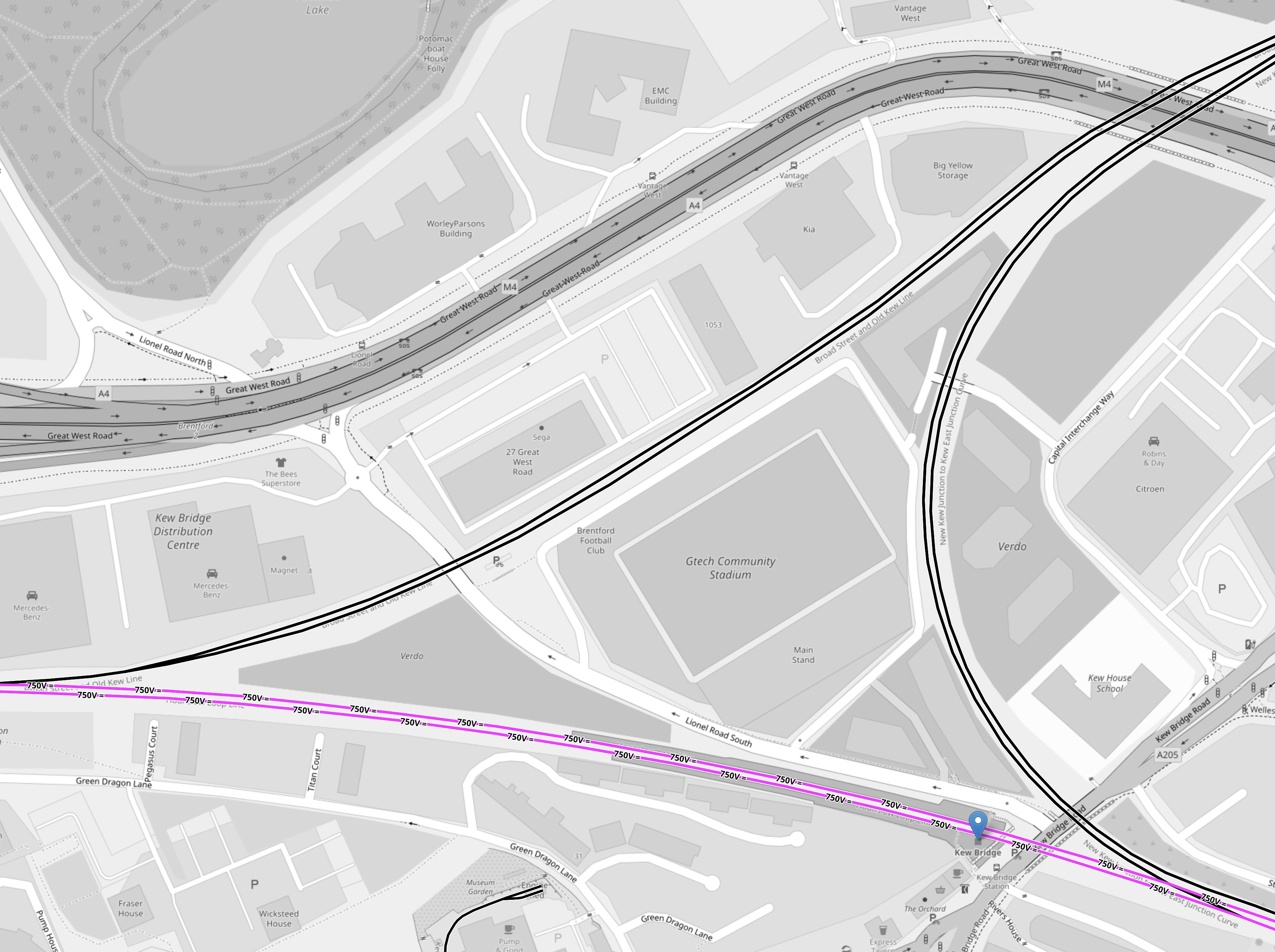
Note.
- As before black tracks have no electrification.
- Mauve tracks are electrified with 750 VDC third-rail electrification.
- Kew Bridge station is indicated by the blue arrow at the Eastern point of the junction.
- Trains to Hounslow will arrive in the North-East corner of the map and go diagonally across the map to leave in the South-West point of the junction.
- Trains to Kew Bridge will arrive in the North-East corner of the map and take the Eastern chord of the junction to a new platform in Kew Bridge station.
Brentford’s new stadium and a lot of housing are in the middle of the junction.
It would seem to be obvious to electrify the triangular junction using 750 VDC third-rail electrification.
But not to the ORR it isn’t, as they won’t allow any new third-rail electrification to be installed on Health and Safety grounds.
Charging Trains At Kew Bridge Station
Consider.
- It looks like trains from Hendon will terminate in a new platform on the chord without electrification to the North of the current Kew Bridge station.
- A short length of 25 KVAC overhead electrification could be used to charge trains.
It may be sensible to build two platforms on the chord, as this could allow more flexible operation of the London Overground during engineering works.
Charging Trains At Hounslow Station
A short length of 25 KVAC overhead electrification could be used to charge trains.
Project Management Issues
I believe this could be one of those projects, where by careful selection of the order of the sub-projects, time and money can be saved and passengers will see benefits earlier.
For example.
- Early delivery of Old Oak Common Lane station would also connect the North London Line to High Speed Two and the Elizabeth Line.
- Early delivery of step-free access at Kew Bridge station would help passengers going to the new Brentford stadium.
There may be other projects, that need an early delivery.
The Feltham And Wokingham Resignalling Programme
The Feltham And Wokingham Resignalling Programme is currently underway and there are pairs of new and old signals everywhere between Kew Bridge and Feltham and also between Feltham and Richmond.
These are digital signals and according to Network Rail, they will increase the capacity, which must surely allow the extra trains between Kew Bridge and Hounslow stations.
This signalling project finishes in mid-2024, so I suspect by then the Southern part of the West London Orbital Railway will not have any problems with interaction with other services.
The Feltham And Wokingham Resignalling Programme could be considered an important enabling sub-project of the West London Orbital Railway, that is being performed early.
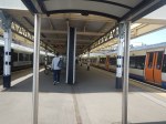
Richmond Station
As I came through Richmond station, there was an Overground train in Platform 3 and I noticed that Platforms 3 to 5 were allocated to the Overground.
Has the new signalling given Network Rail and train operators more flexibility and extra capacity at Richmond?
Currently, the London Overground runs four trains per hour (tph) between Stratford and Richmond.
The increased flexibility may allow the following.
- An increase in frequency of trains to Stratford.
- An increase in frequency of District Line trains, if Ealing Broadway station swaps from being a District to a Piccadilly Line terminus, as I wrote about in Extending The Elizabeth Line – Piccadilly Line To Ealing Broadway.
- Could Richmond also act as a terminal of the West London Orbital Railway during construction and engineering works?
Another benefit that could be arranged is to run the current four tph London Overground services into Platform 3.
These pictures show a Waterloo-bound South Western Railway train in Platform 2 and a Stratford-bound London Overground train in Platform 3.
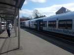
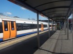
As there are 8 tph between Richmond and Waterloo via Clapham Junction, this could be quite a useful cross-platform interchange for passengers going from say Staines or Windsor to Hampstead.
Trains
Consider.
- The three most likely Northern termini are Brent Cross West, Hendon and West Hampstead Thameslink.
- There could be other terminals on the North London Line or the Gospel Oak and Barking Line.
- All possible Northern terminals have 25 KVAC overhead electrification.
- The two most likely Southern terminals are Hounslow and Kew Bridge.
- There may be other possible Southern terminals like Twickenham or Richmond.
- All possible Southern terminals have 750 VDC third-rail electrification.
- The sections without electrification of the route are less than twelve miles.
- The ORR won’t allow any new third-rail electrification.
It looks like the trains will need to be dual-voltage with a battery capability.
In this article in Global Rail News from 2011, which is entitled Bombardier’s AVENTRA – A new era in train performance, gives some details of the Aventra’s electrical systems. This is said.
AVENTRA can run on both 25kV AC and 750V DC power – the high-efficiency transformers being another area where a heavier component was chosen because, in the long term, it’s cheaper to run. Pairs of cars will run off a common power bus with a converter on one car powering both. The other car can be fitted with power storage devices such as super-capacitors or Lithium-ion batteries if required. The intention is that every car will be powered although trailer cars will be available.
Unlike today’s commuter trains, AVENTRA will also shut down fully at night. It will be ‘woken up’ by remote control before the driver arrives for the first shift
This was published over twelve years ago, so I suspect Bombardier or Alstom have refined the concept.
In an article in the October 2017 Edition of Modern Railways, which is entitled Celling England By The Pound, Ian Walmsley says this in relation to trains running on the Uckfield Branch, which is not very challenging.
A modern EMU needs between 3 and 5 kWh per vehicle mile for this sort of service.
So for a four-car running for twelve miles, the train would need a battery capacity of between 144 and 240 kWh.
These are not large batteries.
I suspect that the best trains for the route, will be dual-voltage Class 710 trains.
- The Class 710/2 variant used on the Gospel Oak and Barking Line is dual-voltage.
- London Overground has 54 Class 710 trains.
- I am certain, that the batteries needed can be fitted to the trains.
- Aventras are still in production in Derby.
A test battery-electric version could probably be created and tested on the short Romford and Upminster Line.
There may be other places in London and the rest of the UK, where a four-car battery-electric Aventra would be the ideal train.
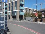
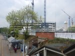
Development North Of Kew Bridge Station
This Google Map shows the large site to the North of Kew Bridge station.
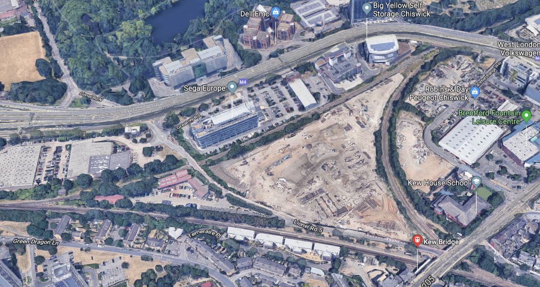
Note.
- Kew Bridge station in the South-East corner of the map.
- The M4 passing around the North of the site.
- The triangle of railway lines going to Hounslow in the West, South Acton in the North and Barnes and Waterloo in the East.
Some of the plans for the site have been disclosed.
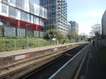
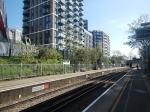
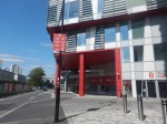
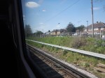
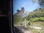
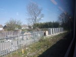
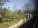
Brentford’s New Stadium
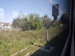
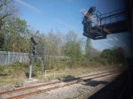
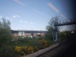
I took these pictures from a train, as I passed through yesterday.
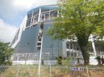
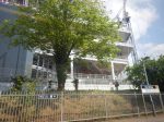
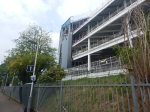
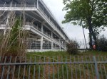
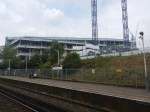
Brentford Community Stadium is planned to open in Summer 2020.
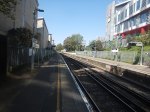
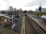
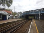
Step-Free Access At Kew Bridge Station
Currently, Kew Bridge station is not step-free.

Searching the Internet, I found this document on the Hounslow Borough Council web site, which is dated April the 15th 2019 and entitled Step-Free Access To Many Of Hounslow’s Stations Proceeding At Pace!
This is an extract.
Kew Bridge is also set to benefit from accessibility improvements when the new Brentford stadium opens. The London-bound platform is to be made step free and the council is working with SWR and NR to explore how step-free access from the country-bound platform to the street can also be delivered. A feasibility study is due to progress later this year.
This map from carto.metro.free.fr shows the lines at Kew Bridge station.
The two lines, through the disused platforms at Kew Bridge station could be used as a terminus, by the proposed West London Orbital Railway.
I’m sure Brentford FC wouldn’t object to more trains serving their new ground.
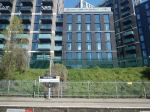
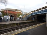
Preparations For The West London Orbital
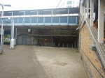
This picture was taken as I looked through the short tunnel, that connects the current Platform 1 to the disused platform shown on the map of the lines.
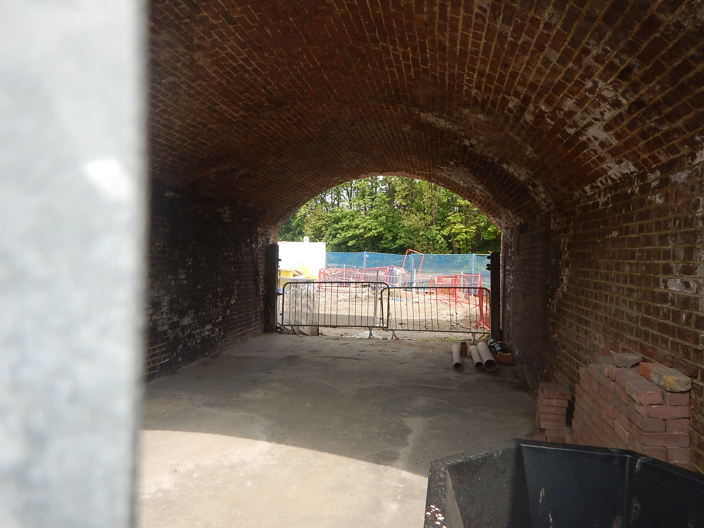
It appears that the rubbish and shrubbery of many decades is being cleared.
Could it be in connection with making the London-bound platform step-free?
It would also allow surveyors to assess how much work is needed to get the platform back into use for the West London Orbital Railway.
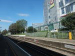
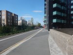
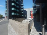
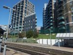
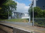
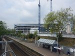
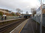
Development To The South Of The Station
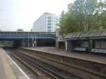
This picture shows a large site behind the station building and the country-bound platform

The location of the site can be seen behind the Express Tavern on this Google Map.
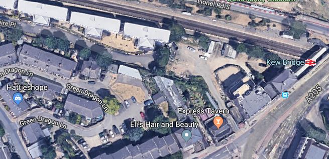
The map also shows how the flats developed on the South side of the tracks have limited the ability to put a second footbridge over the tracks to whisk passengers from London to the stadium.
I wonder, if a route could be built, through the developments, to deliver step-free access to the country-bound platform.
But it would be the wrong side for the stadium!
A step-free bridge is needed at Kew Bridge station.
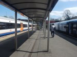
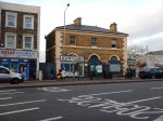
The Cafe At Kew Bridge Station
Whilst at the station, I had a welcoming coffee.

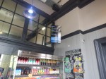
It’s certainly better than your average chain coffee shop.
I could also wait watching a Departures display.
