East Coast Main Line South Bi-Directional Capability
London has a rail capacity problem, for both freight and passenger trains.
This report from Network Rail is entitled The London Rail Freight Strategy (LRFS).
One of the secondary recommendations of the report is to use the bi-directional capability of the East Coast Main Line to create another freight route through London.
The report explains it like this.
The southern end of the East Coast Main Line, from Kings Cross to Stoke Tunnel (about five miles south of Grantham), is due to be the first part of a national main line to be fully converted to European Train Control System (ETCS) digital signalling.ETCS, because it does not rely on fixed lineside equipment facing one way or another, is bi-directional by nature.
This presents an opportunity for freight to make use of a new routeing at the southern end of the East Coast Main Line, which current signalling and track layout do not permit.
This strategy therefore proposes installing new track layout features that would facilitate this routeing for freight trains, enabling them to take advantage of the bi-directional capability brought about through ETCS deployment.
The main expected change would be the creation of a facing crossover at Bowes Park, to enable southbound freight trains to run onto the Down Enfield Viaduct in the up direction, before continuing onwards to the terminal at Ferme Park or accessing the Gospel Oak-Barking Line at Harringay.
This example shows an advantage of digital in-cab signalling.
This map from cartometro, shows the lines between Bowes Park and Alexandra Palace stations.
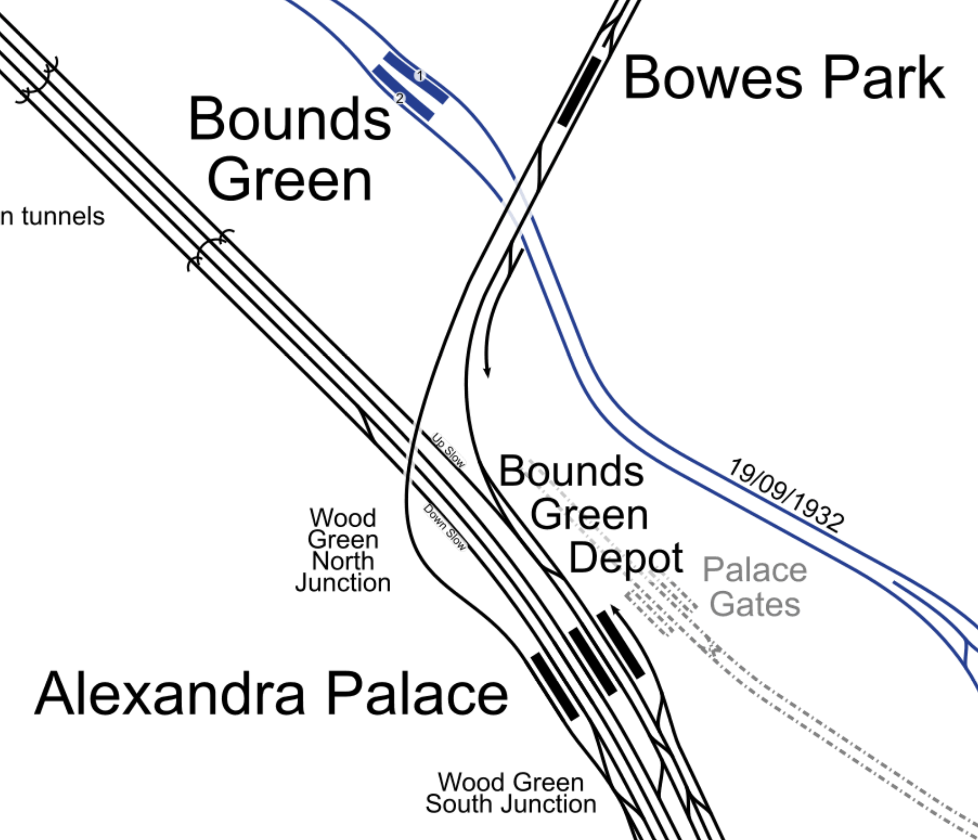
Freight trains coming from the North regularly take the Hertford Loop Line and arrive in North London at Bowes Park
Currently, they sneak down the Eastern side of the East Coast Main Line and then take a route across London, which probably uses the North London Line.
What is proposed is that with an extra crossover just South of Bowes Park station, freight trains will crossover and take Enfield Viaduct the wrong way to the Western side Alexandra Palace station.
The Enfield Viaduct is the track taken from Alexandra Palace station to Bowes Park station, by trains going to Enfield. It takes a bit of a loop to the West.
This second map from cartometro, shows the lines South of Alexandra Palace stations.
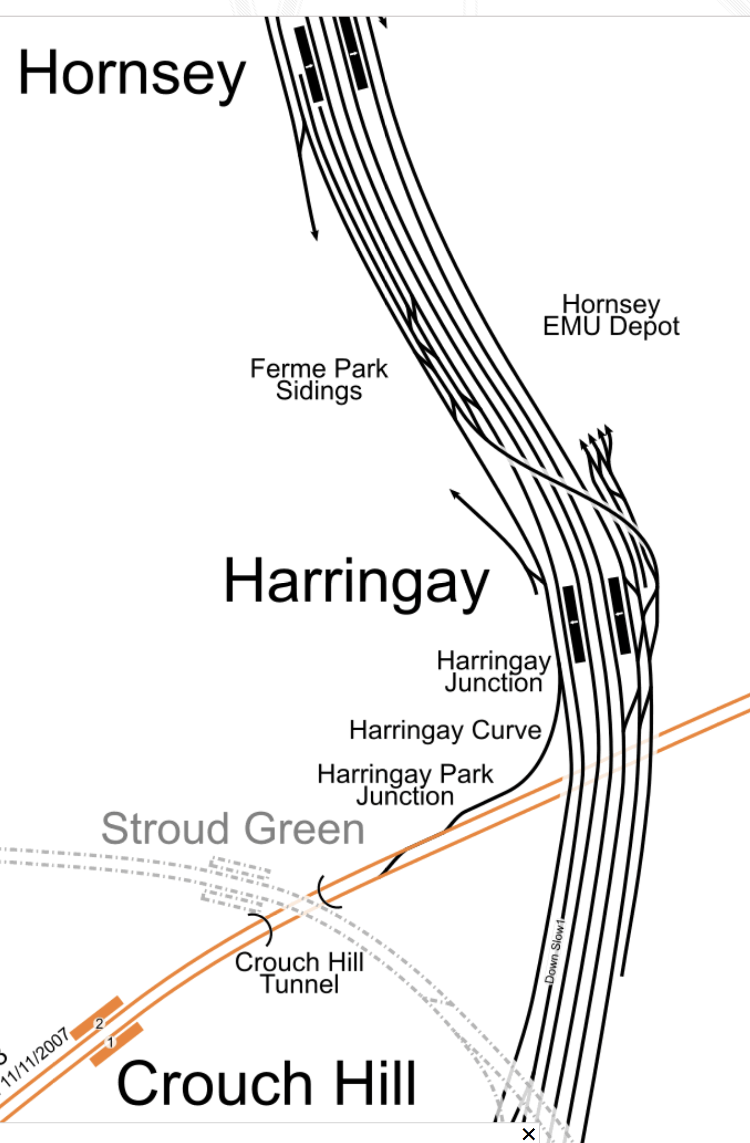
Note.
- Hornsey is the next station to the South of Alexandra Palace.
- The Eastern side of the East Coast Main Line is crowded with maintenance depots for trains.
- The orange line is the Gospel Oak to Barking Line.
By the use of digital signalling a new freight route through North London can been created.
Conclusion
How many other places can this technique be used?
Related Posts
These are related posts about the London Rail Freight Strategy (LRFS).
Decarbonisation Of London’s Freight Routes
Gauge Improvements Across London
Headway Reductions On The Gospel Oak To Barking, North London and West London Lines
Heavy Axle Weight Restrictions
Kensal Green Junction Improvement
Longhedge Junction Speed Increases
Moving The West London Line AC/DC Switchover To Kensington Olympia
Moving The West London Line AC/DC Switchover To Shepherd’s Bush
Stratford Regulating Point Extension
Gospel Oak Speed Increases
London has a rail capacity problem, for both freight and passenger trains.
This report from Network Rail is entitled The London Rail Freight Strategy (LRFS).
One of the secondary recommendations of the report is to increase speed through Gospel Oak.
The report explains it like this.
This proposal would see the current 20mph line speeds through Gospel Oak increased, through an upgrade to the junction immediately to the west of the station. Improving the flow of traffic through this critical flat junction, where the North London Line and Gospel Oak-Barking Line meet, would be of benefit for the wider operations and performance of these orbital routes. Freight trains in particular, which run non-stop through Gospel Oak, using all available routes, would see a notable uplift to how quickly they are able to pass through the area.
This would not only contribute to achieving the fast end-to-end cross-London paths that are a priority for freight but would also reduce the time trains would occupy the junction, increasing performance resilience at Gospel Oak, the impact of which would drive improvement right across the North London Line and Gospel Oak and Barking Line.
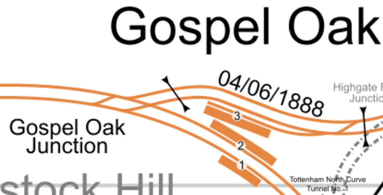
This map from cartometro shows the track layout at Gospel Oak.
Note.
- The double-track North London Line passing through Platforms 1 and 2 at Gospel Oak station.
- The double-track Gospel Oak and Barking Line passing to the North of the station.
- Platform 3 is a West-facing bay platform for services to Barking.
- There is no Westbound connection to Platform 3.
- All tracks in the map are hace 25 KVAC overhead electrification.
The two double-track railways merge west of the station at Gospel Oak junction.
This Google map shows the same area.
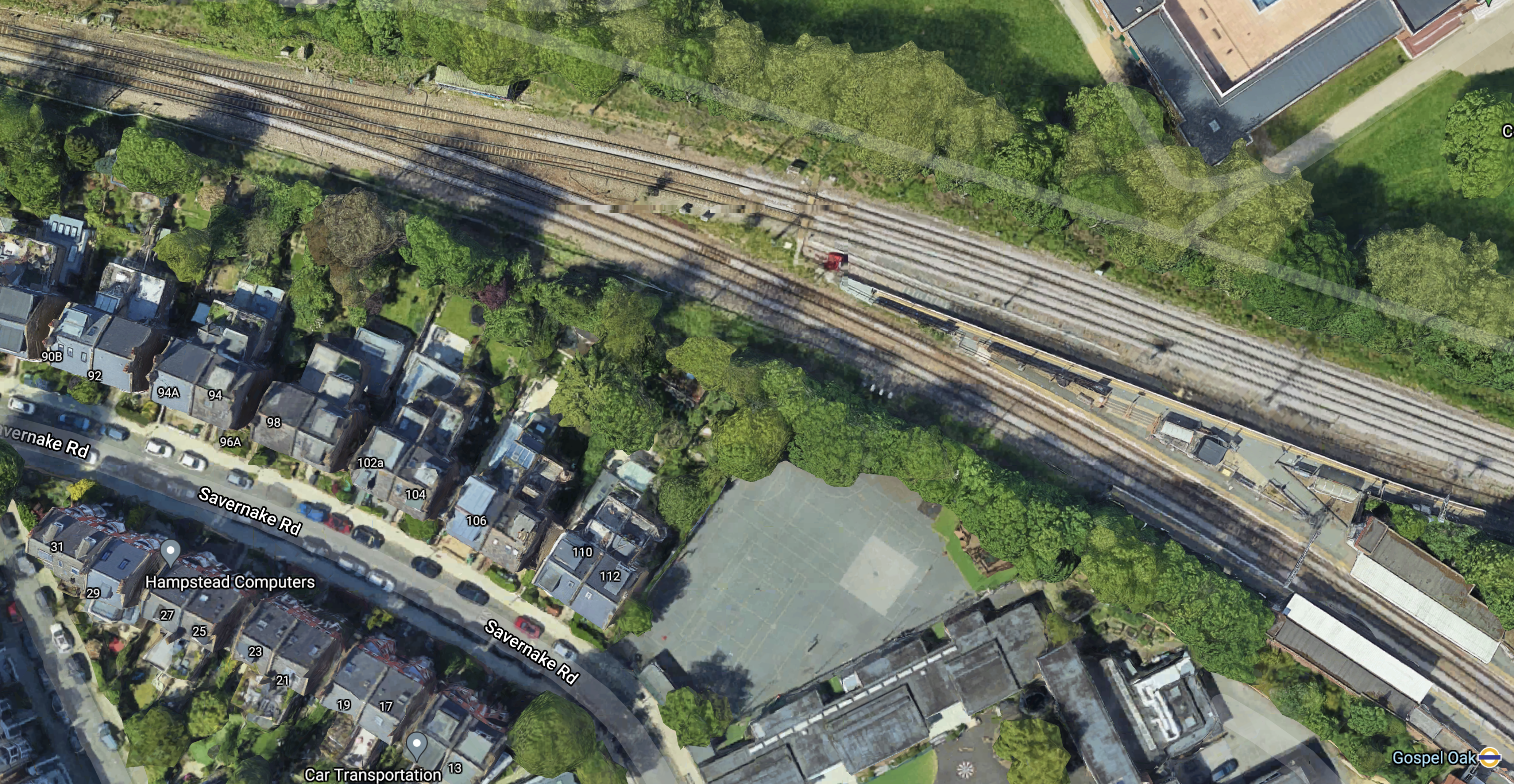
Note.
- Gospel Oak junction is in the North-West corner of the map.
- Platform 1 and 2 of Gospel Oak station are in the South-East corner of the map.
This Google map shows the junction to a larger scale.
There would appear to be space to the North of the junction for expansion.
It might even be possible to squeeze in another line, so that trains can go straight through at a faster speed.
Conclusion
This looks like another junction, that could be easy to improve on an engineering basis.
But whether the locals will accept it quietly could be another matter.
Related Posts
These are related posts about the London Rail Freight Strategy (LRFS).
Decarbonisation Of London’s Freight Routes
East Coast Main Line South Bi-Directional Capability
Gauge Improvements Across London
Headway Reductions On The Gospel Oak To Barking, North London and West London Lines
Heavy Axle Weight Restrictions
Kensal Green Junction Improvement
Longhedge Junction Speed Increases
Moving The West London Line AC/DC Switchover To Kensington Olympia
Moving The West London Line AC/DC Switchover To Shepherd’s Bush
Stratford Regulating Point Extension
Gauge Improvements Across London
London has a rail capacity problem, for both freight and passenger trains.
This report from Network Rail is entitled The London Rail Freight Strategy (LRFS).
One of the secondary recommendations of the report is to improve the gauge across London.
The report explains it like this.
The portfolio of options developed from this strategy needs to include a cross-London programme of gauge clearance, to address existing gaps and open up new market opportunities for rail freight in the long-term future.
Priorities in this area include:
- Formal publication of W10 clearance on the North London Line from Kensal Green Junction to Acton Wells Junction. This section is currently only published as W9 but has been used for diversions of W10 traffic in the recent past.
- Further work to understand what would be required to achieve W12 clearance on the North London Line and Gospel Oak-Barking Line.
This stands to enable rail freight to take advantage of emerging opportunities in the short-sea market from the Essex Thameside ports
and is a priority for stakeholders.Continued development work towards gauge enhancement of the Channel Tunnel classic routes, which run through south and west London to Wembley.
The ultimate aim is to progress a programme of clearance works to achieve full W12, but opportunities to deliver incremental improvements by clearing for wagon and box combinations above what is possible today, but short of W12, are also being actively considered.
It appears to me, that a series of well-designed and well-defined projects is needed to update all those places, where loading gauge is insufficient.
In the Felixstowe And Nuneaton Freight Capacity Scheme, Phase 1 included increasing the loading gauge between Peterborough and Nuneaton to a loading gauge of W10.
This scheme involved the replacement of fourteen bridge and eleven tracking lowering/slewing schemes.
Conclusion
Gauge enhancement on a difficult railway has been performed successfully in several places in the UK and the bullet must be bitten to enhance the loading gauge appropriately, through London.
Related Posts
These are related posts about the London Rail Freight Strategy (LRFS).
Decarbonisation Of London’s Freight Routes
East Coast Main Line South Bi-Directional Capability
Headway Reductions On The Gospel Oak To Barking, North London and West London Lines
Heavy Axle Weight Restrictions
Kensal Green Junction Improvement
Longhedge Junction Speed Increases
Moving The West London Line AC/DC Switchover To Kensington Olympia
Moving The West London Line AC/DC Switchover To Shepherd’s Bush
Stratford Regulating Point Extension
Longhedge Junction Speed Increases
London has a rail capacity problem, for both freight and passenger trains.
This report from Network Rail is entitled The London Rail Freight Strategy (LRFS).
One of the secondary recommendations of the report is to increase speed through Longhedge junction.
The report explains it like this.
There is an opportunity to enhance Longhedge Junction, a key location for freight passing through the Battersea area, to enable higher speeds and provide faster transit between the South London Line and West London Line or Clapham Junction (for the Brighton Main Line or Windsor lines).
This would benefit the numerous freight flows through this important part of the network, where two orbital routes connect to each other and to radial routes in and out of London to the south and south-west.
London Overground SLL services running to and from Clapham Junction would also benefit from an increase to the existing 25mph line speed through Longhedge Junction.
This map from cartometro shows the location of Longhedge junction.
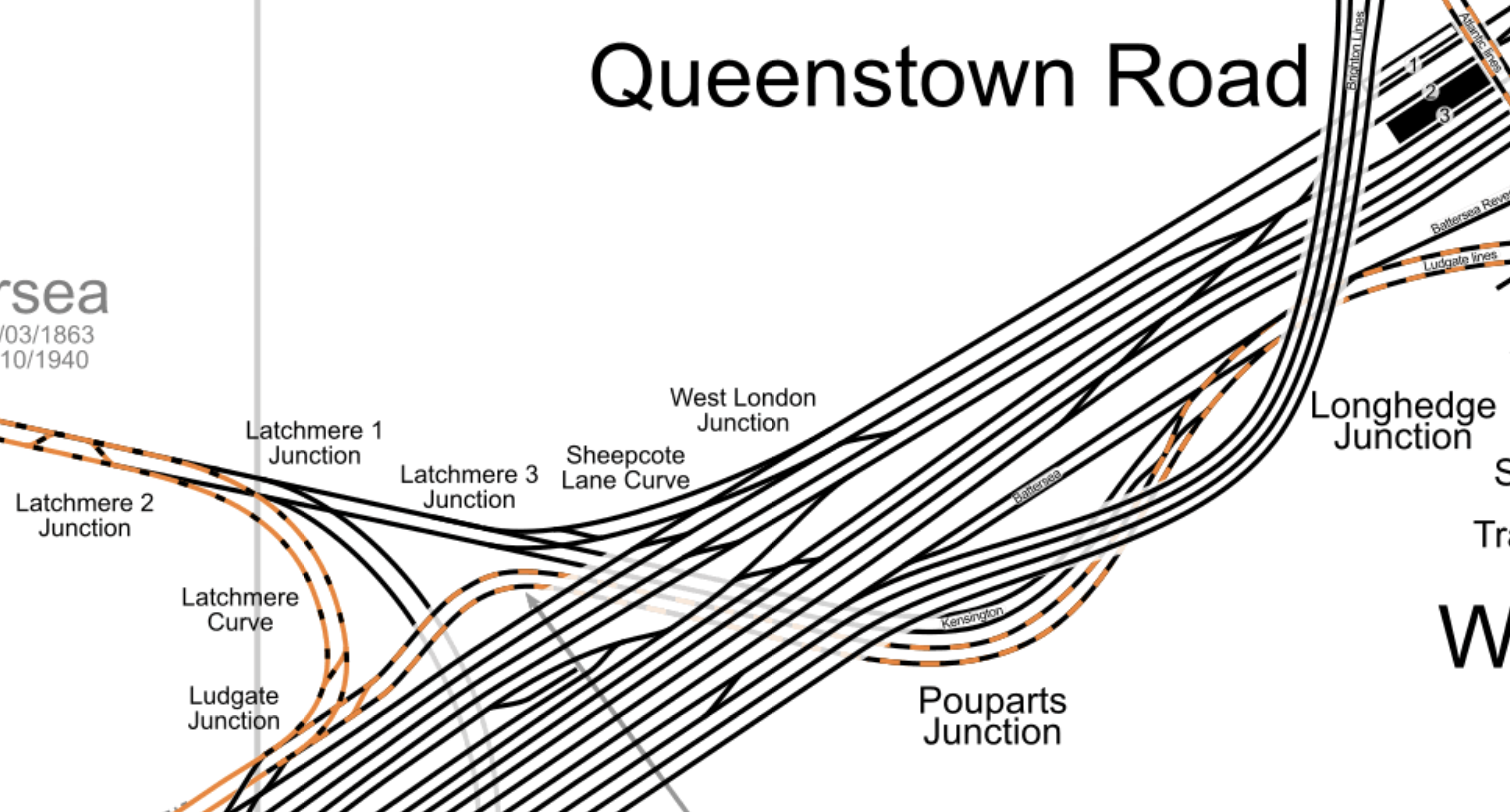
Note.
- The orange and black tracks are London Overground routes.
- The Overground route going East is the Dalston Junction and Clapham Junction service that goes via the South London Line (SLL).
- The Overground route going West is the Stratford and Clapham Junction service that goes via the West London Line (WLL).
- The two Overground routes combine to run into the Overground platforms at Clapham Junction.
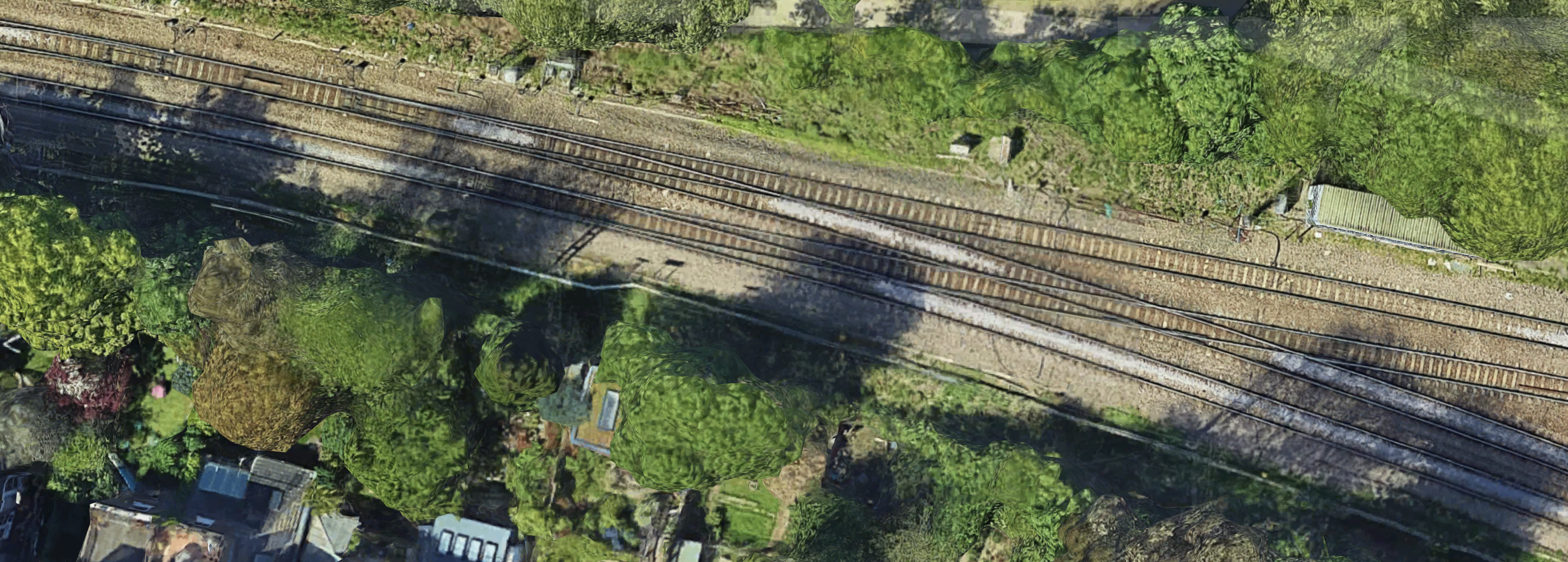
- There is a double-track route, that links Latchmere 1 junction on the West London Line with Longhedge junction on the South London Line.
- Longhedge junction is in the East of the map.
It is an area congested with train tracks and junctions.
Traffic Through Longhedge Junction
Longhedge junction is busy, with the following trains in a typical hour.
- Four tph between Dalston Junction and Clapham Junction stations.
- Up to six assorted freight tph.
Note that services run in both directions.
But this Google Map of the are gives hope.
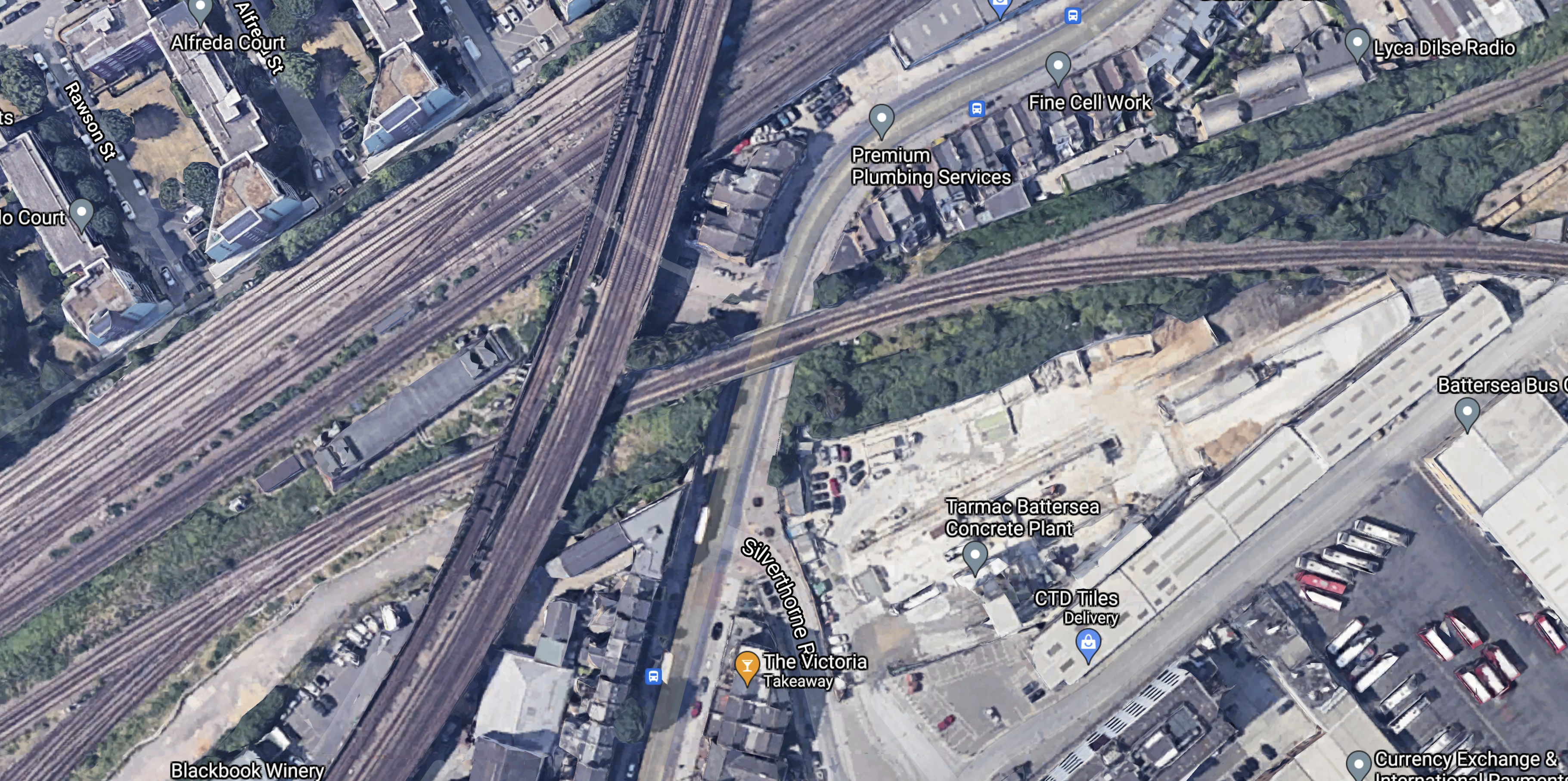
Longhedge junction is to the West of the West of the tracks running North South and it looks like there could be plenty of space to realign the tracks and improve the junction.
As with Nunhead Junction, which I wrote about in Nunhead Junction Improvement, it could be that the use of electric haulage on freight trains through the junction with their more nimble acceleration might help.
Conclusion
This appears to be a serious problem.
What it needs now is a well-designed scheme to speed freight and passenger trains through the junction.
Related Posts
These are related posts about the London Rail Freight Strategy (LRFS).
Decarbonisation Of London’s Freight Routes
East Coast Main Line South Bi-Directional Capability
Gauge Improvements Across London
Headway Reductions On The Gospel Oak To Barking, North London and West London Lines
Heavy Axle Weight Restrictions
Kensal Green Junction Improvement
Moving The West London Line AC/DC Switchover To Kensington Olympia
Moving The West London Line AC/DC Switchover To Shepherd’s Bush
Stratford Regulating Point Extension
Will Camden Road Station Get A Third Platform?
Will Clapham Junction Station Get A Platform 0?
Could London Overground Services To Stratford Be Extended To Meridian Water?
My arrival In Platform 11 at Stratford station has got me thinking!
And others too! Judging by the comments I’ve received.
Yesterday, I took a train from Dalston Kingsland station to Stratford station.
- The train was the 0934 from Clapham Junction, which was timed to arrive in Stratford at 1038.
- It arrived in Platform 11 at 1036.
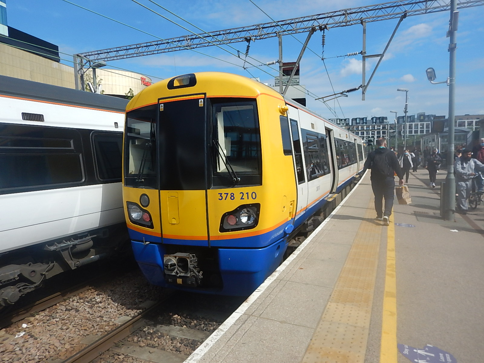
In A London Overground Class 378 Train In Platform 11 At Stratford Station, I show pictures of the train in Platform 11 at Stratford station.
I suspected this was just a one-off occurrence, caused by a malfunction in a train or the signalling, which prevented my train from using the normal Platforms 1 or 2, that services to Stratford would use.
Although, looking at Real Time Trains, the 0938 train this morning, terminated in Platform 11. As it did on Monday and Tuesday this week.
- This train was the only train from Clapham Junction station not to use Platform 2.
- Checking days last week, it appears that this train always terminated in Platform 2.
So why did the service terminate in Platform 11?
Driver training is one possibility, so they can use the Platform 11, if there is a malfunction that stops them using Platform 2.
But is there a clue in the first picture, I took, when I arrived in Stratford?
The train in Platform 12 is the 1046 to Meridian Water, which arrived from Bishops Stortford at 1040.
Could it mean that there is to be a reorganisation of platforms at Stratford?
- Platform 12 will be exclusively used by Greater Anglia for their West Anglia Main Line services.
- Platform 11 will be used by London Overground.
In Using Platform 12 At Stratford Station, I described ending up on Platform 12, so I know it is possible, but when it happened information was bad for passengers, who didn’t know here they needed to go to continue on their way.
But why would London Overground need the extra platform?
These are my thoughts.
Do London Overground Need An Extra Platform At Stratford?
Currently London Overground services to Stratford are as follows.
- Four tph – Stratford and Richmond
- Four tph – Stratford and Clapham Junction
Note.
- tph is trains per hour.
- Both Class 378 and Class 710 trains can work the routes to Stratford.
- Eight tph can easily be handled by two platforms.
To handle more trains may need a third platform at Stratford for the London Overground.
Extra Trains Between Stratford And Canonbury
This report from Network Rail is entitled The London Rail Freight Strategy (LRFS).
It says this about creating a third platform at Camden Road station.
This proposal would reinstate a third track and platform on the northern side of Camden Road station, utilising part of the former 4-track formation through the station.
The additional capacity provided would facilitate much greater flexibility in pathing options for trains on this busy central section of the NLL, opening up new options for future service provision and bolstering performance resilience.
Reinstatement of a third platform would enable platform 2 to be used as a central turnback, with platform 3 becoming the eastbound line for through London Overground services and the majority of freight.
Transport for London modelling suggests that the eastern end of the NLL, from Canonbury to Stratford, will see some of the strongest long-term demand growth on the Overground network.
A turnback platform will allow this to be addressed with peak capacity boosting services between Stratford and Camden Road and there would also be the option to operate these through the off-peak, which could offer a means of providing additional passenger capacity where it is most needed.
The availability of an additional platform would also aid performance recovery during perturbation on
the orbital routes.
Note.
- The strongest passenger growth on the North London Line (NLL), will be between Canonbury and Stratford.
- Extra services are proposed between Stratford and Camden Road stations.
- If you travelled between Highbury & Islington and Stratford before the pandemic, the trains only had space for a few extra very small people in the Peak.
I use this section of the North London Line regularly and suspect the route needs at least twelve tph.
Twelve tph into Stratford would probably mean that the London Overground would need a third platform at Stratford.
More Trains Serving Meridian Water
In the Wikipedia entry for Meridian Water station, this is said.
In August 2019, it was announced that funding had been approved for construction of a fourth platform and a new section of track between Tottenham Hale and Meridian Water to enable up to 8 trains per hour to serve the station at peak times.
This must be the earliest upgrade in history, after a new station has opened.
I got the impression, when the station was announced that it would have four tph to Stratford. Currently, there are just two tph.
Two tph between Stratford and Bishops Stortford also pass through without stopping.
If these called at Meridian Water in the Peak, then there would still be four tph to find.
An easy way to create four tph between Stratford and Meridian Water would be to extend four London Overground services from Stratford.
- Services would call at Lea Bridge, Tottenham Hale and Northumberland Park stations.
- Trains would pass through Platform 11 at Stratford.
- Platform 11 at Stratford would be bi-directional.
- The service could be run all day, at a frequency of four tph.
- As these trains have their own track, they won’t delay the Cambridge and Stansted trains on the West Anglia Main Line.
- A cross-London service between Meridian Water and Clapham Junction or Richmond, would be possible.
Note.
- London Overground would be responsible for the bulk of the Meridian Water service.
- London Overground’s four- or five-car trains would probably have sufficient capacity for the service.
- The main new infrastructure needed would be the fourth platform and a new section of track at Meridian Water station.
- Some improvements as specified in the London Rail Freight Strategy will be useful, as they will increase capacity on the North and West London Lines.
- My only worry would be, that can modern signalling handle four tph in both directions through Platform 11 at Stratford station.
What Will Be The Track Layout And Method of Operation?
The current track layout is simple.
A bi-directional third track has been laid between Lea Bridge junction, just to the North of Lea Bridge station and Meridian Water station.
- It is to the East of the double-track West Anglia Main Line.
- There are bi-directional platforms at Tottenham Hale and Northumberland Park stations.
- There is a single terminating Platform 2 at Meridian Water station.
A train going between Stratford and Meridian Water stations does the following.
- Leaves from Platform 11 or 12 at Stratford station.
- Calls in Platform 2 at Lea Bridge station.
- Switches at Lea Bridge junction to the bi-directional third-track.
- Calls in Platform 2 at Tottenham Hale station.
- Calls in Platform 2 at Northumberland Park station.
- Terminates in Platform 2 at Meridian Water station.
A train going between Meridian Water and Stratford stations does the following.
- Leaves from Platform 2 at Meridian Water station
- Calls in Platform 2 at Northumberland Park station.
- Calls in Platform 2 at Tottenham Hale station.
- Switches at Lea Bridge junction to the Up line of the West Anglia Main Line.
- Calls in Platform 1 at Lea Bridge station.
- Terminates in Platform 11 or 12 at Stratford station.
The track layout can probably handle a maximum of two tph.
I suspect the upgrade will build on this layout to allow a frequency of at least four tph.
The following works will be done.
- A fourth track to the East of the bi-directional third track will be built.
- The fourth track will run between Tottenham Hale and Meridian Water stations.
- I suspect the fourth track will split from the third track at a junction to the North of Tottenham Hale station. Could this be called Tottenham Hale North Junction? I will use that name, to make things simple!
- A new Platform 1 will be built in Meridian Water station.
- Trains going North between Tottenham Hale and Meridian Water will use the current bi-directional third track and will be able to terminate in either Platform 1 or 2 at Meridian Water station.
- Trains going South between Meridian Water and Tottenham Hale will use the new fourth track and will be able to start from either Platform 1 or 2 at Meridian Water station.
- I suspect, Northumberland Park station will need a new Platform 1 for Southbound trains. But the station was designed with that in mind.
A train going between Stratford and Meridian Water stations will do the following.
- Leave from Platform 11 or 12 at Stratford station.
- Call in Platform 2 at Lea Bridge station.
- Switch at Lea Bridge junction to the bi-directional third-track.
- Call in Platform 2 at Tottenham Hale station.
- Call in Platform 2 at Northumberland Park station.
- Terminate in Platform 1 or 2 at Meridian Water station.
A train going between Meridian Water and Stratford stations will do the following.
- Leave from Platform 1 or 2 at Meridian Water station.
- Use the new fourth track to come South.
- Call in Platform 1 at Northumberland Park station.
- Continue on the bi-directional third-track at Tottenham Hale North Junction.
- Call in Platform 2 at Tottenham Hale station.
- Switch at Lea Bridge junction to the Up line of the West Anglia Main Line.
- Call in Platform 1 at Lea Bridge station.
- Terminate in Platform 11 or 12 at Stratford station.
The track layout is effectively two double-track sections linked by a bi-directional single track between Lea Bridge Junction and Tottenham Hale North Junction.
- On the double-track sections of the route trains can pass each other, as they are on different tracks.
- Lea Bridge and Tottenham Hale stations are 1.9 miles apart.
- Trains take three or four minutes between Lea Bridge and Tottenham Hale stations. Including the stop at Tottenham Hale on the single track section.
If trains could alternate through the single-track section, this would give a capacity of well over four tph in both directions.
- A train going North would wait in Platform 2 at Lea Bridge station until the previous Southbound train had cleared Lea Bridge junction, before proceeding North.
- A train going South would wait at Tottenham Hale North Junction until the previous Northbound had safely passed, before proceeded South.
I suspect that the trains need full digital signalling with a degree of Automatic Train Control.
But I suspect we could see six tph in both directions.
- This would fit nicely, with London Overground’s ambition of six tph on all routes.
- It could be increased to eight tph in the Peak, by arranging for an appropriate number of Greater Anglia services to and from Liverpool Street at Meridian Water.
I feel that a service that meets all objectives will be possible.
Proposals From The London Rail Freight Strategy That Might Help
These proposals from the London Rail Freight Strategy might help.
- NLL, GOB And WLL Headway Reductions – See Headway Reductions On The Gospel Oak To Barking, North London and West London Lines
- Kensal Green Junction Improvement
- Moving The West London Line AC/DC Switchover To Kensington Olympia
- Stratford Regulating Point Extension
- Camden Road Platform 3 – See Will Camden Road Station Get A Third Platform?
- Clapham Junction Platform 0 – See Will Clapham Junction Station Get A Platform 0?
It does look to me, that the London Rail Freight Strategy was designed with one eye on improving the passenger train service between North-East and South-West London.
Taking The Pressure Off The Victoria Line
Consider.
- If you’re going between Walthamstow and the West End or the major stations of Euston, Kings Cross, St. Pancras and Victoria, you will use the Victoria Line.
- If you live in the new housing, being built at Meridian Water, currently you will be likely to hop to Tottenham Hale station and take the Victoria Line.
Consequently, Northern end of the line can get busy! And not just in the Peak!
But a four tph service between Meridian Water and Stratford, will encourage passengers to go to Stratford to take advantage of the Central and Jubilee Lines and Crossrail.
Hence there will be less passengers, who need to use the Victoria Line.
A Better Interchange Between Camden Road And Camden Town Stations
The essential upgrade of Camden Town station has been put on indefinite hold due to TfL’s financial position.
This is a big mistake.
- Camden Town station gets dangerously full!
- It would allow the splitting of the Northern Line into two independent lines, which would increase capacity of the current system.
- Camden Town station is not step-free but Camden Road station has lifts.
Hopefully, it would result, in a better route between the two stations, rather than the polluted route on a narrow pavement.
I very much believe that the rebuilding of Camden Town station is the most important project to improve London’s Underground and Overground network.
But it won’t get built with the current Mayor, as he’s a South Londoner.
Could A Meridian Water and Clapham Junction Service Be An Affordable Crossrail 2?
Consider.
- Crossrail 2 will link Clapham Junction and Meridian Water via Central London and Dalston.
- A Meridian Water and Clapham Junction service would link the two stations via Shepherd’s Bush, Old Oak Common, West Hampstead, Camden Road, Dalston and Stratford.
Each route has their connectivity advantages.
- Both have good connections to Crossrail, Thameslink and the Bakerloo, Central and Jubilee Lines.
- The London Overground route has good connections to the Victoria Line and High Speed Two at Old Oak Common.
- Crossrail 2 serves important stations in Central London.
A Meridian Water and Clapham Junction service could be a valuable addition to London’s rail infrastructure without too much new expensive infrastructure.
Conclusion
An extension of some London Overground services from Stratford to Meridian Water would be worthwhile.
Implementation of this is made easier by the recommendations of the London Rail Freight Strategy.
I
Nunhead Junction Improvement
London has a rail capacity problem, for both freight and passenger trains.
This report from Network Rail is entitled The London Rail Freight Strategy (LRFS).
One of the secondary recommendations of the report is to improve Nunhead junction.
The report explains it like this.
Rail freight stakeholders have consistently highlighted Nunhead as a priority location for improving the flow of freight around the London orbital routes. The junction to the immediate east of the station is a flat crossing where two lines of route and multiple passenger and freight services groups converge into the South London Line, creating a pinch point for capacity.
Freight train drivers, when consulted for input into this strategy, flagged the route eastbound from Peckham Rye through Nunhead and towards Lewisham as a challenging section on which to keep heavier trains moving. This is primarily a consequence of the relatively slow permissible speed of 25mph over Nunhead Junction when routed towards Lewisham,
which follows a steadily rising gradient from Peckham Rye.The option proposed by this strategy is for changes to the track alignment in order to increase the speed of the turnout towards Lewisham, as far as can be achieved without affecting the speed of the main route towards Catford. This option would primarily benefit the performance of eastbound freight flowing from the South London Line towards the North Kent lines, one of the key rail freight corridors in the South East, enabling freight trains to run at faster and more consistent speeds towards Lewisham.
This would most likely increase right time presentation at the critical flat junction at Lewisham, as well as assisting the flow of passenger and freight trains to the Catford Loop by ensuring preceding Lewisham-bound traffic can clear Nunhead Junction as quickly as possible.
Addressing the existing constraints to freight traffic through Nunhead, which by their nature most affect the heavier bulk traffic that characterises the North Kent corridor, would also support industry aspirations to maximise the payloads that trains can haul.
This map from cartometro.com shows the route between Nunhead and Lewisham stations.
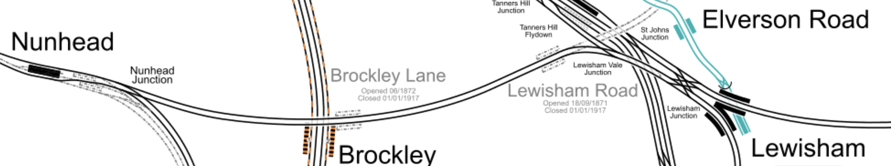
And this Google Map shows Nunhead station and the junction.
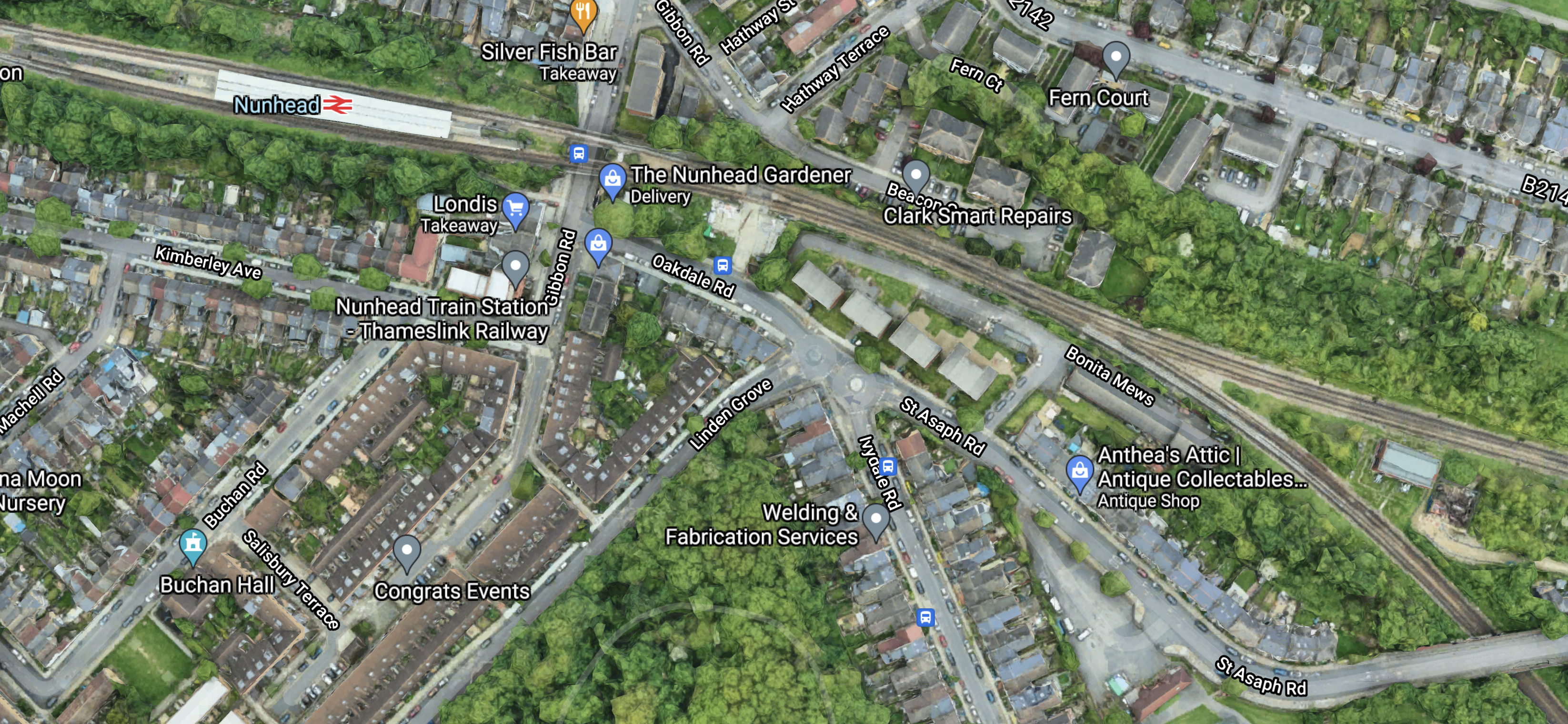
Note.
- Nunhead junction is towards the right of the map.
- The lines going to the East go to Lewisham.
- The lines going to the South East go to Crofton Park and Catford.
- I have counted the freight trains through Nunhead junction on real time trains and there can be as main as six trains per hour (tph), through the junction at times, using both Lewisham and Crofton Park routes.
But there would also appear to be plenty of space around the junction to realign the tracks.
As many trains need to go East from Lewisham and there are two flat junctions on the route; Nunhead and Lewisham, anything that improves keeping to schedule is to be welcomed.
The Use Of Electric Haulage
All routes through Nunhead junction have 750 VDC third-rail electrification, but I suspect all freight trains through the junction are diesel hauled.
Real time trains also shows that many of the trains through Nunhead junction also use the West London Line through Shepherd’s Bush.
In Decarbonisation Of London’s Freight Routes, I proposed a dual-voltage battery-electric locomotive to handle freight trains.
Perhaps more capable battery-electric freight locomotives with their better acceleration, are part of the solution at Nunhead junction.
Conclusion
This appears to be a well-thought out solution to one of the problems for freight trains in London.
I also believe that dual-voltage battery-electric locomotives could be part of the solution at Nunhead junction and would also help in many other places on the UK rail network.
Related Posts
These are related posts about the London Rail Freight Strategy (LRFS).
Decarbonisation Of London’s Freight Routes
East Coast Main Line South Bi-Directional Capability
Gauge Improvements Across London
Headway Reductions On The Gospel Oak To Barking, North London and West London Lines
Heavy Axle Weight Restrictions
Kensal Green Junction Improvement
Longhedge Junction Speed Increases
Moving The West London Line AC/DC Switchover To Kensington Olympia
Moving The West London Line AC/DC Switchover To Shepherd’s Bush
Stratford Regulating Point Extension
Stratford Regulating Point Extension
London has a rail capacity problem, for both freight and passenger trains.
This report from Network Rail is entitled The London Rail Freight Strategy (LRFS).
One of the secondary recommendations of the report is what Network Rail call the Stratford Regulating Point Extension.
The report explains it like this.
Capacity analysis for this study emphasised in its conclusions that the key to making the timetable work is the ability to hold trains in strategic locations in order to match capacity between the orbital lines and the radial routes in and out of London.
It therefore noted that holding capacity at Stratford for the longest freight trains (up to 775m) is essential, recommending that consideration is given to lengthening the Up Channelsea Loop at Lea Junction in particular.
The purpose of this scheme would be to provide a regulating point offering 775m standage for freight trains passing through Stratford towards the NLL, fully segregated from other traffic.
This would be achieved by extending the existing Up Channelsea Loop to the North-West, so that it can accommodate a 775m train clear of Stratford Central Junction.
This option offers combined capacity and train lengthening benefits, as the ability to regulate the longest trains at key interface points on the network increases the chances of finding them a compliant path through successive timetable structures as they pass from route to route.
Note.
- 775 metres is the longest train allowed on UK railways.
- Longer trains are an efficient way of moving freight and often mean less trains in total.
- It is extremely handy to have a place to park a train, to aid in keeping to the timetable.
This map from cartometro.com shows the Eastern end of the North London Line and the Up Channelsea Loop.
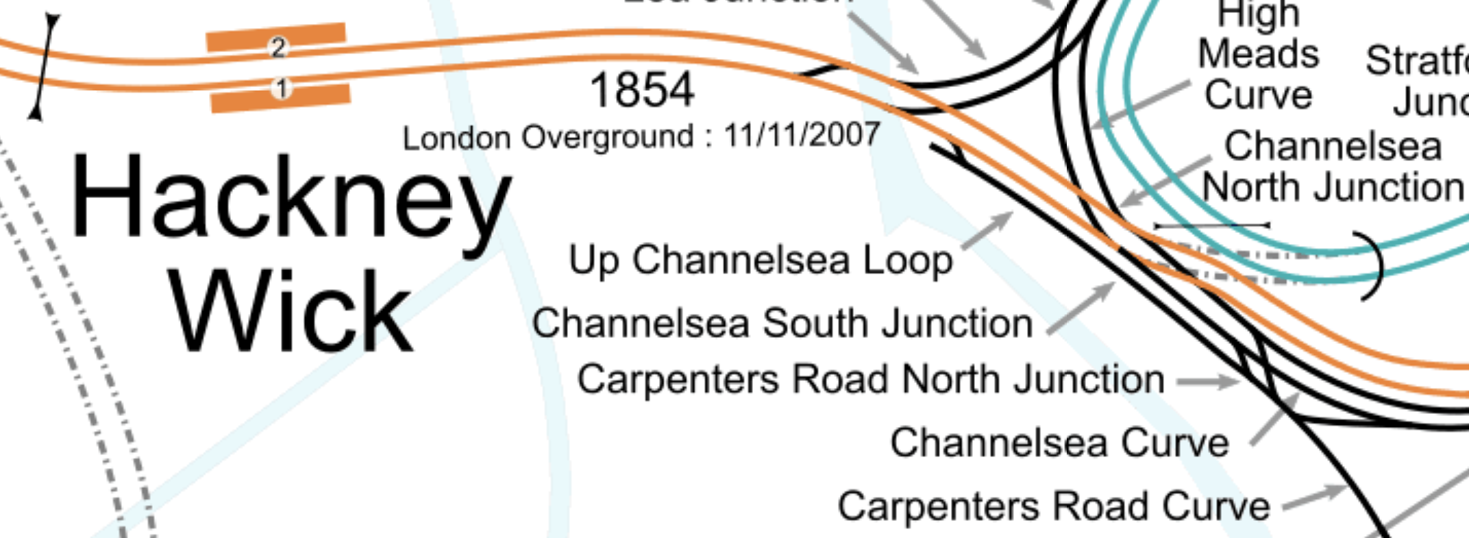
Note.
- The orange tracks are the North London Line and are used by the London Overground and freight trains.
- The Up Channelsea Loop to the South-West of the North London Line.
- The Up Channelsea Loop has connections to both directions of the Great Eastern Main Line at its South-Eastern end.
- Carpenters Road North junction would appear to connect Liverpool Street station to the High Meads curve, so that empty stock can be moved to and from the sidings at Orient Way.
- I would expect that any train waiting in the Up Channelsea Loop can’t overhang Carpenters Road North junction, as this would block the empty stock movements between Liverpool Street and Orient Way sidings.
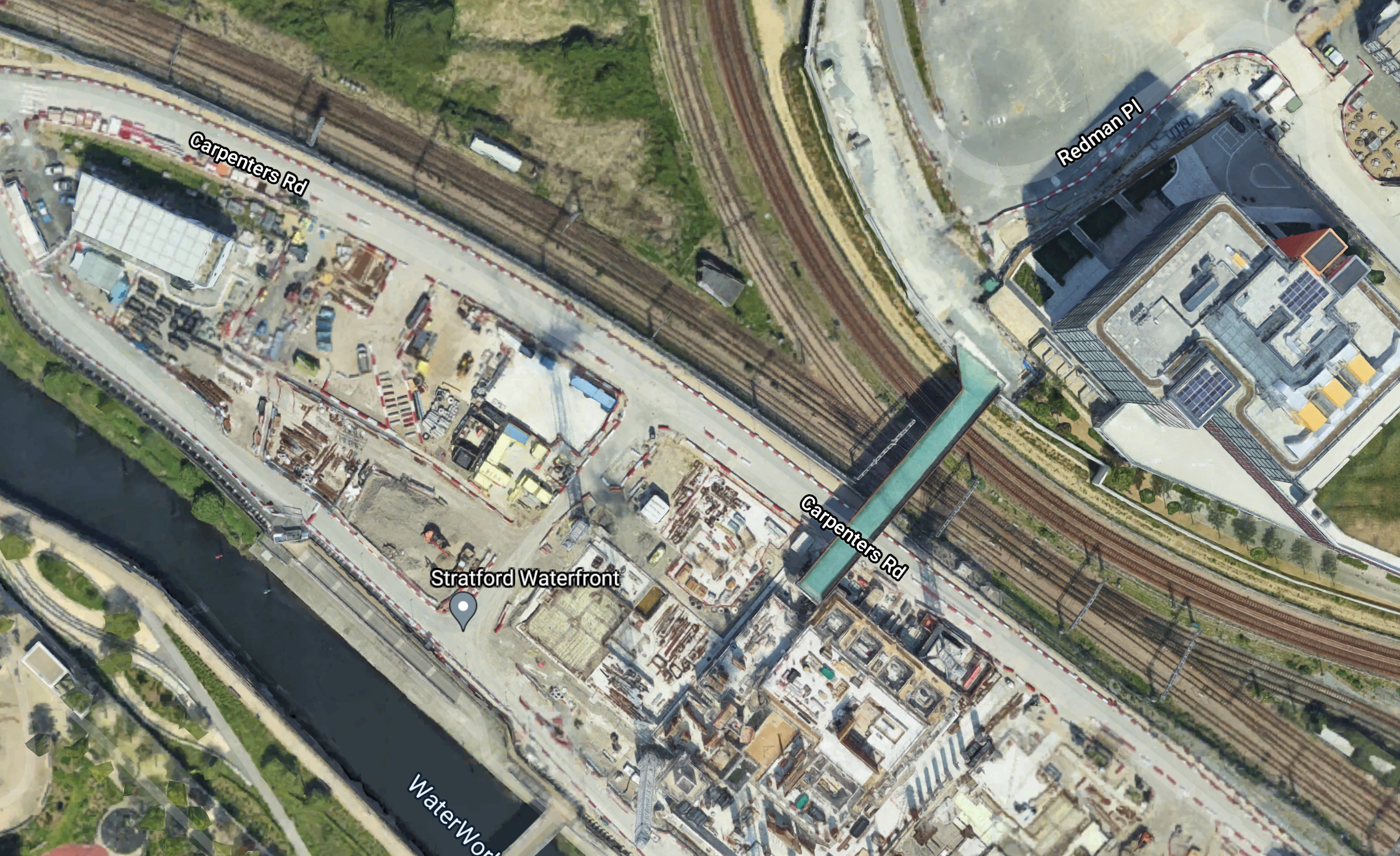
This Google Map shows the South-Eastern end of the Up Channelsea Loop.
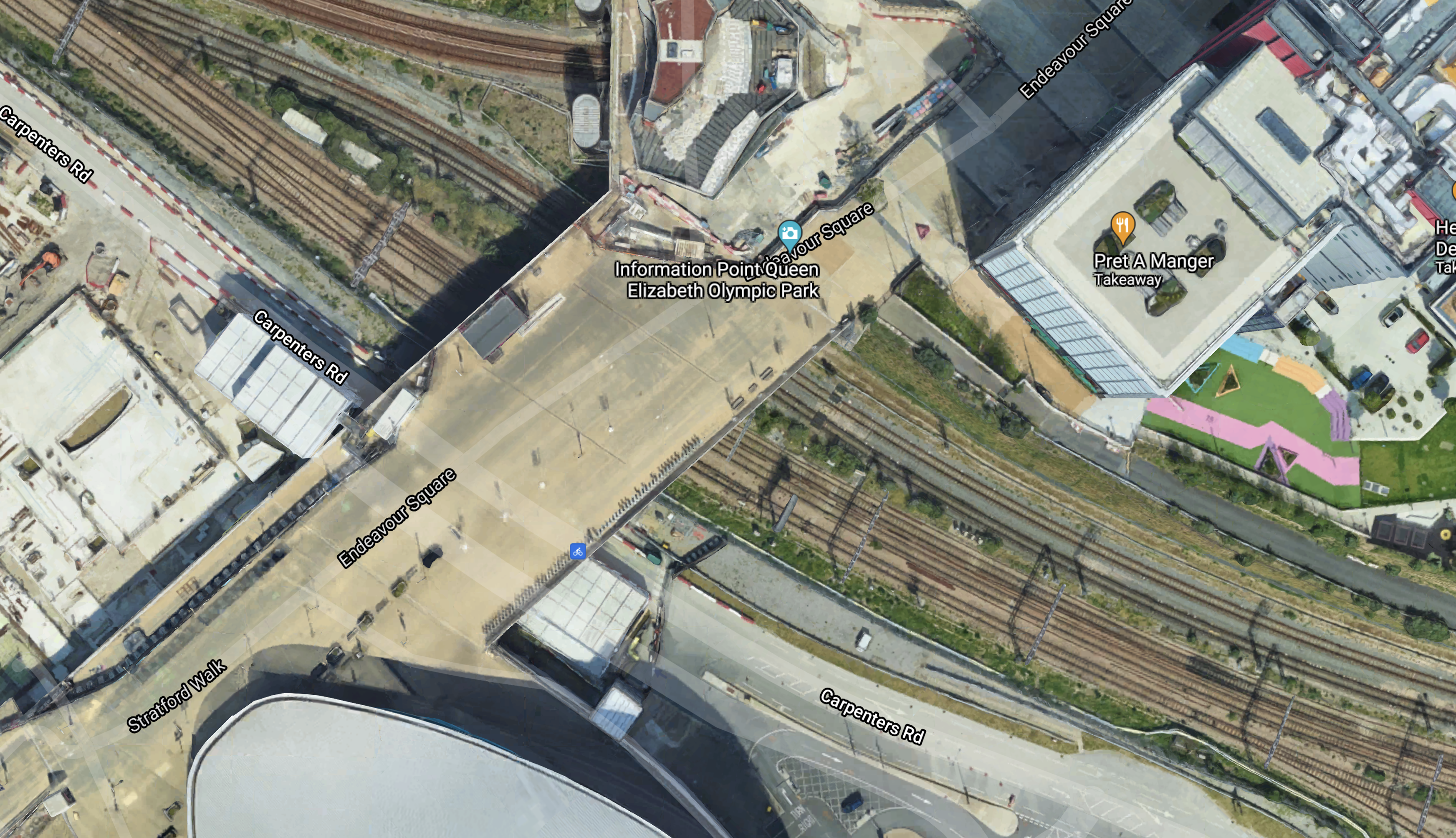
Note.
- The bridge over the tracks is the main access to the Olympic Park.
- I have arranged that the Up Channelsea Loop runs between the North-West and South-East corners of the map.
- The two tracks to access the Up Channelsea Loop join in the South-East corner of the map.
- The crossover to the North of the bridge is part of Carpenters Road North junction.
I would estimate that freight trains waiting in the Up Channelsea Loop can’t be closer than about thirty metres from the bridge.
This second Google Map shows what I suspect is the usable section of the Up Channelsea Loop.
Note.
- I have arranged the North-Western corner of the map over the buffer stops at the end of the Up Channelsea Loop.
- The South-Eastern corner is at the lower limit of the Up Channelsea Loop.
- I estimate that the usable length of the current Up Channelsea Loop is six hundred metres at most.
This third Google Map shows the Northern end of the Up Channelsea Loop.
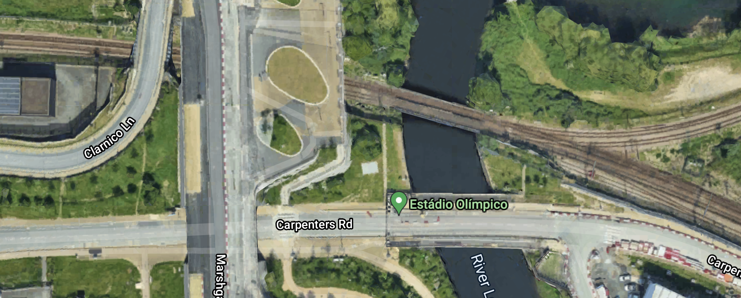
Note.
- The crossover so trains can leave the Up Channelsea Loop in the South-East corner of the map.
- There is a red buffer stop on the end of the loop.
I feel they will certainly have to bridge the River Lea, if the Up Channelsea Loop is going to be lengthened to the North-West.
Perhaps this fourth Google Map, that shows a 3D view of the area from the West.
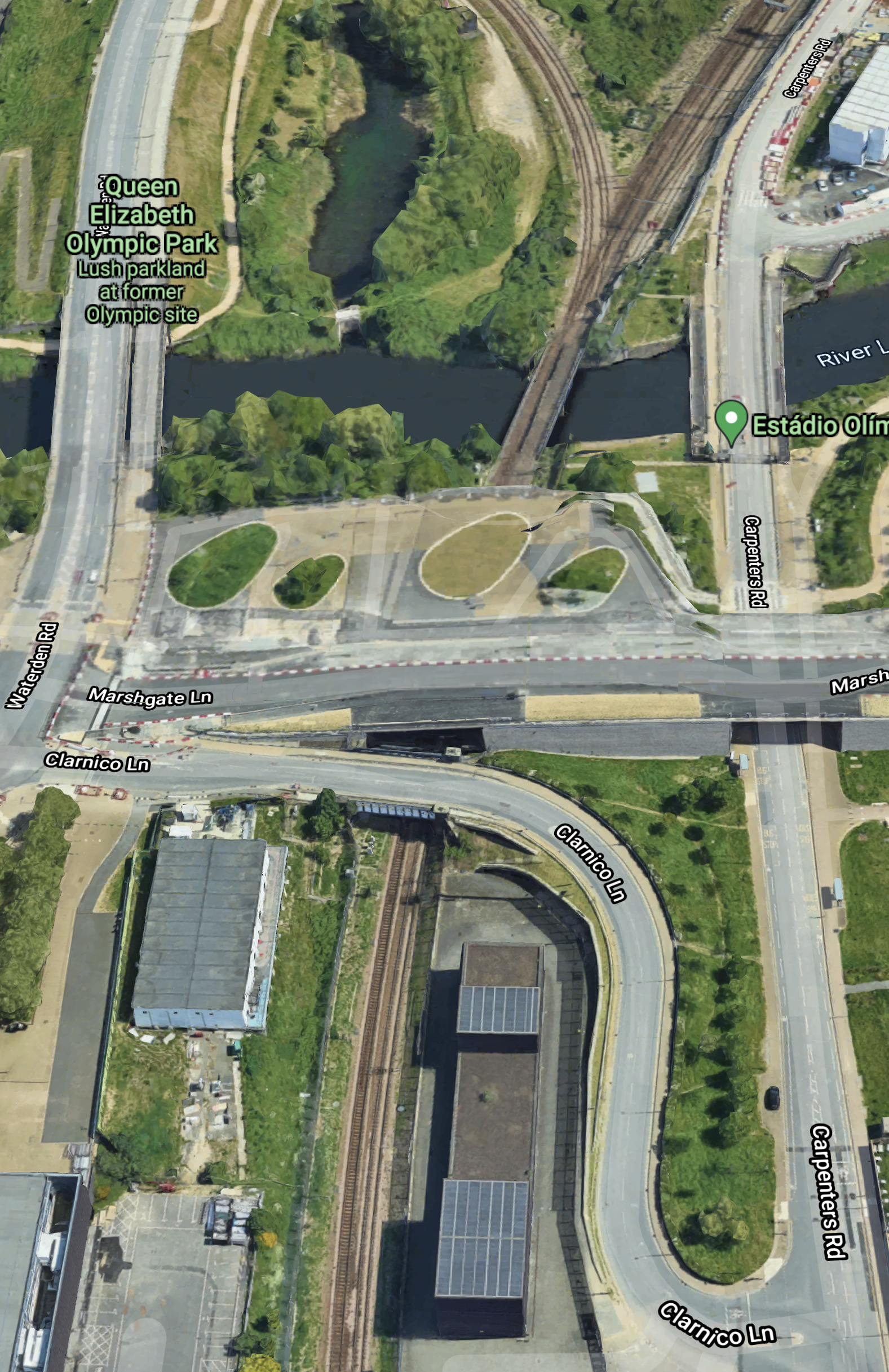
Note.
- Is there a tunnel under Marshgate Lane that can take three tracks.
- There could be space to extend the Up Channelsea Loop over the River Lea and alongside the long building, which is the Energy Centre for the site.
- There might even be a bit more space to create a fast exit from the Up Channelsea Loop.
If the Up Channelsea Loop is going to extend this far, then it looks like it has been planned for some time.
I took these pictures as I approached Stratford station.
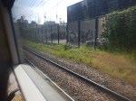
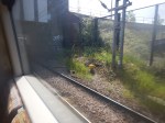

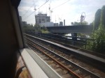
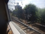
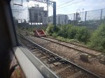
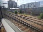
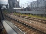
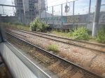
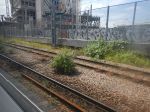
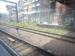
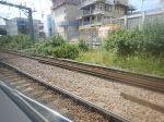
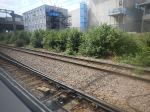
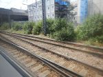
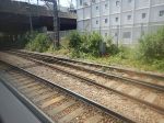
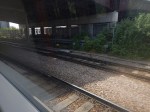
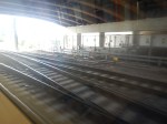
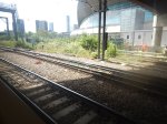
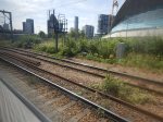
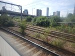
Note.
- The Up Channelsea Loop is the track furthest away to the right.
- The red buffer stop can be picked out.
- I started taking pictures alongside the Energy Centre.
- I think that the short tunnel between the Energy Centre and the River Leacan handle three tracks.
It looks to me, that provision was made for lengthening the Up Channelsea Loop, when these tracks were laid.
Conclusion
I think it is going to be a tight fit to extend the Up Channelsea Loop by sufficient length to handle the longest freight trains.
But it should be possible.
Related Posts
These are related posts about the London Rail Freight Strategy (LRFS).
Decarbonisation Of London’s Freight Routes
East Coast Main Line South Bi-Directional Capability
Gauge Improvements Across London
Headway Reductions On The Gospel Oak To Barking, North London and West London Lines
Heavy Axle Weight Restrictions
Kensal Green Junction Improvement
Longhedge Junction Speed Increases
Moving The West London Line AC/DC Switchover To Kensington Olympia
Moving The West London Line AC/DC Switchover To Shepherd’s Bush
Doubling Harlesden Junction
London has a rail capacity problem, for both freight and passenger trains.
This report from Network Rail is entitled The London Rail Freight Strategy (LRFS).
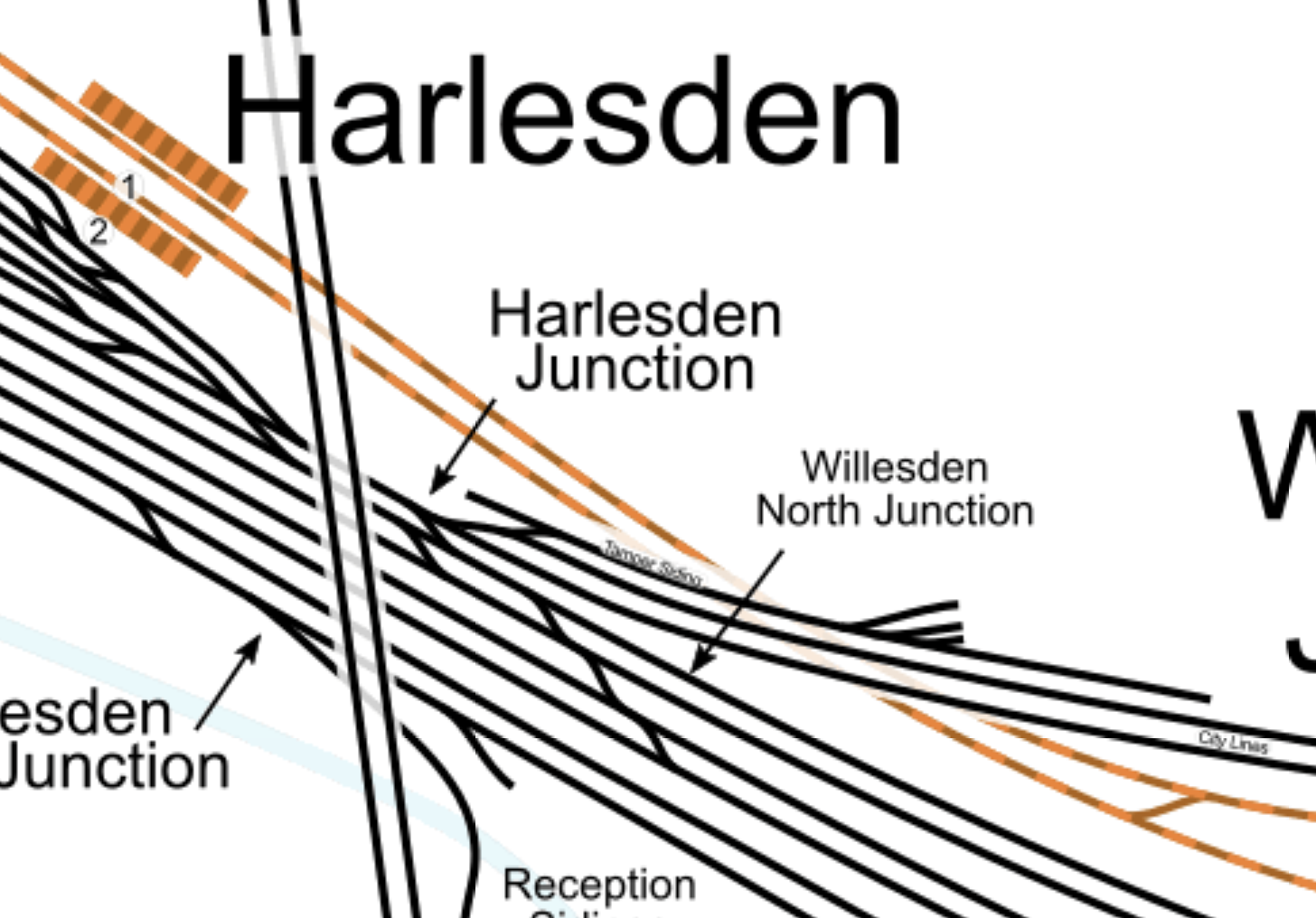
One of the secondary recommendations of the report is to double Harlesden Junction. It says this about the doubling.
At present, several Goods lines from the direction of Wembley Yard converge into a single lead through Harlesden Junction, the connection to the City lines, from which the North London Line is accessed. This represents a bottleneck where trains are unable to pass in each direction simultaneously. Conceptual design work for the LRFS has identified that the bridge span immediately above the junction, which the two West Coast Main Line Slow lines also pass under, formerly accommodated four tracks in total.
Because the City lines extend for a relatively short distance between Harlesden Junction and Kensal Green Junction, a speed increase at Harlesden Junction is necessary in order to align with the uplifted speeds proposed for Kensal Green Junction (see Core Interventions). Upgrading Harlesden Junction is therefore required in order to realise the benefits of the core intervention at Kensal Green Junction. Doubling the junction would further ease the flow of freight trains through this critical connection between the West Coast Main Line and the orbital routes.
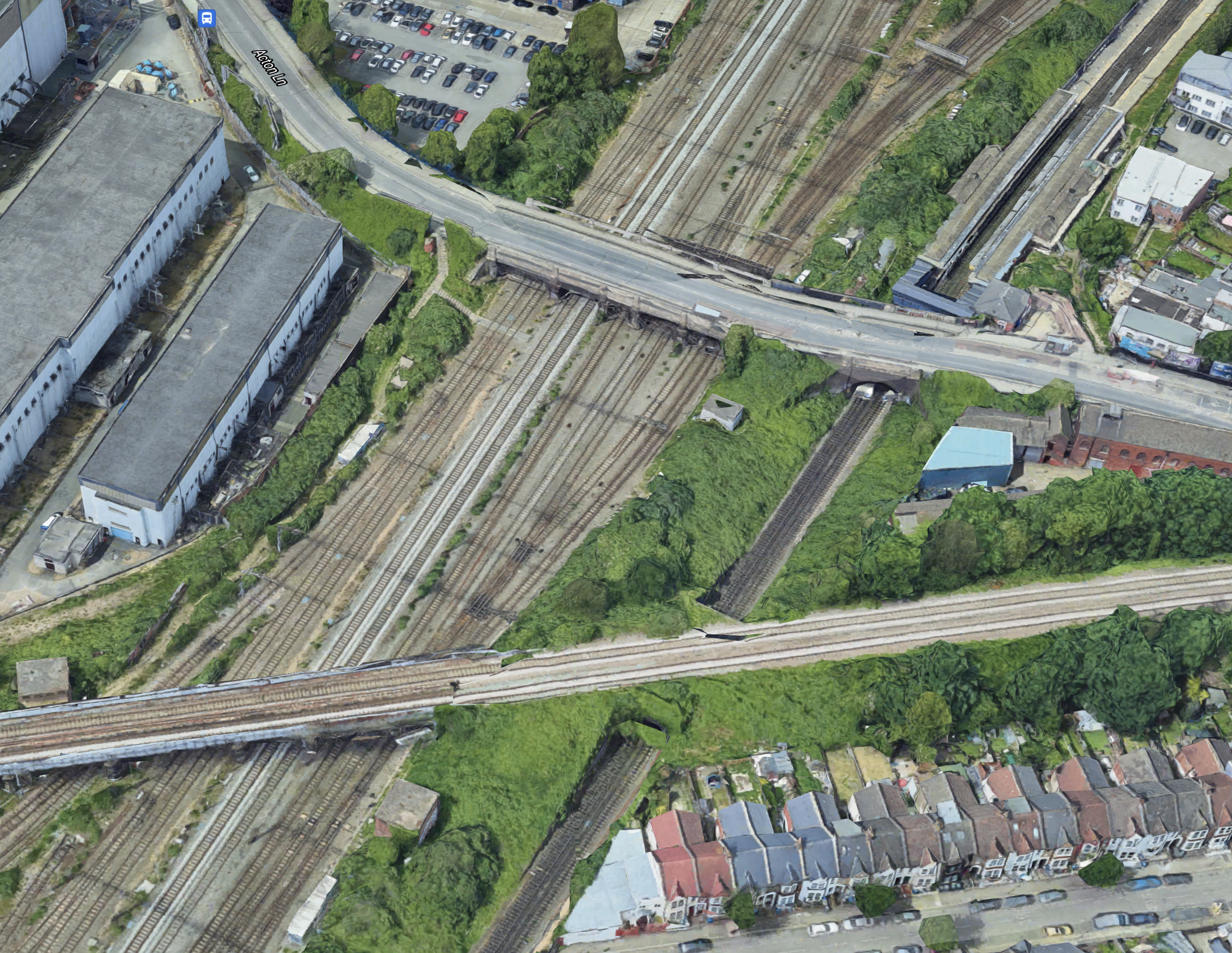
This map from cartometro.com shows Harlesden Junction.
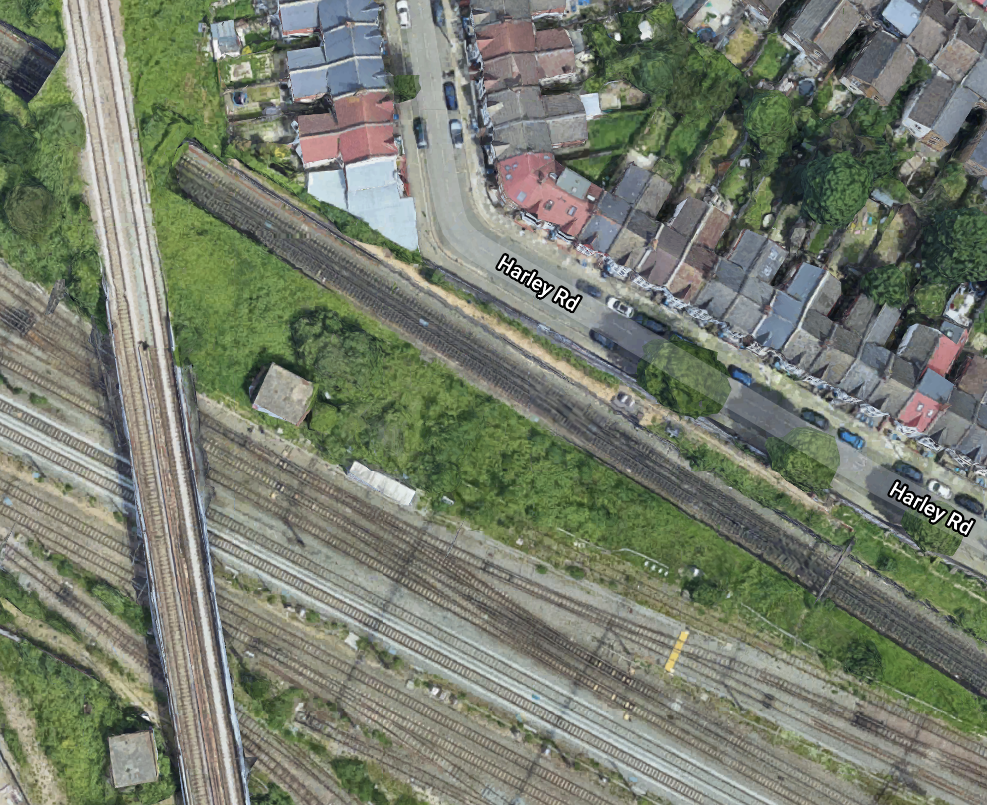
This Google map shows the area.
Note.
- The six tracks across the bottom of both maps are the West Coast Main Line.
- The double track rail line going North-South over the West Coast Main Line is the Dudding Hill Line.
- The Northernmost tracks, that go East-West under the Dudding Hill Lines are the combined Watford DC and Bakerloo Lines, which explains their colour in the first map.
- South of these tracks are the City Lines and Harlesden Junction, which connects it to the West Coast Main Line.
This 3D image shows the Harlesden Junction with the Dudding Hill Line over the top, looking from the South-East.
Note that Harlesden station can be seen in the North-East of the map.
There is certainly space in the area to improve the junction.
Conclusion
It strikes me that if you improve Kensal Green Junction, then doubling of Harlesden Junction is needed, to make the most of the investment at Kensal Green.
Related Posts
These are related posts about the London Rail Freight Strategy (LRFS).
Decarbonisation Of London’s Freight Routes
East Coast Main Line South Bi-Directional Capability
Gauge Improvements Across London
Headway Reductions On The Gospel Oak To Barking, North London and West London Lines
Heavy Axle Weight Restrictions
Kensal Green Junction Improvement
Longhedge Junction Speed Increases
Moving The West London Line AC/DC Switchover To Kensington Olympia
Moving The West London Line AC/DC Switchover To Shepherd’s Bush
Stratford Regulating Point Extension
