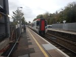
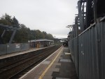
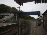
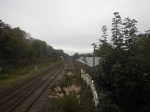
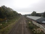
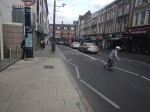
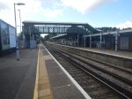
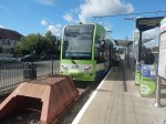
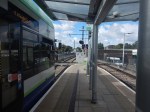
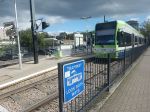
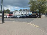
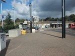
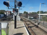
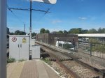
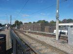
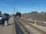
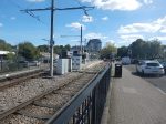
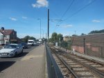
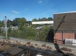
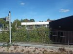
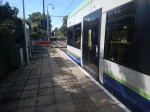
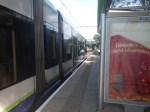
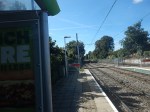
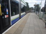
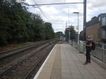
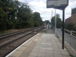
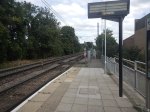
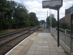
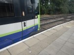
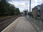
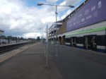
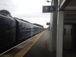
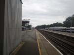
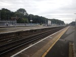
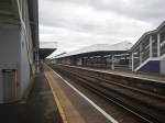
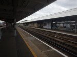
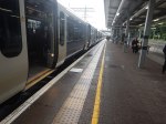
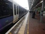
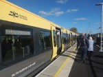
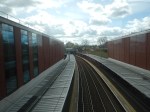
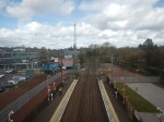
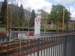
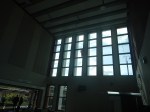
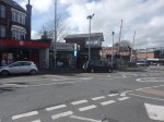
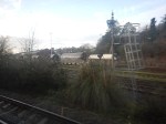
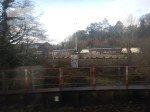
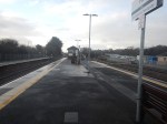
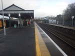
Old Street Station – 29th November 2024
I went back to the station today and took more pictures of the parts, I didn’t photograph yesterday.


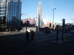


Note.
- I arrived in and left from Silicon Roundabout via City Road to the South.
- There is a single lift on the North-East side of the roundabout to give access to the lower level.
- There is no lift access to the platforms.
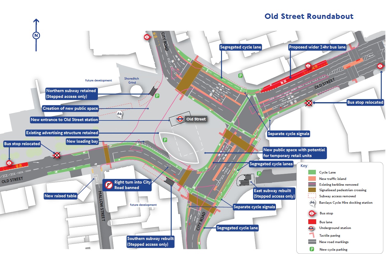
This map from Transport for London shows the future layout of Old Street Roundabout.
The step-free access could be better.
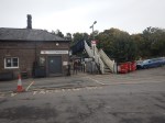
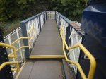
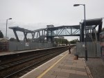
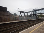
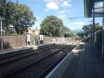
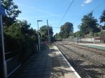
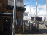
Abergavenny Station – 13th October 2024
For a trip today, I went to Abergavenny station to see the progress on the new step-free bridge and take a few pictures.
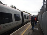
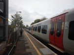

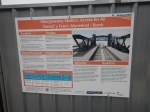

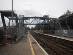
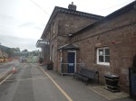


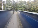

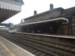

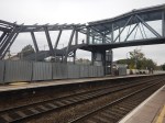
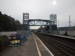
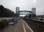
Note.
- The station has several unusual features.
- The car park could take all of about six cars.
- The current bridge would be dangerous for the elderly with shopping trolleys.
- Network Rail seem to be explaining the work in more detail, than usual.
Why is it that each new step-free station bridge appears to be a different design?
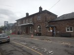
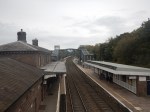
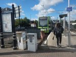
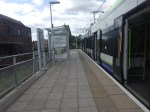
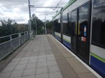
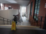
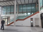
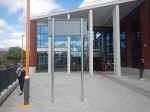
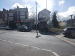
A Small Station Entrance With Almost Everything
The pictures show the second entrance to Hackney Central station, which was built a few years ago.

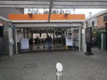

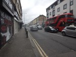
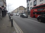
Note.
- There is a light controlled-crossing outside the station.
- There are two ticket machines, where National Rail tickets can be bought and collected.
- There is a coffee hut.
- Stairs lead all the way up to the Westbound platform.
- The Eastbound platform is over a step-free bridge.
- The best M & S Food store in East London is within a hundred metres of both platforms.
- 38, 242 and 277 buses pass the the new entrance.
It is a well-appointed entrance to a station.
Potential Tram Builders Announced For New London Trams
The title of this post, is the same as that of this article on RailAdvent.
These three paragraphs outline the design of the new trams.
Transport for London has issued an Invitation to Tender for four manufacturers to design and build a new fleet of trams.
Alstom UK, CAF, Hitachi and Stadler are the four manufacturers who can now proceed to the next stage of the procurement process with Transport for London to design and build the new trams.
The new trams are expected to feature air-conditioning, real time travel info and charging points, along with areas designed for wheelchair users and those with pushchairs and luggage.
It sounds that the new trams will be to a higher standard with more comfort and interior space.
These are my observations and thoughts.
Will There Be The Same Number of Trams?
These two paragraphs indicate the number of trams.
The initial contract will be for 24 new trams to replace the oldest trams on the network – which are now nearly 25 years old.
There is an option in the contract to replace the trams that were introduced from 2012.
Could this mean, that each tram would be replaced on a one-to-one basis?
It would surely make it easy to introduce the new fleet.
Will The New Trams Be Longer?
To me, the most significant words in the article are “areas designed for wheelchair users and those with pushchairs and luggage”.
As passengers seem to want to carry more and more with them on buses, trains and probably trams in London, I believe the new trams will probably need more interior space.
Increasing the width of the tram, would probably mean gauging difficulties, but with the lengthening of some platforms longer trams might be possible.
The current trams are as follows.
- 24 x Bombardier CR4000 – 30.1 metres – 70+138=208 = 6.9 pass/metre
- 12 x Stadler Variobahn – 32 metres – 72+134 = 206 = 6.4 pass/metre
Note.
- The total number of each tram type is at the left.
- Seats+Standing=Total Passengers.
- The Bombardier trams only have a single articulation, but it looks like the Stadler ones have four.
The longer Stadler trams seem less crowded, despite carrying two fewer passengers.
I have looked at the terminal platforms on maps and it appears, that 35 metre and possibly 40 metre trams would be possible.
At least in London, passengers are used to being told not to use the end door.
A 40 metre tram could probably handle over 250 passengers based on the Stadler passenger density.
Longer Trams Could Increase Capacity By Up To 25 %
I believe my figures show this could be possible.
More Articulations Should Mean A Tighter Turning Circle
This could help operation on some existing or new sections of London Tramlink.
Would Battery Tram-Train Operation Be Useful?
CAF’s trams in the West Midlands already have batteries and Stadler’s tram-trains in Cardiff will have batteries to extend routes on rail tracks, that don’t have electrification.
In Could Beckenham Junction To Birkbeck Be Run Using Third-Rail Tram-Trains?, I detailed how third-rail tram-trains could be used between Harrington Lane tram stop and Beckenham Junction station to create more capacity.
I believe that third-rail tram-trains would work, but that Health and Safety would outlaw the concept.
On the other hand, battery-electric tram trains could probably handle the link between train and tram routes.
If I was bidding for the TramLink contract, I’d make sure the trams could be updated with a battery-electric tram-train capability.
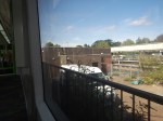
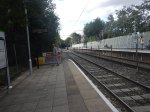
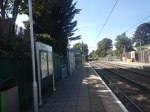
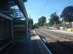
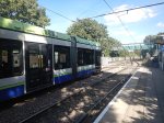
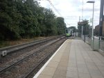
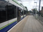
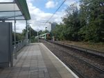
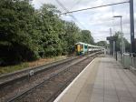
Increasing Capacity At Elmers End Tram Stop
Elmers End tram stop, is the only terminal on the London Tramlink with a single platform.
This map from OpenRailwayMap shows the platform layout at Elmers End station.
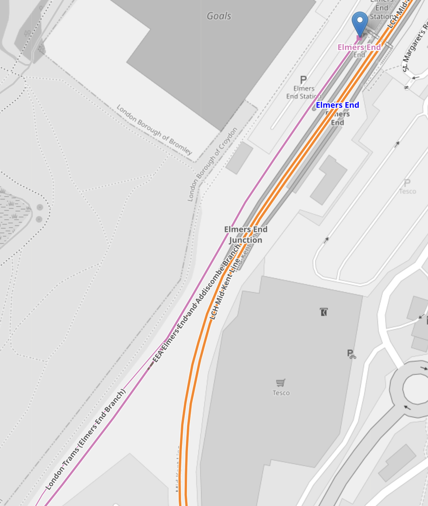
Note.
- The orange lines are the Hayes Line.
- The mauve line is the London Tramlink.
- The London Tramlink has a single platform on the North-West side of the Hayes Line.
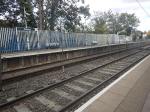
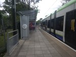
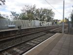
These pictures show Elmers End station and a tram in the London Tramlink platform.
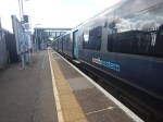
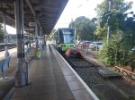
Note.
- The bridge in the station is not step-free.
- The tram is a five-section Stadler Variobahn.
- The tram platform would appear to be able to handle a tram, that is several metres longer than the 32.0 metre Stadler Variobahn.
- The London Tramlink has a typical off-peak service to Wimbledon every ten minutes from Elmers End tram stop.
The Wikipedia entry for Elmers End station, says this about Tramlink developments at the station.
Work is underway to open a second tram platform and double the tram line to Arena to increase capacity. As of March 2019, vegetation has been cleared to make way for the new line. The platform was due to open in December 2020, but has been delayed.
My pictures show no ongoing work or evidence of the second Tramlink platform.
There are two main ways, that capacity can be increased at Elmers End station.
- Install a second platform and run more trams to the station.
- Run longer trams with a higher capacity.
Perhaps, Transport for London have decided, that the second way, is the best, especially, if the money saved, allows them to build a much-needed step-free footbridge at Elmers End station.
From my observations, I would estimate that Elmers End tram stop could accommodate a forty metre tram and possibly, one that was even longer.
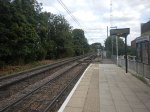
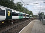
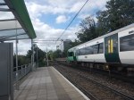
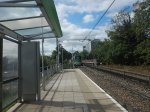
Arena Tram Stop
The Arena tram stop, is where the Beckenham Junction and Elmers End branches join and split.
This map from OpenRailwayMap shows the platform layout at Arena tram stop.
Note.
- The mauve lines are the London Tramlink.
- The line going North-East runs to Elmers End. It starts off as double-track at Arena tram stop and quickly becomes single track all the way to Elmers End. tram stop.
- The line going North-West runs to Beckenham Junction.
- The line going South-West runs to East Croydon and Wimbledon.
- The platforms are on the outside of both tracks.
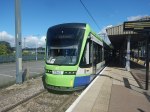
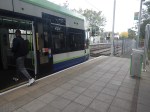
These pictures show Arena tram stop and some trams passing through.
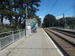
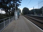
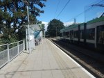
Note.
- The tram platforms are generally a few metres longer than the trams.
- All tram doors are step-free to the platform.
- Passengers walk across the line in front or behind the trams.
- The platform is wide, so that passengers can stay well clear of the occasional passing tram. One picture shows a tram is signed “Not In Service”
I believe, that with some judicial platform lengthening, some selective door opening and trams stopping automatically in the right place on the platform, that longer trams could be handled in a stop like Arena.
As with Elmers End, I believe a forty metre tram will be possible, but this might not be the limit with clever design.
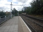
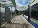
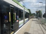
Handling Longer Trams At Beckenham Junction Tram Stop
This map from OpenRailwayMap shows the platform layout at Beckenham Junction tram stop.
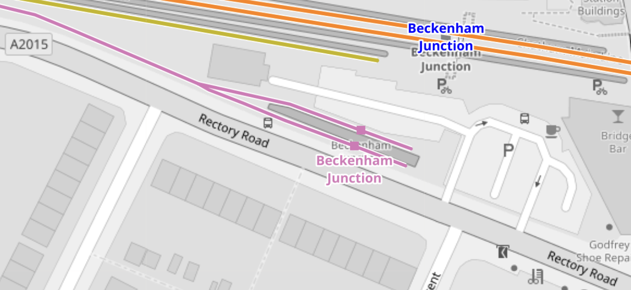
Note.
- The orange lines are the Chatham Main Line.
- The mauve line is the London Tramlink.
- There are a pair of short platforms for the London Tramlink.
- The platforms would be difficult to extend to the East.
- The platforms would be difficult to extend to the West, as the map above shows a building, just to the North of the junction of the two Tramlink platforms.
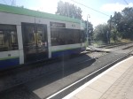
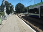
These pictures show Beckenham Junction station and the London Tramlink platforms.
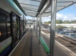

The Wikipedia entry for Beckenham Junction tram stop, says this about the Tramlink service.
Tram services at Beckenham Junction are operated by Tramlink. The tram stop is served by trams every 10 minutes to Wimbledon via Croydon. This is reduced to a tram every 15 minutes on Saturday evenings and Sundays.
Perhaps, the solution to lengthen Tramlink platforms at Beckenham Junction is to do the following.
- Rebuild the building to the North of the junction of the two Tramlink platforms.
- Extend the two Tramlink platforms to the West.
- Move the junction between the two Tramlink platforms to the West.
These pictures show the building in detail.

Note.
- There is a Network Rail van outside the building.
- The building looks like it dates from about 2000, when the Tramlink was built.
- Perhaps, the building houses power supply or signalling equipment for the Tramlink.
After the modifications, operation would be the same, but longer trams could be handled.
Trams And Trains Between Birkbeck And Beckenham Junction Stations
This short section of track must be one of the most unusual and complicated in the UK.
- There are three dual National Rail and Tramlink stations; Birkbeck, Avenue Road and Beckenham Road.
- Each station has a single bi-directional National Rail track and/or platform.
- Birkbeck has a single bi-directional Tramlink platform.
- Avenue Road and Beckenham Road each have two Tramlink platforms.
Engineer; Baldrick was obviously having one of his cunning phases.
This map from OpenRailwayMap shows the track/platform layout at Birkbeck station/tram stop.
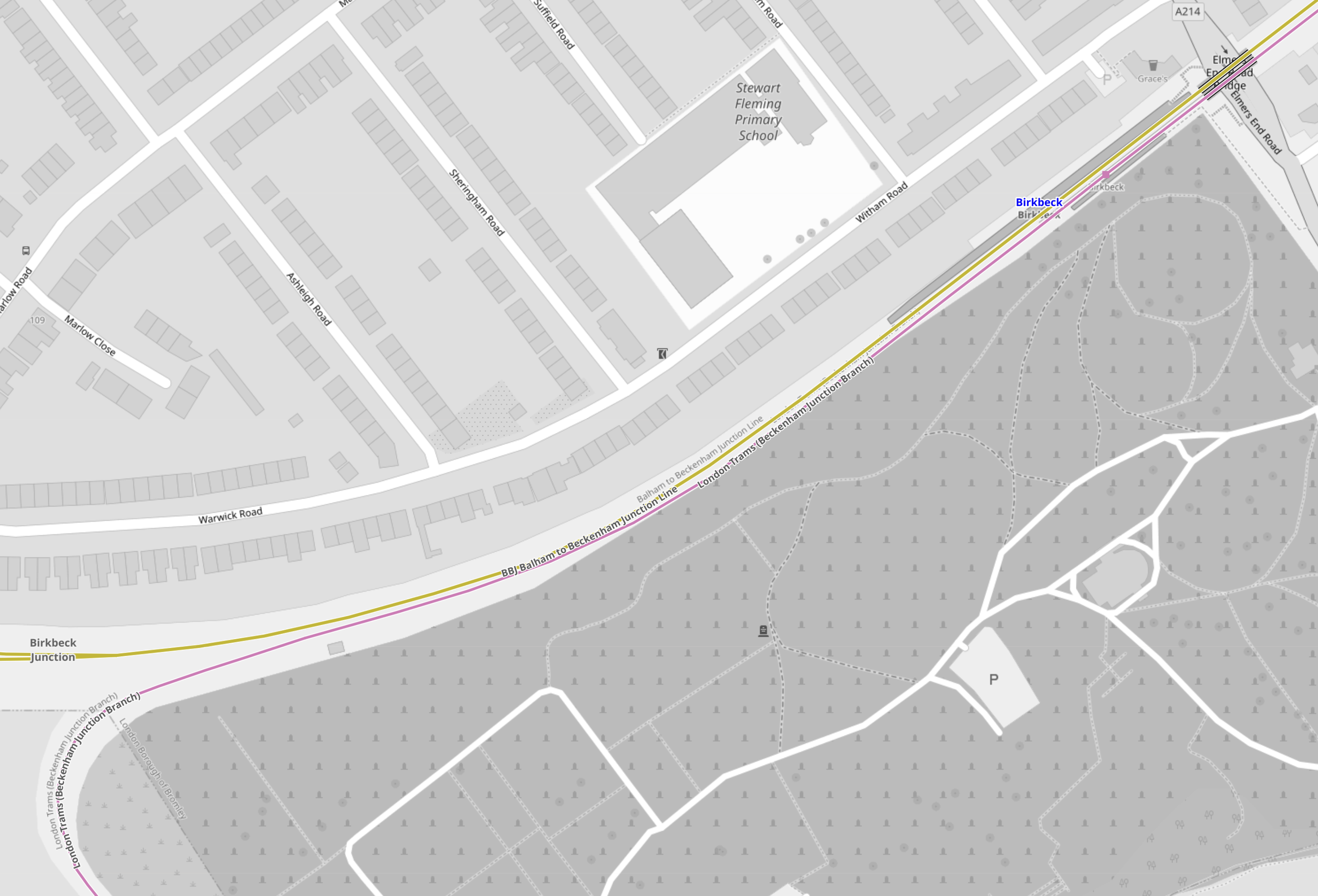
Note.
- The yellow line is the National Rail line between Crystal Palace and Beckenham Junction.
- The mauve line is the London Tramlink between Croydon and Beckenham Junction.
- There is no rail connection between the two lines.
Birkbeck station/tram stop has bi-directional platforms on both National Rail and London Tramlink.
These pictures were taken at the Birkbeck station/tram stop.

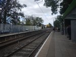

Note.
- The two bi-directional platforms.
- The wire fence between the tracks.
- The two tracks appear to be the same level, but the National Rail platforms seem quite a bit higher.
From the pictures, I would estimate that the Birkbeck tram stop platform is currently about thirty-five metres and could probably handle a forty metre tram with selective door opening.
This map from OpenRailwayMap shows the track/platform layout at Avenue Road station/tram stop.
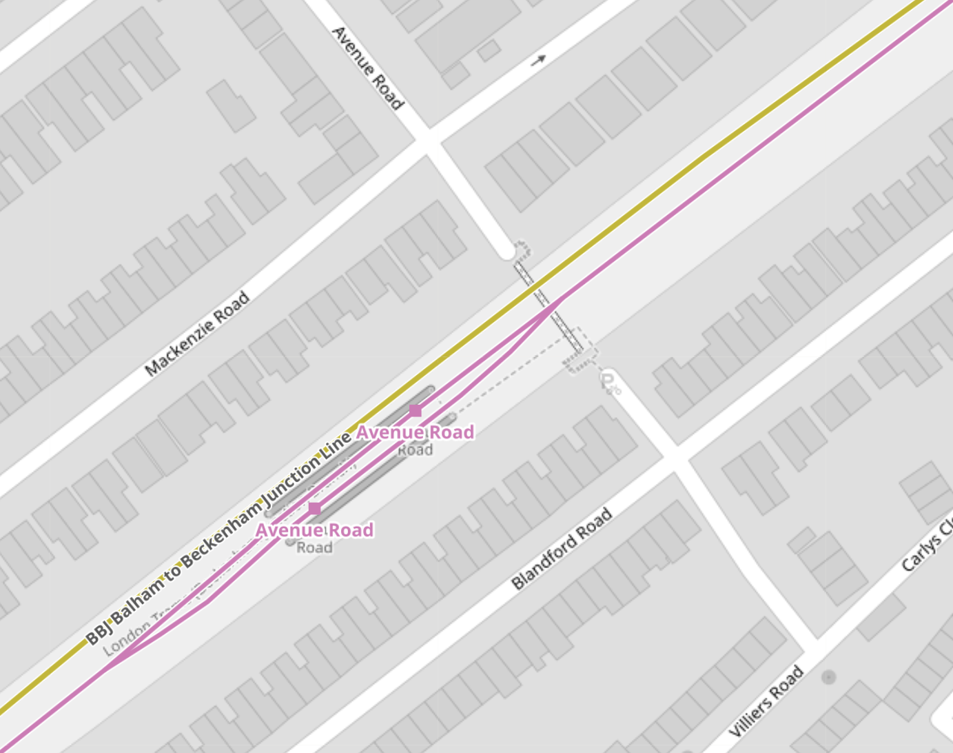
Note.
- The yellow line is the National Rail line between Crystal Palace and Beckenham Junction.
- The National Rail line isn’t shown to have a platform.
- The mauve line is the London Tramlink between Croydon and Beckenham Junction.
- There is no rail connection between the two lines.
London Tramlink has a loop through the tram stop and each branch has a platform.
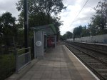
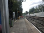
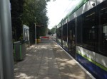
These pictures were taken at the Avenue Road tram stop.
I would estimate the the loop at Avenue Road tram stop could handle a forty metre tram and possibly one of forty-five metres, judging the loop against this thirty-two metre Stadler tram.
This map from OpenRailwayMap shows the track/platform layout at Beckenham Road station/tram stop.
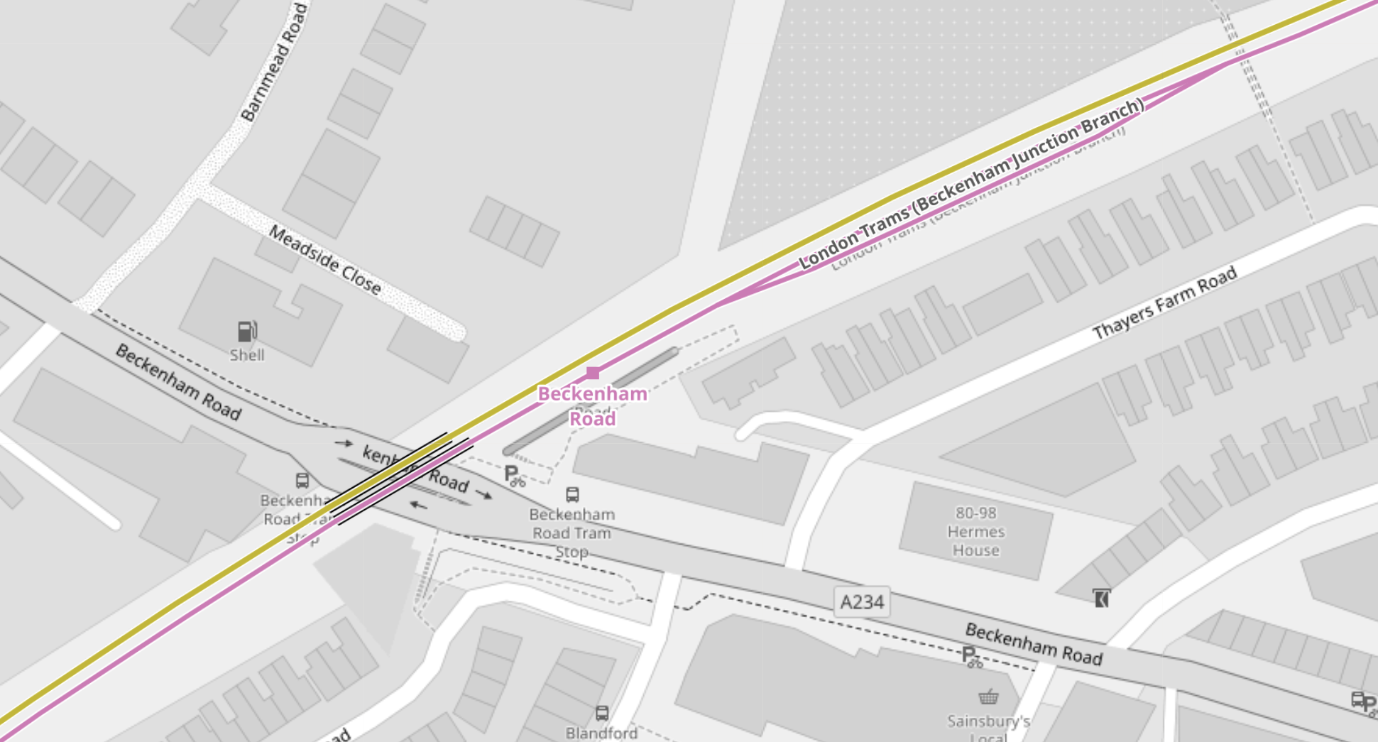
Note.
- The yellow line is the National Rail line between Crystal Palace and Beckenham Junction.
- The National Rail line isn’t shown to have a platform.
- The mauve line is the London Tramlink between Croydon and Beckenham Junction.
- There is no rail connection between the two lines.
The London Tramlink has a single bi-directional platform.
There is also a loop in the London Tramlink to the East of Beckenham Road station/tram stop to allow trams to pass.
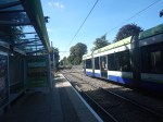
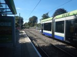
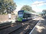
These pictures were taken at the Beckenham Road tram stop.
Note.
- A train conveniently came through from London Bridge to Beckenham Junction, when I was taking pictures.
- Several pictures show trams using the loop to the East of the tram stop.
- Both types of tram were pictured in the tram stop.
- The platform in the tram stop is wide.
From the pictures, I would estimate that the Beckenham Road tram stop platform is currently about thirty-five metres and could probably handle a forty metre tram with selective door opening.
Tram-Train Operation Between Birkbeck And Beckenham Junction Stations
I am certain that if this track was being designed today, tram-train operation would be used.
- There would be two tracks, with one for each direction, through Birkbeck, Avenue Road and Beckenham Road stations.
- Both tracks would have dual-height platform at each station/tram stop, so tram and train passengers got level boarding.
- Trains would use third-rail power and trams would use battery-power.
Unfortunately, tram-trains didn’t exist, when the London Tramlink was designed.
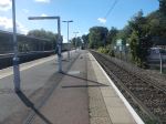
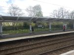
Handling Longer Trams At New Addington Tram Stop
This map from OpenRailwayMap shows the platform layout at New Addington tram stop.
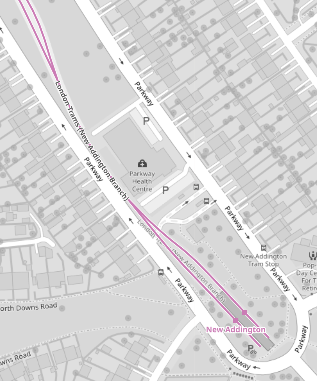
These pictures show the New Addington tram stop and the London Tramlink platforms.
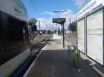

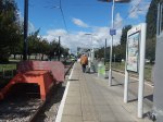

If some of the grassland around the platforms was allocated to the tram stop, I suspect the platforms could be lengthened.
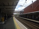
Handling Longer Trams At Wimbledon Station
This map from OpenRailwayMap shows the platform layout at Wimbledon station.
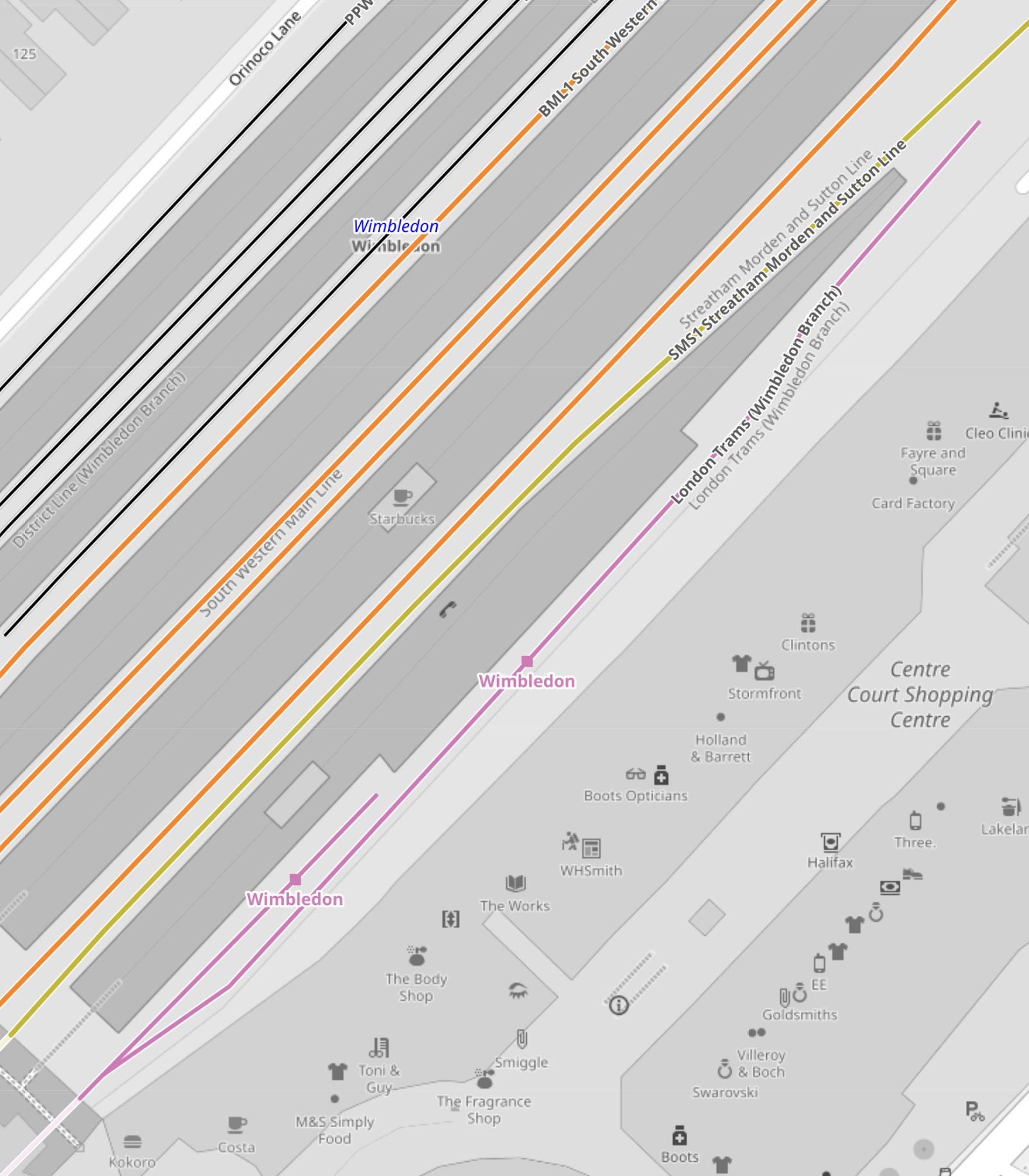
Note.
- The mauve line is the London Tramlink.
- There are two platforms; 10A and 10B, which are indicated with a separate dot.
- Platform 9, which is used by Thameslink, is the other side of Platform 10, so interchange to Thameslink is excellent.
- The main tram platform 9/10 is wide.
- The platforms are step-free to the trams, with lifts to the station bridge and the other platforms and Way Out.
I suspect that when the second platform was built, both platforms were made longer than the thirty-two metres needed for the Stadler trams.
These pictures show the two platforms.
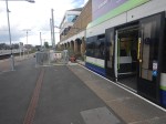
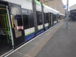
Could another platform be created on the other side of the tracks to give better access to the tracks?
Conclusions
My first conclusion is that the London Tramlink could be run by a new fleet of the same number of trams, that were a few metres longer than the current 30.7/32 metres of the current trams.
- I suspect that forty metre trams would be possible, with a few modifications to platforms.
- It might even be possible to have forty-five metre trams, with a more substantial rebuild at Beckenham Junction.
- Trams could overhang platforms and selective door opening could be used.
- Forty metre trams would carry 25 % more passengers than the current trams.
- The Elmers End and Wimbledon terminals already seem to be capable of handling forty metre long trams and possibly could take trams a few metres longer.
I suspect that Elmers End and Wimbledon, could be the first route, where the longer trams were introduced, as the trams should be able to shuttle between the two end terminals to the current timetable.
The New Addington tram stop would be brought into operation next.
- Platforms would be lengthened as required.
- Trams operate a frying pan loop from New Addington to Croydon, with an Off Peak frequency of 7-8 minutes.
- I suspect that one platform won’t be able to handle this frequency.
- The last point probably means that the two platforms will need to be lengthened.
Works at the New Addington tram stop could be tricky, but not substantial.
Initially, the service to Beckenham Junction could be run by the existing Stadler Variobahn trams.
I believe that a lot of work will need to be done to get Beckenham Junction ready for the new trams if they are longer, which I suspect they are.
- The Network Rail installation will have to be relocated.
- The two platforms will have to be lengthened.
I suspect the works will be substantial.
But I do believe, that there is scope to plan all the works at the terminals, so they can be done efficiently, whilst at least maintaining a partial service.
My second conclusion, is that it will be possible to build a financial model, which shows infrastructure costs against tram lengths.
Longer trams will cost more and cost more for infrastructure, but they will carry more passengers and collect more fare revenue.
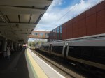
Orpington Station And The 358 Bus
This morning, I went to Orpington station, to look at the preparations for the 358 bus and took these pictures.

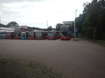
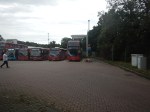


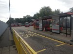
Note.
- Orpington station is a eight -platform station with full step-free access.
- There are three bay platforms.
- The platforms are long.
- There was no sign of the new Irizar ie Trams, that will be used on the 358 route.
- The charger had been installed.
Transport for London have said the new vehicles will be running in Summer 2024.
But then TfL’s promises, must be taken with a large pinch of salt.
Could Stadler RS ZERO Be Used For The West London Orbital Railway?
In Stadler Presents A World First In Berlin, I talked about the launch of the Stadler RS ZERO.
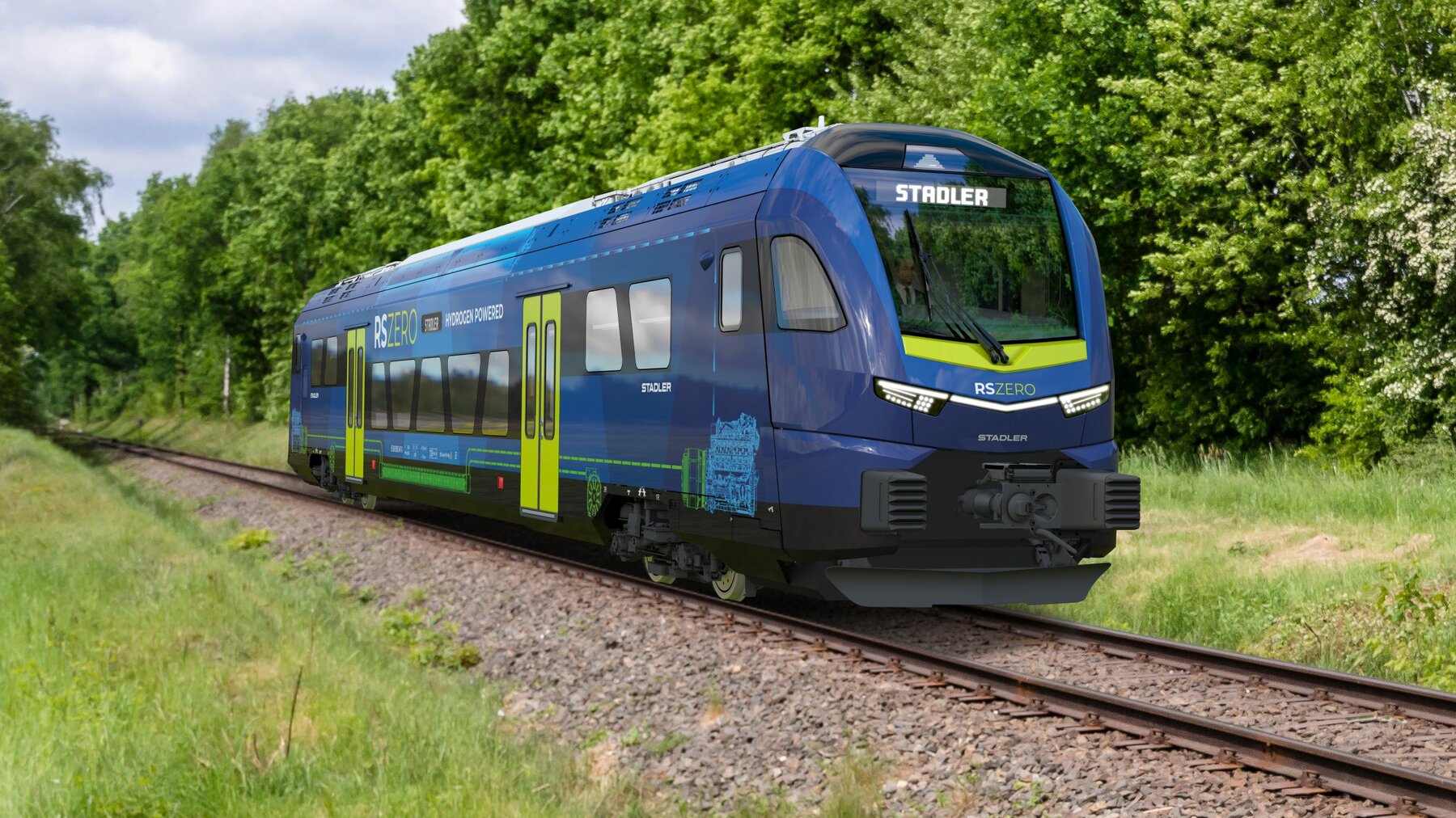
I wonder, if these newly-launched trains, would be ideal for the West London Orbital Railway?
- They will be zero-carbon and will not be emitting fumes or carbon dioxide.
- Stadler could size the trains to UK platform height, just as they did the Flirts for Greater Anglia.
- The two routes are only eleven miles long with 25 KVAC electrification at the Midland Main Line end, so the battery-electric version could be ideal.
- They are likely to be extremely quiet, as battery-electric trains always seem to be.
This picture of the earlier Stadler Regio-Shuttle RS1 from Chemnitz, shows that it should be possible to have almost level boarding.
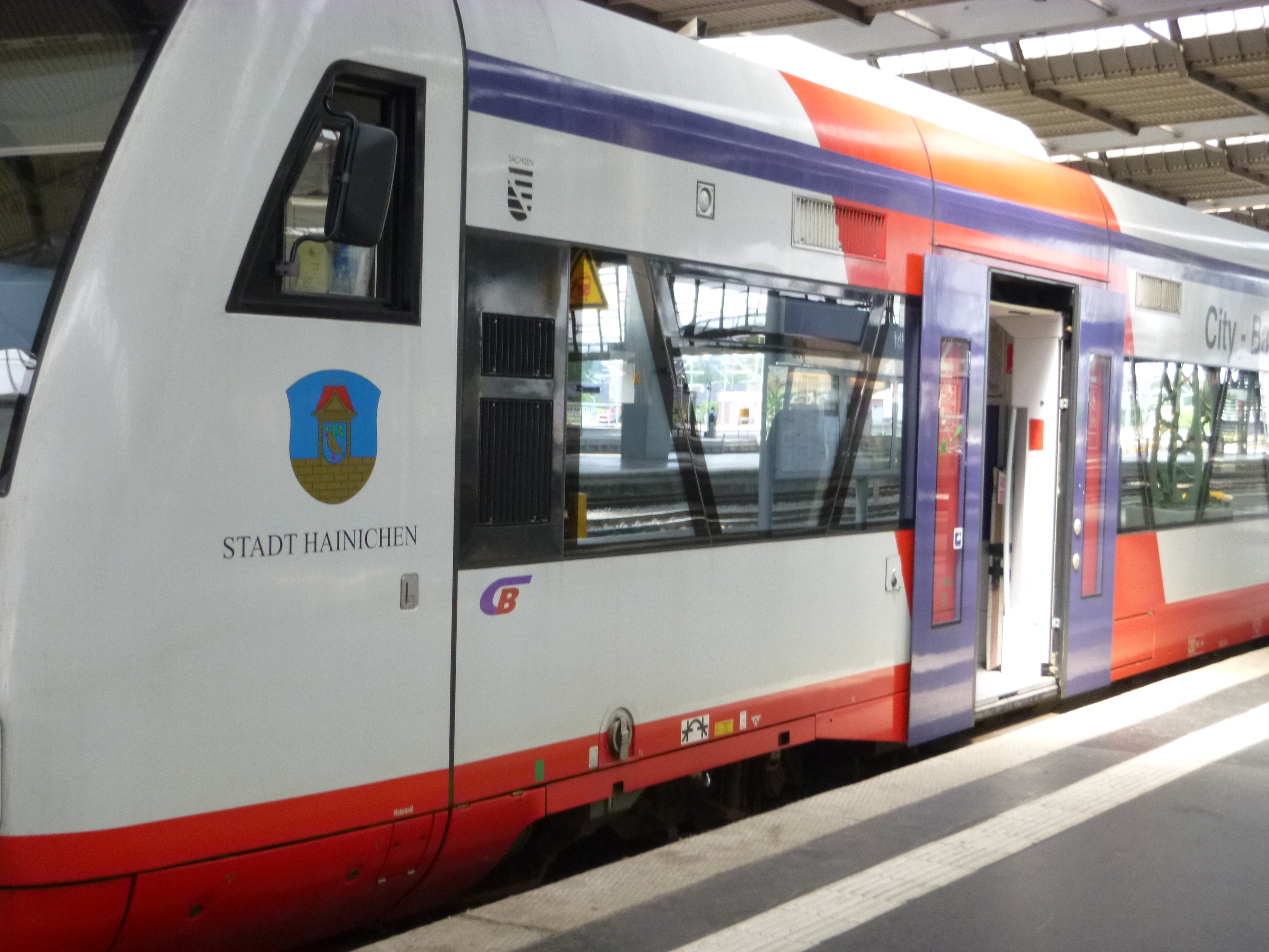
At least at new stations, where the platform height could be built for the RS ZERO.
The new stations along the Dudding Hill Line could be very simple indeed.
Conclusion
I feel that a fleet of RS ZEROs could convert the Dudding Hill Line into an efficient, step-fee and frequent addition to London’s passenger railways.
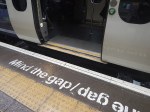
Minding The Gap: ‘It’s A Scandal, It’s A Death Trap’
The title of this post, is the same as that of this article on the BBC.
This is the sub-heading.
The announcement “mind the gap” is almost as much a part of travelling in London as the Tube sign or a red bus. But when is the gap between the train and the platform too far and too dangerous?
These are the first two paragraphs.
Eric Leach thinks he has the answer to that, and it is 30cm, or 12 inches. He knows this because while lying on the platform in agony having fallen over while getting off a train, he had time to look at the vertical drop between the train and the platform.
In February, at Ealing Broadway station in west London, he stepped off an Elizabeth line train onto the platform. Such was the force from the drop, that he broke a bone in his foot. He collapsed on the platform.
I went to Ealing Broadway station and took these pictures.

The gap is quite large, but not larger than many of the suburban trains in London.
These pictures are from Greater Anglia and Merseyrail.
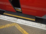
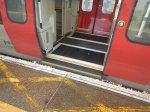

Note the gap-fillers below the door.
Conclusion
The Elizabeth Line can do better.
A Redbrick Station For A Redbrick University
My late wife; C and myself, met at Liverpool University in the 1960s.
Liverpool considers itself as the Original Redbrick on its web site.
This Google 3D visualisation shows why.

Note.
- This 3D picture was taken from the East.
- The white building in the bottom-right corner is the Electrical Engineering and Electronics, where I did most of my studying.
- The building above it is the Harold Cohen Library.
- The clock tower in front is part of the Victoria Building.
There’s a lot of redbrick on the University site.
These pictures show University (Birmingham) station.
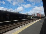
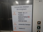
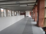


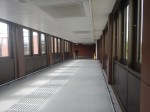

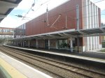
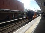
Note.
The Architects didn’t spare the red bricks.
- The station has an NHS Clinic
- The bridge has lifts and steps.
- There is a lot of glass.
There are a pair of bi-sexual toilets, which seems to the standard for new stations these days.
Will Other Universities Want A Station?
Here are a few thoughts.
Liverpool University
I wrote about the possibility in A Railway Station At Liverpool University.
This is an extract.
In Liverpool’s Forgotten Tunnel, I showed this map, which shows a proposed reopening of the Wapping Tunnel as a passenger route between Liverpool Central and Edge Hill stations.
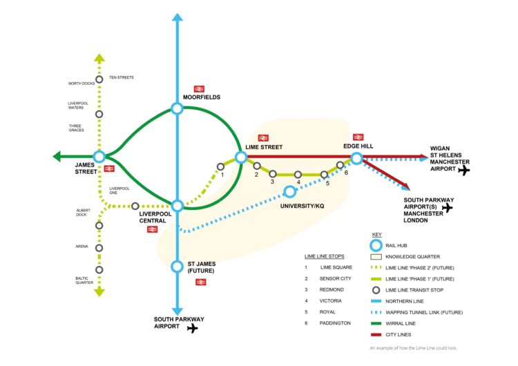
Note.
- The map shows a station at University
- The Wapping Tunnel is shown as a dotted blue line.
- Between four and eight trains per hour (tph) would be running through University station.
Liverpool has other projects on its mind at present, but I wouldn’t rule it out in the future.
Manchester University
This Google Map shows the location of Manchester University.
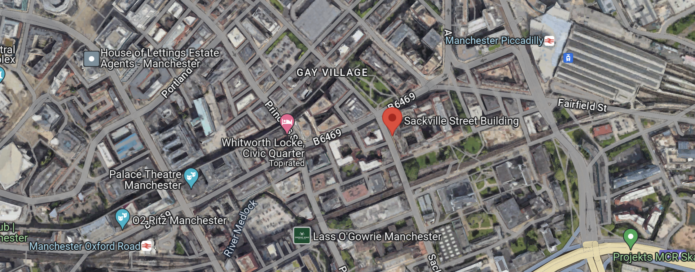
Note.
- The red arrow picks out a notable building in the University.
- Manchester Piccadilly station is in the North-East corner of the map.
- Manchester Oxford Road station is in the South-West corner of the map.
- In recent years I’ve walked between the two stations.
- The Castlefield Corridor passes through the University.
A station on the Castlefield Corridor could be a possibility.
A Trip To Highams Park Station
I went to Highams Park station, as the Internet rumoured, that there could be gluten-free jam doughnuts near the station, at a shop called the Community Larder.
I took these pictures.


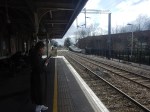
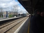
Note.
- The restored signal box, that I talked about in An Unusual Office Property has been used as a creperie. Unfortunately, it appears to have gone out of business.
- The Community Larder had a good selection of cakes, including some that were gluten-free, but no gluten-free jam doughnuts, as they are delivered on Saturdays.
- Crossing the roads by the level crossing is a nightmare.
- The station needs a step-free bridge.
The 3D Google Map shows the level crossing looking from the East.
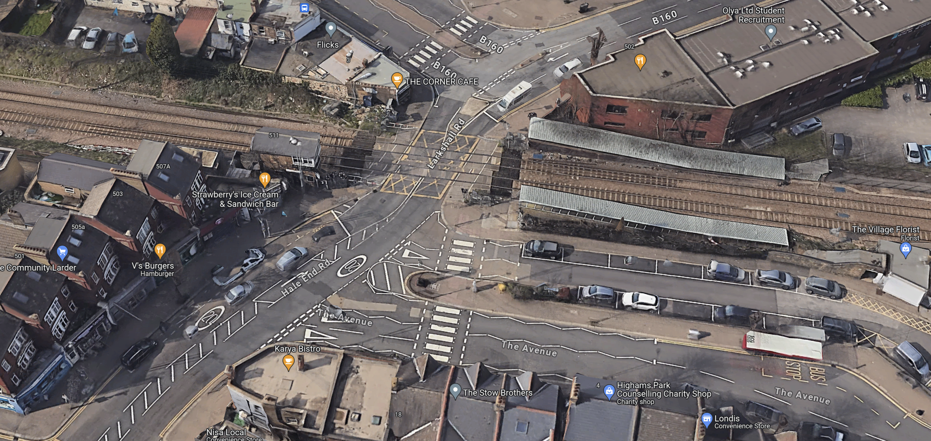
Note.
- The railway runs North-South through the station, with South to the left.
- The signal box is on the South-East corner of the level crossing.
- Hale End Road runs East from the level crossing.
- The Community Larder is on the South side of Hale End Road.
Sorting the road traffic out will be difficult.
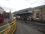
Par Station – 10th February 2024
Par station will see changes because of the Mid-Cornwall Metro.
I took these pictures as I passed through.

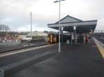
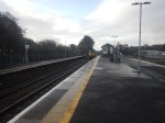
Note.
- The level crossing was busy with cars every time I crossed it.
- The semaphore signalling.
- The arriving GWR Castle in the last picture.
This Google Map shows Par station.
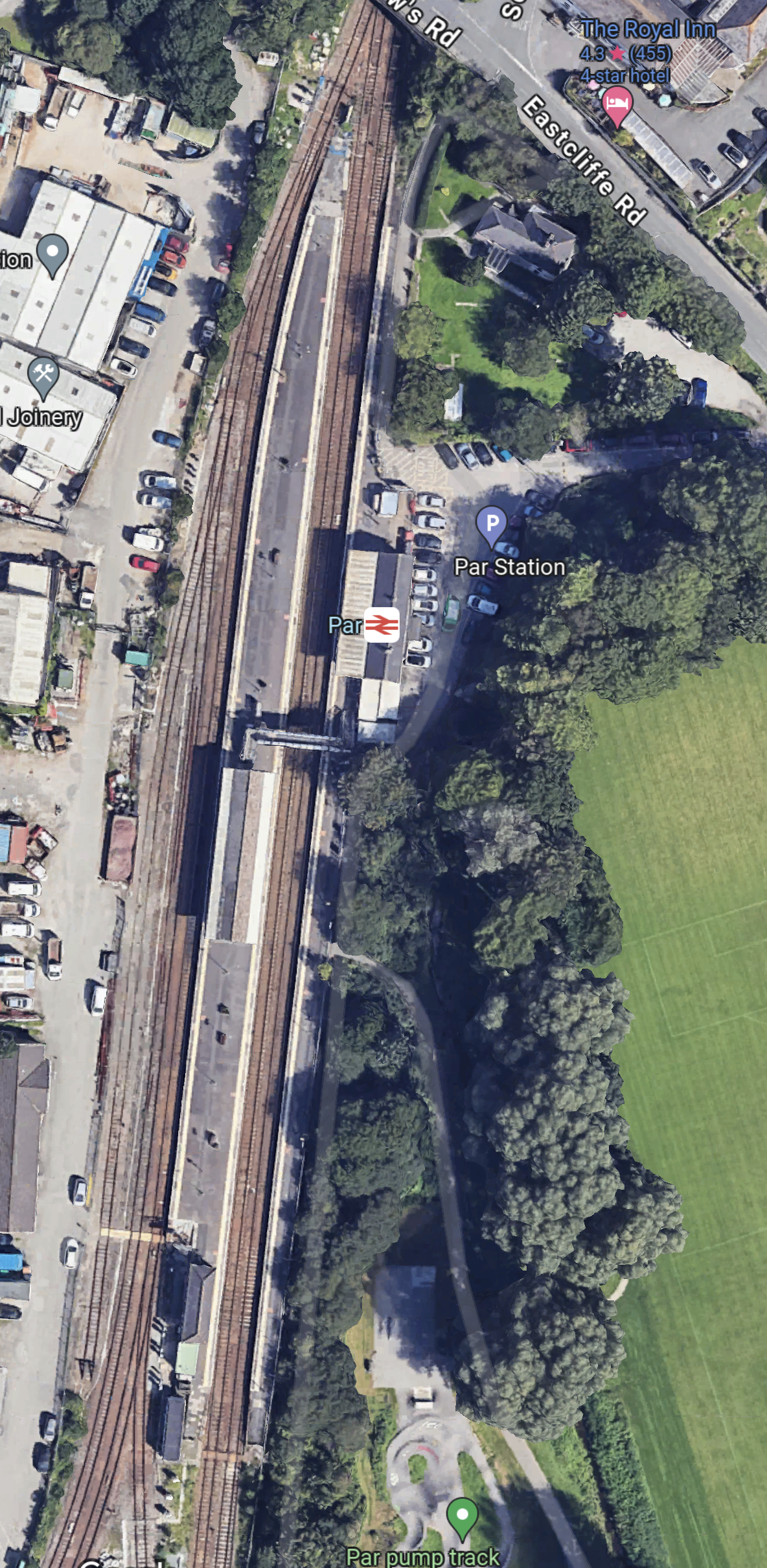
Note.
- There three platforms. Platform 1 is in the East, with Platforms 2 and 3 forming an island platform.
- There is a footbridge connect the platforms together.
- The Atlantic Coast Line leaves the map in the South West Corner.
As one of the modifications for the Mid-Cornwall Metro, the footbridge will be replaced with one that is step-free.
I have a few thoughts.
Will The Mid-Cornwall Metro Reverse At Par Station?
This OpenRailwayMap shows the track layout at Par station.
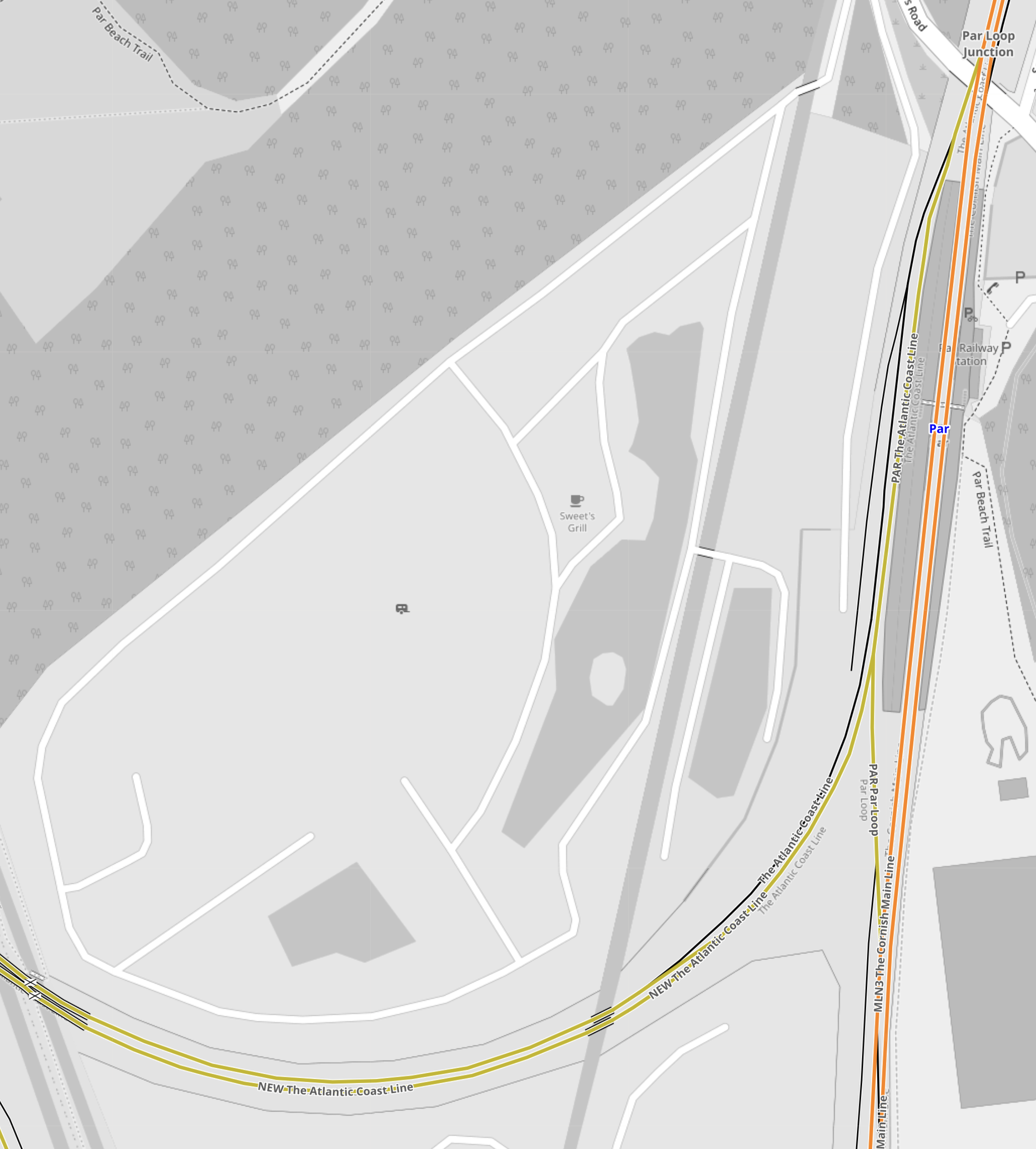
Note.
- The tracks shown in orange form the Cornish Main Line.
- The tracks shown in yellow that curve away to the West are the Atlantic Coast Line.
- The busy level crossing is shown in the South-West corner of the map.
- The Atlantic Coast Line connects to Platform 3 on the West side of the station.
- The track layout allows trains to access Platform 3 from both directions on the Cornish Main Line.
It does look like, Mid-Cornwall Metro trains will have to reverse every time, they call at Par station.
Could The Cornish Main Line Be Electrified At Par Station?
At some point in time, it will be desirable to run zero-carbon trains both on the Mid-Cornwall Metro and the Cornish Main Line.
- Plymouth and Par is a distance of 34.7 miles.
- Truro and Par is a distance of 19 miles.
- Newquay and Par is a distance of 20.8 miles.
- All of these distances would be in range of a typical battery-electric train.
- In The Data Sheet For Hitachi Battery Electric Trains, I said that a Hitachi express train with a battery range of 43.5 miles.
To my untrained eye, it looks like Par station wouldn’t be the most difficult place to electrify.
I believe there are possibilities to put an island of electrification at Par to give the trains a quick Splash-and-Dash before continuing.
