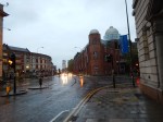
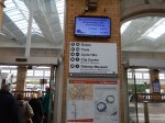
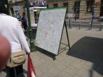
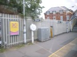
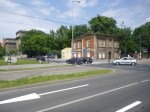
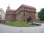
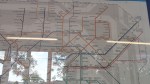
A Design Crime – Manchester’s Totally Crap MiGuide
When I see things like this, it really gets my anger up.
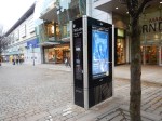
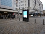
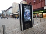
All I want in a City Centre, is a map that will show me where to go, not some indecipherable device, that I probably can’t work, as I have the sort of fingers that don’t work well with touch screens. I don’t want to be bombarded with advertising.
If I need information, like the nearest gluten-free restaurant, I’ll search Google.
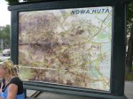
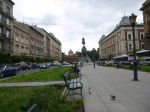
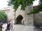
Give me maps on liths like Ipswich, Glasgow, Preston, Bristol, Birmingham, Southampton and Sheffield! Or big ones with seats like Krakow!
Manchester used to have some nice maps, but they seem to have been removed.
Perhaps they’;re kept with the Ed Stone?
These devices are total crap, that should be consigned to the dustbin of the future.
They’re certainly a Design Crime.
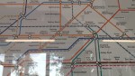
HS2’s Interactive Map
For those who are worried, need to know or just plain curious, HS2 have put a very good quality interactive map on their web site on this page.
These are some images, I have captured.
Stations are shown by red dots
Euston, St. Pancras and Kings Cross Stations With HS2
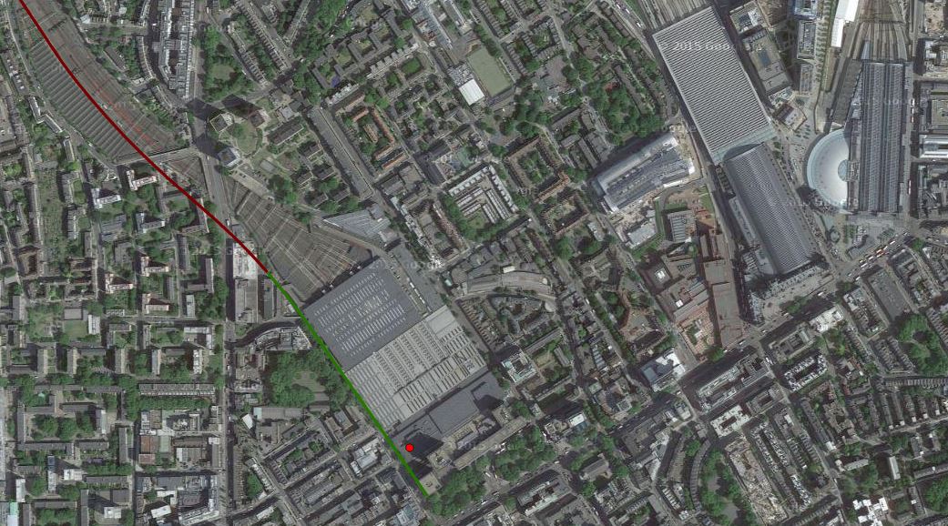
Euston, St. Pancras and Kings Cross Stations With HS2
The map clearly shows the three stations and the route of HS2 into Euston.
Note the following.
- HS2 clearly arrives at Euston on the western side of the station.
- The pedestrian route to St. Pancras could be more difficult than planners think.
- The station would appear to be extended towards Euston Road.
- Whilst the station is built, I suspect, that a good connection to the Metroipolitan/Circle can be created.
I think we’ll see some plans in the next few years, that make the connection between the three stations a lot better.
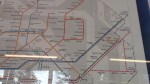
Old Oak Common Station
Old Oak Common Station
The map shows the myriad of lines in the area.
I believe that for many people using HS2 to and from London, will use this station, as its connectivity is so much more comprehensive than Euston.
Birmingham Interchange Station
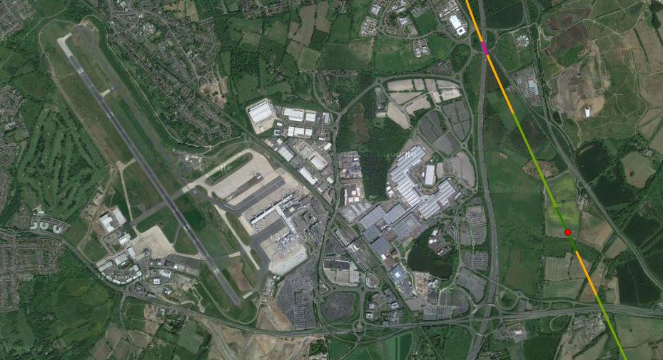
Birmingham Interchange Station
Birmingham Curzon Street Station
Birmingham Curzon Street Station
Birmingham Moor Street and Birmingham New Street stations are to the south of the new station.
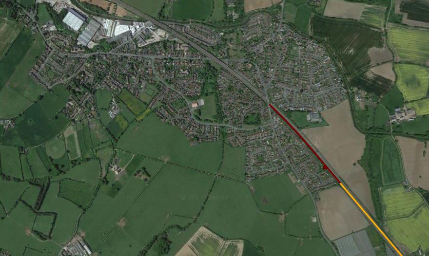
HS2 East Of Birmingham

HS2 East Of Birmingham
This map clearly shows how trains for the North via Birmingham will go into Birmingham and then reverse direction in Birmingham Curzon Street station.
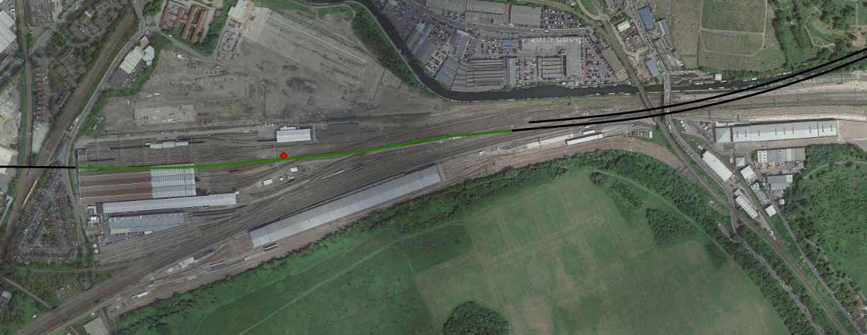
Handsacre And HS2
Handsacre And HS2
This map shows where HS2 joins the West Coast Main Line at Handsacre.
Conclusion
The interactive map is a real credit to modern computing.
Every project that could benefit should have one.
Will we be seeing one for Crossrail 2?
The 2017 UK City Of Culture
Hull is going to be the 2017 UK City of Culture
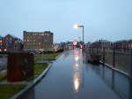
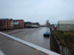


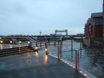


I walked across Hull twice from my supposedly City Centre hotel, which seemed to be almost closer to Grimsby than the railway station.
The first time was in the dark and there were no signs or maps, so I had to climb up on a dual-carriageway bridge, as the direct route across the footbridge was blocked due to demolition. The taxi-driver who brought me to the hotel said that all other routes were dangerous.
Despite the hotel saying it would take twenty minutes to get to football at the KC Stadium, It took me over an hour.
The pictures were taken in the morning and it was very wet, as they show.
I had hoped to find a paper shop to buy my copy of The Times, but in the forty minute walk, I didn’t pass one open shop selling newspapers. They was also no nice cafe for breakfast.
So instead of looking around Hull, I made an executive decision to go to Meadowhall to get some breakfast.
I know it was eight o’clock, but round here in East London, most things start at seven. Even my local Carluccio’s opens at eight in the week and nine at the weekends.
I got lost both times and I couldn’t even find a taxi to take me to the station.
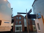
I have never seen a city so badly signposted in my life.
But then to many of these towns and cities, maps are a waste of money, as everybody uses smart phones.
I don’t as my left hand isn’t good enough to hold it steady enough. Also as it was raining, the screen doesn’t appear to be too readable underwater.
UK Capital of Culture 2017?
They’re having a laugh or are they trying to lure visitors into those unsavoury areas my taxi driver warned me about?
I shan’t be going back to Hull again.
The place is an absolute disgrace as regards welcoming visitors, who don’t have cars and prefer or have to walk.
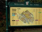
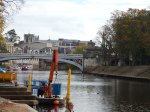
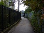
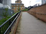
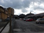
A Circular Walk Through York
At York station, I took a circular walk to the City Centre and back to get some lunch.
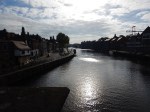

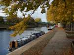
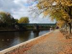
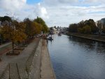
The return route from the centre was as follows.
- Through the Museum Gardens
- Along the River Ouse.
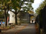
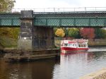
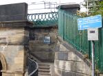
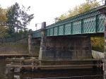
- Across the Pedestrian Bridge by the York to Scarborough Line
- Directly into the station through the cycle parking.
The installation of the new bridge was talked about in Dancing With Cranes And A Bridge With Help From Lego.
My return route along the river and over the new bridge was a lot easier, as you’re away from the traffic on pavements that are better.
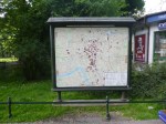
This map shows the area where I walked back to the station.
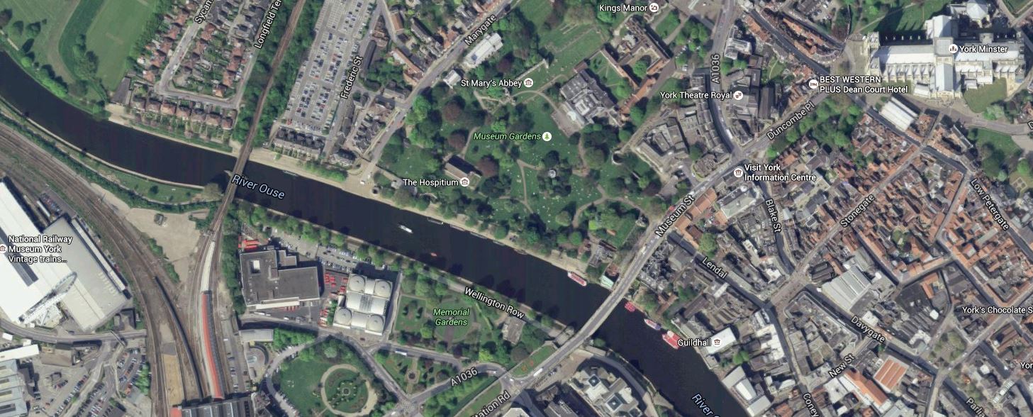
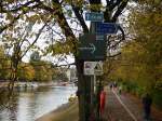
York Minster To York Station
The Scarborough Bridge is the most westerly one over the River Ouse.
I would also think it’s easier to go this way between the National Railway Museum and York Minster and the City Centre.
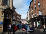
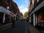
For a city that relies on tourism, it is not blessed with decent and numerous, maps and information.
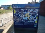
Of the major cities in Yorkshire that I’ve visited only Sheffield seems to have a large number of decent maps. None are up to the standard of Glasgow, Krakow and Preston.
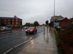
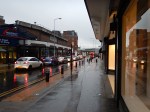
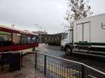
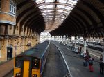
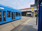
Manchester’s Metroshuttle
Manchester has a network of three free Metroshuttle buses that you can use in the City Centre.


My big complaint about the system is the limited hours. Surely, in a busy City Centre a bus service like this should go on later than 19:00.
I also feel that the stops away from Piccadilly station could be better designed with more information and local maps.
Getting To The Falkirk Wheel And The Kelpies
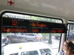
I took a train to Falkirk Grahamstown station and then got a pink bus called The Loop.


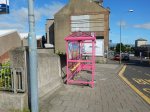
I know it is relatively early days, but information for the bus needs to be improved. You can find the stops easily, but knowing how long to wait is difficult, unless you are psychic. A big poster is needed in every stop, with the times that the buses arrive clearly marked.
The stops should also be clearly marked on the maps on the liths!
This type of tourist bus is crying out for a contactless ticketing system using bank/credit cards. Every time, the bus is used you touch in and at the end of the day your card would be charged appropriately.
In the next few years, this will become the gold standard for small payments and buses like this, that don’t embrace the technology will get lots of complaints.
If the Falkirk Wheel attracts a massive number of visitors, I feel that the area could support a rail station. Look at this Google Map of the lower basin at the wheel.

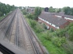
The Railway Passing The Falkirk Wheel
The railway is the line between Stirling and Glasgow and the bridge across the railway leads to the car park for the Falkirk Wheel.
To actually build a simple station should be fairly easy and visitor numbers and the level of success of the attraction will determine, if the station is ever built.
I think it will be built, as it has so many factors going for it.
Dreadful Doncaster
Doncaster is a town that doesn’t deserve to have a football team.
I went to the match on Tuesday, where Ipswich won by four goals to one.
On arrival at the station, as I’d got plenty of time, I thought I’d take a bus to the excellent Keepmoat Stadium. Doncaster station is next to the bus station, but I couldn’t find any information or in fact anybody to ask. So I had to take a taxi.
I asked the taxi-driver how I would get a taxi back after the game and he said that I couldn’t, as because of the traffic taxis can’t get near the ground.
Two stewards told me that I could get a bus from a particular stop to get back. So that was some progress.
As I had to catch the 22:43 train, I decided to leave after the match proper, which meant I missed the extra time, but it did give me an hour to get to the station.
Unfortunately, the buses seemed to have stopped running, so after waiting for twenty minutes, I decided to use the most reliable transport I had – my feet!
But there were no signposts and after scrambling over busy dual carriageways and walking through dark and dismal subways, I made it with about ten minutes to spare.
If a ground, is not obvious from the station, then councils and football clubs, should at least provide some signs and maps.
I shall not be going to the football in Doncaster on a Tuesday night again.
At least I’d booked a ticket in First for the trip home for £23.75.
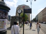
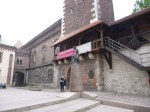
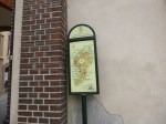
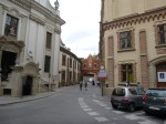
Krakow – A City Of Maps, Clocks, Trams And Gluten Free Food
Krakow is well-known for its buildings, but I found some other things equally fascinating in a delightful city.


-
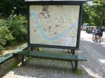
- A Large Map With Seats
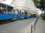

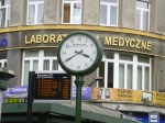
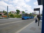


All of the maps, clocks, trams and excellent gluten-free food, made the city a real joy to explore and I would recommend the city to anybody.
To see all the posts for my Home Run From Krakow click here.
Out Run To Krakow
These images tell the story of my trip out and arrival in Krakow.


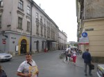
Rarely, in all my years of travelling, have I arrived in a foreign city, where it has been so obvious as to how to get to the city and then to walk to your hotel.
Admittedly, I was using the maps on my my phone to get vague directions, but usually, there was a street name or map to guide me, as I walked from the bus station to the Saski Hotel.
If I printed a Google Map before I left home, I wouldn’t have even needed to use my phone.
And at the Airport, Information told me where to go in perfect English.
Many take a taxi from Krakow Airport to the City Centre, but it’s so easy to get a bus from outside the terminal and then either walk or get a tram from the main bus station.
A First Glimpse Of The New Tube And Rail Map
There was a copy of this map at Enfield Town station.
Incidentally, I probably look at this map more than I ever look at the standard tube map, as I generally need it when coming home from an unfamiliar rail station south of the Thames.
One of these maps should be prominently displayed at all rail stations in at least the grester South East of England. This was originally said to me by a Virgin employee at somewhere like Coventry, as they’re always getting asked where unusual London stations are by passengers. So he thought one on the London-bound platform would be a good idea and passengers could look it up for themselves.
