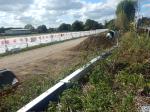
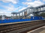
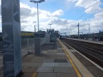
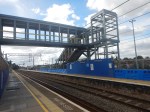
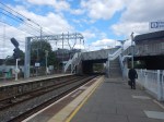
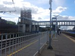
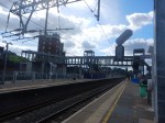
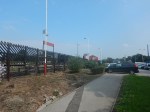
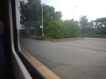
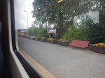
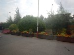
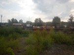
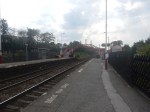
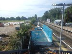
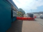
Progress At Syon Lane Station – 18th September 2019
The builders are now digging on both platforms at Syon Lane station.


The posters at the station give the impression that brick towers might be built.
But it looks to my untrained eye, that the foundations being dug don’t appear to be deep enough.
Waiting at the station for my train, I wondered, if they are going to put a set of stairs and a life on both platforms to give step-free access to the existing road bridge.
- The towers would be shorter and height costs money.
- There would be no need to build and lift in an additional bridge, as pedestrians would use the existing pavement.
- It might be possible to do all the work without closing the railway.
- This would meet all the step-free regulations.
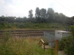
There certainly seems to be no work going on further down the platform, where it appeared some trees were cleared.
It’ll all come clear in a few weeks and I suspect it will meet the generally high standards of Network Rail.
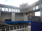
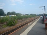
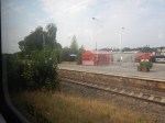
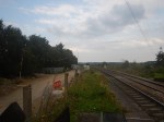
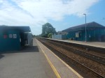
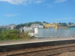
Progress At Syon Lane Station – 8th September 2019
It looks like the builders have started to dig the foundations for the step-free footbridge at Syon Lane station.

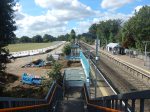

I wonder, if the digging further down the platform indicates that there has been a change of design.
Acton Main Line Station – 2nd September 2019
These pictures show Acton Main Line station.

These improvements are promised in Wikipedia.
- New station building with a larger ticket hall with level access from Horn Lane
- Step-free access between street level and all platforms via a new footbridge with stairs and two lifts
- Platforms 2–4 extended to enable 10-car trains to stop
- Improved passenger facilities including a new canopy on platform 4, along with information and security systems.
There is still work to do.
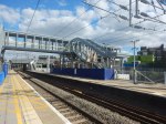
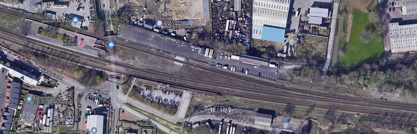
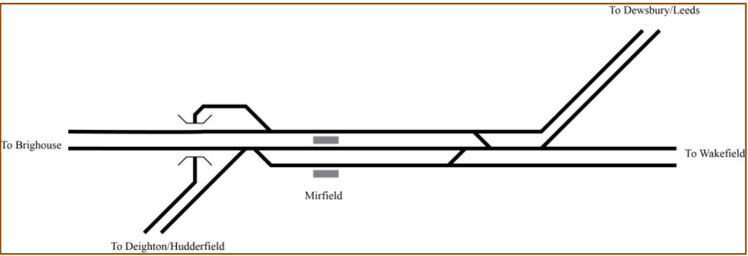
Upgrading Mirfield Station
Mirfield station is due to be upgraded as part of Network Rail’s £2.9billion project to upgrade the Huddersfield Line between Huddersfield and Dewsbury stations, that I wrote about in Network Rail Reveals Detailed £2.9bn Upgrade Plans For TransPennine Route.
This Google Map shows the station and the surrounding land.
These pictures show the station.
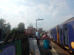
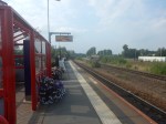


Currently, it is a three-station platform, with a wide island Platform 1/2 and a separate platform 3. The platforms are used as follows.
- Platform 1 for all Eastbound trains.
- Platform 2 for Westbound through trains.
- Platform 3 for Westbound stopping trains.
This document on the Digital Railway web site is entitled Transpennine Route Upgrade SDO1 ETCS – Analysis.
It is mainly about using digital signalling called ETCS on the Transpennine Route, but it does give these track layouts between Huddersfield and Dewsbury.
This is the current layout.
This is a reduced four-track layout.
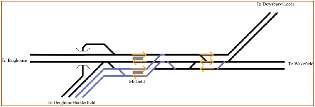
In Proposed Track Layouts Between Huddersfield And Dewsbury, I came to the conclusion, that the reduced four-track layout or something better could handle the current trains through the area.
If the reduced four-track layout is used, the requirements for a new Mirfield station can now be stated.
- Platforms 1/2 sharing an island on the slow tracks.
- Platforms 3/4 sharing an island on the fast tracks.
- Some better shelters than at present.
- Step-free footbridges or a tunnel
In Winner Announced In The Network Rail Footbridge Design Ideas Competition, I wrote how the competition was won by this bridge.
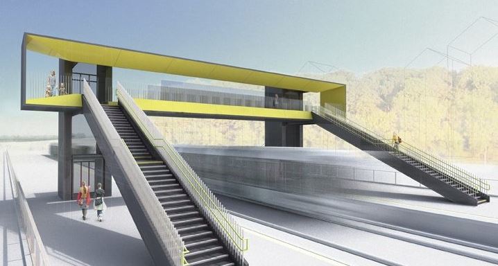
So could a factory-built bridge like this be installed at Mirfield station?
- There is plenty of space.
- The bridge would have the correct clearance for the electrification.
It could also replace the subway to Platform 1/2.
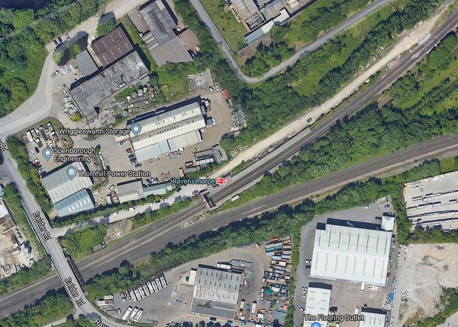
Upgrading Ravensthorpe Station
Ravensthorpe station is due to be upgraded as part of Network Rail’s £2.9billion project to upgrade the Huddersfield Line between Huddersfield and Dewsbury stations, that I wrote about in Network Rail Reveals Detailed £2.9bn Upgrade Plans For TransPennine Route.
This Google Map shows the station and the surrounding land.
Note.
- The lines through the station go between Huddersfield in the East and Dewsbury in the North-East.
- The line going East goes to Wakefield.
These pictures show the station.

I did try to get a picture of the bridges over the River Calder, but I was unable to find the route and the weather was about to deteriorate.
The station is currently just two platforms on the lines between Huddersfield and Dewsbury, with a terrible overbridge, a poor shelter and a couple of seats.
The Wikipedia entry for Ravensthorpe station says this.
Ravensthorpe station is adjacent to Thornhill LNW (London North Western) Junction, where a line branches to Wakefield Kirkgate. There are plans to extend the station by building new platforms on this line, which was built by the former Manchester and Leeds Railway.
This document on the Digital Railway web site is entitled Transpennine Route Upgrade SDO1 ETCS – Analysis.
It is mainly about using digital signalling called ETCS on the Transpennine Route, but it does give these track layouts between Huddersfield and Dewsbury.
This is the current layout.
This is a reduced four-track layout.
In Proposed Track Layouts Between Huddersfield And Dewsbury, I came to the conclusion, that the reduced four-track layout or something better could handle the current trains through the area.
If the reduced four-track layout is used, the requirements for a new Ravensthorpe station can now be stated.
- Two platforms on the tracks to and from Dewsbury.
- Two platforms on the tracks to and from Wakefield.
- Some better shelters than at present.
- Step-free footbridges.
In Winner Announced In The Network Rail Footbridge Design Ideas Competition, I wrote how the competition was won by this bridge.
So could a factory-built bridge like this be installed at Ravensthorpe station?
- The platforms from Dewsbury and to Wakefield, could probably be arranged as a walk-across interchange.
- This would mean that the flexible nature of the bridge design would enable a single bridge with three lifts and three sets of stairs to be erected to join all the platforms together.
- The bridge would have the correct clearance for the electrification.
I doubt it would be the most complicated of stations.
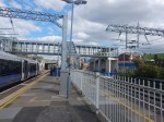
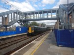
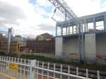
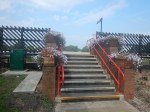
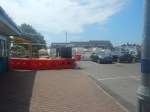
Progress At Syon Lane Station – 27th August 2019
At last, something seems to be happening about erecting the new step-free footbridge at Syon Lane station.
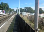

Easily spotted are the following.
- An access road seems to have been fenced off.
- The tea huts and the toilets have arrived.
- Some scraping and digging has commenced by the down platform
- There is a poster saying finish, will be by the end of the year.
Nothing seems to have happened on the up platform.
It also seems strange that no building materials appear to have been delivered.
Could it just be that a concrete slab will be created on the down platform and on the up platform, the two advertising hoarding will be removed to create space for the bridge tower and stairs?
A prefabricated bridge, built off-site, will then be lifted in.
It’s the only way, that the bridge could be built by the promised completion date of the end of the year.
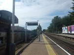
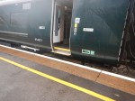
A Trip To Kingham Station
I visited Kingham station on a trip to have lunch with friends nearby.
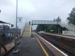
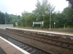


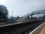

The station is not step-free, by any means.
Commuters or shoppers going to London, Reading or Oxford must use the bridge without lifts on the Outward journey, but at least when returning, it’s a level walk to the car park.
All services are run by Class 800/801/802 trains, which as the first picture shows don’t have step-free access between train and platform.
But there are many stations that are worse and more difficult to make step-free.
This Google Map shows Kingham station, with London to the South and Worcester to the North.
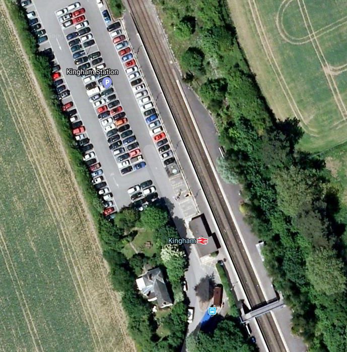
If you look at my pictures taken in 2019 and the Google Map, you’ll notice that the stairs on the bridge point the other way and that the bridge is the other side of the station building, which is indicated by the red logo.
This sentence in the Wikipedia entry for the station, indicates what is happening.
In 2015, a car park extension has been added with 100 car spaces, and a new footbridge is being added, with provision for passenger lifts.
This probably means the Google Map was created before 2015 and that lifts can be added on the Worcester side of the new footbridge.
It also gives Network Rail an unusual dilemma.
In Winner Announced In The Network Rail Footbridge Design Ideas Competition, I wrote how the competition was won by this bridge.
A factory-built bridge would be ideal for Kingham station and it could have easily been fitted in the space taken by the new bridge.
But in 2015, when the current bridge was installed, the new style of step-free bridge hadn’t even been designed.
Network Rail have two choices.
- Add traditional lifts to the current bridge.
- Swap the current bridge for one of the new design with lifts.
There may even be a third choice.
Could two lift towers designed for the winning design be erected and linked to the 2015 bridge?
- The lift towers appear to have been designed to be free-standing and be able support the weight of the bridge deck, perhaps with the stairs acting as a structural support.
- The 2015 bridge been designed to accept traditional lifts in brick or steel towers, so why can’t it accept modern steel and glass lifts?
I think it would be possible and at Kingham station, I suspect the lifts could be installed without disrupting the trains or passengers, during a short closure of the line or the station.
I suspect the cost would salso be more affordable.
Other Stations
There are probably several stations with a very serviceable footbridge, that are suitable for lifts to be added.
This picture shows the footbridge at Marks Tey station.

This could be an ideal candidate.
- The bridge appears sound.
- The bridge appears to meet all the regulations concerning electrification.
- The handrails on the stairs could be updated to a modern standard.
- It looks like there is sufficient space for the towers.
I doubt installation of lifts would be a difficult and expensive project.
There are probably several other stations with a similar design of bridge.
Conclusion
Could Network Rail’s new design of step-free bridge be applied to existing bridges in other stations?
Tram-Trains To Hale Station
In Manchester Metrolink Extensions In A Sentence, I quoted this sentence from the Manchester Evening News.
It includes tram extensions to Port Salford, Middleton and Stalybridge, plus ‘tram trains’ to Hale, Warrington, Gorton and Glossop.
How would tram-trains from Hale join the current Metrolink network?
Hale Station
Hale station, is located in a busy and important village, in the middle of Cheshire’s footballer suburb, if you believe the tabloids.


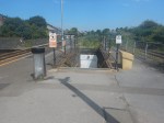
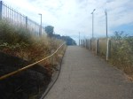
The station has some problems.
- The station needs a refurbishment.
- The station needs step-free access.
- The level crossing needs removing.
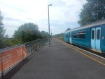
But the biggest problem is that there is only an hourly service serving the station, that runs between Manchester Piccadilly and Chester stations. To make matters worse the train is only two cars. My train was a Pacer, as the pictures show.
Onward To Knutsford, Northwich, Middlewich and Sandbach
In Business Case Requested For Middlewich Reopening, I looked at the opening of Middlewich station on the Northwich to Sandbach Line, which is just a dozen miles to the West of Hale station.
I’m certain in other parts of the UK, like East London, Nottingham and East Lancashire, that the provision of a train service between Middlewich and Manchester would be heavily patronised.
Or is it that the people in Cheshire too posh to use trains?
The Wikipedia entry for Middlewich station, says this about the initial service, when the station opened. in 1868.
The basic train service for passengers was from Crewe via Sandbach to Middlewich and Northwich. Some trains reversed at Northwich and then continued to Hartford and Greenbank and then along a short stretch of the West Coast Main Line (WCML) to Acton Bridge.
If the Northwich and Sandbach Line is ever reopened, surely one possibility for a train service is between Crewe and Manchester via Sandbach, Middlewich, Northwich, Hale and Altrincham.
- Such a service would allow passengers between Althincham and Sandbach to have a handy connection to Crewe with its famed connectivity.
- It would be a very useful commuter service to and from Manchester.
- If it had a frequency of two trains per hour (tph) it would give a substantial increase to train services between Northwich and Altrincham.
- It could possibly ease the overcrowding on the Styal Line.
By 2030, it would even provide a link to High Speed Two at Crewe, in addition to the connection in Manchester.
The Class 399 Train-Train
The Class 399 tram-train is a cross between a tram and a train.
- They are members of the Stadler Citylink family of tram-trains.
- In the UK, they are already running successfully between the centre of Sheffield and Rotherham Parkgate Shopping Centre.
- In Sheffield, they work as trams and drivers have told me, they are powerful trams, that cope with Sheffield’s hills extremely well.
- The tram-trains have step-free access between tram-train and platform.
- On the National Rail lines to Rotherham, they cruise happily at 100 kph, which is almost as fast as a Class 156 train.
- They can run on both 25 KVAC and 750 VDC overhead electrification.
- Trains for Wales have ordered thirty six similar Class 398 tram-trains, that can run on battery power, where electrification has not been erected.
This is one of Sheffield’s Class 399 tram-trains at Rotherham Parkgate.
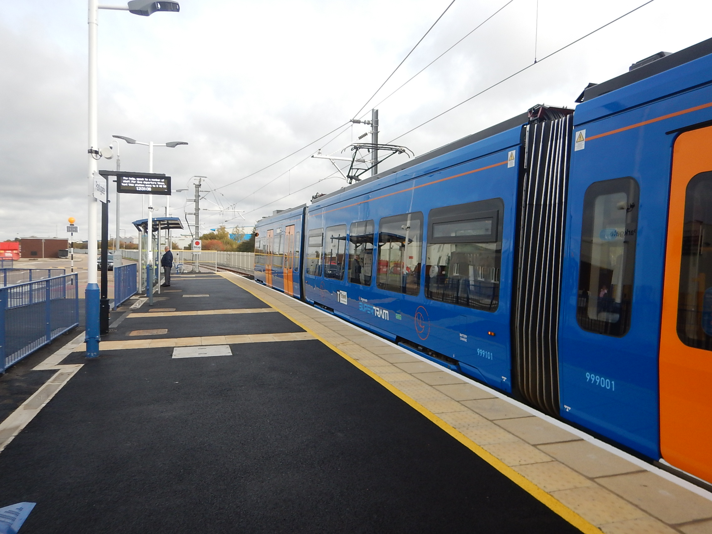
Note the step-free access.
They are a very versatile tram or train, depending on where they are running.
I would suspect the following will happen in the next few years.
- Sheffield are planning to replace their ageing tram fleet and they will look seriously at more Class 399 tram-trains, as they perform well as trams and the region needs more tram-trains.
- Manchester have stated that they are looking seriously at tram-trains and Class 399 tram-trains will surely be considered.
- Other tram networks are looking at tram-trains and they won’t ignore the Class 399 tram-train.
I feel we can expect to see more of these tram-trains in the UK.
Manchester Metrolink Needs More Trams
Manchester Metrolink will need more trams in the next few years and I wouldn’t be surprised that the new ones have a tram-train capability.
Testing Tram-Trains On The Manchester Metrolink
On the Sheffield Supertram, the new tram-trains were first tested as trams on the existing network.
This approach could be taken on the Manchester Metrolink, to both full test the tram-trains and train the staff.
Improving Navigation Road
Navigation Road station has two platforms, one of which is used for the Metrolink and the other for National Rail.
The station could be configured, so that the Western platform would be for Northbound services and the Eastern platform would be for all Southbound services.
There would be two pairs of tracks leading away from the Northern end of the station; one pair for Metrolink services and the other for National Rail services.
The current two pairs of tracks South of Navigation Road station would be used as follows.
- The Western pair would be for any Metrolink tram services terminating in Altrincham station.
- The Eastern pair would be for National Rail services and Metrolink tram-train services going beyond Altrincham station.
Tram-trains running past Altrincham station, would either need the tracks to be electrified or the tram-trains to be fitted with batteries.
Possible Tram-Train Routes To Hale
These are possible routes.
A Metrolink Extension From Altrincham
This is the simplest option, where tram-trains would replace some or all of the service on the Atrincham and Bury and Altrincham and Piccadilly Metrolink services.
The tram-trains would use new electrification or onboard batteries South of Navigation Road.
A Northward Extension From Manchester Victoria Station
In Could A Class 399 Tram-Train With Batteries Go Between Manchester Victoria And Rochdale/Bury Bolton Street/Rawtenstall Stations?, I looked at the possibilities of a Northward extension of the Metrolink, using tram-trains, that had been suggested by an article in the February 2019 Edition of Modern Railways.
I have included it here, as it would be a good destination for a cross-city tram-train service, that started at Hale.
A Southward Extension From Altrincham To Middlewich
If the Sandbach and Northwich Line were to be reopened to traffic with a station at Middlewich, this would be a possible Southern terminus for the route.
The distance would probably be too far for battery operation, so there would be a need to electrify the extension using either 25 KVAC main line or 750 VDC tramway electrification.
As the route has been used by Virgin’s Euston and Chester services as a diversion route, and the Crewe and Chester Line has a high priority for electrification, there is a chance that lines in the area will be electrified.
This could mean the tram-trains could easily run from Altrincham as far as Crewe, as the route could be fully electrified.
Tram-Train Between Manchester Piccadilly and Hale Via Stockport
On the route between Manchester Piccadilly and Hale station via Stockport, there are only two stations between Stockport and Hale station; Navigation Road and Altrincham.
Would it be feasible or worthwhile to convert this route into tram-train operation by perhaps adding 750 VDC overhead electrification?
- There is typically one or two freight trains and one Chester and Manchester Piccadilly service in each direction in every hour, so two tram-trains per hour in each direction should be possible.
- Stops could be added at convenient places.
- Between Stockport and Manchester Piccadilly stations, the existing 25 KVAC electrification would be used.
It would not be the largest project.
The Refurbishment Of Hale Station
Hale station needs a refurbishment and a step-free bridge.
In Winner Announced In The Network Rail Footbridge Design Ideas Competition, I wrote how the competition was won by this bridge.
So could a factory-built bridge like this be installed at Hale station?
This Google Map shows Hale station.
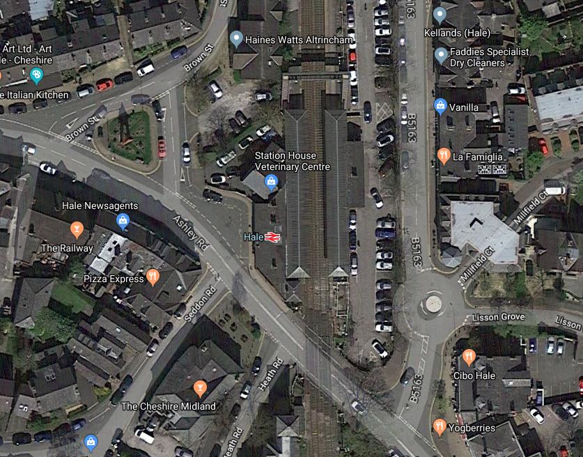
I think a new bridge could be installed at the Northern end of the station, if it were to be decided that the current one couldn’t be fitted with lifts.
The Electrification And Bi-Mode Alternative
As I said earlier the Crewe and Chester Line could be electrified, which would enable electric trains to run between London and Chester.
However, since the award of the West Coast Partnership to First Trenitalia, I now think it is unlikely the Crewe and Chester Line will be electrified in the near future, as new bi-mode trains will be ordered for North Wales services.
But I don’t reject the notion, that Northern will run bi-mode Class 769 trains between Manchester Piccadilly and Chester.
These trains could use the electrification between Stockport and Manchester Piccadilly stations.
Conclusion
These are my conclusions.
- Tram-trains can deliver a capacity improvement through Navigation Road station.
- Tram-trains could be extensively tested on the existing Manchester Metrolink network.
- Tram-trains could be used to build a simple extension to Hale station from Altrincham.
- The Manchester and Chester service via Stockport, Navigation Road and Altrincham stations could be run by tram-trains.
A comprehensive network of tram-trains could be developed between, through and beyond Altrincham, Crewe and Chester.
Cadoxton Station Is Going Step-Free
This article on Rail Advent is rntitled MP Visits Cadoxton station to see upgrade work.
This is the first paragraph.
Vale of Glamorgan MP, Alun Cairns, met the Network Rail team upgrading Cadoxton station to see first-hand the work being delivered to make the station accessible for all passengers.
So as I was in South Wales, I had to go and have a look at Cadoxton station.
I took these pictures.


It appears to be a traditional step-free installation and will take about a year to complete.
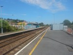
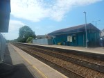
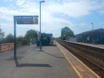
Barry Station To Go Step-Free
This document on the Government web site is entitled Access for All: 73 Stations Set To Benefit From Additional Funding.
Barry station is on the list.
These pictures show the station and the current bridge,

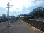

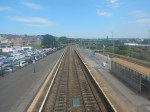


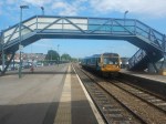
Note.
- The trains were very crowded.
- The bridge is approaching its rust-by date.
- I think it is true to say, that the station buildings need a thorough refurbishment.
I have been sent a map of the proposed works and facilities for the South Wales Metro. This snippet shows the lines around Barry station.
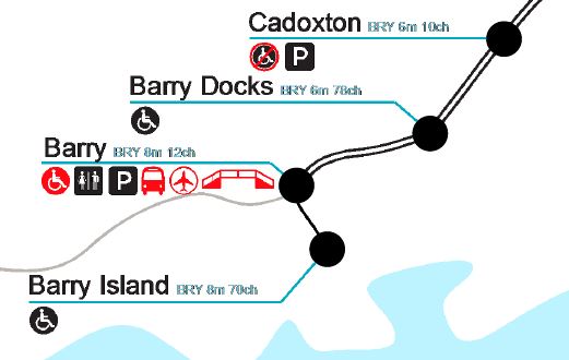
Note.
- The lines are not planned to be electrified.
- Barry station will get a new PRM-compliant bridge with step-free access between street and train.
- There will be an airport connection at the station.
I would assume that the station buildings will get the much-needed refurbishment.
Services To Barry, Barry Island, Bridgend and Penarth
The South Wales Metro services through Barry will be as follows.
- Services will terminate in the South and West at Barry Island, Bridgend and Penarth
- Services will terminate in the North at Coryton and Rhymney.
- There will be increased train frequencies.
Trains will be tri-mode Stadler Flirts with three or four cars, which will be similar to Greater Anglia’s Class 755 trains.
Judging by yesterday this capacity increase will be welcome.
Installing The Step-Free Access
It would appear there is plenty of space for a step-free footbridge with lifts.
In Winner Announced In The Network Rail Footbridge Design Ideas Competition, I wrote how the competition was won by this bridge.
A bridge like this could be built at the other end of the station.
It would also be able to built it, without disrupting the train services or the passengers.
Once complete, the old bridge could be demolished or left as required.
