Clapham High Street Could Gain Direct Overground Routes To Victoria Station
The title of this post, is the same as that of this article on the Clapham Nub News.
These two paragraphs introduce the article.
Local councillors and the Clapham Transport Users Group have been in discussions with Network Rail about the direct route once the current ‘Networker’ trains are replaced.
Clapham High Street lost its direct services to Victoria in December 2012 when the South London Line was withdrawn in favour of the London Overground to Clapham Junction.
This forces passengers onto the Northern Line, which through Clapham has two dangerous-looking stations; Clapham Common and Clapham North.

I have a few thoughts and observations.
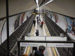
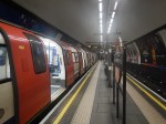
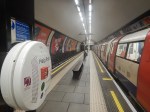
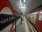
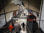
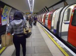
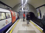
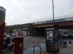
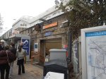
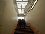
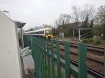
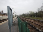
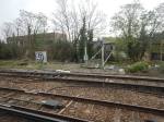
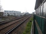
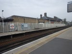
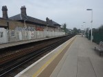
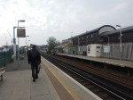
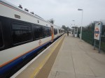
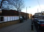
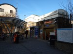
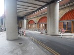
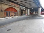
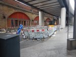
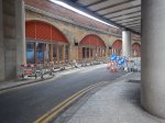
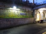
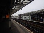
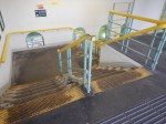
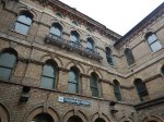
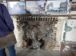
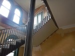
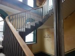
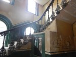
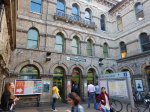
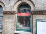
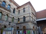
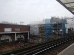
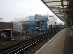
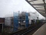
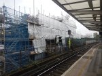
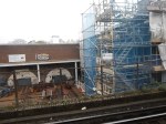
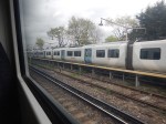
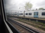
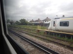
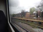
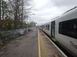
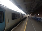
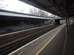
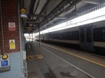
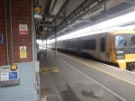
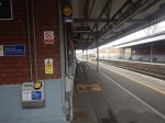
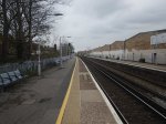
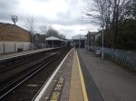
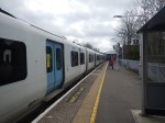
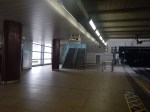
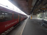
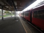
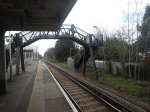
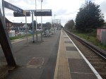
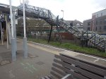
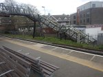
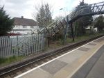
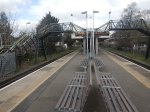
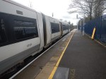
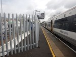
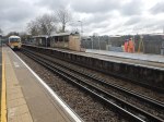
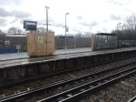
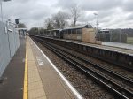
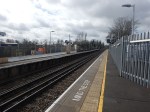
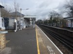
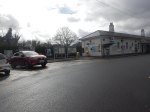
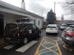
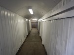
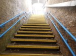
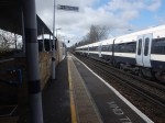
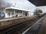
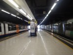
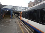
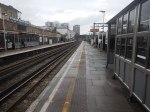
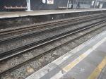
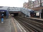
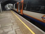
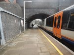
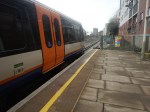
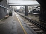
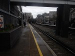
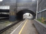
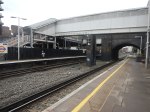
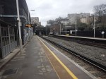
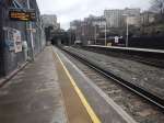
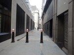
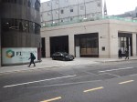
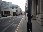
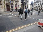
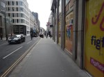
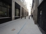
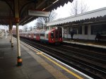
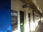
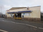
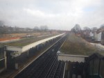
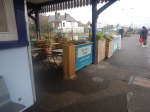
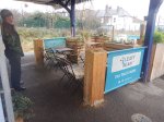
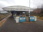
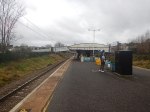
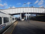
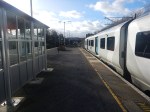
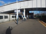
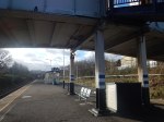
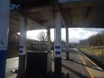
Clapham High Street Station
These pictures show Clapham High Street station.
Note.
- The station is Grade II Listed.
- There are four tracks through Clapham High Street station.
- Only the lines used by the London Underground have platforms.
- I don’t think it will be difficult to add platforms to the other two tracks.
- The platforms will probably take five-car trains.
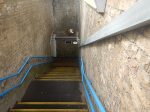
- Access to the platforms is by a subway, which could probably be extended to the other side of the tracks.
- A second entrance would be closer to Clapham North station.
- I suspect step-free access would not be too difficult to install.
- The tracks are over railway arches, which could be developed to add to the quality businesses in the area.
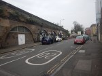
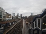
This Google Map shows the station.
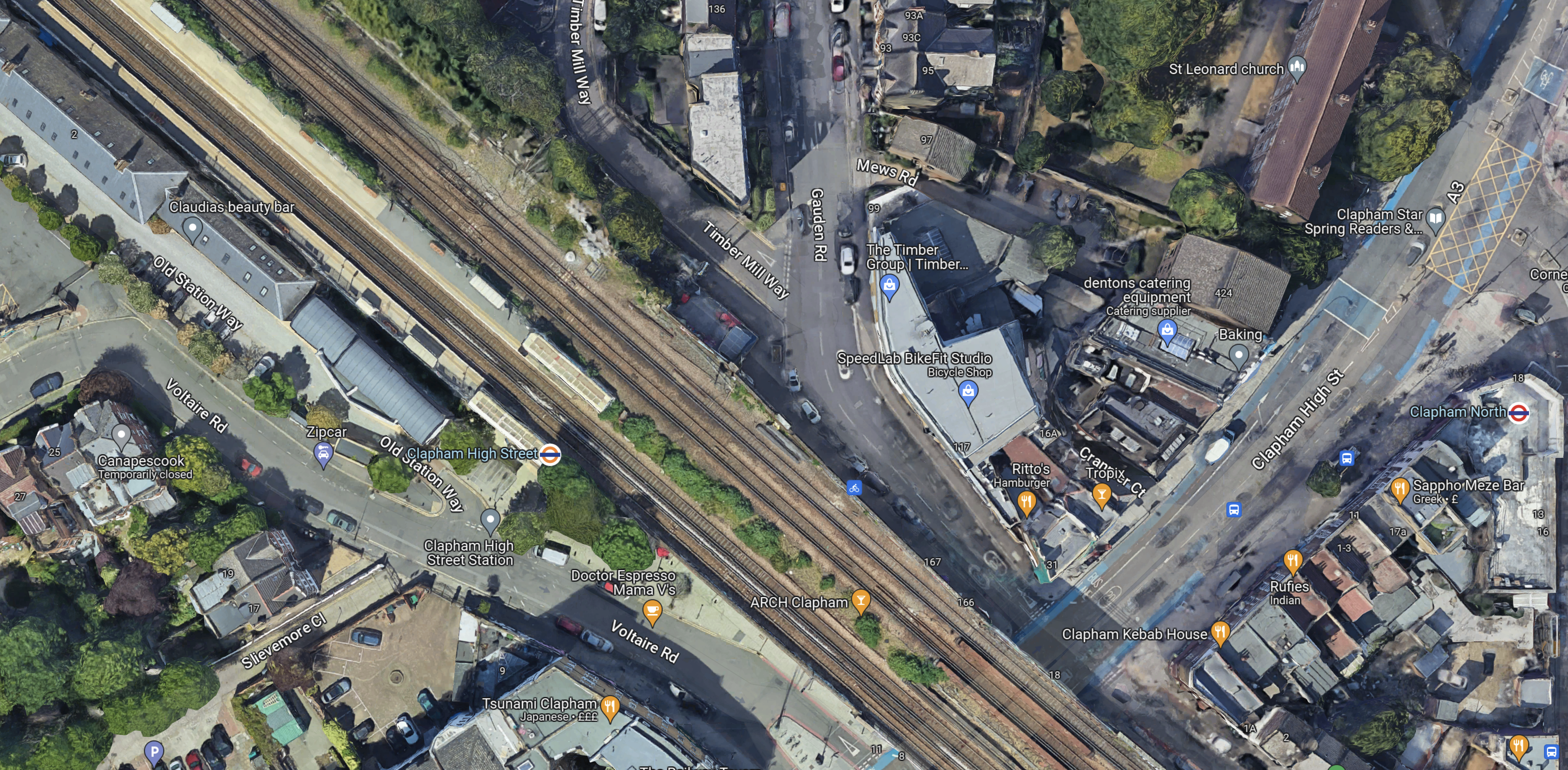
Note.
- Clapham High Street station is in the North-West corner of the map.
- Clapham North station is at the Eastern edge of the map in the middle.
- There seems plenty of space for two more platforms.
I think there is a lot of scope to improve this station.
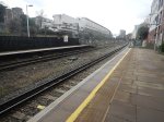
Tracks Through Clapham High Street Station
This map from cartometro.com shows the tracks through Clapham High Street station.

Note.
- The Overground tracks are shown in orange and black.
- The fast lines, which are to the North of the Overground lines are shown in black.
- Shepherds Lane and Voltaire Road junctions allow trains on the fast lines to call in Clapham High Street station.
I suspect full digital signalling will be employed for efficiency of handling the junctions.
Services Through Clapham High Street Station
These services run through Clapham High Street station.
- London Overground – Dalston Junction and Clapham Junction – four tph – Goes via Denmark Hill and Peckham Rye
- Southeastern – London Victoria and Ashford International – one tph – Goes via Brixton, Herne Hill and West Dulwich
- Southeastern – London Victoria and Dartford – two tph – Goes via Denmark Hill, Peckham Rye, Nunhead and Lewisham
- Southeastern – London Victoria and Dover Priory – one tph – Goes via Brixton, Herne Hill and West Dulwich
- Southeastern – London Victoria and Gillingham – one tph – Goes via Denmark Hill, Peckham Rye, Nunhead and Bromley South
- Southeastern – London Victoria and Orpington – two tph – Goes via Brixton, Herne Hill and West Dulwich
- Southeastern – London Victoria and Ramsgate – one tph – Goes via Brixton, Herne Hill and West Dulwich
Note.
- tph means trains per hour.
- The London Overground services could be increased to 6 tph.
- Only the London Overground services stop in Clapham High Street station.
- The Dartford, Gillingham and Orpington trains are pathed for 90 mph trains.
- The Ashford International, Dover Priory and Ramsgate trains are pathed for 100 mph trains.
It is a comprehensive timetable.
Southeastern’s New Trains
In Battery EMUs Envisaged In Southeastern Fleet Procurement, I wrote about Southeastern’s proposed new trains.
Full details haven’t been announced yet, but I think we can be sure of the following.
- The first trains to be replaced will be the Networker trains, because they are the oldest and slowest.
- The new trains will have selected door opening (SDO), as this a feature of nearly all modern trains.
- I also suspect the trains will be capable of running at 100 mph and will be five cars long, with the ability to run in pairs.
This will enable the new trains to cross over from the fast lines to the Overground lines to stop in Clapham High Street station.
How Many Trains Would Stop At Clapham High Street Station?
Currently trains passing through the station are as follows.
- London Overground – 4 tph – Stopping
- Southeastern – 3 tph – 100 mph services to Ashford International, Dover Priory and Ramsgate – Non-stop
- Southeastern – 5 tph – 90 mph services to Dartford, Gillingham and Orpington – Non-stop
Note.
- It is likely that the London Overground service will go to 6 tph.
- Would 100 mph services always go through without stopping?
- In an ideal world would it be best if services alternated?
I suspect that a better service could be provided between Clapham High Street and Victoria with very little expenditure on infrastructure.
High Speed One Issues
An article in the July 2017 Edition of Modern Railways is entitled Kent On The Cusp Of Change.
The article suggests that Fawkham junction, could be used to allow Southeastern Highspeed services to access Victoria as a second London terminal, to increase capacity on High Speed One.
The route could be via Clapham High Street, Denmark Hill, Bromley South, St. Mary Cray, Swanley and Farningham Road.
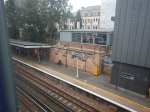
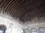
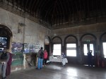
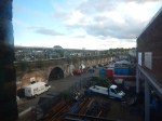
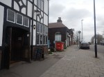
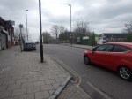
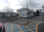
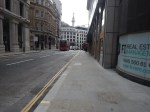
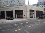
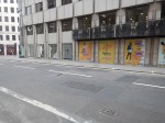
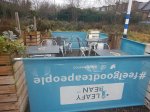
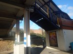
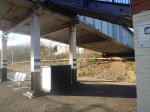
The Arches Underneath
There are several railway arches underneath the tracks at Clapham High Street station.
Some of the businesses look good and there are several other arches that are boarded up.
Railway arches are now generally owned by The Arch Co.
In Findlater’s Corner At London Bridge – 11th February 2023, I wrote about the company’s restoration of some arches at London Bridge station, which included these pictures.
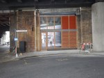
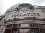


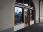
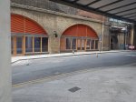
I suspect that a similar restoration in up-market Clapham could be a good investment for The Arch Co.
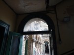
A Four-Platform Clapham High Street Station
Consider.
- There is space for two new platforms alongside the fast lines.
- The station entrance is in an arch, that goes right under the tracks.
- Putting lifts in an arch would not be the most challenging of tasks.
- A second entrance in Gauden Road would be nearer Clapham North Underground station.
- It should also be remembered that the Government is giving out levelling up funding.
- Hackney is to receive this type of funding and I wrote about it in Hackney Central Before Levelling Up.
I can see a fully-accessible four-platform station being built at Clapham High Street station.
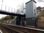
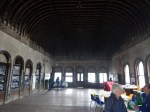
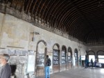
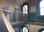
Denmark Hill Station
Denmark Hill station is the next station to the East of Clapham High Street station and after a rebuild is now a high quality station, with these features.
- Four tracks and platforms.
- Frequent trains to Ashford International, Clapham Junction, St. Pancras, Victoria and Whitechapel.
- Full step-free access with lifts.
- A solar roof.
- A Grade II listing.
- King’s College and Maudsley Hospitals are next door.
- A pub.
I wrote about the station in Denmark Hill Station – 4th September 2021.
These are a few pictures.


Note the solar roof. There’s more about the roof on this page of the BiPVco web site.
On the About page, there is a section called Our Story, where this is said.
BIPVco was established in April 2015 following five years of collaborative research between Tata Steel LCRI (Low Carbon Research Institute) and Swansea University with support from the Welsh government.
The research program developed ways of integrating thin-film CIGS PV cells directly onto the same substrates that make roofs and walls so that true BIPV functionality would become integral to the building envelope and could be achieved without having to resort to heavy on site mounting systems.
Our manufacturing processes were further enhanced to suit commercial production, and the products and procedures were tested and accredited before commercial launch.
Working with select partners, we designed and built many pilot PV integrated roofs between 2015 and 2017 in varying climates, including Nigeria, Canada, UAE and the UK, to demonstrate product suitability in all environments. The full commercial launch was effected in June of 2017.
They certainly seem to have taken solar panels to a new level.
I would also rate Denmark Hill station one of the finest suburban railway stations in the world!
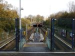
Peckham Rye Station
The next station to the East of Denmark Hill station is Peckham Rye station.
Like many other stations and buildings in London, including the original Denmark Hill station, Peckham Rye station was designed by Charles Henry Driver.
These are some pictures, I’ve taken over the years at Peckham Rye station.

Note.
- It is a very busy station.
- I’ve read somewhere, that it is the busiest station in the UK, without any step-free access.
- It could be a magnificent station.
- One of the people driving this project is the architect; Benedict O’Looney.
This page on the Network Rail web site is entitled Peckham Rye Station Upgrade and it starts with this statement.
On 7th March 2022, we submitted Planning Permission and Listed Building Consent applications to upgrade Peckham Rye station to make it fully accessible with more capacity and better facilities for passengers.
It’s all a bit out of date, but these pictures, that I took this morning, indicate that something is progressing.

This article on IanVisits gives a few more details.
South London Crosslink
The South London Crosslink, doesn’t seem to have a website or a Wikipedia entry.
But it is mentioned in a question and answer to the London Mayor.
In response to this question.
Will you consider bringing the Victoria rail service back to Clapham High Street station and providing direct trains to Brixton, Herne Hill, and Bromley South?
The Mayor gave this answer.
The Department for Transport (DfT) is responsible for these services, as they run Southeastern railway as operator of last resort. Transport for London (TfL) is not opposed to the existing Southeastern services to and from Victoria making additional calls at Clapham High Street should the DfT, wish to take the idea forward.
There are however several practical issues that would need to be taken into consideration, and any changes to the service would be subject to cost-effective solutions being found to these.
The Clapham High Street platforms are too short for the eight-car trains used on the Victoria to Dartford and Orpington metro routes, and the existing rolling stock lacks a safety intervention called “Selective Door Opening” that enables trains to call at a station where the platform is shorter than the train. There are also technical restrictions, such as the frequent routing of these services along an adjacent pair of tracks which do not have any platforms, which would make implementation difficult using the existing railway infrastructure. Finally, there would need to be clear consideration on the wider capacity of the rail network and the robustness of the timetable. All of these concerns could affect the value for money of any proposal for these services to call at Clapham High Street station.
As I showed earlier, it looks like new trains will solve most of these problems. If they don’t, then the wrong trains have been ordered.
But there’s still not much about where the route will go after Peckham Rye, except for vague mentions of Dartford and Orpington.
I asked a friend and they said the South London Crosslink could possibly go to Bellingham.
This map from cartometro, shows the route between Denmark Hill and Crofton Park stations.
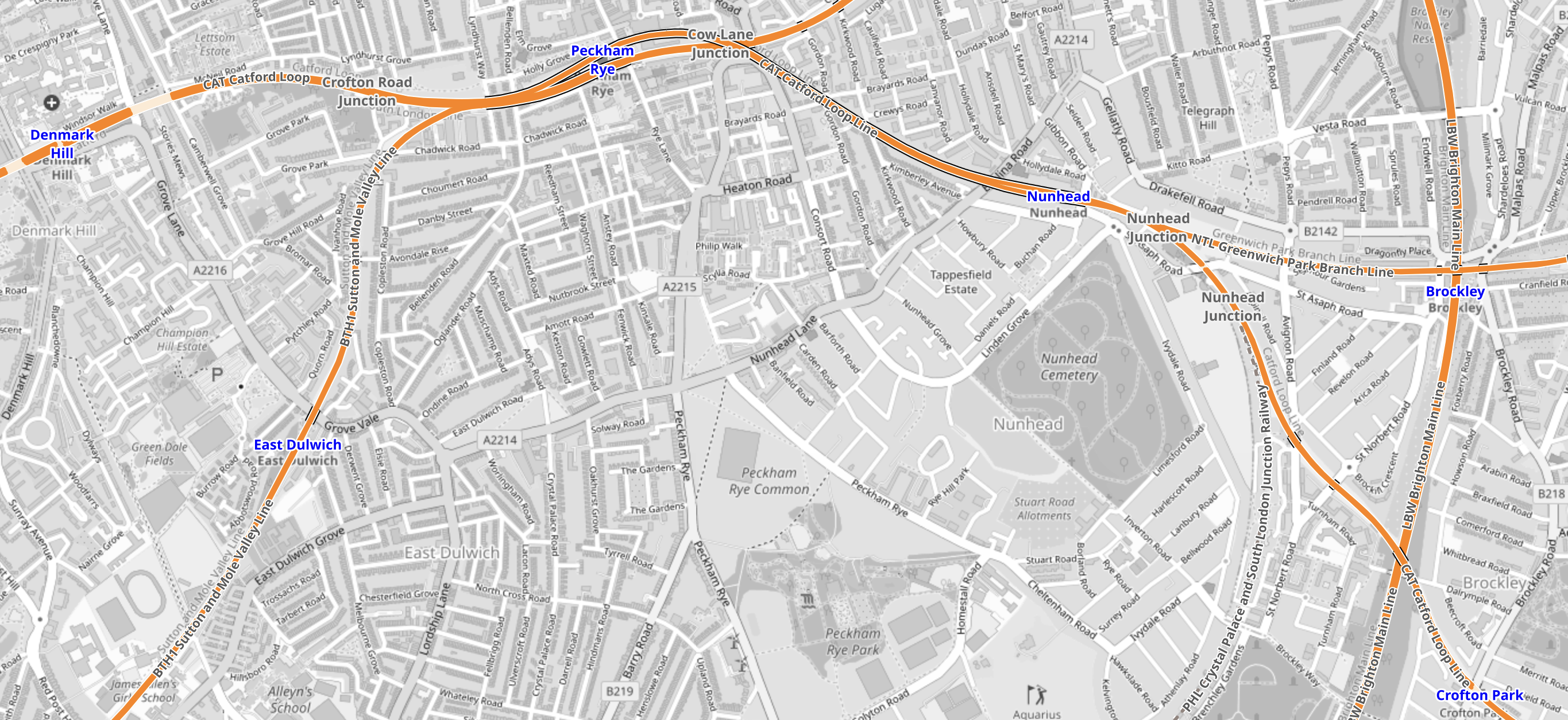
Note.
- Denmark Hill station is in the North-West corner of the map.
- Crofton Park station is in the South-East corner of the map.
- The route would be via Peckham Rye and Nunhead stations.
- It is not a very fast route with an operating speed of 50-60 mph.
- In Nunhead Junction Improvement, I wrote about improvements needed at Nunhead junction to the East of Nunhead station to improve capacity for freight trains.
This second map from cartometro, shows the route between Crofton Park and Bellingham stations.
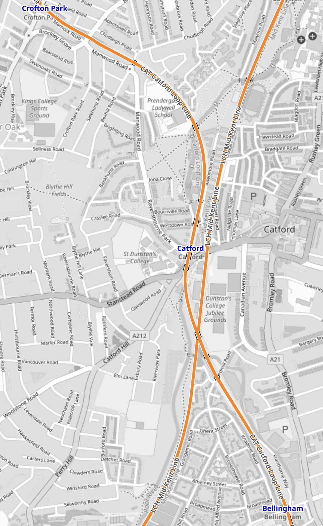
Note.
- Crofton Park station is in the North-West corner of the map.
- Bellingham station is in the South-East corner of the map.
- The line going diagonally across the map from North-East to South-West is the Hayes Line to Hayes.
- There are plans to create an interchange station at Catford.
This Google Map shows Bellingham station.
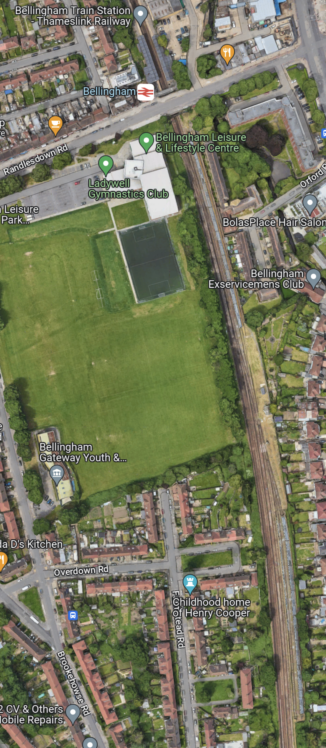
Note.
- Bellingham station is at the top of the map.
- Bellingham station is on the Catford Loop Line.
- South of Bellingham station are a series of sidings.
Is the reason, that Bellingham station was proposed as a terminus, that with a proper interchange at Catford, it creates a very efficient operational railway with some convenient sidings thrown in?
This map from cartometro, show the track layout at Bellingham station.
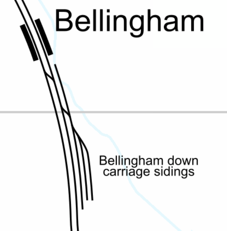
I believe that the sidings could be used as a turnback siding for trains from both directions.
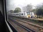
These pictures show trains in the sidings.
And these are of the station.
Note.
St. Pancras To Heathrow By Elizabeth Line
I ate breakfast in Le Pain Quotidien in St.Pancras station this morning and afterwards I took the Elizabeth Line to Heathrow.
I took Thameslink for one stop to Farringdon station and got a Elizabeth Line train direct to Terminal 2 and 3 at the Airport.


Note.
- The train I took was going to Gravesend. I suspect it was because of engineering work.
- An empty train passed through, whilst I waited. I’ve never seen that before on Thameslink in St. Pancras station.
- I travelled in the front of the Thameslink train for the one stop.
- The change at Farringdon station was very quick, as it was just down in the lift and the Heathrow train was waiting.
These are some notes on a fast change using the lifts between Southbound Thameslink and the Elizabeth Line at Farringdon station.
- Get the first lift of the two that arrives, if like me, you can use escalators.
- If it goes up, walk across the station at street level and get the two serial escalators down to the Elizabeth Line.
- If it goes down, take the lift to the Elizabeth Line.
If you can’t manage escalators, you have to wait for a lift going down.
I have some observations.
Meeting And Greeting At St. Pancras Station
From my position in Le Pain Quotidien, I was able to watch passengers leaving and arriving at the Eurostar terminal opposite.
There were quite a few people, who were meeting and greeting others.
In Effects Of The ULEZ In West London, I said this about meeting and greeting at Heathrow.
But as it now so easy to get to the Airport using the Elizabeth Line will more people use the new line to meet and greet and say goodbye to loved ones or business associates. Since the Elizabeth Line opened, I’ve met a couple of friends at Heathrow, who were passing through.
Will the Elizabeth Line increase the number of trips to the airport, by making meeting and greeting easier?
If it does, then it will put more pressure on the services to Heathrow Airport.
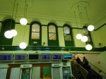
Seats In St. Pancras Thameslink Station
These pictures show some of the large number of seats in St. Pancras Thameslink Station.


Should there be more seats along the platform at stations on the Elizabeth Line, where passengers change trains?
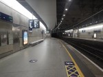
My Train To The Airport Was Crowded
Ten in the morning on a Sunday, is not the time I’d expect to be busy, but I estimated it was about ninety percent full, judging by the few empty seats.
There Were Eight Trains Per Hour (tph) To And From Heathrow
From Real Time Trains, it looks like the following trains were running.
- Elizabeth Line – Abbey Wood and Terminal Four – 2 tph
- Elizabeth Line – Abbey Wood and Terminal Five – 2 tph
- Heathrow Express – Paddington and Terminal Five – 4 tph
My train to the Airport had been going to Terminal Four.
Is eight tph the maximum frequency, that can use the tunnel to the Airport?
Is The Elizabeth Line Diverting Passengers From Heathrow Express?
When I returned from the Airport, my Elizabeth Line train left about ten minutes after a Heathrow Express train.
- The Heathrow Express train wasn’t very full.
- The Elizabeth Line train was very full.
- Passengers got out at all stations.
- I got out at Tottenham Court Road.
It will be interesting to see the Heathrow Express passenger figures.
Which Is The Best Elizabeth Line Station For A Marks and Spencer?
Because their gluten-free food is so much better than other shops, this is important to me.
- There are larger stores at Ealing Broadway, Tottenham Court Road (West), Liverpool Street (West), Stratford and Ilford.
- There are food only stores at Heathrow, Paddington, Bond Street and Liverpool Street (East).
Today, I used the large store by the Western entrance at Tottenham Court Road station.
But, if you want to avoid walking, Stratford is probably the easiest.
Work Underway At Motspur Park Station In South London
The title of this post, is the same as that of this article on Rail Business Daily.
These two paragraphs outline the project.
Network Rail has announced that £8.9 million is being invested in new lifts and walkways installed among other upgrades at Motspur Park station in south London.
Network Rail is working with South Western Railway and the London Borough of Merton Council to install a step free footbridge as part of the Government’s Access for All programme, funded by the Department for Transport (DfT).
I visited the station this morning and took these pictures.

Note.
- When Motspur Park station was built in 1925, I must assume that there were no persons of restricted mobility.
- According to some commentators, it sounds like Network Rail and its partners are going for a complete rebuild.
- Did the Woodworm Preservation Society protest at the new design?
- Some new trains to serve the station would surely help too!
It should open in early 2024.
I shall be interested to see how the new station alters passenger numbers.
‘Lift-off’ – Project To Provide Step-Free Access At Bexley Station In Kent Kicked Off In February
The title of this post is the same as that of this press release from Network Rail.
This is the sub-heading.
Network Rail has kicked off construction of a new footbridge and lifts at Bexley station which will provide passengers with a fully accessible station.
These four paragraphs outline the scheme.
This project, which is funded through the Department of Transport’s (DfT) ‘Access for All’ scheme, is expected to be completed in late spring 2024 and will ensure there is step-free access to all of the station’s platforms.
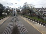
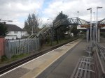
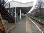
Network Rail will be working with contractors BAM Nuttall to install two 16-person capacity lifts which will be located behind the existing subway and help passengers with impaired mobility or those travelling with luggage, children, or cycles to access the platforms.
Platform one will be widened to create space for the lifts and allow passengers to navigate through the station a lot easier.
Alongside this, a new footbridge will be built to allow passengers easily get from one side of the platform to the other.
I’m surprised that lifts are being added to the existing subway, rather than being added to the new footbridge.
Looking at the statistics for Bexley and nearby stations, I suspect that Bexley station has more traffic.
This Google Map shows Bexley station.
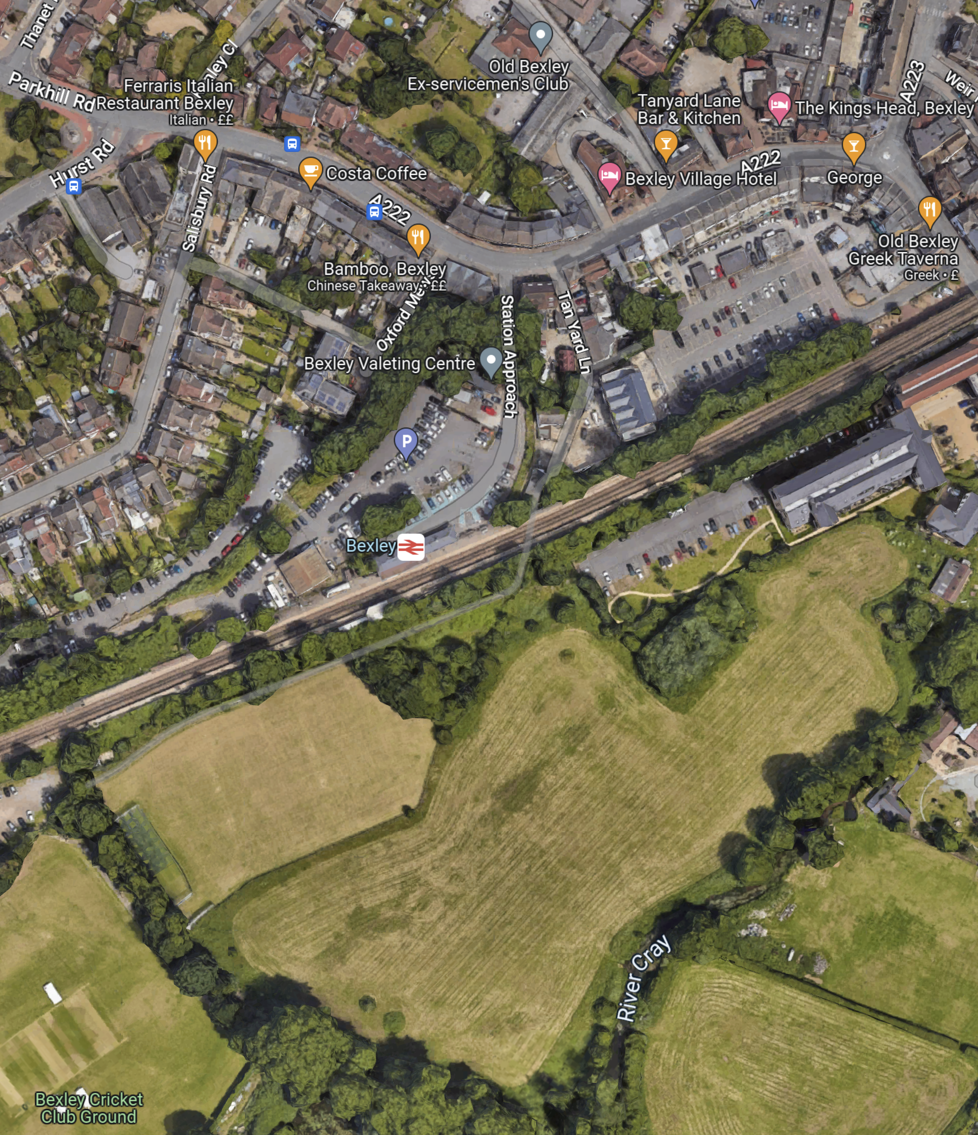
As there appears to be a lot more housing and the car park to the North of the railway, I suspect there’s a lot of crossing of the railway by passengers.
So it does seem that Network Rail have designed scheme for the number of passengers, which is something Transport for London haven’t done with the buses, where I live.
On a visit to the station on the 14th of March, I took these pictures.

This is a Network Rail visualisation of how it will look.
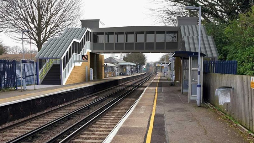
The visualisation is looking towards the East.
Would It Be Possible For The Bakerloo And Watford DC Lines To Use The Same Trains? – 6th March 2023 Update
These two lines are very different.
- The Bakerloo Line is a classic London Underground Line with 25 stations and services run by 1972 Stock trains.
- The Watford DC Line is part of the London Overground with 19 stations and services run by Class 710 trains.
Ten stations are shared between the lines, of which only one; Queen’s Park offers level boarding.
The Shared Stations
The nine shared stations often have considerable steps up and down, as at Willesden Junction station, which is shown in Train-Platform Interface On Platform 1 At Willesden Junction.
I am rather pleased and pleasantly surprised, that there are not more accidents at the shared stations, but using the line must be a nightmare for wheelchair users, buggy pushes and large case draggers.
If Transport for London proposed building a line like this, they would have to launch it at the Hammersmith Apollo, where comedians perform.
The One Train Type Solution
To my mind, there is only one solution. The two services must use the same type of trains.
These are a few thoughts on the trains.
Trains Would Be Underground-Sized
As the trains will have to work through the existing tunnels to Elephant & Castle station, the trains would have to be compatible with the tunnels and therefore sized for the Underground.
I suspect they would be a version of the New Tube for London, that are currently being built by Siemens for the Piccadilly Line.
New Tube For London And Class 710 Train Compared
This Siemens infographic summarises the New Tube For London.
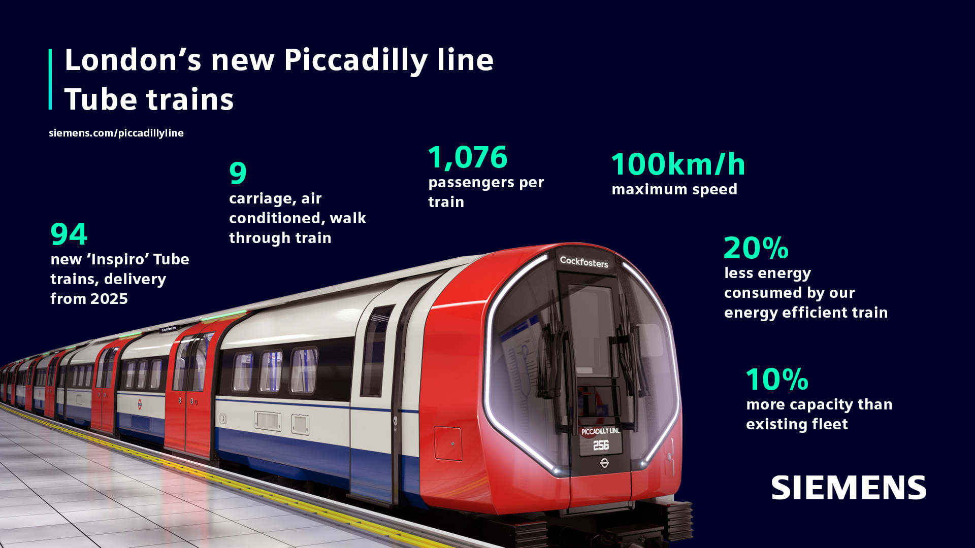
These figures are from Wikipedia.
- Cars – NTFL – 9 – 710 – 4
- Car Length – NTFL – 12.6 metres – 710 – 20 metres
- Train Length – NTFL – 113.4 metres – 710 – 80 metres
- Seated Passengers – NTFL – 268 – 710 – 189
- Total Passengers – NTFL – 1076 – 710 – 678
- Passenger Density – NTFL – 9.5 per metre – 710 – 8.2 per metre
- Speed – NTFL – 62 mph – 710 – 75 mph
Note.
- The figures for the Class 710 train are for a four-car train.
- The passenger density and speed are closer than I thought they’d be.
- I’m sure Siemens can design a longer and/or faster train if required for the Euston service.
I feel that the New Tube for London design could be adjusted , so that it could work the Watford DC service.
Platform Modifications
I suspect that the New Tube for London will be lower than the Class 710 train and all platforms would need to be lowered to fit the new trains.
I would also suspect that it would be easier to lower platforms, than modify them, so that they had dual-height sections to satisfy two classes of train.
It should be noted that the New Tube for London has shorter cars than the sixteen metre 1972 Stock trains currently used on the line, so there will be smaller gaps at stations with curved platforms like Waterloo.
I believe that with one class of train, all of the stations on the Bakerloo and Watford DC Lines could be made step-free between train and platform.
Platform Height On Platform 9 At Euston
I took these pictures on Platform 9 at Euston station.
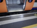
Note that it is rather a high step into the train and there is a large gap.
But if say, a modern London Underground train from say the Victoria Line pulled into the platform would it be a better fit?
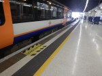
Platform Height At Kilburn High Road Station
These pictures show Kilburn High Road station.
I should have taken more pictures, but the step between the platform and train is similar to Platform 9 at Euston.
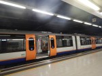
Platform Height At South Hampstead Station
These pictures show South Hampstead station.
I should have taken more pictures, but again the step between the platform and train is similar to Platform 9 at Euston.
Were The Platforms At Euston, South Hampstead And Kilburn High Road Built For Another Class Of Train?
This Wikipedia entry is for the London Underground Watford Joint Stock train, where this is said.
The Watford Joint Tube Stock was built for the service to Watford along both the Bakerloo tube and the London North Western Railway. As a result, the cars were owned by both the Underground and the London North Western Railway. To be able to operate on both lines, the car floors were 4+1⁄2 inches (110 mm) higher than other tube cars. This was a compromise height between the platform heights on the two lines.
The cars were ordered in 1914, but construction was delayed by The First World War. As a result, the first cars were not delivered until early 1920.
Note.
- The Wikipedia entry has links to some images of which this is one.
- They must have been rather cramped trains if they were built for deep tunnels and had a floor that was 110 mm higher, than other tube trains.
It certainly appears to be possible to design a train, that would fit both lines.
But would it fit modern regulations and give full step-free access?
Queen’s Park And Euston
This map from cartometro.com, shows the route between Queen’s Park and Euston stations.
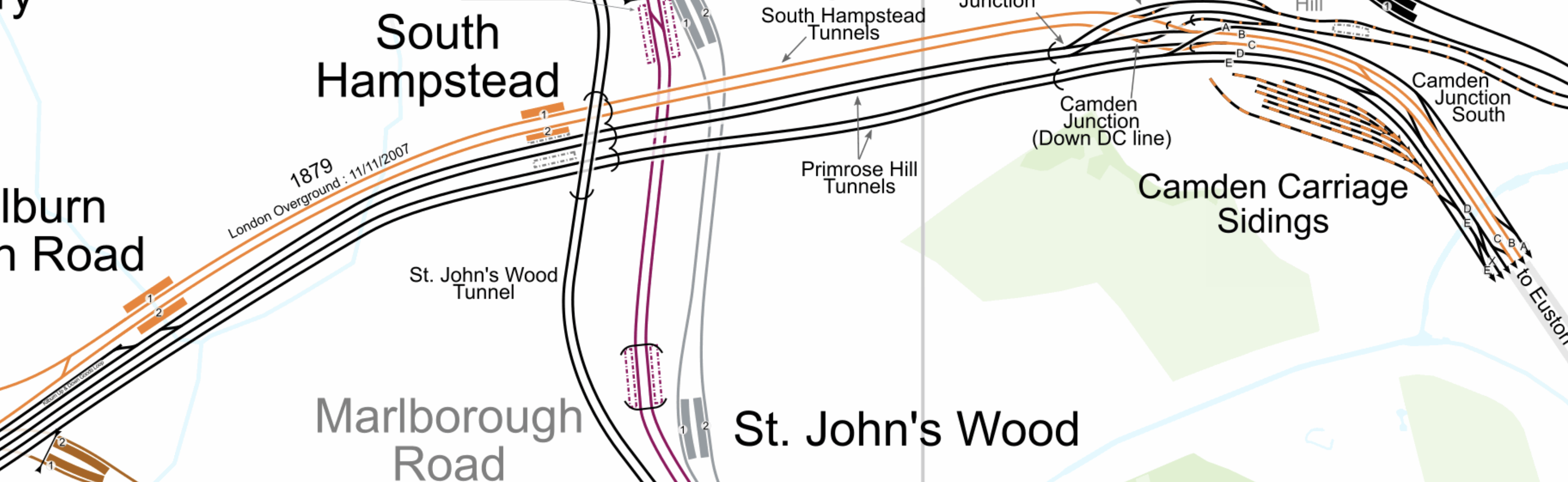
Note.
- The Watford DC Line is shown in orange.
- Queen’s Park station is to the West of Kilburn High Road station.
- It appears that Watford DC Line trains always use Platform 9 at Euston station.
The route seems to be a self-contained third-rail electrified line into Euston station.
On the subject of electrification between Queen’s Park and Euston stations, there would appear to be a choice between the third-rail system and London Underground’s four-rail system.
But it is rumoured that the New Tube for London will have a battery capability.
As Euston and Queen’s Park stations are only 3.7 miles apart, perhaps the choice would be to use battery power into Euston station, which would remove electrified rails from Euston?
How Many Trains Could Run Into Euston?
Currently, four trains per hour (tph) run into Euston.
It is generally accepted that six tph can use a single platform. But would this be enough?
I suppose there is the possibility of tunnelling under Euston station to a pair of terminal platforms.
In that case the current platform could be used by other services.
Southern’s Milton Keynes And Clapham Junction Service
This service wouldn’t be affected as it uses the fast lines between Willesden and Watford Junction.
Advantages Of One Train Type On The Bakerloo And Watford DC Lines
I can think of these advantages.
- Step-free access between train and platform, should be achieved.
- A unified fleet.
- A higher frequency between Euston and Willesden Junction stations.
- Higher frequency where needed.
- If trains had a battery capability, Euston could be free of third-rail electrification.
As only one type of train will be using the Watford DC line between Euston and Watford Junction, this could result in operational efficiencies.
Linking Of The Bakerloo And Abbey Lines
This could be the biggest advantage of all.
This map from cartometro shows the lines at Watford Junction station.
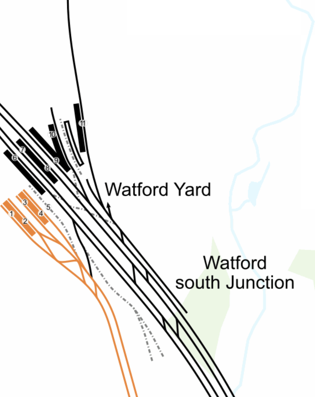
Note.
- The orange lines are the current Watford DC Line services of the London Overground, terminating in platforms 1 to 4 of Watford Junction station.
- These lines would be taken over by the unified Bakerloo/Watford DC Line services, running nine-car New Tubes For London.
- The next station to the South is Watford High Street.
- The West Coast Main Line goes through the station and uses platforms 5 to 10.
- At the North of the station is Platform 11 on the Abbey Line which leads roughly North East to St. Albans.
Look at how the Abbey Line is more or less in line with the twin-tracks of the Watford DC Line.
Recently, during the Bank Station Upgrade, a 488 metre long single track tunnel was built to divert the Southbound Northern Line.
This tunnel was not dug with a tunnel boring machine, but traditionally by hand, using men, picks, shovels and I suspect a few small machines.
I believe, that a similar technique could be used to dig a tunnel, to connect the Abbey Line and the Watford DC Line.
- It would only be single-track
- It would probably be less than 500 metres long.
- It would connect to the Abbey Line to the South of Platform 11.
- It would be deep-level tube-sized.
- It might be dug by hyperTunnel.
- Geography wouldn’t allow the tunnel to terminate in the Watford DC Line platforms at Watford Junction station.
But where would the terminal be on the Southern side of the West Coast Main Line?
This map from OpenRailwayMap, shows the two routes between Watford Junction and Bushey stations.

Note.
- Watford Junction station is at the top of the map.
- The orange line is the West Coast Main Line.
- The yellow line looping to the West of the West Coast Main Line is the double-track Watford DC Line.
- Bushey station is at the bottom of the map, where the two rail lines meet.
- Watford High Street station is in the middle of the map on the Watford DC Line.
The new service could certainly take the Watford DC Line as far as Watford High Street station.
- The station is close to the centre of Watford, the hospital and Vicarage Road stadium.
- But there is no space for a terminal platform.
This second OpenRailwayMap shows the disused railways to the West of Watford High Street station.
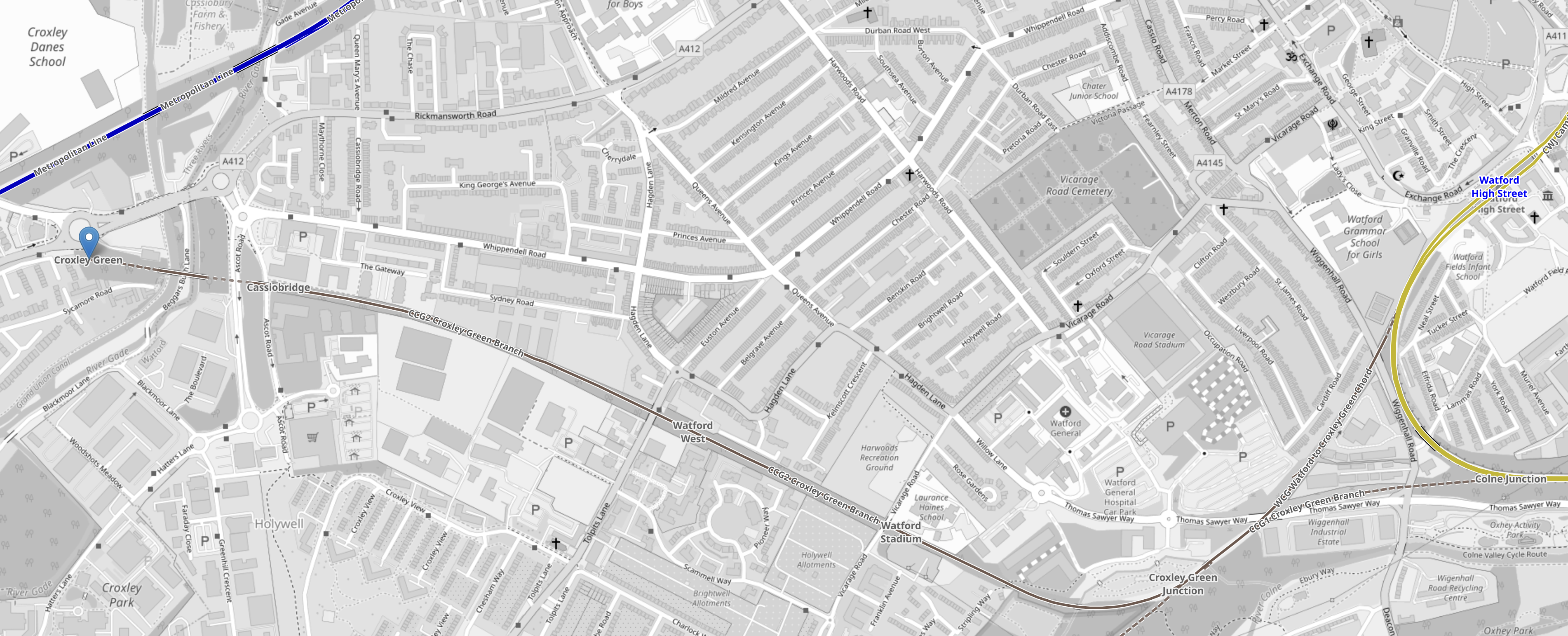
Note.
- The yellow loop at the East of the map is the Watford DC Line.
- Watford High Street station is on this loop.
- There is a triangular junction, that connects the former Croxley Green branch to the Watford DC Line.
- The terminus at Croxley Green station is marked by a blue arrow.
- There used to be intermediate stations at Cassiobridge, Watford West and Watford Stadium.
- This route was used for the failed attempt to build the Croxley Rail Link.
But could a Western extension of the Abbey Line be built?
- It would terminate at either Croxley Green or Cassiobridge.
- There would be intermediate stations at Watford West, Watford Stadium and Watford High Street.
- There would be two tph.
- Trains would be nine-car New Tubes For London.
- The current Abbey Line is 6.4 miles and would be run using battery power, with possible charging at St. Albans Abbey station.
- The tunnel under the West Coast Main Line would be run on battery power.
- The Western extension from Watford High Street station would be run using battery power, with possible charging at the Western end.
I believe, an extended Abbey Line could be a viable alternative to the ill-fated Croxley Rail Link.
- I have used battery power, as I doubt Health and Safety would allow any new third-rail electrification.
- I have used nine-car New Tubes For London for the extended Abbey Line, as their small cross-section would allow a smaller tunnel and they would be certified for running in tunnels.
- Some platforms on the Abbey Line would need to be lengthened, but these would be the only modifications, other than the possible installation of the charging system.
- The extended Abbey Line would serve Watford Hospital and Vicarage Road.
The capacity of the extended Abbey Line would be substantially more than the current line.
Conclusion
A common fleet used by the Bakerloo and Watford DC Line would appear to give advantages and it has been done successfully before.
But what the Bakerloo Line, the Watford DC Line, the Abbey Line and the Bakerloo Line Extension need is a good dose of holistic design.
Is The Nightmare On The Buses Going To Get Worse?
This morning after photographing the finish of the Bank Station Upgrade, I walked down the side of the new Cannon Street entrance to catch a 141 bus from King William Street to my home.

Note.
- There are two bus stops for the 21, 43 and 141 buses on King William Street; one Northbound and one Southbound.
- The bus stops are a two minute level walk from the gate-line at the Cannon Street entrance.
- To go between the gate-line and the Northbound stop requires no crossing of any road, but the route to the Southbound stop requires the use of a light-controlled crossing.
- The Cannon Street entrance is step-free and only a short walk, between the street and the platforms of the Docklands Light Railway and the Northern Line.
- The access to the Central Line is also easy, but a longer walk.
This afternoon, I walked the other way from the Southbound bus stop on King William Street to the new Cannon Street entrance of Bank station.
Note.
- It is a totally level walk.
- There are lights to help the crossing of King William Street.
- The concrete building on the other side of King William Street is the other end of the new station entrance.
- It looked to me, that there was a retail unit in the corner of that building. This was confirmed by station staff and it would surely be an ideal place for an upmarket takeaway.
- The building on the corner of Cannon Street and King William Street is a set of shared offices. Again it is in a prime position.
- You can also walk from the bus stop to the main Monument station entrance.
I timed myself from the Southbound stop on King William Street to the various platforms.
- Central Line – Under five minutes
- Dockland Light Railway – Under four minutes
- Northern Line – Under three minutes
Will these times encourage passengers to use the new entrance and its buses to North London?
If I was looking for offices for a foreign company, that wanted to be in the City, as I do occasionally for an American attorney, I would start in this area.
Step-Free Access On The Northern Line Is Rather Variable
If you look at the step-free access on this section of the Northern Line, you find the following.
- Euston – Escalators – No Lifts until High Speed Two
- King’s Cross – Escalators – One Lift to platform
- Angel – Escalators – No Lifts – Medium walk to the buses
- Old Street – Escalators – No Lifts – Medium walk to the buses
- Moorgate – Escalators – Long Lift route – Medium walk to the buses
- Bank (North) – Escalators – Lots of Steps – Medium walk to the buses
- Bank (Cannon Street) – Escalators – Two Lifts to platforms – Short walk to buses
- London Bridge – Escalators – One Lift to platform – Steps to buses
Note.
- If I was going between My House and the Northern Line South of Bank station, I’d change between the 141 bus and the Northern Line at the Cannon Street entrance to Bank station.
- Alternatively, I can take a 38 bus to the Angel and join the route there. But that route can be very slow coming North, as there is a lot of walking. Going South, it’s also likely to be blocked by a Tesco truck at the Angel.
- Between My House and the Docklands Light Railway, I’d change from the 141 bus at the Cannon Street entrance to Bank station.
- I might even take that route, if I wanted the Central Line out of Bank.
It does appear that as the new Cannon Street entrance to Bank station has been well-designed with full step-free access and short walks to the bus stops, that it will be the interchange of choice for many travellers to and from the area, who are using the buses.
Conclusion
I feel that a lot of passengers from North London will use the 21, 43 and 141 buses to access the Central and Northern Lines, and the Docklands Light Railway using the new Cannon Street entrance to the Bank station complex.
I very much feel that all three bus routes will have a lot more passengers, so the Nightmare On The Buses, is likely to get worse.
Surrey Quays Station On The London Overground Getting Step-Free Access
This is part of the package of upgrades that I wrote about in More Frequent Trains And A New Station For The London Overground, that was published in 2019.
It looks like the upgrade will start this year. and be finished in 2026.
Could The Giant Station At Bank, Liverpool Street, Monument And Moorgate Be Considered A Superhub?
In Is The City Of London Moving Towards One Giant Station?, I showed how the four stations were being drawn together and developed as one large station that served the heart of the City of London.
London is also developing other large interchange stations that could claim because of their connectivity could be classed as London superhub stations.
- Canary Wharf stations, which connect the Elizabeth and Jubilee Lines, and the Docklands Light Railway.
- Old Oak Common station, which could bring together the Central, Chiltern and Elizabeth Lines, the London Overground and High Speed Two.
- Stratford station, which connects the Central, Elizabeth and Jubilee Lines, the Docklands Light Railway, the London Overground, High Speed One and the Great Eastern Main Line.
- Whitechapel station, which connects the Circle, District, Elizabeth and Hammersmith & City Lines, and the London Overground.
But what are the characteristics of a superhub station?
A Lot Of Lines And Services
Obviously, it must have a lot of lines and services, so perhaps Clapham Junction station is the original superhub station.
All Lines Should Have Step-Free Access
This surely, goes without saying.
There Should Be Lots of Information
If the station is large it needs a lot of information and there’s probably the space to put it.
Helpful Staff
Should we have a fully-staffed kiosk at superhub stations, as there are at some main line stations?
Good Bus Connections
Bus connections at a superhub station must be comprehensive and probably connect to other superhubs.
There Should Be A Selection Of Shops For Travellers
I do my daily food and other shopping, as I travel around London. I’ll often use a station like Paddington with a good selection of shops.
Toilets
There are not enough public toilets in London.
Cash Machines
I know we’re using less cash, but a large station is a secure place to put a cash-machine.
Works Of Art
I also believe that railway stations are a secure place to put some of those large bronze sculptures and other works of art, that are currently locked away in the storerooms of galleries.
Leyton Station – 26th January 2023
Leyton station on the Central Line, is going to be upgraded as I wrote about in Leyton Station Set For £14m Upgrade.
I said this in the related post.
Leyton Station will receive step-free access and a new ticket hall and concourse thanks to £14 million from the government’s Levelling Up Fund.
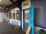
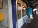
I took these pictures today.


Note.
- The station has two waiting rooms and at least one toilet.
- The London-bound platform has a unique cloisters with a glass roof.
- A new ticket office and concourse, would improve the look of the station.
- Well-designed step-free access improves any station.
- The platforms are long.
I think it is a station with the potential to be one of the best.
These are a couple of thoughts.
The Red Bridge At The Eastern End Of The Station
This Google Map shows the station.
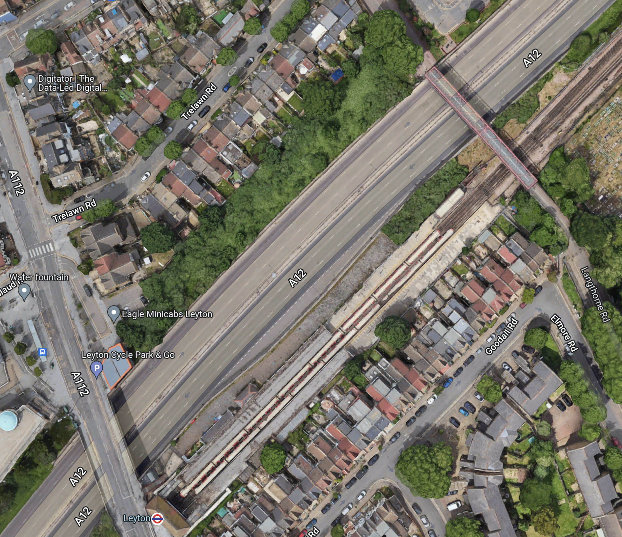
Note.
- The station buildings are in the South-West corner of the map.
- The red bridge is in the North-East corner of the map.
- Two trains are in the station, with plenty of space at both ends.
Would it be worthwhile and possible to add access to the station from the bridge?
Step-Free Access Between Train And Platform
This picture shows the current access between train and platform.
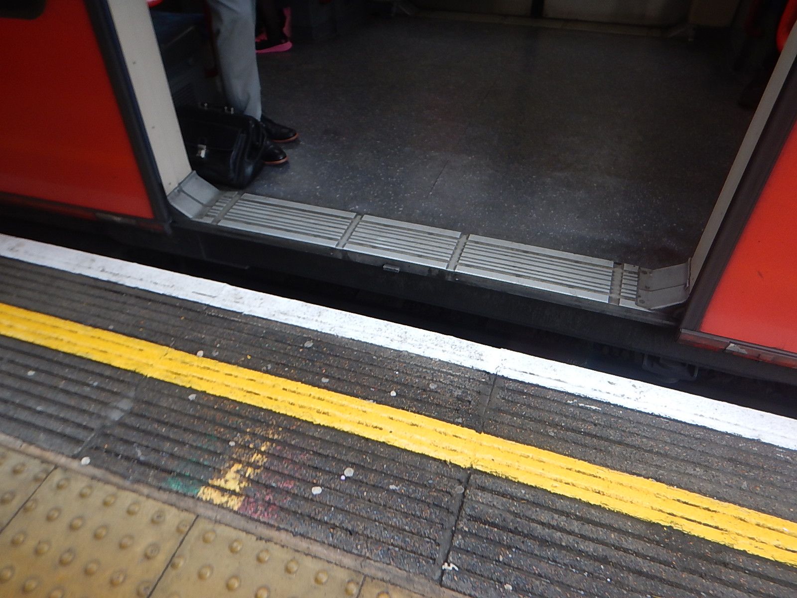
As the edge of the platforms will probably be realigned, would it be sensible to make the access better?
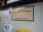
Bowes Park Station – 12th January 2023
I’d never used Bowes Park station until I moved back to London in 2011, despite the fact I had friends in the 1960s, who lived nearby.
Today, I was wanting to go from the Northern end of the Piccadilly Line to Moorgate station.
There are a number of ways to do this journey.
- Piccadilly Line to Bounds Green tube station and then a Great Northern train from Bowes Park station to Moorgate
- Piccadilly Line to Wood Green tube station and then a 141 bus to Moorgate.
- Piccadilly Line to Manor House tube station and then a 141 bus to Moorgate.
- Take the double cross-platform change route, I outlined in Extending The Elizabeth Line – Improving The Northern City Line.
I decided to take the first route.
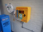
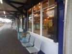
I took these pictures at Bowes Park station.
Note.
- The station has a warm well-stocked cafe, that is an asset to the station.
- The station has a defibrillator.
In an ideal world the station would have step-free access, as this would give a step-free route to Moorgate and the Elizabeth Line.
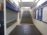
I returned a day later and took these pictures to see if a lift could be fitted.
I don’t think it would be one of the most difficult or expensive jobs to fit in a lift, that took passengers between the platform and the bridge.
The existing stairs would be retained and fitted with a decent fully-compliant handrail.
If a single lift were to be placed on the opposite side to the stairs, passenger access to the station would be possible during the installation.
