More Frequent Trains And A New Station For The London Overground
The title of this post, is the same as that of this article on IanVisits.
This is said.
In a statement, the government agreed to requests for £80.8 million from the GLA to support transport upgrades so that 14,000 homes can be built along the East London Line.
Upgrades include.
- New Bermondsey station, which was originally to be called Surrey Canal Road, will be built.
- A second entrance will be built at Surrey Quays station.
- Frequency between Dalston Junction and Clapham Junction stations will be increased from four trains per hour (tph) to six tph.
- Frequency between Highbury & Islington and Crystal Palace stations will be increased from four tph to six tph.
The frequency upgrades will mean twenty tph between Dalston Junction and Surrey Quays stations, or a train every three minutes as opposed to the current three minutes and forty-five seconds.
A few thoughts follow.
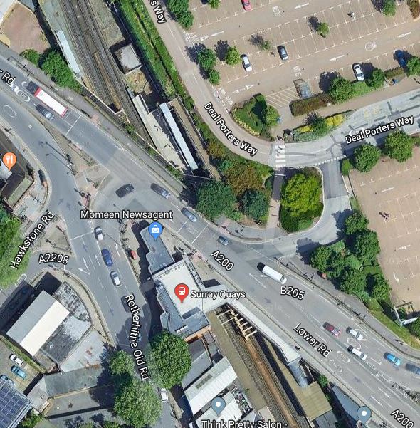
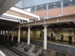
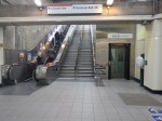
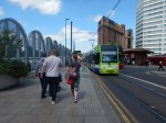
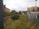
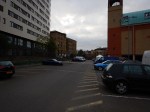
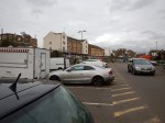
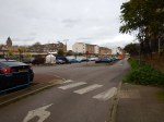
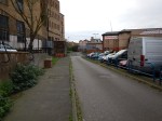
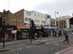
Surrey Quays Station Upgrade
Ian’s article says this about the new entrance at Surrey Quays station.
The very cramped Surrey Quays station gets a second entrance, which will run under the main road and be based on the north side, where the shopping centre car park is today. That avoids crossing two busy roads, which can take some time if you’re waiting for the lights to change.
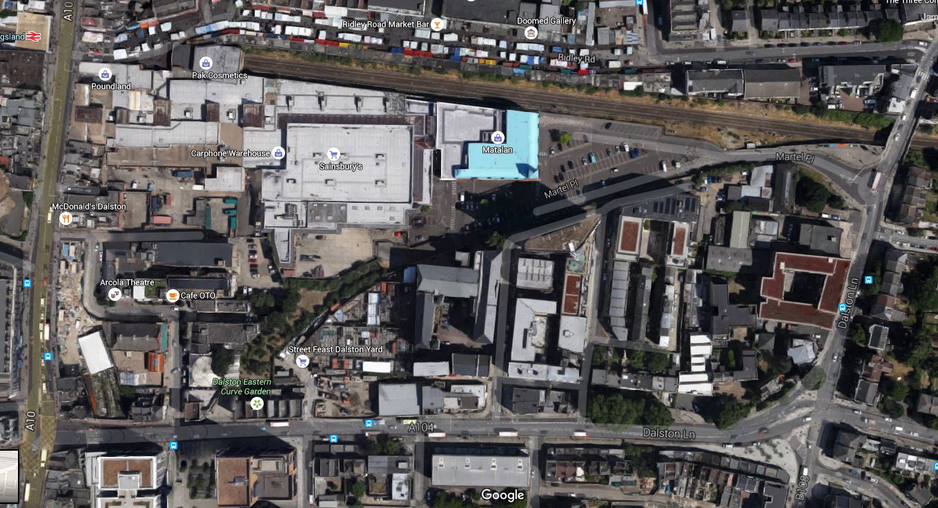
This Google Map shows the station and the car park of the Shopping Centre.
These are my pictures, taken at and around the station.
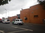
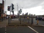
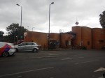
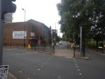

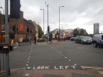
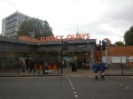
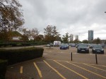
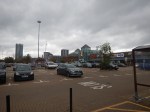
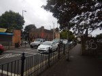
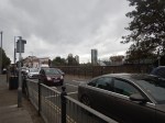
Traffic is bad and the subway suggested by Ian’s wording will be very welcome.
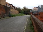
Collateral Benefits At New Cross Gate
New Cross Gate station will be one of several stations along the East London Line to see benefits in service frequency and quality.
The train frequency on East London Line services will rise from eight tph to ten tph.
But this is not all that should or could happen.
- The service between Highbury & Islington and West Croydon stations could rise from four tph to six tph.
- This would mean that New Cross Gate would have a twelve tph service to and from Whitechapel, which in a year or so, will have Crossrail connections to Canary Wharf, Bond Street, Paddington and Heathrow.
- Southeastern should be getting new higher-capacity, higher-performance and possibly longer trains to replace their elderly trains into London Bridge.
- Charing Cross station is redeveloped into a higher-capacity, cross-river station, to allow more trains.
- Digital signalling, as used on Thameslink will be extended to cover all trains through New Cross and New Cross Gate.
- The Docklands Light Railway to Lewisham will get new and higher-capacity trains.
- Southeastern Metro services could go to the London Overground.
Could this all mean that the East London Line, Southeastern and Crossrail will more than hold the fort until it is decided to build the Bakerloo Line Extension?
The Bakerloo Line Extension
This map from TfL shows the route of the Bakerloo Line Extension.
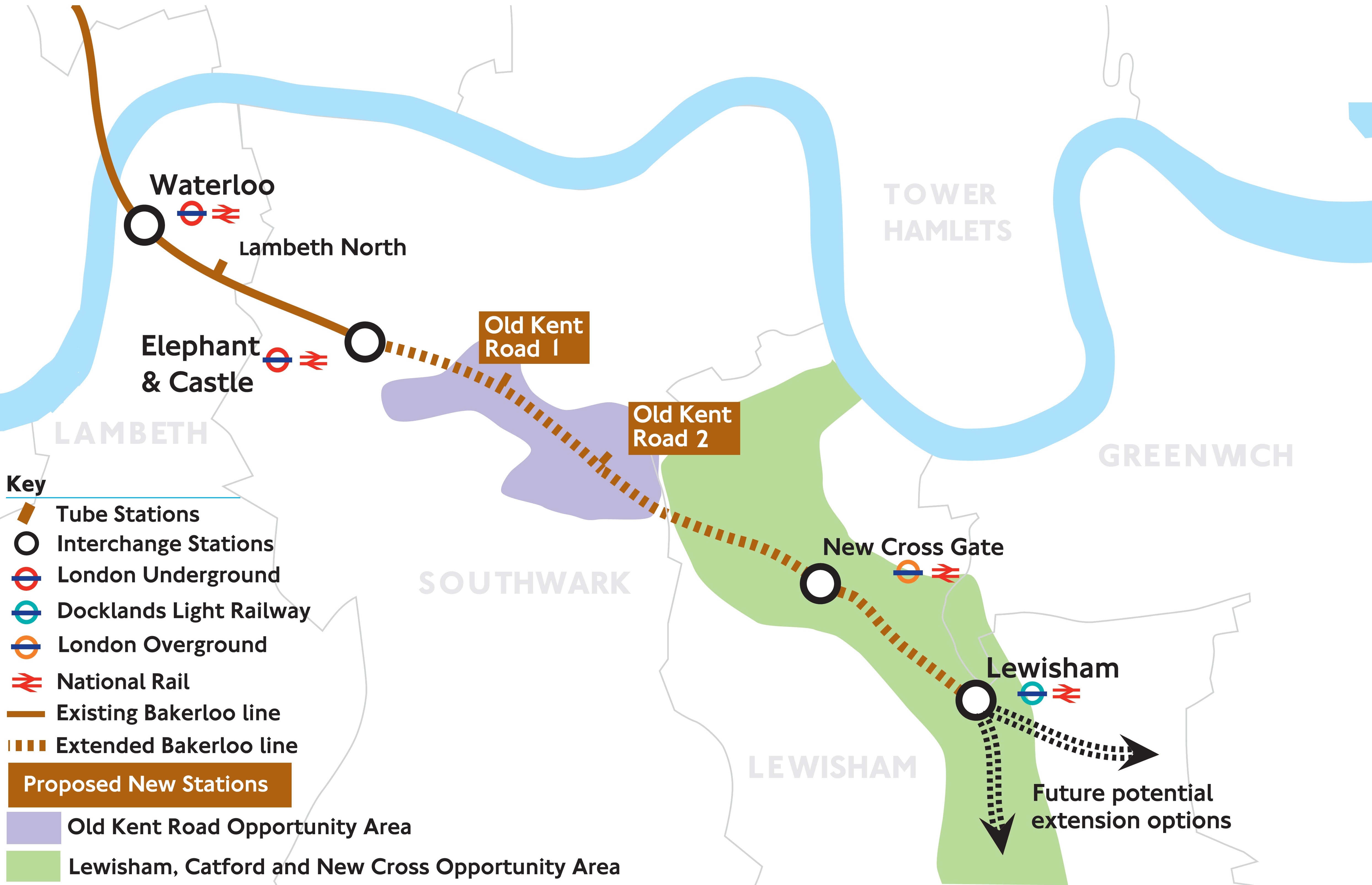
If and when the Bakerloo Line Extension is built, New Cross Gate will surely become a major transport hub.
If you look at the current and proposed stations on the Southern section of an extended Bakerloo Line, you can say the following.
- Paddington will get a step-free pedestrian link between Crossrail and the Bakerloo Line.
- Charing Cross will benefit from more Southeastern Metro services into the main line station.
- Waterloo will benefit from more Southeastern Metro services through the attached Waterloo East station.
- Elephant & Castle station will benefit from more Thameslink services through the attached main line station.
- New Cross Gate will benefit from more Southeastern Metro and East London Line services through the station.
- Lewisham will benefit from more Southeastern Metro services through the station.
But there are no interim benefits for the blue-mauve area, that will be served by the proposed Old Kent Road 1 and Old Kent Road 2 stations.
In addition, is there a need to add capacity between the New Cross area and Lewisham? Southeastern improvements will help, but the Bakerloo Line Extension will do a lot more!
Except for these two stations, is there a reason to build an extension to the Bakerloo Line, as train services between Charing Cross, Waterloo East and New Cross and Lewisham will be significantly increased in frequency, reach and quality?
A Bakerloo Line Extension Redesign
Whatever happens to the Bakerloo Line, the following should be done.
- New walk-through trains running at a higher-frequency on the current route.
- Major access improvements and better connection to main line services at Elephant & Castle, Waterloo East, Charing Cross and Willesden Junction stations.
- A radical reorganisation North of Queen’s Park station, in conjunction with the Watford DC Line and the proposed West London Orbital Railway.
This would improve the current line, but it would do nothing for those living where the extension will go!
So why not do what is happening to the Northern Line at Battersea and create a short extension to the Bakerloo Line that serves the areas that need it and one that can be extended in the future?
- You could argue, that the extension to Lewisham is short and it could be extended to Hayes and other places.
- I also think, that the route goes via New Cross Gate, as that is one of the few sites in the area, from where a large tunnel could be built.
Ideally, what could be needed is a high-capacity public transport link from Elephant & Castle and Greenwich and/or Lewisham via the Old Kent Road, New Cross Gate and New Cross.
The Germans, the Dutch and others wouldn’t mess about and would run trams along the road, but that would go down with the locals like a lead West London Tram.
So it looks like some form of extension of the Bakerloo Line is the only way to go.
Consider.
- Two-platform terminal stations at Brixton and Walthamstow Central handle up to thirty-six tph on the Victoria Line.
- New Cross Gate and New Cross stations are about five hundred metres apart.
- Double-ended stations like Knightsbridge on the Piccadilly Line and Kings Cross on the Victoria Line work very well.
I would look at building a double-ended Bakerloo Line station deep underneath New Cross Road.
- It would be connected by escalators and lifts to the existing stations at New Cross Gate in the West and New Cross in the East.
- Provision would be made to extend the line further to either Greenwich or Lewisham.
- New Cross and Lewisham already have a high-frequency connection of six tph.
- The whole extension could be built from the single tunnelling location on the Sainsbury’s site at New Cross Gate.
- There would be no necessity for any works at Lewisham station.
It would probably need more services to be run between New Cross and Lewisham.
Current Services Between New Cross And Lewisham
Southeastern currently runs these services between New Cross and Lewisham.
- London Cannon Street and Slade Green via Sidcup
- London Cannon Street and Orpington via Grove Park
- London Cannon Street and Hayes
All services are two tph.
Extending The East London Line Service South From New Cross
New Cross is served by the only short service on the London Overground; the four tph between Dalston Junction and New Cross stations.
So could this East London Line service be extended South to serve Lewisham to increase services between New Cross and Lewisham?
This map from carto.metro.free.fr shows the lines at New Cross station.
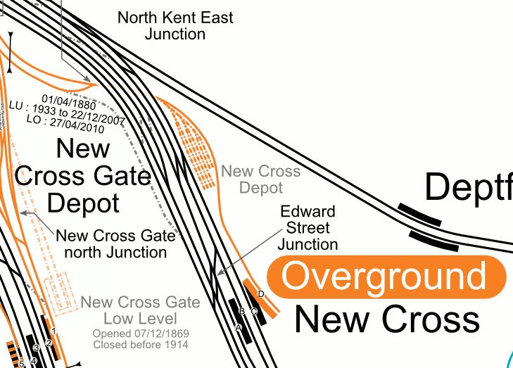
Note how the double-track East London Line, shown in orange, arrives from Surrey Quays station arrives in the North-Western corner of the map, becomes a single-track and then goes under the main lines before going into the bay platform D.
This Google Map shows the same area.
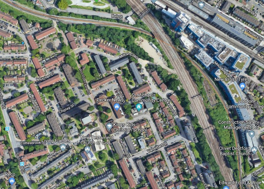
The London Overground track is clearly visible.
Could extra track be added, to enable the following?
- Southbound trains could join the main line and stop in Platform C
- Northbound trains could leave the main line after stopping in Platform A and go towards Surrey Quays station.
If this is possible, then it would give a four tph service between Dalston Junction and Lewisham, with an important stop at Whitechapel to connect to Crossrail.
Lewisham doesn’t have the space for a terminal platform, but there would appear two possible terminals South of Lewisham.
- Hayes – Journey time to and from Dalston Junction would take around 53 minutes.
- Orpington – Journey time to and from Dalston Junction would take around 50 minutes.
Both stations would make ideal terminals.
- They have bay platforms for terminating the trains.
- Round trips would be a convenient two hours.
- Eight trains would be needed for the service.
- New Cross will have the same four tph to and from Dalston Junction as it does now!
- Lewisham and Dalston Junction would have a four tph service that would take 27 minutes.
The service could even be split with two tph to each terminal.
Will the Extended Services Need To Replace Other Services?
Currently Hayes has these current Off Peak services.
- Two tph to Cannon Street via London Bridge
- Two tph to Charing Cross via London Bridge
I would expect that if digital signalling is applied through the area, that the extra services could be added to Hayes and Orpington as decided.
An Improved Hayes Line
Transport for London and various commentators always assume that the Bakerloo Line will eventually take over the Hayes Line.
This will or could mean the following.
- Passengers used to a full-size train looking out on the countryside and back gardens through big windows, will have to get used to a more restricted view.
- Platforms on the Hayes Line will need to be rebuilt, so that two different size of train will be step-free between train and platform.
- The service could be slower.
- The ability to walk through an increasingly pedestrianised Central London to and from Cannon Street, Charing Cross and London Bridge will be lost.
- Loss of First Class seats. which will happen anyway!
I think that passengers could want to stick with the current service.
The only reason to allow the Bakerloo Line Extension to take over the Hayes Line, is that it would allow another four tph to run between Lewisham and London Bridge. But digital signalling could give the same benefit!
But what if the Overground muscled in?
The Hayes Line could take up to four tph between Dalston Junction and Hayes, via Lewisham and New Cross, which would give these benefits.
- Increased capacity on the Hayes Line.
- An excellent connection to Crossrail, which would give a better connection to the West End, Liverpool Street and Heathrow.
- Better connection to the Eastern side of the City of London and Canary Wharf.
- It could free up four tph between New Cross and London Bridge.
- Same-platform interchange between Southeastern and East London Line services at Lewisham and New Cross.
There would need to be these changes to the infrastructure.
- A new track layout at New Cross.
- Installation of digital signalling.
The latter will happen anyway.
Times To And From Crossrail
Times to and from Whitechapel, with its Crossrail connection are.
- Lewisham – 17 minutes
- Hayes – 44 minutes
- Orpington – 41 minutes
The current service between Orpington and Farrington, which also will connect to Crossrail, takes 52 minutes.
Penge Interchange
Although, this has not been funded, I think that this new interchange could be very much in Transport for London’s plans.
I discuss the possible Penge Interchange station in Penge Interchange.
It’s certainly something to watch out for, as it could improve connectivity by a large amount.
The View From The Dalston Omnibus
For decades, Dalston had a terrible reputation and then came the Overground, which changed everything.
There are now these combined devices from the two Dalston stations.
- Eight tph to Stratford
- Four tph to Richmond via Willesden Junction
- Four tph to Clapham Junction via Willesden Junction
- Four tph to Clapham Junction via Surrey Quays
- Four tph to Crystal Palace via Surrey Quays
- Four tph to New Cross via Surrey Quays
- Four tph to West Croydon via Surrey Quays
There is also a useful eight tph connecting service between Dalston Junction and Highbury & Islington.
In the next couple of years, these developments should happen.
- Services on the East London Line will be increased with an extra two tph to Clapham Junction and Crystal Palace.
- Services on the North London Line will be increased to cope with overcrowding. As the Dalston Junction and Highbury & Islington connecting service will be going to ten tph, it would seem logical that the North London Line service should match this frequency.
- Crossrail will open and Dalston will have a twenty tph connection to its services at Whitechapel.
Dalston needs better connections to either main line terminal stations or their interchanges a few miles out.
Currently, Dalston has very useful connections to the following main interchanges.
- Stratford for the Great Eastern Main Line.
- Clapham Junction for the South Western Railway and Southern services.
- Richmond for Windsor and Reading services.
- Whitechapel will provide a link to Crossrail.
- In addition the planned update at Norwood Junction will give better connection to services to Gatwick, Brighton and other services to the South of Croydon.
Better interchanges are needed with services to the North and the South East of London.
Extending the Dalston Junction and New Cross service to Hayes or Orpington via Lewisham could greater improve the train service from Dalston, by providing interchange to services fanning out into and beyond South East London.
Conclusion
I am drawn to these two conclusions.
- The Bakerloo Line should be extended via two new Old Kent Road stations to a double-ended terminal station in New Cross with interchange to both New Cross Gate and New Cross stations.
- The New Cross branch of the London Overground should be extended through Lewisham to Orpington and/or Hayes.
My preferred destination for the London Overground service could be Hayes, as this would surely help to free up paths through Lewisham and London Bridge.
House Prices And Stations
I clipped this from the Evening Standard.
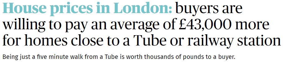
Enough said!
I purposely chose my house to be within ten minutes walk from the two Dalston Overground stations, that would open a couple of years after I moved in.
- It is also within walking distance of twelve major bus routes. All the routes can carry wheel-chairs, if I should ever need one!
- Five routes have stops, within a hundred metres, serving Bank, British Museum, Euston, Harley Street, Kings Cross, London Bridge, Manor House, Moorgate, Piccadilly Circus, Shaftesbury Avenue, St. Pauls, University College Hospital and Victoria.
- I’m only fifty metres from a major cycling route between the City and White Hart Lane.
- I even have a garage, that opens onto the street! But no car!
- My road is wide and there is usually plenty of parking space for visitors or on-line deliveries.
- A taxi ride from Euston, Liverpool Street or Kings Cross is usually under fifteen pounds at all times.
It will get even better!
- When Crossrail opens, I will have 10-12 buses per hour to the Moorgate/Liverpool Street station.
- Dalston Junction station will get a frequency of twenty trains per hour to and from Canada Water, Shoreditch and Whitechapel, that fan out to a selection of places in South London like Crystal Palace, Clapham Junction, Peckham and Penge.
- Dalston Kingsland station will get a frequency of twelve trains per hour to Stratford in the East and Camden, Clapham Junction, Hampstead and High Speed Two in the West.
- I will probably get a series of electric car charging points in the parking spaces in the road, where I live.
- I could put a personal electric car charging point in my garage.
I’m told the value of my house has risen well in the almost ten years, I’ve owned it.
Did somebody once say, that the location of a property, were the three most important things about it?
Conclusion
Make sure your next property has good access to public transport.
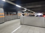
The Steps At Dalston Junction Station
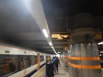
Dalston Junction is a four-platform station and these are the only stairs at the station.

I think the design is excellent.
- They serve all four platforms, so you can’t go the wrong way!
- They are very wide, so have a high capacity.
- There are effectively four handrails for those like me, who want or need to hold on.
- Fit travellers who can lift their case, can use the stairs.
- There is a landing half-way up.
- The stairs are well-lit.
- in 2017-2018, the stairs handled nearly six million passengers.
- The small number of interchange passengers don’t need to use the stairs and walk between platforms on the level.
- The steps are Transport for London’s typical low-slip design.
- At the bottom of the staircase, there is a wide landing area with two train information displays and a 20-30 metre walks to the four platforms.
- At the top of the staircase there is a wide lobby, with the wide gate-line in front of passengers coming up the stairs.
- There is usually, a member of the station staff watching the passenger flows and answering any questions.
But above all there is a single lift about ten-twenty metres from the stairs, so avoiding the stairs is easy and obvious.
I have seen few stairs in stations as well-designed as these.
A few more general observations.
Wide Stairs With A Double Rail In the Middle
This design of stairs is being increasingly seen in London and around Europe.
In Stairs And A Lift At Cannon Street Station, I show a similar installation.
But there are loads like this monstrosity at Bethnal Green station in Before Overground – Stairs Not Fit For Purpose.
How many stations could be improved by widening the staircase?
Probably quite a few, but many staircases are constrained within solid walls.
Handrails
Transport for London generally use round and easy-to-grip handrails.
These are the best I’ve seen, which are on the Amsterdam Metro.

Some on British Rail-era stations are big and square and must be difficult for those with small or frail hands.
An Obvious Lift
At Dalston Junction, the lift is obvious as you approach the stairs.
But in some stations, the lifts are at the other end of the platform.
The Greenford Solution
These pictures show the solution at Greenford station.


Note.
- There is an up-escalator.
- A staircase,which is as wide as possible.
- There are three handrails with a low rail for those who prefer it.
- There is an inclined lift, which saves space.
I think we’ll see more step-free installations of this style.
Safety
I won’t comment on safety, as I don’t want to bring bad luck to the installations.
Conclusion
All those designing staircases and lift systems for stations, should be made to visit Dalston Junction and Greenford stations in the Peak.
Beggars On The London Overground
Beggars on the London Overground are becoming a nuisance.
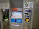
Today, as I returned home, I saw this notice at Dalston Junction station.
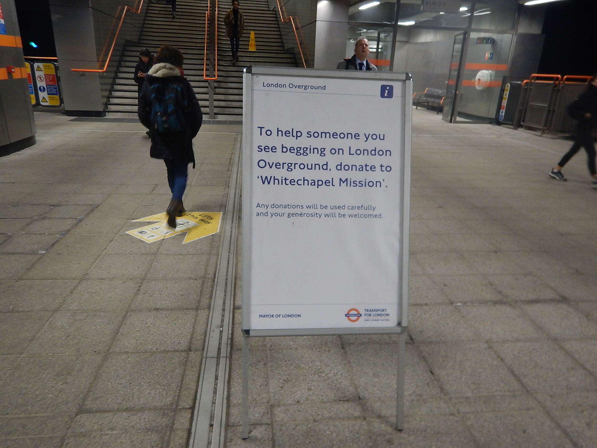
So I made a small donation to the Whitechapel Mission.
Let’s hope it helps.
Dalston To Gatwick And Back For £6.15
This could be one of the best travel bargains for those like me, who have the privilege of a Freedom Pass.
I can use my pass, as far as East Croydon or West Croydon stations, but I must buy a ticket or use contactless to get to Gatwick Airport.
So I use the following route.
- London Overground to West Croydon station using my Freedom Pass.
- London Tramlink to East Croydon station using my Freedom Pass.
- Thameslink or Southern to Gatwick using a contactless credit card.
I paid £3.10 for the last leg.
These pictures show my journey to Gatwick.


Note that as my flight on Friday was early, I was staying the the Premier Inn, where I watched the World Cup 2018, before taking an early bath and an early bed.
The only problem was finding how to get from the shuttle to the Premier Inn at the Gatwick North Terminal.
Coming back, was just a two-legged journey.
- Thameslink to London Bridge station using the ticket I bought on the way out and my Freedom Pass.
- A 141 bus to just outside my house from the forecourt of London Bridge to just outside my house using my Freedom Pass.
I paid £3.05 for the ticket between Gatwick and East Croydon.
The Journey Could Be Improved
I do this journey a lot of times, especially as it is an easy way to the South Coast.
- Getting to Victoria will continue to be difficult, until there is a comprehensive rebuild of Highbury and Islington station.
- I could go to St. Pancras and get Thameslink, but there are time restrictions on using a Freedom Pass early in the morning.
- I could get a 141 bus to London Bridge, but going South seems a lot longer than coming North due to traffic, road works and bus frequency.
So what would I do to improve things?
The Overground Should Go To East Croydon Not West Croydon Station
Often, when I do the journey to West Croydon, the train is almost empty from perhaps Penge West station.
So do passengers from the East London Line wanting to go to Croydon choose a train to East Croydon?
- East Croydon has a cornucopia of services going all over the South.
- West Croydon has only a few services and no long distance ones.
- There are no intermediate stations between either station and Norwood Junction station.
- East Croydon is the hub station of London Tramlink.
- There is only a tram service going East at West Croydon.
- To get a tram to Wimbledon at West Croydon, it is a long walk, which is badly signposted.
What is needed is a dedicated Overground platform at East Croydon station.
- One platform could handle six trains per hour (tph)
- It would create a simple one-change link between Gatwick Airport, Brighton and other South Coast destinations to East London and especially Whitechapel station, for the Eastern branches of Crossrail.
I know space is difficult, but I suspect that there is a solution somewhere.
Refurbish The Class 700 Trains
The Class 700 trains have only been in service for about two years, but when you travel on one after using another train, you realise their inadequacies.
- The seats are worse than most and certainly not up to the standard of those on Electrostars, like the Class 377 train, I took to Gatwick.
- There is no wi-fi.
- There are no power sockets to charge a mobile phone or laptop.
- Tables don’t exist in most of Standard Class.
- There’s nowhere to put a drink.
- Some drivers, who worked for East Midlands Trains told me, that they are not fast enough for the Midland Main Line.
They are crap design of the highest class. They certainly don’t say “Welcome to the UK”, to arriving passengers at Gatwick.
But I do believe the trains can be sorted, as the Class 707 trains are better.
Extend The Freedom Pass Area
A Freedom Pass works to any station in Fare Zone 6, with a few extensions like Shenfield station using TfL Rail and Watford Junction station using the Overground.
I don’t think that the area, where the Freedom Pass can be used for free, should be extended, but the technology must exist to link a Freedom Pass with a credit or debit card, so that all journeys within the Oyster contactless area are charged appropriately.
I’m surprised that this or something like it hasn’t been implemented yet, as surely it could be an encouragement for Freedom Pass holders to vote for a Mayoral candidate.
Conclusion
Travelling to Gatwick will get easier and more comfortable.
Four Trains Per Hour Between Dalston Junction And Battersea Park Stations
Normally, there is only one train per day in both directions between Dalston Junction and Battersea Park stations.
Wikipedia says this about the service.
Until December 2012, Southern operated a twice-hourly service from London Victoria to London Bridge via Denmark Hill. This ceased when London Overground’s Clapham Junction to Dalston Junction service commenced at that time. However, since December 2012, a skeleton London Overground service has run to/from Battersea Park (instead of Clapham Junction) at the extreme ends of the day to retain a “parliamentary service” between Battersea Park and Clapham High Street.
But today, London Overground were running four trains per hour between Dalston Junction and Battersea Park stations, as there was a track fault, which meant trains couldn’t get between Wandsworth Road and Clapham Junction stations.
I took these pictures on my journey.


It certainly looked, like London Overground weren’t having much trouble, in running four trains per hour between Dalston Junction and Battersea Park stations.
Do We Sometimes Misjudge The Consequence Of New Railways And Roads?
I ask this question after reading this article in the Hawick News, which is entitled Calls for extension of Borders Railway to Hawick building up fresh head of steam.
It was this phrase that worried me.
“Hawick businesses are feeling the impact of a one-way ticket that is seeing local shoppers travel from Tweedbank to all points north without any reciprocal arrangements.
It looks like building the Borders Railway has hurt businesses in Hawick. And what about other places in the area like Selkirk?
I think we’ve seen this before in other places.
Where I live near Dalston Junction station, has seen a massive uplift, since the creation of the East London Line. It was in some ways predictable, but I don’t think Transport for London expected the uplift that happened.
Our predictions, were never good in the past, but they don’t seem to be improving.
I wonder how far out predictions will be for Crossrail/Thameslink?
Consider.
- Crossrail and Thameslink working together will make a lot more journeys single change.
- Crossrail has good connections with the East London Line.
- Crossrail gives much improved access to the Bakerloo and Northern City Lines.
- Crossrail/Thameslink gives much improved access to Canary Wharf, the City of London, Gatwick Airport, Heathrow Airport, Luton Airport and Oxford Street in the centre of the cap[ital.
One consequence I see, is that those with Freedom Passes like me, will use the new free railways to advantage.
Roll on 2018 and 2019!
My Links To Thameslink
Thameslink is a railway, I don’t use much these days, as getting to stations is not that easy, since London Bridge was taken off the route, by the rebuilding.
St. Pancras is an absolute pain of a station to use, as the station was designed by a sadist with long tunnels from the deep-level Underground lines.
Farringdon is a better interchange going South, as it is step-free from the Westbound Metropolitan Line, which I take from Whitechapel after using the East London Line from Dalston Junction. But going North coming home from Farringdon is not easy.
City Thameslink is a bit of a walk from the 56 bus, which stops by my house.
Blackfriars is not the easiest station to get to from my area.
These are my thoughts about using Thameslink after about 2018, when the Great Northern Metro is open with its new Class 717 trains.
My Link To Thameslink Going North
Living where I do approximately midway between Highbury and Islington, Dalston Junction and Essex Road stations, getting to some major rail termini can be difficult and if I was taking a case with me, I would have to use a bus or taxi.
I tend to avoid Highbury and Islington station going out, as the station and its environs is in desperate need of a rebuild and to get say to the Victoria Line for Kings Cross is a long and difficult walk from the bus stop and through the maze of roads and tunnels to the platform.
But with Essex Road station having a frequent bus service from the stop nearest my house and a 10 tph connection to Finsbury Park, that will be my route to get to Thameslink going North to Cambridge or Peterborough.
I don’t think I’ll be alone, in using the Great Northern Metro to get access to Thameslink to go North.
My Link To Thameslink Going South
I have a choice of routes to go South on Thameslink.
- I could take the same route as for going North, but the interchange at Finsbury Park is a dreaded down and upper.
- I can take a 141 or 21 bus to London Bridge station. I regularly use this route coming home, but going South is dreadfully slow through Bank.
- I can take a 38/56 bus to the Angel and get the Northern Line to London Bridge.
- I can take a 56 bus to St. Bartholomews Hospital and walk downhill to Farringdon station.
- I can take a train from Dalston Junction to Canada Water and then use the Jubilee Line.
- Don’t suggest the Victoria Line to St. Pancras as the walk in the depressing tunnel at Kings Cross is to be avoided at all costs.
- Don’t suggest a 30 bus to St. Pancras, as it requires a long walk through the busy Shopping Centre at St. Pancras because Thameslink doesn’t have a much needed Southern entrance.
- I could always go via Essex Road and Finsbury Park.
I actually would like to take a train from Dalston Junction to say New Cross Gate for East Croydon and get Thameslink or the myriad Southbound services from there.
But the new proposed timetable for 2018, would seem to make that an more difficult dream, unless I wanted to wait for a long time on say Norwood Junction station.
Conclusion
Going North is easy, but as they don’t serve the \greater East London, GTR treat us with contempt and make it difficult for us to use Thameslink easily, if we’re going South.
The Dalston Eastern Curve
In several posts like Improving The East London Line, An Opportunity For Dalston, Platforms 11 And 12 At Stratford and Missing Links On The Overground, I mention the Dalston Eastern Curve. Currently, the land is occupied by a community garden called unsurprisingly the Dalston Eastern Curve Garden.
The Google Map shows the area.
Dalston Eastern Curve
The line of the Dalston Eastern Curve is clearly shown, as it leaves the North London Line that goes across the map, and curves its way down to Dalston Junction station on Dalston Lane. The garden occupies the Southernmost section and has an entrance on the Lane.
These pictures show the area of the Curve.
If it were to be reinstated the big losers would be the car park of the Shopping Centre and the Garden.
A new reinstated Dalston Eastern rail curve would probably be covered, as is much of the Western Curve. After all, railway lines in tunnels or covered over can be used as building land for houses, offices, shopping centres or gardens.
The rebuilding plans for Dalston Shopping Centre,shown many months ago, showed an open-aired concept, rather than the dated layout it has today. It also appears that the landlord of the Dalston Eastern Curve Garden is the owner of the Shopping Centre.
So I suppose that what Transport for London and the Shopping Centre agree is needed, will be implemented.
Other trends and facts must also be taken into account.
- The walking route between the two Dalston stations is terrible.
- Car parking is increasingly non-profitable for Shopping Centres to provide.
- More people will use bicycles and public transport to get to Dalston.
- Four extra trains an hour, are already planned on the East London Line.
- The East London Line has a capacity of twenty-four trains an hour. TfL has stated these could be six cars after some platform extensions.
- The East London Line will be given better connectivity to South East London, possibly by extending from New Cross or creating interchanges at Brockley and Penge.
- The North London Line could have more passenger trains. Especially, if freight trains on the line can be reduced.
- Waltham Forest Council has ambitions to have trains from Walthamstow Central and Chingford to Stratford by a reinstated Hall Farm Curve.
- Crossrail 2 or not, there will be massive developments up the Lea Valley, including housing and the Walthamstow Wetlands.
- Crossrail will connect to the East London Line at Whitechapel. What effects will this have on Dalston?
- Joining services back-to-back is always a good idea, as Thameslink showed years ago. It reduces the number of trains, staff and platforms needed to provide the service.
And then there is Crossrail 2, which once it is defined and started, will change everybody’s plans for Central Dalston.
I believe that the Dalston Eastern Curve will eventually be reinstated.
The main reason will be the need to have more Northern destinations for all of those trains going up and down the East London Line. A reinstated curve will allow services to go to and from Stratford and possibly if the Hall Farm curve was also to be reinstated as far as Walthamstow and Chingford.
So a series of short routes are converted into one long one, from Stratford or Chingford to say West Croydon, Orpington, Ebbsfleet or wherever!
It should be noted that at present Chingford/Walthamstow to South London is a difficult crowded journey on the Victoria Line to get a train going south from either St. Pancras or Victoria. A reinstated Hall Farm Curve would make things better by giving access at Stratford to the Jubilee Line and Crossrail in 2019.
Savvy passengers going from Stratford to South London destinations, change at Canonbury. But they would probably prefer a direct train via the Dalston Eastern Curve.
One thing that will happen, is that when the Shopping Centre is rebuilt, then space will be left to reinstate the Dalston Eastern Curve.
Crossrail 2 October 2015 – Dalston Station
Are us plebs in humble Dalston going to get one of the best and busiest stations on Crossrail 2?
I wrote that opening statement in jest, but think about the proposed combined Dalston station’s position in London’s rail network.
- It is the most Northerly station before the two branches to New Southgate and Broxbourne link under Stamford Hill.
- Dalston Junction (Or is it Dalston South?) gives an escalator connection between Crossrail 2 and an up to twenty-four trains an hour to South-East London on the East London Line.
- Dalston Kingsland (Or is it Dalston North?) gives an escalator connection between Crossrail 2 and all those trains on the North London Line.
So Dalston will become the important interchange for a large number of cross-London journeys. Raynes Park to New Southgate may well be direct, but so many journeys like Norwood Junction to Brimsdown will just be a single change at Dalston.
Crossrail 2 will put Dalston in one of the most important places on the map of London’s rail network.
Crossrail 2’s proposal for Dalston Station
This Crossrail document is entitled Dalston Station.
The proposal in the document starts like this.
The Crossrail 2 station at Dalston would be a double-ended station, with an interchange at Dalston Junction at the southern end, and an interchange with Dalston Kingsland at the Northern end.
So we get three stations in one, which also means that at last there will be a true dry interchange between Dalston Kingsland station on the North London Line and Dalston Junction station on the East London Line.
This map from the document shows the layout of the two existing stations and their connection by means of two two-hundred and fifty metre long underground Crossrail 2 platforms.

Crossrail 2 Dalston Station
It would appear that two shafts will be sunk to the Crossrail 2 tunnels.
- The Southern one would be in the Tesco Express or the bar next door,
- The Northern one would be just to the north of Ridley Road in the block containing the NatWest Bank.
Note how much of the route of the Crossrail 2 tunnels, runs on the East side of Kingsland High Street, under the Shopping Centre and the new flats. The tunnels will be at least twenty metres down just to get past High Speed One, which runs under the North London Line and Dalston Kingsland station, so any older buildings will be well above any Crossrail 2 construction.
I would also suspect that High Speed One also makes designing and construction of the Kingsland end of the station challenging.
The Work Sites
The Crossrail 2 proposal for Dalston station is nothing but ambitious and to build it there will be no less than five work sites.
- Site A – Would be used as the main site for construction of the station tunnels and southern station shaft
- Site B – Would be used for construction of a new Crossrail 2 station entrance and ticket hall. The site includes properties on the southern side of Bradbury Street.
- Site C – Would be used for construction of the northern station shaft and escalator connection to the Crossrail 2 platforms
- Site D – Would be used for construction of a new bridge providing access from the new ticket hall to the westbound platform at Dalston Kingsland
- Site E – Would be used for construction of a station entrance and ticket hall, for interchange with Dalston Junction station.
But I would be very surprised if the work wasn’t phased so that the work-load in Dalston was spread and work is performed in a logical order.
Dalston Kingsland station is a dump compared to Dalston Junction station, with all the charm, access problems and convenience of a Victorian tube station.
In a reasonable world, it would be replaced now, whether Crossrail 2 is built soon or postponed to the Twenty-Second Century.
The need for a Site D indicates that a new bridge will be built across the station to give access. As Site D is currently in the construction site for new flats called Fifty Seven East and Dalston Kingland station desperately needs step-free access, then surely this bridge should be built now!
To further assess the work-sites, I walked along Tottenham Road to Site A, then crossed to Site E, before walking up Kingsland High Street to look at Sites B, C and D.


There is certainly, a lot going on and if everybody gets it right, it can become one of London’s more important High Streets.
What Is Already Happening In Kingsland High Street?
Before I come to my conclusions, I’ll say a little about what is already happening.
- Plans may have been published to rebuild Dalston Kingsland station.
- There are more projects to build flats in the area. London needs housing and as these will be designed so they don’t affect Crossrail 2, they will go ahead.
- The Dalston Kingsland Shopping Centre is supposed to be being rebuilt.
- There are also plans to improve the pedestrian flows on what is a very congested road for walkers.
- There will be other changes due to the Cycle Superhighway passing about fifty metres to the west of Kingsland High Street.
So in say four or five years time, we should have a better High Street and Kingsland station, whether Crossrail 2 is coming or not!
Conclusions
So what are my initial conclusions?
- Because of the station design, there will need to be some demolition at both current stations.
- Site A needs a full rebuild, as it has very little property of merit and I certainly wouldn’t miss the Subway, Tesco and the bar on the end. The shaft to access the new platforms, will probably be in the middle of the current Tesco.
- Site B is in a bad state with much of the property locked up. Some of the properties on Bradbury Street will need to be demolished to rebuild Dalston Kingsland station, let alone build the Crossrail 2 station. Will anybody mourn?
- Site C is where the Northern shaft will be. There will be some demolishion.
- Site D is a curious one in that it is inside a site that is being developed.
- Site E is where the new entrance to |Dalston Junction and the Crossrail 2 station is going to be built. I’d have hoped that the Crossrail 2 passages would have been laid out in the redesign of the Overground station. What’s been published gives me doubts!
- How much of the demolition will be of properties worth keeping? Those that I photographed didn’t shout save me!
There are three sites on the High Street, which will be very much affected by the rebuilding of Dalston Kingsland station and building of Crossrail 2.
- Site A, where the Southern shaft for the station is located.
- Site B, where the Northern entrance to the new station is proposed, is substantially closed at present.
- Site C, opposite Dalston Kingsland station that will contain the Northern shaft for the station and escalator connection to the Crossrail 2 platforms.
All could be developed with new residential or commercial properties on top.
I believe that the proposed plan for the new Crossrail 2 station should be treated as what it is, just a proposal.
Or at least as far as the above ground presence is concerned.
All three sites could be developed as welcoming portals to enhance the public transport system as it serves the area around Dalston.
I would apply the principle, that access to the Crossrail 2 station, should be available from both sides of Kingsland High Street at both the Northern and Southern ends.
I will now look at each site in detail.
Site A
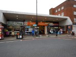
This is a Google Map showing Dalston Junction station and Site A.
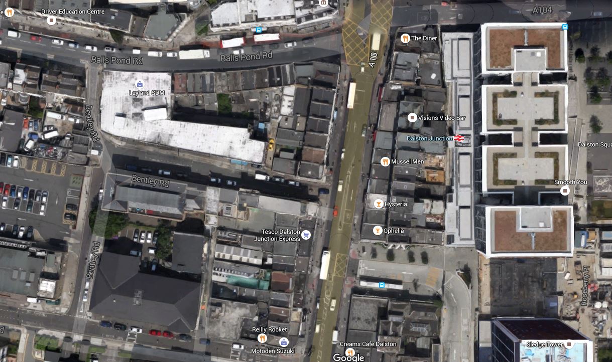
Dalston Junction Station And Site A
Note the station and its towers above in the East and Bentley Road Car Park in the West. You should be able to pick out the Tesco Express on the Kingsland Road.
I walk to Dalston Junction station most days to get the Overground. But it is not a good walking route.
- The pavements along the Balls Pond Road and Kingsland Road are very narrow and you are squashed between traffic and large numbers of walkers.
- It is easier to walk up Tottenham Road, but as with the other route crossing Kingsland Road can be difficult.
- If you live to the South West of Dalston Junction station, it is probably easier to walk to Haggerston station, as I do sometimes.
- It is particularly difficult to cross at the cross roads where the Balls Pond Road meets the Kingsland Road.
As the frontage of Site A on the Kingsland Road will have to be substantially demolished, in an ideal world, provision would be made to access the escalator and lift connection to the Crossrail 2 station from the West side of Kingsland Road.
Perhaps when the frontage of Site A on Kingsland Road is rebuilt after Crossrail 2 works have finished, it should provide a subway under the road to the station and the sort of shops and cafes, that passengers like in their stations.
It would welcome those, who live to the South West of Dalston Junction station to the area, just as Dalston Square on the other side of the station welcomes those from the South East.
Site B
This is a Google Map showing Dalston Kingsland station and Sites B and C.

Dalston Kingsland Station And Sites B And C
Site B is to the North of Dalston Kingsland station, on the West side of Kingsland High Street.
Note that this map was made before the construction of Fifty Seven East started, as Peacocks is still on the West side of Kingsland High Street.
I feel that if they rebuild Dalston Kingsland properly, then then are possibilities to not only build residential or commercial development on top of Site B, but over the railway and the station as well.
Land is expensive and the station occupies almost as much space as Fifty Seven East, so surely a similar sized development over the station would be a welcome addition to London’s housing stock.
I would also hope that the design of the station includes the following.
- A step-free subway under Kingsland High Street to Ridley Road Market. This is probably a given, as the escalators to Crossrail 2 go down from Site C.
- As the station is close to the Cycling Superhighway, I suspect that it will be heavily used by cyclists, who would need lots of secure bike parking.
- Personally, I would like easy walking access along Bradbury Street as I regularly walk to Dalston Kingsland station along that route.
There are certainly lots of possibilities to make the existing Dalston Kingsland station a welcoming North West gateway to Crossrail 2 and Kingsland High Street.
Site C
This is a Google Map showing Dalston Kingsland station and Sites B and C.
Dalston Kingsland Station And Sites B And C
Site C is to the North of Dalston Kingsland station, on the East side of Kingsland High Street. The NatWest bank, which is at the Northend of Site C is indicated.
Any development on this site must enhance the Ridley Road Market and provide that gateway for those travelling to and from the North East of the station.
It is essential that there is an entrance to the station on the East side of Kingsland High street, to give good connections to the market and the Shopping Centre.
My Ultimate Test Of The New Station
My ultimate test of the new Dalton station would be on a cold and wet day, to have the ability to arrive at Dalston Kingsland station on the North London Line, go down an escalator to Crossrail 2, where I can walk along to the Southern End, go up the escalator and exit the station on the West side through a rebuilt Site A.
And do it pushing my yet-to-be-born great-grandchild in a buggy! The spirit of my grandmother, who was born opposite Dalston Junction station would be very pleased!
