More Government Details Emerge On How Fleetwood’s Rail Link Will Be Restored – Using Tram-Train Technology
The title of this post, is the same as that of this article on the Blackpool Gazette.
This is the sub-heading.
New details have emerged about how the Government plans to restore the rail link between Fleetwood and Poulton using state-of-the-art tram-train technology.
These are points from the article, which mainly come from a letter to the local MP; Paul Maynard.
- In a letter to Mr Maynard, Rail Minister Huw Merriman has set out for the first time how the Government intends to restore the rail link.
- The Government is now looking at the finer details of a tram-train scheme and how the project can be funded.
- Tram-trains will be used for the link.
- The re-opened railway can be linked into the existing Blackpool to Fleetwood tramway, allowing services to run into the heart of Fleetwood.
- Services would operate twice hourly from Preston station to Poulton-le-Fylde over the existing heavy rail network, before joining a new light rail link between Poulton-le-Fylde and the Denham Way roundabout on Amounderness Way, calling at up to three new intermediate stops.
- From the roundabout, the services would continue on the existing Blackpool tram network towards Fleetwood town centre and Fleetwood ferry terminal.
- The Government is committed to the project.
These are my detailed thoughts.
The Route
The Blackpool Gazette article describes the route like this.
Services would operate twice hourly from Preston station to Poulton-le-Fylde over the existing heavy rail network, before joining a new light rail link between Poulton-le-Fylde and the Denham Way roundabout on Amounderness Way, calling at up to three new intermediate stops.
From the roundabout, the services would continue on the existing Blackpool tram network towards Fleetwood town centre and Fleetwood ferry terminal.
This map from OpenRailwayMap shows the route.
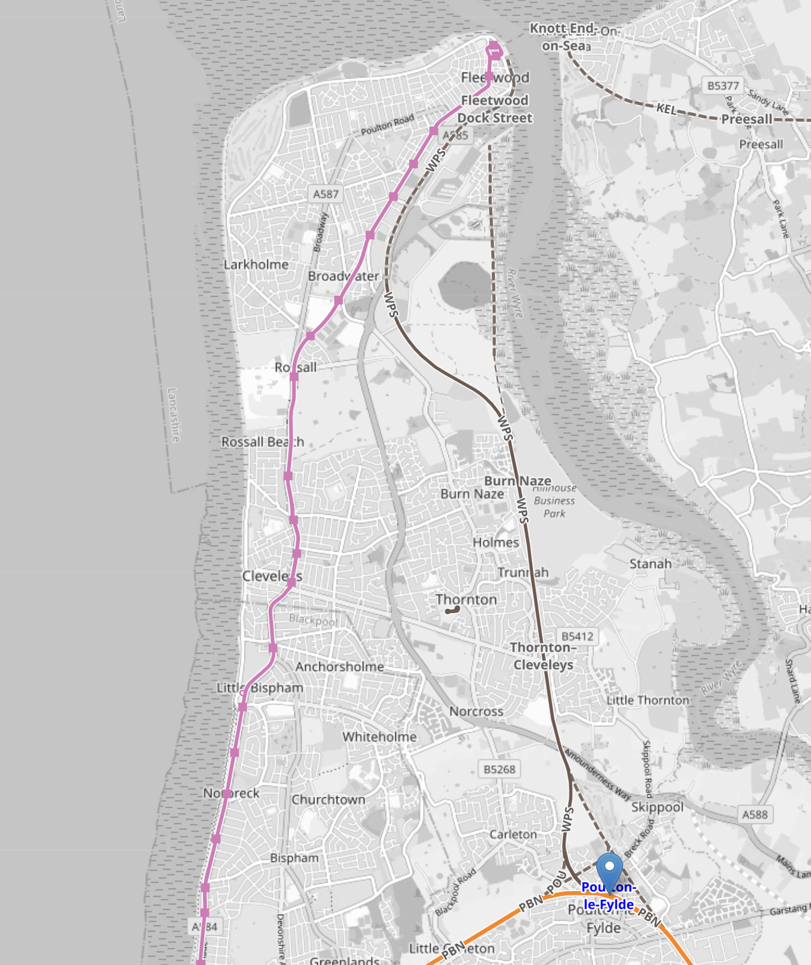
Note.
- Poulton-le-Fylde station is marked by the blue arrow in the South-East corner of the map.
- The pink line running up the coast is the Blackpool tramway.
- The Blackpool tramway terminates at Fleetwood Ferry at the top of the map.
This second OpenRailwayMap shows Fleetwood Ferry tram terminus.
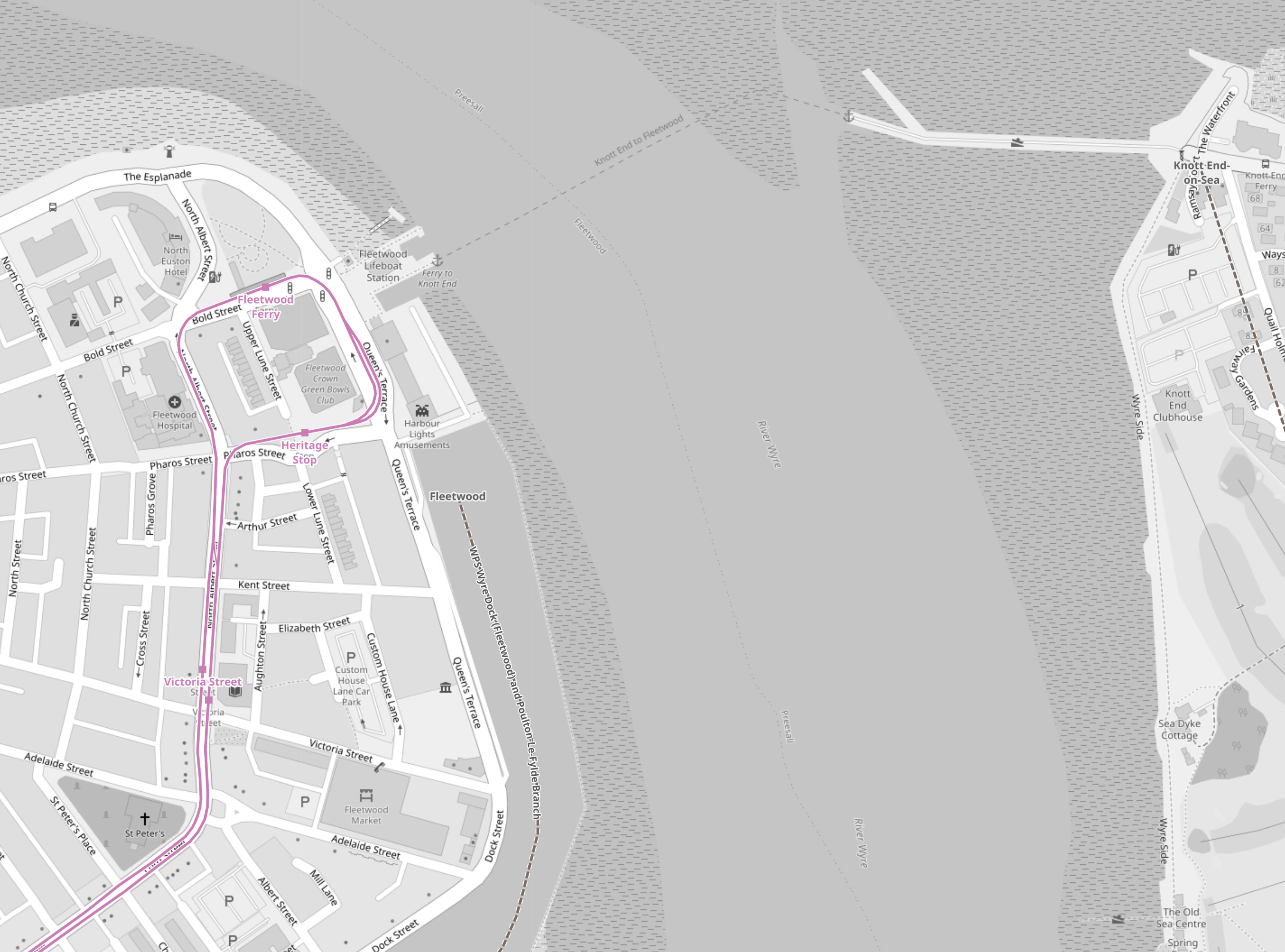
Note.
- As before, the Blackpool tramway tracks are shown in pink.
- There is a lifeboat station and a ferry to the other side.
- The tracks allow a tram to come from the South, go round the loop and return to the South.
- I believe that both the Blackpool tramway and the Fleetwood tram-train will both reverse direction in the same way.
- No new infrastructure would be needed at the Fleetwood Ferry terminal, except for perhaps a few signs.
This third OpenRailwayMap shows the track from Fleetwood Ferry to the Lindel Road tram stop.
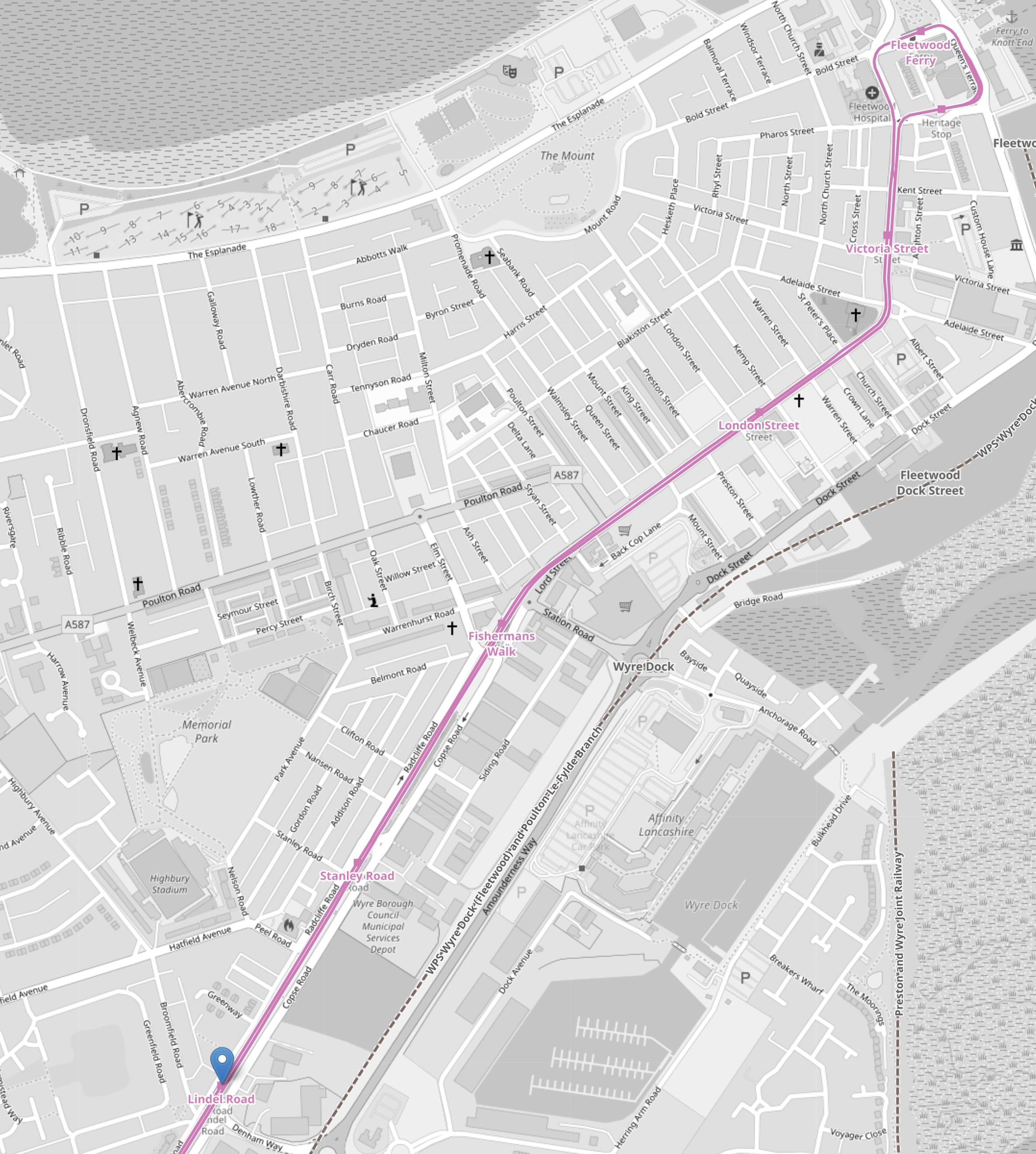
Note.
- As before, the Blackpool tramway tracks are shown in pink.
- Fleetwood Ferry is in the North-East corner if the map.
- Lindel Road tram stop is marked by the blue arrow in the South-West corner if the map.
This fourth OpenRailwayMap shows the Lindel Road tram stop area at a larger scale.
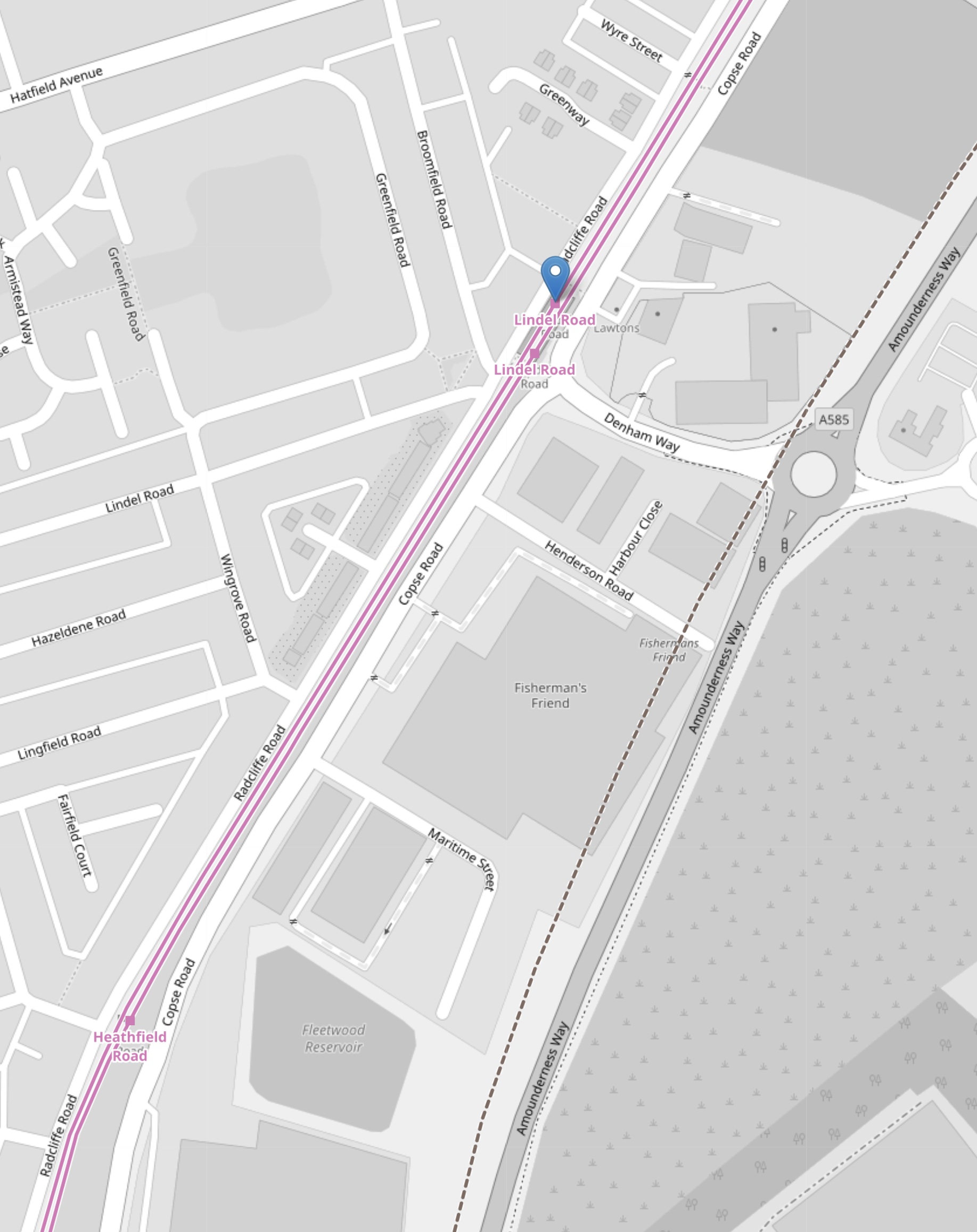
Note.
- As before, the Blackpool tramway tracks are shown in pink.
- Lindel Road tram stop is marked by the blue arrow.
- Running parallel to and to the East of the Blackpool tramway is Amounderness Way, which appears to have been built on the line of the railway to Fleetwood.
- Along the West side of Amounderness Way, a disused railway is indicated, which must be the closed railway to Fleetwood.
I believe that Network Rail or their engineers have found a route to connect the old branch line to the Blackpool tramway.
- The railway connecting the Blackpool tramway and the closed railway to Fleetwood, would only need to be single-track.
- There might be a convenient route, where all the land is owned by the Council.
- If the tram-trains were to be was fitted batteries, then there would be no need to electrify the line.
I suspect, that the connection would be to the South of Lindel Road tram stop.
- This would mean that the tram-train would serve a number of stops in the town centre.
- The tram-train could use the catenary of the Blackpool tramway.
- Connection and disconnection to the catenary could be done in the Lindel Road tram stop.
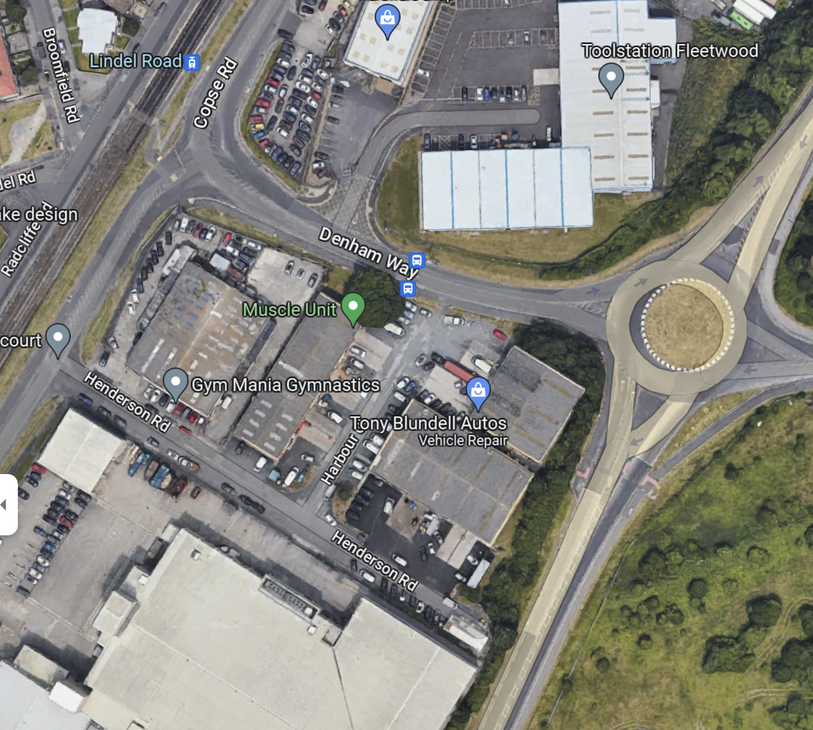
This Google Map shows the area of the Lindel Road tram stop and Denham Road.
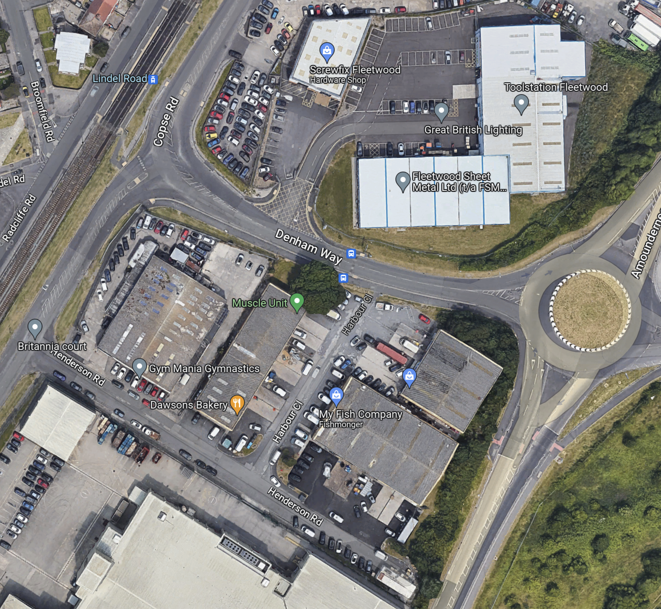
Note.
- The Lindel Road tram stop in the North-West corner of the map, with the Blackpool tramway running NE-SW across the corner of the map.
- The roundabout and Amounderness Way on the East side of the map.
- Denham Way connecting the roundabout to Copse Road and the tram stop.
- On the fourth OpenRailwayMap it showed the original line of the railway was to the West of Amounderness Way.
So could the spur between the Lindel Road tram stop and the railway to Poulton-le-Fylde station take the following route?
- Just South of the tram stop the two tracks connect to a new single-track that goes East on the South side of Denham Way.
- The turn would be quite sharp, but trams and tram-trains have the articulation of a snake and can use tight turns and narrow formations.
- The crossing of Copse Road would be protected by traffic lights.
When the tram-train gets to the roundabout other end of Denham way, I think there are two choices.
- Turn sharp right and go South alongside the West side of Amounderness Way.
- Somehow cross Amounderness Way and go down the West side.
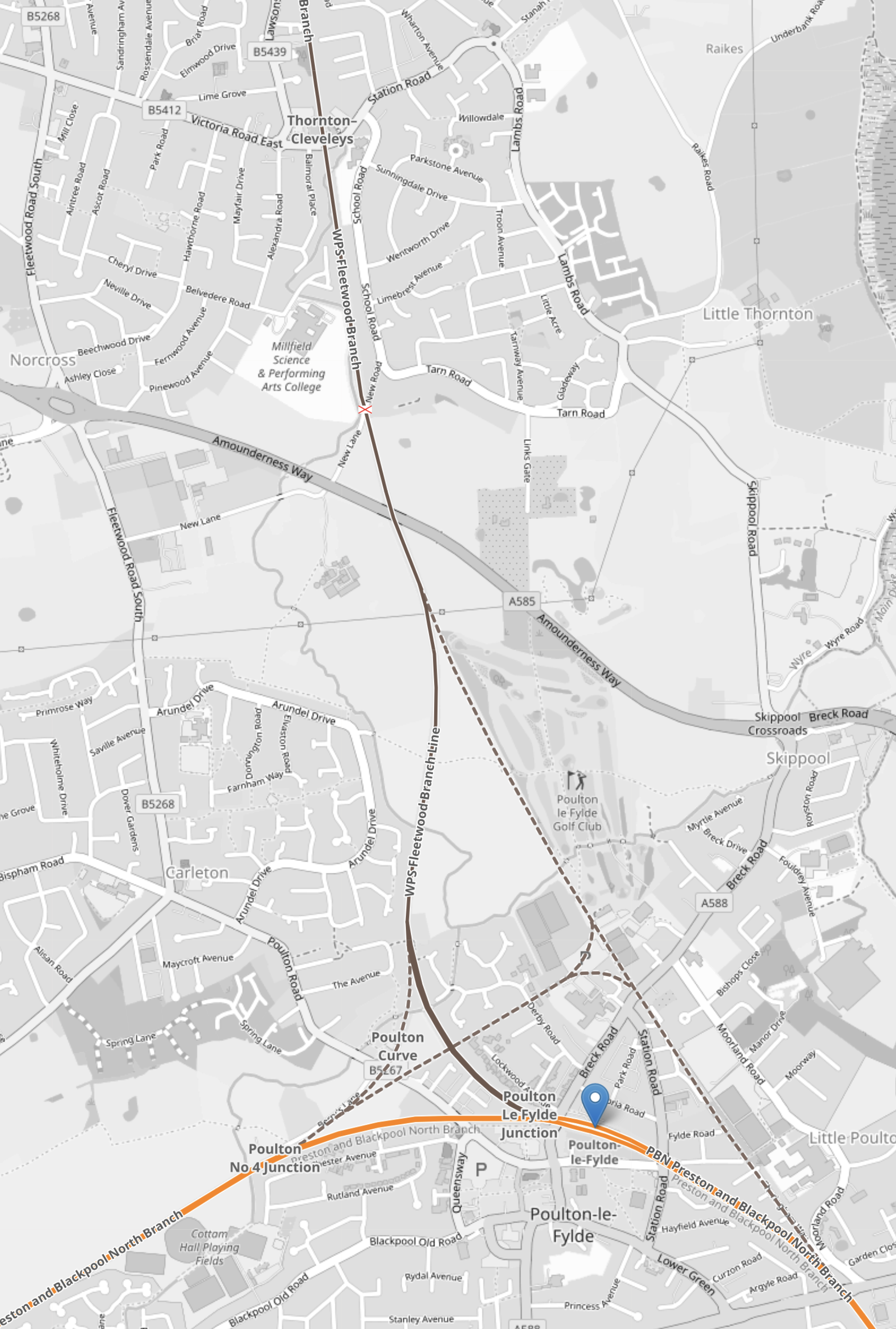
This Google Map Amounderness Way going South.
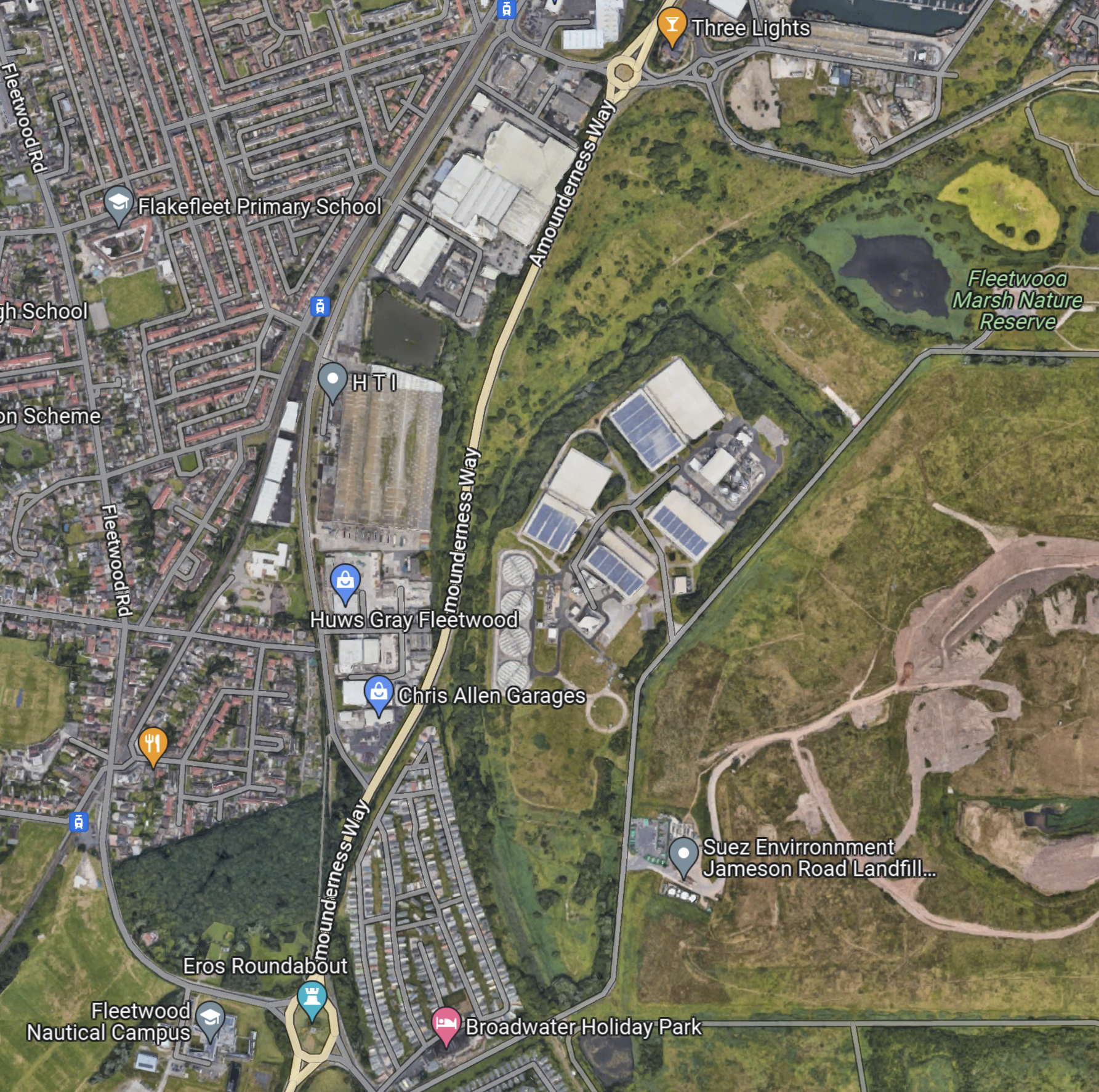
Note.
- Amounderness Way runs North-South down the map between two roundabouts.
- The large industrial area to the East of the road is labelled as SUEZ Recycling and Recovery.
- North-East of SUEZ is Fleetwood Marsh Nature Reserve.
- South-East of SUEZ is SUEZ Environmental Jameson Road Landfill and Lancashire County Council’s Fleetwood Household Waste Recycling Centre.
- There also seem to be a lot of large holiday caravans.
- There is a road running along the South-East of the large SUEZ site called Jameson Road.
The Wikipedia entry for the Fleetwood branch line, says this about the state of the branch.
Some of the line is now cleared of overgrowth because the northern track was not lifted from past Burn Naze Halt to just beyond Jameson Road Fleetwood. However, the road bridge was filled in below it. The junction, last used when goods trains took coal to Fleetwood Power Station, still exists. Looking over the road bridge on Jameson Road, the track to both north & south can still be seen through the undergrowth. In the 1990s, the new A585 The Amounderness Way bypass has been built on the former trackbed, although sufficient space still exists for a reinstated railway should it be required.
Note.
- It appears that enough space has been left at the Northern end to connect to the Blackpool tramway.
- It doesn’t seem to be in too bad a state.
- I suspect that rebuilding the branch has a similar degree of difficulty to rebuilding the Dartmoor Line to Okehampton, which is now operating successfully.
This gave me hope, that a single-track tramway could be built between Poulton-le-Fylde junction and the Lindel Road tram stop.
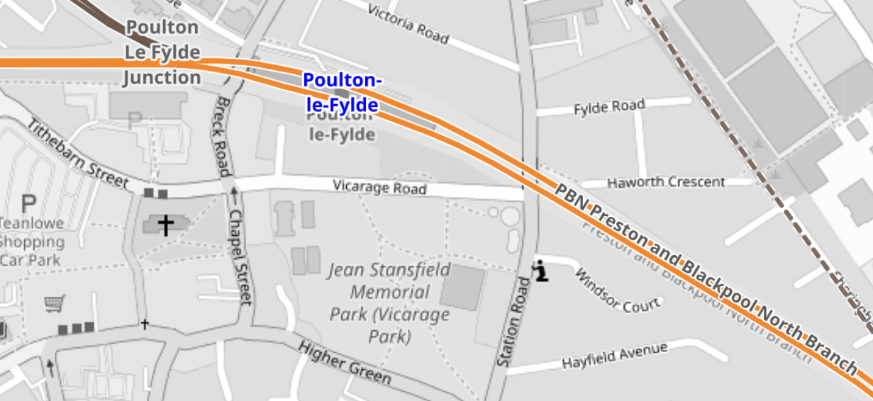
This Google Map shows the track meeting the filled in road bridge on Jameson Road.
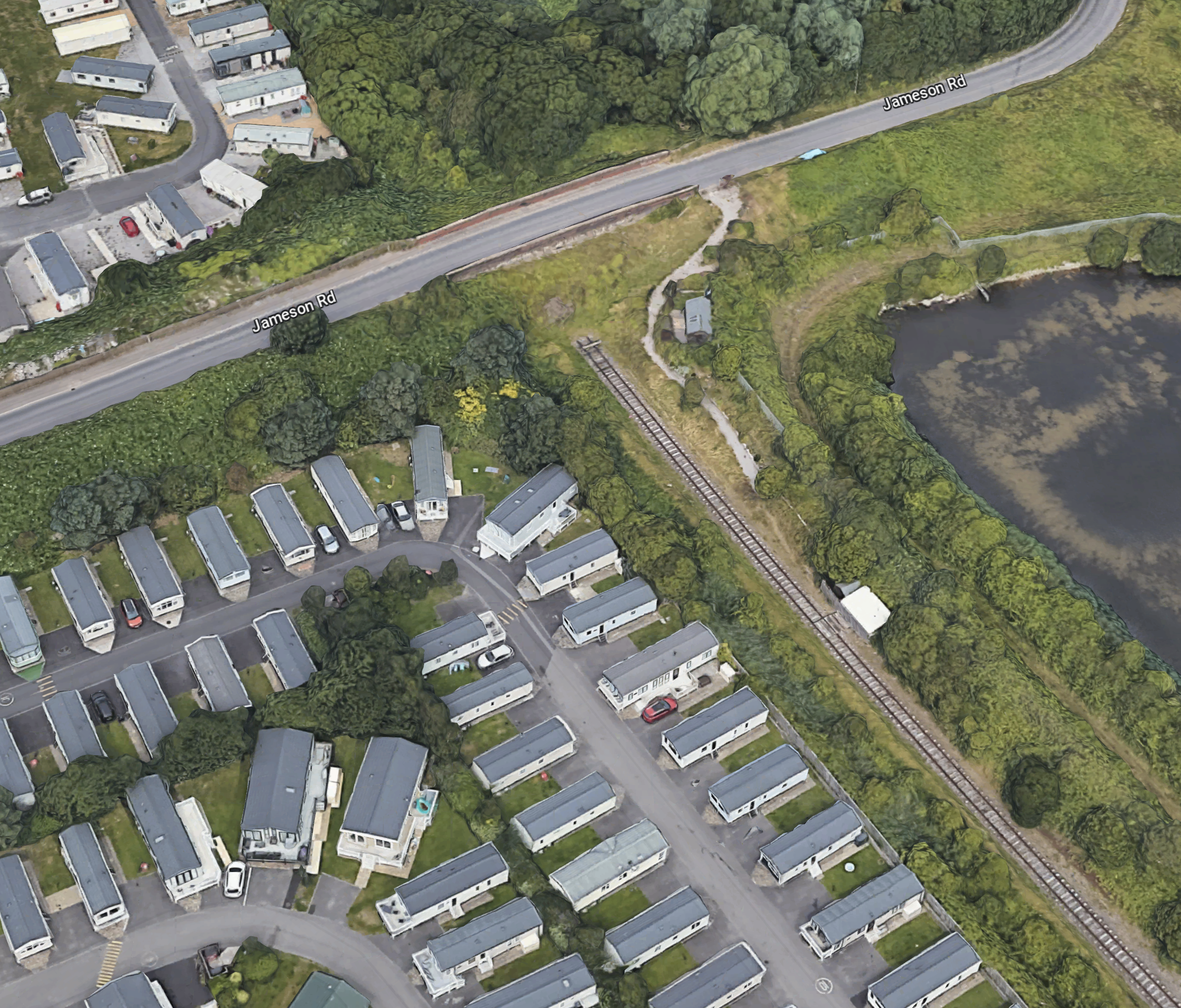
Note.
- If that’s not a single-track railway and the filled-in bridge on Jameson Road, I’m a Dutchman.
- The railway can be followed on Google Maps for most of the way to Poulton-le-Fylde station.
- Google Maps also shows traces of railway to the North of the bridge on Jameson Road.
This Google Map shows the section of Amounderness Way from the North of the SUEZ Recycling and Recovery site to the Denham Way roundabout.
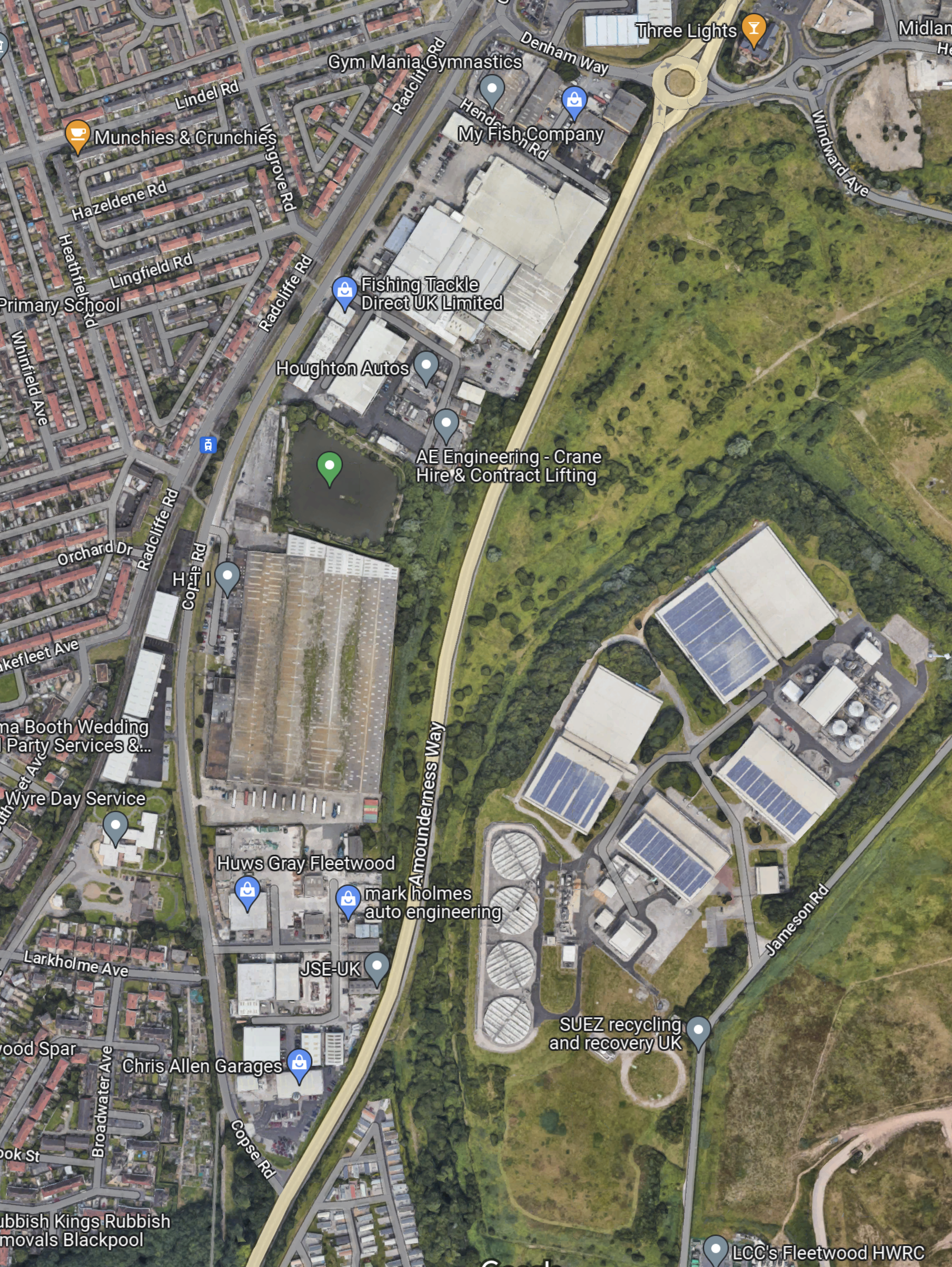
I suspect that the tram would go straight up the East side of ‘Amounderness Way.
But how would the tramway cross the road.
This Google Map shows Denham Way, the roundabout and Lindel Road tram stop.
I am fairly sure that a single-track bridge of some sort could connect Lindel Road tram stop with a single-track railway along the East side of Amounderness Way, to link up with the orphaned track South of Jameson Road.
This OpenRailwayMap shows Poulton-le-Fylde junction, where the former railway to Fleetwood, joins the Blackpool branch.
Note.
- Poulton-le-Fylde station is indicated by the blue arrow.
- The orange track is the Blackpool branch to Blackpool North station.
- Poulton-le-Fylde junction is to the West of the station.
- The track going North from the junction, is the disused track to Fleetwood.
- The map also shows a couple of level crossings.
I am fairly certain, that a single-track tramway could be built between Poulton-le-Fylde junction and the Lindel Road tram stop.
This OpenRailwayMap shows Poulton-le-Fylde junction and Poulton-le-Fylde station.
These pictures taken in 2018, show Poulton-le-Fylde station.
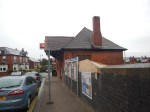
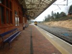
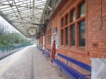
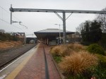
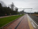
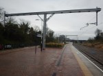
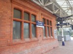
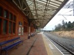
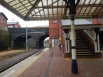
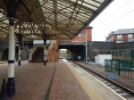
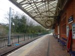
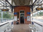
Note.
- It is a small station, that oozes quality.
- The tracks and electrification were all installed or renewed in the last few years.
- There is even a cafe and a lift to the street.
- The flower-beds in the middle of the platform, are at the Preston end of the station.
- As the tram-trains will stop in the station, they can raise and lower the pantograph in the station.
- Tram-trains and trains will share the appropriate platform.
The possibility can probably be arranged that an incoming train to Blackpool North will be able to drop passengers at a waiting tram-train for Fleetwood Ferry.
Will The New Fleetwood Branch Be Electrified?
There are various arguments for and against electrification between Poulton-le-Fylde station and the Lindel Road tram stop.
In favour, is that a continuous catenary can be run from end-to end, with 750 VDC electrification.
- An insulated section would be used at Poulton-le-Fylde station to separate the 750 VDC of the tramway and the 25 KVAC of the Blackpool branch.
- Standard tram-trains, like Sheffield’s Class 399 tram-trains could be used.
- Battery-electric tram-trains are probably more expensive.
Against electrification are.
- There would be no electrification between Poulton-le-Fylde station and the Lindel Road tram stop to install.
- There would be no need for any modifications to the catenary at Poulton-le-Fylde station and the Lindel Road tram stop.
- The filled in bridge mentioned in Wikipedia, might only need a tram-sized hole and not complete rebuilding to get the trams through.
- Occasional freight trains could probably be run, if required.
- Battery-electric tram-trains are proven technology.
It will definitely one for the accountants to decide.
The Tram-Trains
These are pictures of Stadler Citylink tram-trains in Sheffield.
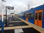

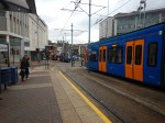
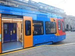

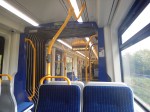
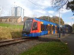
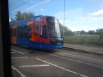

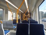
Note.
- These Class 399 tram-trains were the first tram-trains to run in the UK, when they entered service in 2017.
- They were built by Stadler in Spain.
- They share the tracks in Sheffield happily with Sheffield’s other trams of a different type.
- At the time, Paul Maynard, who is the local MP, was the Parliamentary Under Secretary of State for Transport, so I suspect that explains, why the MP appears pleased with the choice of tram-trains and talks knowledgeably about them.
- There is also a battery electric version of these tram-trains, which has been ordered by the South Wales Metro.
- Blackpool’s tramway uses Bombardier Flexity 2 trams. However, it doesn’t seem, that there is a tram-train version of the Flexity 2.
- Merseyrail in the Liverpool area, are introducing a large fleet of Stadler trains, which will be running to Preston in a couple of years.
I suspect that these tram-trains will be built by Stadler and they could be fitted with batteries.
Tram-Train Frequency Between Fleetwood Ferry And Poulton-le-Fylde Station
The Blackpool Gazette article is definite, that the frequency of the tram-train will be two trains per hour (tph).
Consider.
- The Blackpool tramway operates a service of trams every 10-15 minutes between Starr Gate and Fleetwood Ferry, so the frequency will be increased by two tph North of Lindel Road tram stop.
- As heritage trams also share the route to Fleetwood, I suspect that at some busy times, the Fleetwood Ferry and Preston service could be reduced to hourly.
- But it does look to me, that the all-important terminal at Fleetwood Ferry has been well-designed and can handle the extra traffic.
- Looking at the timetable for the Blackpool tramway, trams take forty-one minutes between Fleetwood Ferry and the North Pier.
- As Poulton-le-Fylde station and North Pier tram stop, are probably similar distances from Fleetwood Ferry, I suspect that Poulton-le-Fylde station and Fleetwood Ferry would take thirty minutes or more.
- Real Time Trains indicates that electric trains to Blackpool North station take around 16-17 minutes between Poulton-le-Fylde and Preston stations, with diesel trains taking a couple of minutes more.
- Add in time for stops at Kirkham & Wesham, possibly another at Salwick and cleaning and crew changeover at Preston station, I suspect that a roundtrip from Preston to Fleetwood Ferry and back will take a very convenient two hours.
A two hour round trip and two tph, will mean four trains will be needed to work the timetable.
I can’t prove it, but I my gut feeling is that there there will be a passing loop somewhere between Poulton-le-Fylde station and the Lindel Road tram stop.
The passing loop would also give scope for operational flexibility.
Train Services Through Poulton-le-Fylde Station
Train services through Poulton-le-Fylde station are currently as follows.
- Avanti West Coast – London Euston and Blackpool North – 1 train per day (tpd)
- Northern – Liverpool Lime Street and Blackpool North – 1 tph
- Northern – Manchester Airport and Blackpool North – 2 tph
- Northern – York and Blackpool North – 1 tph
Note that all trains stop at Preston.
The Avanti West Coast service only calls Southbound, but I wouldn’t be surprised, if the Fleetwood tram-train is built, that Avanti West Coast started a Northbound service.
Could The Blackpool South Branch Be Served By Similar Tram-Trains?
In Beeching Reversal – South Fylde Line Passing Loop, I talked about improving the Blackpool South branch.
Objectives included.
- Two tph.
- Better trains.
- A passing loop that would enable the 2 tph.
Note.
- Pacers have been replaced with Class 150 trains.
- The route is electrified between Preston and Kirkham & Wesham station.
- 12.2 miles are without electrification.
It certainly would seem possible that if a battery-electric tram-train had sufficient range, it could handle the current route to Blackpool South station.
The trams would have a ninety-minute round trip between Preston an Blackpool South stations and two tph, will mean three trains will be needed to work the timetable.
The MP is quoted in the Blackpool Gazette article, as liking the concept of a tram loop to Blackpool from Preston.
Trams might go to Fleetwood, down the promenade and then take the Blackpool South branch beck to Preston.
It could obviously go the other way around the loop.
This Google Map shows the location of Blackpool South station.
Note.
At the West side of the map is the promenade, with tramway running North and South.
At the East side of the map is Blackpool South station.
The walking route between the tramway and the station is not arduous, but it is not a seamless transfer.
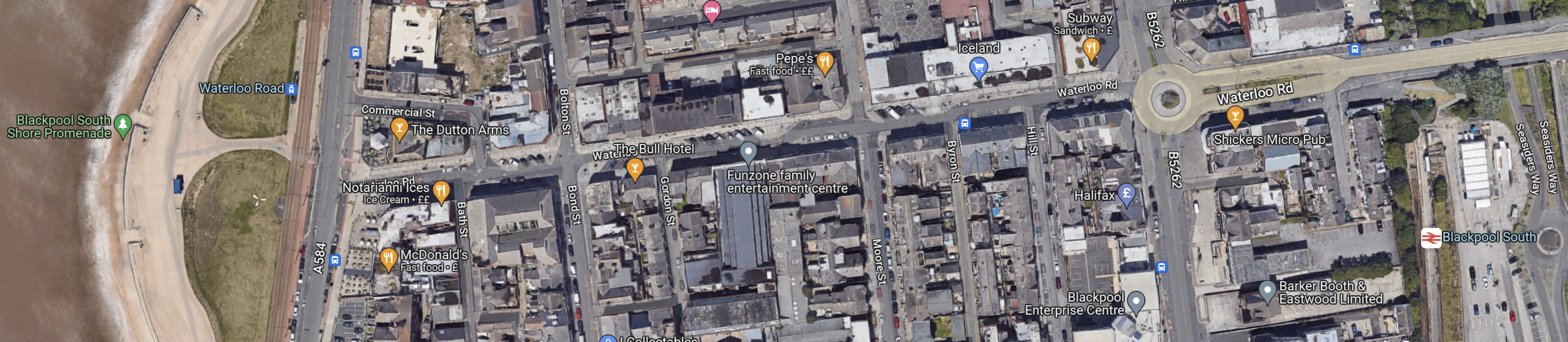
It might be better to make the connection at Blackpool Pleasure Beach, which is shown in this Google Map.
Note.
- The Pleasure Beach lies between the tramway and the promenade by the beach and the Blackpool South branch on the East side.
- There are two stops on the tramway and a station just to the South.
Perhaps, if the Pleasure Beach were redeveloping an area, they might leave provision for tram-trains to to sneak through to join the tramway going North.
But it’s a difficult problem, as there is not much space, that is undeveloped and the roads aren’t very wide.
This Google Map shows the North Pier and Blackpool North station.
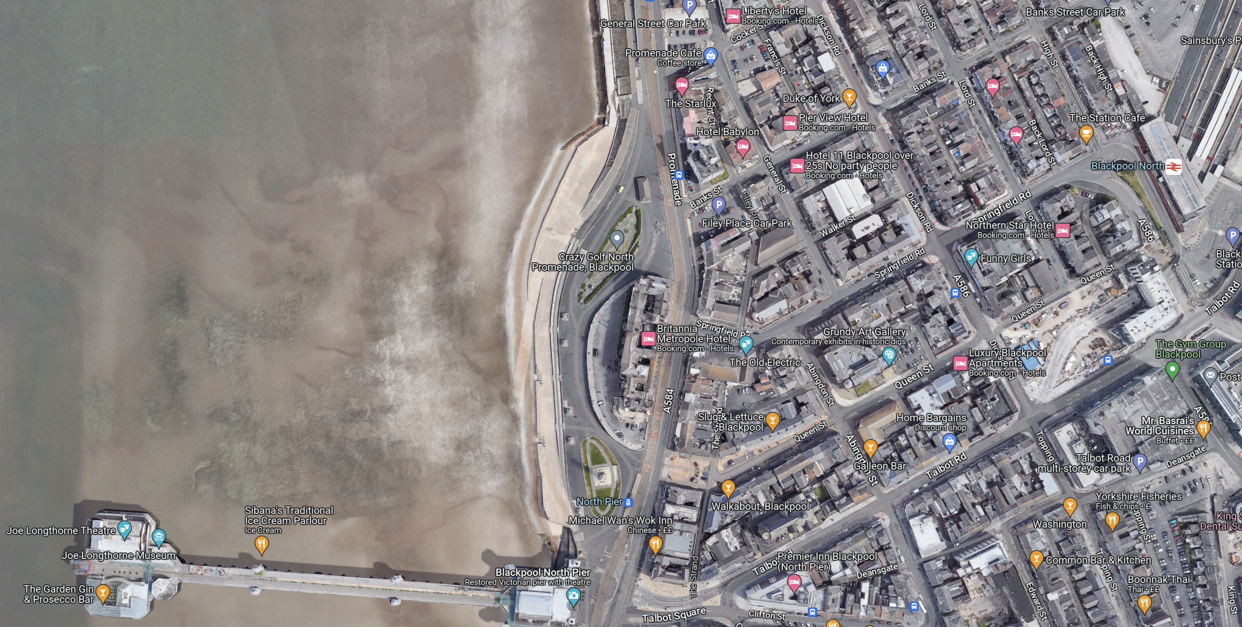
Note.
- The North Pier is in the South-West corner of the map.
- Blackpool North station, which is Blackpool’s main station is in the North-East corner of the map.
- The tramway runs along the sea-front.
The North Pier and the station are linked by Talbot Road.
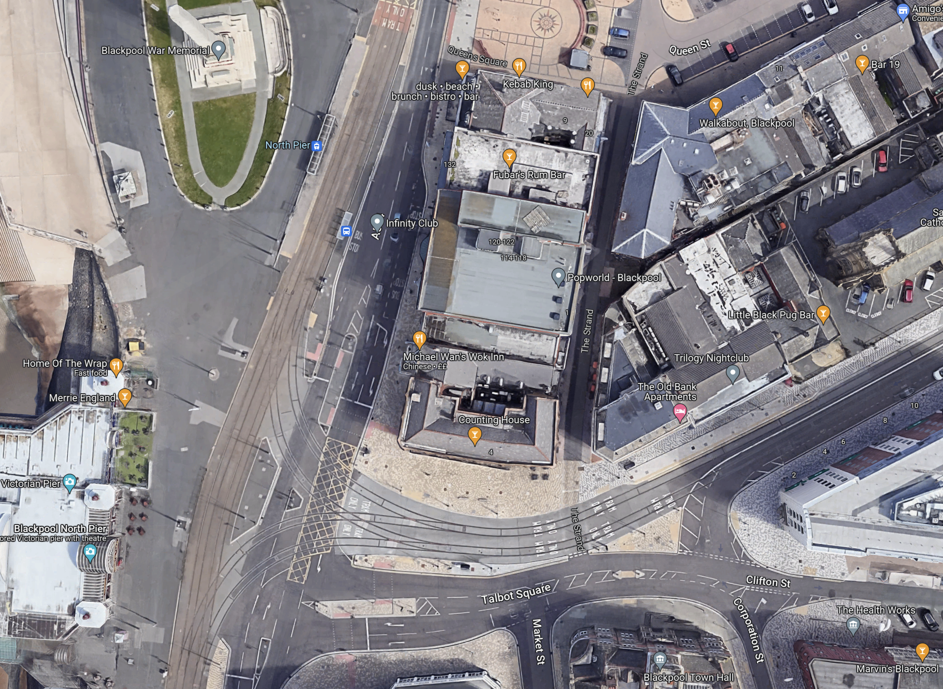
This Google Map shows Talbot Road and the development of a tram stop by Blackpool North station.
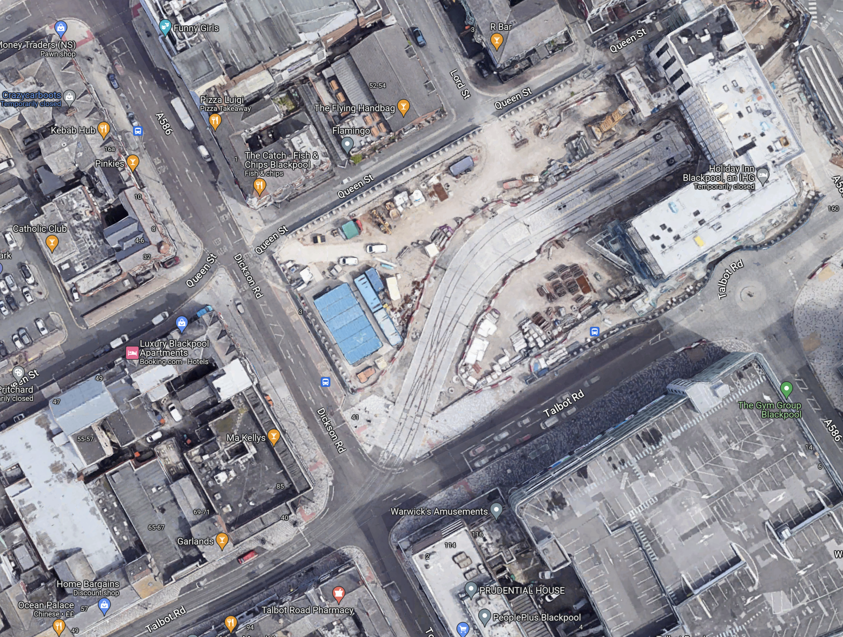
Note.
- To create the space a large Wilkinson’s store was demolished.
- Blaxkpool North station is just off the North-East corner of the map.
- The tram stop will have two platforms.
- There is a large diamond crossing on the approach to the tram stop, so operation is smooth and reliable.
- It looks like there will be substantial development around and possibly over the tram stop.
This Google Map shows Talbot Square, where the tram branch to Blackpool North station joins the main North-South tramway.
It is all very crowded and I believe this illustrates, why despite their close proximity, there is no rail connection between the Blackpool South branch and the Blackpool tramway.
There just isn’t the space to put in junctions like this and the tramway doesn’t go past Blackpool Airport, so the connection would have to be amongst the crowded houses on the sea front.
The Development Of Blackpool Airport
Aviation is changing and I believe a new breed of airliners and the airports to serve them, will be developed in the next few years.
- Zero-carbon aircraft are being developed and I believe some will have entered service by 2026.
- They will be powered directly by batteries or from green hydrogen.
- Some like the Eviation Alice are already entering a flight-test program, that will lead to certification.
- These airliners are likely to be smaller and quieter than current airliners, with typically a passenger capacity of around 19 passengers.
- They will often fly routes between smaller regional airports.
Blackpool Airport could be an ideal airport for these airliners.
- Offshore electricity and even hydrogen generated offshore will be easy to deliver to Blackpool Airport.
- It could have excellent transport connections with trams and trains.
- Blackpool Airport has good runways.
- Many take-offs will be over the sea.
- We will see airports converting to zero-carbon airports.
So why not Blackpool Airport?
These are distances between Blackpool Airport and other airports.
- Aberdeen – 238 miles
- Amsterdam Schipol – 340 miles
- Belfast City – 128 miles
- Cardiff – 165 miles
- Dublin – 134 miles
- Edinburgh – 150 miles
- Exeter – 211 miles
- Geneva – 661 miles
- Glasgow – 155 miles
- Haverfordwest – 157 miles
- Jersey – 318 miles
- Kirkwall – 358 miles
- London Gatwick – 220 miles
- London Heathrow – 192 miles
- London Southend – 219 miles
- Newcastle – 89 miles
- Paris Orly – 422 miles
- Isle of Man Ronaldsway – 68 miles
- Shannon – 254 miles
- Southampton – 208 miles
- Sumburgh – 427 miles
These distances fit nicely with the range of the nine-seater Eviation Alice electric aircraft, which is predicted to be 620 miles.
This Google Map shows Blackpool Airport.
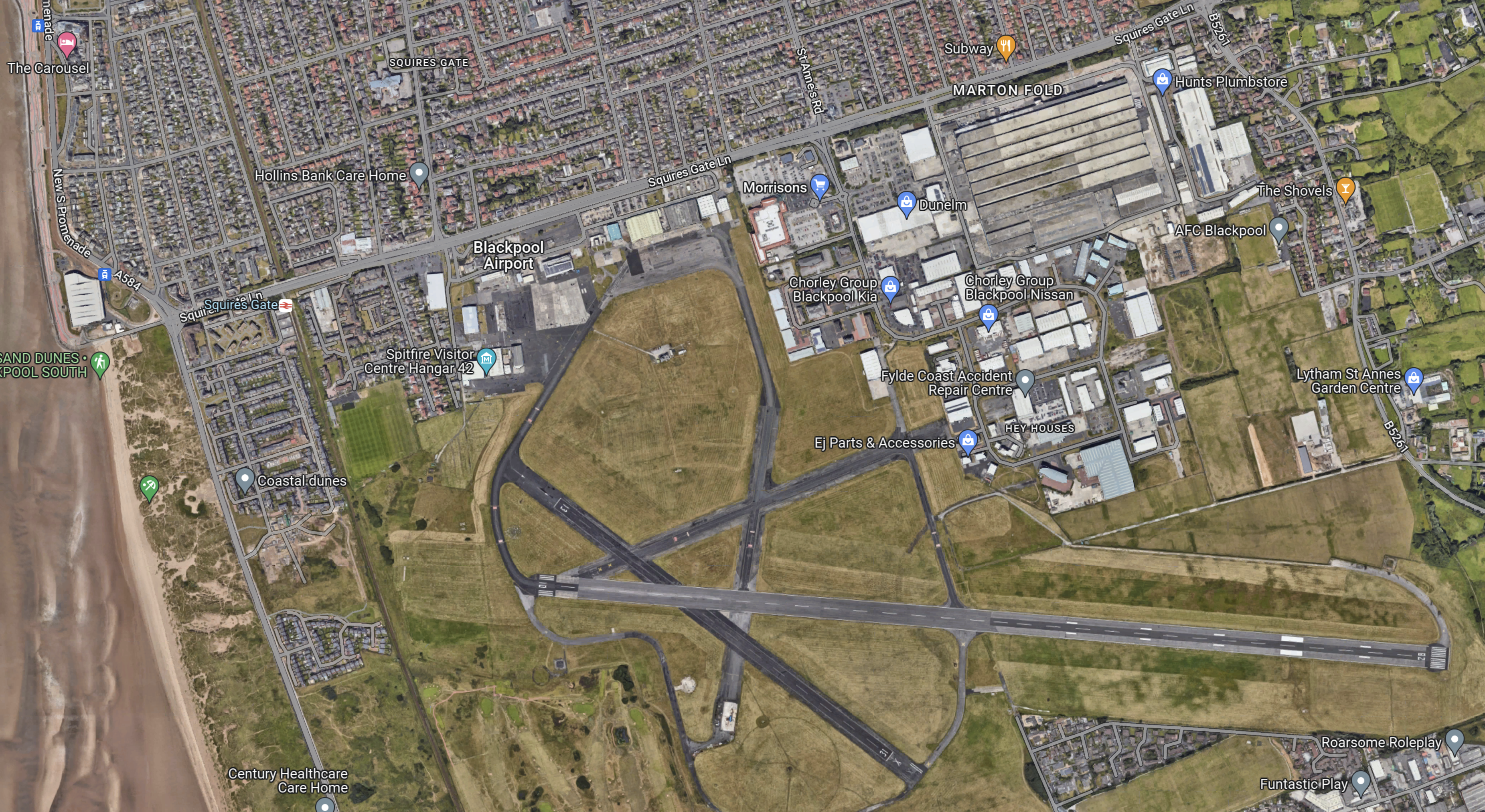
Note.
- The East-West main runway, which is over 1,800 metres long, which will probably mean an easier takeoff into the wind, for much of the time.
- The acres of space.
- The Blackpool South branch running down the side of the airport, with Squires Gate station on the road past the Airport.
- But zoom in on the airport and some improvement and refurbishment needs to be done. Years of neglect and uncertainty has taken its toll.
This Google Map shows the North-West corner of the map at a greater scale.
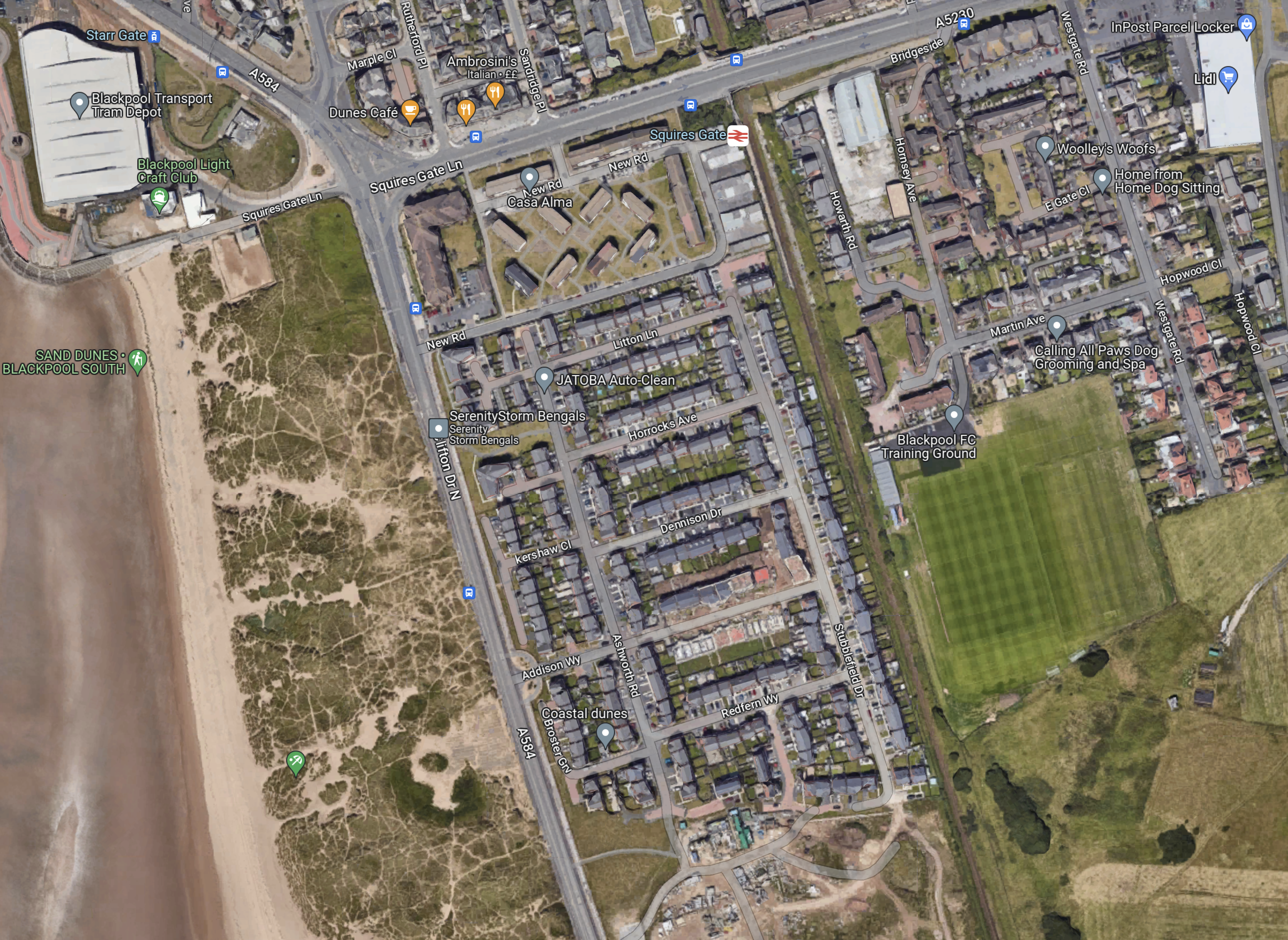
Note.
- In the North-West corner of the map is Blackpool tramway’s depot and Starr Gate tram stop with its loop.
- The rail station is Squires Gate for Blackpool Airport.
- The smart green space to the East of the railway is Blackpool FC’s training ground.
- Below the training ground on the East side is Blackpool Airport.
- On the other side of the track from the Airport, it appears to be the local rubbish dump.
I wonder, if this is where the Blackpool tramway and the Blackpool South branch could be joined up.
- A joint two-platform station partly on Airport land would replace the current Squires Gate station.
- It could be connected to the Airport terminal by some form of shuttle or travellator.
- The trams would be connected to the Starr Gate loop by a line going along the front, as the tramway does in much of Blackpool, before cutting through the waste ground.
- Trains to Blackpool South station would use their current route.
This plan and probably lots of others could allow a Blackpool loop tram-train from Preston.
What would a zero-carbon airport do for Blackpool?
Stadler Presents Mock-Up Of Tram-Trains For German And Austrian Operators
The title of this post, is the same as that of this article on Railway Gazette.
This is the first paragraph.
A mock-up of the Citylink tram-trains that Stadler is to supply to operators in Karlsruhe, Saarbrücken, Neckar-Alb, Oberösterreich and Salzburg was unveiled at the Betriebshof West depot in Karlsruhe on December 13.
This is the most interesting paragraph.
‘Maximum standardisation and the fact that the order was shared between different operating companies reduces the costs by to up to €1m per vehicle’, said Karlsruhe Mayor Frank Mentrup at the unveiling ceremony.
It shows the value of standardisation and large orders.
Leading Transport Experts To Explore Innovative Options For The Watford To Croxley Link
The title of this post, is the same as that of this news item on the Watford Borough Council web site.
The news item starts with this sub-title.
A wide range of proposals to bring a long disused stretch of railway back to life as a key transport link between Watford and Croxley Green are to be explored…
These four paragraphs then outline what is to be done.
A wide range of proposals to bring a long disused stretch of railway back to life as a key transport link between Watford and Croxley Green are to be explored by three leading travel and transport consultancies.
Atkins, SYSTRA UK and Wood Group will work in partnership with Hertfordshire County Council, Watford Borough Council, Three Rivers District Council and Network Rail to provide innovative solutions to improve connectivity within the area.
The transport link will connect important areas of Watford like the town centre, hospital, Watford FC and Croxley Park with Croxley Green and Watford Junction and the travel network beyond.
Securing the right solution is an important part of the overall plans of the partnership and Network Rail for future cleaner, healthier and greener travel in the area for the benefit of residents, visitors and commuters.
Note.
SYSTRA UK and the Wood Group are respected consultancies.
The main railway station, town centre, football ground and the hospital should be connected together by decent public transport. In Watford, as in many towns, they currently are a long walk or a taxi.
Watford Junction and Croxley stations will be connected together.
These are my thoughts.
The Abbey Line
I believe that the Abbey Line, which links Watford Junction and St. Albans Abbey stations should be included in any proposals.
- It has a rather unusual timetable with trains running every forty-five minutes.
- Proposals exist for a passing loop, which would allow two trains per hour (tph)
- All stations only have a single platform.
If it were updated to a modern railway, it would be a valuable asset with charm.
Connecting St. Albans Abbey And St. Albans City Stations
This map from OpenRailwayMap shows the two stations.
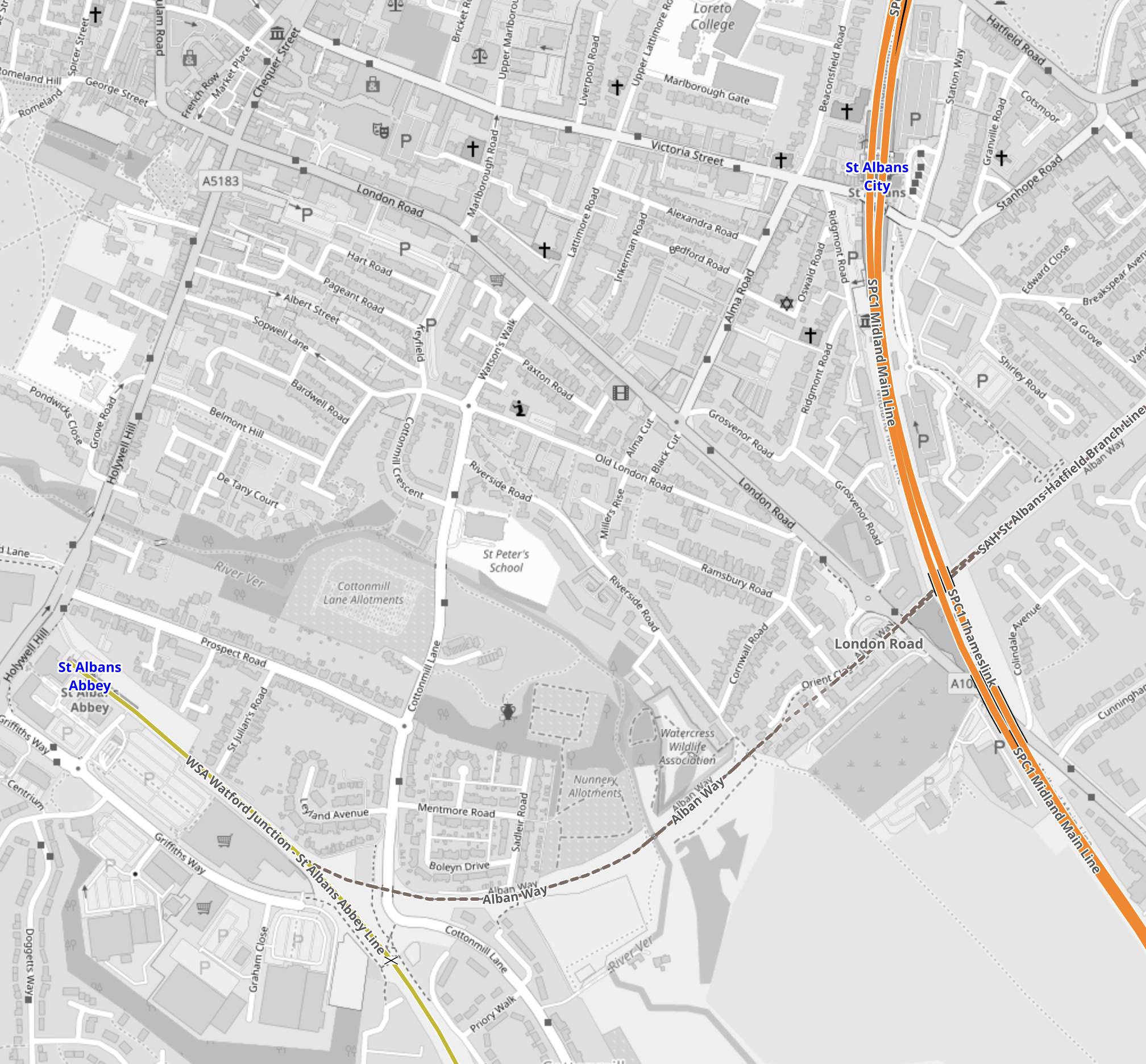
Note.
- The yellow line in the South-West corner is the Abbey Line that terminates in St. Albans Abbey station.
- The orange line is the Midland Main Line passes through St. Albans City station.
- The dotted line crossing the Midland Main Line and linking to the Abbey Line is a disused railway that has been converted into the St, Albans Way.
Tram-trains with a tight turning circle might be able to use the Abbey Line and with selected use of street running be able visit the City Centre and terminate at St. Albans City station.
Connecting The Abbey Line And The London Overground
This map from OpenRailwayMap, shows the track layout at Watford Junction station.
Note.
- The orange tracks are the West Coast Main Line.
- The yellow track to the North of the West Coast Main Line is the Abbey Line.
- The yellow track to the South of the West Coast Main Line is the Watford DC Line of the London Overground.
If you were using tram-trains, like the Class 399 tram-trains on the Abbey Line, I suspect a single-track dive-under could connect the Abbey Line with the Overground tracks to Watford High Street station.
Why Tram-Trains?
Tram-Trains have advantages in a scheme like this.
- They can run as trams on the streets.
- They can run as trains on railway tracks.
- They can use lightweight catenary, which is quicker and more affordable to erect.
- They are narrower and lighter than trains.
- They have a tighter turning circle than trains.
But most importantly, tram-trains have been running successfully in Sheffield for several years.
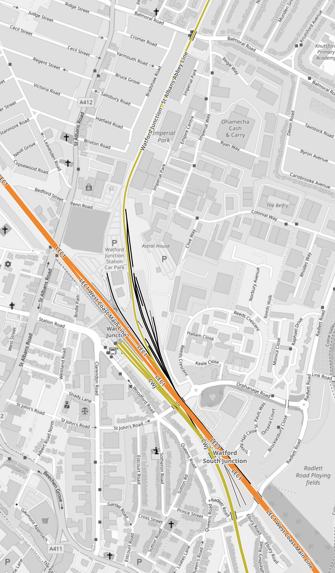
The Eastern Section Of The Croxley Rail Link
This map from OpenRailwayMap shows the Eastern section of the Croxley Rail Link.
Note.
- The yellow track is the Watford DC Line, which goes through Watford High Street station.
- A disused line runs via the Croxley Green Chord to the disused stations of Croxley Green, Watford Stadium and Watford West.
- Vicarage Road and Watford General Hospital are to the North of the disused line.
The original plan for the Croxley Rail Link would have seen a double-track along the line of the old railway with stations at Vicarage Road and Watford General Hospital.
I don’t see why tram-trains could join the Watford DC Line to the South of Watford Junction station, go through Watford High Street station and then continue along the reinstated track.
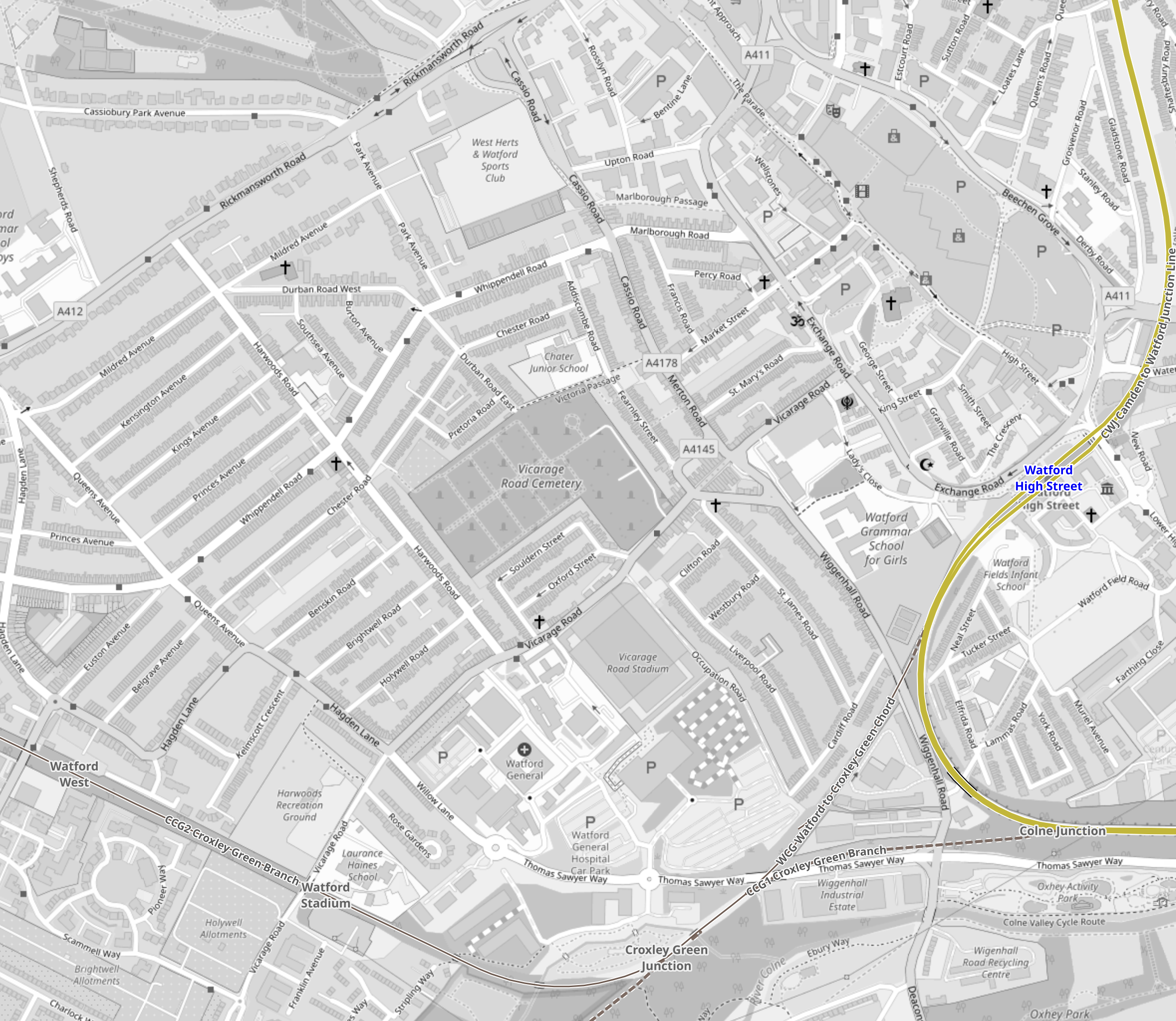
The Western Section Of The Croxley Rail Link
This map from OpenRailwayMap shows the Western section of the Croxley Rail Link.
Note.
- The blue track is the Metropolitan Line, which runs to Watford station.
- The disused line runs West from the former Watford West station to the roundabout at Croxley Green on the A 412.
The original plan involved a large double-track viaduct, which is shown in this visualisation from the Watford Observer.
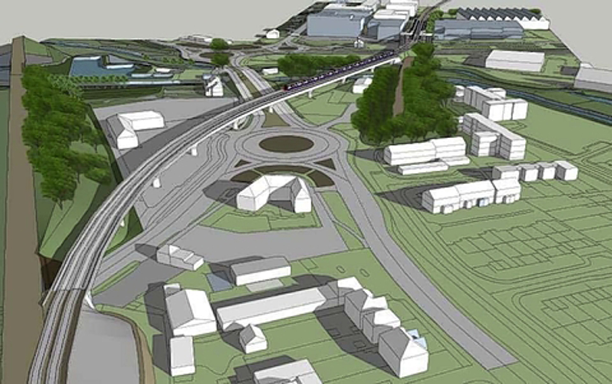
Note that the roundabout is the Croxley Green roundabout.
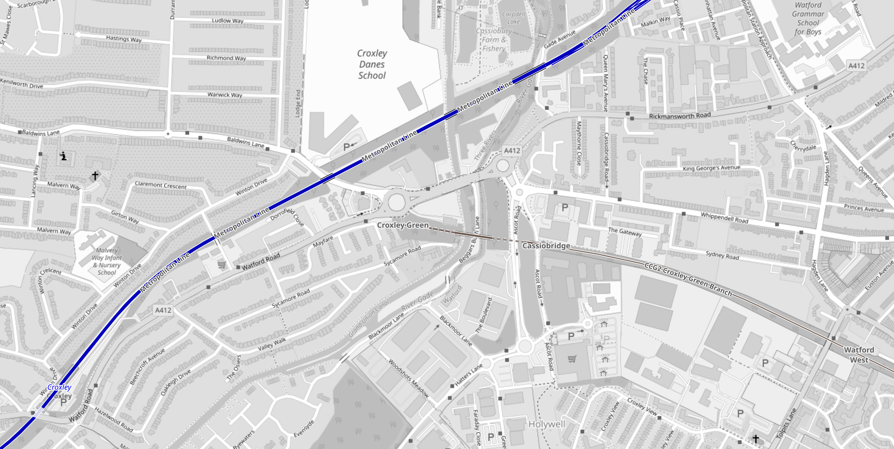
This Google Map shows the Croxley Green roundabout.
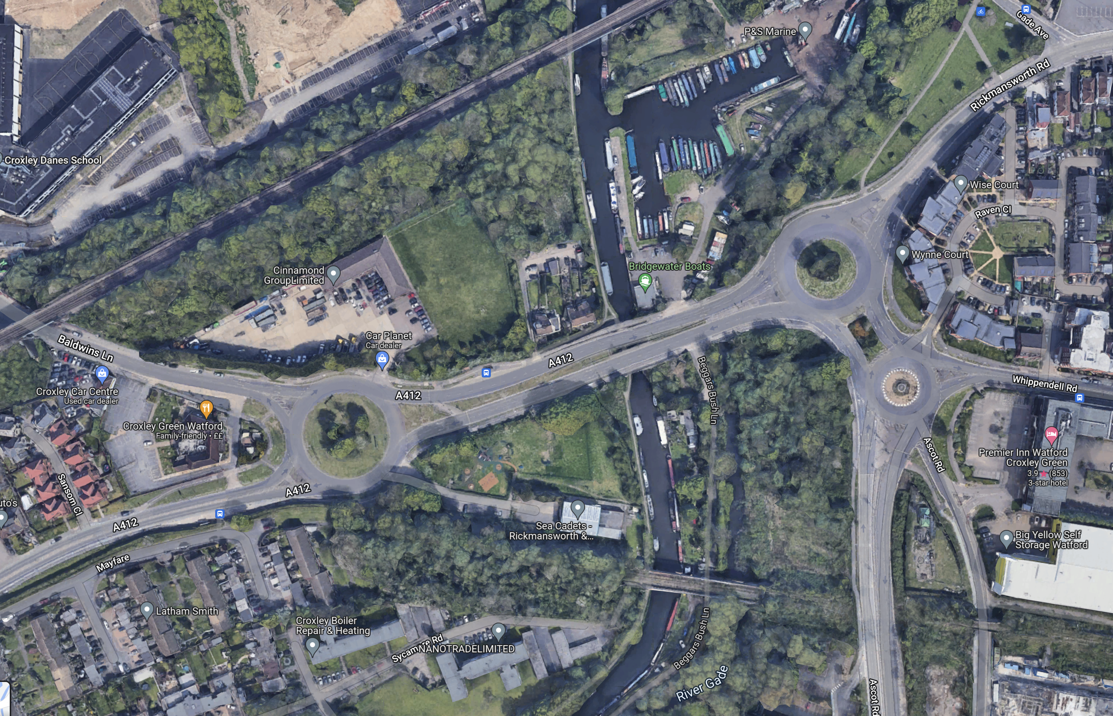
Note.
- The Metropolitan Line to Watford station runs across the North-West corner of the map.
- The Croxley Green roundabout is the roundabout in the West of the map.
- The disused railway runs from South of the roundabout to the South-East corner of the map.
- The proposed Cassiobridge station would be in the South-East corner of the map.
I wonder, if it would be possible to build a Croxley Green station to the South of the roundabout.
This would be an interim solution until it is worked out how to connect the Croxley Link to the Metropolitan Line.
Solutions could be.
- The original solution of a massive flyover, which would be very expensive and disruptive to build.
- Street-run the tram-train, which I feel are needed on the Croxley Link to Croxley station.
- Build a Croxley Green station on the Metropolitan Line to the North of the roundabout.
I think that experienced transport planners can find an acceptable solution.
Cardiff Northwest Corridor Tram-Train Report Published
The title of this post, is the same as that of this article on Railway Gazette.
This is the introductory paragraph.
Proposals have been published for the development of a tram-train network to serve housing developments on the Northwest Corridor between Cardiff and Llantrisant.
And this paragraph describes the route.
The report looks at a route making use of the existing City Line railway from Cardiff and then following a safeguarded former railway alignment to M4 Junction 33 and Creigiau. Possible extensions could run from Creigiau to Cross Inn and Pontyclun and from Cross Inn to Miskin, Talbot Green, Llantrisant and Beddau.
This map shows the route from the City Line to Creigiau.
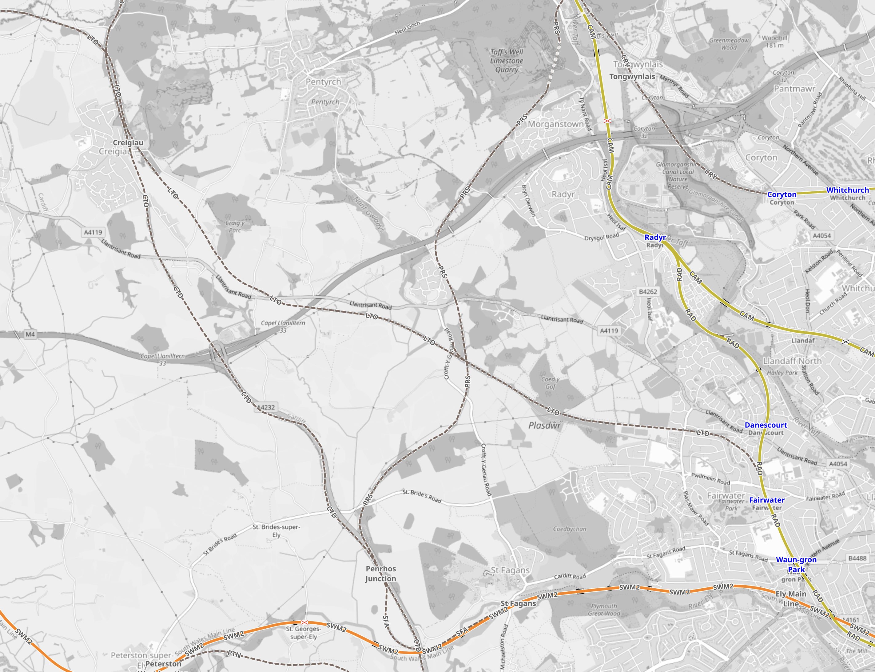
Note.
- The City Line to Radyr passing through Waun-Gron Park, Fairwater and Danescourt, which is shown in yellow.
- The South Wales Main Line running across the bottom of the map, which is shown in orange.
- The M4 running Westerly from the North-East corner of the map.
- The A4232 runs North-South and meets the M4 at Junction 33.
- Creigiau is in the North-West corner of the map.
The route of the tram-train would follow the route of the disused railway between the City Line and Creigiau, which is shown as a dotted line, identified with the code LTO.
This second map from OpenRailwayMap shows the area around Junction 33 of the M4.
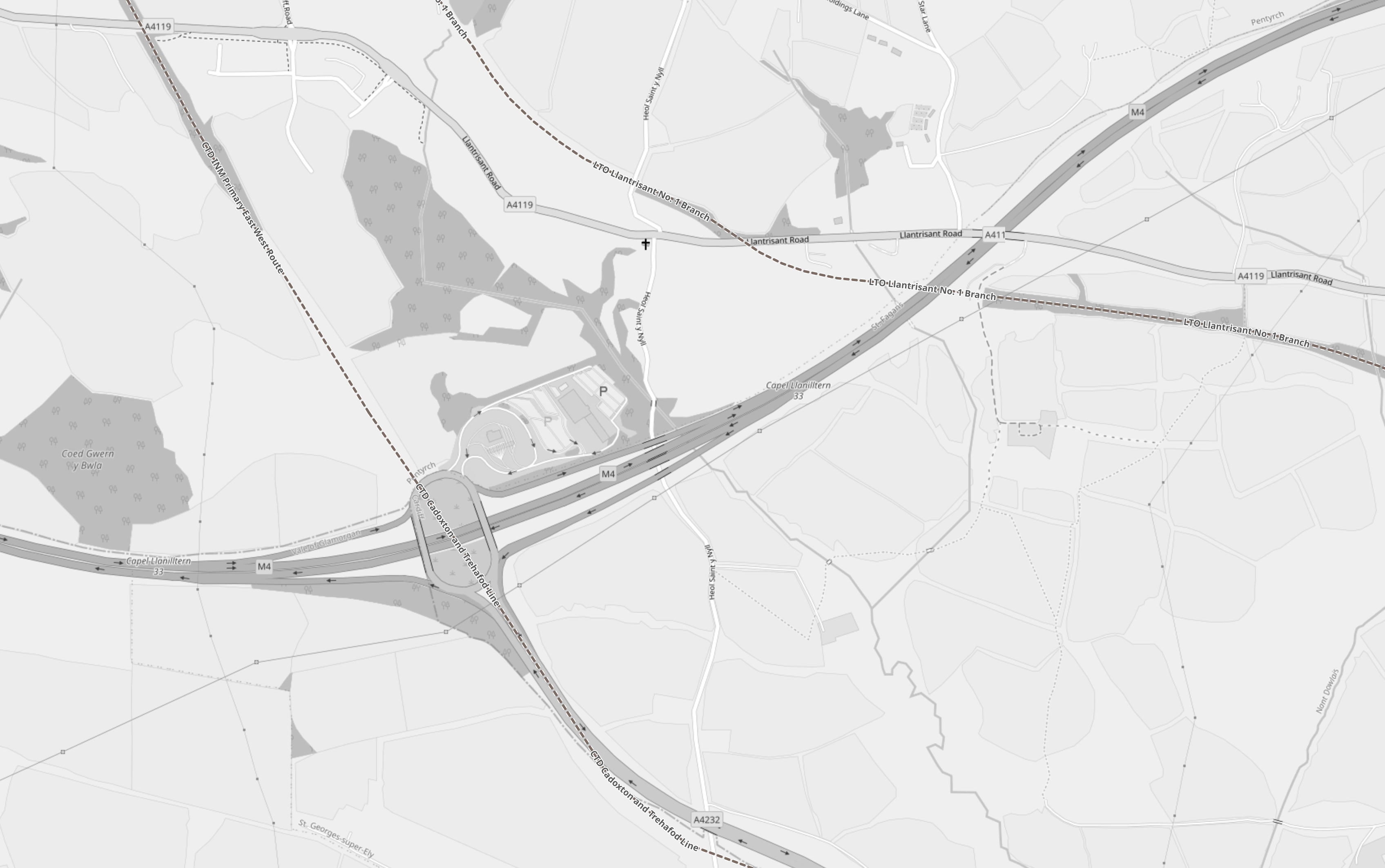
Note.
- The M4 going across the map.
- The A4232 going South from Junction 33.
- The proposed tram-train line passing to the East of Junction 33.
I suspect that as there is a BP petrol station and a Travel Lodge at the junction, there is a lot of scope to create a comprehensive Park-and-Ride hub for Cardiff, that would be served by the new tram-train.
The third OpenRailwayMap shows the various routes from Creigiau.
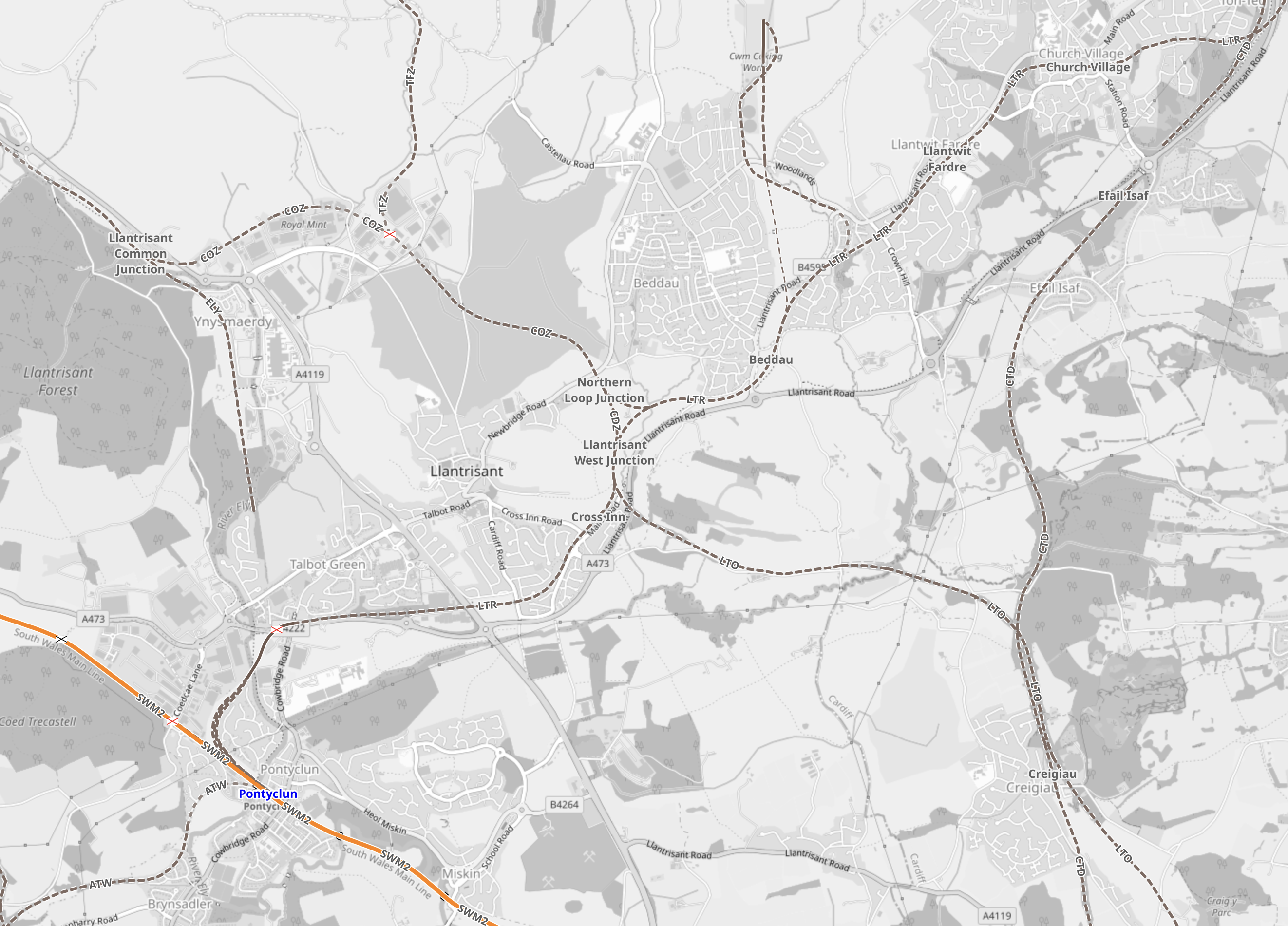
Note.
- Creigiau is in the South-East corner of the map.
- Cross Inn is in the middle of the map.
- The South Wales Main Line, which is shown in orange, cuts across the the South-West corner of the map.
The ultimate destinations of Miskin, Pontyclun, Talbot Green, Llantrisant and Beddau all have disused railway tracks leading to Cross Inn.
Serving The Royal Mint
The Royal Mint moved to Llantrisant in the late 1960s and it could be served by the tram-train, as it is to the North of the town, close to a disused railway line.
I must admit, I am very surprised, that a company that employs 10,000 people doesn’t have a nearby railway station.
But then the move of the Royal Mail to Wales was planned by Harold Wilson’s government, which was led by a man, who believed that railways were irrelevant and everybody should have their own cars.
Six Operators Award Joint Contract For Up To 504 Tram-Trains
The title of this post, is the same as that of this article on Railway Gazette.
These are the first three paragraphs.
A consortium of six German and Austrian transport bodies has awarded Stadler a framework contract for the supply and maintenance of up 504 tram-trains worth €4bn, the largest contract in the Swiss company’s history.
The VDV TramTrain framework contract was awarded on January 14 by Karlsruhe’s VBK and AVG, Saarbrücken’s Saarbahn Netz, Schiene Oberösterreich, the Land of Salzburg and Zweckverband Regional-Stadtbahn Neckar-Alb.
It includes a €1·7bn firm order for the supply of 246 Citylink tram-trains over 10 years from 2024, and the provision of 16 years of maintenance. There are options to order up to 258 more vehicles and to extend the maintenance to 32 years.
That will keep the factories running for a few years.
Note that all these Stadler Citylink tram-trains are similar to the Class 399 tram-trains, that run between Sheffield and Rotherham.
More Stadler Citylink tram-trains will start running in the next couple of years in Cardiff.
I can also envisage these tram-trains being used on the following projects in the UK, if they were to go ahead.
- Reopening The Don Valley Section Of The Former Woodhead Line Between Stocksbridge and Sheffield Victoria To Passenger Services
- Beeching Reversal – South Yorkshire Joint Railway
- Reinstatement Of The Barrow Hill Line Between Sheffield And Chesterfield
- Plans To Reopen The Brentford To Southall Railway
- Tram-Trains To Hale Station
- Manchester Metrolink To Gorton And Glossop
- Sheffield Region Transport Plan 2019 – Tram-Trains Between Sheffield And Doncaster-Sheffield Airport
- Sheffield Region Transport Plan 2019 – Renewal Of Supertram Network
- Sheffield Region Transport Plan 2019 – A New Tram-Train Route To A New Station At Waverley
- Could There Be A Tram-Train Between Ipswich And Felixstowe?
- Could A Class 399 Tram-Train With Batteries Go Between Manchester Victoria And Rochdale/Bury Bolton Street/Rawtenstall Stations?
Note.
- Six are extensions to the Sheffield Supertram network.
- Three projects are extensions to the Manchester Metrolink.
- These are possible orders, that if the projects go ahead would likely have Stadler Citylink as the first choice of tram!
- All the tram-trains would be of a similar design.
How many other projects are under discussion in Europe?
Conclusion
Stadler have designed a tram-train that everybody likes and that generates orders.
I think Stadler will soon need to increase production of these Citylink tram-trains.
Karlsruhe Kombilösung Tram Tunnels Inaugurated
The title of this post, is the same as that as this article on Railway Gazette.
I first came to Karlsruhe to see the tram-trains in 2015 and wrote about them in Exploring Karlsruhe And Its Trams And Tram/Trains.
I couldn’t help notice, that the good citizens of Karlsruhe were digging a tunnel for tram-trains, all the way along their equivalent of Oxford Street.
I said this.
It will certainly be worth returning to Karlsruhe, when the tunnel is complete and the network is expanded.
So now almost seven years after that first visit, the €1·5bn project has been completed and I had better think about returning.
Szeged Tram-Train Service Inaugurated
The title of this post, is the same as that of this article on Railway Gazette.
This is the first paragraph.
The country’s first public tram-train service left Hódmezővásárhely for Szeged at 03.31 on November 29, with guests onboard including János Lázár, the government’s special commissioner for the project, and László Palkovics, Minister of Innovation & Technology.
They are obviously early starters in Hungary.
The Szeged-Hódmezővásárhely Tram-Train has its own Wikipedia entry.
From the Railway Gazette article and Wikipedia, I can ascertain the following.
- It is a 32 km route.
- Journey time will be 51 minutes, with an Off Peak frequency of two trains per hour (tph), with three tph in the Peak.
- The main stations in Hódmezővásárhely and Szeged are served.
- The route between the two cities is not electrified, but has been partially-upgraded to double-track and the speed has been upgraded to 100 kph.
- In both central districts the vehicles run as tram-trains.
The rolling stock will be electro-diesel versions of Stadler Citylink tram-trains.
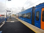
This pictures show Sheffield Supertram’s Class 399 tram-trains, which are also members of the Stadler Citylink family.
The two tram-trains would appear to be very similar in terms of cab design, passenger compartment and an operating speed of 100 kph.
The question has to be asked, if Sheffield could expand their Supertram network with some electro-diesel tram-trains.
They could be ideal for the proposed service to Stocksbridge, that I wrote about in Reopening The Don Valley Section Of The Former Woodhead Line Between Stocksbridge and Sheffield Victoria To Passenger Services.
The route could be tested using diesel engines on sections without electrification and if the route attracted enough passengers, electrification could be erected.
Liverpool’s Vision For Rail
This document on the Liverpool City Region web site is entitled Metro Mayor’s Vision Of A Merseyrail for All Takes Vital Step Forward With Successful Trial Of New Battery-Powered Trains.
It makes these points in the first part of the document.
- Game-changing technology paves way for Merseyrail network expansion across the Liverpool City Region and beyond
- Merseyrail services could reach as far as Wrexham and Preston
- City Region is at the forefront of the introduction of pioneering energy efficient technology.
The new battery-powered trains would certainly go a long way to enable, these objectives.
- Battery-powered trains would need a range of 26.9 miles to go between Bidston and Wrexham stations.
- Battery-powered trains would need a range of 15.3 miles to go between Ormskirk and Preston stations.
This link is to the North Cheshire Rail User Group’s Newsletter for Spring 2021.
This is said about battery range of the new Class 777 trains.
Later model Class 777’s have the ability to leave the 3rd rail and operate under battery power for 20 miles or more with a full load thus
permitting expansion of the Merseyrail network beyond its current limits.
I suspect they will also have regenerative braking to batteries, which will increase the range and allow Preston and Wrexham stations to be achieved without charge.
It certainly sounds like Preston and Wrexham and all the intermediate stations, will be added to the Merseyrail network.
As to the third point above about the introduction of pioneering energy efficient technology, I suspect this is mainly regenerative braking to batteries and replacement of elderly worn-out power supply equipment.
There is more in the Liverpool City Region document.
Expanding Merseyrail
This is said.
The game-changing technology could allow the Merseyrail network to extend across all six city region boroughs to places like Rainhill in St Helens, Woodchurch on the Wirral and Widnes in Halton.
It could also allow the new fleet to operate as far afield as Skelmersdale, Wrexham, Warrington and Runcorn.
Note.
- A 25 KVAC capability could well be needed. But that is built into the Class 777 trains.
- Chargers could be needed at some of these stations. I suspect Stadler have a Swiss manufacturer in mind.
In the run-up to May’s elections, the Mayor pledged to deliver ‘Merseyrail for All, a commitment to connecting under-served communities to the Merseyrail network.
New Stations
Initially the battery-powered trains, which are considerably greener, using up to 30% less energy than the existing fleet, are set to run on services to a planned new station at Headbolt Lane, Kirkby.
The wider Merseyrail for All programme could ensure every community is well served by an integrated public transport network and new and refurbished train stations are also high on the agenda.
They could include:
- The Baltic Triangle in Liverpool
- Carr Mill in St Helens
- Woodchurch on the Wirral
Note.
- The Baltic Triangle station will be built on the site of the former Liverpool St. James station.
- The Carr Mill station will probably be built on the site of the former Carr Mill station.
- Woodchurch station is likely to be built on the Borderlands Line between Upton and Heswall stations.
Tram-Trains And Trackless Trams
The document says this.
Tram-Train technology and trackless trams will also be looked at as potential means of extending the Merseyrail network into hard-to-reach places. The technology could benefit areas such as Liverpool John Lennon Airport and Speke, Kirkby Town Centre, Southport Town Centre, Wirral Waters and the Knowledge Quarter.
Tram-trains built by Stadler in Valencia are already running in Sheffield and in the next few years they should be deployed on the South Wales Metro.
TStadler are also building Merseyrail’s new Class 777 trains, so I suspect they’ll go together like peaches and cream.
The Belgian firm; Van Hool have a product called Exquicity. This video shows them working in Pau in France.
These tram buses run on rubber types and are powered by hydrogen.
Similar buses running in Belfast are diesel-electric.
Could these be what the document refers to as trackless trams?
Battery Train Trials
The article finishes with this summary of the battery train trials. This is said.
Under the battery trials, financed by the Transforming Cities Fund, one of the new class 777 trains fitted with the battery technology was tested on the Northern line.
The batteries exceeded expectations with the trains travelling up to 20 miles per run without the need for re-charging.
The battery trains would remove the need for the third ‘electric’ rail, enabling the trains to travel beyond the existing network without major track investment.
The units passed all tests during four weeks of trials on the City Region’s rail network in May and June.
The Combined Authority and partners are still assessing the full impact of the Coronavirus pandemic on the programme and will provide more information regarding the roll out as soon as it has been agreed.
It looks to me, if all these plans get implemented successfully, Liverpool City Region will have one of the best public transport systems of any similar-sized cities in the world.
The Full Plan As A Map
This article on the BBC is entitled Battery-Powered Trains Part Of Merseyrail Expansion Plan.
The article contains this map.

There is no key or explanation, but it appears that the pink lines are new routes, where Merseyrail will run trains.
Before I discuss each of the possible routes, I will discuss two big factors, that will affect a lot of my thinking.
The West Coast Main Line
Avanti West Coast have the following stops in trains per hour (tph) at these stations on the West Coast Main Line as its trains pass the East of Merseyside to and from London Euston.
- Crewe – At least 5 tph
- Warrington Bank Quay – At least 2 tph
- Preston – At least 1 tph
These frequencies are in addition to these direct trains from London Euston.
- 1 tph to Liverpool Lime Street, which will rise to 2 tph in the December 2022, with a call at Liverpool South Parkway station.
- Occasional services to Chester throughout the day.
Passengers do not have to go via Liverpool Lime Street to travel to London.
In addition. there are useful services run by TransPennine Express between Liverpool Lime Street and Scotland, that call at Preston.
In Future; High Speed Two
This will call at Crewe, Liverpool Lime Street, Liverpool South Parkway, Preston and Warrington.
Northern Trains
Northern Trains were in all sorts of troubles and the service is now run directly by the Government’s Operator of Last Resort. I suspect that any reasonable offer to takeover over a service will be looked at favourably.
I will now look at Merseyrail’s new routes.
Ormskirk And Southport Via The Burscough Curve
Consider.
- This route has been a long term aspiration of Merseyrail.
- A curve between Burscough Bridge and Burscough Junction will have to be rebuilt on a former alignment.
- Southport and Ormskirk are about 13 miles apart.
- Southport and Ormskirk have third-rail electrified lines to Liverpool and the South.
It would be an ideal route for battery-electric trains with a range of 20 miles.
What would it do for passengers?
- It gives those living near five stations a direct link to Liverpool.
- It gives Southport a town of over 91,000 people more capacity to the city of Liverpool for jobs, leisure and shopping.
- Will it open up more opportunities for new housing in villages like Burscough?
It will certainly give Merseyrail operational advantages to Southport.
Ormskirk And Preston
Consider.
- Takeover of this Northern Trains route has been a long term aspiration of Merseyrail.
- Preston and Ormskirk are about 15.3 miles and 32 minutes apart.
- Omskirk has 750 VDC third-rail electrification and Preston has 25 KVAC overhead electrification.
- The Class 777 trains have been built so they can be updated to dual voltage.
It certainly looks to be a route that could be handled by a battery-electric Class 777 train.
What would it do for passengers?
- It gives those living near the Ormskirk and Preston Line a direct link to Liverpool.
- It creates a direct link in modern electric trains between North Liverpool and Preston, for onward travel on West Coast Main Line services and High Speed Two in the future.
- The journey time could be reduced to under thirty minutes.
As football is so important to the Liverpool economy, would a time around forty-five minutes between Preston and Sandhills station tempt football supporters going to Anfield and Goodison Park to use the train and then perhaps a trackless tram to the stadium?
This Google map shows the location of Anfield, Goodison Park and Sandhills station.
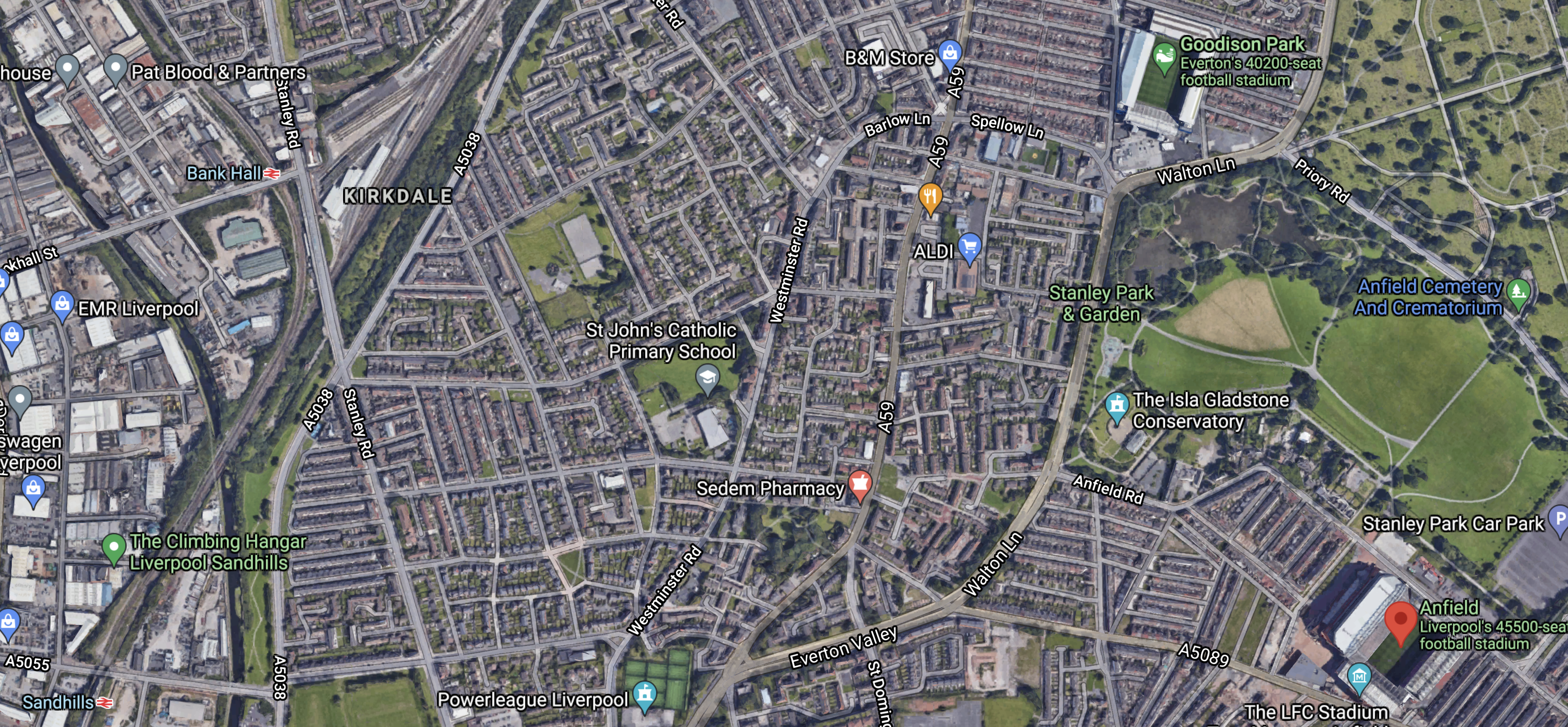
Note.
- Anfield is in the bottom-right corner of the map and is marked by a red arrow.
- Goodison is in the top-right corner of the map, slightly to the West of Anfield.
- Sandhills station is in the bottom-left corner of the map.
Both stadia are around a mile and a half from the station.
Southport And Preston
Once the Ormskirk and Southport and Ormskirk and Preston services are up and running, it would surely be possible to run a Southport and Preston service.
- There would be a reverse at Ormskirk.
- The two sections of Ormskirk and Southport and Ormskirk and Preston would both need battery power.
- Whilst the driver changed ends at Ormskirk, the train would be recharged using a fast and efficient charger.
- Times between Southport and Preston would be under an hour.
It certainly looks to be a route that could be handled by a battery-electric Class 777 train.
What would it do for passengers?
- It gives those living in Southport, a direct link to Preston.
- It creates a direct link in modern electric trains between Southport and Preston, for onward travel on West Coast Main Line services and High Speed Two in the future.
This service could be very valuable for passengers, but I suspect the route could be implemented with minimal infrastructure changes at Ormskirk station.
Ormskirk Station
This picture shows Ormskirk’s single platform from the Merseyrail end.
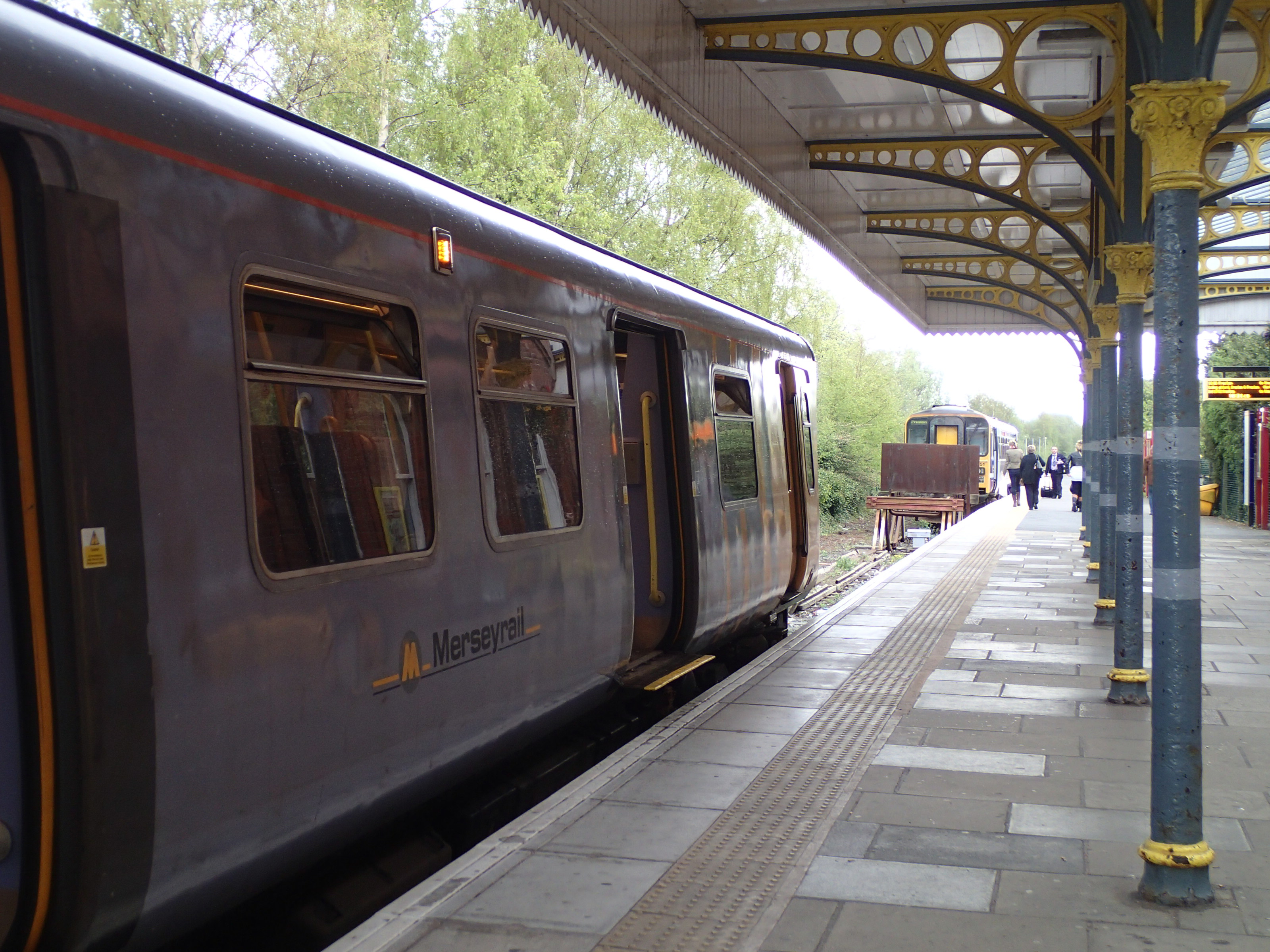
Note.
- The Liverpool train in the foreground.
- The Preston train in the background.
- The solid barrier between the trains.
I wonder if the following would be possible with the barrier removed.
- The long platform would be treated as one platform divided into two.
- Perhaps they will be the Liverpool and Preston/Southport platform,
- Trains that will leave the station for Liverpool will stop in the Liverpool platform.
- Trains that will leave the station for Preston or Southport will stop in the Preston/Southport platform.
- Through trains between Liverpool and Preston or Southport would be possible.
- A train between Preston and Southport could reverse in the Preston/Southport platform, whilst trains for Liverpool used the Liverpool platform.
It looks like it’s an efficient layout borrowed from somewhere else. and Stadler have probably seen it before.
Headbolt Lane Station
In Headbolt Lane Station Fly-Through, I described the new Headbolt Lane station.
This screen capture is from the video in that post,

Note.
- Two platforms going away from the camera and one platform and what looks to be a siding going towards the camera.
- There appears to be no direct connection between the two different sets of tracks.
Until proven wrong, I believe that the camera is looking towards Liverpool, as it would mean that Liverpool services had two platforms. But they currently make do with one at Kirkby.
There is a walk through between the tracks, which
- Enables passengers to access the second platform.
- Allows passengers to enter the station from the other side.
- Allows non-passengers to cross the tracks on the level.
- Avoids the need to build a bridge.
It is certainly an innovative design.
If occasional trains need to go through, could there be a lift-out section of the walk-through?
But as there are buffer stops on the tracks in the three platforms, that are either side of the walk-through, I suspect it will never happen, as it’s too much hassle.
In the Wikipedia entry for Headbolt Lane station this is said.
The Liverpool City Region Combined Authority announced in July 2021 that a trial of a battery electric multiple unit (BEMU) version of the new Class 777 will serve the new station, when it opens. This will not require all of the line extension to Headbolt Lane to be electrified.
Merseyrail would appear to have neatly side-stepped, the Office of Road and Rail’s policy of no more third-rail electrification.
But I’m sure Merseyrail could put an approved train-charging system in the station.
- They would need one if a Class 777 train arrived with a flat battery.
- They would need one to charge trains on the Headbolt Lane and Skelmersdale service, if the service were to be run by battery-electric trains.
- They would need one to charge trains on the Headbolt Lane and Wigan Wallgate service, if the service were to be run by battery-electric trains.
The system could be based on a short length of overhead wire and a slim pantograph or a system like Railbaar from Furrer + Frey.
But does it give any clues as to the orientation of the station in the video?
- As there are three platforms and a siding, that meet at Headbolt Lane station, all could be fitted with chargers. to make sure the services are reliable.
- Liverpool services could be handled at either end, as it only needs one platform.
- Skelmersdale and Wigan services could probably share a platform, but they would be better surely using two platforms.
- The siding could be created into a platform for extra services to be added to the Merseyrail network
So there is no pressing reason, why the station cannot be North or South of the railway.
I suspect road layout and land use issues will eventually decide, the orientation of the station.
Headbolt Lane And Skelmersdale
Consider.
- This has been a long term aspiration of Merseyrail and Lancashire County Council.
- Headbolt Lane and Skelmersdale are just a few miles apart.
- Direct running between Liverpool and Skelmersdale will not be possible, but it will be a step-free change between trains.
The Wikipedia entry for Headbolt Lane station seems to indicate a proposed extension of the Northern Line with the next stop being the existing Rainford station. This would surely not add greatly to costs and bring Merseyrail to more fare-paying customers.
It certainly looks to be a route that could be handled by a battery-electric Class 777 train.
What would it do for passengers?
- Skelmersdale is a town of nearly 39,000 and is said to be one of the largest towns in England without a rail connection.
- At Headbolt Lane passengers will be able to change for Liverpool or Manchester.
A lot of passengers will have received a modern train service.
Headbolt Lane And Wigan
Consider.
- This service is currently run by Northern trains.
- Kirkby and Wigan Wallgate stations are just over twelve miles apart.
- Someone, who should know told me that by the time High Speed Two starts running through Wigan at a frequency of two tph, the two Wigan stations will have been combined.
- Headbolt Lane station could be the drop-off point for those needing to go to Birmingham, Edinburgh, Glasgow and London on both the current West Coast Main Line and the future High Speed Two.
What better way to start that journey than on one of Merseyrail’s battery-electric Class 777 trains.
What would it do for passengers?
With modern battery-electric trains linking Headbolt Lane station to the combined Wigan station complex, this route could be the zero-carbon route between large parts of Liverpool and cantres of tourism and employment along and to the East of the M6 and the West Coast Main Line.
Liverpool South Parkway And Warrington Central
Consider.
- This would be takeover of part of the current Liverpool Lime Street and Manchester Oxford Road service.
- The map shows the service going at least as far as Warrington Central station.
- Stations between Hunts Cross and Warrington Central include Halewood, Hough Green, Widnes, Sankey and the new Warrington West stations.
Distances are as follows.
- Liverpool South Parkway and Liverpool Lime Street – 5.5 miles
- Liverpool South Parkway and Warrington Central – 12.7 miles
- Liverpool South Parkway and Trafford Park – 25.4 miles
- Liverpool South Parkway and Manchester Oxford Road – 28.7 miles
The following sections of the route have 25 KVAC overhead electrification.
- Liverpool South Parkway and Liverpool Lime Street
- East of Trafford Park.
With a bit more electrification at either end, the whole route should be in range of a battery-electric Class 777 train.
Or the Class 777 trains could be fitted with bigger batteries!
It certainly looks to be a route that could be handled by a battery-electric Class 777 train.
What would it do for passengers?
- This is a route that has needed decent trains for years and has finally got new Class 195 trains.
- But, in addition, the battery-electric Class 777 trains would decarbonise the route.
The major problem, though is not infrastructure or trains, but surely Andy Burnham, who is the outspoken Mayor of Greater Manchester and could object to Merseyrail invading his patch.
Merseyrail’s Cheshire Ambitions
This is a section of the map shown on the BBC article, showing Cheshire.
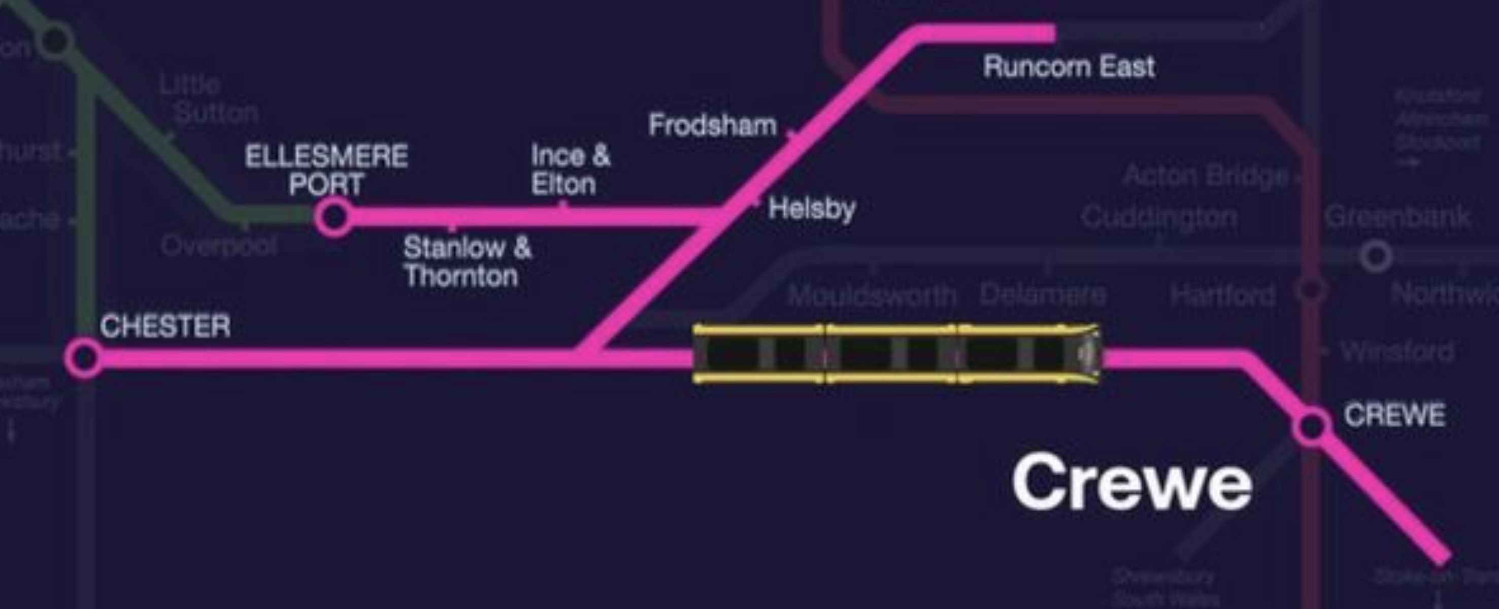
It looks like there could be as many as three routes.
- Chester and Crewe
- Chester and Runcorn East
- Ellesmere Port and Runcorn East
I’ll now cover the routes in detail.
Chester And Crewe
Consider.
- This would be a takeover by Merseyrail of the existing Trains for Wales service.
- Chester And Crewe are about 21,2 miles and 25 minutes apart.
- Chester has 750 VDC third-rail electrification and Crewe has 25 KVAC overhead electrification.
- The Class 777 trains have been built so they can be updated to dual voltage.
- There is a proposal, that Beeston Castle and Tarporley station be re-opened.
It certainly looks to be a route that could be handled by a battery-electric Class 777 train.
What would it do for passengers?
- If trains will run between Crewe and Liverpool, this creates a second route between the two major stations.
- It creates a direct link in modern electric trains between The Wirral and Crewe, for onward travel on West Coast Main Line services and High Speed Two in the future.
- The journey time could be reduced by enough to increase service frequency on the route.
I This would be a very useful extension of the Merseyrail network.
Chester And Runcorn East
Consider.
- This would be a takeover by Merseyrail of the existing Trains for Wales service.
- Chester And Runcorn East are about 13.1 miles apart.
- Two stations and five miles further on is Warrington Bank Quay station.
- Chester has 750 VDC third-rail electrification and Warrington Bank Quay has 25 KVAC overhead electrification.
- The Class 777 trains have been built so they can be updated to dual voltage.
It certainly looks to be a route that could be handled by a battery-electric Class 777 train.
What would it do for passengers?
- It would enable a Merseyrail circular route from Liverpool Lime Street to Chester via Edge Hill, Wavertree Technology Park, Broad Green, Roby, Huyton, Whiston, Rainhill, Lea Green, St Helens Junction, Warrington Bank Quay, Frodsham, Runcorn East and Helsby.
- After Chester, it could take the Wirral Line back to Liverpool to make it a true Mersey Circular service.
Would a Mersey Circular service be a good idea?
Ellesmere Port And Runcorn East
Consider.
- This been a long term aspiration of Merseyrail.
- This would be a takeover by Merseyrail of the infrequent Northern Rail service.
- Ellesmere Port And Runcorn East are about 10.8 miles apart.
- Two stations and five miles further on is Warrington Bank Quay station.
- Ellesmere Port has 750 VDC third-rail electrification and Warrington Bank Quay has 25 KVAC overhead electrification.
- The Class 777 trains have been built so they can be updated to dual voltage.
It certainly looks to be a route that could be handled by a battery-electric Class 777 train.
What would it do for passengers?
- It would certainly improve rail transport along the South Bank of the Mersey from Ellesmere Port to Warrington Bank Quay or Runcorn East depending on the Eastern terminus.
- If the terminal were to be Warrington Bank Quay that would sort out the charging.
- It could create a direct link in modern electric trains between Ellesmere Port and Warrington Bank Quay, for onward travel on West Coast Main Line services and High Speed Two in the future.
I feel that an Ellesmere Port and Warrington Bank Quay service would be good for the area.
The Borderlands Line
I’ve left the Borderlands Line to last, as I feel it will be a lot more than commuter and leisure line between Liverpool and Wrexham.
- It crosses the border between England and Wales
- The line is 26.9 miles of double track, with a single-track extension of under two miles between the two Wrexham stations.
- It has over twenty stations with more planned in both countries
- It crosses a couple of rivers on long steel bridges.
- It brings commuters to Liverpool and takes workers to the high-tech factories of companies like Airbus and Toyota on Deeside.
- It connects to a lot of golf courses, one of which is the Open Championship course at Royal Liverpool.
- Once in Wales it has two connections to the North Wales Coast Line, which runs between Chester and holyhead.
It is no ordinary railway and is ripe for improvement to bridge passengers to employment sites and leisure areas along its route.
The line has one big problem in that passengers need to change trains at Bidston between Liverpool and Wrexham stations.
- Between Bidston and Liverpool the Merseyrail electric trains to and from Hoylake are used and they turn in the Liverpool Loop under Liverpool City Centre calling at four stations before returning.
- Between Bidston and Wrexham, diesel multiple units are used.
It is a route design straight out of the 1970s of men with minds without imagination. Even British Rail were designing battery-electric trains in the 1950s, which I wrote about in Did The Queen Ever Ride In This Train?.
Merseyrail intend to right the wrongs of the past using battery-electric Class 777 trains.
- As electric versions of these trains will be used on the Liverpool and Hoylake service, there would be no need to change trains at Bidston if the Liverpool and Wrexham trains were just a battery-electric version of the same train.
- The Wrexham trains would drive round the Liverpool Loop tunnel as hundreds of trains do every day.
- The trains would be charged on the existing third-rail electrification at the Liverpool end.
- I’m fairly certain that a frequency of two tph would be possible on the route, if the Liverpool Loop tunnel signalling could cope,
- Trains would need to be charged at the Wexham end of the route and I’m sure Stadler have a solution.
It would be an efficient and cost effective way to decarbonise a tricky but useful branch line.
Conclusion
Stadler are playing their full orchestra of ideas on Merseyrail.
When completed, it will be one of the best metros of any urban areas up to a million people in the world.
This metro could do for Liverpool, what the Beatles did for the city in the 1960s.
Electro-Diesel Tram-Train Order Expanded To Support Service Increase
The title of this post, is the same as that of this article on Railway Gazette.
This is the introductory paragraph.
National passenger operator MÁV-Start has exercised an option for Stadler’s Valencia plant to supply a further four Citylink electro-diesel tram-trains for the route being developed to link Hódmezővásárhely with Szeged.
The reason, I am posting this, is that I feel the use of diesel tram-trains may have applications in this country.
- The Class 399 tram-trains in Sheffield and the Class 398 tram-trains ordered for the South Wales Metro are both members of the Citylink family, that were built or will be built in Stadler’s Valencia plant.
- The Class 398 tram-trains will have batteries to extend the route on routes without electrification.
Perhaps, if they ran on bio-diesel, they may have applications, where electrification would be difficult or inappropriate and the distance is too long for a Citylink with batteries.
Beeching Reversal – South Yorkshire Joint Railway
This is one of the Beeching Reversal projects that the Government and Network Rail are proposing to reverse some of the Beeching cuts.
This railway seems to have been forgotten, as even Wikipedia only has a rather thin entry for the South Yorkshire Joint Railway.
The best description of the railway, that I’ve found is from this article in the Doncaster Free Press, which is entitled South Yorkshire Railway Line, Which Last Carried Passengers 100 Years Ago Could Be Reopened.
This is said.
The line remains intact, and recently maintained, runs from Worksop through to Doncaster, via North and South Anston, Laughton Common/Dinnington and Maltby.
I jave got my helicopter out and navigating with the help of Wikipedia, I have traced the route of the South Yorkshire Joint Railway (SYJR) between Worksop and Doncaster.
Shireoaks Station
This Google Map shows the Southern end of the SYJR on the Sheffield and Gainsborough Central Line between Shireoaks and Kiveton Park stations.
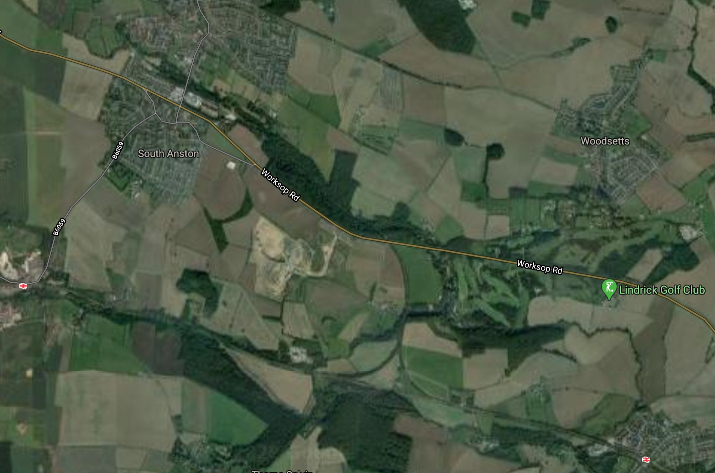
Note.
- Shireoaks station is in the East.
- Kiveton Park station is in the West.
- The SYJR starts at the triangular junction in the middle of the map.
- Lindrick Golf Club, where GB & NI, won the Ryder Cup in 1957 is shown by a green arrow to the North of Shireoaks station.
- The original passenger service on the SYJR, which closed in the 1920s, appears to have terminated at Shireoaks station.
The line immediately turns West and then appears to run between the villages of North and South Anston.
Anston Station
This Google Map shows the location of Anston station.
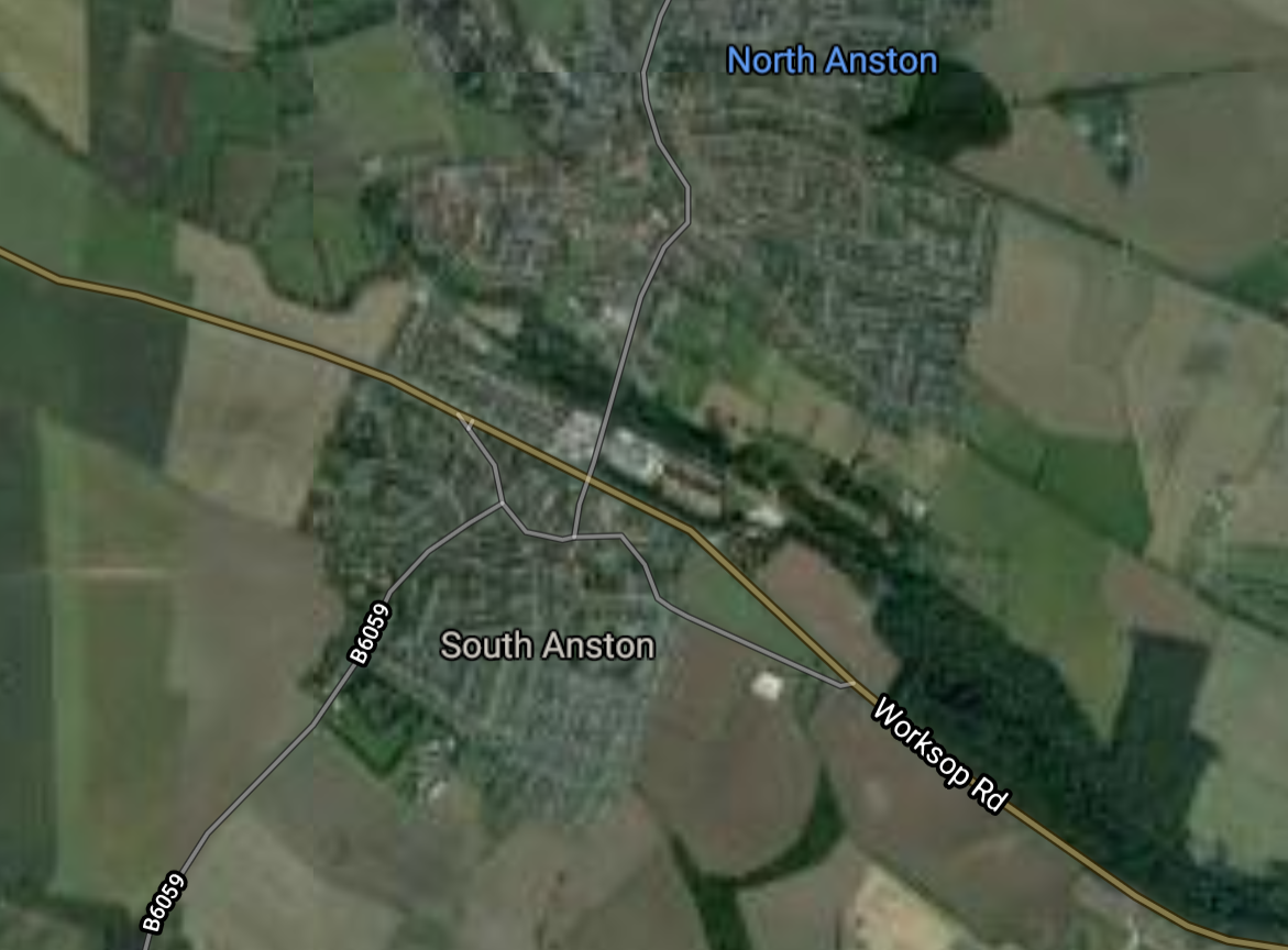
Note that the SYJR goes between the two villages and runs along the North side of the wood, that is to the North of Worksop Road.
Dinnington & Laughton Station
This Google Map shows the location of the former Dinnington & Laughton station.
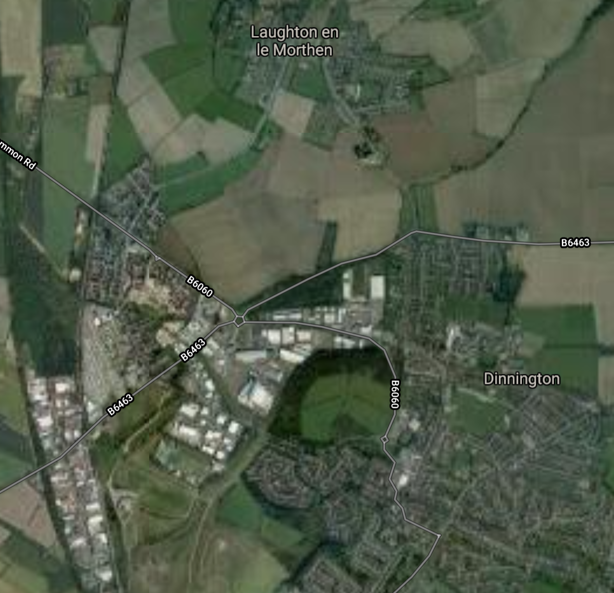
Note that the SYJR goes to the west side of both villages, so it would have been quite a walk to the train.
Maltby Station
This Google Map shows the location of the former Maltby station.
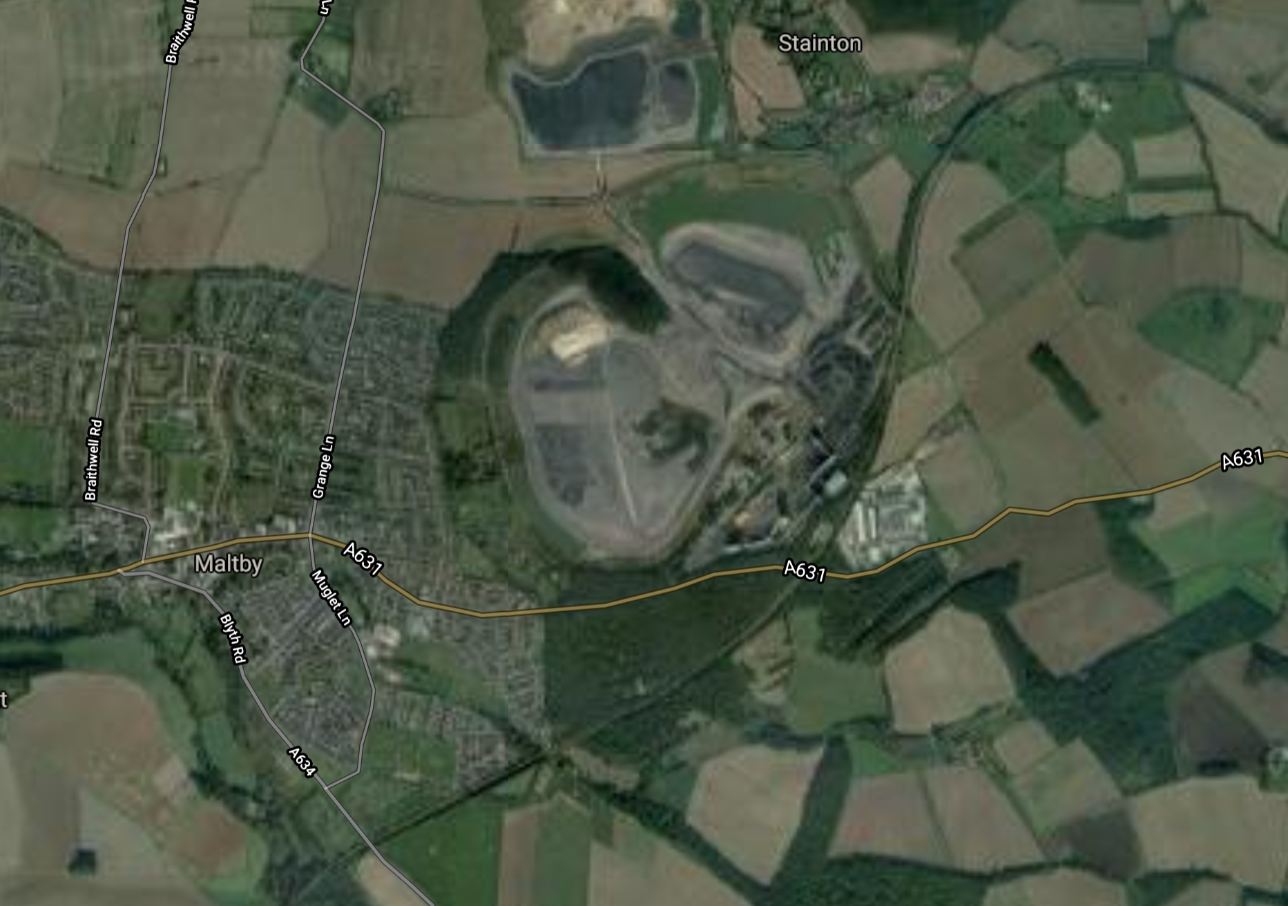
Note.
- The SYJR goes around the South side of the village.
- The remains of the massive Maltby Main Colliery, which closed several years ago.
I wonder if they fill the shafts of old mines like this. if they don’t and just cap them, they could be used by Gravitricity to store energy. In Explaining Gravitricity, I do a rough calculation of the energy storage with a practical thousand tonne weight. Maltby Main’s two shafts were 984 and 991 metres deep. They would store 2.68 and 2.70 MWh respectively.
It should be noted that Gravitricity are serious about 5.000 tonnes weights.
Tickhill & Wadworth Station
This Google Map shows the location of the former Tickhill & Wadworth station.
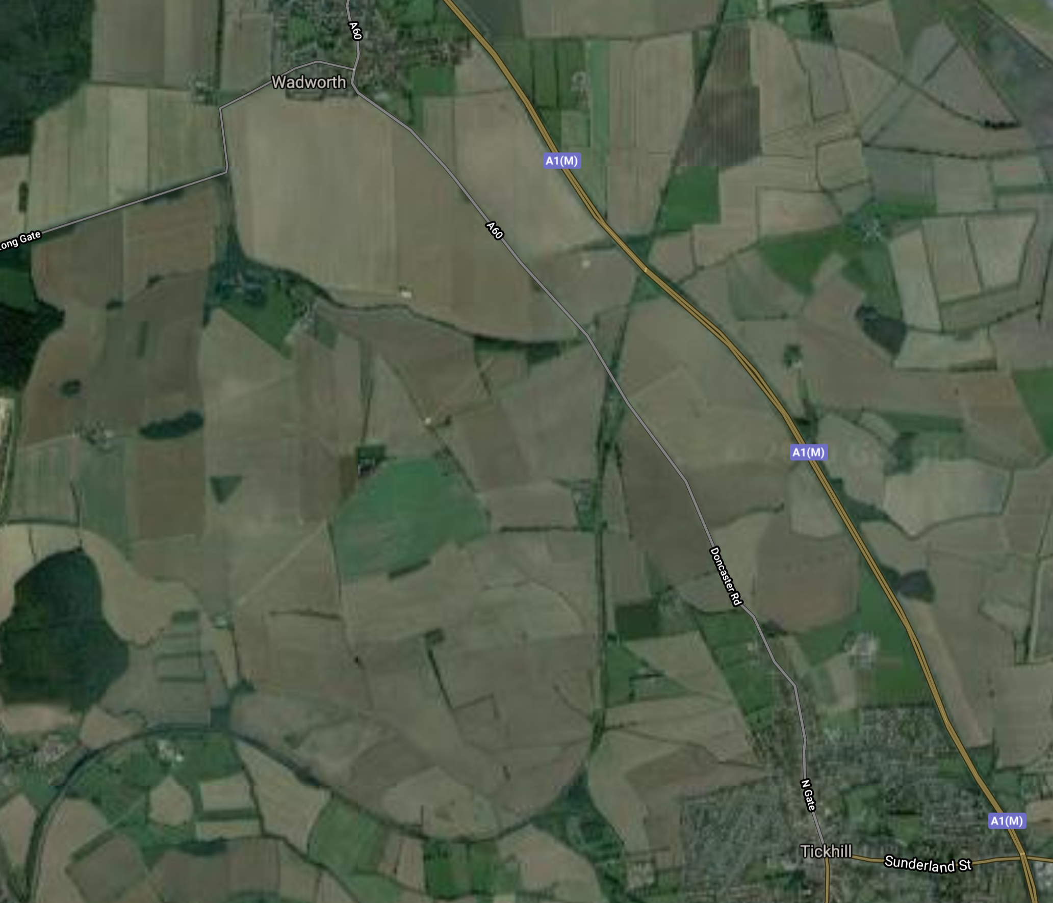
Note.
- Tickhill is in the South and Wadworth is in the North.
- Both villages are to the West of the A1 (M)
- The SYJR runs in a North-Easterly direction between the villages.
The station appears to have been, where the minor road and the railway cross.
Doncaster iPort
The SYJR then passes through Doncaster iPort.

Note.
- The iPort seems to be doing a lot of work for Amazon.
- The motorway junction is Junction 3 on the M18.
- The SYJR runs North-South on the Western side of the centre block of warehouses.
This is Wikipedia’s introductory description of the iPort.
Doncaster iPort or Doncaster Inland Port is an intermodal rail terminal; a Strategic Rail Freight Interchange, under construction in Rossington, Doncaster at junction 3 of the M18 motorway in England. It is to be connected to the rail network via the line of the former South Yorkshire Joint Railway, and from an extension of the former Rossington Colliery branch from the East Coast Main Line.
The development includes a 171-hectare (420-acre) intermodal rail terminal to be built on green belt land, of which over 50 hectares (120 acres) was to be developed into warehousing, making it the largest rail terminal in Yorkshire; the development also included over 150 hectares (370 acres) of countryside, the majority of which was to remain in agricultural use, with other parts used for landscaping, and habitat creation as part of environment mitigation measures.
It ;looks like the SYJR will be integrated with the warehouses, so goods can be handled by rail.
Onward To Doncaster
After the iPort, the trains can take a variety of routes, some of which go through Doncaster station.
I have some thoughts on the South Yorkshire Joint Railway (SYJR).
Should The Line Be Electrified?
This is always a tricky one, but as there could be a string of freight trains running between Doncaster iPort and Felixstowe, something should be done to cut the carbon emissions and pollution of large diesel locomotives.
Obviously, one way to sort out Felixstowe’s problem, would be to fill in the gaps of East Anglian electrification and to electrify the Great Northern and Great Eastern Joint Line between Peterborough and Doncaster via Lincoln. But I suspect Lincolnshire might object to up to fifteen freight trains per hour rushing through. Even, if they were electric!
I am coming round to the believe that Steamology Motion may have a technology, that could haul a freight train for a couple of hours.
These proposed locomotives, which are fuelled by hydrogen and oxygen, will have an electric transmission and could benefit from sections of electrification, which could power the locomotives directly.
So sections of electrification along the route, might enable the freight trains to go between Felixstowe and Doncaster iPort without using diesel.
It should be said, that Steamology Motion is the only technology, that I’ve seen, that has a chance of converting a 3-4 MW diesel locomotive to zero carbon emissions.
Many think it is so far-fetched, that they’ll never make it work!
Electrification of the line would also enable the service between Doncaster and Worksop to be run by Class 399 tram-trains, which are pencilled in to be used to the nearby Doncaster Sheffield Airport.
What Rolling Stock Should Be Used?
As I said in the previous section, I feel that Class 399 tram-trains would be ideal, if the line were to be electrified.
Also, if the line between Shireoaks and Kiveton Park stations were to be electrified to Sheffield, this would connect the South Yorkshire Joint Line to Sheffield’s Supertram network.
Surely, one compatible tram-train type across South Yorkshire, would speed up development of a quality public transport system.
A service could also be run using Vivarail’s Pop-up Metro concept, with fast charging at one or two, of any number of the stations.
Conclusion
This seems to be a worthwhile scheme, but I would like to see more thought on electrification of the important routes from Felixstowe and a unified and very extensive tram-train network around Sheffield.
