Hydrogen-Powered Vehicles And Trains In Tunnels
In writing about the Silvertown Tunnel, I started to wonder, if hydrogen vehicles will be allowed in the tunnel.
Consider.
- I don’t think diesel-powered trains are allowed in the Channel Tunnel and the tunnels of the link to London.
- Some tunnels don’t seem to allow hydrogen-powered vehicles.
- In a few years, hydrogen-powered buses, cars, locomotives, trains, trucks and vans will be more common, than they are today.
But help is at hand, with a co-operation between UK and EU agencies called HyTunnel-CS.
It is over fifty years now, since I worked as an instrument engineer in an ICI hydrogen factory at Runcorn. Truckloads of hydrogen were filled and despatched all over the UK. I may be wrong, but in all those intervening years, I can’t remember a hydrogen emergency on the UK’s roads.
I am confident, that we will achieve a safety regime, that allows hydrogen-powered vehicles and trains to be certified to pass through tunnels.
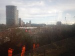
Silvertown Tunnel Bus Network Proposals
This web page is the Silvertown Tunnel Bus Network Proposals.
These proposals are made.
- A new high frequency, limited stop service between Grove Park and Canary Wharf referred to in this consultation as route X239
- To extend route 129 (Lewisham – North Greenwich) north across the river to Great Eastern Quay via the Royal Docks development zone
- A minor change to route 108 so that it uses the new Millennium Way slip road to exit the Blackwall Tunnel southbound
- We are also seeking your views on route options for three sections of routes 129 and X239.
It looks like route 108 will continue to use the current stop.
The proposals include this map.
I copied this map from the TfL web site, as they don’t provide one for people who want or need to use it.
These are my observations.
The 108 Bus
The 108 seems to be more or less as now and will be continue to be run by a single-decker bus, as double-decker buses can’t use the Blackwall Tunnel.
North of the Thames, the 108 calls at these stations.
- Stratford International for DLR and National Rail.
- Stratford for DLR, Central, Elizabeth and Jubilee Lines, and National Rail.
- Bow Church for DLR
- Devons Road for DLR
- Langdon Park for the DLR
- Bazely Street (All Saints) for DLR
South of the Thames, the 108 calls at these stations.
- North Greenwich for the Jubilee Line.
- Westcombe Park for National Rail
- Blackheath for National Rail
- Lewisham for DLR and National Rail
Note.
- It is possible to go between Lewisham and Stratford on the DLR with a change at Canary Wharf.
- It is possible to go between North Greenwich and Stratford on the Jubilee Line.
- Westcombe Park station is on the Greenwich Line.
I would wonder, if many people use this bus route for long distances.
The 129 Bus
Note.
- The 129 appears to connect Lewisham and Greenwich to the City Airport and the Becton branch of the DLR.
- Many journeys on the 129 bus, might be easier using the DLR, with a change at Westferry or Poplar, which is probably what travellers do now.
- The 129 bus is shown on the map with a stop at Silvertown. Does that mean that it could connect with a Silvertown station on the Elizabeth Line?
- As the 129 bus will pass through the larger Silvertown Tunnel, it could be a double-decker route, instead of the current single-decker.
North of the Thames, the 129 calls at these stations.
- Gallions Reach for the DLR
- Beckton for the DLR
- Royal Albert for the DLR
- London City Airport for the DLR
- Silvertown
- Pontoon Dock for the DLR
- West Silvertown for the DLR
South of the Thames, the 129 calls at these stations.
- North Greenwich for the Jubilee Line.
- Cutty Sark for DLR
- Greenwich for DLR and National Rail
- Lewisham for DLR and National Rail
Would improvements and a frequency increase to the DLR and the building of Silvertown station, mean that changes to the 129 bus route, would not be so important?
The X329 Bus
Note.
- Canary Wharf must be served and starting at Westferry Circus is probably a good choice.
- But is Grove Park station, the ideal Southern terminal?
- Not stopping the X329 bus at North Greenwich is probably correct, as North Greenwich station is a large Jubilee Line and bus interchange close to the O2.
North of the Thames, the X329 calls at these stations.
- Canary Wharf for DLR and Elizabeth and Jubilee Lines
South of the Thames, the X329 calls at these stations.
- Blackheath for National Rail
- Lee for National Rail
- Grove Park for National Rail
Note.
- Blackheath station is on the Bexleyheath and North Kent Lines.
- Lee station is on the Dartford Loop Line.
- Grove Park station is on the South Eastern Man Line.
- Grove Park has a bus station, where there could be space for a battery charger for electric buses.
The X329 seems to have been partly designed on the premise, that an express bus should be run through the Silvertown Tunnel. But it does connect four of the rail lines going into London terminals to Canary Wharf.
Silvertown Station For London City Airport
Silvertown station would more than double the number of stations with easy routes to the London City Airport.
The Elizabeth Line would enable the direct connection that is needed to Canary Wharf, the City of London, Heathrow, Liverpool Street and Paddington stations and the West End.
- A single change at Abbey Wood, would give access to much of Kent.
- A single change at Farringdon, would give access to Thameslink services and Gatwick and Luton airports.
- Around 2030, a single change at Old Oak Common, would give access to High Speed Two services.
- A single change at Paddington, would give access to Wales and West services.
- A single change at Whitechapel, would give access to the great circle of the London Overground.
I believe the case for a Silvertown station with at least a good walking route to the London City Airport is strong, and the station would be a marvellous asset for Silvertown and the Airport.
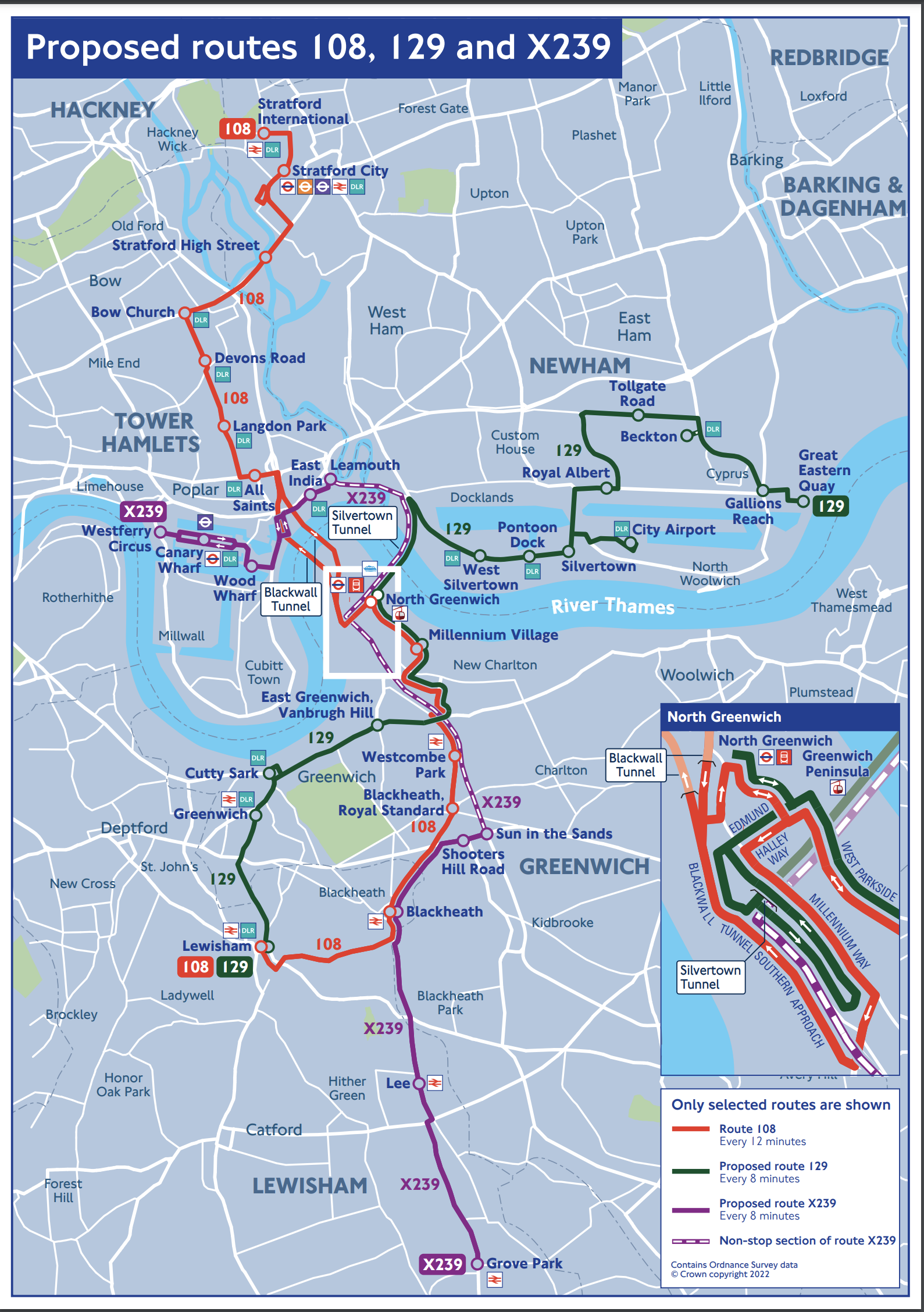
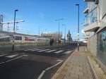
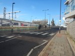
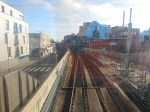
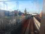
The Northern End Of The Silvertown Tunnel From The DLR To Woolwich Arsenal – 6th January 2023
I took these pictures of the Northern end of the Silvertown Tunnel from DLR trains to and from Woolwich Arsenal.
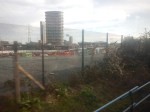
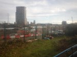
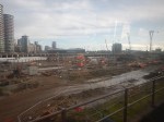
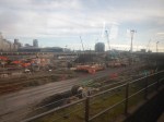
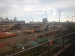

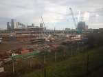
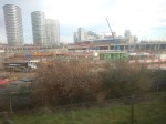
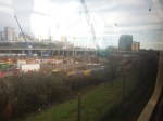
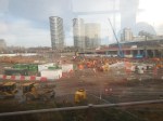
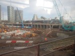
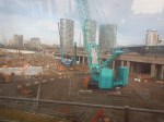

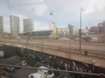
Note.
- The New London City Hall and the Cable Car in the background.
- All pictures were taken going to Woolwich.
The pictures are better than the earlier ones, which I may retire.
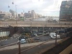
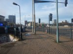
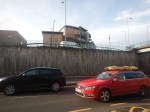
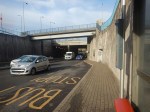
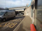
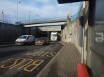
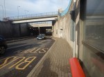
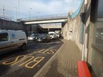
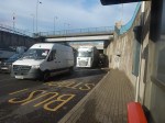
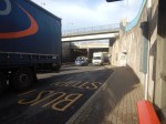
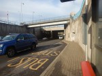
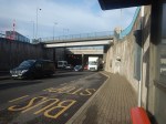
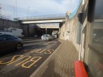
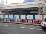
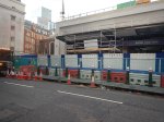
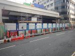
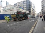
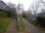
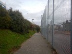
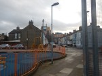
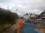
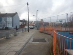
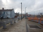
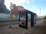
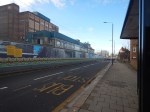
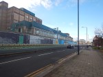
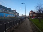
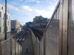
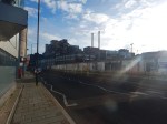
Is This The Worst Bus Stop In London?
This article on MyLondon is entitled The ‘Creepiest’ London Bus Stop Hidden At The Bottom Of A Dark, Grimy Staircase In East London.
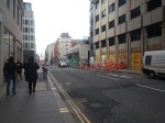
I just had to go and take a look at the bus stop.

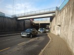
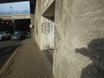
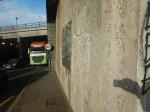

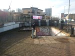
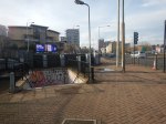
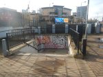


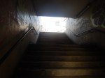


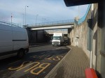
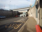
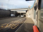
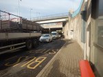
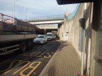
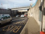
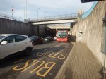
Note.
- The bus stop is on the road leading to the modern Southbound tunnel.
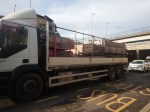
- There were a surprising number of full-size articulated trucks.
- The traffic was moving fairly slowly.
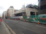
- The pollution was bad, but I’ve been in worse.
The stairs were covered in graffiti, but they appeared to have been swept recently, as there was only a small amount of litter and that was mainly a few leaves.
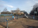
This Google Map shows the junction and the position of the bus stop.
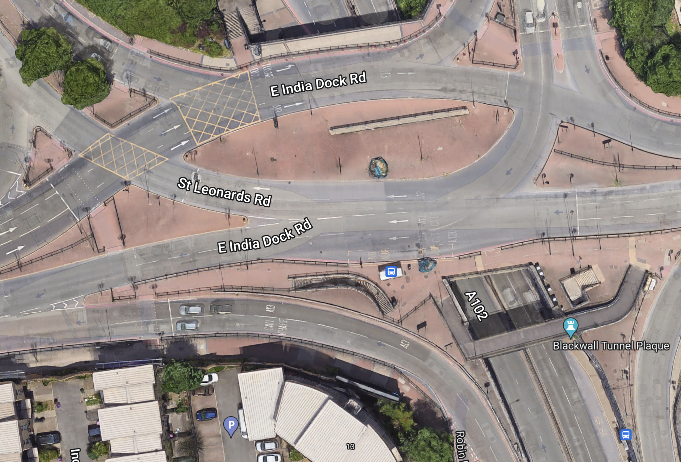
The bus stop is in the bottom-right corner of the map.
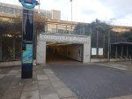
Bank Station Upgrade – 6th January 2023
I took these pictures this morning of the new Cannon Street entrance to Bank station.

There’s certainly space above the building for a substantial oversite development.
This article on Ian Visits is entitled TfL’s Office Development At Bank Tube Station Gets Taller.
These four paragraphs describes the scheme.
Transport for London (TfL) already had permission for a 7-storey building on the site but was structurally future-proofed for the possibility of an additional floor. They’ve now received permission to add the extra floor on top, and it’s further stepped back from the front of the building so that there’s space to create a large roof terrace as well.
Commercially, the previous top floor, the sixth floor lost about a third of the floorspace to plant room equipment, but will now be a full-width open plan office space, and while the new top floor still needs space for the plant equipment, but also has the new roof terrace and some additional office space. They’ve also flipped the plant room from the western side where it blocked the view of the church steeple and a lower-rise set of buildings, to the other side, which faces an office block, so the 6th-floor office users have a rather better view from the windows.
The revised scheme provides accommodation totalling 142,310 square feet across the ground and 7 upper floors plus over 7,600 square feet of terrace space over three floors.
The new scheme also changes the roof structure, which was to be covered in solar cells. However, that’s because the attic level above the offices was for traditional water boilers. The new scheme has removed the water boilers to replace them with a lower energy air source heating network, so the roof needs to be open to the air instead.
There’s also been a requirement from the City of London to reduce the number of vehicles allowed to make deliveries to the building from 54 per day to a maximum of 42, which considering that the building is also larger, is a meaningful change. Planning policy required at least 142 cycle racks, but another recent change to the building requested by the developer allowed them to put in space for 229 cycle spaces at the basement level, which is significantly higher than the minimum required.
The building certainly appears to have good environmental credentials.
Portishead Reopening Finally Approved
The title of this post, is the same as that of a small article in the January 2023 Edition of Modern Railways.
These are the first two paragraphs.
Secretary of State for Transport Mark Harper has approved a Development Consent Order to reopen the railway to Portishead as part of the West of England Combined Authority’s MetroWest Phase 1B project.
Under the £152 million scheme, the disused railway between Portishead and Pill will be rebuilt, with the Pill to Ashton Junction freight line upgraded. It joins the Bristol & Exeter route at Parson Street Junction.
Note.
- MetroWest is going to be Bristol’s Metro.
- Portishead station is going to be one of its termini.
- It appears that a new station is going to be built at Portishead.
- There used to be other stations on the branch.
I have these thoughts.
Portishead Station
In the Wikipedia entry for Portishead station, there is a section called Future, where this is said.
In April 2019 the Department for Transport committed £31.9m to cover the shortfall in finance for MetroWest Phase 1, meaning that funding for the new station and reopened line has now been secured. In November 2019 North Somerset Council submitted a Development Consent Order (DCO) application to the Planning Inspectorate, which seeks powers to build and operate the disused section of railway from Portishead to Pill, gain environmental consent to undertake works to the existing freight railway through the Avon Gorge and obtain powers for the compulsory acquisition of land. The Secretary of State for Transport is expected to make a decision within 18 months. Subject to final business case approval, construction work is expected to start on the line in December 2021 and then take around two years to complete.
The Secretary of State for Transport gave his decision in December 2022, but I would expect two year construction time to hold.
Stations On The Branch
The original branch had five stations; Ashton Gate, Clifton Bridge, Pill, Portbury and Portishead.
How many will be reopened?
In the Wikipedia entry for Ashton Gate station, there is a section called Future, where this is said.
The line through Ashton Gate would be increased to double track. Network Rail stated that it was not feasible to reopen Ashton Gate during the initial stage of the project, but that the scheme will be future-proofed to allow the construction of a station at a later date.
The section also mentions a reopened station at Pill.
The Wikipedia entry for Pill station, there is a section called Future, where this is said.
As part of the works, Pill station will be reopened. Trains both to and from Portishead will use the southern platform, which will be resurfaced and provided with a waiting shelter, lighting, passenger information displays and audible announcements. The northern platform, adjacent to the current single track line to Royal Portbury Dock, will not be reinstated, however the track will be retained for freight trains. The two tracks will have a junction east of the station.
It is expected that reopening the station will result in reduced car usage to and from Pill and the surrounding villages. Most station users will walk to the station, with the next largest share being car drivers and car passengers being dropped off, followed by cyclists and bus users. Some parking restrictions are proposed to prevent rail users parking on the local streets, which are narrow and not suitable for widening.
Note.
- The station design appears to not need a bridge.
- There would be disabled parking and a pick up/drop off point adjacent to the entrance.
I think this station design could be able to handle two trains per hour (tph).
What Will Be The Service?
This paragraph outlines the service.
An hourly service is proposed, with journey times from Portishead to the centre of Bristol expected to be around 22 minutes, which is said to be competitive with roads in the area.
Twenty-two minutes is an interesting time, as it will mean that it should be possible to do the following in an hour.
- Go from Bristol Temple Meads to Portishead.
- The driver changes ends and gets ready to return.
- Go from Portishead to Bristol Temple Meads
- The driver changes ends and gets ready to go to Portishead again.
If the train can do the full return journey in an hour, it will be able to run the service with a single train.
The Wikipedia entry for Pill station, there is a section called Future, where this is said.
Trains along the reopened line will operate between Portishead and Bristol Temple Meads, with two trains per hour in each direction. Services would call at Pill and Parson Street, with aspirations to also call at Bedminster and a reopened Ashton Gate. Trains could also be extended on to the Severn Beach Line. The trains used will be diesel multiple units, likely three carriages long.
Note.
- Wikipedia and Modern Railways are giving different frequencies.
- Two tph could probably be run by using two trains.
I suspect that the Modern Railways figure is correct, as it is the most recent.
Strategic Outline Business Case Submitted For Reopening Tavistock To Plymouth Rail Line
The title of this post, is the same as that of this news topic on the Devon County Council web site.
This is the sub-heading for the news item.
The Strategic Outline Business Case for the reopening of the Tavistock to Plymouth rail line has been submitted.
These three paragraphs outline the proposal.
Our submission to the Government’s Restoring Your Railway programme sets out the rationale for reopening the line between Bere Alston and Tavistock.
The scheme would reinstate approximately five miles of track and deliver a new single platform station at Tavistock, which would serve around 21,000 residents of Tavistock, Horrabridge, Lamerton, and Mary Tavy.
An hourly Tavistock-Plymouth service would stop at Bere Alston, Bere Ferrers and the west Plymouth stations, while maintaining the existing two-hourly service between Plymouth and Gunnislake.
I have a few thoughts.
The Connection At Bere Alston Station
This OpenRailwayMap shows the track layout at Bere Alston station.
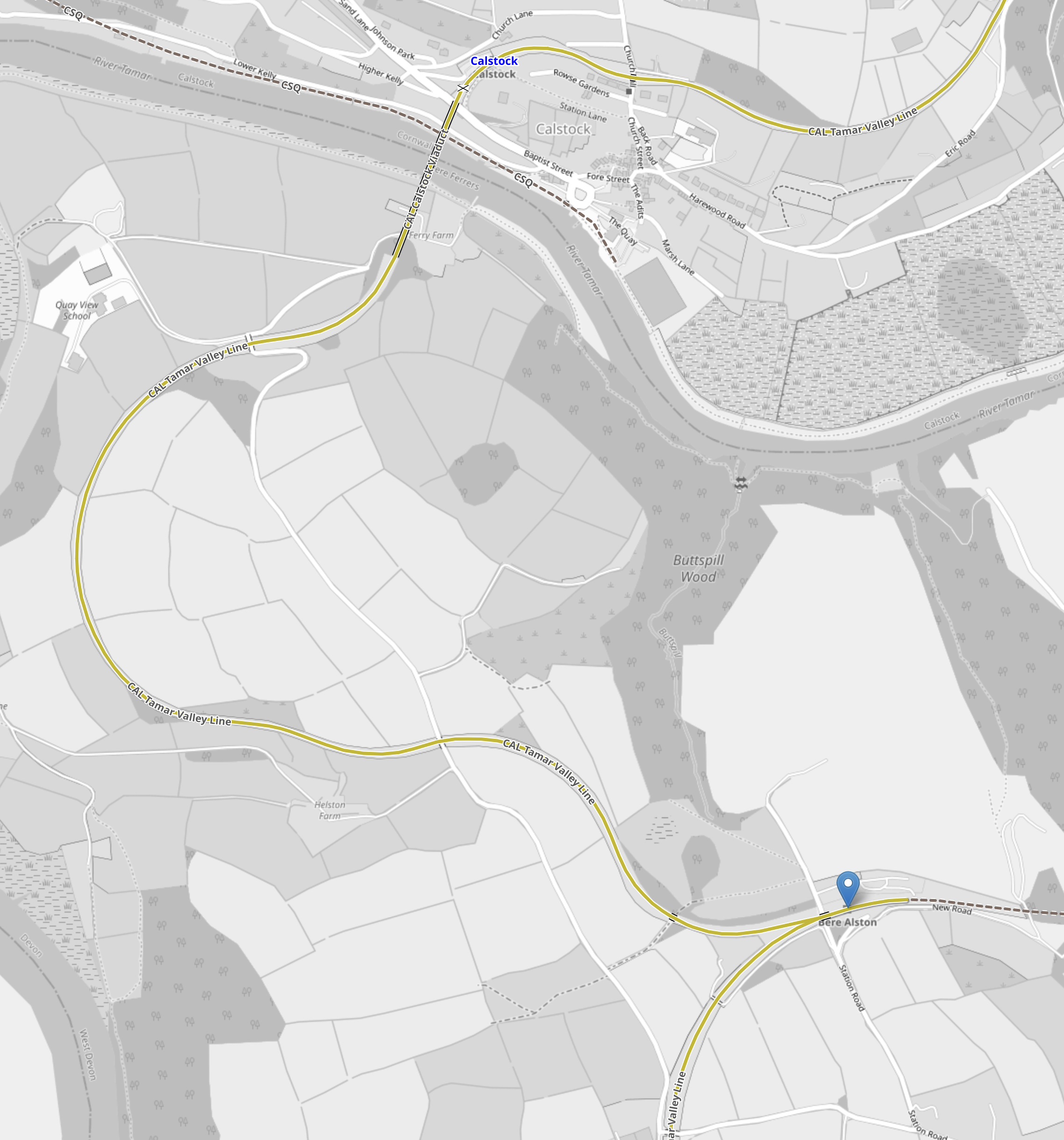
Note.
- Bere Alston station is indicated by the blue arrow.
- The line between Bere Alston and Tavistock goes East from Bere Alston station and is shown as a black dotted line.
- The single-track Tamar Valley Line between Plymouth and Gunnislake stations, is shown in yellow.
- Tamar Line trains reverse in Bere Alston stations.
- Plymouth is to the South.
- Gunnislake is to the North.
It would appear to be a simple connection.
The Route Between Bere Alston Station And Tavistock
This OpenRailwayMap shows the route between Bere Alston Station And Tavistock.
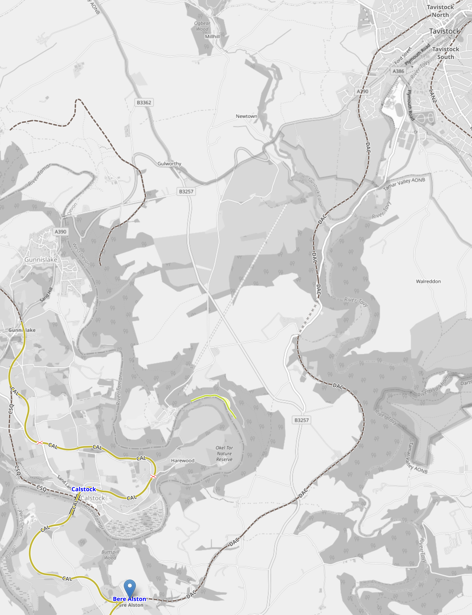
Note.
- Bere Alston station is indicated by the blue arrow.
- The single-track Tamar Valley Line between Plymouth and Gunnislake stations, is shown in yellow.
- Tavistock is in the North-East corner of the map.
- The dotted line between Bere Alston and Tavistock shows the route of the proposed reopened railway.
The new railway follows the route of a railway that closed in 1968.
These two paragraphs from the Wikipedia entry for Tavistock North station, describe the state of the railway between Tavistock North and Bere Alston stations.
The station building has been restored and converted into three self-catering cottages. The stationmaster’s house is being restored as a private dwelling, while the goods yard, now known as Kilworthy Park, houses the offices of West Devon Borough Council. The track bed for about one mile (1.6 km) south of Tavistock North station is open to the public as a footpath and nature reserve, and it is possible to walk across the viaducts that overlook the town.
The rest of the track bed south of Tavistock is almost intact to Bere Alston, where it joins the present-day Tamar Valley Line. There has been discussion regarding the re-opening of a rail link for a number of years. Engineering assessment has shown that the track bed, and structures such as bridges and tunnels, are in sound condition.
It doesn’t appear that restoring the track will be the most challenging of tasks.
But it does appear that extending the railway to the former Tavistock North station, would be a very challenging task indeed.
The Proposed Station At Tavistock
This OpenRailwayMap shows the track as it runs through Tavistock to the former Tavistock North station.
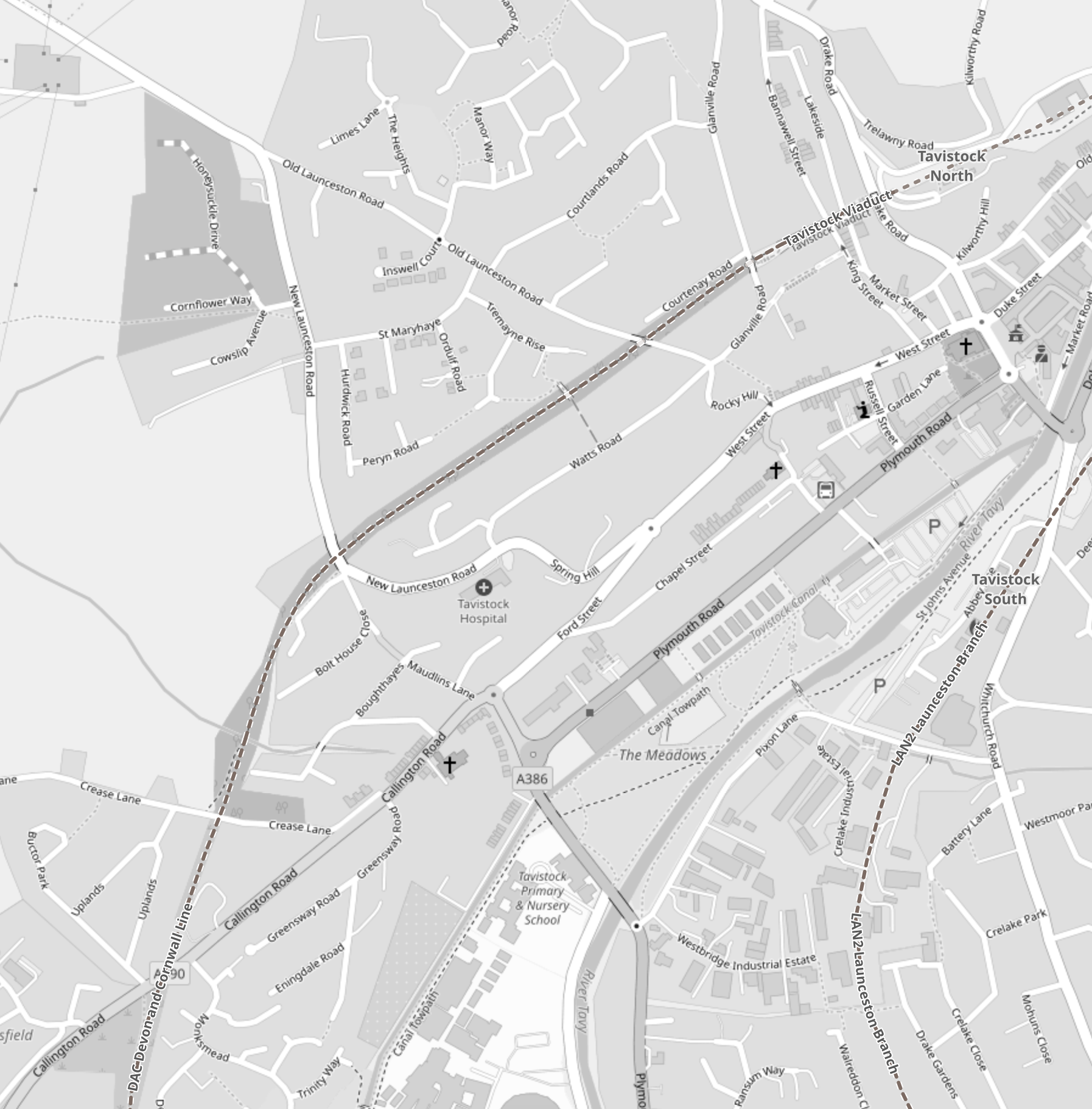
Note.
- The former railway is shown as a dotted line running diagonally SW-NE across the map.
- The former Tavistock North station is shown in the North-East corner of the map.
- This railway turns South as it leaves the town.
- The single-platform station will be built, where the railway crosses the A390.
- Another former railway passes through the town to the South-East, that passes through the former Tavistock South. station.
Between the former Tavistock North station and the A390 is now the Tavistock Viaduct Walk, which is about a mile long.
This Google Map shows where the track-bed of the old railway approaches the A390.
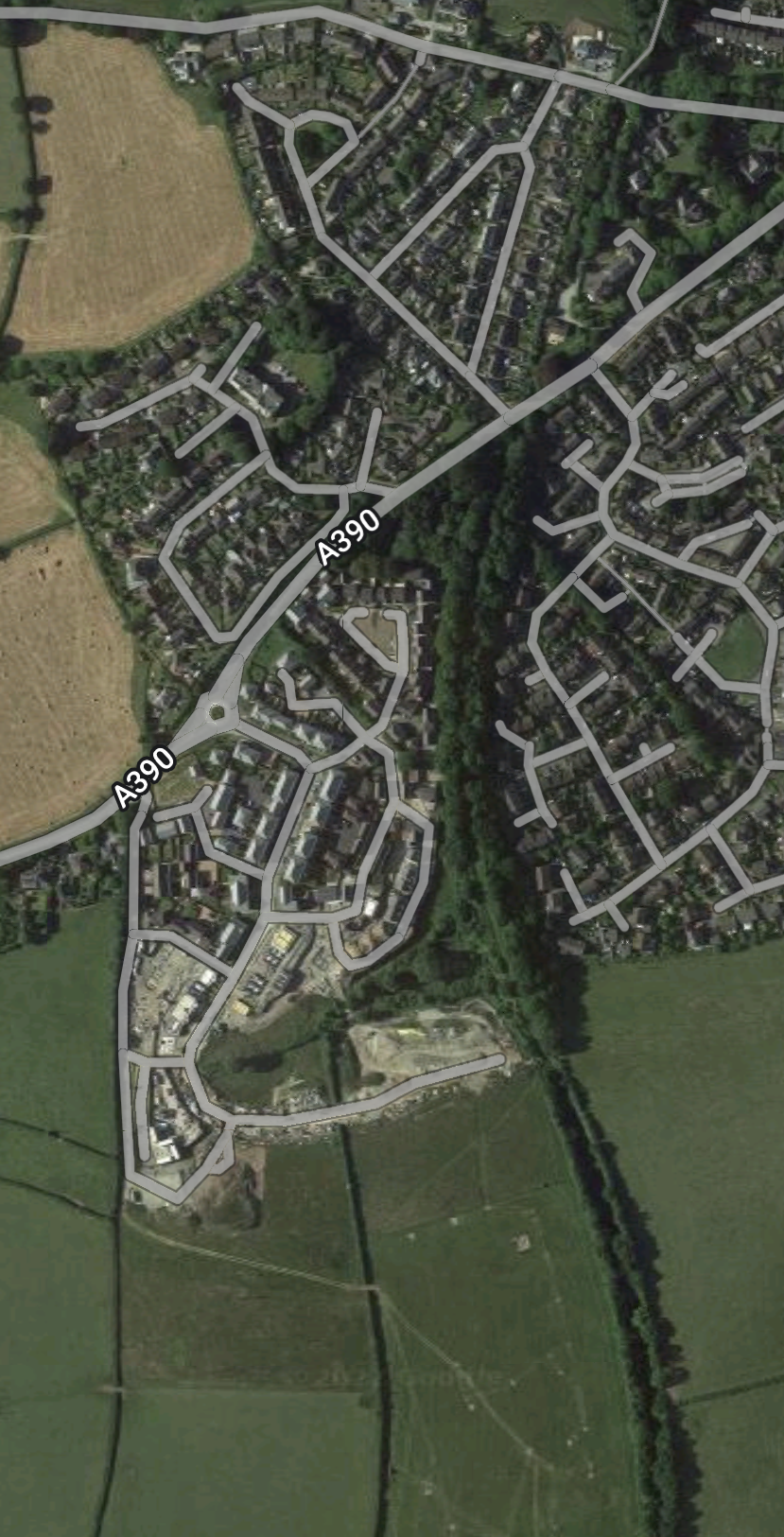
Note.
- The green scar of the former railway approaching from the South.
- The A390 running diagonally across the map.
- The plans only include a one-platform station, which I suspect is all that will fit.
Could this be a station without car-parking?
There’s not much space to put it!
Will It Be Possible To Extend From Tavistock To Okehampton?
The Line between Bere Alston and Tavistock North stations used to extend to Okehampton and train operators and Local Authorities are keen to provide a new link, in case the railway gets washed away again at Dawlish.
It’s not so much for passengers, as coaches can be used between Okehampton and Bodmin Parkway stations along the A30.
But an alternative route for freight is needed.
I would hope that the new Tavistock station will be capable of being modified, so that trains can run between Plymouth and Okehampton stations.
What Class Of Train Will Be Used Between Plymouth And Tavistock?
As a Class 150 train is used from Plymouth to Gunnislake, I suspect a Class 150 train will be used.
But the station will probably be long enough for a five-car Class 802 train.
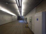
The Southern Entrance To London City Airport
I entered London City Airport by a different route today, taking these pictures as I walked.


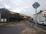


Note.
- The route is level.
- It is on the Southern side of Hartmann Road, which is the main entrance road for the airport.
- There is a pedestrian tunnel under Hartmann Road into the airport.
- There are stairs and lifts into the Docklands Light Railway station at the airport.
- The lifts so all the way to the platforms of the DLR.
- The route is level from the lifts to the airport.
This Google Map shows the walk.
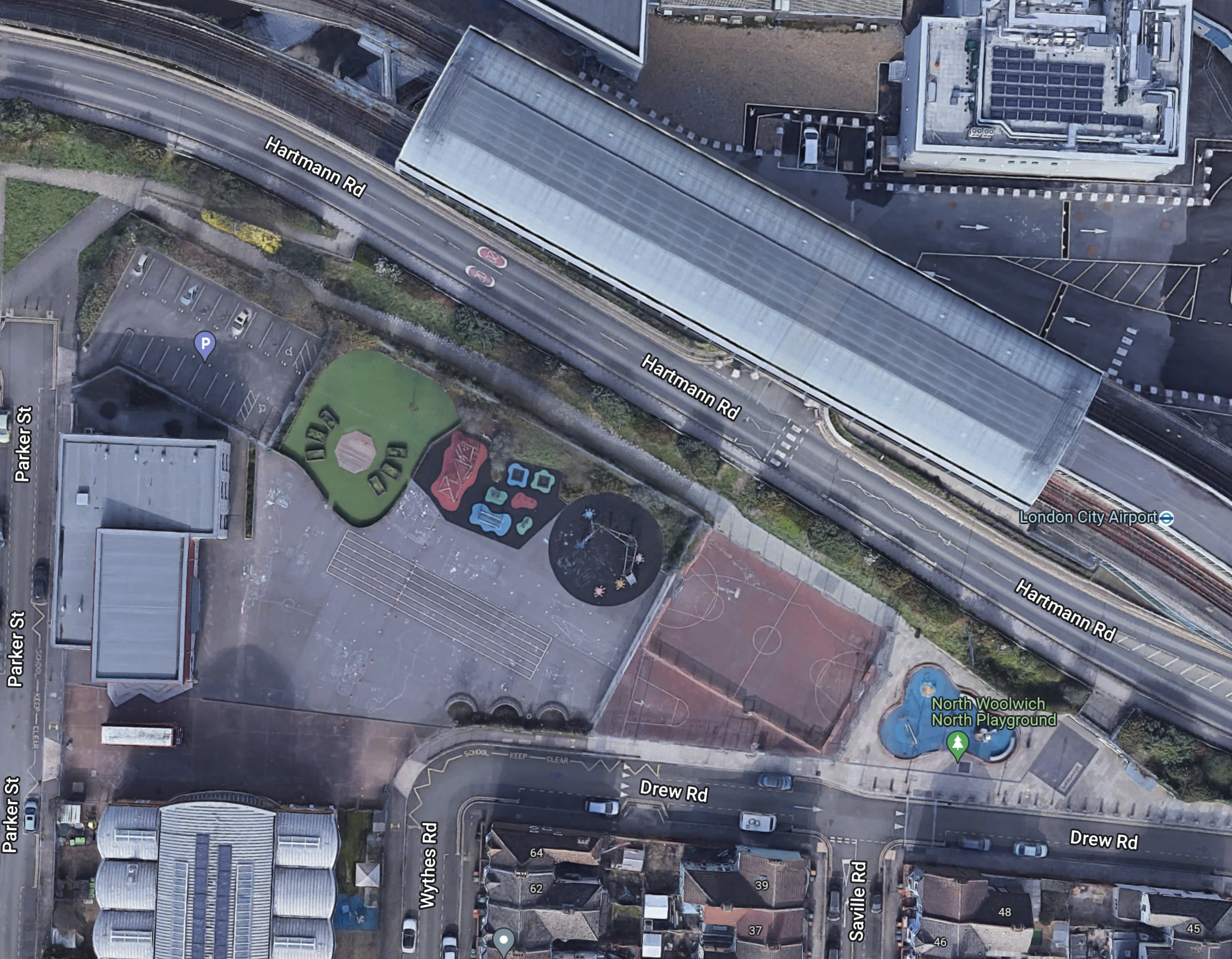
Note.
I walked along the path, that runs NW-SE on the Northern side of the various courts and playgrounds.
The entrance to the DLR station is at the South-East end of the path at the junction of Drew and Saville Roads.
This Google Map shows a 3D visualisation of the entrance.
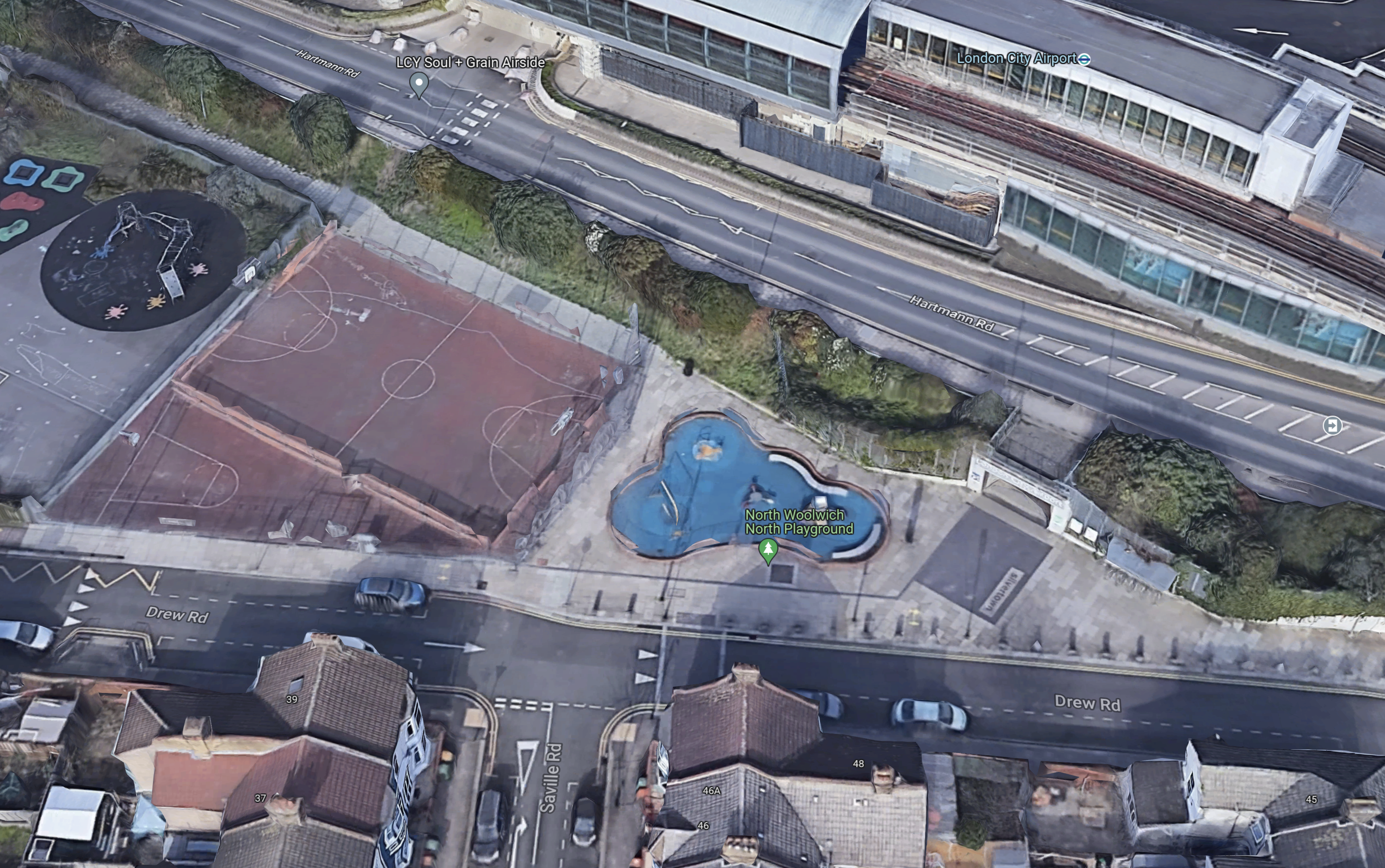
Note.
- The path runs on the North side of the football pitch.
- The Southern entrance is to the right of blue play area.
- Drew Road runs across the entrance.
- It looks like there is a drop-off point for passengers, where the car is parked by the football pitch.
Would it be possible to create a waking route from this Southern entrance to a rebuilt Silvertown station on the Elizabeth Line?
This Google Map shows the area between the Southern entrance to the airport and the footbridge over the Elizabeth Line.
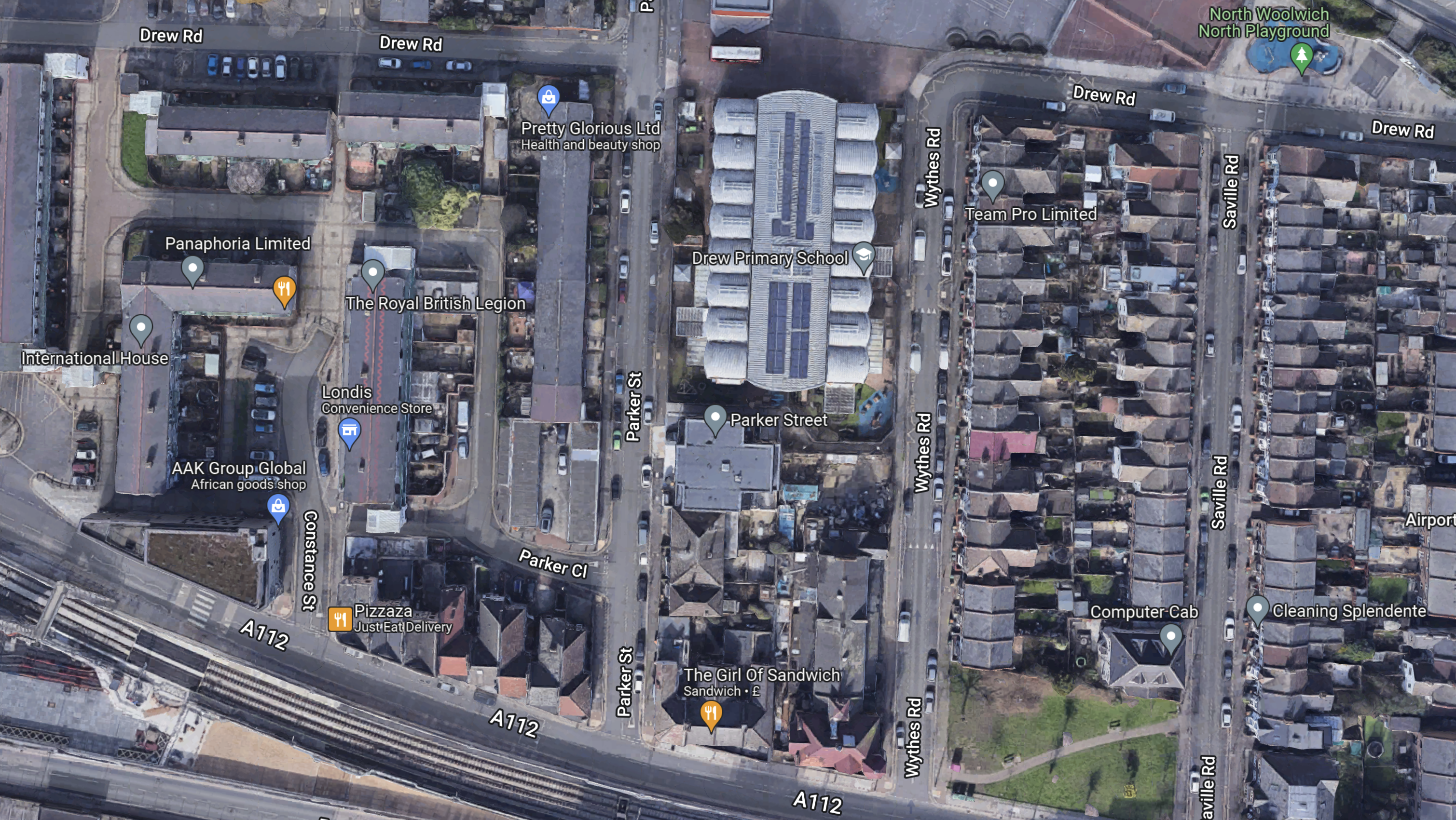
Note.
- The Southern entrance to the airport is in the North-East corner of the map.
- The footbridge over the Elizabeth Line is in the South-West corner of the map.
- The large building in the middle is Drew Primary School.
- Whytes Road, Saville Road and Leonard Street lead between the Southern entrance to the airport and the A112.
I took these pictures of the A112 and the footbridge a few days ago.

I think it would be possible to run a fleet of small electric shuttle buses on the route.
Elizabeth Line Trains From Silvertown Station
Currently, the following trains pass through the site of the original Silvertown station.
- Reading and Abbey Wood stopping at Twyford, Maidenhead, Taplow, Burnham, Slough, Langley, West Drayton, Hayes & Harlington, Southall, Ealing Broadway, Paddington, Bond Street, Tottenham Court Road, Farringdon, Liverpool Street, Whitechapel, Canary Wharf, Custom House and Woolwich.
- Maidenhead and Abbey Wood stopping at Taplow, Burnham, Slough, Langley, Iver, West Drayton, Hayes & Harlington, Southall, Ealing Broadway, Paddington, Bond Street, Tottenham Court Road, Farringdon, Liverpool Street, Whitechapel, Canary Wharf, Custom House and Woolwich.
- Heathrow Terminal 4 and Abbey Wood stopping at Heathrow Terminals 2 & 3, Hayes & Harlington, Southall, Hanwell, West Ealing, Ealing Broadway, Acton Main Line, Paddington. Bond Street, Tottenham Court Road, Farringdon, Liverpool Street, Whitechapel, Canary Wharf, Custom House and Woolwich.
- Heathrow Terminal 5 and Abbey Wood stopping at Heathrow Terminals 2 & 3, Hayes & Harlington, Southall, Hanwell, West Ealing, Ealing Broadway, Acton Main Line, Paddington, Bond Street, Tottenham Court Road, Farringdon, Liverpool Street, Whitechapel, Canary Wharf, Custom House and Woolwich.
Note.
- All four services have a frequency of two trains per hour (tph).
- Paddington, Bond Street, Tottenham Court Road, Farringdon, Liverpool Street, Whitechapel, Canary Wharf, Custom House and Woolwich have a frequency of eight tph.
- Heathrow Terminals 2 & 3 has a frequency of two tph and it has extra connections to Heathrow Terminal 4 and Heathrow Terminal 5.
The number of services will increase in May 2023.
Stadler Presents Mock-Up Of Tram-Trains For German And Austrian Operators
The title of this post, is the same as that of this article on Railway Gazette.
This is the first paragraph.
A mock-up of the Citylink tram-trains that Stadler is to supply to operators in Karlsruhe, Saarbrücken, Neckar-Alb, Oberösterreich and Salzburg was unveiled at the Betriebshof West depot in Karlsruhe on December 13.
This is the most interesting paragraph.
‘Maximum standardisation and the fact that the order was shared between different operating companies reduces the costs by to up to €1m per vehicle’, said Karlsruhe Mayor Frank Mentrup at the unveiling ceremony.
It shows the value of standardisation and large orders.
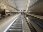
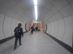
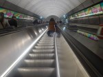
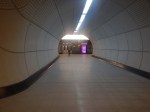
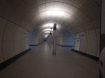
Passenger Tunnel Linings At Waterloo Underground Station
This pictures show the cast-iron pedestrian tunnel linings at Waterloo tube station.
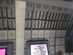
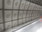
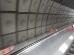
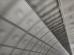

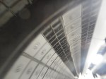
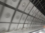
The Jubilee Line opened in 1999.
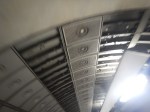
In the last few years, concrete has been able to be 3D-printed, so it can now be produced in different shapes.
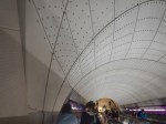
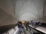
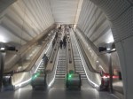
All these wall and roof panels on the Elizabeth Line were made by 3D-printing of concrete.
Conclusion
Design has progressed in 25 years.
