I’ve Just Glimpsed The Future Of Train Travel Across The North Of England And I Like It
Yesterday, I had an appointment at Liverpool Lime Street station at four o’clock, so as I hadn’t seen the works for the TransPennine Upgrade for some time, I decided to go the long way round with a change of train from LNER to TransPennine Express at Leeds.
These sections document my day.
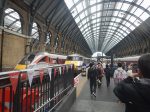
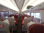
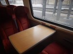
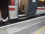
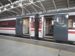
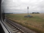
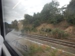
London King’s Cross To Leeds In An InterCity 225
I took these pictures on the journey.

Note.
- The 31 InterCity 225 trains were built around 1990.
- They have a capacity of 535 seats, whereas the newer Hitachi Class 801 trains have a capacity of 611 seats. Both trains are nine cars with both First and Standard seats.
- There is more of a step-up and step-down when entering or leaving the trains, compared to the best of today’s trains.
- They are now being phased out in favour of ten new CAF tri-mode Class 897 trains, which should be entering service in 2027.
- No details are available of the seating capacity of these trains, but they could be between 650 and 700, so they could maximise capacity on any LNER route.
Yesterday, the InterCity 225 performed well, although the windows at the seat where I sat, were rather dirty.
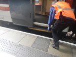
Changing Trains At Leeds Station
I changed to TransPennine Exzpress at Leeds station.
- At least, Leeds station, is one of the few in the UK, with a ticket office behind the barrier. Reading station please note this.
- But, I did have to walk across the bridge from one side of the station to the other.
In the end, I caught the TransPennine Express with about thirty seconds to spare.
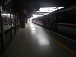
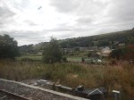
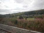
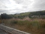
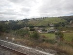
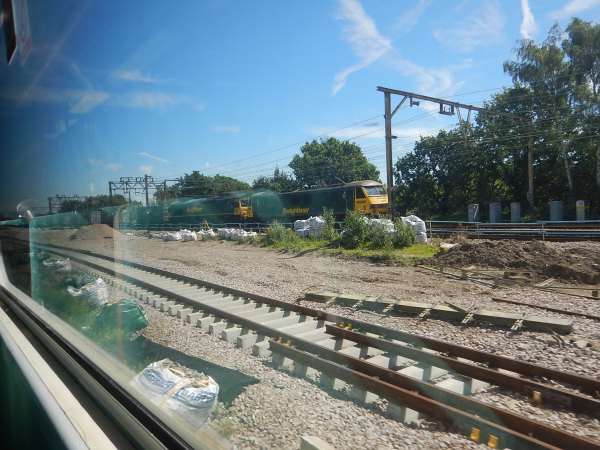
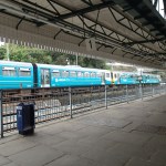
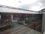
Between Leeds And Huddersfield Stations
I took these pictures between Leeds and Huddersfield stations.

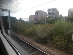
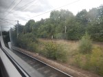
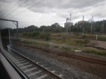
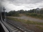

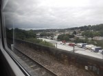
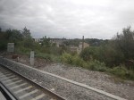


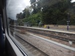
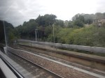

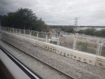
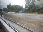
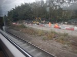

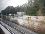
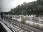
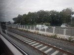
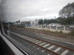
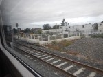

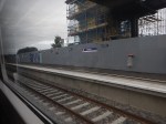

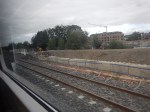
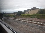
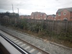
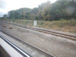
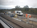
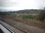
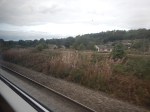
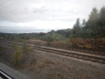

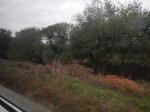

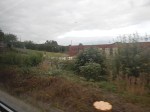
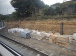
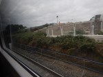
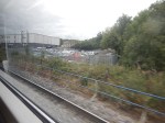
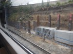
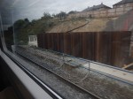
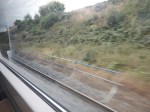
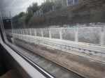
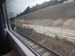
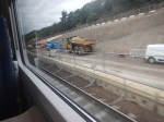
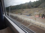
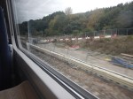
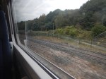
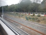
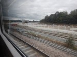
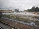

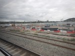
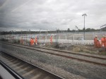
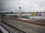
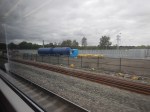
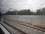
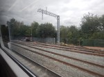


Note.
- Dewsbury and Huddersfield stations is about eight miles and takes about eight minutes.
- It is virtually a continuous building site, where extra tracks are being inserted.
- Three stations are being rebuilt.
- Overhead electrification is being installed. But except for approaching Huddersfield, there’s not much to be seen.
- OpenRailwayMap gives the maximum speed between Dewsbury and Huddersfield stations as between 60-75 mph.
The ride on my Class 803 train was very quiet and smooth. Was it on battery power or was I sitting in a coach without a diesel engine underneath?
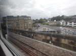
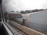
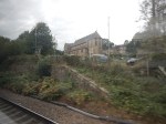
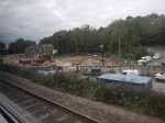
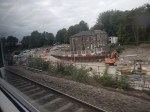
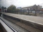
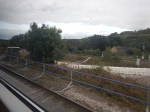
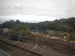
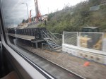
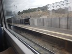
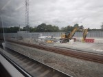
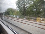
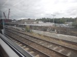
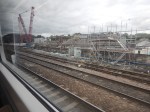
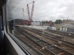
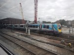
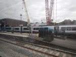
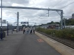
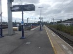
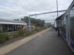
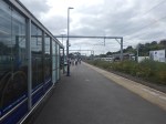
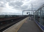
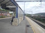
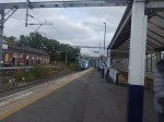
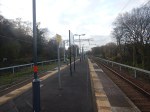
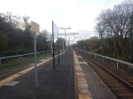
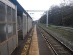
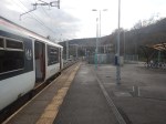
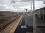
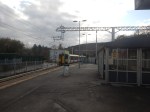
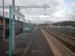
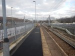
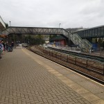
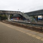
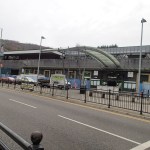
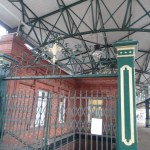
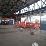
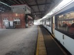
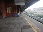
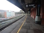
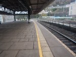
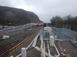
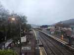
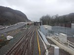
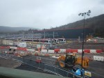
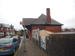
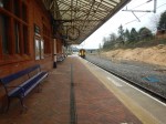
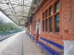
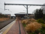
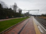
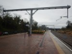
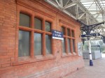
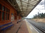
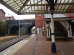
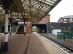
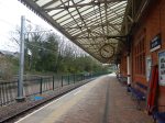
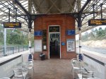
Huddersfield Station
I took these pictures at Huddersfield station.
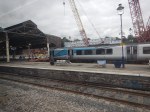
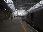
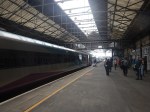

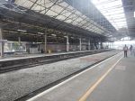
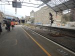


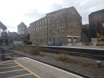
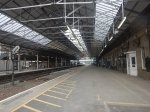
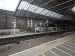
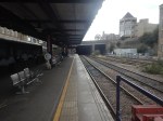
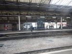

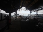
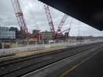
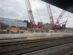

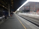

Note.
- Huddersfield station is Grade I Listed.
- There is a pub in each wing.
- I had a beer in the West Wing.
- There are currently three main through platforms and three bay platforms.
- Extensive works, which will be part of the TransPennine Upgrade, will include electrification, a new roof, a new footbridge, and two extra through platforms.
Huddersfield station will be the jewel in the Costa del Yorkshire.
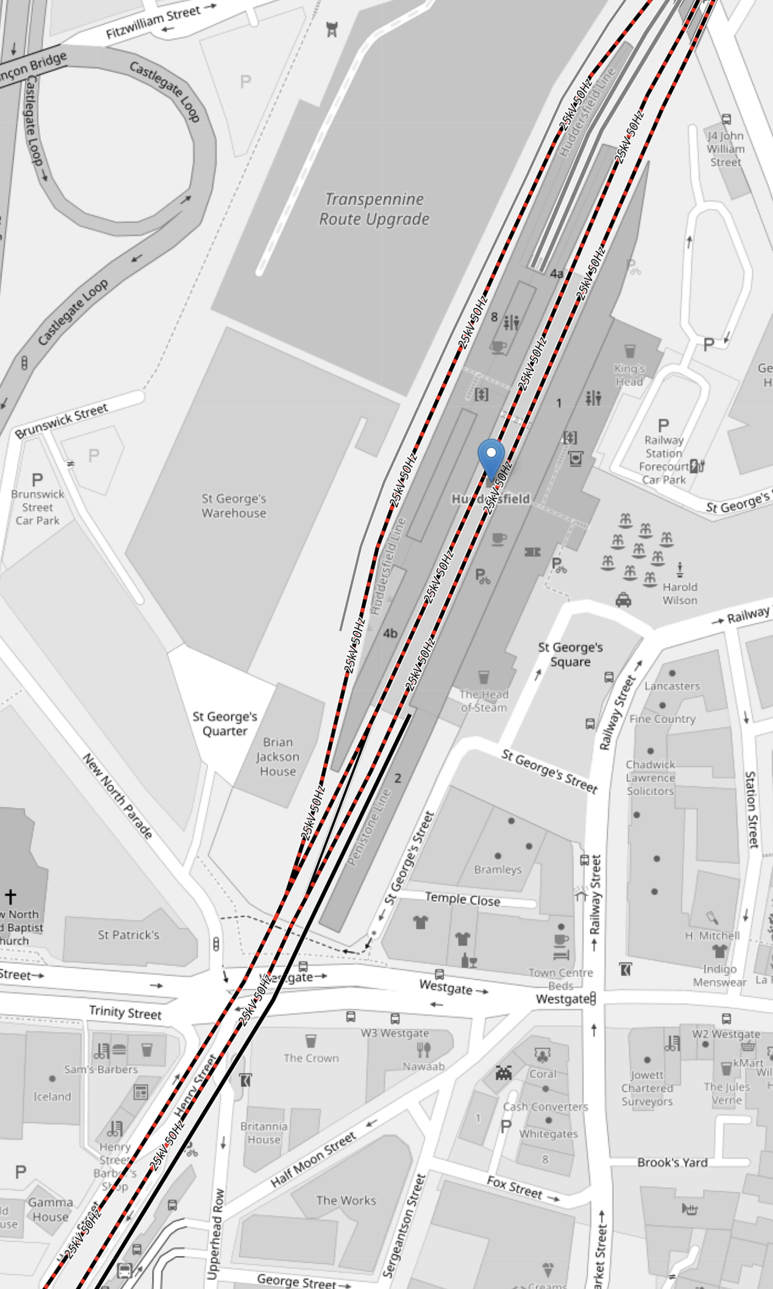
The Platforms At Huddersfield Station
This OpenRailwayMap shows the platforms in Huddersfield station.
Note.
- The red and black tracks are being electrified.
- Of the current platforms, Platforms 1, 4 and 8 will be electrified.
- The two bay platforms; 5 and 6, will be converted into through platforms.
- Platform 2 is the bay platform in the South-West corner of the map, that is used by the shuttle train from Sheffield.
I am sure extra platforms could be electrified as required, as there must be a good electrical connection at Huddersfield station.
A Tram-Train Service Between Huddersfield And Sheffield Stations
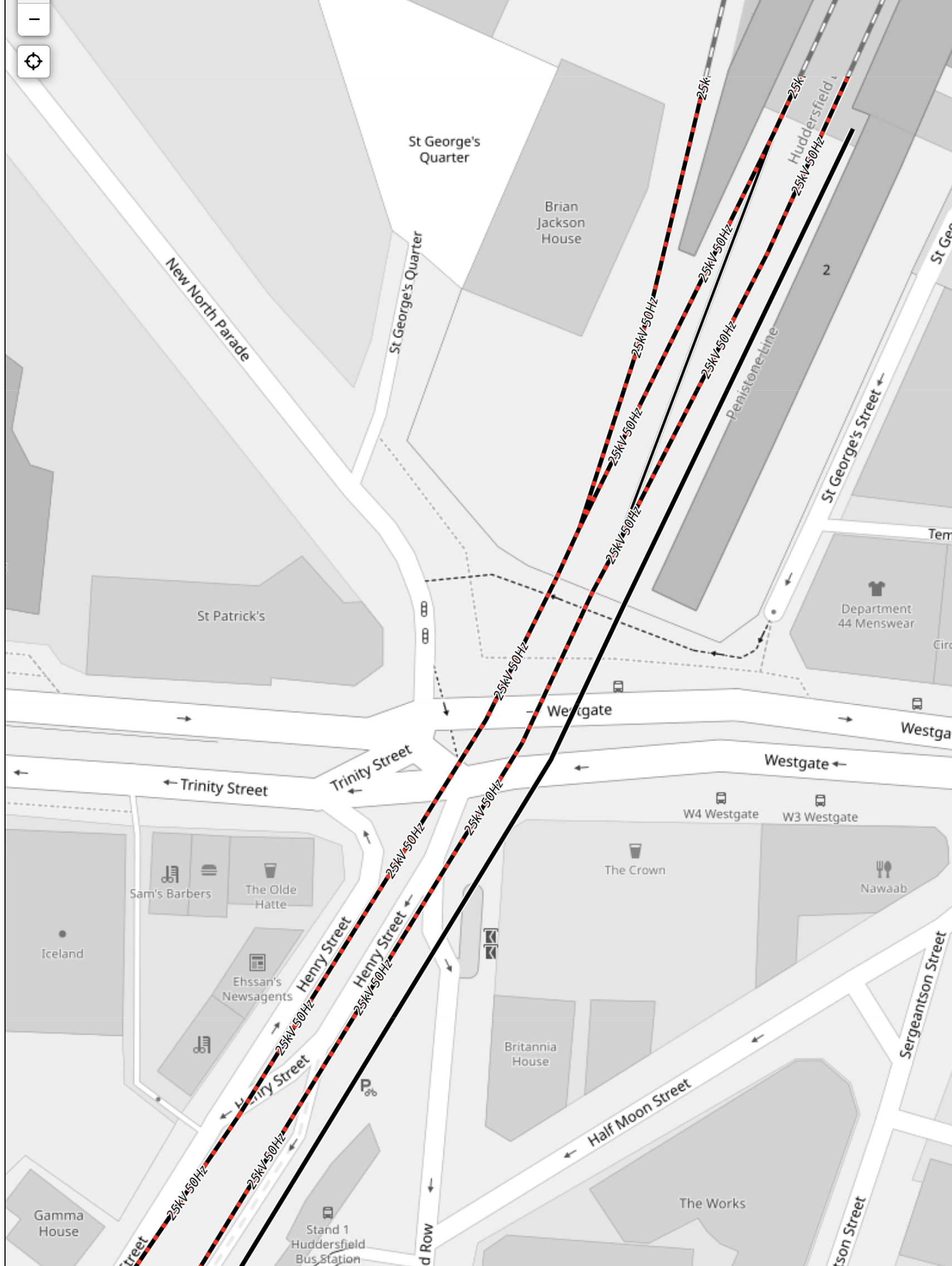
This OpenRailwayMap shows platform 2 at Huddersfield station.
Note.
- Platform 2 is the black track at the right of the two through tracks, that are being electrified.
- Platform 2 is a bay platform close to the Head of Steam pub.
- I estimate that the platform is about 90 metres long.
- I suspect Platform 2 could be lengthened if required.
- Sheffield’s Class 399 tram/trains are 37.2 metres long, so a pair should fit in Platform 2.
- The Class 398 tram/trains can run on battery power and climb hills in South Wales.
- Platform 2 at Huddersfield station could be electrified to charge the tram/trains.
- There could be a significant height difference between Huddersfield and Sheffield stations of about 40 metres, which could be used to charge tram/trains on the way down.
- I feel with some track improvements, that a four trains per hour (tph) service could be run.
The service would call at Meadowhall, Chapeltown, Elsecar, Wombwell, Barnsley, Dodworth, Silkstone Common, Penistone, Denby Dale, Shepley, Stocksmoor, Brockholes, Honley, Berry Brow and Lockwood
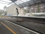
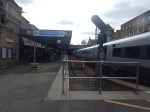
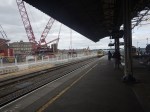
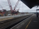
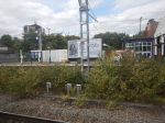
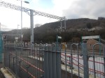
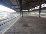
The Pair Of Cranes In Huddersfield Station
These can’t be missed in the pictures. But why two massive cranes?
With an old roof to be taken down and a new roof and a footbridge to be lifted into place, I believe Network Rail have decided to bring in two of largest mobile cranes available in the UK, so that all the lifting doesn’t delay the project.
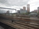
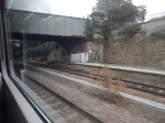
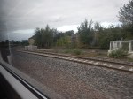
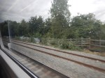
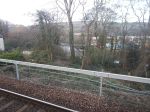
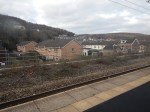
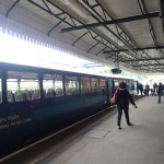
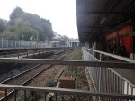
Between Huddersfield And Stalybridge Stations
I took these pictures between Huddersfield and Stalybridge stations.
Note.
- The Class 802 train was running freely along a well-laid track.
- There are four stations between Huddersfield and Stalybridge; Slaithwaite, Marsden, Greenfield and Mossley(Manchester).
- The stations were in reasonable condition, but some needed new footbridges and a bit of refurbishment.
- There was virtually no signs of any foundations for electrification.
This map shows the route.
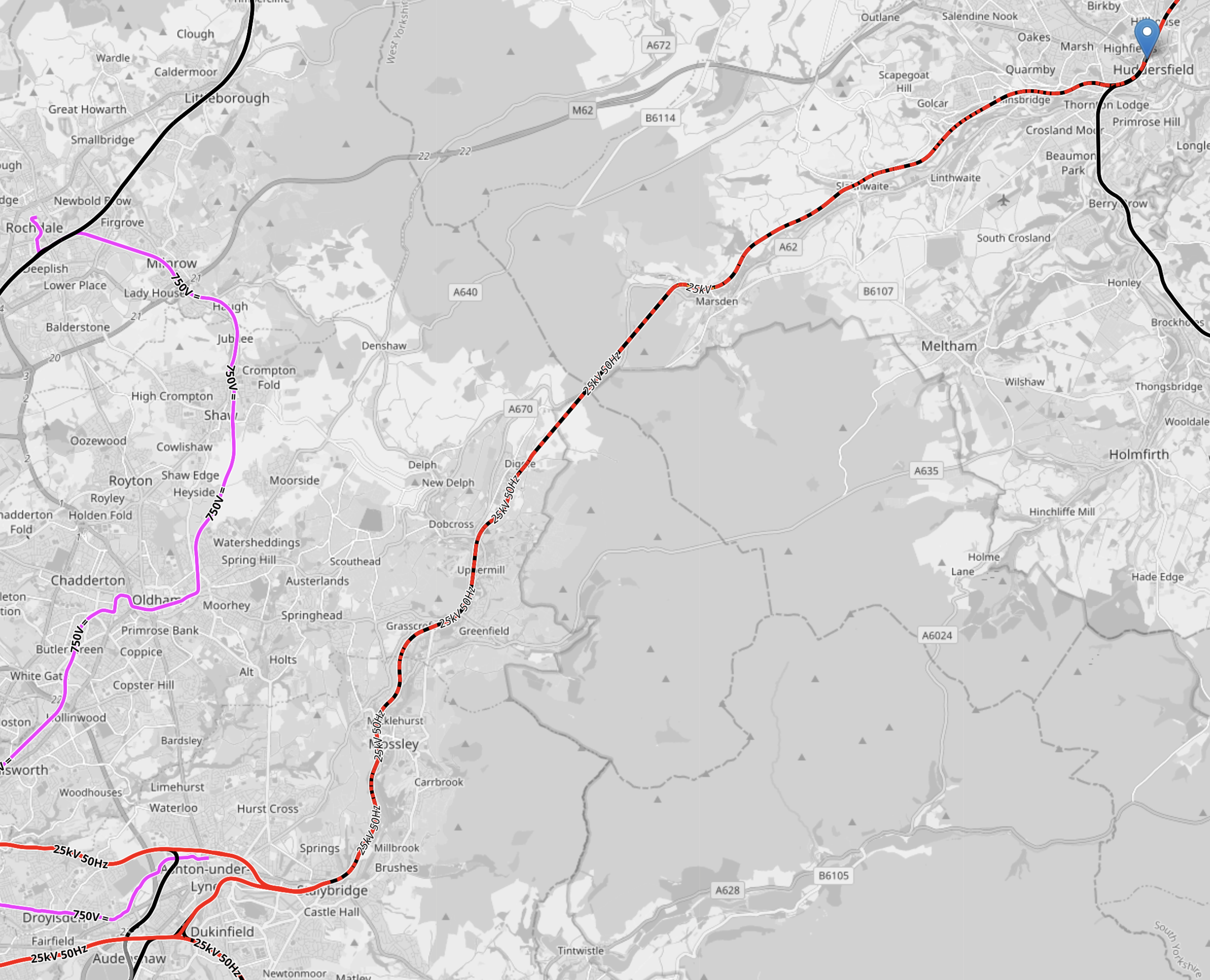
Note.
- The pink tracks are the Manchester Metrolink.
- The red tracks are electrified at 25 KVAC overhead.
- The red and black tracks are being electrified.
- Huddersfield is indicated by the blue arrow in the North-East corner of the map.
- Stalybridge station is in the South-West corner of the map.
- The pink track in the South-West corner of the map is the Manchester Metrolink branch to Ashton-under-Lyme.
- The route between Huddersfield and Stalybridge is shown as it will will be fully electrified.
- Huddersfield and Stalybridge is 18 miles.
- There are three short tunnels between Huddersfield and Stalybridge.
I wonder, if it would be more affordable to not put up wires between Huddersfield and Stalybridge and use battery-electric passenger trains and hydrogen freight locomotives?
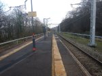
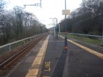
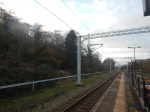
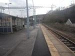
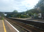
Stalybridge Station
I took these pictures at Stalybridge station.
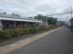
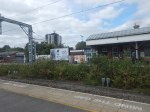
The station is fully-electrified and has direct services to Huddersfield, Hull, Leeds, Liverpool, Manchester Piccadilly, Manchester Victoria, Newcastlle, Wigan and York.
Will Liverpool Lime Street And Newcastle Be Fully Electrified?
Consider.
- Liverpool Lime Street and Newcastle stations is 180.8 miles.
- Newcastle and Church Fenton stations is 91.4 miles and is fully-electrified.
- Liverpool Lime Street and Stalybridge stations is 39.4 miles and is fully-electrified.
This means that the gap between Church Fenton and Stalybridge stations is just fifty miles.
Real Time Trains indicate that the current Class 802 trains on the route run on diesel between Stalybridge and York stations, which is 60.8 miles.
- Changing power in Stalybridge and York stations means if anything goes wrong passengers can be easily rescued.
- From what I saw on Thursday, it looks like electrification will be completed between Neville Hill depot and Huddersfield.
I wouldn’t be surprised, if they just electrified to the West of Stalybridge and the East of Huddersfield.
That would mean that the 18 miles between Stalybridge and Huddersfield would be run on batteries.
- But it would also avoid electrifying three tunnels.
- How much disruption would be saved, by not electrifying the tunnels?
- Freight trains would use something like a bi-mode Class 99 locomotive, but it would only need a range of 18 miles on diesel.
I can also see improvised bi-mode locomotives being used like this combination of a Class 66 and Class 90 locomotives.
It was certainly doing its job, when I saw the combination at Shenfield.
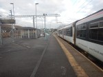
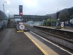
Treforest Estate Station – 28th November 2023
On Tuesday, I went to South Wales to look at the progress of the South Wales Metro.
I took these pictures at Treforest Estate station.
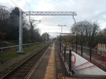
Note.
- The station has a narrow island platform.
- Aberdare, Merthyr Tydfil and Treherbert trains go through here. but on Tuesday not all were stopping.
- It was rather cold and draughty.
- The electrification looks to be of high quality.
This OpenRalwayMap shows the tracks through the station.
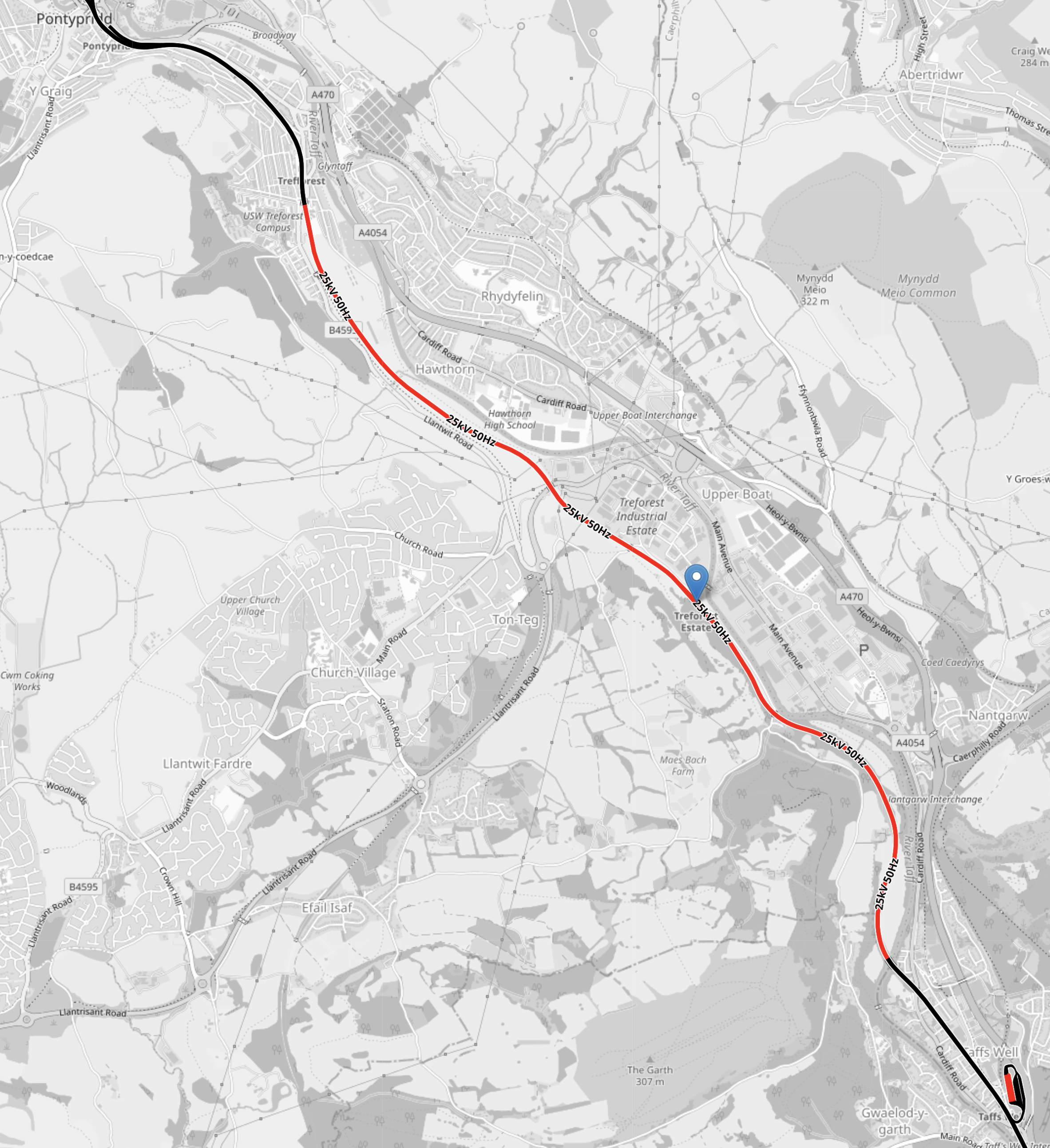
Note.
- Electrified lines are shown in red.
- Unelectrified lines are shown in black.
- Pontypridd, where the tracks are not electrified is at the top of the map.
- The strange squiggle in the South-East corner of the map is Taff’s Well Depot.
- The blue arrow indicates the position of Treforest Estate station.
This OpenRalwayMap shows the station at a larger scale.
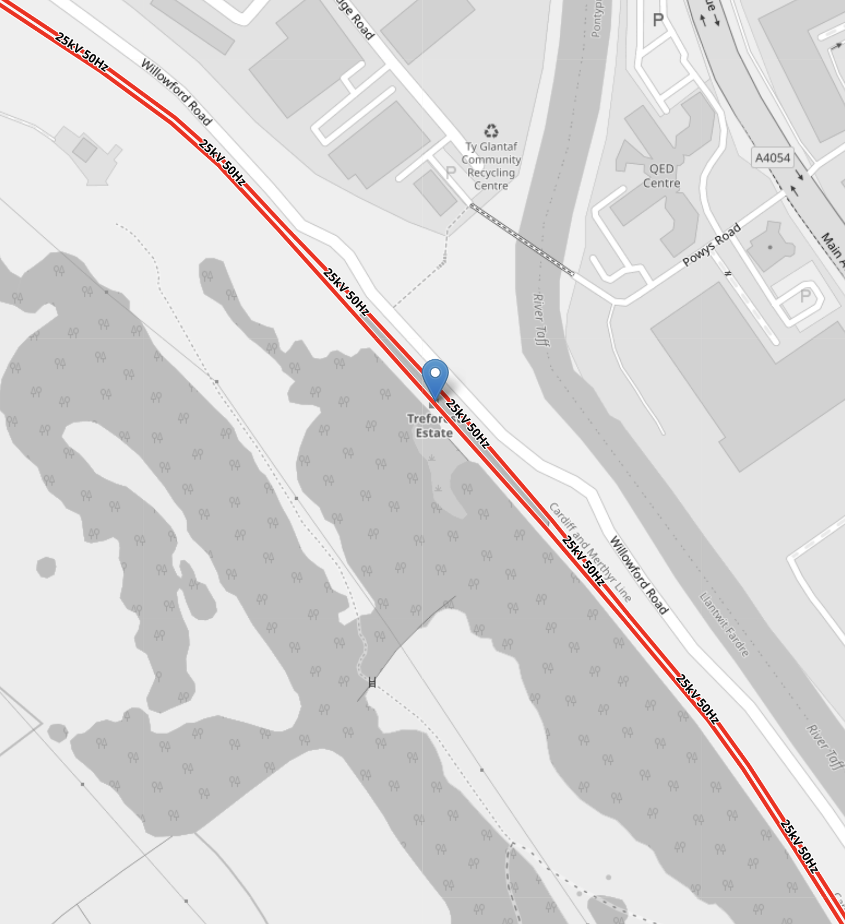
Note.
- Electrified lines are shown in red.
- Unelectrified lines are shown in black.
I wonder if the drivers will raise and lower the pantograph in Treforest Estate station. Or will this be automatic?
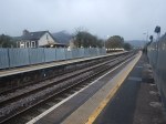
Abercynon Station – 28th November 2023
On Tuesday, I went to South Wales to look at the progress of the South Wales Metro.
I took these pictures at Abercynon station.
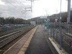
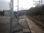
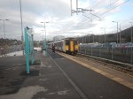
Note.
- The station has a wide island platform.
- The Aberdare and the Merthyr Tydfil branches merge here.
- It was rather draughty.
- The electrification looks to be of high quality.
This OpenRalwayMap shows the tracks through the station.
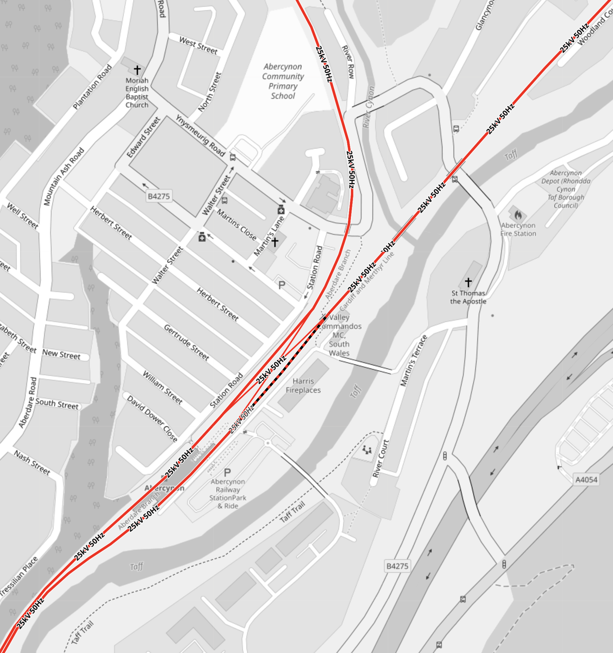
Note.
- Electrified lines are shown in red.
- Unelectrified lines are shown in black.
- The single-track going North is the Aberdare branch.
- The single-track going North-East is the Merthyr Tydfil branch.
- There is a crossover to the North of the station, so that trains can go where they should.
- The single platform is the grey-shaded area between the two tracks.
- The tracks are electrified to the South.
It is a neat simple station, that also allows passengers to travel between stations on different Northern branches.
The Increase In Passenger Capacity
Consider.
- Currently, there are two Class 150/2 tph on both Northern branches.
- This means current capacity is 596 passengers per hour.
- After electrification, there will be four Class 398 tph on both Northern branches.
- This means future capacity is 2016 passengers per hour.
That is an increase of 238 % in the capacity.
Climbing The Valley Lines In The South Wales Metro
There are five terminal stations on the Cardiff Valley Lines, of which four will be served by battery-electric trains or tram-trains from Cardiff.
In this post, I will show how they will achieve this feat.
Consider.
- To get to Aberdare, Merthyr Tydfil or Treherbert, a tram-train must first get to Pontypridd.
- To get to Rhymney, a train must first get to Caerphilly.
I will now deal with the seven stations in alphabetic order.
Aberdare
This OpenRailwayMap shows the three branches of the Cardiff Valley Lines, that go through Pontypridd.

Note.
- Electrified lines are shown in red and unelectrified lines are shown in black.
- The branch to Aberdare is the middle of the three branches.
- It is planned that the service on the Aberdare branch will be provided using Class 398 tram-trains, that will be fitted with batteries.
- Electrification will be complete between Aberdare and Pontypridd.
It would appear that a tram-train could run between Aberdare and Pontypridd using the complete electrification.
Caerphilly
These two OpenRailwayMaps show the tracks through Caerphilly.


Note.
- The map on the left shows infrastructure, with the Rhymney Line shown in yellow.
- Caerphilly station is in the top third of the map.
- The white section of the Rhymney Line is the Caerphilly tunnel.
- The map on the right shows electrification, with the sections of the Rhymney Line that will be electrified are shown in red.
- Black sections will not be electrified.
- North of Caerphilly, the Rhymney Line is electrified, but through the station and the Caerphilly tunnel, there will be no electrification.
Trains will use battery power, where there is no electrification.
Ebbw Vale Town
This OpenRailwayMap shows the Ebbw Valley Railway.
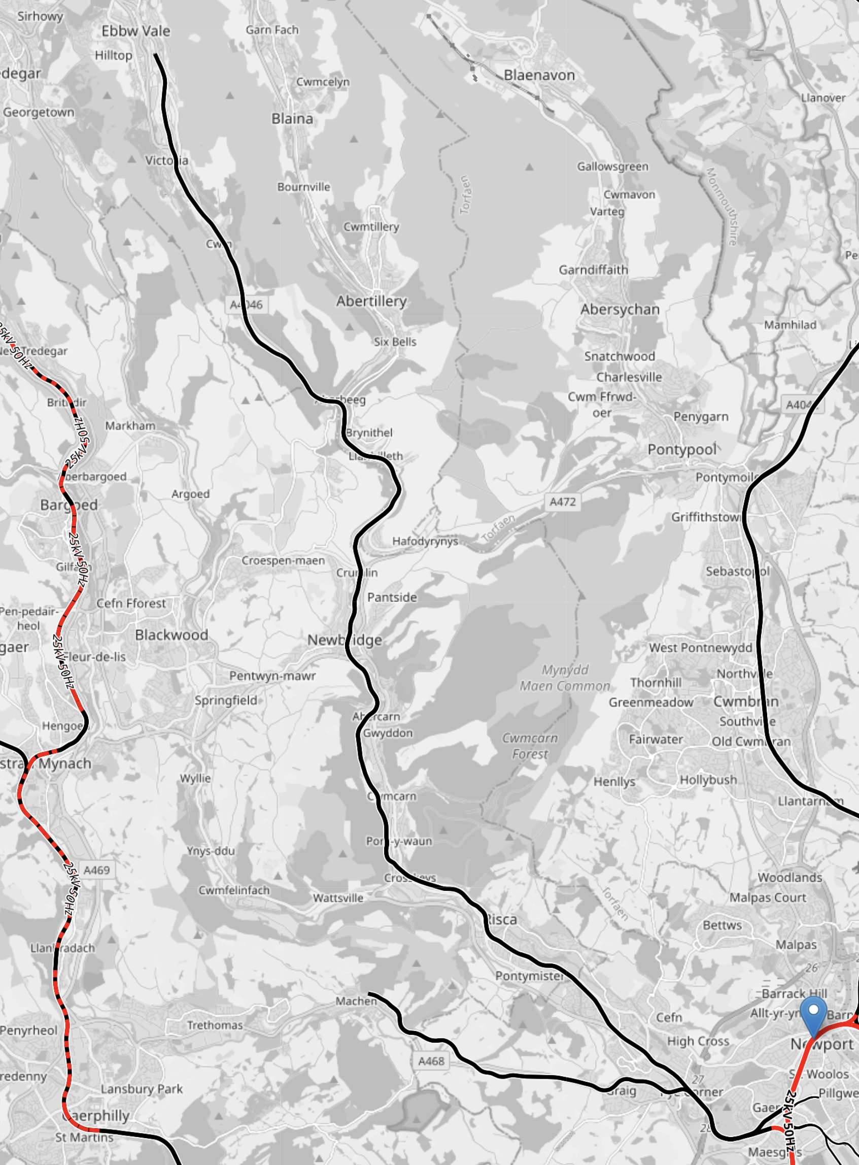
Note.
- Electrified lines are shown in red and unelectrified lines are shown in black.
- Lines where electrification will be installed are shown in red and black.
- Newport is marked by the blue arrow.
- The North-South Line at the left is the Rhymney Line.
- The North-South Line in the middle is the Ebbw Valley Railway.
- The North-South Line at the right is the Marches Line to Hereford and Shrewsbury.
Trains will use diesel power on the Ebbw Valley Railway, as there is no electrification and no means of charging battery-electric trains.
It does seem strange that no electrified solution has been proposed for the Ebbw Valley Railway.
Consider.
- An Abertillery branch has been proposed.
- A Newport and Ebbw Vale Town service has been proposed and will be implemented.
- Perhaps the line is difficult to electrify.
It could just be, the electrifying the Ebbw Valley Railway, was a step too far.
Merthyr Tydfil
This OpenRailwayMap shows the three branches of the Cardiff Valley Lines, that go through Pontypridd.
Note.
- Electrified lines are shown in red and unelectrified lines are shown in black.
- The branch to Merthyr Tydfil is the rightmost of the three branches.
- It is planned that the service on the Merthyr Tydfil branch will be provided using Class 398 tram-trains, that will be fitted with batteries.
- Electrification will be complete between Merthyr Tydfil and Pontypridd, except for two short sections.
- I would assume that the short unelectrified sections can be handled using the tram-trains battery power.
It would appear that a tram-train could run between Merthyr Tydfil and Pontypridd using the electrification and the tram-trains batteries.
This shows the track layout at Quaker’s Yard station.
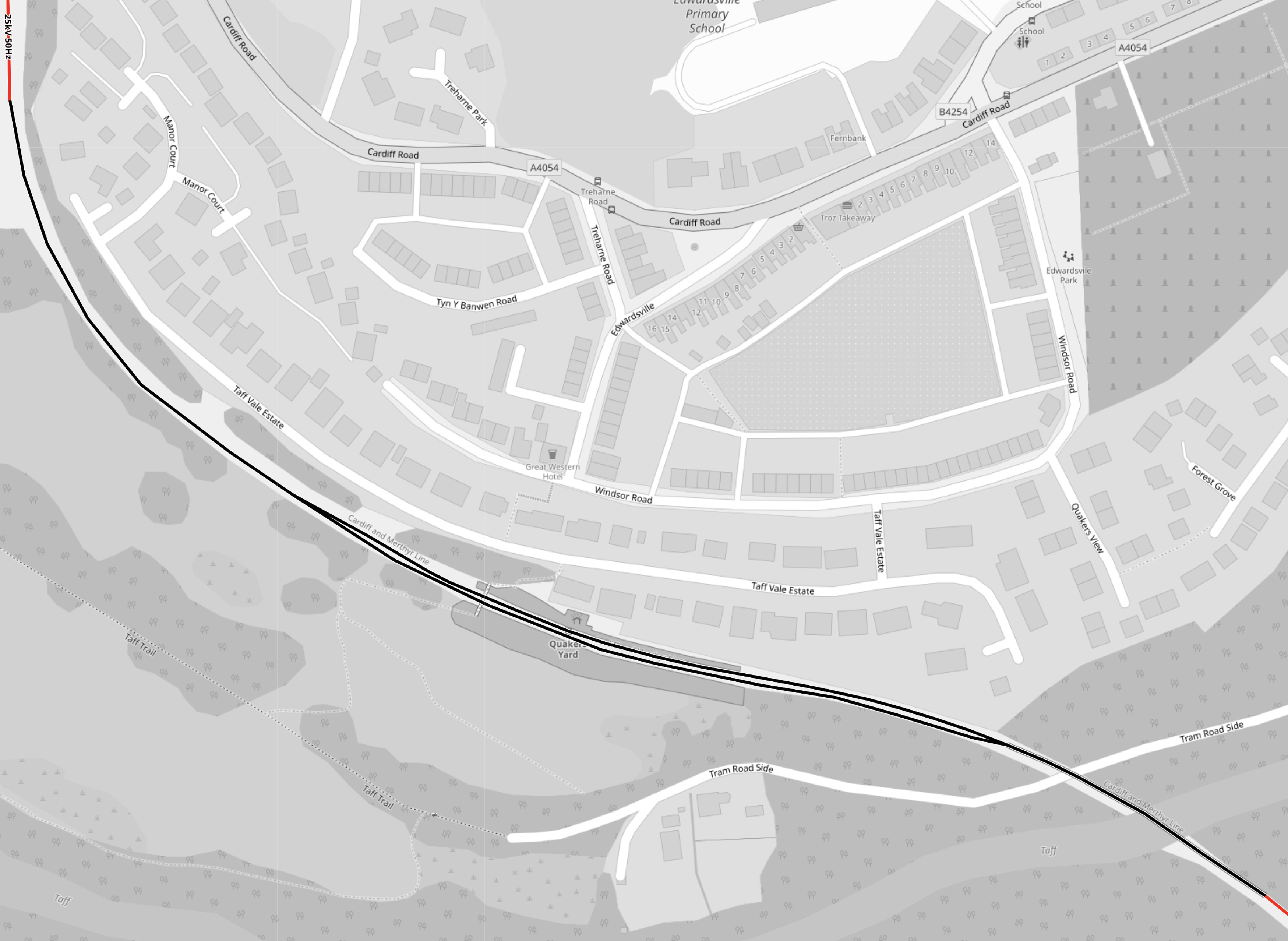
Note.
- Electrified lines are shown in red and unelectrified lines are shown in black.
- There are only two short length of electrification shown in the corners the map.
- Quaker’s Yard station has two platforms.
- The track layout appears to have single- and double-track sections.
It looks like it has been decided not to electrify this section. Perhaps, it was just too complicated to electrify easily?
This 3D Google Map shows the terminal station at Merthyr Tydfil.
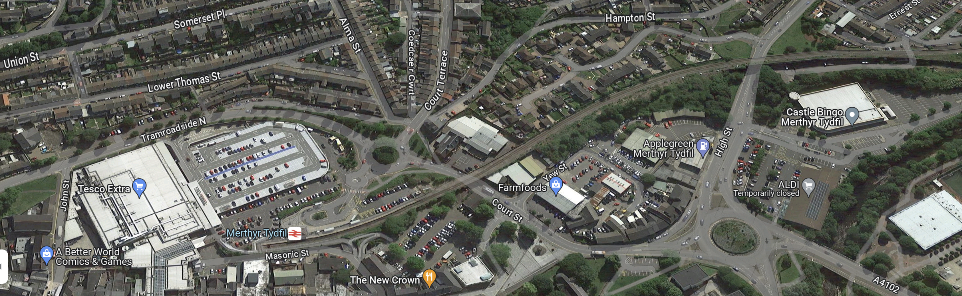
It looks like the railway runs through the town to the station. So perhaps leaving out the electrification made everything safer?
Pontypridd
This OpenRailwayMap shows the tracks through Pontypridd.
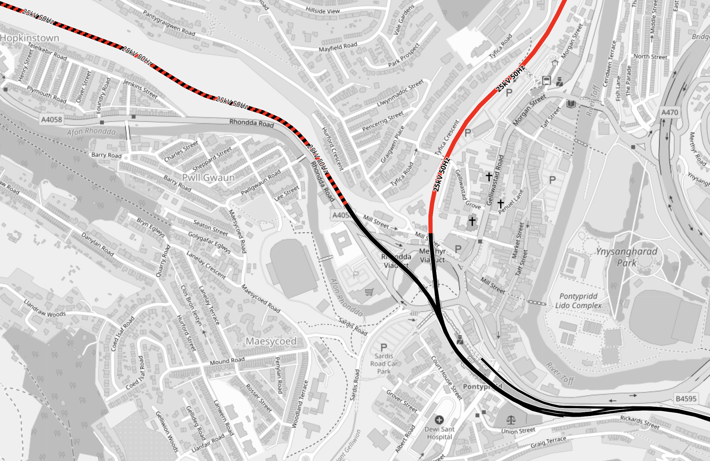
Note.
- Electrified lines are shown in red and unelectrified lines are shown in black.
- Lines where electrification will be installed are shown in red and black.
- The line leaving the map in the South-East corner is the line to Cardiff.
- The line leaving the map in the North-West corner is the Rhondda Line to Treherbert.
- The line leaving the map in the North-East corner is the Merthyr Line to Aberdare and Merthyr.
Pontypridd stations lies at the junction of the three lines.
This OpenRailwayMap shows the platforms at Pontypridd.
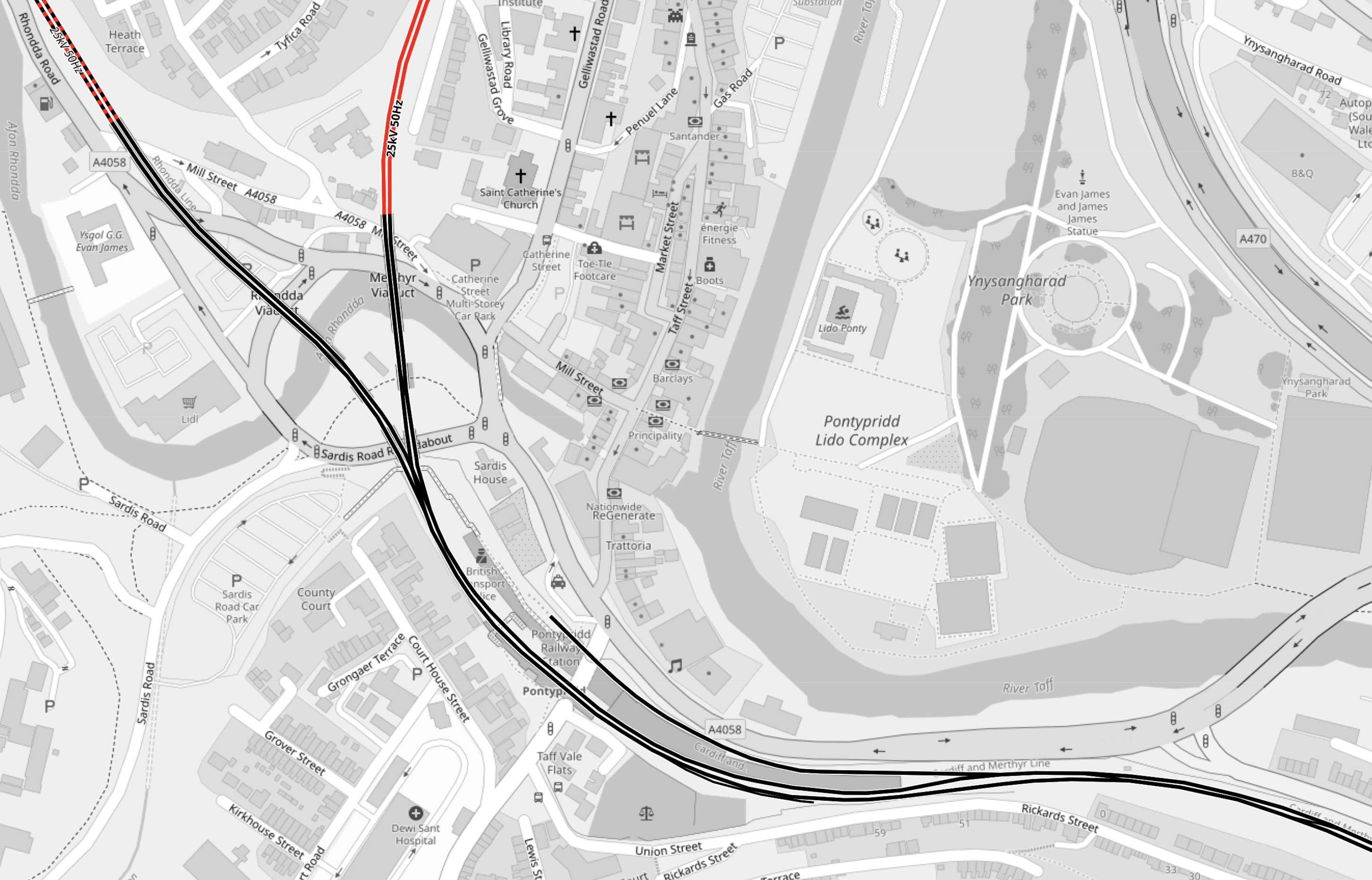
Note.
- There are two long through platforms.
- There is a bay platform on the North side of the station for extra Cardiff services.
- The station is not electrified.
These pictures show Pontypridd station.
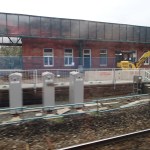
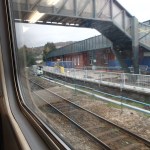
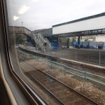


The station is Grade II Listed.
How will the tram-trains be powered through Pontypridd station?
Older Welsh railwaymen have told tales of how the coal trains from the mines in the valleys to Cardiff Docks were powered in part using gravity to propel the trains to the Docks. Steam locomotives then hauled the trains up the hills to get another load of coal.
Will Newton’s Friend be used to help the tram-trains return to Cardiff?
As the tram-trains descend, regenerative braking can be used to recharge the batteries.
A sophisticated computer control system, would choose the source of power from that which is available.
Descending from the terminal stations of Aberdare, Merthyr and Treherbert, and through Pontypridd would probably need a small amount of battery power to nudge the train to descend down the hill.
Fully-electrified stations like Aberdare and Treherbert will have the luxury of being able to use power from the electrification to start the descent.
Climbing the hills will be mainly on battery power, with the batteries being charged, where overhead electrification exists.
Rhymney
This OpenRailwayMap shows the Northern part of the Rhymney Line from Caerphilly to Rhymney.
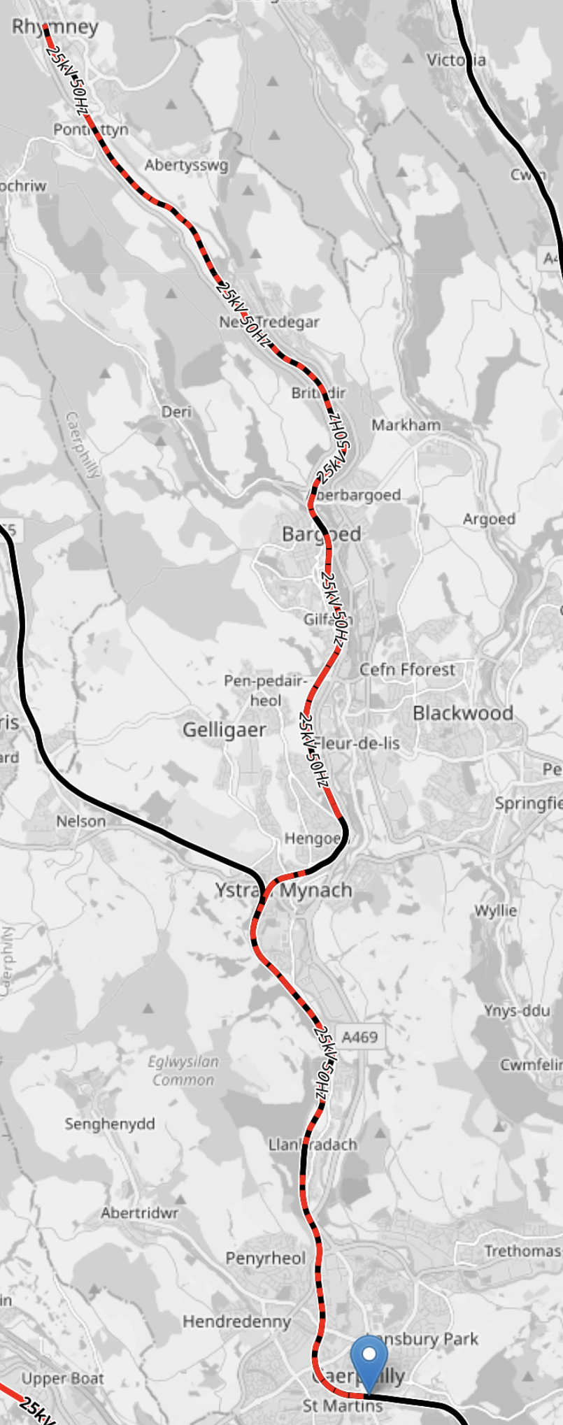
Note.
- Electrified lines are shown in red and unelectrified lines are shown in black.
- Lines where electrification will be installed are shown in red and black.
- Caerphilly is marked by the blue arrow at the bottom of the map.
- Rhymney is at the Northern end of the rail line.
- Bargoed, Hengoed, Llanbradach and Caerphilly stations appear not to be electrified.
- It is planned that the service on the Rhymney Line will be provided using Class 756 trains, that will be fitted with batteries and diesel engines.
The Class 756 trains appear to have been designed to climb to Rhymney in all conditions, including a complete power cut. They will use batteries on the unelectrified sections of the climb.
Treherbert
This OpenRailwayMap shows the three branches of the Cardiff Valley Lines, that go through Pontypridd.
Note.
- Electrified lines are shown in red and unelectrified lines are shown in black.
- Lines where electrification will be installed are shown in red and black.
- The branch to Treherbert is the leftmost of the three branches.
- It is planned that the service on the Theherbert branch will be provided using Class 398 tram-trains, that will be fitted with batteries.
- Electrification will be complete between Treherbert and Pontypridd.
It would appear that a tram-train could run between Treherbert and Pontypridd when the electrification is complete.
Conclusion
Each of the five lines use their own methods of getting trains up the hills.
I suspect we’ll see some of the ideas used here on other stretches of electrification.
Taff’s Well Station – 22nd November 2023
I took these pictures as I passed through.
Note.
- A depot for the tram-trains is being built.
- The depot looks rather small.
- Four Class 398 tram-trains are lined up in the sidings of the depot.
- The last picture was taken four years ago , before any work started.
This OpenRailwayMap shows the depot.
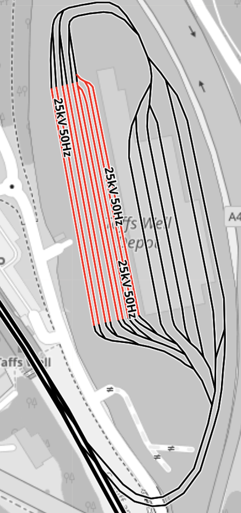
Note.
- Electrified tracks are shown in red.
- Unelectrified tracks are shown in black.
- There are nine electrified sidings, which from my picture appear to be able to hold two tram-trains each.
- From other pictures on the web four of the unelectrified lines are covered tracks in the depot.
- The final two tracks seem to allow tram-trains to enter and leave the depot and these tracks are partially covered, there could be a washer alongside the building.
- The unelectrified Merthyr Line runs across the South-West corner of the map.
- Tram-trains will always enter the depot from the North.
- Tram-trains will always leave the depot to the North.
It is a slightly unusual layout for a depot, but it seems to fit well into a small site.
This OpenRailwayMap shows the Merthyr Line as it passes Taff’s Well Station and Depot.
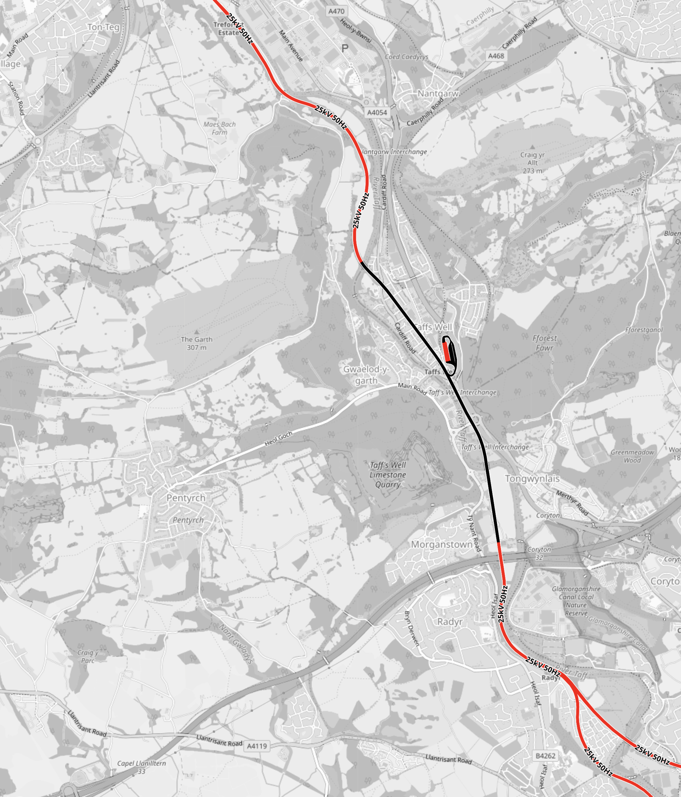
Note.
- The Merthyr Line runs roughly North-West and South-East across the map.
- The Northern and Southern sections of the Merthyr Line are electrified, but the central section is not.
- Taff’s Well Depot is the red and black wart on the unelectrified section of the Merthyr Line.
- Tram-trains going North go to Pontypridd and then on to the three branch terminals at Treherbert, Aberdare and Merthyr Tydfil.
- Tram-trains going South go to Cardiff Central and Cardiff Queen Street stations.
Tram-trains use a mixture of overhead electrisation, battery power and assistance from Newton’s friend for power.
How A Tram-Train Arrives At Taff’s Well Depot
Consider.
- Tram-trains must approach Taff’s Well Depot from the North to enter the depot.
- This shouldn’t be a problem, as there appear to be crossovers at Pontypridd to transfer a tram-train to the right line if needed.
- As they descend from Pontypridd, any braking can be used to charge the batteries on the tram-trains.
- The track layout in the depot appears to allow any entering train to go into any track in the depot.
So depending on the work needed before the next trip, the tram-train can be efficiently placed in the right section.
How A Tram-Train Leaves Taff’s Well Depot
Consider.
- Tram-trains must leave Taff’s Well Depot to the North.
- As the Merthyr Line is not electrified, where the tram-trains leave the depot, they need to leave with enough power in the battery to reach the electrified section of the Merthyr Line.
- Tram-trains can only be charged in the nine electrified sidings.
So do the tram-trains, wait in the electrified sidings until, they have enough power in the batteries to do a circuit of the depot, join the Merthyr Line and go up the hill to the electrification?
If as I suspect, there is a tram-wash behind the depot, they can even take a pass through, so they enter service after a wash.
Conclusion
This could be a very efficient depot.
More Government Details Emerge On How Fleetwood’s Rail Link Will Be Restored – Using Tram-Train Technology
The title of this post, is the same as that of this article on the Blackpool Gazette.
This is the sub-heading.
New details have emerged about how the Government plans to restore the rail link between Fleetwood and Poulton using state-of-the-art tram-train technology.
These are points from the article, which mainly come from a letter to the local MP; Paul Maynard.
- In a letter to Mr Maynard, Rail Minister Huw Merriman has set out for the first time how the Government intends to restore the rail link.
- The Government is now looking at the finer details of a tram-train scheme and how the project can be funded.
- Tram-trains will be used for the link.
- The re-opened railway can be linked into the existing Blackpool to Fleetwood tramway, allowing services to run into the heart of Fleetwood.
- Services would operate twice hourly from Preston station to Poulton-le-Fylde over the existing heavy rail network, before joining a new light rail link between Poulton-le-Fylde and the Denham Way roundabout on Amounderness Way, calling at up to three new intermediate stops.
- From the roundabout, the services would continue on the existing Blackpool tram network towards Fleetwood town centre and Fleetwood ferry terminal.
- The Government is committed to the project.
These are my detailed thoughts.
The Route
The Blackpool Gazette article describes the route like this.
Services would operate twice hourly from Preston station to Poulton-le-Fylde over the existing heavy rail network, before joining a new light rail link between Poulton-le-Fylde and the Denham Way roundabout on Amounderness Way, calling at up to three new intermediate stops.
From the roundabout, the services would continue on the existing Blackpool tram network towards Fleetwood town centre and Fleetwood ferry terminal.
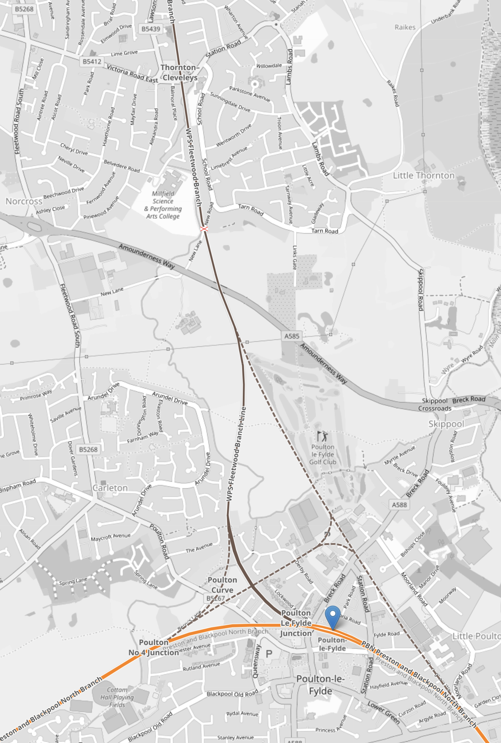
This map from OpenRailwayMap shows the route.
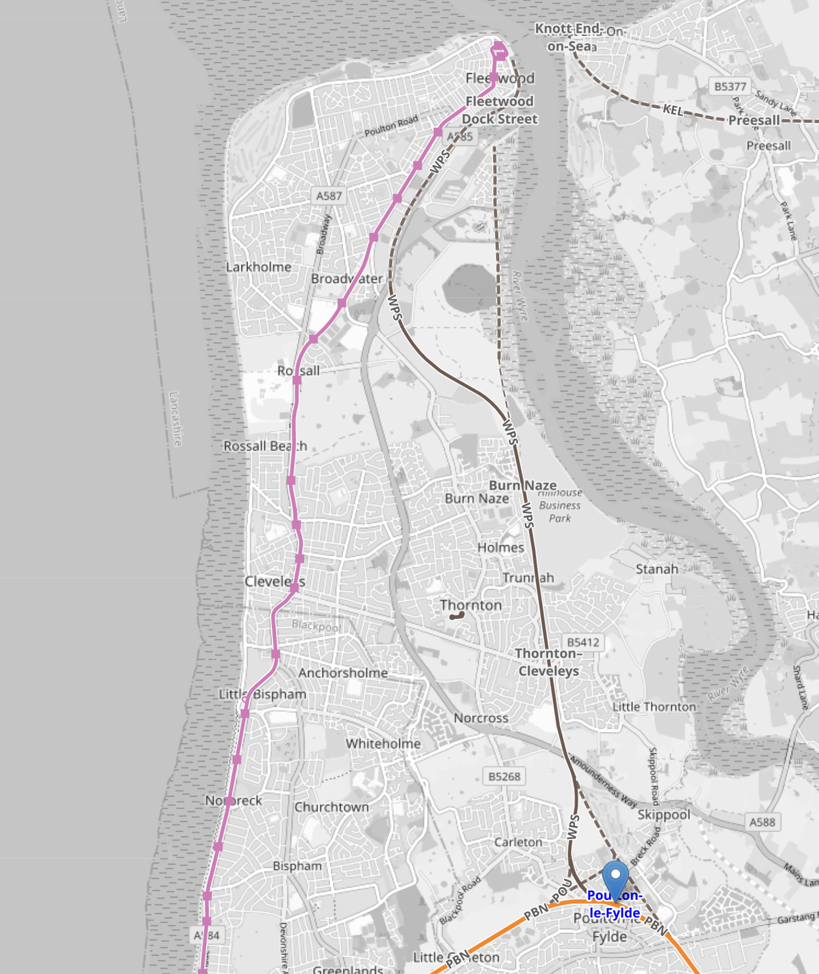
Note.
- Poulton-le-Fylde station is marked by the blue arrow in the South-East corner of the map.
- The pink line running up the coast is the Blackpool tramway.
- The Blackpool tramway terminates at Fleetwood Ferry at the top of the map.
This second OpenRailwayMap shows Fleetwood Ferry tram terminus.
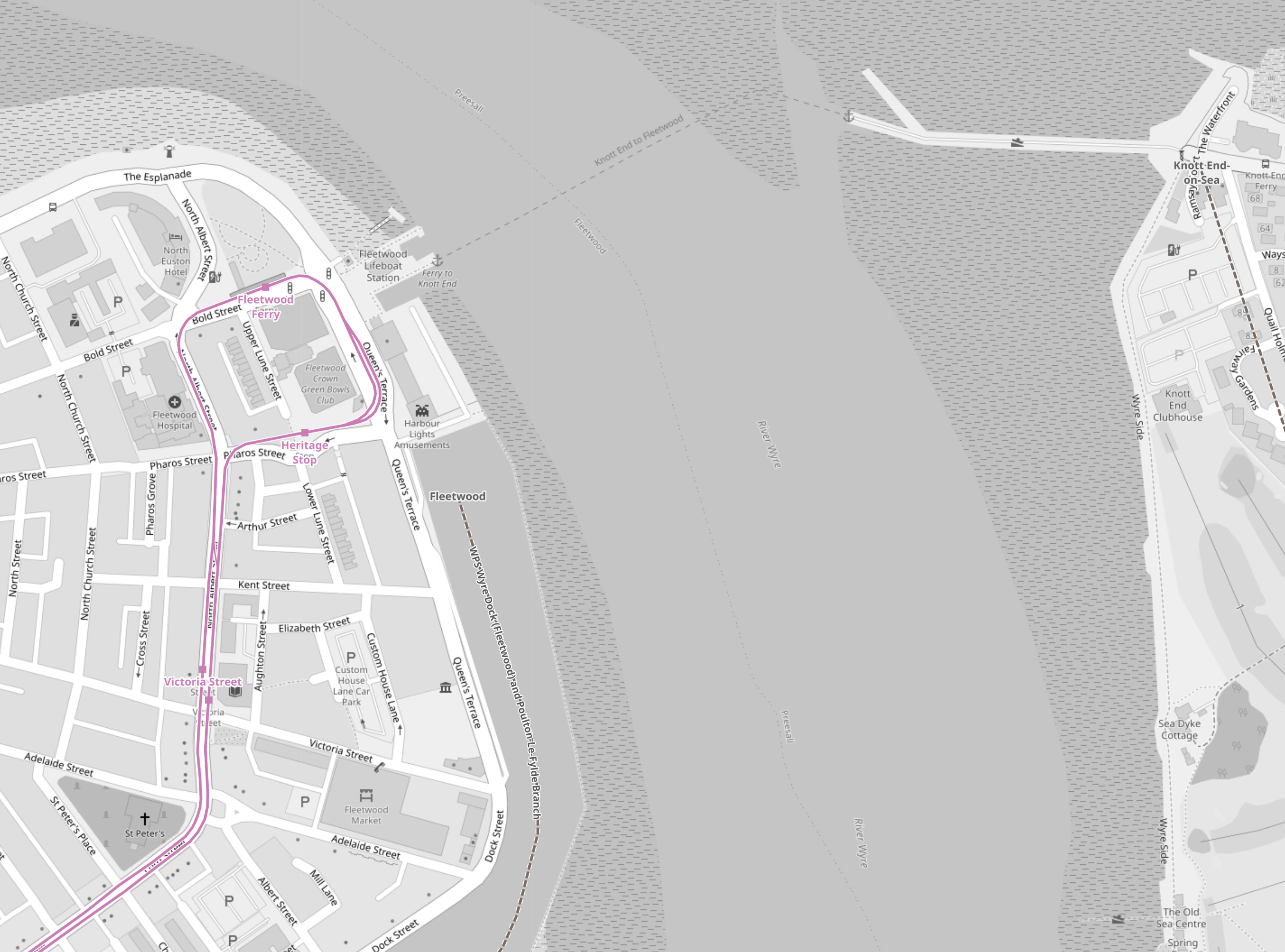
Note.
- As before, the Blackpool tramway tracks are shown in pink.
- There is a lifeboat station and a ferry to the other side.
- The tracks allow a tram to come from the South, go round the loop and return to the South.
- I believe that both the Blackpool tramway and the Fleetwood tram-train will both reverse direction in the same way.
- No new infrastructure would be needed at the Fleetwood Ferry terminal, except for perhaps a few signs.
This third OpenRailwayMap shows the track from Fleetwood Ferry to the Lindel Road tram stop.
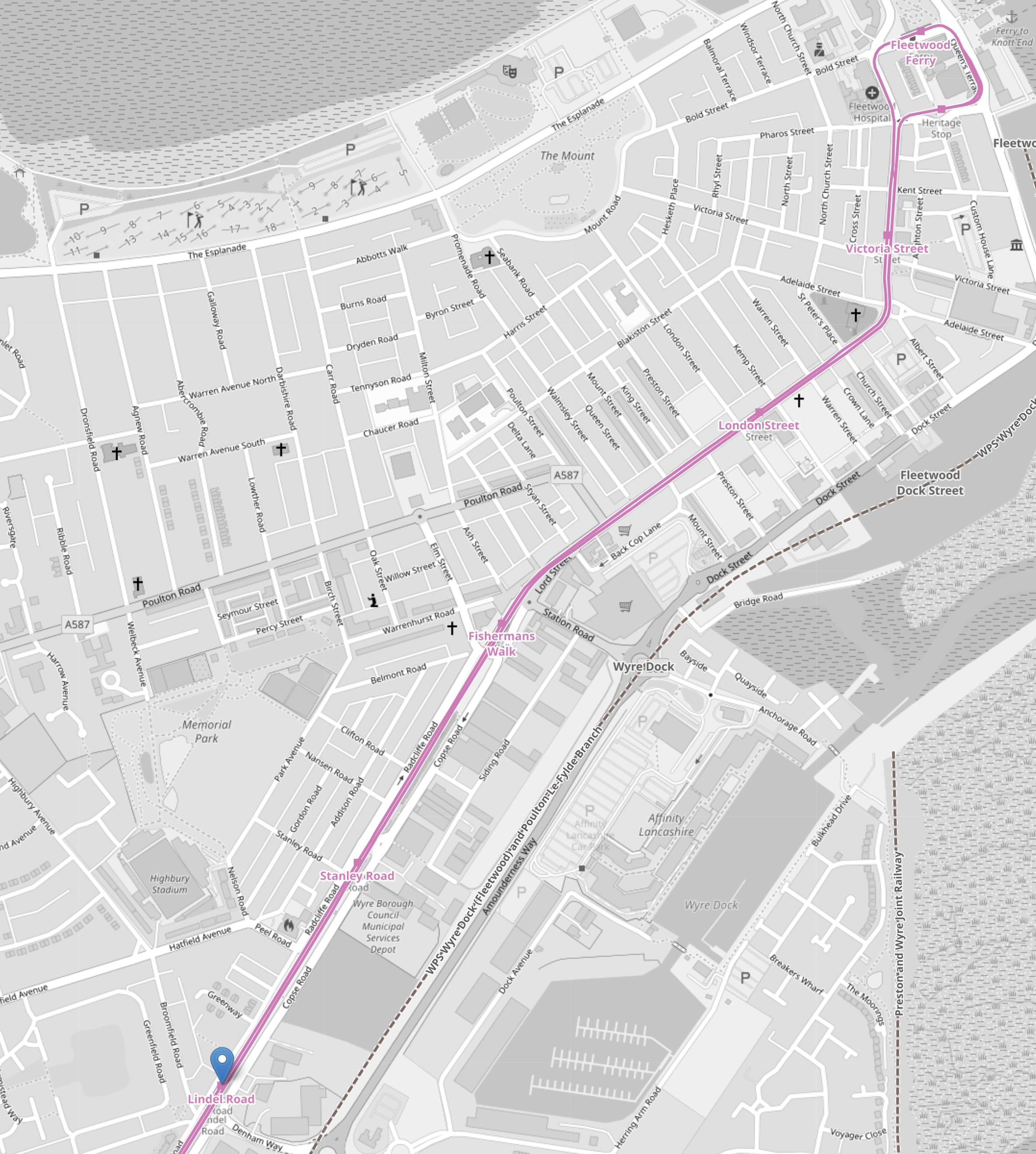
Note.
- As before, the Blackpool tramway tracks are shown in pink.
- Fleetwood Ferry is in the North-East corner if the map.
- Lindel Road tram stop is marked by the blue arrow in the South-West corner if the map.
This fourth OpenRailwayMap shows the Lindel Road tram stop area at a larger scale.
Note.
- As before, the Blackpool tramway tracks are shown in pink.
- Lindel Road tram stop is marked by the blue arrow.
- Running parallel to and to the East of the Blackpool tramway is Amounderness Way, which appears to have been built on the line of the railway to Fleetwood.
- Along the West side of Amounderness Way, a disused railway is indicated, which must be the closed railway to Fleetwood.
I believe that Network Rail or their engineers have found a route to connect the old branch line to the Blackpool tramway.
- The railway connecting the Blackpool tramway and the closed railway to Fleetwood, would only need to be single-track.
- There might be a convenient route, where all the land is owned by the Council.
- If the tram-trains were to be was fitted batteries, then there would be no need to electrify the line.
I suspect, that the connection would be to the South of Lindel Road tram stop.
- This would mean that the tram-train would serve a number of stops in the town centre.
- The tram-train could use the catenary of the Blackpool tramway.
- Connection and disconnection to the catenary could be done in the Lindel Road tram stop.
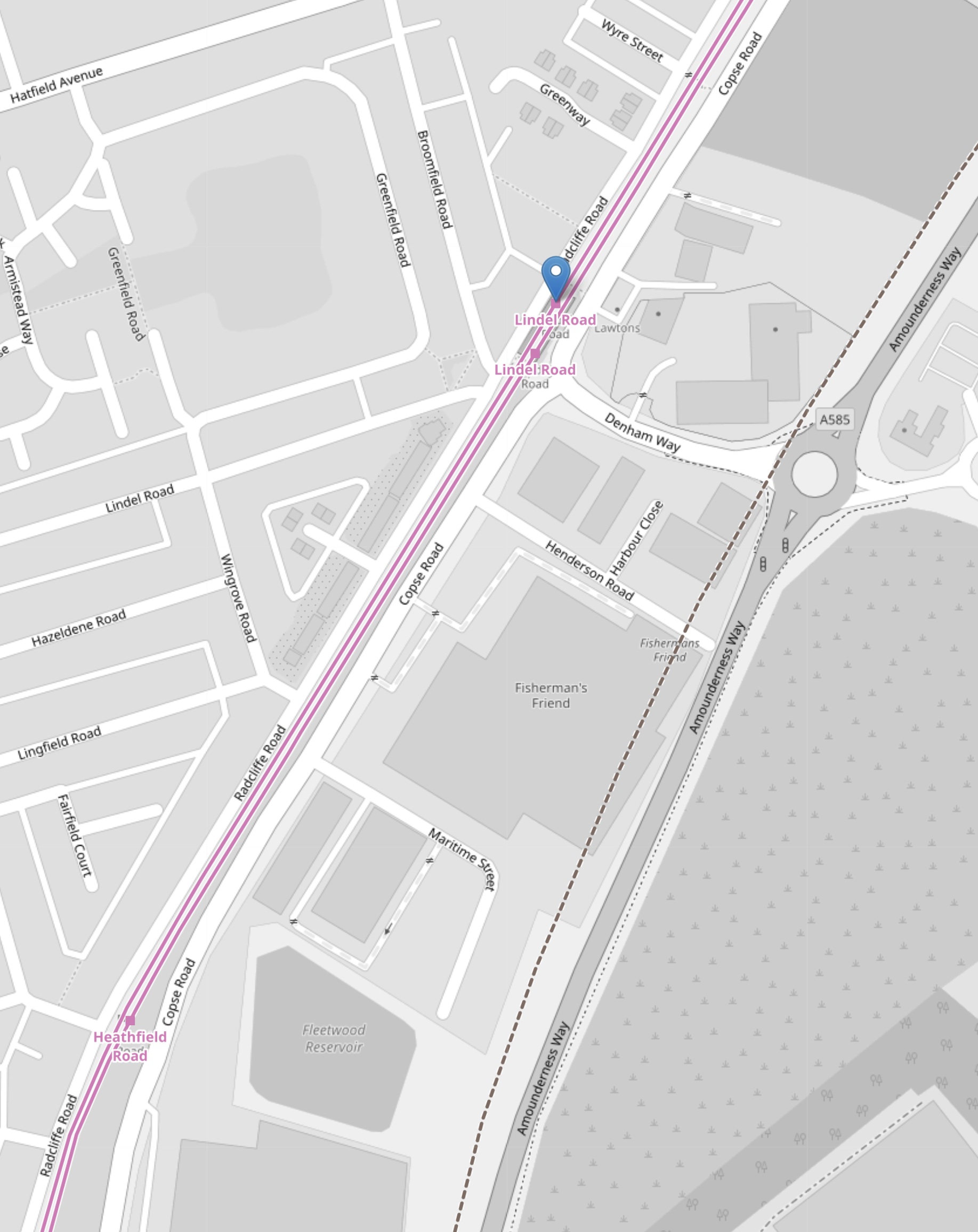
This Google Map shows the area of the Lindel Road tram stop and Denham Road.
Note.
- The Lindel Road tram stop in the North-West corner of the map, with the Blackpool tramway running NE-SW across the corner of the map.
- The roundabout and Amounderness Way on the East side of the map.
- Denham Way connecting the roundabout to Copse Road and the tram stop.
- On the fourth OpenRailwayMap it showed the original line of the railway was to the West of Amounderness Way.
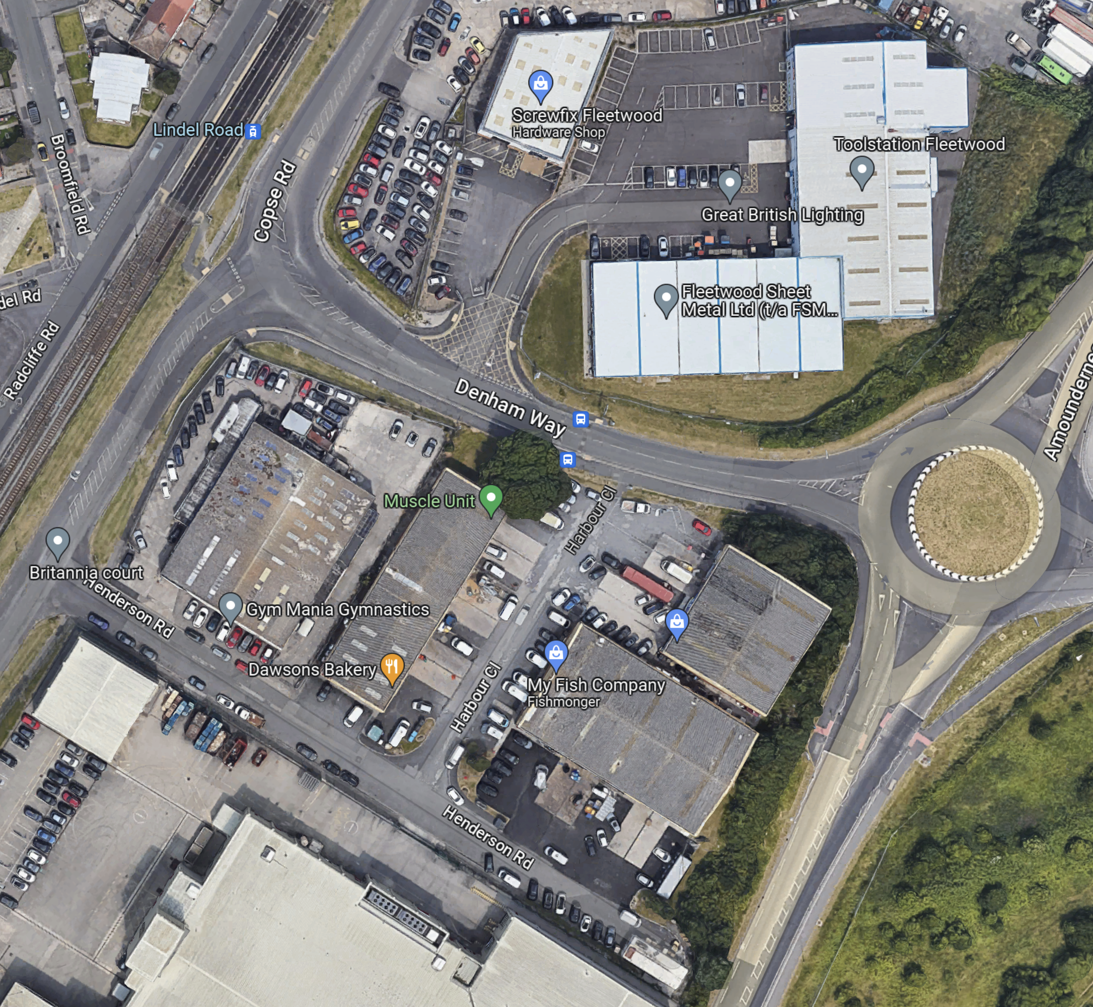
So could the spur between the Lindel Road tram stop and the railway to Poulton-le-Fylde station take the following route?
- Just South of the tram stop the two tracks connect to a new single-track that goes East on the South side of Denham Way.
- The turn would be quite sharp, but trams and tram-trains have the articulation of a snake and can use tight turns and narrow formations.
- The crossing of Copse Road would be protected by traffic lights.
When the tram-train gets to the roundabout other end of Denham way, I think there are two choices.
- Turn sharp right and go South alongside the West side of Amounderness Way.
- Somehow cross Amounderness Way and go down the West side.
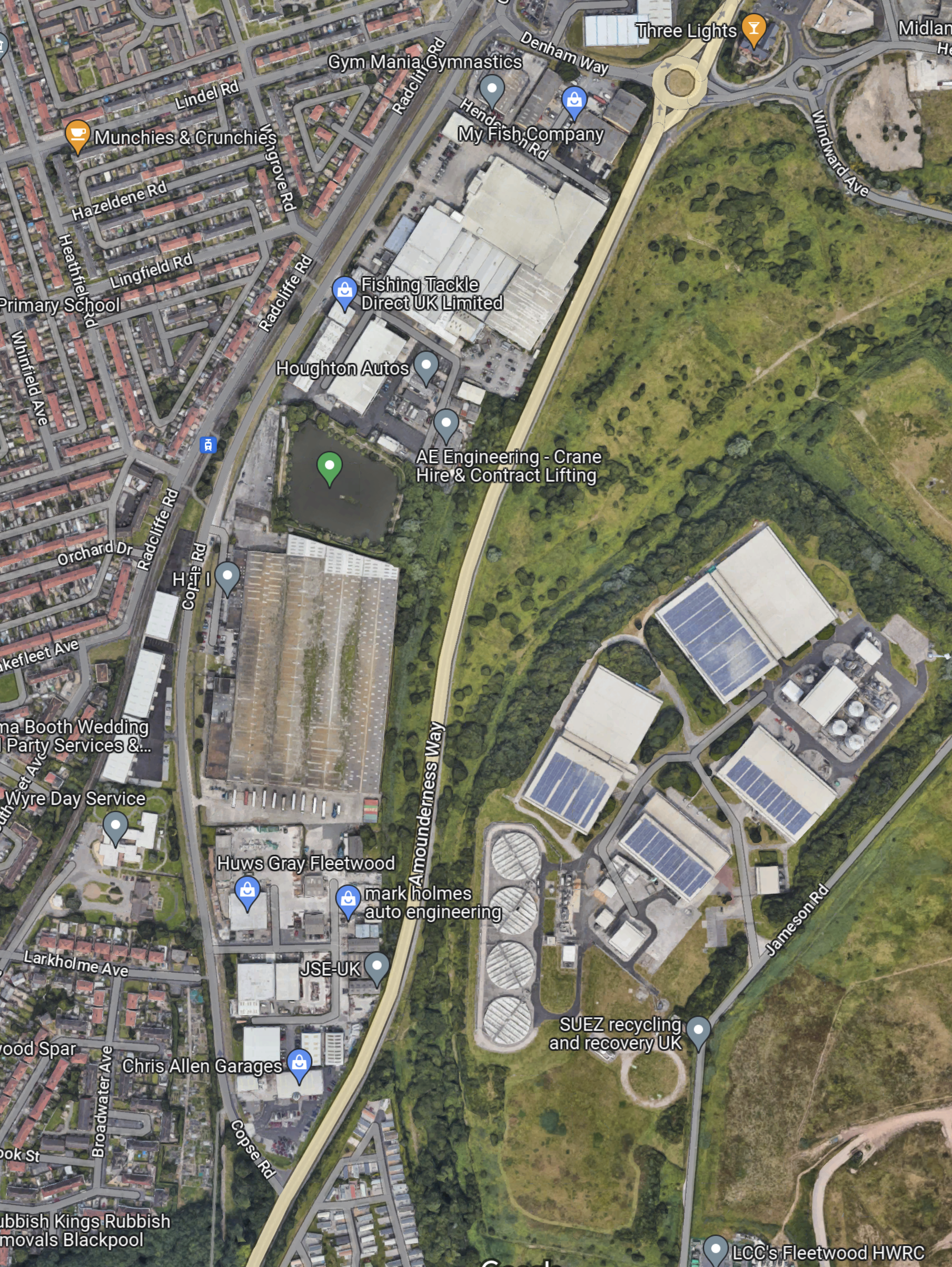
This Google Map Amounderness Way going South.
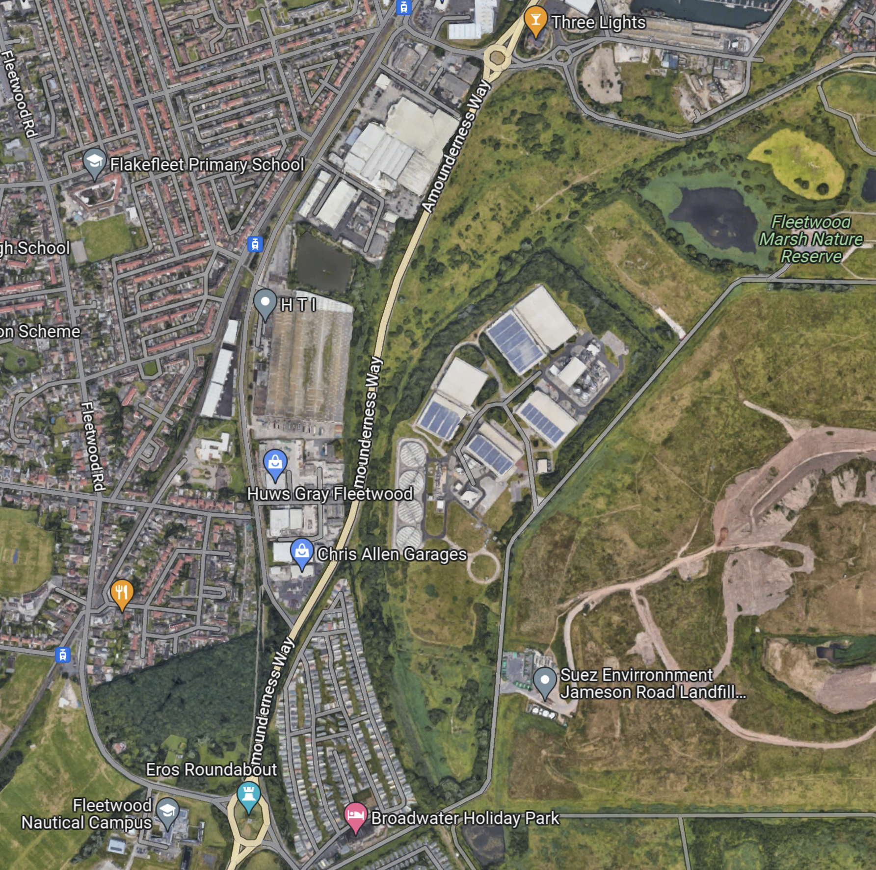
Note.
- Amounderness Way runs North-South down the map between two roundabouts.
- The large industrial area to the East of the road is labelled as SUEZ Recycling and Recovery.
- North-East of SUEZ is Fleetwood Marsh Nature Reserve.
- South-East of SUEZ is SUEZ Environmental Jameson Road Landfill and Lancashire County Council’s Fleetwood Household Waste Recycling Centre.
- There also seem to be a lot of large holiday caravans.
- There is a road running along the South-East of the large SUEZ site called Jameson Road.
The Wikipedia entry for the Fleetwood branch line, says this about the state of the branch.
Some of the line is now cleared of overgrowth because the northern track was not lifted from past Burn Naze Halt to just beyond Jameson Road Fleetwood. However, the road bridge was filled in below it. The junction, last used when goods trains took coal to Fleetwood Power Station, still exists. Looking over the road bridge on Jameson Road, the track to both north & south can still be seen through the undergrowth. In the 1990s, the new A585 The Amounderness Way bypass has been built on the former trackbed, although sufficient space still exists for a reinstated railway should it be required.
Note.
- It appears that enough space has been left at the Northern end to connect to the Blackpool tramway.
- It doesn’t seem to be in too bad a state.
- I suspect that rebuilding the branch has a similar degree of difficulty to rebuilding the Dartmoor Line to Okehampton, which is now operating successfully.
This gave me hope, that a single-track tramway could be built between Poulton-le-Fylde junction and the Lindel Road tram stop.
This Google Map shows the track meeting the filled in road bridge on Jameson Road.
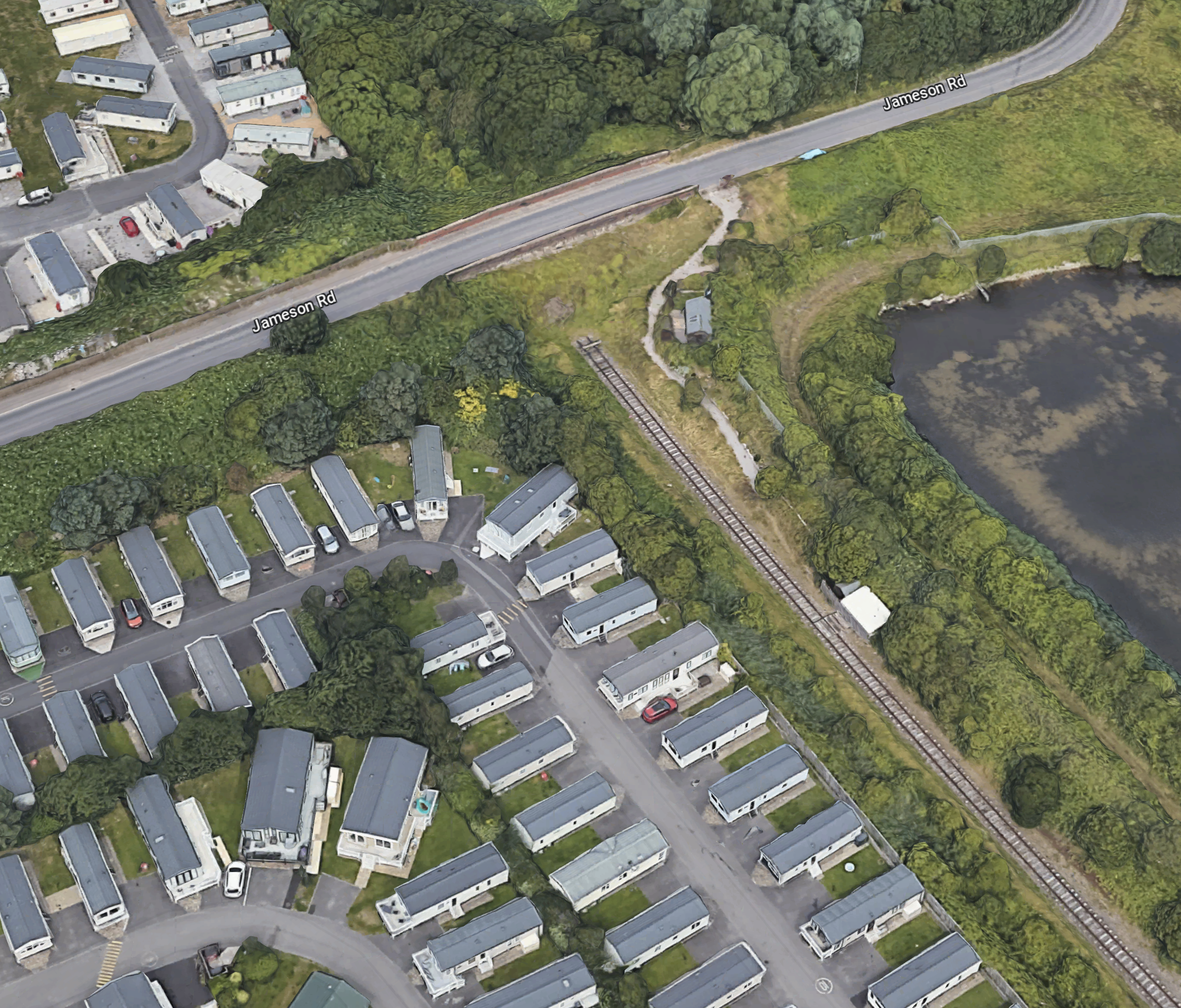
Note.
- If that’s not a single-track railway and the filled-in bridge on Jameson Road, I’m a Dutchman.
- The railway can be followed on Google Maps for most of the way to Poulton-le-Fylde station.
- Google Maps also shows traces of railway to the North of the bridge on Jameson Road.
This Google Map shows the section of Amounderness Way from the North of the SUEZ Recycling and Recovery site to the Denham Way roundabout.
I suspect that the tram would go straight up the East side of ‘Amounderness Way.
But how would the tramway cross the road.
This Google Map shows Denham Way, the roundabout and Lindel Road tram stop.
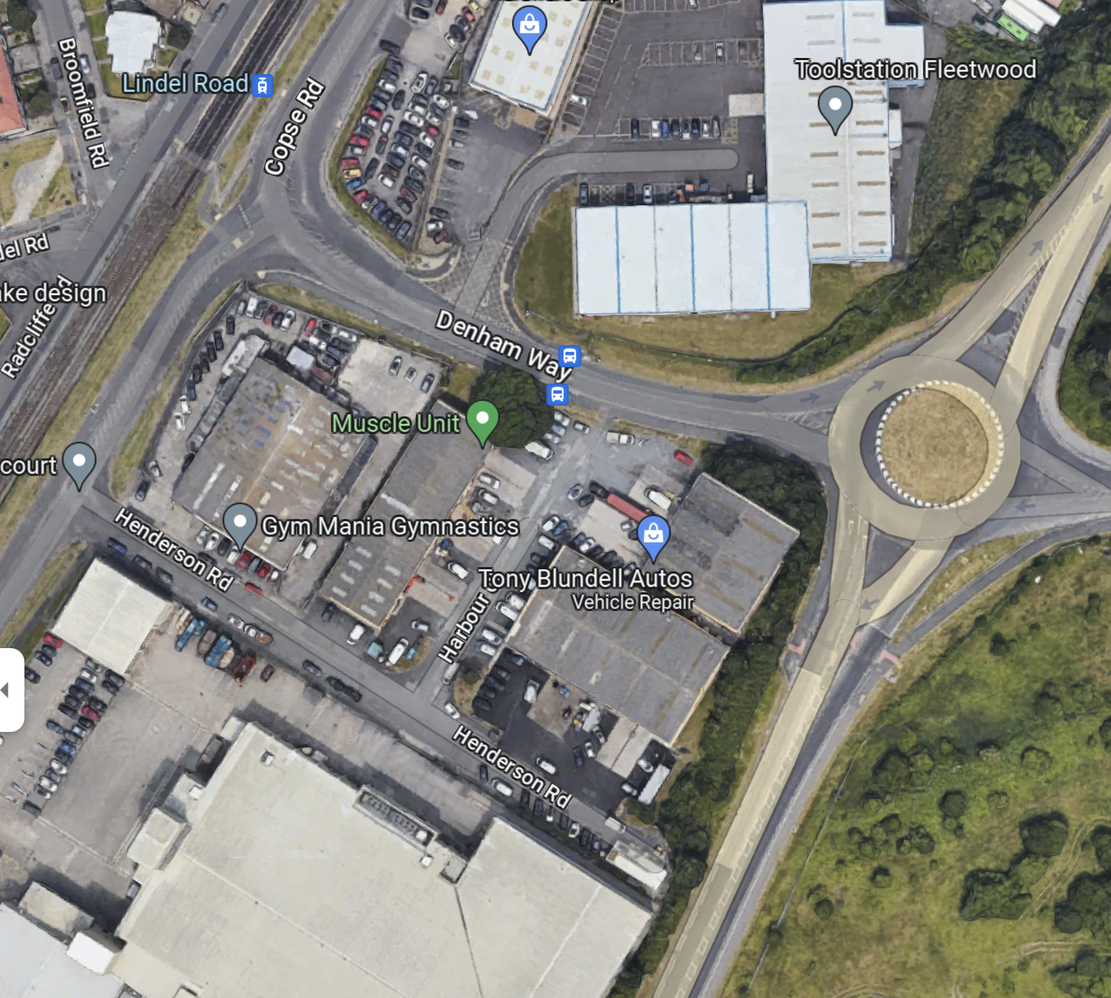
I am fairly sure that a single-track bridge of some sort could connect Lindel Road tram stop with a single-track railway along the East side of Amounderness Way, to link up with the orphaned track South of Jameson Road.
This OpenRailwayMap shows Poulton-le-Fylde junction, where the former railway to Fleetwood, joins the Blackpool branch.
Note.
- Poulton-le-Fylde station is indicated by the blue arrow.
- The orange track is the Blackpool branch to Blackpool North station.
- Poulton-le-Fylde junction is to the West of the station.
- The track going North from the junction, is the disused track to Fleetwood.
- The map also shows a couple of level crossings.
I am fairly certain, that a single-track tramway could be built between Poulton-le-Fylde junction and the Lindel Road tram stop.
This OpenRailwayMap shows Poulton-le-Fylde junction and Poulton-le-Fylde station.
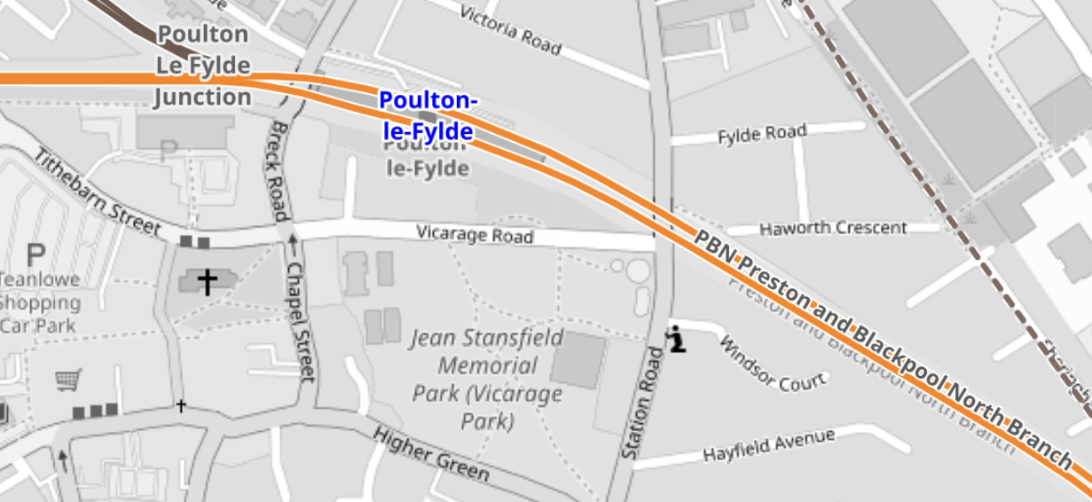
These pictures taken in 2018, show Poulton-le-Fylde station.
Note.
- It is a small station, that oozes quality.
- The tracks and electrification were all installed or renewed in the last few years.
- There is even a cafe and a lift to the street.
- The flower-beds in the middle of the platform, are at the Preston end of the station.
- As the tram-trains will stop in the station, they can raise and lower the pantograph in the station.
- Tram-trains and trains will share the appropriate platform.
The possibility can probably be arranged that an incoming train to Blackpool North will be able to drop passengers at a waiting tram-train for Fleetwood Ferry.
Will The New Fleetwood Branch Be Electrified?
There are various arguments for and against electrification between Poulton-le-Fylde station and the Lindel Road tram stop.
In favour, is that a continuous catenary can be run from end-to end, with 750 VDC electrification.
- An insulated section would be used at Poulton-le-Fylde station to separate the 750 VDC of the tramway and the 25 KVAC of the Blackpool branch.
- Standard tram-trains, like Sheffield’s Class 399 tram-trains could be used.
- Battery-electric tram-trains are probably more expensive.
Against electrification are.
- There would be no electrification between Poulton-le-Fylde station and the Lindel Road tram stop to install.
- There would be no need for any modifications to the catenary at Poulton-le-Fylde station and the Lindel Road tram stop.
- The filled in bridge mentioned in Wikipedia, might only need a tram-sized hole and not complete rebuilding to get the trams through.
- Occasional freight trains could probably be run, if required.
- Battery-electric tram-trains are proven technology.
It will definitely one for the accountants to decide.
The Tram-Trains
These are pictures of Stadler Citylink tram-trains in Sheffield.
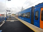
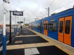

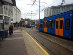
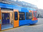
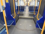

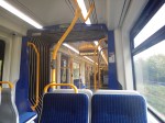
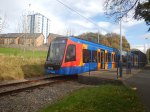
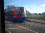

Note.
- These Class 399 tram-trains were the first tram-trains to run in the UK, when they entered service in 2017.
- They were built by Stadler in Spain.
- They share the tracks in Sheffield happily with Sheffield’s other trams of a different type.
- At the time, Paul Maynard, who is the local MP, was the Parliamentary Under Secretary of State for Transport, so I suspect that explains, why the MP appears pleased with the choice of tram-trains and talks knowledgeably about them.
- There is also a battery electric version of these tram-trains, which has been ordered by the South Wales Metro.
- Blackpool’s tramway uses Bombardier Flexity 2 trams. However, it doesn’t seem, that there is a tram-train version of the Flexity 2.
- Merseyrail in the Liverpool area, are introducing a large fleet of Stadler trains, which will be running to Preston in a couple of years.
I suspect that these tram-trains will be built by Stadler and they could be fitted with batteries.
Tram-Train Frequency Between Fleetwood Ferry And Poulton-le-Fylde Station
The Blackpool Gazette article is definite, that the frequency of the tram-train will be two trains per hour (tph).
Consider.
- The Blackpool tramway operates a service of trams every 10-15 minutes between Starr Gate and Fleetwood Ferry, so the frequency will be increased by two tph North of Lindel Road tram stop.
- As heritage trams also share the route to Fleetwood, I suspect that at some busy times, the Fleetwood Ferry and Preston service could be reduced to hourly.
- But it does look to me, that the all-important terminal at Fleetwood Ferry has been well-designed and can handle the extra traffic.
- Looking at the timetable for the Blackpool tramway, trams take forty-one minutes between Fleetwood Ferry and the North Pier.
- As Poulton-le-Fylde station and North Pier tram stop, are probably similar distances from Fleetwood Ferry, I suspect that Poulton-le-Fylde station and Fleetwood Ferry would take thirty minutes or more.
- Real Time Trains indicates that electric trains to Blackpool North station take around 16-17 minutes between Poulton-le-Fylde and Preston stations, with diesel trains taking a couple of minutes more.
- Add in time for stops at Kirkham & Wesham, possibly another at Salwick and cleaning and crew changeover at Preston station, I suspect that a roundtrip from Preston to Fleetwood Ferry and back will take a very convenient two hours.
A two hour round trip and two tph, will mean four trains will be needed to work the timetable.
I can’t prove it, but I my gut feeling is that there there will be a passing loop somewhere between Poulton-le-Fylde station and the Lindel Road tram stop.
The passing loop would also give scope for operational flexibility.
Train Services Through Poulton-le-Fylde Station
Train services through Poulton-le-Fylde station are currently as follows.
- Avanti West Coast – London Euston and Blackpool North – 1 train per day (tpd)
- Northern – Liverpool Lime Street and Blackpool North – 1 tph
- Northern – Manchester Airport and Blackpool North – 2 tph
- Northern – York and Blackpool North – 1 tph
Note that all trains stop at Preston.
The Avanti West Coast service only calls Southbound, but I wouldn’t be surprised, if the Fleetwood tram-train is built, that Avanti West Coast started a Northbound service.
Could The Blackpool South Branch Be Served By Similar Tram-Trains?
In Beeching Reversal – South Fylde Line Passing Loop, I talked about improving the Blackpool South branch.
Objectives included.
- Two tph.
- Better trains.
- A passing loop that would enable the 2 tph.
Note.
- Pacers have been replaced with Class 150 trains.
- The route is electrified between Preston and Kirkham & Wesham station.
- 12.2 miles are without electrification.
It certainly would seem possible that if a battery-electric tram-train had sufficient range, it could handle the current route to Blackpool South station.
The trams would have a ninety-minute round trip between Preston an Blackpool South stations and two tph, will mean three trains will be needed to work the timetable.
The MP is quoted in the Blackpool Gazette article, as liking the concept of a tram loop to Blackpool from Preston.
Trams might go to Fleetwood, down the promenade and then take the Blackpool South branch beck to Preston.
It could obviously go the other way around the loop.
This Google Map shows the location of Blackpool South station.
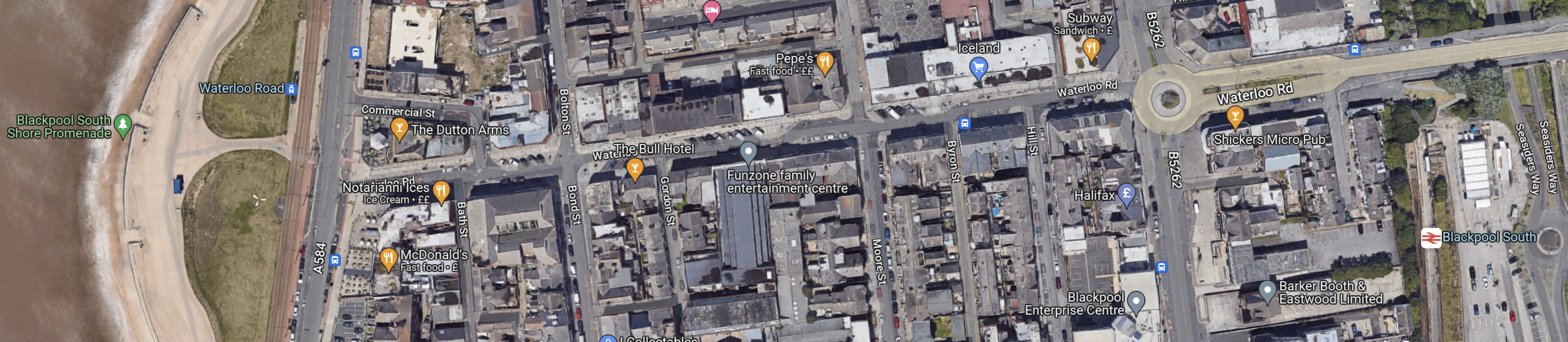
Note.
At the West side of the map is the promenade, with tramway running North and South.
At the East side of the map is Blackpool South station.
The walking route between the tramway and the station is not arduous, but it is not a seamless transfer.
It might be better to make the connection at Blackpool Pleasure Beach, which is shown in this Google Map.
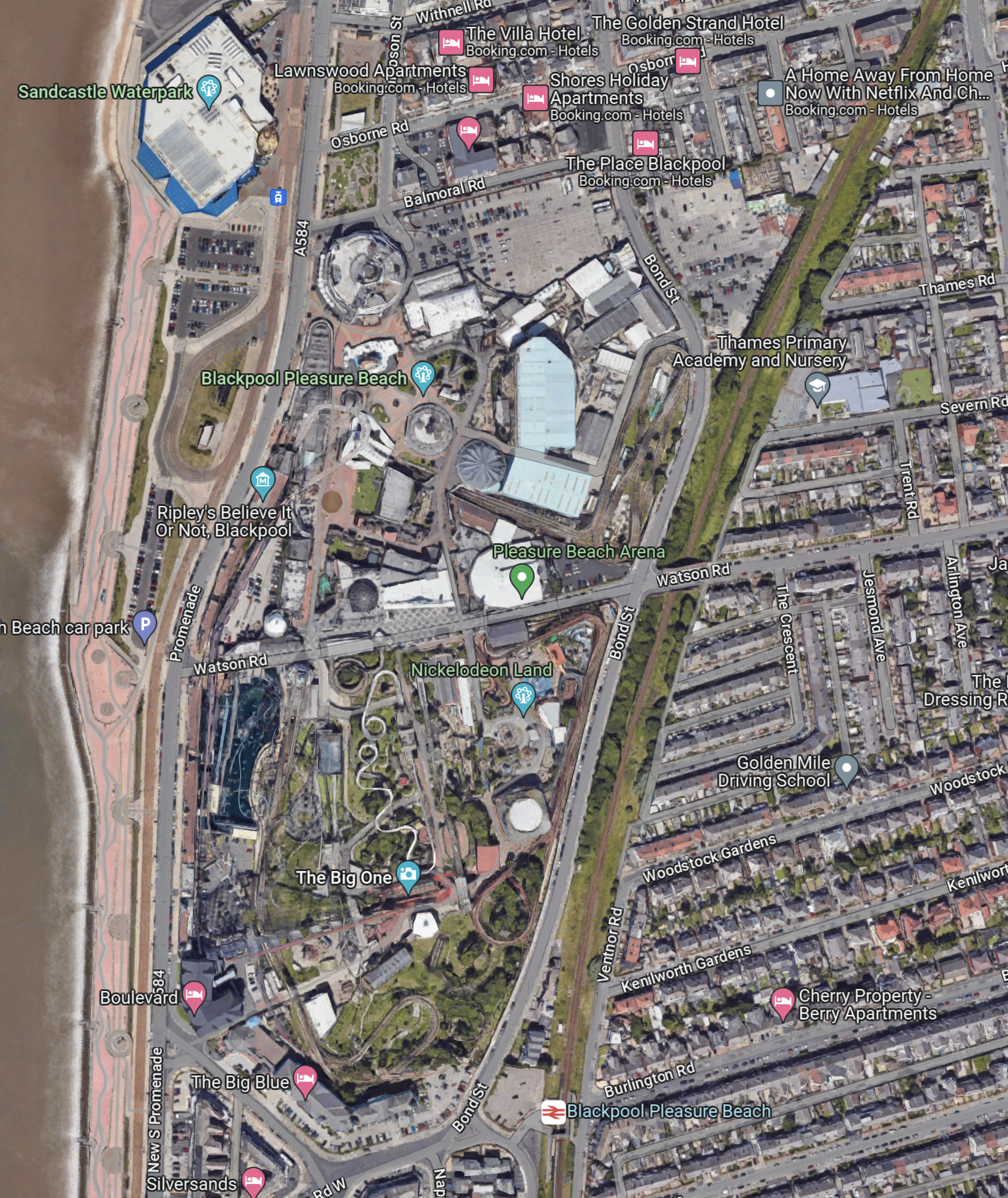
Note.
- The Pleasure Beach lies between the tramway and the promenade by the beach and the Blackpool South branch on the East side.
- There are two stops on the tramway and a station just to the South.
Perhaps, if the Pleasure Beach were redeveloping an area, they might leave provision for tram-trains to to sneak through to join the tramway going North.
But it’s a difficult problem, as there is not much space, that is undeveloped and the roads aren’t very wide.
This Google Map shows the North Pier and Blackpool North station.
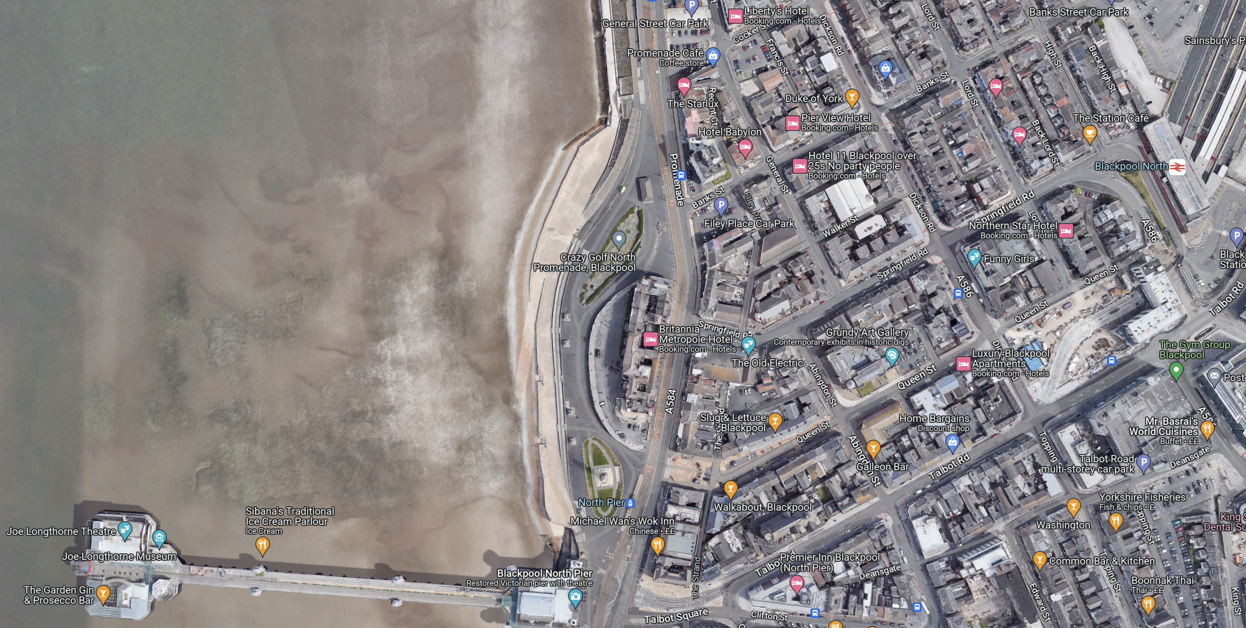
Note.
- The North Pier is in the South-West corner of the map.
- Blackpool North station, which is Blackpool’s main station is in the North-East corner of the map.
- The tramway runs along the sea-front.
The North Pier and the station are linked by Talbot Road.
This Google Map shows Talbot Road and the development of a tram stop by Blackpool North station.
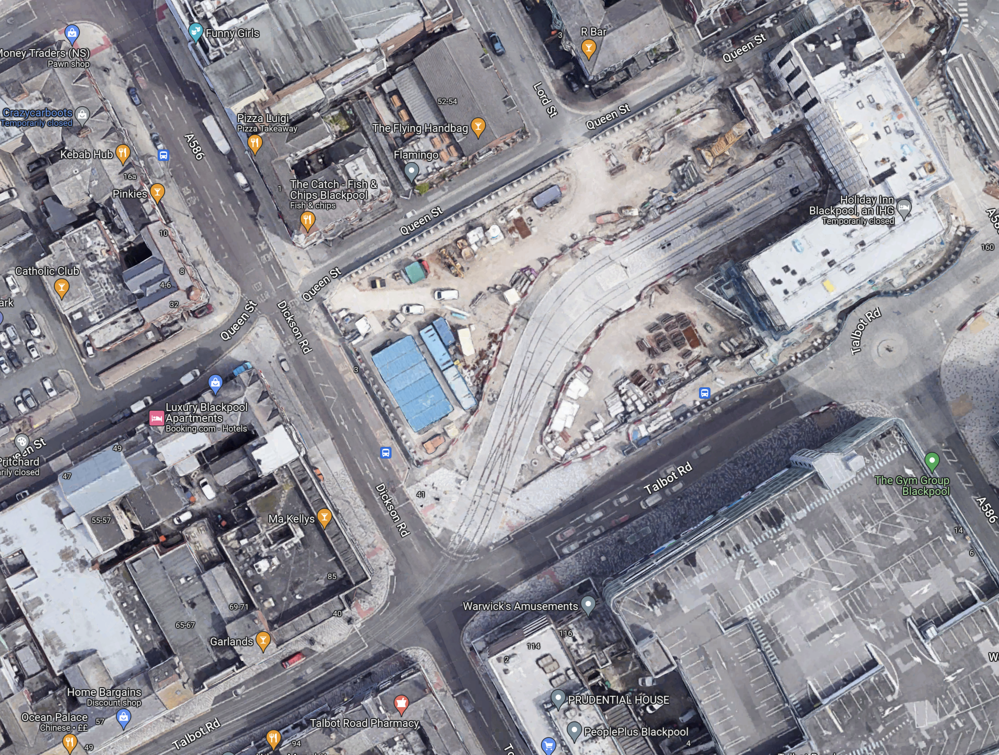
Note.
- To create the space a large Wilkinson’s store was demolished.
- Blaxkpool North station is just off the North-East corner of the map.
- The tram stop will have two platforms.
- There is a large diamond crossing on the approach to the tram stop, so operation is smooth and reliable.
- It looks like there will be substantial development around and possibly over the tram stop.
This Google Map shows Talbot Square, where the tram branch to Blackpool North station joins the main North-South tramway.
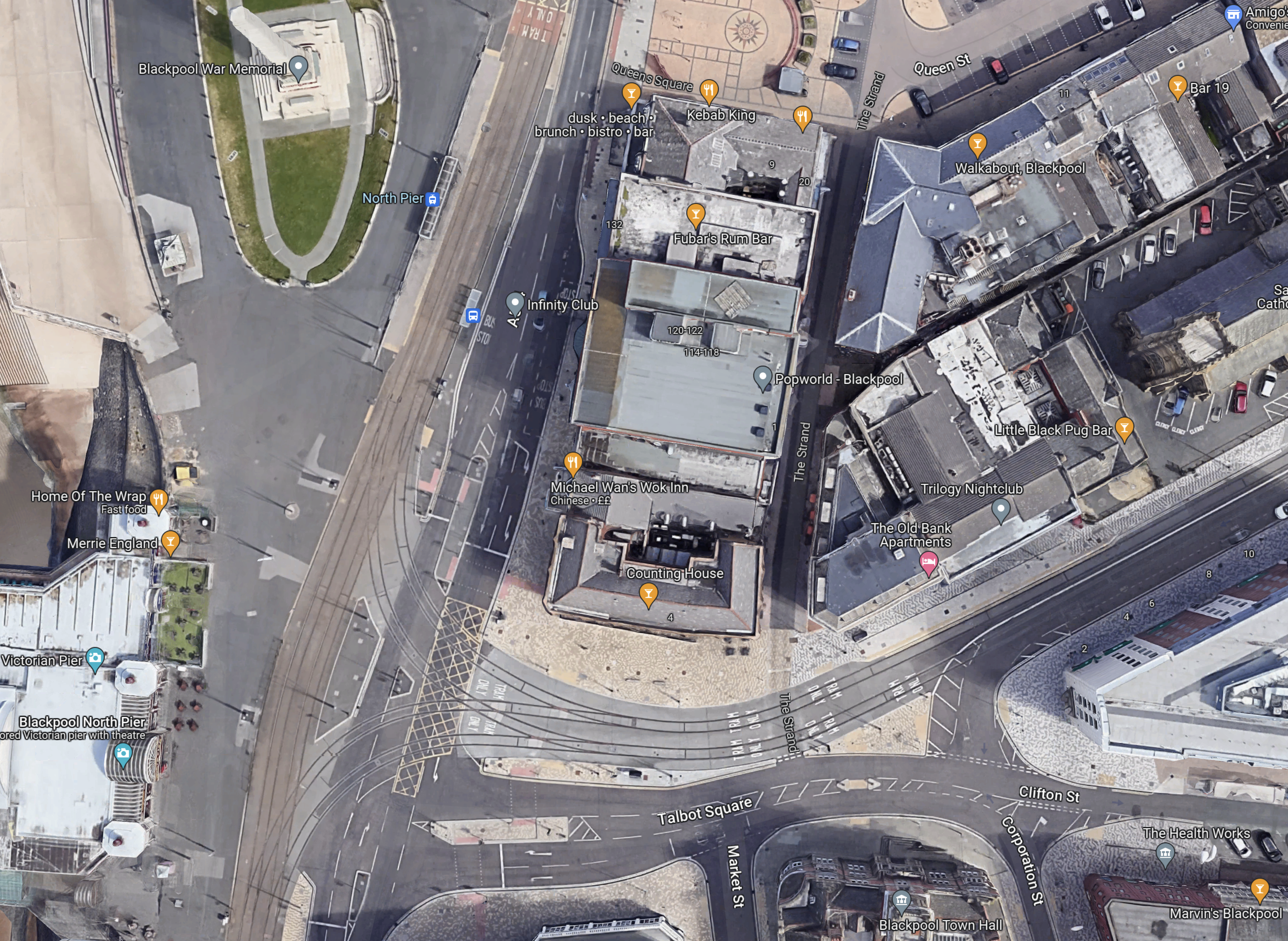
It is all very crowded and I believe this illustrates, why despite their close proximity, there is no rail connection between the Blackpool South branch and the Blackpool tramway.
There just isn’t the space to put in junctions like this and the tramway doesn’t go past Blackpool Airport, so the connection would have to be amongst the crowded houses on the sea front.
The Development Of Blackpool Airport
Aviation is changing and I believe a new breed of airliners and the airports to serve them, will be developed in the next few years.
- Zero-carbon aircraft are being developed and I believe some will have entered service by 2026.
- They will be powered directly by batteries or from green hydrogen.
- Some like the Eviation Alice are already entering a flight-test program, that will lead to certification.
- These airliners are likely to be smaller and quieter than current airliners, with typically a passenger capacity of around 19 passengers.
- They will often fly routes between smaller regional airports.
Blackpool Airport could be an ideal airport for these airliners.
- Offshore electricity and even hydrogen generated offshore will be easy to deliver to Blackpool Airport.
- It could have excellent transport connections with trams and trains.
- Blackpool Airport has good runways.
- Many take-offs will be over the sea.
- We will see airports converting to zero-carbon airports.
So why not Blackpool Airport?
These are distances between Blackpool Airport and other airports.
- Aberdeen – 238 miles
- Amsterdam Schipol – 340 miles
- Belfast City – 128 miles
- Cardiff – 165 miles
- Dublin – 134 miles
- Edinburgh – 150 miles
- Exeter – 211 miles
- Geneva – 661 miles
- Glasgow – 155 miles
- Haverfordwest – 157 miles
- Jersey – 318 miles
- Kirkwall – 358 miles
- London Gatwick – 220 miles
- London Heathrow – 192 miles
- London Southend – 219 miles
- Newcastle – 89 miles
- Paris Orly – 422 miles
- Isle of Man Ronaldsway – 68 miles
- Shannon – 254 miles
- Southampton – 208 miles
- Sumburgh – 427 miles
These distances fit nicely with the range of the nine-seater Eviation Alice electric aircraft, which is predicted to be 620 miles.
This Google Map shows Blackpool Airport.
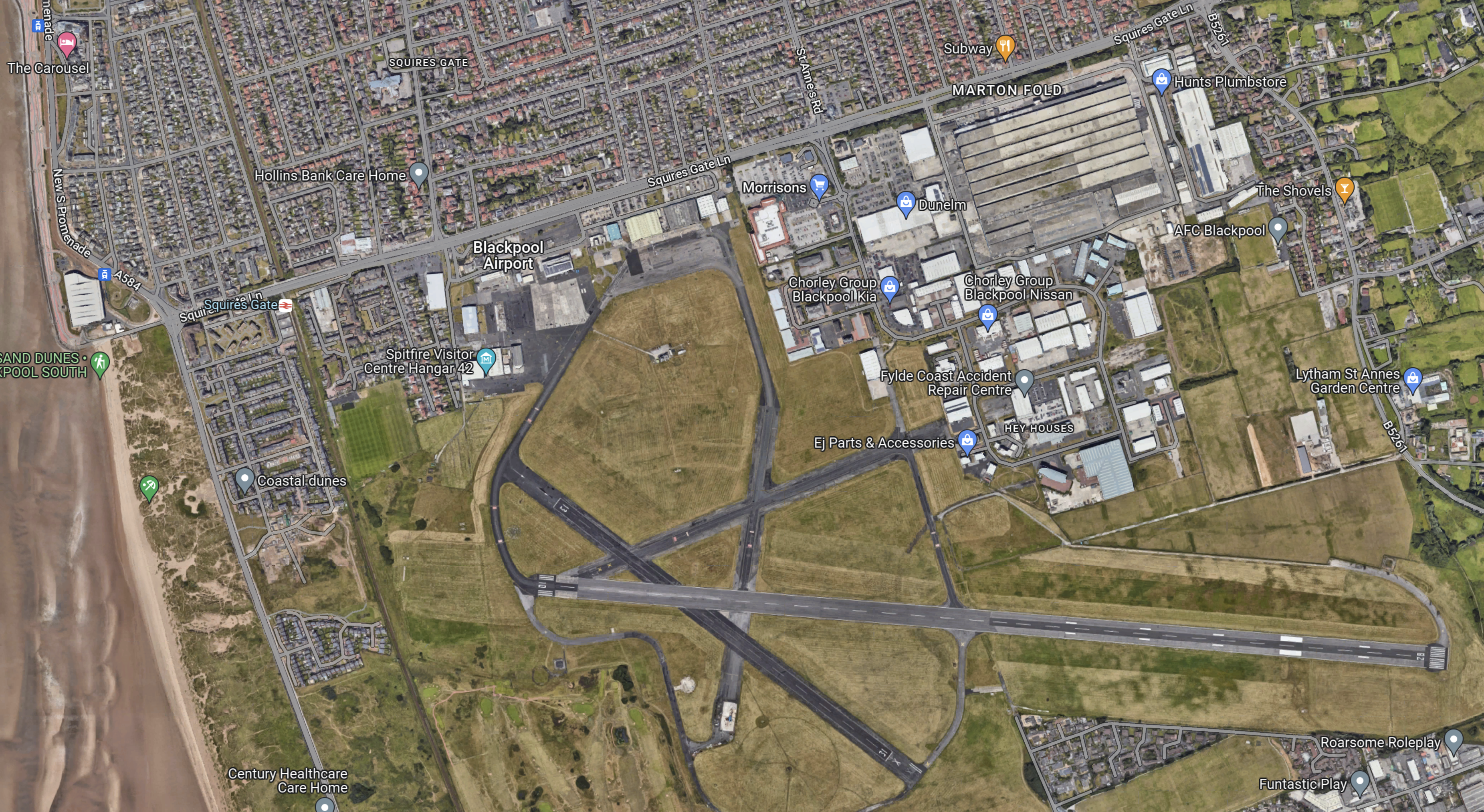
Note.
- The East-West main runway, which is over 1,800 metres long, which will probably mean an easier takeoff into the wind, for much of the time.
- The acres of space.
- The Blackpool South branch running down the side of the airport, with Squires Gate station on the road past the Airport.
- But zoom in on the airport and some improvement and refurbishment needs to be done. Years of neglect and uncertainty has taken its toll.
This Google Map shows the North-West corner of the map at a greater scale.
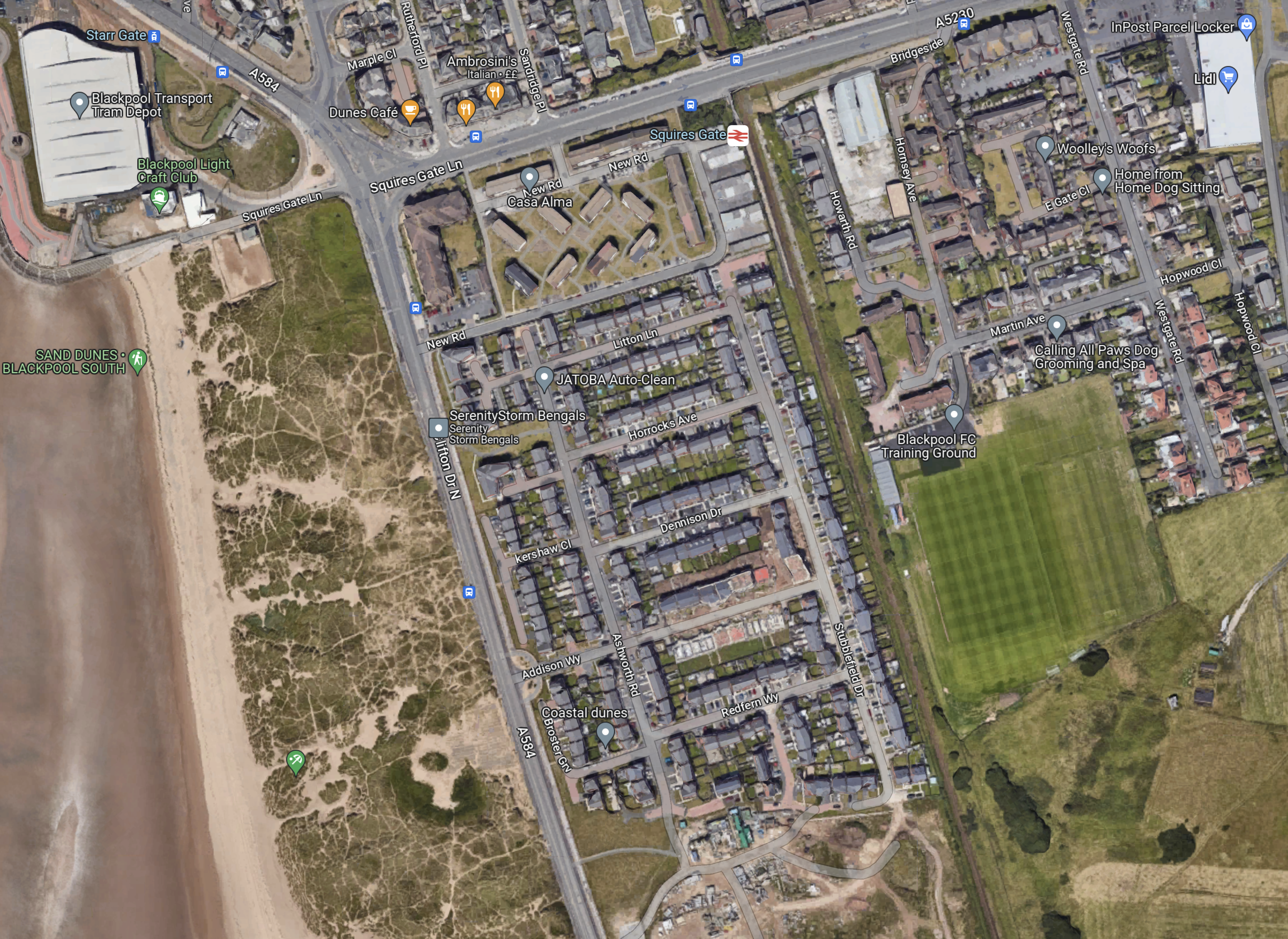
Note.
- In the North-West corner of the map is Blackpool tramway’s depot and Starr Gate tram stop with its loop.
- The rail station is Squires Gate for Blackpool Airport.
- The smart green space to the East of the railway is Blackpool FC’s training ground.
- Below the training ground on the East side is Blackpool Airport.
- On the other side of the track from the Airport, it appears to be the local rubbish dump.
I wonder, if this is where the Blackpool tramway and the Blackpool South branch could be joined up.
- A joint two-platform station partly on Airport land would replace the current Squires Gate station.
- It could be connected to the Airport terminal by some form of shuttle or travellator.
- The trams would be connected to the Starr Gate loop by a line going along the front, as the tramway does in much of Blackpool, before cutting through the waste ground.
- Trains to Blackpool South station would use their current route.
This plan and probably lots of others could allow a Blackpool loop tram-train from Preston.
What would a zero-carbon airport do for Blackpool?
Beeching Reversal – A New Station At Waverley In Sheffield
This is one of the Beeching Reversal projects that the Government and Network Rail are proposing to reverse some of the Beeching cuts.
In July 2019, I covered this new station in Sheffield Region Transport Plan 2019 – A New Tram-Train Route To A New Station At Waverley.
Note that to avoid confusion, I now refer to this station as Sheffield Waverley station.
This was my conclusion in the July 2019 post.
Why shouldn’t Sheffield have an advanced tram-train system to serve the Advanced Manufacturing Park?
I feel the service should be as follows.
-
- It should be terminated in a loop around the Waverley area and the Advanced Manufacturing Park.
- In the West it could terminate in Sheffield station or perhaps pass through and terminate in the West of the City.
- The service could be run using battery electric tram-trains, similar to the Class 398 tram-trains, that will be used on the South Wales Metro.
I don’t think that the engineering will be very challenging.
I shall be adding to this post.
Thoughts On The Actual Battery Size In Class 756 Trains And Class 398 Tram-Trains
A Freedom of Information Request was sent to Transport for Wales, which said.
Please confirm the battery capacity and maximum distance possible under battery power for the Tram/Train, 3 & 4 Car Flirts.
The reply was as follows.
The batteries on the new fleets will have the following capacities: –
- Class 756 (3-car) Flirt – 480 kWh
- Class 756 (4-car) Flirt – 600 kWh
- Class 398 tram-trains – 128 kWh
I will now have thoughts on both vehicles separately.
Class 756 Trains
In More On Tri-Mode Stadler Flirts, I speculated about the capacity of the batteries in the tri-mode Stadler Flirts, which are now called Class 756 trains, I said this.
I wonder how much energy storage you get for the weight of a V8 diesel, as used on a bi-mode Flirt?
The V8 16 litre diesel engines are made by Deutz and from their web site, it looks like they weigh about 1.3 tonnes.
How much energy could a 1.3 tonne battery store?
The best traction batteries can probably store 0.1 kWh per kilogram. Assuming that the usable battery weight is 1.2 tonnes, then each battery module could store 120 kWh or 360 kWh if there are three of them.
I also quoted this from the July 2018 Edition of Modern Railways.
The units will be able to run for 40 miles between charging, thanks to their three large batteries.
Since I wrote More On Tri-Mode Stadler Flirts in June 2018, a lot more information on the bi-mode Stadler Class 755 Flirt has become available and they have entered service with Greater Anglia.
Four-car trains weigh around 114 tonnes, with three-car trains around a hundred. I can also calculate kinetic energies.
How Good Was My Battery Size Estimate?
These are my estimate and the actual values for the three batteries in Class 756 trains
- My estimate for Class 756 (3- & 4-car) – 120 kWh
- Class 756 (3-car) Flirt – 160 kWh
- Class 756 (4-car) Flirt – 200 kWh
So have Stadler’s battery manufacturer learned how to squeeze more kWh into the same weight of battery?
In Sparking A Revolution, I talked about Hitachi’s bullish plans for battery-powered trains, in a section called Costs and Power.
In that section, I used Hitachi’s quoted figures, that predicted a five tonne battery could hold a massive 15 MWh in fifteen years time.
If Stadler can get the same energy density in a battery as Hitachi, then their battery trains will have long enough ranges for many applications.
Class 398 Tram-Trains
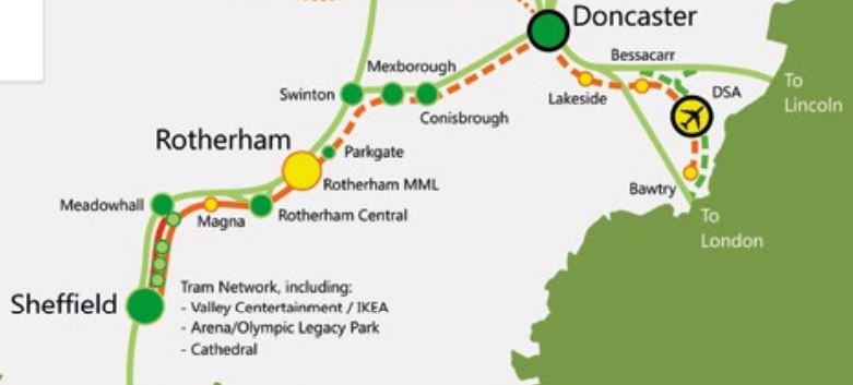
In Sheffield Region Transport Plan 2019 – Tram-Trains Between Sheffield And Doncaster-Sheffield Airport, I showed this map of the route the trams would take.
I also said this about the tram-trains.
The distance between Rotherham Parkgate and Doncaster is under twelve miles and has full electrification at both ends.
The Class 399 tram-trains being built with a battery capability for the South Wales Metro to be delivered in 2023, should be able to reach Doncaster.
But there are probably other good reasons to fully electrify between Doncaster and Sheffield, via Meadowhall, Rotherham Central and Rotherham Parkgate.
The major work would probably be to update Rotherham Parkgate to a through station with two platforms and a step-free footbridge.
Currently, trains take twenty-three minutes between Rotherham Central and Doncaster. This is a time, that the tram-trains would probably match.
If you adopt the normal energy consumption of between three and five kWh per vehicle mile on the section without electrification between Rotherham Parkgate and Doncaster, you get a battery size of between 108 and 180 kWh.
It looks to me, that on a quick look, a 128 kWh battery could provide a useful range for one of Stadler’s Class 398/399 tram-trains.
Class 398 Tram-Trains Between Cardiff Bay and Cardiff Queen Street Stations
The distance between these two stations is six chains over a mile,
Adding the extra bit to the flourish might make a round trip between Cardiff Queen Street and The Flourish stations perhaps four miles.
Applying the normal energy consumption of between three and five kWh per vehicle mile on the section without electrification between Cardiff Queen Street and The Flourish, would need a battery size of between 36 and 60 kWh.
Conclusion
The battery sizes seem to fit the routes well.
Sheffield Region Transport Plan 2019 – A New Tram-Train Route To A New Station At Waverley
Sheffield’s plans state that a medium to long term priority is to have a new station on the Sheffield-Lincoln Line.
This Google Map shows the location of Waverley between Darnall and stations.
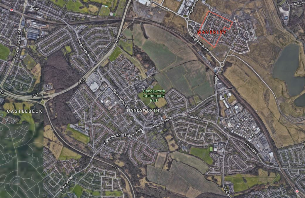
Note.
- Darnall station is in the North-West corner of the map.
- Woodhouse station is in the South-East corner of the map.
- Waverley is a new housing area and is highlighted in red towards the North-East corner of the map.
The plans also propose that the service will be run by tram-trains and they will also serve the Advanced Manufacturing Park (AMP)
This Google Map shows AMP and Waverley in a larger scale.
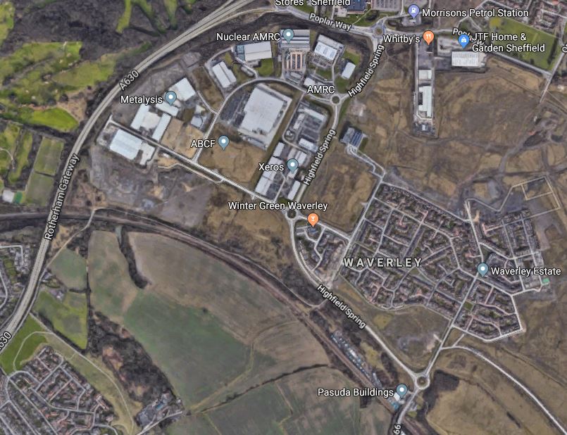
Note.
- Waverley in the South-East corner of the map.
- The AMP in the North-West corner of the map.
- The Sheffield-Lincoln Line curving through to the South.
Most rail and tram systems are straight out-and-back layouts, but there are two very important loops that serve a wider area under Liverpool City Centre and Heathrow Airport.
Could Waverley and the AMP be served by a surface loop from the Sheffield-Lincoln Line?
- The loop could be single- or double-track.
- Stops would be in appropriate places.
- The loop could be electrified as needed with 750 VDC to the Sheffield Supertram standard.
As Sheffield is less than three miles from Waverley, the battery-electric version of Class 399 tram-trains could be used.
- These have been ordered for the South Wales Metro,
- They are now numbered Class 398 tram-trains.
- They should be able to run to and from Sheffield on battery power.
- If the loop was fully electrified, this could charge the tram-trains.
The Sheffield-Lincoln Line passes to the back of the Sheffield Supertram Depot, so I suspect, if required the tram-trains could sneak through the depot to join the main tram route through Sheffield City Centre.
But as the Sheffield Supertram expands, there must surely come a point, where a second route across the City is needed to handle increasing numbers of trams. Manchester found this a few years ago and have since built the Second City Crossing.
Sheffield already has a second route across the City and it is the rail line through Sheffield station, which will be electrified in the next few years, to allow High Speed Two trains to reach the City.
So I can see no reason, why tram-trains from Waverley and the AMP can’t terminate in Sheffield station or go across the City.
To show what the Germans get up to, here’s one of Karlruhe’s tram-trains in a platform in Karlsruhe HBf, with a double-deck TGV in an adjacent platform.
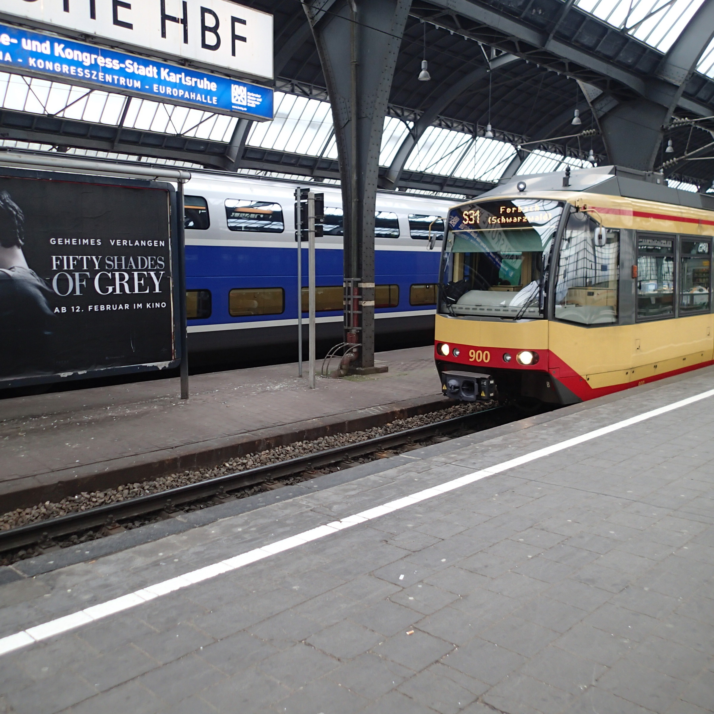
This is one of Karlsruhe’s older train trains, that are being replaced by tram-trains, which are cousins of those in Sheffield.
If the Waverley loop is built, it can be considered as a separate tram system, that connects to Sheffield station, by running as a battery-electric train.
Conclusion
Why shouldn’t Sheffield have an advanced tram-train system to serve the Advanced Manufacturing Park?
I feel the service should be as follows.
- It should be terminated in a loop around the Waverley area and the Advanced Manufacturing Park.
- In the West it could terminate in Sheffield station or perhaps pass through and terminate in the West of the City.
- The service could be run using battery electric tram-trains, similar to the Class 398 tram-trains, that will be used on the South Wales Metro.
I don’t think that the engineering will be very challenging.
