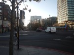
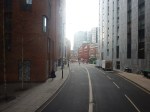
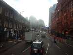
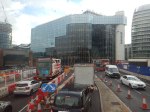
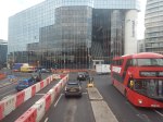
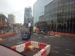
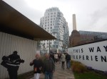
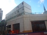
Will 22 Ropemaker Street Have Shops?
As I walked past 22 Ropemaker Street on Sunday, the builders appeared to be finishing off the Ground Floor.
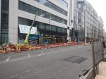
Looking at the building’s web site, there is no mention of retail.
- But the web site does show off the transport and walking connections.
- It also has its own entrance for cyclists.
- Car parking is not mentioned on the web site.
- The web site also details the building.
It’s certainly a well-designed office building.
British Land Unveils Plans To Transform London’s Euston Tower Into A Life Sciences And Innovation Hub
The title of this post, is the same as that of this press release from British Land.
The Wikipedia entry for the Euston Tower gives this paragraph of history.
The site was developed by Joe Levy who bought properties along the north side of Euston Road to enable him to build a complex of two tower blocks with office shops and apartments. The building, which was designed by Sidney Kaye Eric Firmin & Partners in the International style and built by George Wimpey, was completed in 1970. It is 36-storeys and 124 metres (407 ft) high. Early tenants included Inmarsat and Capital Radio.
When you get to over fifty years old, various parts of your body get tired and I suspect it is the same with buildings.
These are the two bullet points of the press release.
- Euston Tower represents a major retrofit and redevelopment opportunity at the heart of London’s Knowledge Quarter
- Proposals aim to transform the building into a world-class net zero home for world-leading life science and innovation occupiers
These two paragraphs then add a bit more vision.
Leading property company British Land has unveiled plans to redevelop Euston Tower through an innovative combination of retention, re-use and an ultra-low carbon new structure. The plans would transform the building into a pioneering, modern, net zero workspace for cutting-edge businesses of all sizes, including new world-class, lab-enabled spaces at the heart of London’s Knowledge Quarter.
Currently under discussion with Camden Council and other local stakeholders, the vision for Euston Tower will lead the way in low carbon retrofit and construction techniques, using inclusive design which creates high quality workspaces and continues to support the local community and economy. The current proposals will bring forward lab-enabled spaces for start-up and scale-up innovation businesses, as well as spaces for the local community to support education and training opportunities.
These are points from the press release.
- Leading the design are award-winning Danish architecture practice 3XN.
- They are supported by London-based architecture and landscape studio DSDHA who re-designed much of Broadgate’s public realm, including Exchange Square.
- In line with British Land’s longstanding commitment to net zero development, the design’s sustainability strategy is based on retaining, re-using and re-cycling existing material, specifying low carbon and recycled materials where new is required and only using certified carbon offsets as an action of last resort.
- This multi-layered approach to net zero development aims to create a blueprint for the sustainable redevelopment of challenging, inflexible old buildings that can be used in the future.
British Land has owned and operated Regent’s Place for nearly 40 years, which means they must have a lot of knowledge about how best to develop the building and its surroundings.
They certainly seem to be applying a modern net-zero approach to a building that was iconic and modern in the 1970s.
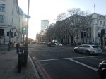
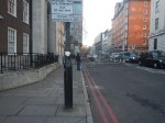
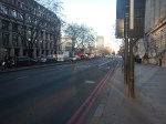
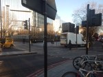
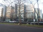
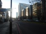
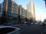
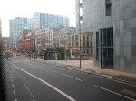
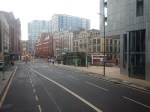
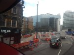
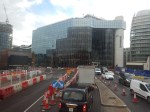
This afternoon I walked down the Euston Road between Euston and Great Portland Street stations and took these pictures.


Note.
- Euston Station is a shadow of its former self.
- Euston Tower is the boxy tower on the North side of Euston Road.
- University College London Hospital (UCLH) is the tower on the South side of Euston Road.
- I believe the glass-fronted building opposite the hospital and Euston Tower contains a lot of BT infrastructure.
I have some thoughts.
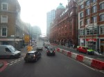
Traffic Along The Euston Road
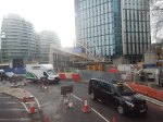
I took the pictures around 1400 in a Friday and they show how busy the Euston Road is most of the time.
According to the Wikipedia entry for the Euston Road, there was a plan to remove the underpass.
In the early-21st century, the Greater London Authority commissioned a plan to improve the road from the architectural firm, Terry Farrell and Partners. The original study proposed removing the underpass (which was subsequently cancelled) and providing a pedestrian crossing and removing the gyratory system connecting the Tottenham Court Road and Gower Street. The scheme was approved by the Mayor of London, Ken Livingstone as “the start of changing the Marylebone to Euston road from a highway into a series of linked public spaces.” The pedestrian crossing opened in March 2010. Livingstone’s successor, Boris Johnson, favours keeping the Euston Road underpass and declared it to be a good place to test his nerves when cycling around London.
Nothing is said about, where the traffic would have gone, if the underpass had been closed.
I walked along the South side of the Euston Road past the hospital and the air couldn’t be considered clean. As I write this, this website rates it Hazardous.
If we ignore the pollution for pedestrians and cyclists, is it really a road, that is fit for the purpose of moving traffic between King’s Cross and Baker Street, and vice-versa? I don’t think so!
The UK Needs More Lab Space
Cambridge innovators and developers were always saying they needed more lab space.
I also suspect, they are moaning in Oxford too!
So building high-quality space in London could reduce the pressure.
In Canary Wharf Boosts Its Science Ambitions, I talked about the ambitions of Canary Wharf to be a life sciences hub.
The Euston Tower Is Well-Connected
Consider.
- The Euston Tower is within walking distance of Euston, King’s Cross and St. Pancras stations, with all their long distance connections.
- The Euston Tower is within walking distance of Euston Square, Great Portland Street, King’s Cross St. Pancras and Warren Square stations, with all their Underground connections.
- There are buses everywhere.
But that’s not to say, that these links cannot be improved.
Euston High Speed Two Station Could Be Euston Tower’s Sister?
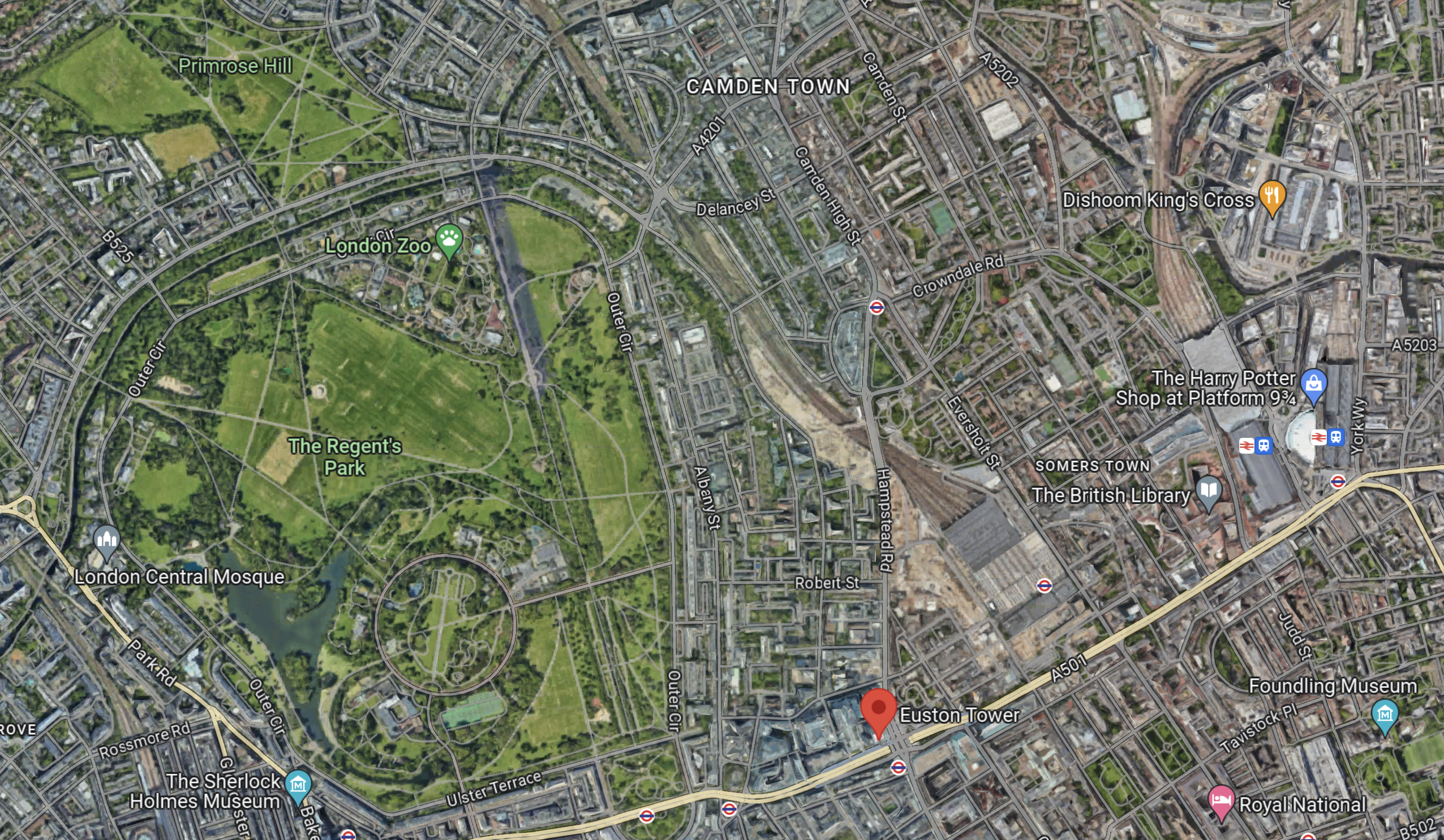
This Google Map shows the location of Euston Town and the proposed Euston High Speed Two station.

Note.
- Euston Tower is marked by a red arrow in the South-West corner of the map.
- The existing Euston station is in the North-East corner of the map.
- The High Speed Two station will be built along the Western side of the existing station.
With good landscaping, an excellent walking route, and perhaps a people mover Euston Tower could have superb connections to the rest of the UK.
Cycling And Walking Could Be A Possibility!
This Google Map shows the wider area around Euston Tower.
Note.
- Euston Tower is marked by the red arrow towards the bottom of the map.
- To its West lies the cycling- and walking-friendly spaces of Regents Park and Primrose Hill.
In the 1970s, I regularly walked or cycled across the park from where we lived near Primrose Hill to a client in Great Portland Street.
I also suspect other cycling and walking routes could be developed to Euston Tower from Euston, King’s Cross, St. Pancras and other stations.
Crossrail 2
Crossrail 2 would certainly help travelling to the Euston Tower, by linking Euston, King’s Cross and St.Pancras to North-East and South-West suburbs of London, with trains at frequencies of up to 30 thirty trains per hour (tph) in the central tunnel.
But.
- The new line will cost at least £31.2 billion. Who can afford it?
- The Elizabeth Line took sixteen years from approval to full opening.
- Crossrail 2 would still be a walk from Euston Tower.
So Crossrail 2 is unlikely to be any help to the redevelopment of Euston Tower.
Improving The Sub-Surface Lines
The Euston Tower is close to two stations on the sub-surface lines; Euston Square and Great Portland Street.
Services through these stations are currently as follows.
- Circle Line – 6 tph – In both directions all day.
- Hammersmith & City Line – 6 tph – In both directions all day.
- Aldgate and Amersham- 2 tph – In both directions all day.
- Aldgate and Chesham – 2 tph – In both directions all day.
- Aldgate and Uxbridge – 6 tph Peak – 8 tph – Off-Peak
- Aldgate and Watford – 4 tph – Peak
Note.
- In the Peak there are 26 tph through Great Portland Street and Euston Square stations.
- In the Off Peak there are 24 tph through Great Portland Street and Euston Square stations.
- In this article on Modern Railways,it is said that after digital signalling is installed on the sub-surface lines, the capacity on the lines, will be 32 tph in the Peak and 27 tph in the Off-Peak.
These figures give a 33 % capacity increase in the Peak and a 28 % increase in the Off Peak.
Both Great Portland Street and Euston Square stations are cramped and not fully step-free stations and could struggle with a 28 % and upwards increase in passenger numbers.
In The New Step-Free Entrance At Euston Square Station, I detailed TfL’s plans to put a new full step-free entrance South of Euston Road at Euston Square station.
This would not directly help travellers going between Euston Tower and Euston station, but hopefully, it would help to make Euston station less crowded and more passenger-friendly.
It would certainly ease walking between University College and the hospital, and the station.
This map from cartometro shows the Underground lines at Great Portland Street station.
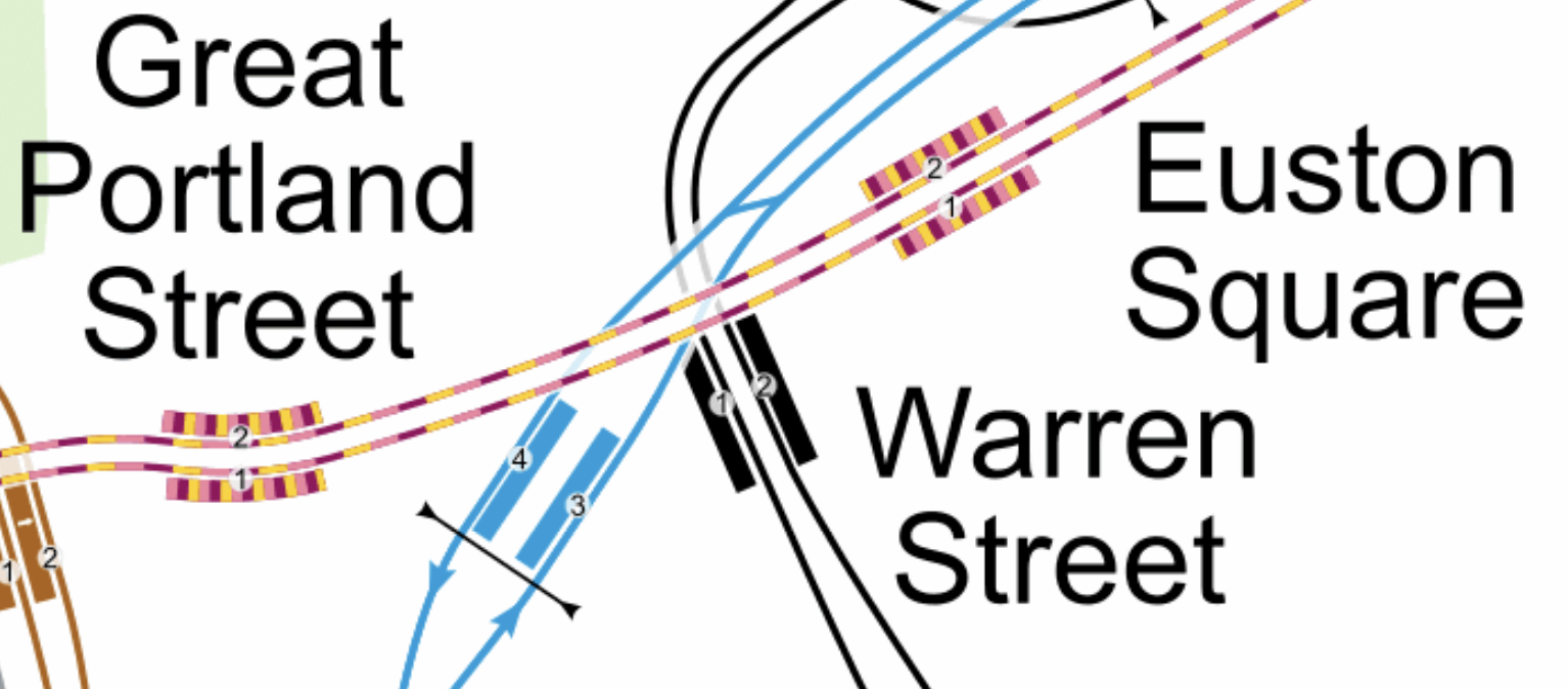
Note.
- The yellow and mauve tracks are the sub-surface lines.
- The black tracks are the Northern Line.
- The blue tracks are the Victoria Line.
This Google Map shows the Euston Tower, Great Portland Street and Warren Street stations.
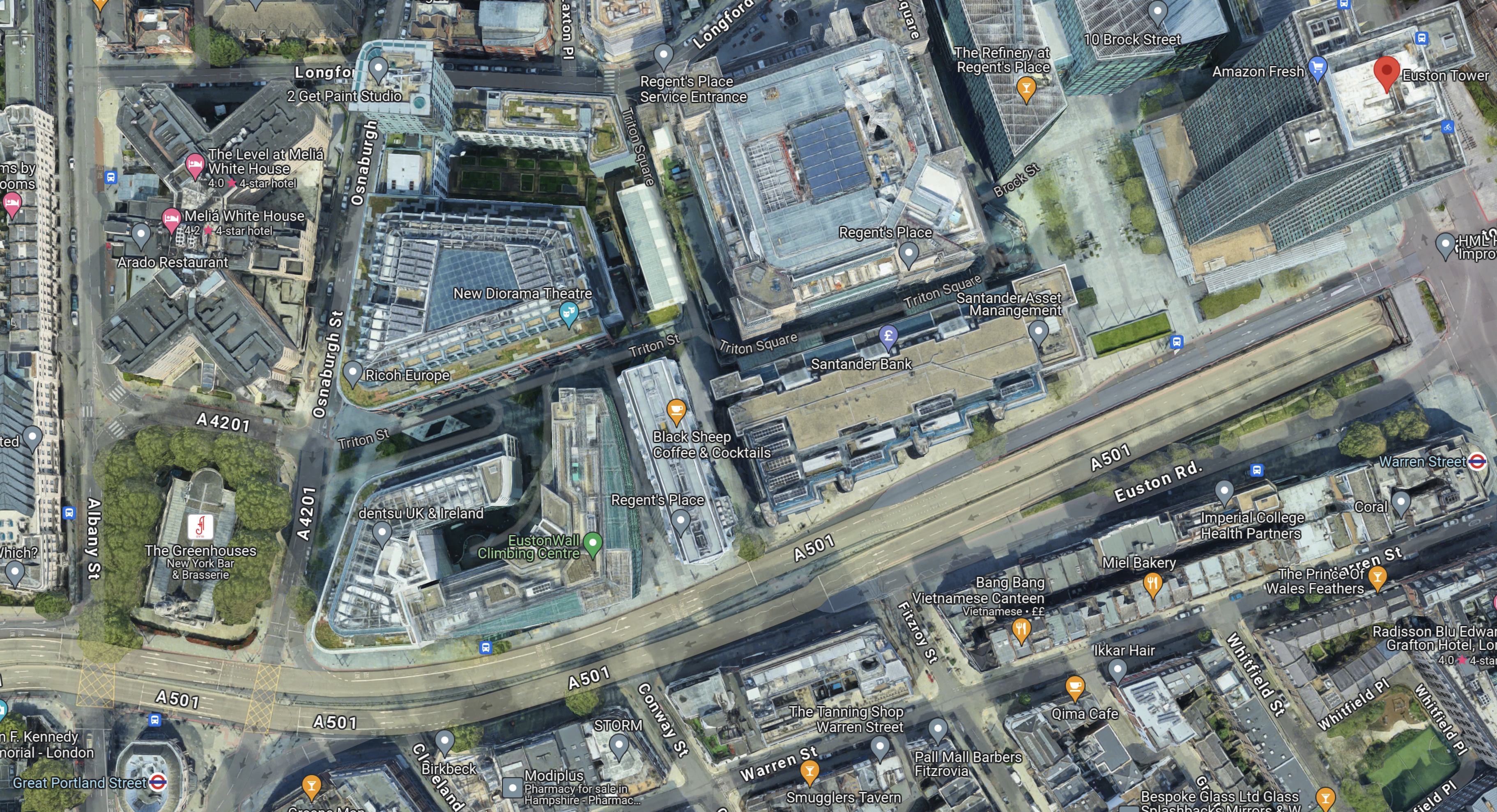
Note.
- The Euston Tower is indicated by a red arrow in the top-right corner of the map.
- Great Portland Street station is in the bottom-left corner of the map.
- Warren Street station is at the left of the map.
I wonder if the platforms were to be extended Eastwards at Great Portland Street station, that a new entrance to the station could be created perhaps fifty metres from Euston Tower.
I am convinced that the extra passenger traffic created by the life sciences and innovation hub can be handled by an augmented transport infrastructure, which would rely mainly on planned improvements to the sub-surface lines, which are approaching their final stages.
Conclusion
Converting Euston Tower into a life sciences and innovation hub is a plan that I believe can work well!
I would recommend the following improvements to public transport.
- The planned extra step-free entrance to Euston Square station on Gordon Street is constructed.
- An extra fully step-free entrance is built at the Eastern ends of the platforms at Great Portland Street station, which would be about halfway between Euston Tower and the station.
As improvements to the signalling of the sub-surface lines will deliver an upwards of 27 % capacity on the sub-surface lines, the life sciences and innovation hub might as well take advantage.
ABP To Explore Opportunities For Offshore Wind Port In Scotland
The title of this post, is the same as that of this article on offshoreWIND.biz.
This is the sub-heading.
Associated British Ports (ABP) has signed an agreement to investigate an area for the development of infrastructure to support offshore wind manufacturing, assembly, and marshalling and green energy on the Cromarty Firth in Scotland, within the Inverness Cromarty Firth Green Freeport.
This first paragraph gives a bit more information including the possible location.
The area, located within the proposed Nigg and Pitcalzean area of the Green Freeport, could support both fixed-bottom and floating offshore wind projects and play a major role in the development of current and future ScotWind leasing rounds, said ABP.
This Google Map shows the location of the Port of Nigg.
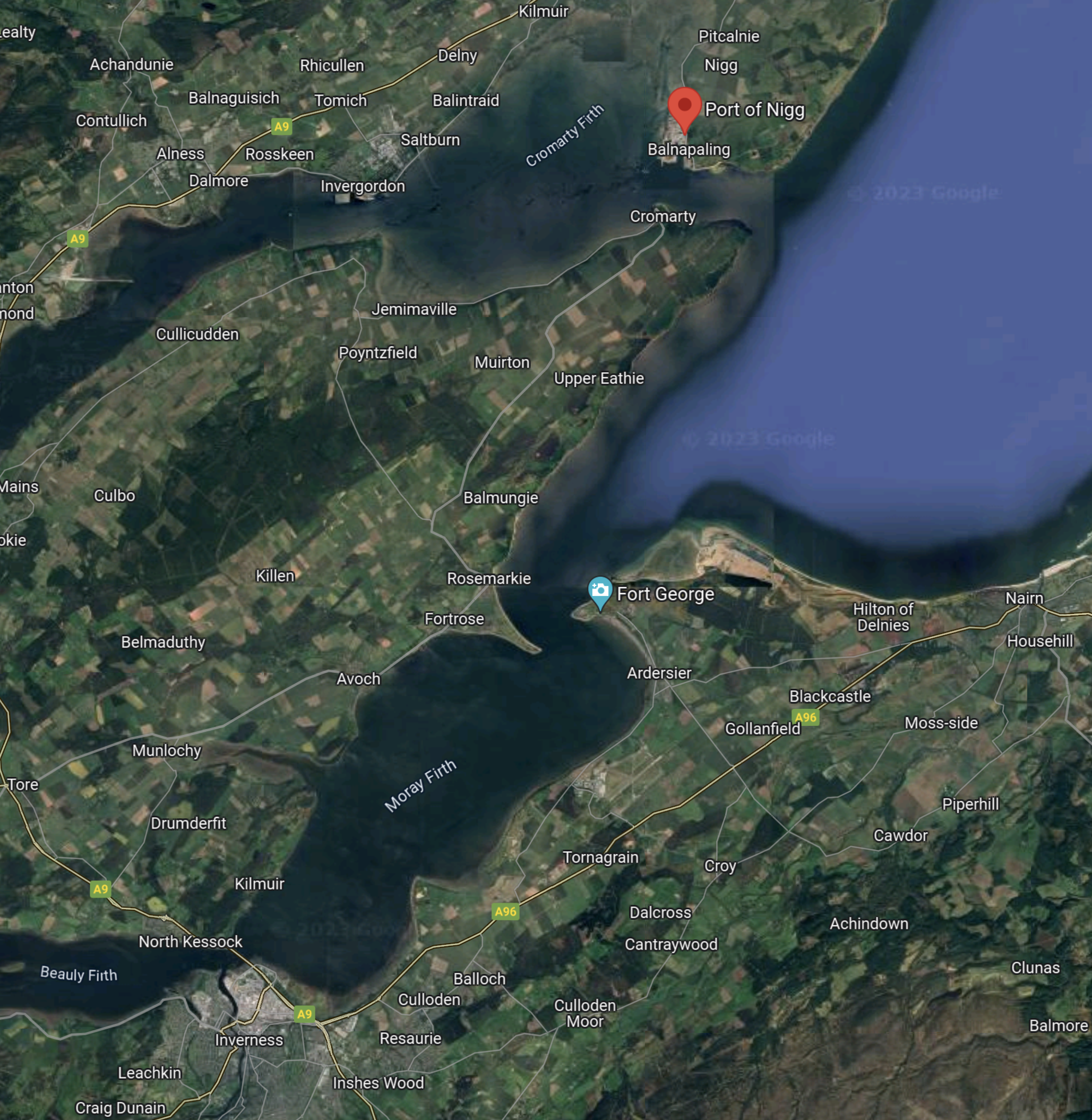
Note.
- The Moray Firth with Inverness at its Southern end is the large body of water in the centre of the Southern half of the map.
- The Port of Nigg is on Cromarty Firth and marked by a red arrow.
- Nigg and Pitcalzean are to the North of the port.
This second Google Map shows an enlarged view of the port.
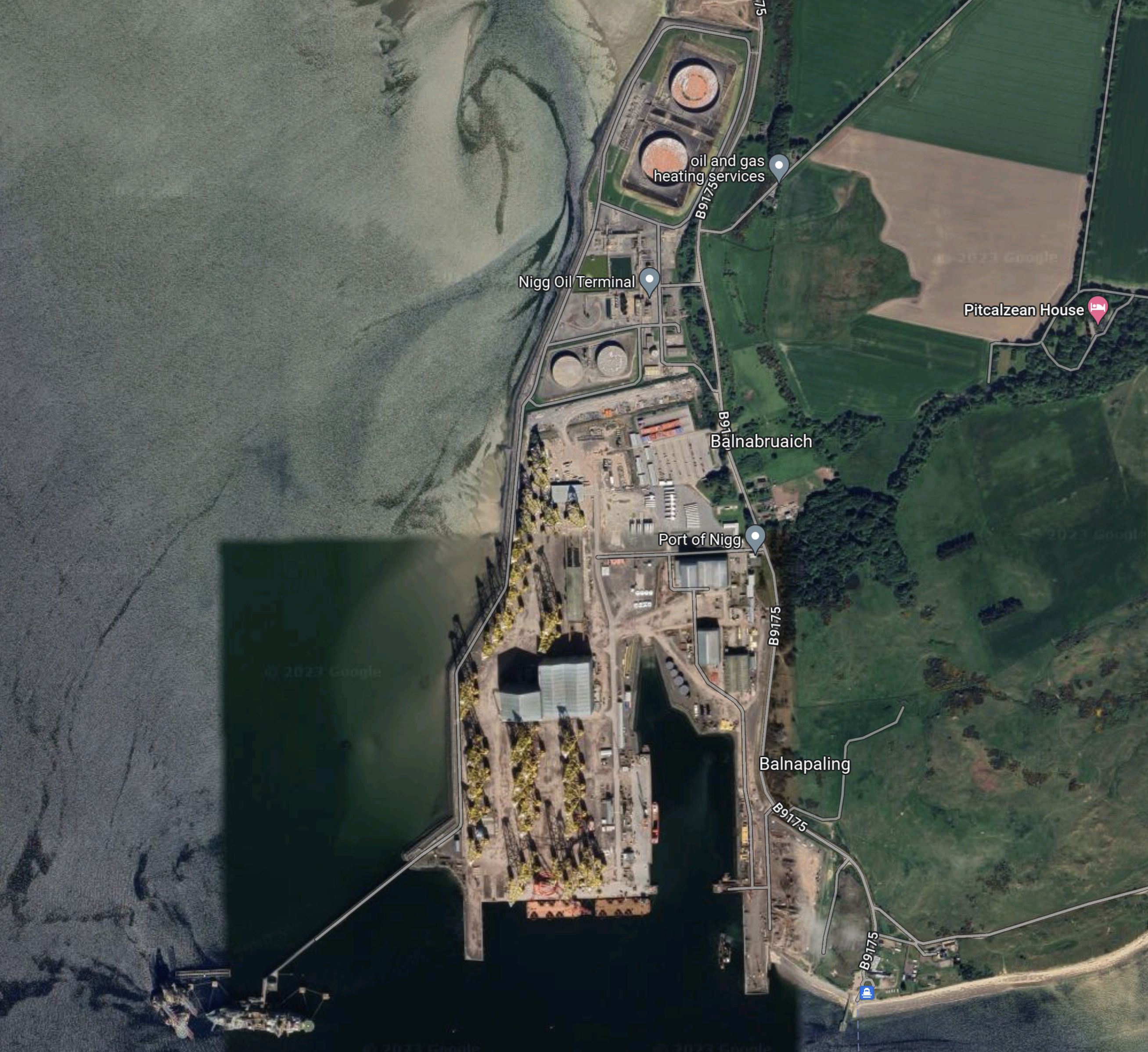
Note.
- Pitcalzean House is in the North-East corner of the map.
- The Port of Nigg is in the centre of the map.
- The water to the West and South of the port is Cromarty Firth.
- The yellow structures in the port are fixed-bottom foundations for wind farms.
Inverness & Cromarty Firth Green Freeport has a web site.
A Quote From Henrik Pedersen
Henrik Pedersen is CEO of ABP and the article quotes him as saying this.
We’re excited to explore the potential of Nigg, applying our experience across the UK, including at our Ports of Grimsby, Hull, Lowestoft and Barrow which already host significant offshore wind activity and at Port Talbot, where we are developing a Floating Offshore Wind port project. We look forward to working with key local partners, the community, and public sector stakeholders.
The article also has this final paragraph.
The Floating Offshore Wind Taskforce’s recently published “Industry Roadmap 2040”, estimated that planed floating offshore wind projects in Scottish waters alone will require three to five integration ports.
There is certainly going to be a significant number of ports, that will be supporting offshore wind activity.
UK Ports Need GBP 4 Billion Investment To Help Unleash Floating Offshore Wind Industry – Report
The title of this post, is the same as that of this article on offshoreWIND.biz.
This is the sub-heading.
A new report by the Floating Wind Offshore Wind Taskforce says up to eleven ports around the UK will need to be transformed as fast as possible into new industrial hubs to enable the roll-out of floating offshore wind at scale
This is the first paragraph.
The report contains a series of recommendations which could see 34 GW of floating wind installed in UK waters by 2040 if the country’s government takes swift and decisive action. At present Ministers have set a target of 5 GW by 2030.
What a lorra lorra lot of wind! (With apologies to Cilla!)
Thoughts On Extending The Northern Line To Clapham Junction
As I wrote in Northern Line Could Be Extended To Clapham Junction In Regeneration Plans, the extension of the newly-built extension to Battersea Power Station station could be further extended to Clapham Junction station.
Railways Between Battersea And Clapham
This map from OpenRailwayMap shows the tracks that run between the two stations.

Note.
- Battersea Power Station station is in the North-East corner of the map.
- The orange and yellow lines going North from that corner go to Victoria station.
- The orange and yellow lines going North-East from that corner go to Waterloo station.
- The yellow line going West is the West London Line to Shepherds Bush and Willesden Junction stations.
- Clapham Junction station is in the South-West corner of the map.
I estimate that the distance between Battersea Power Station and Clapham Junction stations is about three kilometres.
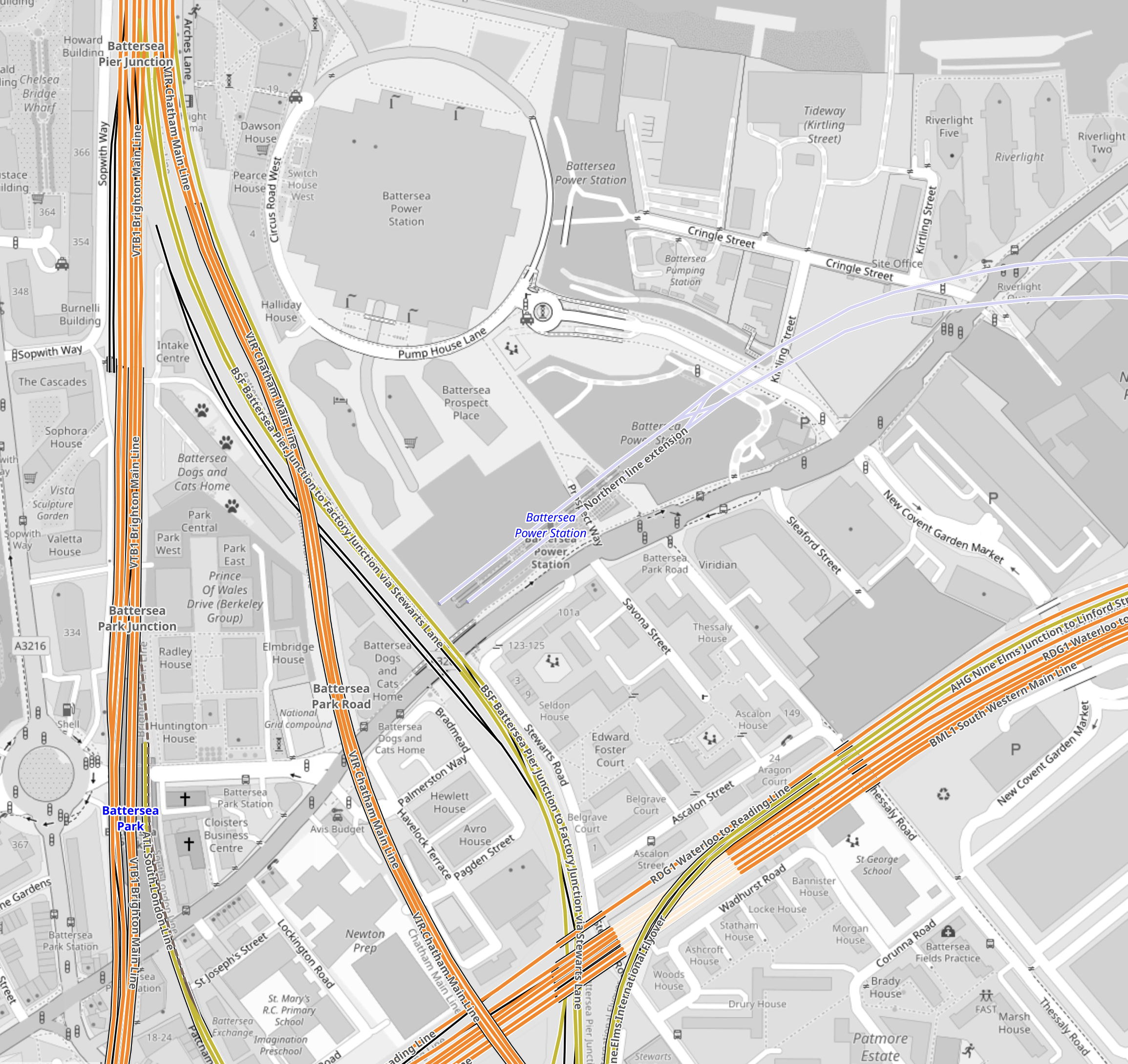
This map from OpenRailwayMap shows an enlargement of the tracks around Battersea.
Note.
- The tracks going North over the River to Victoria station.
- The tracks going East to Waterloo station.
- The tracks going South West to Clapham Junction station.
- The tracks from Victoria pass over and then join the tracks from Waterloo to continue to Clapham Junction station.
Battersea Power Station station can be seen to the North-East of the junction.
This map from OpenRailwayMap shows an enlargement of the tracks around Battersea Power Station station.
Note how the tracks go through Battersea Power Station station and terminate just before the lines into Victoria station.
It should also be noted that the platforms at Battersea Power Station station are reached using two sets of escalators, so they could be over forty metres below the surface. This would surely make the construction of tower blocks with deep foundations easier over the Northern Line.
But the depth would also enable an extended Northern Line to be below any existing or future construction.
This map from OpenRailwayMap shows the approaches to Clapham Junction station.
There are certainly a lot of tracks through Clapham Junction station.
Reasons For The Extension Of The Northern Line To Clapham Junction
These reasons come to mind.
To Enable Development In The Area
This is always a good reason.
In Network Rail To Outline Business Case For Clapham Junction Redevelopment, I said this.
The Rail Technology Magazine article talks of decking over the whole station and putting two million square feet of development on top. But it also cautions, it would be very expensive.
With that amount of development, there would be a need for as many transport links as possible.
To Improve Access To The Elizabeth Line For Passengers On Trains To And From Victoria
Victoria station does not have an Underground Line, that connects to easily the Elizabeth Line.
The best route to use is described in The Lizzie Line And Circle/District Line Interchange At Paddington – 1st July 2022, where you use the Circle to Paddington.
- To go to the West on the Elizabeth Line, take the Circle/District Line to Paddington.
- To go to the East on the Elizabeth Line, take the District Line to Whitechapel.
- To go to Liverpool Street take the Circle Line all the way.
Getting to the stations between Paddington and Liverpool Street means a change at either of those stations.
At Waterloo, you can use the Northern Line, which has a direct connection to Tottenham Court Road on the Elizabeth Line.
Connecting to the Northern Line at Clapham Junction will give Victoria-bound passengers, the advantages of those going to Waterloo.
An Alternative Way Of Connecting Victoria To The Elizabeth Line
The lack of an easy connection between the Victoria and the Elizabeth Line is a pain and I believe that it was a major omission in the design of the Elizabeth Line.
- Dear Old Vicky has a frequency of upwards of thirty trains per hour (tph)
- With some improvements at stations like Oxford Circus, Highbury & Islington and Walthamstow Central, the line could handle some more passengers.
- More step-free access would also help increase capacity.
- Engineers are a competitive bunch and I could see the day, when Vicky is running at 40 tph.
If Vicky was running at forty full tph, it would be moving 45120 passengers per hour.
This would mean that to match the passenger capacity of the older line, the Elizabeth Line would have to be running at a frequency of thirty tph.
As passengers at the ends of the line have difficulty getting to places like Paddington and Heathrow, a connection between the two Queens would really help.
Vicky was universe-class in the 1960s and now she needs updating to the 21st Century.
This map from cartometro shows the Lines through Bond Street and Oxford Circus stations.
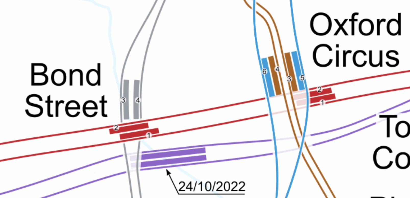
Note.
- The Bakerloo Line is shown in brown.
- The Central Line is shown in red.
- The Elizabeth Line is shown in purple.
- The Victoria Line is shown in light blue.
- The Elizabeth Line is the deepest line.
In addition, consider.
The Eastern exit of the Elizabeth Line at Bond Street station has three escalators and lifts. It also opens onto Hanover Square, so it won’t suffer from overcrowding problems outside.
- Hanover Square is just a garden, with no car park underneath, so pedestrian tunnels could pass under it
- I also suspect there are no existing or planned buildings between the two stations with deep foundations that would block a pedestrian tunnel.
- With the capability and ingenuity of three-D design software, I can see wide tunnels being created that would link Oxford Circus and the two Bond Street stations.
- The new wide tunnels at Bank station have opened up the station’s capacity and all the tunnels were dug traditionally.
- If it was felt to be needed, moving walkways could be added, just as they have been at Bank station.
I am absolutely sure, that by using the ideas and methods, that have worked so well in the upgrade of Bank station, that Oxford Circus and Bond Street stations could be turned into a London Superhub Station, that connects all the Underground lines together and has entrances all over the area.
The benefits of such a station would be.
- It would provide a high-capacity link between London’s two highest-capacity Underground Lines; Elizabeth and Victoria.
- It would provide a high-capacity link between the Elizabeth Line and Euston, St. Pancras and King’s Cross.
- It would provide a high-capacity link between the Elizabeth Line and Victoria.
- It would provide a high-capacity link between the Elizabeth Line and High Speed Two.
- Areas like Brixton, Haringey and Walthamstow would gain a much needed link to the Elizabeth Line for Heathrow and Paddington.
Wikipedia says this about the building of the Bank Station Upgrade.
As part of the development of the scheme, TfL worked with potential bidders to improve the design of the station from TfL’s original design. The design proposed in the winning bid by Dragados was 9.7% cheaper than the original design (saving TfL £60m), took 10 months less time to construct than the original design (the proposed closure of the Northern line was also 5 weeks shorter), and the layout of the station was more efficient. This substantially improved the benefit–cost ratio by 45% to 3.5:1.
The Mayor should be knocking on the door of Dragados and asking them for a price for a design and build for a West End Superhub station.
A Possible Route For The Extension Of The Northern Line To Clapham Junction
I suspect that the simplest route for the extension of the Northern Line would be to bore or dig a twin-track railway underneath the numerous other railways in the area.
It could terminate in two underground platforms at Clapham Junction station.
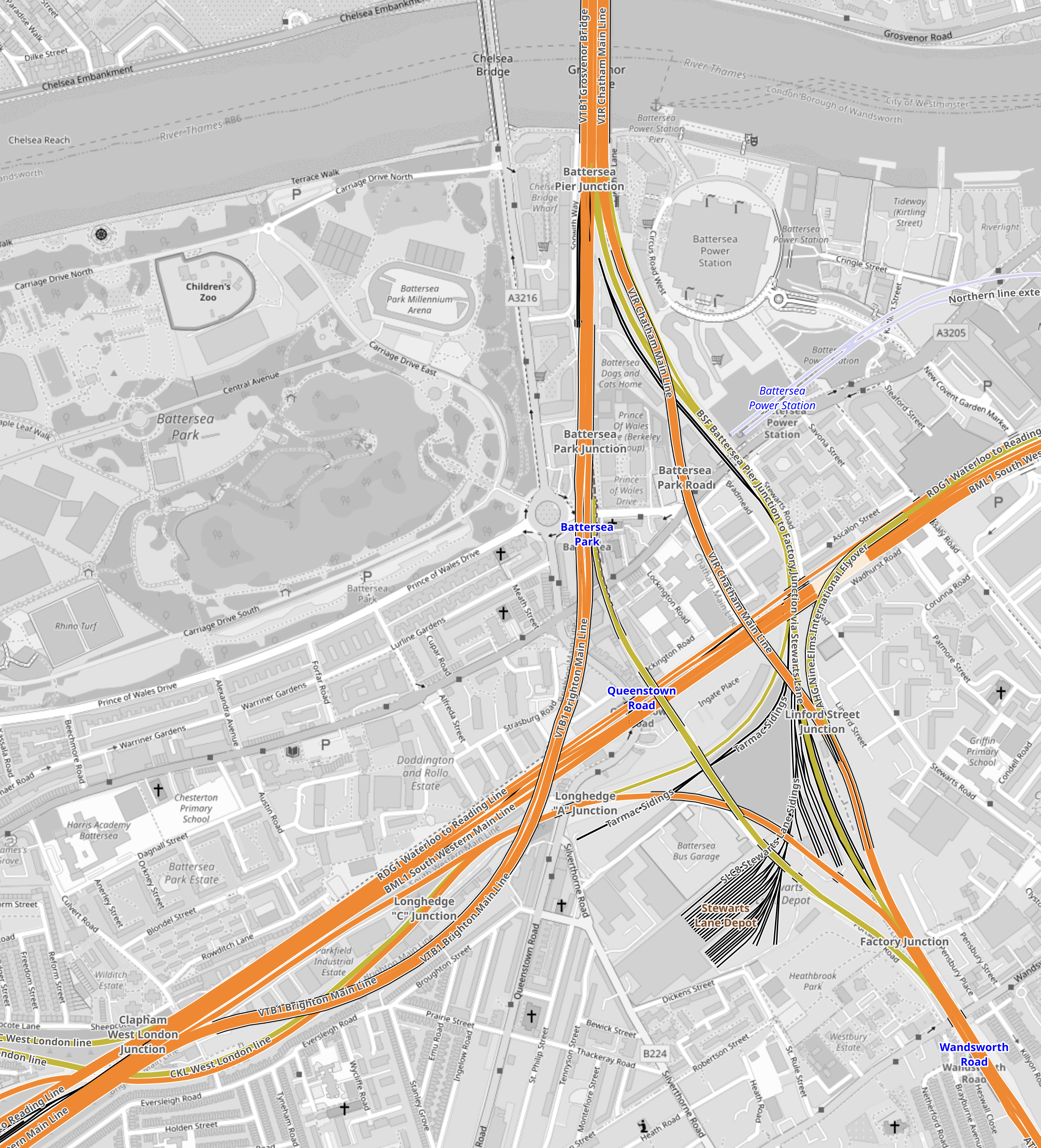
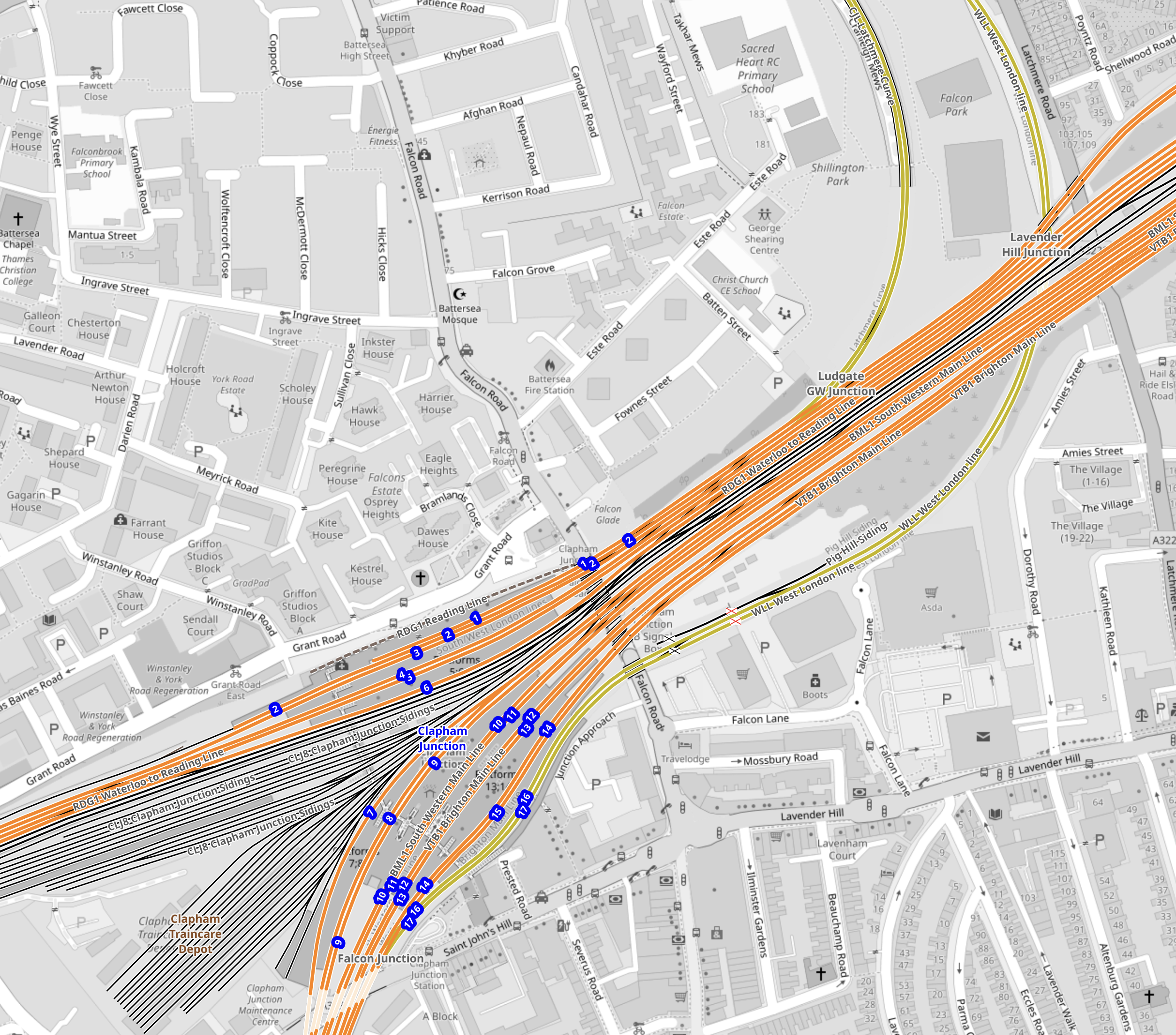
This is the first map of this post and it shows the tracks that run between the two stations.
Note.
- Battersea Power Station station is in the North-East corner of the map.
- Clapham Junction station is in the South-West corner of the map.
The Western of the pair of orange Lines going off the map in the North-East corner of the map is the Brighton Main Line.
It passes through Battersea Park station.
It passes over the South Western Main Line out of Waterloo.
It then loops to the West and joins the lines to Clapham Junction on the Southern side.
It serves four platforms at Clapham Junction; 12 and 14 are up platforms and 13 and 15 are down platforms.
This Google Map shows an overview of Clapham Junction station.
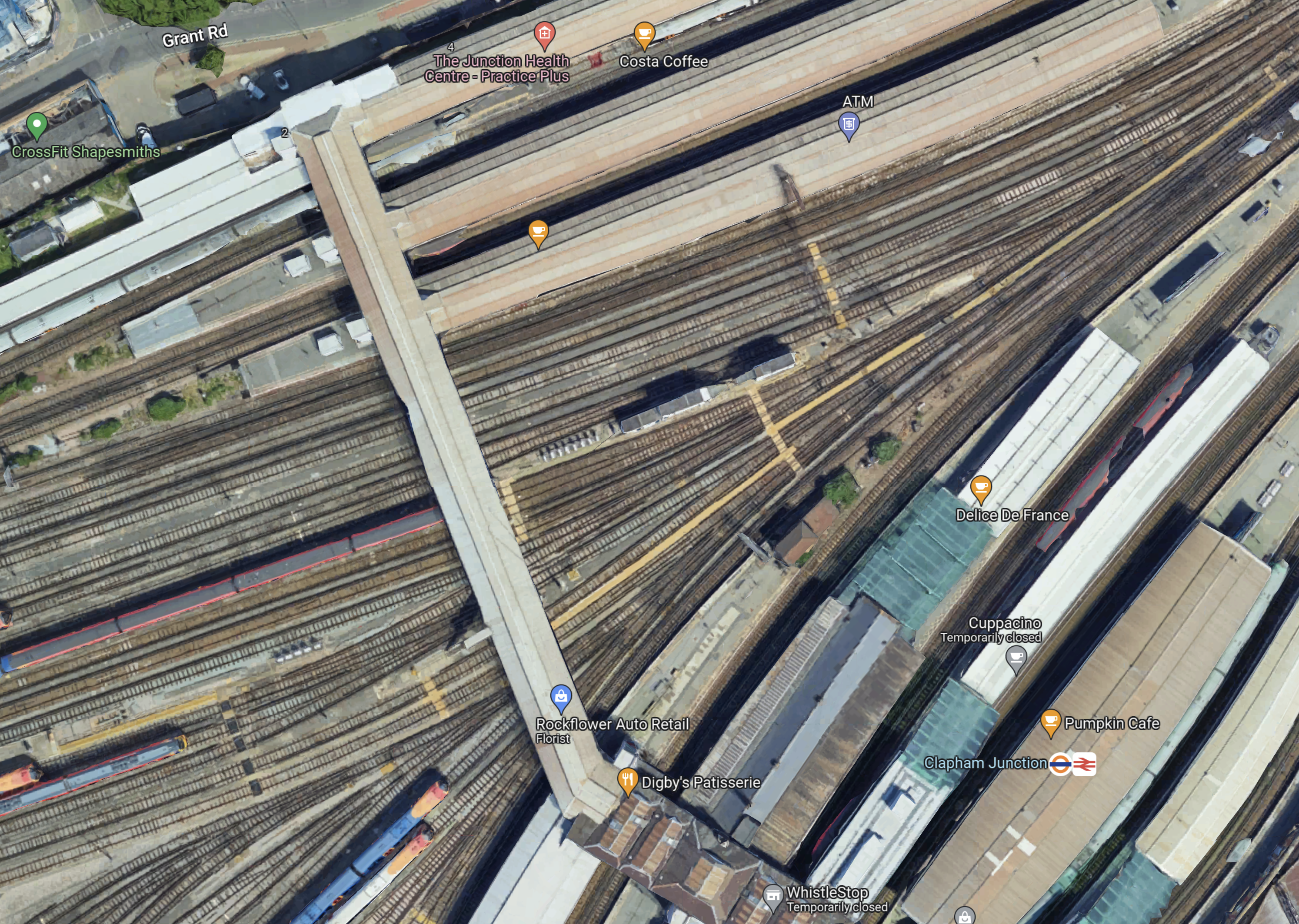
Note.
- Platforms 1 and 2 at the top of the map, handle London Overground services.
- Platforms 3 to 11 handle South Western Train services.
- Platforms 12 to 17 handle Southern services.
- Platforms 9 and 10 have a Delice de France cafe.
- Platforms 11 and 12 have a Cuppacino cafe.
- Platforms 13 and 14 have the logos.
- All platforms have full step-free access with lifts to the wide footbridge that connects all platforms.
The platforms don’t seem to be very wide and putting stairs and escalators down to underground platforms could be a difficult proposition.
This map from OpenRailwayMap shows shows the platforms at Clapham Junction station and the track layout to the West of the footbridge.
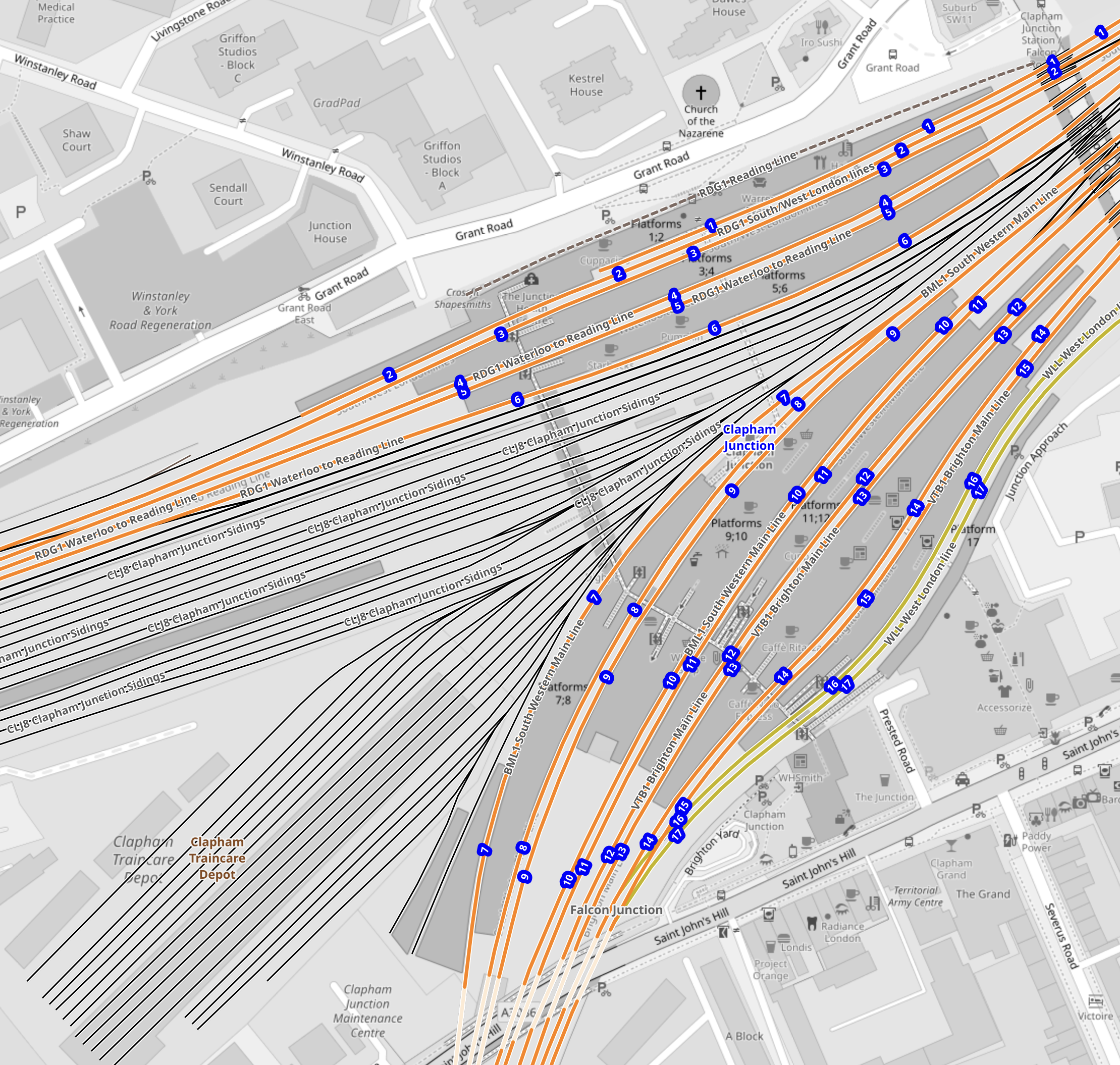
Note.
- The tracks through the platforms are shown in orange.
- The blue dots are platform numbers.
- The bridge connecting all the platforms is shown shaded in the middle of the map.
- To the West of the bridge are Clapham Junction Sidings and Clapham Traincare Depot.
These pictures were taken from the bridge.
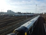
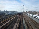
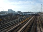
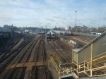
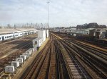
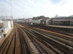
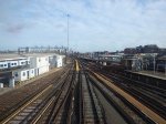
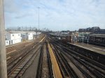
Note.
- The top row of pictures were taken looking West.
- The bottom row of pictures were taken looking East.
- Many of the tracks are electrified.
- There is a lot of space to park trains.
Will all the space be needed now, that a new depot has been built at Feltham.
Could Two New Surface Platforms Be Built For The Extension Of The Northern Line To Clapham Junction?
Consider.
- The step-free bridge across all the platforms at Clapham Junction station works well.
- It is connected to the streets around the station at both ends.
- Clapham Junction station will be redeveloped and surplus depot land could be used for housing.
- As the maps show, there is a large gap in the platforms between the South Western Railway and the Southern sides of the station.
- As Battersea Power Station station can turn services on the Northern Line with only two platforms, there would only need to be the same number of Northern Line platforms at Clapham Junction.
So could an extra pair of platforms be built under the bridge, with stairs and a lift similar to the existing platforms?
- The platform would have full step-free access.
- The platforms could be long enough for any future trains.
- There could be sidings for a few trains.
- The tunnels from Battersea Power Station would surface just outside the station.
- There would need to be a crossover or a turnback siding for operational reasons.
I also think, that once the depot and sidings at Clapham Junction have released the space, the new platforms and tracks could be installed without interrupting main line services through the station.
Would The Extension Of The Northern Line Be Electrified?
Consider.
- Merseyrail were not allowed to use third-rail electrification to Headbolt Lane station and had to use batteries.
- The Northern Line was extended to Battersea Power Station station using London’s four-rail electrified system.
- Clapham Junction station has third-rail electrification everywhere.
I think that the authorities would be very churlish not to allow electrification to Clapham Junction.
Conclusion
I believe it is possible to extend the Northern Line to two new surface platforms at Clapham Junction station.
But I also believe that using similar methods to those used in the Bank Station Upgrade, that a full interchange between the Elizabeth and Victoria Lines can be built at Oxford Circus and Bond Street.
.
Cromarty Firth And Forth To Host First Green Freeports
The title of this post, is the same as that, of this article on the BBC.
This is the sub-heading.
Sites at Cromarty Firth and the Forth have been selected to host Scotland’s first green freeports.
These three paragraphs outline the deal.
The winning bids were revealed in a joint announcement by the UK and Scottish governments.
The special economic zones north of the border are being created under a scheme agreed by the two governments.
The successful applicants will be able to offer tax incentives and lower tariffs in the zones.
At least it seems that Westminster and Holyrood are in agreement.
What Is A Green Freeport?
This article on the BBC, is entitled Freeports: What Are They And Will They Help The Economy?.
It is a good summary of freeports in the UK.
This press release from the UK Government is entitled Joint Cooperation To Deliver Two New Green Freeports In Firth Of Forth And Inverness And Cromarty Firth, contains this statement from Deputy Scottish First Minister; John Swinney.
This is a milestone achievement in the process to deliver Green Freeports for Scotland. Inverness and Cromarty Firth Green Freeport and Forth Green Freeport will support businesses to create high-quality, well-paid new jobs, promote growth and regeneration, and make a significant contribution to achieving our net zero ambitions.
A rigorous joint selection process has been followed. The successful applicants showed a strong determination to embed fair work practices, including payment of the Real Living Wage, and to enshrine net zero initiatives in their work.
We look forward to working closely with them to ensure they deliver maximum positive impact and become operational as soon as possible. We will also work with the unsuccessful bidders to consider how they can build on the plans set out in their bids to deliver jobs and growth in their regions outside the Green Freeports programme.
Scotland has a rich history of innovation, trade and manufacturing and as we look to seize the many opportunities achieving net zero offers, the creation of these internationally competitive clusters of excellence will help us to create new green jobs, deliver a just transition and support our economic transformation.
This statement may be a lot more about aspiration, than hard directions, but having in my lifetime seen Scotland rally round their newborn oil and gas industry, I am very hopeful that the concept of a green freeport will be successful.
Unless anyone can correct me, I do feel that Scotland’s two green freeports are a world first.
Forth Green Freeport
This is the home page of the Forth Green Freeport.
- It talks about being Central to Scotland’s green ambitions.
- Places shown on a map of the freeport are Burntisland, Edinburgh Airport, Grangemouth, Leith and Rosyth.
- The freeport has a long list of partners.
It appears to be a well-backed ambitious plan.
Cromarty Green Freeport
Opportunity Cromarty Firth are leading the development of the Cromarty Green Freeport and they have this web site.
This is the sub-heading on the home page.
Opportunity Cromarty Firth (OCF), is a consortium leading a bid in the current competition for Green Freeport status, which could “revolutionise” the Highland economy and stimulate major new manufacturing activity locally and elsewhere in Scotland and the UK.
It is following by these two paragraphs.
The consortium is backed by port owners Port of Cromarty Firth, Global Energy Group, Port of Inverness and The Highland Council alongside a dozen regional businesses, public sector organisations and academic bodies.
OCF believes the creation of such a zone on the Firth would maximise local and Scotland-wide benefits from a pipeline of renewable energy projects placing the Highlands at the heart of the drive towards net-zero and create tens of thousands of jobs.
There would appear to be a lot of aspiration and a good list of partners, but the plans for the freeport don’t seem to be as advanced as those for the Forth Green Freeport.
No Shortage Of Electricity
One thing, that will not be a problem for either freeport, is going to be a poor electricity supply, as both the Forth Estuary and Cromarty Form will be the home to several gigawatts of offshore wind.
In addition, it is likely that the wind farms in the Cromarty Firth will be backed by large amounts of pumped storage hydroelectricity in the Great Glen.
Wind Farms Close To The Cromarty Firth Green Freeport
These wind farms are currently close to the Cromarty Firth Green Freeport.
- Beatrice – 10 MW – Operational
- Beatrice Extension – 588 MW – Operational
- Moray East – 950 MW – Operational
- Moray West – 862 MW – Operational in 2025
- Caldeonia – 2000 MW – Operational in 2030
This is a grand total of 4410 MW. Hinckley Point C will be 3260 MW.
Wind Farms Close To The Forth Green Freeport
These wind farms are currently close to the Forth Green Freeport.
- Seagreen – 862 MW – Operational in 2023
- Inch Cape – 1080 MW – Operational in 2026/27
- Neart Na Gaoithe – 450 MW – Operational in 2024
- Forthwind – 12 MW – Operational in 2023/24
- Berwick Bank 4100 MW – Operational in 2030
This is a grand total of 6504 MW.
North of Scotland Hydrogen Programme
One plan that seems to be being developed by OCF is the North of Scotland Hydrogen Programme, which has this web page on the OCF web site.
These paragraphs outline the plan.
The North of Scotland Hydrogen Programme was established through Opportunity Cromarty Firth and brings together key partners who share ambitions for the region’s renewable, low carbon future. The programme aims to develop a state-of-the-art hub in the Cromarty Firth to produce, store and distribute green hydrogen at scale to the region, Scotland, other parts of the UK and Europe.
The Highlands will be at the centre of future large-scale production of green hydrogen if the Cromarty Firth wins Green Freeport status.
ScottishPower and Storegga have expressed their support for the Green Freeport bid by Opportunity Cromarty Firth (OCF), which could attract more than £1 billion investment to the area and create thousands of jobs and local supply chain opportunities during construction.The joint developers recently announced plans to develop one of the UK’s largest green hydrogen electrolyser plants on the Cromarty Firth. The project’s initial phase would see the facility produce up to 30 megawatts (MW) of green hydrogen to be used in heating processes in nearby whisky distilleries.
Achieving Green Freeport status would have the potential to bring forward significant investment in a larger-scale plant by up to 10 years and would place the Highlands firmly at the centre of future large-scale production of green hydrogen, because of the region’s enormous growth potential of offshore wind, which is critical to the industry’s development.
Note.
- The hydrogen from the first phase of the electrolyser will be used in the whisky industry.
- Gradually, hydrogen use will widen throughout the region.
- I suspect that as hydrogen production grows, it will be exported from the freeport.
This map from the web site shows all the energy flows.
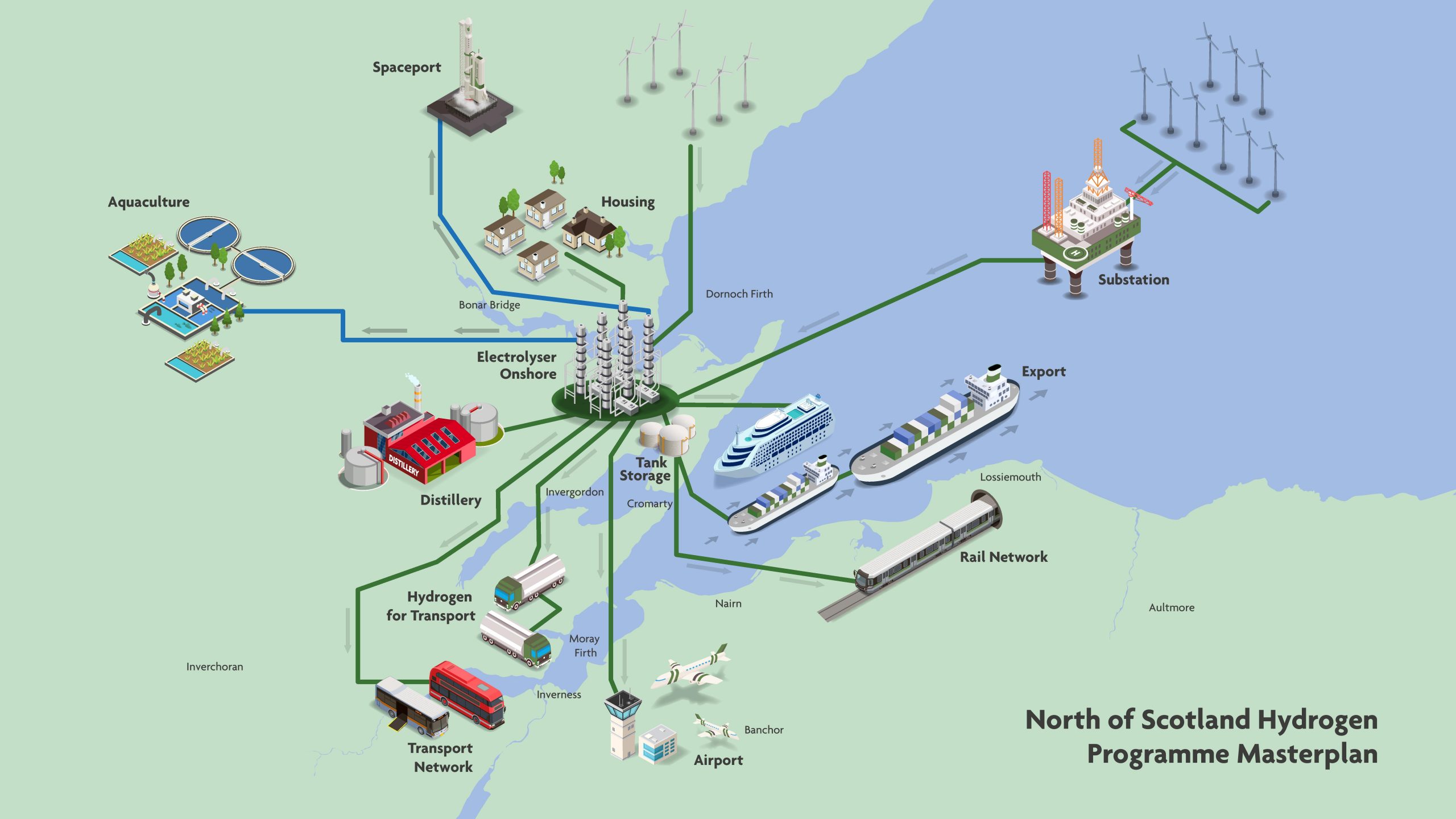
Note.
- Aquaculture is a use for the oxygen produced by the electrolyser.
- Everybody is promoting spaceports. Both hydrogen and oxygen can be used as rocket fuel.
- Hydrogen or electricity is shown powering all sorts of transport, including buses, a cruise ship, trains and trucks.
It certainly is a comprehensive plan.
Hydrogen At The Forth Green Freeport
Hydrogen is mentioned on the About page of the Forth Green Freeport web site in this general statement.
Investments will stimulate growth in trade, providing expanded logistics and trade capacity for existing and emerging industries including advanced modular systems, biofuels, hydrogen and carbon capture and storage, as well as support additional R&D capability and green incubator space to drive SME and start-up business growth.
But as INEOS are a partner, I would expect some hydrogen production from all that green offshore electricity.
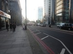
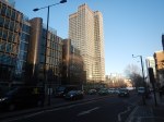
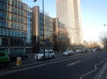
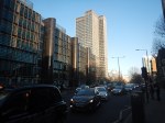
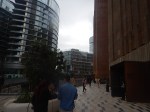
KPF Unveils Plans For Old Street Skyscraper
The title of this post, is the same as that of this article on the Architects’ Journal.
This is the sub-heading.
Kohn Pedersen Fox Associates (KPF) has unveiled early plans for a 160m office tower by Old Street roundabout in East London
These three paragraphs describe the development.
The site at 99 City Road is currently occupied by a 10-storey postmodern office block developed in the late 1980s as headquarters for satellite telecommunications company Inmarsat. However, Inmarsat relocated last year and developer Endurance Land bought the site in spring for £150 million.
The new owner now wants to demolish 37 per cent of the existing building, before vertically extending it to create an approximately 37-storey tower providing an additional 45,000m2 of office space, according to early plans published for consultation.
The tower scheme would feature improved public realm around the building, as well as active frontages, café space and 510m2 of flexible community space – including a triple-height ‘great room’, which could hold markets, exhibitions, and performances.
I took these pictures these morning as I passed the site at the front of the top-deck of a 21 bus.
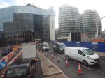
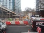
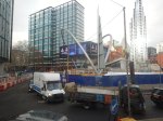
Note.
- I showed the approach to the station, to show the number of high rises in the area.
- The Inmarsat Headquarters at 99 City Road is on the South-East corner of the roundabout, with a new station entrance alongside.
- Unusually it has Inmarsat shown vertically on the front.
- The double-fronted curved building is the Bezier Apartments, which made the short-list for the Carbuncle Cup in 2010.
- The building on the South-West corner is the White Collar Factory.
The construction of the new Old Street station seems as slow as ever.
I have some thoughts.
Will The Building Fit In?
The architects’ Journal article says this.
Consultation documents said the tower’s design is ‘rooted in the distinct history of the local areas’, its appearance ‘tak[ing] inspiration from the Victorian buildings in the neighbouring conservation areas of Bunhill Fields, Finsbury Square and South Shoreditch’.
I can see some arguments as at 37 stories, it’s two higher than the Barbican towers.
Will Access Between The New Building And Old Street Station Be Good?
This map from Transport for London shows the future layout of Old Street Roundabout.
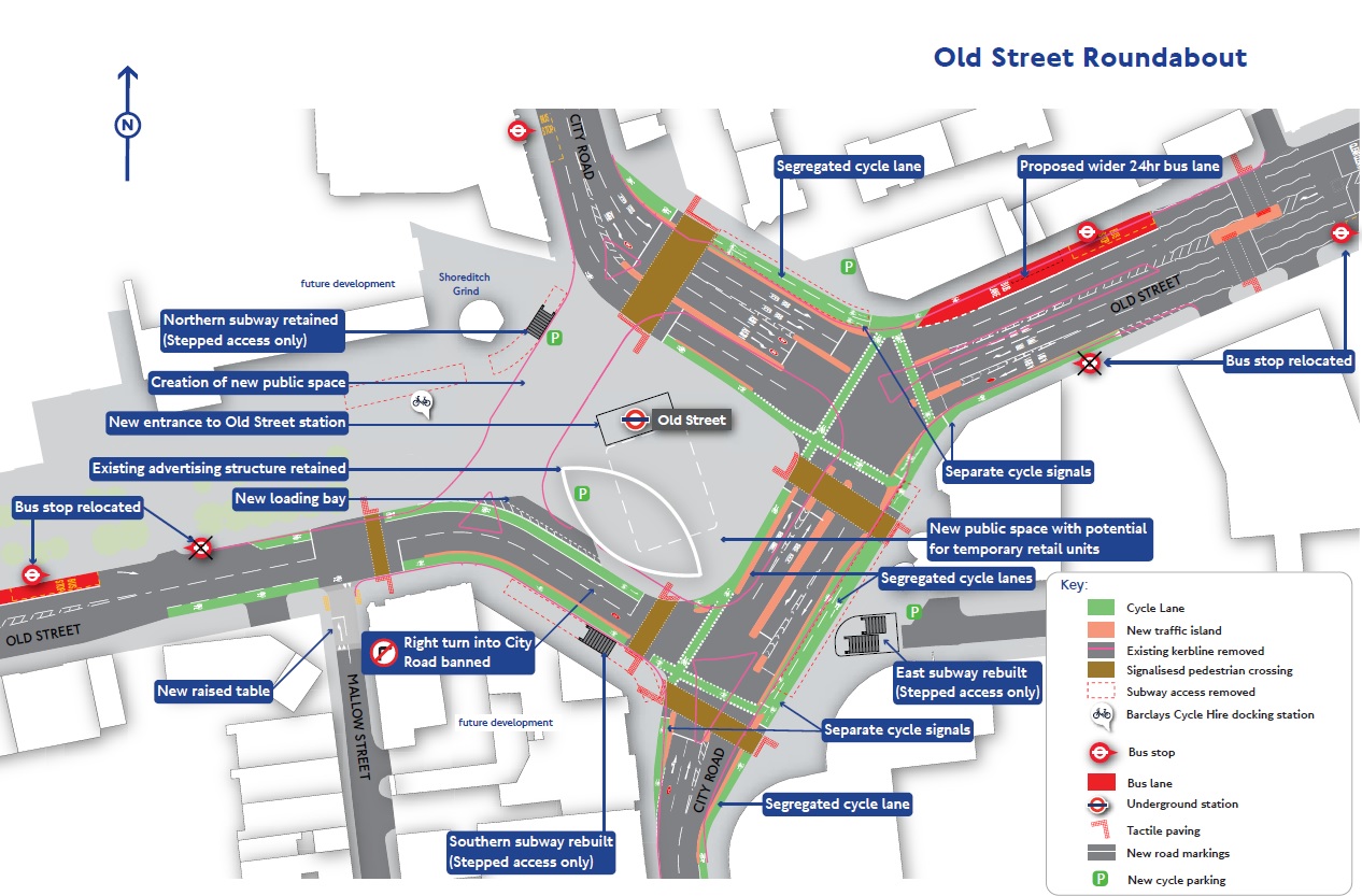
Note.
- The Inmarsat Headquarters is in the South-East corner of the roundabout.
- There is a new entrance to the station between the building and the Bezier apartments.
- The new main entrance to the station in the middle of the roundabout.
- Original plans showed a lift to the main station entrance from the surface, but two may have been built.
There appears to be a subway and two light-controlled pedestrian crossings between the new development and the station.
This Google Map shows the current state of Old Street Roundabout and the front of the Inmarsat Headquarters.
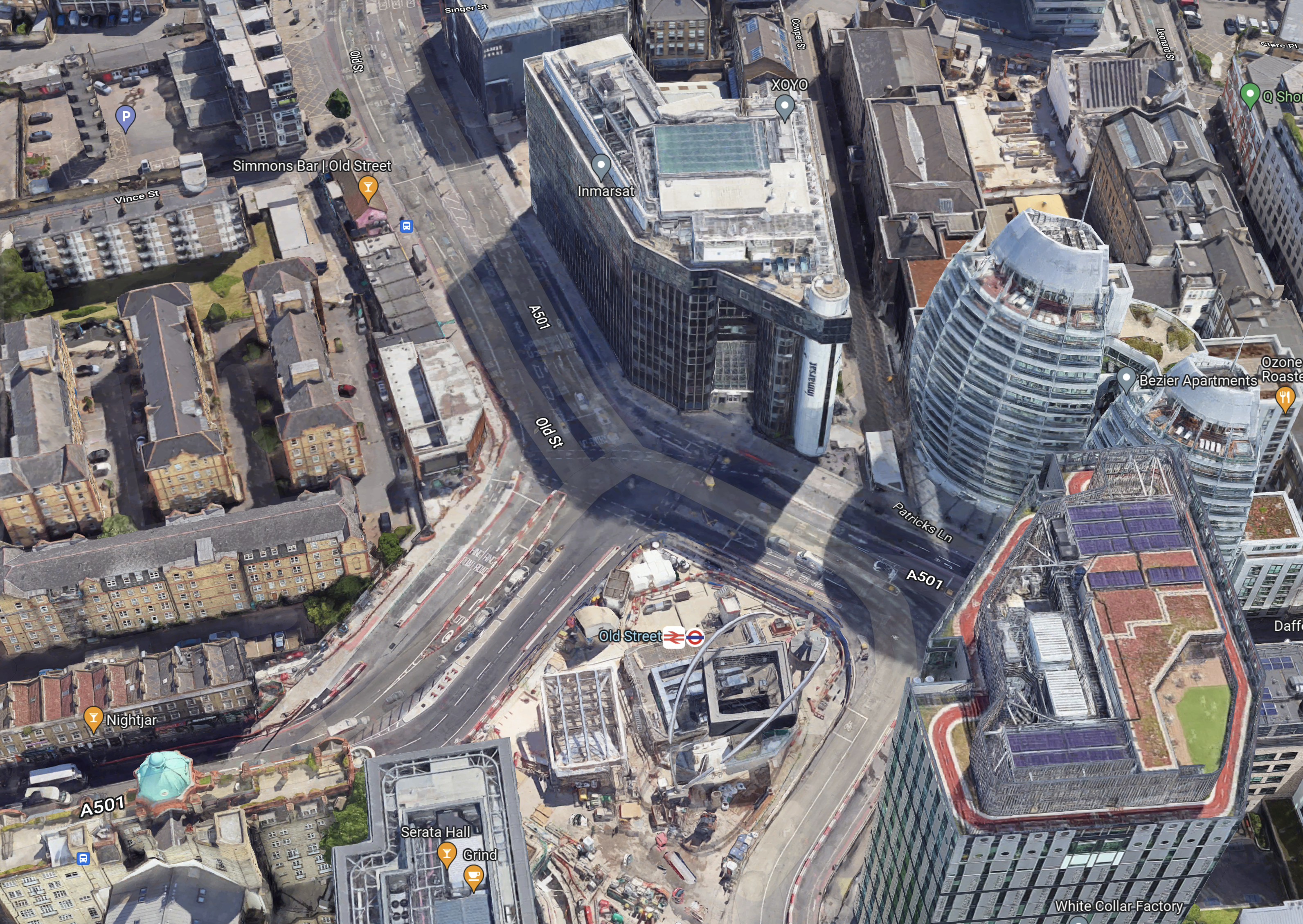
It can’t be long before developers build on the other two sides of the roundabout.
Who Will Be The Tenants?
This article on the Hackney Gazette, is entitled New 36-Storey Office Tower Proposed For Old Street.
It says this about the tenants.
The new site would contain approximately 4,000 sqm of new affordable workspaces that would be accessible to local businesses and organisations.
I suspect that these offices will be much better than some of the dumps Metier worked out of in the 1970s and 1980s.
Just promising to show the view could get a few visitors and some possible sales
Will The Building Have An Observation Platform?
At 160 metres tall, this building will be 150 metres shorter than The Shard, but it will be 27 metres than the Barbican towers.
So why not have an observation platform?
I suspect that from there, you will be able to see Hackney Mashes, as there are few buildings in between.
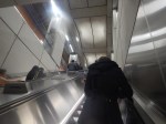
Battersea Power Station – 14th October 2022
I went to Battersea Power Station today and took these pictures.


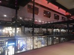


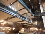

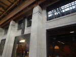

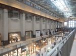
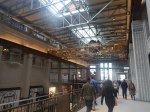
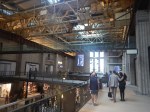

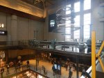
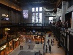

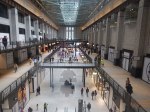
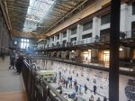
Note.
- The picture of my jacket was taken in the toilet. All male toilets should have a hook for jackets.
- The crane is still in place.
- There are a number of shops still to open.
- There was no food store, although a Marks and Spencer’s food store is coming soon.
- The only place to have a coffee and cake and sit down was Starbucks. But I never eat in an American cafe or eat American food, as I don’t trust their gluten labelling.
One guy I met described it as Dubai without the sand.
I have some thoughts.
Getting There
There are two main routes.
- Northern Line to Battersea Power Station station.
- Thames Clipper to Battersea Power Station pier.
I went by the Northern line, changing both ways at Tottenham Court Road station to and from the Elizabeth Line.
- This interchange is a short walk and step-free, if you use the lift.
- There are no trains to Battersea Power Station on the Bank branch of the Northern Line.
- There are five trains per hour (tph) to Battersea Power Station, with an extra two tph in the Peak.
- There are no Night Tube trains to Battersea Power Station.
I can see this service being improved.
Arriving At Battersea Power Station By Underground
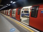
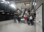
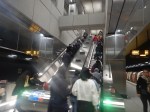
Punters were certainly arriving.
Gluten-Free Food
There was absolutely none, that I could find.
At least though a Gordon Ramsay restaurant is opening soon.
Signage
It wasn’t good. But then I have found several modern shopping centres work on this principle.
Conclusion
Canary Wharf is better.
- Partly because the shops are more useful and to my taste.
- But mainly because it is on the Elizabeth and Jubilee Lines, and the DLR.
- All rail lines go through Canary Wharf rather than terminate there.
Battersea Power Station might be better, when the Northern Line is extended to Clapham Junction station.
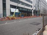
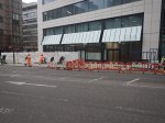
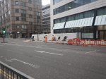
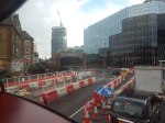
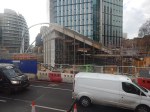
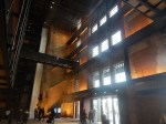
Bank Station – 16th September 2022
On August 13th, I wrote What Goes Up Must Come Down, where I described the crane coming down over the new Bank station entrance on Cannon Street.
The triangular site, that lies between Cannon and King William Streets, has now been opened up for development, as these pictures show.
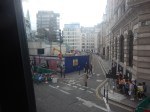
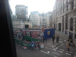
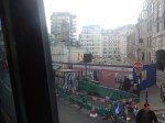
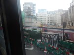
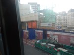
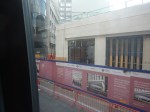
Note.
- I took the pictures from the top of a 141 bus, that was going to London Bridge station.
- It is going to be a large block on top of the station.
- Do the pictures indicate retail or further station entrances along King William Street?
- This development must help in the financing of the massive Bank Station Upgrade.
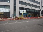
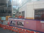
This is the last picture, shown to a larger scale.

On the end of the lowest level of the portable offices, you can just about make out a sign indicating a ladies toilet.
Is this the most inaccessible ladies toilet in London? Or even the world?
Platforms 16 and 17 At Liverpool Street Station – 2nd July 2022
On my way to Ilford station today, I used the Elizabeth Line at a not too busy time from Liverpool Street station.
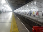
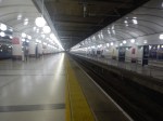


Note.
- Platform 18 has been closed.
- Platform 16 is to the left and Platform 17 is to the right.
- Platforms 16 and 17 have been lengthened.
- The can now handle the full nine-car Class 345 trains.
- There is a wide walkway on the far side of Platform 17.
I have a few thoughts.
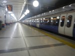
Why Is The Access Between Train And Platform Not Level?
This picture shows level access on the central section of the Elizabeth Line at Whitechapel station.
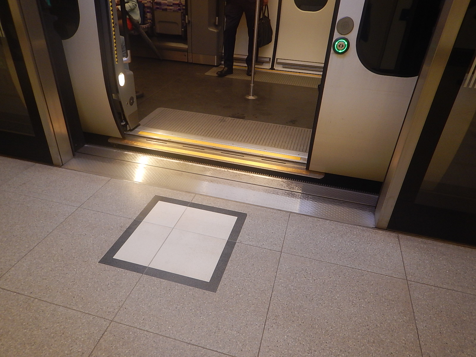
Why wasn’t the platform height adjusted to fit the trains in the rebuilt platforms 16 and 17 at Liverpool Street station?
Are There Any Plans For The Walkway Behind Platform 17?
Consider.
- At the other end of the station concourse, there is a walkway alongside Platform 1, that leads in and out of the station.
- There is also a walking route out between the two sections of the station.
A walkway behind Platform 17 could be possible.
Station Redevelopment
This article on Ian Visits is entitled Liverpool Street Station Plans For A £1.5 billion Redevelopment.
This is the first paragraph.
Initial plans have been revealed for a £1.55 billion redevelopment of Liverpool Street station that would see it become a two-level station with a much larger entrance built next to the tube station.
As the station is surrounded by a large cluster of skyscrapers, I will assume there will be another one.
Despite Brexit, Covid-19 and the War in Ukraine, there still seems to be an appetite for new office space in London.
