GC Applies For Manchester Paths
The title of this post, is the same as that of a short news item in the August 2026 Edition of Modern Railways.
This is the body of the news item.
Open Access Operator Grand Central has applied to operate five trains per day between St. Pancras International and Manchester Piccadilly from December 2029. These would operate via the Midland Main Line using GC’s five-car Class 180 DMU fleet currently employed on its East Coast Main Line operations. These are due to be replaced by a fleet of tri-mode Class 820s being constructed by Hitachi Rail, which were ordered last year and are being financed by Angel Trains.
Meanwhile, GC is also bidding to operate trains between London Waterloo and Bristol Temple Meads, running via the South West Main Line and Salisbury. The operator says that under these proposals, trains would begin operating from December 2027 with seven trains per day running using stock currently off lease.
These are my thoughts on the St. Pancras International and Manchester Piccadilly service.
The Route Between The Midland Main Line And Manchester Piccadilly
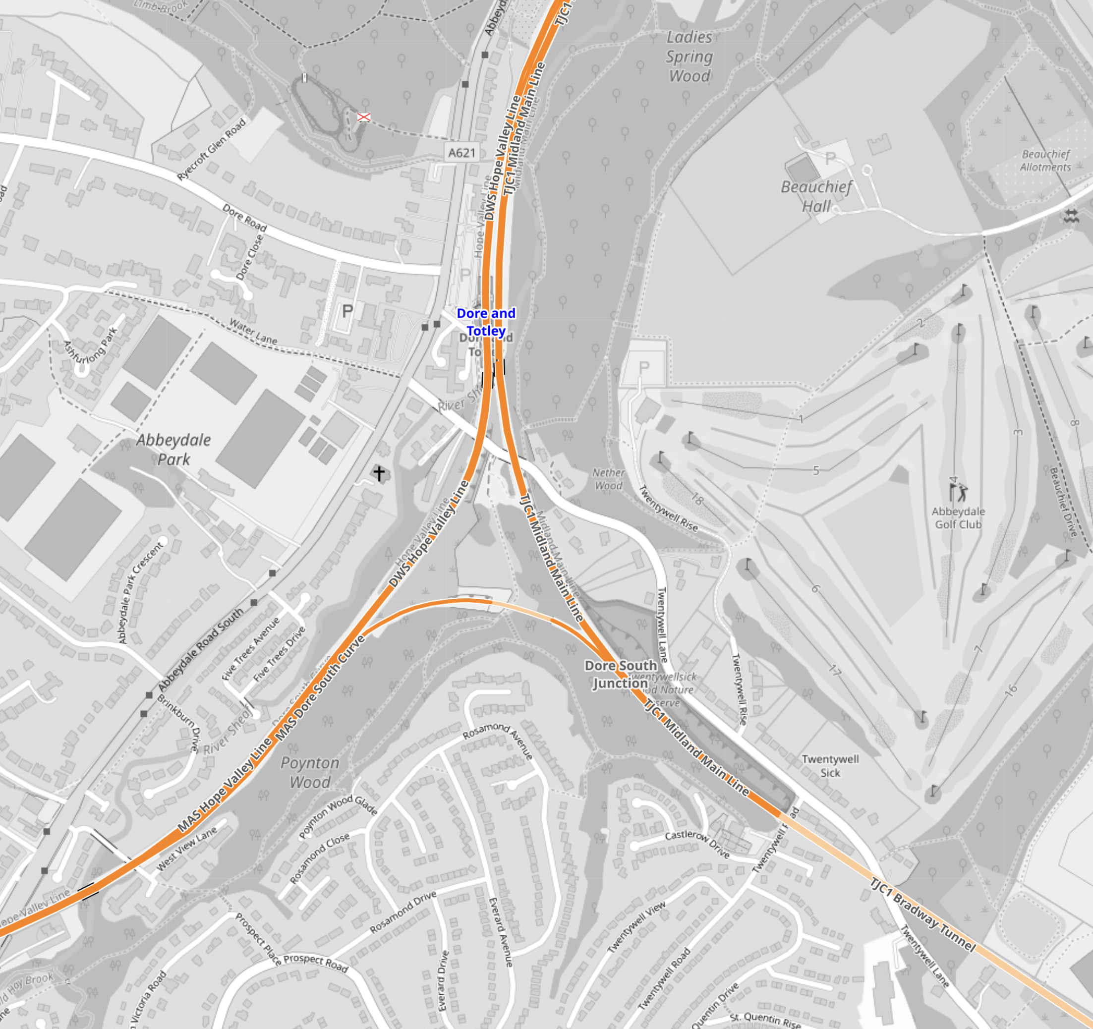
This OpenRailwayMap shows Dore Junction, where the Midland Main Line meets the Hope Valley Line between Chesterfield and Sheffield stations.
Note.
- Dore Junction is a triangular junction in the middle of the map.
- Dore and Totley station is on the North point of the junction, which leads to Sheffield station.
- Dore & Totley Station – 1st April 2025 shows the station before and after its rebuilding.
- The South-East point of the junction leads to Chesterfield station.
- The South-West point of the junction leads to the Hope Valley Line and eventually to Manchester Piccadilly station.
There are three routes that trains can take between the Midland Main Line at Chesterfield station and the Hope Valley Line.
- They can take the Dore South Curve shown in the map.
- They can go directly into Sheffield station and reverse.
- They can go via Barrow Hill and enter Sheffield station from the East.
Note.
- The first route doesn’t call at Sheffield.
- The second route is taken by trains between Liverpool and Norwich.
- I wrote about the third route in Reinstatement Of The Barrow Hill Line Between Sheffield And Chesterfield.
The reinstatement of the Barrow Hill Line may ease operations in Sheffield and allow a new station or two.
The Current Hope Valley Service Between Manchester Piccadilly And Sheffield
There are two passenger services between Manchester Piccadilly and Sheffield stations.
- A Northern Trains local train that stops everywhere.
- An East Midlands Railway faster train, that only stops at Stockport.
Both trains are hourly.
The Northern End Of Grand Central’s St. Pancras International And Manchester Piccadilly Service
I would feel that the ideal route for Grand Central’s new service would call at Chesterfield, Sheffield, Stockport and Manchester Piccadilly.
Hopefully, it could use the Barrow Hill Line to avoid a reverse at Sheffield.
Where Would Grand Central’s St. Pancras International And Manchester Piccadilly Service Call On The Midland Main Line?
East Midlands Railway services to Sheffield call at Leicester, Loughborough, East Midlands Parkway, Long Eaton, Derby and Chesterfield.
I would expect Grand Central’s service would only call at a selection of those stations.
Would St. Pancras International Be Able To Handle The Extra Trains?
East Midlands Railway run the following services from St. Pancras International.
- Nottingham
- Sheffield
- Corby
Note.
- All services are two trains per hour (tph)
- Nottingham and Sheffield services can be five- or ten-car trains.
- Corby services can be four- or eight-car trains.
- There are only four East Midlands Railway platforms at St. Pancras International, but they are 260 metres long.
- 260 metre platforms will take a pair of five-car Class 800/801/802 Hitachi trains, which have the standard Hitachi car length of 26 metres. The architects got that right,
- Each platform can take one ten-car train or two five-car trains.
- East Midlands Railway’s Class 810 trains are 120 metres long.
- East Midlands Railway’s Class 360 trains are 80 metres long.
- Grand Central Trains’s Class 180 trains are 116.52 metres long.
- The train length of Grand Central Trains’s Class 820 trains has not been disclosed, but if they had the standard Hitachi car length of 26 metres, they’d be 130 metres long.
I am fairly certain, that St. Pancras International can handle two Hitachi trains in the same platform.
This leads me to believe that Grand Central Trains Class 180 and Class 820 trains could also share a platform with an East Midlands Railway Class 810 train.
The Route And Electrification Between Manchester Piccadilly And Hazel Grove
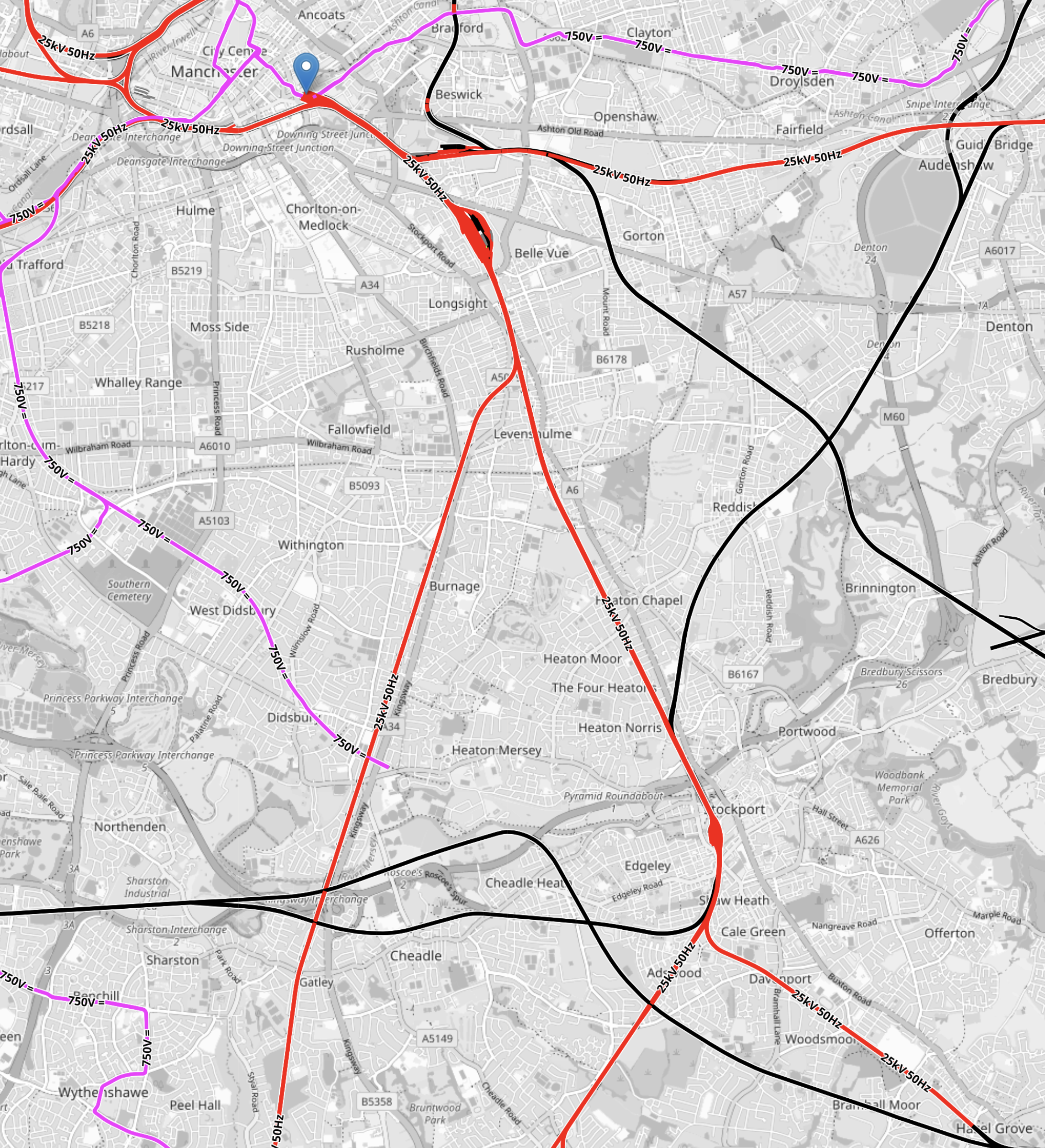
This OpenRailwayMap shows the Manchester Piccadilly end of the route.
Note.
- Tracks shown in black are not electrified.
- Tracks shown in red are electrified with 25 KVAC overhead.
- Tracks shown in mauve are the Manchester Metrolink.
- Manchester Piccadilly station is indicated by the blue arrow.
- Hazel Grove station is in the South-East corner of the map.
- Between Manchester Piccadilly and Hazel Grove stations is fully-electrified.
- The red knot of electrified tracks close to Manchester Piccadilly station is Longsight depot.
- The Southern red knot of electrified tracks is Stockport station.
- Manchester Piccadilly and Hazel Grove stations are 8.7 miles apart and local trains take about 15 minutes.
The Route And Electrification Between Hazel Grove And Sheffield
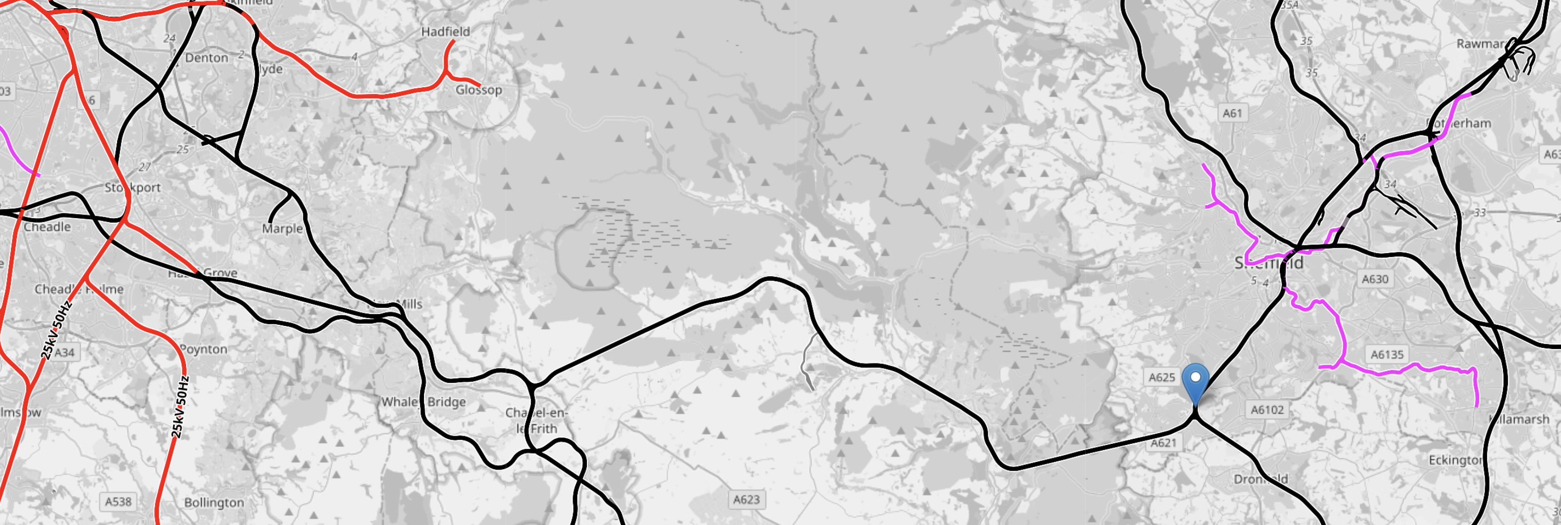
This OpenRailwayMap shows the route between Hazel Grove and Sheffield.
Note.
- Tracks shown in black are not electrified.
- Tracks shown in red are electrified with 25 KVAC overhead.
- Tracks shown in mauve are the Manchester Metrolink and Sheffield Supertram.
- Stockport and Hazel Grove can be picked out on the electrified tracks in the North-East corner of the map
- Dore and Totley station is indicated by the blue arrow.
- Sheffield station is to the North-East of Dore and Totley station.
- The mauve tracks are the Sheffield Supertram.
- Leading West from Dore and Totley station is the Hope Valley Line which connects Sheffield and Hazel Grove stations.
- Dore and Totley and Hazel Grove stations are 29.7 miles apart.
- Leading South-East from Dore and Totley station is the Midland Main Line to Chesterfield, Derby and the South.
- The electrification from St. Pancras International finishes just North of Market Harborough station.
Dore and Totley and Market Harborough stations are 67.1 miles apart.
Will Tri-Mode Trains We Able To Go Between St. Pancras International And Manchester Piccadilly Stations
It would appear that the gap in the electrification between Market Harborough and Hazel Grove is a few miles under a hundred miles.
Both Hitachi Rail and CAF have said that their five-car trains should be able to handle up to 122 miles.
So there should be enough range to go via Barrow Hill, which would remove the reversal at Sheffield station.
These are my thoughts on the London Waterloo and Bristol Temple Meads service.
The Route Between Bristol Temple Meads And Salisbury
Currently, there are two Great Western Railway services between Bristol Temple Meads and Salisbury.
- One calls at Bath Spa, Bradford-on-Avon, Trowbridge, Westbury, Dilton Marsh and Warminster.
- One calls at Keynsham, Oldfield Park, Bath Spa, Freshford, Avoncliff, Bradford-on-Avon, Trowbridge, Westbury and Warminster.
Note.
- Both services call at Bath Spa, Bradford-on-Avon, Trowbridge, Westbury and Warminster.
- Only Bath Spa and Westbury have a frequent service to London.
- There are five other stations, that are called at occasionally by Bristol Temple Meads and Salisbury services.
I do feel that Grand Central Trains have a lot of scope to create a very passenger-friendly timetable.
Tales Of Woe And Opportunity On The West Of England
The title of this post, is the same as that of the Railtalk editorial in the September 2027 Edition of Modern Railways.
These is the opening four paragraphs.
The West of England Line from London Waterloo to Exeter was once an important main line, the London & South Western Railway’s great rival to Brunel’s ‘billiard’ table, but its role is much diminished since the glory days.
Largely singled west of Salisbury in the 1960s, and with many of its coastal branches closed, a casual onlooker might conclude it has rather lost its purpose.
Yet recent journeys on the route suggest otherwise. Travelling from Waterloo on the way West one late afternoon was instructive.
On a baking hot day in London, the six-car South Western Railway Class 159 departed on time, full and standing. More passengers joined at Clapham Junction, and Woking.
The two problems of the line are mentioned in the text from the article.
- The singling of the West of England Line, to the West of Salisbury was typical of many short-sighted acts of vandalism inflicted by the Treasury on British Rail.
- The Class 159 diesel trains date from the early 1990s and probably need replacing.
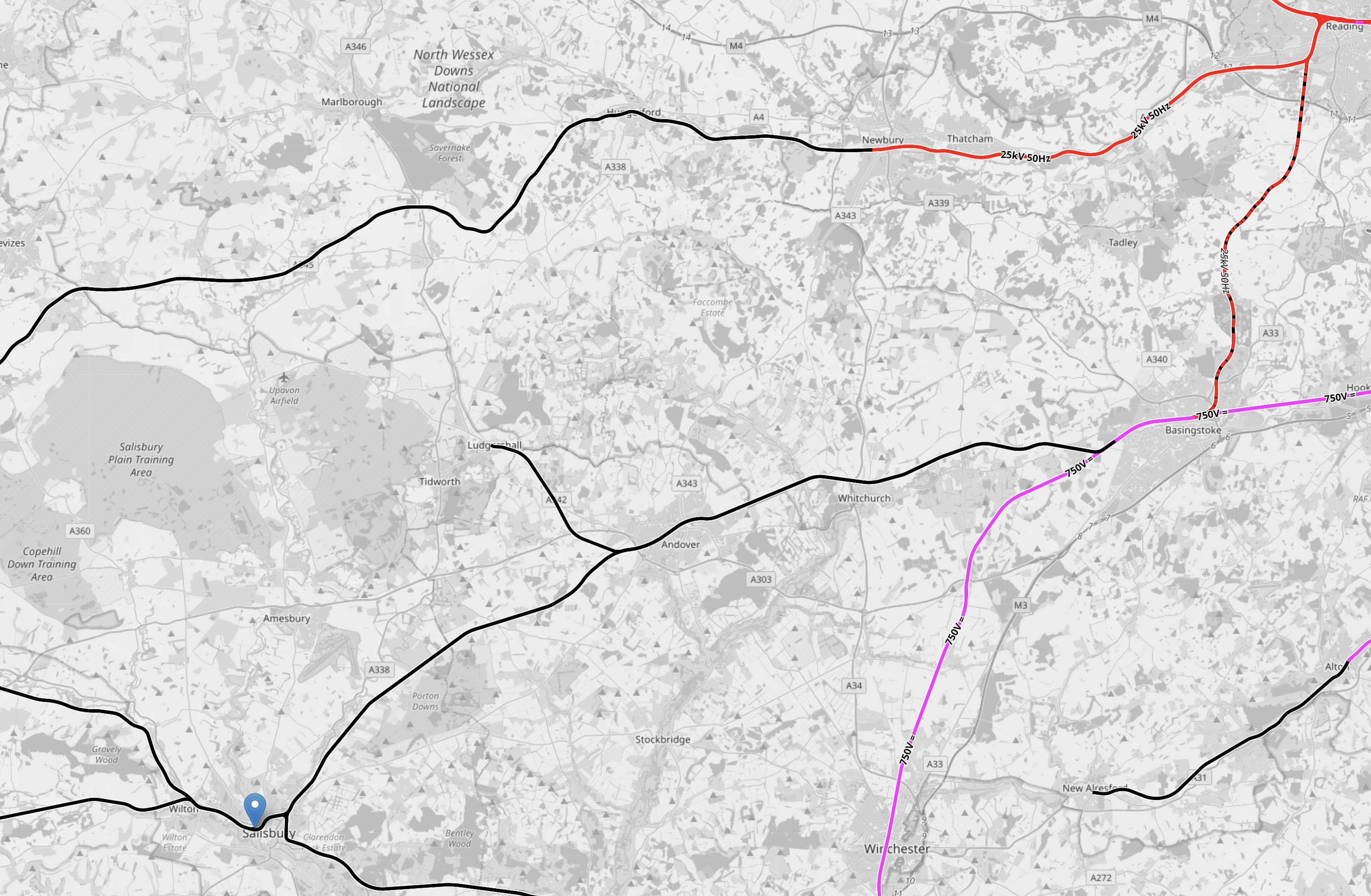
This OpenRailwayMap shows middle part of the route between Basingstoke and Salisbury.
Note.
- Tracks shown in black are not electrified.
- Tracks shown in red are electrified with 25 KVAC overhead,
- Tracks shown in dashed red and black are proposed to be electrified.
- Tracks shown in mauve are electrified with 750 VDC third rail.
- Reading station is in the North-East corner of the map.
- The Reading and Basingstoke Line runs South from Reading station and is shown dashed.
- Basingstoke station is on the third-rail electrified South West Main Line between London Waterloo and Southampton.
- Salisbury station is indicated by the blue arrow.
- Linking Basingstoke and Salisbury is the unelectrified West of England Main Line between London Waterloo and Exeter.
- The branch line going North from the West of England Main Line to the East of Salisbury is used by the Army to move tanks.
- Ludgershall Town Council want passenger trains on the branch line to support housing at Tidworth with trains to Andover on the West of England Main Line.
- I wrote about this branch line in A Branch Line For Ludgershall
- Across the top of the map is the Reading and Taunton Line, which is electrified as far as Newbury.
I will now look at replacing the Class 159 trains.
Consider.
- Between Exeter St. David’s and Basingstoke stations is not electrified and is 124.3 miles.
- I believe that both Hitachi and CAF have the capability to produce a zero-carbon train with a range of 125 miles.
- The Office of Rail and Road will not allow any more third-rail electrification.
- Trains could have a generous turnround time at Exeter St. David’s which could allow trains to be charged, before returning to London.
- Basingstoke and Salisbury is only 35.8 miles, so a train terminating at Salisbury from London, should be able to return to London.
- Trains could be charged using short length of overhead electrification.
- Five-car trains, which could run in pairs might be ideal.
- I believe several manufacturers could make trains capable of running the route.
I also believe that once the charging strategy is known and any infrastructure has been installed, the new trains can be introduced into service to run alongside the Class 159 trains.
This would hopefully avoid, the current problems of the Class 820 trains on the Midland Main Line.
Thoughts On Extending The Northern Line To Clapham Junction
As I wrote in Northern Line Could Be Extended To Clapham Junction In Regeneration Plans, the extension of the newly-built extension to Battersea Power Station station could be further extended to Clapham Junction station.
Railways Between Battersea And Clapham
This map from OpenRailwayMap shows the tracks that run between the two stations.

Note.
- Battersea Power Station station is in the North-East corner of the map.
- The orange and yellow lines going North from that corner go to Victoria station.
- The orange and yellow lines going North-East from that corner go to Waterloo station.
- The yellow line going West is the West London Line to Shepherds Bush and Willesden Junction stations.
- Clapham Junction station is in the South-West corner of the map.
I estimate that the distance between Battersea Power Station and Clapham Junction stations is about three kilometres.
This map from OpenRailwayMap shows an enlargement of the tracks around Battersea.
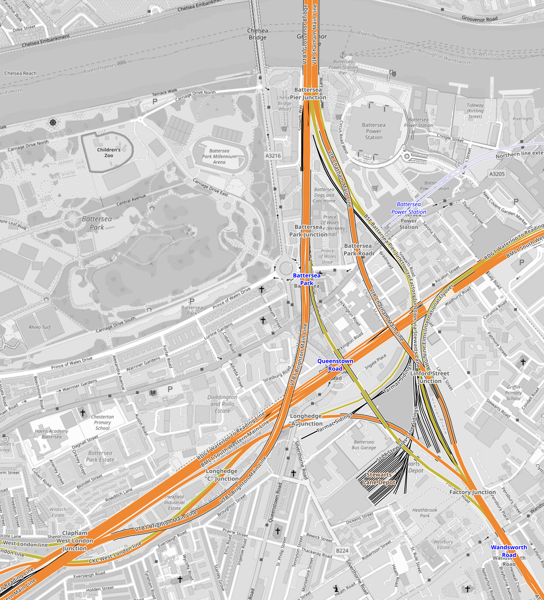
Note.
- The tracks going North over the River to Victoria station.
- The tracks going East to Waterloo station.
- The tracks going South West to Clapham Junction station.
- The tracks from Victoria pass over and then join the tracks from Waterloo to continue to Clapham Junction station.
Battersea Power Station station can be seen to the North-East of the junction.
This map from OpenRailwayMap shows an enlargement of the tracks around Battersea Power Station station.
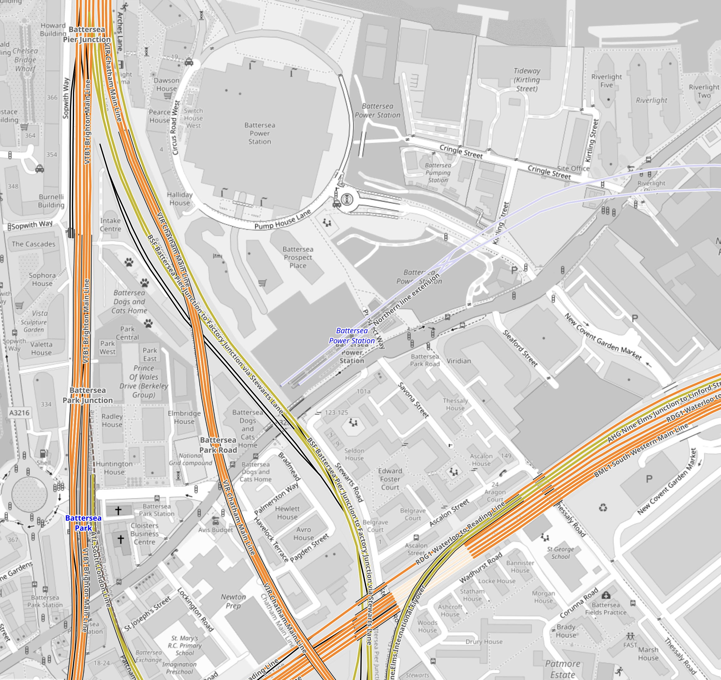
Note how the tracks go through Battersea Power Station station and terminate just before the lines into Victoria station.
It should also be noted that the platforms at Battersea Power Station station are reached using two sets of escalators, so they could be over forty metres below the surface. This would surely make the construction of tower blocks with deep foundations easier over the Northern Line.
But the depth would also enable an extended Northern Line to be below any existing or future construction.
This map from OpenRailwayMap shows the approaches to Clapham Junction station.
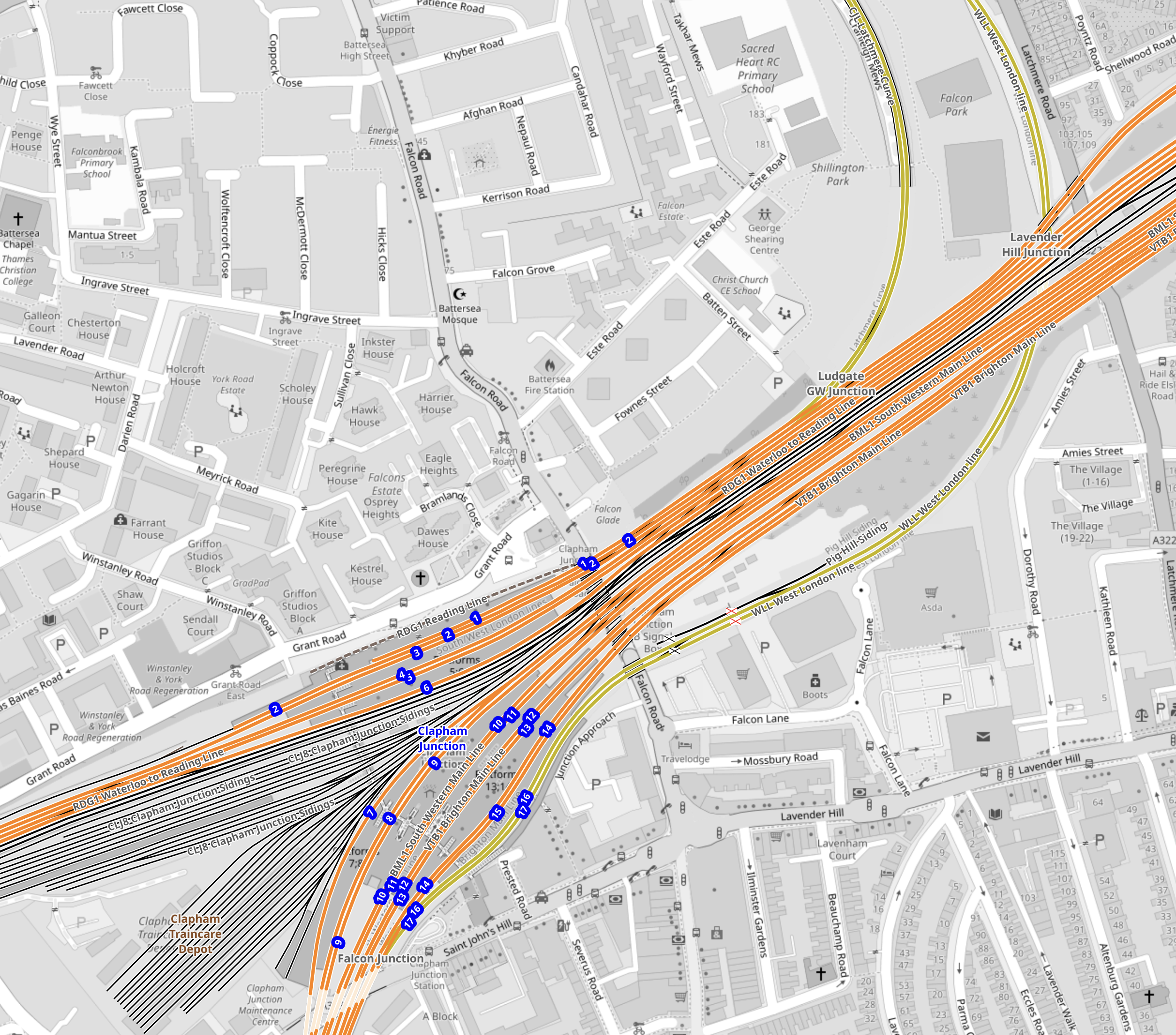
There are certainly a lot of tracks through Clapham Junction station.
Reasons For The Extension Of The Northern Line To Clapham Junction
These reasons come to mind.
To Enable Development In The Area
This is always a good reason.
In Network Rail To Outline Business Case For Clapham Junction Redevelopment, I said this.
The Rail Technology Magazine article talks of decking over the whole station and putting two million square feet of development on top. But it also cautions, it would be very expensive.
With that amount of development, there would be a need for as many transport links as possible.
To Improve Access To The Elizabeth Line For Passengers On Trains To And From Victoria
Victoria station does not have an Underground Line, that connects to easily the Elizabeth Line.
The best route to use is described in The Lizzie Line And Circle/District Line Interchange At Paddington – 1st July 2022, where you use the Circle to Paddington.
- To go to the West on the Elizabeth Line, take the Circle/District Line to Paddington.
- To go to the East on the Elizabeth Line, take the District Line to Whitechapel.
- To go to Liverpool Street take the Circle Line all the way.
Getting to the stations between Paddington and Liverpool Street means a change at either of those stations.
At Waterloo, you can use the Northern Line, which has a direct connection to Tottenham Court Road on the Elizabeth Line.
Connecting to the Northern Line at Clapham Junction will give Victoria-bound passengers, the advantages of those going to Waterloo.
An Alternative Way Of Connecting Victoria To The Elizabeth Line
The lack of an easy connection between the Victoria and the Elizabeth Line is a pain and I believe that it was a major omission in the design of the Elizabeth Line.
- Dear Old Vicky has a frequency of upwards of thirty trains per hour (tph)
- With some improvements at stations like Oxford Circus, Highbury & Islington and Walthamstow Central, the line could handle some more passengers.
- More step-free access would also help increase capacity.
- Engineers are a competitive bunch and I could see the day, when Vicky is running at 40 tph.
If Vicky was running at forty full tph, it would be moving 45120 passengers per hour.
This would mean that to match the passenger capacity of the older line, the Elizabeth Line would have to be running at a frequency of thirty tph.
As passengers at the ends of the line have difficulty getting to places like Paddington and Heathrow, a connection between the two Queens would really help.
Vicky was universe-class in the 1960s and now she needs updating to the 21st Century.
This map from cartometro shows the Lines through Bond Street and Oxford Circus stations.
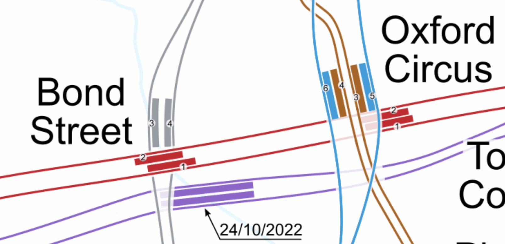
Note.
- The Bakerloo Line is shown in brown.
- The Central Line is shown in red.
- The Elizabeth Line is shown in purple.
- The Victoria Line is shown in light blue.
- The Elizabeth Line is the deepest line.
In addition, consider.
The Eastern exit of the Elizabeth Line at Bond Street station has three escalators and lifts. It also opens onto Hanover Square, so it won’t suffer from overcrowding problems outside.
- Hanover Square is just a garden, with no car park underneath, so pedestrian tunnels could pass under it
- I also suspect there are no existing or planned buildings between the two stations with deep foundations that would block a pedestrian tunnel.
- With the capability and ingenuity of three-D design software, I can see wide tunnels being created that would link Oxford Circus and the two Bond Street stations.
- The new wide tunnels at Bank station have opened up the station’s capacity and all the tunnels were dug traditionally.
- If it was felt to be needed, moving walkways could be added, just as they have been at Bank station.
I am absolutely sure, that by using the ideas and methods, that have worked so well in the upgrade of Bank station, that Oxford Circus and Bond Street stations could be turned into a London Superhub Station, that connects all the Underground lines together and has entrances all over the area.
The benefits of such a station would be.
- It would provide a high-capacity link between London’s two highest-capacity Underground Lines; Elizabeth and Victoria.
- It would provide a high-capacity link between the Elizabeth Line and Euston, St. Pancras and King’s Cross.
- It would provide a high-capacity link between the Elizabeth Line and Victoria.
- It would provide a high-capacity link between the Elizabeth Line and High Speed Two.
- Areas like Brixton, Haringey and Walthamstow would gain a much needed link to the Elizabeth Line for Heathrow and Paddington.
Wikipedia says this about the building of the Bank Station Upgrade.
As part of the development of the scheme, TfL worked with potential bidders to improve the design of the station from TfL’s original design. The design proposed in the winning bid by Dragados was 9.7% cheaper than the original design (saving TfL £60m), took 10 months less time to construct than the original design (the proposed closure of the Northern line was also 5 weeks shorter), and the layout of the station was more efficient. This substantially improved the benefit–cost ratio by 45% to 3.5:1.
The Mayor should be knocking on the door of Dragados and asking them for a price for a design and build for a West End Superhub station.
A Possible Route For The Extension Of The Northern Line To Clapham Junction
I suspect that the simplest route for the extension of the Northern Line would be to bore or dig a twin-track railway underneath the numerous other railways in the area.
It could terminate in two underground platforms at Clapham Junction station.
This is the first map of this post and it shows the tracks that run between the two stations.
Note.
- Battersea Power Station station is in the North-East corner of the map.
- Clapham Junction station is in the South-West corner of the map.
The Western of the pair of orange Lines going off the map in the North-East corner of the map is the Brighton Main Line.
It passes through Battersea Park station.
It passes over the South Western Main Line out of Waterloo.
It then loops to the West and joins the lines to Clapham Junction on the Southern side.
It serves four platforms at Clapham Junction; 12 and 14 are up platforms and 13 and 15 are down platforms.
This Google Map shows an overview of Clapham Junction station.
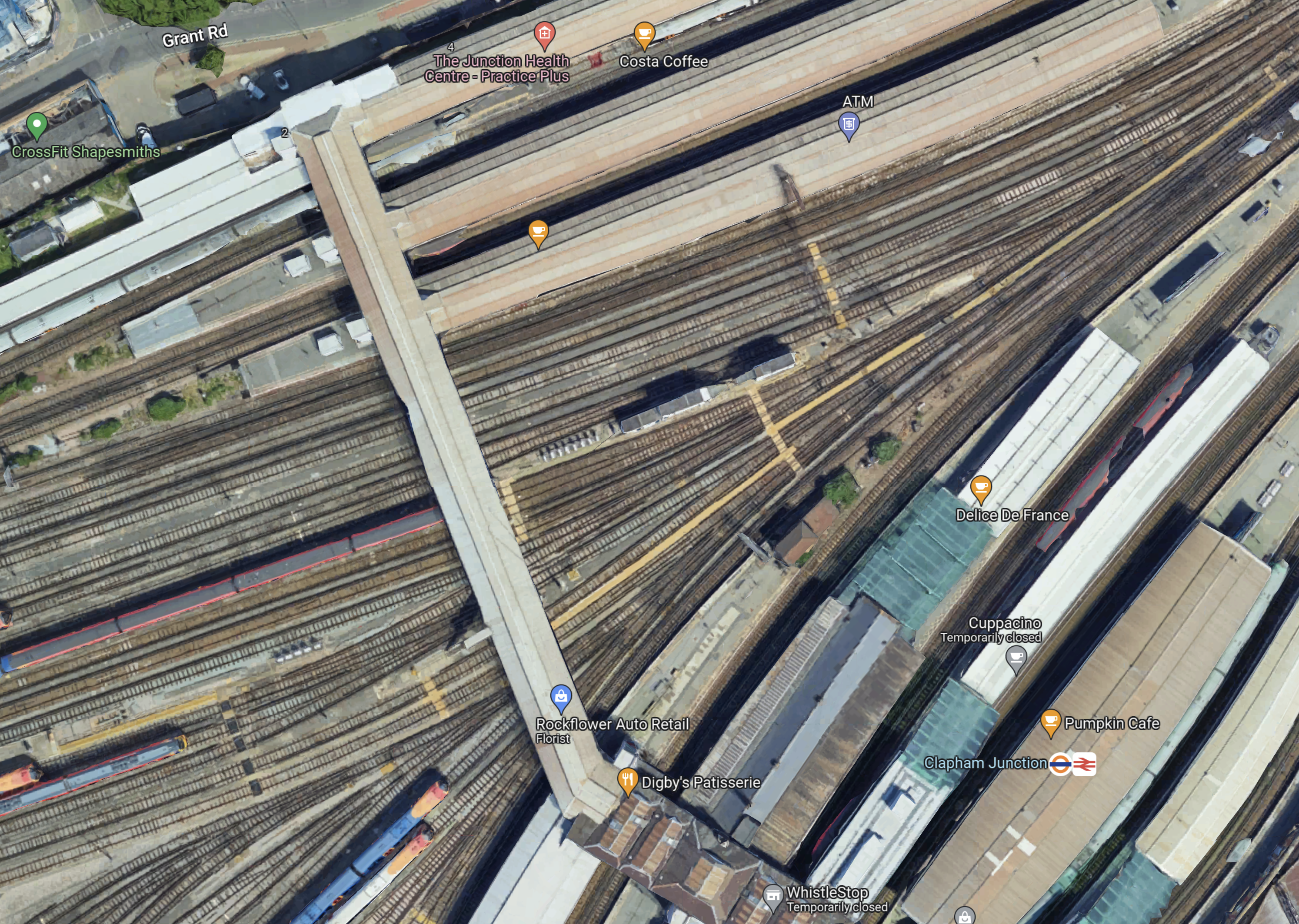
Note.
- Platforms 1 and 2 at the top of the map, handle London Overground services.
- Platforms 3 to 11 handle South Western Train services.
- Platforms 12 to 17 handle Southern services.
- Platforms 9 and 10 have a Delice de France cafe.
- Platforms 11 and 12 have a Cuppacino cafe.
- Platforms 13 and 14 have the logos.
- All platforms have full step-free access with lifts to the wide footbridge that connects all platforms.
The platforms don’t seem to be very wide and putting stairs and escalators down to underground platforms could be a difficult proposition.
This map from OpenRailwayMap shows shows the platforms at Clapham Junction station and the track layout to the West of the footbridge.
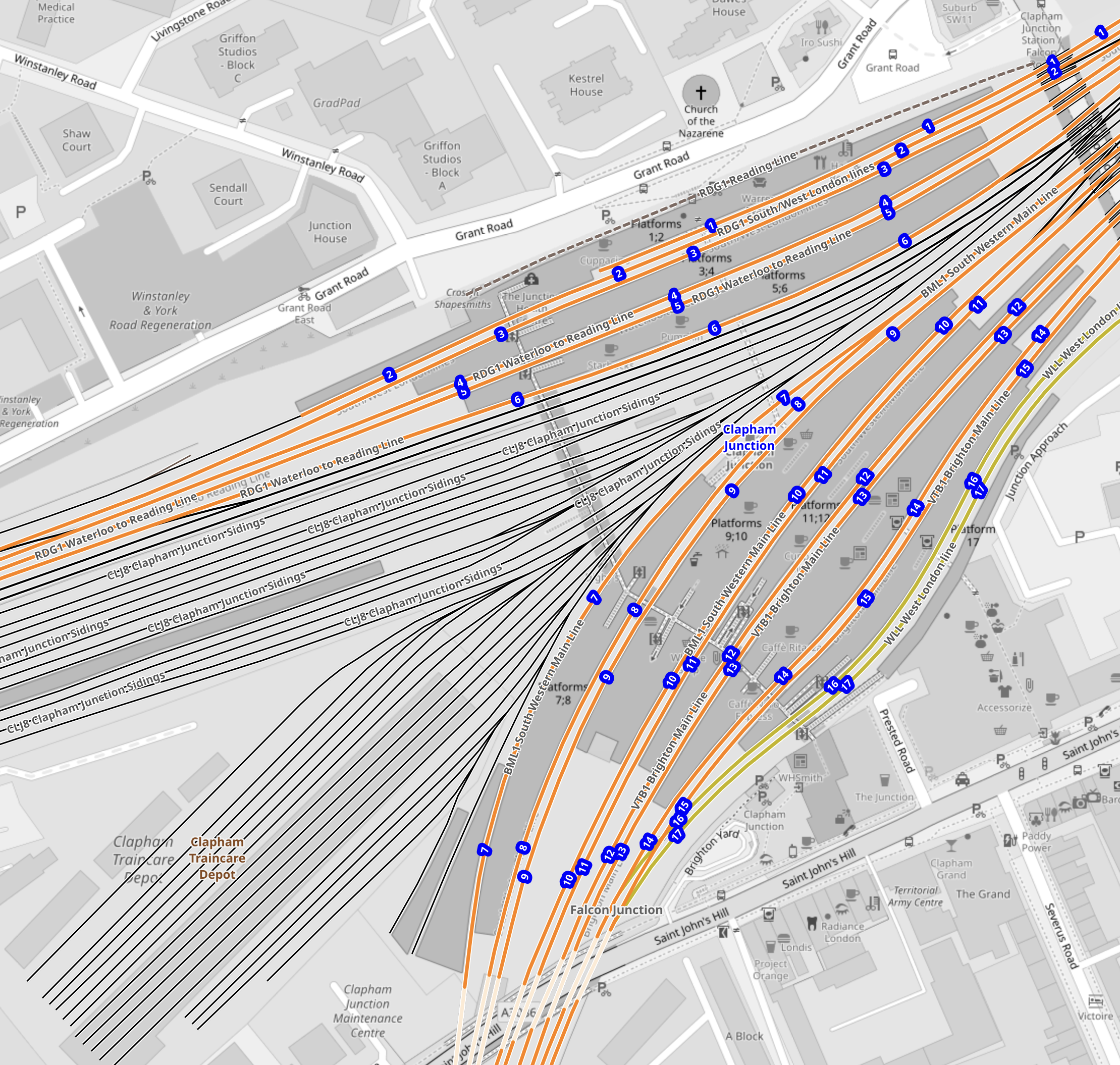
Note.
- The tracks through the platforms are shown in orange.
- The blue dots are platform numbers.
- The bridge connecting all the platforms is shown shaded in the middle of the map.
- To the West of the bridge are Clapham Junction Sidings and Clapham Traincare Depot.
These pictures were taken from the bridge.
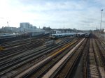
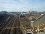
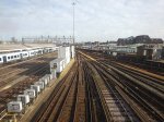
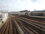
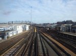
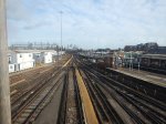
Note.
- The top row of pictures were taken looking West.
- The bottom row of pictures were taken looking East.
- Many of the tracks are electrified.
- There is a lot of space to park trains.
Will all the space be needed now, that a new depot has been built at Feltham.
Could Two New Surface Platforms Be Built For The Extension Of The Northern Line To Clapham Junction?
Consider.
- The step-free bridge across all the platforms at Clapham Junction station works well.
- It is connected to the streets around the station at both ends.
- Clapham Junction station will be redeveloped and surplus depot land could be used for housing.
- As the maps show, there is a large gap in the platforms between the South Western Railway and the Southern sides of the station.
- As Battersea Power Station station can turn services on the Northern Line with only two platforms, there would only need to be the same number of Northern Line platforms at Clapham Junction.
So could an extra pair of platforms be built under the bridge, with stairs and a lift similar to the existing platforms?
- The platform would have full step-free access.
- The platforms could be long enough for any future trains.
- There could be sidings for a few trains.
- The tunnels from Battersea Power Station would surface just outside the station.
- There would need to be a crossover or a turnback siding for operational reasons.
I also think, that once the depot and sidings at Clapham Junction have released the space, the new platforms and tracks could be installed without interrupting main line services through the station.
Would The Extension Of The Northern Line Be Electrified?
Consider.
- Merseyrail were not allowed to use third-rail electrification to Headbolt Lane station and had to use batteries.
- The Northern Line was extended to Battersea Power Station station using London’s four-rail electrified system.
- Clapham Junction station has third-rail electrification everywhere.
I think that the authorities would be very churlish not to allow electrification to Clapham Junction.
Conclusion
I believe it is possible to extend the Northern Line to two new surface platforms at Clapham Junction station.
But I also believe that using similar methods to those used in the Bank Station Upgrade, that a full interchange between the Elizabeth and Victoria Lines can be built at Oxford Circus and Bond Street.
.

