London Underground Upgrades To Northern Line and Bank Station Gather Pace
The title of this post, is the same as that of this article on New Civil Engineer.
It all sounds like good progress and these are some points from the article.
- The Northern Line Extension to Battersea is scheduled for completion this autumn.
- At Battersea Power Station station, equipment, gateline, tiling and finishes are being installed.
- Nine Elms station is getting there, as I said in Nine Elms Underground Station – 14th February 2021.
- Work continues at the two ventilation shafts at Kennington Park and Kennington Green.
- All the major contracts at Bank station have been awarded.
- It appears that the new track in the new Southbound tunnel at Bank is getting ready to be installed.
Note that no date is given for the Bank station blockade to connect the new tunnels or completion of the works.
Under Future Station Upgrade And Expansion, in the Wikipedia entry for the station, this is said.
Before the project can be completed, the Northern line Bank branch will have to close for several months to allow the existing line to be connected to the new running tunnels. As of October 2020, this closure is planned to occur in late 2021/early 2022.
As I suspect other works like those in the new passenger tunnels can go on unhindered by the track works, I would suspect that a few months after the new tracks are connected, the station upgrade will be substantially finished.
I certainly, think that the full upgrade could open complete with the new entrance on Cannon Street sometime in 2022 or if not early in 2023.
It has been reported that the oversite development on the new Cannon Street entrance will be done after the station is complete.
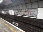
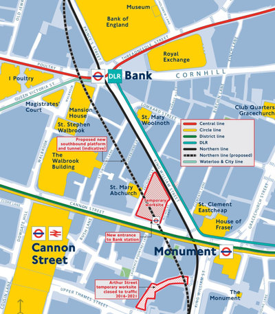
The Pedestrian Tunnels In Bank Station
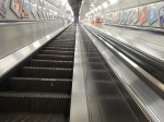
Growing up in London in the 1950s, I was always intrigued by the escalator connection between Bank and Monument stations, shown on the tube map.
The connection opened in the 1930s, but I can’t remember using it until recently.
It is not shown on the latest map.
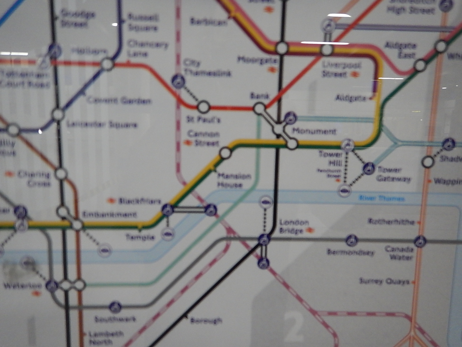
The combined Bank and Monument stations now have lots of tunnels and some will be affected by the works to extend the station.
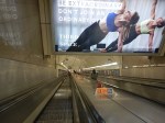
Arriving On The DLR
These pictures show arriving on the DLR and taking the route up the escalator to the Central, Northern and Waterloo and City Lines.
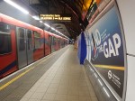
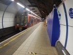
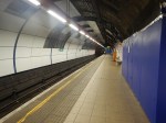

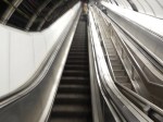
Note.
- Once at the top of the escalator, the Central, Northern and Waterloo and City Lines are accessed by more tunnels.
- The tunnel, that used to run between the two platforms appears to be closed off at the moment.
- Could the Northern end be being turned into an information point?
Access To The Central Line
This visualisation shows the current and future access to the Central Line.
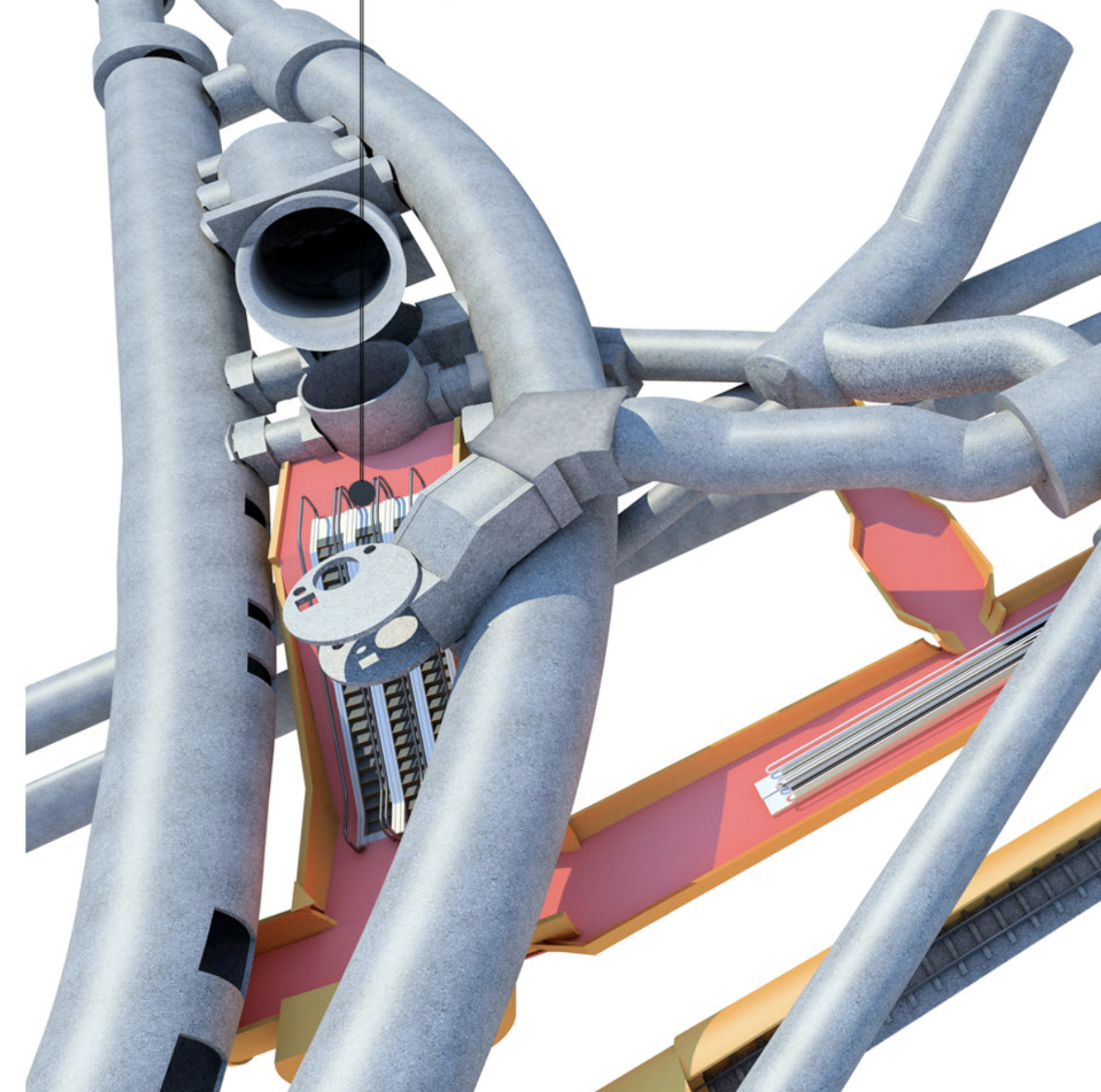
Note.
- The two fat curved grey tunnels on the left are the Central Line.
- The straighter one on the left is the Eastbound tunnel, with East at the top.
- The curved one is the Westbound tunnel.
- The tunnel facing us, between the Central Line tunnels is the triple escalator barrel from the entrance under Bank junction.
- Just visible underneath it is the spiral staircase that connects to the Northern Line.
- A new triple escalator will connect the Central Line platforms down to the main North-South travelator.
- Above the new escalators is the current connection between the Central Line platforms and the DLR.
These pictures show the connection between the Central and Northern Lines via the spiral staircase.


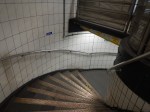
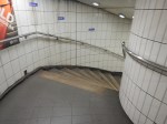
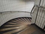
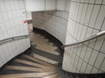


Note that once down the spiral staircase, the passage is level.
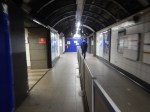
Northern Access To The Northern Line Platforms
Currently, there are two staircases down from the lobby, where both the previous routes end to the Northern Line platforms.
This visualisation shows the Northern ends of the current Northern Line platforms.
Note.
- North is to the left.
- The two tracks and the narrow island platform of the current Northern Line on the far side of the visualisation.
- The two staircases leading up from Northern Line to a lobby, where passengers can walk North to the Central Line.
- The double escalator barrel going down to the DLR.
- The three cross passages linking the DLR escalators to the lobby between the Central and Northern Lines.
- The most Southerly of these cross passages has a lift to the DLR.
These pictures show the two staircases leading up from the Northern Line platforms.


Other pictures show, top of the stairs, the lobby and the current state of the Southbound platform.
After completion of the upgrade, the following works will have been done.
- The Southbound track will be filled in.
- The Northbound platform will be extended over the former Southbound track and platform, to make a very wide platform.
- The doors in the tunnel walls will become cross passages to the new Southbound platform about thirty metres to the West, the triple bank of escalators to the new Cannon Street entrance, escalators to the DLR and the travelator to the Central Line.
What will happen to the two short staircases?
At present they lead up to lobby with passages to the DLR and the Central and Waterloo & City Lines and the lifts.
- It all depends on how much, they will be used with so many new routes in the station.
- They could be refurbished, with perhaps one for up and one for down.
- They could be shut off.
There certainly is space for wide staircases, leading down to the very wide single platform.
I think they should be kept to please the duckers-and-divers.
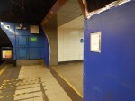
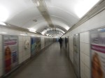
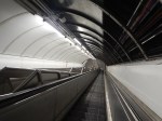
From The Northern Line Platforms To Monument Station
This is the original 1930s escalator connection between the Northern Line at Bank station and the District and Circle Lines at Monument station.


Note.
- Judging by the two sets of blue hoardings, there will be some extra passages connection to this route.
- The escalator is surprisingly long.
I do wonder, if this route might tend to be sidelined, as many passengers will find the new Cannon Street entrance quicker.
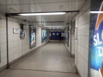
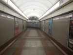
From Monument Station To The DLR
These pictures show going between Monument station And The DLR.


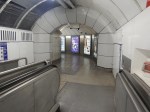
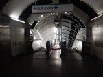


Note.
- Except at the DLR end, there is no blue hoardings hiding the construction work.
- The tunnel between the two platforms is blocked off.
- At the DLR rnd, both platforms can be accessed.
It strikes me that after the completion of the expansion of Bank station, this tunnel will be substantially the same.
TfL Confirms Northern Line Extension Work Is ‘On Track’
The title of this post, is the same as that of this article on the Wandsworth Guardian.
It is good to hear, that there has been no further delays.
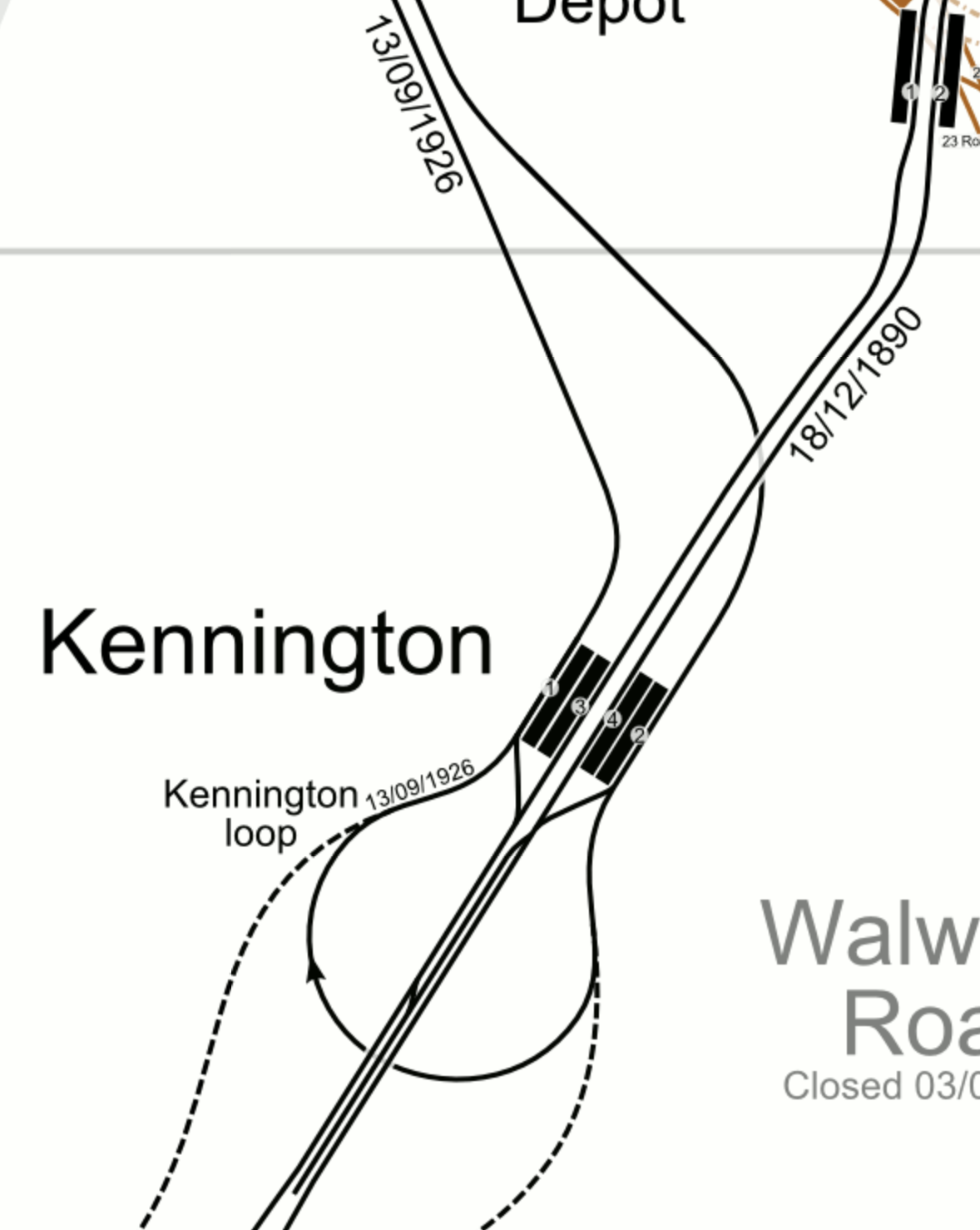
Part of the article talks about the use of the Kennington Loop, which is shown in this visualisation from at least a century ago.
But what I found useful was speculation about the services after the extension opens.
However, it is thought that when the new stations open, 16 trains per hour will carry on to Nine Elms and Battersea, leaving just eight trains per hour terminating at Kennington and travelling around the loop.
On the other hand, I wouldn’t be surprised to see all trains going to Battersea Power Station station, as it might be operationally easier and the higher frequency may attract more passengers.
Thoughts On The Closure Of The Northern Line At Bank To Complete The Upgrade To Bank Station
The Bank Station Upgrade is a major project that will increase the capacity of Bank station by forty percent.
This document on the Transport for London web site gives details of the project.
It was originally planned that sometime in late 2021, the Northern Line will be closed through Bank station.
The document says this.
We will need to close part of the Northern line Bank branch in 2021, between Kennington and Moorgate, to connect new and existing sections of tunnel safely. Trains will run less frequently on those sections of the Bank branch that are still open. Check back here for details.
This would mean that Bank, London Bridge, Borough and Elephant & Castle stations will be closed on the Northern Line.
To help passengers, TfL say, they will do the following.
- Run 33% more trains on the Northern line Charing Cross branch
- Review bus use and consider enhancing services where necessary
- Investigate scope for passengers to use alternative National Rail services, such as Waterloo to London Bridge, and London Bridge to Cannon Street
- Review available walking space on the Moorgate to London Bridge pedestrian corridor.
These are my thoughts.
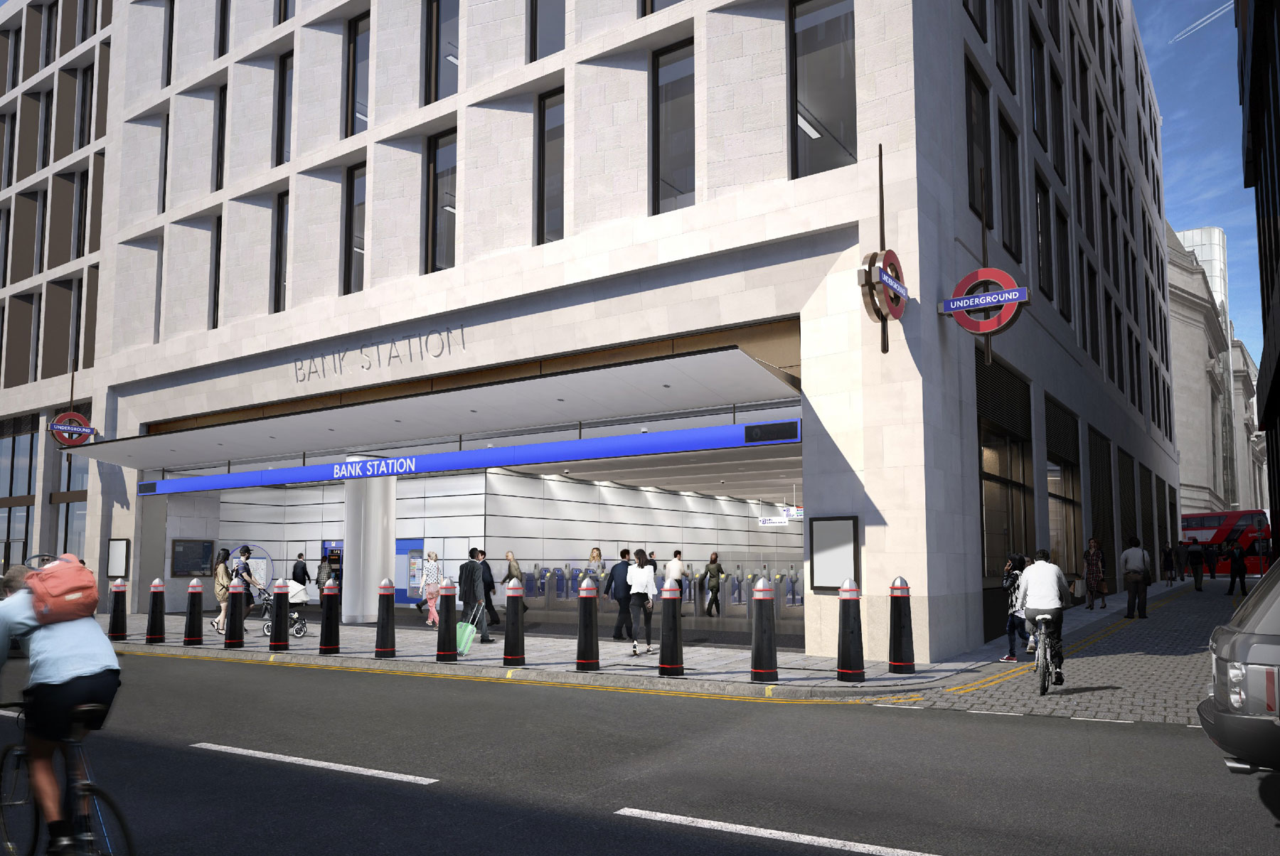
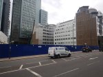
The New Cannon Street Entrance To Bank Station
This visualisation shows the new Cannon Street entrance to Bank station.
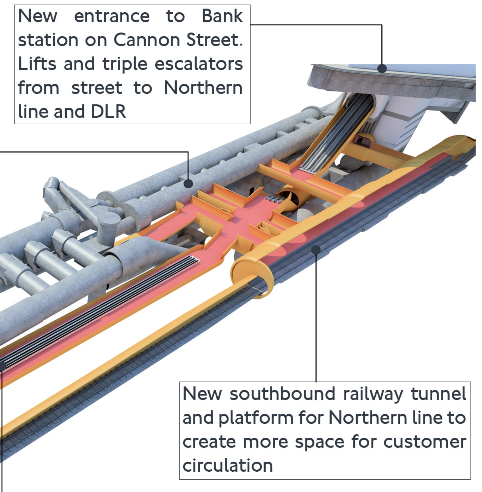
Note.
- South is to the right and we’re looking from roughly the North-West.
- The existing twin bores of the Northern Line on the far side of the visualisation.
- The escalator connection to the District and Circle Lines at Monument station Starts at the Southern end of these two narrow platforms.
- The new single bore of the new Southbound tunnel on the near side of the visualisation.
- The triple escalators descending from the new Cannon Street entrance to one of the four cross-walks between the Northern Line platforms.
- The current Eastern ends of these cross-walks are shown in The Southbound Northern Line Platform At Bank Station.
But where is the Docklands Light Railway (DLR)?
This map from carto.metro.free.fr shows the lines at Bank station.
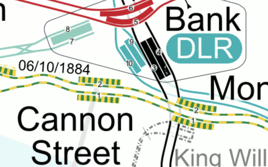
Note.
- The two existing Northern Line Platforms 3 and 4 are shown in black.
- The Central Line is shown in red.
- The DLR is shown in turquoise and sneaks under the Northern Line into Platforms 9 and 10.
- Platforms 7 and 8 are the platforms of the Waterloo and City Line.
- It would appear that the escalator connection between Bank and Monument stations goes between the existing tracks of the Northern Line.
So where is the Docklands Light Railway?
- As Platforms 3 and 9 appear to be close together with Platform 9, the deeper of the two, I suspect we can’t see the Docklands Light Railway in the visualisation, as it is hidden behind and underneath everything else.
- I also suspect that the triple escalators between the new Northern Line cross-walks descend in the space at the Southern ends of Platforms 9 and 10.
This is the Northern end of the visualisation I showed earlier
Note.
- North is to the left.
- The two tracks and the narrow island platform of the current Northern Line on the far side of the visualisation.
- The two staircases leading up from Northern Line to a lobby, where passengers can walk North to the Central Line.
- The double escalator barrel going down to the DLR.
- The travelator that will connect the Northern and Central Lines
- The three cross passages linking the DLR escalators to the lobby between the Central and Northern Lines.
- The most Southerly of these cross passages has a lift to the DLR.
The new Southbound platform of the Northern Line, would appear to be to the West of the Docklands Light Railway.
It appears to be a very tight fit.
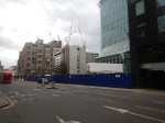
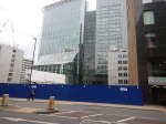
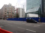
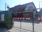
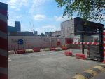
These pictures show the current status of the new entrance.
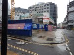

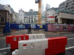
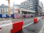
There would appear to be still a lot to be done.
This TfL image shows how it will look in 2022.
Ducking And Diving
No-one ducks and dives like Londoners. So rest assured, that if someone needs to get from A to B and the obvious route is blocked, Londoners will always get through. And if all else fails, a black cab will find a way, usually driven by a Londoner or someone infected with the ducking and diving virus.
Crossrail
As ever Crossrail is the herd of elephants in the London railway system.
The Northern Line is possibly the most important North-South route across Central London with two branches through the centre; Bank and Charing Cross.
But Crossrail connects to these North-South routes.
- Lea Valley Lines at Stratford
- East London Line at Whitechapel
- Lea Valley and West Anglia Lines at Stratford
- Northern Line Bank Branch at Moorgate/Liverpool Street
- Northern and City Line at Moorgate/Liverpool Street
- Thameslink at Farringdon
- Northern Line Charing Cross Branch at Tottenham Court Road
- Jubilee Line at Bond Street
- Bakerloo Line at Paddington
Crossrail will give a lot of opportunities for ducking and diving.
Under original plans Crossrail was supposed to open in 2019, with the Bank station closure for the upgrade in 2021.
This phasing certainly seemed a good idea at the time.
- Crossrail will be able to offer alternative routes during the closure.
- If the Crossrail stations are substantially complete, they can release workers to finish Bank station.
I wonder, if it would be sensible to not upgrade the tracks through Bank station until Crossrail opens through Moorgate/Liverpool Street.
As I wrote in Your First Crossrail Service May Arrive In Time For Christmas, Crossrail could open this year.
So are we being prepared for the mother of all cunning plans?
- Crossrail between Paddington and Abbey Wood opens before Christmas.
- The closure of the Bank branch to allow the Bank station upgrade happens at a convenient time after the opening of Crossrail through Moorgate/Liverpool Street.
- Moorgate continues to have a limited Northern Line service to the North.
- Crossrail continues work on the other branches.
Note.
- There is a crossover to the North of Moorgate station, which might allow Moorgate to work as a two-platform terminal station handling up to 4 or 6 trains per hour (tph).
- If Crossrail is running at Moorgate, the station should be step-free to and from the deep-level platforms.
- Transport for London are looking at walking routes on the Moorgate and London Bridge route.
- During the closure of the Northern Line through Bank, passengers for the City will go to Moorgate and walk or perhaps take a bus.
It is my view, that Crossrail must be open, before the Northern Line through Bank station is closed to allow work to be completed.
A Demonstration of the Northern Line Capacity At Moorgate When Working As A Terminal Station
Yesterday, which was a Sunday, the Northern Line was closed between Moorgate and London Bridge stations.
- After a walk, I returned home from Moorgate station via Angel station, where I got a 38 bus.
- I was surprised to find that trains on the Northern Line were leaving Moorgate station for the North every four to five minutes.
This would seem to indicate that frequencies of between 12 and 15 tph are possible.
Current frequencies through Bank station are 24 tph in the Peak and 20 tph in the Off Peak, so it will be a substantial reduction. But it is better, than my original estimate earlier in this section.
33% More Trains on the Northern Line Charing Cross Branch
Currently, the Charing Cross branch has a capacity of twenty-four tph and handles the following services in the Peak.
- 10 tph between Edgware and Kennington
- 2 tph between Edgware and Morden
- 10 tph between High Barnet and Kennington
- 2 tph between High Barnet and Morden
And these services in the Off Peak.
- 10 tph between Edgware and Kennington
- 10 tph between High Barnet and Kennington
Note.
- Extra trains go between the two Northern branches and Morden via the Bank branch.
- Kennington and Morden can handle 28 tph and regularly does.
- The loop at Kennington turns twenty trains per hour in both the Peak and the Off Peak
If there is an increase of 33 % in the number of trains, this must mean that 32 tph will run through Charing Cross in the Peak and 28 tph in the Off Peak.
- The signalling system on the Northern Line is the same as that on the Jubilee Line, where it handles 30 tph.
- It also can handle up to 30 tph between Kennington and Morden on the Northern Line.
- Perhaps it can be stretched to 32 tph through Charing Cross in the Peak.
If the Charing Cross branch can only be uprated to 30 tph, that is still an increase of 25 % in the number of trains.
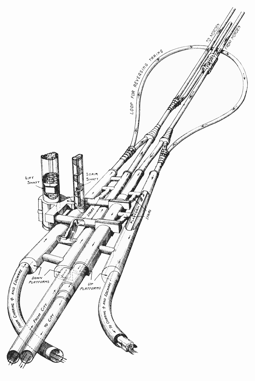
The Kennington Loop
I mentioned the Kennington Loop and this beautiful old drawing shows its layout.
Note.
- South is at the top of the drawing.
- At present, as I said, the loop turns twenty tph all day.
- The extension to Battersea connects to the loop.
This map from carto.metro.free.fr shows a map of the loop.
Note.
- The Charing Cross branch goes to the North-West from Kennington.
- The Bank branch goes to the North-East from Kennington.
- ,The lines to Battersea are shown dotted.
- Trains using the extension to Battersea can only use the Charing Cross branch.
I don’t know, but I wouldn’t be surprised, if the line speed to and from Battersea, is faster than it is round the loop.
It’s just that the lines to Battersea are not such a sharp curve and they have been recently designed and built.
As the Modern branch can handle 30 tph, I wouldn’t be surprised to find that the Battersea extension has been designed to handle this frequency.
The Northern Line Extension To Battersea
This document on the Transport for London web site gives details of the Northern Line Extension To Battersea.
This paragraph introduces the project.
The Northern line extension (NLE) between Kennington and Battersea will help regenerate the Vauxhall, Nine Elms and Battersea areas by supporting new jobs and homes. The extension is scheduled to be completed in autumn 2021.
The opening of the extension could offer benefits to the existing Northern Line.
As I said in the previous section, twenty tph are turned at Kennington using the loop.
Will all these trains now use the new Battersea extension, when it opens?
- The Battersea extension is fully double-track.
- Battersea Power Station station has two platforms and a cross-over, so if Brixton and Walthamstow Central stations can handle in excess of 30 tph, I suspect London’s newest terminal station can too!
If the Battersea extension has a design capacity of 30 tph, it would certainly be able to handle 20 tph.
So I wouldn’t be surprised to see all trains that currently turn at Kennington will take the Battersea extension, when it opens.
There must surely be the interesting possibility of before the Battersea extension opens to passengers, using it to turn the trains that would otherwise use the loop at Kennington. It would certainly be a very thorough test, of track and signalling.
I am fairly certain, there would be advantages in having the Battersea extension open before the Bank branch is upgraded.
- Running trains to Battersea could be more efficient than using the Kennington Loop.
- Opening the Battersea extension would need the signalling at Kennington to be upgraded and fully tested, so any changes needed for increased frequencies on the Charing Cross branch could be performed at the same time.
- All the residents of the new housing in Battersea. would have an Underground connection.
Opening the Battersea extension will change passenger patterns on the Northern Line and as the changes will be difficult to predict, it would surely be better to upgrade Bank station, after the opening of the Battersea extension.
Thameslink
Thameslink is not mentioned in any of the Transport for London documents, but surely it has a big part to play.
- Thameslink serves a lot of stations in South and South East London and beyond, including Brighton, East Croydon, Orpington, Sevenoaks and Woolwich Arsenal.
- Thameslink has an interchange with the Circle and District Lines at Blackfriars.
- Thameslink has an interchange with the Metropolitan and Circle Lines at Farringdon.
- Thameslink will have an interchange with Crossrail at Farringdon.
- Blackfriars and City Thameslink stations have good walking routes along the River and to the City.
Thameslink should be appearing on the Tube Map any time soon.
Waterloo And City Line
I am missing the Drain, as it is the easiest way for people in the area, where I live to get to Waterloo station.
I just take a bus to Bank and then walk underground to London’s shortest Underground line.
According to this article on London SE1, it is closed because of the covids, but should reopen in April 2021.
Surely, Transport for London could reopen the line, if they vaccinated all the drivers.
As the Waterloo and City Line has an independent new entrance on Wallbrook, there should be no reason, why it couldn’t reopen before the Northern Line through bank is upgraded.
The Central Line At Bank Station
Nothing has been said, about whether the Central Line will be closed through Bank station, during the upgrade.
I don’t think it will be continuously closed, although access to some parts may be restricted.
There could be partial closures at weekends or in the evenings.
So for commuters and other must-travellers, I suspect the Central Line will get through.
The Circle And District Lines At Monument Station
My thoughts about the Circle and District Line would be similar to the Central Line.
But these lines with their connections at Westminster, Blackfriars, Cannon Street, Tower Hill and Whitechapel could prove important during the works.
The Docklands Light Railway At Bank Station
Again my thoughts about the Docklands Light Railway would be similar to the Central Line.
But there is a lot of work going on to improve access to the Docklands Light Railway, and this could result in a closure to allow completion.
Review Bus Use
When I come into London Bridge station, I usually go to the bus station and get a bus, which stops within fifty metres of my front door. Going to London Bridge isn’t as convenient and I take a variety of routes.
But the corridor between London Bridge and Old Street via Bank and Moorgate has three bus routes; 21, 43 and 141, the last two of which terminate in the bus station at London Bridge. I suspect that the frequency of the last two buses could be increased, if they had a few more buses and drivers, and turned them faster at London Bridge.
I also feel there is scope to run a shuttle between Finsbury Square and London Bridge station.
- It would loop round Finsbury Square at the Northern end.
- It would loop through London Bridge station, as the 43 and 141 buses currently do.
- They would serve Moorgate and Bank.
- As it will be running through a busy part of the City with lots of pedestrians, these buses should be either battery or hydrogen.
- But as they should be high-capacity double-deckers, battery probably wouldn’t have enough power.
What better way would there be, to showcase London’s new hydrogen buses?
And I’m sure Jo Bamford, would make sure that London had enough new Wrightbus hydrogen buses to provide the service.
National Rail Between Charing Cross/Waterloo And London Bridge
I am probably not alone in using this route in preference to the Jubilee Line to travel between Westminster and London Bridge, as where there is an alternative to the deep-level Underground, I will often use it.
In my case coming home from Waterloo, I’ll often hop to London Bridge on National Rail and then get a 141 bus home.
This is classic ducking and diving on my part.
I’m sure others will do the same during the Bank branch closure.
I would also hope, that season tickets would allow passengers to swap terminals without too much trouble and any expense.
National Rail Between Cannon Street And London Bridge
Using Cannon Street instead of London Bridge could be an relatively easy alternative for many passengers.
- It connects to the Circle and District Lines.
- There are East-West buses outside the station.
This Google Map shows the location of the station.
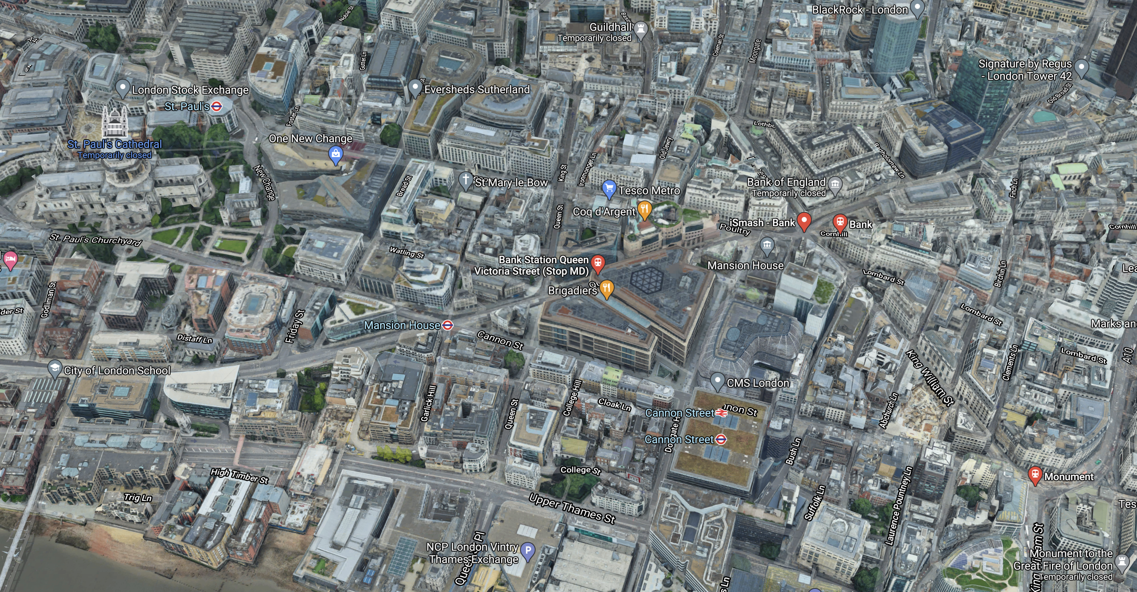
There are a number of useful walking routes from the station, which is towards the bottom of the image slightly towards the right.
- Bank station is about 300 metres and six minutes away.
- The North-South buses between Moorgate and London Bridge on King William Street are 200 metres and three minutes away.
- St. Paul’s is a bit further but it does have the Central Line and lots of buses including the 76 to Moorgate and Old Street stations.
At seventy-three, I can still walk between Cannon Street and Moorgate stations in 15 minutes.
Walking Between London Bridge and Moorgate
Transport for London have said they will review this.
It is not a difficult walk and it has improved since traffic was reduced at Bank.
Conclusion
As originally planned, the timings of the various projects were such that these projects would be more of less completed before the upgrade of the tracks at Bank station was to be performed.
- Crossrail
- The Northern Line Extension to Battersea.
- The new Wallbrook entrance to Bank station.
But no-one had foreseen Covid-19.
So I would plan the date of the Northern Line closure with the utmost care.
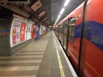
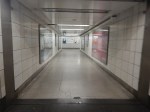
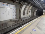
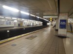
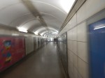
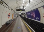
The Southbound Northern Line Platform At Bank Station
These pictures show the Southbound platform of the Northern Line at Bank station.
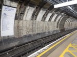

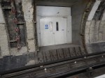
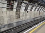
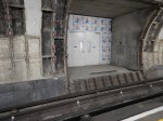
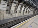

Can there be a Metro, U-bahn, Underground or subway platform anywhere with such bad design and worse decor?
- There are no tiles or cladding on the walls.
- You can see all the cast iron linings dating from the nineteenth century.
- How do people get across the tracks to the passages in the wall?
- But above all there are no adverts.
The state of this tunnel only tells a one-sided story.
Some metres to the West of the existing tunnel a new larger Southbound tunnel has been dug.
This map from Transport for London, shows the route of the new tunnell.
Note.
- The continuous black line of the existing Northbound line.
- The dotted black line of the new Southbound line.
This sentence from this article on IanVisits, which is entitled Bank Tube Station Upgrade Reaches Tunnelling Milestone, explains how the new tunnels were built.
Part of the tunnelling work saw the project team cut through deep-level piled foundations of one building, which required careful excavation and the installation of a new load-support system to support the existing foundations while still allowing a tunnel to pass through them.
According to Ian, 1300 metres of new tunnels have been constructed. All have been dug by fairly traditional methods, uding men, shovels and small diggers and other machines.
The space between the two running tunnels will become a wide concourse. This picture taken at Angel station, shows a wide platform that could be delivered at Bank station.

The old Southbound tunnel will be filled in to form the concourse. Those curious doors will become through passages to the escalators, lifts and the other platform.
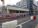
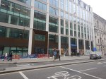
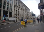
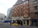
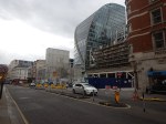
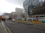
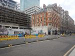
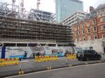
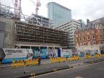
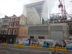
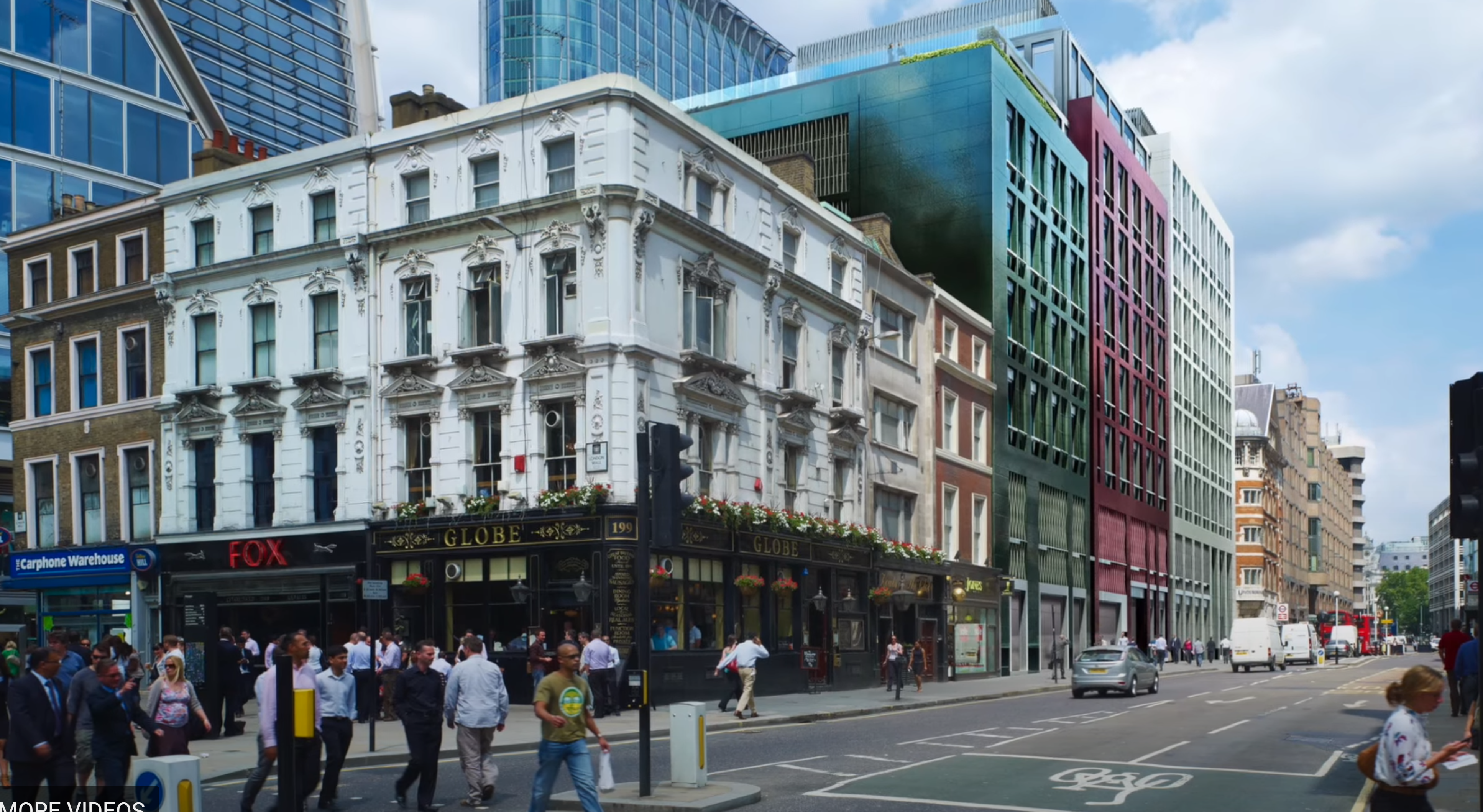
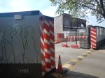
Walking Along Moorgate – 30th September 2020
I took these pictures as I walked from North to South along Moorgate today from the bus stop by Finsbury Square.
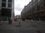

Note.
- I did cross the road three times.
- The building site behind the blue hoardings in some of the first pictures, looks like it could be another tall building.
- The tower looming in the background of several of the pictures is Citypoint, which was originally built in 1967 and refurbished in 2000.
- The new looking building, with the Barclays branch at street level, is not new but another refurbished building, that has been finished in the last few months.
- The older red and white building is Moorgate station. There is nothing to indicate that this building will be rebuilt.
- The odd shaped building to the South of the station is Moor House.
- A large new entrance to the station, with an office block on top is being built between the original station entrance and Moor House.
- Between the new station entrance and Moorgate, 101 Moorgate is being built.
There is certainly, a lot of all types of property development going on at Moorgate station, which after Crossrail opens will become the Western entrance to the Crossrail station at Liverpool Street station.
This 3D Google Map shows Moorgate.
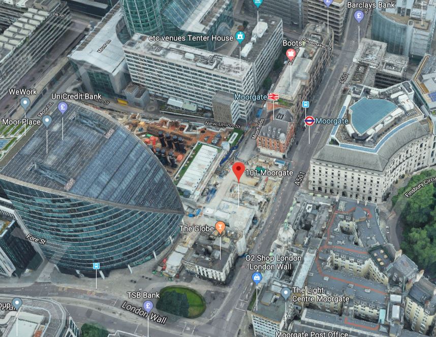
101 Moorgate is marked with a red arrow.
A Crossrail Video Of Liverpool Street Station
This video shows the design of Crossrail’s Liverpool Street station.
This screen-capture from the video shows a possible future Moorgate.
Note the new buildings at 101 Moorgate and the current Moorgate station.
These are related posts on the design of the Crossrail station at Moorgate and Liverpool Street.
- London’s First Underground Roller Coaster
- Moorgate Is Being Refurbished In Readiness For Crossrail
- Has The Possibility Been Created For A Pedestrian Tunnel Between Bank And Moorgate Stations?
The station could become the major one for the City of London.
Extending the Northern City Line To The South
This was intended by the builders of the Northern City Line and they intended to take the route to just North of Bank station at Lothbury.
In the Wikipedia entry for Moor House, this is said.
Completed in 2004, it was the first building to be designed for the forthcoming Crossrail, with a ventilation shaft to the station underneath the building. When built, it had the deepest foundations in London, which reach down 57 metres (187 ft) and are specifically designed to withstand further tunneling below it in the future.
I suspect that could mean that Moor House won’t get in the way of any further railway development.
In the Wikipedia entry for the Northern City Line, this is said about possible developments planned after World War 2.
After the war there were proposals to extend the Northern City Line north and south. The London Plan Working Party Report of 1949 proposed several new lines and suburban electrification schemes for London, lettered from A to M. The lower-priority routes J and K would have seen the Northern City Line extended to Woolwich (Route J) and Crystal Palace (Route K), retaining the “Northern Heights” extensions to Edgware and Alexandra Palace. The lines would have run in small-diameter tube tunnels south from Moorgate to Bank and London Bridge. The “K” branch would have run under Peckham to Peckham Rye, joining the old Crystal Palace (High Level) branch (which was still open in 1949) near Lordship Lane. Nothing came of these proposals, and the Edgware, Alexandra Palace and Crystal Palace (High Level) branches were all closed to passengers in 1954. As a result, the Northern City Line remained isolated from the rest of the network.
Note.
- The proposed J branch to Woolwich has been covered by Crossrail calling at both Moorgate and Woolwich.
- The proposed K branch to Peckham Rye and Crystal Palace has been covered by Crossrail and the London Overground with a change at Whitechapel.
So why bother to open up the possibility by designing Moor House for more tunnels to be bored?
As the London Plan Working Party Report of 1949 indicated several more lines and electrification were proposed.
Also during the war several deep-level shelters were built under Underground stations. Wikipedia says this about the background to the shelters.
Each shelter consists of a pair of parallel tunnels 16 feet 6 inches (5.03 m) in diameter and 1,200 feet (370 m) long. Each tunnel is subdivided into two decks, and each shelter was designed to hold up to 8,000 people. It was planned that after the war the shelters would be used as part of new express tube lines paralleling parts of the existing Northern and Central lines. Existing tube lines typically had 11-foot-8.25-inch (3.56 m) diameter running tunnels and about 21 feet (6.4 m) at stations; thus the shelter tunnels would not have been suitable as platform tunnels and were constructed at stations the new lines would have bypassed. However, they would have been suitable as running tunnels for main-line size trains. (One existing tube, the Northern City Line opened in 1904, used a similar size of tunnel for this reason, although in fact main-line trains did not use it until 1976.)
Shelters were planned on the Northern Line at Belsize Park, Camden Town, Goodge Street, Stockwell, Clapham North, Clapham Common, and Clapham South on the Northern Line. Did London Transport do a full survey of the Northern Line before the war and leave documents saying where an express Northern Line could be easily built.
My mother told me about these plans and as her best friend worked in Personnel at London Transport, she probably knew more than the average suburban housewife, who worked part-time for my father as a book-keeper.
After Crossrail opens and Moorgate station and the Bank station Upgrade are completed will it be possible to bore two new full-size tunnels underneath the Northern Line and Moor House and other buildings on the route to create a Northern Line Express service?
Consider.
- The tunnels would be very deep and suitable for full-size trains.
- Moorgate, Bank and London Bridge stations will have all been rebuilt in the last twenty years, so hopefully, they have been built to allow tunnels for a Northern Line Express service to pass through.
- The Northern Line Express would take the pressure off the City Branch of the Northern Line?
- Initially, the line might terminate under London Bridge station in perhaps a two platform station.
- Modern digital signalling would allow up to 24 trains per hour (tph) on the section between London Bridge and Alexandra Palace station and 12 tph on the Welwyn Garden City and Stevenage branches
It would be a lot easier to build than Crossrail 2 and would give some of the benefits.
An Extension To North Cheam?
The Wikipedia entry for Morden station has this paragraph.
A post-war review of rail transport in the London area produced a report in 1946 that proposed many new lines and identified the Morden branch as being the most overcrowded section of the London Underground, needing additional capacity. To relieve the congestion and to provide a new service south of Morden, the report recommended construction of a second pair of tunnels beneath the northern line’s tunnels from Tooting Broadway to Kennington and an extension from Morden to North Cheam. Trains using the existing tunnels would start and end at Tooting Broadway with the service in the new tunnels joining the existing tunnels to Morden. The extension to North Cheam would run in tunnel. Designated as routes 10 and 11, these proposals were not developed by the London Passenger Transport Board or its successor organisations.
Perhaps, the solution would be to bore two new deep full-size tunnels from Moorgate to Tooting Broadway.
- The Northern Line Express trains couldn’t continue to Morden, as they would be too big for the existing tunnels.
- So they would have to turn back at Tooting Broadway station.
- The stations between Kennington and Morden, that are in need of improvement could be updated.
- I would design the interchange between Northern Line Express and Northern Line trains at Tooting Broadway station as a step-free cross-platform interchange.
The Wikipedia entry for North Cheam station, describes the extension to the station.
- It would have been in tunnel from Morden.
- There would be an intermediate station at Morden South station.
- It didn’t think much of the economics.
- I would suspect that the tunnel would run under the A 24.
- The tunnel would be just under three miles long.
I wonder, if the extra distance, made operation of the line easier.
I estimate that a train could go from Morden to North Cheam stations and back in under ten minutes.
- This would allow 6 tph with a single tunnel and track between the two stations.
- The two new stations; North Cheam and Morden South could be single platform.
- The signalling could be simplified.
The extension could be more affordable.
The Abandoned Tube Entrance At Euston
These pictures show the abandoned tube entrance at Euston station.

The station was built to serve the Charing Cross, Euston and Hampstead Railway, which is now part of the Northern Line.
- It opened in 1907.
- The building will now be demolished to make way for High Speed Two.
- I can’t ever remember using the entrance.
It looks to be a station, which are typical of many, that were created by Leslie Green.
- Wikipedia has a list of over forty stations, that were designed by Leslie Green.
- Many are Grade II Listed
- His designs inspired the look of the fictional Walford East Underground station in EastEnders.
I would reckon, the one I use most is Oxford Circus.
Braving The London Underground
I took these pictures today, in a short Underground trip between Angel and Kings Cross St. Pancras tube stations.


It’s not very busy! Is it?
- There was no-one else in the tunnel as I walked between the escalators at Angel station.
- There was only two other people in my carriage on the train.
- There were few people in the tunnels at Kings Cross.
Isuspect that I travelled during lunchtime helped.
Ian Publishes Details Of Future Developments At Euston And Euston Square Underground Stations
This post on the Ian Visits blog is entitled A New London Underground Entrance To Euston Station.
The Underground Lines In The Euston Station Area
This map from carto.metro.free.fr shows the Underground Lines in the Euston station area.
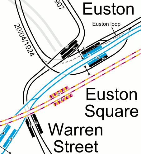
Note.
- The sub-surface lines run underneath the busy Euston Road.
- Platform 2 at Euston Square station has no lift or escalator.
- Platform 1 at Euston Square station has a lift, which also serves the subway.
- To connect between the sub-surface lines at Euston Square and the deep lines at Euston means a walk on the surface.
- Euston station only has two up and two down escalators and no lifts for the six deep-level platforms.
- To connect between the Bank and Charing Cross branches of the Northern Line is often along a very crowded passage.
This interchange has not been fit for purpose since the Victoria Line was built in the 1960s.
A Second Entrance To Euston Square Station
One of the key projects to unlock the interchange, is to create a subway from the current Euston station.
It will lead to a new entrance placed in the middle of Gordon Street.
The subway will have stairs, escalators and/or lifts to connect to the Eastern ends of the current Euston Square platforms.
Ian showed this diagram of the subway.
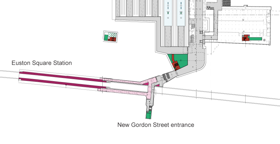
Note.
- It serves both platforms at Euston Square station.
- It looks to be reasonably wide and level.
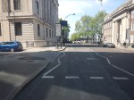
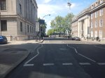
These are some pictures I took on a walk round the area.


This is a possible future visualisation from Ian’s site.
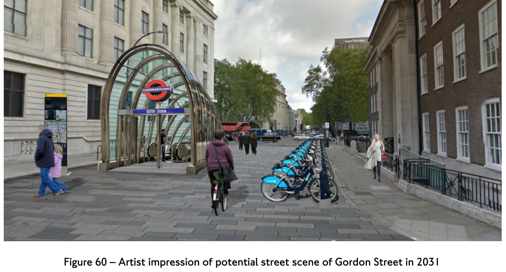
The new Gordon Street entrance appears to be opposite the porticoed building, which is part of University College London.
- The view is looking North, like the first three of my pictures.
- Gordon Street appears to be at least part-pedestrianised.
- Escalators are visible.
It looks to be a London version of Bilbao’s fosteritos.


Fosteritos are named after Norman Foster, as he or his practice designed the Bilbao Metro.
- The escalators in Bilbao are longer than would be needed at Gordon Street.
- I don’t think that fitting in a slimline lift would be difficult.
I like the fosterito concept and I feel a similar approach could be used to add step-free access to a lot of stations on the London Underground.
The Design Of The Updated Euston Underground Station
Ian showed this visualisation of the updated Euston Underground station.
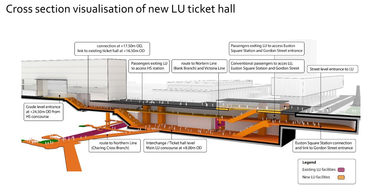
At a first look, it appears to be a very similar concept to the entrance to the Underground in front of St. Pancras station.
Click on the image to show it large and you can pick out the following.
- West is to the left and East is right.
- Much of the construction appears to replace the original car park and taxi rank.
- The upper level looks like where passengers enter and leave the station.
- The subway to Euston Square station and the new Gordon Street entrance joins to the upper level towards the Eastern end.
- There is grade access between the upper level and the High Speed Two concourse.
- There are lots of escalators to travel between levels. The square orange columns could be lift towers.
- The lower level is the Interchange/Ticket Hall level.
- The lower level is not much higher than the Charing Cross branch of the Northern Line.
- The design seems to make clever use of levels to make changing easier.
- The access between the lower level and the Charing Cross branch of the Northern Line at the Western end of the station, appears to be comprehensive and step-free.
- The access between the lower level and the Victoria Line and the Bank branch of the Northern Line, appears to use the current route, which will probably be upgraded to be fully step-free.
This second image shows the design from above the platforms of the convention section of Euston station.
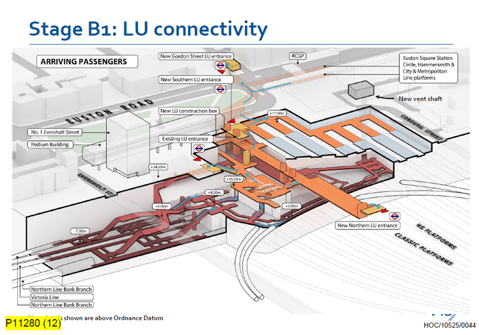
Click on the image to show it large and you can pick out the following.
- The complicated passages, escalators and lifts of the existing four platforms serving the Bank branch of the Northern Line and the Victoria Line.
- The cross passage connecting these lines to the platforms of the Charing Cross branch of the Northern Line.
- The two up and two down escalators leading to the existing ticket hall.
- The Charing Cross branch of the Northern Line curving in and away from the station. See the earlier map of the Underground lines.
- The eleven High Speed platforms on the West side of the station.
- The thirteen Classic platforms on the East side of the station.
- The new Northern entrance to the Underground between the two sets of platforms. How convenient!
- There appears to be a wide passage between the Northern and Southern entrances, with connections to the lines branching off.
- The subway to the new Gordon Street entrance is shown at the top of the image.
The design seems to have separated access to the two branches of the Northern line, by creating a new high-capacity route to the Charing Cross branch.
I also think, that the design allows the station to be built without disrupting passengers using the Underground and the current Euston station.
- A large hole for the station can be excavated, without touching existing access.
- It could then be fitted out section by section.
- Once the new access to the Charing Cross branch of the Northern Line is complete, the current access to the Northern and Victoria Lines can be refurbished.
Arriving At Euston
Imagine you are a passenger arriving from the North, who knows the Underground line, you need to take, you would then enter the Underground station using the new Northern entrance.
- For the Bank branch of the Northern Line or the Victoria Line, you would go through the existing ticket hall and down the escalators, much as you do now! Except that you’d enter the ticket hall on the other side from the East side of the passageway connecting the two entrances. New lifts appear to be shown.
- For the Charing Cross branch of the Northern Line, you would take the passages, lifts and escalators on the West side of the passageway connecting the two entrances.
- If you wanted the sub-surface lines, you would just keep going and take the new subway, which connects to the Eastern ends of the platforms at Euston Square station.
It will certainly do me fine, if I arrive at Euston, as I’ll walk through the subway and get in the front of any Eastbound train for Moorgate station, where being in the front is convenient for the exit and the nearby bus stop to my home.
This route will surely be one of the ways arriving passengers at Euston will get Crossrail to Abbey Wood, Canary Wharf and Shenfield stations. In Crossrail – Northern – Northern City Interchange At Moorgate Station, I show some visualisations of Moorgate station and the connectivity.
Conclusion
I certainly think, that the new Underground station is a good design.
Step-Free Access At Kentish Town Station
On a web page recently, I saw a suggestion about how to add step-free access to Kentish Town station.
The suggestion was that it was too difficult to add it to the Underground station, but why not add it to the Thameslink station?
This Google Map shows the station.
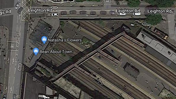
Note the pedestrian bridge across the tracks with steps going down to the platforms.
Adding a lift to each platform would give full step-free access to Thameslink and would give an alternative step-free route to these step-free stations in Central and South London.
- Kings Cross St. Pancras
- Farringdon
- Blackfriars for the South Bank
- London Bridge
- Elephant & Castle
- Denmark Hill
- Herne Hill
- Mitcham Eastfield
- Wimbledon
- Sutton
The step-free access would be much easier to install, than on the Northern Line platforms.
