National Express Owner Plans To Launch Eurostar Rival
The title of this post, is the same as that of this article on the Financial Times.
I have documented a few attempts to start a competitor to Eurostar.
- Express London-Amsterdam Eurostar Service Being Explored
- Getlink Pushes Budget Train Service Between London And Paris To Rival Eurostar
- RENFE Aims To Compete With Eurostar On Paris – London Route
- Transmanche Metro
- The Wikipedia entry for Eurostar details German and Italian attempts to start a service.
Note.
- None of the proposals seem to have got past being announced.
- The only useful fact given in the article, is that the service will be called Evolyn.
Searches of the Internet reveal virtually no more facts, rehashes of the FT article and a lot of waffle.
These are my thoughts.
Would Eurostar Give Up And Slots At St. Pancras International?
I use slots deliberately, as British Airways don’t seem keen to ever give up slots at Heathrow or Gatwick.
And I suspect Eurostar would be the same!
St. Pancras International Doesn’t Have Enough Space
This article on Kent & Surrey Bylines, which is entitled Why Are There Such Queues At St Pancras For Eurostar?, is typical of many you can find on the Internet.
This is the sub-heading.
Eurostar no longer stops at Ebbsfleet or Ashford International, and the queues at St Pancras are becoming intolerable
This is the first paragraph.
Passengers are complaining. The queues at St Pancras are now intolerable. The lines stretch back into the main hall. It is like an airport with the slow shuffle towards the security kiosks. Then, once you are through that, you go to the departure lounge. However, there is not enough seating for the waiting passengers (see picture above taken this month). Because you have to check in 90 minutes before the train starts, one can be stuck standing in this waiting room for an hour. Unless, that is, one is white-haired and venerable, in which case one is usually offered a seat by someone younger and fitter.
It was written on the 9th of last month. But the problems have been bad for some years, as St. Pancras station is too small.
Could Ashford International Station Be Used As A Terminal?
The station has platforms on High Speed One, but the Financial Times says the service will be run between London and Paris.
I doubt even Ryanair would stretch it to say that Ashford was in London.
Could Ebbsfleet International Station Be Used As A Terminal?
It might be possible to say that Ebbsfleet was in London, but then it is not well-connected to Central London.
Does That leave Just Stratford International?
In Platforms 1 And 4 At Stratford International Station, I came to this conclusion.
I have come to these conclusions about Platforms 1 And 4 at Stratford International station.
- The platforms are designed to take the longest Eurostar trains.
- The access to Platforms 1 And 4, doesn’t appear to be designed for continuous heavy use.
- The diamond crossover at the Eastern end of the station would allow Stratford International station to be used as an emergency terminus.
The track layout at the London end of High Speed One appears to have been designed for all eventualities.
But I suspect that Stratford International station will need a lot of money spent to provide Customs and Immigration facilities.
Could Victoria Station Be Used As A Terminal?
National Express is primarily a coach company, so could they be planning a service to connect the long distance coach networks of London and Paris?
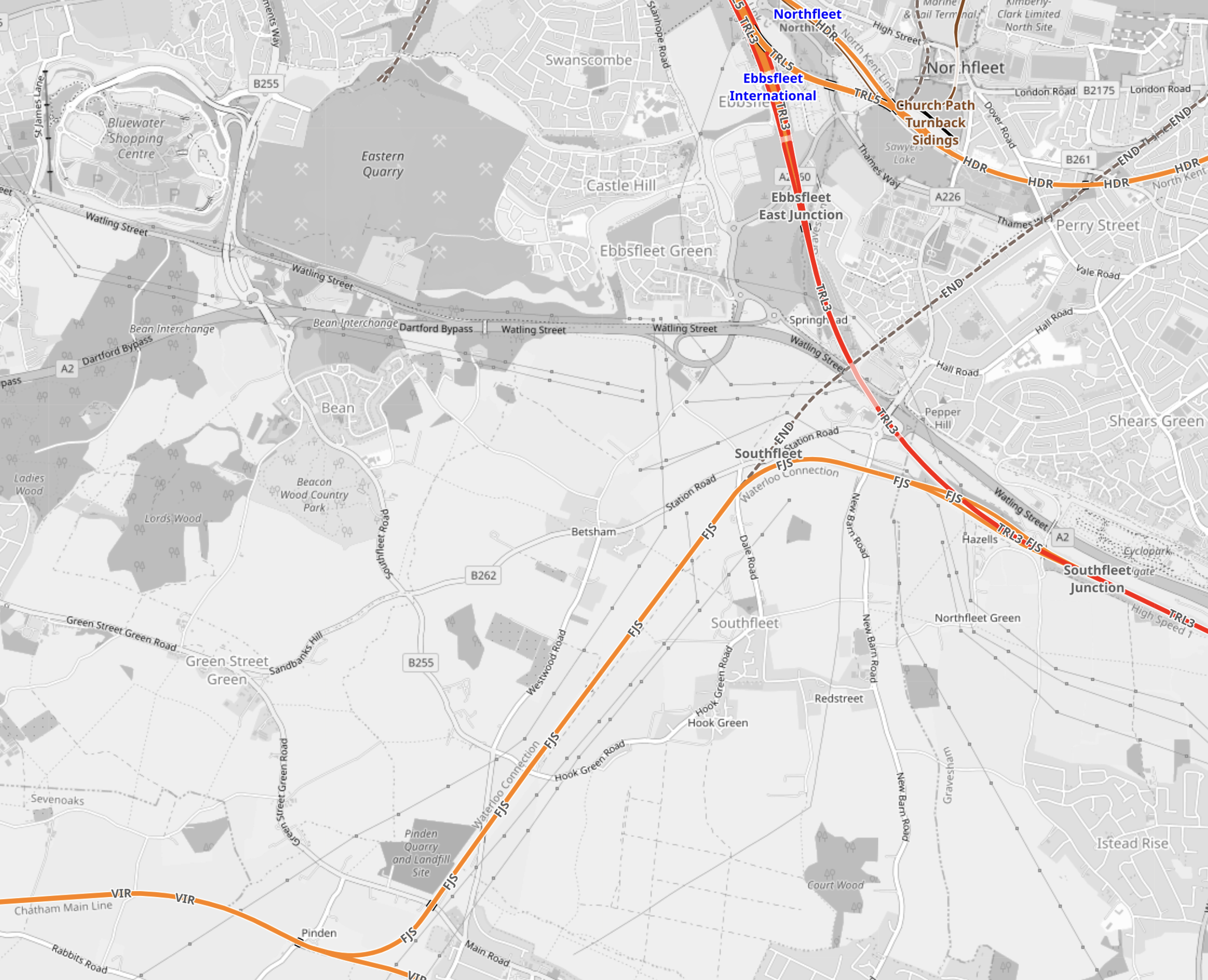
This OpenRailwayMap shows the link between High Speed One and the Chatham Main Line.
Note.
- Ebbsfleet International and Northfleet stations are at the top of the map.
- High Speed One is the red line going through Ebbsfleet International station.
- The orange line going across the South-West corner of the map is the Chatham Main Line between Victoria station and Chatham.
- The Chatham Main Line is connected to High Speed One, by the Waterloo Connection or the Fawkham Junction Link.
This route was the original route for Eurostar to Waterloo.
But it could just as easily go into Victoria.
- Southeastern’s Victoria and Dover service takes this route.
- The distance between Victoria and Fawkham junction is 22.6 miles.
- Trains take 28 minutes with a stop at Bromley.
- I wrote some more about the Fawkham Junction Link in Kent On The Cusp Of Change – Fawkham Junction Link.
- I also wrote some more about Victoria as a High Speed terminal in Kent On The Cusp Of Change – Victoria As A Highspeed Terminal.
Note that the two Kent On The Cusp Of Change posts were based on an article in the July 2017 Edition of Modern Railways.
I am convinced that Victoria could be used as a terminal for Continental trains.
Where Would The Service Terminate In France?
Everything I said about congestion also applies to Gare Du Nord, so would it be better to use Marne-la-Vallée–Chessy station that serves Disneyland Paris and Charles de Gaulle Airport, which used to be used by Eurostar.
There are certainly possibilities to do something different.
What Trains Would Be Needed?
The FT article says that the consortium have talked to Alstom, who build the Class 373 trains.
The trains would probably need a specification like this.
- Maximum speed of at least 200 mph, like Eurostar’s Class 374 trains.
- Ability to run on tracks with a UK loading gauge.
- Ability to use both 750 VDC third rail and 25 KVAC overhead electrification.
- Less than 240 metres long, which are the platform lengths at Victoria.
Would a High Speed Two Classic-Compatible Train be suitable?
- The trains will have a maximum speed of 224 mph.
- It has been designed for a UK loading gauge.
- The two partners in these trains; Alstom and Hitachi, have both built high speed trains capable of running at slower speeds using third rail electrification.
- The standard length of the trains are 200 metres.
I suspect they would do nicely.
Conclusion
I suspect that the National Express service could use High Speed Two Classic-Compatible Trains between Victoria and Marne-la-Vallée–Chessy stations.
- The trains would be standard with the ability to use third rail electrification
- They would use a single International platform at Victoria and Marne-la-Vallée–Chessy.
- Victoria station is well-connected to the Underground.
- Marne-la-Vallée–Chessy station is connected to Charles de Gaulle airport and Disneyland Paris.
I feel that there is a feasible service that can be designed.
Thanet Parkway Station – 31st July 2023
Thanet Parkway station opened yesterday, so I went to have a look.
I took these pictures.


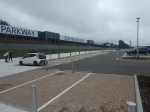


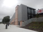


Note.
- I arrived in a twelve-car Class 395 train and the platforms handled it with ease.
- Both platforms are served by steep stairs and a lift.
- There seems to be 293 car parking spaces and 16 accessible spaces according to the National Rail information page.
- The only worthwhile architectural feature is the use of the existing tunnel to cross under the tracks.
But this station seems to be defined more by what it doesn’t have.
- No cafe or pub within walking distance.
- No convenience store to pick up a few supplies on the way home.
- No chargers for electric vehicles.
- No toilets.
- No staff.
It is a rather underwhelming station.
I have some further thoughts.
Last Train Home
In the early years of this century, C and myself would often spend a day in London, shopping, watching a show and probably having a meal.
- We generally used to drive up from Suffolk and would park near King’s Cross.
- Although, sometimes we would take the train from Whittlesford Parkway station to the South of Cambridge.
So out of curiosity, I looked at the last train to Thanet Parkway yesterday.
It had these times.
- St. Pancras International – 22:37
- Stratford International – 22:44
- Thanet Parkway – 23:50
- Ramsgate – 23:57
- Broadstairs – 00:02
- Margate – 00:07
It could enable long days out or late working in London.
Not Enough Trains
I believe that one train per hour (tph) is not a frequent enough service to London for this station.
Other nearby stations have the following HighSpeed services to St. Pancras International.
- Ramsgate – 3 tph
- Broadstairs – 2 tph
- Margate – 2 tph
In addition, these three stations get a 1 tph stopping service to Victoria.
Perhaps there could be a Thanet Loop service from St. Pancras International.
- It would run via Stratford International, Ebbsfleet International, Gravesend, Strood, Rochester, Chatham, Gillingham, Rainham, Sittingbourne, Faversham, Whitstable, Herne Bay, Birchington-on-Sea, Margate, Broadstairs. Ramsgate, Thanet Parkway, Canterbury West, Ashford International, Ebbsfleet International and Stratford International.
- It would also run both ways at a frequency of 1 tph.
- I estimate that a train to go round the loop would take three hours and thirteen minutes.
This would probably mean fourteen trains would be needed to run the service.
I don’t think they probably have enough.
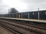
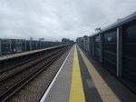
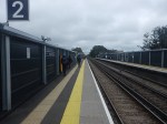
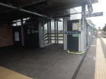
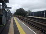
Platforms 1 And 4 At Stratford International Station
This map from OpenRailwayMap shows the tracks through Stratford International station.
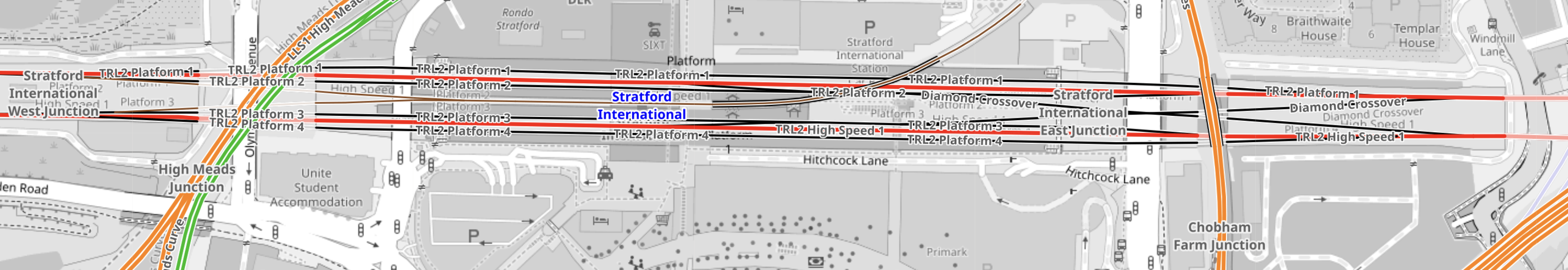
The tracks starting from the North side of the station are as follows.
- Platform 1 – Not used by normal services – Shown in black
- Fast Line for Eastbound through trains – Shown in red
- Platform 2 – Used by Eastbound stopping services – Shown in black
- Platform 3 – Used by Westbound stopping services – Shown in black
- Fast Line for Westbound through trains – Shown in red
- Platform 4 – Not used by normal services – Shown in black
Note.
- There are three Eastbound tracks, that connect together into a single track from St. Pancras and a single track to Ebbsfleet International station.
- An Eastbound train can use any of the three Northernmost tracks to pass though Stratford International station.
- There are three Westbound tracks, that connect together into a single track to St. Pancras and a single track from Ebbsfleet International station.
- A Westbound train can use any of the three Southernmost tracks to pass though Stratford International station.
- As Eurostar trains aren’t scheduled to stop at Stratford International station, they would normally take the fast lines through the station.
- Southeastern HighSpeed services usually stop in Platforms 2 or 3, as they pass through the station.
- There is a diamond crossover at the eastern end of the station.
It would appear that under normal circumstances Platforms 1 and 4 are not used.
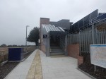
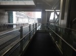
These pictures show Platforms 1 and 4 at Stratford International station.
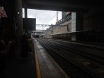


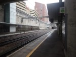
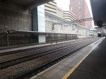


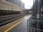
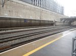

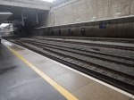

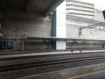
Note.
- Both Platforms 1 and 4 appear to have stairs, an escalator and a lift.
- I left from Platform 2, in a pair of Class 395 trains, which would have been 244 metres long.
- From the OpenRailwayMap, Platforms 1 and 4, appear to be longer than Platforms 2 and 3.
As Eurostar’s Class 374 trains are 390 metres long, it looks like Platforms 1 and 4 are designed to be able to handle these trains.
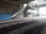
The Diamond Crossover At Stratford International Station
The diamond crossover at the Eastern end of the station could be used for unusual or occasional train movements.
- It could allow services to use St. Pancras station, when there was an inconvenient points failure.
- It might also allow a train to terminate before returning to the East in either Platform 1 or 4.
It could even allow Stratford International station to be used as a terminus during emergencies or engineering works.
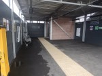
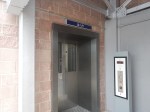
An Escalator Problem At Stratford International Station
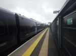
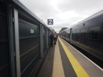
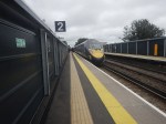
There was an escalator problem At Stratford International station today, which meant I had to walk down to the platform.
I took these pictures.


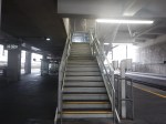
After walking down, I am fairly sure, that these stairs, which appear to be identical to those on Platforms 1 and 4, are for occasional use only.
Conclusion
I have come to these conclusions about Platforms 1 And 4 at Stratford International station.
- The platforms are designed to take the longest Eurostar trains.
- The access to Platforms 1 And 4, doesn’t appear to be designed for continuous heavy use.
- The diamond crossover at the Eastern end of the station would allow Stratford International station to be used as an emergency terminus.
The track layout at the London end of High Speed One appears to have been designed for all eventualities.
Not Getting Wet At Paddington Station
On my trip to High Street Kensington station today, I changed trains at Paddington both ways between the Elizabeth and Central Lines.
Going, I took the route I did in The Lizzie Line And Circle/District Line Interchange At Paddington – 1st July 2022.
Coming back, I walked through the station in the dry, despite it chucking it down outside.
At least outside the Elizabeth Line was under a roof and dry.


Despite the rain, the clouds on the glass roof are visible.
The Power Behind Rolls-Royce
My post entitled ‘Spirit of Innovation’ Stakes Claim To Be The World’s Fastest All-Electric Vehicle, was based on this press release from Rolls-Royce, which has the same title.
In the post I talk about Rolls-Royce’s experimental electric aircraft; Sprit of Innovation.
- The aircraft set a world record for electric-aircraft of 345.4 mph.
- the aircraft clocked up a maximum speed of 387.4 mph.
- The aircraft was propelled on its record breaking runs by a 400kW electric powertrain.
- Rolls-Royce worked in partnership with aviation energy storage specialist; Electroflight and automotive powertrain supplier; YASA.
For comparison, my Cessna 340A had two 230 kW engines and a maximum speed of 281 mph.
Electroflight, Evolito And YASA
YASA has this description of the company on their home page.
YASA is at the forefront of eMotor innovation and development. Our axial flux technology motors are up to 4x more powerful than those used in nearly all Electric Vehicles on the road today, whilst being around 50% smaller & lighter.
We already feature in some of the best eMotor applications across multiple sectors, and now as part of Mercedes-Benz, with sites in Oxfordshire and Welshpool, we are accelerating development of axial flux eMotors and Control Systems for of the next generation of Electric Vehicles.
Evolito has this description of the company on their About page.
Evolito was spun out in 2021 by YASA, the world-leading pioneer of automotive axial-flux electric motors acquired by Mercedes-Benz in July 2021, to exclusively commercialise YASA’s next-generation electric motor technology and IP for the rapidly-growing aerospace market. Evolito is funded by a portfolio of private investors including B-FLEXION and Oxford Science Enterprises (OSE).
Electroflight has this company story on their About page.
Founded in 2011 to address battery-electric issues in the aerospace market, we are a UK-based innovation engineering company, taking expertise from across the automotive and aerospace sectors, working with leading airframers to develop and supply next-generation battery technology.
In 2019, Electroflight, Rolls-Royce and YASA partnered to design and build the worlds fastest all-electric vehicle – The Spirit of Innovation. 3 years of dedication from the team involved integrating the full powertrain into a NXT aircraft, optimising the system to peak performance and following rigorous testing processes in an emerging market with new regulations; in 2021 the record breaking flight reached a staggering 345.5 mph!
Following the successful spinout of Evolito (YASA’s Aerospace Division) in 2021, Evolito acquired Electroflight in July 2022 to offer a fully optimised powertrain solution for the electric aerospace industry.
It appears that Mercedes-Benz now own YASA’s technology for the the automotive industry and Evolito have the aerospace technology.
Evolito’s Technology
The Evolito web site has a Technology page, which is entitled The World’s Most Advanced Electric Propulsion Solution.
- Their Axial Flux Motors are certainly a revolutionary approach.
- It looks like one of their motors has a peak power of 280 kW, a continuous power of 100 kW and weighs just 35 Kg.
There is also this page, which gives more details about the creation of the Spirit of Innovation, which has this video.
Evolito And Project Fresson
This press release from Cranfield Aerospace Solutions is entitled Cranfield Aerospace Welcomes Ground-Breaking UK Technology Innovator Onboard Project Fresson.
These paragraphs explain the link-up.
Cranfield Aerospace Solutions (CAeS) welcomes Evolito, a ground-breaking UK technology innovator onboard as the motor & inverter supplier for its hydrogen-powered aircraft demonstrator – Project Fresson.
Evolito join Reaction Engines and Ricardo as technology collaborators on Project Fresson, showcasing the UK innovation that is redefining the aviation industry.
Based in Oxfordshire, Evolito is the aerospace spin out of YASA – the world-leading pioneer of automotive axial-flux electric motors.
Producing the world’s most advanced electric propulsion system, Evolito’s motors are smaller, lighter, and typically 4 times more power dense than radial flux solutions, making them ideally suited to the emerging zero-emissions aviation markets.
Evolito’s axial-flux technology requires up to 75% less iron, less copper and fewer permanent magnets than competing radial solutions, making it lighter and more environmentally friendly.
Note.
- Project Fresson is a project to develop an electric propulsion system for Britten-Norman Islanders.
- There are 700 Islander aircraft in service.
A hydrogen propulsion system, would be useful for new aircraft and conversions.
Electrification Between Newbury And East Somerset Junction
In the August 2023 Edition of Modern Railways, there is an article, which is entitled GWR Seeks Opportunities To Grow.
This is the sub-heading.
Managing Director Mark Hopwood tells Philip Sherratt there is plenty of potential to increase rail’s economic contribution.
This is two paragraphs.
The desire to provide electrification to support aggregates traffic from the Mendip quarries could also benefit GWR , says Mr. Hopwood. ‘Having an electric loco would massively help with pathing heavy freight trains through the Thames Valley. If you could electrify from Newbury to East Somerset Junction, a big chunk of the Berks and Hants route would be wired.
Then you can ask how much further you could get on battery power on an IET without running out of juice.’
I have some thoughts.
Where Is East Somerset Junction?
This OpenRailwayMap shows East Somerset junction.
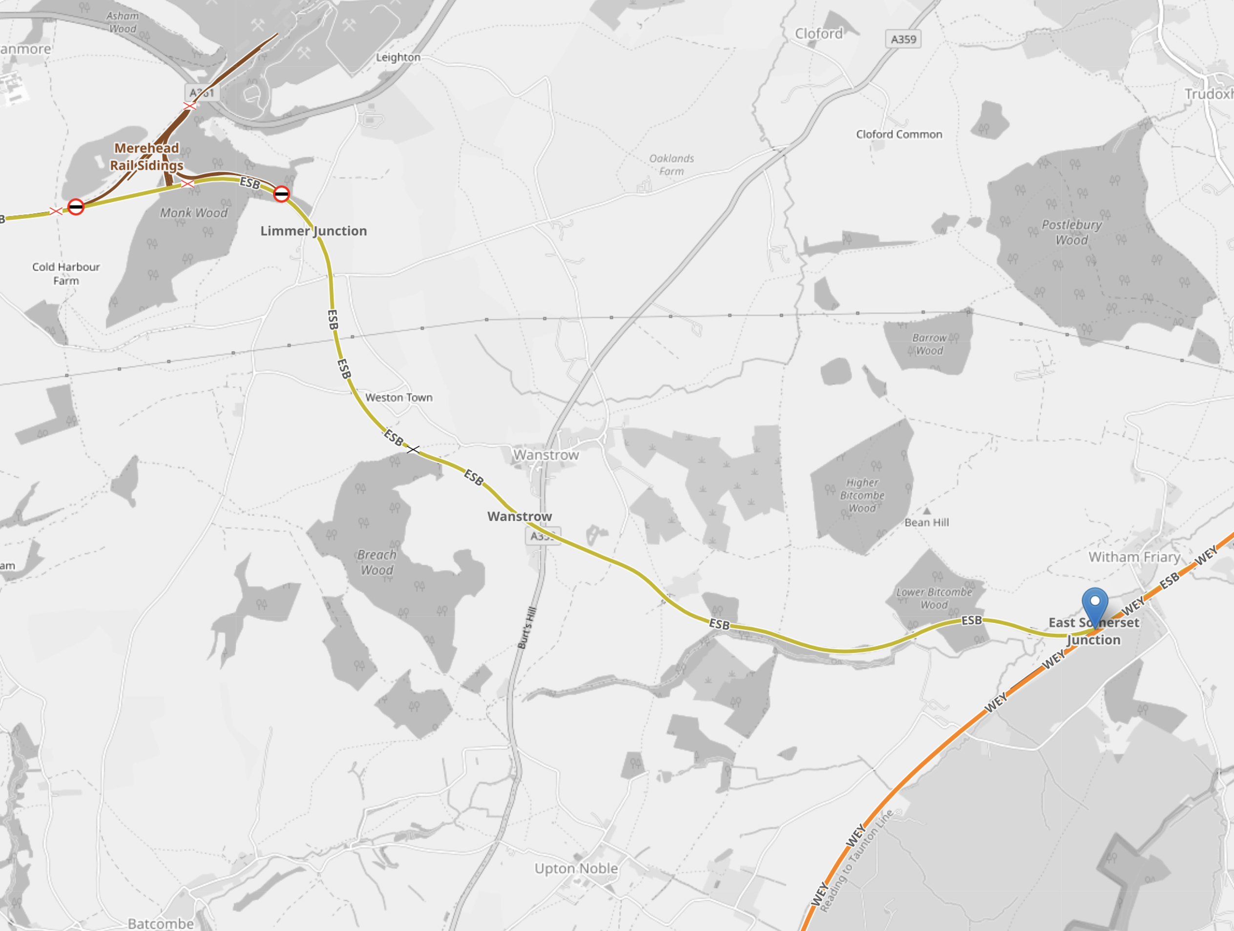
Note.
- The East Somerset junction is marked with the blue arrow.
- East Somerset junction is 5.2 miles North of Bruton station and 5.4 miles South of Frome station on the Reading and Taunton Line.
As the map shows there is a branch to Merehead Rail Sidings, which is shown in yellow.
This Google Map shows Merehead Rail Sidings.
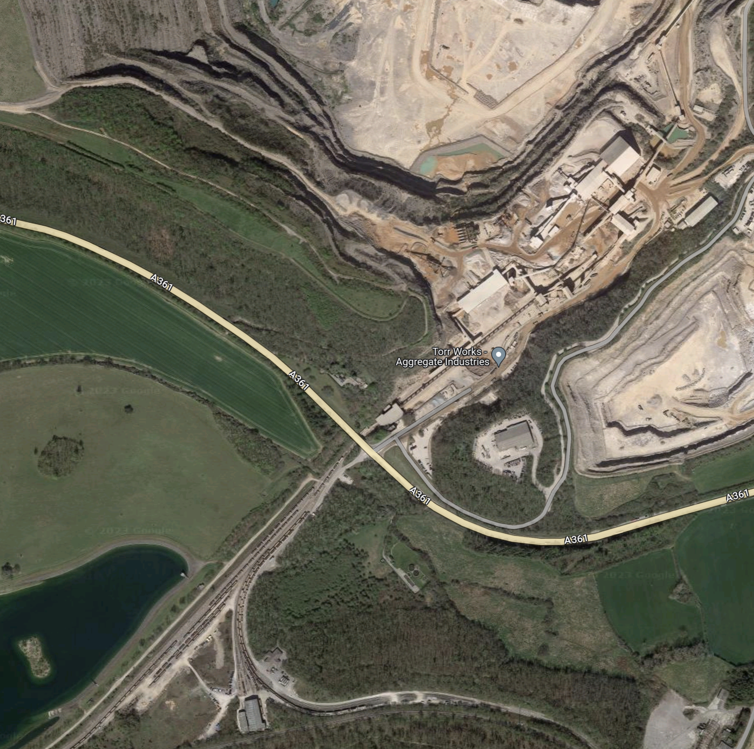
Note.
- It looks like there is a massive quarry to the North of the A361 road, which curves across the map.
- It is labelled Torr Works – Aggregate Industries.
- Torr Works has a Wikipedia entry.
- The rail sidings are South of the A361.
- Zooming in on the map, shows that the railway between East Somerset junction and Merehead is single-track and only a few miles long.
Distances from East Somerset junction are as follows.
- Dorchester junction – 41.2 miles
- Newbury – 53.4 miles
- Taunton – 37.2 miles
- Weymouth – 47.8 miles
Note that it is electrified with 750 VDC third-rail between Weymouth and Dorchester junction.
Range of Battery-Electric Trains
Consider.
- A Bombardier engineer told me eight years ago, that the battery-electric Class 379 train had a range of sixty miles.
- Stadler’s FLIRT Akku has a Guinness world record of 139 miles on one battery charge. See this page on the Stadler web site.
- Even Stadler’s Class 777 trains for Merseyrail have a range of 84 miles on battery power. See New Merseyrail Train Runs 135 km On Battery.
It does appear that five-car battery-electric trains will have ranges in excess of a hundred miles.
I believe that because Hitachi’s battery makers have a good record, they will probably be very ambitious and will want that Guinness record, that Hitachi’s Class 802 trains will have a battery range not far short of the 139 miles of the Stadler FLIRT Akku.
I will be very surprised if Hitachi’s battery-electric version of a Class 802 train, doesn’t have range of at least 125 miles.
But say if they could do say 140 miles, the battery-electric Class 802 train could cover every long-distance route in the UK, which would attract orders for trains to run on the following routes.
- Cardiff and Swansea
- Crewe and Holyhead
- Edinburgh and Aberdeen
- Edinburgh and Inverness
- Crewe and Holyhead
- London Waterloo and Exeter St. Davids
A substantial reward to the battery makers, would probably not be out of order.
Aggregate Trains From The Mendips
Consider.
- Mining and quarrying companies are under pressure from governments, shareholders and environmentalists to reduce their carbon footprints.
- Many are replacing diesel-powered mining excavators and trucks, with electric or hydrogen versions.
- In addition, those companies delivering building products to the construction industry are under pressure to provide low-carbon products.
- Using rail with electric traction to deliver products to market would cut carbon emissions and might even help sales.
These Mendip quarries appear to be connected to the Reading and Taunton Line.
- Torr Works – Connects 5.4 miles to the South of Frome.
- Whatley Quarry – Connects close to Frome.
There may be others.
But these rail-connected quarries, connect at or North of East Somerset junction, to where Mark Hopwood is proposing electrification.
Zero-carbon rail traction could even be possible, by electrifying the short single-track branch lines. or by using hydrogen-electric hybrid locomotives.
GWR’s London And South-West Services
These services use the Reading and Taunton Line to join the Bristol and Exeter Line at Taunton, before going on to Exeter, Plymouth and other destinations in the South-West of England.
These are distances from East Somerset Junction.
- Exeter – 67 miles
- Paignton 95.2 miles
- Penzance – 198.5 miles
- Plymouth – 119.0 miles
- Taunton – 37.2 miles
Note.
- Exeter, Paignton, Penzance and Plymouth stations would need short lengths of electrification to charge terminating trains or top-up passing trains.
- In Thoughts About Electrification Through Devon And Cornwall, I showed that the average stop time at Plymouth station was eight minutes, which could be enough for the rail equivalent of a Formula One splash and dash.
- A 125 mile battery range, not only enables London and Penzance, but also Cardiff and Swansea, and Edinburgh and Aberdeen, when the extra electrification is completed.
Could my estimate of a 125 mile battery range, be Hitachi’s objective for their battery-electric trains?
The Ultimate Battery-Electric Class 802 Train
Hitachi have been totally silent on how the fitting of batteries to Class 802 trains is going.
But Mark Hopwood is more forthcoming in the GWR Seeks Opportunities To Grow article. where this is said.
Meanwhile, GWR had announced plans with Eversholt Rail to trial the replacement of a diesel generator unit with batteries on a Class 802 IET. However, Mr. Hopwood says this would not be useful for GWR and so the trial is not proceeding; instead, a TransPennine Express Class 802 will be the subject of a battery trial.
It sounds to me that another solution is being developed to get trains to run on electric power between London and the South-West.
- I think we can rule out full electrification on the grounds of cost, disruption, time and the Nimbys and objectors will have a field day.
- Newbury and Penzance is a distance of 251.9 miles, which would surely need a lot of batteries.
Mark Hopwood’s idea to electrify the 53.4 miles between Newbury And East Somerset junction, is starting to look like a good compromise.
GWR’s Bristol/Gloucester And Weymouth Services
These stopping trains are run by diesel trains and take the following route between Bristol Temple Meads and Weymouth stations.
- Keynsham
- Oldfield Park
- Bath Spa
- Freshford
- Avoncliff
- Bradford-on-Avon
- Trowbridge
- Westbury
- Frome
- East Somerset junction
- Bruton
- Castle Cary
- Yeovil Pen Mill
- Thornford
- Yetminster
- Chetnole
- Maiden Newton
- Dorchester West
- Dorchester junction
- Upwey
Note.
- I would assume that there is enough electrification at Bristol Temple Meads and towards Gloucester to charge the trains.
- Trains would leave Bristol Temple Meads with a full battery.
- The eighteen stops mean that an electric train with regenerative braking will be more efficient.
- Bristol Temple Meads and Westbury is not electrified.
- Westbury and East Somerset junction will be electrified with 25 KVAC overhead electrification under Mark Hopwood’s proposal.
- Trains take sixteen minutes between Westbury and East Somerset junction.
- East Somerset junction and Dorchester junction is not electrified.
- Dorchester junction and Weymouth is electrified with 750 VDC third-rail electrification.
- Trains take ten minutes between Dorchester junction and Weymouth.
Distances of the various legs are as follows.
- Bristol Temple Meads and Westbury – 28.3 miles – Not Electrified
- Westbury and East Somerset junction – 11.4 miles – Electrified
- East Somerset junction and Dorchester junction – 41.4 miles – Not Electrified
- Dorchester junction and Weymouth – 6.6 miles – Electrified
The two sections without electrification, should be well within range of a dual-voltage battery-electric train, that has been designed for the route.
GWR’s Cardiff Central And Portsmouth Harbour Service
These stopping trains are run by diesel trains and take the following route between Bristol Temple Meads and Portsmouth Harbour stations.
- Keynsham
- Oldfield Park
- Bath Spa
- Freshford
- Avoncliff
- Bradford-on-Avon
- Trowbridge
- Westbury
- Warminster
- Salisbury
- Romsey
- Redbridge
- Southampton Central
- Fareham
- Cosham
- Fratton
- Portsmouth & Southsea
Note.
- I would assume that there is enough electrification at Bristol Temple Meads and towards Cardiff Central to charge the trains.
- Trains would leave Bristol Temple Meads with a full battery.
- The seventeen stops mean that an electric train with regenerative braking will be more efficient.
- Bristol Temple Meads and Westbury is not electrified.
- Westbury station will be electrified with 25 KVAC overhead electrification under Mark Hopwood’s proposal.
- Trains would leave Westbury with a full battery.
- Westbury and Redbridge is not electrified.
- Redbridge and Portsmouth Harbour is electrified with 750 VDC third-rail electrification.
Distances of the various legs are as follows.
- Bristol Temple Meads and Westbury – 28.3 miles – Not Electrified
- Westbury and Redbridge – 46.4 miles – Not Electrified
- Redbridge and Portsmouth Harbour – 28.5 miles – Electrified
The two sections without electrification, should be well within range of a dual-voltage battery-electric train, that has been designed for the route.
GWR’s Bristol Temple Meads And Salisbury Services
These stopping trains are run by diesel trains and take the following route between Bristol Temple Meads And Salisbury stations.
- Keynsham
- Oldfield Park
- Bath Spa
- Freshford
- Avoncliff
- Bradford-on-Avon
- Trowbridge
- Dilton Marsh
- Warminster
Note.
- I would assume that there is enough electrification at Bristol Temple Meads to charge the trains.
- Trains would leave Bristol Temple Meads with a full battery.
- An electric train with regenerative braking will be more efficient.
- Bristol Temple Meads and Westbury is not electrified.
- Westbury station will be electrified with 25 KVAC overhead electrification under Mark Hopwood’s proposal.
- Trains would leave Westbury with a full battery.
- Westbury and Salisbury is not electrified.
Distances of the various legs are as follows.
- Bristol Temple Meads and Westbury – 28.3 miles – Not Electrified
- Westbury and Salisbury – 24.4 miles – Not Electrified
The two sections without electrification, should be well within range of a battery-electric train, that has been designed for the route.
GWR’s Swindon And Westbury Services
These stopping trains are run by diesel trains and take the following route between Swindon and Westbury stations.
- Chippenham
- Melksham
- Trowbridge
Note.
- This is the Transwilts service.
- I would assume that there is enough electrification at Swindon to charge the trains.
- Trains would leave Swindon with a full battery.
- An electric train with regenerative braking will be more efficient.
- Chippenham and Westbury is not electrified.
- Westbury station will be electrified with 25 KVAC overhead electrification under Mark Hopwood’s proposal.
- Trains would leave Westbury with a full battery.
Distances of the various legs are as follows.
- Swindon and Chippenham – 16.9 miles – Electrified
- Chippenham and Westbury – 15.8 miles – Not Electrified
The section without electrification, should be well within range of a battery-electric train, that has been designed for the route.
What Can Be Done If The Electrification Is Not Long Enough?
Some of these routes battery-electric routes may need more electrification to work efficiently.
Despite some routes having both 25 KVAC overhead and 750 VDC third-rail electrification, any extension of the electrification would be overhead, as new third-rail electrification is effectively banned.
Conclusion
It looks like Mark Hopgood proposal is an excellent idea to enable the decarbonisation of GWR services in Wiltshire and Somerset.
- Express services would be run by battery-electric Class 802 trains.
- Local services would be run by battery-electric trains with perhaps three cars.
Some of the local trains would need to be dual-voltage to use both forms of electrification.
Northumberland Line: Construction Of New Stations To Begin
The title of this post, is the same as that of this article on the BBC.
This is the sub-heading.
The construction of three stations for a new Northumberland rail line is set to begin.beec
These are the first three paragraphs.
Northumberland County Council said contracts had been exchanged for work to start on Bedlington, Blyth Bebside and Seaton Delaval Stations.
The project is described as a “key milestone” to restore passenger services lost in the 1960s.
It is planned to run a half-hourly passenger service along the 18-mile (29km) lines.
It certainly seems that the reopening of this line is progressing.
Ozzy Puts The Bull Into New Street Station
I went to Birmingham New Street station today to see Ozzy, the Birmingham Bull in his new home.


I don’t think we’ve seen such a camera frenzy in the UK, since the days of Princess Diana.
In The Birmingham Bull – 5th August 2022, there are pictures of the Bull a year ago. Ozzy has changed, but a year ago, he wasn’t intended to be permanent.
This picture is from last year.
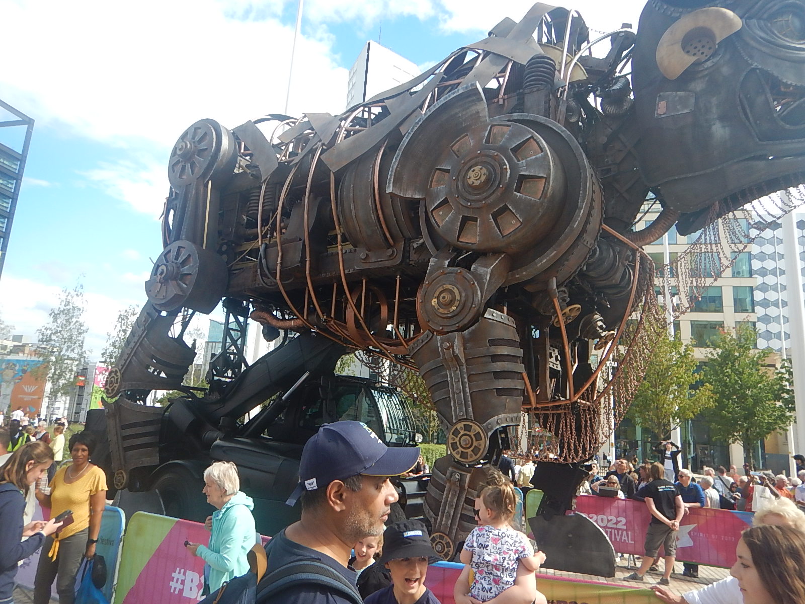
There are differences. Note the loader underneath to give the artwork movement.
A year ago, I said this in the post.
This wonderful work of engineering art, is far too good and is now too well-loved to be scrapped.
As it needs to go inside, why not bring it inside High Speed Two’s new Curzon Street station, to greet passengers visiting Birmingham?
Ozzy has found a new permanent home in Birmingham New Street station, but I wouldn’t rule out a move to Curzon Street station, for several decades.
West Midlands Metro – Eastside Extension – 26th July 2023
These pictures show the current state of the Eastside Extension of the West Midlands Metro.


Note.
There is a triangular junction, where the lines split to the South of the Bull Street tram stop.
The Eastside Extension will run past Curzon Street station and then on to somewhere around Digbeth Coach station.
There is a triangular junction, where the lines split to the South of the Bull Street tram stop.
Through Birmingham City Centre On A Tram – 26th July 2023
When I get to a new city, I like to take a tram across the City Centre taking pictures.
I realised, that I’d never done this in Birmingham before, so I did it today on the West Midlands Metro.


Note.
It will be better, when the gaps are filled in.
- I got on at Brindleyplace.
- I got off at Grand Central.
This was my all-day Zone 1 ticket, that I used to go up and down all day.

For just £2.80 all day, you can go between Edgbaston Village and Jewellery Quarter, as much as you need.
