Hydrogen ‘The Only Option’ For Metrobus Fastway ZE
The title of this post, is the same as that of this article on Route One.
This is the introductory paragraph.
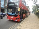
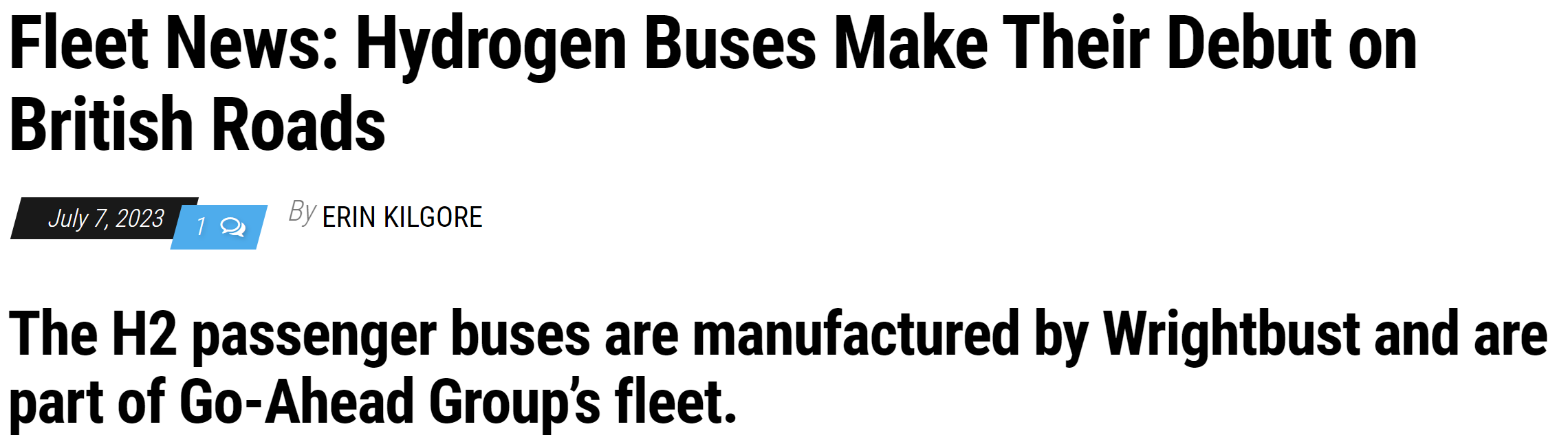
Hydrogen fuel cell-electric remains the most realistic zero-emission technology for usage cases requiring very high mileage and utilisation capabilities. That is the verdict from the Go-Ahead Group after its Metrobus subsidiary launched 20 Wrightbus GB Kite Hydroliner single-deckers on 29 June.
This paragraph gives more details.
Go-Ahead Group Chair Claire Hollingsworth, who was present at the launch alongside Under-Secretary of State for Transport Richard Holden and other stakeholders and dignitaries, underlines the need for hydrogen on Fastway. “These are the most intensive routes in the Go-Ahead network,” she explains. “We need 300 miles of range and have little time to plug in.”
Let’s face it, a bus that takes a lot of time to fuel-up can’t be as efficient, as one that takes just a few minutes. Especially, if the buses are running a large number of hours per day.
The whole article is a must read and surely Go-Ahead’s conclusion to other modes of transport, that do long distances, like heavy trucks, long-distance coaches and railway locomotives.
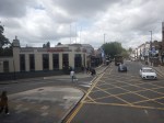
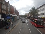
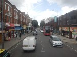
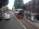
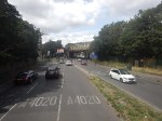
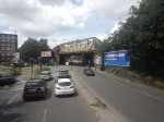
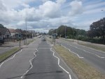
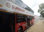
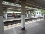
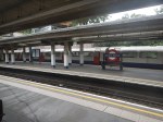
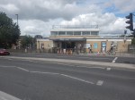
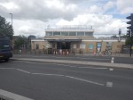
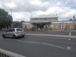
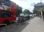
Riding The SL8 Bus Between Shepherd’s Bush Market And Uxbridge Stations – 16th July 2023
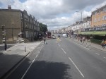
This draft map from TfL illustrates the concept of the Superloop.
The spoke on the Western side of the map is route SL8 between White City and Uxbridge stations.
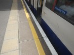
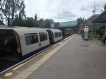
This morning I rode the route between Shepherd’s Bush Market and Uxbridge stations and took these pictures.


Note.
- Some of the buses have still to be painted in the new white-topped Superloop livery.
- The buses are diesel-powered.
- The stops have their own livery.
- I estimate the route is 12.3 miles long and the bus took 67 minutes.
- The frequency appeared to be typically four buses per hour.
- The route is mainly dual-carriageway to the West of Ealing Hospital.
Route SL8 used to be route 607 and except for the branding nothing has changed.
I have few thoughts.
The Concept
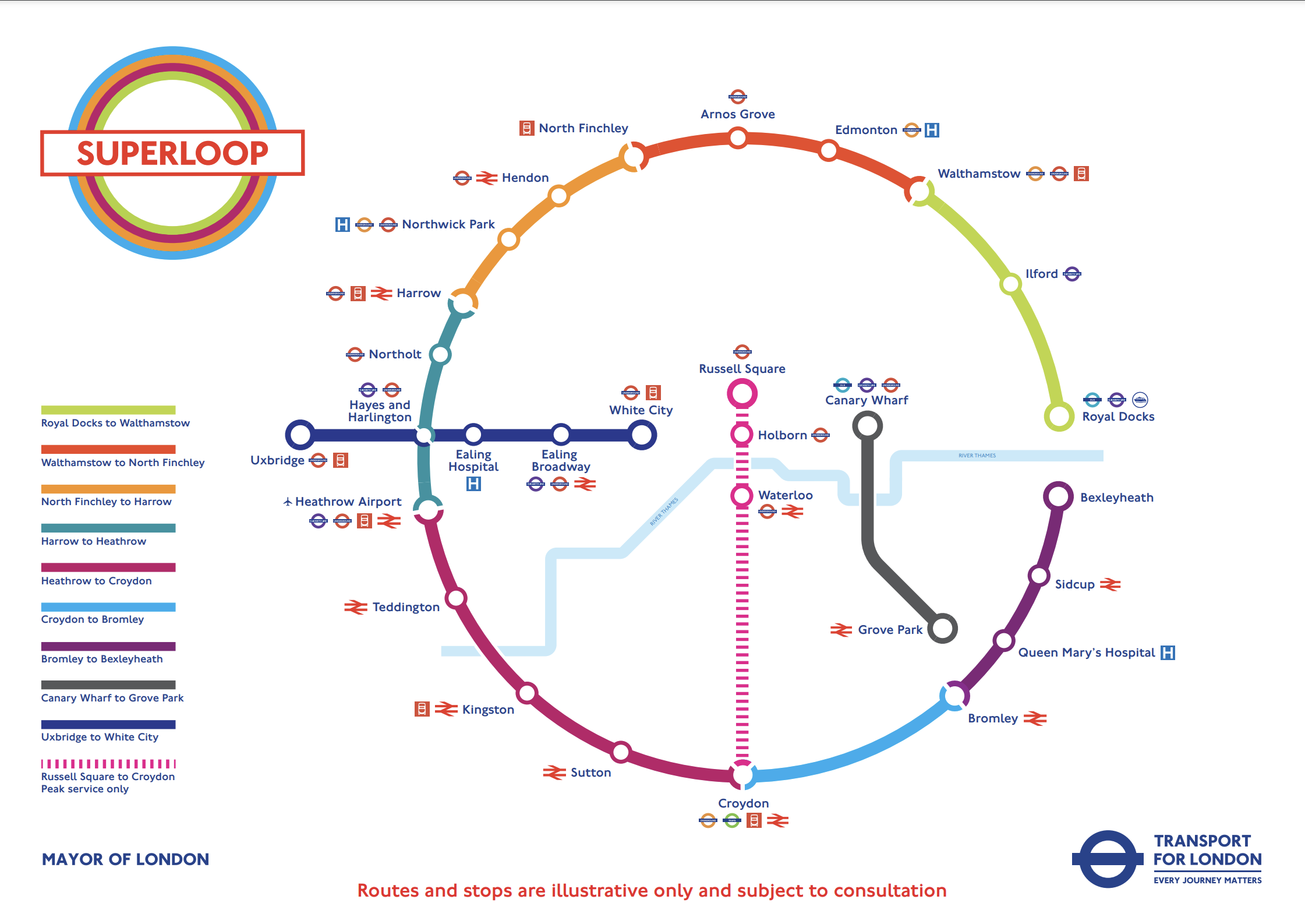
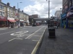
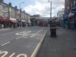
The concept seemed to work well, where the roads were free of traffic.
But we get get a bit delayed through places like Ealing Broadway, where parking reduced the width of the road.
The Route
The route connects quite a few stations and other important locations.
From East to West they include.
- Westfield Shopping Centre
- Shepherd’s Bush station for the Central Line and the Overground.
- Shepherd’s Bush Market station for the Hammersmith and City Line
- Acton Central station for the Overground
- Ealing Common station for the District and Piccadilly Lines.
- Ealing Broadway station for the Central, District and Elizabeth Lines.
- Ealing Broadway
- Ealing Town Hall
- Ealing Hospital
- Southall Broadway
- Hayes
Note.
- The route is very much the same as the now-abandoned West London Tram, which was proposed twenty years ago.
- The tram was opposed y the three London boroughs on the route, as it cut them in half. But buses don’t cause the same problems.
- The Superloop map shows that the SL8 bus calls at Hayes and Harlington station, but we went nowhere near it today.
- The route with its sections of dual carriageway and congested shopping streets was a bit like the route o Birmingham’s hydrogen buses, that I wrote about in Riding Birmingham’s New Hydrogen-Powered Buses.
I feel as the route is very similar to the West London Tram, which was probably extensively researched, that there won’t be too many changes to this route.
Parking Along The Route
I wouldn’t be surprised to see more parking restrictions along the route, to speed up the buses in the crowded shopping streets like Acton, Ealing Broadway and Southall Broadway.
The Buses
The buses are Egyptian-built eVoSeti diesel buses, which use a Volvo chassis.
- I don’t like these buses as they don’t have a flat floor and I’ve seen some passengers struggling with the stairs on the lower deck.
- At least the stairs to the upper deck aren’t too bad.
We used to have them locally in Dalston and I used to avoid them, if there was another bus close behind.
This new route, though should be served by zero-carbon buses, so that pollution and carbon emissions are reduced.
- Between White City and Uxbridge takes over an hour.
- A battery-electric bus would need recharging during the day.
- It looks like there’s not much space at White City and Uxbridge stations, to install charging stations.
- A hydrogen-powered bus could probably manage all day on one filling.
For these reasons, I suspect that hydrogen buses would be the preferred option.
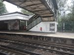
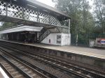
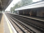
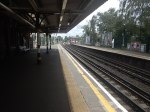
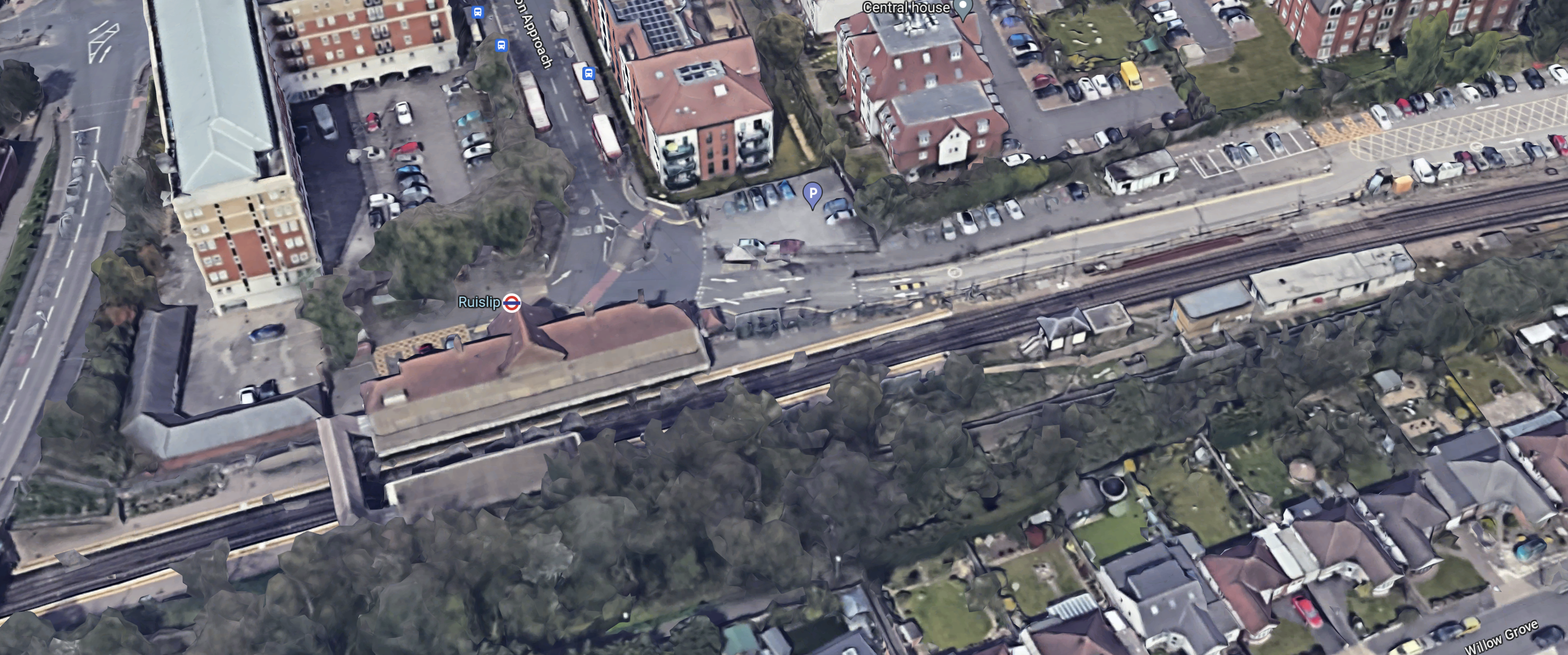
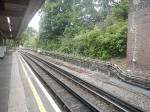
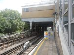
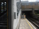
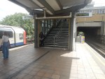
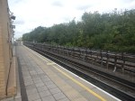
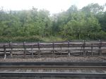
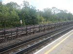
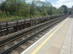
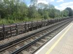
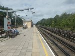
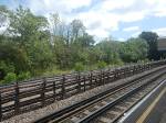
Ruislip Station – 16th July 2023
In TfL Announces The Next Tube Stations To Be Prioritised For Step-Free Access To Meet The Mayor’s Bold Accessibility Targets, it stated that Ruislip station will be made step-free.
So I went to have a look and took these pictures.

Note.
- The station is used by Piccadilly and Metropolitan Line trains, which are different sizes.
- There appears to be a well-preserved signal-box at the Eastern end of the station.
- The Eastbound platform has step-free access from the street.
- Crossing the tracks is by a Victorian steel footbridge.
- The station is Grade II Listed.
- The listing includes the the signal box and the footbridge.
This 3D Google Map shows the station.
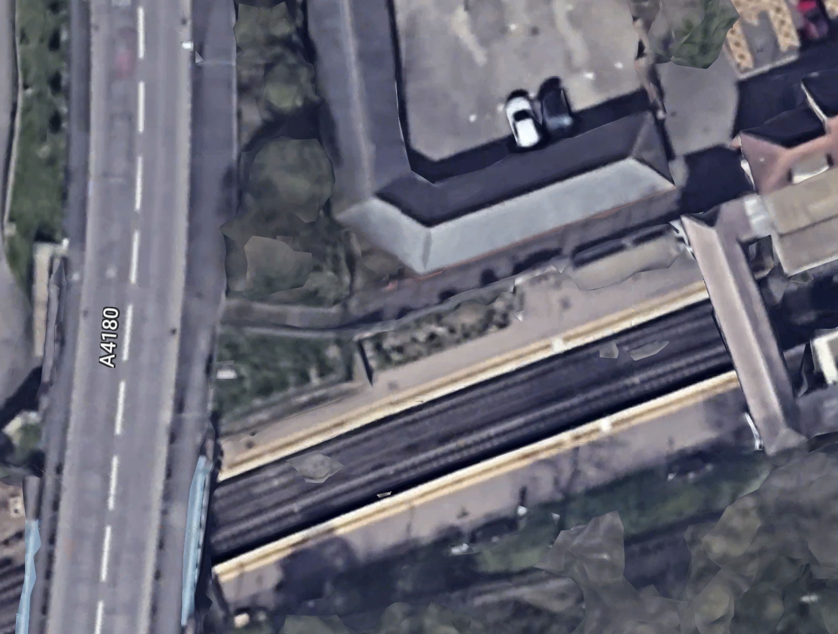
Note.
- The footbridge in the South-West corner of the map.
- There is not much space to put a second bridge across the tracks.
- It might be possible to build a step-free footbridge with lifts by the road bridge.
If English Heritage and the Heritage Taliban dig in their heels, this could be a difficult station to make step-free.
But the London Underground has several bridges of this type, so perhaps this one is being scheduled early to test the reaction.
This second Google Map shows the road bridge and the Western ends of the platforms to an enlarged scale.
This picture shows the station side of the road bridge.
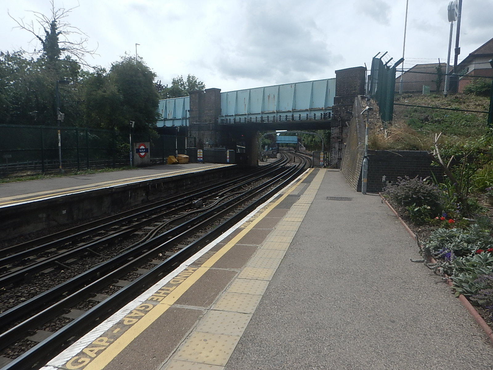
There could be space to put a steel bridge with two lifts by the road bridge.
Coupled with a comprehensive restoration of the current footbridge and a repainting of the road bridge, this could satisfy all parties.
Would A Dual-Fuel Boeing 747 Or Airbus A380 Save Carbon?
This press release from Airbus is entitled The ZEROe Demonstrator Has Arrived.
This is the introductory paragraph.
2022 marks a new and exciting phase for ZEROe – Airbus’ ambition to develop the world’s first zero-emission commercial aircraft by 2035. The multi-year demonstrator programme has officially been launched with the objective to test a variety of hydrogen technologies both on the ground and in the air.
The ZEROe demonstrator will be the first Airbus A 380 aircraft and it is shown in this Airbus visualisation.

Note.
- The four hydrogen tanks in the fuselage.
- The fifth engine mounted in a pod on the fuselage.
- There’s certainly lots of space inside the fuselage for more hydrogen tanks and test and monitoring equipment.
Take away the fifth engine and the test equipment and this aircraft becomes an A380 with two fuel systems; hydrogen and aviation fuel.
Consider.
- Suppose two engines were hydrogen-capable and two were normal engines running on aviation fuel or Sustainable Aviation Fuel (SAF).
- I don’t think it is impossible to build engines that could run on both hydrogen and Sustainable Aviation Fuel.
- All aircraft use fuel at a higher rate, during take-off and climbing.
- Do long non-stop flights use less fuel, than ones with stops?
- As altitude increases, air resistance decreases.
- Aircraft could fly slower to reduce the fuel needed, as they did in the oil crises in the last century.
- Generally, the most economical way to fly a route, is to climb to maximum altitude, fly level until descending into the destination.
- The aircraft would not carry cargo in the belly-hold.
- There could be a hydrogen-powered APU, as I wrote about in Airbus To Trial In-flight Auxiliary Power Entirely Generated By Hydrogen.
- This document from IATA says that in its liquid form, contains about 2.5 times more energy per kilogram than kerosene.
- The Boeing 747 first flew in 1969 and the Airbus A 380 in 2005, so these aircraft are well known.
I just wonder, if it is possible to work out a flight profile, that would enable these aircraft to fly very long non-stop routes?
- All four engines would be used for take-off.
- An appropriate power setting would be used for the cruise and the descent.
- There would be large numbers of 747s and A 380s in good condition to convert.
- The plane would land with little or no hydrogen left.
The hydrogen used would cut the carbon footprint of the flight.
Bradford Railway Station: Axed Plans For New Travel Hub Reconsidered
The title of this post, is the same as that of this article on the BBC.
This is the sub-heading.
Plans for a new railway station in Bradford will be reconsidered after the government previously scrapped them.
These paragraphs outline how the government has changed its mind.
Former Transport Secretary Grant Shapps cancelled the plan for Northern Powerhouse Rail (NPR), a brand new line serving the city, in November 2021.
The government has said an updated business case for the project was expected later this year.
West Yorkshire Mayor Tracy Brabin welcomed the news but criticised the “dither and delay”.
When the Integrated Rail Plan (IRP) was unveiled in 2021, it included cutting much of HS2’s eastern leg and scaling back NPR, including plans for a new station and line in Bradford.
The announcement that the government would now reconsider plans was made in the Department for Transport’s (DfT) response to the Transport Select Committee’s report on the IRP.
The committee had argued that the department had not properly tested alternative options to its proposals and had left out analysis of wider economic “levelling up” impacts of different options for NPR.
But there are no details yet.
Do We Know Anything?
The new station has been proposed to be built on the site of the current St. James Wholesale Market In Bradford.
This OpenRailwayMap shows the route of the railway between Leeds and Bradford Interchange stations, which runs via New Pudsey station.

Note.
- Leeds is to the East.
- Bradford Interchange station is in the North-West corner of the map.
- The yellow line across the map is the railway between Leeds and Bradford Interchange stations.
- St. James Wholesale Market is the rectangular building towards the top of the map in the middle.
- The dotted line going through the market is a disused goods line.
It is not obvious how the station will be connected to the rail network.
Silvertown Tunnel: Cracks In Mayoral Policies
The title of this post, is the same as that, as this article on the BBC.
This is the sub-heading.
It is an infrastructure project that is well-underway with the boring almost completed — but it has a very low profile.
These three paragraphs possibly explain why.
Every step of the Crossrail tunnelling, the media were invited along. Not so with this project.
This is Silvertown Tunnel. It is more than 1km long and will be London’s first road tunnel in over 30 years.
Perhaps one of the reasons it isn’t being pushed publicity-wise, is it is very controversial.
Reading the rest of the article it certainly is controversial in many people’s minds.
These are my thoughts.
Avoiding The Dartford Crossing
When I drove back to Suffolk from Gatwick, Kent or Sussex, in the last century, because of congestion at the Dartford Crossing, I would sometimes cut through London and use the Blackwall Tunnel, when I thought it would be quicker.
When the Silvertown Tunnel opens, this could be a viable alternative for vehicles.
My experience of modelling flows, tells me, that water finds its own level. With driving, Satellite Navigation will be able to tell drivers, which will be the fastest route.
It is my view, that the Silvertown Tunnel will become the biggest rat-run in London.
Except some of these rats will be super-rats in 45-tonne HGVs.
Cutting Pollution In London
If super-rat-running is going to happen, then this will raise pollution in Central London, with all those heavy trucks going through.
The only way to cut pollution would be to have differential pricing for vehicles in the tunnels.
Perhaps hydrogen and electric vehicles should be at a discount.
But then Sadiq Khan doesn’t have a hydrogen policy, except to ignore it and hope it goes away.
The Elizabeth Line Effect
Talking to Elizabeth Line staff at Whitechapel station, they feel that there is an increasing number of passengers, who do journeys in East London on an up-one-branch-down-t’other basis between places like Ilford and Woolwich.
I believe, that other cross-river railways and the Bank station improvements, will also take passengers out of their cars, which will free up the Silvertown Tunnel for more HGVs.
A City Airport Station On The Elizabeth Line
I wrote about this in Thoughts On London City Airport And The Elizabeth Line.
How many cars would this remove from the tunnels under the Thaames?
TfL Announces The Next Tube Stations To Be Prioritised For Step-Free Access To Meet The Mayor’s Bold Accessibility Targets
The title of this post is the same as that of this press release from Transport for London.
These are the first two paragraphs.
Transport for London (TfL) has outlined the ten London Underground stations it will be reviewing for potential step-free access, as it progresses plans to further improve public transport accessibility in London.
These ten stations, spread across London, have been identified using an approach focused on the benefits to customers, such as reducing journey times for those needing to use step-free access and reflecting issues that impact the delivery of step-free access such as the feasibility of new lifts, sufficient space for work to be carried out and the depth of each Tube station.
The ten stations listed are.
- Alperton
- Arnos Grove
- Burnt Oak – Some work has been started, but paused because of the pandemic
- Eastcote
- Finchley Road
- Northolt – Some work has been started, but paused because of the pandemic
- North Acton
- Rayners Lane
- West Hampstead
- White City
The linked posts will show the latest status at the stations.
Other stations are named in the press release, where work will be done, if funds are available.
- Boston Manor
- Brondesbury
- Colindale
- East Putney
- Hackney Downs
- Hatton Cross
- Leyton
- North Ealing
- Park Royal
- Peckham Rye
- Queen’s Park
- Rickmansworth
- Ruislip
- Snaresbrook
- Surrey Quays
in addition, TfL will be looking at the Northern Line between Elephant and Castle and Morden, where there is a gap in step-free access.
These are a few thoughts.
The London Mayor Election In 2024
How many of these stations are in areas, where Sadiq Khan is short of votes for the 2024 election?
Arnos Grove Station
Work has already started at Arnos Grove station, as I showed in Are Arnos Grove And Northolt Tube Stations Going Step Free?.
The BBC Jumped The Gun
The press release now explains the BBC story from Mpnday, that I wrote about in Are Arnos Grove And Northolt Tube Stations Going Step Free?.
Are Arnos Grove And Northolt Tube Stations Going Step Free?
BBC London local news announced this morning some Underground stations would be made step-free.
- It could have been two or ten stations, that would be made step-free.
- Arnos Grove and Northolt were definitely mentioned.
- A timescale of eighteen months was given.
The news story seems to have vanished without trace.
Arnos Grove Station
This Google Map shows Arnos Grove station.
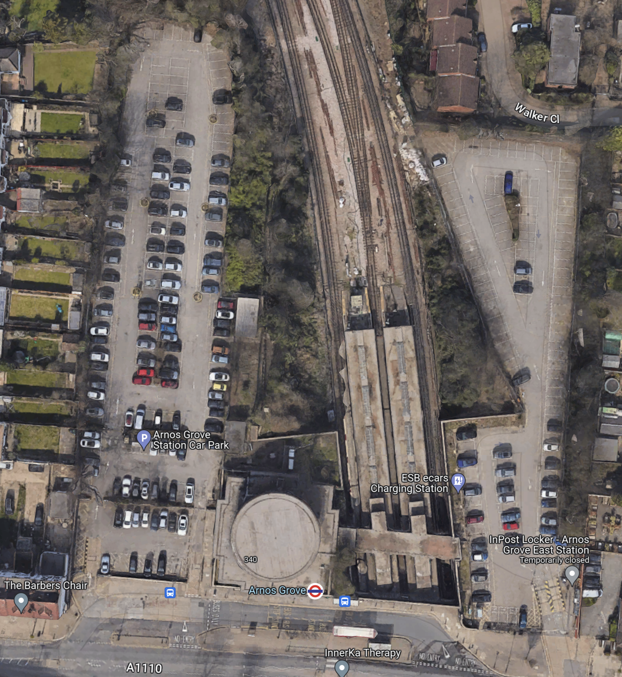
Note.
- The cylindrical shape of Arnos Grove station.
- The bridge over the tracks, which gives access to the trains to the East of the cylinder.
- Car parks to the East and West of the station.
- In Go-Ahead For West London 460-Home Build To Rent Scheme, I described how houses were to be built in the two car parks.
- According to this article on Ian Visits, which is entitled Plans To Build Flats On Arnos Grove Tube Station Car Park, there will be 162 flats in four blocks.
These pictures show Arnos Grove station.


Note.
- Work on the flats on either side seems to have started.
- There are lots of period features.
- There will be a lot of work needed on the rather steep stairs.
- There will be a need for at least three lifts.
This page on Connected Living London, has a plan of the development.
- Gardens are shown each side of the iconic station.
- The gardens can be accessed from the pavement in front of the station.
- Southbound buses draw up in front of the station.
- A zebra crossing gives access to the Northbound buses on the other side of the road.
I suspect that there will be step-free access to the station bridge over the tracks from both gardens.
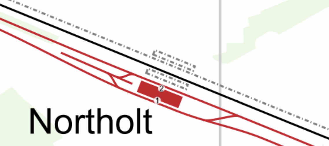
Northolt Station
This Google Map shows Northolt station.
Note.
- The station entrance in the South-East corner of the map on Mandeville Road.
- The long island platform stretching North-West from the station building.
- An eight-car 1992 Stock train is in the Southern platform going West.
- The land on the Northern side of the railway appears to be low-grade woodland, which is quite similar to that at Arnos Grove station.
This map from cartometro.com shows the lines through Northolt station.
Note.
- The Central Line is shown in red.
- The Central Line is laid out so that there are two ways of turning a train back to London.
- The single-track Acton-Northolt line is shown in black.
- The former second track if the Acton-Northolt line is shown dotted, as are the two former platforms.
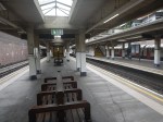
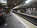
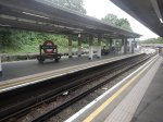
These pictures show Northolt station.
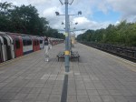
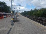
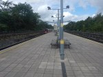


Note.
- The station is showing signs of a sympathetic refurbishment.
- The steps down to the platform is a double set of steps separated by a handrail.
- There is a stylish glass shelter.
- There doesn’t seem much space for a lift to the station entrance.
It should also be noted that for eleven in the morning, the station seemed busy.
These are Underground passenger figures for 2021 in million for stations between Hanger Lane and West Ruislip.
- Hanger Lane – 1.47
- Perivale – 1.08
- Greenford – 2.05
- Northolt – 2.47
- South Ruislip – 0.89
- Ruislip Gardens – 0.48
- West Ruislip – 0.71
Note.
- Greenford, South Ruislip and West Ruislip have some extra National Rail passengers.
- Greenford is the only station between Hanger Lane and West Ruislip, with full step-free access.
- Greenford station uses an inclined lift and I wrote about it in The Inclined Lift In An Improved Greenford Station.
As Northolt is the busiest station without step-free access, this is probably sufficient reason for step-free access to be installed.
Could Step-Free Access At Northolt Be Linked To Property Development?
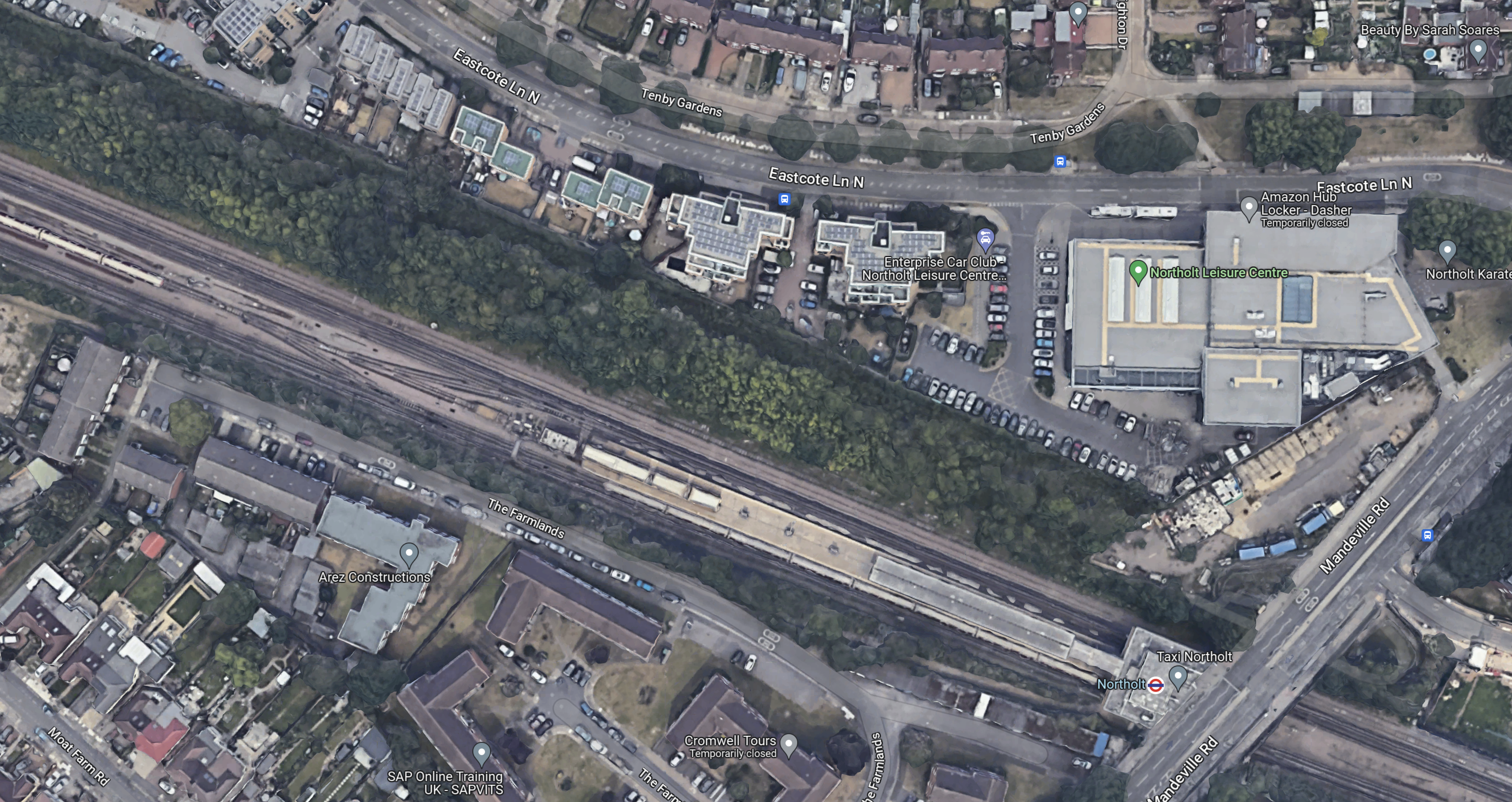
This Google Map shows a close-up of the station building and Mandeville Road.

Note.
- The station building is marked by the London Transport roundel.
- To the North of the station, is Northolt Leisure Centre, which was opened in 2010.
- Mandeville Road runs across the map to the East of the station and the Leisure Centre.
- In the South-East corner of the map, thee looks what could be a High Speed Two site, marked out with red and white barriers.
- Between the station and the Leisure Centre, there appears to be a site used for parking trucks.
Could it be possible to develop step-free access from the site to the North of the station?
This second set of pictures show that site.


Note.
- The site is rather a dump.
- There is even a subway.
This third set of pictures, show the land on the other side of the Acton-Northolt line from the platform at Northolt station.

There are certainly possibilities! Especially if, housing were to be developed alongside the Northern side of the railway.
I suspect, that there could be a bridge across the railway, at this position in the station.
Certainly something would be possible.
Conclusion
Property development at both Arnos Grove and Northolt station would probably need step-free access at both stations.
If the BBC report was right, then to build the step-free access as the first part of the projects, is probably a good idea, as passengers get some early benefits.
I suspect though, that we’ll get a press release that says what is actually happening in a few days.
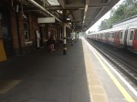
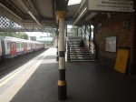
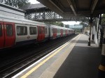
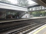
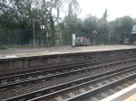
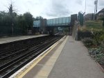
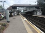
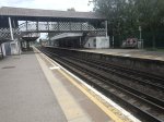
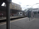
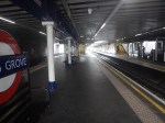
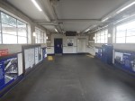
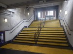
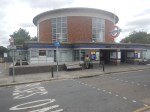
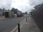
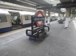
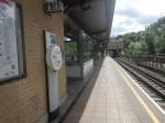
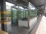
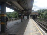
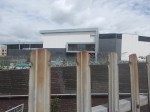
A Very Busy Paddington – 4th July 2023
On my trip to Marsh Barton station, Paddington was very busy, as these pictures show.

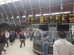

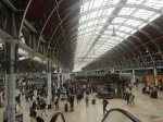

Note.
- Trains were leaving to Cheltenham Spa, Great Malvern. Newquay and Paignton, in addition to the more expected destinations of Bristol Temple Meads, Cardiff and Swansea.
- I took the Elizabeth Line to the station and it was very busy.
I feel, that action needs to be taken to increase the capacity of the station for both passengers and trains.
These are my thoughts.
Catching Trains From Reading
Recently, if I want to go somewhere, that is within an hour West of Reading station, I’ve started taking the Elizabeth Line to Reading using my Freedom Pass and then buying an Off Peak Day Return ticket from Reading.
- It saves a few pounds.
- I can catch the Elizabeth Line train at Moorgate direct to Reading, after having breakfast on Moorgate.
- Moorgate is an easy bus ride from outside my house.
I suspect some other Freedom Pass holders will start to use Reading station to go West.
The only disadvantages are that you miss the Reading train and have to wait half-an-hour for another and that buying tickets at Reading means leaving the station.
Improvements, I would make would include.
- Four trains per hour (tph) between Whitechapel and Reading.
- A ticket machine on the bridge at Reading station, so that those needing a ticket can buy one without leaving the station.
I suspect other improvements could also improve this option.
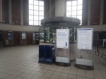
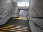
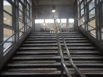
A Second Concourse At The Western End Of Paddington Station
If you go to Paddington station on the Hammersmith and City Line of the Underground, you can walk across the top of the main station and take stairs down to the platform for your departing train.
There has been talk of improving this area of the station, so that passengers using that route from the Underground have an easier route with more facilities like cafes, shops and toilets.
I’m all for this improvement.
What Is The Point Of Heathrow Express?
On my trip, I watched a Heathrow Express arrive in Paddington and just a few people got off.
I am utterly certain, that the Elizabeth Line is giving Heathrow Express a good kicking, as it is so much better connected to the important destinations within London, like Bond Street, Canary Wharf, Farringdon for Thameslink, Liverpool Street for The City, Stratford for events and Whitechapel for the East London Line.
Discussions of the future of Heathrow Express, must also include the Western Rail Link to Heathrow, which is currently being planned by Network Rail.
This page on the Network Rail web site gives more details, including these benefits for the link.
- Reduce rail journey times between Reading and Heathrow by delivering a new, faster, frequent, more reliable direct train service to Heathrow with four trains per hour in each direction. All trains would call at Reading and Slough and alternate trains at Twyford and Maidenhead. Journey times could be as short as 26 minutes from Reading and 6 to 7 minutes from Slough.
- Significantly improve rail connectivity to Heathrow from the Thames Valley, South Coast, South West, South Wales and West Midlands.
- Provide an alternative form of transport for passengers and the large number of people who work at the airport who are currently travelling by road.
- Ease congestion on some of the UK’s busiest roads, the M4, M3 and M25 resulting in lower CO2 emissions equivalent to approximately 30 million road miles per year, helping to deliver the UK’s climate change and carbon reduction targets.
- Generate economic growth and new jobs across the Thames Valley and surrounding areas.
- Reduce passenger congestion at London Paddington.
There is then the question of who should run the service; Heathrow Express, the Elizabeth Line or both.
At the present time, trains from London to Heathrow are.
- Elizabeth Line – 2 tph – Shenfield and Terminal 5
- Elizabeth Line – 4 tph – Abbey Wood and Terminal 4
- Heathrow Express – 4 tph – Paddington and Terminal 5
Note.
- All trains also serve Heathrow Terminals 2 and 3.
- The Piccadilly Line also serves all Heathrow Terminals.
- It appears that Terminal 4 is only served by the Elizabeth Line.
- Terminal 5 has 6 tph, but the Western Rail Link will be at a frequency of four tph.
Because of the mismatch at Terminal 5 and that two tph will stop at Slough, Maidenhead and Twyford, I suspect we might see the following services on the Western Rail Link
- Elizabeth Line – 2 tph – Terminal 5 and Reading via Slough, Maidenhead and Twyford
- Heathrow Express – 2 tph – Terminal 5 and Reading via Slough.
Note.
- This would give Reading and Central London, a much-needed four tph on the Elizabeth Line. Two tph would be direct and two tph would be via Heathrow.
- It would not require any more paths in the Elizabeth Line Central Tunnel, as the 2 tph between Shenfield and Terminal 5 will just be extended to Reading.
- Heathrow Express has Western access with a connection to Reading.
It looks like this service pattern could be a good compromise.
I also suspect that this would improve passenger numbers for Heathrow Express.
Could Heathrow Express Run Its Service Using One Platform At Paddington?
I am fairly certain that this would be possible, if passenger access to the platforms at Paddington station were to be improved, by the building of a second concourse at the Western end of the station.
It is also likely, that full digital signalling will be applied between Paddington and Reading and this will surely improve the ease of running four tph into one platform at London Paddington for Heathrow Express.
I can see, that a reorganisation of Heathrow Express after the building of a second Western concourse at Paddington and the Western Rail Link to Heathrow, that Heathrow Express could be able to release a platform.
Could Great Western Railway Reorganise Suburban Services?
These are Great Western Railway’s suburban services, that terminate at Paddington.
- 1 tph – London Paddington and Oxford via Reading and Didcot Parkway
- 2 tph – London Paddington and Didcot Parkway via Slough, Maidenhead, Twyford, Reading, Tilehurst, Pangbourne, Goring & Streatley and Cholsey
- 1 tph – London Paddington and Newbury via Reading, Theale and Thatcham
Note.
- The Oxford services, are run by Class 800 trains, running as either five-car, nine-car or ten-car trains.
- Oxford is also served by the hourly Paddington and Great Malvern service.
- All of the other services, are run by Class 387 trains, running as either four-car or eight-car trains.
- There doesn’t seem to be any pattern to the platforms used by these services.
I find the last point very surprising, as my extensive scheduling experience says that it is easier to schedule several similar processes, rather than a number of different ones.
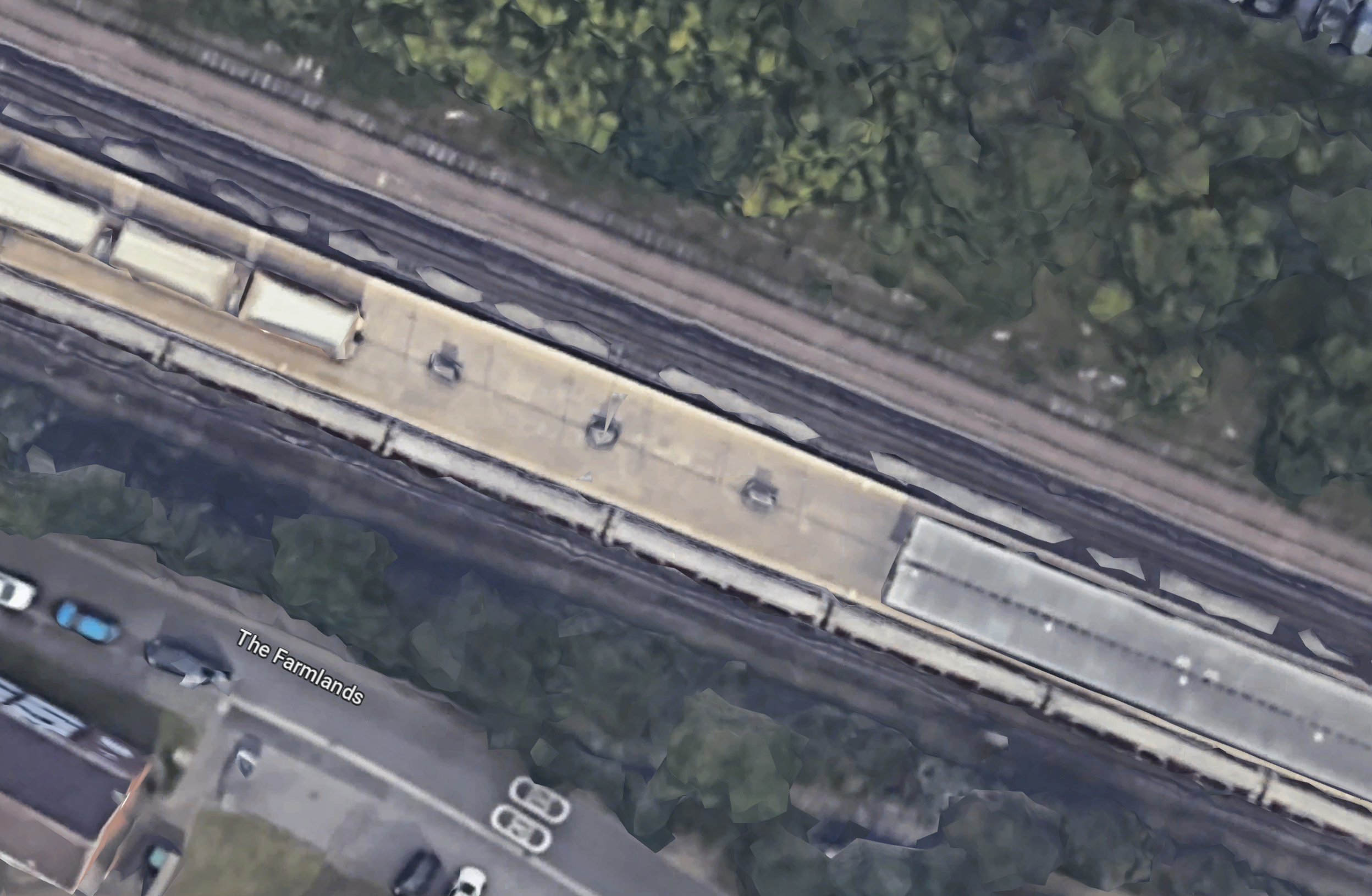
This OpenRailwayMap shows the platforms at Paddington station.
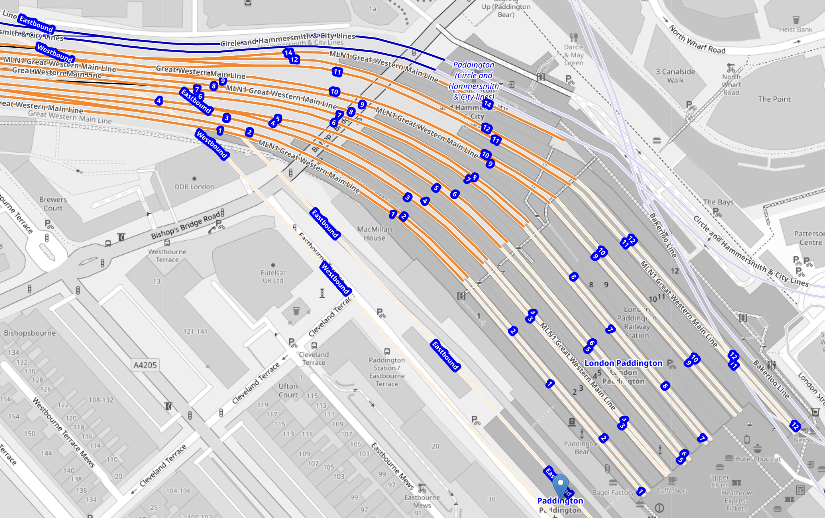
Note.
- The platforms are numbered 1 to 14 from South-West to North-East.
- Platforms 1 to 12 all appear to long platforms about the same length.
- As some platforms can take ten-car Class 800 trains, I wouldn’t be surprised to find out all platforms 1-12 can.
- The only short platform is platform 14, which can accommodate an eight-car Class 387 train, which is 163 metres long.
It looks to me, with twelve long similar platforms, they can schedule the platforms on the fly, so perhaps this explains, the randomness of platform allocations.
I think in an ideal world, I would try and organise these services as follows.
- The Oxford and Great Malvern services could share a platform at Paddington, which would help passengers to find the next Oxford train.
- The Didcot Parkway and Newbury services could also share a platform at Paddington, for the same reason.
- Unless Didcot Parkway and Newbury services are occasionally run by a twelve-car train, they could even use the short platform 14.
This would surely be a more efficient use of the platforms at Paddington station.
Could Didcot Parkway Services Become Another Elizabeth Line Destination?
Consider.
- Didcot Parkway to London Paddington services appear to use the same tracks as Elizabeth Line services between Reading and Southall West Junction, where they change to the main line for Paddington.
- London Paddington to Didcot Parkway services appear to use the main line from Paddington to Dolphin Junction, which is just to the East of Slough station, where it joins the same tracks as Elizabeth Line services to Reading.
- Nine-car Class 345 trains are forty metres longer than an eight-car Class 387 train.
- Class 345 trains are 90 mph trains.
- Class 387 trains are 110 mph trains.
- Class 387 trains wouldn’t fit the platform edge doors in the Elizabeth Line Central Tunnel.
It would appear that the Didcot Parkway and London Paddington services could be moved to the Elizabeth Line, by doing the following.
- The Class 387 trains would be replaced by Class 345 trains.
- Trains to London would go straight on at Southall West Junction and through the Elizabeth Line Central Tunnel.
- Trains from London would emerge from the Elizabeth Line Central Tunnel on the right track for Reading.
- There might be a need to lengthen a few platforms.
Note.
- The Didcot Parkway to London Paddington services would not need to use the main line.
- 2 tph would be removed from Paddington station.
As one electric train is being replaced by another, there would probably be no need for more electrification.
Could Newbury Services Become Another Elizabeth Line Destination?
Consider.
Freight trains appear to be able to go from Theale station to Platform 5 at Slough station, through Platform 15 at Reading station, which is a possible route that a Newbury to the Elizabeth Line Central Tunnel train would take.
Freight trains appear to be able to go from Platform 4 at Slough station to Theale station, through Platform 15 at Reading station, which is a possible route that an Elizabeth Line Central Tunnel to Newbury train would take.
It would appear that the Newbury and London Paddington services could be moved to the Elizabeth Line, by doing the following.
- The Class 387 trains would be replaced by Class 345 trains.
- Trains through Reading would follow the freight route.
- There might be a need to lengthen a few platforms.
Note.
- The Newbury to London Paddington services would not need to use the main line.
- 1 tph would be removed from Paddington station.
As one electric train is being replaced by another, there would probably be no need for more electrification.
Conclusion
It looks like the capacity of Paddington station can be increased by the following.
- Building a new second concourse at the Western end of the station.
- Heathrow Express releasing a platform.
- Oxford and Great Malvern services could share a platform at Paddington
- Moving Didcot Parkway and Newbury services to the Elizabeth Line.
No new electrification would be required.
A Spelling Mistake From Hydrogen Fuel News
This clipping from Hydrogen Fuel News contains one of the best spelling mistakes I’ve seen in a long time.
It wasn’t auto-suggestion, as the only lady in the article, is very demurely dressed.
