The Potential For Floating Solar In The UK
The title of this post, is the same as that of this article on Solar Power Portal.
I like the concept and I have written a few posts on the topic, which can be viewed from this link.
The application, I particularly like, is the use of floating solar on reservoirs, which in addition to producing energy, can reduce water evapotation and reduce the forming of algal blooms.
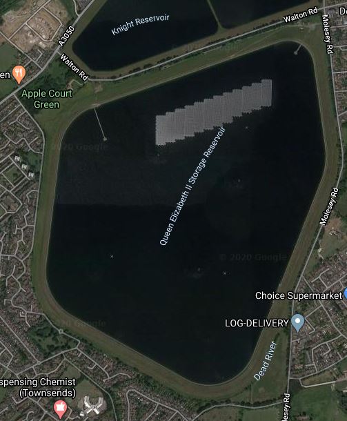
This Google Map shows the farm in the Queen Elizabeth II Reservoir, near Walton-on-Thames.
There is also this article in the Guardian, which is entitled World’s Biggest Floating Solar Farm Powers Up Outside London. It gives a good description of the project.
Conclusion
The article is a must-read and we need more floating solar in the UK, especially on reservoirs.
Why The Elizabeth Line Must Be Extended To Ebbsfleet International
There are various plans to link the Elizabeth Line to Ebbsfleet International.
In Elizabeth Line To Ebbsfleet Extension Could Cost £3.2 Billion, I showed this map from the Abbeywood2Ebbsfleet consultation.
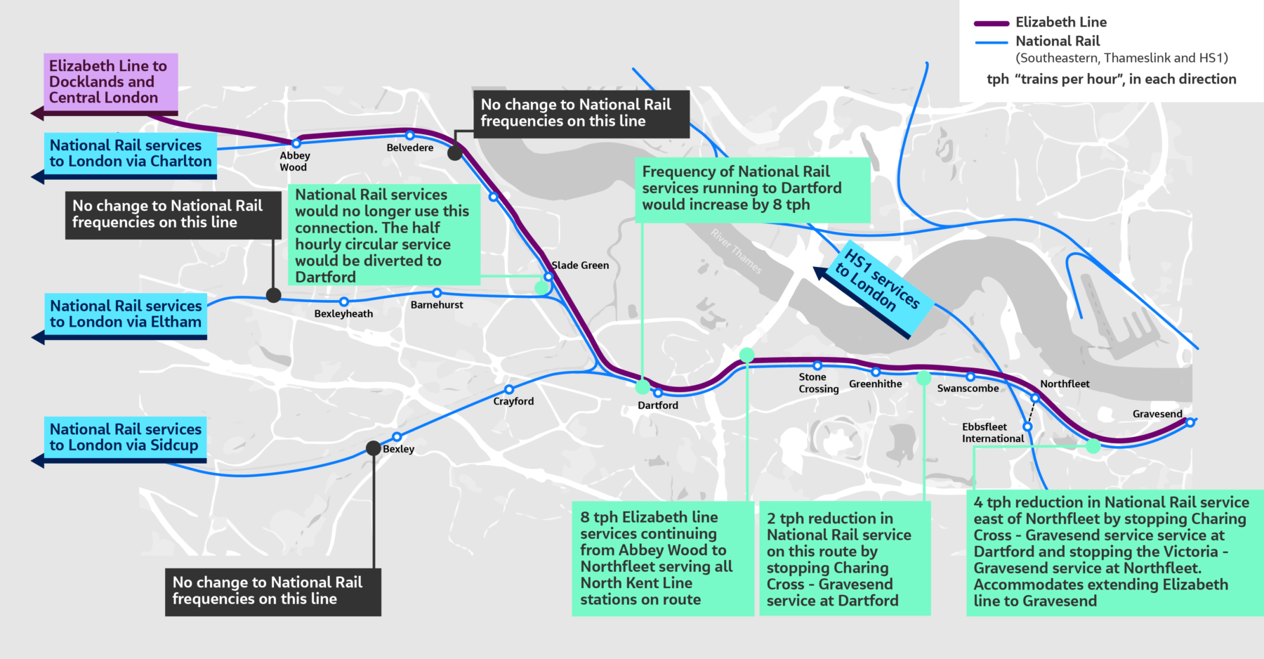
There doesn’t appear to be too much new infrastructure, except for a proper connection between Northfleet and Ebbsfleet stations. References on the Internet, say that the similar-sized Luton DART connection at Luton Airport, cost around £225 million.
The Elizabeth Line connects to the following.
- Bond Street
- Canary Wharf
- City of London
- Farringdon for Thameslink
- Heathrow Airport
- Old Oak Common for High Speed Two
- Liverpool Street station
- Oxford Street
- Paddington station
- Slough for Windsor
- Tottenham Court Road for the British Museum, Oxford Street, Soho, Theatreland and the Underground.
- West End of London
- Whitechapel for the Overground and Underground
For many people like me, the Elizabeth Line at Ebbsfleet will provide one of the quickest ways to get to and from European trains.
High Speed Two Services
This diagram shows High Speed Two services, as they were originally envisaged before Phase 2 was discontinued.
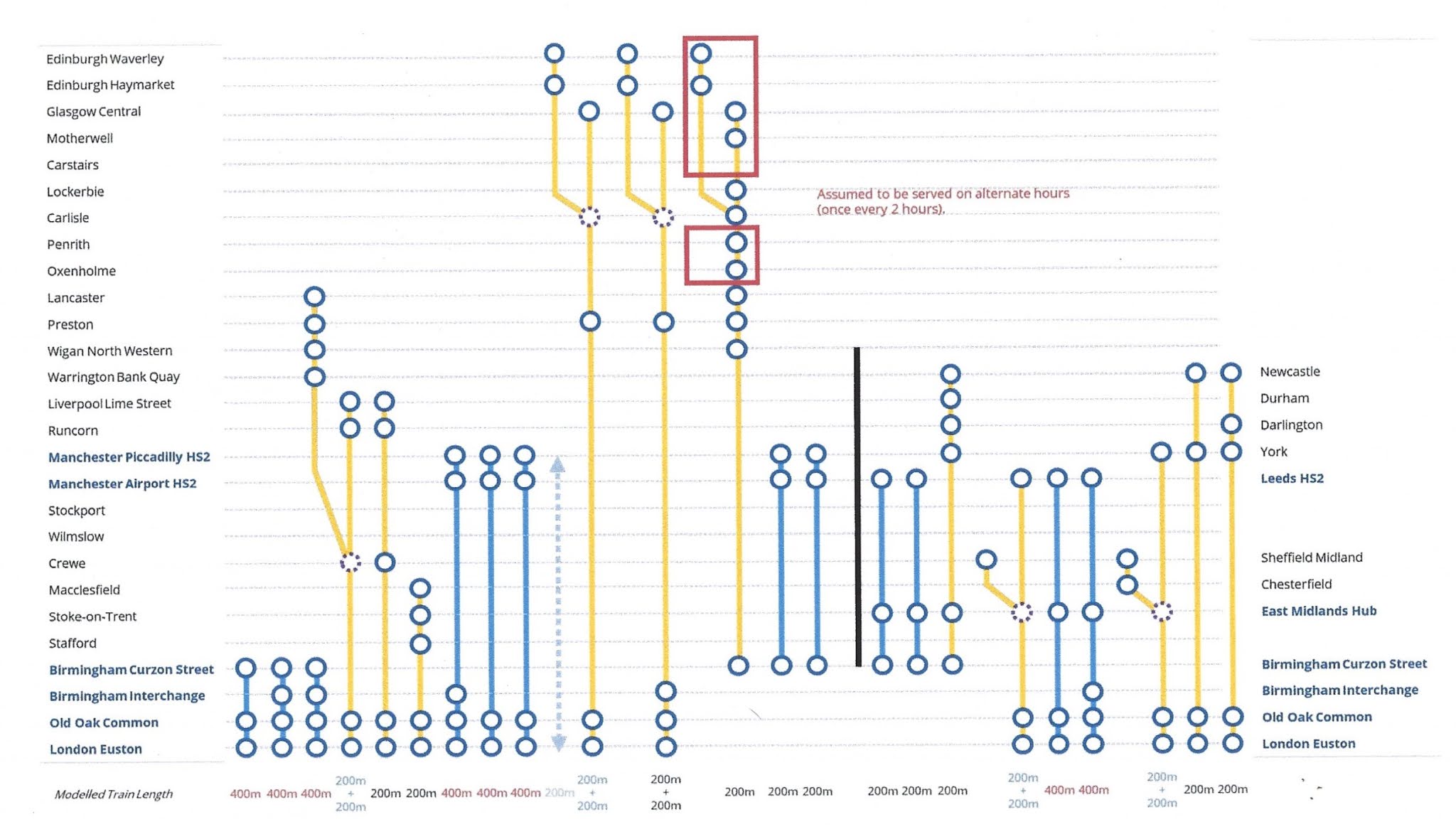
Note.
- Trains to the left of the vertical black line are Phase 1 and those to the right are Phase 2.
- Full-Size trains are shown in blue.
- Classic-Compatible trains are shown in yellow.
- The dotted circles are where trains split and join.
- In the red boxes routes alternate every hour.
- Was Lancaster chosen as it’s close to the new Eden Project Morecambe?
Click on the diagram to enlarge it.
Destinations served by the current foreshortened High Speed Two or High Speed Two Lite will be.
- Birmingham Curzon Street
- Birmingham Interchange
- Carlisle
- Carstairs
- Crewe
- Edinburgh Haymarket
- Edinburgh Waverley
- Glasgow Central
- Lancaster
- Liverpool Lime Street
- Lockerbie
- Macclesfield
- Manchester Airport
- Manchester Piccadilly
- Motherwell
- Oxenholme
- Penrith
- Preston
- Runcorn
- Stafford
- Srockport
- Stoke-on-Trent
- Warrington Bank Quay
- Wigan North Western
- Wilmslow
That is twenty-five stations.
I would add these extra stations.
- Bangor
- Blackpool
- Chester
- Holyhead
- Llandudno Junction
- Wrexham
Note.
- These extra six stations would make High Speed Two, a line for more of the people.
- Because the Eastern leg is cancelled, the paths that would have served that leg can be used to provide services for the West of the country.
The East of the country could be served by updating the East Coast Main Line.
The Development Of Eurostar
Consider.
- Eurostar and Thalys have now merged and I can see them providing extra direct services between London and Europe.
- Bordeaux, Cologne, Frankfurt and Geneva have been mentioned as possible destinations.
- Most of the new destinations, will be served by extending current services from Amsterdam, Brussels and Paris appropriately.
But to cope with the extra numbers of passengers, there will have to be extra passenger capacity at St. Pancras and/or Ebbsfleet International.
High Speed Two And Continental Services
Currently, if you want to go from the North of England or Scotland to the Continent, you do one of the following.
- Take a train to King’s Cross and walk across to St. Pancras International.
- Take a train to St. Pancras and walk to the International section of the station.
- Take a train to Euston and walk or take a bus, taxi or Underground to St. Pancras International.
Note.
- Passengers from North Wales take the Euston route.
- Some passengers will take an Elizabeth Line train to Farringdon and then take Thameslink to St. Pancras International.
- Passengers arriving at Paddington on Heathrow Express will probably take a taxi to St. Pancras International.
- Passengers arriving at Paddington on a budget will probably take the Underground to St. Pancras International.
For Londoners and those travellers, who know London well, the routes to St. Pancras International, are not to bad but they could be better.
If the current foreshortened High Speed Two or High Speed Two Lite finishes at Old Oak Common station, passengers will have to use the following routes for their onward journey.
- Elizabeth Line
- Great Western Railway – local services.
- Heathrow Express
- North London Line of the London Overground, or whatever the Mayor at the time calls it.
If the full High Speed Two or High Speed Two Lite finishes at Euston station, passengers will have to use the following routes for their onward journey.
- Avanti West Coast
- Circle, Hammersmith & City and Metropolitan Lines
- London North Western – local services
- Northern Line
- Victoria Line
- Watford DC Line of the London Overground, or whatever the Mayor at the time calls it.
These routes will be in addition to those at Old Oak Common station.
There will be two routes between High Speed Two and St. Pancras International station.
- Passengers arriving at Old Oak Common will take an Elizabeth Line train to Farringdon and then take Thameslink to St. Pancras International.
- Passengers arriving at Euston will walk or take a bus, taxi or Underground to St. Pancras International.
I am not sure that either route will have enough capacity, if High Speed Two attracts a large number of passengers.
Extend High Speed Two To Euston
I believe that this is essential, as it improves the connectivity greatly, at the bottom end of High Speed Two, as several Underground Lines will be connected to High Speed Two.
Extend The Elizabeth Line from Old Oak Common To Ebbsfleet International
I believe this too is essential, as it gives the North of England and Scotland, the connection to the Continent that they need.
There could be cross-platform connections at both Old Oak Common and Ebbsfleet International between the Elizabeth Line and the high speed lines.
Conclusion
Politicians should stop the dithering and act to give the UK, the rail connection it needs up and down the country and to the Continent.
World-First Operation To Treat Rhino’s Broken Leg
The title of this post, is the same as that of this article on the BBC.
This is the sub-heading.
A rhinoceros with a broken leg is back on its feet after a world-first operation.
These are the first three paragraphs.
Amara, a southern white rhino at Knowsley safari park, was given keyhole surgery and had to wear a cast for four weeks.
Surgeons took what they knew about operating on horses and applied it to Amara because there was so little information about rhinos which had been injured in this way.
A team of 10 vets was involved in the operation, which they described as “unlike anything we’ve experienced previously”.
I bet it wasn’t like a horse, as equines in my experience don’t have a bodger on their bonce.
The BBC featured the story in BBC Breakfast this morning and I wouldn’t be surprised to see it turn up later or on the Internet.
Some may say, is the expense worth it to operate on a rhino.
But I would say, that the experience gained by the University of Liverpool, will be applied to the treatment of other large animals, like buffalo, bison, draught horses, elephants and hippotami.
Also, knowing Scousers as I do, I suspect that some of the techniques used, will be scrounged by Liverpool’s medics and applied to humans.
Council’s Concerns Over Suggested Tunnel Charges
The title of this post, is the same as that of this article on the BBC.
This is the sub-heading.
Concerns have been raised by a county council over suggested charges at the Silvertown and Blackwall tunnels in London.
These are the first two paragraphs.
Kent County Council (KCC) said the proposed charges could impact on the county’s traffic, including at the Dartford Crossing.
The council said although it supported TfL’s ambition to improve journey reliability and reduce air pollution, it believed the proposed changes could “significantly affect” drivers from Kent.
I can’t see that the charges on the two tunnels won’t affect drivers habits.
Thirty years ago, before satellite-navigation had been invented, when my family and myself lived in East Suffolk, if I was returning from Brighton or Gatwick, I would make a choice about, whether to use the Dartford Crossing or the Blackwall Tunnel. Sometimes traffic was so bad, that I had to take the longer Western route using the M11 and the A14.
I didn’t really bother about the toll on the Dartford Tunnel, as it was then, but often the free Blackwall route was quicker.
In those days, I was relying on radio reports, but now with satellite-navigation, drivers will be taking more intelligent decisions, that take account of tolls.
The BBC article also says this.
The council says Kent drivers make up 10% of the Blackwall Tunnel’s users.
So it looks like the drivers of Kent will be paying tolls to London.
These are my thoughts.
How Can The Tolls Be Avoided?
There will still be two free crossings, to the East of Tower Bridge; the Rotherhithe Tunnel and the Woolwich Ferry, but how long will they remain free, if they drain money from the tolled tunnels?
What About The Trains?
Trains from somewhere like Ebbsfleet international station can be used.
Ebbsfleet international station has a lot of parking, but at some stations parking is distinctly limited.
I doubt though, that Transport for London have done a professional survey of the amount of parking that is needed.
They tend to believe if people live out of London, that parking for trips to London is not a Transport for London problem.
Are there any plans to increase the train frequencies, if more people use them?
Note that Off Peak Day Return tickets can be purchased with a Railcard, from Dartford to London for under a tenner, and from Ebbsfleet international to London for under fifteen pounds.
If Built, Will The Lower Thames Crossing Help?
The first paragraph of the Wikipedia entry for the Lower Thames Crossing, describes it like this.
The Lower Thames Crossing is a proposed road crossing of the Thames estuary downstream of the Dartford Crossing that links the counties of Kent and Essex, and its proposed approaches. If built it would pass through the districts of Thurrock and Gravesham, supplementing the Dartford route. The approximately 14.3-mile (23.0 km) route is being assessed by the Planning Inspectorate.
As it is likely to cost nine billion pounds and take six years to build, I can’t see the current Government building it.
But it would certainly make it easier for traffic to go between the Channel Tunnel and North of London.
Conclusion
I can see the UK muddling through, when we should be bold and create the transport infrastructure for the Twenty-First Century.
For instance, I would extend the Elizabeth Line in the North-East to Southend and in the South-East to Ebbsfleet and Gravesend. With the existing cross-platform interchange at Whitechapel, I believe, it could pick up much of the cross-river passenger traffic close to London.
I also feel that there will need to be improved connections between the fast-expanding London Gateway freight port and the Channel Tunnel.
Principle Power Unveils New Floating Wind Foundations For 15 MW+ Turbines
The title of this post, is the same as that of this article on offshoreWIND.biz.
This is the sub-heading.
Principle Power has expanded its WindFloat portfolio by introducing two new semisubmersible floating wind foundation designs, called WindFloat TC and WindFloat FC, which are said to be optimised for 15 MW+ wind turbines.
A large picture and these two paragraphs introduce the new designs.
According to the company, the new designs are natural evolutions of the existing WindFloat technologies that support a wind turbine located on a column in the centre of the platform.
Designed to complement the existing perimeter column designs WindFloat T and WindFloat F, the new solutions share the same 4th generation design heritage and benefits.
Smart Hull Trim System
The article also mentions a Smart Hull Trim System in this sentence.
Some of these include a Smart Hull Trim system to maximise annual energy production and reduce loads.
I would assume that the Smart Hull Trim System, works very much like the control surfaces of an aeroplane or submarine to keep the craft straight and level.
On the Principle Power web site, the various WindFloats are described as follows.
- WindFloat T – Proven WindFloat® design, suitable for tubular construction.
- WindFloat F – A pontoon-based design suitable for flat panel construction.
- WindFloat TC & FC – Center column design solutions, optimized for 15MW+ turbines with stiff-stiff towers.
From work, I did in the 1970s, with two Cambridge University engineering professors, I reckon that the TC and FC designs will be the best.
Conclusion
Whatever way you look at it, a 15 MW+ floating wind turbine, when you consider they can have capacity factors in excess of 50 %, could be a very powerful electricity generator.
Recently Opened In Dalston
This shop has recently opened at Dalston Junction.


Is the name a bit cheeky?
1.4GW Of BESS Capacity Could Be Co-Located With AR6 Winners
The title of this post, is the same as that of this article on Solar Power Portal.
These are the first two introductory paragraphs of the article.
Analysis from Modo Energy has revealed that renewable energy projects awarded contracts under the Contracts for Difference (CfD) Allocation Round 6 (AR6) could facilitate 1.4GW of co-located battery energy storage systems (BESS).
While BESS projects themselves cannot directly participate in the CfD auction, projects awarded contracts are able to co-locate with a battery. Following changes to the rules following Allocation Round 4, BESS co-location is now a far easier prospect for generators, and AR6 saw record high levels of awards for solar projects.
Modo Energy have used two rules to decide which projects will have a battery.
Modo Energy analysis suggests that 5GW of the 9.6GW of renewable energy capacity awarded contracts in AR6 could be suitable for, or has already revealed plans for, co-located battery storage. As a result, as much as 1.4GW of BESS capacity could be created as part of new renewable projects resulting from the AR6.
Using an average ratio of 60MW of BESS capacity for every 100MW of solar generation capacity, Modo Energy has calculated that 1GW of this potential BESS capacity could come from solar projects alone.
Longfield Solar Energy Farm
The article and related documents also say this about Longfield Solar Energy farm.
- This could be the largest battery to co-locate with renewables from this allocation round.
- The project does have a web site.
- The farm has a 399 MW solar array.
- The web site says that the project will store or export up to 500 MW to and from the grid.
- The project is being developed by EDF Renewables.
- The solar farm appears to be North-East of Chelmsford.
The project should be completed by 2027/28.
Conclusion
As time goes on, we’lll see more and more batteries of all kinds co-located with renewable resources.
Potential Tram Builders Announced For New London Trams
The title of this post, is the same as that of this article on RailAdvent.
These three paragraphs outline the design of the new trams.
Transport for London has issued an Invitation to Tender for four manufacturers to design and build a new fleet of trams.
Alstom UK, CAF, Hitachi and Stadler are the four manufacturers who can now proceed to the next stage of the procurement process with Transport for London to design and build the new trams.
The new trams are expected to feature air-conditioning, real time travel info and charging points, along with areas designed for wheelchair users and those with pushchairs and luggage.
It sounds that the new trams will be to a higher standard with more comfort and interior space.
These are my observations and thoughts.
Will There Be The Same Number of Trams?
These two paragraphs indicate the number of trams.
The initial contract will be for 24 new trams to replace the oldest trams on the network – which are now nearly 25 years old.
There is an option in the contract to replace the trams that were introduced from 2012.
Could this mean, that each tram would be replaced on a one-to-one basis?
It would surely make it easy to introduce the new fleet.
Will The New Trams Be Longer?
To me, the most significant words in the article are “areas designed for wheelchair users and those with pushchairs and luggage”.
As passengers seem to want to carry more and more with them on buses, trains and probably trams in London, I believe the new trams will probably need more interior space.
Increasing the width of the tram, would probably mean gauging difficulties, but with the lengthening of some platforms longer trams might be possible.
The current trams are as follows.
- 24 x Bombardier CR4000 – 30.1 metres – 70+138=208 = 6.9 pass/metre
- 12 x Stadler Variobahn – 32 metres – 72+134 = 206 = 6.4 pass/metre
Note.
- The total number of each tram type is at the left.
- Seats+Standing=Total Passengers.
- The Bombardier trams only have a single articulation, but it looks like the Stadler ones have four.
The longer Stadler trams seem less crowded, despite carrying two fewer passengers.
I have looked at the terminal platforms on maps and it appears, that 35 metre and possibly 40 metre trams would be possible.
At least in London, passengers are used to being told not to use the end door.
A 40 metre tram could probably handle over 250 passengers based on the Stadler passenger density.
Longer Trams Could Increase Capacity By Up To 25 %
I believe my figures show this could be possible.
More Articulations Should Mean A Tighter Turning Circle
This could help operation on some existing or new sections of London Tramlink.
Would Battery Tram-Train Operation Be Useful?
CAF’s trams in the West Midlands already have batteries and Stadler’s tram-trains in Cardiff will have batteries to extend routes on rail tracks, that don’t have electrification.
In Could Beckenham Junction To Birkbeck Be Run Using Third-Rail Tram-Trains?, I detailed how third-rail tram-trains could be used between Harrington Lane tram stop and Beckenham Junction station to create more capacity.
I believe that third-rail tram-trains would work, but that Health and Safety would outlaw the concept.
On the other hand, battery-electric tram trains could probably handle the link between train and tram routes.
If I was bidding for the TramLink contract, I’d make sure the trams could be updated with a battery-electric tram-train capability.
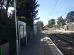
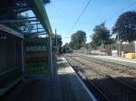
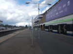
Increasing Capacity At Elmers End Tram Stop
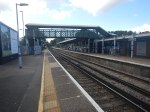
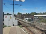
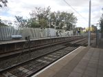
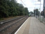
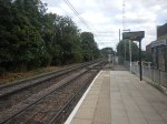
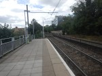
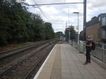
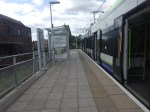
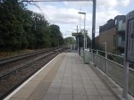
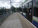
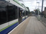
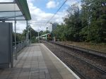
Elmers End tram stop, is the only terminal on the London Tramlink with a single platform.
This map from OpenRailwayMap shows the platform layout at Elmers End station.
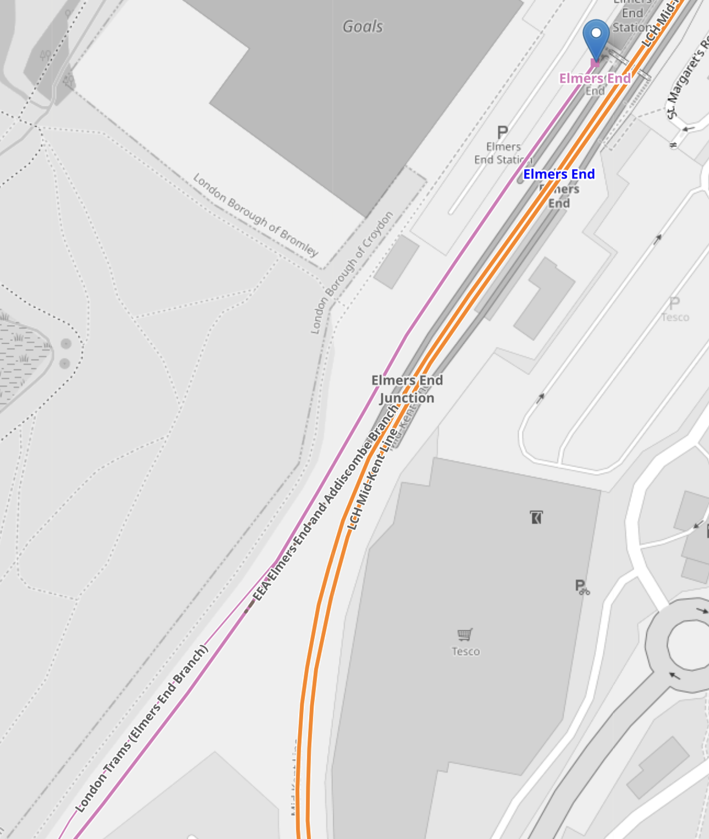
Note.
- The orange lines are the Hayes Line.
- The mauve line is the London Tramlink.
- The London Tramlink has a single platform on the North-West side of the Hayes Line.
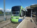
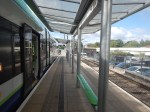
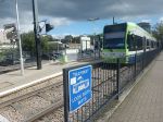
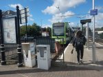
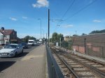
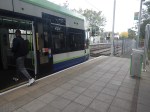
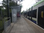
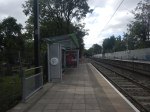
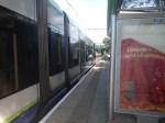
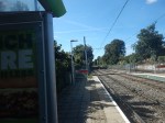
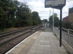
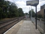
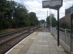
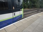
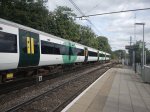
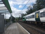
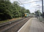
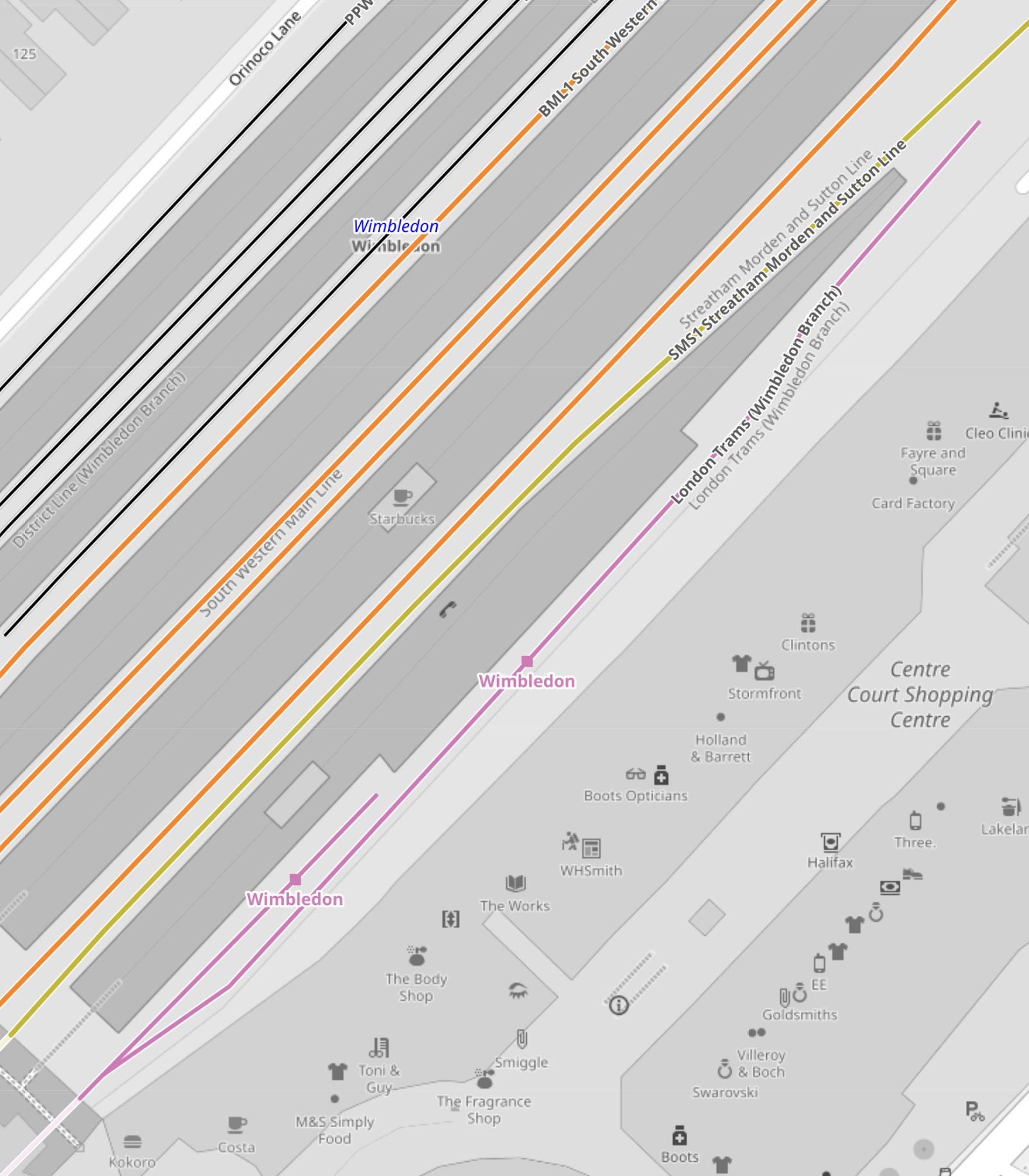
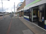
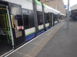
These pictures show Elmers End station and a tram in the London Tramlink platform.
Note.
- The bridge in the station is not step-free.
- The tram is a five-section Stadler Variobahn.
- The tram platform would appear to be able to handle a tram, that is several metres longer than the 32.0 metre Stadler Variobahn.
- The London Tramlink has a typical off-peak service to Wimbledon every ten minutes from Elmers End tram stop.
The Wikipedia entry for Elmers End station, says this about Tramlink developments at the station.
Work is underway to open a second tram platform and double the tram line to Arena to increase capacity. As of March 2019, vegetation has been cleared to make way for the new line. The platform was due to open in December 2020, but has been delayed.
My pictures show no ongoing work or evidence of the second Tramlink platform.
There are two main ways, that capacity can be increased at Elmers End station.
- Install a second platform and run more trams to the station.
- Run longer trams with a higher capacity.
Perhaps, Transport for London have decided, that the second way, is the best, especially, if the money saved, allows them to build a much-needed step-free footbridge at Elmers End station.
From my observations, I would estimate that Elmers End tram stop could accommodate a forty metre tram and possibly, one that was even longer.
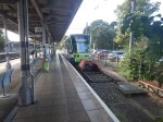
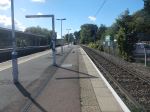
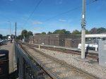
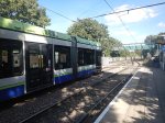
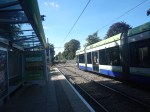
Arena Tram Stop
The Arena tram stop, is where the Beckenham Junction and Elmers End branches join and split.
This map from OpenRailwayMap shows the platform layout at Arena tram stop.
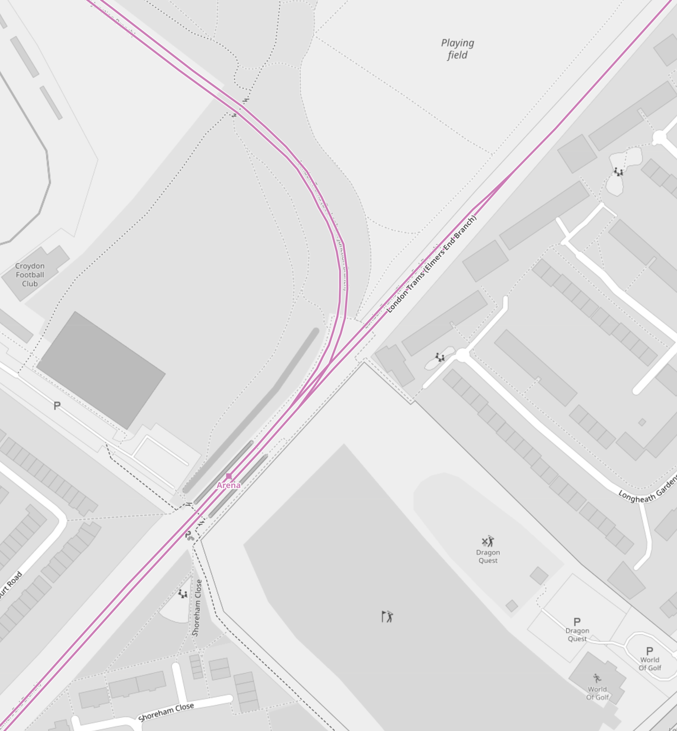
Note.
- The mauve lines are the London Tramlink.
- The line going North-East runs to Elmers End. It starts off as double-track at Arena tram stop and quickly becomes single track all the way to Elmers End. tram stop.
- The line going North-West runs to Beckenham Junction.
- The line going South-West runs to East Croydon and Wimbledon.
- The platforms are on the outside of both tracks.
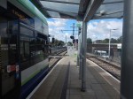
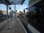
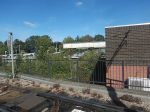
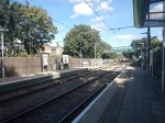
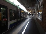
These pictures show Arena tram stop and some trams passing through.
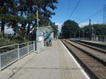
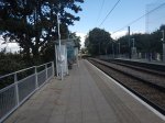
Note.
- The tram platforms are generally a few metres longer than the trams.
- All tram doors are step-free to the platform.
- Passengers walk across the line in front or behind the trams.
- The platform is wide, so that passengers can stay well clear of the occasional passing tram. One picture shows a tram is signed “Not In Service”
I believe, that with some judicial platform lengthening, some selective door opening and trams stopping automatically in the right place on the platform, that longer trams could be handled in a stop like Arena.
As with Elmers End, I believe a forty metre tram will be possible, but this might not be the limit with clever design.
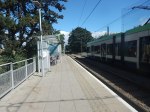
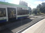
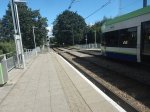
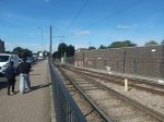
Handling Longer Trams At Beckenham Junction Tram Stop
This map from OpenRailwayMap shows the platform layout at Beckenham Junction tram stop.
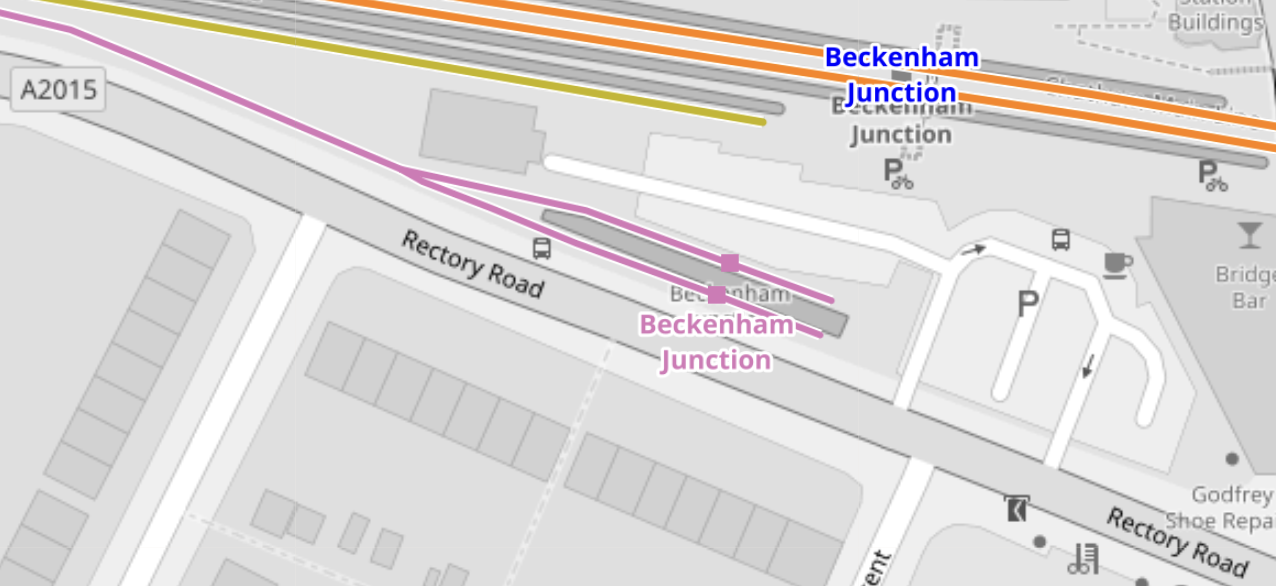
Note.
- The orange lines are the Chatham Main Line.
- The mauve line is the London Tramlink.
- There are a pair of short platforms for the London Tramlink.
- The platforms would be difficult to extend to the East.
- The platforms would be difficult to extend to the West, as the map above shows a building, just to the North of the junction of the two Tramlink platforms.
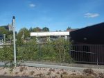
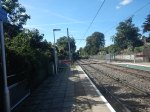
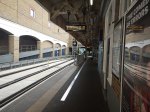
These pictures show Beckenham Junction station and the London Tramlink platforms.


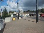
The Wikipedia entry for Beckenham Junction tram stop, says this about the Tramlink service.
Tram services at Beckenham Junction are operated by Tramlink. The tram stop is served by trams every 10 minutes to Wimbledon via Croydon. This is reduced to a tram every 15 minutes on Saturday evenings and Sundays.
Perhaps, the solution to lengthen Tramlink platforms at Beckenham Junction is to do the following.
- Rebuild the building to the North of the junction of the two Tramlink platforms.
- Extend the two Tramlink platforms to the West.
- Move the junction between the two Tramlink platforms to the West.
These pictures show the building in detail.
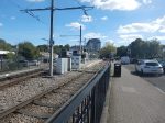

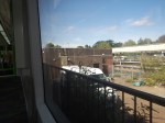
Note.
- There is a Network Rail van outside the building.
- The building looks like it dates from about 2000, when the Tramlink was built.
- Perhaps, the building houses power supply or signalling equipment for the Tramlink.
After the modifications, operation would be the same, but longer trams could be handled.
Trams And Trains Between Birkbeck And Beckenham Junction Stations
This short section of track must be one of the most unusual and complicated in the UK.
- There are three dual National Rail and Tramlink stations; Birkbeck, Avenue Road and Beckenham Road.
- Each station has a single bi-directional National Rail track and/or platform.
- Birkbeck has a single bi-directional Tramlink platform.
- Avenue Road and Beckenham Road each have two Tramlink platforms.
Engineer; Baldrick was obviously having one of his cunning phases.
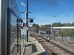
This map from OpenRailwayMap shows the track/platform layout at Birkbeck station/tram stop.
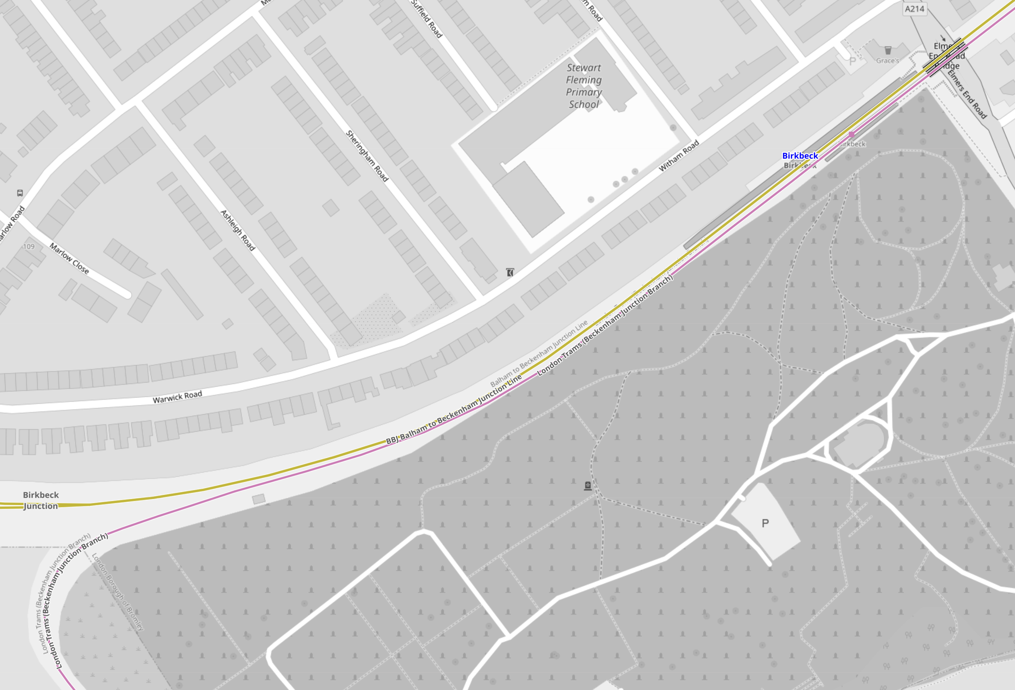
Note.
- The yellow line is the National Rail line between Crystal Palace and Beckenham Junction.
- The mauve line is the London Tramlink between Croydon and Beckenham Junction.
- There is no rail connection between the two lines.
Birkbeck station/tram stop has bi-directional platforms on both National Rail and London Tramlink.
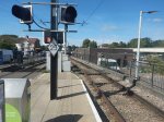
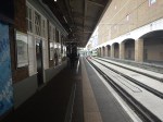
These pictures were taken at the Birkbeck station/tram stop.

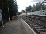
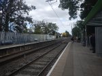
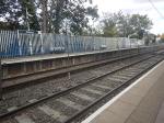

Note.
- The two bi-directional platforms.
- The wire fence between the tracks.
- The two tracks appear to be the same level, but the National Rail platforms seem quite a bit higher.
From the pictures, I would estimate that the Birkbeck tram stop platform is currently about thirty-five metres and could probably handle a forty metre tram with selective door opening.
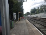
This map from OpenRailwayMap shows the track/platform layout at Avenue Road station/tram stop.
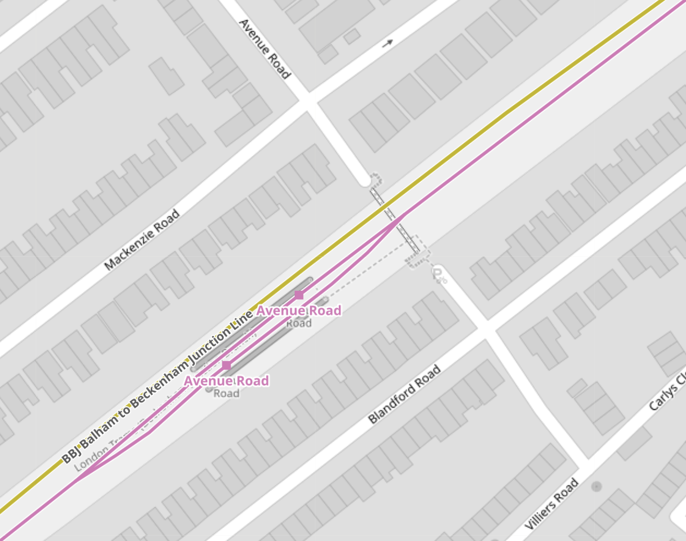
Note.
- The yellow line is the National Rail line between Crystal Palace and Beckenham Junction.
- The National Rail line isn’t shown to have a platform.
- The mauve line is the London Tramlink between Croydon and Beckenham Junction.
- There is no rail connection between the two lines.
London Tramlink has a loop through the tram stop and each branch has a platform.
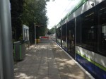
These pictures were taken at the Avenue Road tram stop.
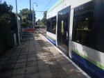
I would estimate the the loop at Avenue Road tram stop could handle a forty metre tram and possibly one of forty-five metres, judging the loop against this thirty-two metre Stadler tram.
This map from OpenRailwayMap shows the track/platform layout at Beckenham Road station/tram stop.
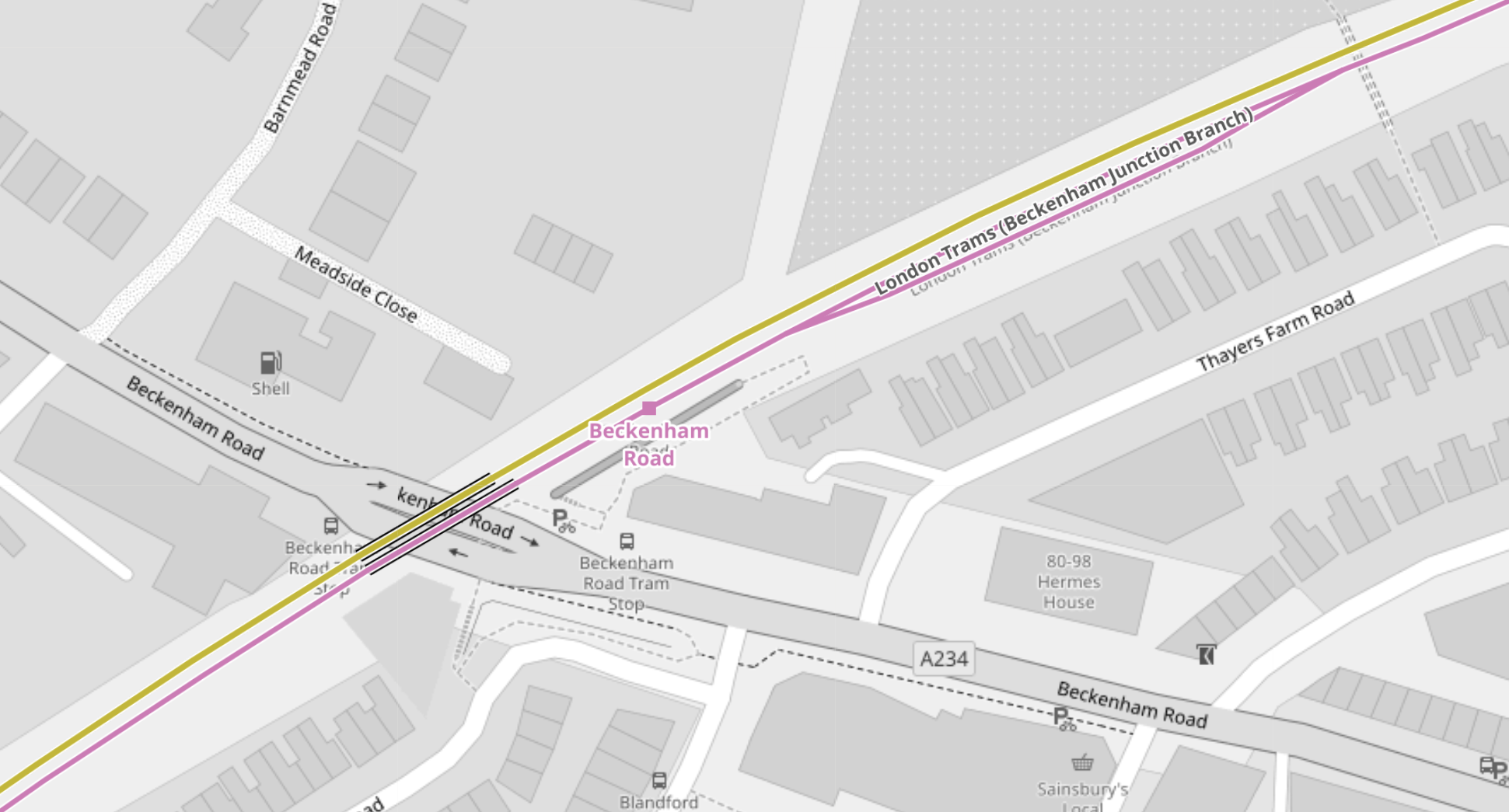
Note.
- The yellow line is the National Rail line between Crystal Palace and Beckenham Junction.
- The National Rail line isn’t shown to have a platform.
- The mauve line is the London Tramlink between Croydon and Beckenham Junction.
- There is no rail connection between the two lines.
The London Tramlink has a single bi-directional platform.
There is also a loop in the London Tramlink to the East of Beckenham Road station/tram stop to allow trams to pass.
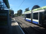
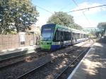
These pictures were taken at the Beckenham Road tram stop.
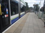


Note.
- A train conveniently came through from London Bridge to Beckenham Junction, when I was taking pictures.
- Several pictures show trams using the loop to the East of the tram stop.
- Both types of tram were pictured in the tram stop.
- The platform in the tram stop is wide.
From the pictures, I would estimate that the Beckenham Road tram stop platform is currently about thirty-five metres and could probably handle a forty metre tram with selective door opening.
Tram-Train Operation Between Birkbeck And Beckenham Junction Stations
I am certain that if this track was being designed today, tram-train operation would be used.
- There would be two tracks, with one for each direction, through Birkbeck, Avenue Road and Beckenham Road stations.
- Both tracks would have dual-height platform at each station/tram stop, so tram and train passengers got level boarding.
- Trains would use third-rail power and trams would use battery-power.
Unfortunately, tram-trains didn’t exist, when the London Tramlink was designed.
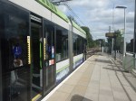
Handling Longer Trams At New Addington Tram Stop
This map from OpenRailwayMap shows the platform layout at New Addington tram stop.
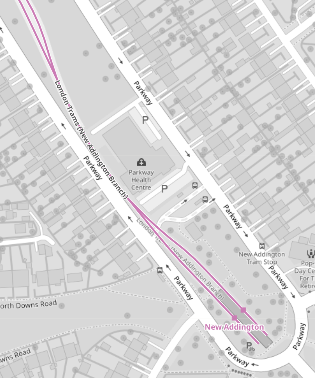
These pictures show the New Addington tram stop and the London Tramlink platforms.


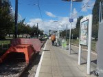

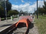
If some of the grassland around the platforms was allocated to the tram stop, I suspect the platforms could be lengthened.
Handling Longer Trams At Wimbledon Station
This map from OpenRailwayMap shows the platform layout at Wimbledon station.
Note.
- The mauve line is the London Tramlink.
- There are two platforms; 10A and 10B, which are indicated with a separate dot.
- Platform 9, which is used by Thameslink, is the other side of Platform 10, so interchange to Thameslink is excellent.
- The main tram platform 9/10 is wide.
- The platforms are step-free to the trams, with lifts to the station bridge and the other platforms and Way Out.
I suspect that when the second platform was built, both platforms were made longer than the thirty-two metres needed for the Stadler trams.
These pictures show the two platforms.
Could another platform be created on the other side of the tracks to give better access to the tracks?
Conclusions
My first conclusion is that the London Tramlink could be run by a new fleet of the same number of trams, that were a few metres longer than the current 30.7/32 metres of the current trams.
- I suspect that forty metre trams would be possible, with a few modifications to platforms.
- It might even be possible to have forty-five metre trams, with a more substantial rebuild at Beckenham Junction.
- Trams could overhang platforms and selective door opening could be used.
- Forty metre trams would carry 25 % more passengers than the current trams.
- The Elmers End and Wimbledon terminals already seem to be capable of handling forty metre long trams and possibly could take trams a few metres longer.
I suspect that Elmers End and Wimbledon, could be the first route, where the longer trams were introduced, as the trams should be able to shuttle between the two end terminals to the current timetable.
The New Addington tram stop would be brought into operation next.
- Platforms would be lengthened as required.
- Trams operate a frying pan loop from New Addington to Croydon, with an Off Peak frequency of 7-8 minutes.
- I suspect that one platform won’t be able to handle this frequency.
- The last point probably means that the two platforms will need to be lengthened.
Works at the New Addington tram stop could be tricky, but not substantial.
Initially, the service to Beckenham Junction could be run by the existing Stadler Variobahn trams.
I believe that a lot of work will need to be done to get Beckenham Junction ready for the new trams if they are longer, which I suspect they are.
- The Network Rail installation will have to be relocated.
- The two platforms will have to be lengthened.
I suspect the works will be substantial.
But I do believe, that there is scope to plan all the works at the terminals, so they can be done efficiently, whilst at least maintaining a partial service.
My second conclusion, is that it will be possible to build a financial model, which shows infrastructure costs against tram lengths.
Longer trams will cost more and cost more for infrastructure, but they will carry more passengers and collect more fare revenue.
BMF And NMC: ‘Plans To Charge Motorcyclists To Use The Silvertown And Blackwell Tunnels Are Flawed’
The title of this post, is the same as that as this page on the British Motorcyclists Federation.
These are the first two paragraphs.
The British Motorcyclists Federation (BMF) and the National Motorcyclists Council (NMC) have responded to the Transport for London (TFL) consultation on plans to charge motorcyclists to use the Silvertown and Blackwell tunnels from 2025. TfL are urged to “think again” on flawed plans that fail to take into account the positive impact of motorcycles on London’s pollution and congestion levels.
The BMF and NMC, in a combined response to TfL’s consultation on the proposed Charging Scheme for the Silvertown and Blackwall tunnels, have lodged detailed objections to the proposals to implement charges for motorcycles to use the Tunnels from 2025. Both UK motorcycling organisations have urged TfL to reconsider their proposed strategy and to exempt motorcyclists from the charges.
I think that the two organisations have a point and they emblazon this across the article.
To equate motorcycles with cars, with the same fee charged for both, is completely illogical.
But then, when were the Mayor of London and Transport for London ever logical and mathematically-correct?
Will The Charging System Identify Motorcycles Correctly?
On a project, I worked on in the 1970s, I was told it was difficult. I doubt that has changed.
Conclusion
The article makes some powerful arguments, but I doubt they’ll get anywhere with the stubbornest man in the UK.
A Funny Turn On Thursday
Because of my endoscopy at five on Thursday, I had a quiet day. I wasn’t allowed to eat anything for eight hours before or drink anything but water for four hours.
About one in the afternoon, I was sitting at my computer, typing a post into my blog.
And then everything, went rather fuzzy and words were coming out garbage. Often each letter was replaced by one of the next on the keyboard.
I was also a bit unsteady on my feet and as I was alone in my house, I decided to go out, so that if it was something worse and I collapsed, there would be someone to help me.
As I got to the bus stop, which is about fifty metres away, a violent thunderstorm broke out.
On the bus to The Angel, I tried to check my phone to get the time. It didn’t respond and I couldn’t unlock it. And even with help from the EE Shop and a guy on the bus, the phone wouldn’t respond to my fingers.
At the Angel, I did at least have a sensible conversation with an assistant about a clothes purchase, but in the end I bought nothing.
I left the Angel earlier than I’d intended and as I was on a 38 bus, which starts my journey to Homerton Hospital, I gave up on the idea of going home for some water.
I had a long change at Dalston Junction for the 242 bus for the hospital, but at least the rain had stopped somewhat and I was by now steady on my feet.
My phone was also working, so I was able to read the instructions about where to go at the hospital.
So what had happened to me at one in the afternoon?
Was there a low pressure before the storm, that sucked all the water out of my body and in the process made my fingers dry, so they didn’t work the phone?
Interestingly, I lost 0.9 of a Kg between 08:00 on Thursday and 08:00 on Friday. Was that just the fasting?
My INR also dropped from 2.4 at 08:00 on Thursday to 2.0 at 08:00 on Saturday. Was that because of all the fluid I lost, thickened my blood?
