SSE Renewables Partners With Fluence And OCU Energy To Deliver Its Battery Storage Project At Fiddler’s Ferry
The title of this post, is the same as that of this press release from SSE Renewables.
This is the sub-heading.
*The 150MW / 300MWh battery energy storage system will be built on the site of the former SSE-owned coal fired power station*
These four paragraphs give full details of the project.
SSE Renewables has announced its principal contractor and battery supplier for its 150MW battery storage project at Fiddler’s Ferry, Warrington.
OCU Energy – who are Stockport-based and are currently working with SSE Renewables on its Ferrybridge battery storage project – will be the principal contractor at Fiddler’s Ferry.
Fluence, a global leader in energy storage technology, digital solutions and services, has been selected as the supplier of the battery-based energy storage system.
Construction is set to begin at the site in the coming weeks after SSE Renewables took a final investment decision back in December 2023.
Note.
- This will be a two-hour battery.
- Good to see a press release with both battery output and battery capacity shown in the appropriate units.
It’s also good to see, SSE adding to the fleet of the UK’s battery storage.
This page on the SSE Renewables web site is entitled About Solar And Battery.
This is the sub-heading.
SSE Renewables is progressing a 1.2GW secured pipeline of utility-scale solar and battery projects across the UK and Ireland and a further 1.3GW of other prospective sites under development. These assets complement SSE’s existing portfolio of other low carbon infrastructure such as wind and hydro.
This is the first paragraph.
Our solar projects will be capable of harnessing the abundant power of the sun to bring renewable power onto the grid, while our battery projects will be able to store renewable power when the sun doesn’t shine or the wind doesn’t blow. The delivery of these projects is part of our commitment to a net zero transition.
What follows is a job advert.
As an electrical and control engineer, who has enjoyed over fifty years exploring the mathematics of big engineering projects, I don’t regret the choice of career I made.
Ørsted Receives Development Consent For 2.6 GW Hornsea Four Offshore Wind Farm
The title of this post, is the same as that of this article on offshoreWIND.biz.
This is the sub-heading.
The UK Secretary of State for Energy Security and Net Zero has granted development consent to Hornsea Project Four, a 2.6 GW offshore wind farm Ørsted plans to build some 69 kilometres off the Yorkshire Coast.
This is the first paragraph.
The UK government, in a press release issued on 12 July, stated that Hornsea Four was the 126th Nationally Significant Infrastructure Project and 73rd energy application to have been examined by The Planning Inspectorate within the timescales laid down in the Planning Act 2008.
It certainly looks like The Planning Inspectorate has been working overtime.
Note that the four Hornsea wind farms are planned to have at least the following sizes.
- Hornsea 1 – 1218 MW
- Hornsea 2 – 1386 MW
- Hornsea 3 – 2852 MW
- Hornsea 4 – 2600 MW
These four wind farms give the Hornsea complex, a total capacity of at least 8056 MW.
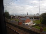
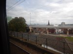
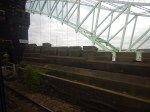
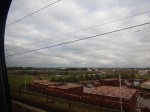
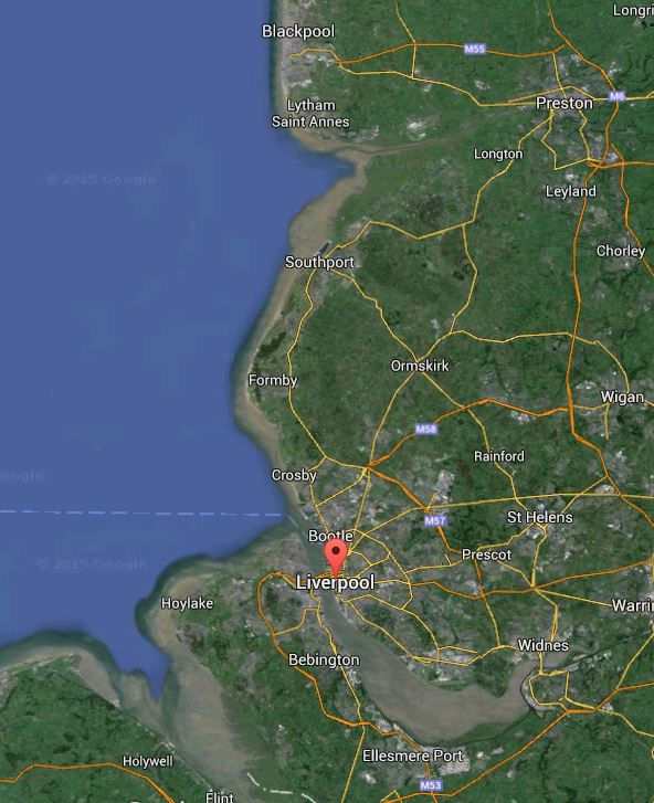
When I worked at ICI in Runcorn in the late 1960s, I used to cross the Runcorn Bridge twice every day and would see Fiddlers Ferry power station, with its eight cooling towers, on the North Bank of the River Mersey to the East. It was generally thought of as a large coal-fired power station.
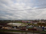
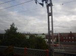
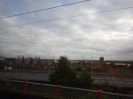
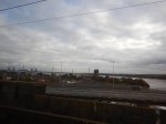
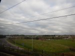
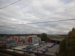
These pictures of Fiddlers Ferry power station were taken in 2021, from a Liverpool-bound train on the railway bridge.
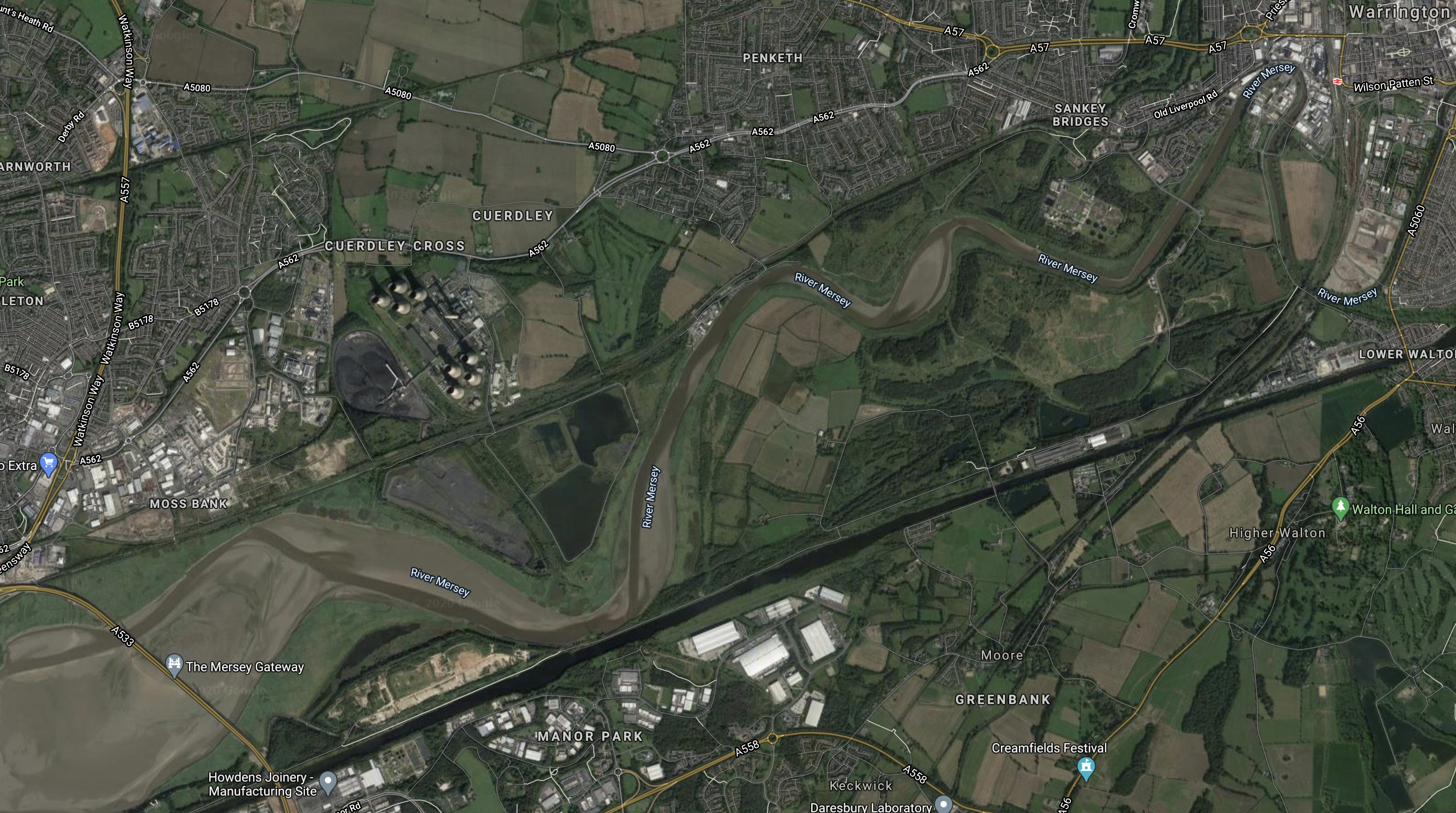
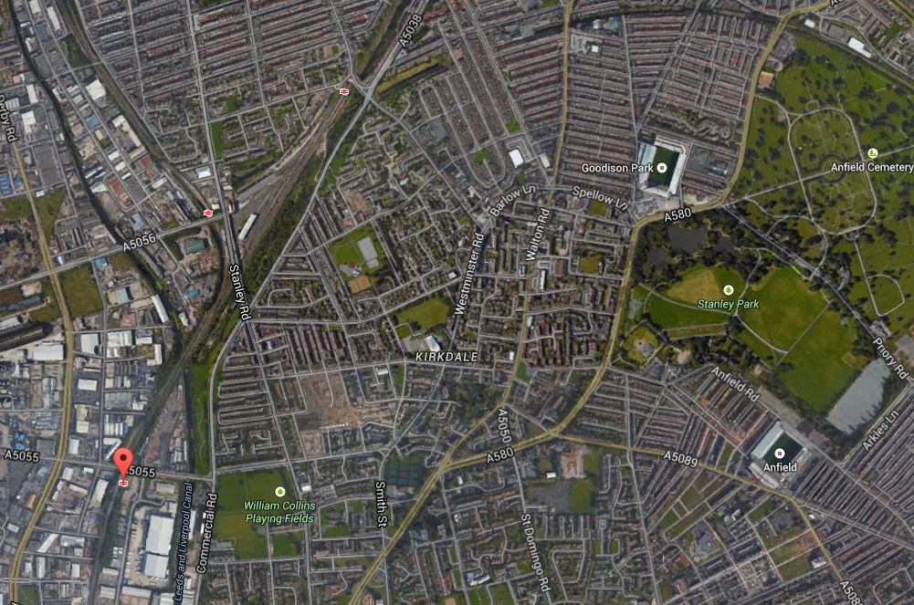
This Google Map shows the power station.

Note.
- Fiddlers Ferry may have been large for its time at 1989 MW, but it is still less than a quarter of the size of the Hornsea wind farm!
- Drax power station in 1986 at 3960 MW, was larger than Fiddlers Ferry, but was still less than half of the size of Hornsea!
Hornsea wind farm is a true green giant!
This paragraph is from the Hornsea Project 4 section of the Wikipedia entry for the Hornsea wind farms.
Construction of the wind farm was provisionally expected to start in 2023, and be operational by 2027, at the earliest. The project’s capacity is unknown by Ørsted due to the ever increasing size of available wind turbines for the project.
When completed, it could be even bigger.
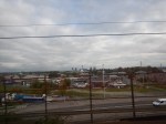
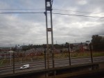
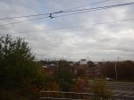
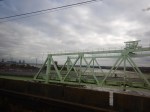
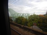
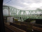
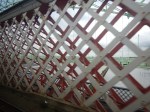
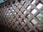
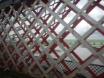
Crossing The Mersey
I took these pictures as the train to Liverpool crossed the Mersey yesterday.
Note.
- The green bridge is now called the Silver Jubilee Bridge, but when I lived in Liverpool and worked at ICI in Runcorn, everybody called it the Runcorn-Widnes Road Bridge.
- The train is on the Ethelfleda, Britannia or Runcorn Railway Bridge depending on your preference. I tend to use Britannia, as the guys I worked with used that name.
- The three towers of the cable stayed Mersey Gateway Bridge can be seen in several pictures.
- Fiddlers Ferry power station is now decommissioned, but was an almost 2GW coal-fired power station.
In January 2011, I took a video as I crossed the Mersey and it is shown in Train Across the Mersey.
The Future Of Fiddlers Ferry Power Station
The Wikipedia entry for the power station, says this about the future use of the site.
Demolition of the station was due to begin in 2020 and will take up to seven years. The land upon which it sits will be redeveloped, with Warrington Council stating it had designated the land as an employment site.
As it obviously has a high-capacity electricity connection and there is a lot of offshore wind power in Liverpool Bay, I would feel it could be an ideal location for a large battery of perhaps 2 GWh.
The Future Of The Britannia Railway Bridge
The bridge was opened in 1868 and is Grade II* Listed.
Did the designer of the bridge; William Baker ever envisage, that in the future his bridge would be carrying trains over 250 metres long, that were capable of 125 mph?
Probably not! But in a few years, the bridge will be carrying High Speed Two Classic Compatible trains between London and Liverpool.
Denmark To Build ‘First Energy Island’ In North Sea
The title of this post, is the same as that of this article on the BBC.
This is the first three paragraphs
A project to build a giant island providing enough energy for three million households has been given the green light by Denmark’s politicians.
The world’s first energy island will be as big as 18 football pitches (120,000sq m), but there are hopes to make it three times that size.
It will serve as a hub for 200 giant offshore wind turbines.
It seems to follow the bigger-is-better offshore principle, I talked about in Crown Estate’s Auction Of Seabed For Wind Farms Attracts Sky-High Bids.
The BBC article says this about the energy generation of the island and its turbines.
The new island would supply an initial 3 gigawatts, rising to 10 over time.
For comparison the coal-fired Fiddlers Ferry power station on the banks of the Mersey near Widnes was a 2 gigawatt station and the nuclear Hinkley Point C will hopefully generate 3.2 GW.
These are my thoughts.
The Location Of The Island
According to the BBC, the Danes are being secretive about the location of the island, but the BBC does say this about the location of island.
While there is some secrecy over where the new island will be built, it is known that it will be 80km into the North Sea. Danish TV said that a Danish Energy Agency study last year had marked two areas west of the Jutland coast and that both had a relatively shallow sea depth of 26-27m.
According to Wikipedia, Denmark has a sizeable offshore gas industry and I did wonder, if the island would be built near to a large worked out field, so that the field could be used for one of the following.
- Store hydrogen produced on the island from surplus electricity.
- Store carbon dioxide produced on the mainland.
But the gas fields are further than 80 km. from the shore being closer to where Danish, German, Dutch and British waters meet.
Hydrogen And The Island
In ITM Power and Ørsted: Wind Turbine Electrolyser Integration, I talked about a joint project between, electrolyser company; ITM Power of the UK and turbine manufacturer and developer; Ørsted of Denmark.
The post was based on this press release from ITM Power.
These were points from the press release.
- Costs can be saved as hydrogen pipes are more affordable than underwater power cables.
- It also stated that wind turbines produce DC electricity and that is ideal for driving electrolysers.
So will the island be connected to the mainline by a hydrogen gas line?
- Cost will play a big part.
- I don’t like the concept of electrical cables on the sea floor,
- Gas pipes have been laid everywhere in the North Sea.
- A hydrogen connection might better support different types of future turbines.
- If there is a worked-out gas-field nearby, the hydrogen can be stored offshore until it is needed.
I think it is a distinct possibility.
Hydrogen could be generated in one of two ways.
- Wind turbines based on the ITM Power/Ørsted design could generate the hydrogen directly and a gas network could deliver it to the island.
- Conventional turbines could generate electricity and an electrical network could deliver it to the island, where a large electrolyser would convert water into hydrogen.
Both methods would be better suited to a hydrogen connection to the mainland.
Connection To Other Islands
The Dutch are already talking about a North Sea Wind Power Hub on their section of the Dogger Bank.
So could we see a network of islands in the Southern North Sea?
- Some like the Danish island would support a network of wind turbines.
- Some would store energy as hydrogen in worked-out gas fields.
- Some would store captured carbon dioxide in worked out gas fields.
- Some would supply hydrogen to onshore hydrogen and carbon dioxide networks like HumberZero.
- Islands could be linked by electrical cables or gas pipelines.
- Gas pipelines would allow both hydrogen or carbon dioxide to be stored or moved
The North Sea could become the largest power station in the continent of Europe, or even the world.
Northern Powerhouse Rail – A New Line Between Liverpool And Manchester Via The Centre Of Warrington
In this article on Transport for the North, which is entitled Northern Powerhouse Rail Progress As Recommendations Made To Government, one of the recommendations proposed for Northern Powerhouse Rail is a new rail line between Liverpool and Manchester via the centre of Warrington.
I shall look at a few of the possibilities for various sections of the line starting at the Manchester end.
High Speed Two And Northern Powerhouse Rail Between Warrington/Lymm And Manchester Airport
This map clipped from High Speed Two’s interactive map, shows the route of High Speed Two in the area between Lymm and Manchester Airport.

Note.
- High Speed Two is shown in orange
- The blue dot is Manchester Interchange station at Manchester Airport.
- High Speed Two goes North to Wigan North Western station.
- High Speed Two goes South to Crewe station.
- High Speed Two goes East to Manchester and the East.
- The East-West Motorway is the M56 with Junction 7/8 in the middle of the map and Junction 9 with the M6, at the Western edge of the map.
This enlarged map shows High Speed Two between Manchester Airport and Junction 7/8 of the M56.

The colours of High Speed Two indicate the type of construction.
- Black is a bored tunnel. Only in the North East corner, where it continues to Manchester.
- Brown is a track between retaining walls. Used through Manchester Interchange or Airport station.
- Red is a viaduct.
- Yellow is a cutting.
This Google Map shows a similar area.

High Speed Two’s tracks will be on the South side of the Motorway and will be shared with Northern Powerhouse Rail.
- There is likely to be up to twelve trains per hour (tph) in both directions.
- I would think, that with modern signalling that the trains would be running at 140 mph or more.
- Between Manchester Airport and Warrington could be a line as between St. Pancras and Ebbsfleet on High Speed One.
This map clipped from High Speed Two’s interactive map, shows the M56 and High Speed Two around Junction 7/8 of the M56.

The colours are as before.
- The obvious way to build a new rail line between Manchester and Warrington, would surely be to create a rail junction just South of the Motorway junction.
- A line to Warrington could run along the South side of the Motorway.
- I also believe that there should be a connection between the High Speed Two lines to Manchester and Wigan North Western, to allow high speed services between Manchester and Barrow, Blackpool, Preston, Windermere and Scotland.
Building the rail junctions around the Motorway junctions would be a good idea for environmental and visual reasons.
Northern Powerhouse Rail would then continue to Junction 9 of the M56 Motorway.
This Google Map, shows the M56 around Junction 9 with the M6.

Note.
- The M56 running East-West.
- The M6 running North-South.
- Lymm services to the North-West of the junction.
- Lymm is to the North-East and Warrington is to the North-West of the junction.
Would it be possible for to run South of the M56 and then turn North to run along the Western side of the M6 towards Warrington?
I very much feel, that with modern 3D software, an engineer with expertise in extreme knitting could thread a double-track line through to take a North-Western route towards Warrington.
The Bridge Across The Mersey
If you look at maps of the area, there is a big problem of water between Junction 9 of the M56 and Warrington town centre, with its two stations of Warrington Bank Quay and Warrington Central, both of which have services to Liverpool Lime Street station.
The problem is the Manchester Ship Canal.
I then noticed a bridge to the South East of the town centre, which is shown in this Google Map.

It may look like it has got more than a touch of the dreaded iron moths, but it certainly looks like it was once a double track rail line.
The bridge was on the Warrington and Altrincham Junction Railway, which did what you would expect from the name.
This Google Map shows the track of the railway either side of the bridge.

Note the bridge in the centre of the map and the green scar of the former railway running East-West across the map.
To the East the green scar of the railway can be picked out all the way to M6.

Note.
- The bridge is at the West over the Manchester Ship Canal.
- The green scar of the Warrington and Altrincham Junction Railway can be followed all the way to the M6,
- I think the track is now a footpath, as it is marked on the map with a dotted white line.
I would be interested to know, if it could take a modern double track railway.
This Google Map shows an enlarged view of where the green scar of the Warrington and Altrincham Junction Railway goes under the M6.

Note the dotted white line marking the railway, towards the top of the map.
Would it be possible to design a track layout, where Northern Powerhouse Rail came up the Western side of the M6 and was able to connect to Warrington?
I certainly believe it’s a possibility.
Warrington Bank Quay Station
To the West of the bridge over the Manchester Ship Canal, the Warrington and Altrincham Junction Railway ran through low-level platforms at Warrington Bank Quay station.
This Google Map shows Warrington Bank Quay station.

This picture shows a freight train passing under Warrington Bank Quay station.

Note.
- There are four North-South platforms on the West Coast Main Line.
- The Warrington and Altrincham Junction Railway passes East-West under the four main platforms.
- Low levels platforms used to handle passengers on the East-West lines.
- I was looking to the East in the picture.
- The tracks continue to the West on the route of the former St. Helens Railway, which is now a freight route.
- The map shows the tracks curving sharply round one of the meanders of the River Mersey.
Warrington Bank Quay station is on a congested and tight site, but by using some of the spare railway land, I feel it could rebuilt to be an excellent station for Warrington.
Warrington Bank Quay Station As An Interchange
Warrington Bank Quay station could be an excellent and efficient interchange between High Speed Two and Northern Powerhouse Rail.
There are also local services from the station, which could be useful for some travellers.
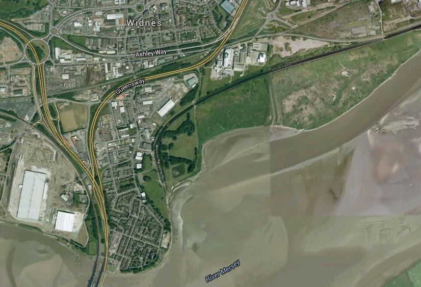
Between Warrington Bank Quay Station And Widnes
This Google Map shows the Mersey estuary between Warrington Bank Quay station and Widnes.
Note.
- Warrington is in the North-East corner of the map, with Warrington Bank Quay station shown by a red station symbol.
- The new Mersey Gateway bridge is in the South-West corner of the map.
- The River Mersey meanders between the bridge and Warrington.
- Fiddlers Ferry power station can be picked out in the nearest meander of the Mersey to the bridge.
- The dark straight line below the river is the Manchester Ship Canal.
- There is currently a freight line on the North bank of the river.
This Google Map shows Fiddlers Ferry power station, with the railway between the now-decommissioned power station and the River Mersey.
Note.
- Fiddlers Ferry will become an employment site.
- It could even be a good place for a depot for Northern Powerhouse Rail.
- I think there’s scope to increase the operating speed of the railway along the Mersey.
Could it even be an electrified high speed line with a 125 mph operating speed?
Between Widnes And Liverpool Lime Street
The trains coming from Warrington could join the Liverpool Branch of the West Coast Main Line at Ditton East Junction.
The route between Ditton East Junction and Liverpool Lime Street has the following characteristics.
- It has four tracks.
- It is 10.6 miles long.
- Avanti West Coast’s expresses typically take twelve minutes for the trip without stopping.
- The stations on the route; Liverpool South Parkway; West Allerton, Mossley Hill and Edge Hill, all have one platform per line.
- It is fully electrified.
- Lime Street station has recently been updated with longer platforms and a higher capacity approach to the station.
- Some local services have already been moved to Merseyrail’s Northern Line.
- Stopping services on the route have their own platforms.
I believe that with the installation of full digital signalling and a degree of automatic train control, as far as Crewe and Warrington Bank Quay stations, that the following services could be handled.
- Six tph – Northern Powerhouse Rail – Liverpool and Manchester Airport and Manchester Piccadilly
- One tph – East Midlands Railway – Liverpool and Nottingham
- Three tph – High Speed Two – Liverpool and London Euston
- One tph – High Speed Two – Liverpool and Birmingham Curzon Street
- Two tph – London North Western – Liverpool and Birmingham and London Euston
Note.
- This is only 13 tph.
- Avanti West Coast services would be replaced by High Speed Two.
- TransPennine Express services would be replaced by Northern Powerhouse Rail
- The Liverpool and Nottingham service may or may not go via Ditton East junction.
If the capacity on this branch could be raised to 15 tph, that would be only be a train every four minutes, or half the frequency, that will eventually be operational on Crossrail and Thameslink. It would also be less than the 18 tph frequency of High Speed Two.
Conclusion
This simple exercise has proven to me, that a high speed line could be built between Manchester Airport and Liverpool Lime Street station.
- Several sections of the route could have an operating speed of 125 mph or more.
- By running the tracks along the M56 and M6, visual and aural intrusion could be minimised.
- The line along the Mersey through Warrington could be a valuable part of the route.
- West of Warrington, much of the infrastructure needed, appears to be in place and it would only need to be upgraded.
There was a large and extremely pleasant surprise at the Liverpool end.
The approach to Liverpool Lime Street is two fast and two slow lines, and I believe, that this section of the route could handle up to say 15 fast trains and six stopping trains per hour, with full digital signalling.
Unlike London and Manchester, I doubt that Liverpool will need a tunnel to access the City Centre.
I also believe that after its refurbishment of the last couple of years, Lime Street could be substantially ready for High Speed Two and Northern Powerhouse Rail.
Project Management Recommendations
This project divides neatly into three.
- Between Manchester Airport and Warrington along the route of the M56 and M6.
- Reconstruction, upgrading and electrification through Warrington and the rebuilding of Warrington Bank Quay station.
- Reconstruction, upgrading and electrification between Warrington and Liverpool.
The first project will be a major one, involving the construction of nearly twenty miles of new electrified railway, with numerous viaducts, bridges and a large junction at High Legh with High Speed Two.
The other two projects would be a lot simpler and would involve turning twenty miles of double-track freight line into a modern electrified railway.
I would construct projects 2 and 3 early in the schedule, as it would give Warrington a new Bank Quay station. A passenger service to Liverpool Lime Street, could also be opened if required.
Could Tram-Trains Be Used To Advantage In Liverpool?
This document discusses the various issues concerning tram, tram-trains and conventional rail in the wider Liverpool area.
It is divided into the following sections.
1. Liverpool Trams And The Merseytram Proposal
2. A Tram-Train To The Airport
3. The Future Of Public Transport In The Wider Liverpool Area
4. Further Electrification In The Merseyrail Network
5. Extensions To The Merseyrail Network
7. Increasing Capacity On The Northern Line Through The City Centre
8. Connecting To Football At Anfield And Goodison Park
9. Capacity Problems At Lime Street
10. There Is A Need For Extra Southern Terminals
11. Upgrading The Halton Curve
12. Expansion Of South Parkway Station
13. The Canada Dock Branch And The Edge Hill Spur
14. The North Mersey Branch To Aintree
16. Electrified and Extended Lines In The North
18. Electrification Between Liverpool to Manchester via Warrington Central
22. Conclusions
Note that all of this post was produced using WordPress with most of the maps from Google Earth.
1. Liverpool Trams And The Merseytram Proposals
Liverpool doesn’t have trams any more, although it does have a legacy of wide dual-carriageways with a wide grass area in the middle, which was where the trams used to run. These would help with on-street running of a modern tram system.
Plans for a system called Merseytram are hanging around.
Merseytram Map
This map shows the comprehensive nature of the proposal.
In some ways, I’m surprised that Liverpool hasn’t done something to implement a modern system.
Liverpool too, doesn’t have much traffic congestion outside of the city centre and as they’ve just abolished bus lanes without too many protests, it might be assumed, that there is not the need for any more public transport, other than the current extensive buses and trains.
The latter are undergoing more electrification.
2. A Tram-Train To The Airport
However, there is one place, where a tram-train is being proposed in the area. Look at this Google Earth image, showing the area between Liverpool South Parkway station and John Lennon Airport.
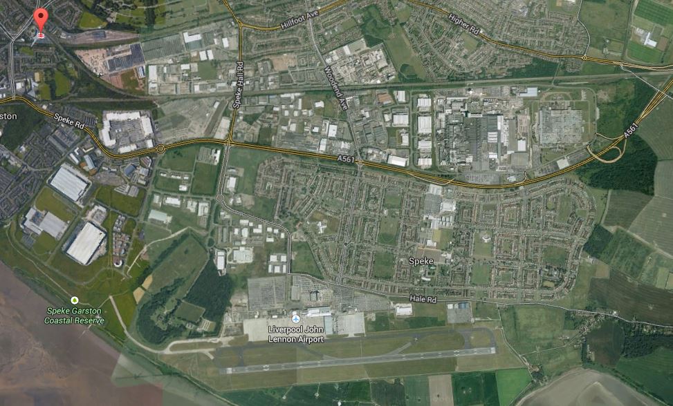
Liverpool South Parkway To John Lennon Airport
I’m not sure of the route and I can’t find anything on the Internet, but an airport to a nearby station is a classic tram-train application, as effectively you’re extending a rail line, by using much more affordable tramway infrastructure. In this type of application, you often have lots of airport infrastructure like secondary terminals and car parks, that need to be connected to both ends of the link. In Liverpool’s case you might even put a stop at Speke Hall. I know the area fairly well and those wide dual-carriageways and spare land alongside the railways will mean that putting in the tracks and stops will not be the most challenging of engineering. It would appear that compared to other schemes proposed for tram-trains it is very affordable, with the major cost being procuring the new tram-trains, which would also be used to run to the city centre and beyond on the existing train lines, giving passengers a one vehicle journey to a large number of places in Liverpool city centre.
What makes this proposal even more sensible in my view, is that Liverpool South Parkway, is served by both the City Line and the Northern Line that go to the city centre. Within a few years both lines will be electrified and would be a route for tram-trains.
This proposal is surely one of several around the country, that will be looked at in great detail, if the Sheffield-Rotherham tram-train trial is a success.
After my experiences in Kassel and Karlruhe, I’m sure that trial will be an outstanding success. If only, because we’ve got all the accumulated knowledge from design and operations of several tram-train systems all round the world.
3. The Future Of Public Transport In The Wider Liverpool Area
Liverpool and Merseyside in general have various plans, problems and decisions to take or solve in the next few years.
4. Further Electrification In The Merseyrail Area
On March the fifth, 2015 the North of England Electrification Task Force published its final report of which lines should be electrified.
The lines are grouped into three tiers and those in the Merseyrail area are.
Tier 1
- Liverpool to Manchester via Warrington Central
- Southport/Kirkby to Salford Crescent
- Chester to Stockport
- Warrington to Chester
Tier 2
- Chester to Crewe
Tier 3
- Ormskirk to Preston
These and other schemes may or may not effect this discussion.
5. Extensions To The Merseyrail Network
This map from Wikipedia shows the current network.
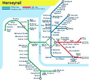
Merseyrail Network
A lot of the lines out of the centre end in areas in need of development, at all places on the price scale. Some of these and other places might be better served by using tram-trains, which run on from the current network and then perhaps could even go on a loop at the end of the line before returning to the city centre.
- The Skelmersdale branch could be reopened from Ormskirk.
- Could tram-trains run along the coast from Ainsdale, to the north of Southport, to create a tram line serving all of the golf courses and other leisure facilities?
- Could tram-trains help sort out the problems at Kirkby station, by going in a worthwhile loop around the town?
- Edge Hill to Bootle is an important freight line, that runs close to Goodison and Anfield football grounds, Network Rail have stated that this line may be electrified. Would using tram-trains with their simpler infrastructure needs make adding passenger services on this line easier?
- The North Mersey Branch from Bootle to Aintree is another freight line, that also runs close to Aintree racecourse. Like Edge Hill to Bootle, could tram-trains be a more affordable solution to adding passenger services to the line?
- Liverpool have long had aspirations to build an Outer Rail Loop. The route is safeguarded and could tram-trains enable an affordable passenger service?
I suspect that other lines and branches will be added to this list.
It is worth noting that all the tram-trains I’ve seen in Kassel, Karksruhe and Mulhouse, start on one line coming into the city as a train, go through the city centre as a tram and then take another line out of the city as a train. The Sheffield to Rotherham trial will use a version of this model. However in Liverpool, it would appear more likely, that tram-trains will be used to extend the existing rail network.
I don’t think anybody in their right mind, would expect Liverpool to follow convention.
6. Train Replacement
Merseyrail has a current fleet of just under 60, Class 507 and Class 508 three-car electric trains, that work the DC lines and these will need replacement in a few years. At nearly thirty-five years old, they are older than a lot of the dreaded Pacers. But they have certainly worn better.
With all the 25kV AC electrification that is planned for the area, any new trains would have to be dual-voltage, so they wouldn’t be limited in where they ran on the Merseyrail network.
Should some of the replacement trains, be something like Class 399 tram-trains? Some of these may be purchased anyway, if the tram link between Liverpool South Parkway and John Lennon Airport goes ahead.
They also tick all of the boxes of being dual-voltage, low-floor and with main-line performance and crash protection, so they could work the City, Wirral and Northern Lines, without causing problems with faster traffic.
They could probably be easily certified for working in tunnels.
It is worth stating some of the sdvantages I perceived when I saw tram-trains in action, in Kassel, Karlsruhe and Mulhouse.
1. When running as trains on a normal rail line, they fit in with the other traffic just like an electric multiple unit of the same length, taking their power from either overhead line or third-rail at the line’s voltage. Except for testing, you could run a compatible tram-train on many rail lines tomorrow.
2. When running as trams, they trundle around slowly in very much the same manner as trams do in Manchester, Sheffield and Croydon. Stops just need to be shelters with information and possibly a ticket machine. Power would usually come from a simple 750V DC overhead line, like most tramways in the UK and Europe.
3. Tram-trains can also run as trams on say a freight line, which has been electrified with either 25kV AC or 750V DC overhead line. This type of operation is being trialled on a Sheffield to Rotherham freight line to test the applicability of tram-trains to the UK. If the stops are simple affairs and not complete stations, the cost is kept low.
4.One problem that tram-trains might have is the difficulty of maintaining level access to the different platform heights. The new tram-trains in Mulhouse used clever steps to make sure it is easy to get on and off for all passengers.
5. Early tram-trains used to have separate control systems for when they were running as trams and as trains. But I suspect now, that UK trains are being equipped to run under ERTMS, which does away with line-side signals and relys on radio and screens, that this system can be used in tram-mode. This would certainly simplify operation.
In some ways because we are late to look at tram-trains we get the benefit of everybody else’s design and operational mistakes.
We might even be lucky in that a tram-train can be designed and built, that could run on any tram or train line in the country.
7. Increasing Capacity On The Northern Line Through The City Centre
This is mentioned as a problem in the Wikipedia entry for Merseyrail under tram-trains. This is said.
Tram-trains would allow street running, providing an alternative route through Liverpool city centre. It could potentially relieve pressure on the busy underground section of the network.
I don’t think you’d take a route in front of Lime Street station, but you could run along the historic water-front, to much the same route as the iconic Liverpool Overhead Railway. Although, you’d probably run at street level, rather than on a viaduct.
The line could run up the Mersey starting from Garston, Liverpool South Parkway or even the Airport in the South, going through the gardens along the river at Otterspool and then move away from the river to go on the landward side of the Albert Dock, the Liverpool Arena and the Three Graces. It would go close to the shops at Liverpool One, James Street station, the Mersey Ferries, the Cruise Ship Terminal and the development at Liverpool Waters, before possibly rejoining the Northern Line.
Liverpool are thinking of creating a new station at Vauxhall between Moorfields and Sandhills stations, which could be a good place for the rejoining. Incidentally, the developers are proposing a monorail link to the city centre for this development, so at least transport is being thought about.
This would be World-class transportation for a city making a reputation for itself as a World-class destination.
8. Connecting To Football At Anfield And Goodison Park
When people think about Liverpool, many think about football. I also think there is an increasing trend for football grounds at the top level to be well-served by trains or trams.
Following on from the previous section about increasing capacity on the Northern Line through the city centre, look at this Google Earth image of the area between Sandhills station and Anfield and Goodison Park.
Sandhills Station, Anfield and Goodison Park
Sandhills is the station, from where connecting buses leave for football and it is indicated by a red arrow. North of Sandhills you can see Bank Hall station on the Southport branch of the Northern Line and Kirkdale station on the Kirkby branch.
Crossing under the two branches of the Northern Line, just south of Bank Hall and Kirkdale, and then curving away initially in a north-easterly direction before turning south-easterly around the Anfield Cemetery is the Edge Hill to Bootle Line or the Canada Dock branch, which is an important route for freight trains in and out of the docks. Merseyrail would like to use this line as a passenger line possibly with a station at Walton and Anfield, which would be about four hundred metres from Goodison Park and another at Breck Road, which would be a little bit further from Anfield. This modified Google Earth image, shows the two football grounds and the stations.
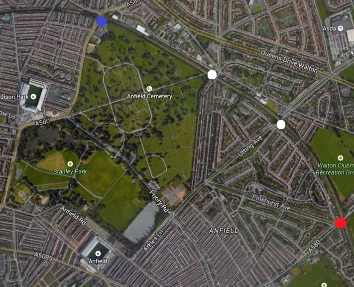
Anfield, Goodison Park and Stations
Obviously, Walton and Anfield is shown with a blue circle and Breck Road with a red one. I don’t know the area very well, as I have only been to Anfield once in the last forty years or so, so it might be that there is a possibility of putting a station at Utting Avenue or the north-east corner of the cemetery to serve both grounds. Both possibilities are shown with white circles.
If tram-trains were to be used on this line running as trams, then it might be possible to use a simple standard station design, as all stations are on bridges over roads. The Disused Stations web site has some more information and pictures, about the former Walton and Anfield and Breck Road stations.
As the line curves round to Edge Hill, supporters coming from the South and East could avoid the City Centre.
9. Capacity Problems At Lime Street
Liverpool Lime Street is a station, where capacity is a problem and I’ve read somewhere that Virgin can’t run their longest Pendolinos to the city. Wikipedia says this about work being done to create an extra platform.
The old platform 6A which is located next to platform 7 and is only used as a siding will become the new platform 7 in 2014. Existing platforms 7/8/9 will become new platforms 8/9/10, this will allow new long distance services to start and terminate at Lime Street to Scotland and London starting in 2015 from the new platform 8 & 9 (Virgin Trains).
There is also an idea called the Edge Hill Spur, that has been in the pipeline since the 1970s. This extract from Wikipedia sums it up.
The construction of the Spur would have connected the City Line branches to the east of Liverpool into the electrified Merseyrail network and importantly the underground section in Liverpool’s city centre. An increase in integration and connectivity of the system would be achieved. An additional and substantial benefit was releasing platform space at Lime Street mainline terminus station from urban to mid and long haul mainline routes, as the Spur would divert local urban routes entering the city underground in the city centre.
So everybody would seem to win. Even I would, as one of the proposals now is to have an underground station at my old University of Liverpool.
The accountants certainly win too, as much of the tunnelling required was dug by the Victorians or was enabled when Liverpool sorted out the underground railway in the 1980s.
One of the things that you have to remember as a visitor to Liverpool, is that the city centre slopes down to the Mersey, so it is an easy walk. I can walk up, but those with a lot of purchases in Liverpool One or various movement problems can get a train up from James Street station, a bus or a taxi.
There may be a case for running tram-trains as trams past Lime Street station, but I think if the connection at the station to the underground lines is improved and the train frequency around the loop is increased, then there is a lot less need. As it is frequencies to all destinations on the Wirral Line at Lime Street are four trains per hour, so to get to Central or James Street usually means a wait of no more than four minutes.
Once at Central to go North it’s the same fifteen minute frequency to go all destinations, with a train every five minutes. Going south to Hunts Cross there’s a train every fifteen minutes.
New trains with perhaps four cars and ERTMS, drawing on the experience of Crossrail and Thameslink in London, may be able to increase the capacity through the core.
10. There Is A Need For Extra Southern Terminals
If you look at the East London Line in London, which is of a similar layout of a central core with north and south branches, that runs modern trains, this handles sixteen trains per hour through its core section.
I think it is reasonable to expect that the Northern Line should be able to take a similar number of trains. But as the planned frequency in London is twenty-four and ERTMS is coming to both lines, does sixteen trains per hour on the Northern Line look very conservative? .
My scheduling gut-feelings also say that if the number of destinations south of the city centre were increased and this meant that fewer trains were turned back at Liverpool Central, then capacity and frequency would be raised. This section on services at Liverpool Central says that twelve services an hour go north to the various destinations of Southport, Ormskirk and Kirkby and only four go south to Hunts Cross and Liverpool South Parkway. So that means eight per hour have to wait. It’s a similar problem to what used to happen in London at Edgware Road on the Circle Line, except there it was an easy solution. They turned the circle into a spiral.
Trains and drivers seem to be wasting their time sitting in the turn back platform at Liverpool Central, when they could be doing something useful, like perhaps running to Runcorn or Warrington.
The Edge Hill Spur won’t help, as because it joins to the north of Liverpool Central station, if another terminus is not added in the south, this will just add to the problems.
Resources must be balanced, so if from Sandhills to Liverpool Central the frequency is twelve trains per hour, the frequency should be planned to be the same from Liverpool Central to Brunswick.
If the traffic isn’t balanced you get trains in the centre waiting to go back north.
If Merseyrail wants to run traffic to three northern destinations at a frequency of four trains per hour, it would seem that one of the best solutions would be to run trains to three southern destinations at the same frequency. On the East London Line, there are four Southern destinations and two in the north, but each with two platforms.
In Liverpool they’ve already got Hunts Cross and they’re planning to add the Airport as another. I think they need another to balance the line and improve frequency and punctuality.
11. Upgrading The Halton Curve
Funds have been made available to upgrade the Halton Curve, so that trains can reach Chester from Liverpool South Parkway via Runcorn.
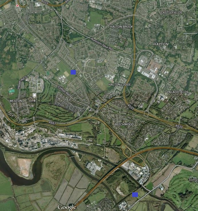
The Halton Curve
The two blue squares indicate the two ends of the current single-track curve. The top one is where the curve leaves the Liverpool branch of the West Coast Main Line south of Runcorn station and the bottom one is where it joins the Chester to Manchester Line east of Frodsham.
The main reason for doing this would be to allow trains from Chester and North Wales better access to Liverpool Lime Street and South Parkway stations, and the John Lennon Airport.
As the Tier Two and Three electrification plans for the North as they effect Merseyside, include full electrification of the lines around Chester, this would mean that an upgraded curve would be electrified.
There are probably good reasons to add an extra track to the curve, which would make it possible for Chester to be a new southern destination of the Northern Line.
12. Expansion Of South Parkway Station
Liverpool South Parkway was built as a transport hub so that travellers to the city,could use the local electric trains to get to all parts of the area, without going into the city centre. This Google Earth image shows how the station is built between the Northern Line and the Liverpool branch of the West Coast Main Line.

Liverpool South Parkway Station
The Northern Line platforms are at the bottom, with the ones to the right serving the other lines, so it is effectively two stations and a transport hub.
Liverpool want to get more services running from Liverpool South Parkway station and would like to see some Virgin Trains services stop there, but the platforms are too shirt for Pendelinos.
Tram-trains might help grow traffic, as with the airport connection and perhaps other services using the technology, the station could become a hub from where you could get all over Merseyside.
Other factors will also help.
1. As time progresses, quite a high proportion of services from to and from Liverpool Lime Street will stop at the station, so it could become an alternative station from where to catch long distance trains.
2. Merseyrail wants to fully develop the Halton curve, which will give alternative routes to Chester and North Wales. Due to its proximity to the John Lennon Airport, Liverpool South Parkway can only benefit.
3. Merseyrail also have a desire to create an Outer Rail Loop that encircles the city. Nothing has happened much in recent years, but if the North Liverpool Extension Line should be reopened, I’ll ride it, as it goes through places dear to my memory of the wonderful four years I spent in Liverpool. C and myself at one time lived in a rented flat near Gateacre station on the line and regularly drunk in the Black Bull pub in Gateacre. If the line should be reopened and a circular railway is formed around Liverpool, Soputh Parkway station will only gain more traffic.
4. HS2 and HS3, if they reach Liverpool will surely stop at Liverpool South Parkway.
Most Parkway stations in this country are isolated and you need a car to get to them, but Liverpool South Parkway is unique in that it is a transport hub outside of the city centre close to an airport.
I believe that in time South Parkway will become an alternative station to Lime Street. After all, it only takes twenty minutes on a train between South Parkway and Central or Moorfields in the city centre.
Improved trains and a few tram-trains can only hasten the rise of this station’s importance.
13. The Canada Dock Branch and the Edge Hill Spur
I talked in Section 7 about how the Canada Dock Branch between Bootle and Edge Hill could improve passenger services in an arc in the north-eastern part of the city and in Section 8 about how capacity problems at Lime Street might be improved by the Edge Hill Spur.
Edge Hill station is one of the oldest stations in the country and will only grow in importance, when it receives the new electrified services from Manchester in a few months. At present the Canada Dock Branch is not electrified, but with the large number of freight trains going into and out of the docks, it can’t be long before this line gets wired.
This Google Earth image shows where the southern end of the Canada Dock branch splits to allow trains to go east to Broad Green station or west to Edge Hill station.
The Southern End Of The Canada Dock Branch
The chord going east is the Olive Mount Chord, which was only reopened in 2009 to create an easier route for freight trains between Seaforth Dock and the West Coast Main Line. Read this section in the Wikipedia entry for Seaforth Dock, which describes how one three hundred metre rail line made everything easier and increased capacity of the rail line by 100%. It also freed up capacity so that a passenger service could be created.
The station south of the junction is Wavertree Technology Park on the main Liverpool to Manchester Line, between Edge Hill and Broad Green. It should also be noted that there used to be a station at Edge Lane, where the branch crosses the road of that name.
Obviously, if the Canada Dock Branch were to be run using tram-trains, there are possibilities of extra stops in the area.
Merseyrail originally planned to put a transport hub at Broad Green and you can see why, as trains on both the Canada Dock Branch and the Edge Hill spur could pass to or through the station. As this Google Earth image shows, the station is shoe-horned into a forest of motorways and dual-carriageway roads.
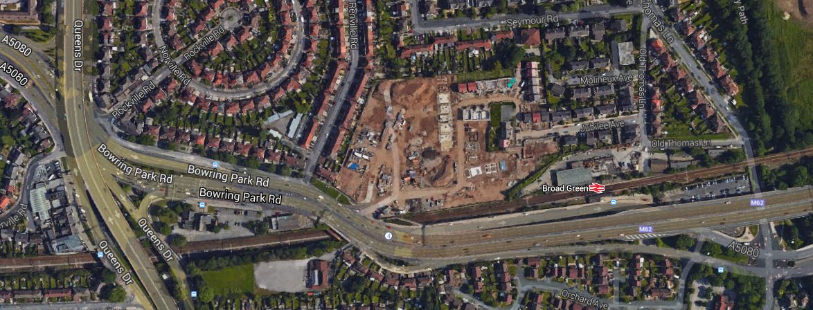
Broad Green Station
, A good creative architect could make something of this transport hub and give Broad Green a bay platforms for the extra trains.
14. The North Mersey Branch To Aintree
The North Mersey Branch is a railway to the north of Liverpool, that is really only used for engineering purposes. It originally linked Gladstone Dock and Bootle with Aintree and the racecourse.
This Google Earth image shows the line of the Aintree end of the branch.
The North Mersey Branch
The station on the left of the image is Seaforth and Litherland and Aintree station and the racecourse can be seen in the east.
The line could also be extended to the west into the docks and at the east to Kirkby, which is an area that in the 1960s needed a good sort-out of public transport and probably still does.
Could this be a line that would benefit the area, by being turned into a tram-train route across the north of the city?
15. The Skelmersdale Branch
Skelmersdale is the second largest town in North West England without a railway service. Merseyrail’s entry on Wikipedia, has a section about the reopening of the Skelmersdale Branch to the town centre, which includes this.
The reopening of a section of the Skelmersdale Branch from Upholland to Skelmersdale town centre has been proposed.[42] The line was completely closed in 1963. This would give Skelmersdale, the second largest town in North West England without a railway service, direct access to Liverpool city centre. Network Rail has recommended that a further feasibility study be carried out.
One proposal is to extend the line from Ormskirk station by laying 3 miles of new single track along the previous route towards Rainford Junction station.
This single track proposal could be one to be built in an affordable way for a tram-train.
16. Electrified and Extended Lines In The North
Under the electrification plans for the North, some of the lines fanning out in the north of Liverpool and Southport will be electrified.
In Tier One, the Southport to Manchester Line and the Kirkby Branch would be joined to the electrification in Manchester at Salford Crescent station, which is being improved and expanded.
This electrification is essentially separate from the third-rail Northern Line, so it does mean that Southport and Kirkby stations will be on both electrification systems.
Where they do interact more directly is when under Tier Three of the electrification, the Ormskirk to Preston Line is electrified.
This line crosses the Southport to Manchester Line at the Burscough Curves. Merseyrail have wanted to reinstate this full junction for some time and this is said about the curves on the Wikipedia entry for Merseyrail.
The Burscough Curves were short chords linking the Ormskirk to Preston Line with the Manchester to Southport Line. The last regular passenger trains ran over the curves in 1962; the tracks were subsequently lifted. The reinstatement of the Burscough Curves would allow direct Preston-Southport and Ormskirk-Southport services and provide an alternative Liverpool-Southport route. Network Rail has recommended that a strategy for the Burscough Curves be developed further.
This Google Earth image shows the curves.
Burscough Curves
The two stations are Burscough Junction indicated by the red arrow on the Ormskirk to Preston Line and Burscough Bridge on the Southport to Manchester Line. The crossing of the two lines can be clearly seen and the two curves can also be made out, although the track was lifted decades ago.
Although, a reinstated junction would undoubtedly be good for the area, this link doesn’t really have any ramifications for the rail system in Liverpool, as both lines will have 25kV AC overhead electrification.
If trains on the Northern Line are to run past Ormskirk and Kirkby, they would have to be dual-voltage.
17. The Outer Rail Loop
Wikipedia explains the Outer Rail Loop in a section of the entry for Merseyrail, This is said.
The Orbital Outer Rail Loop was a part of the initial Merseyrail plans of the 1970s. The route circled the outer fringes of the city of Liverpool using primarily existing rail lines merged to create the loop. With Liverpool city having a semi-circular footprint with the city centre at the western fringe against the River Mersey, the western section of the loop would run through the city centre. The scheme was started along with the creation of Merseyrail however postponed due to cost cutting.
As Liverpool has been a major port since we started building railways in this country, as in London and Glasgow, they go hither and thither linking the docks to the lines in and out of the city.
The railways that may go to create the Outer Rail Loop, like the North Liverpool Extension Line, North Mersey Branch Line and some of the electified lines in the city, are either fully operational or safeguarded.
It’s a real pity that all those railways closed after the Beeching Report, were not protected from building over, as we’d have saved millions in creating some of the new railways.
But then design by hindsight is easy.
As finally planned the Outer Rail Loop was a northern loop and a southern one. Each probably has their own very good reasons why they should be built and the large economic forces at work in Liverpool will decide what actually gets built.
Most of the North Liverpool Extension Line now is a walk called the Mersey Path. This Google Earth image shows the green way, where the track used to be.
North Liverpool Extension Line
The red arrow picks out Broad Green station and you can see the green line of the Mersey Path or Liverpool Loop Line passing to its right in a northerly direction. At the southern end it splits with one branch going east to Halewood and the other west to Hunts Cross.
I never rode the original trains, but the place names as you go north bring back lots of memories; Gateacre, Childwall, Broad Green, Knotty Ash, West Derby, Fazakerley, Walton, Aintree and Huskisson. Pronunciation of most has to be learned by foreigners!
In writing this, I think those planners in the 1960s got their ideas right. An Outer Rail Loop might just be a good idea for which the technology has finally arrived.The Liverpool Loop Line has certainly been well-laid out as a cycle and walking route.
Imagine a tram-train using the path in tram mode running on mainly a single track with passing places, which it shares with the cycle and walking route of the Mersey Path. I don’t know of this being done in the UK, but I’ve certainly seen it in The Netherlands. But something similar has been done to provide a walking and cycling route alongside the Cambridge Guided Busway and Wilford Toll Bridge is being widened to take Line 2 of the Nottingham tram and cyclists and pedestrians.
Starting at Hunts Cross, it would go up the line to Broad Green, where it would have an interchange with the Liverpool to Manchester and Wigan services, and then it would loop across the north of the city to the Mersey and the Docks. Interchanges could be made with the Northern Line there and the tram-trains could even go back down the riverside to Hunts Cross.
18. Electrification Between Liverpool and Manchester via Warrington Central
This electrification has been proposed in the Tier One electrification plans for the North.
This is the busiest passenger route between the two cities will start from Hunts Cross at the Liverpool end and continue through Warrington to Manchester Piccadilly.
This electrification has been mooted before and the Wikipedia section for the line says this.
The Liverpool to Warrington section of this line was initially scheduled to be on the Merseyrail electric urban network. The Strategic Plan for the North West, the SPNW, in 1973 envisaged that the Outer Loop which was to be an orbital line circling the city of Liverpool, the Edge Hill Spur which is a tunnel connecting the east of Liverpool to the central underground sections, and the lines to St. Helens, Wigan and Warrington would be electrified and all integrated into Merseyrail by 1991. This meant that trains from Warrington would access Liverpool city centre’s underground stations via the Northern Line and Liverpool Central underground station, giving access to Liverpool’s shopping and business quarters. This never transpired, however is a long term aspiration of Merseytravel.
It truly has taken a long time to be planned, let alone delivered.
If Northern Line trains do eventually run to Warrington, then like the trains used to extend to the north, they will have to be specified as dual-voltage, to run in the third-rail electrified tunnel and on the sections of the line with 25kV AC overhead electrification.
19. A Coastal Tramway
Liverpool Airport is on the bank of the Mersey and the current Northern Line goes all the way up the coast to Southport. The West Lancashire Railway used to continue the line to Preston but was closed in the 1960s. This Google Earth image shows the coasts and major towns around Liverpool.
The Liverpool Coastline
This image shows there is a possibility to extend the tramway in the north. If the Blackpool trams and the Northern Line were both extended almost as far as Preston, they could be connected across the River Ribble and you would have a scenic way of getting between Blackpool and Liverpool on a coastal tramway, that took in all range of sites from world class architecture to some of the best links golf courses.
Going west the Wirral Line at West Kirby could be extended down the coast of the River Dee. I don’t think you’d make a direct route, but passengers could change lines at an upgraded James Street station. Its design doesn’t really reflect its importance as a station, but says more about being an economy station station created in the 1970s.
Going south towards Widnes and Runcorn would never have been a possibility, when I lived in Liverpool and worked in Runcorn in the late 1960s, but now all is changing. I believe that it is so significant that it deserves its own section.
If Northern Line trains do eventually run to Warrington, then they will have to be specified as dual-voltage.
20. The Mersey Gateway
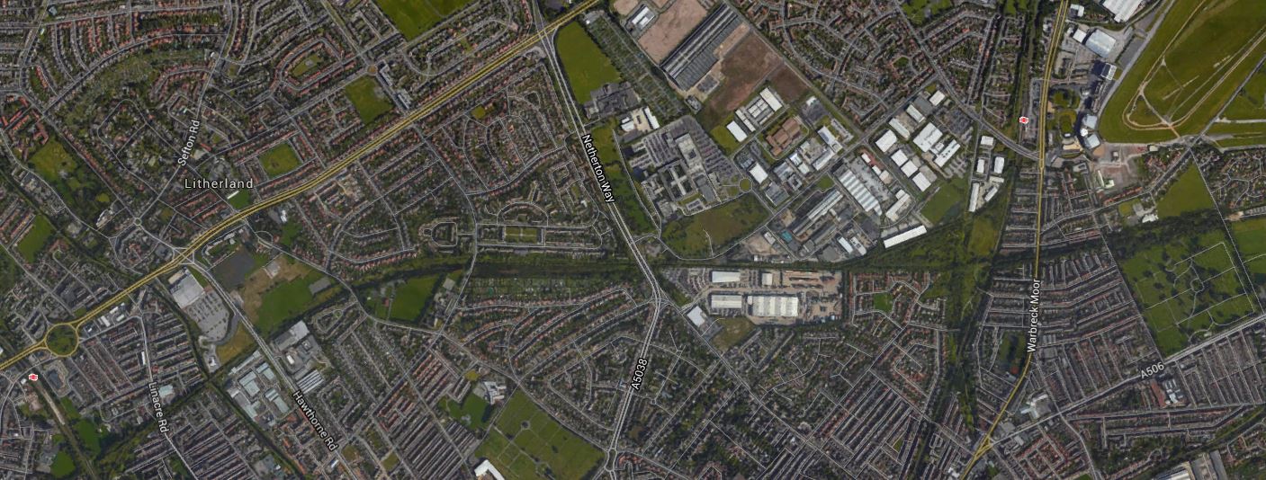
The Mersey Gateway is a new bridge being built over the river to the east of the existing Silver Jubilee Runcorn-Widnes Bridge. This Google Earth image shows the Mersey from Liverpool South Parkway station to the massive Fiddlers Ferry Power Station.
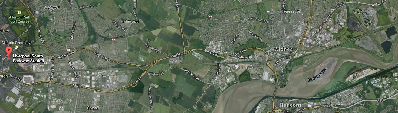
Along The Mersey
The station is indicated by a red arrow and you can clearly see the existing bridge across the Mersey, next to the Britannia Bridge carrying the Liverpool Branch of the West Coast Main Line. The power station is at the top right or north-east corner of the image.
This is said by Wikipedia about the charging arrangements for the new bridge.
It is envisaged that the new bridge will be a toll bridge, with three lanes in each direction. The Halton Borough Council has also stated that the current bridge will also become a toll bridge, making Halton the only borough in England separated by only toll bridges. It was also put forward that the current bridge may be reduced to one lane in each direction for vehicles, with the other two lanes being converted into cycle lanes and/or pedestrian lanes.
As the current bridge is toll free, it will go down like a lead balloon. Especially with those, who commute across the river to and from Liverpool every day. There is this report on the BBC, saying that Halton residents will be able to use the bridge for free. It would appear there is a strong campaign against the tolls from the report.
One good alternative would be to extend the Northern Line from Hunts Cross to Runcorn, but Runcorn station would not have the capacity in its present form. Look at this Google Earth image of the area from the station to the bridges.
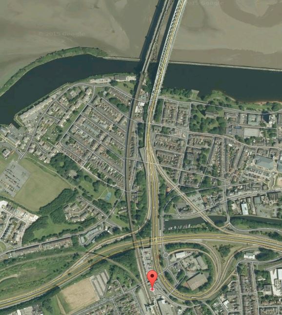
Runcorn Station And The Bridges
It might be possible to squeeze in the extra platform and junctions that would be needed, or more probably the trains could go on via the Halton Curve to Chester via Frodsham and Helsby. Obviously, following practice on the Northern Line, there would be an objective of providing four trains per hour to and from Hunts Cross and the centre of Liverpool. Look at this Google Earth image of the northern end of the Halton Curve.
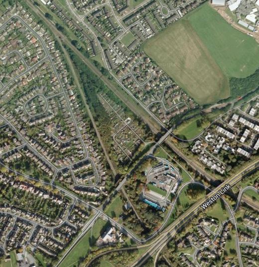
Northern End Of The Halton Curve
Surely a station could be built in this area, which could also be used to turnback trains for Liverpool. Tram-trains might be able to take a circular on-street route around the town, if that was thought to be what was needed.
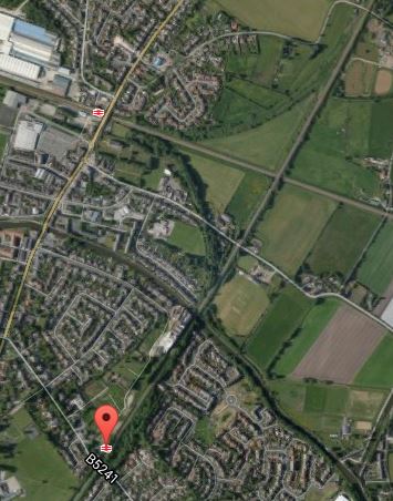
Returning to the North Bank of the river, the first image in this section shows a rail freight line that runs from Liverpool docks to the power station for the transport of biomass via Liverpool South Parkway. This Google Earth image shows the area north of the Mersey around Widnes.
Widnes
The freight line can be seen going across the image from west to east, passing under the railway and roads linking to the existing bridges, then following on the north side of the dual-carriageway before going southwards to follow the St. Helens Canal.
So could this line be used by extended Northern Line services in the future? I suspect that within a few years, plans will be published for the decommissioning of the power station, as it is now over forty years old, so who knows what will be done with the site. But surely, a good train or tram-train service to the centre of Liverpool in the west and Warrington and Manchester in the east will be essential, whatever is developed on the site.
The train line could also have stations or even simple tram stops in the region of both bridges. Unfortunately, due to the design and height of the approaches to the Britannia and Silver Jubilee Bridges, a simple interchange might not be possible, but you could rebuild the station at Ditton, where the two lines meet.
The biggest problem for Widnes and Runcorn, is that the borough is effectively in two parts on either side of the River Mersey.
The availability of tram-trains may give advantages to sorting this out, but overall the Mersey Gateway, looks like a project,that has been designed in isolation for road users.
21. Onward To Warrington
Currently, Widnes is served by trains on the Liverpool to Manchester Line that go via Warrington Central station.This Google Earth image shows the Warrington area.
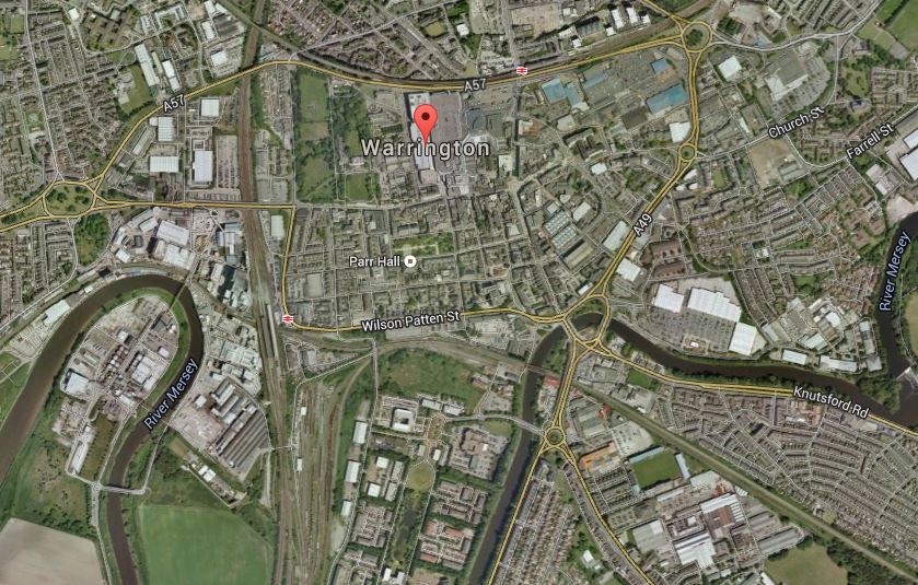
Warrington
Warrington Central station is to the right of the red arrow indicating Warrington and Warrington Bank Quay station is below the arrow to the left on the West Coast Main Line. One of the problems of the trains in the town, is that you have to get a shuttle bus, a taxi or walk between the two stations.
Note how the freight line along the Mersey goes around the bend of the Mersey on the left, under Warrington Bank Quay station in the disused Low Level station and then crosses the Mersey before going off in a south-easterly direction. To the West of Warrington, this railway is the St. Helens and Runcorn Gap Railway and to the East it is the Warrington and Altrincham Junction Railway. It effectively was another route between Liverpool and Manchester, although it is closed in places and just runs freight services over parts of the line.
As both these southern Liverpool-Manchester routes go through Warrington, it could be a reasonable assumption, that some of the trains on the Northern Line could turnback in the town, as was originally envisaged in 1973.
There is a lot of scope to provide an intelligent solution to turning trains round, which would at worst add another four trains an hour to and from Liverpool.
I’ve just looked at how you get from Widnes to London or Carlisle by train on the National Rail Journey Finder. It is not an easy journey and at best involves a change at Liverpool or Manchester and at worst a transfer across Warrington.
A few days after I wrote this article, I visited Warrington. I found a modern town with a good shopping centre and wrote this.
As I walked through Warrington town centre, I thought that an innovative tramway engineer could probably find a way to turn the tramway northward after Bank Quay station to perhaps finish its journey by Warrington Central station and the bus station. The route would probably be not more complicated than some of those in Manchester that I saw today.
But you could also go for a simple solution. There is probably space at the low-level Bank Quay station for a bay platform, where trains from Liverpool would turn back. That would not solve the problem of transfer passengers between the two rail stations and the bus station. They use a shuttle bus at present, so why not increase the frequency, perhaps power it by batteries and make it more visible!
It is not an easy problem to solve, but I do believe that Warrington would make an ideal additional destination for Northern Line trains.
Unless they revert to street running, the trains coming to Warrington would be normal trains without any tram capability, thus simplifying the needs even more.
And after Warrington, should the Northern Line trains go all the way to Manchester? Or could the line through Warrington Central go to Manchester and the southern line underneath Bank Quay go to Stockport? The possibilities are endless.
If Liverpool’s tram-trains are certified for Manchester and vice-versa, you probably get some innovative joint services but you stir up an awful lot of political hornets’ nests.
22. Conclusions
Liverpool still has a lot of connecting railways and as it is acquiring a new fleet of electric trains and has aspirations to link the airport to the Merseyside electric rail network using a tram-train. There are also other places where a tram-train could be sensibly used to create new services, perhaps including these lines and applications.
1. The Airport Connection From South Parkway.
2. The Canada Dock Branch serving the football grounds.
3. Furthe Extensions to the Northern Line in both the North and South.
4. An iconic tram running up the river from Garston to Bootle and possibly further.
5. The Liverpool Loop Line from Hunts Cross to Aintree and Litherland.
I would think it would be prudent if the new train order included a number of tram-trains.
Liverpool though, does show that you don’t need to have trams to run tram-trains. You just need freight lines where adding passenger services is a necessary and plausible idea. You add the simpler stations using well-proven tramway technology, to make the whole project affordable.
The Northern Line could grow from a well-used, but limited line, which predominately serves the northern side of Liverpool, to one that goes along the bank of the Mersey and through Liverpool City Centre from Runcorn, Widnes, Warrington and Liverpool Airport in the South, to Southport, Ormskirk, Kirkby and Preston in the North. In the future, It might even link Chester and Stockport to Wigan, Preston and Blackpool.
If you look at the East London Line in London, which is of a similar layout, with modern trains, this now handles sixteen trains per hour through its core section. I think it is reasonable to expect that the Northern Line should be able to take a similar number of trains with just the investment of creating extra Southern terminals.
The line is but a sapling just about to grow into a tree, with a full size collection of branches.
If you look at the Future section in the Wikipedia entry for Merseyrail, you realise the potential that there is in Liverpool’s railways.
Tram-trains could help the dreams become realities.
Train Across the Mersey
Everybody knows about the Mersey Ferries, in part due to Gerry Marsden‘s song of the same name. The train though crosses the river at Runcorn on one of my favourite bridges, the Ethelfreda or Britannia Bridge, depending on your preference.
The bridge lies alongside the Runcorn-Widnes road bridge, which was built in the 1960s. I remember after a party once in Cheshire getting C to stop the car on the bridge as I was feeling unwell. I then proceeded to puke my guts into the river below. After that incident, she nearly didn’t marry me! I never went to another party, where ICI’s Petrochemicals and Polymer Laboratory, were responsible for the punch.
There is an interesting footnote to the design of the bridge and that is why it is not a suspension bridge. It is hinted at in the Wikipedia entry for the bridge.
The next idea was for a suspension bridge with a span of 1,030 feet (314 m) between the main towers with a 24 feet (7 m) single carriageway and a 6 feet (2 m) footpath. However aerodynamic tests on models of the bridge showed that, while the bridge itself would be stable, the presence of the adjacent railway bridge would cause severe oscillation.
But the true story is all about how good engineers know their subjects.
The designers of the bridge made a presentation before the design was finalised to the ICI Merseyside Scientific Society. One of those attending was Mond Division’s vibration expert, who supposedly had a fearsome knowledge of the subject, even if he was slightly eccentric. After the presentation, he rose to his feet and said that he’d done some quick calculations and because of the proximity of the two bridges, the proposed suspension bridge would shake itself to pieces at a particular windspeed.
The bridge designer was not amused.
But ICI’s vibration expert was proved to be right in wind tunnel tests and we now have the steel arch bridge. Here are some notes on the design from Wikipedia.
The design of the bridge is similar to that of Sydney Harbour Bridge but differs from it in that the side spans are continuous with the main span rather than being separate from them. This design feature was necessary to avoid the problem of oscillation due to the railway bridge.
So good design avoided creating another Galloping Girtie.
I took a video as the train crossed and you can see the road bridge and some of the details of the railway bridge, with the large Fiddlers Ferry power station in the distance.
