Riding Into the Future: Germany’s Pioneering Hydrogen-Powered Tram Project
The title of this post, is the same as that as this article on bnn Breaking.
This is the sub-heading.
Explore Germany’s groundbreaking project to develop a fuel cell-powered tram, leading the charge in sustainable urban mobility and reimagining the future of public transportation.
These are the first two paragraphs.
In the quiet, industrious corners of Germany, a revolution is unfolding on the tracks of public transportation. A consortium led by Hörmann Vehicle Engineering, alongside partners Heiterblick, Flexiva Automation & Robotik, and Technische Universität Chemnitz, has embarked on a groundbreaking journey to conceptualize, design, and test what could be the world’s next leap in eco-friendly mass transit: a hydrogen-powered tram. The project, aptly named the Hydrogen Tram for Next Generation, merges the realms of innovation, sustainability, and practicality, aiming to redefine urban mobility in ways we’ve only begun to imagine.
The project’s heart beats with a simple yet ambitious goal: to create a fuel cell-powered tram that doesn’t just exist as a prototype but thrives as a model for future public transportation. This initiative isn’t just about building a tram; it’s about reimagining the entire ecosystem surrounding urban mobility. From devising a robust refueling strategy to simulating operations and testing the fuel cell system, the collaborators are leaving no stone unturned. The project, with a generous €8 million budget, is buoyed by support from the federal government’s national hydrogen and fuel cell technology innovation program. This isn’t merely an experiment; it’s a statement of intent by Germany to lead the charge in sustainable transit solutions.
I have a few thoughts.
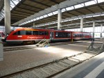
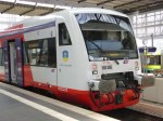
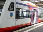
Chemnitz
These pictures show Chemnitz and its trams.


Note.
- Chemnitz used to be called Karl Marx Stadt.
- Chemnitz has some hybrid trams and tram-trains.
- I described how the Chemnitz trams work in Chemnitz Trams And The Chemnitz Model.
Chemnitz could be a very suitable place to try out the technology.
Hence, the involvement of Chemnitz University in the project doesn’t surprise me.
Tram-Trains
This article on Railway Gazette International, which is entitled Hydrogen Tram Development Project Underway, is also about the same project.
This is the first paragraph.
The Hydrogen Tram for Next Generation project has been launched to develop a fuel cell-powered vehicle which would enable services to be extended into new areas and tram-train routes created without the need for electrification.
It looks like this was added in the translation.
Tram Trains In South London
In The Third-Rail Tram-Train, I postulated using third-rail tram trains to extend the London Tramlink.
Since then Merseyrail have tried to extend, their third-rail electrified network and been told they couldn’t.
I have written these posts about using tram-trains to extend the London Tramlink.
- Could There Be A Tram-Train Connection At Reeve’s Corner?
- Would Third-Rail Tram-Trains Affect The Design Of The Proposed Streatham Interchange Station?
- The Cranleigh Line
- Thoughts On The Sutton Loop Line
- Could Third-Rail Tram-Trains Work The Epsom Downs Branch?
- Could Third-Rail Tram-Trains Be Used To Increase Services In South London?
- Could Beckenham Junction To Birkbeck Be Run Using Third-Rail Tram-Trains?
- Could Tram-Trains Be Used To Advantage In Croydon?
So would a hydrogen-powered tram-train be useful technology to extend the London Tramlink?
It just could be!
Zero-Carbon Between Manchester and Sheffield
This OpenRailwayMap shows the electrification across the Pennines.

Note.
- Red lines are electrified with 25 KVAC overhead.
- Mauve lines are tram lines electrified with 750 VDC overhead.
- The mauve lines in the West are the Manchester Metrolink.
- The mauve lines in the East are the Sheffield Supertram
- Black lines are not electrified.
- Red and black lines are currently being electrified.
- The blue arrow at the bottom of the map indicates Buxton.
- To the North of Buxton, the line linking Manchester and Sheffield is the Hope Valley Line.
- Running North-East from Manchester is the main TransPennine route between Leeds and Manchester via Dewsbury and Huddersfield.
This OpenRailwayMap shows the TransPennine route between Morley and Mossley stations.
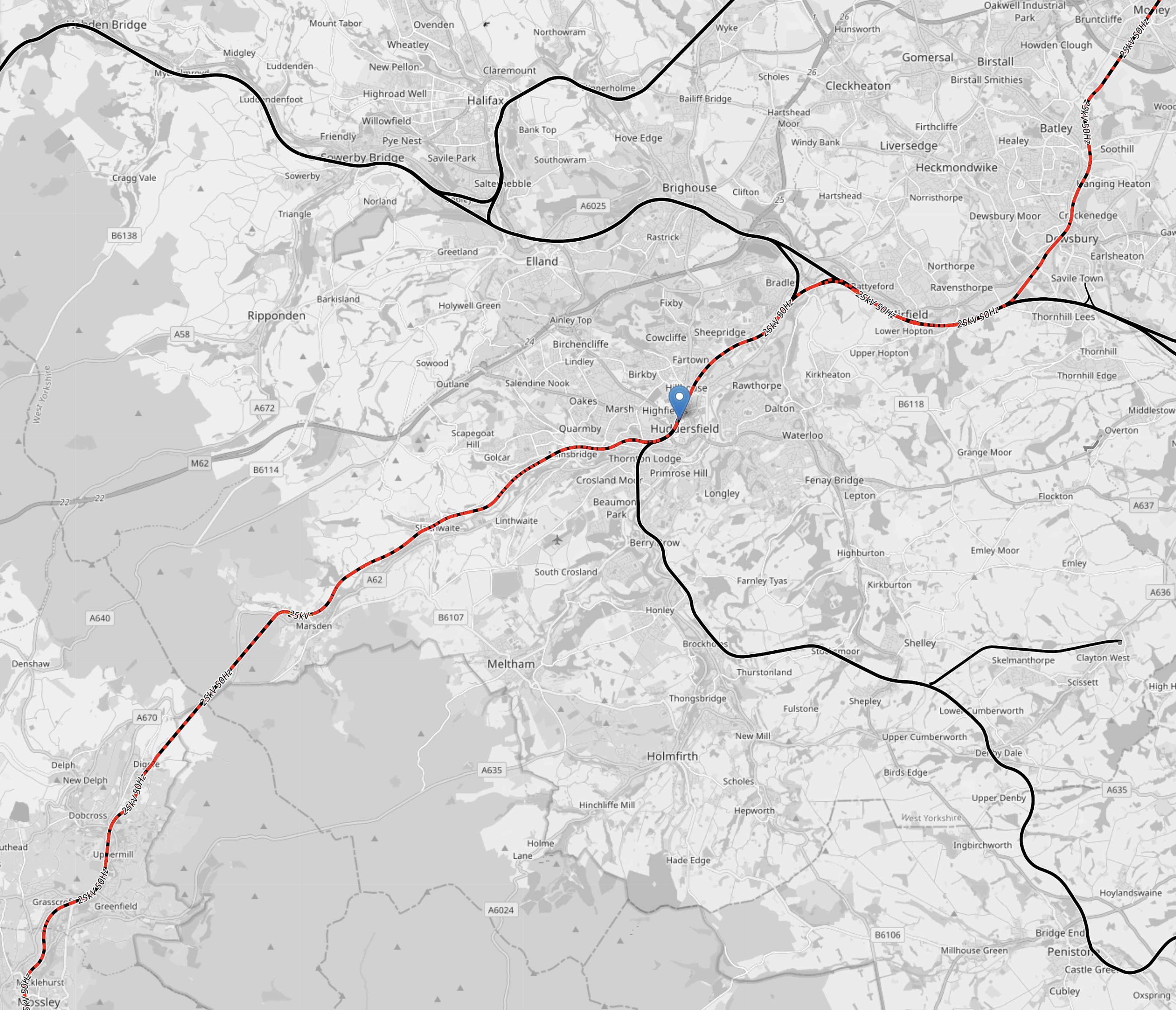
Note.
- Colours are as before.
- Morley station is in the North-East corner of the map.
- Huddersfield station is indicated by the blue arrow in the middle of the map.
- Mossley station is in the South-West corner of the map.
In a few years time, there will be 25 KVAC overhead electrification all the way between Leeds and Manchester via Dewsbury and Huddersfield.
This OpenRailwayMap shows the routes around Manchester and Sheffield and the connecting routes between Barnsley, Huddersfield, Manchester and Sheffield.
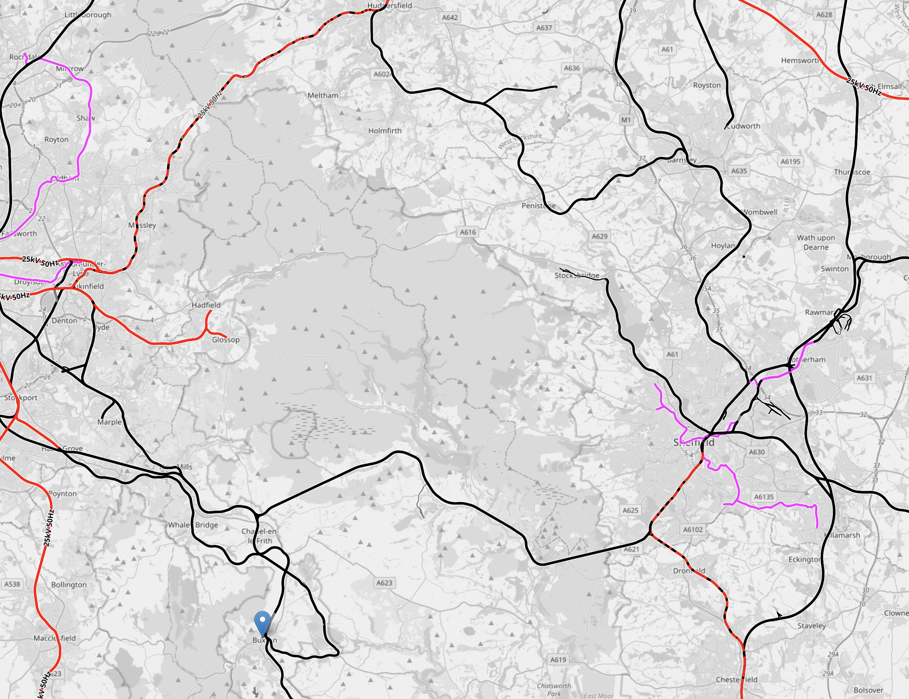
Note.
- Colours are as before.
- The blue arrow at the bottom of the map indicates Buxton.
- The line to Stocksbridge runs North-West from Sheffield.
- To its East the Penistone Line runs to Huddersfield via Barnsley.
- Manchester has a series of lines to the East that need to be electrified.
How many of these lines could be integrated into the tram systems of Manchester and Sheffield, by the use of hydrogen-powered tram-trains?
Hydrogen-powered tram-trains could share lines with battery-electric trains.
Tram-trains could run from say Cathedral in Sheffield to Piccadilly Gardens in Manchester.
Using self-powered trains would cut the need for expensive infrastructure.
The possibilities are endless and carbon free.
Conclusion
Hydrogen-powered trams and tram-trains could be a valuable tool for decarbonising trams and trains.
Superloop -February 2024
This article on the Londonist, shows the latest status of the Superloop on this TfL map.
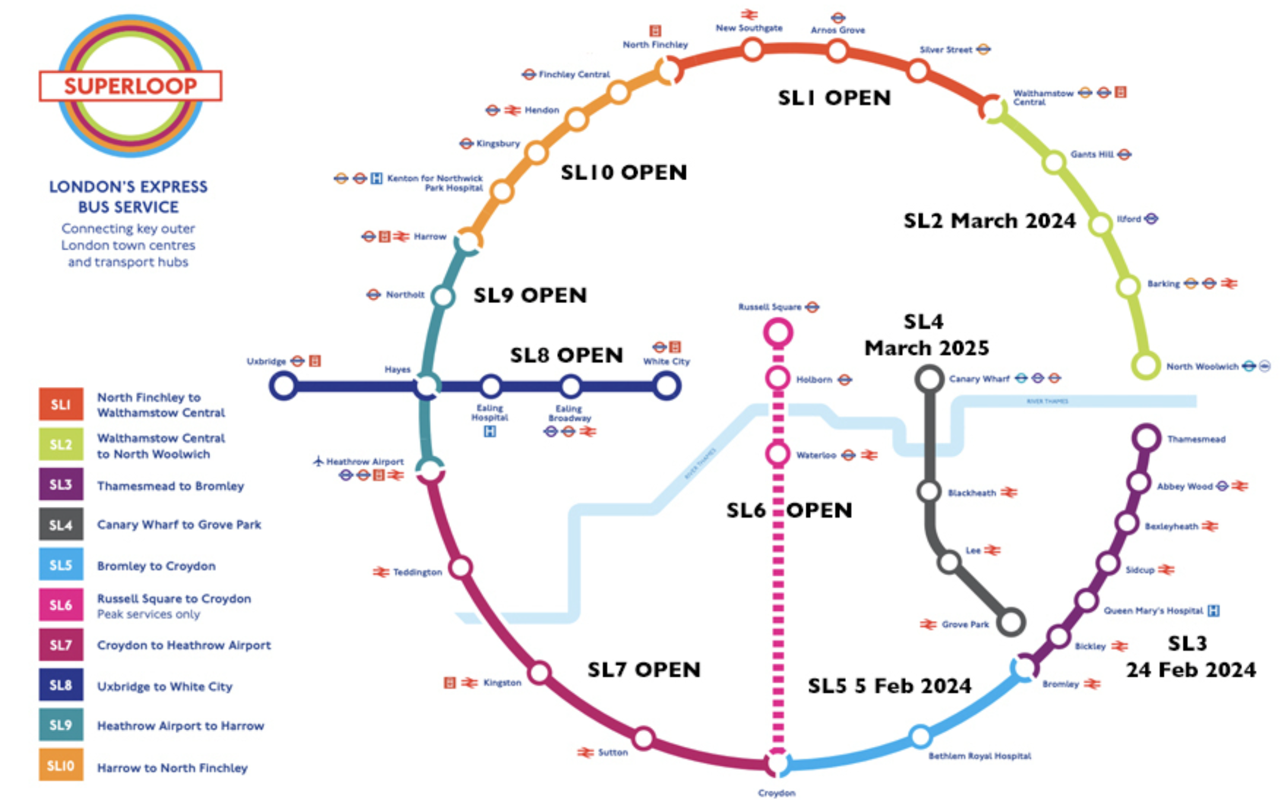
Note.
- The recently opened; SL3 has a lot of stops including Abbey Wood on the Elizabeth Line.
- SL4 will go through the Silvertown Tunnel.
- Since it opened, I’ve never needed to use a Superloop route going about my daily business.
I have this feeling, that a couple of years after it fully opens, there will be a few modifications to the route.
UK Can Secure Record Number Of Offshore Wind Farms In This Year’s Auction For New Projects
The title of this post, is the same as that of this press release from RenewableUK.
The first five paragraphs, should be read as a whole and are a good summary of, where the UK is with offshore wind.
A new report published today by RenewableUK shows that the Government has an opportunity to secure a record number of new offshore wind farms, and record amount of new capacity, in this year’s summer’s auction for contracts to generate clean power (Contracts for Difference). In a huge boost to the UK’s energy security, the Government has the potential to double the country’s offshore wind capacity in this year’s auction alone.
RenewableUK’s latest EnergyPulse Insights Offshore Wind report reveals that 14 wind farms are already eligible to bid into this year’s CfD auction (Allocation Round 6), providing nearly 10.3 gigawatts (GW) of new capacity. The previous records were set in 2022 when 8.5GW was eligible across 7 projects.
In addition to this, a further 4.7GW of new offshore wind capacity (out of 8.7GW in the planning system) could become eligible before applications open for AR6 at the end of March. If these projects were to receive consent from the Government, 14.9GW of offshore wind capacity would be eligible for this year’s auction. The report notes that being eligible does not mean that projects will choose to bid in – but they have the potential to do so.
To put this 14.9GW of potential new capacity into context, we currently have 14.7GW of fully operational offshore wind which generates 14% of the UK’s entire electricity needs. Just one gigawatt of offshore wind generates enough electricity to power over a million British homes for a year.
The report also shows that a further 5.2GW are already under construction in UK waters, and it forecasts that nearly 45GW could be fully operational by the end of 2030.
It is certainly worth reading through to the last paragraph.
The press release also lists the projects eligible to bid into AR6.
- Norfolk Vanguard West and Norfolk Vanguard East (2,760MW) – RWE
- Hornsea Four (2,600MW) – Ørsted
- Awel y Môr (1,100MW) – RWE
- East Anglia Two (900MW) – Iberdrola
- East Anglia One North (800MW) – Iberdrola
- Hornsea Three (753.1MW) – Ørsted
- Seagreen 1A (500MW) – SSE Renewables, TotalEnergies
- East Anglia Three (318MW) – Iberdrola
- Inch Cape (270MW) – Inch Cape Offshore
- Pentland (floating project) (100MW) – Highland Wind Limited
- Erebus (floating project) (100MW)
- Blyth 2 (floating project) (58MW)
- Forthwind (test and demonstration site) (8MW) – Forthwind Limited
These make a total of 10,267MW
Currently, as I write this the UK is generating 29 GW, so 45 GW with a lot of energy storage, should be enough to power the country.
Iberdrola Preparing Two East Anglia Offshore Wind Projects For UK’s Sixth CfD Round
The title of this post, is the same as that of this article on offshoreWIND.biz.
This is the sub-heading.
ScottishPower Renewables, Iberdrola’s company in the UK, is getting the East Anglia One North and East Anglia Two offshore wind projects ready for the upcoming auction round for Contracts for Difference (CfD).
These three paragraphs give more details.
This is according to project updates Iberdrola published as part of its financial results for 2023.
Iberdrola says “good progress is being made in the key engineering and design work” for the two projects and, while they were not presented in the UK’s fifth CfD Allocation Round (AR5), preparations are being made to take part in Allocation Round 6 (AR6).
The two offshore wind farms are part of the GBP 6.5 billion (around EUR 7.6 billion) East Anglia Hub project, which also includes East Anglia Three, currently in construction and expected to start delivering electricity in 2026. The 1.4 GW East Anglia Three was awarded Contract for Difference in July 2022.
It is now possible to build a table of Iberdrola’s East Anglian Hub.
- East Anglia One – 714 MW – Commissioned in 2020.
- East Anglia One North – 800 MW – To be commissioned in 2026.
- East Anglia Two – 900 MW – To be commissioned in 2026.
- East Anglia Three – 1372 MW – To be commissioned in 2026.
Note.
- East Anglia One is the largest windfarm in Iberdrola’s history
- These four wind farms are connected to the shore at Bawdsey on the River Deben.
These wind farms are a total of 3786 MW.
In addition there are RWE’s three Norfolk wind farms.
- Norfolk Boreas – 1386 MW – To be commissioned in 2027.
- Norfolk Vanguard East – 1380 MW – To be commissioned before 2030.
- Norfolk Vanguard West – 1380 MW – To be commissioned before 2030.
These wind farms are a total of 4146 MW, with a grand total of 7932 MW.
What Will Happen To The Electricity?
Consider.
- It is a lot of electricity.
- The good people of Norfolk are already protesting about the cables and pylons, that will connect the electricity to the National Grid.
- The good people of Suffolk will probably follow, their Northern neighbours.
- The wind farms are owned by Spanish company; Iberdrola and German company; RWE.
I wonder, if someone will build a giant electrolyser at a convenient place on the coast and export the hydrogen to Europe by pipeline or tanker.
- The ports of Felixstowe, Great Yarmouth and Lowestoft could probably handle a gas tanker.
- The Bacton gas terminal has gas pipelines to Belgium and The Netherlands.
In addition, there are various electricity interconnectors in use or under construction, that could send electricity to Europe.
- National Grid’s Lion Link to the Netherlands.
- NeuConnect to Germany from the Isle of Grain.
Whoever is the UK’s Prime Minister in 2030 will reap the benefits of these East Anglian and Norfolk wind farms.
In addition.
- The Hornsea wind farm will have tripled in size from 2604 MW to 8000 MW.
- The Dogger Bank wind farm will have grown from 1235 MW to 8000 MW.
- There is 4200 MW of wind farms in Morecambe Bay and around England.
They would be so lucky.
Connecting The Bakerloo, Elizabeth and Victoria Lines At Oxford Circus Station
To my mind it is a design fault of the Elizabeth Line, that it does not correct directly to the Victoria Line.
This OpenRailwayMap shows the various lines at Oxford Circus station.

Note.
- Oxford Street running East-West across the top of the map.
- The Central Line runs under Oxford Street.
- Regent Street running North-South down the map.
- The Bakerloo Line runs under Regent Street.
- The buff tracks running East-West are the Elizabeth Line.
- Hanover Square is above the Elizabeth Line at the Western edge of the map.
- The tracks of the Victoria Line can be picked outrunning North-South down the map.
- They pass through Oxford Circus station at the outside to give cross-platform interchange with the Bakerloo Line.
Consider.
- Oxford Circus station is not step-free.
- The Elizabeth Line entrance in Hanover Square is step-free.
I believe, as at Bank station, that a deep tunneled connection could be made between Oxford Circus station and the Elizabeth Line entrance in Hanover Square.
Note.
- It could be below the foundations of the buildings.
- A travellator might make it easier for some.
- There could even be shops, cafes and perhaps toilets in the tunnel.
There might not need to be any new street entrances to the below ground complex.
Hinkley Point C Fish Protection Plans Attacked By Environmental Organisations
The title of this post, is the same as that of this article on New Civil Engineer.
This is the sub-heading.
Revised plans to protect fish from water intake tubes for the Hinkley Point C nuclear power plant on the Severn Estuary have come under fresh criticism from environmental organisations.
These three paragraphs outline the story.
EDF recenrly proposed plans to create a saltmarsh at the Somerset nuclear plant site as an alternative to an acoustic fish deterrent. This followed the Environment Secretary having ruled in 2021, in line with Environment Agency recommendations, that the plant should install an acoustic fish deterrent.
The plant is scheduled to circulate 120,000l of water per second from the Bristol Channel to the nuclear power station through 8km underground tunnels to provide cooling for the power station’s systems.
A group of environmental non-governmental organisations (eNGOs) issued a statement coordinated by Somerset Wildlife Trust saying Hinkley Point C “will have a significant impact on marine and migratory fish including already vulnerable Atlantic salmon, twaite shad and European eel over its lifetime”.
This Google Map shows Lake Michigan, which was where I came across another tale of fish and nuclear power.
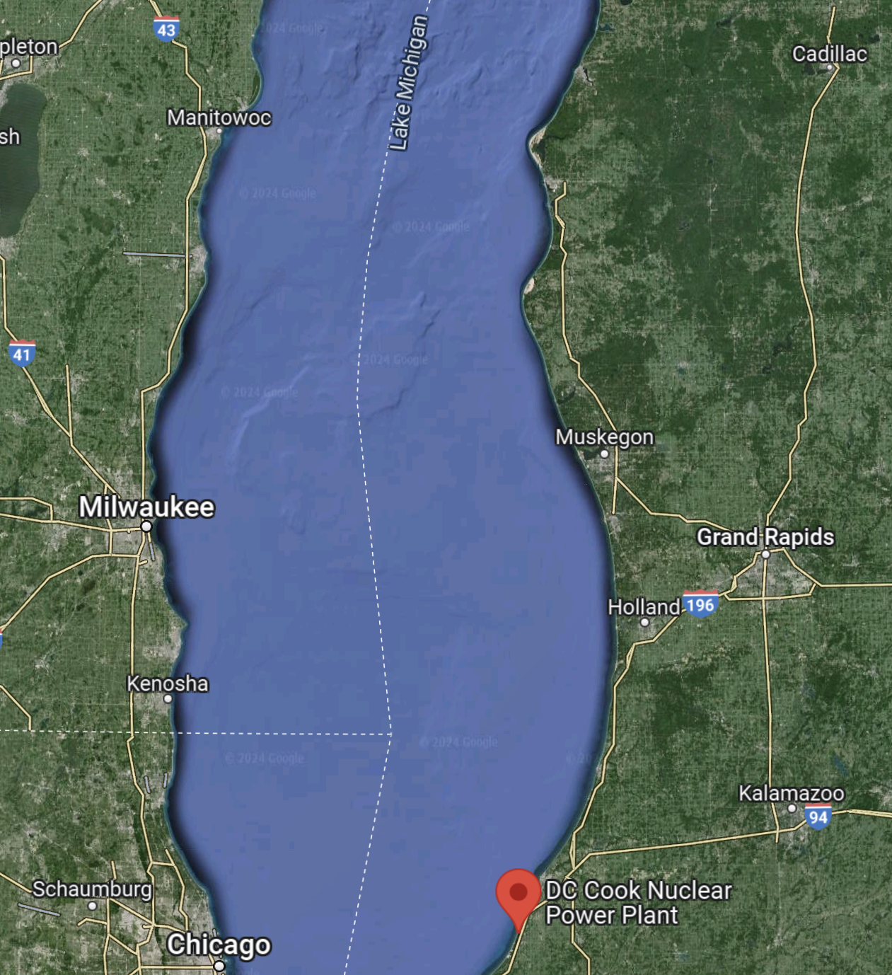
Note the red arrow, which marks the DC Cook Nuclear Power Plant.
This second Google Map shows a close-up of the plant.
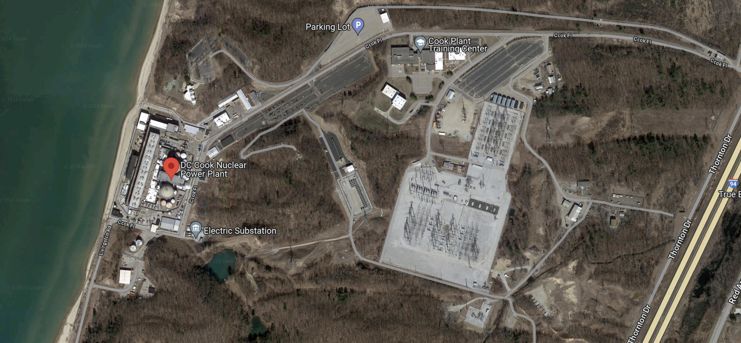
The power plant sits on the shores of Lake Michigan, from which it gets its cooling water.
In the early 1980s, after the Three Mile Island accident in 1979, I was given a tour of two nuclear power stations of which this plant was one and Shippingport or Beaver Valley was the other. Both were Artemis customers and one of the projects they were using the software on, was to plan and document all the Three Mile Island modifications or TMIs.
But it’s the Cook power plant that I remember.
- I’d turned up at Benton Harbor Airport on a very cold, snowy evening and I remember that the Hertz representation had got all the cars running so customers could drive away in the warm.
- DC Cook was impressive and very well run, and it was a very good customer visit.
- The fishy tale, I heard there was that the warm water from the power station attracted the fish and that some locals in the winter took to fishing through the ice of Lake Michigan. Occasionally, they fell through the ice.
- I was told, that some locals felt that the plant should be shut because of this, but it’s still running forty years after my visit.
- Lunch was interesting, as we went to a Michigan version of the famous Rook restaurant in the Two Ronnies. Except that every dish on the menu had something to do with beans, as that is the area of the US, where navy (baked) beans are grown. They even had a bean savoury for afters!
This article from the Huron Daily Tribune is entitled Fish Force Michigan Nuke Plant Shut Down, where these are the first two paragraphs.
Officials shut down a nuclear power plant on the eastern shore of Lake Michigan on Thursday after a large number of fish swam into the plant’s cooling-water system.
The two reactors at Donald C. Cook Nuclear Plant were idled as workers removed the fish and monitored the cooling system. It wasn’t clear when the reactor would be restarted, owner and operator American Electric Power Co. Inc. said in a statement.
It does appear that Cook was suffering from fish in the system.
I hope this doesn’t predict more delays for Hinckley Point C.
Wrightbus Hydrogen Coach Planned For 2026
The title of this post, is the same as that of this article in Bus&Coach Buyer.
This is the sub-heading.
Wrightbus‘ planned hydrogen coach is expected to be in production by 2026.
These are the first three paragraphs.
Jean-Marc Gales, Wrightbus CEO, told B&CB that a prototype model intended to demonstrate the powertrain is expected towards the end of the year.
Jean-Marc said: “The concept is ready, the predevelopment work has been done, so we are confident we can launch it in 2026.”
He says the vehicle is aimed at operators that do long distance coach journeys. “Hydrogen coaches can do up to 1,000km range and in five to ten years we will see a much higher proportion of hydrogen coaches than electrical,” he said.
Jean-Marc Gales also said this about the design challenge.
Jean-Marc said: “If you build a hydrogen coach, it’s a technical tour de force. Coach operators require six to ten cubic metres of luggage space. You need at least 50 to 60 seats and disability access and enough packaging space to put the tanks and the hydrogen cooling system and the fuel cells in. But we can do it, we have the technical expertise with fuel cells; we have the best engineers on the market for fuel cell buses. We have millions of miles with electrical and fuel cell vehicles in service since we launched them.
I haven’t ever used coaches much, but in the UK, there are some well-established long-distance markets.
These are some typical driving distances.
- Plymouth and Sunderland – 334 miles – 537 km.
- Brighton and Liverpool – 216 miles – 347 km.
- London and Edinburgh – 332 miles – 534 km.
- London and Paris – 213 miles – 343 km.
- London and Gdansk – 804 miles – 1294 km.
Note.
- Away football and fans of other sports use coaches and a 1,000 km range would certainly be needed to get Plymouth supporters to all away matches and back.
- The London and Scottish Market has been strong all my life.
- London and Gdansk would be an interesting trip in a coach. If you need one, look for Sinbad Coaches.
I certainly believe that Jean-Marc Gales and Wrightbus, are developing the technology for a worthwhile market.
Jobs, Homes And The Economy: Bakerloo Line Upgrade And Extension To Be Transformational For London
The title of this post, is the same as that of this article on Rail Technology Magazine.
This is the sub-heading.
The government has been urged to use the upcoming spring budget to commit to upgrading and extending the Bakerloo line after a new impact assessment found its effects could be transformational.
These three paragraphs introduce the article.
The impact assessment – commissioned by Central London Forward, a partnership of 12 central London boroughs – finds that such a move would boost the economy, unlock new homes, create new jobs, and more.
The upgrade would centre around new trains and signalling, while the extension would take the terminus to Lewisham in the first phase, and eventually to Hayes – adding 14 new stations.
The impact assessment concludes that the extension and upgrade of the Bakerloo line would create 9,700 jobs, 190,000 square metres of commercial floorspace, as well as generate £1.5bn of GVA.
The article is a must-read and eloquently puts the case for the Bakerloo Line Extension.
I have a few thoughts.
A Loop At Brixton For The Victoria Line
This has been proposed and the Wikipedia entry for the Victoria Line has this paragraph.
Proposals have been made to extend the line one stop southwards from Brixton to Herne Hill, a significant interchange in south London providing access to Kent, Blackfriars, London Bridge and Sutton. The latter station would be on a large reversing loop with a single platform removing a critical capacity restriction eliminating the need for trains to reverse at Brixton and provide a more obvious route for passengers who look for the nearest tube station before any other transport options.
I like this idea.
- It will make it easier to run the full frequency of 33 trains per hour (tph) between Brixton and Walthamstow Central stations.
- Loops at Heathrow and Liverpool seem to work very well.
- A single-platform with platform-edge doors has a high level of safety.
- Only one tunnel boring machine (TBM) would be needed.
- Large lifts could be used between the surface and the platform.
- It is a more affordable option.
But perhaps most importantly, I am sure, the loop could be built whilst other services at Brixton and Herne Hill were running almost without disruption, as services did at Kennington, whilst the Battersea Extension of the Northern Line was built.
A Loop At Elephant And Castle For The Bakerloo Line
I have spent forty years involved in project management, writing software for project managers and generally listening to some of the thoughts and experiences of some of the best engineers from all over the world.
One common thread, which is best illustrated by how the size of lift possible increased in the North Sea in the 1970s, is that as time has progressed machines have got bigger and more capable, and the techniques of using them has improved immeasurably.
The Crossrail tunnel boring machines (TBM) make those used on the Jubilee Line extension or the Channel Tunnel look like toys. But not only are the TBMs bigger and faster, they have all the precision and control to go through the eye of the smallest needle.
If we look at the proposals for the Bakerloo Line Extension, there have been several differing ideas. Some envisage going under Camberwell and in others the trains terminate on the Hayes line.
Transport for London (TfL), obviously know the traffic patterns, but do we really want to take the chance of say connecting the Hayes line to the Bakerloo and then finding that it’s not the best solution?
What we should do is augment the services in the area, by providing a good alternative transport route, that links to some of the traditional rail lines to give even more flexibility. We certainly shouldn’t repeat the grave mistake that was made at Brixton in the 1960s by not connecting the Victoria line to the surface rail lines.
This is Transport for London’s indicative map of the extension.

I have reason to believe that the Northern Line Extension may be being built as an extension to the Kennington Loop.
So could we design the Bakerloo Line Extension as a loop starting and finishing at Elephant and Castle calling at important stations?
A possible route could be.
- Elephant and Castle – Interchange with Northern Line and National Rail including Thameslink
- Old Kent Road 1 – Proposed on Map
- Old Kent Road 2 – Proposed on Map
- New Cross Gate – Interchange with London Overground and National Rail
- Lewisham – Interchange with Docklands Light Railway and National Rail including Hayes Line
- Catford Bridge – Interchange with Catford station and National Rail including Hayes Line and Thameslink
- Peckham Rye – Interchange with London Overground and National Rail
- Camberwell – Interchange with National Rail including Thameslink
- Elephant and Castle
The advantages of this simple design are.
- The tunnel would be excavated in one pass by a single TBM.
- The line could be deep under any existing infrastructure.
- Most stations would be simple one-platform affairs, with perhaps only large lifts and emergency stairs, to give unrivalled step-free access for all from the street to the train. Surely lifts exist, that are large and fast enough to dispense with escalators.
- For safety, passenger convenience and flows, and other reasons, the stations could have two entrances, at opposite ends of the platform.
- The simple station entrances would be much easier to position on the surface, as they wouldn’t need to be much bigger than the area demanded by the lifts.
- A single loop would only need half the number of platform edge doors.
- At stations like New Cross Gate, Lewisham, Catford and Peckham Rye the lifts would surface within the confines of the existing surface stations.
- The route has interchanges with the Brighton Main Line, East London Line, Hayes Link, Thameslink and other services, so this would give lots of travel possibilities.
- Trains do not need a terminal platform, as they just keep going on back to Elephant and Castle.
- The loop would be operationally very simple, with no points to go wrong. TfL have aspirations to run twenty-seven trains per hour on the Bakerloo and a simple reversing loop , which would mean the driver didn’t have to change ends, must certainly help this. It would probably be a lot more difficult to get this capacity at the northern end of the line,where Harrow and Wealdstone doesn’t have the required capacity and the only possibility for a reversing loop would be north of Stonebridge Park.
- Elephant and Castle would need little or no modification. Although it would be nice to have lifts to the Bakerloo Line.
- Somewhere over two billion pounds has been quoted for the extension. A single loop with simple stations must be more affordable.
The main disadvantage is that the loop is only one-way.
But making even part of the loop two-way would create all the operational difficulties of scheduling the trains. It would probably be better, less costly and easier to make the trains go round the loop faster and more frequently.
But if a passenger went round the loop the wrong way and changed direction at Elephant and Castle that would probably only take a dozen minutes or so.
Alternatively, I’m sure some New Routemasters would step up to the plate and provide service in the other direction between the stations.
Future Rolling Stock For The Bakerloo Line
This has a section in the Wikipedia entry for the Bakerloo Line, where this is said.
In the mid 2010s, TfL began a process of ordering new rolling stock to replace trains on the Piccadilly, Central, Bakerloo and Waterloo & City lines. A feasibility study into the new trains showed that new generation trains and re-signalling could increase capacity on the Bakerloo line by 25%, with 27 trains per hour.
In June 2018, the Siemens Mobility Inspiro design was selected.[ These trains would have an open gangway design, wider doorways, air conditioning and the ability to run automatically with a new signalling system.[35] TfL could only afford to order Piccadilly line trains at a cost of £1.5bn. However, the contract with Siemens includes an option for 40 trains for the Bakerloo line in the future. This would take place after the delivery of the Piccadilly line trains in the late 2020s.
A loop from Elephant and Castle with a train every 2¼ minutes, is not going to be short of passengers.
The Catford Interchange
Catford and Catford Bridge stations are not far apart.
In An Opportunity At Catford, I talked about what could be done to create a full step-free interchange, which could be connected to the Bakerloo Line loop underneath.
Would It Be Possible For The Bakerloo And Watford DC Lines To Use The Same Trains?
I answered this question in a post with the same name and this was my conclusion.
A common fleet used by the Bakerloo and Watford DC Line would appear to give advantages and it has been done successfully before.
But what the Bakerloo Line, the Watford DC Line, the Abbey Line and the Bakerloo Line Extension need is a good dose of holistic design.
The current trains on the Watford DC Line would be moved to the London Overground. They could be ideal for the future West London Orbital Railway.
Would There Be Advantages In Creating The West London Orbital Railway And Extending The Bakerloo Line As One Project?
Consider.
- The two lines will have an interchange station at Harlesden, which will need to be rebuilt.
- The current trains on the Watford DC Line could be cascaded to the West London Orbital Railway.
- As new trains are delivered to the Piccadilly Line, some of the current trains could be cascaded to the Bakerloo Line.
- Major work for the Bakerloo Link Extension includes a new tunnel, updated signalling and at least seven underground stations.
- Major work for the West London Orbital probably includes track refurbishment, new signalling and updated stations.
I believe that with good project management, that if these two lines were to be created together, this would be advantageous.
Conclusion
I have only outlined how the two projects might be done together.
But I am absolutely certain, that someone with full knowledge of both projects could build the two at a very affordable cost.
Rio Tinto Signs Australia’s Biggest Renewable Power Deal As It Works To Repower Its Gladstone Operations
The title of this post, is the same as that of this press release from Rio Tinto.
These three paragraphs outline the deal.
Rio Tinto has signed Australia’s largest renewable power purchase agreement (PPA) to date to supply its Gladstone operations in Queensland, agreeing to buy the majority of electricity from Windlab’s planned 1.4GW Bungaban wind energy project.
The agreement, which follows the announcement last month of a PPA for the Upper Calliope solar farm in Queensland, will make Rio Tinto the biggest industrial buyer of renewable power in Australia and is another major step in the work to repower the company’s Gladstone production assets – Boyne aluminium smelter, Yarwun alumina refinery and Queensland Alumina refinery.
Under the new PPA with Windlab, Rio Tinto will buy 80% of all power generated from the Bungaban wind energy project over 25 years. The project, which is currently in early development, will be built and operated by Windlab at a site in Queensland about 40 kilometres from the town of Wandoan, and 290 kilometres south-west of Gladstone, subject to development and grid connection approvals.
This Google Map indicates the position of Gladstone on the coast of Queensland.
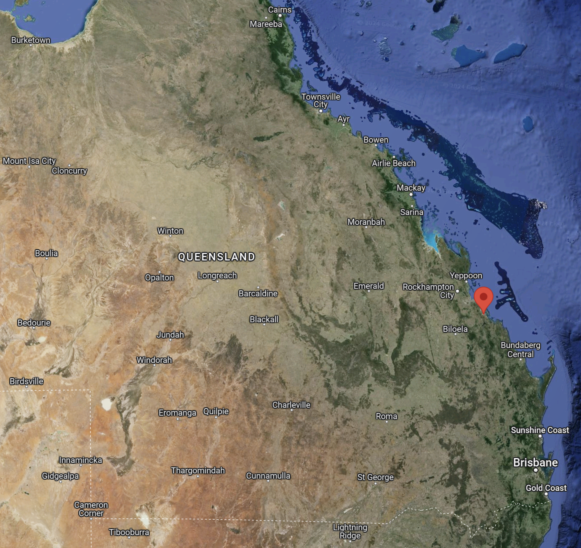
This map brings back memories.
I had hired a Piper Arrow from Sydney and I flew my late wife via Mildura, Adelaide, Coober Pedy, Yulara to Alice Springs taking about a week for it.
From Alice, I flew via Mount Isa to Cairns, which is at the top of the map on the coast.
I remember on leaving Aloce, I asked Air Traffic Control, what time it was in Queensland. The reply was “They’re half-an-hour ahead and twenty-five years behind!”
Mount Isa was infamous on the trip, as it was there we met the only disagreeable Aussie on the whole adventure. Unfortunately, he was in charge of the fuel and didn’t want to serve us. Probably, because he was drunk.
Finally, we got away and spent a couple of nights at Cairns, where we drove up the coast and explored the Daintree.
It was then a short hop for the plane onto the Battier Reef, where we stayed at a resort called Bedarra, which was probably the most exclusive place we ever stayed.
After a few days it was back in the plane and down the coast to Brisbane. That was a strange flight, as all Australian airline pilots were on strike, so we had the airspace to ourselves. At Mackay, the refuellers were so lacking in business, they were all too happy to fuel the plane.
After a couple of days in Brisbane, we flew the plane to Goondawindi, where we picked up our eldest son, before flying back to Sydney, where we took a flight home.
It was a memorable trip and I now wish, that we’d extended it by a couple of weeks.
Conclusion
Australia is a land of boundless solar energy, which is why we went there on holiday and Rio Tinto will be doing all there aluminium smelting by the use of renewables.
I can see in the future that the UK’s boundless wind energy will attract high energy businesses to the UK.
A World First For Liverpool
This article on The Engineer is entitled ABB Grid Balancing Facility Comes Online.
This is the sub-heading.
A significant new project to provide vital inertia across the UK’s electricity grid has gone live at the Lister Drive Greener Grid Park in Liverpool.
This Google Map, shows the Lister Drive Greener Grid Park.

Note.
- The red arrow indicates the location of the pair of synchronous condensers.
- The metal forest to the West of the Statkraft site, looks like a large substation.
These are the first two paragraphs.
Featuring two ABB synchronous condensers, the facility is designed to replicate the inertia currently provided by spinning turbines at coal and gas-fired plants. This inertia is essential for maintaining the correct frequency and voltage across electricity grids, so an alternative source must be installed as thermal generation is replaced by wind and solar, which provide no inertia.
Developed for Norwegian renewable energy firm Statkraft, Lister Drive is the first project anywhere in the world to feature a high-inertia configuration that couples a synchronous condenser with a 40-tonne flywheel. According to ABB, this approach increases the instantaneously available inertia by 3.5 times, ensuring the network frequency and voltage are held stable within the tight limits essential to maintain grid reliability.
In my Electrical Engineering degree course at Liverpool University, I opted out of power engineering, as I preferred Electronics and Control Engineering. So I am indebted to this Wikipedia entry for what a synchronous condenser is and does.
Statkraft seem to be developing several of their Greener Grid Parks, in various places in the UK.
