Uncomplicated Pancolonic Diverticular Disease And Stress
This afternoon, I found myself in a stressful situation and my gut played up. Was it my uncomplicated pancolonic diverticular disease and stress actually playing up?
So, I asked Google AI if there was a link between uncomplicated pancolonic diverticular disease and stress and got this answer.
While there’s no direct causal link, stress may exacerbate uncomplicated pancolonic diverticular disease, potentially by influencing the digestive system and increasing the risk of anxiety and depression, which are often associated with diverticular conditions. Some theories suggest stress can disrupt the autonomic nervous system, leading to spasms and inflammation that can trigger flares in diverticular disease. Managing stress through healthy lifestyle choices, such as a high-fiber diet and regular exercise, may help reduce risk and support the digestive system.
This doesn’t deny a link, but it would appear to be secondary.
The source used by Google AI is the NHS web site.
As a follow up, I asked Google AI if there was a link between uncomplicated pancolonic diverticular disease and a high-fibre diet and got this answer.
For uncomplicated, pancolonic diverticular disease, a high-fiber diet is recommended to prevent complications by promoting softer stools and preventing constipation. Increase fiber intake by gradually adding whole grains, fruits, vegetables, nuts, and legumes, while also drinking plenty of fluids to aid digestion and prevent bloating. A balanced, high-fiber diet can help manage symptoms and reduce the risk of developing symptomatic diverticular disease.
The source used was this paper on the National Library of Medicine, which was entitled Role Of Fiber In Symptomatic Uncomplicated Diverticular Disease: A Systematic Review.
Starmer Appoints Octopus Energy Tycoon As Cabinet Adviser
The title of this post, is the same as that of this article on The Telegraph.
This is the sub-heading.
Greg Jackson Will Help Modernise Whitehall In PM’s Efficiency Drive
These are the three introductory paragraphs.
The founder of Octopus Energy has been appointed to an influential role advising the Government, weeks after Ed Miliband rejected his recommendations on energy pricing.
Greg Jackson will become one of three non-executive members of the Cabinet Office board, providing him with a platform from which to challenge the thinking of ministers and officials.
The entrepreneur said he intended to press departments to embrace the kinds of technology central to Octopus’s success in order to implement policies more rapidly and efficiently.
I certainly, agree with the last paragraph, but I feel that steering the supertanker of government, might need quieter rules on the tiller.
Rolls-Royce mtu Series 4000 engines To Power New Catalina Express Ferry In California
The title of this post, is the same as that of this press release from Rolls-Royce.
These two bullet points act as sub-headings.
High-capacity ferry to feature four EPA Tier 4-certified engines, delivering over 7463 kW (10,000 bhp)
Cutting-edge propulsion system will integrate SCR and DPF once certified by the EPA, USCG, and CARB to meet commercial harbour craft regulations
These three paragraphs from the press release, describe the ferry and its operation.
Rolls-Royce has been selected by Catalina Express of San Pedro, CA (USA) to supply the marine propulsion system for its new high-capacity ferry. The 500-passenger vessel, which will be the largest in the Catalina Express fleet upon completion, will be powered by four mtu 12V4000 M65L engines, delivering a combined output of over 7463 kW (10,000 bhp).
The new ferry is part of the Port of Los Angeles’ $31 million LA MER project, which is funded by the California Air Resources Board (CARB). Via the project, Catalina Express received a $15 million grant, matching it with $15 million of its own investment. The goal of the LA MER project is to test ways to reduce emissions as the Port works toward becoming a zero-emission port.
The new 42-meter ferry, which will be able to reach speeds up to 37 knots, will replace three older Catalina Express vessels maintaining capacity and increasing environmental performance. The vessel will serve as a next-generation leader of the fleet, showcasing the company’s commitment to sustainable operations.
The Wikipedia entry for Catalina Express has this first paragraph.
Catalina Express is an American passenger ferry service that operates scheduled trips between Santa Catalina Island and mainland California. The company began service in 1981 with a single sixty-passenger vessel. As of 2016, the Catalina Express fleet includes eight high-speed vessels that can make the roughly 30-mile (48 km) crossing in about an hour.
There appears to be strong commitment of the California Air Resources Board and Catalina Express to air quality and zero emissions.
In Liberty Lines Commissions First High-Speed Ferry With mtu Hybrid System From Rolls-Royce, I wrote about another high-speed ferry, that will be powered by a Rolls-Royce mtu hybrid system.
The European ferry will be able take 281 passengers at 34.5 mph, and also use battery-power in port.
I can see larger, faster and more advanced ferries being developed, with lower-emission power systems, that will take over some of the shorter sea routes.
US Transportation Dept Cancels Funding For 12 Offshore Wind Port Projects To ‘Invest In Real Infrastructure’
The title of this post, is the same as that of this article on offshoreWIND.biz.
This is the sub-heading.
The US Department of Transportation (USDOT) has withdrawn or terminated funding for twelve offshore wind-related port projects, totalling USD 679 million (approximately EUR 580 million). These funds will be used, where possible, “to invest in real infrastructure, restoring American maritime dominance,” according to a press release issued by USDOT on 29 August.
The rest of the article is in two sections.
- US Wind-Backed Sparrows Point Steel Marshalling Port on the List
- ‘Prioritizing Real Infrastructure Improvements Over Fantasy Wind Projects’
Both sections are worth a detailed read.
They sound even more stupid decisions, if read in a voice reminiscent of Baldrick with an American accent.
Midlands Rail Hub Looks To The Future With Preferred Alliance Partners
The title of this post, is the same as that of this press release from Network Rail.
The press release has a spectacular picture, which I’m showing here.
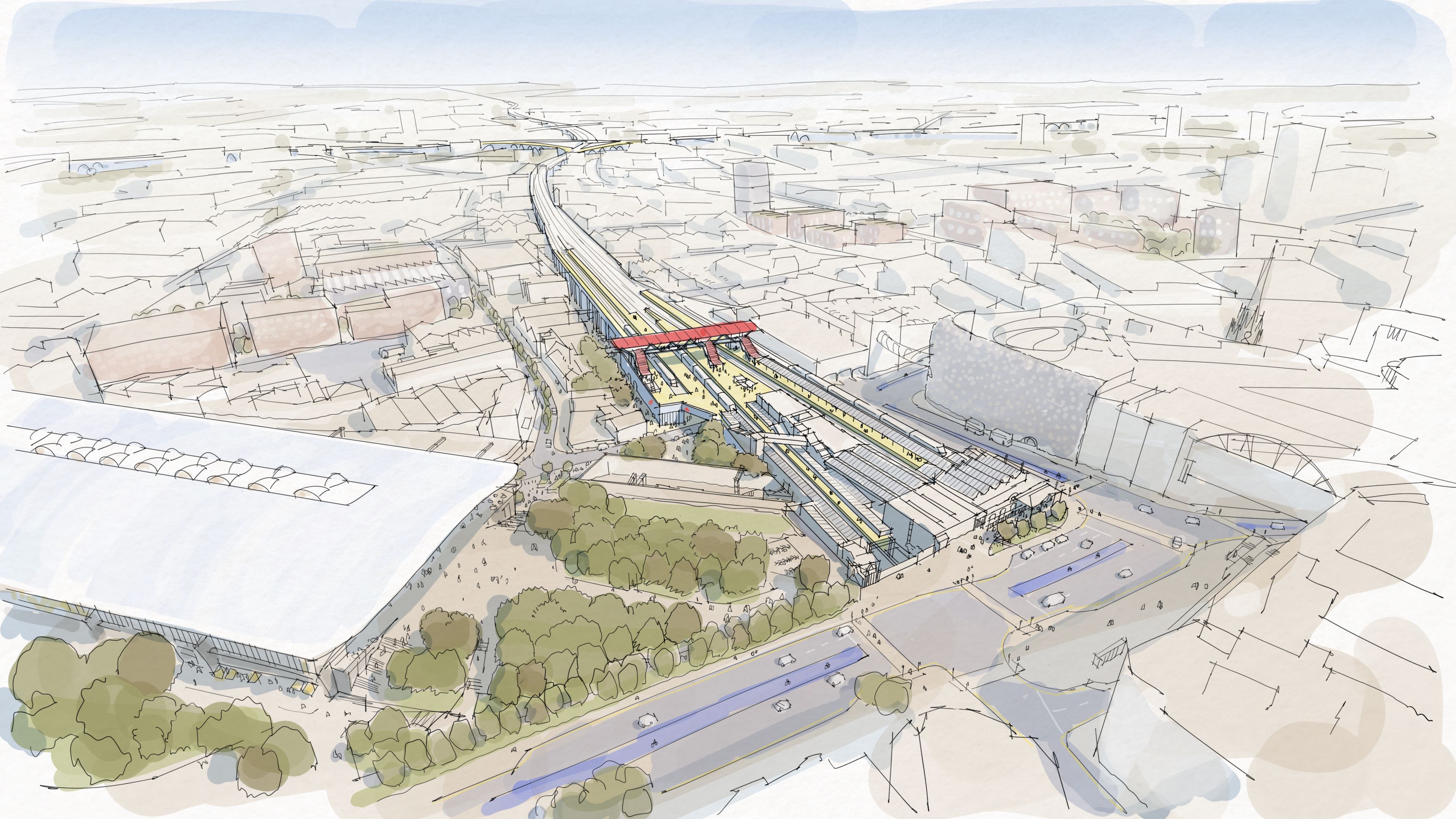
Note.
- High Speed Two’s Curzon Street station is on the left.
- Birmingham Moor Street station is in the centre.
- There appears to be parkland between the two stations.
- Is that the West Midlands Metro running across in front of Moor Street station?
This OpenRailwayMap shows the railway lines in the area.
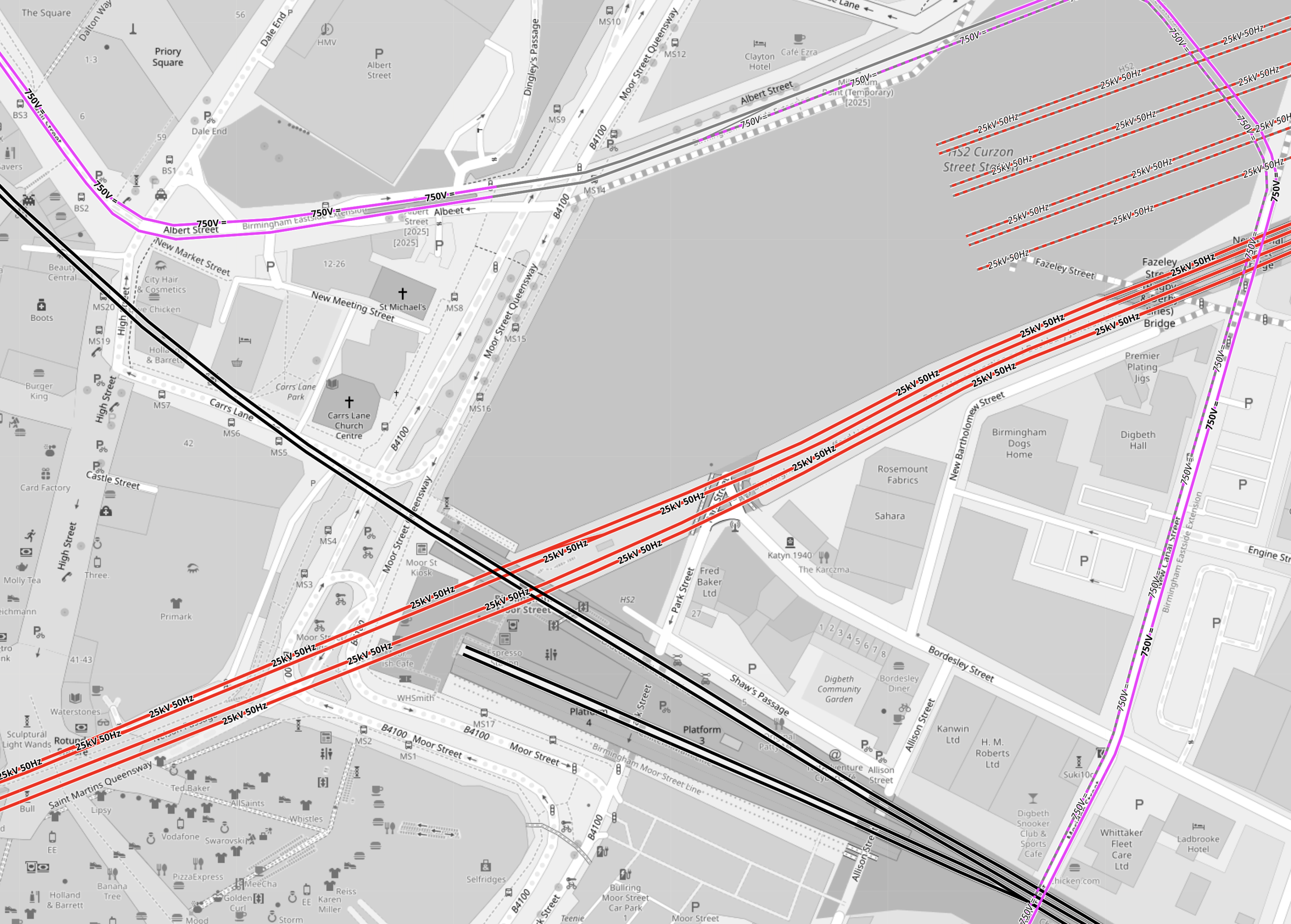
Note.
- Electrified tracks are shown in red.
- Tracks without electrification are shown in black.
- West Midlands Metro tracks are shown in mauve.
- The red tracks going diagonally across the map are the four electrified tracks going into Birmingham New Street station.
- Birmingham New Street station is off the map to the West.
- To the North of the tracks going into Birmingham New Street station, there are the seven platforms of High Speed Two’s Curzon Street station.
- The four platforms without electrification are shown South of the tracks into Birmingham New Street station.
- Two platforms at Birmingham Moor Street station are through platforms, that pass under Birmingham City Centre to Birmingham Snow Hill station.
- The other two platforms at Birmingham Moor Street station are bay platforms.
- The West Midlands Metro appears to take a loop around the stations.
But when you get into the words of the press release, there are a lot of vegetables and very little meat.
- The Midlands Rail Hub could cost around £1.75bn if delivered in full.
- The government’s recent spending review committed to progress the next stage of Midlands Rail Hub.
- Alongside this, planning is underway to begin to deliver two smaller but significant upgrades to benefit passengers as quickly as possible.
- The Alliance partners will be VolkerRail, Laing O’Rourke, AtkinsRéalis, Siemens Mobility, and Network Rail.
These four paragraphs indicate the work, that could be done.
The biggest change will be connecting the Chiltern main line, which runs into Moor Street, with the Camp Hill lines which run towards the South West and East Midlands via two new chords in Bordesley, near Birmingham city centre.
The transformation of the network will include running more train services on key routes through Birmingham and significantly improving connections for the millions of people who use the railway every day.
Work will be prioritised to explore how smaller, but vital, pieces of work which will provide passengers and communities with quicker benefits, including new journey options and more trains can be delivered as soon as possible.
They include reopening platform 4 at Snow Hill station so additional Chiltern Railways services can run directly between Birmingham’s business district and London Marylebone, and redeveloping Kings Norton station and the lines through it so extra Cross City trains can be added and new Midlands Rail Hub-enabled services can call there.
Three projects are specifically mentioned.
- The new chords in Bordesley.
- The reopening of platform 4 at Snow Hill station.
- The redeveloping of Kings Norton station.
I shall now look at each in detail.
The New Chords At Bordesley
This OpenRailwayMap shows the tracks going into and around Birmingham Moor Street station.
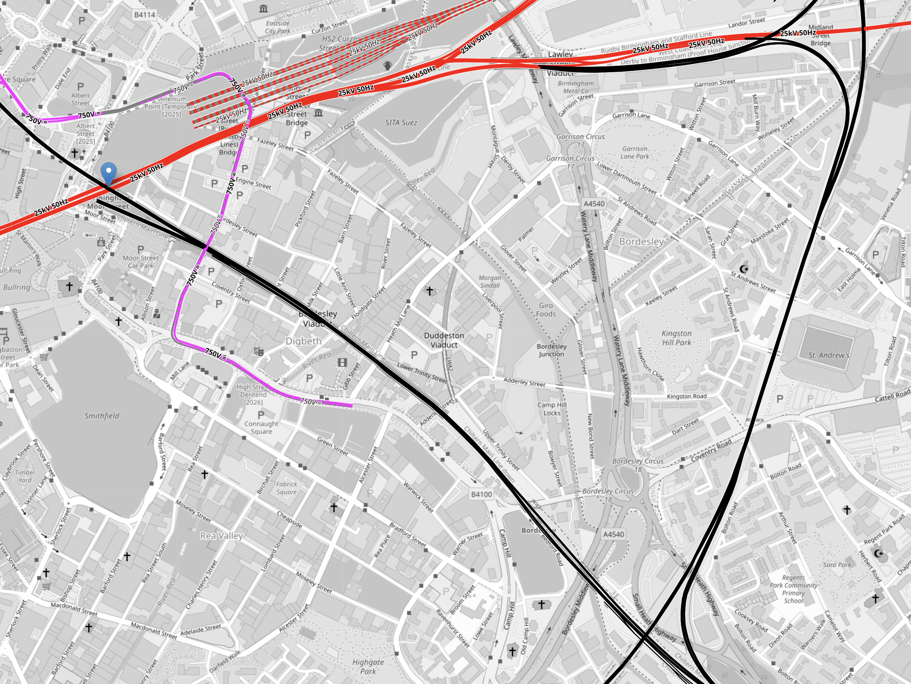
Note.
- Electrified tracks are shown in red.
- Tracks without electrification are shown in black.
- West Midlands Metro tracks are shown in mauve.
- The red tracks going diagonally across the map are the four electrified tracks going into Birmingham New Street station.
- Birmingham New Street station is off the map to the West.
- To the North of the tracks going into Birmingham New Street station, there are the seven platforms of High Speed Two’s Curzon Street station.
- The black track running NW-SE is the Chiltern Main Line between London Marylebone and Birmingham Moor Street stations.
- Birmingham Moor Street station is indicated by the blue arrow in the North-West corner of the map.
- The black track running NE-SW is the Camp Hill Line, that allows services to cross Birmingham.
Two new chords will be built where the Chiltern Main and the Camp Hill Lines cross, to allow services on the Camp Hill Line to call at Birmingham Moor Street station.
Consider.
- The press release described these chords as the biggest change.
- The chords will probably not be fully used, until the new stations are built on the Camp Hill Line.
- There may be need for extra platforms at Birmingham Moor Street station to accommodate any new services.
For these reasons, I suspect that these chords could well be the project that is pushed back to a later date.
The Reopening Of Platform 4 At Snow Hill Station
This OpenRailwayMap shows the track layout at Birmingham Snow Hill station.
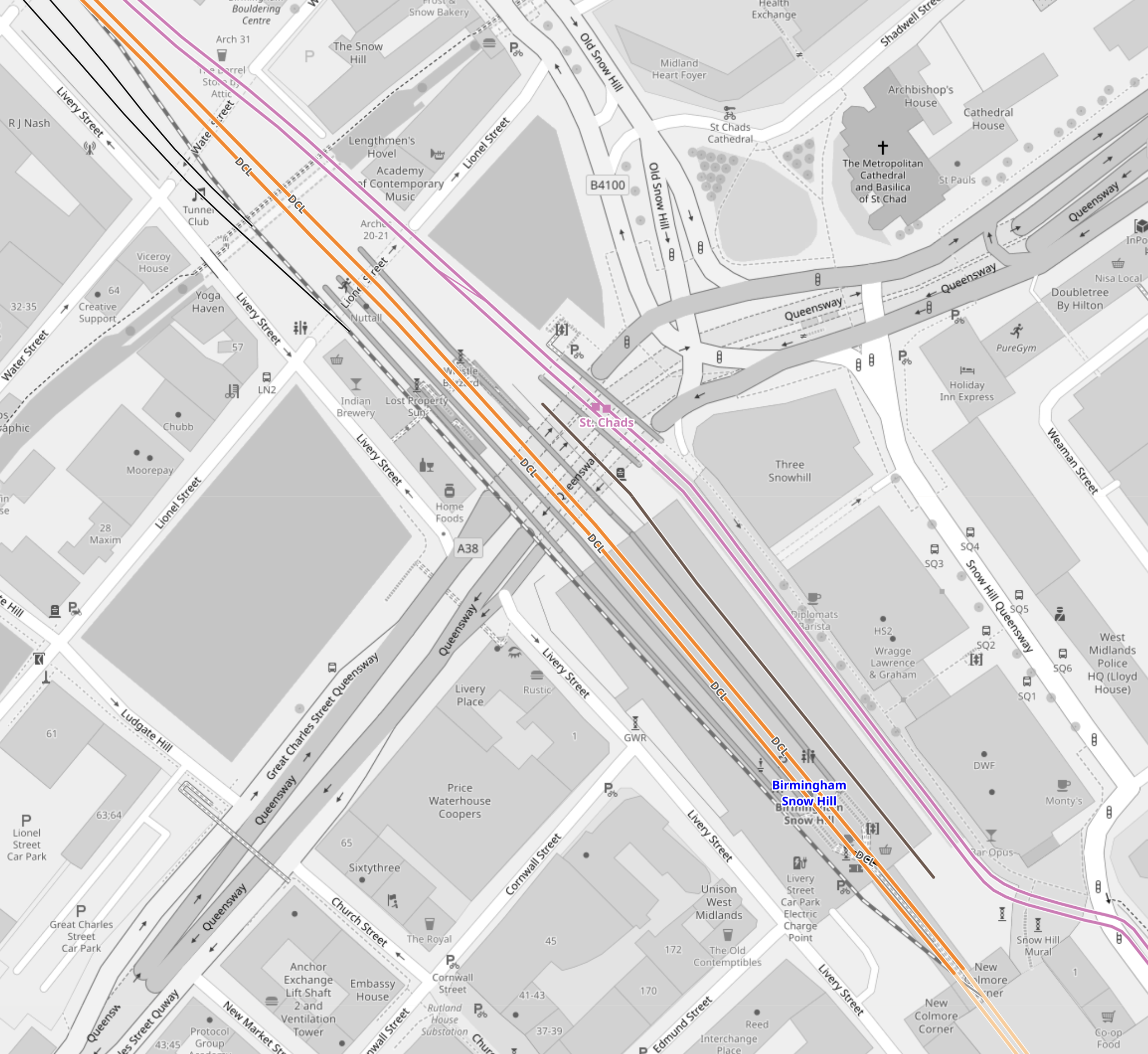
Note.
- The two lilac tracks are the West Midlands Metro.
- The two orange tracks are the two through tracks between Birmingham Moor Street and Stourbridge Junction stations.
- Platform 3 is the Southbound track to Birmingham Moor Street on the right.
- Platform 2 is the Northbound track to Stourbridge Junction on the left
- Platform 1 is a loop on left.
- Platforms 1, 2 and 3 are all bi-directional.
- The closed Platform 4 is on the right and is shown by the black track.
I would expect that this reopening could be fairly straightforward and may also have worthwhile benefits.
- Would an extra platform, allow all Chiltern services to serve both Birmingham Moor Street and Birmingham Show Hill stations?
- Chiltern would probably find it easy to extend services from Birmingham to the North-West of the city.
- In this century, services have run as far as Wrexham from Marylebone.
- If all Chiltern services terminated at Birmingham Show Hill station would this have operational and/or marketing advantages?
- If all Chiltern services terminated at Birmingham Show Hill station would this, make it easier for some passengers to get a train to London and the South?
- If all Chiltern services terminated at Birmingham Show Hill station would this release a platform at Birmingham Moor Street station for other services?
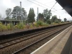
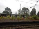
These are a few pictures of Birmingham Snow Hill station.


Platform 4 at Birmingham Snow Hill station could be a Build One Platform-Get One Free At Another Station situation!
The Redeveloping Of Kings Norton Station
This will probably be needed for running services on the Camp Hill Line, so why not get some of the work done early, so the rebuilding doesn’t effect existing services?
This OpenRailwayMap shows the Eastern end of Kings Norton station
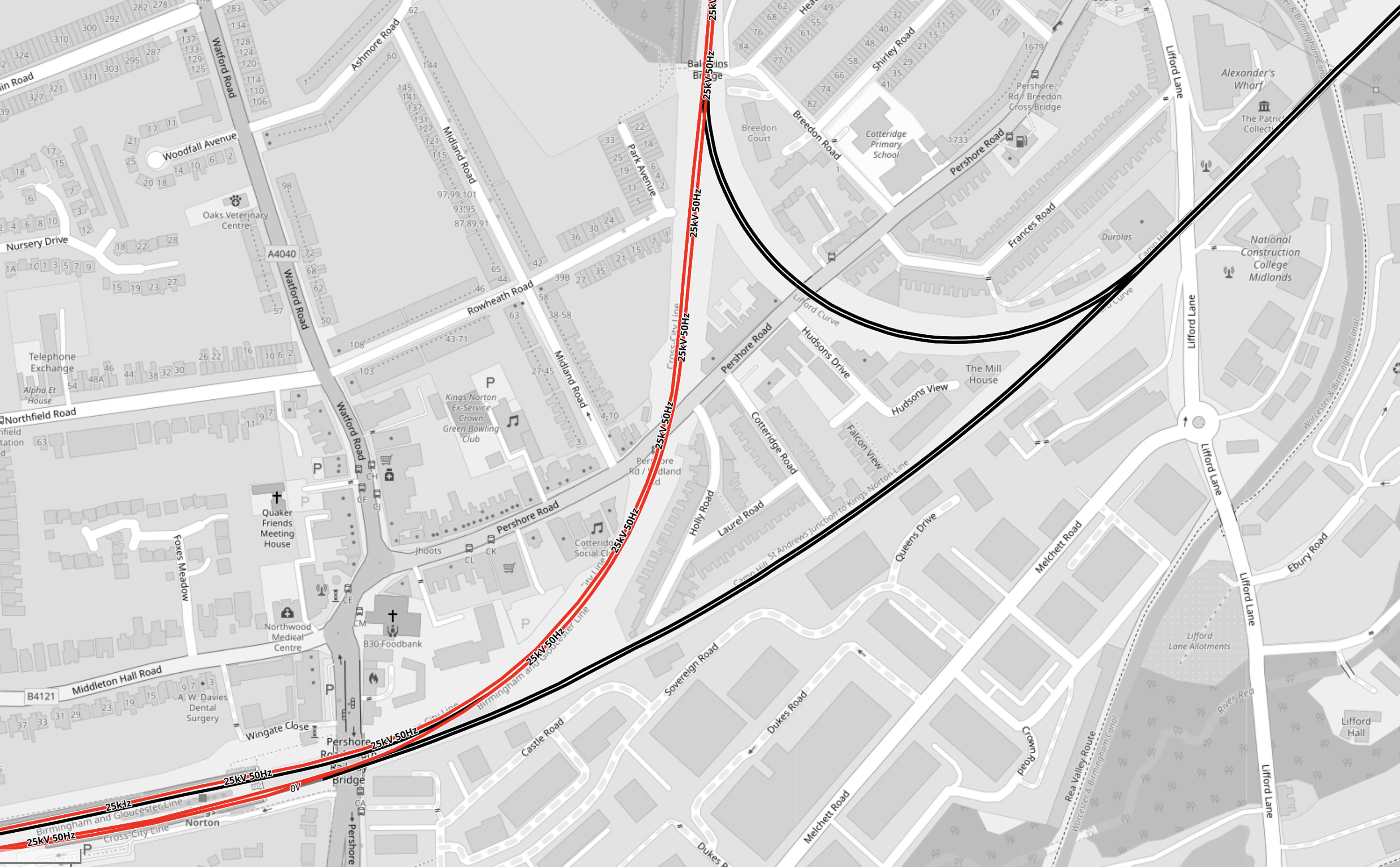
Note.
- Electrified tracks are shown in red.
- Tracks without electrification are shown in black.
- The station has four platforms, but some are unused.
- Two platforms are on an island, with a single platform on either side.
This OpenRailwayMap shows the Western end of Kings Norton station.
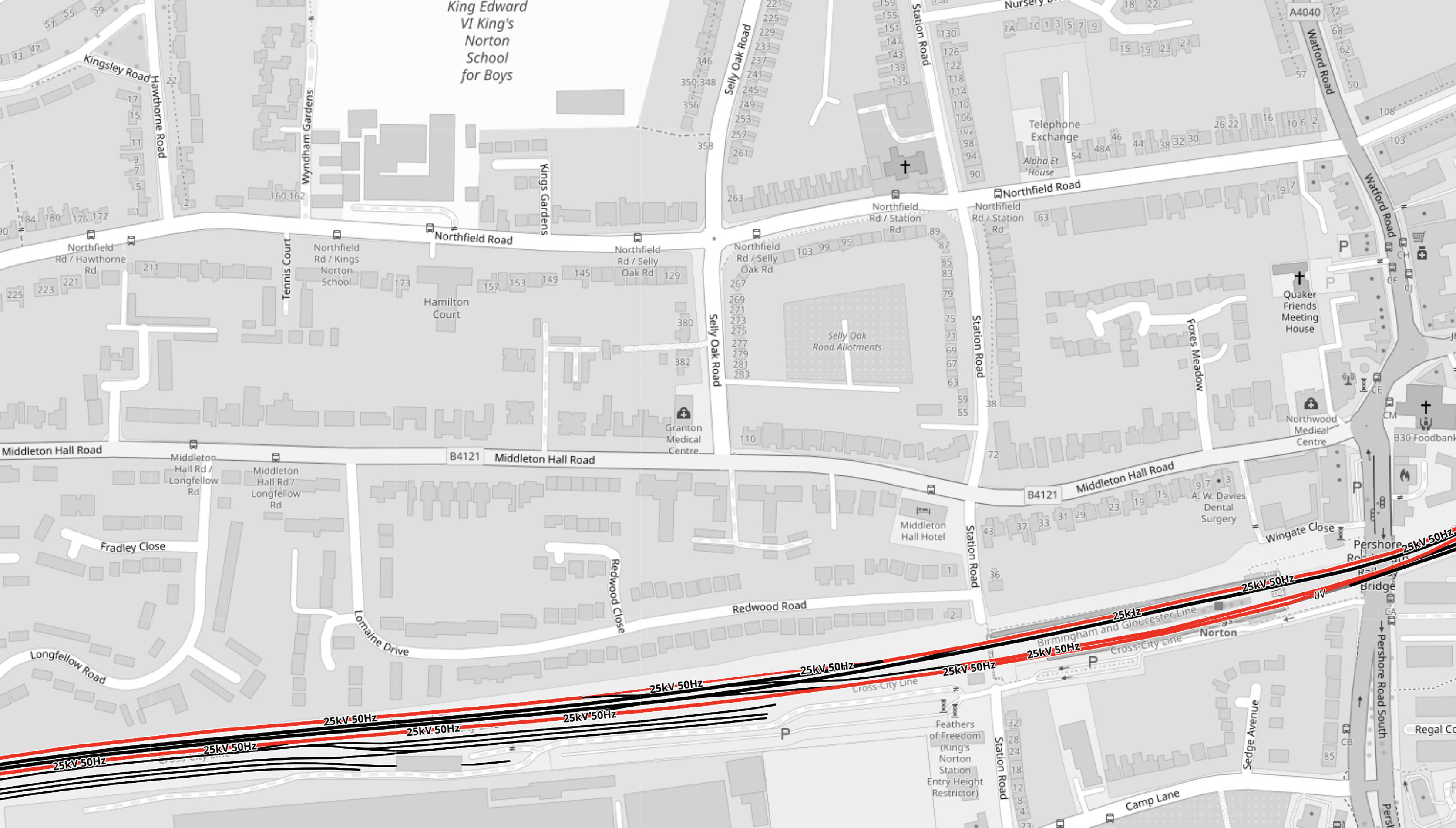
The notes to the previous map apply.
These two paragraphs from the Wikipedia entry for Kings Norton station, describe the station.
With the development of both bus and tram services, the need for such a large facility reduced from the 1930s onwards. The result is that today although all four platforms remain in place, only the outer two are in passenger use, with the middle island platforms now derelict.
Refurbished as part of the Cross-City line in 1978, it retained some of its original features following refurbishment, unlike the other ‘cross city line’ stations. The original station building survived, leased out for commercial purposes, until it was demolished in February 2006 for safety reasons. An extension car park provides a Park and Ride facility.
Disabled-access doesn’t seem to be the best either.
These pictures show the station.


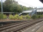


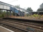


Note.
- As I guessed, there is no disabled-access.
- But there are Braille markings on the handrails down to the platforms.
- Two CrossCountry trains are seen going through the station.
- The local Class 730 trains, lights and information screens appeared to be new.
- Three platforms are electrified, but the fourth is not.
- The electrification structure could probably be used to electrify the fourth platform.
- Only the two outside platforms ; 1 and 4 are in use, with the central island platforms ; 2 and 3 left derelict.
- There is car parking and possibly space for more.
- The two active platforms are 150 metres long and the six-car Class 730 trainstrains appear to be 144 metres long.
- The Class 220 trains, that are run by CrossCountry Trains appear to be 93 metres long.
It was one of the scruffiest stations, that I’ve ever seen.
These are my thoughts on the station.
Handling The Camp Hill Line
Refurbishing Kings Norton Station
I don’t feel, that this will be the most horrendous of jobs, as it is very much a job, where all the rubbish and wild forest is removed and new platforms and a bridge are built.
Rolls-Royce SMR Advances To Final Stage In Swedish Nuclear Competition
The title of this post, is the same as that of this press release from Rolls-Royce.
This is the sub-heading.
Rolls-Royce SMR has been selected by Vattenfall as one of only two companies to reach the final stage in the process to identify Sweden’s nuclear technology partner.
These are the first two paragraphs, which add details.
After being shortlisted in 2024, Rolls-Royce SMR has progressed through a detailed assessment and will now work with Vattenfall through the final technology selection which could initially result in Rolls-Royce SMR delivering three SMRs.
This positive news is testament to Rolls-Royce SMR’s transformative approach to delivering proven nuclear technology in an innovative way through modularisation and builds on our successful selection in both the United Kingdom and Czech Republic.
Some other points from the press release.
- Sweden is initially looking to build three SMRs.
- Each SMR will supply 470MWe of clean low-carbon electricity.
- They are expected to have a lifetime of sixty years. Sizewell B was originally expected to have a lifetime of forty years, but appears to be being extended to sixty years, so I will accept Rolls-Royce’s expected lifetime.
- The first units will be at the Ringhals site on the Värö Peninsula, where there is an existing nuclear power station.
This Google Map shows the Ringhals site in relation to Gothenburg.
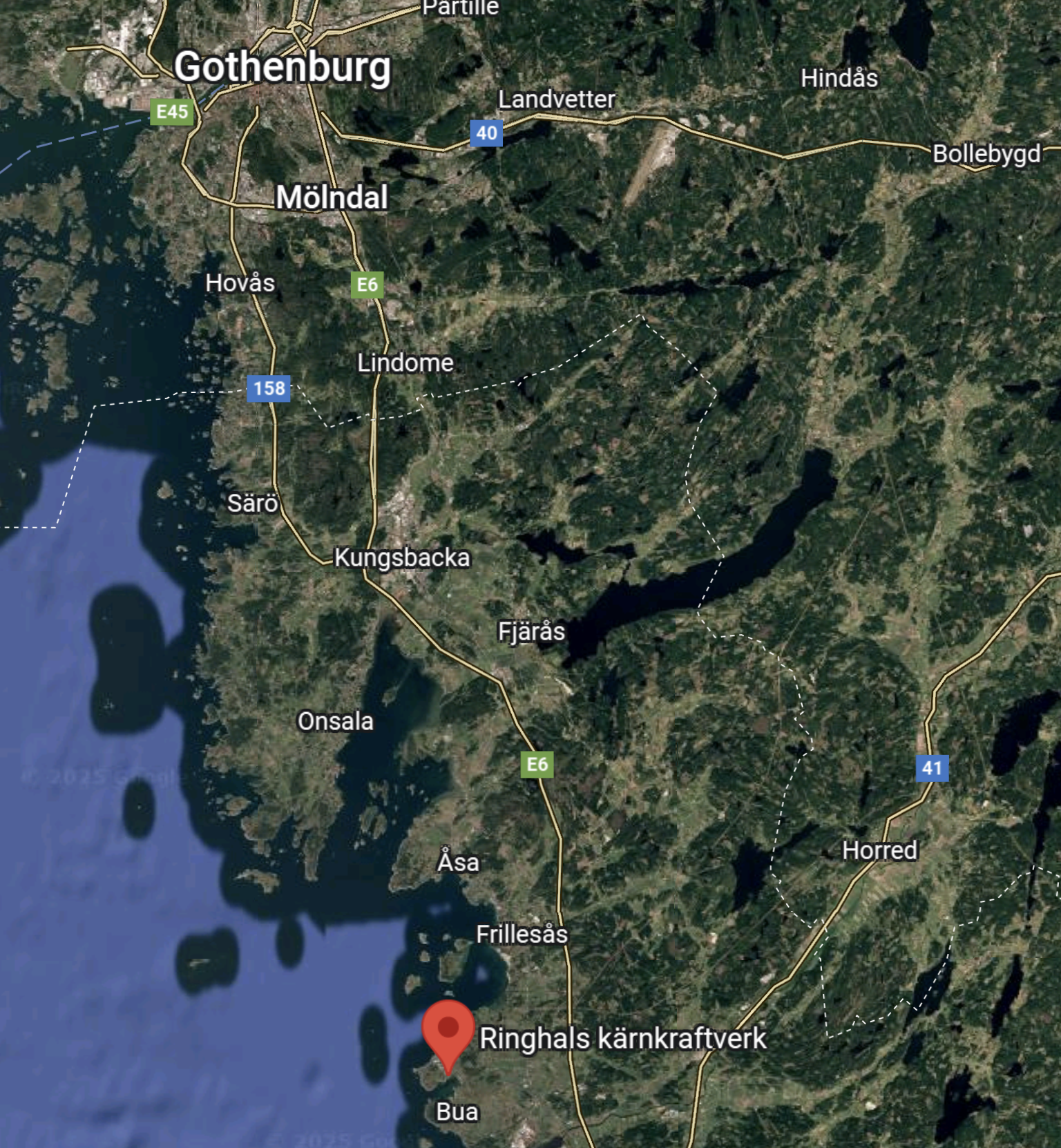
The site is marked by the red arrow.
On taking a closer look, it appears to be a site with expansion possibilities.
The British Media Don’t Seem Very Interested
It is now the 31st of August and the only paper to report the story has been the Financial Times.
DB And PKP To Expand Cross-Border Rail Services Between Germany And Poland
The title of this post, is the same of that as this article on Railway=News.
These two introductory paragraphs add more detail.
From mid-December 2025, Deutsche Bahn (DB) and PKP Intercity (PKP) are expanding their joint long-distance rail services, increasing the number of direct daily connections between Germany and Poland by more than 50 percent.
Starting on 14 December, 17 daily train pairs will operate across the border, up from the current 11. The additional capacity will provide a two-hourly service on the Berlin–Warsaw route, with seven trains in each direction.
I did a lot of this route, when I did a Home Run From Krakov.
I feel this German-Polish route will attract a lot of passengers, as it serves three excellent Polish cities Gdansk, Krakov and Warsaw, where you can spend a few days and it connects you to Berlin.
‘This Has Nothing To Do With National Security’ | Revolution Wind Halt Leaves Connecticut Leaders Demanding Answers
The title of this post, is the same as that of this article on offshoreWIND.biz.
This is the sub-heading.
Connecticut officials say they have been left in the dark about why the US federal government suddenly ordered construction of the Revolution Wind offshore project to stop, even as billions of US dollars, hundreds of jobs, and counted-on grid capacity hang in the balance.
This paragraph outlines what has happened.
On 25 August, the Connecticut State Government, joined by congressional leaders and representatives from the offshore wind supply chain, held a press conference at the New London State Pier after the Bureau of Ocean Energy Management (BOEM) issued a directive on 22 August halting all offshore activities on the almost-completed Revolution Wind, citing national security concerns and interference with US waters.
This may only appear to be about Trump stopping the erection of a wind farm in its tracks, but it is classic example of how to not do things.
He has left two states very angry, because of his prejudices.
Green Hydrogen – Meranti Green Steel Launches Green Iron Project In Oman
The title of this post is the same as that of this article on Hydrogen Central.
The title shows how if you have plenty of energy, you can produce green steel.
Surely, if the Omanis can do it, we can attract a company to make green steel in the UK, as we have lots of renewable energy around our shores.
All the current steelmakers do is blackmail the UK Government into paying them subsidies.
