When Silvertown Opens, Blackwall Tolls Start Too
The title of this post, is the same as that of this article on the BBC.
This is the sub-heading.
In under a month, tolls will be introduced for drivers at the new Silvertown Tunnel and the existing Blackwall Tunnel in east London.
These four paragraphs add detail to the story.
For car drivers it will cost £8 a day in peak. These are huge changes to London’s transport network and awareness seems to be low.
The new highly controversial Silvertown Tunnel opens on 7 April.
Critics have dubbed the crossing a huge polluting white elephant that will do nothing to cut congestion and pollution with little or no business case.
Supporters say it will reduce congestion on the old, existing Blackwall Tunnel and improve resilience on the crossing that closes between 600-700 times a year. It will also provide more cross river bus routes as well as a bus that can carry bikes.
As a very experienced mathematical modeller, my gut feeling is that four new tolled lanes under the River Thames is not the solution.
These are my thoughts.
Transport for London Are Not Good Mathematical Modellers
As a non-driver, I rely heavily on the 141 bus for transport.
- It stops close to my house.
- It takes me to and from Moorgate, where I also pick up the Elizabeth Line.
- It takes me to and from Bank, where I also pick up the Central Line.
- It takes me to and from River Thames, from where I pick up the Thames Clippers.
- It takes me to and from London Bridge station, where I also pick up theThameslink.
- It takes me to and from Manor House station, where I pick up the Piccadilly Line.
- It takes me to and from Harringay Green Lanes station, where I pick up the Gospel Oak to Barking Line.
I must admit some of the reasons I like the bus route, are that it connects me to my childhood memories of WoodGreen, Southgate, Oakwood and Cockfosters.
When, I moved here, there were two North-South buses that ran within fifty metres of my house.
- The 21 bus ran between Newington Green and Lewisham.
- The 141 bus ran between Palmers Green and London Bridge station.
Then, two years ago the Elizabeth Line and the rebuilt Bank station both opened, followed a year later by an upgraded Old Street station.
These three improvements, added a lot more passengers to the North-South corridor, between London Bridge station and Newington Green roundabout.
I suspect a quality modelling of bus passengers North-South, through the city of London, would have shown, that more buses were needed on the combined 21/141 route.
So what did Sir SadIQ and Transport for London do? They rerouted the 21 bus away from the busiest section through De Beauvoir Town.
In their modelling, I suspect.
- They overestimated how many travellers used the Northern Line.
- They ignored the fact, that the Piccadilly Line doesn’t serve the City of London.
- They ignored the fact, that the Piccadilly Line doesn’t connect to the Elizabeth Line.
- They ignored the fact, that the 141 bus, is the only direct way between Palmers Green, Wood Green, Turnpike Lane and Manor House to the City of London.
- They felt De Beauvoir Town was a posh area and doesn’t need more buses, as residents can use their cars.
Halving the number of buses was a seriously bad decision.
I now have a damaged left knee due to constant standing on overcrowded buses.
It’s also got a lot worse lately due to constant bus diversions and cancellations, due to Islington’s LTNs and constant road works.
I’ve heard similar tales of bad bus planning from all over London.
So why should I trust Transport for London’s traffic modelling on the Silvertown and Blackwall Tunnels?
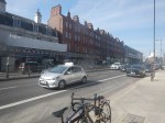
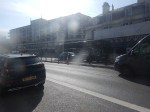
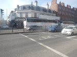
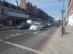
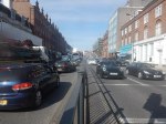
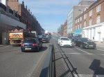
The Silvertown And Blackwall Tunnel Share Approach Routes
This map from the BBC article shows the layout of the two tunnels and their approach roads.
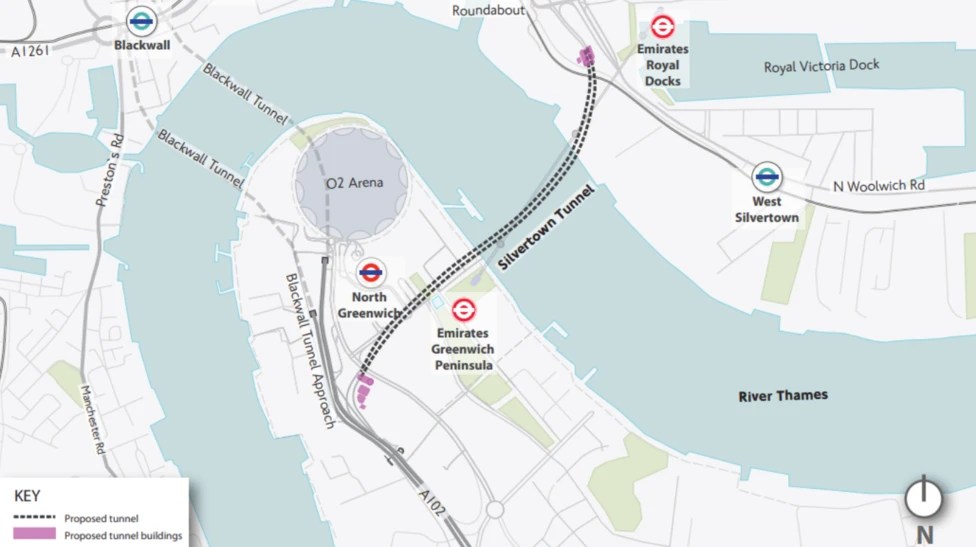
Note.
- The Blackwall Tunnel is two, two lane tunnels, one in each direction.
- The Silvertown Tunnel is one four lane tunnel, with two lanes in each direction.
- The O2 lies between the two tunnels.
The map shows the shared approach road for both tunnels.
What happens if there is an accident on the approach to the tunnels?
Tolling Problems
I feel that the tolling regime is overly complicated.
Hopefully, any problems this causes will lessen, as drivers know what to do.
The Sat-Nav Route Between The Tunnels And The M1
I’ve just looked one recommended route up, not that I have a Sat-Nav and I’ve never used one and the route is straightforward.
- Blackwall Tunnel Northern Approach to Hackney Wick.
- Wick Lane to Hackney Central.
- Graham Road and Dalston Lane to Dalston Junction
- Balls Pond Road to Southgate Road/Mildmay Park
- St. Paul’s Road to Highbury & Islington station.
- Holloway Road to Archway.
- Archway Road, Aylmer Road and Falloden Way to Henly’s Corner.
- North Circular Road and Great North Way to the M1.
I live just South of the Southgate Road/Mildmay Park junction and often these days it is jammed solid.
But there is another route from Hackney Wick.
- A12 to Redbridge Roundabout on the North Circular Road.
- North Circular Road to the M1.
I dread to see what happens, when the Dartford Crossing is closed and heavy trucks from the Channel Tunnel to the M1, decide to take the Silvertown Tunnel as an alternative route.
More Than Four In Ten New Homes In England Built With Solar Power
The title of this post, is the same as this press release from Solar Energy UK.
These two paragraphs add some more detail.
The introduction of more stringent rules on energy efficiency for new homes in England has driven a surge in solar panel installations.
The proportion of new homes and buildings that come with solar photovoltaic panels included has risen by more than three times in the last twelve months.
It certainly appears that solar is now an essential part of a new house.
The article calls it a dramatic jump.
That is a dramatic jump compared to only 5,731 of 44,310 newbuilds sporting solar panels in the last quarter of 2023 – only 13%.
Will the next product to be installed in houses, be batteries for individual houses?
I’m certainly thinking of one to complement my solar panels.
Drax To Get £24m In Green Subsidies For Pumped Hydro
The title of this post is the same as that of this article in The Times.
These three paragraphs give details of the subsidy.
Drax will bank £24 million in green subsidies from energy bill-payers for its pumped hydro assets, ahead of a revival in the energy storage technology in Britain.
The FTSE 250 constituent, which also operates Britain’s largest power station in North Yorkshire, has secured contracts to provide 434 megawatts of capacity from its pumped storage and hydro assets, the largest of which is the Cruachan power station near Oban in Scotland.
The contracts cover energy to be delivered between October 2028 to September 2029, at a price of £60 a kilowatt a year.
This will arouse the anti-Drax lobby, but it should be born in mind, that according to Wikipedia, Cruachan can provide a black start capability to the UK’s electrical grid.
This is Wikipedia’s definition of a black start.
A black start is the process of restoring an electric power station, a part of an electric grid or an industrial plant, to operation without relying on the external electric power transmission network to recover from a total or partial shutdown.
After the Great Storm of 1987, we were without power in my part of Suffolk for two weeks and I suspect there were several black starts in the South of England.
I suspect that power from interconnectors could now be used.
Drax is expanding Cruachan from 440 MW to 1 GW, which will be a large investment and surely increase its black start capability.
So in this case the future subsidy could be considered something like an insurance policy to make sure black start capability is available.
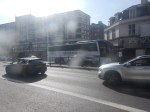
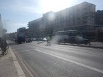
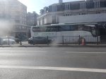
Walking Down Finchley Road And Frognal Station To The Finchley Road Coach Stop
This morning, I walked down Finchley Road from the bus stop at Finchley Road and Frognal station to the Finchley Road coach stop.
I took these pictures as I walked.
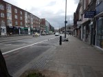
Note.
- I’d arrived on a nearly-new Wrightbus electric bus on route 113 from Edgware station.
- The walk was downhill and fairly easy.
- I crossed Finchley Road using a light-controlled pedestrian crossing.
- The pavement by the coach stop was rather strewn with litter.
- London buses seemed to be stopped just to the North of the coach stop.
The coach stop wasn’t too crowded despite five or six coaches stopping, whilst I was there.
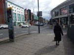
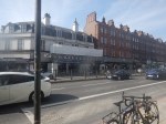
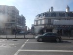
Moorgate Is Getting A Light-Controlled Crossing
Whilst, the building of 101 Moorgate was ongoing, crossing Moorgate has been a bit of a nightmare.
But now, as this picture shows a light-controlled crossing is being installed.
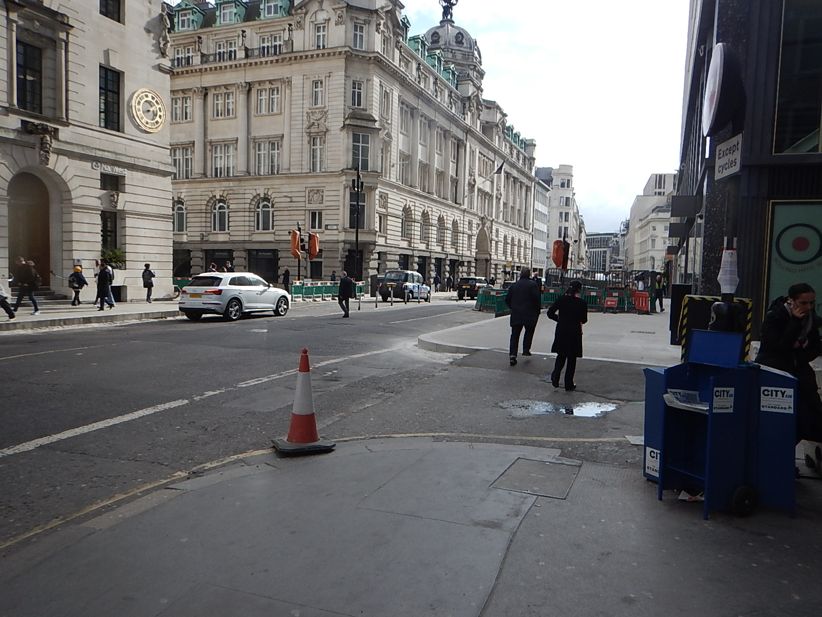
The gap in the building behind the traffic lights on the far side of Moorgate leads through to Finsbury Square.
This Google Map shows the City of London between Moorgate and Liverpool Street stations.
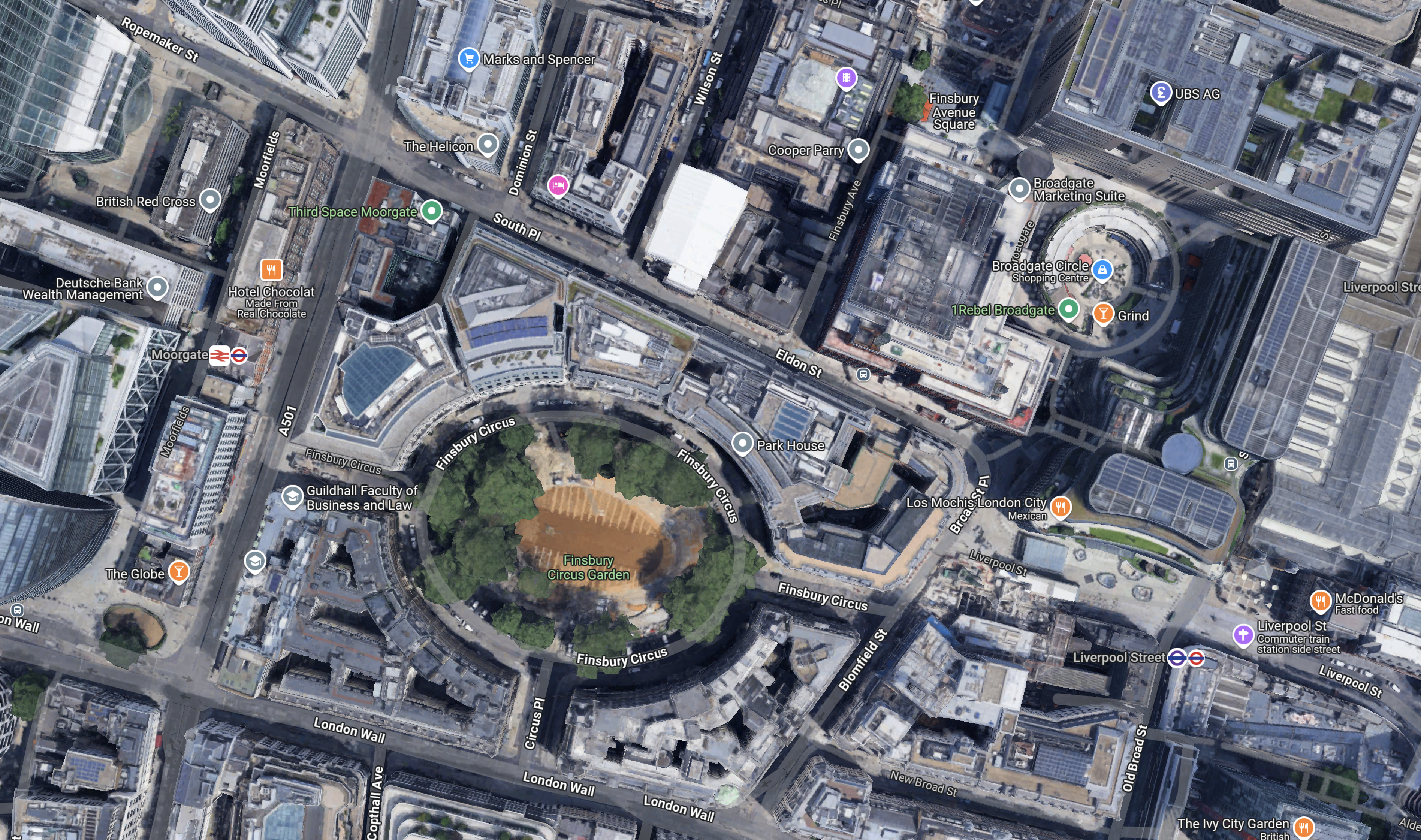
Note.
- Finsbury Square Gardens is in the centre of the map.
- Moorgate station is to the West of the gardens with Moorgate and its North-South buses in between.
- There is a Marks and Spencer department store on Moorgate to the North of the gardens.
- The shops and offices of Broadgate and Liverpool Street station are to the East of the gardens.
Especially, when it is good weather, there is a pleasant East-West walking route across the map.
British Gas Introduce Hydrogen-Powered Van Trials
The title of this post, is the same as that of this press release from Centrica.
This is the sub-heading.
British Gas is piloting the use of a hydrogen-powered van to help decarbonise their fleet, marking a significant step in their commitment to achieve net zero emissions by 2040
These two paragraphs add some details.
The partnership with Ryze Power, the suppliers of clean hydrogen and alternative fuels and energy, will provide British Gas with access to the green hydrogen to power the Vauxhall Vivaro van over the two-month trial. The van is being put through its paces by a British Gas engineer in Birmingham, accessing Ryze’s refueling station at Tyseley during their working day.
The journey to Centrica, parent company of British Gas, reaching its 2040 net zero target includes achieving a net zero fleet by 2030, which is where this initiative supports the business in its vital next steps. Water vapour is the only emissions from the hydrogen vans, which include a battery a fraction of the size of that in an EV, meaning less requirement for mining precious metals.
I have written about this van before in Vauxhall Begins UK Customer Trials Of Hydrogen Vans.
The New Station With Wildflowers And No Car Park
The title of this post, is the same as that of this article on the BBC.
This is the sub-heading.
A new railway station with solar panels and wildflowers on the roof and no car park has been hailed as an example of sustainable transport
These three paragraphs, explain the thinking behind the design.
Cambridge South station, on Francis Crick Avenue, at the city’s Biomedical Campus, is expected to be completed by early 2026.
Designer and architect Jan Kroes said the site, which sits next to a nature reserve, would “fit in within the green belt”.
Network Rail said the site would be next to a guided busway system and connect with local cycleways and footpaths.
Regularly, when I lived nearly twenty miles from Cambridge, I would drive to Whittlesford Parkway station, which has 348 parking spaces and take the train to London.
This Google Map shows the area to the South-East of Cambridge.
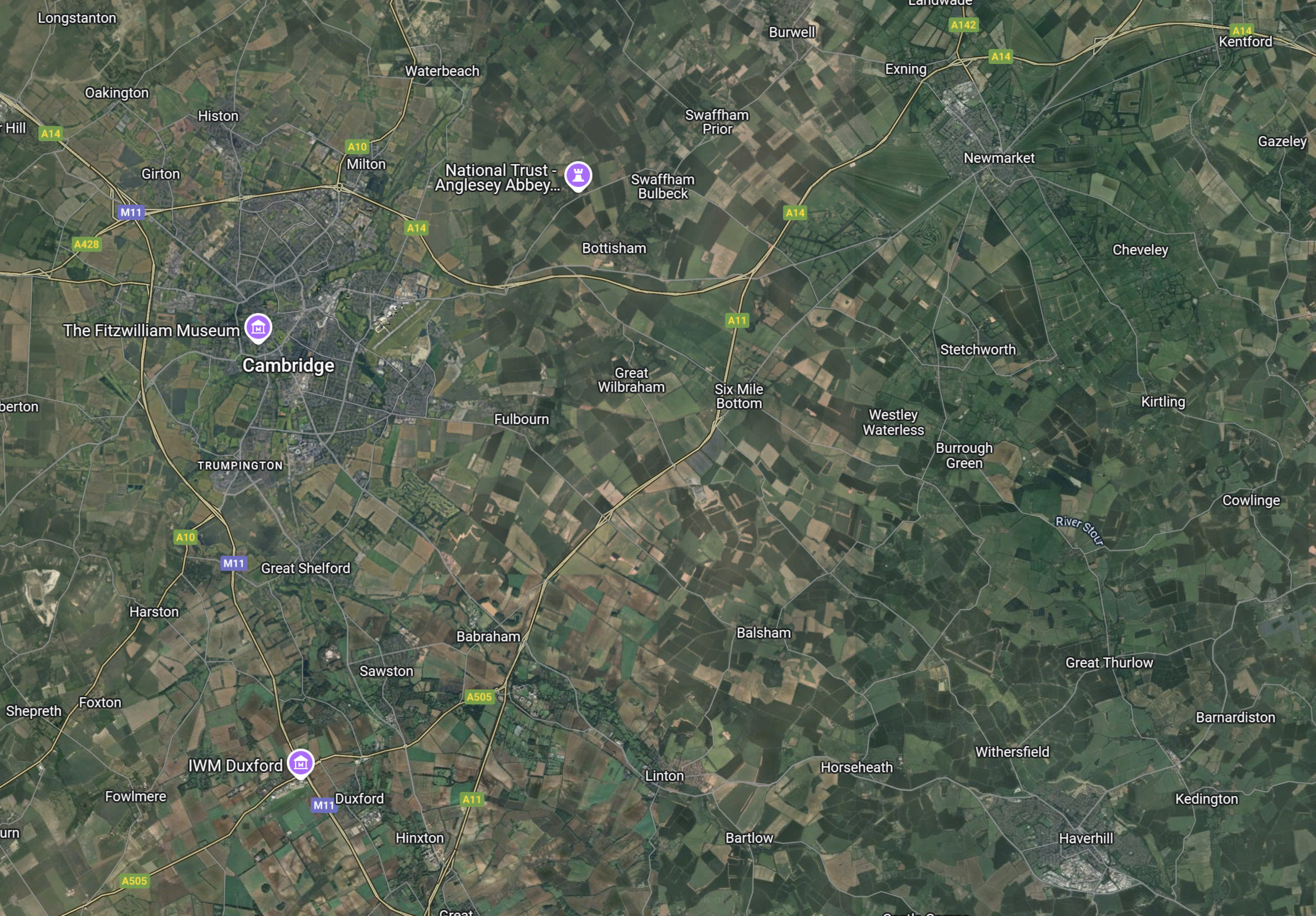
Note.
- Cambridge is towards the North-West corner of the map.
- Newmarket, which has a population of nearly 16,000, is towards the North-East corner of the map.
- Haverhill, which has a population of nearly 30,000, is towards the South-East corner of the map.
- Whittlesford Parkway station, is towards the South-West corner of the map close to the Imperial War Museum at Duxford
- I used to live at Great Thurlow between Newmarket and Haverhill.
The only railway stations on this map are Cambridge, Cambridge North, Dullingham, Newmarket, Shelford and Whittlesford Parkway.
As bus services are pretty thin on the ground, if you live to the bSouth-East of Cambridge, I can understand if there has been surprise, at the lack of parking at the new Cambridge South station.
- If you are travelling to London or Stansted Airport, you can still use Whittlesford Parkway, which has parking.
- But if when the East West Railway opens, you will need to use Cambridge or Cambridge South stations.
- Now that Cambridge North station is open, travelling to Norwich by train may be easier, unless there is not enough parking at Cambridge North station.
When I lived in the area, the most common excuse for not using the train, was the problems of parking at the stations.
I predict, that parking will be added to Cambridge South station.
A True Underground Advert
I spotted this advert at Swiss Cottage station today.
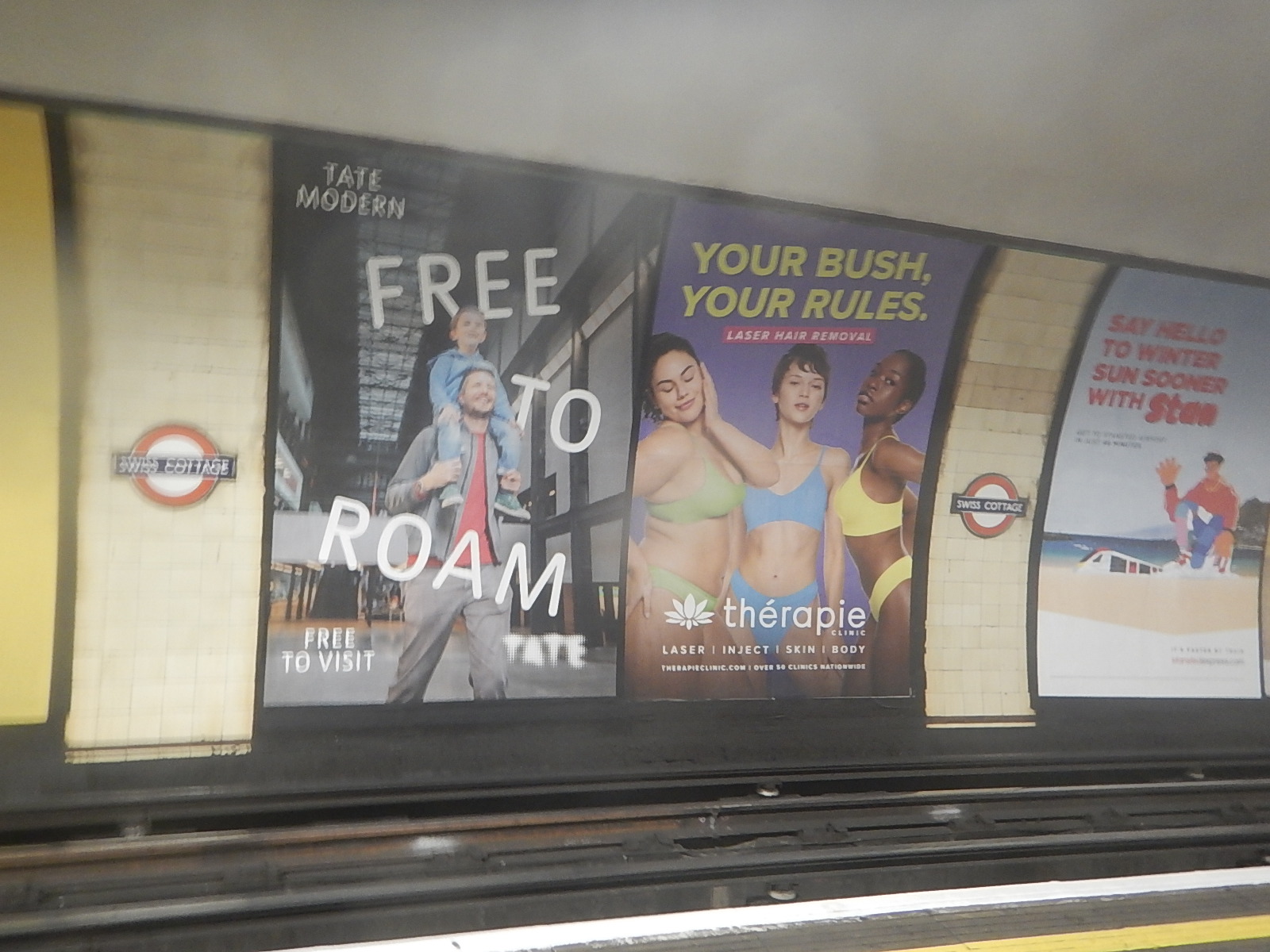
I’m surprised the censors of Transport for London didn’t ban it.
Another version of the advert is also running around on a 476 bus near me. But in that one a single lady is lying down to fit the bus.
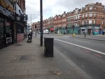
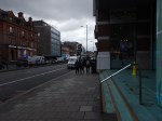
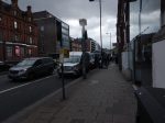
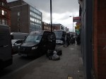
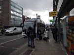
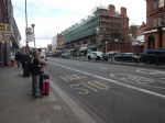
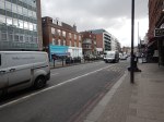
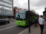
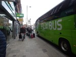
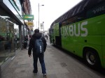
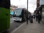
Coach Chaos At The Finchley Road Coach Stop On A Sunday Lunchtime
I went to Finchley Road coach stop at lunchtime today and took these pictures.
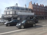
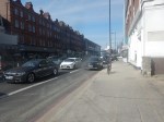
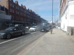
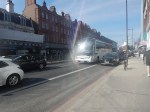
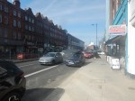
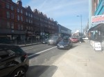
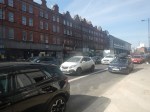
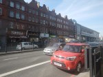
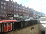
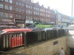
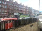

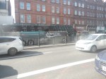
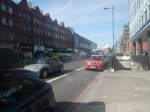
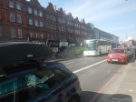


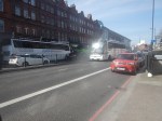
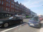
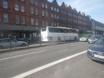
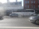

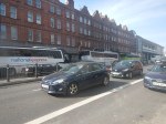
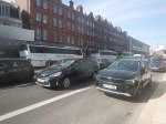
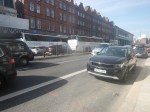


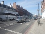
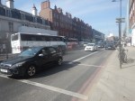
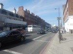
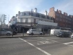
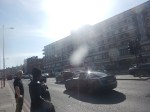
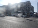
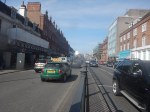

Note.
- Finchley Road coach stop is on the Finchley Road, just to the North of Finchley Road tube station.
- The Finchley Road coach stop is lavelled CL.
- Not all coaches stopped at the Finchley Road coach stop.
- I did see a double-deck coach taking visitors to the Harry Potter Attraction pass through ar Victoria Coach station and the Finchley Road.
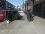
- There is a pedestrian subway under Finchley Road.
- There is a second stop for Southbound coaches on the other side of the Finchley Road.
- There are a few tatty shops along the pavement selling snacks, coffee, tea and other travellers needs.
- In the early pictures note, the large number of travellers queuing along the pavement in front of those shops.
- It looks like a lot of those travellers, were waiting for the Flixbus.
- The Flixbus stayed parked for several minutes.
- Finchley Road tube station is not step-free.
- Finchley Road tube station is served by the Metropolitan and Jubilee Lines.
I took most of the pictures from the opposite site to the Northbound coach stop, as the pavement was rather crowded.
This Google Map shows Finchley Road, the tube station and the coach stop.
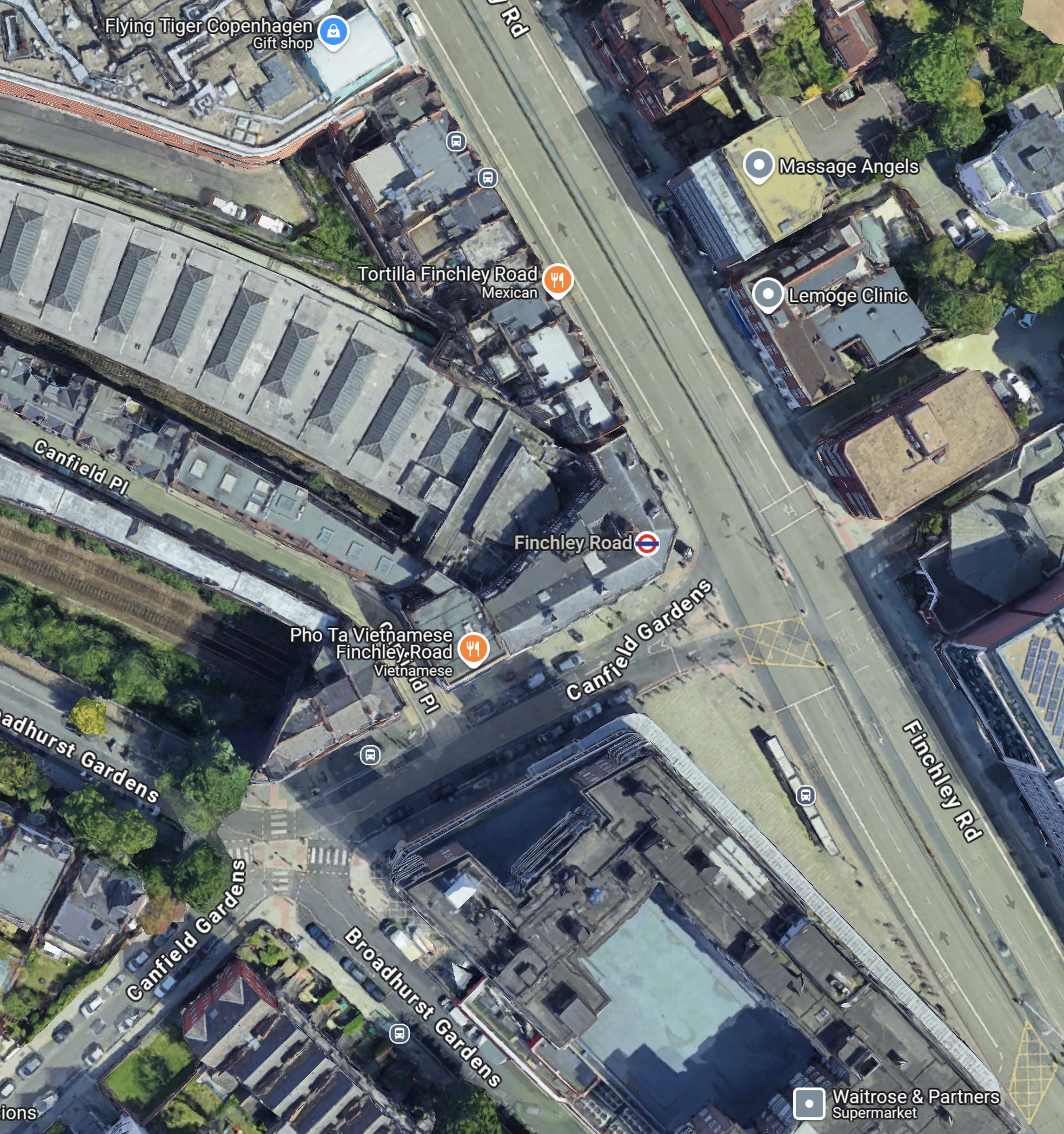
Note.
- The Finchley Road is the dual-carriageway road.
- The two grey dots at the Northend end of the Finchley Road, indicate the Coach stop and to its North a bus stop.
- The larger orange dot indicates the Tortilla restaurant, which is visible in several of the pictures.
- The London Underground roundel indicates Finchley Road tube station.
- The building curving away to the North-West is the train shed for the four platforms of Finchley Road tube station.
South of Finchley Road tube station, is a large Waitrose in the old John Barnes building.
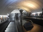
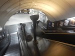
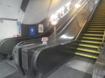
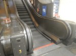
This pictures show some of the Train to Street access at Finchley Road station.
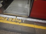
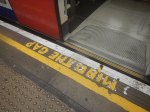
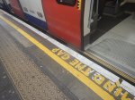
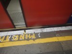
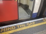
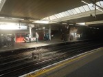
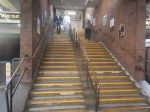
Note.
- There is a high step out of the Jubilee Line trains.
- The steps from platform to the street are steep with a heavy case or a baby in a buggy.
But it’s a long time, since I’ve done any travelling with a baby.
I have some further thoughts.
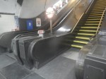
Travelling With Heavy Luggage, In A Wheelchair Or A Baby Buggy
It might be better to take a 13 or 113 bus to Finchley Road tube station, as the stop is just South of the station and no more than fifty metres from the Finchley Road coach stop.
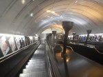
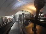
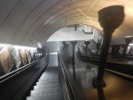
You could even get the bus from Swiss Cottage station, which is the next station South from Finchley Road and has a complete set of traditional escalators with uplighters.
Note.
