Superloop -February 2024
This article on the Londonist, shows the latest status of the Superloop on this TfL map.
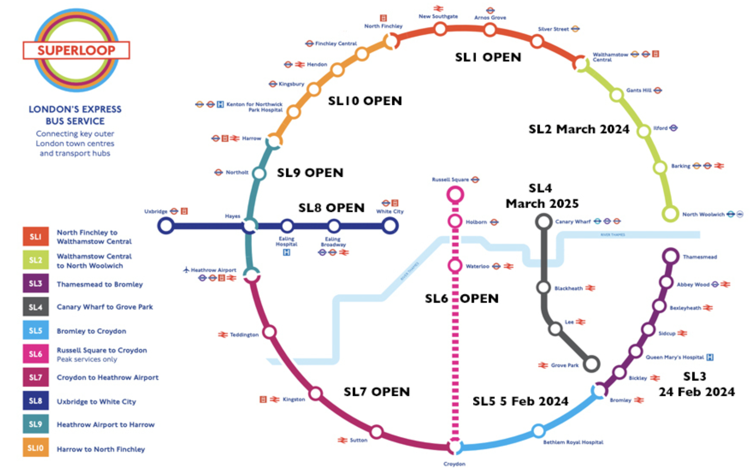
Note.
- The recently opened; SL3 has a lot of stops including Abbey Wood on the Elizabeth Line.
- SL4 will go through the Silvertown Tunnel.
- Since it opened, I’ve never needed to use a Superloop route going about my daily business.
I have this feeling, that a couple of years after it fully opens, there will be a few modifications to the route.
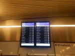
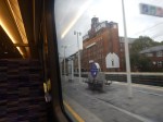
That Was Close!
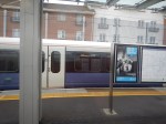
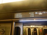
I took this picture in Liverpool Street station on the Elizabeth Line.
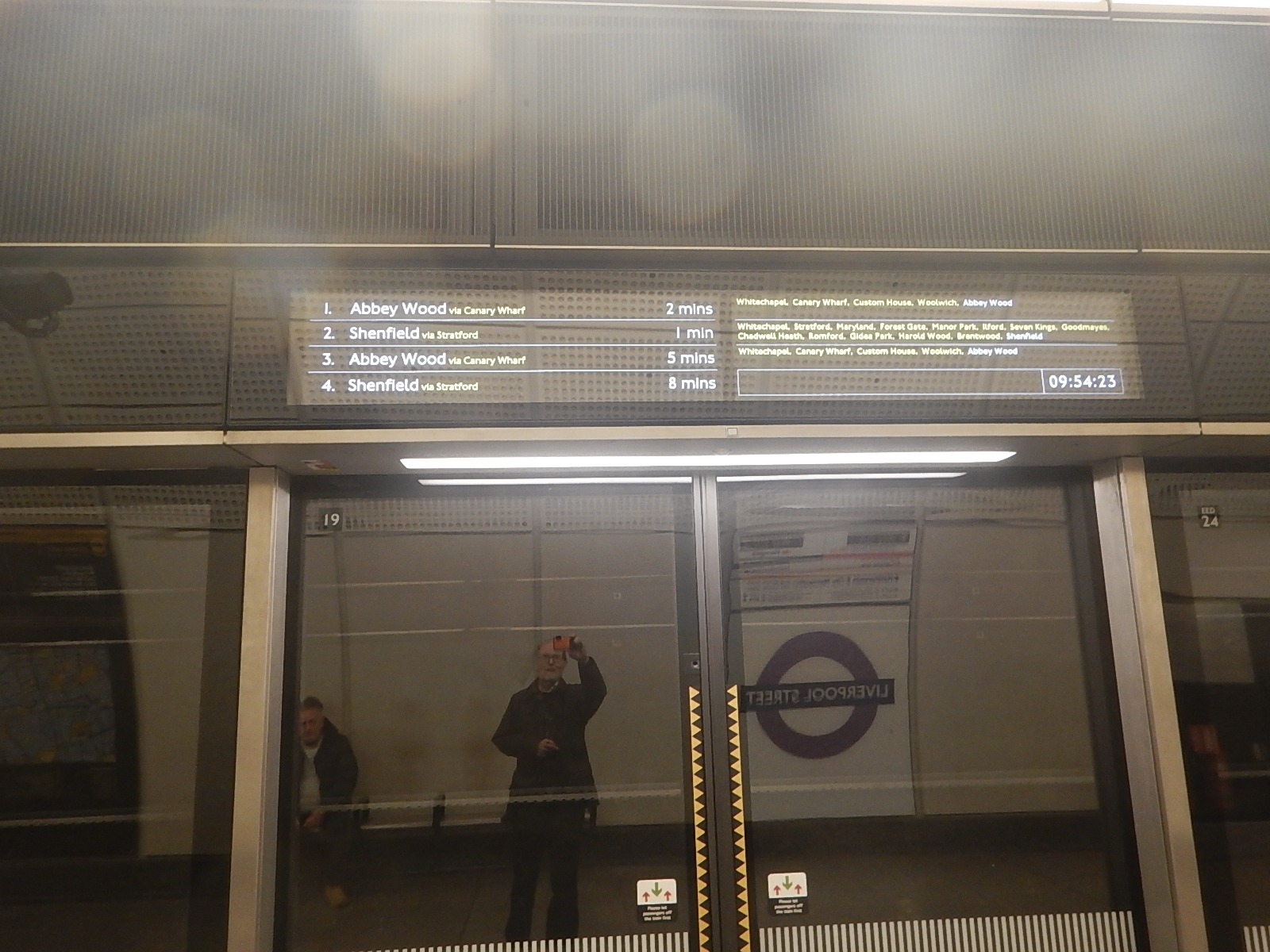
Note.
- The timings of the first two trains.
- The Shenfield train did arrive before the one for Abbey Wood.
How did it manage that? It looks like a another Fujitsu moment in the display to me!
Could There Be An Elizabeth Line Extension To Grays?
This article on My London is entitled London Underground Tube Map: The Towns That Could Be Added To The Elizabeth Line As New Giant Loop Through London, Essex And Kent Is Proposed.
This paragraph described the proposal.
The proposal, which is part of its Vision 2050 local transport plan, would see the current Elizabeth line service from Romford take over the Overground branch to Emerson Park and Upminster, then join c2c services continuing via Chafford Hundred Lakeside to Tilbury. It would then head under a new tunnel beneath the Thames to Gravesend, connecting with the reintroduced Eurostar at Ebbsfleet International/Northfleet.
It’s certainly a bold idea and you can view the report to Thurrock Council here.
These are my thoughts.
The Frequency Of Trains
Currently, these services have a frequency of two trains per hour (tph) in both directions.
- Romford and Upminster.
- Upminster and Tilbury Town.
It would seem sensible that this frequency is preserved, thus giving every station on the loop four tph to and from the Eastern End of the Central Tunnel at Whitechapel station. Two tph would go via Romford and Stratford and two tph would go via Ebbsfleet and Abbey Wood.
What Would Be The Western Terminal?
It would probably be the two busiest terminals in the West.
I suspect that these will be Heathrow Terminal 4 and Heathrow Terminal 5
- Two tph would go between Heathrow Terminal 4 and Heathrow Terminal 5 via the loop.
- Two tph would go between Heathrow Terminal 5 and Heathrow Terminal4 via the loop.
- Two tph would go clockwise.
- Two tph would go anticlockwise.
I suspect the digital signalling can sort it out, just as it does the loop in Thameslink.
The Connection At Romford To The Romford and Upminster Line
Consider.
- The Romford and Upminster Line is single-track.
- A well-signalled single-track railway can handle two tph in both directions in an hour.
- Trains take five minutes to go between Romford and Emerson Park stations.
- Trains between Romford and Upminster will use Platform 5 at Romford station.
- Trains between Upminster and Romford will use Platform 4 at Romford station.
This map from cartometro shows the track layout at Romford station.
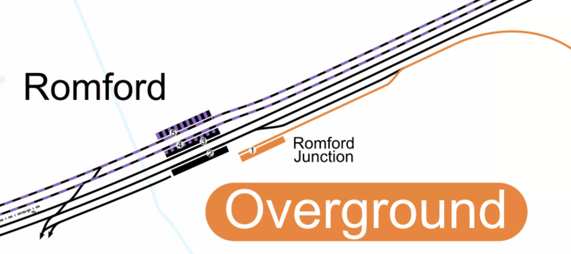
Note.
- The orange lines are the Overground tracks of the Romford and Upminster Line, which connects to Platform 1 in Romford station.
- The black and purple lines are the Elizabeth Line, which go through Platforms 4 and 5 at Romford station.
- The black lines are the fast lines of the Great Eastern Main Line, which go through Platforms 2 and 3 at Romford station.
- There is no connection between the Elizabeth Line and the Romford and Upminster Line.
I believe it is possible to build a single-track flyover or dive-under that connects both Platforms 4 and 5 at Romford station to the Romford and Upminster Line.
A similar double track flyover was built to connect the Barking Riverside branch to the main lines through Barking.
- But this track layout would only need to be single-track.
- I also suspect that there may not be enough space to put in a full double-track flyover.
- It would avoid the inconvenience and danger of using flat junctions to cross the fast lines of the Great Eastern Main Line.
As it only takes five minutes to go between Romford and Emerson Park stations, there is plenty of time to fit two tph in both directions in an hour.
Platform Extension In Platform 1 At Romford Station
Platforms 4 and 5 at Romford regularly take nine-car Class 345 trains, but I think that Platform 1 should be lengthened, to provide a bay platform on the route to help out when the service needs to recover.
Platform Extension At Emerson Park Station
The platform at Emerson Park station will need to be lengthened to take nine-car Class 345 trains.
Some commentators claim, that the passing loop at the station needs to be rebuilt. But I suspect, this isn’t needed as the expanded layout at Romford station effectively creates a passing loop.
The Connection At Upminster Between The Romford and Upminster Line And The Upminster And Tilbury Town Line
Consider.
- Both lines are single-track.
- But there is a passing loop at Ockenden station.
- There are three tracks between West Thurrock junction and Grays.
- Trains take five minutes to go between Emerson Park and Upminster stations.
- Trains take ten minutes to go between Upminster and Chafford Hundred stations.
- Trains take four minutes to go between Chafford Hundred and Grays stations.
- Trains take thirteen minutes to go between Upminster station and West Thurrock junction.
This map from cartometro shows the track layout at Upminster station.

Note.
- The orange lines are the Overground tracks of the Romford and Upminster Line, which connects to Platform 6 in Upminster station.
- The green lines are the District Line tracks that handle the services that terminate at Upminster station.
- The black lines are the c2c tracks between Fenchurch Street and Southend Central stations go through Platforms 1 and 2 at Upminster station.
- The Upminster and Tilbury Town Line leaves Upminster station in a South-Easterly direction.
- The Upminster and Tilbury Town Line connects to Platforms 1 and 2 at Upminster station.
I believe it is possible to build a single-track flyover or dive-under that connects both Platforms 1 and 2 at Upminster station to the Romford and Upminster Line.
This would connect the following.
- The Romford and Upminster Line to the the Upminster and Tilbury Town Line.
- The Romford and Upminster Line to the the Fenchurch Street and Southend Central Line.
Upminster station would be a much improved interchange.
Two tph Between Tilbury Town and Romford Stations
Consider.
- The route is fully electrified.
- The route is a mixture of single and double-track.
- There is a passing loop at Ockendon station.
- The platform at Emerson Park and possibly others may need to be extended to take nine-car Class 345 trains.
I believe single-track flyovers or dive-unders at Romford and Upminster stations would enable two tph on the route.
The only downside I can see, is that passengers going between Fenchurch Street and Chafford Hundred or Ockendon stations would need to change at Grays or Upminster stations.
Alternatively, they could take the Elizabeth Line, which would have a 4 tph direct service between the Central Tunnel of the line and Chafford Hundred and Ockendon stations.
Under The Thames
This map from OpenRailwayMap shows the lines on the North bank of the Thames.
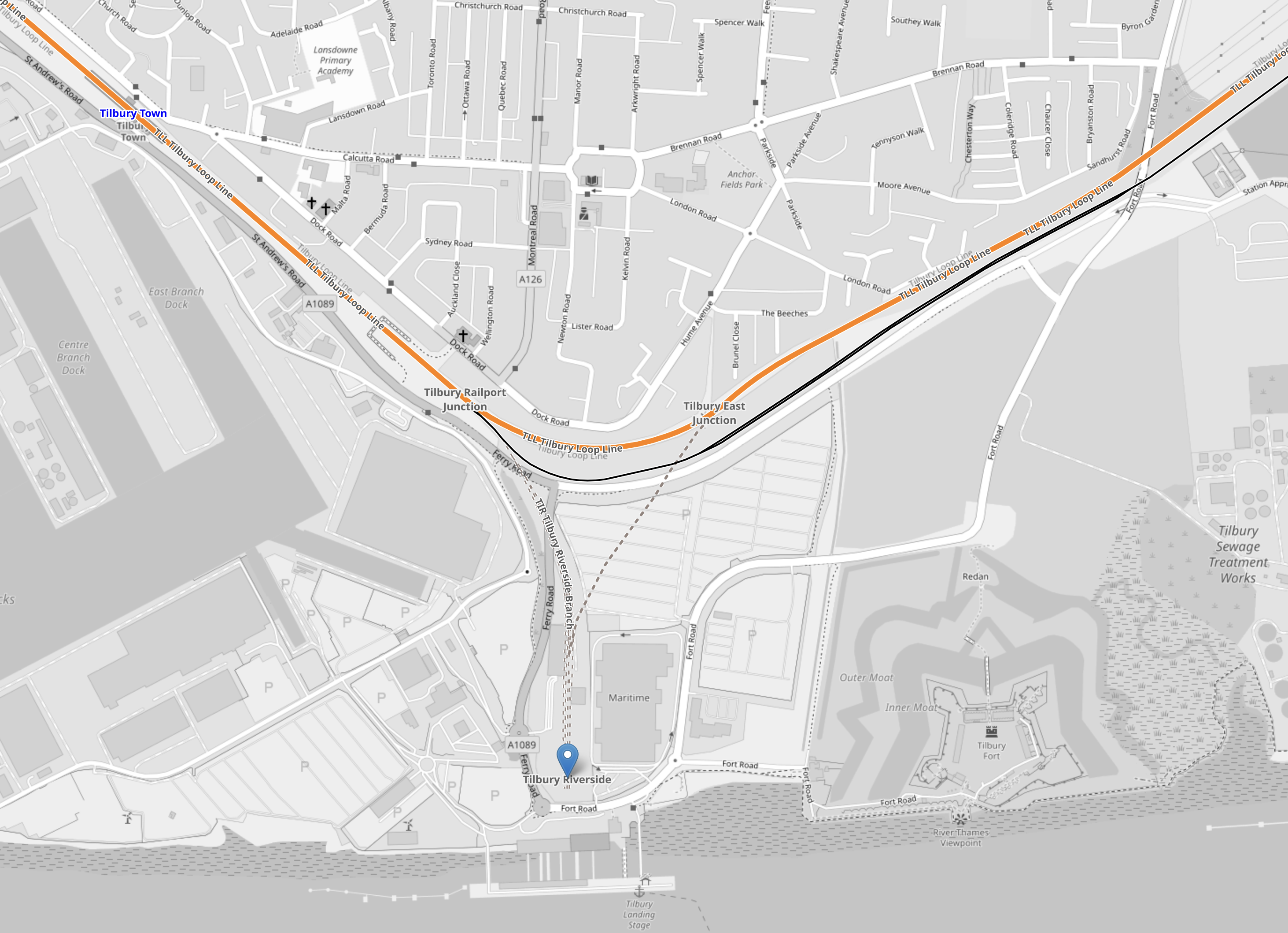
Note.
- The orange line is the double-track Tilbury Loop Line between Fenchurch Street and Southend Central stations.
- Tilbury Town station is in the North-West corner of the map.
- There is a proposal for a Tilbury Fort station in the North-East corner of the map.
- The blue arrow at the bottom of the map indicates the former Tilbury Riverside station, which is next to the London International Cruise Terminal.
I believe the North portal of the tunnel under the river could be at the site of the former Tilbury Riverside station.
Would it be an idea to rebuild the station and connect it to the cruise terminal, so that passengers on the cruise ships would have excellent access to Central London, Ebbsfleet International station for High Speed One and Heathrow Airport?
This map from OpenRailwayMap shows the lines on the South bank of the Thames.
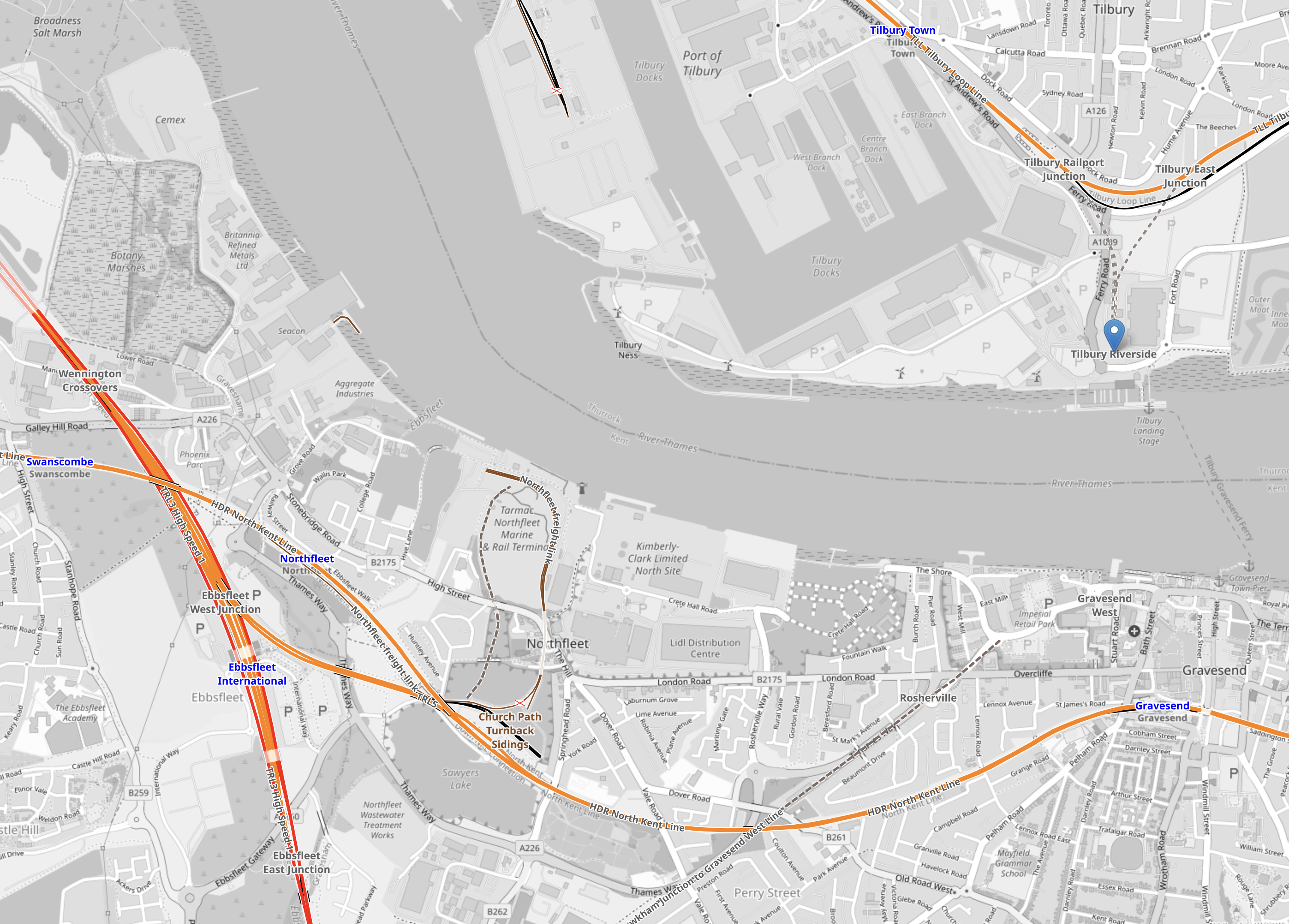
Note.
- Tilbury Town station, the former Tilbury Riverside Riverside station and the Tilbury Loop Line are in the North-East corner of the map.
- Gravesend station is in the South-East corner of the map.
- The wide orange line going vaguely North-South at the Western side of the map is High Speed One going through Ebbsfleet International station.
- Connecting Gravesend and Ebbsfleet International stations is the North Kent Line.
I suspect it would be possible to bore a tunnel from Tilbury Riverside, that passed under Gravesend station and joined the North Kent Line to the West of the station.
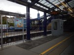
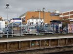
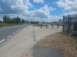
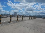
How Would The River Crossing Connect To Gravesend Station?
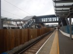
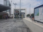
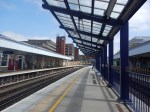
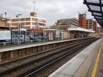
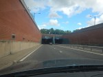
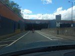
The platform or platforms on the Elizabeth Line Loop would have to be underground, as there is not much space at Gravesend station as these pictures show.
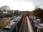
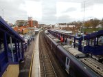
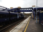
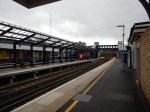
Note.
- Gravesend has SouthEastern HighSpeed services to St. Pancras International station and North-East Kent.
- The route to Gravesend has been safeguarded for the Elizabeth Line.
- The railway under the Thames could replace the Tilbury and Gravesend Ferry.
There also could be operational advantages in not terminating Elizabeth Line services at Gravesend.
Abbey Wood And Gravesend
In Elizabeth Line To Ebbsfleet Extension Could Cost £3.2 Billion, I looked at the Transport for the South East proposal for extending the Elizabeth Line to Kent.
This image from the Abbeywood2Ebbsfleet consultation, shows the proposal.
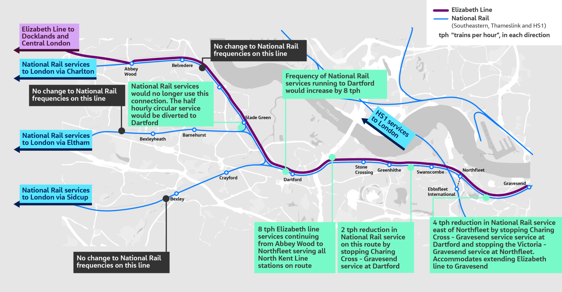
Note, that there doesn’t appear to be too much new infrastructure, except for a proper connection between Northfleet and Ebbsfleet stations. References on the Internet, say that the similar-sized Luton DART connection at Luton Airport, cost around £225 million, but we now know it was well upwards of that.
The TfSE proposal says that trains would terminate as follows.
- Abbey Wood – 4 tph
- Northfleet – 4 tph
- Gravesend – 4 tph
As space is limited at Gravesend and there is money for extending a railway service to a new Hoo station, I feel that proposing a two tph service to Hoo station would be a prudent action to take.
This would leave a handy two tph to take the loop back to Central London.
Could A Large Parkway Station Be Built Between Romford and Tilbury Riverside Stations?
Ebbsfleet International station, which is to the South-East of London, has 5,000 parking spaces and is the only large Park-and-Ride site around the capital.
Could another large Park-and-Ride site be opened on the Elizabeth Line North of the Thames?
One place could be at Chafford Hundred station and the nearby Lakeside Shopping Centre.
This Google Map shows the area.
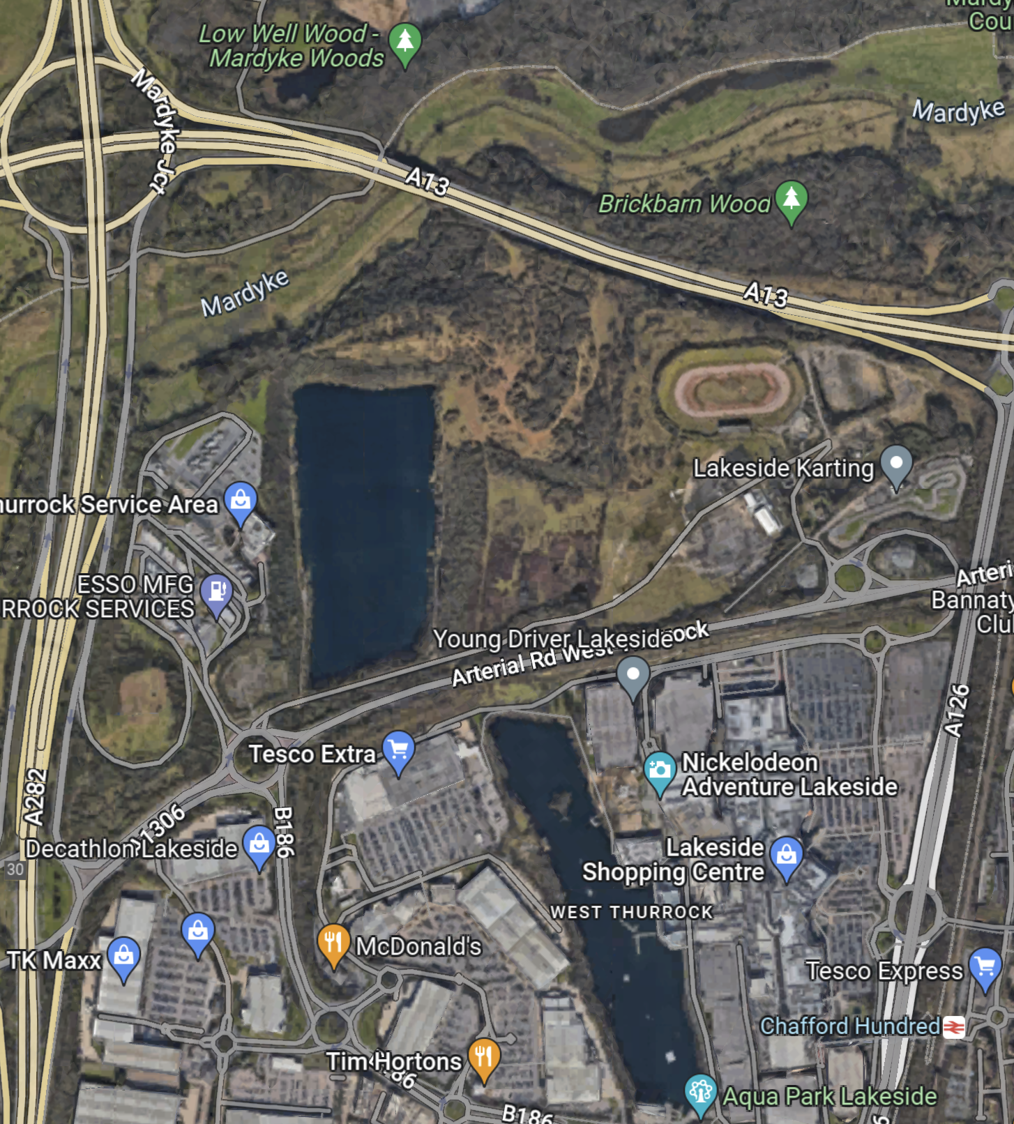
Note.
- The M25 runs North-South up the Western side of the map.
- Chafford Hundred station is in the South-East corner of the map.
- The shopping centre is next to the station.
Last time I went, Lakeside was looking tired.
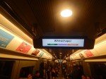
Timings To And From Whitechapel
These are estimated timings to and from Whitechapel.
- Romford – 26 mins – 81 mins
- Emerson Park – 31 mins – 76 mins
- Upminster – 35 mins – 72 mins
- Ockendon – 41 mins – 66 mins
- Chafford Hundred – 45 mins – 62 mins
- Grays – 49 mins – 58 mins
- Tilbury Town – 52 mins – 55 mins
- Tilbury Riverside – 58 mins – 49 mins
- Gravesend – 62 mins – 45 mins
- Northfleet – 65 mins – 42 mins
- Swanscombe – 68 mins – 39 mins
- Greenhithe for Bluewater – 71 mins – 36 mins
- Stone Crossing – 73 mins – 34 mins
- Dartford – 81 mins – 26 mins
- Slade Green – 86 mins – 21 mins
- Erith – 88 mins – 19 mins
- Belvedere – 89 mins – 18 mins
- Abbey Wood – 92 mins – 15 mins
Note.
- The times between Tilbury Town and Gravesend are my best estimates.
- All other times are taken from current services.
- The first time is the time to Whitechapel via Romford.
- The second time is the time to Whitechapel via Abbey Wood.
It does appear that the best times from all stations are under an hour.
Very Busy Lizzie
Yesterday, I took the Elizabeth Line, back from Reading to Moorgate.
- When, I got on at Reading, there were perhaps fifty empty seats and I was able to have three seats to myself.
- But by Slough, It was standing room only!
- It cleared a bit at Paddington, but by Moorgate there were only a few seats left.
Currently, there are two trains per hour (tph) between Abbey Wood and Reading stations.
As other passengers said it’s always busy, I suspect that Transport for London need to tweak the signalling, so that four tph run to Reading.
This section called Planned Service in the Wikipedia entry for the Elizabeth Line says this.
In May 2023, it is planned to allow trains to run from both eastern branches to west of Paddington. This will allow both more flexible, and higher frequency, services: 24 tph peak, 20 tph off-peak, and direct services between Shenfield and Heathrow. In the longer term, when Old Oak Common opens, all trains will serve Old Oak Common, with those not serving the Reading or Heathrow branches reversing there.
The service changes for May 2023 were confirmed in February 2023. The peak timetable will increase to 24 trains per hour. Off-peak service level will remain at 16 trains per hour, with two Shenfield–Paddington trains extended to Heathrow Airport Terminal 5 and two Abbey Wood–Terminal 5 trains switching to Terminal 4.
This will give an Off Peak schedule as follows.
- Reading and Abbey Wood – 2 tph
- Maidenhead and Abbey Wood – 2 tph
- Heathrow Terminal 4 and Abbey Wood – 4 tph
- Heathrow Terminal 5 and Abbey Wood – 0 tph
- Heathrow Terminal 5 and Shenfield – 2 tph
- Paddington and Shenfield – 6 tph
I don’t believe it is good enough.
- There is no direct Heathrow Terminal 5 and Abbey Wood service.
- Reading needs four tph to Central London.
- See Elizabeth Line: Commuters Say Service ‘Not What Was Promised’
- See So Many Cases On A Train!
I suspect passenger congestion and reaction will force a rethink by the Mayor and Transport for London.
Extending The Elizabeth Line – Serving South-East London
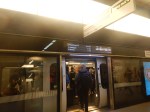
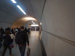
The Inadequacies Of Abbey Wood Station
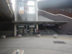
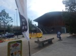
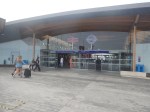
Abbey Wood station is the Elizabeth Line’s main terminus in South-East London.

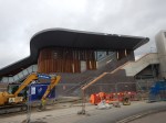
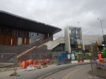
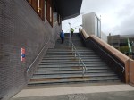
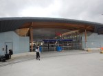
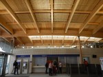
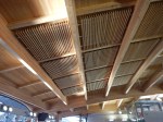
The architecture is impressive, as the pictures taken before the station was finished show.
But other things are less than impressive.
- There is no station parking.
- Central London rail terminals served by Elizabeth Line services are only Liverpool Street/Moorgate and Paddington.
- Central London rail terminals served by National Rail services are Cannon Street, London Bridge, King’s Cross and St. Pancras.
In my view, Abbey Wood is a lost cause, as a commuter station, unless substantial parking is built at the station.
Parking At Stations In West Kent
This list shows the number of car parking spaces at stations in West Kent and South East London.
- Barnehurst – 162 *
- Belvedere – None *
- Bexleyheath – 83 *
- Chatham – 276 *
- Dartford – 186 *
- Ebbsfleet International – 4945 #
- Erith – None *
- Eynsford – 15
- Farningham Road – None
- Gillingham – 152 *
- Gravesend – 94 *
- Greenhithe – 8 *
- Longfield – 88
- Meopham – 167
- Northfleet – None *
- Plumstead – None *
- Rochester – None *
- St. Mary Cray – 31
- Slade Green – 25
- Sole Street – 61
- Stone Crossing – None *
- Strood – 112 *
- Swanley – 106
- Swanscombe – None *
- Welling – 117
Note.
- An asterisk (*) indicates direct trains to and from Abbey Wood station for the Elizabeth Line.
- An hash(#) indicates direct trains to and from Stratford International for the Elizabeth Line.
These figures are according to the National Rail web site.
It looks like unless you can walk to your nearest station and that has an easy connection to Abbey Wood, you’re probably better off going to Ebbsfleet and parking there.
Travelling Between Ebbsfleet International And The Elizabeth Line At Stratford International
Consider.
- Southeastern’s Highspeed service between Ebbsfleet International and Stratford International has a frequency of three trains per hour (tph)
- It takes less than twelve minutes between the two stations.
- It takes ten minutes to walk between Stratford International and Stratford Station for the Elizabeth Line and Greater Anglia services.
- There are eight Elizabeth Line tph to Paddington, calling at all stations. For Heathrow change at Whitechapel station.
Note.
- From these points, it should be possible to estimate the time you should park at Ebbsfleet to get to an event in London or East Anglia, if you live in Kent and are parking at Ebbsfleet International.
- I think four tph between Ebbsfleet International and Stratford International would make the route more attractive.
- If you’re going to Norwich or Ipswich be careful, as only one of the two tph stop at Stratford.
I catch the 12:30 from Liverpool Street for matches at Ipswich on Saturdays. This is the 12:38 from Stratford, so I suspect if you parked at parked at Ebbsfleet before 12:00, you’d make it.
Who’d have thought, that when they built the massive car parks at Ebbsfleet international, that they would be a Park-and-Ride for football at Ipswich. And Norwich too!
Changing Trains At Stratford
This map from Cartometro shows the two Stratford stations.
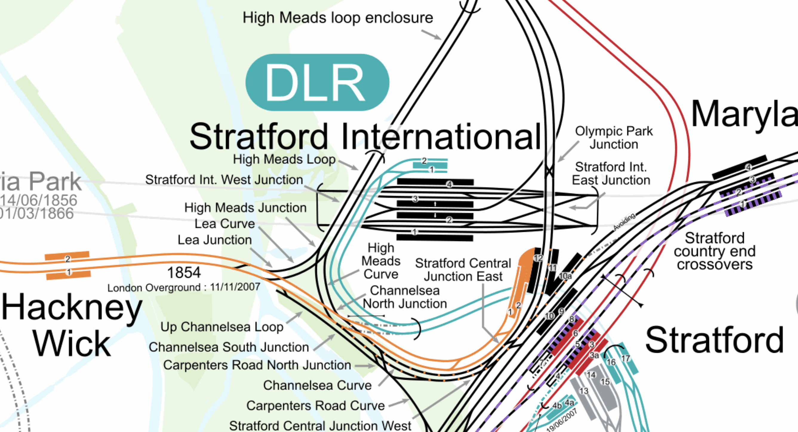
Note.
- The Elizabeth Line is shown in purple.
- The Central Line is shown in red.
- The Jubilee Line is shown in silver.
- The Overground is shown in orange.
- Lifts and escalators take passengers to and from the surface from between platforms 2 and 3 at Stratford International station.
Two pedestrian tunnels connect all the platforms in Stratford station.
- Elizabeth Line trains use platforms 5 and 8.
- Central Line trains use platforms 3, 3a and 6.
- Great Eastern Main Line trains use platforms 9, 9a and 10.
- Overground trains use platforms 1 and 2.
All platforms have lifts.
I suspect, that when you get to know the Stratford complex well, it’s easier than it looks.
But it does need better signage.
Full Step-Free Route Between Ebbsfleet And Heathrow Central
I have just used Transport for London’s Journey Planner, as if I was in a wheelchair and need full step-free access to go from Ebbsfleet to Heathrow Central.
This was the route.
- Southeastern to Stratford International station – 10 mins
- Walk to Stratford station – 21 mins
- Jubilee Line to Bond Street – 24 mins
- Bond Street to Heathrow Central – 32 mins
Note.
- The times are slower than say myself.
- I think it is possible to pick up the Elizabeth Line at Stratford.
But the route is certainly possible in a wheel-chair.
The Penge Interchange
This map from Cartometro shows where the East London Line of the London Overground and the Chatham Main Line between Victoria and Chatham cross in Penge.
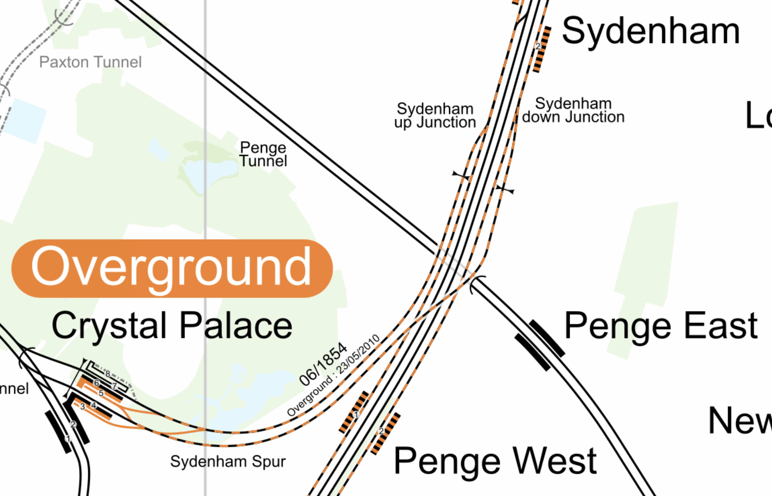
Note.
- The East London Line runs North-South through Sydenham and Penge West stations.
- The Chatham Main Line runs through Penge East station.
There is a plan by Transport for London to create a Penge Interchange station on railway land, where the two lines cross.
- The station could replace Penge West and Penge East stations.
- It would be fully step-free.
- Interchange would be allowed between the East London Line and the Chatham Main Line.
This would increase connectivity for those travelling to and from South-East London and West Kent.
I brlieve that this one interchange could help level-up a large area of South-East London.
Taking A Train Between Abbey Wood And Ilford Stations On The Lizzie Line
The Elizabeth Line will open up a large number of new routes for Londoners, those who visit and those who live close to the tentacles of the new line.
One of these routes is between South East London and East London or South Essex.
You could take two trains in and out of central London, with the Underground in between, but the easiest way is to drive.
But then the Dartford Crossing hasn’t the needed capacity.
But the Elizabeth Line, which opened today, gives you an alternative with a simple cross-platform change at Whitechapel or Liverpool Street stations.
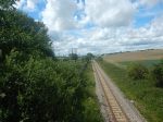
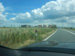
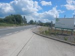
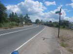
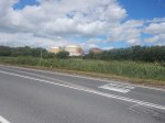
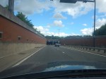
I took a trip today between Abbey Wood and Ilford stations, changing at Whitechapel to assess the feasibility of a route like this as a daily commute, taking these pictures along the route,


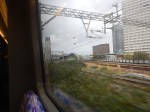
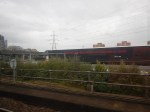

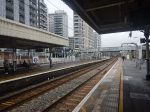
Note.
Between Abbey Wood And Ilford stations took 39 minutes.
Google says a car will take 45 minutes.
Extending The Elizabeth Line – Connecting North Kent Line Services To The Central Tunnel At Abbey Wood
This map from cartometro.com shows the track layout at Abbey Wood.
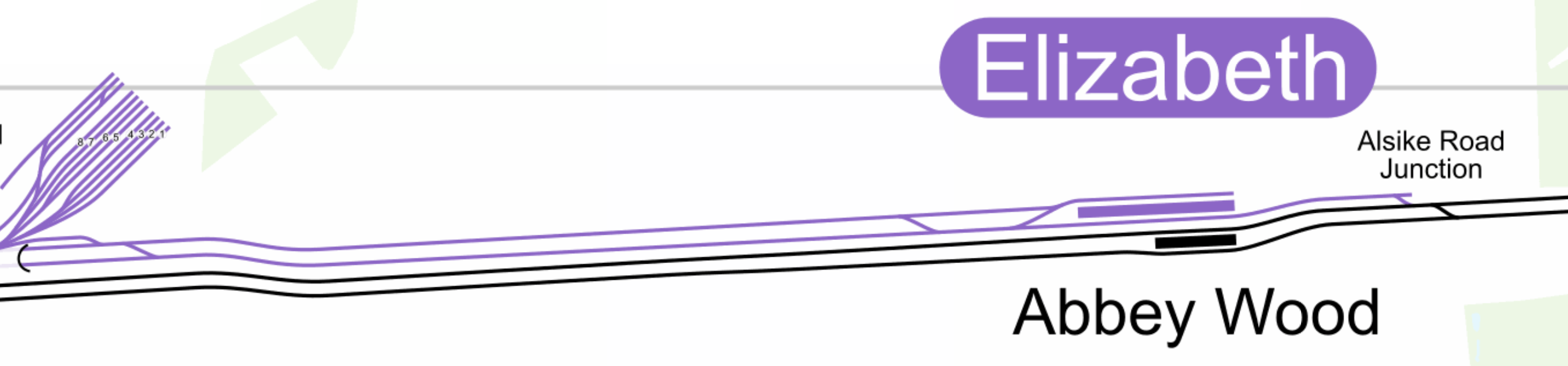
Note.
- The Elizabeth Line is shown in purple.
- The North Kent Line is shown in black.
- The North Kent Line platform to London is the Southernmost platform and is numbered 1.
- The North Kent Line platform from London is the other Southern platform and is numbered 2.
- The Elizabeth Line platforms are numbered 3 and 4.
- Platform 4 is the Northernmost platform.
At present the Elizabeth Line service to Abbey Wood station is twelve trains per hour (tph), with each platform handling six tph.
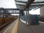
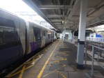
This picture shows trains in both Platform 3 and 4 looking towards the station buildings.

Note.
- Platform 3 is on the right.
- Platform 4 is on the left.
In Elizabeth Line To Ebbsfleet Extension Could Cost £3.2 Billion, I talk about this proposal as described in this article on Ian Visits.
One of the key features of Crossrail To Ebbsfleet (C2E) project is that instead of all trains terminating at Abbey Wood, trains will terminate as follows.
- Abbey Wood – 4 tph
- Northfleet – 4 tph
- Gravesend – 4 tph
This will mean that 8 tph would pass through Abbey Wood station.
- Platform 4 could certainly handle the four tph that terminated on the Elizabeth Line.
- Platform 3 would need to handle eight tph in both directions or sixteen tph to fulfil the proposed C2E service.
- This would be one train every 225 seconds.
I believe that digital signalling could handle this easily and safely.
I am fairly sure that the track layout at Abbey Wood allows eight tph to go both ways between the North Kent Line and the Elizabeth Line Central Tunnel.
The Maximum Capacity At Abbey Wood Station
Because of the current track layout at Abbey Wood, I believe that without track modifications, Abbey Wood station will not be able to handle more than 12 tph.
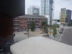
To Abbey Wood For An Ice Cream
Yesterday, I went to Abbey Wood station to see what was there.
If you continue along the Elizabeth Line platforms, you come to a ground level step-free entrance to the platforms. So I used this route and found a rather nice shop, where I had a proper ice cream.


We need more proper ice cream outlets in London.
Crossness
Abbey Wood station is probably the best access point for one of London’s best tourist attractions; Crossness. I visited Crossness during Open House and wrote about it in Open House – Crossness.
These are some pictures I took in 2012.


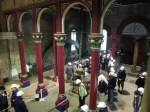


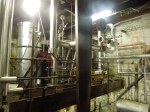

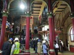
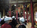

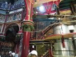


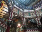


Crossness should be on everyone’s bucket list. The site is now managed by the Crossness Engines Trust.
But getting there by public transport is not easy.
In my view what is needed is either a shuttle bus from Abbey Wood station or perhaps modification to an existing route, so that it calls at Crossness.
The Joining Up Of The Elizabeth Line
I asked a station guy, when the three sections of the Elizabeth Line would be joined up.
He gave me a straight answer – The 6th of November.
This is twelve Sundays from today.
A Trip To Northfleet
Yesterday, I went to Northfleet station.
Partly, it was to have a drink with my old friend; Ian, but mainly it was to take some pictures to add to Elizabeth Line To Ebbsfleet Extension Could Cost £3.2 Billion.
Normally, when I go to see Ian I take the HighSpeed service out of St. Pancras.
But this service is expensive and as I was leaving from Moorgate, I decided to take the Elizabeth Line to Abbey Wood and get a train to Northfleet station instead.
I have a few thoughts on my journey.
Cost
I used my Freedom Pass to Abbey Wood and then bought an Off Peak Day Return between Abbey Wood and Northfleet for just £4.95 with a Senior Railcard.
Convenience
As you have to use one of the bridges at Abbey Wood to change to and from the Elizabeth Line, I used the one at the station end and popped through the barrier to buy my onward ticket from a machine.
Surely, Freedom Passes should be linked to a bank account, so if you want to stray outside Zone 6, you are automatically charged.
Elizabeth Line Messages On Southeastern
At Swanscombe station today, whilst waiting for my Thameslink train to take me back to Abbey Wood, I noticed that the displays were telling passengers to change at Abbey Wood for the Elizabeth Line.
You certainly wouldn’t use the dreadful Swanscombe station with heavy cases, but stations like Abbey Wood, Dartford, Gravesend and others would enable granny or grandpa to take a sensible-size wheeled case to Heathrow Airport with reasonable ease, once the Elizabeth Line becomes a fully-connected railway between Abbey Wood and Heathrow.
Onward Trains At Abbey Wood
There are two easy onward Thameslink tph at Abbey Wood, that run at sixteen and forty-six minutes past the hour.
You can also take the first Dartford train and then take the first train from there.
If you get the Thameslink train from Abbey Wood timings are as follows.
- Slade Green – 6 minutes
- Dartford – 11 minutes
- Stone Crossing – 16 minutes
- Greenhithe – 18 minutes
- Swanscombe – 21 minutes
- Northfleet – 23 minutes
- Gravesend – 27 minutes
- Higham – 33 minutes
- Strood – 39 minutes
- Rochester – 42 minutes
- Chatham – 45 minutes
- Gillingham – 50 minutes
- Rainham – 55 minutes
Note.
- There are also two Southeastern tph between Charing Cross and Gravesend, but they don’t serve Abbey Wood.
- The timings appeared sensible in my two trips; yesterday and today.
- Travellers also have a choice in that they can use the more expensive HighSpeed services to selected stations.
After just missing a Thameslink train today by a few seconds, and then had to wait thirty minutes for the next train, I am convinced that there needs to be a four tph service between Abbey Wood and Rainham.
Four tph Between Rainham And Abbey Wood
In Crossrail Ltd Outlines Plan To Complete The Elizabeth Line, I said this about Western branch services.
When Crossrail is fully open, the Western Branch frequencies are planned to be as follows.
- Reading and Abbey Wood – 4 tph in the Peak and 2 tph in the Off Peak
- Maidenhead and Abbey Wood – 2 tph all day
- Heathrow Terminal 4 and Abbey Wood – 4 tph all day.
- Heathrow Terminal 5 and Abbey Wood – 2 tph all day.
This includes 6 tph between Heathrow and Abbey Wood all day.
Crossrail To Ebbsfleet is proposing that the South-Eastern branch will terminate as follows.
- 4 tph – Abbey Wood
- 4 tph – Northfleet
- 4 tph – Gravesend
So will this mean that the six tph to Heathrow will be split equally between Abbey Wood, Northfleet and Gravesend, with two Heathrow tph terminating at each terminal?
The North Kent Metro
My naive mind thinks, why don’t the two Heathrow and Gravesend services terminate at Rainham?
This would give the following.
- The minimum four tph between Abbey Wood and Rainham.
- Rainham should be able to turnback for tph.
- Services would call at Belvedere, Erith, Slade Green, Dartford, Stone Crossing, Greenhithe, Swanscombe, Northfleet, Gravesend, Higham, Strood, Rochester, Chatham and Gillingham.
North Kent would have its own metro running under London Overground rules.
It could even start as soon as Class 345 trains are allowed to run to Rainham.
Airport Connect
Consider
- The Elizabeth Line service between Abbey Wood and Rainham could serve Heathrow at its Western end.
- The Thameslink service would serve Luton Airport Parkway.
- Both services would serve Liverpool Street for the Stansted Express and services to and from Southend Airport.
- Both services would serve Farringdon for services to and from Gatwick Airport.
- An extra station at Silvertown could serve London City Airport.
- In future, there could even be a connection to High Speed Two at Old Oak Common.
One service on the Elizabeth Line would connect all these together.
Elizabeth Line To Ebbsfleet Extension Could Cost £3.2 Billion
The title of this post, is the same as that of this article on Ian Visits.
These is the first paragraph.
A report looking at transport upgrades across the southeast of England suggests that extending the Elizabeth line into Kent would cost around £3.2 billion. The report, by Transport for the South East (TfSE) also supports the proposal and looks at how it could be funded.
This image from the Abbeywood2Ebbsfleet consultation, shows the proposal.
Note, that there doesn’t appear to be too much new infrastructure, except for a proper connection between Northfleet and Ebbsfleet stations. References on the Internet, say that the similar-sized Luton DART connection at Luton Airport, cost around £225 million.
As the quoted cost is £3.2 billion, I would assume, that installation of digital signalling on the North Kent Line and the trains that use it, is one of the major costs.
I have some thoughts.
Improvement Is Needed
There are endless jokes, which have a punchline something like, “If you want to go to X, I wouldn’t start from here.”
On Monday, I intend to go to visit my friend; Ian, who lives at Longfield in Kent. Abbey Wood is the nearest Elizabeth Line station to Longfield and it is only seventeen miles away from Abbey Wood, but the quickest way you can do it by train is 64 minutes with a change at Rochester or 79 minutes going back into London and coming out from Victoria.
As before, I leave London, I will be having breakfast with another friend in Moorgate, the Elizabeth Line to Abbey Wood will be a good place to start.
If I got the trains right, I can get between Moorgate and Northfleet in 41 minutes. Northfleet is just 5.5 miles from Longfield.
If Ian, wants to go to London, he usually drives to Ebbsfleet, where there is lots of parking and gets the Highspeed trains to Stratford or St. Pancras. Trains take 12 and 19 minutes to and from the two London termini, but go nowhere near to Canary Wharf, the City of London, Liverpool Street, Oxford Street, Paddington, West London and Heathrow.
I believe that for Ian and the other nearly million residents of West Kent, that the following should be done as soon as possible.
- Extend the Elizabeth Line to Gravesend, which would give 300,000 more people a local Elizabeth Line station.
- Build a people-mover between Northfleet and Ebbsfleet stations, which would create a high-capacity rail hub for North-West Kent, with connections to London, Heathrow and the Continent, and massive parking.
Heathrow and Northfleet would take under an hour and a quarter on a direct train.
Current Services Between Abbey Wood And Gravesend
Currently, these services run at some point on the North Kent Line between Abbey Wood And Gravesend stations.
- Southeastern – London Cannon Street and London Cannon Street – 2 tph – Via Abbey Wood, Belvedere, Erith and Slade Green.
- Southeastern – London Cannon Street and Dartford – 2 tph – Via Abbey Wood, Belvedere, Erith, Slade Green and Dartford.
- Southeastern – London Charing Cross and Gravesend – 2 tph – Via Dartford, Stone Crossing, Greenhithe, Swanscombe, Northfleet and Gravesend.
- Southeastern HighSpeed – London St Pancras and Ramsgate via Faversham – 1 tph – Via Ebbsfleet International and Gravesend.
- Thameslink – Luton and Rainham – 2 tph – Via Abbey Wood, Slade Green, Dartford, Stone Crossing, Greenhithe, Swanscombe, Northfleet and Gravesend.
Note.
- tph is trains per hour.
- I have only indicated stations, where trains stop between Abbey Wood and Gravesend stations.
Aggregating these trains gives the following totals for each station.
- Abbey Wood – 6 tph
- Belvedere – 4 tph
- Erith – 4 tph
- Slade Green – 6 tph
- Dartford – 6 tph
- Stone Crossing – 4 tph
- Greenhithe – 4 tph
- Swanscombe – 4 tph
- Northfleet – 4 tph
- Gravesend – 5 tph
As stations get at least four tph, with more important ones getting 5 or 6 tph, it appears to be a well-constructed timetable.
Effect Of Changing The London Cannon Street And London Cannon Street From The Erith Loop To A Dartford Service
This should make no difference to the numbers, as the service is now clear of the Elizabeth Line after Slade Green.
Effect Of Cutting Back The London Charing Cross and Gravesend Service To Dartford
This service between London Charing Cross and Gravesend has a frequency of 2 tph and calls at Dartford, Stone Crossing, Greenhithe, Swanscombe, Northfleet and Gravesend.
Cutting it back to Dartford adjusts the totals as follows.
- Abbey Wood – 6 tph
- Belvedere – 4 tph
- Erith – 4 tph
- Slade Green – 6 tph
- Dartford – 4 tph
- Stone Crossing – 2 tph
- Greenhithe – 2 tph
- Swanscombe – 2 tph
- Northfleet – 2 tph
- Gravesend – 3 tph
Some of the frequencies have halved.
Effect Of Adding Eight tph To Northfleet And Four tph To Gravesend On The London Charing Cross and Gravesend Service
The Elizabeth Line Extension is proposed to add the following trains to the service.
- 8 tph will continue from Abbey Wood to Northfleet.
- 4 tph will continue from Abbey Wood to Gravesend.
This adjusts the totals as follows.
- Abbey Wood – 6 tph
- Belvedere – 12 tph
- Erith – 12 tph
- Slade Green – 14 tph
- Dartford – 12 tph
- Stone Crossing – 10 tph
- Greenhithe – 10 tph
- Swanscombe – 10 tph
- Northfleet – 10 tph ( 4 tph – Terminating, 6 tph – Passing through)
- Gravesend – 7 tph ( 4 tph – Terminating, 3tph – Passing through)
Note.
- These surely are frequencies, that will satisfy the most picky traveller.
- There are freight trains running on the route.
- The tightest section would appear to be between Abbey Wood and Dartford, although Dartford and Northfleet is only two tph less.
- West of Northfleet it gets easier.
- But I do think though, that full digital signalling between Abbey Wood and Gravesend would be able to handle it.
- 14 tph is a frequency that is less than that of the central sections of the East London Line, the Elizabeth Line and Thameslink.
- I have flown my virtual helicopter along the line and there may be places to add a third track, which would add more capacity.
I believe that it is possible to achieve the passenger train frequencies in the last table.
Abbey Wood East Junction
This Google Map shows the track layout to the East of Abbey Wood station.
Note.
- There are crossovers so trains can run between the Elizabeth Line platforms on the North side of Abbey Wood station and the North Kent Line.
- There is space on either side of the railway.
- I have my doubts that the current track layout would be able to handle twelve Elizabeth Line, six North Kent Line and possibly a freight train in every hour, especially where flat junctions are involved.
I can see a flyover or dive-under being built in this area to handle the trains efficiently.
Abbey Wood Power Change-Over
Some thoughts.
- I will assume, that the change-over between 25 KVAC overhead and 750 VDC third-rail power will take place in or near Abbey Wood station.
- This would avoid any erection of electrification gantries to the East of Abbey Wood station.
- If the Office of Road and Rail refuse to allow any more third rail, I could see a Headbolt Lane solution being applied, where batteries are used to bridge the 1.4 mile gap between Abbey Wood station with its 25 KVAC overhead electrification and Belvedere station with its 750 VDC third-rail electrification.
- North Kent Line trains would take their existing route between Abbey Wood and Belvedere stations.
- Also, if a comprehensive and efficient track layout is used here, then there might be cost savings if the Elizabeth Line trains supplied their own power from batteries.
An efficient junction to the East of Abbey Wood station, coupled with well-thought out electrification could be key to successfully handling the nearly 20 tph at Abbey Wood station.
Belvedere, Erith And Slade Green Stations
Belvedere, Erith and Slade Green stations are on a double-track section of the line.
- The three stations are not step-free.
- There appear to be a lot of industrial sites, that could be developed for housing.
- There might be the possibility of adding an extra track in places.
- Luckily, there are no level crossings.
- There are some footbridges over the railway, that probably need updating to step-free
I suspect that developing the housing on this route will be most important.
Slade Green Depot
This Google Map shows Slade Green depot and the large triangular junction opposite the depot.
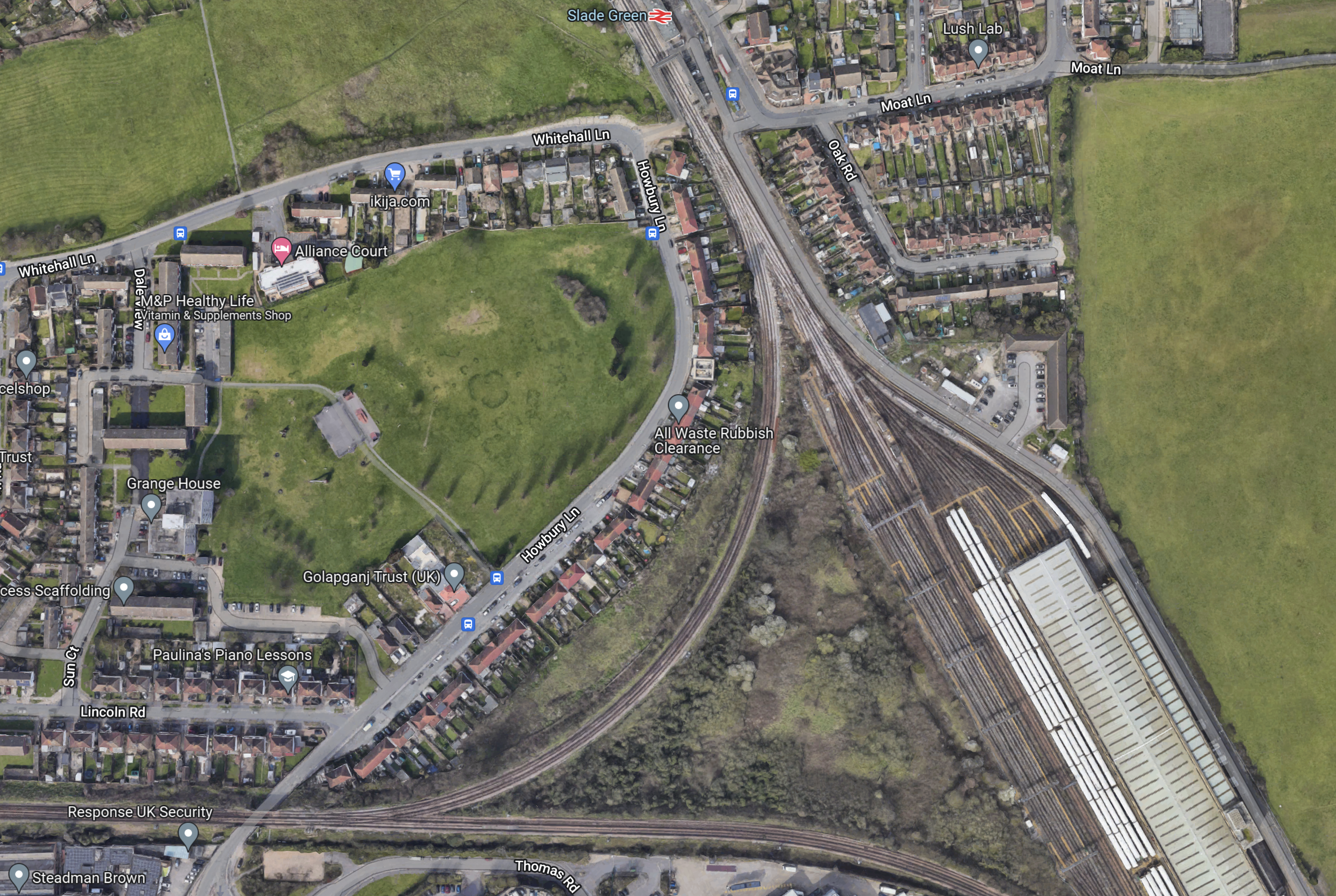
Note.
- Slade Green station is at the top of the map.
- Slade Green depot is in the South-East corner of the map.
- The West point of the junction leads to Bexleyheath.
- The West and North points of the junction are connected by the Erith Loop.
- The South point of the junction leads to Dartford.
There are rail capacity problems in this area.
- Slade Green depot is not big enough.
- One train service goes both ways on the Erith Loop between Slade Green and Bexleyheath every thirty minutes, which could be a block on increasing train frequencies between Abbey Wood and Dartford stations.
- The proposal is saying that the Slade Green and Bexleyheath service will go via Dartford station, where it will probably reverse.
I can see comprehensive redevelopment of the depot and the junction to remove the capacity problems and perhaps build a lot of housing.
- If the Erith Loop is not used could the centre of the junction be developed with a much-needed extension to the depot?
- The depot might be moved elsewhere or perhaps rebuilt with tower blocks on the top.
I think that moving the Slade Green and Bexleyheath service via Dartford could mean that the Erith Loop isn’t needed, so this might free up space to increase the size of the depot.
Dartford Station
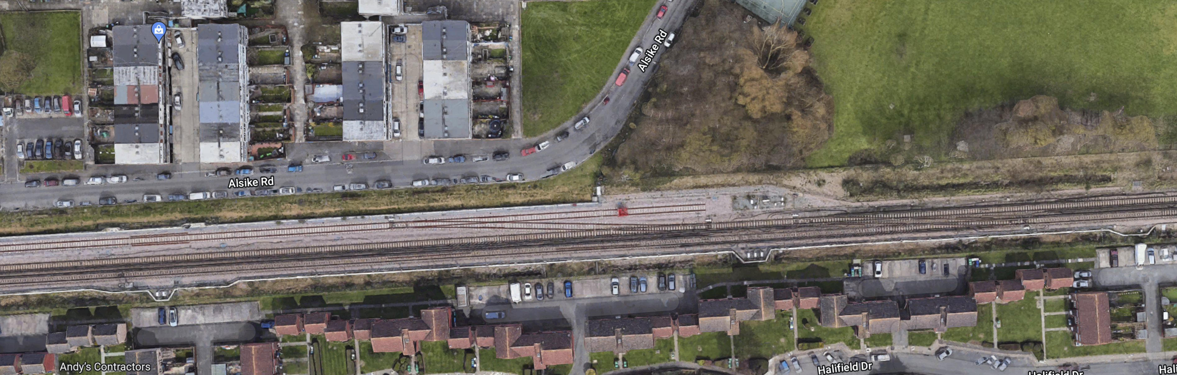
This Google Map shows Dartford station and the area around the station.
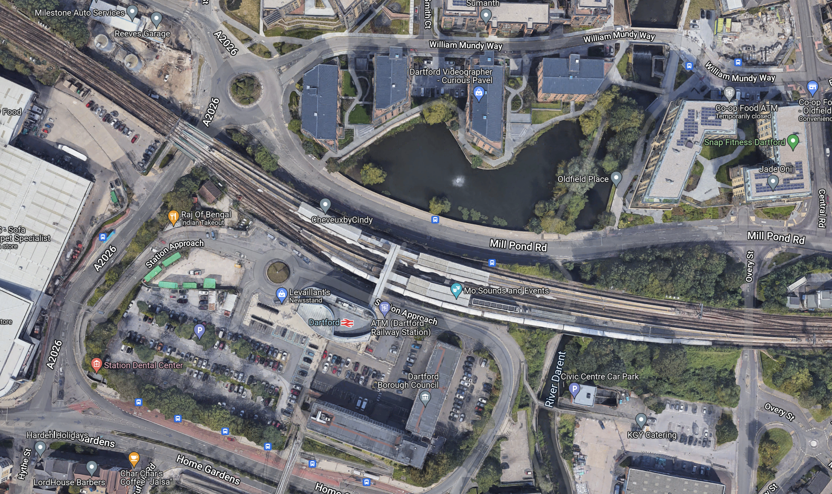
Note.
- The station has four long platforms.
- It should be able to handle the 12 tph in both directions.
- There is a lot of new developments by the station.
- The station is step-free.
- There are some pictures of Dartford station in Dartford Station – June 27th 2022.
But I do suspect that the station probably needs extra capacity and a substantial rebuild.
Stone Crossing, Greenhithe And Swanscombe Stations
Stone Crossing, Greenhithe and Swanscombe stations will be handling 10 tph.
- Greenhithe is a new station with full step-free access.
- But Stone Crossing and Swanscombe stations may need improvement to bring them up to Elizabeth Line standards.
- More details of Stone Crossing station are given in Stone Crossing Station – June 27th 2022.
- More details of Greenhithe station are given in Bluewater Shopping Centre By Train.
- More details of the current state of Swanscombe station are given in Swanscombe Station – June 27th 2022.
- The one level crossing in the area was closed in 2018.
- There may be scope to add an extra track at places in this section.
I feel that these three stations could be fairly easy to bring up to the required standards.
Northfleet Station
Northfleet station is a station, which in the words of estate agent; Roy Brooks, would have a lot of potential.
This Google Map shows the station.

Note.
- The two tracks through the station are the North Kent Line.
- The other two tracks are freight sidings.
- The car-parks at Ebbsfleet station are in the South-West corner of the map.
- There appears to be a large cleared site to the North-West of the station.
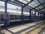
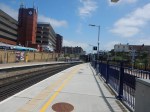
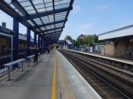
These pictures show the station.
The requirements for the station will be as follows.
- The ability to handle 6 tph passing through.
- The ability to be able to handle 4 tph, that terminate at the station.
- Terminating four tph, will probably need two platforms for all eventualities.
- Full step-free access.
- An interchange with Ebbsfleet International station is also needed.
- Is car parking needed?
There is certainly enough space.
The Pedestrian Link Between Northfleet And Ebbsfleet Stations
This is part of the plan and is shown on the first map in this post.
This Google Map shows Northfleet and Ebbsfleet stations.
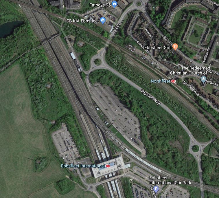
Note.
- The large Ebbsfleet International station towards the bottom of the map.
- Northfleet station on the North Kent Line in the North East corner of the map.
- The two stations are about five hundred metres apart as the crow flies.
There has been a lot of pressure in the past to build a pedestrian link between the two stations, as reported by the Wikipedia entry for Northfleet station.
The station is very close to Ebbsfleet International station (the NNE entrance is only 334 yards (305 m) from Northfleet’s station), but passengers (using public transport) will find it far easier to access Ebbsfleet International from Gravesend or Greenhithe, as these stations are more accessible and offer easy access to Fastrack bus services. The walking route between the two stations is 0.6 miles (1 km) or 0.8 miles (1.3 km) and a suitable pedestrian link has not been built because of funding issues and objections from Land Securities.
Why when Ebbsfleet International station was built in the early 2000s for opening in 2007, was a pedestrian link not built between the two stations?
How much did omitting the link save?
Luton Airport are building the Luton DART, which is a people mover to connect Luton Airport Parkway station with the airport.
- It is 1.4 miles long.
- It is fully automated.
- It might have an extra station serving the mid-stay parking.
- It appears to be taking three years to build.
All of this very comprehensive system appears to be costing around £200 million.
I doubt that a simple pedestrian link, like a bridge with travellators, would have cost more than a few tens of million pounds.
Will Northfleet/Ebbsfleet Become A Major Railway Hub?
If Northfleet station and the connection to Ebbsfleet is well designed,, I can see this station becoming a major railway hub.
- It would have Eurostar Continental services.
- It would have HighSpeed services to London and Kent.
- It would have Elizabeth Line services to London and Heathrow.
- It would have Thameslink and Southeastern services.
- The station would have lots of parking.
I also feel in the future that more Continental services will be developed.
- Adding extra platforms for Continental services could be easier than at St. Pancras.
- It could be an ideal terminus for sleeper trains to and from the Continent.
- I might be the ideal terminus for very long distance trains to and from the Continent.
Northfleet/Ebbsfleet has something that St. Pancras lacks – space.
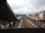
Gravesend Station
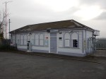
Gravesend station is a rebuilt step-free station with three platforms, as these pictures show.
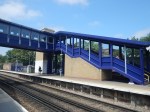
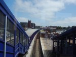
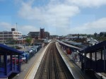
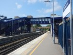
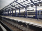
But is it the right station, for the end of the Elizabeth Line?
These points are in favour.
- There is a bay platform, that could handle 4 tph.
- The station is step-free.
- The station has had a recent refurbishment.
- It has HighSpeed services to London and East Kent.
- Gravesend is a town of 74,000 people.
- Passengers can change between through trains by just staying on the same platform.
But these points are against.
- The station is on a cramped site in the town centre.
- There is no train stabling nearby.
- Adding lots of car parking may be difficult.
- Suppose adding the Elizabeth Line to the town was very successful and it was felt more services were needed. Could Gravesend station cope?
These are the times for the various services.
- HighSpeed to St. Pancras – 25 minutes
- HighSpeed to Stratford – 17 minutes
- Southeastern to Charing Cross – 65 minutes
- Thameslink to Abbey Wood- 28 minutes
- Thameslink to London Bridge – 60 minutes
I estimate that the Elizabeth Line will take just over 50 minutes to Tottenham Court Road.
This last timing in itself is a good reason for the Elizabeth Line to serve Gravesend.
But I don’t think the Elizabeth Line has to start there.
I am worried that the Elizabeth will be too successful.
- It serves Central London, Paddington and Heathrow.
- It will have a frequency of four tph from and to Gravesend.
- It will have trains with a very large capacity.
- The trains will have wi-fi and 4G connections.
I don’t think the cramped Gravesend station will be able to cope with the needs of expansion.
- An extra platform.
- Handling trains that need to be turned back to London.
- More car parking.
Northfleet/Ebbsfleet will have the parking and eight tph on the Elizabeth Line, so surely the best solution is to have the actual Elizabeth Line terminal station to the East of Gravesend.
- Travellers to the West of Gravesend will use Northfleet/Ebbsfleet.
- Travellers in Gravesend will use Gravesend station by walking, cycling or using a local bus.
- Travellers to the East of Gravesend will use the new terminal station.
The Elizabeth Line extension is supposedly costing £3.2 billion, so it should serve as many potential passengers as possible.
The Elephant In The Garden Of England
It is proposed that the new Lower Thames Crossing is built to the East of Gravesend.
This map from the Department of Transport, shows the route.
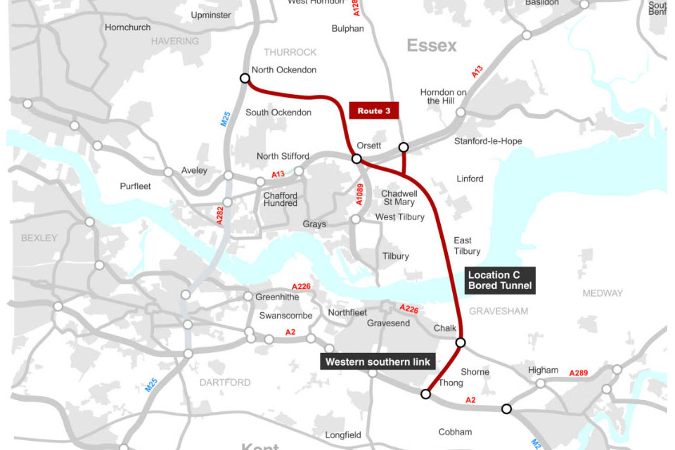
Note.
- The new crossing, which is shown in red, bypasses the Dartford Crossing on the M25.
- The A226 runs between Gravesend and Higham via a junction with the new crossing at Chalk.
- Northfleet is to the West of Gravesend.
This Google Map shows the area between Chalk and Higham.
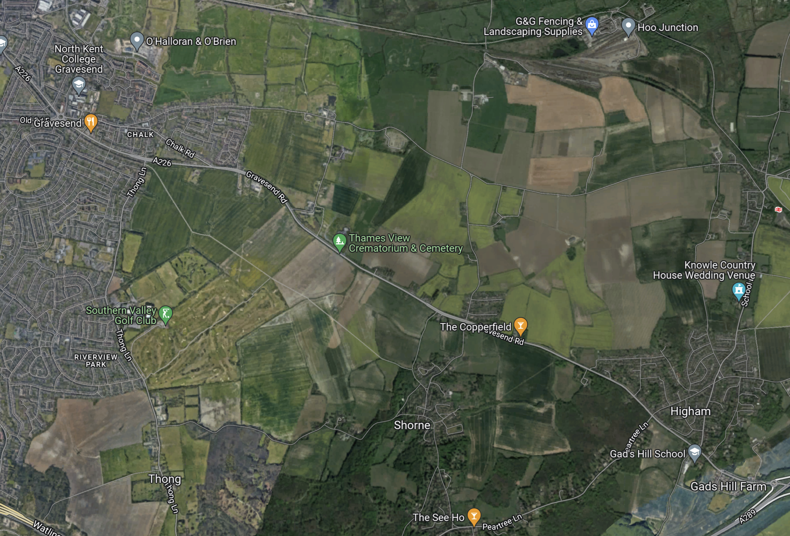
Note.
- Chalk in the North-West corner of the map.
- Higham in the South-East corner of the map.
- The A226 running between Chalk and Higham.
- Higham station on the North Kent Line about half-way up the East side of the map.
- The North Kent Line running across the top of the map between Gravesend and Higham stations via Hoo Junction.
The Lower Thames Crossing will run North-South across this map to the East of Chalk and according to the Department of Transport map to the West of Thong.
I should admit, that I don’t drive, so the Lower Thames Crossing will be of no use to me, but I have friends in Kent and most seem to be in favour of the new crossing.
Reopening The Hoo Branch To Passenger Trains
In Effort To Contain Costs For Hoo Reopening, I wrote about an article in the April 2022 Edition of Modern Railways with the same title.
This is the first paragraph of the Modern Railways article..
Medway Council is working with Network Rail and other industry players in an effort to make restoration of a passenger service to Hoo on the Isle of Grain branch feasible. The Council was awarded £170 million from the Housing Infrastructure Fund in 2020 to support schemes to facilitate building of 12,000 new houses in the area, with £63 million of the HIF money for reinstatement of services on the Hoo Branch.
The article mentions, this new infrastructure.
- A new station South of the former Sharnal Street station.
- Works to level crossings, of which there are six between Gravesend station and proposed site of the new Hoo station.
- A passing place at Hoo Junction, where the branch joins the North Kent Line.
- A passing place at Cooling Street.
It looks like we may have the smaller project of reopening the Hoo branch railway, whilst a major road and tunnel is built through the area.
This OpenRailwayMap shows the North Kent Line between Gravesend and Higham stations.
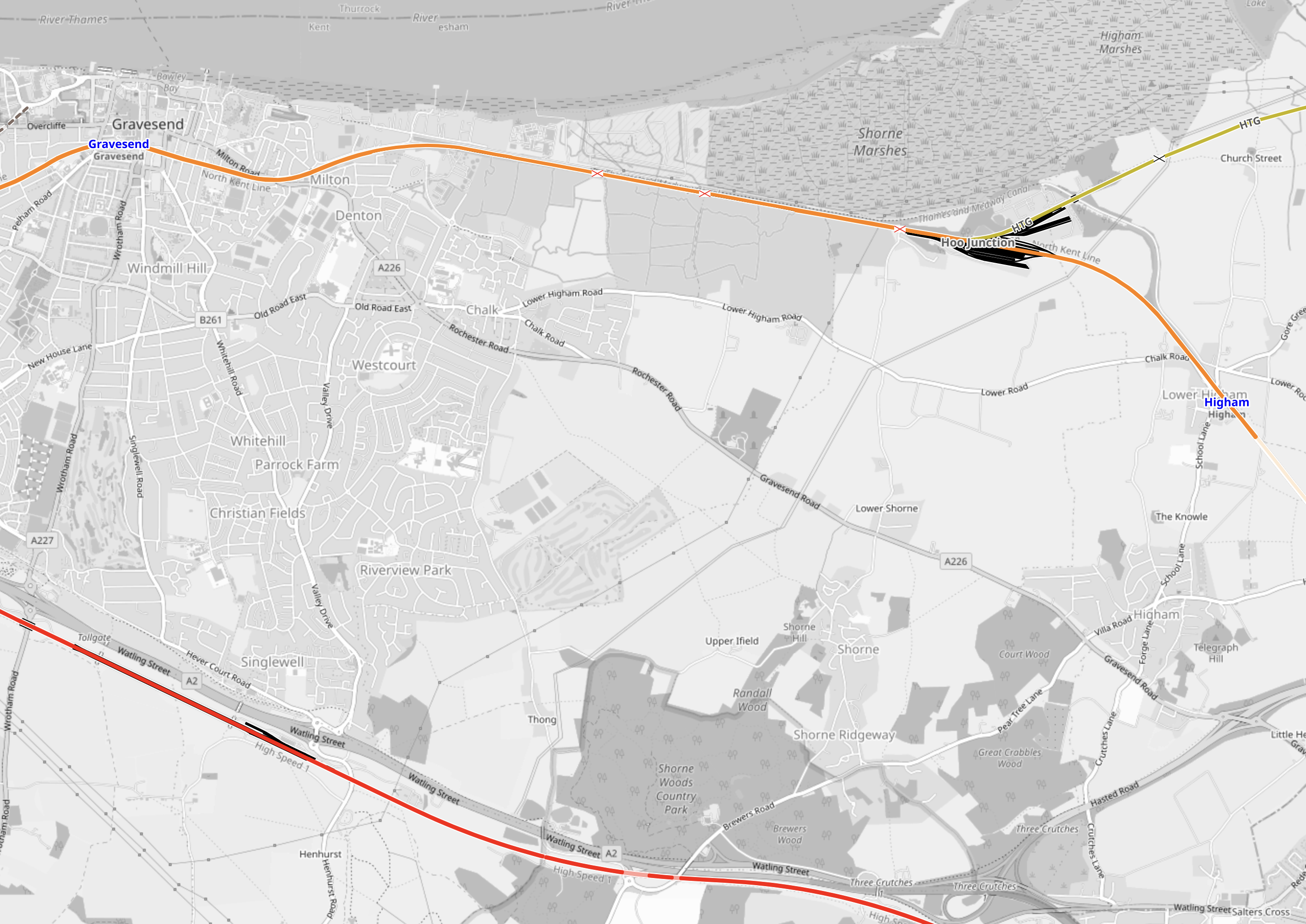
Note.
- Gravesend station is in the North-West corner of the map.
- Higham station is at the Eastern edge of the map.
- The railway shown in orange is the North Kent Line.
- The railway shown in yellow is the Hoo branch.
- The railway shown in red is the Channel Tunnel Rail Link.
It looks like the path of the new crossing could follow a similar path to the overhead power cable shown on this map.
According to Modern Railways, the main reason for reopening the Hoo Branch for passenger trains is to provide rail access for new housing on the Isle of Grain.
- Improving the Hoo branch will also help the freight services to the various docks and installations on the Isle of Grain.
- Will the builders of the new crossing, use the Isle of Grain for the supply of aggregates and the disposal of tunnel spoil?
- Remember that barges on the Thames were used to remove the tunnel spoil from London for both Crossrail and the Battersea extension to the Northern Line.
My knowledge of major projects is saying to me, that before the major works of the new crossing are started, this branch railway must be updated, otherwise it will cause problems in the future.
Could this be why, the Hoo branch reopening has been mentioned in both the April and July 2022 Editions of Modern Railways? Perhaps a sensible decision has been made, that means the Hoo branch will be improved first, to speed the construction of the new Lower Thames Crossing.
Could The Elizabeth Line Be Extended To The Proposed Hoo Station?
The proposed Hoo station is to be just South of the former Sharnal Street station.
- This is under ten kilometres from Hoo Junction, where the North Kent Line is electrified.
- A single platform could handle 4 tph, but provision for two platforms would be prudent.
- A couple of sidings could provide stabling.
- Services would join the North Kent Line at Hoo Junction.
- Services would use battery power between Hoo Junction and Hoo station.
- If charging were needed at Hoo station a short length of 25 KVAC overhead electrification would be needed.
- There is plenty of power available locally to power any electrification.
This Google Map shows the possible location of the station.
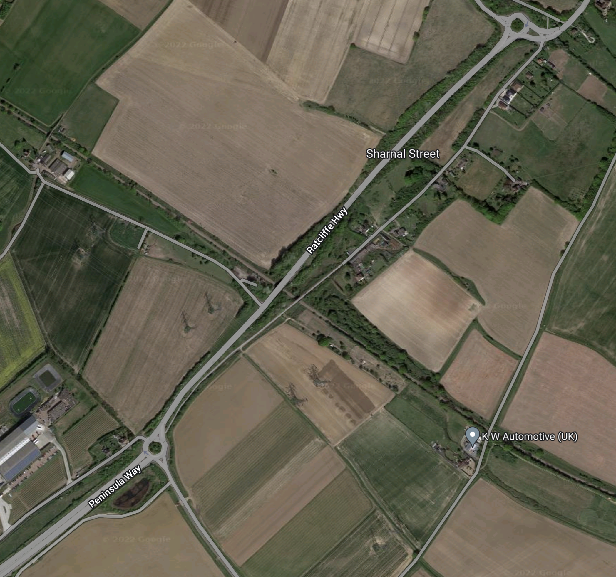
Note.
- The A 289 road running NE-SW across the map from a roundabout in the North-East corner of the map.
- The A 289 leads from the roundabout in the South-West corner of the map to the Medway Tunnel to Chatham.
- Sharnal Street is between the two roundabouts.
- The single-track railway crosses the A 289 at right-angles, about 500 metres South of Sharnal Street.
- There is even a high voltage power line going through the area to the South of the railway.
It seems to be an ideal place for a station with good road access, space and plenty of power to charge battery vehicles and trains.
I took these pictures of where the A289 crosses over the railway on June 27th 2022.
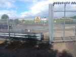
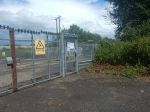
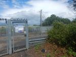
Note.
- The substation site, which is marked with Network Rail logos. It looks like power has been provided to the site.
- The high-voltage line passing to the South of the site.
- There were trucks carrying tunnel segments. Is there a factory on the Isle of Grain and will it produce segments for the Lower Thames Crossing?
- The Sharnal Street bridge over the railway.
It certainly looks like Network Rail have been planning a station there for some time.
Around The Isle Of Grain
I took these pictures of the Isle of Grain on June 27th 2022.


Note.
- There is a lot of housing planned on the island.
- Someone wants to build a theme park.
- The road past the station leads to the Medway Tunnel.
All these factors would add to the case for the station.
Battery-Electric Class 345 Trains
There would be a need to develop a third-rail battery/electric version of the Class 345 trains.
In this article in Global Rail News from 2011, which is entitled Bombardier’s AVENTRA – A new era in train performance, gives some details of the Aventra’s electrical systems. This is said.
AVENTRA can run on both 25kV AC and 750V DC power – the high-efficiency transformers being another area where a heavier component was chosen because, in the long term, it’s cheaper to run. Pairs of cars will run off a common power bus with a converter on one car powering both. The other car can be fitted with power storage devices such as super-capacitors or Lithium-ion batteries if required. The intention is that every car will be powered although trailer cars will be available.
Unlike today’s commuter trains, AVENTRA will also shut down fully at night. It will be ‘woken up’ by remote control before the driver arrives for the first shift
This was published over eleven years ago, so I suspect Bombardier have refined the concept.
A Simple Extension Of The Elizabeth Line
The branch to Hoo station could be a very simple extension of the Elizabeth Line.
- There appear to be no challenging engineering problems.
- Parking and cycling routes could be provided as required at the station.
- The centre of Gravesend would be under ten minutes from Hoo station.
- There would be a same-platform change for HighSpeed services at Gravesend station.
- The developers of the housing would be over the moon.
- Workers for the Lower Thames Crossing and the big energy projects on the Isle of Grain could reverse commute from London.
- The station would only be a few minutes more than an hour from Central London.
- The station could also double as a Park-and-Ride for Chatham and Gillingham.
- Buses could connect Hoo station to Chatham and Gillingham.
It could prove to be a very valuable station for the Isle of Grain and the Medway Towns.
The Contactless Ticketing Conundrum
This is said on the Transport for London website.
Contactless pay as you go is accepted throughout the Elizabeth line.
So it’s just a case of Have Card Will Travel!
So this will mean, that contactless ticketing will have to be accepted at all stations East of Abbey Wood.
Everybody will love that!
Are There Any Other Possible Elizabeth Line Destinations In Kent?
Train companies, since the days of British Rail have run Peak time commuter trains to bring workers into London in the morning and take them home in the evening.
There will be four tph passing through Gravesend and they don’t all have to go to and from Hoo station.
Digital signalling will give flexibility as to which stations the trains could serve.
Possibilities include.
Gillingham
Gillingham station may be a possibility.
Maidstone West
Maidstone West station may be a possibility.
Rainham
Rainham station has three platforms and is already served by two Thameslink tph to Luton through Central London, which use the bay Platform 0
Some might argue that two Elizabeth Line tph should extend from Abbey Wood to Rainham, to give a four tph service between Abbey Wood and Rainham.
This would be a North Kent Metro.
Rochester
Rochester station has three platforms and Platform 3 can turn trains back to London.
It is already used by Thameslink to turn Peak services.
Project Management
The project may be budgeted to cost £3.2 billion, but it is a small number of independent projects.
- Digital signalling
- Electrification changeover at Abbey Wood station.
- An efficient junction East of Abbey Wood.
- Rebuild Belvedere station with step-free access.
- Rebuild Erith station with step-free access.
- Rebuild Slade Green station with step-free access.
- Extend Slade Green depot.
- Upgrade Dartford station.
- Rebuild Stone Crossing station with step-free access.
- Upgrade Greenhithe station.
- Upgrade Swanscombe station.
- Rebuild Northfleet station with step-free access and two extra bay platforms.
- Install people mover between Northfleet and Ebbsfleet stations.
- Upgrade the Hoo Branch.
- Build Hoo station.
Note.
- Gravesend station would only need minimal updating.
- As I said before, I suspect the digital signalling will be the biggest cost.
- Choosing the optimal order is good project management!
- Projects that create fare revenue should be done early, especially if they don’t interfere with services on the railway.
The first projects, that I would develop would be these.
- Rebuild Northfleet station with step-free access and two extra bay platforms.
- Install people mover between Northfleet and Ebbsfleet stations.
- Upgrade the Hoo Branch.
- Build Hoo station.
As I said earlier, this project needs to be developed with the Lower Thames Crossing.
Conclusion
This seems an excellent plan.
