Extending The Sheffield Tram-Train To Adwick
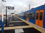
I must admit, I very much like the Class 399 tram-trains in Sheffield and their German cousins in Karlsruhe.
I am not alone, as talking to an experienced Sheffield tram driver, he said that the extra power of the Class 399 tram-trains have over the Supertrams, mean they handle Sheffield’s hills with ease, when the tram-trains are full.
They have a top speed of 62 mph compared to a British Rail Class 150 train being able to manage 75 mph.
Passenger capacity of the two trains is probably about the same.
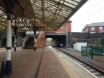
The Current Tram-Train Service
The service has the following characteristics.
- This runs between Sheffield Cathedral and Rotherham Parkgate via Meadowhall South and Rotherham Central stations.
- Services run every thirty minutes.
- I have heard rumours that an extra stop is going to be be added at Magna Science Adventure Centre.
London Overground and local rail services in Birmingham, Liverpool, Manchester and other cities in the UK, seem to run at a frequency of four trains per hour (tph).
The Current Northern Rail Service Between Sheffield And Adwick Via Doncaster
The service has the following characteristics.
- This runs between Sheffield and Aswick stations via Meadowhall, Rotherham Central, Swinton, Mexborough, Conisbrough, Doncaster and Bentley stations.
- Services run every hour.
- The service passes Rotherham Parkway Shopping Centre, but doesn’t stop.
Is there a need for this Northern Rail service to stop at Rotherham Parkway Shopping Centre?
The Current Electrification Between Sheffield And Rotherham
This OpenRailwayMap shows the electrified lines between Sheffield and Rotherham Parkway.
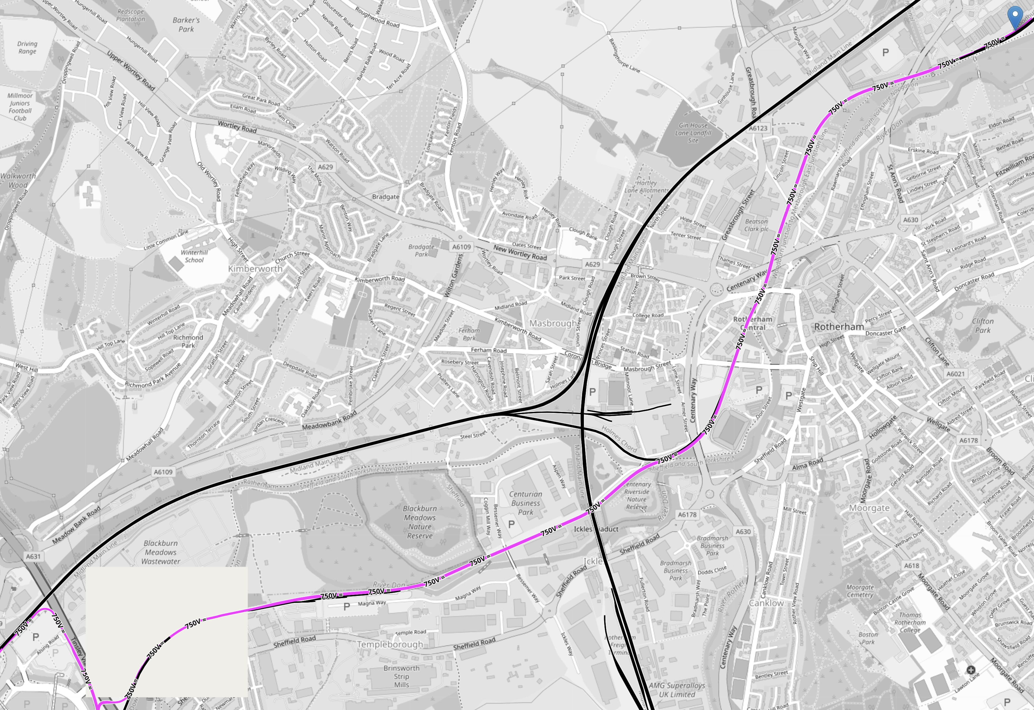
Note.
- Mauve tracks are electrified with 750 VDC overhead wires, so they can power Sheffield’s trams and tram-trains directly.
- Black tracks are not electrified.
- Meadowhall and its rail and tram interchange is in the South-West corner of the map.
- Note how mauve lines indicate the electrified tram tracks, that curve round the Meadowhall Shopping Centre.
- The blue arrow in the North-East corner indicates Rotherham Parkgate tram stop.
- The mauve line diagonally across the map, indicates the current electrification between Meadowhall South and Rotherham Parkgate tram stops.
- Magna Science Adventure Centre, is just to the South of the electrified Sheffield-Rotherham tram-line.
This second OpenRailwayMap shows the rail and tram lines between Sheffield and Rotherham in more detail.
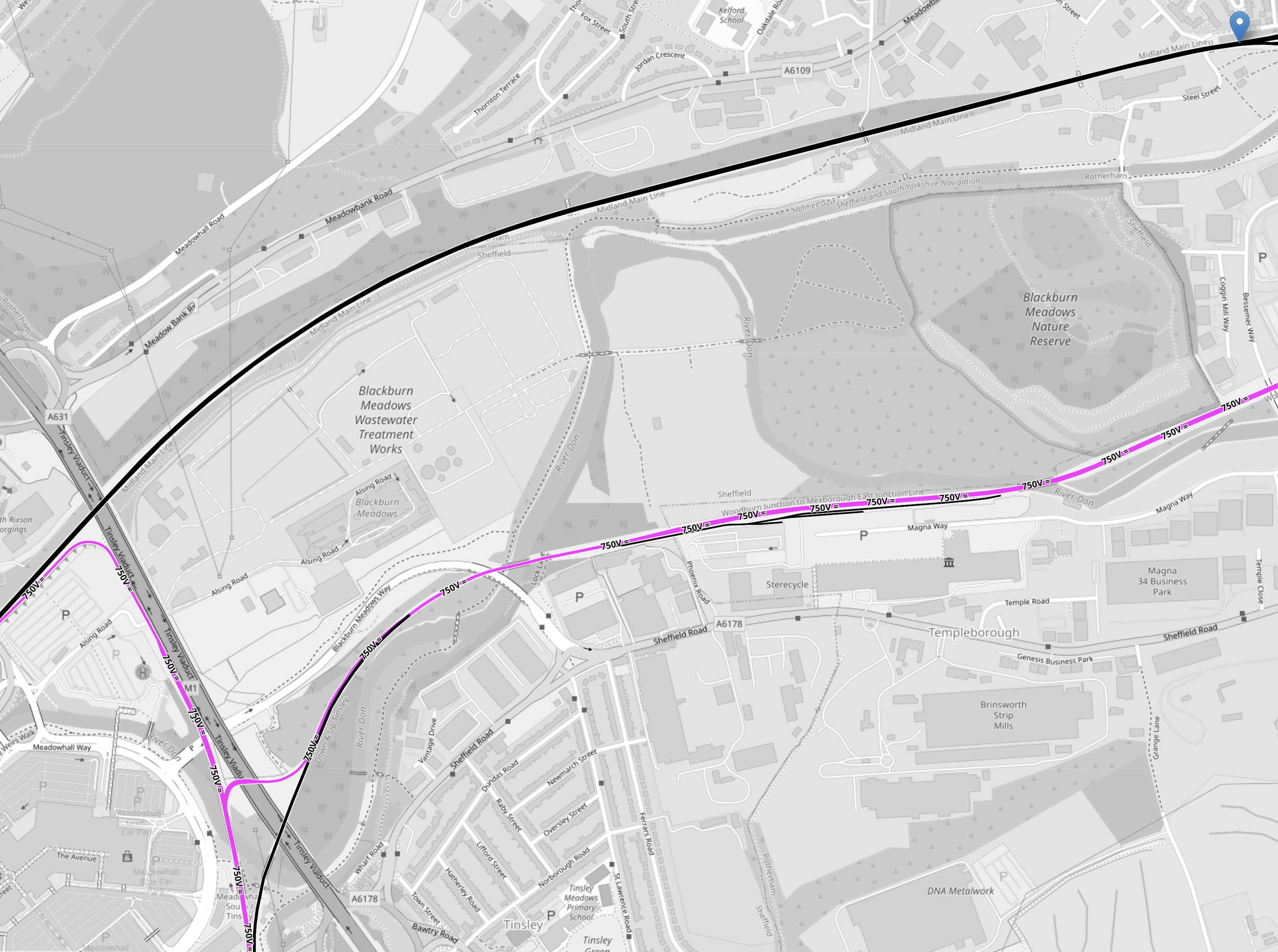
Note.
- Track colours are as in the first map.
- The blue arrow in the North-East corner of the map indicates Holmes junction and is the route that Northern Rail’s current Sheffield and Adwick service takes.
- Sheffield and Rotherham Central stations are 6.1 miles apart.
- Sheffield and Adwick stations are 22.7 miles apart, but the Northern four miles between Doncaster and Adwick are electrified with 25 KVAC overhead wires.
This would indicate that a tram-train with a range of about twenty miles on battery power would be able to handle the route, if it could charge its batteries on the electrified lines.
Terminating a Sheffield And Adwick Service In Sheffield
This OpenRailwayMap shows the rail and tram lines in and through Sheffield station.
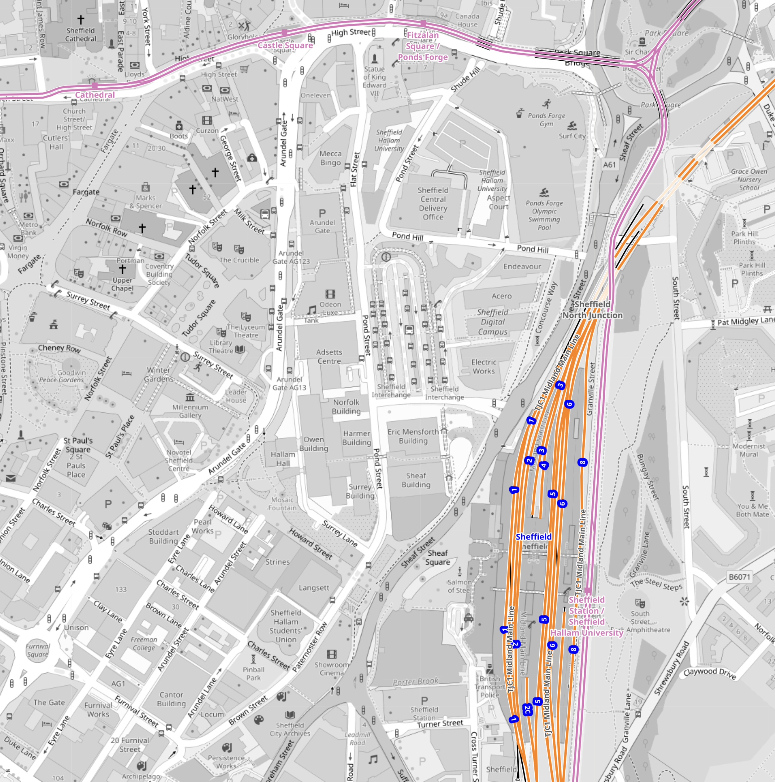
Note.
- Rail lines are in orange.
- Tram lines are in mauve.
- Platform numbers in Sheffield station are shown as blue dots. Click on the map to show it on a larger scale.
- Sheffield Cathedral tram stop is in the North-West corner of the map.
- The triangular junction in the North-East corner of the map, allows trams to use all the main tram lines that go in three directions. A touch of genius as it gives a lot of flexibility, when adding extra services.
Currently, termination of the services from Rotherham and Doncaster is as follows.
- The tram-train terminates at the Sheffield Cathedral tram stop with a frequency of two tph.
- The train terminates in Platform 3 in Sheffield station with an hourly frequency.
- As typically a terminal platform can handle 4 tph, I don’t see why a second Sheffield and Adwick service can’t be running every hour into Sheffield station.
A short length of overhead electrification would need to be added on Platform 3 to recharge any tram-trains terminating in the platform.
It could also become a tram and run to any of the other destinations served from the triangular junction; Halfway, Herdings Park or Malin Bridge. This would allow batteries to be charged as the tram-trains ran across the city.
Remember, Sheffield station is likely to be electrified with 25 KVAC overhead wires in connection with running electric trains between London St. Pancras and Sheffield.
If the four bay platforms at Sheffield station, were to be electrified, then these would be ideal for recharging any battery-electric trains or tram-trains, that terminated in the station.
Battery-Electric Trains Between Manchester And Sheffield
Consider.
- Manchester Piccadilly station is already fully electrified.
- Currently, all Manchester Piccadilly and Sheffield, terminate in Platform 8 at Sheffield station.
- The distance between the electrification at Manchester Piccadilly and Platform 8 at Sheffield station is 40.2 miles.
- CAF are promising battery-electric versions of their Class 331 trains.
With a battery range of fifty miles, which is not outrageous, Manchester and Sheffield could be an electric service for the first time since January 1970, when the Woodhead route was closed.
FirstGroup’s Proposed London King’s Cross And Sheffield Service
This open access service might happen, although with this Government of all the Lawyers we have, who can predict anything.
- If it does happen, it is likely that the trains will be battery-electric Class 802 trains.
- These will be the same as those that will be run by Hull Trains.
- Battery range will be sufficient to handle Retford and Sheffield, which is 23.3 miles and much shorter than Temple Hirst junction and Beverley.
These trains will also need charging at Sheffield.
The current Sheffield and Adwick service terminates in platform 3 at Sheffield station, so this platform would probably need to have tramway electrification, so that it could charge the trams.
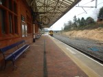
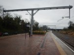
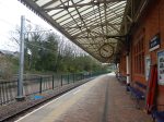
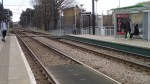
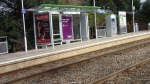
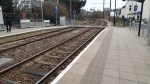
Updating Rotherham Parkgate Tram Stop
My preference would be for four tph passing through Rotherham Parkgate tram stop in both directions, so this would be a tram-train every seven minutes and thirty seconds, if there was only one platform as now.
I’m fairly sure, that Rotherham Parkgate tram stop needs to have a platform in both directions.
This Google Map shows the tram stop.
Note.
- The double-track rail line between Meadowhall and Doncaster curving to the South of the Rotherham Parkgate Shopping Centre.
- The Rotherham Parkgate tram stop on a spur from the rail line.
I am pretty certain, that a two-platform station could be squeezed in.
Plans For New Tram In Wales’ Capital City Revealed
The title of this post, is the same as that of this article on the BBC.
The BBC Article is a good introduction to Cardiff Crossrail.
This is my one thought.
As Cardiff and the valleys will be using Stadler Citylink tram-trains, I think it will be likely similar vehicles will be used across Cardiff.
More Government Details Emerge On How Fleetwood’s Rail Link Will Be Restored – Using Tram-Train Technology
The title of this post, is the same as that of this article on the Blackpool Gazette.
This is the sub-heading.
New details have emerged about how the Government plans to restore the rail link between Fleetwood and Poulton using state-of-the-art tram-train technology.
These are points from the article, which mainly come from a letter to the local MP; Paul Maynard.
- In a letter to Mr Maynard, Rail Minister Huw Merriman has set out for the first time how the Government intends to restore the rail link.
- The Government is now looking at the finer details of a tram-train scheme and how the project can be funded.
- Tram-trains will be used for the link.
- The re-opened railway can be linked into the existing Blackpool to Fleetwood tramway, allowing services to run into the heart of Fleetwood.
- Services would operate twice hourly from Preston station to Poulton-le-Fylde over the existing heavy rail network, before joining a new light rail link between Poulton-le-Fylde and the Denham Way roundabout on Amounderness Way, calling at up to three new intermediate stops.
- From the roundabout, the services would continue on the existing Blackpool tram network towards Fleetwood town centre and Fleetwood ferry terminal.
- The Government is committed to the project.
These are my detailed thoughts.
The Route
The Blackpool Gazette article describes the route like this.
Services would operate twice hourly from Preston station to Poulton-le-Fylde over the existing heavy rail network, before joining a new light rail link between Poulton-le-Fylde and the Denham Way roundabout on Amounderness Way, calling at up to three new intermediate stops.
From the roundabout, the services would continue on the existing Blackpool tram network towards Fleetwood town centre and Fleetwood ferry terminal.
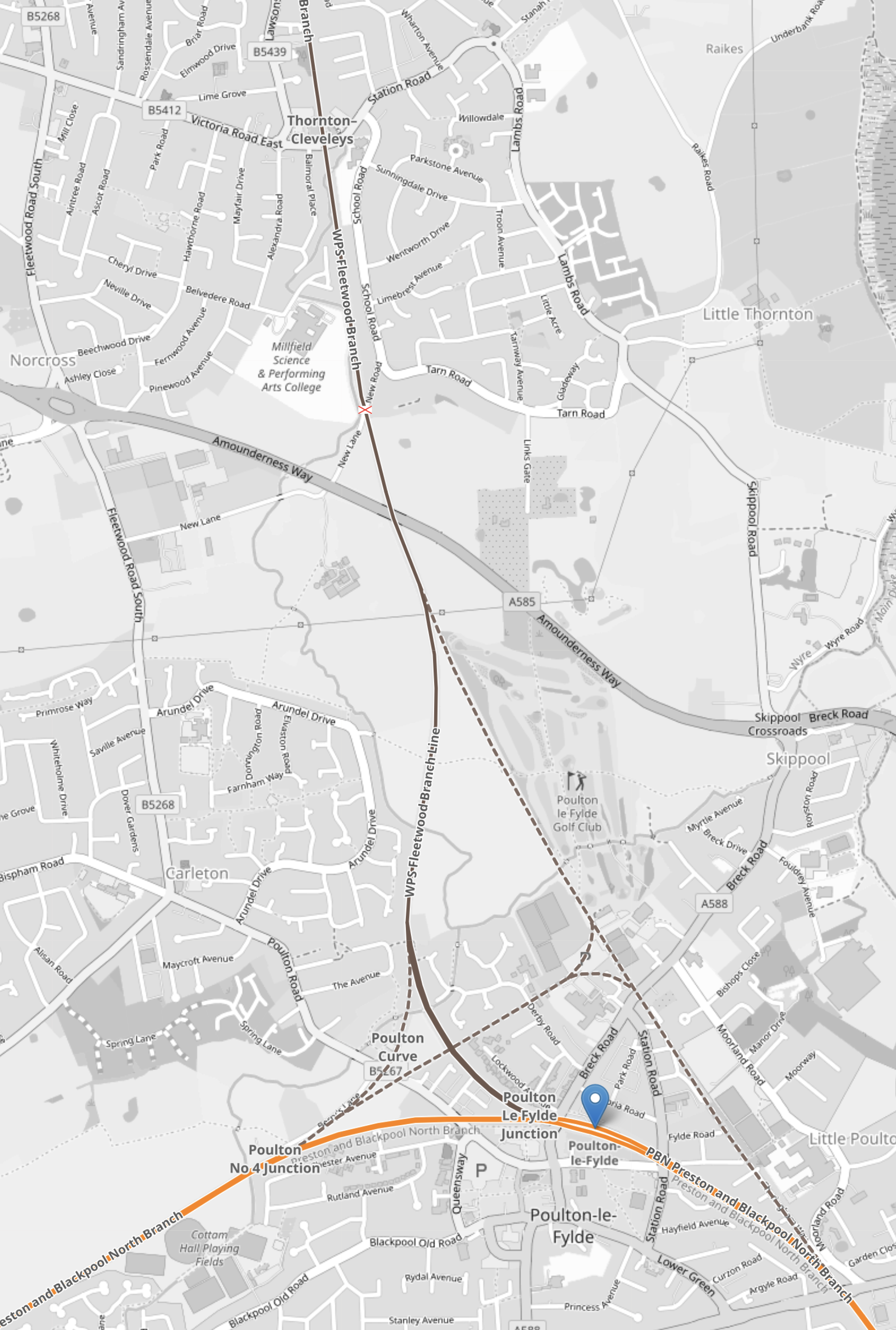
This map from OpenRailwayMap shows the route.
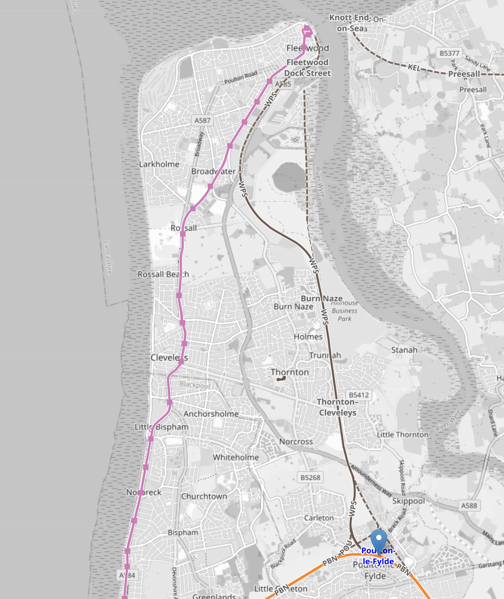
Note.
- Poulton-le-Fylde station is marked by the blue arrow in the South-East corner of the map.
- The pink line running up the coast is the Blackpool tramway.
- The Blackpool tramway terminates at Fleetwood Ferry at the top of the map.
This second OpenRailwayMap shows Fleetwood Ferry tram terminus.
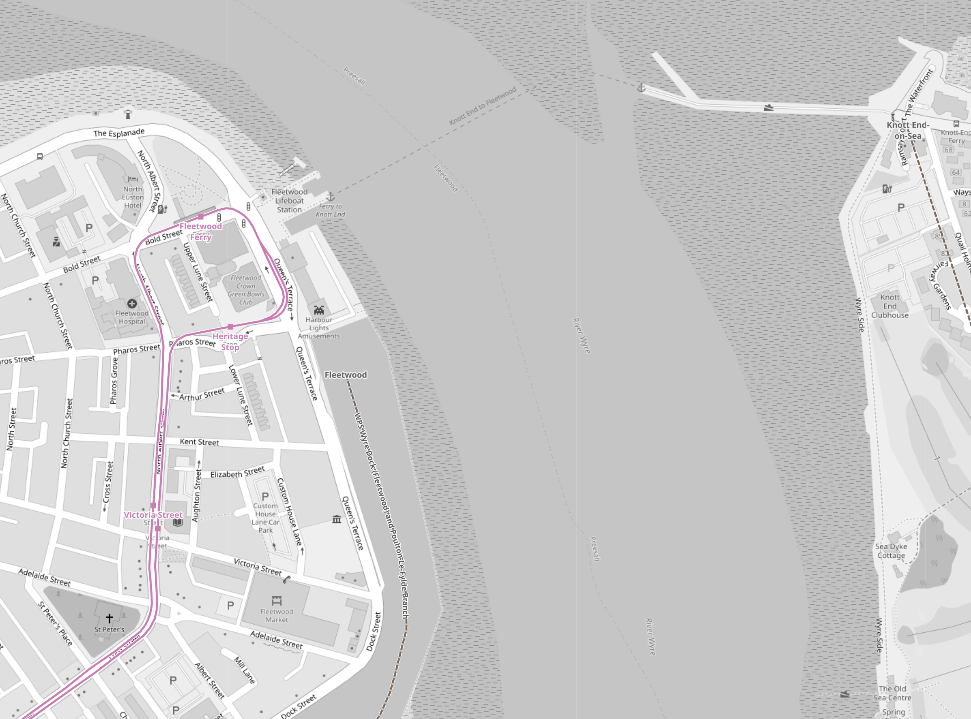
Note.
- As before, the Blackpool tramway tracks are shown in pink.
- There is a lifeboat station and a ferry to the other side.
- The tracks allow a tram to come from the South, go round the loop and return to the South.
- I believe that both the Blackpool tramway and the Fleetwood tram-train will both reverse direction in the same way.
- No new infrastructure would be needed at the Fleetwood Ferry terminal, except for perhaps a few signs.
This third OpenRailwayMap shows the track from Fleetwood Ferry to the Lindel Road tram stop.
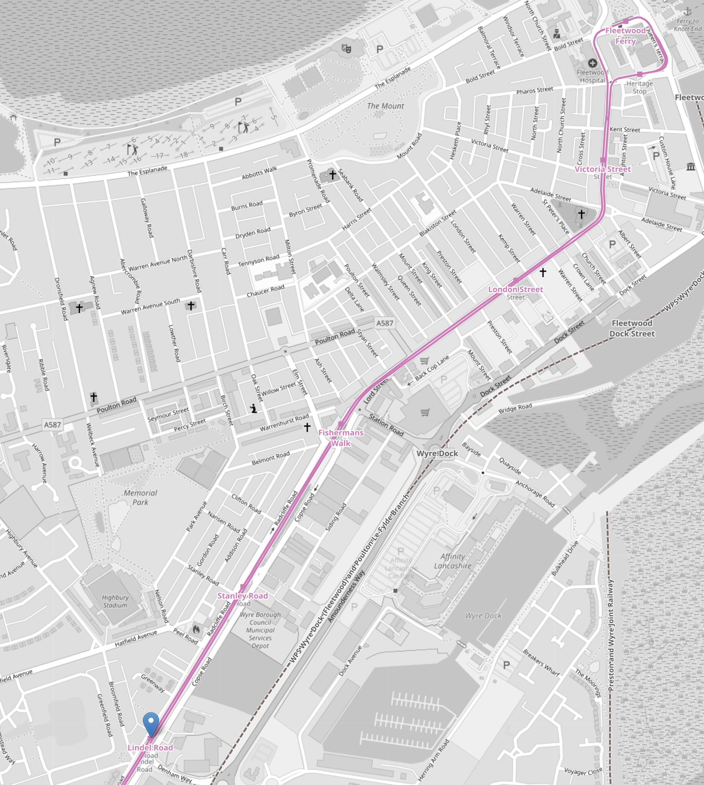
Note.
- As before, the Blackpool tramway tracks are shown in pink.
- Fleetwood Ferry is in the North-East corner if the map.
- Lindel Road tram stop is marked by the blue arrow in the South-West corner if the map.
This fourth OpenRailwayMap shows the Lindel Road tram stop area at a larger scale.
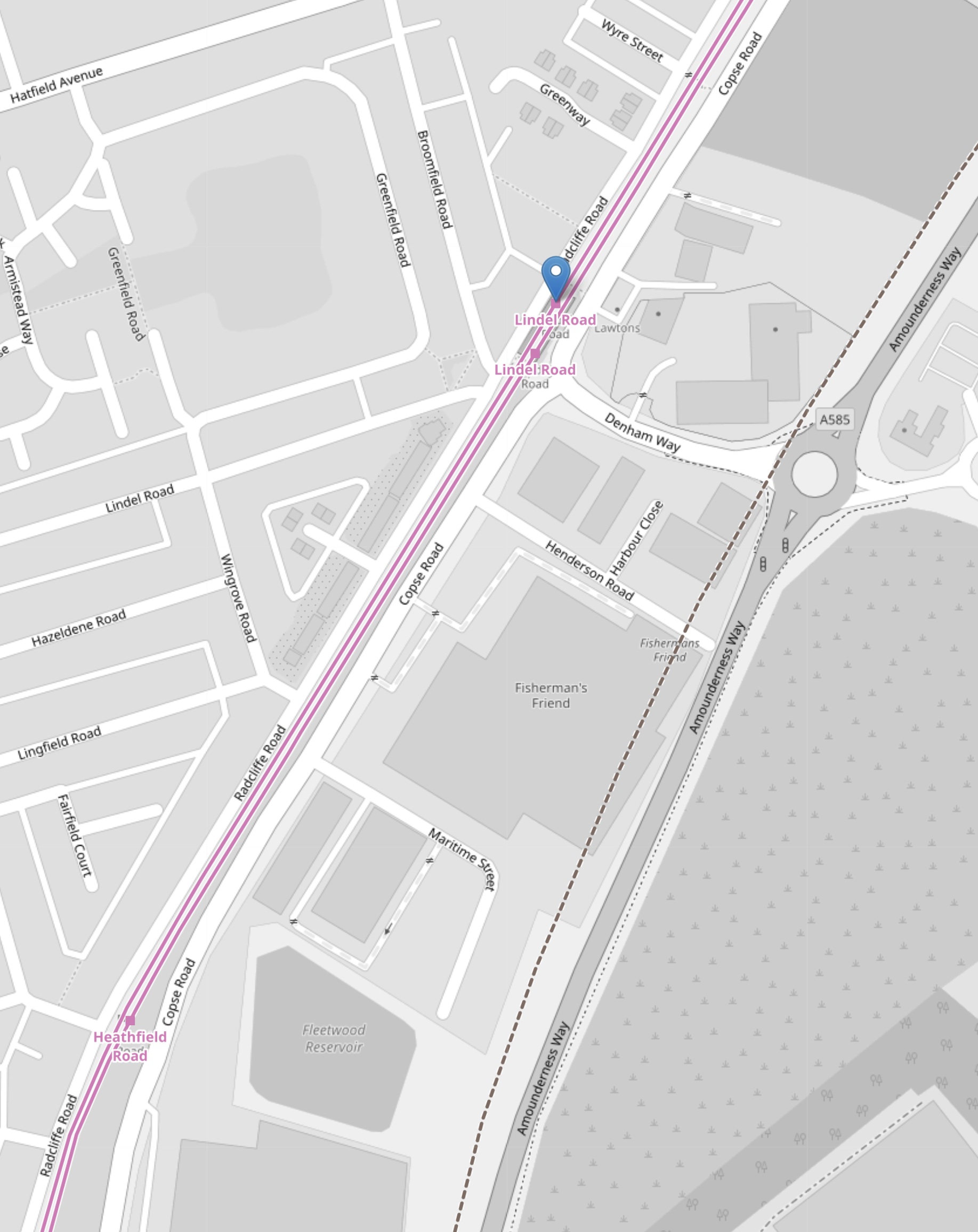
Note.
- As before, the Blackpool tramway tracks are shown in pink.
- Lindel Road tram stop is marked by the blue arrow.
- Running parallel to and to the East of the Blackpool tramway is Amounderness Way, which appears to have been built on the line of the railway to Fleetwood.
- Along the West side of Amounderness Way, a disused railway is indicated, which must be the closed railway to Fleetwood.
I believe that Network Rail or their engineers have found a route to connect the old branch line to the Blackpool tramway.
- The railway connecting the Blackpool tramway and the closed railway to Fleetwood, would only need to be single-track.
- There might be a convenient route, where all the land is owned by the Council.
- If the tram-trains were to be was fitted batteries, then there would be no need to electrify the line.
I suspect, that the connection would be to the South of Lindel Road tram stop.
- This would mean that the tram-train would serve a number of stops in the town centre.
- The tram-train could use the catenary of the Blackpool tramway.
- Connection and disconnection to the catenary could be done in the Lindel Road tram stop.
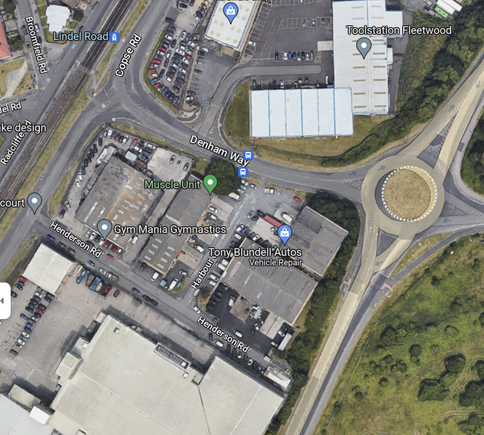
This Google Map shows the area of the Lindel Road tram stop and Denham Road.
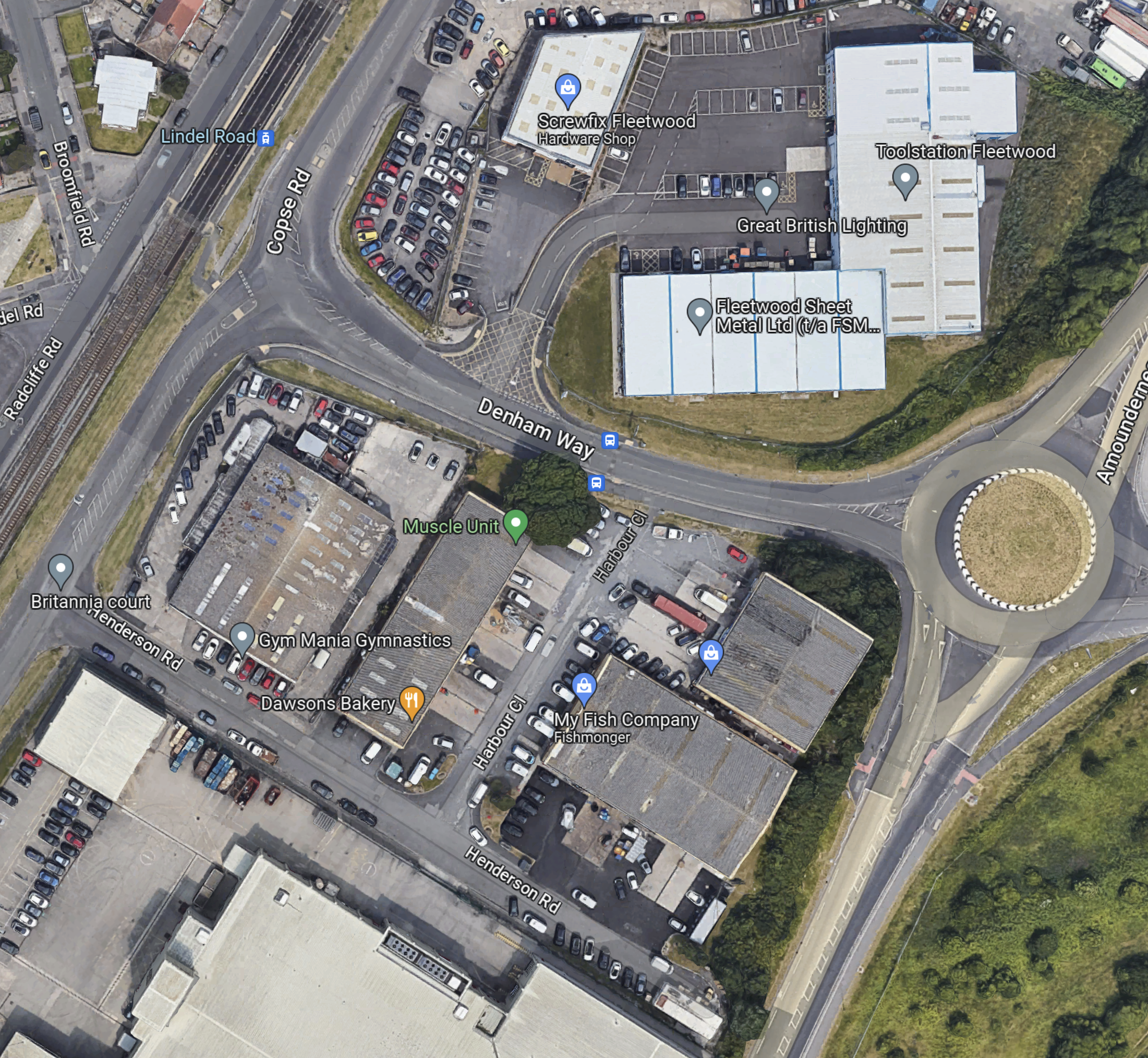
Note.
- The Lindel Road tram stop in the North-West corner of the map, with the Blackpool tramway running NE-SW across the corner of the map.
- The roundabout and Amounderness Way on the East side of the map.
- Denham Way connecting the roundabout to Copse Road and the tram stop.
- On the fourth OpenRailwayMap it showed the original line of the railway was to the West of Amounderness Way.
So could the spur between the Lindel Road tram stop and the railway to Poulton-le-Fylde station take the following route?
- Just South of the tram stop the two tracks connect to a new single-track that goes East on the South side of Denham Way.
- The turn would be quite sharp, but trams and tram-trains have the articulation of a snake and can use tight turns and narrow formations.
- The crossing of Copse Road would be protected by traffic lights.
When the tram-train gets to the roundabout other end of Denham way, I think there are two choices.
- Turn sharp right and go South alongside the West side of Amounderness Way.
- Somehow cross Amounderness Way and go down the West side.
This Google Map Amounderness Way going South.
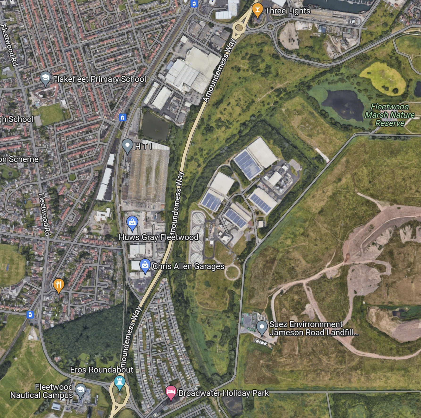
Note.
- Amounderness Way runs North-South down the map between two roundabouts.
- The large industrial area to the East of the road is labelled as SUEZ Recycling and Recovery.
- North-East of SUEZ is Fleetwood Marsh Nature Reserve.
- South-East of SUEZ is SUEZ Environmental Jameson Road Landfill and Lancashire County Council’s Fleetwood Household Waste Recycling Centre.
- There also seem to be a lot of large holiday caravans.
- There is a road running along the South-East of the large SUEZ site called Jameson Road.
The Wikipedia entry for the Fleetwood branch line, says this about the state of the branch.
Some of the line is now cleared of overgrowth because the northern track was not lifted from past Burn Naze Halt to just beyond Jameson Road Fleetwood. However, the road bridge was filled in below it. The junction, last used when goods trains took coal to Fleetwood Power Station, still exists. Looking over the road bridge on Jameson Road, the track to both north & south can still be seen through the undergrowth. In the 1990s, the new A585 The Amounderness Way bypass has been built on the former trackbed, although sufficient space still exists for a reinstated railway should it be required.
Note.
- It appears that enough space has been left at the Northern end to connect to the Blackpool tramway.
- It doesn’t seem to be in too bad a state.
- I suspect that rebuilding the branch has a similar degree of difficulty to rebuilding the Dartmoor Line to Okehampton, which is now operating successfully.
This gave me hope, that a single-track tramway could be built between Poulton-le-Fylde junction and the Lindel Road tram stop.
This Google Map shows the track meeting the filled in road bridge on Jameson Road.
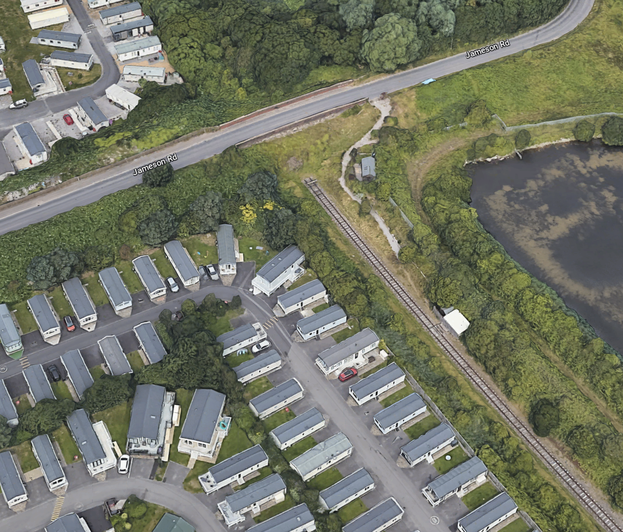
Note.
- If that’s not a single-track railway and the filled-in bridge on Jameson Road, I’m a Dutchman.
- The railway can be followed on Google Maps for most of the way to Poulton-le-Fylde station.
- Google Maps also shows traces of railway to the North of the bridge on Jameson Road.
This Google Map shows the section of Amounderness Way from the North of the SUEZ Recycling and Recovery site to the Denham Way roundabout.
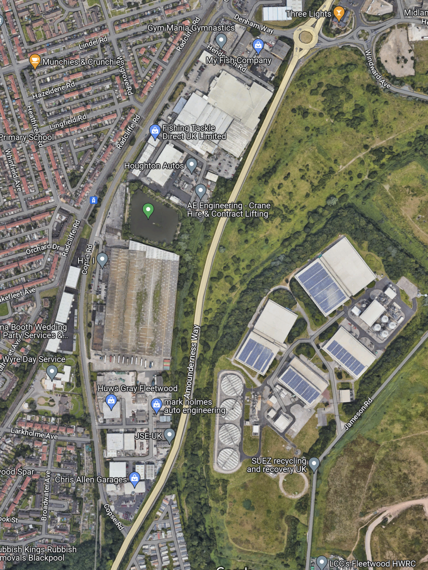
I suspect that the tram would go straight up the East side of ‘Amounderness Way.
But how would the tramway cross the road.
This Google Map shows Denham Way, the roundabout and Lindel Road tram stop.
I am fairly sure that a single-track bridge of some sort could connect Lindel Road tram stop with a single-track railway along the East side of Amounderness Way, to link up with the orphaned track South of Jameson Road.
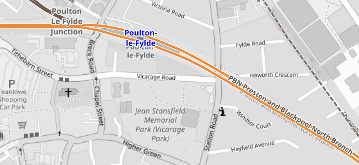
This OpenRailwayMap shows Poulton-le-Fylde junction, where the former railway to Fleetwood, joins the Blackpool branch.
Note.
- Poulton-le-Fylde station is indicated by the blue arrow.
- The orange track is the Blackpool branch to Blackpool North station.
- Poulton-le-Fylde junction is to the West of the station.
- The track going North from the junction, is the disused track to Fleetwood.
- The map also shows a couple of level crossings.
I am fairly certain, that a single-track tramway could be built between Poulton-le-Fylde junction and the Lindel Road tram stop.
This OpenRailwayMap shows Poulton-le-Fylde junction and Poulton-le-Fylde station.
These pictures taken in 2018, show Poulton-le-Fylde station.
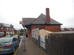
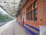
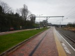
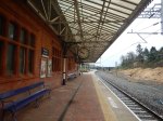
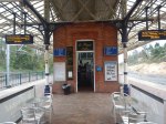
Note.
- It is a small station, that oozes quality.
- The tracks and electrification were all installed or renewed in the last few years.
- There is even a cafe and a lift to the street.
- The flower-beds in the middle of the platform, are at the Preston end of the station.
- As the tram-trains will stop in the station, they can raise and lower the pantograph in the station.
- Tram-trains and trains will share the appropriate platform.
The possibility can probably be arranged that an incoming train to Blackpool North will be able to drop passengers at a waiting tram-train for Fleetwood Ferry.
Will The New Fleetwood Branch Be Electrified?
There are various arguments for and against electrification between Poulton-le-Fylde station and the Lindel Road tram stop.
In favour, is that a continuous catenary can be run from end-to end, with 750 VDC electrification.
- An insulated section would be used at Poulton-le-Fylde station to separate the 750 VDC of the tramway and the 25 KVAC of the Blackpool branch.
- Standard tram-trains, like Sheffield’s Class 399 tram-trains could be used.
- Battery-electric tram-trains are probably more expensive.
Against electrification are.
- There would be no electrification between Poulton-le-Fylde station and the Lindel Road tram stop to install.
- There would be no need for any modifications to the catenary at Poulton-le-Fylde station and the Lindel Road tram stop.
- The filled in bridge mentioned in Wikipedia, might only need a tram-sized hole and not complete rebuilding to get the trams through.
- Occasional freight trains could probably be run, if required.
- Battery-electric tram-trains are proven technology.
It will definitely one for the accountants to decide.
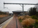
The Tram-Trains
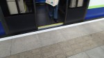
These are pictures of Stadler Citylink tram-trains in Sheffield.
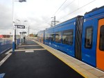

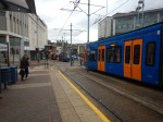
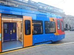
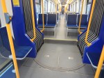

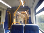
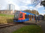
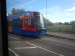

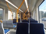
Note.
- These Class 399 tram-trains were the first tram-trains to run in the UK, when they entered service in 2017.
- They were built by Stadler in Spain.
- They share the tracks in Sheffield happily with Sheffield’s other trams of a different type.
- At the time, Paul Maynard, who is the local MP, was the Parliamentary Under Secretary of State for Transport, so I suspect that explains, why the MP appears pleased with the choice of tram-trains and talks knowledgeably about them.
- There is also a battery electric version of these tram-trains, which has been ordered by the South Wales Metro.
- Blackpool’s tramway uses Bombardier Flexity 2 trams. However, it doesn’t seem, that there is a tram-train version of the Flexity 2.
- Merseyrail in the Liverpool area, are introducing a large fleet of Stadler trains, which will be running to Preston in a couple of years.
I suspect that these tram-trains will be built by Stadler and they could be fitted with batteries.
Tram-Train Frequency Between Fleetwood Ferry And Poulton-le-Fylde Station
The Blackpool Gazette article is definite, that the frequency of the tram-train will be two trains per hour (tph).
Consider.
- The Blackpool tramway operates a service of trams every 10-15 minutes between Starr Gate and Fleetwood Ferry, so the frequency will be increased by two tph North of Lindel Road tram stop.
- As heritage trams also share the route to Fleetwood, I suspect that at some busy times, the Fleetwood Ferry and Preston service could be reduced to hourly.
- But it does look to me, that the all-important terminal at Fleetwood Ferry has been well-designed and can handle the extra traffic.
- Looking at the timetable for the Blackpool tramway, trams take forty-one minutes between Fleetwood Ferry and the North Pier.
- As Poulton-le-Fylde station and North Pier tram stop, are probably similar distances from Fleetwood Ferry, I suspect that Poulton-le-Fylde station and Fleetwood Ferry would take thirty minutes or more.
- Real Time Trains indicates that electric trains to Blackpool North station take around 16-17 minutes between Poulton-le-Fylde and Preston stations, with diesel trains taking a couple of minutes more.
- Add in time for stops at Kirkham & Wesham, possibly another at Salwick and cleaning and crew changeover at Preston station, I suspect that a roundtrip from Preston to Fleetwood Ferry and back will take a very convenient two hours.
A two hour round trip and two tph, will mean four trains will be needed to work the timetable.
I can’t prove it, but I my gut feeling is that there there will be a passing loop somewhere between Poulton-le-Fylde station and the Lindel Road tram stop.
The passing loop would also give scope for operational flexibility.
Train Services Through Poulton-le-Fylde Station
Train services through Poulton-le-Fylde station are currently as follows.
- Avanti West Coast – London Euston and Blackpool North – 1 train per day (tpd)
- Northern – Liverpool Lime Street and Blackpool North – 1 tph
- Northern – Manchester Airport and Blackpool North – 2 tph
- Northern – York and Blackpool North – 1 tph
Note that all trains stop at Preston.
The Avanti West Coast service only calls Southbound, but I wouldn’t be surprised, if the Fleetwood tram-train is built, that Avanti West Coast started a Northbound service.
Could The Blackpool South Branch Be Served By Similar Tram-Trains?
In Beeching Reversal – South Fylde Line Passing Loop, I talked about improving the Blackpool South branch.
Objectives included.
- Two tph.
- Better trains.
- A passing loop that would enable the 2 tph.
Note.
- Pacers have been replaced with Class 150 trains.
- The route is electrified between Preston and Kirkham & Wesham station.
- 12.2 miles are without electrification.
It certainly would seem possible that if a battery-electric tram-train had sufficient range, it could handle the current route to Blackpool South station.
The trams would have a ninety-minute round trip between Preston an Blackpool South stations and two tph, will mean three trains will be needed to work the timetable.
The MP is quoted in the Blackpool Gazette article, as liking the concept of a tram loop to Blackpool from Preston.
Trams might go to Fleetwood, down the promenade and then take the Blackpool South branch beck to Preston.
It could obviously go the other way around the loop.
This Google Map shows the location of Blackpool South station.
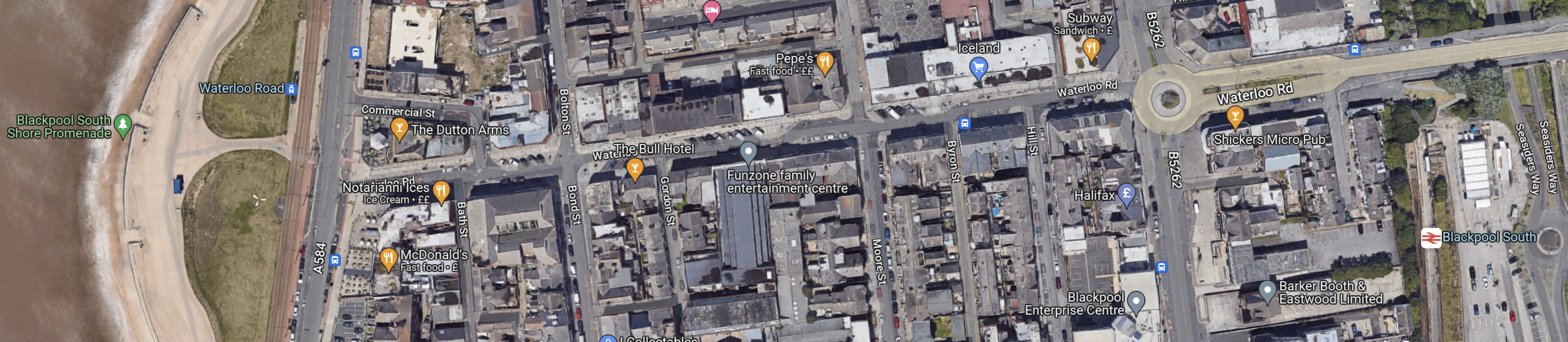
Note.
At the West side of the map is the promenade, with tramway running North and South.
At the East side of the map is Blackpool South station.
The walking route between the tramway and the station is not arduous, but it is not a seamless transfer.
It might be better to make the connection at Blackpool Pleasure Beach, which is shown in this Google Map.
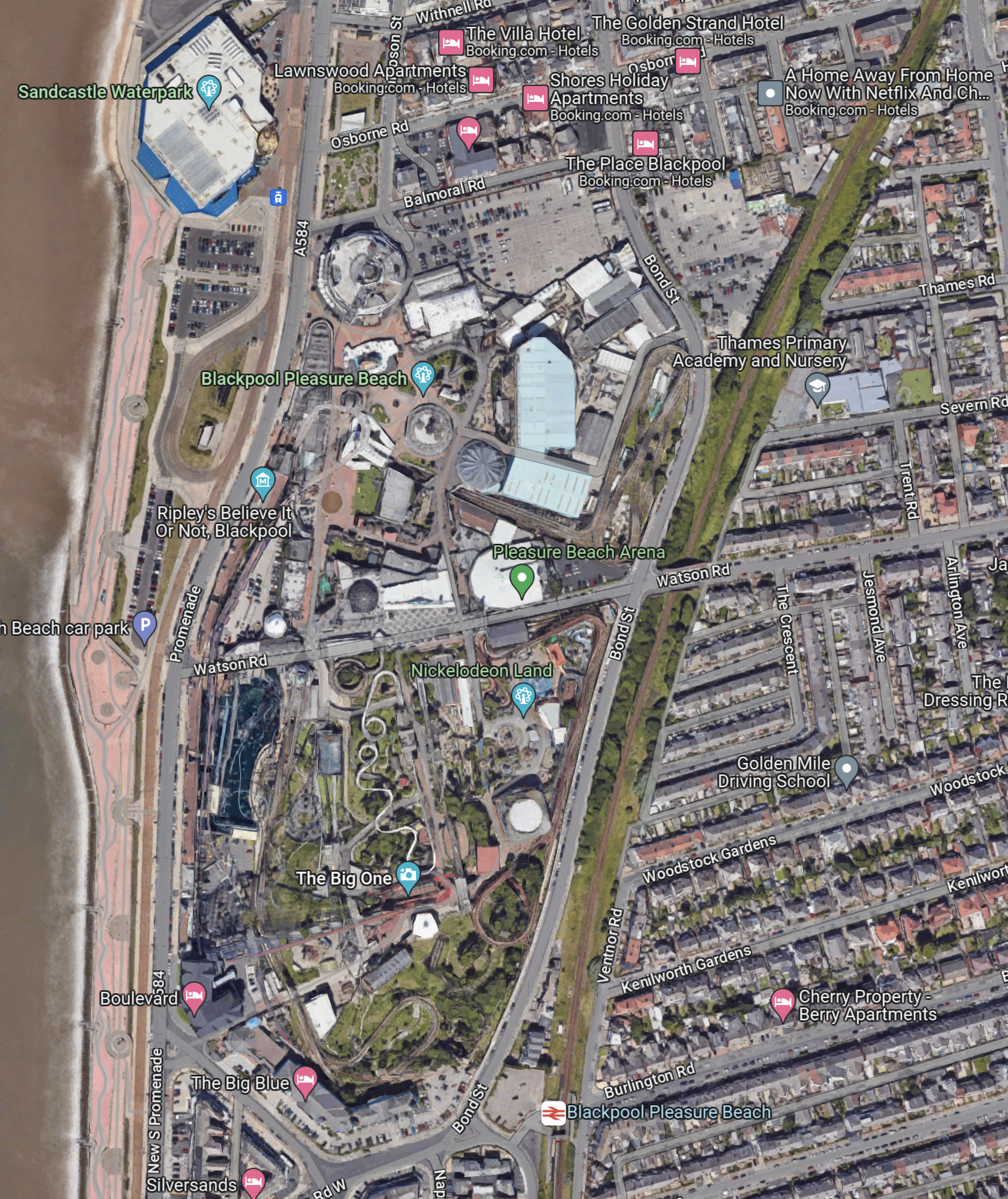
Note.
- The Pleasure Beach lies between the tramway and the promenade by the beach and the Blackpool South branch on the East side.
- There are two stops on the tramway and a station just to the South.
Perhaps, if the Pleasure Beach were redeveloping an area, they might leave provision for tram-trains to to sneak through to join the tramway going North.
But it’s a difficult problem, as there is not much space, that is undeveloped and the roads aren’t very wide.
This Google Map shows the North Pier and Blackpool North station.
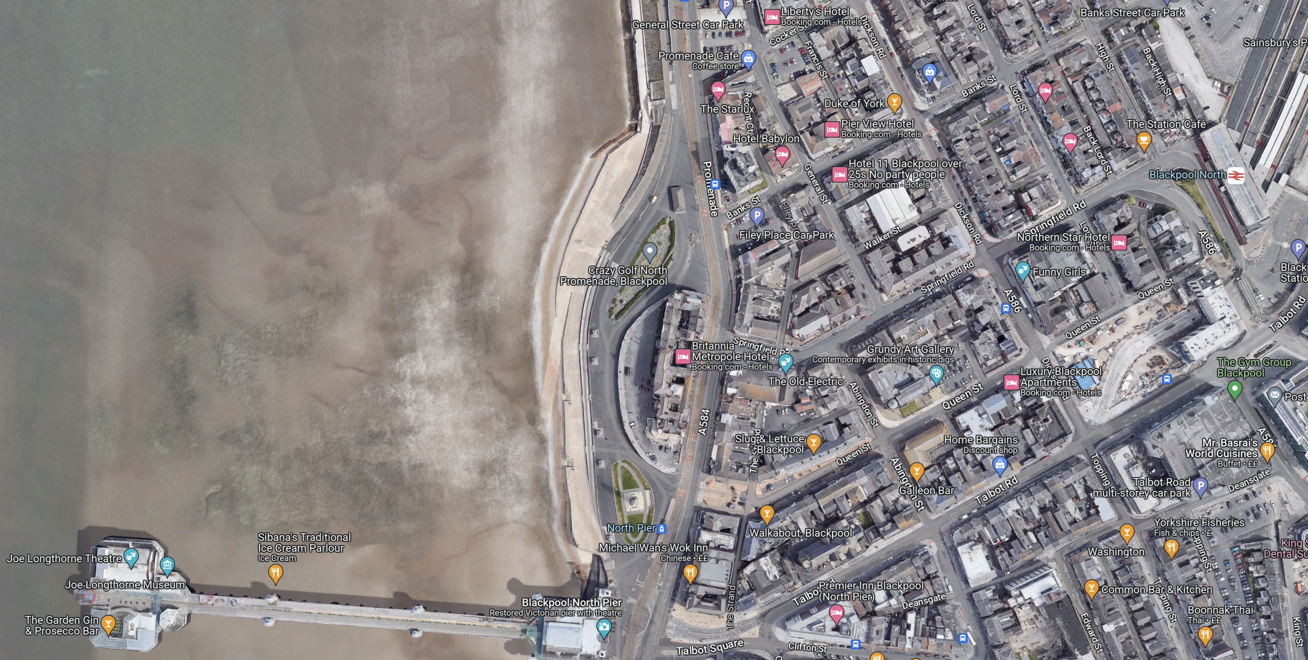
Note.
- The North Pier is in the South-West corner of the map.
- Blackpool North station, which is Blackpool’s main station is in the North-East corner of the map.
- The tramway runs along the sea-front.
The North Pier and the station are linked by Talbot Road.
This Google Map shows Talbot Road and the development of a tram stop by Blackpool North station.
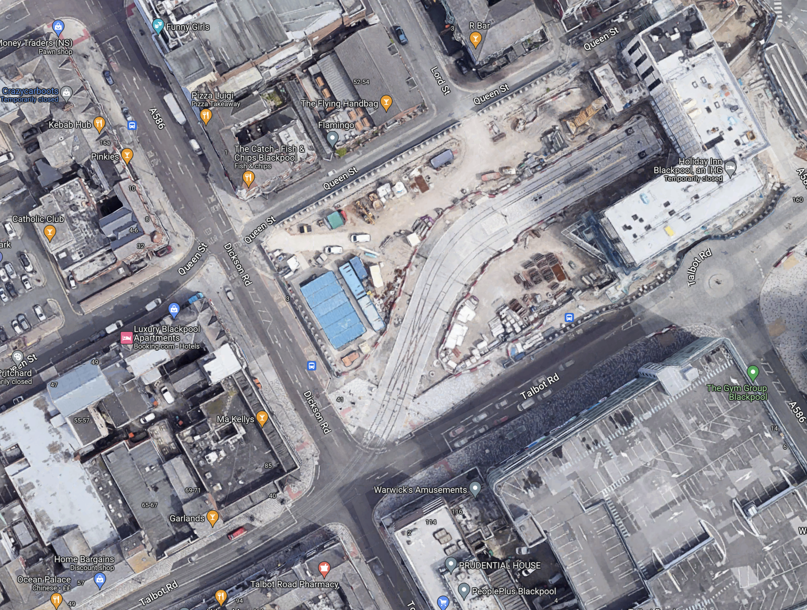
Note.
- To create the space a large Wilkinson’s store was demolished.
- Blaxkpool North station is just off the North-East corner of the map.
- The tram stop will have two platforms.
- There is a large diamond crossing on the approach to the tram stop, so operation is smooth and reliable.
- It looks like there will be substantial development around and possibly over the tram stop.
This Google Map shows Talbot Square, where the tram branch to Blackpool North station joins the main North-South tramway.
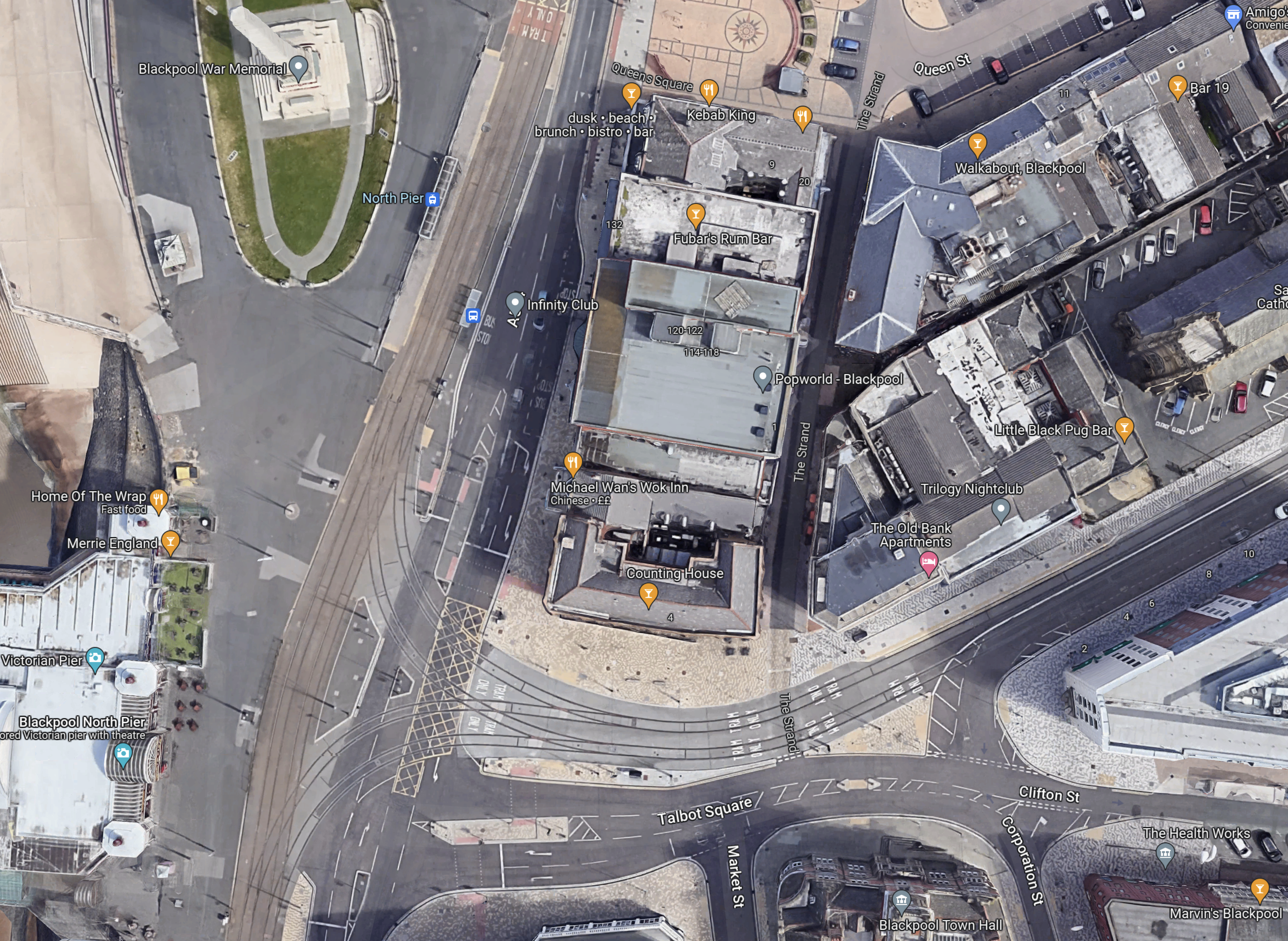
It is all very crowded and I believe this illustrates, why despite their close proximity, there is no rail connection between the Blackpool South branch and the Blackpool tramway.
There just isn’t the space to put in junctions like this and the tramway doesn’t go past Blackpool Airport, so the connection would have to be amongst the crowded houses on the sea front.
The Development Of Blackpool Airport
Aviation is changing and I believe a new breed of airliners and the airports to serve them, will be developed in the next few years.
- Zero-carbon aircraft are being developed and I believe some will have entered service by 2026.
- They will be powered directly by batteries or from green hydrogen.
- Some like the Eviation Alice are already entering a flight-test program, that will lead to certification.
- These airliners are likely to be smaller and quieter than current airliners, with typically a passenger capacity of around 19 passengers.
- They will often fly routes between smaller regional airports.
Blackpool Airport could be an ideal airport for these airliners.
- Offshore electricity and even hydrogen generated offshore will be easy to deliver to Blackpool Airport.
- It could have excellent transport connections with trams and trains.
- Blackpool Airport has good runways.
- Many take-offs will be over the sea.
- We will see airports converting to zero-carbon airports.
So why not Blackpool Airport?
These are distances between Blackpool Airport and other airports.
- Aberdeen – 238 miles
- Amsterdam Schipol – 340 miles
- Belfast City – 128 miles
- Cardiff – 165 miles
- Dublin – 134 miles
- Edinburgh – 150 miles
- Exeter – 211 miles
- Geneva – 661 miles
- Glasgow – 155 miles
- Haverfordwest – 157 miles
- Jersey – 318 miles
- Kirkwall – 358 miles
- London Gatwick – 220 miles
- London Heathrow – 192 miles
- London Southend – 219 miles
- Newcastle – 89 miles
- Paris Orly – 422 miles
- Isle of Man Ronaldsway – 68 miles
- Shannon – 254 miles
- Southampton – 208 miles
- Sumburgh – 427 miles
These distances fit nicely with the range of the nine-seater Eviation Alice electric aircraft, which is predicted to be 620 miles.
This Google Map shows Blackpool Airport.
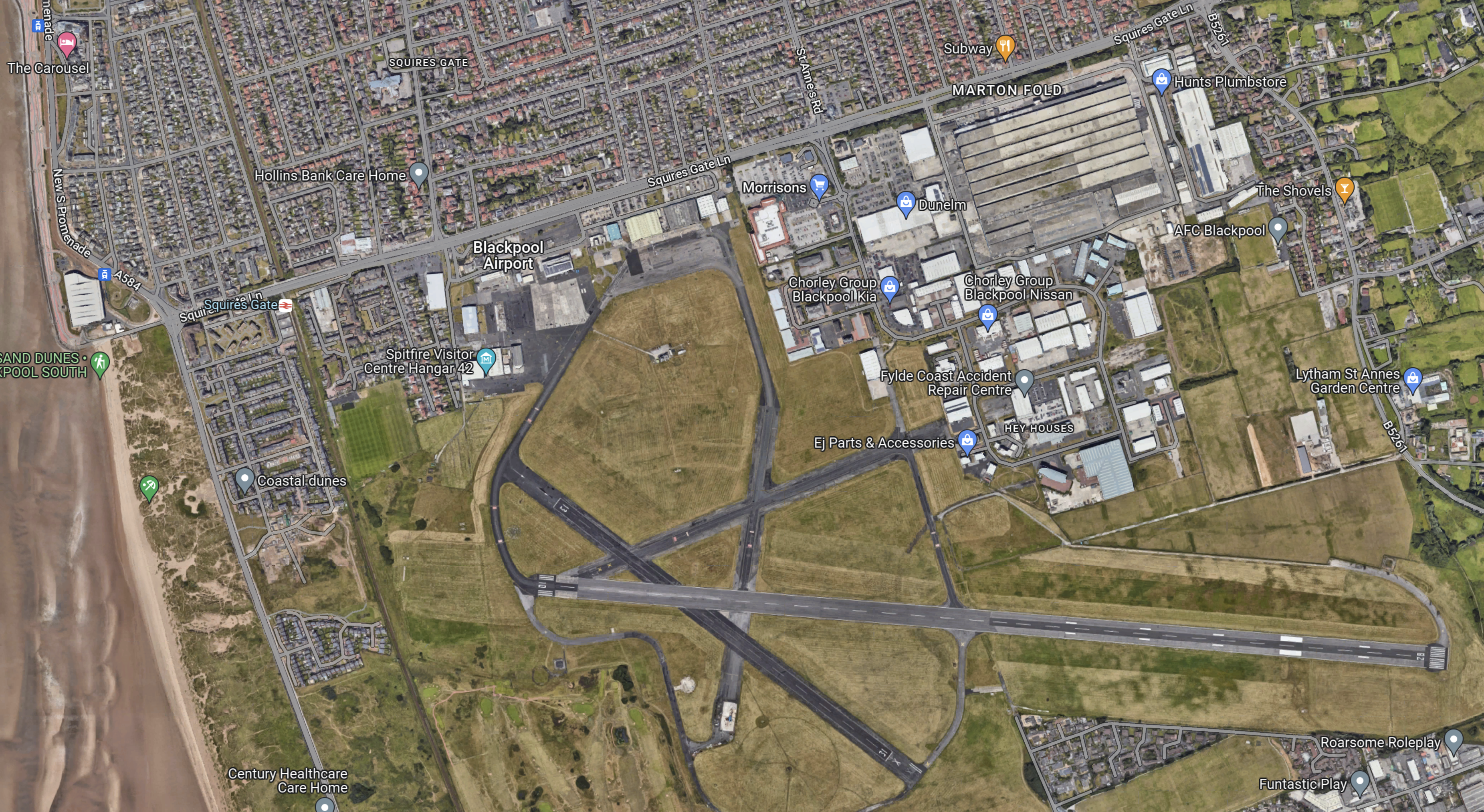
Note.
- The East-West main runway, which is over 1,800 metres long, which will probably mean an easier takeoff into the wind, for much of the time.
- The acres of space.
- The Blackpool South branch running down the side of the airport, with Squires Gate station on the road past the Airport.
- But zoom in on the airport and some improvement and refurbishment needs to be done. Years of neglect and uncertainty has taken its toll.
This Google Map shows the North-West corner of the map at a greater scale.
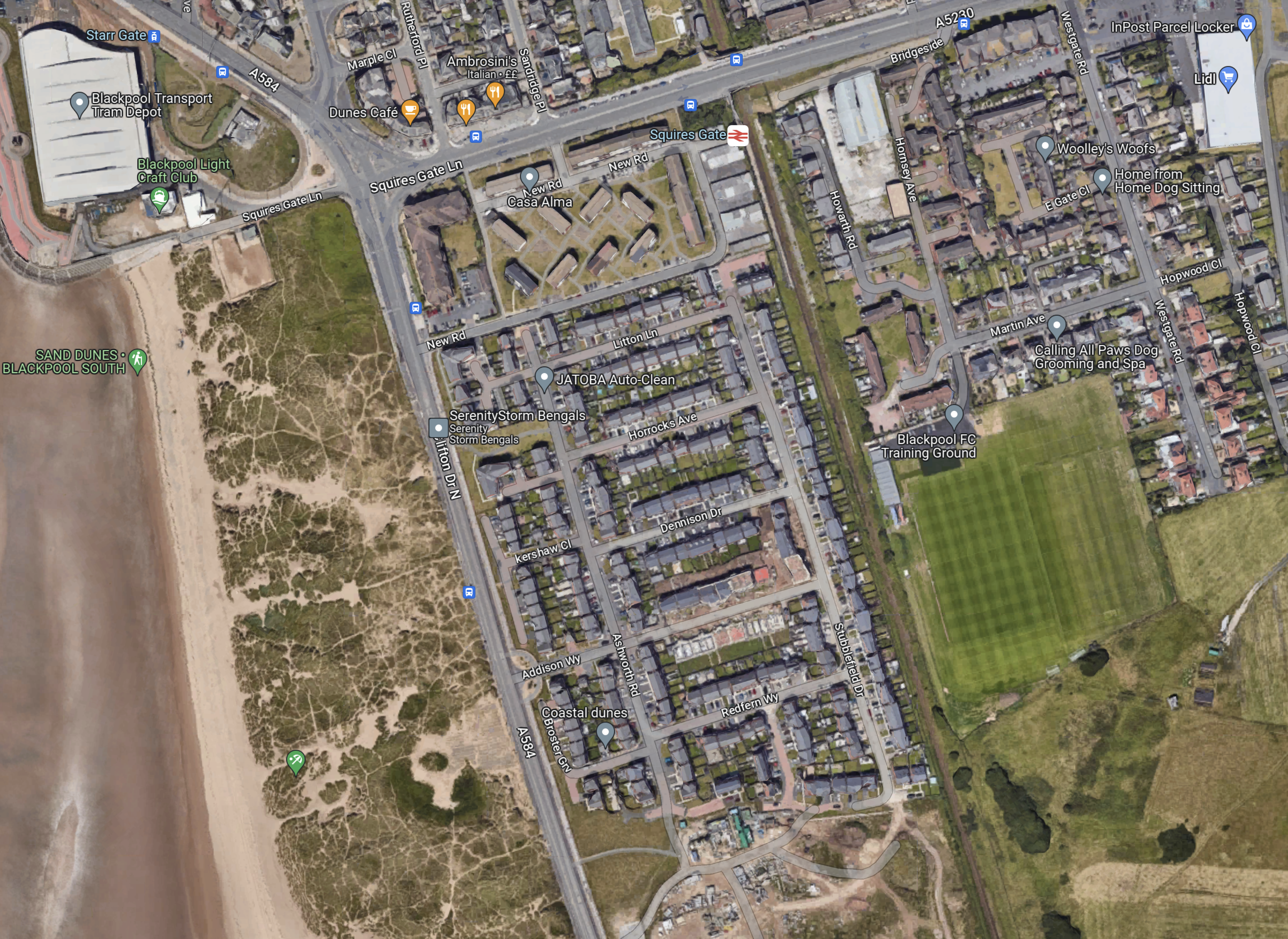
Note.
- In the North-West corner of the map is Blackpool tramway’s depot and Starr Gate tram stop with its loop.
- The rail station is Squires Gate for Blackpool Airport.
- The smart green space to the East of the railway is Blackpool FC’s training ground.
- Below the training ground on the East side is Blackpool Airport.
- On the other side of the track from the Airport, it appears to be the local rubbish dump.
I wonder, if this is where the Blackpool tramway and the Blackpool South branch could be joined up.
- A joint two-platform station partly on Airport land would replace the current Squires Gate station.
- It could be connected to the Airport terminal by some form of shuttle or travellator.
- The trams would be connected to the Starr Gate loop by a line going along the front, as the tramway does in much of Blackpool, before cutting through the waste ground.
- Trains to Blackpool South station would use their current route.
This plan and probably lots of others could allow a Blackpool loop tram-train from Preston.
What would a zero-carbon airport do for Blackpool?
Could Class 777 Trains Create A Metro Centred On Preston?
Preston station is a major station on the West Coast Main Line, that will be served by High Speed Two.
- Electric long distance services to and from Birmingham, Carlisle, Liverpool, London Euston, Manchester, Edinburgh and Glasgow serve the station.
- Electric and diesel local services fan out from the station to Barrow-in-Furness, Blackburn, Blackpool, Burnley, Colne, Liverpool, Manchester and Ormskirk.
- Other local services could be developed.
Could the local services be turned into a zero-carbon Metro centred on Preston station, that would possibly use a version of Merseyrail’s Class 777 trains?
The Routes
These routes could be part of the Metro.
Preston And Barrow-in-Furness
Consider.
- This route is 55.8 miles long.
- The service calls at Lancaster, Carnforth, Silverdale, Arnside, Grange-over-Sands, Kents Bank, Cark, Ulverston, Dalton and Roose
- The route is electrified between Preston and Carnforth.
- 28.1 miles of the route are without electrification.
Northern use Class 195 diesel trains on this route.
Preston And Blackpool North
Consider.
- This route is 17.5 miles long.
- The service calls at Kirkham & Wesham, Poulton-le-Fylde and Layton
- The route is fully-electrified.
Northern use Class 195, 319 and 331 trains on this route.
Preston And Blackpool South
Consider.
- This route is 19.9 miles long.
- The service calls at Salwick, Kirkham & Wesham, Moss Side, Lytham, Ansdell & Fairhaven, St Annes-on-the-Sea, Squires Gate and Blackpool Pleasure Beach
- The route is electrified between Preston and Kirkham & Wesham
- 12.1 miles of the route are without electrification.
Northern use diesel trains on this route.
Preston And Colne
Consider.
- This route is 29.1 miles long.
- The service calls at Lostock Hall, Bamber Bridge, Pleasington, Cherry Tree, Mill Hill, Blackburn, Rishton, Church & Oswaldtwistle, Accrington, Huncoat, Hapton, Rose Grove, Burnley Barracks, Burnley Central, Brierfield and Nelson.
- Colne is 165 metres above sea level.
- The route is not electrified.
Northern use diesel trains on this route.
This route could also be extended to Skipton in Yorkshire, which is something that was promised by Government a few years ago.
The extension to Skipton could be another 15 miles.
Preston And Fleetwood
Consider.
- This route is 20.9 miles long.
- The service could call at Salwick, Kirkham & Wesham and Poulton-le-Fylde
- The route is electrified between Preston and Poulton-le-Fylde
- This route would need to be reinstated.
6.6 miles of the route are without electrification.
Preston And Liverpool Lime Street via St. Helens
Consider.
- This route is 35.2 miles long.
- The service calls at Huyton, St Helens Central, Wigan North Western, Euxton Balshaw Lane and Leyland
- The route is fully-electrified.
Northern use Class 319 and 331 trains on this route.
Preston And Manchester Airport
Consider.
- This route is 35.2 miles long.
- The service calls at Heald Green, Manchester Piccadilly, Manchester Oxford Road, Deansgate, Salford Crescent, Bolton, Lostock, Horwich Parkway, Blackrod, Adlington (1tph), Chorley, Buckshaw Parkway and Leyland
- The route is fully-electrified.
Northern use Class 195 and 331 trains on this route.
Preston And Ormskirk
Consider.
- This route is 15.3 miles long.
- The service calls at Burscough Junction, Rufford and Croston.
- The route is not electrified.
Merseyrail have their eyes on this route.
Preston And Windermere
Consider.
- This route is 50.3 miles long.
- The service calls at Lancaster, Carnforth, Oxenholme Lake District, Kendal, Burneside and Staveley
- The route is electrified between Preston and Oxenholme Lake District.
- 10.2 miles of the route are without electrification.
Northern use Class 195 diesel trains on this route.
Class 777 Trains
Consider.
- According to Stadler’s specification for the Class 777 IPEMU, the battery-equipped Class 777 trains have a range of 55 km or 34.2 miles.
- But, according to New Merseyrail Train Runs 135km On Battery, these trains have done 135 km or 83.9 miles.
- As there is no third-rail electrification at Preston, but lots of 25 KVAC overhead electrification, the version of the Class 777 train for 25 KVAC overhead will need to be used.
- There is no way that any third-rail electrification can be installed.
One comment to my post; The Stadler Data Sheet For A Class 777 IPEMU, suggests that batteries can’t be used with the 25 KVAC variant of the Class 777 due to lack of space.
I will use a starting point for the Class 777 IPEMU, that can access 25 KVAC has a range of 40 miles, which is just under half of the demonstrated maximum range of the current trains.
Class 331 Trains With Batteries
CAF have proposed a battery-electric version of their Class 331 train.
The closely-related Class 195 diesel trains and Class 331 trains already work some of the routes through Preston.
In Thoughts On CAF’s Battery-Electric Class 331 Trains, I estimated the range of these trains and reckoned that they would be between 35 and 70 miles.
The South Wales Valley Lines Solution
In The Greening Of The Valleys, I describe how the South Wales Metro will use a mix of trains.
- Stadler Citylink tram-trains for local routes.
- Stadler FLIRTs for routes on the main lines.
So could a Metro centred on Preston be based on the same principle?
I’ll look at each line in order.
Preston And Barrow-in-Furness
Consider.
- This route is 55.8 miles long.
- 28.1 miles of the route are without electrification.
- Northern use Class 195 diesel trains on this route.
A Class 331 with a battery range of sixty miles could work this route, charging the batteries between Preston and Carnforth.
Preston And Blackpool North
Any train that could use 25 KVAC electrification could use this route.
Preston And Blackpool South
Consider.
- This route is 19.9 miles long.
- 12.1 miles of the route are without electrification.
- Northern use diesel trains on this route.
A Class 777 with a battery range of 24.2 miles could work this route, charging the batteries between Preston and Kirkham & Wesham.
Preston And Colne
Consider.
- This route is 29.1 miles long.
- Colne is 165 metres above sea level.
- The route is not electrified.
- Northern use diesel trains on this route.
A Class 777 with a battery range of 30 miles could work this route, charging the batteries at Preston and Colne.
It might be prudent to electrify the single track line between Gannow Junction and Colne, so that trains have enough power to climb the hill to Colne and reach Colne with a full battery.
The extension to Skipton would require a range of 30 miles or just fifteen miles, if the 25 KVAC at Skipton was used to recharge the trains.
Preston And Fleetwood
Consider.
- This route is 20.9 miles long.
- 6.6 miles of the route are without electrification.
A Class 777 with a battery range of 13.2 miles could work this route, charging the batteries between Preston and Poulton-le-Fylde.
Preston And Liverpool Lime Street via St. Helens
Any train that could use 25 KVAC electrification could use this route.
Preston And Manchester Airport
Any train that could use 25 KVAC electrification could use this route.
Preston And Ormskirk
Consider.
- This route is 15.3 miles long.
- The route is not electrified.
A Class 777 with a battery range of 30.6 miles could work this route.
Trains would charge on their home network.
Preston And Windermere
Consider.
- This route is 50.3 miles long.
- 10.2 miles of the route are without electrification.
- Northern use Class 195 diesel trains on this route.
A Class 331 with a battery range of 20.4 miles could work this route, charging the batteries between Preston and Oxenholme Lake District.
Electrification Between Preston and Skipton Via Colne
Earlier when discussing the service to Colne and Slopton, I said this.
It might be prudent to electrify the single track line between Gannow Junction and Colne.
But surely, as this would mean, that virtually the whole route between The West Coast Main Line at Preston and the East Coast Main Line would be electrified, it would be sensible to electrify between Preston and Gannow Junction.
If this electrification were to be made continuous, this would mean the following.
- There would be a fully-electrified line between Blackpool and Leeds, which could be worked by Class 331 trains.
- There could be a valuable diversion route to help, whilst the main transPennine routes were upgraded.
- Class 777 trains with batteries would only be needed on the Blackpool South and Fleetwood routes from Preston.
The battery range needed would be just 24.2 miles to handle the longer Blackpool South route.
Stadler Presents Mock-Up Of Tram-Trains For German And Austrian Operators
The title of this post, is the same as that of this article on Railway Gazette.
This is the first paragraph.
A mock-up of the Citylink tram-trains that Stadler is to supply to operators in Karlsruhe, Saarbrücken, Neckar-Alb, Oberösterreich and Salzburg was unveiled at the Betriebshof West depot in Karlsruhe on December 13.
This is the most interesting paragraph.
‘Maximum standardisation and the fact that the order was shared between different operating companies reduces the costs by to up to €1m per vehicle’, said Karlsruhe Mayor Frank Mentrup at the unveiling ceremony.
It shows the value of standardisation and large orders.
Szeged Tram-Train Service Inaugurated
The title of this post, is the same as that of this article on Railway Gazette.
This is the first paragraph.
The country’s first public tram-train service left Hódmezővásárhely for Szeged at 03.31 on November 29, with guests onboard including János Lázár, the government’s special commissioner for the project, and László Palkovics, Minister of Innovation & Technology.
They are obviously early starters in Hungary.
The Szeged-Hódmezővásárhely Tram-Train has its own Wikipedia entry.
From the Railway Gazette article and Wikipedia, I can ascertain the following.
- It is a 32 km route.
- Journey time will be 51 minutes, with an Off Peak frequency of two trains per hour (tph), with three tph in the Peak.
- The main stations in Hódmezővásárhely and Szeged are served.
- The route between the two cities is not electrified, but has been partially-upgraded to double-track and the speed has been upgraded to 100 kph.
- In both central districts the vehicles run as tram-trains.
The rolling stock will be electro-diesel versions of Stadler Citylink tram-trains.
This pictures show Sheffield Supertram’s Class 399 tram-trains, which are also members of the Stadler Citylink family.
The two tram-trains would appear to be very similar in terms of cab design, passenger compartment and an operating speed of 100 kph.
The question has to be asked, if Sheffield could expand their Supertram network with some electro-diesel tram-trains.
They could be ideal for the proposed service to Stocksbridge, that I wrote about in Reopening The Don Valley Section Of The Former Woodhead Line Between Stocksbridge and Sheffield Victoria To Passenger Services.
The route could be tested using diesel engines on sections without electrification and if the route attracted enough passengers, electrification could be erected.
Beeching Reversal – A New Station At Waverley In Sheffield
This is one of the Beeching Reversal projects that the Government and Network Rail are proposing to reverse some of the Beeching cuts.
In July 2019, I covered this new station in Sheffield Region Transport Plan 2019 – A New Tram-Train Route To A New Station At Waverley.
Note that to avoid confusion, I now refer to this station as Sheffield Waverley station.
This was my conclusion in the July 2019 post.
Why shouldn’t Sheffield have an advanced tram-train system to serve the Advanced Manufacturing Park?
I feel the service should be as follows.
-
- It should be terminated in a loop around the Waverley area and the Advanced Manufacturing Park.
- In the West it could terminate in Sheffield station or perhaps pass through and terminate in the West of the City.
- The service could be run using battery electric tram-trains, similar to the Class 398 tram-trains, that will be used on the South Wales Metro.
I don’t think that the engineering will be very challenging.
I shall be adding to this post.
Electro-Diesel Tram-Train Order Expanded To Support Service Increase
The title of this post, is the same as that of this article on Railway Gazette.
This is the introductory paragraph.
National passenger operator MÁV-Start has exercised an option for Stadler’s Valencia plant to supply a further four Citylink electro-diesel tram-trains for the route being developed to link Hódmezővásárhely with Szeged.
The reason, I am posting this, is that I feel the use of diesel tram-trains may have applications in this country.
- The Class 399 tram-trains in Sheffield and the Class 398 tram-trains ordered for the South Wales Metro are both members of the Citylink family, that were built or will be built in Stadler’s Valencia plant.
- The Class 398 tram-trains will have batteries to extend the route on routes without electrification.
Perhaps, if they ran on bio-diesel, they may have applications, where electrification would be difficult or inappropriate and the distance is too long for a Citylink with batteries.
Could A Class 399 Tram-Train With Batteries Go Between Manchester Victoria And Rochdale/Bury Bolton Street/Rawtenstall Stations?
In Rossendale Reopening Prospect, I looked at a proposal to run a new service between Manchester Victoria and Bury Bolton Street stations.
Could this route be run by a Class 399 tram-train with a battery capability?
These tram-trains would be very similar to the Stadler Citylink Metro Vehicles, that have been specified for the South Wales Metro.
- Wikipedia gives the weight of the vehicle as 66 tonnes.
- Manchester Victoria has an altitude of 44 metres
- Bury has an altitude of 100 metres.
- Rochdale has an altitude of 137 metres.
- Rawtenstall has an altitude of 174 metres.
- I will assume 200 passengers at 90 Kg. each, which gives a weight of 12 tonnes.
Using Omni’s Potential Energy Calculator gives the following.
- Manchester Victoria to Bury Bolton Street has an increase in potential energy of 12 kWh.
- Manchester Victoria to Rochdale has an increase in potential energy of 20 kWh.
- Manchester Victoria to Rawtenstall has an increase in potential energy of 28 kWh.
When you consider that a Class 230 train has 400 kWh of batteries in a two-car train, I don’t think that there will be any problem fitting batteries big enough to take a Class 399 tram-train from Manchester Victoria to Bury Bolton Street, Rochdale or Rawstenstall stations under battery power with a full load of passengers.
- The batteries would be charged in Manchester Victoria station.
- Returning to Manchester Victoria station would use a small amount of battery power, with some assistance from Newton’s friend; gravity.
- The batteries would get a certain amount of charge from the regenerative braking of the tram-trains.
This Google Map shows the Eastern approaches into Manchester Victoria station.
Note.
- The four through platforms numbered 3 to 6.
- The two bay platforms numbered 1 and 2.
- The four platform faces and three tracks of the Metrolink.
Having seen several tram-train systems all over Europe, I believe it would be possible to connect tram-trains running on batteries on the Calder Valley Line to the Manchester Metrolink at Manchester Victoria station.
- Going from Manchester to Bury Bolton Street, Rochdale or Rawtenstall, the tram-train would stop in the Manchester Victoria tram-stop, drop the pantograph and then continue on its way under battery power.
- Returning from the North, the tram-train would stop in the Manchester Victoria tram-stop, raise the pantograph and then continue on its way using power from the overhead wires.
- Batteries would be charged whilst running through Manchester.
There couldn’t be too many tram-train systems that would be easier to build than this?
It is interesting to note that Hebden Bridge station is just twenty-three miles from Manchester Victoria station and has an altitude of 190 metres.
So would it be possible for a Class 399 tram-train to reach Hebden Bridge station on battery power? I very much think it would be!
Class 399 Tram-Trains And Class 156 Trains
Class 156 trains are one of the better workhorses of the railways in the North and despite their age, they scrub up well.
If their performance is compared to that of a Class 399 tram-train, they are not that different.
- Noise and vibration of the electric tram-train is obviously much lower.
- The modern interior of the tram-train is geared to the needs of passengers.
- Passenger capacity of the two vehicles is also about the same.
- In Karlsruhe, tram-trains travel for up to 100 miles from the centre of the city.
Both Karlsruhe and Sheffield use three-car tram-trains, but Valencia uses much longer ones, so on heavily-used routes larger tram-trains could be used.
I doubt there would be many complaints, if a Class 156 service were to be replaced with one run by Class 399 tram-trains.
Electrification Of The Calder Valley Line
Electrifying the Calder Valley Line with 25 KVAC overhead wires as far as Rochdale station, would certainly make running to Hebden Bridge station possible.
- That electrification would also mean that electric trains could be turned-back at Rochdale station, just as diesel trains are now!
- I have flown my helicopter along the route and it looks like of the seven or eight bridges on the route, mostly appear to be modern structures for new roads or motorways.
- As 25 KVAC overhead electrification is currently being erected between Manchester Victoria and Stalybridge, a spur to Rochdale would be very much a simple addition.
It could be a very useful short length of electrification.
Tram-Trains In Manchester
This article on Rail Technology Magazine was puiblished yesterday and is entitled Plans For Tram-Trains In Manchester Unveiled As Grayling And Burnham Mull Expansion Of Metrolink.
Conclusion
Could we see tram-trains running from Bury Bolton Street, Hebden Bridge, Rawtenstall and Rochdale into Manchester Victoria and then taking to the existing tram network?
If you’ve ever been to Karlsruhe, as I have to see the Class 399 tram-trains German cousins, you wouldn’t rule out anything.
That would include tram-train services to Blackburn, Buxton, Chester, Glossop, Hebden Bridge, Sheffield, Southport and Wigan.
Additional Double Track In South Wales
In the July 2018 Edition of Modern Railways, there is an article entitled KeolisAmey Wins Welsh Franchise.
This is said about the additional double track on the South Wales Metro.
Additional double track will be needed in 15 locations to support increased Core Valley Lines (CVL) frequencies.
So where are these locations?
I shall start by listing all the single platform stations.
I have ignored the following.
- Terminal stations.
- Stations on the Coryton Line.
I have grouped them by branch.
Aberdare Branch
Merthyr Branch
Rhondda Line
Rhymney Line
These total up to fourteen stations.
As the Butetown Branch will be extended through Cardiff Bay station and this station will need a second platform, does this add up to the fifteen new sections of double-track?
How Difficult Will It Be To Add A Second Track At Stations?
Of the fifteen stations, those on the Aberdate, Merthyr and Rhondda will only see the Stadler Citylink Metro vehicles, which will be running to the same rules as trams.
So could it be that these stations will be arranged like this stop on the London Tramlink, which is typical of many tram stops throughout the UK, Europe and the world?


Note.
- There is no bridge.
- There is full step-free access.
- The overhead wires are kept well out of thew way.
As most tram networks have done in the UK, they could design a modern suite of shelters, ticket machines, information displays, seats help points and other items.
I suspect that the platform height would be designed to fit both the tri-mode Stadler Flirts and the Stadler Citylink Metro Vehicles.
The only stations that are served exclusively by the tri-mode Stadler Flirts and might be given an extra track are Pontlottyn and Brithdir stations at the Northern end of the Rhymney Line.
These stations only get four tph in both directions.
Do Many Stations Have Passing Freight Trains?
I never like to be on a platform, when a freight train goes through and it happens regularly at stations near me like Canonbury and Dalston Kingsland.
I looked on Real Time Trains and there don’t appear to be many such trains on the CVL
I suspect too, that they could use temporal separation, with any freight trains ruining, when the Metro is closed.
Conclusion
I do find it strange that the total number of one platform stations is the same as the number of locations, where the track will be doubled.
But surely, if all stations were on a double-track, this would give the maximum flexibility to run services.
If too, the stations could be built without footbridges to the standards of trams, then construction costs could be saved!
