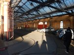
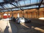
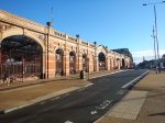
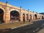
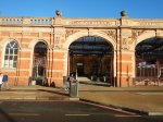
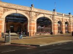
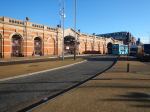
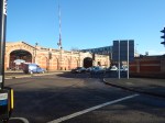
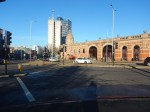
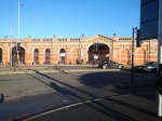
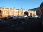
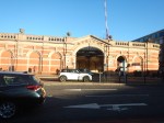
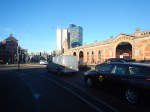
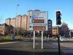
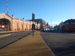
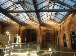
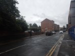
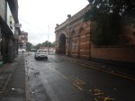
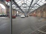
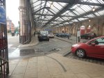
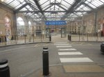
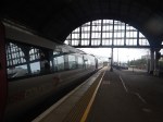
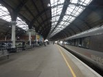
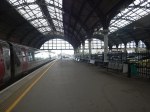
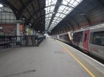
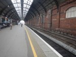
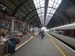
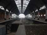
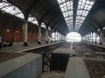
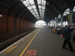
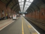
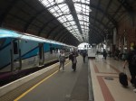
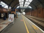
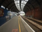
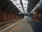
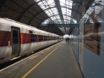
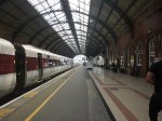
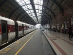
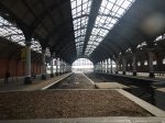
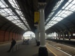
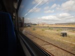
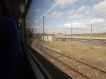
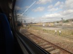
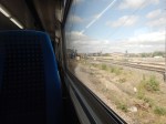
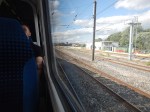
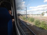
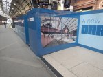
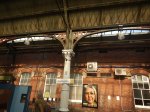
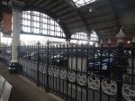
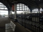
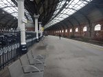
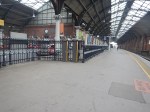
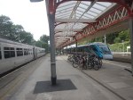
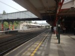
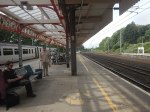
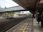
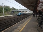
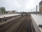
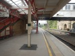
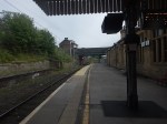
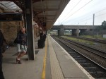
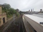
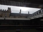
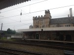
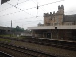
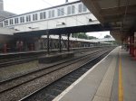
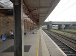
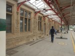
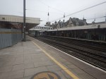
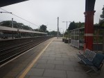
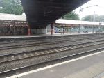
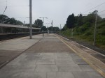
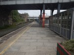
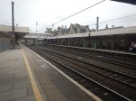
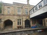
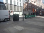
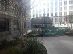
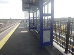
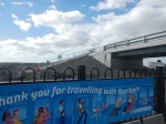
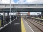
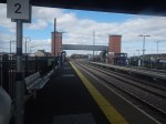
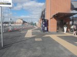
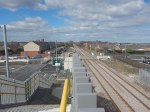
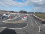
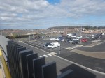
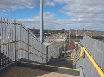
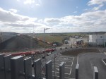
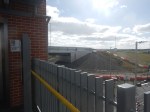
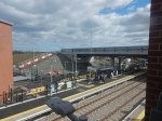
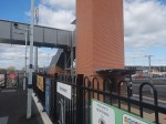
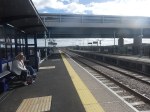
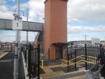
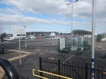
Liverpool Street Station – 20th February 2026
I took these pictures this morning.
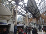
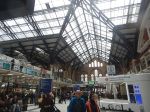
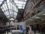
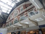
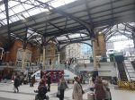
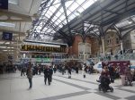

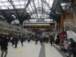

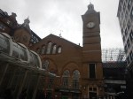
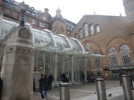
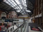
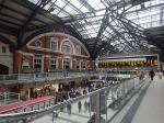
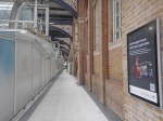
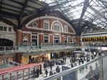
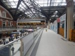
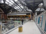
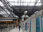
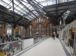
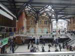
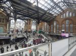
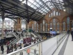
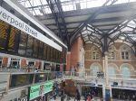
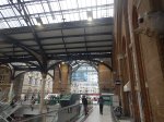
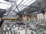
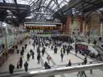


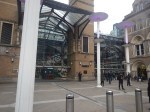
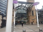

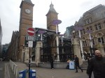


Note.
- There are not enough lifts and escalators.
- It is a station with three monumental clocks and a couple of digital ones.
- There are certainly a lot of shopping, but much of it is tired.
- The Leon in the station isn’t there anymore.
- There is not a gluten-free restaurant in the station, that I would trust enough to use, but there is a Marks & Spencer Food outlet.
This is a visualisation of the upgraded station from Network Rail.
Planning Approval Granted For Network Rail’s Transformation Of Liverpool Street — Britain’s Busiest Station
The title of this post is the same as that of this article in Rail Technology Magazine.
This is the sub-heading.
Network Rail has secured a major milestone in the redevelopment of Liverpool Street station, following the City of London Planning Committee’s resolution on 10 February to grant full planning permission for the long‑awaited transformation of the UK’s busiest rail hub.
These two paragraphs adds some more detail.
The Eastern Region’s Anglia Route will oversee the upgrade, which aims to futureproof the station for decades as passenger numbers continue to grow sharply. Liverpool Street, last redeveloped in 1991, now handles 118 million passenger movements each year, and demand is projected to rise by 35%, reaching 158 million by 2041.
Looking further ahead, planners expect the station will need to accommodate over 200 million annual journeys, making capacity enhancement essential for maintaining operational performance and customer experience across London, East Anglia and the wider east of England.
To say this is a large project would be a massive understatement and I wish, that this could have been the last project planned and built by the Artemis project management system, that I wrote in a Suffolk attic fifty years ago.
This list summarises the work that will be done.
- 76% increase in overall concourse capacity
- 23% expansion of the lower concourse to smooth passenger flow
- Step‑free access from street to all platforms, including every Underground line for the first time
- Eight new large lifts, replacing the existing four‑person unit
- Escalators increased from four to ten
- New accessible entrances and intuitive wayfinding from Broadgate, Exchange Square, and key interchange points
- Toilets on all levels, including Changing Places facilities and family amenities
Respecting Heritage While Creating New Spaces
The project safeguards the station’s Victorian character, with the iconic trainshed fully preserved. The redevelopment will also create new vantage points overlooking the heritage structures, bringing passengers visually closer to the original architecture.
Above the concourse, a new office building featuring a publicly accessible roof garden will provide one of London’s most sustainably connected workplaces, directly supporting the City Corporation’s long‑term growth and employment aspirations.
Around twenty major contractors and professional firms will be handling the transformation.
Hopefully, I will be able to watch this project as it grows to occupy its place in the City of London.
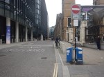
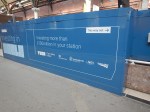
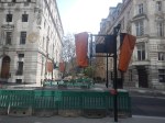
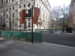
The Power Of Buildings To Come
I took this picture on Bishopsgate in London.
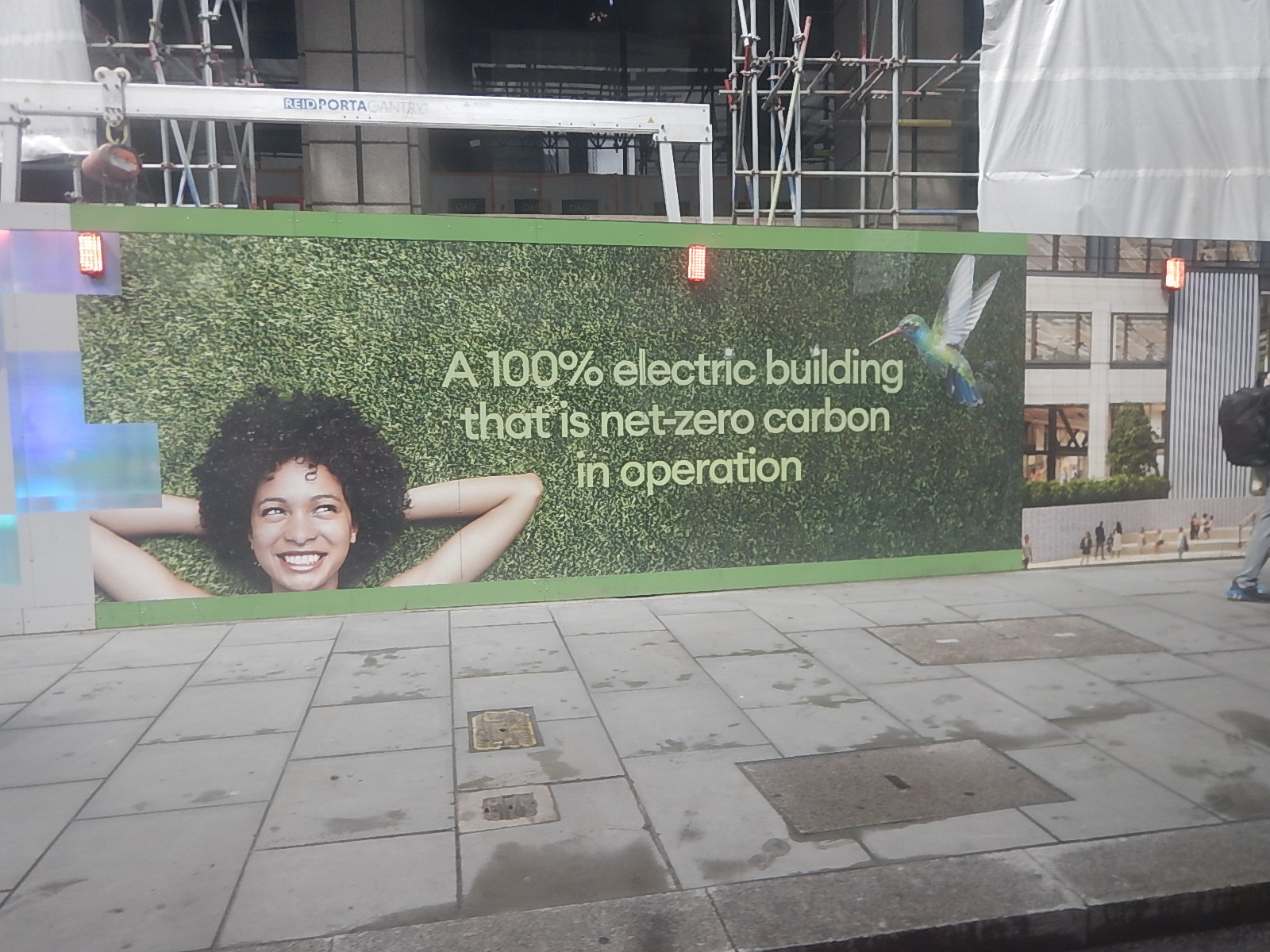
It’s advertising the building, which is being built behind the hoarding called One Exchange Square.
The Problem Of Electrifying Leicester Station
This post is my attempt to try and explain the problem of electrifying the Midland Main Line through Leicester station.
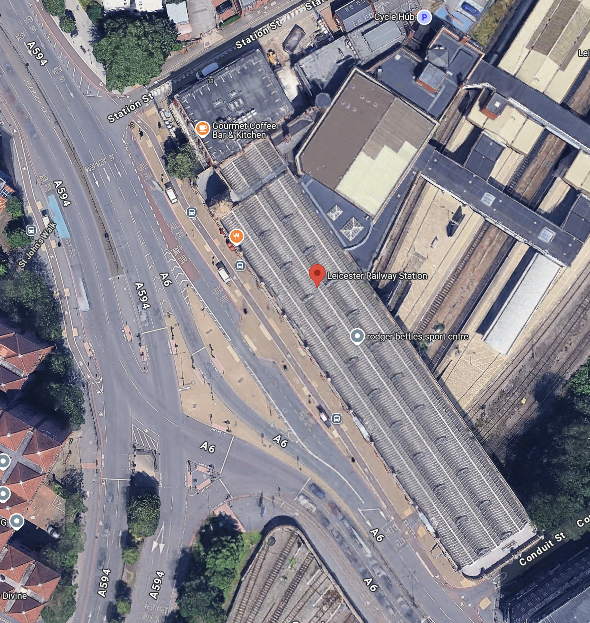
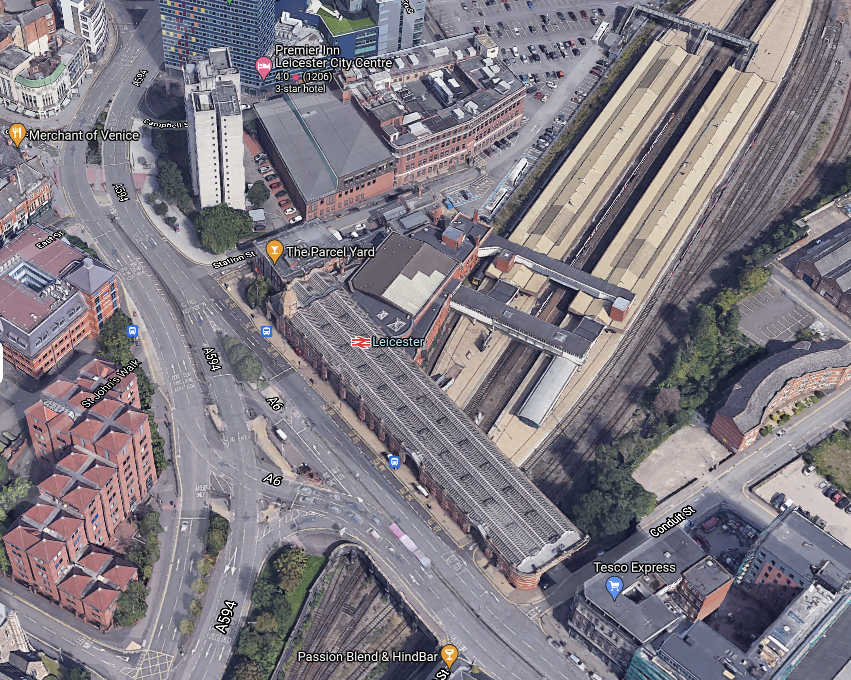
This Google map shows the Southern end of the station.
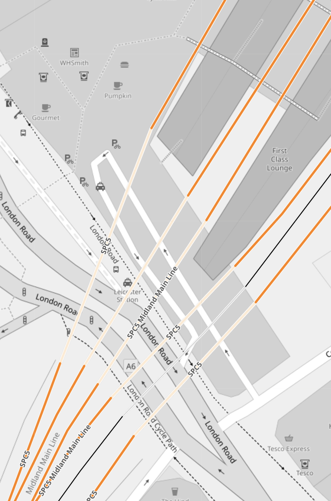
This OpenRailwayMap shows the station.
Note.
- There appear to be five tunnels under the station buildings and London Road.
- What is the tunnel going underneath the tracks used for?
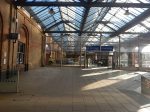
Leicester station has a Grade II Listed frontage.


Note.
- It is an impressive Victorian station.
- The station building is on a bridge over the tracks.
- The station is also on one of the main roads through Leicester.
- The road layout is very complicated.
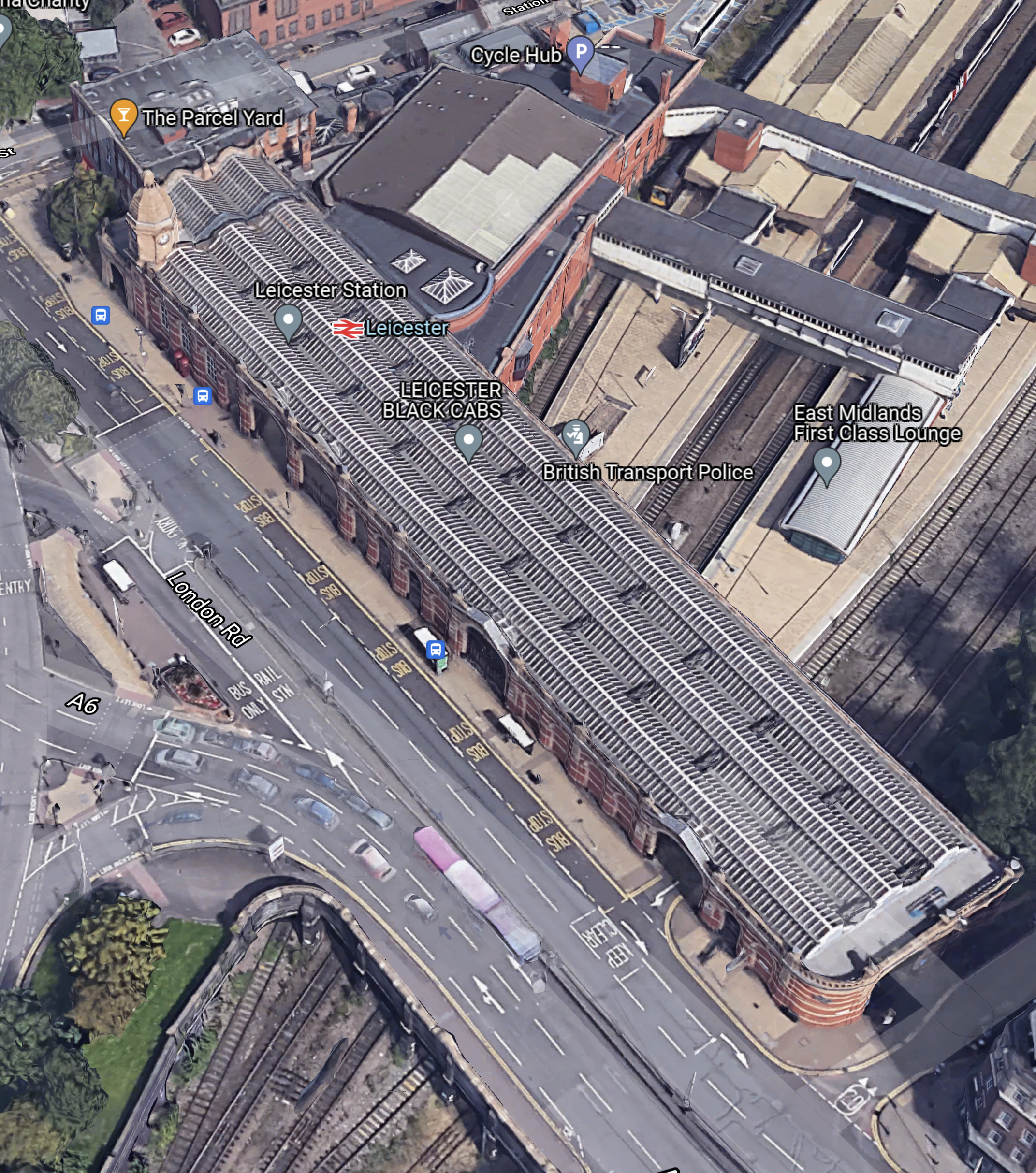
This 3D Google Map, shows an aerial view of the station.
Note.
- There four platforms, which are numbered 1-4 from the left.
- The expresses between London and Derby, Nottingham and Sheffield use the two middle tracks.
- Other main line and East-West services use the outside platforms.
- There is an avoiding line for freight services.
- 5. The step-free footbridge is clearly visible.
This second 3D Google Map, shows an enlargement of the frontage of the station.
These pictures show what is inside the building at the front of the station.
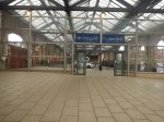

The building would appear to be a Grade II Listed taxi rank and free twenty-minute car park.
There are plans to increase the capacity of the station.
- A fifth platform will be added.
- Three miles of quadruple track will be be built South of the station.
- The Midland Main Line was also to be electrified.
Real Time Trains indicates that the distance between Leicester and Wigston North junction is 3.1 miles.
This OpenRailMap shows that section of track.
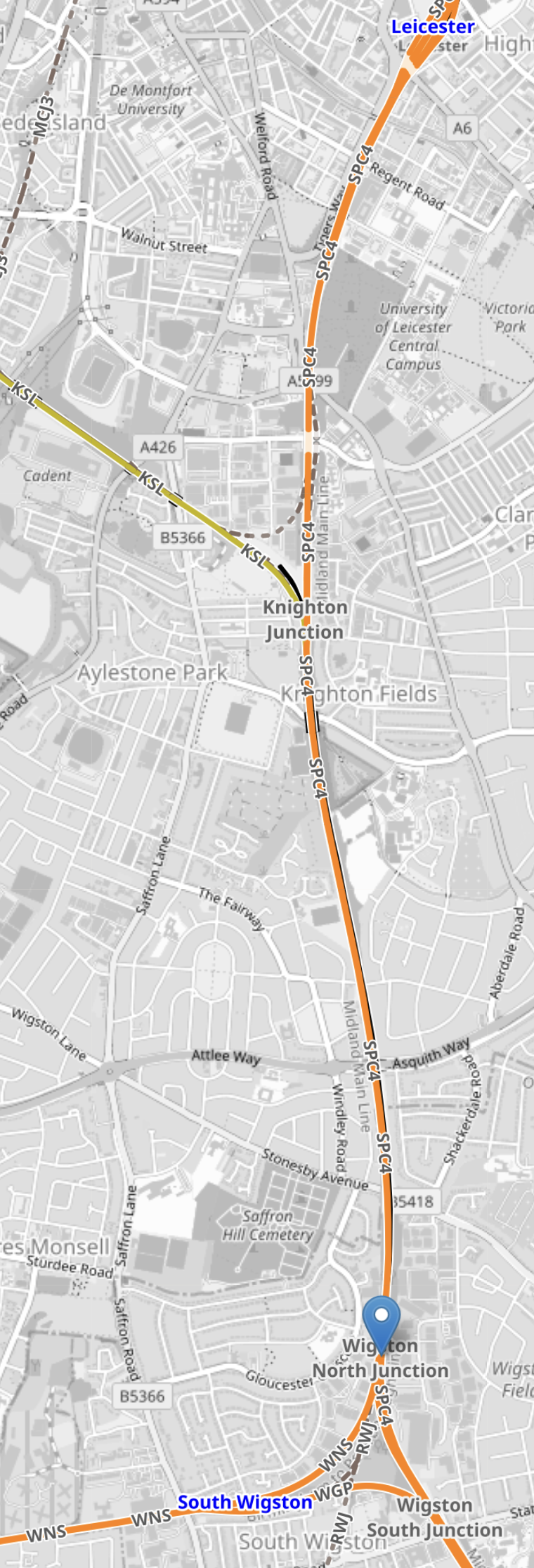
Note.
- Leiester station is at the top of the map.
- Wigston junction is the triangular junction at the bottom of the map.
- Wigston North Junction is indicated by the blue arrow.
- OpenRailwayMap only shows a 100 mph Northbound track and a 90 mph Southbound track on the route.
It looks to me, that four tracks between Leicester and Wigston North junction would mean that trains could expedite arrivals to and departures from Leicester to and from the South.
South From Wigston Junction
Consider.
- London St. Pancras and Kettering is a four-track railway as far as the Corby Branch.
- North of Luton the slowest maximum speed is 100 mph, with much of the line rated at 110 mph plus.
- Wigston North junction and Luton station is 65.8 miles.
- Current Class 222 diesel trains typically take 40 minutes.
- This is an average speed of 98.7 mph.
- An average speed of 110 mph between Wigston North junction and Luton station would take 36 minutes.
- An average speed of 125 mph between Wigston North junction and Luton station would take 31.6 minutes.
- An average speed of 130 mph between Wigston North junction and Luton station would take 30.4 minutes.
I believe with track improvements and digital signalling, there are time savings to be gained between St. Pancras and Leicester stations.
Ultimately, if the 140 mph design speed of the Class 810 trains under digital signalling could be maintained, this would do the following.
- Push the St. Pancras and Leicester times under an hour.
- Push the St. Pancras and Nottingham times under ninety minutes.
- Push the St. Pancras and Sheffield times under two hours.
Batteries would only be used on the three miles between Wigston North junction and Leicester station.
Could Bi-Mode Trains Be Used?
They could be used initially and to prove if the partial electrification works.
But each train has four diesel engines and sometimes they will be working in pairs through the stations between Leicester and Sheffield.
Passengers will take a dim view of being covered in lots of diesel smoke, when they have been promised clean, zero-carbon electric trains.
But the battery-electric trains will be much quieter and pollution-free.
This page on the Hitachi Rail web site is entitled Intercity Battery Trains.
New Infrastructure Needed
The only infrastructure needed will be that which will support the new trains.
The Class 810 trains will be maintained at Etches Park at Derby.
If they are battery-electric trains, there may be some strategically-placed chargers, which typically would be a short length of overhead wire.
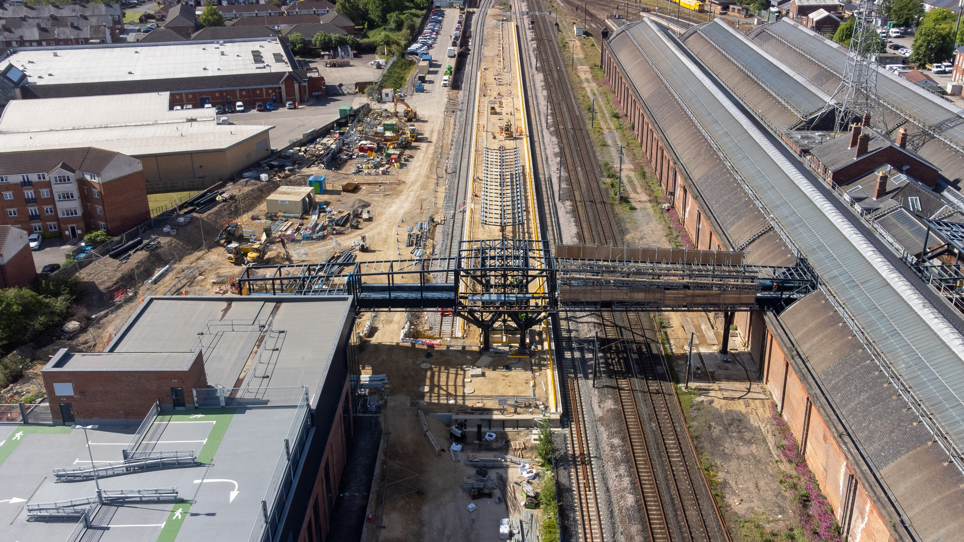
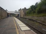
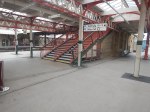
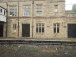
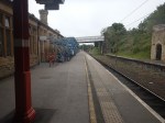
Darlington Station – 26th June 2025
I visited Darlington station, three times on my trip.
These pictures are in chronological order.


Note.
- The station is being given a major upgrade, so it can handle more trains.
- The station has a large number of top-quality Victorian features.
- The station is Grade II* Listed.
- Inside the enormous train-shed are two long platforms, that handle most of the trains and two South-facing bay platforms.
- Two new platforms, which are numbered 5 & 6, and possibly a double-track avoiding line are being added outside the train-shed on the East side.
- In images with a comment saying Note Platform 5, the new long electrified Platform 5 can be seen.
- Platform 5 appears to be already electrified at its Southern end.
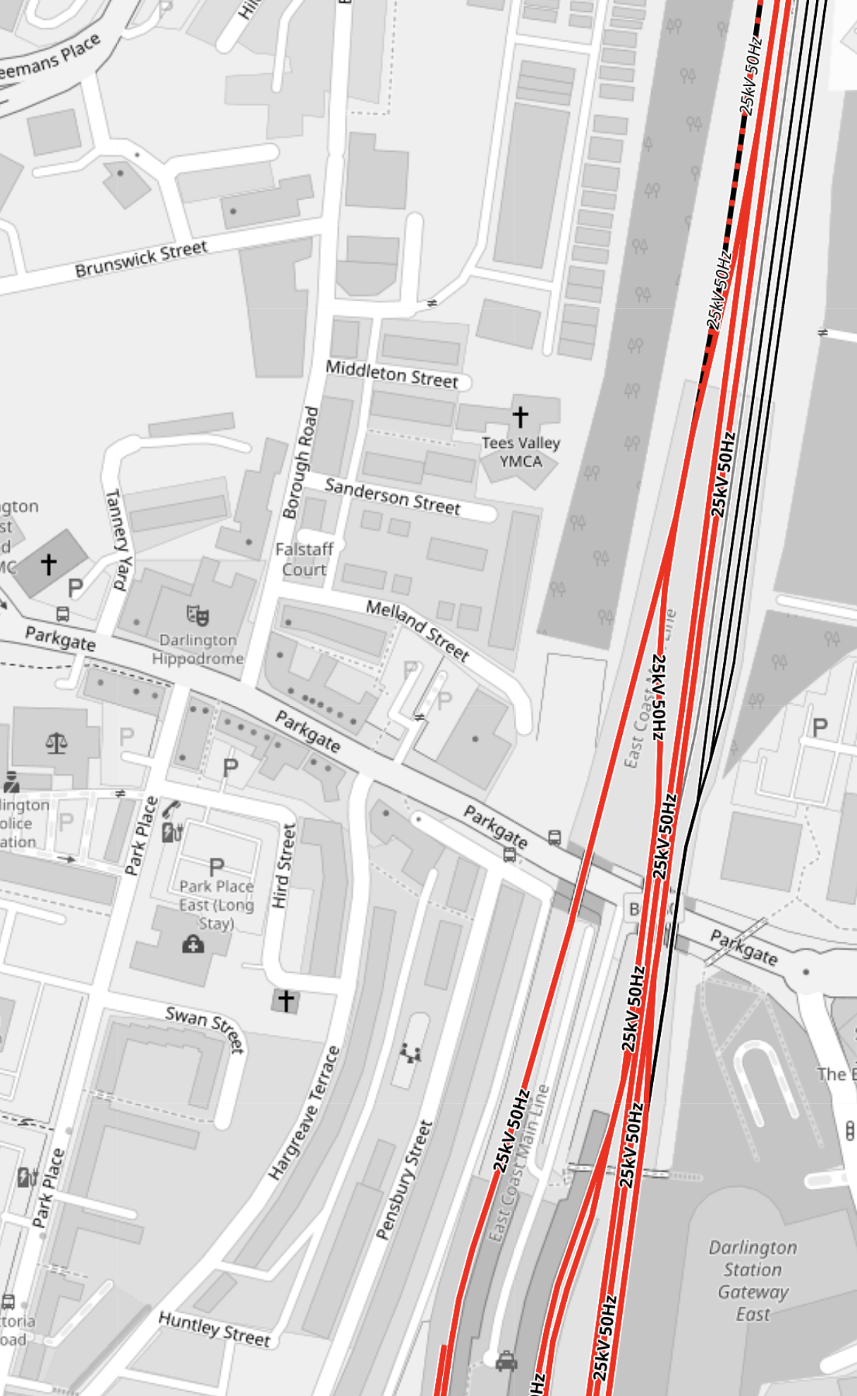
These three OpenRailwayMaps shows the future layout.
The first OpenRailwayMap shows the junction, where the branch to Newton Aycliffe, Shildon and Bishop Auckland connects.
Note.
- The red tracks are electrified and indicate the East Coast Main Line.
- The track curving off to the North-West is the Bishop Auckland Branch.
- The black tracks are not-electrified.
- The Bishop Auckland Branch is shown dotted black and red, as it will be electrified, so that Hitachi can get their new trains to the East Coast Main Line.
- The two tracks of the East Coast Main Line are very straight and the map shows them to have a 125 mph operating speed.
The second OpenRailwayMap, shows the lines immediately to the South of Darlington station.

Note.
- The red tracks are electrified.
- The black tracks are not electrified.
- Tracks are number 4, 3, 2 and 1 from the West.
- The Southern ends of Platforms 1 and 4, and Platforms 2 and 3, which are inside the current train-shed appear to be virtually unchanged.
- Platform 1 is electrified and will probably still cater for Southbound trains.
- Platforms 2 and 3 are bay platforms without electrification for trains terminating at Darlington.
- Platform 4 is electrified and will probably still cater for Northbound trains.
- There is an electrified avoiding line to the East of Platform 1.
- The brick wall of the current train shed is in the white space to the East of Platform 1.
- Outside the current train shed are two electrified 125 mph lines, an electrified through platform and a South-facing bay platform without electrification.
- The new electrified platform looks very long. Could it be long enough to handle a pair of High Speed Two Classic-Compatible trains? I suspect though it is long enough to handle the splitting and joining of a pair of five-car Hitachi Class 80x trains.
- The new bay platform looks longer that the current bay platforms 2 & 3. Is it long enough to handle a five-car Hitachi Class 80x train?
- It does appear from the track layout, that the new electrified platform is connected to the East Coast Main Line, the Saltburn branch and stabling sidings to the North of the station.
- The new bay platform appears to be connected to the Saltburn branch.
The two new platforms also appear to be adjacent to an area of the station, which is labelled Darlington Station Gateway East. I would assume, that this proximity will be used to make the station easy for changing trains.
The third OpenRailwayMap shows the section of the station between the two previous maps.
Note.
- The red tracks are electrified.
- The black tracks are not-electrified.
- The Darlington end of the Bishop Auckland Branch is shown dotted black and red, as it will be electrified, so that Hitachi can get their trains to and from the East Coast Main Line.
- Both Platforms 1 and 4 appear to connect to the East Coast Main Line, so high speed services can operate as they do now, by taking a diversion through the current Darlington station.
- To the East of the East Coast Main Line, there appear to be some very useful stabling sidings.
I have some general thoughts about Darlington station.
Will Trains Not Stopping At Darlington Station Use The New 125 mph Lines Through the Station?
It does appear that the two 125 mph lines through the new part of the station are very straight.
- They are shown as 125 mph, but could be faster.
- It should be remembered that according to Wikipedia, British Rail built the Selby Diversion for 160 mph in 1983.
- Between Durham and York stations is 66.2 miles of mainly 125 mph railway.
I believe that cutting out the need for trains to slow to go through Darlington station could save several minutes.
Will Trains Stopping At Darlington Station Use The Current Platforms 1 And 4 As They Do Now?
The track layout would seem to allow this and those changing to another train, would not have to walk a long way.
Can Trains Stopping At Darlington Station Use The New Eastern Platforms?
I have examined the second and third maps in detail and it looks as if the track layout will allow trains on the East Coast Main Line in both directions to stop at the long electrified platform.
The shorter bay platform appears to be only connected to the Tees Valley Line to Middlesbrough and Saltburn.
How Long Are The New Eastern Platforms?
Estimating against the scale on the map, I reckon these are the likely lengths.
- Long electrified platform – 400 metres – Appears to be numbered 5
- Bay platform – 200 metres – Appears to be numbered 6.
These are very useful lengths.
An Aerial View Of The New Platforms
This image from Tees Valley Combined Authority shows the Northern ends of the new platforms and the new footbridge.
Note.
- The original four-platform Victorian station is on the right, which is the Western side.
- The East wall of the Victorian train shed can be clearly seen.
- The two absolutely straight 125 mph lines, that allow trains to bypass the original station are closest to the wall.
- The long electrified platform, which appears to be numbered 5, also appears to be absolutely straight.
- The unelectrified bay platform, which appears to be numbered 6, is to the left.
- Platforms 5 and 6 would seem to be separated by a wide island platform, which would make interchange easy.
This page on the Network Rail web site, gives more information.
Car Parking At Darlington Station
This image from Tees Valley Combined Authority shows the Northern end of the station.
Note.
- The three sections of the Victorian station.
- The two new platforms ; 5 and 6 at the top of the image.
- The two 125 mph lines bypassing the Victorian station.
- There are two new footbridges connecting the Victorian station to the land on the other side of the 125 mph lines.
To the left of the station, there appears to be a massive multi-story car-park.
I asked Google about the new car park at Darlington station and got this reply.
The new multi-story car park at Darlington Station will have a capacity of more than 650 vehicles. This is part of a larger £140 million redevelopment of the station, which also includes new platforms and an eastern concourse. The car park will include accessible parking bays and electric car charging points.
This image from Tees Valley Combined Authority shows the car parking from the South.

Note.
- The building appears to be a five-story car park.
- There appears to be a very easy connection between the car park and the bridge to the station.
- From the roof layout, there appears to be several lifts.
- It looks like there will be a large area between the platforms and the car park, where travellers can meet and socialise.
- The bay platform 6 already has a pair of red buffer stops.
Railways may have come to Darlington two hundred years ago and it looks like they are getting the car parking at the station ready for at least the next two hundred.
Further Electrification
If as I expect, the UK embraces battery electric technology for local and regional trains, I can see the three South-facing bay-platforms being electrified, so they could charge he battery-electric trains.
This picture shows that bars have been placed across Platforms 2 and 3, that could be used to support the electrification.
This method has been used in Victorian stations in the UK before. I show some installations and discuss electrifying Victorian stations in Could Hull Station Be Electrified?.
Darlington Station And High Speed Two
This graphic shows the original service pattern for High Speed Two.
Note.
- There are seventeen paths terminating in the South at Euston station.
- Six of these paths go to Leeds, Newcastle or York.
- As the Eastern leg has been abandoned, that means there will be no High Speed Two trains to Leeds HS2, York, Darlington, Durham and Newcastle via the East Coast Main Line.
Darlington was to be served by these hourly services.
- Train 17 – Birmingham Curzon Street and Newcastle via East Midlands Hub, York, Darlington and Durham.
- Train 23 – London and Newcastle via York and Darlington.
Both trains would have been a single 200 metre long High Speed Two Classic-Compatible train.
Joining And Splitting Trains At Darlington
As Platform 5 looks like it would be a 400 metre long platform, it would look like it would be possible to handle a pair of High Speed Two Classic-Compatible trains.
But these trains will not now be serving Darlington in the near future, as the Eastern leg of High Speed Two has been cancelled.
A pair of nine-car Class 801 trains would be 467.4 metres long and might be able to fit into Platform 5.
But a pair of seven-car trains would certainly fit into a 400 metre Platform 5.
In Do Class 800/801/802 Trains Use Batteries For Regenerative Braking?, I found this snippet in an Hitachi document.
To simplify the rearrangement and management of train configurations, functions are provided for identifying the train (Class 800/801), for automatically determining the cars in the trainset and its total length, and for coupling and uncoupling up to 12 cars in
normal and 24 cars in rescue or emergency mode.
So I suspect with software updates two nine-car trains could run together.
Suppose LNER wanted to attack the airlines on the London and Scottish route.
- Two seven- or nine-car Class 800 or 801 trains would leave Edinburgh working as a pair.
- First stop would be Platform 5 in Darlington.
- The trains would split in Darlington.
- One train would go to King’s Cross stopping at perhaps Doncaster and Peterborough.
- The other train would go to St. Pancras stopping at perhaps Leeds, Sheffield, Nottingham and Bedford.
Note.
- A seven-car Azuma would be under 200 metres long.
- Seven-car trains would fit in St. Pancras.
- LNER have run an Azuma train into St. Pancras.
- The train would interchange with East-West Rail at Bedford.
- Travellers to and from East Anglia would change at Peterborough.
Large areas of England would have a fast route to and from Scotland.
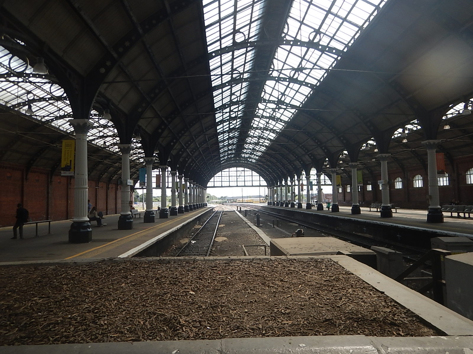
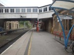
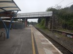
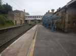
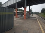
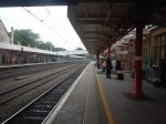
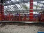
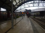
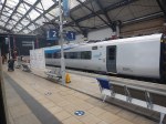
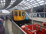
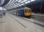
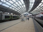
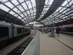
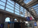
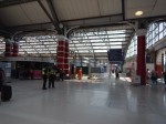
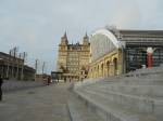
Liverpool Lime Street Station – 23rd May 2025
I took these pictures as I passed through Liverpool Lime Street station on Friday.


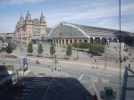
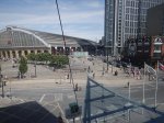


Note.
- The neo-classical building opposite the station is St. George’s Hall, which is Grade I Listed.
- Nikolaus Pevsner expressed his opinion that St. George’s Hall is one of the finest neo-Grecian buildings in the world.
- Lime Street station is Grade II Listed.
- The building with the two towers on the front of the station is the four-star Radisson RED Liverpool hotel.
- The statue in the last picture is of Ken Dodd and Bessie Braddock.
The large plaza between Liverpool Lime Street station and St. George’s Hall gives a big welcome to visitors to Liverpool.
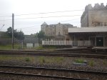
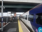
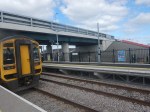
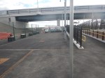
Lancaster Station – 23rd May 2025
I finally got to Lancaster station today, after my failure that I wrote about in An Annoying Day.
I took these pictures.
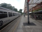
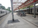
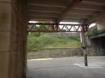
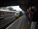
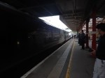
I shall deal with the features of the station in separate sub-sections.
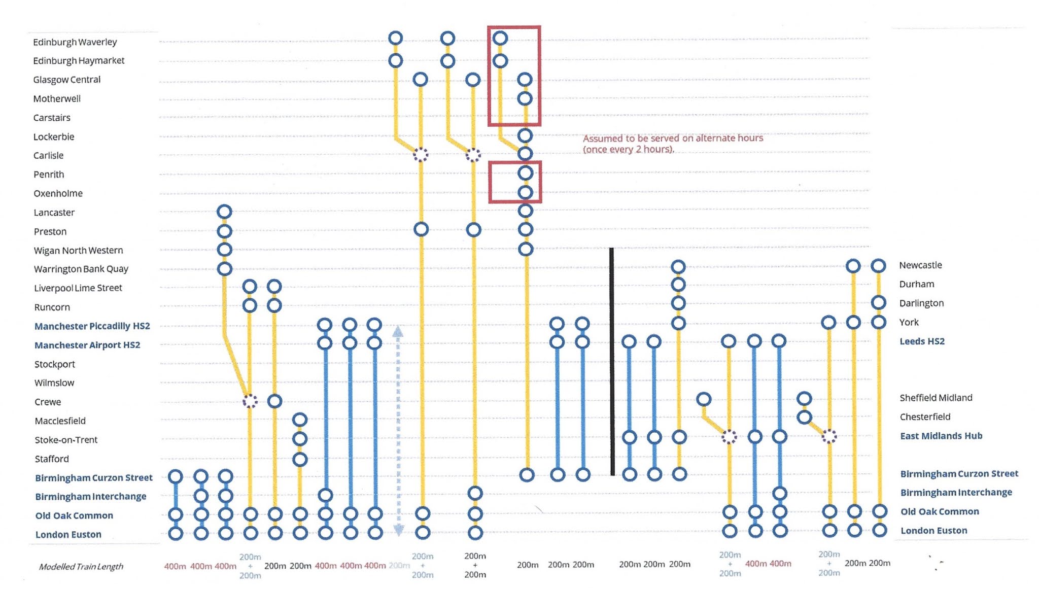
The Original High Speed Two Schedule Through Lancaster Station
This diagram shows High Speed Two services, as they were originally envisaged before Phase 2 was discontinued.
Note.
- Trains to the left of the vertical black line are Phase 1 and those to the right are Phase 2.
- Full-Size trains are shown in blue.
- Classic-Compatible trains are shown in yellow.
- Blue circles are shown, where trains stop.
- The dotted circles are where trains split and join.
- In the red boxes routes alternate every hour.
Click on the diagram to enlarge it.
If I look at the trains counting from the left of the diagram, I see the following trains passing or terminating at Lancaster station.
- Train 4 is a pair of classic-compatible trains, that split and join at Crewe, with one train going to Lancaster and the other to Liverpool Lime Street.
- Trains 10 and 11 are pairs of classic-compatible trains going between London and Scotland.
- Train 12 is a single classic-compatible train going between Birmingham and Scotland.
Only the Lancaster portion of Train 4 stops in Lancaster station.
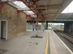
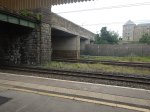
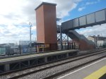
The Track Layout
This OpenRailwayMap shows the track layout through the station.
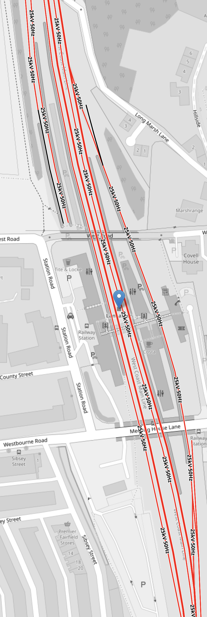
Note.
- Tracks shown in red are electrified and tracks in black or not.
- In the North-West corner of the map the two bay platforms 1 and 2, that are used for local services can be seen.
- Platform 3 is a long platform on the Western side of the station, which is generally for Northbound through stopping trains, that can take 265 metre long eleven-car Class 390 trains.
- Paired with the track through Platform 3, there is a Northbound avoiding line, that allows faster trains to overtake trains stopped in the station.
- Platform 4 is a long platform on the Western side of the island platform on the Eastern side of the station, which is generally for Southbound through stopping trains, that can take 265 metre long eleven-car Class 390 trains.
- Paired with the track through Platform 4, there is a Southbound avoiding line, that allows faster trains to overtake trains stopped in the station.
- Platform 5 is a long platform on the Eastern side of the island platform on the Eastern side of the station, that is over two hundred metres long.
- All through tracks have a 75 mph maximum speed, except for Platform 5, which is just 30 mph.
Click on the diagram to enlarge it.
How Will High Speed Two Operate At Lancaster Station?
I would expect that the three High Speed Two services to and from Scotland will go through Lancaster station on the avoiding lines, which will mean that each avoiding line will handle one High Speed Two classic-compatible train every twenty minutes.
The train, that terminates at Lancaster has a few options.
- It could terminate from London in any of platforms 3, 4 or 5.
- It could leave for London from any of the platforms 3, 4 or 5.
Note.
- All three platforms are long enough to accept a single High Speed Two classic-compatible train, which is only 200 metres long.
- There would probably need to be some works to the tracks so that trains could terminate in platforms 4 or 5.
- There might need to be some works to the tracks so that trains could leave from London from platform 3.
The logical way to terminate the train would probably for the train to arrive and leave in Platform 5, but then this would need improvements to the tracks and also to the passenger footbridge across the tracks.
Eden Project Morecambe And The Morecambe Branch
In a few years time, both the Eden Project Morecambe and High Speed Two will be open and I suspect, a day out could be to take High Speed Two to Lancaster and the local train to Morecambe for a day at the Eden Project Morecambe.
This paragraph from the Eden Project Morecambe web site, describes the current status of the project.
Eden Project Morecambe, previously known as Eden Project North, has been awarded £50m in the second round of the UK Government’s Levelling Up Fund. The funding allows the project to move into its next phase and begin the process of finalising the remaining funds required from private and philanthropic sources identified as part of the bidding process.
I had intended to take a train to Morecambe to have a look round, but the train, that I would have needed to catch to get back to London at a reasonable hour, didn’t run due to lack of train crew.
As High Speed Two will provide connections at Lancaster to Birmingham, Carlisle, Crewe, Edinburgh, Glasgow, London, Preston, Warrington and Wigan and other trains will provide connections to Leeds, Liverpool and Manchester, the Eden Project Morecambe will be well connected to those who might like to visit by rail.
A day out with the kids, could involve a trip on High Speed One to Lancaster, a trip on a battery-electric shuttle train to Morecambe and a day out at the Eden Project Morecambe.
The Eden Project Morecambe could be a big money earner for High Speed Two and other rail companies.
I would envisage, that you would be able to buy an All-in-One ticket to the Eden Project Morecambe, which included your rail tickets.
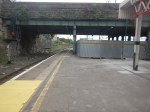
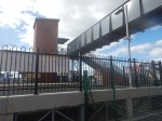
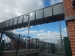
The Passenger Footbridge
There is a lift on the Southbound side, but on the Northbound and bay platform side, there are only steps.
If substantial numbers of passengers visit the station and need to cross the tracks on the footbridge, as you would from arriving in Platforms 4 or 5 and wanting to go to Eden Project Morecambe, the footbridge is totally inadequate.
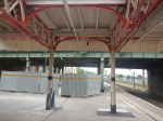
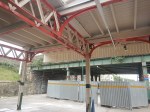
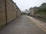
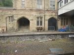
Lancaster Station Architecture
Lancaster station is Grade II Listed and you can see why from the pictures.
Work appears to be ongoing to refurbish the station.
The stonework appeared immaculate and very much High Speed Two-ready.

These picture shows part of the Costa coffee shop.
It was not what I expected.
Moorgate’s New Light-Controlled Crossing – 5th April 2025
I was on Moorgate this morning and took these extra pictures of the new pedestrian crossing.


It will certainly make it easier to cross the road.
Newsham Station – 30th March 2025
Today, I went to Newcastle and took a ride to the recently-opened ; Newsham station on the Northumberland Line.

Note.
- The road bridge over the railway.
- When complete there will be a lot of parking space.
- The orange bollards in the parking could be electric vehicle chargers, ready to be unveiled.
- The full step-free access over the railway via the lifts is already working.
- British Railways, its predecessors and many other countries would have just put in a level crossing.
- The Completed platform is wide.
- Both platforms already have a shelter.
- There are help points, information displays, facilities for those with limited hearing and readers for smart ticketing on both platforms.
- There is a ticket machine by both lift towers.
- The disabled parking is already marked out.
- The brickwork and other workmanship is top-class.
- There is space behind the platforms for taxis, buses and emergency service vehicles.
- There is enough clearance under the two bridges for overhead electrification.
There is still some finishing off and landscaping to do, but it is a station with everything.
I have some other thoughts.
The High Quality Lifts Are By Stannah
Several of the passengers I saw, were getting on in years.
Does the maker of the well-advertised stair-lifts use station lifts, which are likely to be used by those of reduced mobilility, as a promotional tool?
The Station Will Be One Of The Best Rural Stations In The UK, When It is Complete
I can see other stations on a similar theme being built.
Especially, where a level crossing is to be eliminated.
This Google Map shows the level crossing and former station at Six Mile Bottom, near where I used to live.
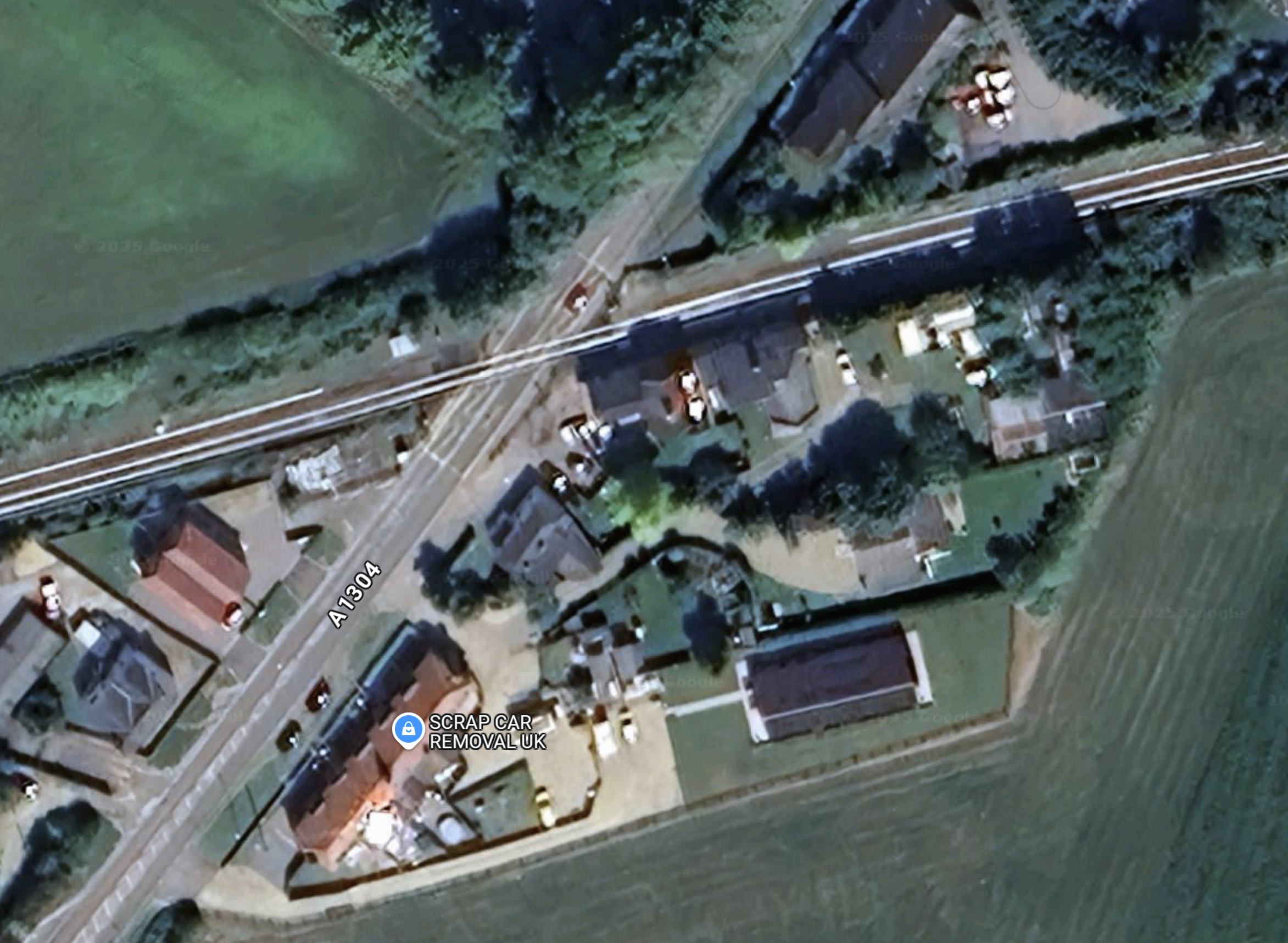
Note.
- The Cambridge and Newmarket railway goes across the map.
- Cambridge is to the West and Newmarket is to the East.
- The main Newmarket to London road crosses the railway here in a level crossing.
- Newmarket is to the North and London and the M11 is to the South.
- There used to be a station here and some want it back.
- There have been several incidents on the level crossing and Greater Anglia have had serious damage to more than one train.
A station like Newsham would be ideal here.
I can see Morgan Sindall building a few more on this theme.
Could they licence the design to construction companies all over the world?
I’ve certainly, seen similar layouts in Eastern Poland, where there are lots of level crossing accidents, according to our guide on one trip. But he said Russia is a lot worse for level crossing accidents.
Heathrow: Where Was The Redundancy?
In the early 1970s, I was involved in a small way, in the design of chemical plants for ICI.
When designing a chemical plant, you obviously want a plant that will have a high availability, so output is maximised, even if some parts have to be shut down.
With chemical plants, you might duplicate some reaction vessels, pipework or pumps for example.
But surely, when you are designing large infrastructure, it should be designed to keep going.
This document from Network Rail is entitled £140m Transformation Of Liverpool Lime Street Completed On Time.
These bullet points serve as sub-headings.
- Track, platform and signalling improvements
- Paving the way for bigger, better trains with more seats for more customers in future
- Part of the wider Great North Rail Project
- Part of #StationsDay – celebrating the £5.2billion investment to regenerate Britain’s rail stations
But I also believe two other important sub-projects were carried out during the work.
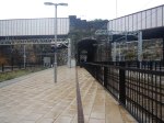
The Station Has Been Substantially Prepared For High Speed Two
Consider.
- Platforms were lengthened so they can accept 265.3-metre long eleven-car Class 390 trains.
- Platforms were widened, so they could handle the 607 passengers, that can be carried in an eleven-car train.
- There appears to be five full-size platforms numbered 6-10.
- Is there the possibility of a sixth platform, which is currently numbered E (for Emergency (?))?
- The approaches to the station have been remodeled, so trains can enter the station very efficiently.
- The Class 390 trains are going between Crewe and Liverpool Lime Street stations, in times that are not far off those expected from High Speed Two trains.
As Liverpool Lime Street will only need to handle half-length 200-metre long classic compatible High Speed Two trains, Liverpool Lime Street station is now ready for High Speed Two.
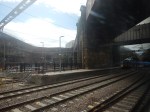
Liverpool Lime Street Station Is Now Effectively Two Five Platform Stations
This OpenRailwayMap shows the platform layout at Liverpool Lime Street station.
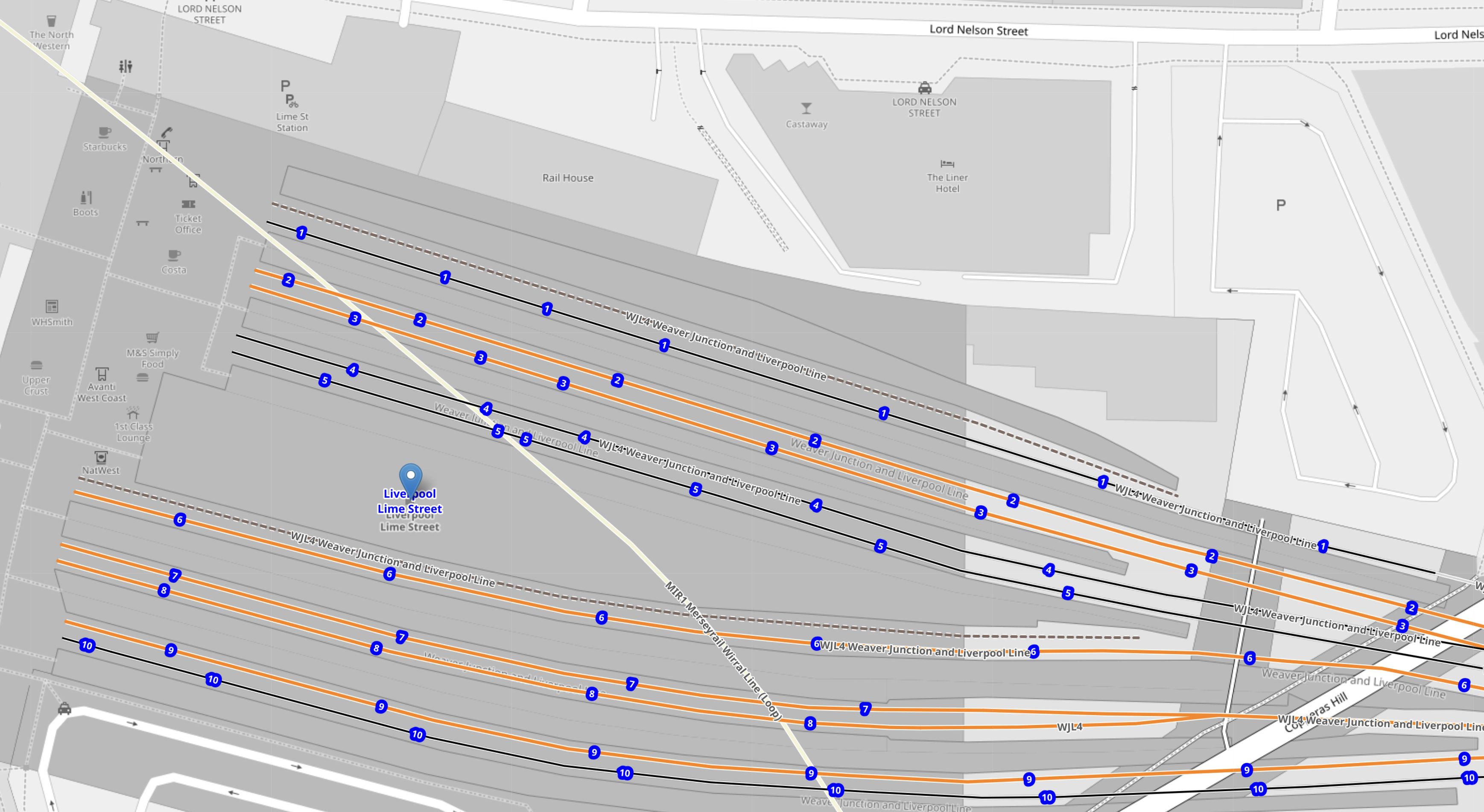
Note.
- The platforms indicated by blue dots with numbers are the ten platforms of the station.
- The platforms in the Northern-half of the station are numbered 1-5.
- The platforms in the Southern-half of the station are numbered 6-10.
- All platforms; 1-10 are electrified.
- The white line running diagonally across the map, shows the route of the loop of the Wirral Line.
Click the map to show it to a larger scale.
These are some of my pictures of the station.


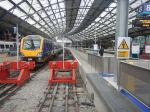

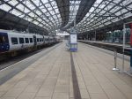
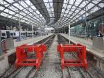

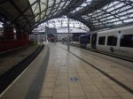
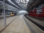


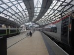
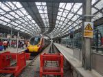


It is without doubt, one of the best stations aesthetically and operationally in the world.
