Could Anglia Railways’ London Crosslink Be Recreated As Part Of The London Overground?
This is the first paragraph of the Wikipedia entry for the original London Crosslink.
London Crosslink was a passenger train service operated by Anglia Railways between Norwich and Basingstoke, using the North London Line to bypass central London. Class 170 Turbostar diesel multiple units were used, and the service operated between 22 May 2000 and 28 September 2002, supported by funding from the Strategic Rail Authority through its Rail Passenger Partnership fund.
Note.
- The service called at Diss, Stowmarket, Ipswich, Colchester, Whitham, Chelmsford, Ingatestone, Romford, Stratford, Highbury & Islington, Camden Road, Willesden Junction, West Hampstead Thameslink, Brentford, Feltham, Staines, Woking, and Farnborough (Main)
- It ran six times on Monday to Friday and five times on Sunday.
- Feltham and Woking stations have a coach link to Heathrow.
- Journeys took around 3 hours and 44 minutes.
Over the years, attractions and other rail lines and stations served by the route have changed. improved and been added.
- In 2006, the Arsenal’s Emirates Stadium opened within walking distance of Highbury & Islington station.
- In 2012, the Olympic Stadium opened at Stratford and is now used by West Ham United.
- In 2020, Brentford Stadium opened within walking distance of Brentford station.
- There are long-term plans for a station at Brentford stadium.
- In 2022, Romford and Stratford stations were connected to the Elizabeth Line.
- In 2025, Beaulieu Park station was added to the Greater Anglia Main Line.
- In 2026, both ends of the route came under the control of Great British Railways.
At some point in the future, Old Oak Common Lane station will open to link the route to High Speed Two, the Great Western Main Line and the Elizabeth Line.
In Can The Signalling Of The London Overground Be Improved?, I looked in detail at the signalling of the London Overground and if it could handle more trains.
My conclusion was that on the East and North London Lines, another three trains per hour (tph) could probably be accommodated, which over an average day was probably around sixty trains.
As a restored London Crosslink would need just six paths per day, I would suspect the service could be restored, if it were thought to be a good idea.
I certainly feel that capacity would not be a problem.
These are a few other thoughts.
Will There Be Political Problems?
Providing the London Mayor approves, I can’s see any problem with Labour and I can’t see other parties objecting if passengers like it.
Would It Be Sensible To Use Lumo Branding And Trains?
Consider.
- Lumo is trusted branding.
- A five-car Lumo Class 803 train is 132 metres long and a pair of four-car London Overground Class 710 trains is 166 metres long, so I suspect platform length problems will be minimal.
- I doubt there will be problems on the Greater Anglia network.
- Stratford and Norwich is mainly a 100 mph network.
- Not all parts of the route have 25 KVAC overhead electrification, but batteries can be fitted to the Class 803 trains, that will cover any gaps.
- My calculations show that the modern trains will be twenty-two minutes quicker, than Anglia Railways Class 170 diesel trains.
- At one point Anglia Railways was owned by First Group, so FirstGroup may have knowledge of the problems of the route.
I believe it would be sensible to use Lumo branding and trains.
Could The Route Be Extended?
Consider.
- It could probably be extended to Winchester, Southampton and Bournemouth in the South.
- If offshore hydrogen takes off at Great Yarmouth, it might be worth extending with a reverse to Yarmouth in the North.
- Yarmouth has had a direct service from London in the past.
The service could also develop days out by the sea.
You Don’t Get Many Eleven Coach Trains
Apart from some Class 390 trains and perhaps a few others, that were built that way, eleven coach trains are fairly unusual in the UK.
So I was surprised to see this image of the 10:00 train from Liverpool Street to Norwich.
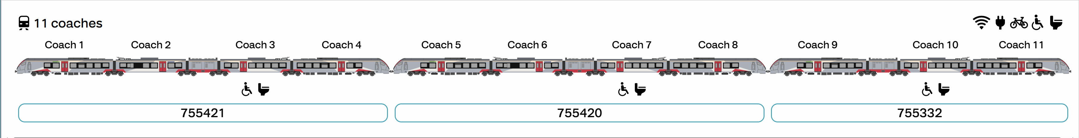
Note.
- I wrote about travelling in a pair of four-car Class 755 trains in A Pair Of Class 755 Trains At Liverpool Street Station.
- The normal trains on this route are twelve-car Class 745 trains, so they should fit all the stations.
- Both trains are 100 mph trains and Liverpool Street and Norwich is fully electrified, so this service will be zero-carbon.
It would appear that somebody is up to something.
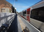
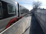
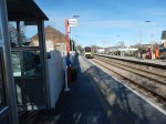
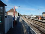
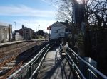
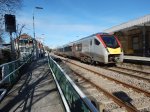
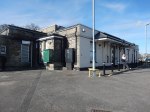
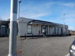
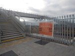
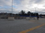
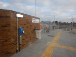
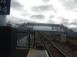
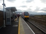
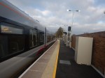
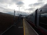
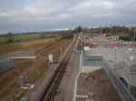
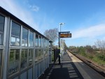
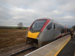
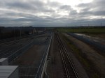
Saxmundham Station – 14th March 2025
On Friday, I went to Saxmundham to view the presentation of LionLink.
I took these pictures of Saxmundham station.
Note.
- The trains are two of Greater Anglia’s excellent Class 755 trains.
- The line is double track at Saxmundham station.
- The station building suffered a devastating fire 2018 and has since been rebuilt.
- Access between train and platform is step-free. See the gap fillers in the first two pictures.
- The tracks are crossed by the use of the level-crossing.
- There was a new comfortable and warm waiting room.
- There is a small car park.
- There is an hourly train in both directions to Ipswich and Lowestoft.
The station is in walking distance from the town.
These are my thoughts.
Extra Services
This OpenRailwayMap shows Saxmundham station and the Aldeburgh branch, which also serves the Sizewell power stations.

Note.
- The blue arrow indicates Saxmundham station.
- The yellow track is the East Suffolk Line.
- A disused branch line curves East, to the North of Saxmundham station and then South to the former site of Aldeburgh station.
- Sidings for Sizewell C construction trains will be built along this branch line.
Would it not be a good idea to reinstate the railway to Aldeburgh and run a second hourly train between Aldeburgh and Ipswich?
- There is space for a Platform 0 at Ipswich station.
- There is only the hourly Ipswich and Lowestoft train in both directions on the East Suffolk Line.
- Simple one platform stations would be needed at Leiston, Sizewell, Thorpness and Aldeburgh.
- There is probably enough double track for the extra train.
The current Ipswich and Saxmundham service takes about 34 minutes, so I suspect two trains would be needed for an Ipswich and Aldeburgh shuttle.
In the Wikipedia entry for Aldeburgh station, there is this paragraph.
In 1929 the LNER introduced luxurious Pullman day excursion trips from Liverpool Street to various seaside resorts. The service, known as the Eastern Belle, served Felixstowe on Mondays, Frinton and Walton on Tuesdays, Clacton on Wednesdays and Thorpeness and Aldeburgh on Thursdays and Fridays. The service ended in September 1939 when the Second World War broke out.
Perhaps not a Pullman service, but a kids special in the summer holidays.
Could Bealings Station Be Rebuilt?
Bealings station, which used to be between Westerfield and Woodbridge stations was closed in 1956.
This Google Map shows its location.

The station is now the Mallard House Business Centre.
Sizewell C – South Park And Ride
This document on the Planning Inspectorate web site, is a description of the Southern Park and Ride for the Sizewell C Project.
This Google Map shows the area of the Park-and-Ride site.
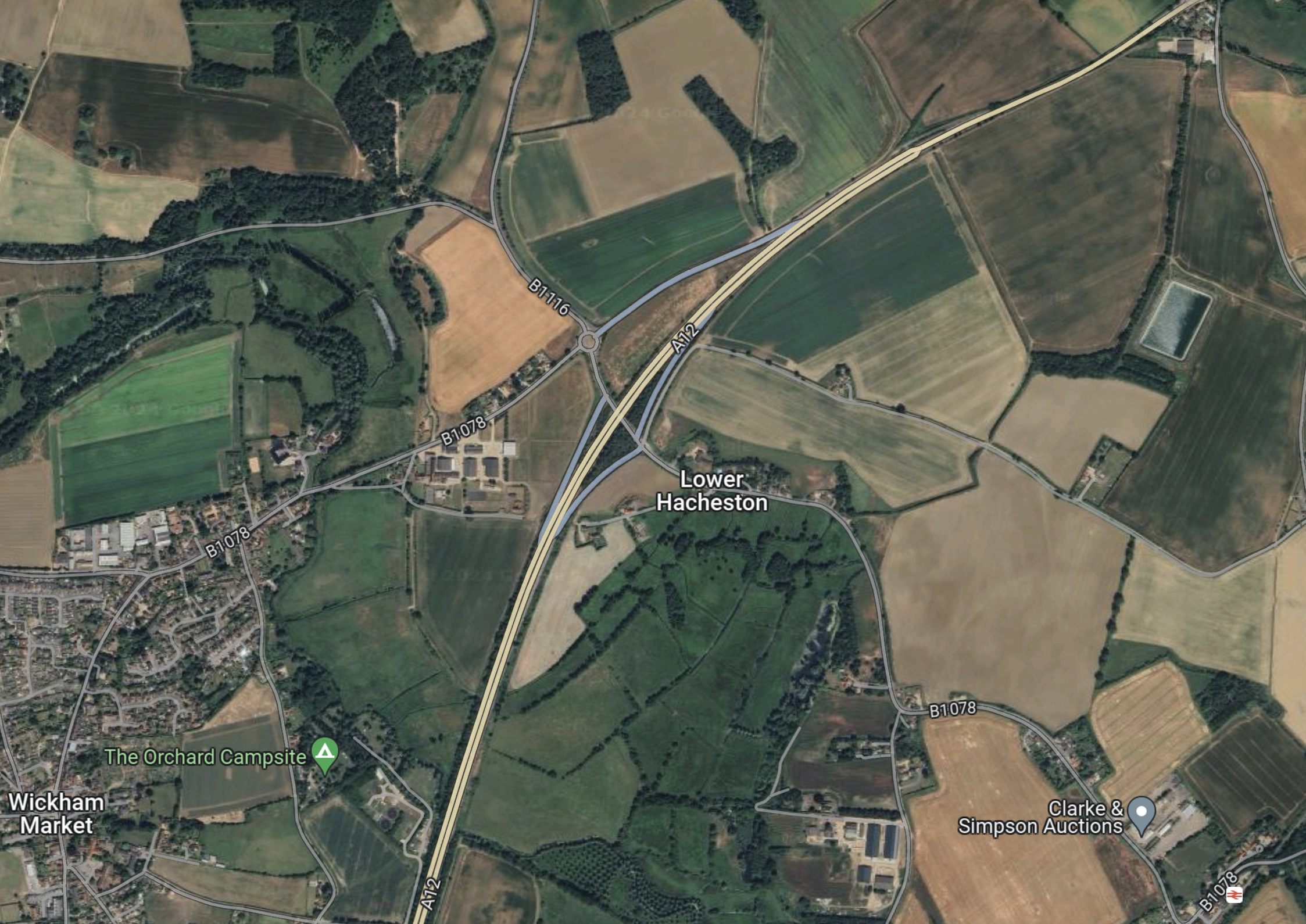
Note.
- Wickham Market is in the South-West corner of the map.
- The dual-carriageway is the Wickham Markey by-pass, which is part of the A12 between Ipswich and Lowestoft.
- Close to Lower Hacheston is the Northern junction of the by-pass which connects the B1116 and B 1078 roads to the A 12.
- If my memory serves me correctly, there is a small roundabout to the North of the A12, where the B 1116 and B 1078 cross, which is referred to as Fiveways Roundabout in some of the documentation.
- Wickham Market station is in the South-East corner of the map.
I know the area well, as I used to live less than ten miles to the West of Fiveways roundabout.
This shows the area to the North of Fiveways roundabout to a large scale.
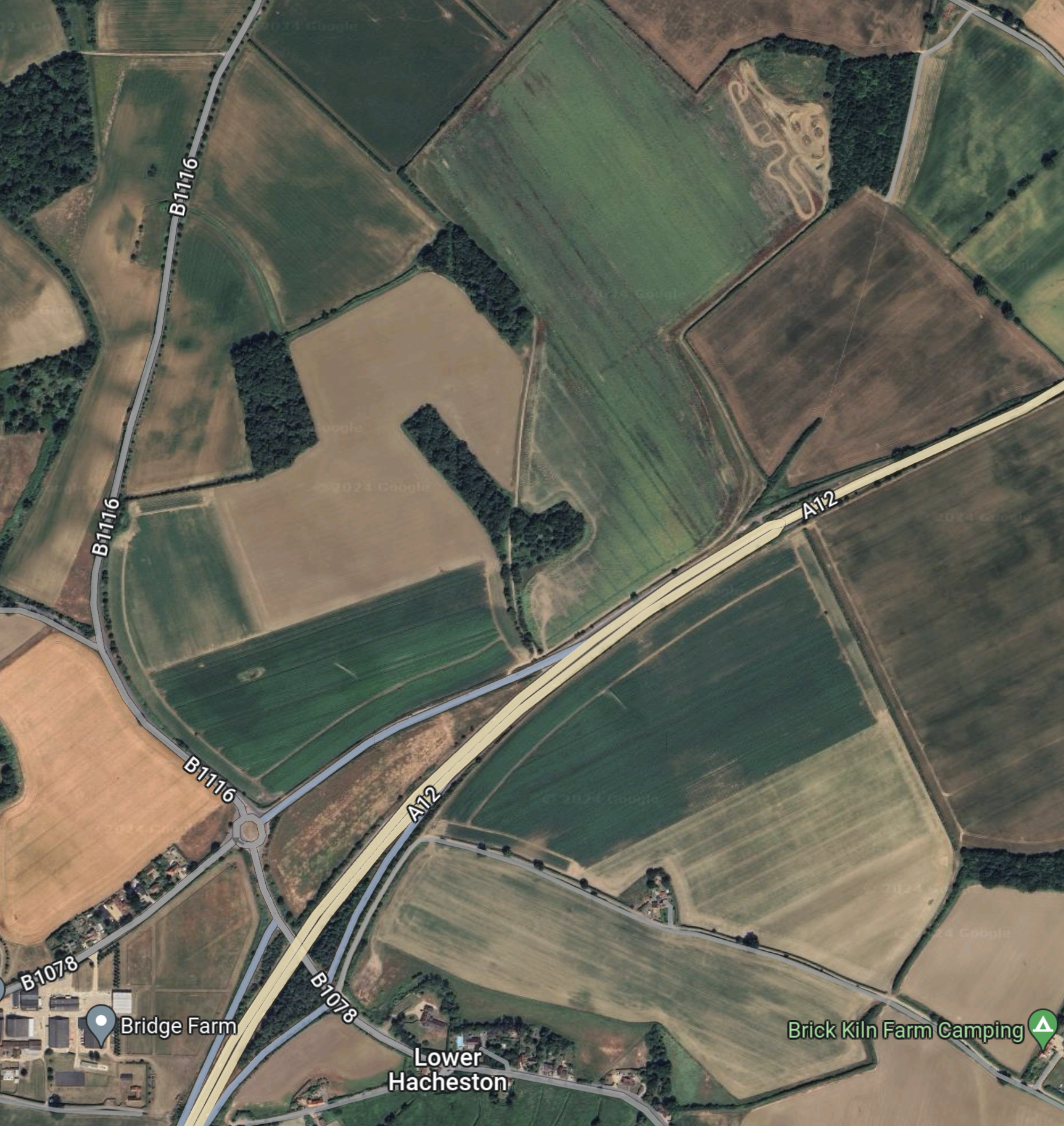
The document on the Planning Inspectorate says this about the site.
The site comprises approximately 26.4 hectares (ha) of predominantly
agricultural land and highway land located north-east of Wickham Market.
The part of the site which would contain the parking and buildings, postal
consolidation building and Traffic Incident Management Area (TIMA) is
approximately 18ha in size, and located to the east of the B1078/B1116, to
the north of the A12. The remainder of the site encompasses a section of
the A12, and an associated slip road where highway improvements are
proposed to form the site access, and associated signage and road
markings, see Chapter 1, Figure 1.1 of this volume.
These are my thoughts.
There Is No Rail Connection
I wrote about the Northern Park-and-Ride in Sizewell C – North Park And Ride and there is one big difference.
The Northern Park-and-Ride is an easy walk from Darsham station.
- Darsham station has an hourly four-car train to Lowestoft and Ipswich.
- Some or all trains could be doubled in capacity as Greater Anglia has enough stock to do this.
- If required, trains could be run to and from London and intermediate stations.
- In the past, Network Rail have developed plans to extend the service as far as Yarmouth.
I believe that a rail connection at the Southern Park-and-Ride could have added flexibility for workers in Ipswich travelling to the Sizewell site.
Bus Routes
The frequency and timing of park and ride buses would depend on the
working patterns adopted during construction of the Sizewell C main
development site, and the number of workers to be moved during the shift
changeover periods. More frequent services would operate during staff
changeover and shift start/end periods. It is anticipated that there would be
three to nine buses from the proposed development per hour during shift
changeover period, and an hourly service outside shift changeover periods.There would be a maximum of 100 daily bus arrivals and 100 daily bus
departures from the proposed development to the Sizewell C main
development site. These buses would use the A12, two village bypass and
Sizewell link road once operational to travel to and from the Sizewell C main development site.
This Google Map shows the A 12 between the South Park-and-Ride site and Yoxford.
Note.
- Yoxford is in the North-East corner of the map.
- Wickham Market is in the South-West corner of the map.
- The A 12 is the cream road linking the two villages.
- The Southern Park-and-Ride will be to the North-East of Wickham Market.
- The Northern Park-and-Ride is a couple of miles North of Yoxford.
- Yoxford and Wickham Market are 11.8 miles apart.
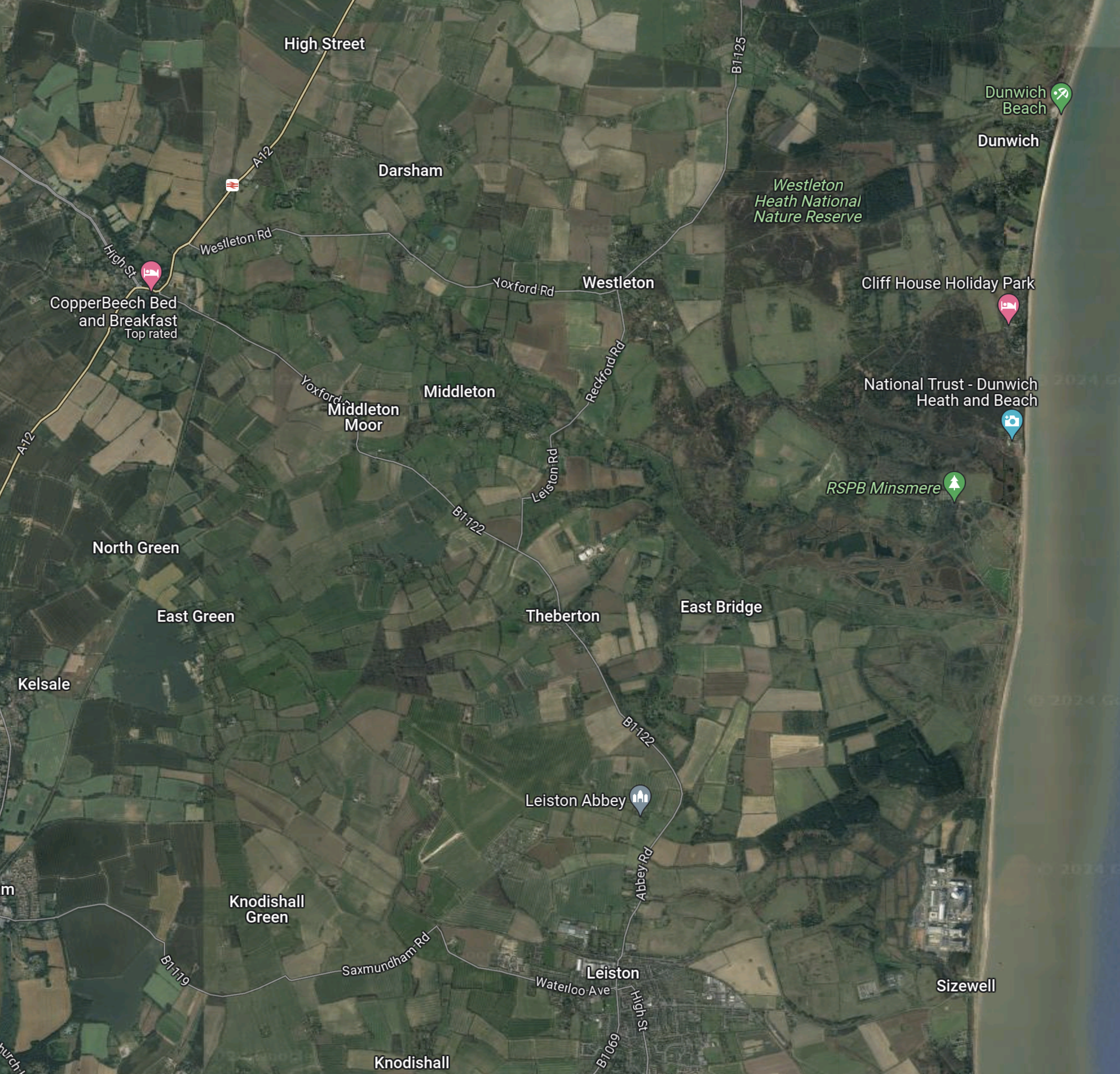
This third Google Map shows the route between Yoxford and Sizewell.
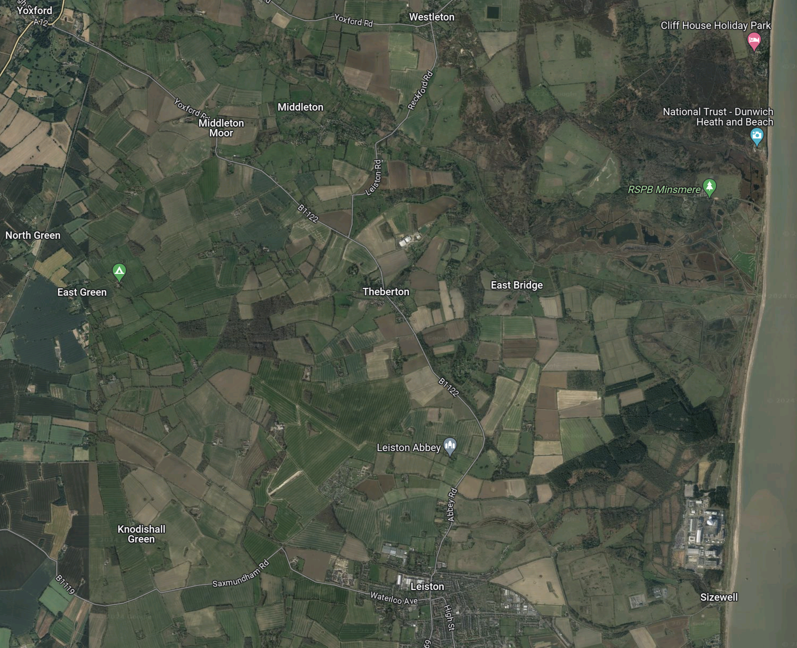
Note.
- Yoxford is in the North-West corner of the map.
- Sizewell is in the South-East corner of the map.
- Leiston Abbey is indicated by the arrow to the North of Leiston.
The B 1122 can be picked out through Middleton Moor and Theberton and then as it skirts Leiston Abbey.
It appears that both Park-and-Ride sites, use the same connection between the A 12 and Sizewell C.
Objections To The Park-and-Ride
This petition on change.org is entitled Stop Sizewell C Park and Ride at Wickham Market.
The petitioner is objecting on the following grounds.
- The size of the site.
- Spoiling of views.
- Disturbance to walkers and horse riders.
- Terrestrial ecology and ornithology will be affected by the site.
- Increase in traffic.
This was the petitioner’s conclusion.
In conclusion I oppose the Sizewell C southern park and ride site at Wickham Market and believe it should be sited further south on the A12 away from residential areas and near the A14.
The Ipswich Northern By-Pass
There is another large project scheduled for Ipswich in the next few years; the Ipswich Northern By-Pass.
This map clipped from the Ipswich Borough Council web site shows possible routes.

Note.
- Wickham Market is in the North-East corner of the map.
- One of the aims of the Northern by-pass is to open up land for housing.
- The railway between Ipswich and Darsham stations goes via Westerfield, Wiidbridge, Melton andWickham Market.
- Perhaps by phasing the developments, an area could be used for a Park-and-Ride, which has a road connection to the A 12.
- When the need for Park-and-Ride for Sizewell has decreased, the site could be handed over to housing.
It would certainly help, if the route of the Northern by-pass was settled soon.
Sizewell C – Where Will The Workers Live?
I have now written about, where the two Park-and-Ride sites are to be built.
- The Northern Park-and-Ride is proposed for Darsham.
- The Southern Park-and-Ride is proposed for Wickham Market.
I can now write about where the workers could be billeted.
I suspect there could be a Bibby Stockholm solution, where accommodation barges are used.
This Google Map shows the centre of Ipswich.
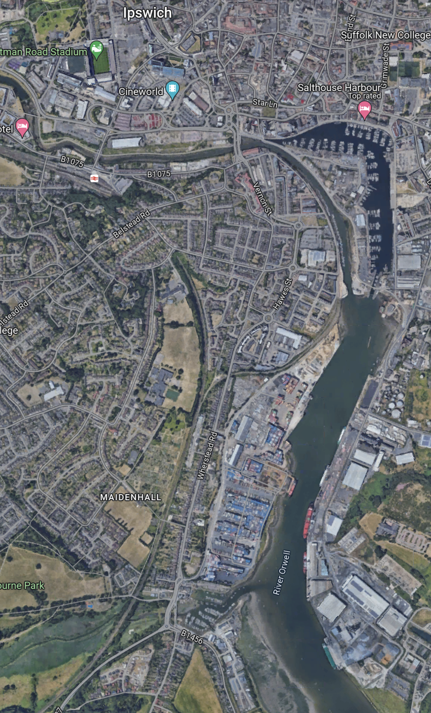
Note.
- There is a lot of space on the River Orwell.
- Ipswich station is in the North-West corner of the map.
- There could be a shuttle bus between the barge and the station.
- Trains could take workers to Darsham for buses to Sizewell.
There could even be direct buses to Sizewell.
This Google Map shows the centre of Lowestoft.
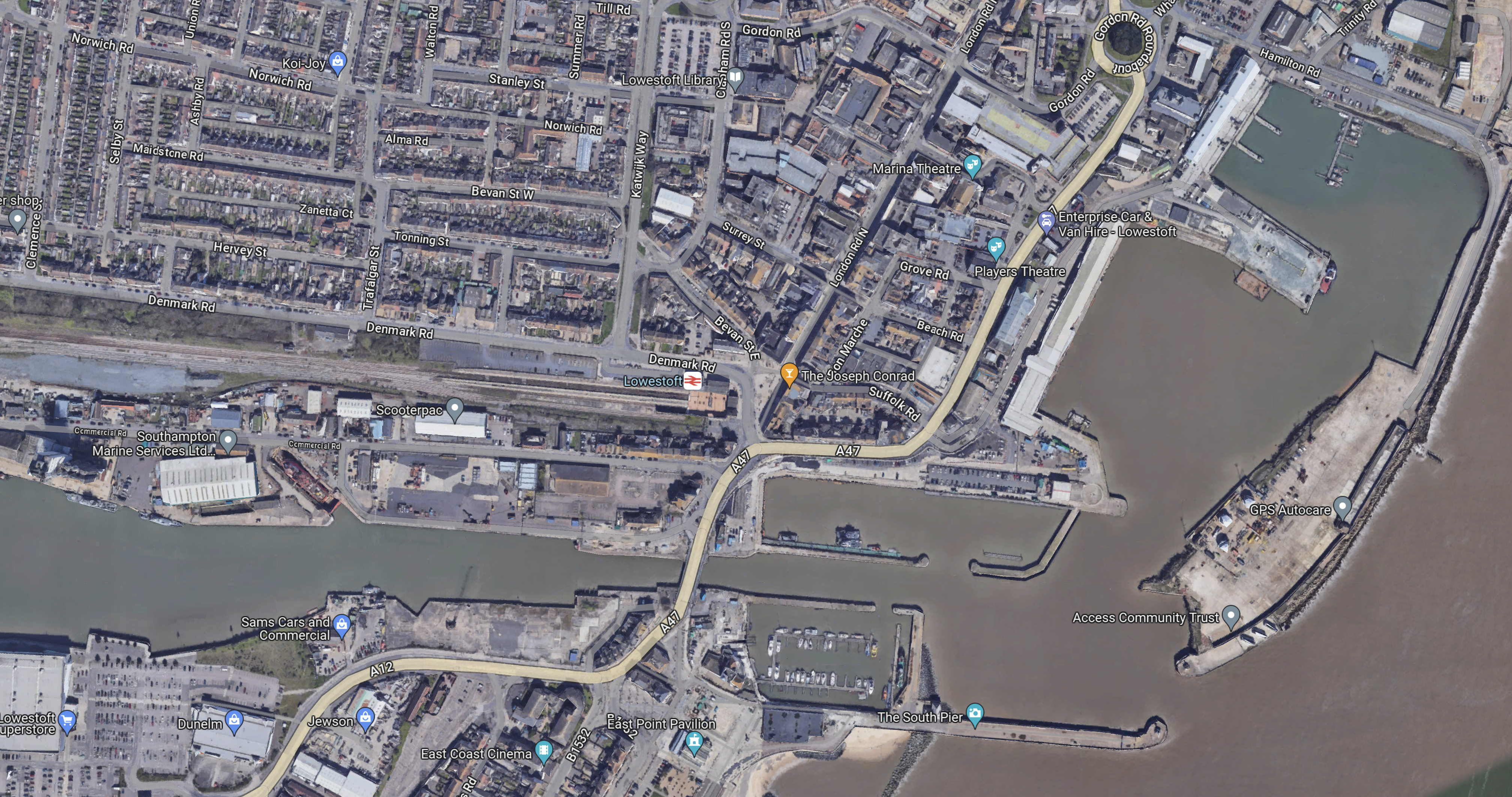
Note.
- The Bibby Stockholm is 100 metres long with a beam of 30 metres.
- Lowestoft station is close to the port.
Workers could take the train direct to the Northern Park-and-Ride for Sizewell C.
Sizewell C – North Park And Ride
This document on the Planning Inspectorate web site, is a description of the Northern Park-and-Ride for the Sizewell C Project.
This Google Map shows the area of the Park-and-Ride site.
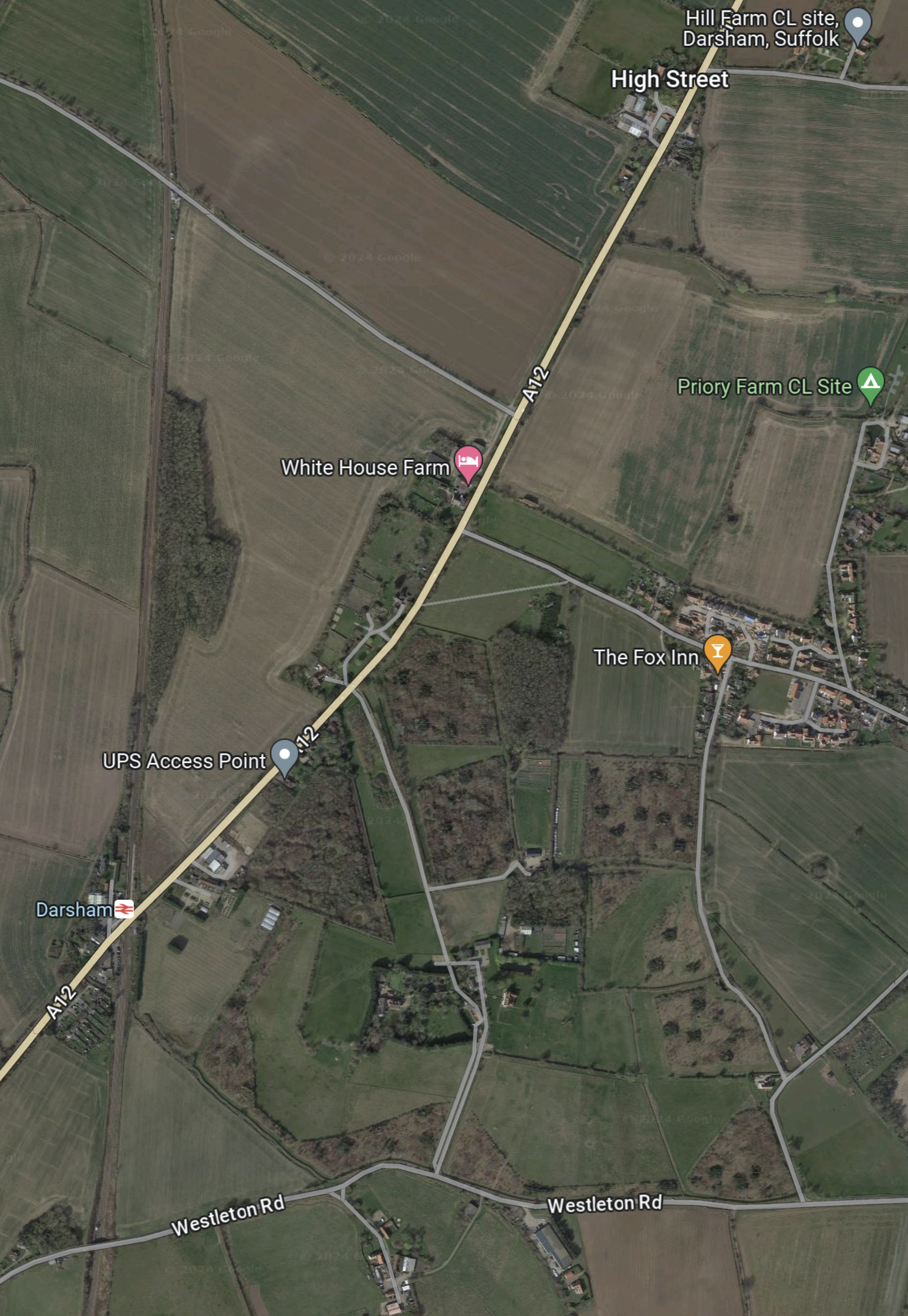
Note.
- The main road running SW-NE is the A 12 between Ipswich, Felixstowe and Woodbridge in the South and Lowestoft and Great Yarmouth in the North.
- The East Suffolk Line runs North-South at the West side of the map.
- Darsham station, which is indicated by the red logo on a white background is situated, where road and railway cross.
- The Fox Inn is in the village of Darsham and indicated by an orange arrow.
- The pink arrow to the North-West of the Fox Inn indicates White House Farm.
- The lane going North-West from the A 12 to the North of the farm is Willow Marsh Lane.
The document on the Planning Inspectorate says this about the site.
The site comprises approximately 27.9 hectares (ha) of predominantly
agricultural land but also includes sections of the A12 and Willow Marsh Lane
towards the north of the site. It is located west of the village of Darsham and
west of the A12, to the east of the East Suffolk line, and to the north of
Darsham railway station (see Chapter 1, Figure 1.1 of this volume). Further
detail on the site and the environmental baseline is provided in Chapters 1
and 4 to 12 of this volume of the Environmental Statement.
This second Google Map shows Darsham station.
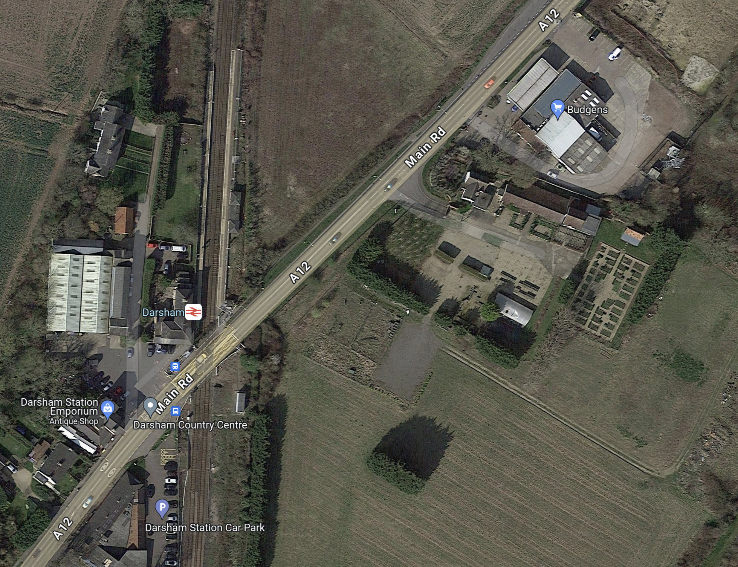
Note.
- Darsham station has long platforms.
- Crossing the line is by means of the level crossing.
- The Budgens store, which is indicated by the blue arrow also sells fuel.
- The station has a bus service.
- The Southern end of the Park-and-Ride site lies between the railway and the road at the North of the map.
The document on the Planning Inspectorate says this about walking between the Park-and-Ride site and the station.
There would be a pedestrian route from Darsham railway station along the
footway on the A12 to the south-east of the site. Pedestrians accessing the
site would leave the A12 and enter through a security gate provided in the
security fencing. Further details of access measures (such as key fobs,
CCTV, intercom system) would be agreed at the detailed design stage.
I could probably manage that at 76.
These are further thoughts.
The Current Rail Service
Currently, the rail service is as follows.
- One train per hour (tph) in both directions.
- |Trains are Class 755 trains, built by Stadler in Switzerland a few years ago.
- Each train can carry up to 229 passengers.
- Up to three trains can run together.
- Trains going to and from Lowestoft in the North call at Oulton Broad South, Beccles, Brampton and Halesworth.
- Trains going to and from Ipswich in the South call at Saxmundham, Wickham Market, Melton and Woodbridge.
- Travellers for London Liverpool Street change at Ipswich.
- The first train from London Liverpool Street would get you to Darsham at 11:00.
- This is not a bad train service but it could be improved.
Direct Trains Between London Liverpool Street And Lowestoft
In 2016, I wrote Making Sense Of The New East Anglia Franchise.
I wrote the following about Greater Anglia’s plans to run four trains per day between London Liverpool Street and Lowestoft.
There are going to be four direct services between London and Lowestoft each day. This probably initially means two trains to London in the morning peak and two trains back in the evening one.
When, I first moved back to Suffolk in the 1970s, I regularly caught a diesel-hauled train from Wickham Market to London for the day.
This is all motherhood and apple pie for those in Lowestoft wanting to go to London, but I suspect it isn’t the easiest service for a train operator to schedule efficiently and make money.
Would a train operator really want to start a full train at Lowestoft at say six in the morning and then have it wait around all day in London before returning in the evening?
The East Suffolk Line from Ipswich to Lowestoft has the following characteristics.
- It is fifty miles long.
- It is not electrified.
- It has a speed limit of 40-55 mph.
- There are nine intermediate stations. Many are just a single platform, and car parking is fairly limited.
- It has enough double-track and a passing loop at Beccles station to run a train in both directions at the same time.
- As it ran long trains in the past, I suspect, that most of the stations have platforms that can handle at least six-carriage trains.
- Trains would appear to take around ninety minutes for the whole journey
But the most important characteristic, is that every time the line is improved, more passengers come rushing out of the woodwork.
There would certainly be no problem with running bi-mode Flirts on this route, as London-Lowestoft is just the type of route for which they are designed.
- They would use their on-board diesel engines on the East Suffolk Line.
- As some would work along the busy lines to London, I suspect their top speed under electric power would be the same as the EMUs.
- Services to and from London, once on the Great Eastern Main Line, would join the high-speed race to and from the capital.
- At the start and finish of the day, the trains could use the electrified main line to position between Ipswich and Crown Point depot at around 100 mph.
- Abellio could use either a single three- or four-car train or perhaps two trains coupled together.
This service would pass through Darsham station, so it could provide a direct link between London and the Park-and-Ride.
It might also stop at stations like Manningtree, Colchester, Chelmsford and Stratford.
I am fairly certain, that a London Liverpool Street and Lowestoft services, that stopped at Darsham station, would improve labour availability and construction efficiency at Sizewell C.
A Connection To Yarmouth
There used to be a direct Yarmouth to Lowestoft Line, but now it is possible to use the Wherry Lines, with a reverse at Reedham station.
So will we be seeing the direct London-Lowestoft trains being extended to Yarmouth?
As Yarmouth hasn’t had a direct connection to London for years and there are lots of fast, capable new trains, I wouldn’t be surprised.
Especially, as Network Rail are talking about reinstating the Reedham Chord to create a more direct route between East Anglia’s largest North-Eastern towns. This is said about the Reedham Chord in Direct Yarmouth Services in the Wikipedia entry for Lowestoft station.
In January 2015, a Network Rail study proposed the reintroduction of direct services between Lowestoft and Yarmouth by reinstating a spur at Reedham. Services could once again travel between two East Coast towns, with an estimated journey time of 33 minutes, via a reconstructed 34-chain (680 m) north-to-south arm of the former triangular junction at Reedham, which had been removed in c. 1880. The plans also involve relocating Reedham station nearer the junction, an idea which attracted criticism.
If we take these current approximate timings.
- Ipswich to Lowestoft takes 90 minutes.
- Lowestoft to Reedham takes 27 minutes.
- Reedham to Yarmouth takes 16 minutes.
That means the service today would take 133 minutes, with a train reverse at Reedham station.
Note.
- Modern three-car bi-mode Flirt trains, with better speed, acceleration and braking than the current Class 170 trains.
- The short-cut along the Reedham Chord, which could save as much as ten minutes.
- A few selective improvements to save a minute here and there.
- Lowestoft station is redeveloped forty metres to the West and eighty metres to the South, as detailed in Wikipedia under Relocation Of The Station.
- I think it would be possible for an Ipswich-Yarmouth service to do the trip in around two hours.
The service would have the following characteristics.
- It would be timetabled for under the all-important two hours.
- Trains would turnround efficiently in a few minutes at either end of the line.
- It could be hourly with four trains or two-hourly with just two, used to run the service.
- All stops would be at the same minutes past each hour at each station.
- Trains would always leave Ipswich and Yarmouth at the same number of minutes past the hour.
- Lowestoft and Yarmouth get a regular hourly direct train service in just thirty-three minutes.
- Intriguingly if the trains left Ipswich and Yarmouth at the same time, they would pass each other at Beccles station, which incorporates a passing loop.
- As Beccles and its passing loop, fits so well into this schedule, I suspect that it was designed with the Reedham Chord and this type of service in mind.
- There would be no prizes for guessing the beer, that should be served on a train on this route.
I don’t think any better than an hourly service, could be run, without some extra passing loops or double-track.
This extension would make commuting between Sizewell and Yarmouth easier.
Bus Route Between Darsham And Sizewell
The document on the Planning Inspectorate says this about the buses and the route.
There would be a maximum of 100 daily bus arrivals and 100 daily bus
departures from the proposed development to the Sizewell C main
development site.Bus services between the proposed development and the Sizewell C main
development site would travel south on the A12 and use the new A12/B1122
roundabout (Yoxford Roundabout – see Volume 7 of the ES) to access the
B1122 and the Sizewell link road (once operational – see Volume 6 of the
ES) towards the Sizewell C main development site.
This Google Map shows Darsham station and the Sizewell site, as it exists today.
Note.
- The Sizewell site is in the South-East corner of the map.
- Darsham station is in the North-West corner of the map.
This second Google Map shows the A 12 between Darsham station and Yoxford.

Note.
- Darsham station is at the top of the map on the A 12.
- The village of Yoxford is on an S-bend of the A 12.
- A B& B is marked by a pink arrow.
The B 1122 connects Yoxford to the South-East corner of the map.
This third Google Map shows the route between Yoxford and Sizewell.
Note.
- Yoxford is in the North-West corner of the map.
- Sizewell is in the South-East corner of the map.
- Leiston Abbey is indicated by the arrow to the North of Leiston.
The B 1122 can be picked out through Middleton Moor and Theberton and then as it skirts Leiston Abbey.
Sizewell C seem to have made a good effort to get the workers to the site.
Why Isn’t A Passenger Train Run Between Ipswich And The Sizewell Site?
In Network Rail Prepares To Send Four Trains A Night Through Suffolk To Sizewell, I came to this conclusion.
I am fairly certain, that it is possible to move four freight trains in and out of the Sizewell site during the night, without doing any major works to the East Suffolk Line between Ipswich and Saxmundham junction.
- Adding extra track at Wickham Market would probably cause major disruption.
- Some level crossings will probably be improved.
But without a full double track between Ipswich and Saxmundham junction, I doubt there could be any increase in passenger services.
But with those track works, it might be possible to run an hourly service between Ipswich and Aldeburgh with calls at Westerfield, Woodbridge, Wickham Market, Saxmundham, Sizewell and Leiston.
This would give a two tph service between Saxmundham and Ipswich.
Objections To The Park-and-Ride
This document from Darsham Parish Council is entitled Consultation Response To Sizewell C.
This is the first paragraph.
Darsham Parish Council (Darsham PC) continues to oppose the proposed location of the Northern Park and Ride (NPR). We believe its location on an already busy single carriageway section of the A12 just north of the level crossing at Darsham Station, coupled with proposed roundabouts at Willow Marsh Lane and the A1120 junction in Yoxford are a recipe for traffic chaos extending northwards up the A12. We have no confidence in the traffic estimates submitted by EDF, which we believe underestimate the amount of local, through, agricultural and tourist traffic. This will be exacerbated by the proposed motel and further proposed development south of the station. We believe that traffic congestion on this main artery into Suffolk will adversely impact tourism throughout the AONB, which generates more than £360 million pa to the local economy (2018 figure). Further, we believe these volumes of traffic will generate excessive noise, vibration and pollution with serious negative impacts on those living alongside or close to the A12. Most significantly, Darsham PC has been advised that location of the NPR on this site could pose a significant flood risk to the railway (see below).
The Parish Council is also worried about flood risk to the railway.
The site of the NPR slopes down from Willow Marsh Lane towards the railway. A consulting engineer has advised us that the heavy clay soil here could pose a drainage and flood risk problem when compacted during the construction period. An appropriate sustainable semi-permeable surface could be utilised for car parking spaces to reduce run-off, with suitable drainage and reservoir capacity at the southern end to protect the railway from flooding. We submitted this evidence to EDF during the consultation period, but it has been ignored.
I suspect as with the opposition to Sizewell B, the opposition is led by second home owners, worried about the value of their investment.
Was Baldrick An Essex Man?
I have been looking at Network Rail’s page for Beaulieu Park station.
This is the heading.
Network Rail and Essex County Council are working together to develop proposals for the first railway station to be built on the Great Eastern main line for over 100 years.
These two paragraphs outline the project and where the finance is being obtained.
The new station is part of a wider regeneration of the Beaulieu Park estate in Chelmsford with new road infrastructure and up to 14,000 homes.
Essex County Council, in partnership with Chelmsford City Council, successfully secured £218m of funding from the Government’s Housing and Infrastructure (HIF) fund together with £34m contributions from the South East Local Enterprise Partnership and the developers of Beaulieu, Countryside and L&Q.
These features of Beaulieu Park station are listed on the page.
- Three platforms with a central loop line and new tracks to enable stopping services to call at the station while allowing fast trains to pass through unimpeded
- Step free access to all platforms via 2 lifts
- Accessible toilets, baby change facilities, waiting area and space for retail/catering
- Ticketing facilities, with ticket vending machines and a gate line
- Pedestrian and cycle access routes to the station
- 500 spaces for cycle parking and storage
- A bus interchange including bus stands for local services
- Pick up and drop off area with dedicated taxi bays
- Parking for over 700 cars, 5% of which to be designated Blue Badge bays, and motorcycle spaces, as well as dedicated parking for station staff, emergency services, and a dedicated space for service access.
Note.
- How many other parkway stations, other than Ebbsfleet International station have 700 parking spaces?
- The parking at Whittlesford Parkway can only hold 377 vehicles.
- How many other parkway stations have an overtaking loop for faster trains?
Beaulieu Park is not your average parkway station!
I have a few thoughts.
Which Of The Current Services Will Call?
The Network Rail page says this about services.
It will provide additional access to the railway with regular connections to the capital (only 40 minutes from London Liverpool Street station) and other destinations in the east of England. New tracks will enable stopping services to call at the station while allowing fast trains to pass through unimpeded.
Note.
- Trains between London and Hatfield Peverel station typically take under forty minutes.
- Two fast trains per hour (tph) between Liverpool Street and Norwich via Colchester, Ipswich and Stowmarket pass through.
- Only one of the fast trains stops at Chelmsford.
- Four stopping tph, one to each of Braintree, Clacton-on-Sea, Colchester Town and Ipswich pass through.
If all the stopping trains stopped, Beaulieu Park would have the following services.
- Braintree – 1 tph
- Chelmsford – 4 tph
- Clacton-on-Sea – 1 tph
- Colchester – 3 tph
- Colchester Town – 1 tph
- Hatfield Peverel – 1 tph
- Ingatestone – 2 tph
- Ipswich – 1 tph
- Kelvedon – 2 tph
- London Liverpool Street – 4 tph
- Marks Tey – 2 tph
- Romford – 1 tph
- Shenfield – 3 tph
- Stratford – 4 tph
- Witham – 4 tph
All trains are new Class 720 electric trains.
I also feel, that Network Rail could be being cunning.
Suppose, the Liverpool Street and Norwich express, that doesn’t stop at Chelmsford, stopped instead at Beaulieu Park.
- This would give an hourly express service between Beaulieu Park and Norwich, which stopped at Colchester, Manningtree, Ipswich, Stowmarket and Diss.
- It would also enable two tph between Beaulieu Park and Ipswich.
The 700 parking spaces at Beaulieu Park now start to make sense.
- Both Ipswich and Norwich stations are within walking distance of the town centres and the football grounds.
- Ipswich station has a shuttle bus service to the town centre and the hospital.
- Both stations have several local train services.
Beaulieu Park station appears to have been designed as a Park-and-Ride station for the Great Eastern Main Line and all its branches.
Services To And From Lowestoft
In Making Sense Of The New East Anglia Franchise, I looked in detail at Greater Anglia’s promises.
In a section, which is entitled London – Lowestoft – Yarmouth Services, I said this.
There are going to be four direct services between London and Lowestoft each day. This probably initially means two trains to London in the morning peak and two trains back in the evening one.
When, I first moved back to Suffolk in the 1970s, I regularly caught a diesel-hauled train from Wickham Market to London for the day.
This is all motherhood and apple pie for those in Lowestoft wanting to go to London, but I suspect it isn’t the easiest service for a train operator to schedule efficiently and make money.
Would a train operator really want to start a full train at Lowestoft at say six in the morning and then have it wait around all day in London before returning in the evening?
The service hasn’t started.
Services To And From Cambridge Or Peterborough
At some time in the last decade, one of the predecessors of Greater Anglia, used to run a service to Peterborough via Colchester and Ipswich, so that travellers in Essex could catch trains to the North.
Given too that Cambridge has an employment problem, if a service was run, it might attract passengers.
The Class 755 trains Could Serve Bury St. Edmunds, Cambridge, Lowestoft, Newmarket, Peterborough And Yarmouth
Consider.
- A pair of Class 755 trains would leave Liverpool Street.
- They would use electric power to run to Ipswich.
- The trains would run in one of the paths of the current hourly Ipswich service.
- Like their all electric siblings; the Class 745 trains, they would probably run most of the journey at near 100 mph.
- At Ipswich the trains would split.
- One train would go to on to Lowestoft and Yarmouth and the other would go to Cambridge and Peterborough.
If passenger numbers felt it was a good idea, I’m certain, it could be timetabled.
The Chelmsford Avoiding Line
In Will The Chelmsford Avoiding Line Be Rebuilt?, I described the avoiding line, that used to be between the two tracks at Chelmsford station.
It probably saved a few minutes, by allowing fast expresses to pass stopping trains.
Effectively, a new avoiding line is being built at Beaulieu Park, a few miles from the original position at Chelmsford.
So will the fast expresses save a few minutes?
Could The Elizabeth Line Run To Beaulieu Park?
Consider
- The end sections of the Elizabeth Line seem to be busy, as I wrote in Very Busy Lizzie.
- The City of Chelmsford is between Shenfield and Beaulieu Park.
- Paddington and Reading is 35.9 miles.
- Liverpool Street and Hatfield Peverel is 35.9 miles.
So Beaulieu Park is actually closer to London than Reading.
Perhaps, at some time in a few years, passenger traffic between Beaulieu Park and Shenfield will be such, that the Elizabeth Line will be extended to Beaulieu Park.
The ideal service from Beaulieu Park would surely be two tph to Heathrow, as getting to Heathrow from East Anglia by train needs a change at Liverpool Street.
The only drawback is that to work effectively on the Great Eastern Main Line, a sub-variant of the Class 345 trains will be needed with a 100 mph operating speed. I wrote about these trains in Extending The Elizabeth Line – High Speed Trains On The Elizabeth Line.
But they may have the advantage of being able to take the fast lines between Shenfield and Stratford.
Conclusion
Beaulieu Park may just look like any other station to serve a housing development.
But it’s a lot more than that!
- It’s a Park-and-Ride for the whole Great Eastern Main Line and London.
- It should speed up expresses between London and Colchester, Ipswich or Norwich.
- It should improve local connectivity.
- It could take a lot of traffic off the nearby A12.
- It could give the City of Chelmsford its own local metro.
- It could give Heathrow a direct link to much of Essex.
- How much carbon will be saved by passengers?
We need many more well thought out Park-and-Ride stations.
Could Greater Anglia Run A Comprehensive Service For East Anglia?
Consider.
- In the last fifty years, there have been direct trains between London Liverpool Street and Lowestoft stations.
- In the last forty years, there have been direct trains between London Liverpool Street and Peterborough stations.
- Greater Anglia currently run an hourly train between London Liverpool Street and Ipswich stations, with stops at Stratford, Shenfield, Chelmsford, Hatfield Peverel, Witham, Kelvedon, Marks Tey, Colchester and Manningtree
- Frequencies on both routes were not high and less than four trains per day (tpd), but they must have been a demand for these services.
- Greater Anglia promised to run a Lowestoft service, when they successfully reapplied for the franchise.
- Greater Anglia have 38 Class 755 trains, of which 14 are three-cars and 24 are four-cars.
- Class 755 trains can run in twoses and possibly threeses. (Suffolk dialect for twins and triplets!)
Could these elements be assembled to provide a comprehensive East Anglia service?
- A pair of Class 755 trains would leave Liverpool Street for Ipswich.
- They would takeover some of the paths of the hourly Liverpool Street and Ipswich service and run possibly about four or five tpd, according to demand.
- Between Liverpool Street and Ipswich the trains could stop at Stratford, Shenfield, Chelmsford, Hatfield Peverel, Witham, Kelvedon, Marks Tey, Colchester and Manningtree
- The services would splitgoing North and join going South at Ipswich
- One train would go to Peterborough with stops at Needham Market, Stowmarket, Elmswell, Thurston, Bury St. Edmunds, Soham, Ely, Manea, March and Whittlesea.
- The other would go to Lowestoft with stops at Woodbridge, Melton, Wickham Market, Saxmundham, Darsham, Halesworth, Brampton, Beccles and Oulton Broad South.
Note.
- The Class 755 trains would use electricity, where electrification exists.
- They would use diesel on lines without electrification.
- They would be able to hold 100 mph, so wouldn’t delay other trains.
- Seventeen towns would get new direct services to and from London.
- A Class 745 train is 236.6 metres long, whereas a pair of four-car Class 755 trains is only 161.4 metres.
- A three-train formation of Class 755 trains is only 5.5 metres longer than a single Class 745 train.
I am fairly sure no new substantial infrastructure would be required.
I have some further thoughts.
Example Timings
These timings to and from London are based on current timings of the Class 745 and 755 trains.
- Ipswich – 60 mins
- Stowmarket -70 mins
- Bury St. Edmunds – 88 mins
- Soham – 108 mins
- Ely – 117 mins
- March – 136 mins
- Peterborough – 158 mins
- Woodbridge – 75 mins
- Melton – 80 mins
- Wickham Market – 86 mins
- Saxmundham – 97 mins
- Darsham – 104 mins
- Halesworth – 113 mins
- Brampton – 119 mins
- Beccles – 128 mins
- Oulton Broad South – 138 mins
- Lowestoft – 146 mins
Notes.
- Times to and from Ipswich are based on typical services at the current time.
- I have assumed that there are no stops South of Ipswich.
- Saxmundham is the closest station to Sizewell and could be important in bringing in construction workers for Sizewell C.
I think some of the times like those to and from Bury St. Edmunds, Ipswich, Lowestoft, Saxmundham and Woodbridge could create popular routes.
Battery-Electric Trains
Consider.
- I wrote about Stadler’s expertise with battery-electric trains in Stadler FLIRT Akku Battery Train Demonstrates 185km Range.
- 185 km. is 115 miles.
- The Class 756 trains for Transport for Wales are similar trains to the Class 755 trains fitted with batteries.
- In Battery Power Lined Up For ‘755s’, I wrote about plans to put batteries in the Class 755 trains.
These sections of lines are not electrified on the routes I have talked about.
- Haughley Junction and Ely – 38 miles
- Ely and Peterborough – 30.5 miles
- Westerfield and Lowestoft – 38 miles
As there is electrification at Ely, Haughley, Peterborough and Westerfield and South to London, I am fairly certain the route could be run by battery-electric trains.
Electrification To Sizewell C
In the January 2023 Edition of Modern Railways, there is an article, which is entitled Rail Set To Support Sizewell C Construction.
It details how sidings will be built to support the construction, with up to four trains per day (tpd), but the electrification word is not mentioned.
This is surprising to me, as increasingly, big construction projects are being managed to emit as small an amount of carbon as possible. High Speed Two is being built this way and I suspect Rolls-Royce’s SMR design will minimise carbon emissions during manufacture and construction. It will be very surprising if Sizewell C doesn’t follow High Speed Two’s example. After all, it may be an isolated site, but in Sizewell B, it’s got one of the UK’s biggest carbon-free electricity generators a couple of hundred metres away.
The writer of the Modern Railways article, thinks an opportunity is being missed.
I feel the following should be done.
- Improve and electrify the East Suffolk Line between Ipswich and Saxmundham Junction.
- Electrify the Aldeburgh Branch Line and the sidings to support the construction or agree to use battery-electric or hydrogen zero-carbon locomotives.
One of the collateral benefits of electrifying from Ipswich to Saxmundham Junction, is that it will make it easier for battery-electric Class 755 trains to work Ipswich and Lowestoft services.
- If the trains were to leave Saxmundham Junction going North with a full battery, they should be able to travel to Lowestoft and return.
- Battery-electric Class 755 trains could bring in workers from Ipswich or Lowestoft and further afield.
- It could even leave behind a zero-carbon branch line to Sizewell, Leiston and Aldeburgh, with two tph to Ipswich.
Sizewell C could be a superb demonstration project for low-carbon construction!
The Lowestoft-Great Yarmouth Conurbation
The Wikipedia entry for Lowestoft says this about the town.
The estimated population in the built-up area exceeds 70,000. Its development grew with the fishing industry and as a seaside resort with wide sandy beaches. As fishing declined, oil and gas exploitation in the North Sea in the 1960s took over. While these too have declined, Lowestoft is becoming a regional centre of the renewable energy industry.
Whilst the Wikipedia entry for Great Yarmouth says this about the town.
Great Yarmouth, often called Yarmouth, is a seaside town and unparished area in, and the main administrative centre of, the Borough of Great Yarmouth in Norfolk, England; it straddles the River Yare and is located 20 miles (30 km) east of Norwich. A population of 38,693 in the 2011 Census made it Norfolk’s third most populous. Its fishing industry, mainly for herring, shrank after the mid-20th century and has all but ended.[3] North Sea oil from the 1960s supplied an oil-rig industry that services offshore natural gas rigs; more recently, offshore wind power and other renewable energy industries have ensued.
Wikipedia also said this about the population of the wider Great Yarmouth.
The wider Great Yarmouth borough had a population of around 92,500, which increased to 97,277 at the 2011 census.
Taken together they are one of the largest conurbations in East Anglia.
The main means of transport between the two towns is by road.
Surely, two towns of over 70,000 people, who are only a few miles apart need a rail connection.
Onward From Lowestoft To Great Yarmouth
If the comprehensive East Anglia service, I’m discussing is to be truly comprehensive, it must serve the Norfolk Broads and Great Yarmouth.
This would also improve the connectivity between two of the largest coastal towns in East Anglia, that I indicated in the last section.
This OpenRailwayMap shows a cunning plan proposed by Network Rail to connect Lowestoft and Great Yarmouth.
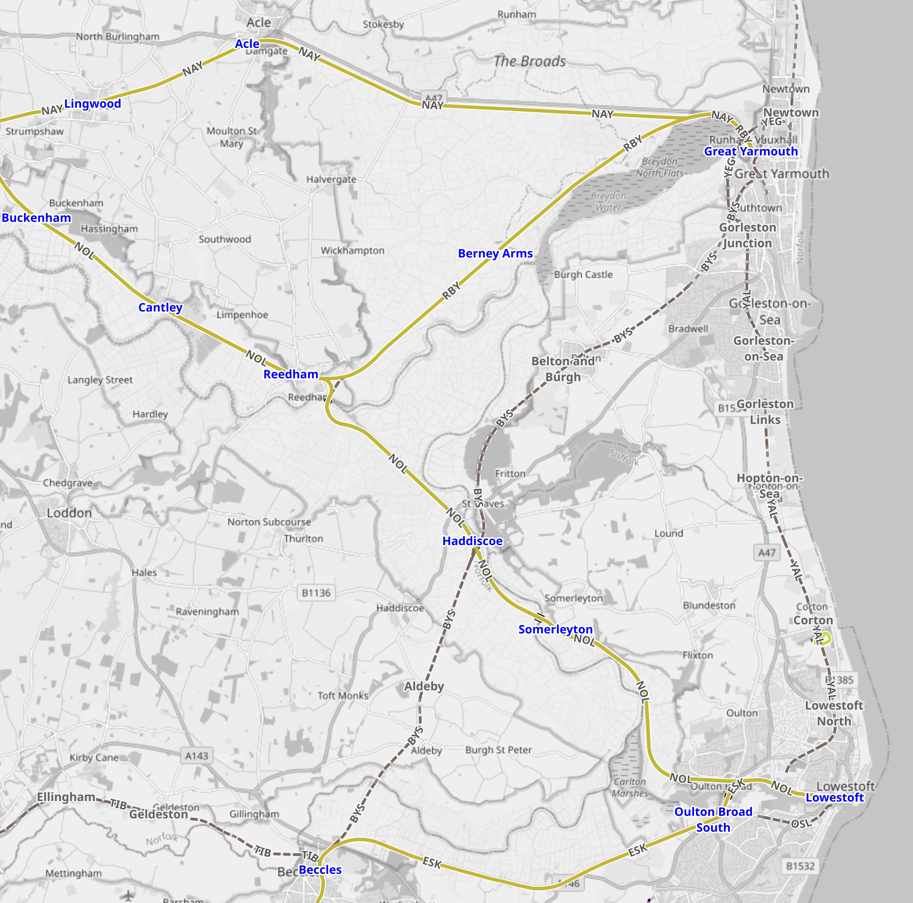
Note.
- Great Yarmouth is in the North East corner of the map.
- Two lines lead West from Great Yarmouth station, with the more Northerly route going direct to Norwich and the more Southerly one going to Norwich via Berney Arms and Reedham.
- Lowestoft is in the South East corner of the map.
- Two lines lead West from Lowestoft station, with the Northern route going to Norwich via Reedham and the Southern one going to Ipswich via Oulton Broad South.
- The route of a coastal railway connecting the two towns is also shown.
Network Rail’s cunning plan is indicated on this second nap from OpenRailwayMap.
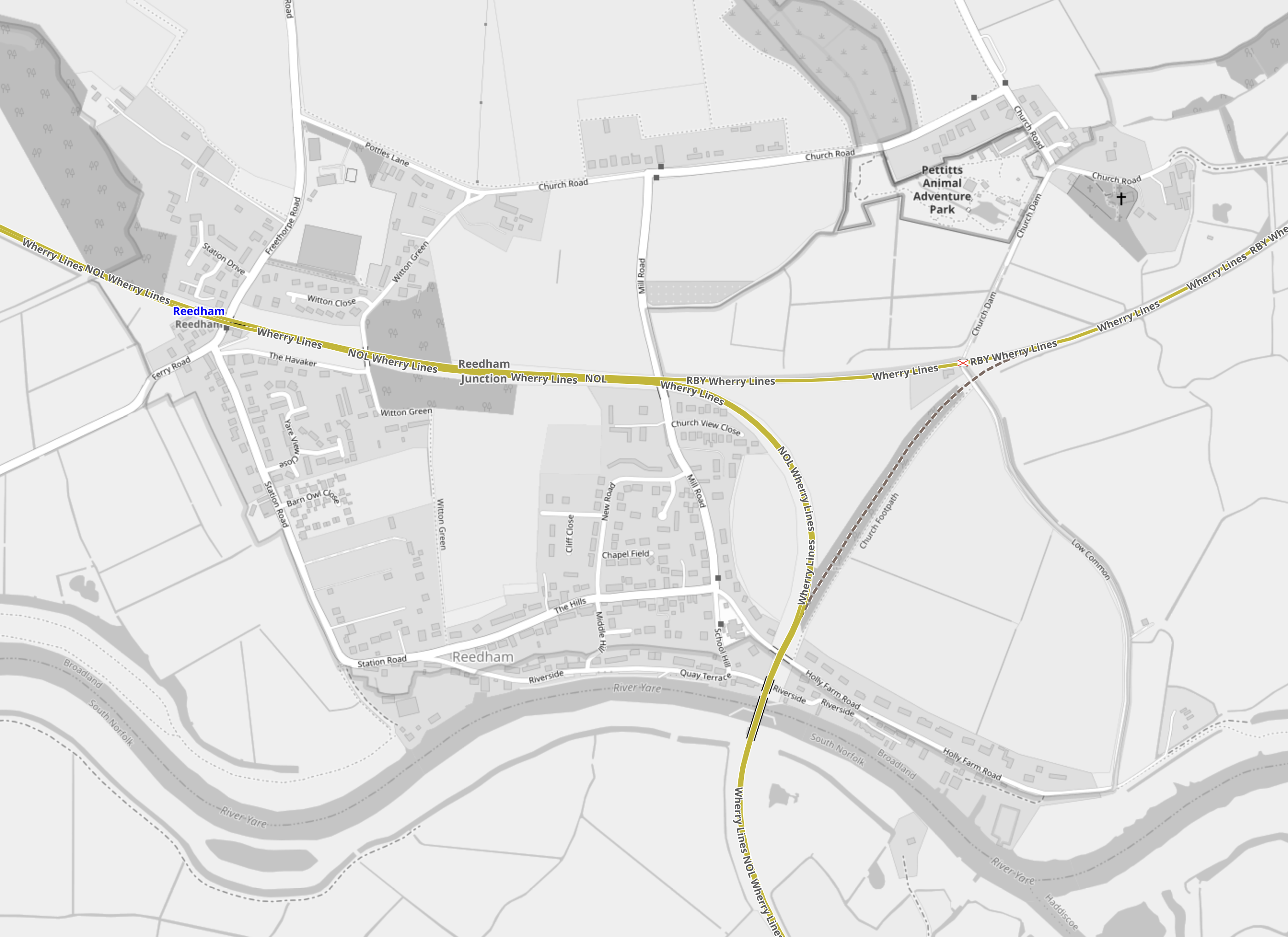
Note.
- Reedham station is in the North-West corner of the map on the line to Norwich.
- To the East of the station is a triangular junction.
- The track from the North-East corner of the junction is the line to Great Yarmouth.
- The track from the Southern corner of the junction is the line to Lowestoft.
- Unfortunately, the South-Eastern leg of the junction was removed in 1880.
In Norfolk Rail Line To Remain Closed As £68m Upgrade Project Overruns, I said this.
Network Rail are talking about reinstating the Reedham Chord to create a more direct route between East Anglia’s largest North-Eastern towns. This is said about the Reedham Chord in Direct Yarmouth Services in the Wikipedia entry for Lowestoft station.
In January 2015, a Network Rail study proposed the reintroduction of direct services between Lowestoft and Yarmouth by reinstating a spur at Reedham. Services could once again travel between two East Coast towns, with an estimated journey time of 33 minutes, via a reconstructed 34-chain (680 m) north-to-south arm of the former triangular junction at Reedham, which had been removed in c. 1880. The plans also involve relocating Reedham station nearer the junction, an idea which attracted criticism.
This sounds a good plan to me.
- It would allow direct services between Lowestoft and Great Yarmouth.
- It would allow direct services between Ipswich and Great Yarmouth with a reverse at Lowestoft in about two hours.
- With possible charging at Lowestoft and/or Great Yarmouth, a scenic route could be created between Ipswich and Norwich for battery-electric Class 755 trains. If that doesn’t get people out of their cars then nothing will!
- Various leisure, tourism and work-related opportunities would be created.
Never in the field of railway engineering would such a small chord have given so much.
Sizewell C Issues
Sizewell C will be a massive project and I also suspect that like High Speed Two, it will be built in a manner that will be zero-carbon where possible.
We already know from the Modern Railways article, that four tpd will shuttle material to a number of sidings close to the site. This is a good start.
Since Sizewell A opened, trains have regularly served the Sizewell site to bring in and take out nuclear material. These occasional trains go via Ipswich and in the last couple of years have generally been hauled by Class 88 electro-diesel locomotives.
It would be reasonable to assume that the Sizewell C sidings will be served in the same manner.
But the route between Westerfield Junction and Ipswich station is becoming increasingly busy with the following services.
- Greater Anglia’s London and Norwich services
- Greater Anglia’s Ipswich and Cambridge services
- Greater Anglia’s Ipswich and Felixstowe services
- Greater Anglia’s Ipswich and Lowestoft services
- Greater Anglia’s Ipswich and Peterborough services
- Freight services serving the Port of Felixstowe, which are expected to increase significantly in forthcoming years.
But the Modern Railways article says this about Saxmundham junction.
Saxmundham junction, where the branch meets the main line, will be relaid on a slightly revised alignment, retaining the existing layout but with full signalling giving three routes from the junction protecting signal on the Down East Suffolk line and two in the Down direction on the bidirectional Up East Suffolk line. Trap points will be installed on the branch to protect the main line, with the exit signal having routes to both running lines.
Does the comprehensive signalling mean that a freight train can enter or leave the Sizewell sidings to or from either the busy Ipswich or the quieter Lowestoft direction in a very safe manner?
I’m no expert on signalling, but I think it does.
- A train coming from the Lowestoft direction needing to enter the sidings would go past Saxmundham junction on the Up line. Once clear of the junction, it would stop and reverse into the branch.
- A train coming from the Ipswich direction needing to enter the sidings would approach in the wrong direction on the Up line and go straight into the branch.
- A train leaving the sidings in the Lowestoft direction would exit from the branch and take the Up line until it became single track. The train would then stop and reverse on to the Down line and take this all the way to Lowestoft.
- A train leaving the sidings in the Ipswich direction would exit from the branch and take the Up line all the way to Ipswich.
There would need to be ability to move the locomotive from one end to the other inside the Sizewell site or perhaps these trains could be run with a locomotive on both ends.
The advantage of being able to run freight trains between Sizewell and Lowestoft becomes obvious, when you look at this Google Map, which shows the Port of Lowestoft.
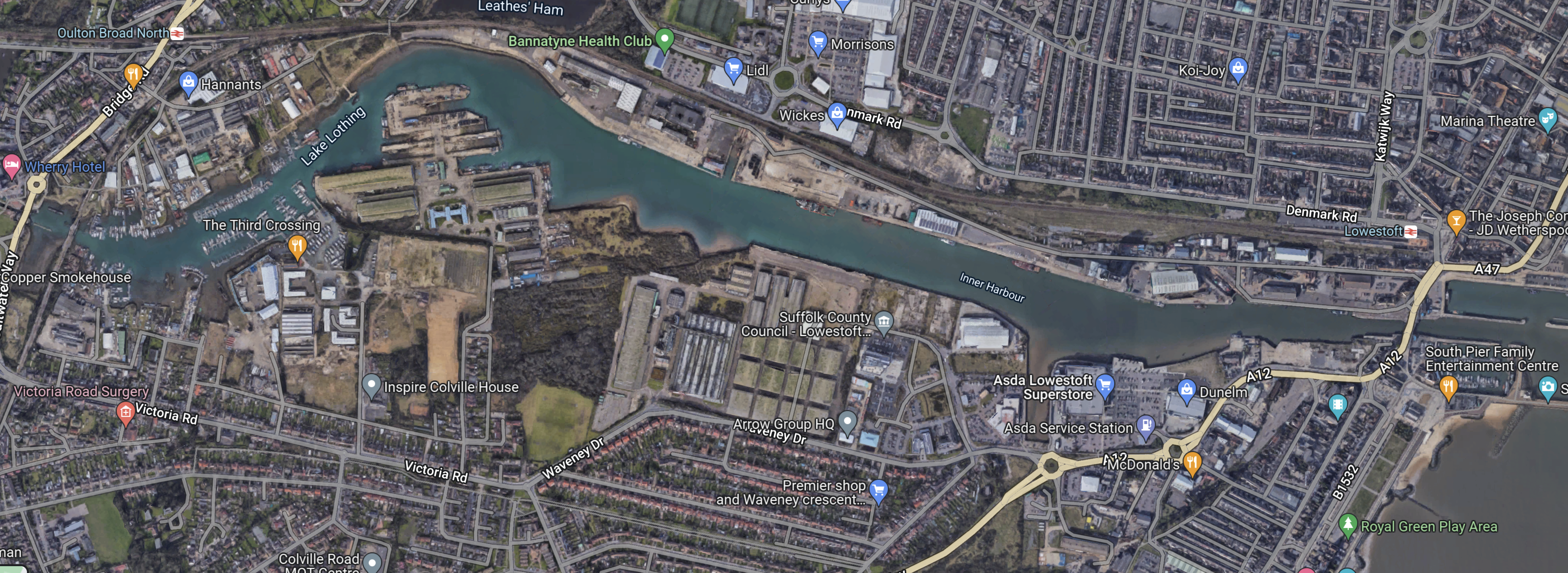
Note.
- The Inner Harbour of the Port of Lowestoft.
- The East Suffolk Line running East-West to the North of the Inner Harbour.
- Lowestoft station at the East side of the map.
I doubt it would be the most difficult or expensive of projects to build a small freight terminal on the North side of the Inner Harbour.
I suspect that the easiest way to bring the material needed to build the power station to Sizewell would be to do the following.
- Deliver it to the Port of Lowestoft by ship.
- Tranship to a suitable shuttle train for the journey to the Sizewell sidings.
- I estimate that the distance is only about 25 miles and a battery or hydrogen locomotive will surely be available in the UK in the next few years, that will be able to provide the motive power for the return journey.
In The TruckTrain, I wrote about a revolutionary freight concept, that could be ideal for the Sizewell freight shuttle.
Great Yarmouth Racecourse
Great Yarmouth Racecourse is one of my favourite racecourses and I believe it is one of the attractions in Great Yarmouth, that would benefit from an improved rail service between Lowestoft and Great Yarmouth, as it would almost double those with efficient public transport access to the racecourse.
The walking distance between Great Yarmouth station and the racecourse is walkable for many and I remember doing it since C died.
With the train connection to Lowestoft and perhaps a courtesy bus from the station, I wouldn’t be surprised to see that a Lowestoft-Yarmouth rail connection being very good for the racecourse. Especially as road traffic between the two towns can be not the best.
Finishing At Norwich
There are operational reasons to carry on to Norwich, where Crown Point, is the home base for the Class 755 trains.
But it would also link a lot of places that are dependant on tourism and are also heavily involved in East Anglia’s energy industry.
Onward From Peterborough To Lincoln
If the Lowestoft service can extend to Great Yarmouth, an extension of the Peterborough service to Lincoln via Spalding and Sleaford might be possible.
But with LNER also serving Lincoln from Kings Cross, I doubt the route would carry many passengers to and from London.
Conclusion
A service from London, that splits into two trains at Ipswich for Lowestoft and Peterborough has possibilities.
Soham Station’s Inaugural Year A Soaring Success
The title of this post, is the same as that of this article on Rail Technology Magazine.
This is the first paragraph.
Soham station has seen healthy and consistent passenger usage over its first year since opening to the public, seeing almost 50,000 journeys starting or finishing there, according to Greater Anglia’s figures.
I took these pictures, when the station opened.


I think Soham station is a good design of a single-platform station.
- It’s a short walk from car park or drop-off point to the platform.
- There is adequate car parking.
- There is a shelter.
The station has also been built, so that it can be expanded.
These are my thoughts.
A Service To Cambridge
Soham station probably needs a train service to Newmarket and Cambridge, as it already has a two-hourly service to Bury St. Edmund’s, Ely and Ipswich and Peterborough.
Wikipedia says this.
There are no current plans for direct services to Cambridge, but the CPCA has expressed support for the idea in a future phase of the project. Mayor James Palmer said “the delivery of Soham station gives us a much stronger case to go to Government and Network Rail and lobby for the reinstating of the Snailwell loop which will provide a direct service between Ely, Soham, Newmarket and Cambridge”
This map from OpenRailwayMap shows the Snailwell Loop.
Note.
- The triangular junction in the middle of the map,
- The line from the junction leading East goes to Bury St. Edmunds and Ipswich.
- The line from the junction leading North goes to Soham, Ely and Peterborough.
- The line from the junction leading South goes to Newmarket and Cambridge.
- The Western side of the junction was removed by British Rail.
It would appear that by reinstating the Western side of the junction, a service between Ely and Cambridge via Soham and Newmarket could be run.
There are proposals for new stations in this area and given the need for comprehensive commuter services into Cambridge this Ely and Cambridge service could develop considerably.
The simplest service pattern would be
- Peterborough via Ely, Manea, March and Whittlesea.
- Ely non-stop.
- Ipswich via Bury St. Edmunds and Stowmarket.
- Cambridge via Newmarket and Dullingham.
All trains would be one train per two hours (tp2h).
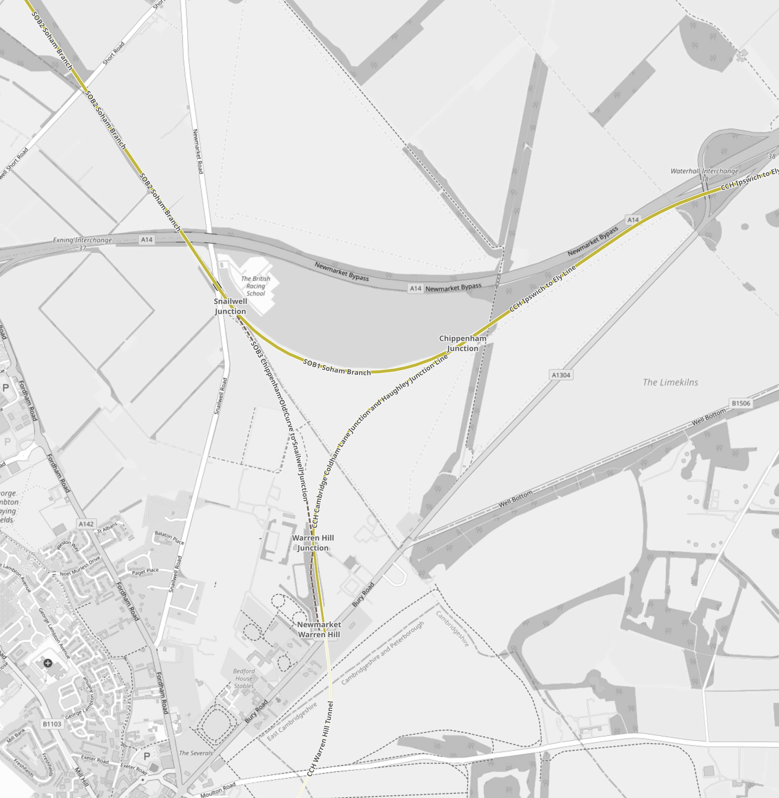
Snailwell Junction And Cambridge
There could be problems between Snailwell junction and Cambridge, as the line is mainly single-track and it would need to handle the following trains.
Ipswich and Cambridge – 1 train per hour (tph)
Ely and Cambridge – 1 tp2h
Sundry freight trains.
In Roaming Around East Anglia – Newmarket Station, I wrote this about the plans of the East West Rail Consortium in the area.
In this document on the East-West Rail Consortium web site, this is said.
Note that doubling of Warren Hill Tunnel at Newmarket and
redoubling between Coldham Lane Junction and Chippenham Junction is included
in the infrastructure requirements. It is assumed that most freight would operate
via Newmarket, with a new north chord at Coldham Lane Junction, rather than
pursuing further doubling of the route via Soham.
So would it be possible to create a double-track railway through Newmarket station?
In the related post, I came to this conclusion.
Newmarket can benefit from East West Rail, but the two parties must agree objectives that don’t cause problems for the other.
But I do think, that Newmarket will not welcome the building of a double-track railway through the town.
The Proposed A14 Parkway Station
Freightliner’s New Livery
.As I passed through Ipswich yesterday, I took these images of Freightliner’s locomotives in their new livery.


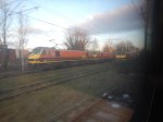

Note.
- Freightliner’s new depot on the town side of the Great Eastern Main Line appears to be fully open.
- Freightliner’s Class 90 locomotives, which they received from Greater Anglia now seem to be in the new livery.
- Freightliner’s Class 08 shunter is also shown in the new livery.
It also looked like up to four Class 90 locomotives were parked by Ipswich station.
This Google Map shows the tracks at the Western end of Ipswich station.
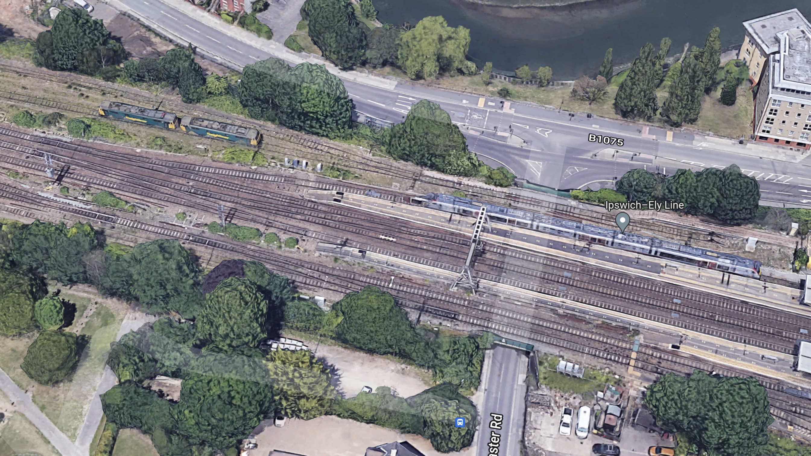
Note.
- The Greater Anglia Class 755 train in Platform 1 of Ipswich station.
- The two Freightliner Class 90 locomotives in the old green livery in the locomotive parking.
- I wonder, if freight trains are now changing to electric haulage after being hauled out of Felixstowe into Ipswich Yard, before continuing their onward journey.
Yesterday, by the use of Real Time Trains, I found these trains changed to electric haulage at Ipswich.
- 0250 – 436K – Felixstowe North to Garston – Changed back to diesel at Crewe.
- 0912 – 496K – Felixstowe North to Trafford Park – Changed back to diesel at Crewe.
- 0932 – 497K – Felixstowe North to Ditton
- 1113 – 412L – Felixstowe North to Trafford Park
- 2046 – 410M – Felixstowe North to Trafford Park
- 2152 – 412M – Felixstowe North to Garston – Changed back to diesel at Crewe.
These are my thoughts.
Changing Locomotives At Ipswich
It seems to take about 25 minutes to change a locomotive from diesel to electric.
At Ipswich, this seems to fairly easy.
- The freight train from Felixstowe stops in Ipswich Yard to the West of the station.
- The diesel locomotive is detached and probably moved to the yard to the South of the station.
- The electric locomotive is moved from by the station and attached to the train.
- The train goes on its way using electric traction.
All locomotive movements don’t seem to be too challenging.
Could More Electric Services Be Run?
I found these paths yesterday, where services left Felixstowe and went South to London.
- Coatbridge – 1
- Ditton – 2
- East Midlands Gateway – 1
- Garston – 2
- Hams Hall – 2
- Lawley Street – 3
- Trafford Park – 5
- Wentloog – 3
This is a total of nineteen trains and currently only six are electrified between Ipswich and London.
Would Bi-Mode Locomotives Be More Efficient?
In GB Railfreight Plans Order For Future-Proofed Bi-Mode Locomotives, I wrote about how GB Railfreight were planning to acquire a fleet of bi-mode locomotives.
In the related post, I said this.
I feel that, as the locomotive must fit current routes and schedules, so I wouldn’t be surprised to see the following specification.
- UK loading gauge.
- Co-Co
- Class 90 locomotive power and operating speed on electricity of 3.7 MW and 110 mph.
- Class 66 locomotive power and operating speed on diesel of 2.5 MW and 75 mph.
- Ability to change between electric and diesel power at speed.
- Ability to haul a heavy freight train out of Felixstowe.
- Ability to haul passenger trains.
Stadler will have one eye on the fact, that if they get this design right, this order for up to fifty locomotives could be just the start.
These locomotives would be ideal for Felixstowe to Ditton, Garston and Trafford Park.
- They would eliminate changing locomotives on these routes.
- They would reduce carbon emissions and fuel usage.
- They would be able to run at at least 100 mph on the Great Eastern and West Coast Main Lines.
They might also open up other partially electrified routes from Felixstowe via London.
Felixstowe And Wentloog
Wentloog freight terminal in South Wales.
In Movable Overhead Electrification To Decarbonise Freight, I used the Ipswich and Wentloog route to show how a long route could be decarbonised by the use of moveable electrification.
Conclusion
It looks like a philosophy is emerging to decarbonise a large proportion of freight services out of the Port of Felixstowe.
